Embed Size (px)
Citation preview
Y Y
Y
Y
YYYY
YYY
Y
YY
YY
Y
YYYYYYYYYYYYYYYY Y
Y
YY
Y
Y
Y
YYYYY
YY
Y Y
YYYYYY
YYYYY
YYY
Y Y
YY
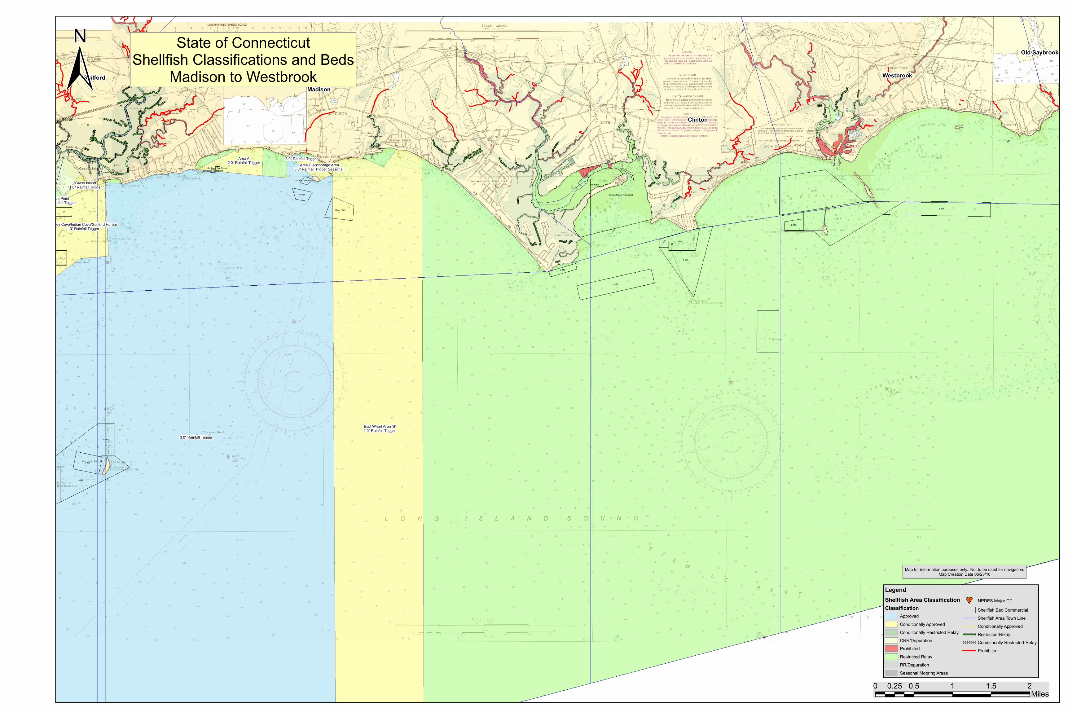
Madison
Clinton
WestbrookGuilford
Old Saybrook
3.0" Rainfall Trigger
East Wharf Area 'B'1.0" Rainfall Trigger
Area A2.0" Rainfall Trigger
L-381
L-548
L-549
L-588
L-606
Clinton Harbor (Historical)
L-430
1
L-490
L-312
Mud Flats
30
L-339
24
42
River Point
16
L-388
L-459
L-346
Wilson
L-460
L-445
Bloody Cove/Indian Cove/Guilford Harbor1.0" Rainfall Trigger
Area C Anchorage Area3.0" Rainfall Trigger Seasonal
Grass Island1.0" Rainfall Trigger
3.0" Rainfall Trigger
Turtle Point1.0" Rainfall Trigger
East River (Historical)East River Upper Neck River
Fence Creek
Toms Creek
Lower Neck River
Dolan's Oyster Ground
Birnbaum Tax GroundBirnbaum Tax Ground
0 0.5 1 1.5 20.25Miles
LegendShellfish Area ClassificationClassification
ApprovedConditionally ApprovedConditionally Restricted RelayCRR/DepurationProhibitedRestricted RelayRR/DepurationSeasonal Mooring Areas
]̂ NPDES Major CTShellfish Bed CommercialShellfish Area Town LineConditionally ApprovedRestricted-Relay
YYYYYYY Conditionally Restricted-RelayProhibited
State of ConnecticutShellfish Classifications and Beds
Madison to Westbrook
Map for information purposes only. Not to be used for navigation.Map Creation Date 06/23/10
±