Embed Size (px)
Citation preview
Updated 1/22/18
Complete agenda item information can be found on the DNRC website at http://dnrc.mt.gov/LandBoard
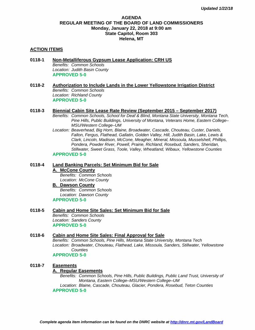
AGENDA REGULAR MEETING OF THE BOARD OF LAND COMMISSIONERS
Monday, January 22, 2018 at 9:00 am State Capitol, Room 303
Helena, MT ACTION ITEMS 0118-1 Non-Metalliferous Gypsum Lease Application: CRH US Benefits: Common Schools Location: Judith Basin County APPROVED 5-0 0118-2 Authorization to Include Lands in the Lower Yellowstone Irrigation District Benefits: Common Schools Location: Richland County APPROVED 5-0 0118-3 Biennial Cabin Site Lease Rate Review (September 2015 – September 2017) Benefits: Common Schools, School for Deaf & Blind, Montana State University, Montana Tech, Pine Hills, Public Buildings, University of Montana, Veterans Home, Eastern College– MSU/Western College–UM Location: Beaverhead, Big Horn, Blaine, Broadwater, Cascade, Chouteau, Custer, Daniels, Fallon, Fergus, Flathead, Gallatin, Golden Valley, Hill, Judith Basin, Lake, Lewis & Clark, Lincoln, Madison, McCone, Meagher, Mineral, Missoula, Musselshell, Phillips, Pondera, Powder River, Powell, Prairie, Richland, Rosebud, Sanders, Sheridan, Stillwater, Sweet Grass, Toole, Valley, Wheatland, Wibaux, Yellowstone Counties APPROVED 5-0 0118-4 Land Banking Parcels: Set Minimum Bid for Sale A. McCone County Benefits: Common Schools Location: McCone County B. Dawson County Benefits: Common Schools Location: Dawson County APPROVED 5-0 0118-5 Cabin and Home Site Sales: Set Minimum Bid for Sale Benefits: Common Schools Location: Sanders County APPROVED 5-0 0118-6 Cabin and Home Site Sales: Final Approval for Sale Benefits: Common Schools, Pine Hills, Montana State University, Montana Tech Location: Broadwater, Chouteau, Flathead, Lake, Missoula, Sanders, Stillwater, Yellowstone Counties APPROVED 5-0 0118-7 Easements A. Regular Easements Benefits: Common Schools, Pine Hills, Public Buildings, Public Land Trust, University of Montana, Eastern College–MSU/Western College–UM Location: Blaine, Cascade, Chouteau, Glacier, Pondera, Rosebud, Teton Counties APPROVED 5-0
Updated 1/22/18
Complete agenda item information can be found on the DNRC website at http://dnrc.mt.gov/LandBoard
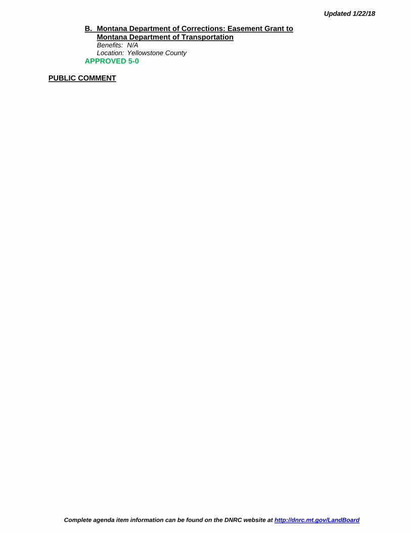
B. Montana Department of Corrections: Easement Grant to Montana Department of Transportation Benefits: N/A Location: Yellowstone County APPROVED 5-0 PUBLIC COMMENT

0118-1 NON-METALLIFEROUS GYPSUM LEASE
APPLICATION: CRH US

Land Board Agenda Item January 22, 2018
0118-1 Non-Metalliferous Gypsum Lease Application: CRH US
Location: Judith Basin County T16N-R10E-10: N½NE ¼ - 80 acres
Trust Benefits: Common Schools Trust Revenue: $260,000 (estimated)
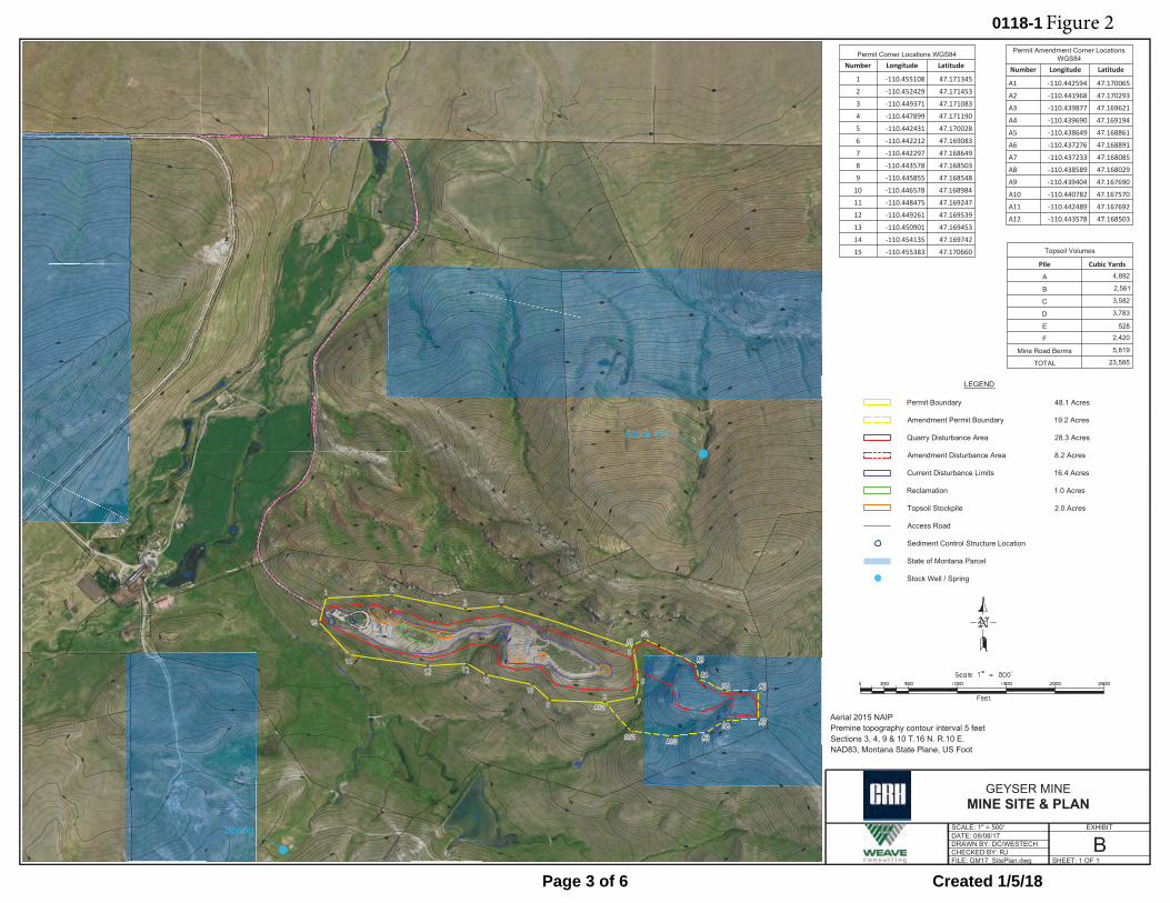
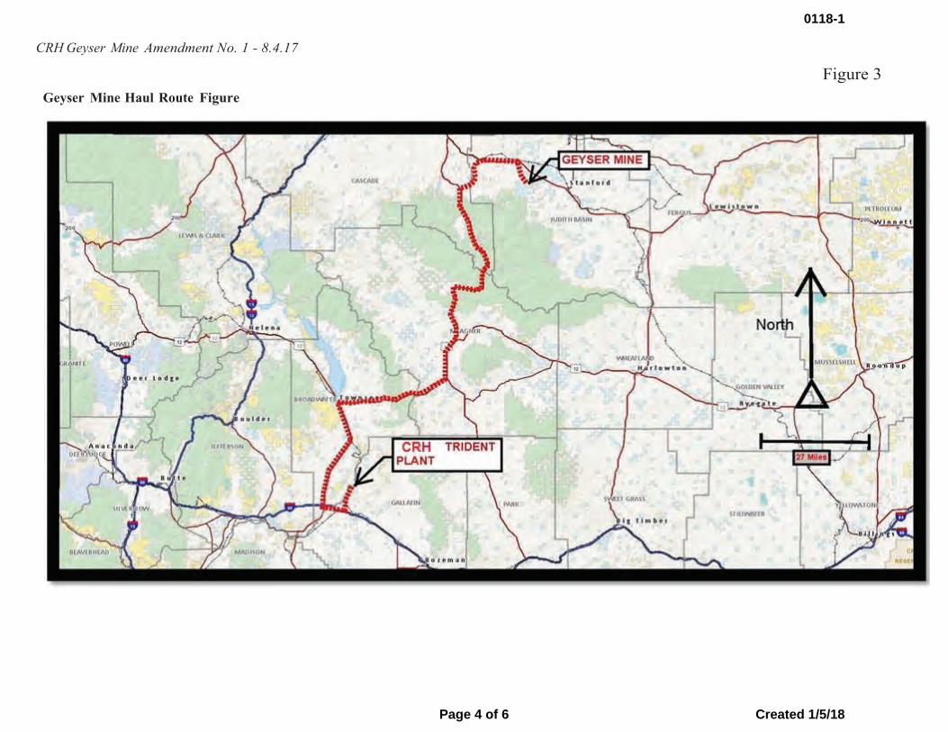
Item Summary The Department of Natural Resources and Conservation (DNRC) received an application from CRH US for a non-metalliferous mineral gypsum lease. The parcel is located 6 miles SSE of Geyser, MT (Figure 1). CRH US currently operates a gypsum mine on private land in this section and now desires to continue mining gypsum as it extends onto state-owned school trust land (Figure 2). The solid yellow outline is the current mine permit area on private land. The dashed yellow line is the expanded permit area as it would extend eastward onto state land. CRH US transports mined gypsum to its Trident cement plant located north of Three Forks, MT (Figure 3).
The actual mine area on state land will encompass approximately 8.2 acres, which is outlined in red on Figure 2. The state land contains ±70,000 tons of gypsum reserves. The royalty rate is $3.75 per ton, consistent with the private lease covering the existing mine. Therefore, the projected royalty revenue is approximately $260,000. An annual rental of $240 is also required. Mining is expected to take 2.5 to 3 years to complete.
Mining is accomplished by removing an average of 8 feet of topsoil and overburden, mining the 5 to 10 foot thick gypsum layer, re-contouring the overburden back over the mined area, replacing the topsoil over the overburden layer, and revegetating the area.
Non-metalliferous mineral mining is regulated by the Montana Department of Environmental Quality (DEQ). An amended mine operating/reclamation plan has been submitted. Approvals will be required from both DEQ and DNRC before any mining can occur.
Impact to State The Common School permanent trust would receive an estimated $260,000 in royalty payments.
DNRC Recommendation The director recommends Land Board approval to issue a non-metalliferous gypsum lease to CRH US.
0118-1
Page 1 of 6 Created 1/5/18

CRH Geyser Mine Amendment No. 1 - 8.4.17
Exhibit A: Mine Location Map Figure 1
0118-1
Page 2 of 6 Created 1/5/18
X X X X X X X X X X
X
X X X XX
XX
XX
X
X
X
X
X
X
X
XX
X
X
X
XX
X
X
X
X
X
X
X
X
X
X
X
X
XX
XX
XX
X
X
X
X
X
XX
X
X
X
X
X
X
X
X
X
X
X
X
X X
X
X
X
X
X
X
X
X
X
X
XX
X
X
X
X
XX
X
X X X X X X X X X X X X X X X
X
X
X
X
X
X
X
X
X
XX
XX
X
X
X
X
X
XX
XX
X
X
XX
X
X
X
X
X
X
X
X
X
X
X
X
X
XX
XX
XX
X
X
X
X
X
XX X X
X
X
X
X
X
X
X
X
X
X
X
X
X
X
X
X
X
X
X
X
X
X
X
X
X
X
X
XX
X
X
X X
X XX X
XX
X
X
X
X
X
X
A
Spring
Stock Well
B
C
D E
FILE: GM17_SitePlan.dwgCHECKED BY: RJDRAWN BY: DC/WESTECHDATE: 08/08/17SCALE: 1" = 500'
BEXHIBIT
GEYSER MINEMINE SITE & PLAN
SHEET: 1 OF 1
NAD83, Montana State Plane, US Foot
LEGEND
Sections 3, 4, 9 & 10 T.16 N. R.10 E.
Permit Boundary 48.1 Acres
Amendment Permit Boundary 19.2 Acres
Quarry Disturbance Area 28.3 Acres
Amendment Disturbance Area 8.2 Acres
Current Disturbance Limits 16.4 Acres
Reclamation 1.0 Acres
Topsoil Stockpile 2.0 Acres
Access Road
Sediment Control Structure Location
State of Montana Parcel
Stock Well / Spring
Premine topography contour interval 5 feetAerial 2015 NAIP
Permit Corner Locations WGS84Number Longitude Latitude
1 -110.455108 47.171345
2 -110.452429 47.171453
3 -110.449371 47.171083
4 -110.447899 47.171190
5 -110.442431 47.170028
6 -110.442212 47.169083
7 -110.442297 47.168649
8 -110.443578 47.168503
9 -110.445855 47.168548
10 -110.446578 47.168984
11 -110.448475 47.169247
12 -110.449261 47.169539
13 -110.450901 47.169453
14 -110.454135 47.169742
15 -110.455383 47.170660 Topsoil Volumes
Pile Cubic Yards
A 4,892
B 2,561
C 3,582
D 3,783
E 528
F 2,420
Mine Road Berms 5,819
TOTAL 23,585
Permit Amendment Corner LocationsWGS84
Number Longitude Latitude
A1 -110.442594 47.170065
A2 -110.441968 47.170293
A3 -110.439877 47.169621
A4 -110.439690 47.169194
A5 -110.438649 47.168861
A6 -110.437276 47.168891
A7 -110.437233 47.168085
A8 -110.438589 47.168029
A9 -110.439404 47.167690
A10 -110.440782 47.167570
A11 -110.442489 47.167692
A12 -110.443578 47.168503
Figure 20118-1
Page 3 of 6 Created 1/5/18
CRH Geyser Mine Amendment No. 1 - 8.4.17
Geyser Mine Haul Route Figure
Figure 3
0118-1
Page 4 of 6 Created 1/5/18
Geyser Mine
Operation Summary
• Existing mine, capable of producing approximately 20,000 tons of gypsum per 8 monthseason. Mine developed in segments moving west to east.
• DEQ reclamation bond currently $359,800. Would be revised as needed if extension ontostate land were approved.
• Operations would continue at current level, but extending operations onto state land wouldextend the life of mine by about 3 years.
• Mining occurs on demand during the year. When active, three to six truckloads of ore hauledper day to CRH’s Trident cement plant. Using over the road rock trucks with pup trailers –34-38 tons per load. Normally one to two equipment operators will be onsite during workinghours.
• Up to eight equipment operators and truck drivers employed• Onsite equipment includes a loader, dozer, excavator and water truck.• Operations 7 am – 6 pm, Monday – Friday• Blasting may be required once per year.• No water used in the mining operation.• Concurrent reclamation when mining in a segment is completed.
Resource Summary
An environmental assessment to cover the extension of the mine onto state land will be conducted by DEQ and DNRC. However, the initial environmental assessment for the mine and the mine plan amendment submitted for review provides basic information on resources.
• The soils present are not fragile, unstable, or overly erosive.• Mine is situated on a bench that does not contain springs or groundwater flows.• An air quality permit is not required as no onsite crushing is proposed. Dust control onsite
managed by spraying water as needed during mining and hauling operations.• Existing vegetation is mostly native range/grassland species. A native seed mix will be used
for reclamation.• Comparable habitat plentiful in area.• DNRC archaeologist surveyed the state land and found no cultural sites.• No public access to mine site or state land.• The mine is not visible from a major highway or the town of Geyser.• Mining and truck noise noticeable at the closest residence (private landowner who owns the
gypsum currently being mined). Nearest non-landowner residence over one mile away.• Concurrent weed control.
Mine Permitting/MEPA Review
• Two decisions – DEQ regulatory permit approval and DNRC mine plan approval.Environmental assessment (EA) jointly prepared by DEQ and DNRC.
• Existing EA prepared in 2013 covering current mine. New EA updates the review for theadditional state mine area.
• Will solicit public comment on the draft EA. Minimal to no interest expected.• Anticipate +/- 6 months to complete.
0118-1
Page 5 of 6 Created 1/5/18
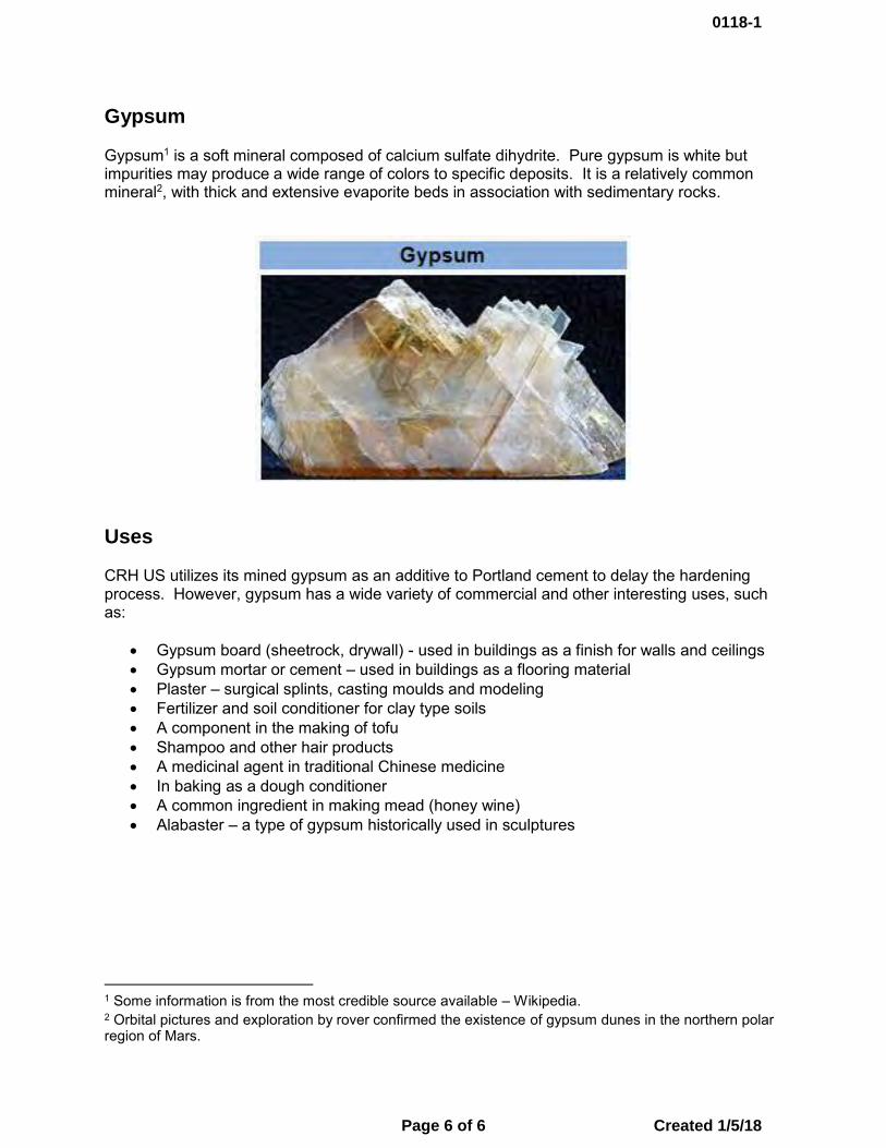
Gypsum
Gypsum1 is a soft mineral composed of calcium sulfate dihydrite. Pure gypsum is white but impurities may produce a wide range of colors to specific deposits. It is a relatively common mineral2, with thick and extensive evaporite beds in association with sedimentary rocks.
Uses
CRH US utilizes its mined gypsum as an additive to Portland cement to delay the hardening process. However, gypsum has a wide variety of commercial and other interesting uses, such as:
• Gypsum board (sheetrock, drywall) - used in buildings as a finish for walls and ceilings• Gypsum mortar or cement – used in buildings as a flooring material• Plaster – surgical splints, casting moulds and modeling• Fertilizer and soil conditioner for clay type soils• A component in the making of tofu• Shampoo and other hair products• A medicinal agent in traditional Chinese medicine• In baking as a dough conditioner• A common ingredient in making mead (honey wine)• Alabaster – a type of gypsum historically used in sculptures
1 Some information is from the most credible source available – Wikipedia. 2 Orbital pictures and exploration by rover confirmed the existence of gypsum dunes in the northern polar region of Mars.
0118-1
Page 6 of 6 Created 1/5/18
0118-2 AUTHORIZATION TO INCLUDE LANDS IN THE
LOWER YELLOWSTONE IRRIGATION DISTRICT

Land Board Agenda Item January 22, 2018
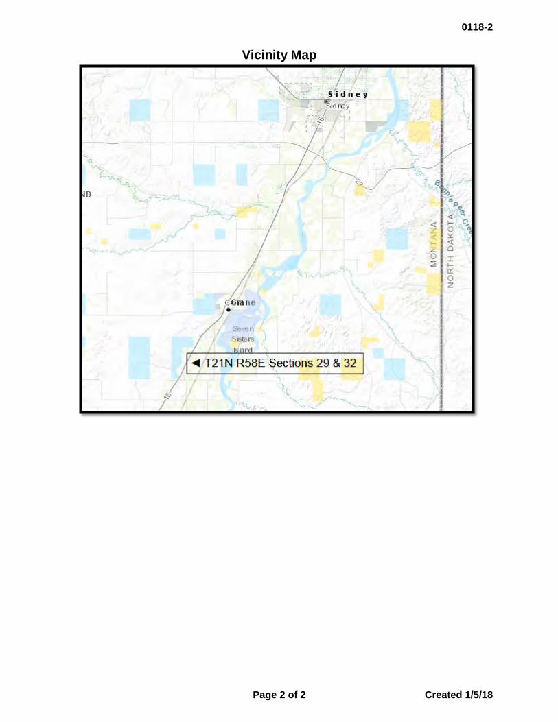
0118-2 Authorization to Include Lands in the Lower Yellowstone Irrigation District
Location: Richland County Trust Benefits: Common Schools Trust Revenue: N/A
Item Summary There are approximately 232 acres located in T21N R58E, Sections 29 & 32 that are currently irrigated with water from the Lower Yellowstone Irrigation District. It is applied by 3 pivot systems that irrigate both state land and adjacent private property owned by Mr. William Struckman. While the lands owned by Mr. Struckman are within the District, the state lands are outside the District boundaries. The District has notified the Department of Natural Resources and Conservation (DNRC) that to continue irrigation on the state land, a request must be submitted to the District Court to include these lands within the Irrigation District. The loss of irrigation water to the property would result in a reduction in revenues to the Common Schools trust and impact the operation of the 1 pivot system that irrigates both state and private lands.
DNRC Recommendation The Director recommends the Board authorize the Department to request that lands located in T21N R58E Sections 29 & 32 be included in the Lower Yellowstone Irrigation District.
0118-2
Page 1 of 2 Created 1/5/18
Vicinity Map
0118-2
Page 2 of 2 Created 1/5/18
0118-3 BIENNIAL CABIN SITE LEASE RATE REVIEW
(SEPTEMBER 2015 – SEPTEMBER 2017)


Land Board Agenda Item January 22, 2018
0118-3 Biennial Cabin Site Lease Rate Review (September 2015 – September 2017)
Location: Beaverhead, Big Horn, Blaine, Broadwater, Cascade, Choteau, Custer, Daniels, Fallon, Fergus, Flathead, Gallatin, Golden Valley, Hill, Judith Basin, Lake, Lewis & Clark, Lincoln, Madison, McCone, Meagher, Mineral, Missoula, Musselshell, Phillips, Pondera, Powder River, Powell, Prairie, Richland, Rosebud, Sanders, Sheridan, Stillwater, Sweet Grass, Toole, Valley, Wheatland, Wibaux, Yellowstone Counties
Trust Benefits: Common Schools, School for Deaf & Blind, Montana State University, Montana Tech, Pine Hills School, Public Buildings, University of Montana, Veterans Home, Eastern College– MSU/Western College–UM
Trust Revenue: N/A
Item Summary The Department of Natural Resources and Conservation’s (DNRC) Trust Lands Management Division (TLMD) is required to provide to the Land Board a review of cabin site lease rates every two years. The review includes data from all cabin site lease bids within the two-year period and a review of the data by an economist. The Biennial Cabin Site Lease Rate Review was presented to the Land Board at their December 2017 meeting as an informational Item.
This lease rate review requirement was established in September 2015 through a settlement agreement to a civil suit (Montrust III). The settlement agreement specifically provided that:
“The Land Board will review the data from all competitively bid Montana cabin site leases, and all non-competitively bid Montana cabin site leases, complete a formal review by an appropriately qualified, professional economist, and consider whether to revise leasing procedures and/or rental rates. Based on the results of the review, the Land Board commits to setting the rental rates for cabin site leases so as to capture for the trust beneficiaries the full market value of such leases in order to maximize the cumulative long-term revenue from cabin sites without creating vacancy rates that are detrimental to the best financial interest of the trust beneficiaries, as required by the Montana Constitution and Enabling Act.”
Current Lease Rate Origin In September of 2015, a Settlement Agreement to resolve the civil suit, Montrust III, was executed between all parties involved, approved by the Land Board, and subsequently approved by the District Court. DNRC then adopted Administrative Rules to implement the settlement agreement in June 2016.
Settlement Agreement Key Points (and subsequent ARM 36.25.1001-36.25.1021) • Voided all rules implementing SB409 (2011) and lease fee calculations of Alternative 3B.• Provided that all current leases remain in place until expiration.• Established lease fee rates for renewals at 5%, and lease fee rates for new bidding will be
adjustable based on vacancy rates (between 6.5% and 3.5%).• The minimum annual lease fee for all renewals and/or new bidding will be $800.
0118-3
Page 1 of 2 Created 1/5/18

• Lease bid rates will be reviewed by the Land Board every two years.
Current Lease Rates (as established in the settlement agreement)
New Bidding: Cabin site leases on unleased lots are issued through a competitive bidding process. The bid rate is a percentage of the Department of Revenue (DOR) land value, and the bid amount is the first year’s lease fee. • 6.5%: All initial bidding starts at 6.5% for 60 days; • 5.0%: The rate may be reduced to 5% for an additional 60 days. • Less than 5%: The rate may be incrementally reduced after bidding has been
unsuccessful at 6.5% and 5%, only in neighborhoods with vacancy rates over 30%. • Minimums: Minimum Rate is 3.5%, and the minimum annual rent is $800.
Renewals: All cabin site leases have a right to renew upon expiration without competitive bidding. • 5%: All renewals are offered at 5% of the land value. • Minimums: The minimum annual rent is $800.
Summary DNRC has implemented the terms of the 2015 settlement agreement, and subsequent administrative rules by renewing all expiring cabin site leases at 5% of the DOR land value, and releasing all available vacant cabin sites for bid in accordance with the terms of the Settlement. All available cabin site leases were released for bid at 6.5% of the DOR land value for 60 days and subsequently released for bid at 5% of the DOR land value. Available cabin sites in high vacancy neighborhoods were then made available for bid at 4.5% of the DOR land value for two bid cycles, and then further reduced to 4% for the final cycle in the report period. High vacancy neighborhoods that saw reduced bid rates included: Beaver Lake, Echo Lake, McGregor Lake, Rogers Lake, and East Lake Shore of Flathead Lake. In some instances, neighborhood vacancy rates reflect unoccupied cabin sites that are not available for lease due to the cabin site sale program, pending resolution of split title and/or access issues, or environmental impacts. DNRC considers these factors when reviewing lease rate adjustments based on vacancy rates. Between September 2015 and September 2017, DNRC renewed 30 leases at 5% and conducted five rounds of competitive bidding. Although DNRC could not start competitive bidding until June 2016 when Administrative Rules were finalized, the department received a record number of bids and a general heightened interest in the leasing program during the 15 months of bidding. Twenty-nine bids were received for 26 lots, and to date 22 competitively bid leases have been executed. DNRC Recommendation Consistent with the economic analysis of the lease rate data provided in the Biennial Cabin Site Lease Rate Review to the Land Board at their December 2017 meeting, the director recommends that the Land Board approve upholding the current lease rates and procedures, and make no changes at this time.
0118-3
Page 2 of 2 Created 1/5/18
0118-4 LAND BANKING PARCELS:
SET MINIMUM BID FOR SALE A. McCone County B. Dawson County
Land Board Agenda Item January 22, 2018
0118-4A Land Banking Parcel: Set Minimum Bid for Sale
Location: McCone County Trust Benefits: Common Schools Trust Revenue: $90,000
Item Summary
The Department of Natural Resources and Conservation (DNRC) requests to set the minimum bid to sell a parcel totaling approximately 240 acres nominated for sale in McCone County. The sale was nominated by the lessee and located approximately 10 miles southeast of Wolf Point, Montana.
Sale # # of Acres Legal Nominator Trust
245 240± SW1/4, W1/2SE1/4, T26N-R48E Sec. 35 Mary Dillon Common
Schools
The sale parcel has been used primarily for livestock grazing purposes. The parcel has average productivity for grazing lands statewide.
The parcel is not legally accessible by DNRC nor the public.
No potentially negative issues were identified through the MEPA process regarding the sale of this parcel.
Economic Analysis Short-term – The rate of return on the sale parcel is 1.25%. The parcel would continue to
receive this return if it remains in state ownership. Long-term – The funds from the sale of this parcel would be combined with other sale funds to
purchase replacement lands through DNRC’s Land Banking program. Lands purchased are required to have an equal or greater rate of return than the combined lands that generated the sale funds used for the purchase. To date, the average annual rate of return on acquisitions has been 2.78% on acquisitions with income generated from annual lease payments.
Cultural/Paleontological Resources The state parcel nominated for sale was inventoried to Class III standards for cultural and paleontological resources. No Antiquities, as defined under the Montana State Historic Preservation Act, were identified. A formal report of findings has been prepared and filed with the Montana State Historic Preservation Office per the requirements of the Montana State Antiquities Act.
Background In July 2017, the Land Board granted preliminary approval for this parcel to continue through the Land Banking sale evaluation process.
0118-4A
Page 1 of 3 Created 1/5/18
Appraised Value of Sale Parcel DNRC Recommendation The director recommends the Land Board set the minimum bid at the value shown above.
Sale # Appraised Value With Access
Appraised Value per acre
Recommended Minimum Bid
245 $90,000 $375 $90,000
0118-4A
Page 2 of 3 Created 1/5/18
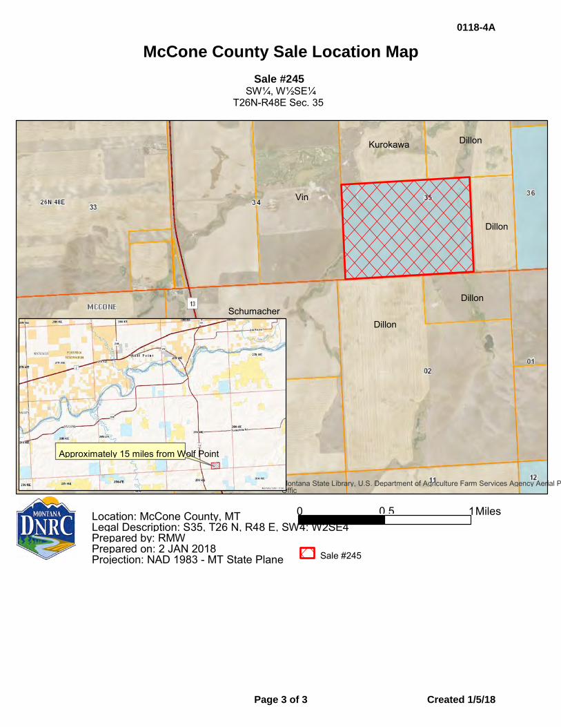
McCone County Sale Location Map
Sale #245 SW¼, W½SE¼
T26N-R48E Sec. 35
Montana State Library, U.S. Department of Agriculture Farm Services Agency Aerial P Offic
0 1 0.5 Miles
Sale #245
Location: McCone County, MT Legal Description: S35, T26 N, R48 E, SW4: W2SE4 Prepared by: RMW Prepared on: 2 JAN 2018 Projection: NAD 1983 - MT State Plane
Kurokawa Dillon
Dillon
Dillon
Dillon
Vin
Approximately 15 miles from Wolf Point
Schumacher
0118-4A
Page 3 of 3 Created 1/5/18
Land Board Agenda Item January 22, 2018
0118-4B Land Banking Parcel: Set Minimum Bid for Sale
Location: Dawson County Trust Benefits: Common Schools Trust Revenue: $135,000
Item Summary
The Department of Natural Resources and Conservation (DNRC) requests to set the minimum bid to sell a parcel totaling approximately 320 acres nominated for sale in Dawson County. The sale was nominated by the lessee and is located approximately 20 miles southwest of Glendive, Montana.
Sale # # of Acres Legal Nominator Trust
613 320± S1/2, T14N-R54E Sec. 36 Tim & Laurie Gibbs Common
Schools
The sale parcel has been used primarily for livestock grazing purposes. The parcel produces lower than average productivity for grazing lands statewide.
The parcel is not legally accessible by DNRC nor the public.
No potentially negative issues were identified through the MEPA process regarding the sale of this parcel.
Economic Analysis Short-term – The rate of return on the sale parcel is 0.68%. The parcel would continue to
receive this return if it remains in state ownership. Long-term – The funds from the sale of this parcel would be combined with other sale funds to
purchase replacement lands through the department’s Land Banking program. Lands purchased are required to have an equal or greater rate of return than the combined lands that generated the sale funds used for the purchase. To date, the average annual rate of return on acquisitions has been 2.78% on acquisitions with income generated from annual lease payments.
Cultural/Paleontological Resources The state parcel nominated for sale was inventoried to Class III standards for cultural and paleontological resources. No Antiquities, as defined under the Montana State Historic Preservation Act, were identified. A formal report of findings has been prepared and filed with the Montana State Historic Preservation Office per the requirements of the Montana State Antiquities Act.
Background In July 2017, the Land Board granted preliminary approval for this parcel to continue through the Land Banking sale evaluation process.
0118-4B
Page 1 of 3 Created 1/5/18
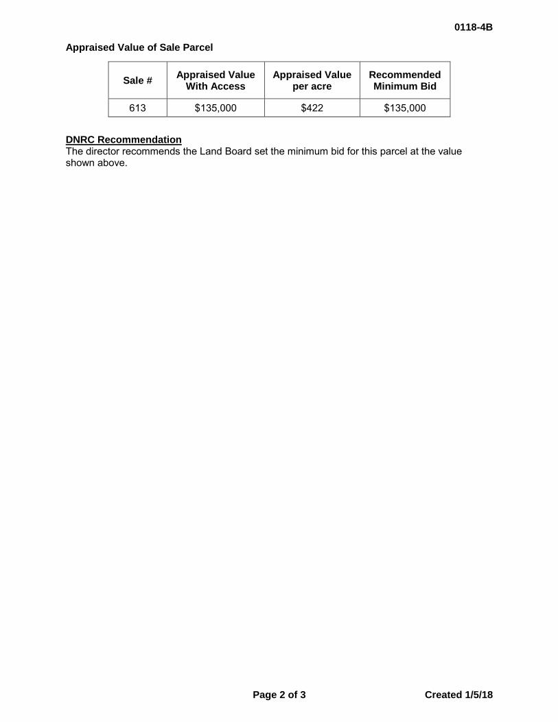
Appraised Value of Sale Parcel
DNRC Recommendation The director recommends the Land Board set the minimum bid for this parcel at the value shown above.
Sale # Appraised Value With Access
Appraised Value per acre
Recommended Minimum Bid
613 $135,000 $422 $135,000
0118-4B
Page 2 of 3 Created 1/5/18
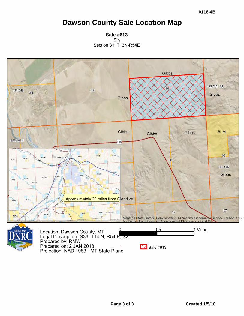
Dawson County Sale Location Map Sale #613
S½ Section 31, T13N-R54E
Montana State Library, Copyright:© 2013 National Geographic Society, i-cubed, U.S. DAgriculture Farm Services Agency Aerial Photography Field Office
0 1 0.5 Miles
Sale #613
Location: Dawson County, MT Legal Description: S36, T14 N, R54 E, S2 Prepared by: RMW Prepared on: 2 JAN 2018 Projection: NAD 1983 - MT State Plane
Approximately 20 miles from Glendive
Gibbs
Gibbs Gibbs
Gibbs Gibbs BLM Gibbs
Gibbs
0118-4B
Page 3 of 3 Created 1/5/18

0118-5 CABIN AND HOME SITE SALES:
SET MINIMUM BID FOR SALE
Land Board Agenda Item January 22, 2018
0118-5 Cabin and Home Sites: Set Minimum Bid for Sale
Location: Sanders County Trust Benefits: Common Schools Trust Revenue: $40,000
Item Summary
The Department of Natural Resources and Conservation (DNRC) requests to set the minimum bid for the sale of a cabin site in Sanders County. The sale was nominated by the lessees and DNRC in conjunction with the Cabin and Home Site Sale Program.
Sale Number
# of Acres Legal Nominator Trust
875 1.27 Lot in NW4NW4
t23N-R27W, Sec. 34 Sanders County
Donna Davis & Denise White
Common Schools
This sale parcel is currently leased as a cabin site and produces an average income for residential leases statewide.
The parcel will be sold with the access that is currently provided to the current lessee under their lease agreement.
Economic Analysis Short term – The average rate of return for the sale parcel is as follows:
Long term – The funds from the sale of this parcel would be combined with other sale funds to purchase replacement lands through DNRC’s Land Banking program. Lands purchased are required to have an equal or greater rate of return than the combined lands that generated the sale funds used for the purchase. To date, the average annual rate of return on acquisitions has been 2.78% on acquisitions with income generated from annual lease payments.
Cultural/Paleontological Resources A Class I level of cultural resource inventory was conducted for the proposed sale. Home sites typically contain numerous structures and the ground surfaces within most home sites have been variously disturbed over the course of many years of occupation and development. This sale will have no effect to state owned heritage properties.
Appraised Value The values for this sale parcel were set after a hearing on the originally-appraised value of the land which took place in November 2017. The hearing was requested by the sale proponents within the time frame allotted by the Cabin and Home Site Sale Program process. The appraised improvements value was not affected by the hearing.
Sale # Rate of Return
875 1.506%
0118-5
Page 1 of 3 Created 1/5/18
The hearing examiner determined the original appraised value of the land to be accurate, which resulted in the following values:
DNRC Recommendation The director recommends that the Land Board set the minimum bid for this sale parcel at the value of the land determined by the valuation hearing and the maximum value of compensation for the improvements as shown above.
Sale # Original Appraised Value of the Land
Value of the Land Determined by the Valuation Hearing
Appraised Value of Improvements
875 $40,000 $40,000 $130,000
0118-5
Page 2 of 3 Created 1/5/18
Sanders County Sales Location Map
Sale Number 875 Lot in NW¼NW¼ T23N-R27W Sec. 34
875
875
0118-5
Page 3 of 3 Created 1/5/18
0118-6 CABIN AND HOME SITE SALES:
FINAL APPROVAL FOR SALE
Land Board Agenda Item January 22, 2018
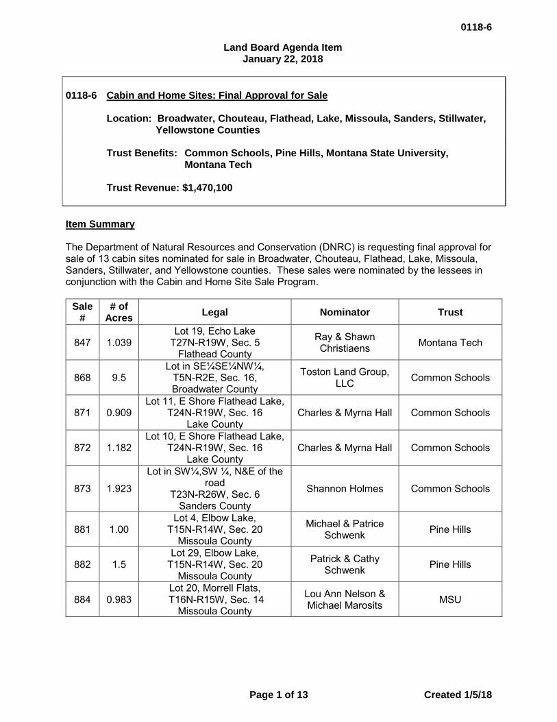
0118-6 Cabin and Home Sites: Final Approval for Sale
Location: Broadwater, Chouteau, Flathead, Lake, Missoula, Sanders, Stillwater, Yellowstone Counties
Trust Benefits: Common Schools, Pine Hills, Montana State University, Montana Tech
Trust Revenue: $1,470,100
Item Summary
The Department of Natural Resources and Conservation (DNRC) is requesting final approval for sale of 13 cabin sites nominated for sale in Broadwater, Chouteau, Flathead, Lake, Missoula, Sanders, Stillwater, and Yellowstone counties. These sales were nominated by the lessees in conjunction with the Cabin and Home Site Sale Program.
Sale #
# of Acres Legal Nominator Trust
847 1.039 Lot 19, Echo Lake
T27N-R19W, Sec. 5 Flathead County
Ray & Shawn Christiaens Montana Tech
868 9.5 Lot in SE¼SE¼NW¼,
T5N-R2E, Sec. 16, Broadwater County
Toston Land Group, LLC Common Schools
871 0.909 Lot 11, E Shore Flathead Lake,
T24N-R19W, Sec. 16 Lake County
Charles & Myrna Hall Common Schools
872 1.182 Lot 10, E Shore Flathead Lake,
T24N-R19W, Sec. 16 Lake County
Charles & Myrna Hall Common Schools
873 1.923
Lot in SW¼,SW ¼, N&E of the road
T23N-R26W, Sec. 6 Sanders County
Shannon Holmes Common Schools
881 1.00 Lot 4, Elbow Lake,
T15N-R14W, Sec. 20 Missoula County
Michael & Patrice Schwenk Pine Hills
882 1.5 Lot 29, Elbow Lake,
T15N-R14W, Sec. 20 Missoula County
Patrick & Cathy Schwenk Pine Hills
884 0.983 Lot 20, Morrell Flats,
T16N-R15W, Sec. 14 Missoula County
Lou Ann Nelson & Michael Marosits MSU
0118-6
Page 1 of 13 Created 1/5/18
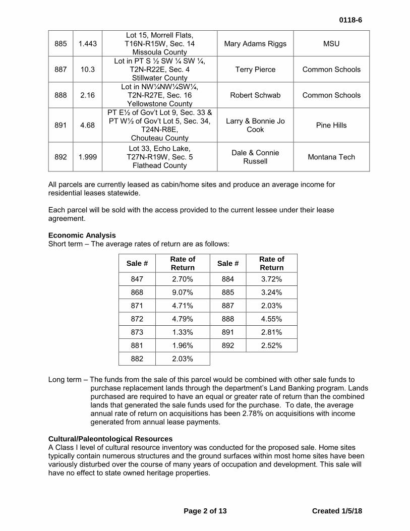
885 1.443 Lot 15, Morrell Flats, T16N-R15W, Sec. 14
Missoula County Mary Adams Riggs MSU
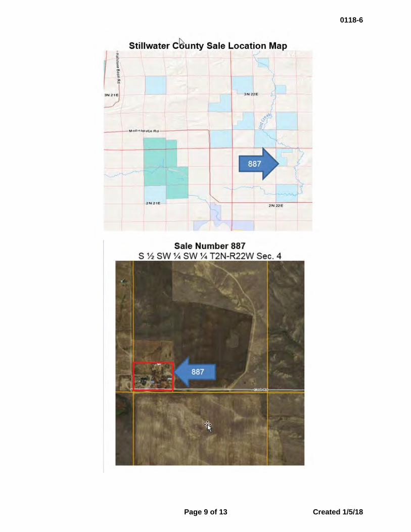
887 10.3 Lot in PT S ½ SW ¼ SW ¼,
T2N-R22E, Sec. 4 Stillwater County
Terry Pierce Common Schools
888 2.16 Lot in NW¼NW¼SW¼,
T2N-R27E, Sec. 16 Yellowstone County
Robert Schwab Common Schools
891 4.68
PT E½ of Gov’t Lot 9, Sec. 33 & PT W½ of Gov’t Lot 5, Sec. 34,
T24N-R8E, Chouteau County
Larry & Bonnie Jo Cook Pine Hills
892 1.999 Lot 33, Echo Lake,
T27N-R19W, Sec. 5 Flathead County
Dale & Connie Russell Montana Tech
All parcels are currently leased as cabin/home sites and produce an average income for residential leases statewide. Each parcel will be sold with the access provided to the current lessee under their lease agreement. Economic Analysis Short term – The average rates of return are as follows: Long term – The funds from the sale of this parcel would be combined with other sale funds to
purchase replacement lands through the department’s Land Banking program. Lands purchased are required to have an equal or greater rate of return than the combined lands that generated the sale funds used for the purchase. To date, the average annual rate of return on acquisitions has been 2.78% on acquisitions with income generated from annual lease payments.
Cultural/Paleontological Resources A Class I level of cultural resource inventory was conducted for the proposed sale. Home sites typically contain numerous structures and the ground surfaces within most home sites have been variously disturbed over the course of many years of occupation and development. This sale will have no effect to state owned heritage properties.
Sale # Rate of Return Sale # Rate of
Return 847 2.70% 884 3.72%
868 9.07% 885 3.24%
871 4.71% 887 2.03%
872 4.79% 888 4.55%
873 1.33% 891 2.81%
881 1.96% 892 2.52%
882 2.03%
0118-6
Page 2 of 13 Created 1/5/18
Background Sale Number 892 was granted preliminary approval to continue through the cabin site sale evaluation process in May 2016. In May 2017, the Land Board granted preliminary approval for the other parcels listed. In August, September, and October 2017, the Land Board set the minimum bid for the land and the maximum value of compensation for the improvements at the appraised values below:
Sale Price The cabin sites were sold at public auctions on December 7th, 2017. There was one bidder per sale who were the lessees. These parcels were sold for the minimum bid amounts listed above. DNRC Recommendation The director recommends final approval for the cabin site lots at the values shown above. The sales will close within 30 days of final approval by the Land Board.
Sale # Appraised Value of the Land Appraised Value of Improvements
847 $366,000 $113,000
868 $33,000 $247,000
871 $60,000 $10,000
872 $60,000 $180,000
873 $30,000 $79,000
881 $155,000 $156,000
882 $100,000 $147,000
884 $42,000 $110,000
885 $42,000 $100,000
887 $21,600 $173,400
888 $37,500 $107,500
891 $23,000 $356,000
892 $500,000 $130,000
0118-6
Page 3 of 13 Created 1/5/18
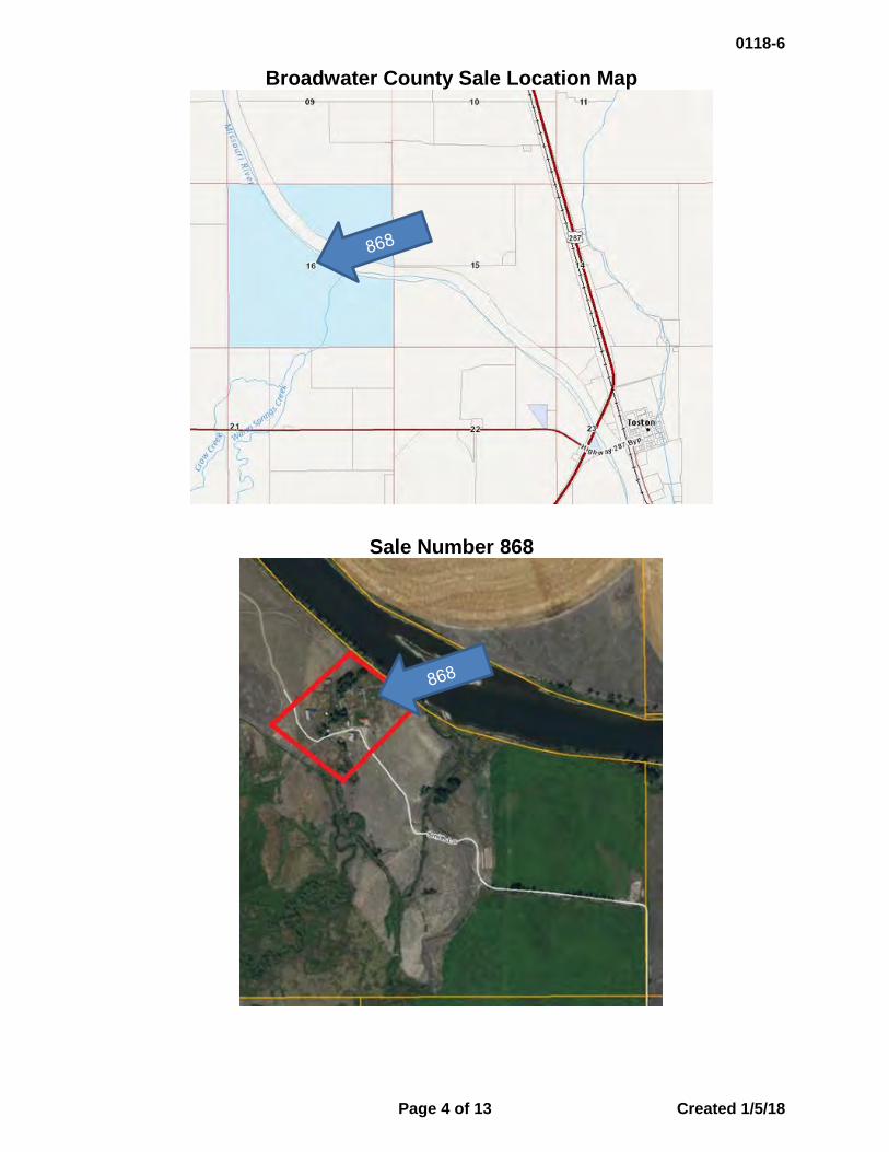
Broadwater County Sale Location Map
Sale Number 868
0118-6
Page 4 of 13 Created 1/5/18

Lake County Sales Location Map
East Shore Flathead Lake, Sale Numbers 871, 872
East Shore
872
0118-6
Page 5 of 13 Created 1/5/18
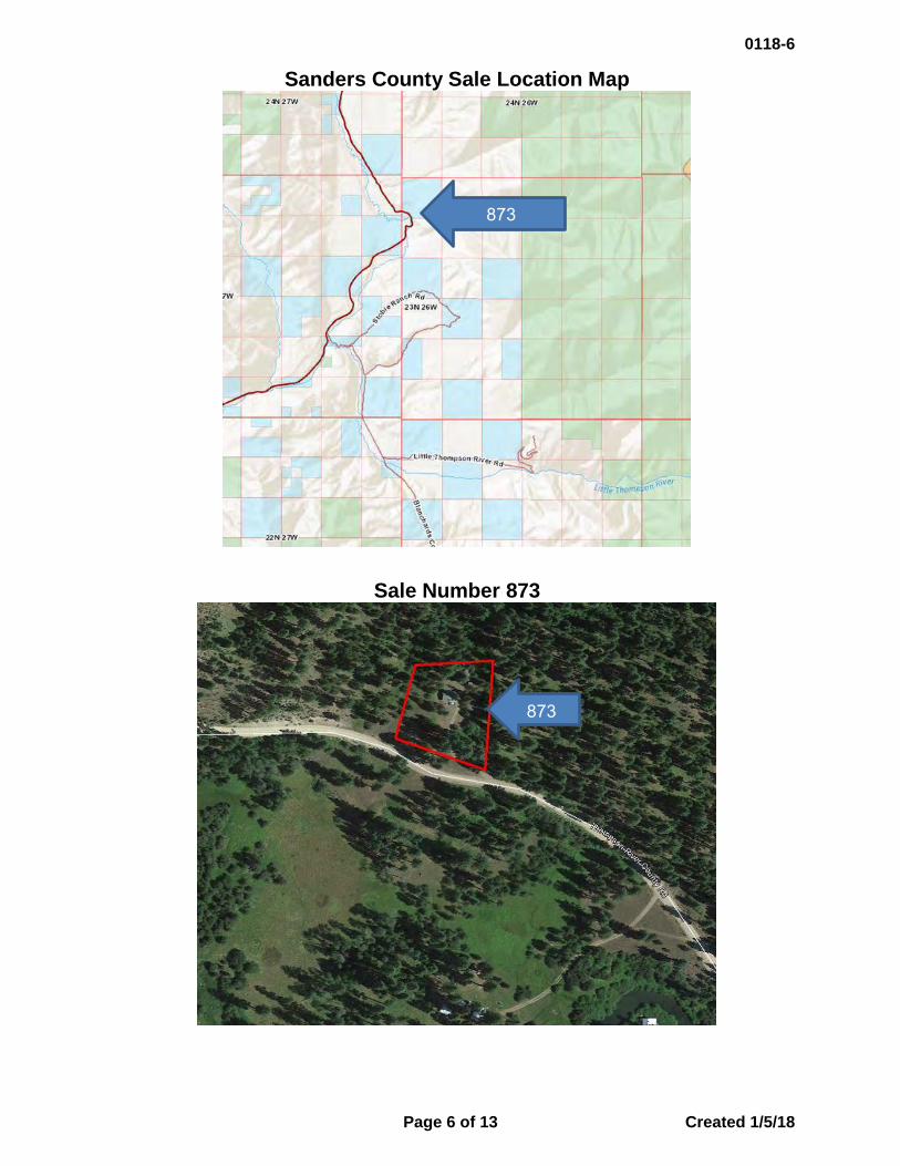
Sanders County Sale Location Map
Sale Number 873
873
873
0118-6
Page 6 of 13 Created 1/5/18

Missoula County Sales Location Map
Morrell Flats, Sale Numbers 884, 885
Morrell Flats
Elbow Lake
0118-6
Page 7 of 13 Created 1/5/18
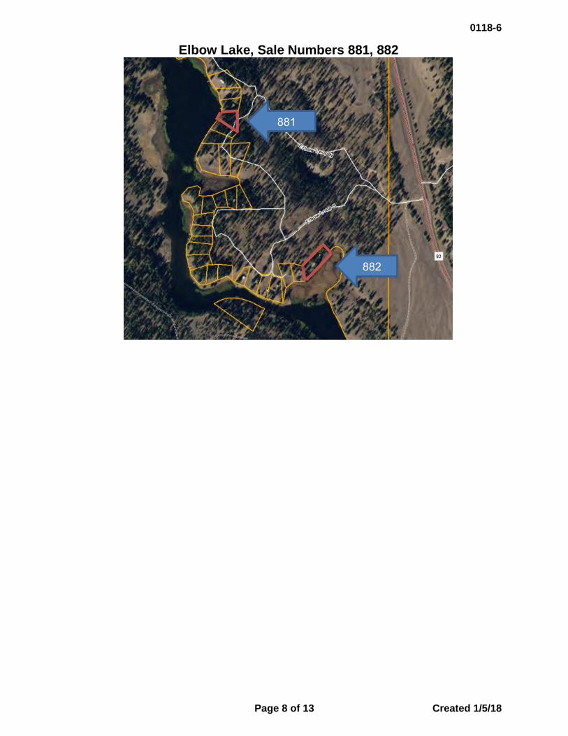
Elbow Lake, Sale Numbers 881, 882
881
882
0118-6
Page 8 of 13 Created 1/5/18
0118-6
Page 9 of 13 Created 1/5/18
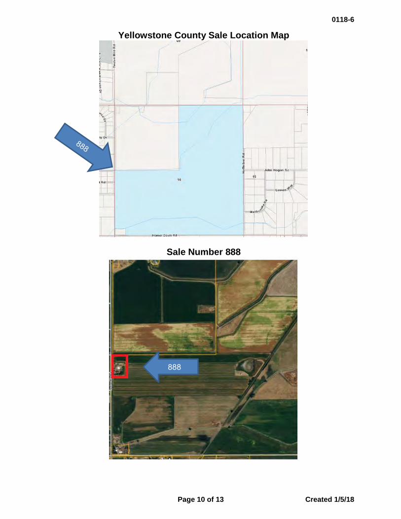
Yellowstone County Sale Location Map
Sale Number 888
888
0118-6
Page 10 of 13 Created 1/5/18

Chouteau County Sale Location Map
Sale Number 891
891
0118-6
Page 11 of 13 Created 1/5/18

Flathead County Sales Location Map
Echo Lake, Sale Number 847
Echo Lake
0118-6
Page 12 of 13 Created 1/5/18
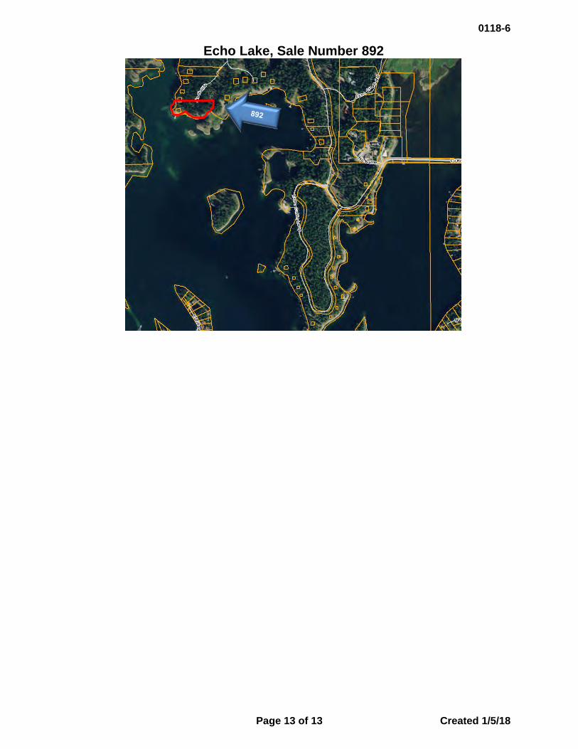
Echo Lake, Sale Number 892
0118-6
Page 13 of 13 Created 1/5/18
0118-7 EASEMENTS:
A. Regular Easements B. Montana Department of Corrections: Easement Grant to Montana Department of Transportation

Land Board Agenda Item January 22, 2018
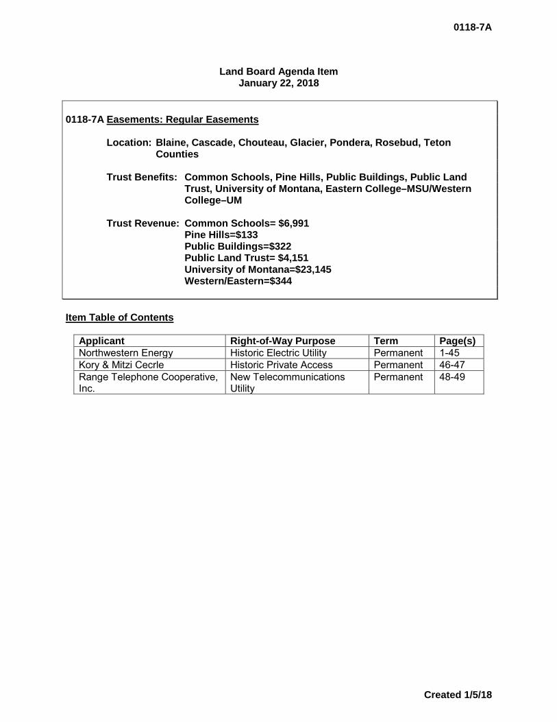
0118-7A Easements: Regular Easements
Location: Blaine, Cascade, Chouteau, Glacier, Pondera, Rosebud, Teton Counties
Trust Benefits: Common Schools, Pine Hills, Public Buildings, Public Land Trust, University of Montana, Eastern College–MSU/Western College–UM
Trust Revenue: Common Schools= $6,991 Pine Hills=$133 Public Buildings=$322 Public Land Trust= $4,151 University of Montana=$23,145 Western/Eastern=$344
Item Table of Contents
Applicant Right-of-Way Purpose Term Page(s) Northwestern Energy Historic Electric Utility Permanent 1-45Kory & Mitzi Cecrle Historic Private Access Permanent 46-47Range Telephone Cooperative, Inc.
New Telecommunications Utility
Permanent 48-49
0118-7A
Created 1/5/18
Rights of Way Applications
January 22, 2018
APPLICANTS AND RIGHTS OF WAY INFORMATION_____ Applicant: Northwestern Energy 11 East Park Butte, MT 59701 Application No.: 17988 R/W Purpose: a 12.47kV overhead electric distribution line Lessee Agreement: N/A (Historic) Acreage: 0.03 Compensation: $104.00 Legal Description: 10-foot strip through NE4NW4 across the Sun River, Sec. 8,
Twp. 20N, Rge. 3E, Cascade County Trust Beneficiary: Public Land Trust Item Summary Northwestern Energy has made application for multiple overhead electric distribution and transmission lines and natural gas pipelines that were constructed on state lands many years ago without proper authorization from the Land Board. Pursuant to §77-1-130, MCA, Northwestern Energy is requesting recognition of these overhead electric distribution and transmission lines and natural gas pipelines as historic rights of ways. DNRC Recommendation The director recommends approval of this historic right of way for Northwestern Energy. ______________________________________________________________
1
0118-7A
Created 1/5/18
Rights of Way Applications
January 22, 2018 APPLICANTS AND RIGHTS OF WAY INFORMATION_____ Applicant: Northwestern Energy 11 East Park Butte, MT 59701 Application No.: 17989 R/W Purpose: a 12.47kV overhead electric distribution line Lessee Agreement: N/A (Historic) Acreage: 0.04 Compensation: $138.00 Legal Description: 10-foot strip across the Sun River in NW4NE4, Sec. 8, Twp.
20N, Rge. 3E, Cascade County Trust Beneficiary: Public Land Trust Item Summary See page 1 DNRC Recommendation See page 1 ______________________________________________________________
2
0118-7A
Created 1/5/18

Rights of Way Applications
January 22, 2018
APPLICANTS AND RIGHTS OF WAY INFORMATION_____ Applicant: Northwestern Energy 11 East Park Butte, MT 59701 Application No.: 17990 R/W Purpose: a 12.47kV overhead electric distribution line Lessee Agreement: N/A (Historic) Acreage: 0.05 Compensation: $173.00 Legal Description: 10-foot strip across the Sun River in NW4SE4, Sec. 9,
Twp. 20N, Rge. 3E, Cascade County Trust Beneficiary: Public Land Trust Item Summary See page 1 DNRC Recommendation See page 1 ______________________________________________________________
3
0118-7A
Created 1/5/18

Rights of Way Applications
January 22, 2018 APPLICANTS AND RIGHTS OF WAY INFORMATION_____ Applicant: Northwestern Energy 11 East Park Butte, MT 59701 Application No.: 17991 R/W Purpose: a 12.47kV overhead electric distribution line Lessee Agreement: N/A (Historic) Acreage: 0.04 Compensation: $139.00 Legal Description: 10-foot strip across the Sun River in NE4SE4, Sec. 9,
Twp. 20N, Rge. 3E, Cascade County Trust Beneficiary: Public Land Trust Item Summary See page 1 DNRC Recommendation See page 1 ______________________________________________________________
4
0118-7A
Created 1/5/18

Rights of Way Applications
January 22, 2018 APPLICANTS AND RIGHTS OF WAY INFORMATION_____ Applicant: Northwestern Energy 11 East Park Butte, MT 59701 Application No.: 17992 R/W Purpose: a 12.47kV overhead electric distribution line Lessee Agreement: N/A (Historic) Acreage: 0.03 Compensation: $104.00 Legal Description: 10-foot strip across the Sun River in SE4NW4, Sec. 9,
Twp. 20N, Rge. 3E, Cascade County Trust Beneficiary: Public Land Trust Item Summary See page 1 DNRC Recommendation See page 1 ______________________________________________________________
5
0118-7A
Created 1/5/18
Rights of Way Applications
January 22, 2018 APPLICANTS AND RIGHTS OF WAY INFORMATION_____ Applicant: Northwestern Energy 11 East Park Butte, MT 59701 Application No.: 17993 R/W Purpose: a 12.47kV overhead electric distribution line Lessee Agreement: N/A (Historic) Acreage: 0.04 Compensation: $192.00 Legal Description: 10-foot strip across the Sun River in NW4SW4, Sec. 10,
Twp. 20N, Rge. 3E, Cascade County Trust Beneficiary: Public Land Trust Item Summary See page 1 DNRC Recommendation See page 1 ______________________________________________________________
6
0118-7A
Created 1/5/18

Rights of Way Applications
January 22, 2018 APPLICANTS AND RIGHTS OF WAY INFORMATION_____ Applicant: Northwestern Energy 11 East Park Butte, MT 59701 Application No.: 17994 R/W Purpose: a 12.47kV overhead electric distribution line Lessee Agreement: N/A (Historic) Acreage: 0.05 Compensation: $316.00 Legal Description: 10-foot strip across the Sun River in NE4NW4, Sec. 15,
Twp. 20N, Rge. 3E, Cascade County Trust Beneficiary: Public Land Trust Item Summary See page 1 DNRC Recommendation See page 1 ______________________________________________________________
7
0118-7A
Created 1/5/18

Rights of Way Applications
January 22, 2018 APPLICANTS AND RIGHTS OF WAY INFORMATION_____ Applicant: Northwestern Energy 11 East Park Butte, MT 59701 Application No.: 17995 R/W Purpose: a 12.47kV overhead electric distribution line Lessee Agreement: N/A (Historic) Acreage: 0.13 Compensation: $1042.00 Legal Description: 10-foot strip across the Missouri River in NW4NE4, Sec. 14,
Twp. 20N, Rge. 3E, Cascade County Trust Beneficiary: Public Land Trust Item Summary See page 1 DNRC Recommendation See page 1 ______________________________________________________________
8
0118-7A
Created 1/5/18

Rights of Way Applications
January 22, 2018 APPLICANTS AND RIGHTS OF WAY INFORMATION_____ Applicant: Northwestern Energy 11 East Park Butte, MT 59701 Application No.: 17996 R/W Purpose: a 12.47kV overhead electric distribution line Lessee Agreement: N/A (Historic) Acreage: 0.05 Compensation: $364.00 Legal Description: 10-foot strip across the Sun River in NW4NW4, Sec. 14,
Twp. 20N, Rge. 3E, Cascade County Trust Beneficiary: Public Land Trust Item Summary See page 1 DNRC Recommendation See page 1 ______________________________________________________________
9
0118-7A
Created 1/5/18

Rights of Way Applications
January 22, 2018 APPLICANTS AND RIGHTS OF WAY INFORMATION_____ Applicant: Northwestern Energy 11 East Park Butte, MT 59701 Application No.: 17997 R/W Purpose: a 12.47kV overhead electric distribution line Lessee Agreement: N/A (Historic) Acreage: 0.31 Compensation: $12,926.00 Legal Description: 30-foot strip through W2NE4, Sec. 23, Twp. 20N, Rge. 3E,
Cascade County Trust Beneficiary: University Of Montana Item Summary See page 1 DNRC Recommendation See page 1 ______________________________________________________________
10
0118-7A
Created 1/5/18

Rights of Way Applications
January 22, 2018 APPLICANTS AND RIGHTS OF WAY INFORMATION_____ Applicant: Northwestern Energy 11 East Park Butte, MT 59701 Application No.: 17998 R/W Purpose: a 12.47kV buried electric distribution line Lessee Agreement: N/A (Historic) Acreage: 0.18 Compensation: $2164.00 Legal Description: 30-foot strip through SW4SW4, Sec. 23, Twp. 20N, Rge. 3E,
Cascade County Trust Beneficiary: University of Montana Item Summary See page 1 DNRC Recommendation See page 1 ______________________________________________________________
11
0118-7A
Created 1/5/18

Rights of Way Applications
January 22, 2018 APPLICANTS AND RIGHTS OF WAY INFORMATION_____ Applicant: Northwestern Energy 11 East Park Butte, MT 59701 Application No.: 17999 R/W Purpose: a 12.47kV overhead electric distribution line Lessee Agreement: N/A (Historic) Acreage: 0.67 Compensation: $8055.00 Legal Description: 30-foot strip through SW4SW4, Sec. 23, Twp. 20N, Rge. 3E,
Cascade County Trust Beneficiary: University of Montana Item Summary See page 1 DNRC Recommendation See page 1 ______________________________________________________________
12
0118-7A
Created 1/5/18

Rights of Way Applications
January 22, 2018 APPLICANTS AND RIGHTS OF WAY INFORMATION_____ Applicant: Northwestern Energy 11 East Park Butte, MT 59701 Application No.: 18003 R/W Purpose: a 12.47kV overhead electric distribution line Lessee Agreement: N/A (Historic) Acreage: 0.04 Compensation: $253.00 Legal Description: 10-foot strip across the Sun River in NW4NE4, Sec. 15,
Twp. 20N, Rge. 3E, Cascade County Trust Beneficiary: Public Land Trust Item Summary See page 1 DNRC Recommendation See page 1 ______________________________________________________________
13
0118-7A
Created 1/5/18

Rights of Way Applications
January 22, 2018 APPLICANTS AND RIGHTS OF WAY INFORMATION_____ Applicant: Northwestern Energy 11 East Park Butte, MT 59701 Application No.: 18029 R/W Purpose: a 12.47kV overhead electric distribution line Lessee Agreement: N/A (Historic) Acreage: 1.35 Compensation: $608.00 Legal Description: 30-foot strip through S2SE4, Sec. 36, Twp. 25N, Rge. 9E,
Chouteau County Trust Beneficiary: Common Schools Item Summary See page 1 DNRC Recommendation See page 1 ______________________________________________________________
14
0118-7A
Created 1/5/18
Rights of Way Applications
January 22, 2018 APPLICANTS AND RIGHTS OF WAY INFORMATION_____ Applicant: Northwestern Energy 11 East Park Butte, MT 59701 Application No.: 18030 R/W Purpose: a 12.47kV overhead electric distribution line Lessee Agreement: N/A (Historic) Acreage: 0.12 Compensation: $100.00 Legal Description: 10-foot strip across the Missouri River in SW4SW4, Sec. 31,
Twp. 25N, Rge. 10E, Chouteau County Trust Beneficiary: Public Land Trust Item Summary See page 1 DNRC Recommendation See page 1 ______________________________________________________________
15
0118-7A
Created 1/5/18
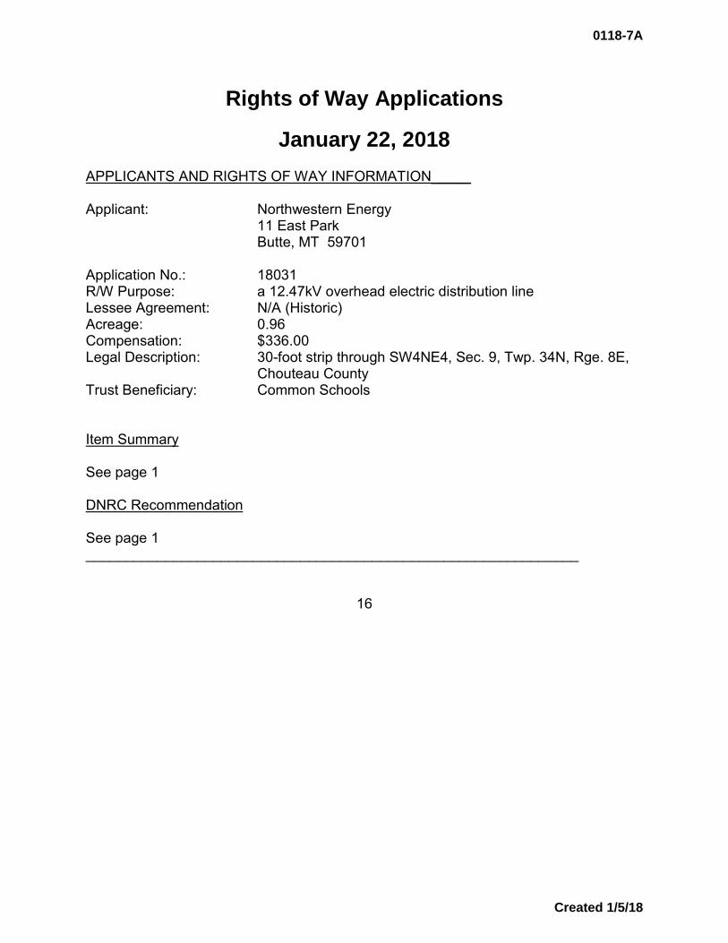
Rights of Way Applications
January 22, 2018 APPLICANTS AND RIGHTS OF WAY INFORMATION_____ Applicant: Northwestern Energy 11 East Park Butte, MT 59701 Application No.: 18031 R/W Purpose: a 12.47kV overhead electric distribution line Lessee Agreement: N/A (Historic) Acreage: 0.96 Compensation: $336.00 Legal Description: 30-foot strip through SW4NE4, Sec. 9, Twp. 34N, Rge. 8E,
Chouteau County Trust Beneficiary: Common Schools Item Summary See page 1 DNRC Recommendation See page 1 ______________________________________________________________
16
0118-7A
Created 1/5/18

Rights of Way Applications
January 22, 2018 APPLICANTS AND RIGHTS OF WAY INFORMATION_____ Applicant: Northwestern Energy 11 East Park Butte, MT 59701 Application No.: 18032 R/W Purpose: a 12.47kV overhead electric distribution line Lessee Agreement: N/A (Historic) Acreage: 0.14 Compensation: $175.00 Legal Description: 10-foot strip across the Missouri River in E2SE4, Sec. 28,
Twp. 24N, Rge. 8E, Chouteau County Trust Beneficiary: Public Land Trust Item Summary See page 1 DNRC Recommendation See page 1 ______________________________________________________________
17
0118-7A
Created 1/5/18
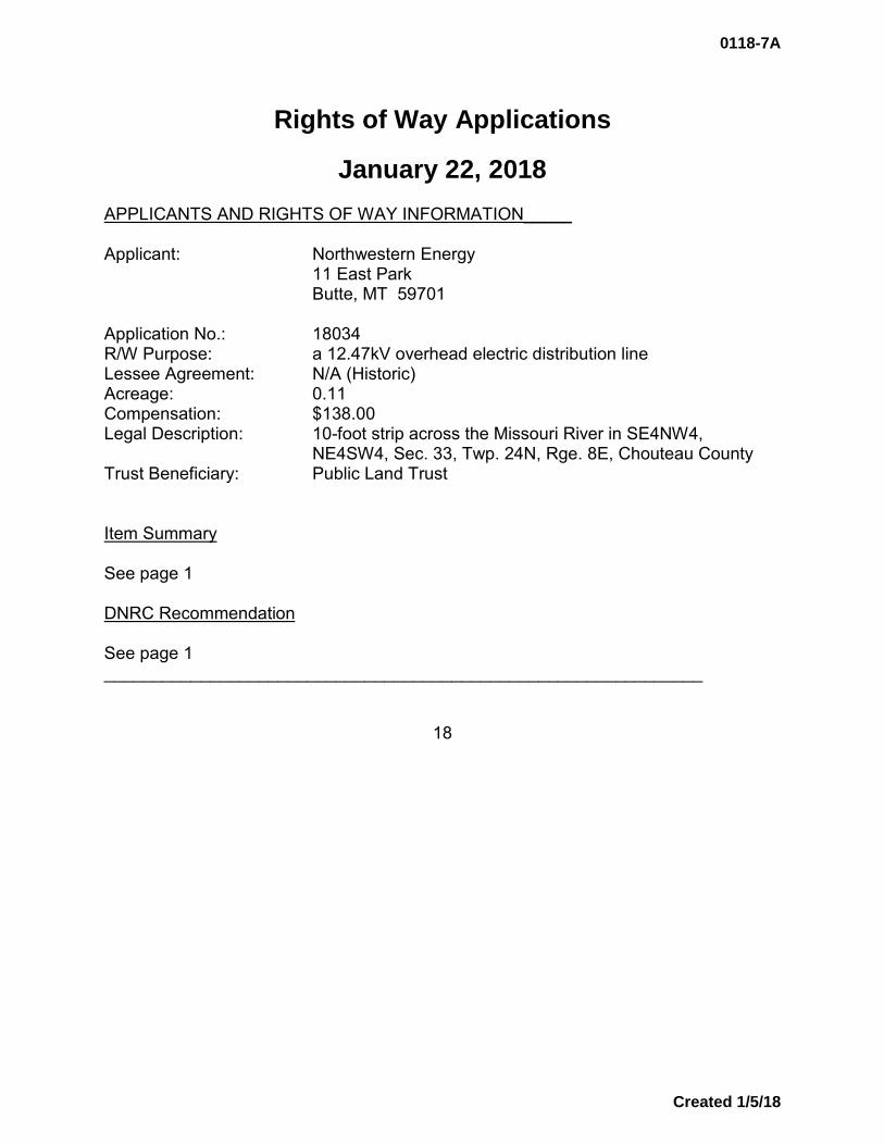
Rights of Way Applications
January 22, 2018 APPLICANTS AND RIGHTS OF WAY INFORMATION_____ Applicant: Northwestern Energy 11 East Park Butte, MT 59701 Application No.: 18034 R/W Purpose: a 12.47kV overhead electric distribution line Lessee Agreement: N/A (Historic) Acreage: 0.11 Compensation: $138.00 Legal Description: 10-foot strip across the Missouri River in SE4NW4,
NE4SW4, Sec. 33, Twp. 24N, Rge. 8E, Chouteau County Trust Beneficiary: Public Land Trust Item Summary See page 1 DNRC Recommendation See page 1 ______________________________________________________________
18
0118-7A
Created 1/5/18
Rights of Way Applications
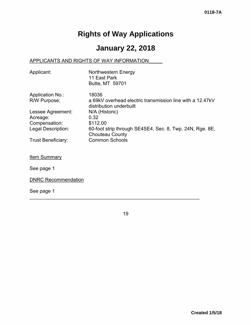
January 22, 2018 APPLICANTS AND RIGHTS OF WAY INFORMATION_____ Applicant: Northwestern Energy 11 East Park Butte, MT 59701 Application No.: 18036 R/W Purpose: a 69kV overhead electric transmission line with a 12.47kV
distribution underbuilt Lessee Agreement: N/A (Historic) Acreage: 0.32 Compensation: $112.00 Legal Description: 60-foot strip through SE4SE4, Sec. 8, Twp. 24N, Rge. 8E,
Chouteau County Trust Beneficiary: Common Schools Item Summary See page 1 DNRC Recommendation See page 1 ______________________________________________________________
19
0118-7A
Created 1/5/18
Rights of Way Applications
January 22, 2018
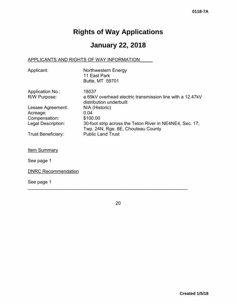
APPLICANTS AND RIGHTS OF WAY INFORMATION_____ Applicant: Northwestern Energy 11 East Park Butte, MT 59701 Application No.: 18037 R/W Purpose: a 69kV overhead electric transmission line with a 12.47kV
distribution underbuilt Lessee Agreement: N/A (Historic) Acreage: 0.04 Compensation: $100.00 Legal Description: 30-foot strip across the Teton River in NE4NE4, Sec. 17,
Twp. 24N, Rge. 8E, Chouteau County Trust Beneficiary: Public Land Trust Item Summary See page 1 DNRC Recommendation See page 1 ______________________________________________________________
20
0118-7A
Created 1/5/18

Rights of Way Applications
January 22, 2018 APPLICANTS AND RIGHTS OF WAY INFORMATION_____ Applicant: Northwestern Energy 11 East Park Butte, MT 59701 Application No.: 18038 R/W Purpose: a 69kV overhead electric transmission line with a 12.47kV
distribution underbuilt Lessee Agreement: N/A (Historic) Acreage: 2.43 Compensation: $851.00 Legal Description: 60-foot strip through NE4NE4, Sec. 17, Twp. 24N, Rge. 8E,
Chouteau County Trust Beneficiary: Common Schools Item Summary See page 1 DNRC Recommendation See page 1 ______________________________________________________________
21
0118-7A
Created 1/5/18

Rights of Way Applications
January 22, 2018
APPLICANTS AND RIGHTS OF WAY INFORMATION_____ Applicant: Northwestern Energy 11 East Park Butte, MT 59701 Application No.: 18039 R/W Purpose: a 69kV overhead electric transmission line with a 12.47kV
distribution underbuilt Lessee Agreement: N/A (Historic) Acreage: 1.21 Compensation: $424.00 Legal Description: 40-foot strip through NE4NE4, Sec. 8, Twp. 22N, Rge. 5E,
Cascade County Trust Beneficiary: Common Schools Item Summary See page 1 DNRC Recommendation See page 1 ______________________________________________________________
22
0118-7A
Created 1/5/18

Rights of Way Applications
January 22, 2018 APPLICANTS AND RIGHTS OF WAY INFORMATION_____ Applicant: Northwestern Energy 11 East Park Butte, MT 59701 Application No.: 18040 R/W Purpose: a 69kV overhead electric transmission line Lessee Agreement: N/A (Historic) Acreage: 0.08 Compensation: $100.00 Legal Description: 40-foot strip through SE4NE4, Sec. 26, Twp. 23N, Rge. 5E,
Chouteau County Trust Beneficiary: Western/Eastern Item Summary See page 1 DNRC Recommendation See page 1 ______________________________________________________________
23
0118-7A
Created 1/5/18

Rights of Way Applications
January 22, 2018 APPLICANTS AND RIGHTS OF WAY INFORMATION_____ Applicant: Northwestern Energy 11 East Park Butte, MT 59701 Application No.: 18041 R/W Purpose: a 1” buried natural gas pipeline Lessee Agreement: N/A (Historic) Acreage: 0.01 Compensation: $100.00 Legal Description: 20-foot strip across the Teton River in SE4NE4, Sec. 26,
Twp. 24N, Rge. 5W, Teton County Trust Beneficiary: Public Land Trust Item Summary See page 1 DNRC Recommendation See page 1 ______________________________________________________________
24
0118-7A
Created 1/5/18
Rights of Way Applications
January 22, 2018
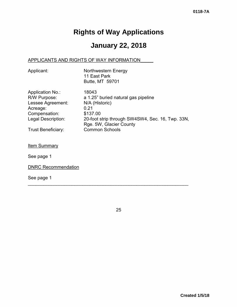
APPLICANTS AND RIGHTS OF WAY INFORMATION_____ Applicant: Northwestern Energy 11 East Park Butte, MT 59701 Application No.: 18043 R/W Purpose: a 1.25” buried natural gas pipeline Lessee Agreement: N/A (Historic) Acreage: 0.21 Compensation: $137.00 Legal Description: 20-foot strip through SW4SW4, Sec. 16, Twp. 33N,
Rge. 5W, Glacier County Trust Beneficiary: Common Schools Item Summary See page 1 DNRC Recommendation See page 1 ______________________________________________________________
25
0118-7A
Created 1/5/18
Rights of Way Applications
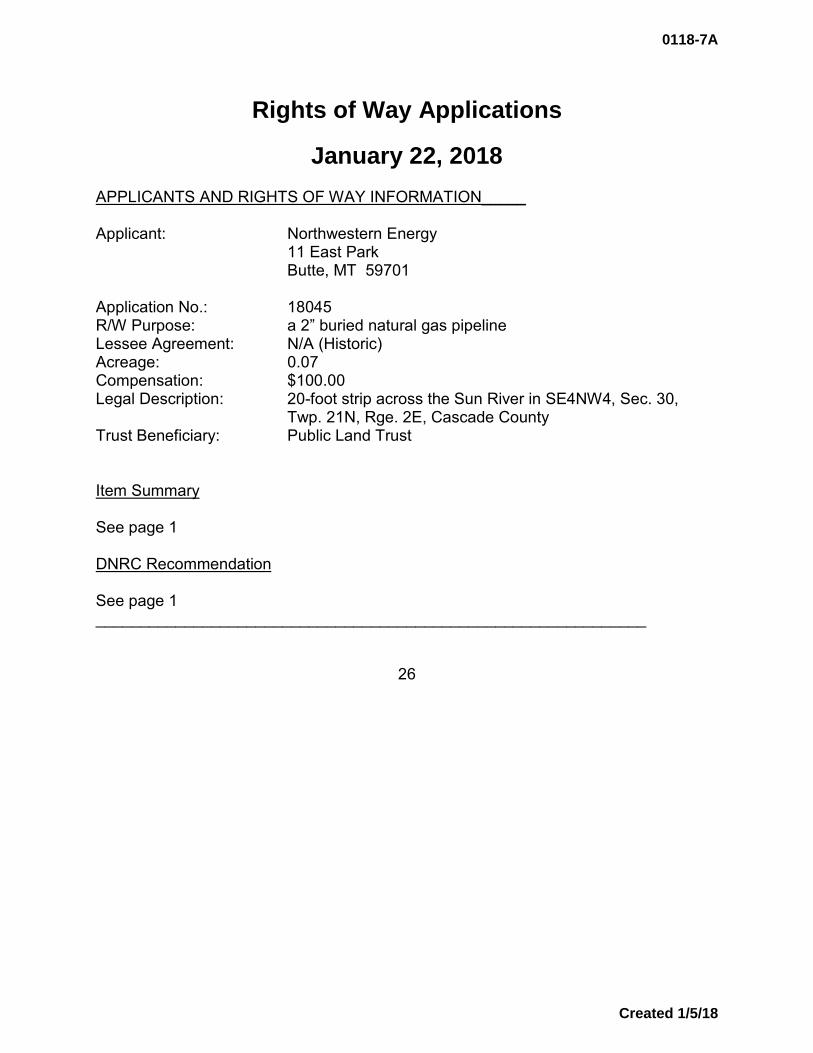
January 22, 2018 APPLICANTS AND RIGHTS OF WAY INFORMATION_____ Applicant: Northwestern Energy 11 East Park Butte, MT 59701 Application No.: 18045 R/W Purpose: a 2” buried natural gas pipeline Lessee Agreement: N/A (Historic) Acreage: 0.07 Compensation: $100.00 Legal Description: 20-foot strip across the Sun River in SE4NW4, Sec. 30,
Twp. 21N, Rge. 2E, Cascade County Trust Beneficiary: Public Land Trust Item Summary See page 1 DNRC Recommendation See page 1 ______________________________________________________________
26
0118-7A
Created 1/5/18

Rights of Way Applications
January 22, 2018 APPLICANTS AND RIGHTS OF WAY INFORMATION_____ Applicant: Northwestern Energy 11 East Park Butte, MT 59701 Application No.: 18046 R/W Purpose: a 2” buried natural gas pipeline Lessee Agreement: N/A (Historic) Acreage: 0.07 Compensation: $100.00 Legal Description: 20-foot strip through NW4NE4 across the Sun River, Sec.
34, Twp. 21N, Rge. 2E, Cascade County Trust Beneficiary: Public Land Trust Item Summary See page 1 DNRC Recommendation See page 1 ______________________________________________________________
27
0118-7A
Created 1/5/18
Rights of Way Applications
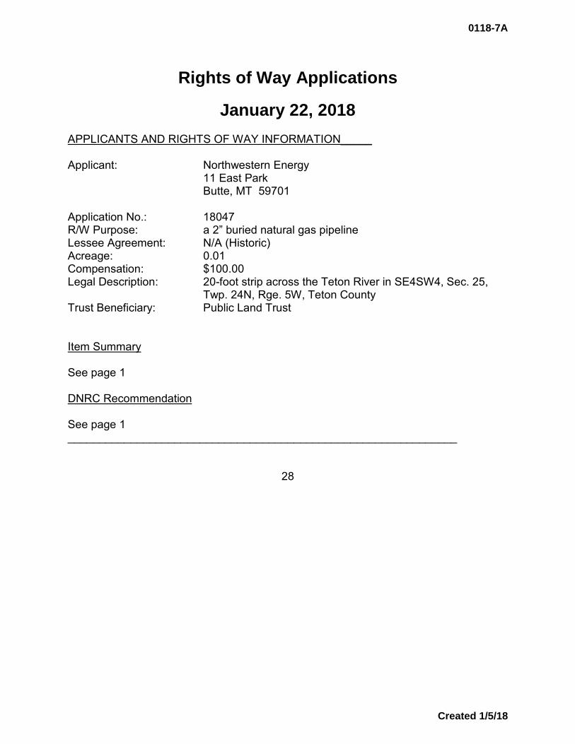
January 22, 2018 APPLICANTS AND RIGHTS OF WAY INFORMATION_____ Applicant: Northwestern Energy 11 East Park Butte, MT 59701 Application No.: 18047 R/W Purpose: a 2” buried natural gas pipeline Lessee Agreement: N/A (Historic) Acreage: 0.01 Compensation: $100.00 Legal Description: 20-foot strip across the Teton River in SE4SW4, Sec. 25,
Twp. 24N, Rge. 5W, Teton County Trust Beneficiary: Public Land Trust Item Summary See page 1 DNRC Recommendation See page 1 ______________________________________________________________
28
0118-7A
Created 1/5/18

Rights of Way Applications
January 22, 2018 APPLICANTS AND RIGHTS OF WAY INFORMATION_____ Applicant: Northwestern Energy 11 East Park Butte, MT 59701 Application No.: 18061 R/W Purpose: a 12.47kV overhead electric distribution line Lessee Agreement: N/A (Historic) Acreage: 0.04 Compensation: $100.00 Legal Description: 10-foot strip across the Sun River in SE4SE4, Sec. 35,
Twp. 21N, Rge. 2E, Cascade County Trust Beneficiary: Public Land Trust Item Summary See page 1 DNRC Recommendation See page 1 ______________________________________________________________
29
0118-7A
Created 1/5/18

Rights of Way Applications
January 22, 2018 APPLICANTS AND RIGHTS OF WAY INFORMATION_____ Applicant: Northwestern Energy 11 East Park Butte, MT 59701 Application No.: 18062 R/W Purpose: a 12.47kV overhead electric distribution line Lessee Agreement: N/A (Historic) Acreage: 0.04 Compensation: $100.00 Legal Description: 10-foot strip across the Sun River in SW4NE4, Sec. 35,
Twp. 21N, Rge. 2E, Cascade County Trust Beneficiary: Public Land Trust Item Summary See page 1 DNRC Recommendation See page 1 ______________________________________________________________
30
0118-7A
Created 1/5/18

Rights of Way Applications
January 22, 2018 APPLICANTS AND RIGHTS OF WAY INFORMATION_____ Applicant: Northwestern Energy 11 East Park Butte, MT 59701 Application No.: 18064 R/W Purpose: a 12.47kV overhead electric distribution line Lessee Agreement: N/A (Historic) Acreage: 0.09 Compensation: $113.00 Legal Description: 10-foot strip across the Marias River in SW4SW4, Sec. 1,
Twp. 25N, Rge. 9E, Chouteau County Trust Beneficiary: Public Land Trust Item Summary See page 1 DNRC Recommendation See page 1 ______________________________________________________________
31
0118-7A
Created 1/5/18
Rights of Way Applications
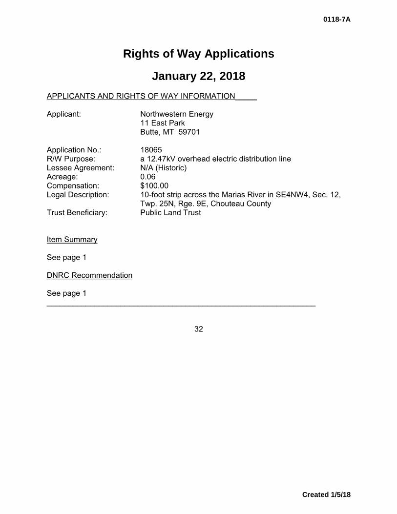
January 22, 2018 APPLICANTS AND RIGHTS OF WAY INFORMATION_____ Applicant: Northwestern Energy 11 East Park Butte, MT 59701 Application No.: 18065 R/W Purpose: a 12.47kV overhead electric distribution line Lessee Agreement: N/A (Historic) Acreage: 0.06 Compensation: $100.00 Legal Description: 10-foot strip across the Marias River in SE4NW4, Sec. 12,
Twp. 25N, Rge. 9E, Chouteau County Trust Beneficiary: Public Land Trust Item Summary See page 1 DNRC Recommendation See page 1 ______________________________________________________________
32
0118-7A
Created 1/5/18

Rights of Way Applications
January 22, 2018 APPLICANTS AND RIGHTS OF WAY INFORMATION_____ Applicant: Northwestern Energy 11 East Park Butte, MT 59701 Application No.: 18066 R/W Purpose: a 4.16kV overhead electric distribution line Lessee Agreement: N/A (Historic) Acreage: 1.15 Compensation: $575.00 Legal Description: 30-foot strip through SE4SE4, Sec. 16, Twp. 27N, Rge. 4W,
Pondera County Trust Beneficiary: Common Schools Item Summary See page 1 DNRC Recommendation See page 1 ______________________________________________________________
33
0118-7A
Created 1/5/18

Rights of Way Applications
January 22, 2018
APPLICANTS AND RIGHTS OF WAY INFORMATION_____ Applicant: Northwestern Energy 11 East Park Butte, MT 59701 Application No.: 18067 R/W Purpose: a 12.47kV overhead electric distribution line Lessee Agreement: N/A (Historic) Acreage: 1.83 Compensation: $915.00 Legal Description: 30-foot strip through S2NE4, Sec. 16, Twp. 27N, Rge. 4W,
Pondera County Trust Beneficiary: Common Schools Item Summary See page 1 DNRC Recommendation See page 1 ______________________________________________________________
34
0118-7A
Created 1/5/18
Rights of Way Applications
January 22, 2018
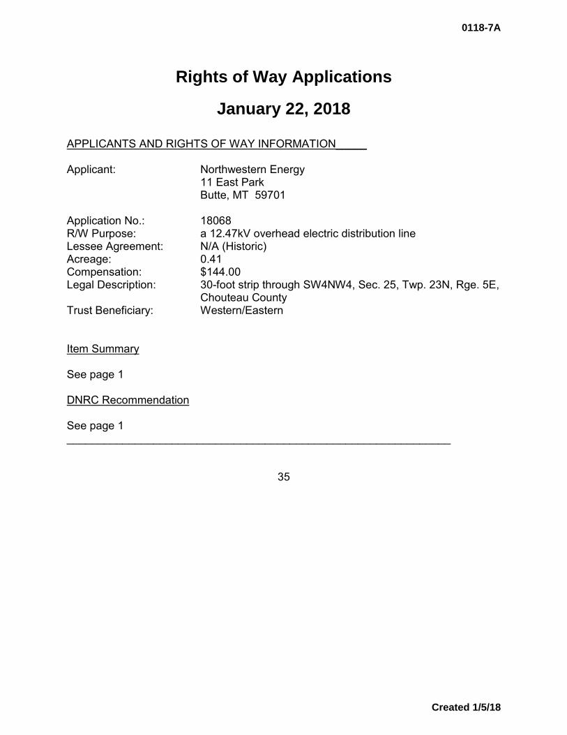
APPLICANTS AND RIGHTS OF WAY INFORMATION_____ Applicant: Northwestern Energy 11 East Park Butte, MT 59701 Application No.: 18068 R/W Purpose: a 12.47kV overhead electric distribution line Lessee Agreement: N/A (Historic) Acreage: 0.41 Compensation: $144.00 Legal Description: 30-foot strip through SW4NW4, Sec. 25, Twp. 23N, Rge. 5E,
Chouteau County Trust Beneficiary: Western/Eastern Item Summary See page 1 DNRC Recommendation See page 1 ______________________________________________________________
35
0118-7A
Created 1/5/18

Rights of Way Applications
January 22, 2018
APPLICANTS AND RIGHTS OF WAY INFORMATION_____ Applicant: Northwestern Energy 11 East Park Butte, MT 59701 Application No.: 18069 R/W Purpose: a 12.47kV overhead electric distribution line Lessee Agreement: N/A (Historic) Acreage: 0.18 Compensation: $100.00 Legal Description: 30-foot strip through SE4NE4, Sec. 26, Twp. 23N, Rge. 5E,
Chouteau County Trust Beneficiary: Western/Eastern Item Summary See page 1 DNRC Recommendation See page 1 ______________________________________________________________
36
0118-7A
Created 1/5/18

Rights of Way Applications
January 22, 2018
APPLICANTS AND RIGHTS OF WAY INFORMATION_____ Applicant: Northwestern Energy 11 East Park Butte, MT 59701 Application No.: 18070 R/W Purpose: a 12.47kV overhead electric distribution line Lessee Agreement: N/A (Historic) Acreage: 0.92 Compensation: $322.00 Legal Description: 30-foot strip through NW4NW4, Sec. 33, Twp. 22N, Rge. 4E,
Cascade County Trust Beneficiary: Public Buildings Item Summary See page 1 DNRC Recommendation See page 1 ______________________________________________________________
37
0118-7A
Created 1/5/18
Rights of Way Applications
January 22, 2018
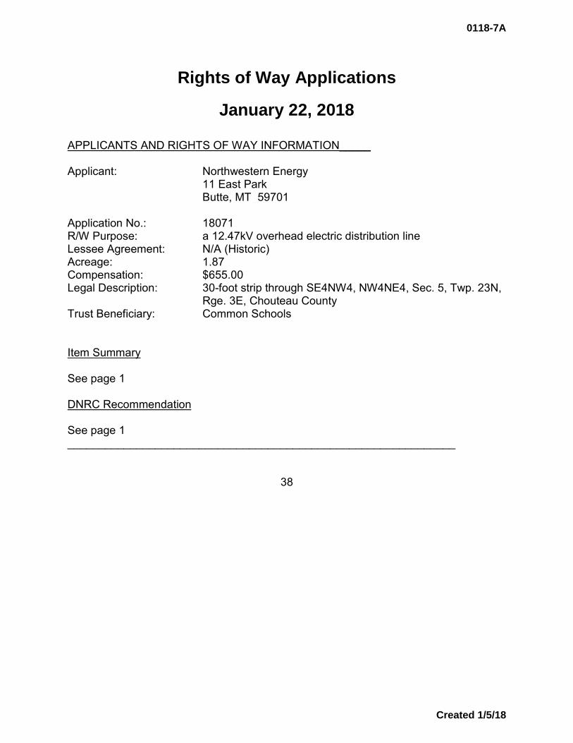
APPLICANTS AND RIGHTS OF WAY INFORMATION_____ Applicant: Northwestern Energy 11 East Park Butte, MT 59701 Application No.: 18071 R/W Purpose: a 12.47kV overhead electric distribution line Lessee Agreement: N/A (Historic) Acreage: 1.87 Compensation: $655.00 Legal Description: 30-foot strip through SE4NW4, NW4NE4, Sec. 5, Twp. 23N,
Rge. 3E, Chouteau County Trust Beneficiary: Common Schools Item Summary See page 1 DNRC Recommendation See page 1 ______________________________________________________________
38
0118-7A
Created 1/5/18
Rights of Way Applications
January 22, 2018
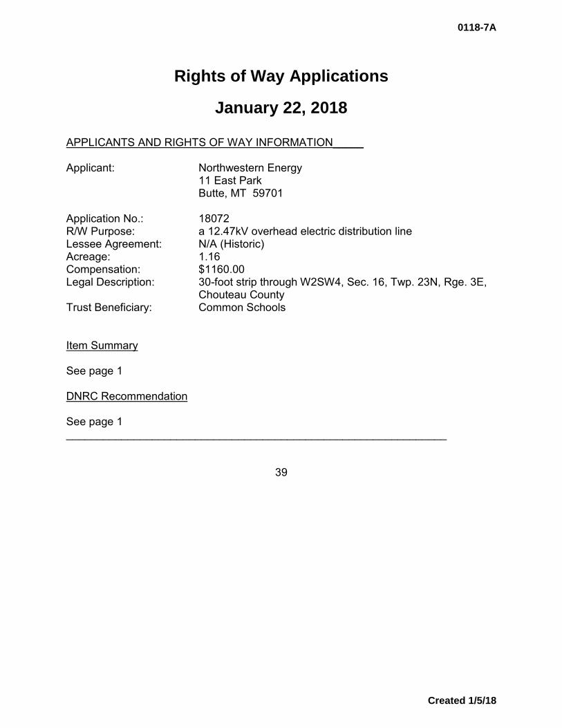
APPLICANTS AND RIGHTS OF WAY INFORMATION_____ Applicant: Northwestern Energy 11 East Park Butte, MT 59701 Application No.: 18072 R/W Purpose: a 12.47kV overhead electric distribution line Lessee Agreement: N/A (Historic) Acreage: 1.16 Compensation: $1160.00 Legal Description: 30-foot strip through W2SW4, Sec. 16, Twp. 23N, Rge. 3E,
Chouteau County Trust Beneficiary: Common Schools Item Summary See page 1 DNRC Recommendation See page 1 ______________________________________________________________
39
0118-7A
Created 1/5/18

Rights of Way Applications
January 22, 2018
APPLICANTS AND RIGHTS OF WAY INFORMATION_____ Applicant: Northwestern Energy 11 East Park Butte, MT 59701 Application No.: 18073 R/W Purpose: a 12.47kV overhead electric distribution line Lessee Agreement: N/A (Historic) Acreage: 0.38 Compensation: $133.00 Legal Description: 30-foot strip through SW4SE4, Sec. 31, Twp. 23N, Rge. 3E,
Chouteau County Trust Beneficiary: Pine Hills Item Summary See page 1 DNRC Recommendation See page 1 ______________________________________________________________
40
0118-7A
Created 1/5/18
Rights of Way Applications
January 22, 2018
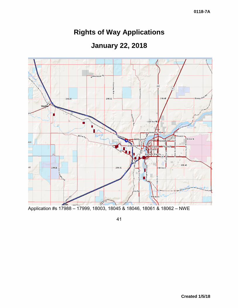
Application #s 17988 – 17999, 18003, 18045 & 18046, 18061 & 18062 – NWE
41
0118-7A
Created 1/5/18

Rights of Way Applications
January 22, 2018
Application #s 18029 & 18030, 18031, 18032 & 18034, 18036 -18038, 18064 & 18065 – NWE
42
0118-7A
Created 1/5/18
Rights of Way Applications
January 22, 2018
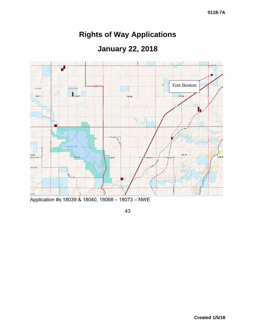
Application #s 18039 & 18040, 18068 – 18073 – NWE
43
Fort Benton
0118-7A
Created 1/5/18
Rights of Way Applications
January 22, 2018
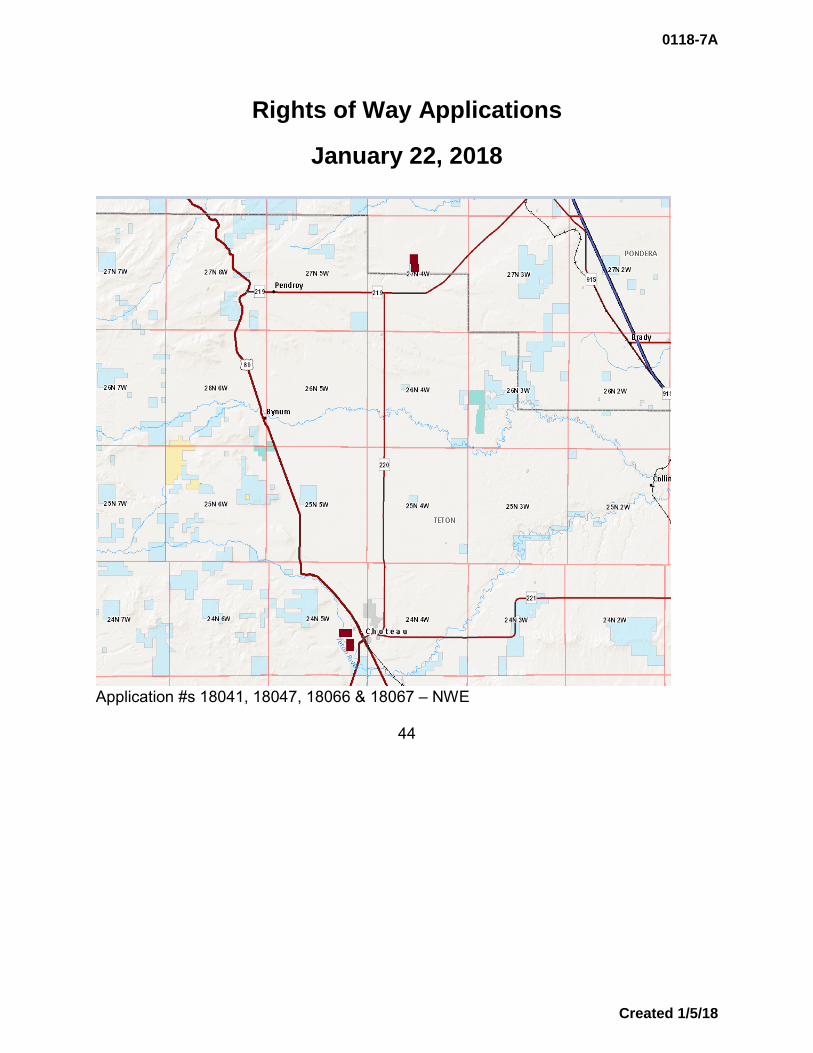
Application #s 18041, 18047, 18066 & 18067 – NWE
44
0118-7A
Created 1/5/18
Rights of Way Applications
January 22, 2018
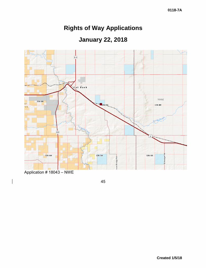
Application # 18043 – NWE
45
0118-7A
Created 1/5/18

Rights of Way Applications
January 22, 2018
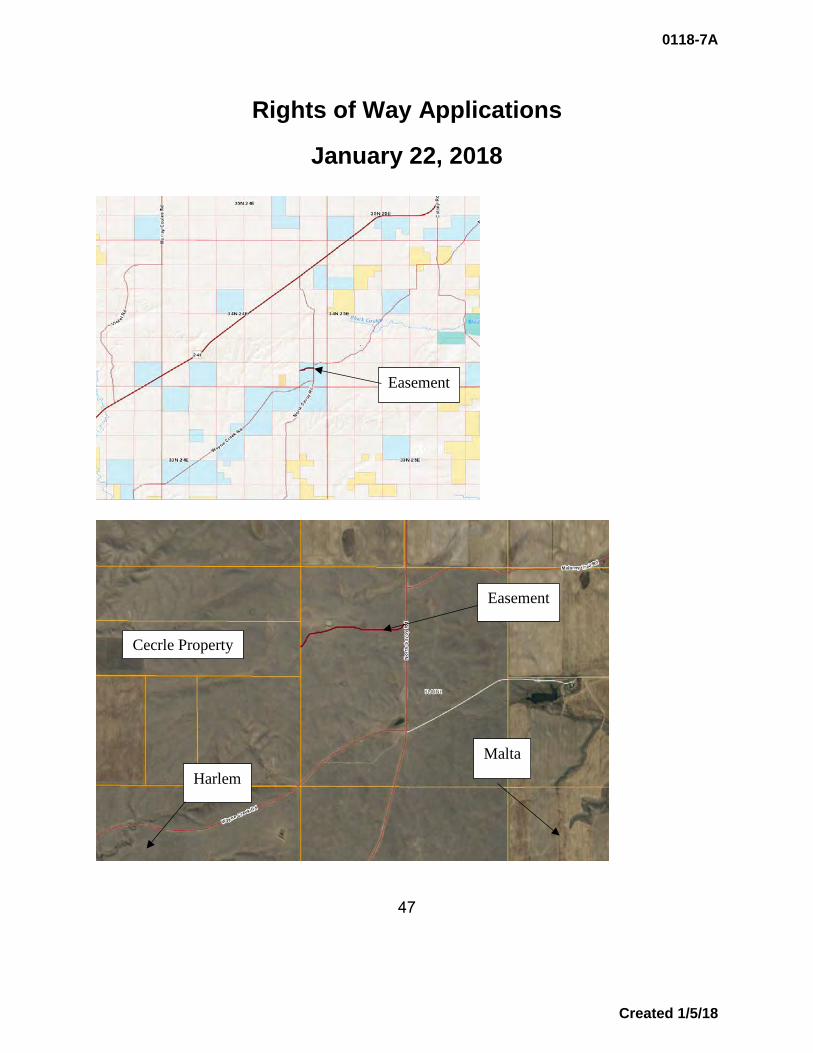
APPLICANTS AND RIGHTS OF WAY INFORMATION_____ Applicant: Kory & Mitzi Cecrle 3395 River Road Chinook, MT 59523 Application No.: 18059 R/W Purpose: a private access road for the purpose of conducting normal
farming and ranching operations Lessee Agreement: N/A (Historic) Acreage: 0.96 Compensation: $288.00 Legal Description: 15-foot strip through S2NW4, Sec. 36, Twp. 34N, Rge. 24E,
Blaine County Trust Beneficiary: Common Schools Item Summary Kory & Mitzi Cecrle have made application for the use of an existing road for conducting normal farming and ranching operations. The road has been in place for years and authorization for continued use is being requested pursuant to §77-1-130, MCA, which allows for recognition of such historic access. State land in the vicinity of the Cecrle property is legally accessed through a series of public county roads, therefore reciprocal access is not viable. The private property to be accessed is described as:
• Sec. 35, Twp. 34N, Rge. 24E – S2N2 DNRC Recommendation The director recommends approval of this historic private access easement. ______________________________________________________________
46
0118-7A
Created 1/5/18
Rights of Way Applications
January 22, 2018
47
Cecrle Property
Harlem Malta
Easement
Easement
0118-7A
Created 1/5/18
Rights of Way Applications
January 22, 2018
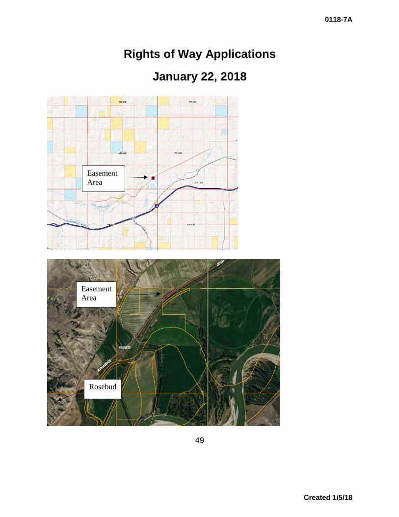
APPLICANTS AND RIGHTS OF WAY INFORMATION_____ Applicant: Range Telephone Cooperative, Inc. PO Box 127 Forsyth, MT 59327 Application No.: 18126 R/W Purpose: a buried telecommunications cable Lessee Agreement: ok Acreage: 0.31 Compensation: $930.00 Legal Description: 10-foot strip through NW4NE4, Sec. 36, Twp. 7N, Rge. 44E,
Rosebud County Trust Beneficiary: Common Schools Item Summary Range Telephone Cooperative, Inc., has made application to install a new buried fiber optic cable described as the North Rosebud East fiber optic project within Rosebud and Custer Counties. This cable would upgrade the existing telecommunication facilities within the Rosebud Exchange service area. The proposed route would be placed within the existing and previously disturbed right of way of Cartersville Road in Rosebud County. This route was chosen for its ease of access and its previous disturbed nature. No other reasonable alternative routes exist within the immediate area. DNRC Recommendation The director recommends approval of this buried telecommunications cable.
48
0118-7A
Created 1/5/18
Rights of Way Applications
January 22, 2018
49
Easement Area
Easement Area
Rosebud
0118-7A
Created 1/5/18
Land Board Agenda Item January 22, 2018
0118-7B Montana Department of Corrections: Easement Grant to Montana Department of Transportation
Location: Yellowstone County Trust Benefits: N/A (non-trust) Non-Trust Revenue: $500.00 to Montana Department of Corrections
Item Summary
The Montana Department of Transportation (MDT) is requesting an additional 15 square feet of land owned by the Montana Department of Corrections at the Women’s State Prison in Billings, MT. The scope of the project is to bring 27th Street from its intersection with Interstate 90 to Logan International Airport up to current federal design standards and to meet Americans With Disabilities Act (ADA) requirements. Proposed work will include new overlay of asphalt on 27th Street and installation of ADA compliant ramps at the intersections along the length of the project. New lighting and pavement markings as well as street signs and drainage features will be included.
Appraisal MDT conducted a market value analysis and determined a value of $7.00 per square foot, which equates to $105 for the 15-square foot parcel necessary for the project. The minimum payment for a federal highway project is $500.00, which has been offered to the Department of Corrections
Department Recommendation
The Department of Corrections requests the Land Board approve this easement grant MDT at the Women’s State Prison in Billings, MT.
0118-7B
Page 1 of 2 Created 1/5/18

Location Map
0118-7B
Page 2 of 2 Created 1/5/18