Embed Size (px)
Citation preview
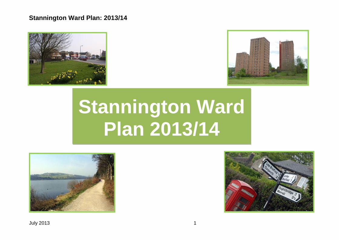
Stannington Ward Plan: 2013/14
July 2013 1
Stannington Ward Plan 2013/14
Stannington Ward Plan: 2013/14
July 2013 2
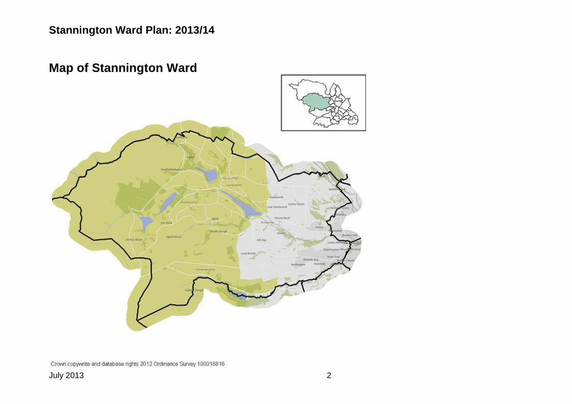
Map of Stannington Ward

Stannington Ward Plan: 2013/14
July 2013 3
Background to the Ward The Stannington Ward has communities living in the Stannington, Loxley, Woodland View, Worrall, and Middlewood neighbourhoods. It also has some of the ‘Rural Area’, which occupies about 30% of land in the city. The ‘rural area’ lies to the west, mainly in the Peak District National Park and is split between four wards, Stocksbridge and Upper Don Ward, Stannington and two Community Assemblies, Northern and South West. There is access to a significant amount of open space across the ward. In particular, Stannington in the west and Worrall in the north are surrounded by open green landscape. Loxley Common is situated north of Loxley toward Worrall. Loxley Valley runs from east to west, overlooked by Loxley and Woodland View. Local amenities vary throughout the area and Hillsborough acts as a district centre with a variety of shops and services, including a supermarket. Worrall has a pub, post office and Bradfield Secondary School but has relatively low access to services due to its remoteness. The Supertram serves the east of the ward at Malin Bridge and Middlewood. Stannington, Loxley and Worrall were originally villages in their own right. Only Worrall remains separated from the urban area. There is a mix of housing across the area with predominantly privately owned inter-war semi detached housing. . There is a mix of privately owned homes in Loxley and predominantly older properties in Worrall. There are pockets of social housing in Stannington which fall within the top 20% most deprived areas in England around the Deer Parks and Liberty Hill areas in Woodland View. This neighbourhood has Victorian terraced housing at Malin Bridge diversifying into modern housing along Wood Lane and Stannington Road, culminating in three distinctive tower blocks at Deer Park. Middlewood is split between three wards with a section of the 1960’s Winn Gardens falling into the Stannington Ward. New developments have changed the character of the population in Middlewood in recent years. Summary of Statistics for the Area Population Summary 2011
Stannington Ward has a population of 18,222. This figure has increased at a greater rate than Sheffield since 2001.
The working age population is relatively small in comparison to Sheffield.
Related to this, the ward has a proportionately high young population (17%) and a large older population (22%).
The 2011 Census indicates that 5% of Stannington Ward is BME, lower than the city average.
The largest single BME population is the Other White group. This group represents 21.9% of BME people. Deprivation Poverty and Access to Services
Stannington is the 21st most deprived ward in Sheffield. This has increased since 2007 when it was ranked 22st.
9.8% of children in Stannington Ward are at risk of living in poverty; compared with 24.2% citywide. This figure has risen by 0.4% since 2006.
Stannington Ward Plan: 2013/14
July 2013 4
There are no people in the ward who are living in areas classed amongst the 10% most deprived in England, according to the latest Indices of Deprivation.
7.5% of school pupils are eligible for free school meals, compared with 20% citywide.
Woodland View neighbourhood is the most deprived in the ward, although none of the area is classed within the most deprived 10% in England.
Compared with other neighbourhoods in Sheffield, it is ranked as only the 49th most deprived neighbourhood in the city. Access to Services
24.4 % of households in the ward do not own a car.
Stannington is served by the 11/12 bus routes which operate on a frequent basis.
There is also has a dedicated bus link to the Malin Bridge Supertram terminus.
Access to other key services such as schools and health services compare favourably with city averages.
The median household income in Stannington Ward is £30,467, above the citywide average of £24,297.
26.2% of households earn below £20k per annum; 5.3% of whom have an income of less than £10k a year. Economy and Enterprise The 2011 Census also shows that:
In Stannington 12.2% of the working age population claim benefits compared with 15.9% in Sheffield.
In Stannington, 21% of workers were employed in professional occupations whilst 27% were employed in managerial / professional technical occupations, compared with 39% citywide.
By contrast, 44% were employed in manual occupations, compared with 30% in Sheffield as a whole.
36.1% of working age people in the ward had no formal qualifications.
Most businesses are in construction (27%) 39.5% were qualified to NVQ Level 3 or higher compared with 41.5% in the city as a whole.
Education
There are five primary and two secondary schools located in Stannington ward; Bradfield Dungworth Primary, Loxley Primary, Nook Lane Junior, Shooter's Grove Primary, Stannington Infant, Bradfield School and Forge Valley Community School
Unauthorised absences from primary schools were 41.4% and 84.4% for secondary school children.
These figures rank Stannington 21st and 22nd, respectively, when compared against other wards in the city.

Stannington Ward Plan: 2013/14
July 2013 5
Educational Attainment School Attendance
2,302 pupils from Stannington attended schools in Sheffield during 2012; 50% boys 50% girls.
62.2% of pupils achieved Key Stage 2 Level 4+ (English & Maths, compared with 5605% in Sheffield
77% of children achieve 5 or more GCSEs (A*-C including Maths and English) compared with 8220% in Sheffield.
Figures suggest that 7% of pupils are BME, whilst 9 had a first language other than English. This ranks the ward 13th in the city, with attainment improving by 17.9% since 2008.
Within the ward, this level of GCSE attainment was; 70% in Stannington, 65% in Worrall, 55% in Woodland View and 39% in Loxley.
Post-16 Education
6.1% of 16-18 year olds are not in education, employment or training (NEET). Health
Significantly low premature mortality rate, and significantly high levels of life expectancy for females.
Significantly low levels of: A&E attendance, Emergency hospital admissions, Alcohol related hospital admissions, Newly diagnosed sexually transmitted diseases, Smoking related mortality and under 18 conceptions
Ward with 2nd lowest premature mortality rate (age under 75 ) for cancer, but significantly high hospital admission rate for cancer.
Significantly low hospital admission rates for: chronic diseases; Stroke, Chronic Obstructive Pulmonary Disease, Asthma and Inpatient mental health specialties
Significantly low mortality rates due to respiratory disorders.
Whilst smoking rates and related mortality are relatively low, there is a low rate of quits per 100 smokers. Housing
The average house costs £135,663 in Stannington the 6th largest in the city compared with other wards.
The cost of renting private accommodation is around £665pcm compared with the citywide average of £613pcm.
In total, there are 8,030 residential dwellings in the ward. 911 of these properties are empty, around 73.6% of the total.
Since the start of the recession, around 2007/08, the average house price in the ward has decreased by 26%, compared with a fall of 16% citywide.
Furthermore, 1,265 of these have been vacant for at least 6 months, which makes up 15.8% of all properties in the ward.
There are currently 218 council properties in the ward, making up 271% of the total housing stock.
There are also 561 Registered Housing Provider (RHP) dwellings, or 699% of the total.
Stannington Ward Plan: 2013/14
July 2013 6
This means that a total of 18% of the stock in Stannington is social housing compared with 25% citywide. Community Safety
The crime rate in Stannington is lower than the citywide average, whilst the rate of anti-social behaviour is below average:
Crime in Stannington Ward (Oct 2011 – Sep 2012)
The latest figures show that in the 12 months preceding September 2012 there were 233 reported crimes.
This equates to around 12.8 incidents per 1000 population compared with 29.6 in Sheffield as a whole.
The most significant type of crime in the area is criminal damage for which there were 3.8 incidents per 1000 population compared with 5.6 citywide.
During the 2010/11 period there were 6 10-17 year old first time entrants to the Youth Justice System. This compares with 24 in 2007/08, a decrease of 75%, compared with a 63.21% fall citywide.
In 2010/11 there were a total of 58 fires in Stannington. Amongst these, 15 were deliberate primary fires. Environment Public Realm and Facilities in Stannington Ward
Stannington has a total area of 7229 hectares. From this: 24.5% is green belt. 0.4% is open space.
The vast majority of the ward is located rurally, much of it situated in the Peak District National Park.
Areas like Little Matlock wood and Wadsley Common are also located in the green belt.
Within the ward there are a few public facilities, including: o 1 public library o 10 playgrounds o 5 recycling centres o 1 cemetery.
Road Safety
Incidents of KSIs have risen by 10% since 2006-08. This increase compares with a fall of 33% citywide.
Between 2009 and 2011 23 people were killed or seriously injured (KSI) in road traffic incidents.
Stannington Ward Plan: 2013/14
July 2013 7
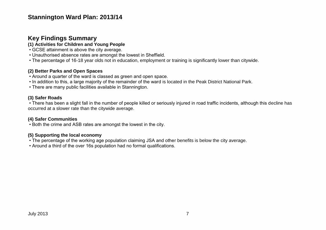
Key Findings Summary
(1) Activities for Children and Young People • GCSE attainment is above the city average. • Unauthorised absence rates are amongst the lowest in Sheffield. • The percentage of 16-18 year olds not in education, employment or training is significantly lower than citywide. (2) Better Parks and Open Spaces • Around a quarter of the ward is classed as green and open space. • In addition to this, a large majority of the remainder of the ward is located in the Peak District National Park. • There are many public facilities available in Stannington. (3) Safer Roads • There has been a slight fall in the number of people killed or seriously injured in road traffic incidents, although this decline has occurred at a slower rate than the citywide average. (4) Safer Communities • Both the crime and ASB rates are amongst the lowest in the city. (5) Supporting the local economy • The percentage of the working age population claiming JSA and other benefits is below the city average. • Around a third of the over 16s population had no formal qualifications.
Stannington Ward Plan: 2013/14
July 2013 8
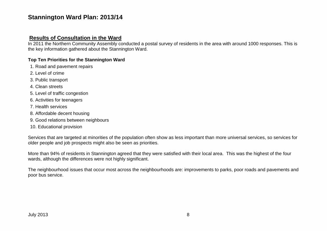
Results of Consultation in the Ward
In 2011 the Northern Community Assembly conducted a postal survey of residents in the area with around 1000 responses. This is the key information gathered about the Stannington Ward. Top Ten Priorities for the Stannington Ward
1. Road and pavement repairs
2. Level of crime
3. Public transport
4. Clean streets
5. Level of traffic congestion
6. Activities for teenagers
7. Health services
8. Affordable decent housing
9. Good relations between neighbours
10. Educational provision Services that are targeted at minorities of the population often show as less important than more universal services, so services for older people and job prospects might also be seen as priorities. More than 94% of residents in Stannington agreed that they were satisfied with their local area. This was the highest of the four wards, although the differences were not highly significant. The neighbourhood issues that occur most across the neighbourhoods are: improvements to parks, poor roads and pavements and poor bus service.
Stannington Ward Plan: 2013/14
July 2013 9
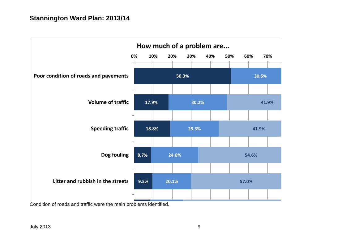
50.3%
17.9%
18.8%
8.7%
9.5%
8.0%
30.5%
30.2%
25.3%
24.6%
20.1%
17.1%
14.4%
41.9%
41.9%
54.6%
57.0%
54.9%
3.7
%
8.9%
13.4%
10.9%
12.3%
17.7%
0% 10% 20% 30% 40% 50% 60% 70% 80% 90% 100%
Poor condition of roads and pavements
Volume of traffic
Speeding traffic
Dog fouling
Litter and rubbish in the streets
Anti-social behaviour
How much of a problem are...
A very big problem A fairly big problem Not a very big problem Not a problem at all
Condition of roads and traffic were the main problems identified.
Stannington Ward Plan: 2013/14
July 2013 10
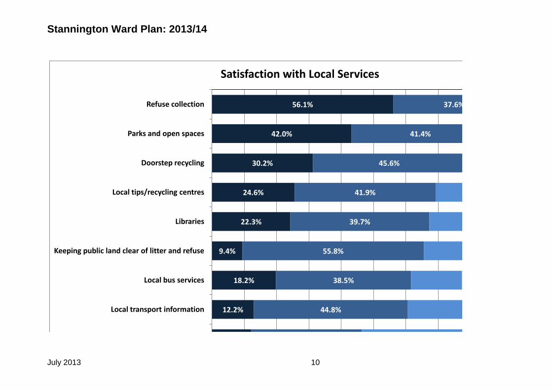
10.3%
12.2%
18.2%
9.4%
22.3%
24.6%
30.2%
42.0%
56.1%
29.3%
44.8%
38.5%
55.8%
39.7%
41.9%
45.6%
41.4%
37.6%
0% 10% 20% 30% 40% 50% 60% 70% 80% 90% 100%
Sports/leisure facilities
Local transport information
Local bus services
Keeping public land clear of litter and refuse
Libraries
Local tips/recycling centres
Doorstep recycling
Parks and open spaces
Refuse collection
Satisfaction with Local Services
Very satisfied Fairly satisfied Neither/Nor Fairly dissatisfied Very dissatisfied

Stannington Ward Plan: 2013/14
July 2013 11
Ward Action Plan
Theme 1 – Environmental Improvements
Activity
Timescales Outcome - Performance Indicator
Lead (and partners)
Support the work of local environmental groups
March 2014 Grants programme open to local environmental groups Councillors to attend community meetings as appropriate
Ward Councillors AMEY Parks Environmental Community Groups Grants Team
Support the work of AMEY in the area
March 2014 Councillors to link in to AMEY’s work in the area to ensure members of the public are well informed Councillors to attend meetings and support consultation as appropriate.
Ward Councillors AMEY
Theme 2 - Supporting Community Life
Activity
Timescales Outcome Performance Indicator
Lead (and partners)
Promote activities happening in the area through the ‘What’s On
September 2013
Ensure the distribution and promotion of the Stannington ‘What’s On Guide’
Ward Councillors Bradfield Parish Council Local Area Team
Stannington Ward Plan: 2013/14
July 2013 12
Guide’
Support the work of local community groups
March 2014 Grants programme available to local groups for activities to improve community life in the ward Councillors to attend community meetings as appropriate Councillors support events and activities that promote community cohesion and community spirit.
Ward Councillors Bradfield Parish Council Local Area Team Grants Team
Internet connectivity in rural and semi-rural areas
March 2014 Councillors to undertake consultation with the community in order to gain a better understanding of the issue Councillors to work with partners to identify possible solutions for the issues Councillors assist in creating links between internet providers and the community
Ward Councillors Internet Service Providers Local businesses and potential businesses Local internet users Bradfield Parish Council Policy Improvement Team Business Information and Transformation (linking to the Digital Strategy) Sheffield Universities
Supporting the Lower Stannington community
March 2014 Grants programme available to local groups for activities to improve community life in the Lower Stannington area Councillors to attend community meetings as appropriate Councillors support events and activities that promote community cohesion and community spirit in the Lower Stannington area
Ward Councillors Grants Team Local community groups and organisations Activity Sheffield Stannington TARA

Stannington Ward Plan: 2013/14
July 2013 13
Theme 3 – Community Safety
Activity
Timescales Outcome- Performance Indicator
Lead (and partners)
Tackle anti-social behaviour and issues of drug and alcohol abuse in the Lower Stannington area
March 2014 Councillors to attend Stannington Community Safety Group meetings Councillors to attend Northern Partnership Action Group meetings as appropriate and to support their activities in the area. Councillors to support local partnership working which aims to tackle anti-social behaviour and issues of drug and alcohol abuse in the Lower Stannington area
Ward Councillors Police Sheffield Homes Community Safety Group DAAT
Ward Councillors STANNINGTON
Councillor Katie Condliffe Liberal Democrat 231 2157 273 5517 [email protected]
Councillor Vickie Priestley Liberal Democrat 234 6837 273 5517 [email protected]
Councillor David Baker Liberal Democrat 418 5011 273 5517 [email protected]