Embed Size (px)
Citation preview
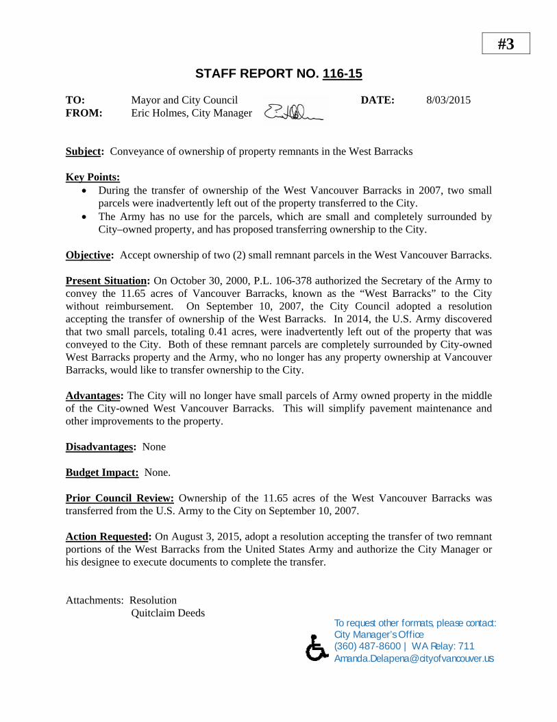
#3
STAFF REPORT NO. 116-15
TO: Mayor and City Council DATE: 8/03/2015 FROM: Eric Holmes, City Manager Subject: Conveyance of ownership of property remnants in the West Barracks Key Points:
During the transfer of ownership of the West Vancouver Barracks in 2007, two small parcels were inadvertently left out of the property transferred to the City.
The Army has no use for the parcels, which are small and completely surrounded by City–owned property, and has proposed transferring ownership to the City.
Objective: Accept ownership of two (2) small remnant parcels in the West Vancouver Barracks. Present Situation: On October 30, 2000, P.L. 106-378 authorized the Secretary of the Army to convey the 11.65 acres of Vancouver Barracks, known as the “West Barracks” to the City without reimbursement. On September 10, 2007, the City Council adopted a resolution accepting the transfer of ownership of the West Barracks. In 2014, the U.S. Army discovered that two small parcels, totaling 0.41 acres, were inadvertently left out of the property that was conveyed to the City. Both of these remnant parcels are completely surrounded by City-owned West Barracks property and the Army, who no longer has any property ownership at Vancouver Barracks, would like to transfer ownership to the City. Advantages: The City will no longer have small parcels of Army owned property in the middle of the City-owned West Vancouver Barracks. This will simplify pavement maintenance and other improvements to the property. Disadvantages: None Budget Impact: None. Prior Council Review: Ownership of the 11.65 acres of the West Vancouver Barracks was transferred from the U.S. Army to the City on September 10, 2007. Action Requested: On August 3, 2015, adopt a resolution accepting the transfer of two remnant portions of the West Barracks from the United States Army and authorize the City Manager or his designee to execute documents to complete the transfer. Attachments: Resolution Quitclaim Deeds To request other formats, please contact:
City Manager’s Office (360) 487-8600 | WA Relay: 711 [email protected]
03/08/15
RESOLUTION NO. _________
A RESOLUTION of the City Council of the City of Vancouver, accepting the transfer of
two remnant parcels in the West Barracks from the United States Army and authorizing the City
Manager to execute certain documents for completion of the transfer.
WHEREAS, on October 30, 2000, P.L. 106-378 authorized the Secretary of the Army to
convey the 11.65 acres of Vancouver Barracks, known as the “West Barracks” to the City
without reimbursement; and
WHEREAS, on September 10, 2007, the City Council adopted a resolution accepting the
transfer of ownership of the West Barracks, and
WHEREAS, two remnant parcels in the West Barracks, totaling 0.41 acres were
inadvertently excluded from the property transfer of the West Barracks to the City from the
United States Army, and
WHEREAS, the United States Army owns the property described in the attached
Quitclaim Deeds; and
WHEREAS, the United States Army has indicated that it is prepared to approve the
transfer of fee simple ownership of two remnant properties in the West Barracks, subject to the
terms and conditions provided for in the Quitclaim Deeds; and
WHEREAS, Vancouver City Council desires to authorize the City Manager or his
designee to sign all documents necessary to complete the transfer of ownership.
NOW, THEREFORE,
BE IT RESOLVED BY THE CITY OF VANCOUVER:

Section 1: That Vancouver City Council authorizes the City Manager or his designee, to
sign all documents necessary to complete the transfer of fee simple ownership of two remnant
parcels in the West Barracks to the City of Vancouver on the terms and conditions provided for
in the Quitclaim Deeds.
ADOPTED at regular session of the Council of the City of Vancouver, this third day of
August 2015.
________________________ Timothy D. Leavitt, Mayor
Attest: ______________________________ R. Lloyd Tyler, City Clerk By: Carrie Lewellen, Deputy City Clerk Approved as to form: ______________________________ E. Bronson Potter, City Attorney Attachments: Quit Claim Deed, Tract 200E, 0.05 acres plus Attachments Quit Claim Deed, Tract A., 0.36 acres plus Attachments
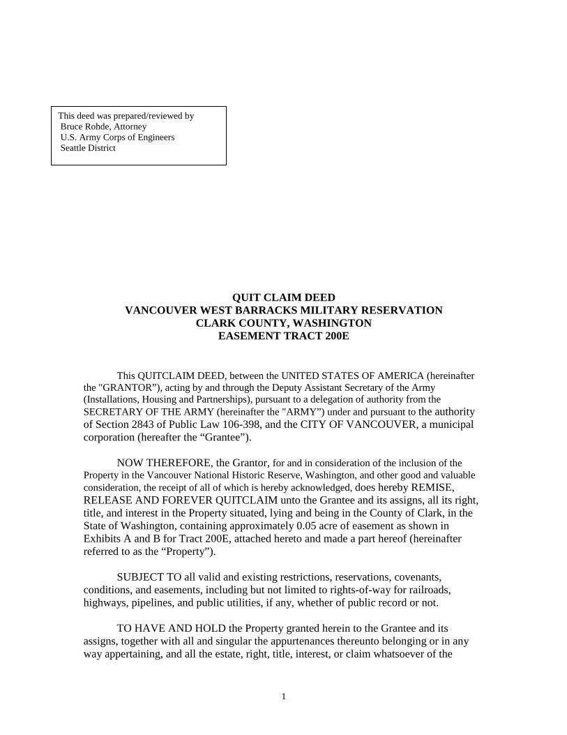
QUIT CLAIM DEED VANCOUVER WEST BARRACKS MILITARY RESERVATION
CLARK COUNTY, WASHINGTON EASEMENT TRACT 200E
This QUITCLAIM DEED, between the UNITED STATES OF AMERICA (hereinafter the "GRANTOR”), acting by and through the Deputy Assistant Secretary of the Army (Installations, Housing and Partnerships), pursuant to a delegation of authority from the SECRETARY OF THE ARMY (hereinafter the "ARMY”) under and pursuant to the authority of Section 2843 of Public Law 106-398, and the CITY OF VANCOUVER, a municipal corporation (hereafter the “Grantee”).
NOW THEREFORE, the Grantor, for and in consideration of the inclusion of the
Property in the Vancouver National Historic Reserve, Washington, and other good and valuable consideration, the receipt of all of which is hereby acknowledged, does hereby REMISE, RELEASE AND FOREVER QUITCLAIM unto the Grantee and its assigns, all its right, title, and interest in the Property situated, lying and being in the County of Clark, in the State of Washington, containing approximately 0.05 acre of easement as shown in Exhibits A and B for Tract 200E, attached hereto and made a part hereof (hereinafter referred to as the “Property”). SUBJECT TO all valid and existing restrictions, reservations, covenants, conditions, and easements, including but not limited to rights-of-way for railroads, highways, pipelines, and public utilities, if any, whether of public record or not. TO HAVE AND HOLD the Property granted herein to the Grantee and its assigns, together with all and singular the appurtenances thereunto belonging or in any way appertaining, and all the estate, right, title, interest, or claim whatsoever of the
This deed was prepared/reviewed by Bruce Rohde, Attorney U.S. Army Corps of Engineers Seattle District
1

Grantor, either in law or in equity and subject to the terms, reservations, restrictions, covenants and conditions set forth in this Deed. 1. “AS IS”
A. The GRANTEE acknowledges that it has inspected or has had the opportunity to inspect the Property and accepts the condition and state of repair of the subject Property. The GRANTEE understands and agrees that the Property and any part thereof is offered “AS IS” without any representation, warranty, or guaranty by the GRANTOR as to quantity, quality, title, character, condition, size, or kind, or that the same is in condition or fit to be used for the purpose(s) intended by the GRANTEE, and no claim for allowance or deduction upon such grounds will be considered.
B. No warranties, either express or implied, are given with regard to the condition of the Property The GRANTEE shall be deemed to have relied solely on its own judgment in assessing the overall condition of all or any portion of the Property. The failure of the GRANTEE to inspect or to exercise due diligence to be fully informed as to the condition of all or any portion of the Property offered, will not constitute grounds for any claim or demand against the United States.
C. Nothing in this “As Is” provision will be construed to modify or negate the GRANTOR’S obligations under CERCLA or any other statutory obligations.
2. POST-TRANSFER DISCOVERY OF CONTAMINATION
A. If an actual or threatened release of a hazardous substance or petroleum product is discovered on the Property after the date of conveyance, GRANTEE, its successors or assigns, shall be responsible for such release or newly discovered substance unless GRANTEE is able to demonstrate that such release or such newly discovered substance was due to GRANTOR’S activities, use, or ownership of the Property. If the GRANTEE, its successors or assigns believe the discovered hazardous substance is due to GRANTOR’S activities, use or ownership of the Property, GRANTEE will immediately secure the site and notify the GRANTOR of the existence of the hazardous substances, and GRANTEE will not further disturb such hazardous substances without the written permission of the GRANTOR.
B. GRANTEE, its successors and assigns, as consideration for the conveyance of the Property, agree to release GRANTOR from any liability or responsibility for any claims arising solely out of the release of any hazardous substance or petroleum product on the Property occurring after the date of the delivery and acceptance of this Deed, where such substance or product was placed on the Property by the GRANTEE, or its successors, assigns, employees, invitees, agents or contractors, after the conveyance. This paragraph shall not affect the GRANTOR’S responsibilities to conduct response actions or corrective actions that are required by applicable laws, rules and regulations or the GRANTOR’S indemnification provision under applicable laws.
2

3. ANTI-DEFICIENCY ACT
The GRANTOR’s obligation to pay or reimburse any money under this Deed is subject to the availability of funds appropriated for this purpose to the Department of the Army, and nothing in this Deed shall be interpreted to require obligations or payments by the GRANTOR in violation of the Anti-Deficiency Act, 31 U.S.C. §1341. 4. NO WAIVER The failure of the Government to insist in any one or more instances upon complete performance of any of the said notices, covenants, conditions, restrictions, or reservations shall not be construed as a waiver or a relinquishment of the future performance of any such covenants, conditions, restrictions, or reservations; but the obligations of the GRANTEE, its successors and assigns, with respect to such future performance shall continue in full force and effect.
IN WITNESS WHEREOF, the GRANTOR has caused this Deed to be executed in its name by the Deputy Assistant Secretary of the Army, Installations, Housing and Partnerships this _____ day of __________________ 2015. UNITED STATES OF AMERICA By: _________________________________
PAUL D. CRAMER Deputy Assistant Secretary of the Army
Installations, Housing and Partnerships
NOTARIAL CERTIFICATE ) ) ss. DISTRICT OF COLUMBIA )
I, the undersigned, a Notary Public in and for the District of Columbia, do hereby certify that this __________ day of _______________________________, 2015, Paul D. Cramer, Deputy Assistant Secretary of the Army, Installations, Housing and Partnerships, known to me or proven through satisfactory evidence of identity to be the person whose name is subscribed to the foregoing document, appeared in person and acknowledged before me that the signature on the document was voluntarily affixed by him for the purposes therein stated and that he had due authority to sign the document in the capacity therein stated. __________________________________ Notary Public My Commission expires the _________ day of _____________________, 20 __.
3

ACCEPTANCE BY GRANTEE The City of Vancouver, GRANTEE, hereby accepts this Quitclaim Deed for itself, its successors and assigns, subject to all of the conditions, reservations, restrictions and terms contained therein, this _____ day of __________________ 2015. THE CITY OF VANCOUVER
By: _______________________ Eric J. Holmes Title: __City Manager_________
Attest: __________________________ R. Lloyd Tyler, City Clerk By: Carrie Lewellen, Deputy City Clerk Approved as to form: ___________________________ E. Bronson Potter, City Attorney STATE OF WASHINGTON ) ) SS: COUNTY OF CLARK ) On this ____ day of _________________, 2015, before me the undersigned, a Notary Public for the State of Washington, personally appeared _Eric John Holmes who stated on oath that he is the __City Manager___ of the City of Vancouver, a municipal corporation, and authorized to execute the within instrument on behalf of said corporation and acknowledged said instrument as the free and voluntary act of the corporation for the uses and purposes mentioned therein. IN WITNESS WHEREOF, I have hereunto set my hand and affixed my official seal the day and year hereinabove first written.
_______________________________________ Notary Public for the State of Washington Residing at:_____________________________ My Commission expires: __________________
4

Vancouver Barracks, Disposal of Parking Easement Area
Tr. 200E ±0.05 acs
By: Chkd: Map: CAD/GIS: Doc:
JEF 13 Jan 2014 OJV 13 Jan 2014 Tract 200E Disposal.mxd Military\VANBK – VANCOUVER BARRACKS\Disposal\WSDOT 002340.docx
1 (1)
LEGAL DESCRIPTION
A parcel of land situated in the northeast quarter of the southeast quarter
(NE¼, SE¼) of Section 27, Township 2 North, Range 1 East, W.M., Clark County, Washington; more particularly described as follows:
Commencing at the point of intersection of the westerly line of the Fort Vancouver Military Reservation and the easterly line of the Amos Short Donation Land Claim, said point being marked with a 3½” brass disk in a monument box, thence north 24°11’39” east, along said west line, for a distance of 1,473.96 feet to the intersection of the westerly prolongation of the north Right-of-Way of N.E. 5th Street as described in book 474, at page 580 Records of Clark County and said westerly line of the military reservation; thence south 81°34’59” east, along said westerly prolongation, for a distance of 231.19 feet to the easterly Right-of-Way of SR 5, said point also being the southwest corner of the Federal Highway Administration tract as described in Auditor’s file No. 8610200075 records of said county; thence north 30°23’01” east, a distance of 273.93 feet to the northwest corner of the Federal Highway Administration tract; thence along said easterly Right-of-Way of Interstate 5, north 30°23’01” east, a distance of 26.33 feet; thence north 24°42’41” east, a distance of 412.03 feet; thence north 27°24’29” east, a distance of 200.25 feet; thence north 21°58’50” east, a distance of 50.05 feet; thence north 30°22’42” east, a distance of 112.24 feet to the southwest corner of the Washington State Highway Patrol tract as described in Auditor’s file No. 9705220254, records of said County; thence north 30°25’22” east 26.18 feet; thence north 65°20’14” east 23.20 feet; north 20°20’14” east, 41.00 feet; thence south 69°40’21” east, 261.74 feet to the start of a non-tangent curve to the left and the POINT OF BEGINNING;
Thence along said non-tangent curve to the left with a radius of 171.50 feet, for
an arc length of 140.11 feet, the chord bearing north 86°55’22” east, with a chord length of 136.25 feet, more or less;
Thence south 18°30’19” west, 54.15 feet; Thence north 69°40’21” west, 126.76 feet to the POINT OF BEGINNING.
Contains 0.05 acre, more or less.

Source: Esri, DigitalGlobe, GeoEye, i-cubed, USDA, USGS, AEX,Getmapping, Aerogrid, IGN, IGP, swisstopo, and the GIS User Community
TR. 200E DIS POS AL EXHIBITVANCOU VER BARRACKS
pDISCLAIMER - While the United States Army Corps of Engineers, (hereinafter refer red to USACE) has made a reasonable effor t to insure the accuracy of the maps and associa ted data, its should beexplicitly noted that USACE m akes no warranty, representation orguaranty, e ither express or impl ied, as to the content, sequence,accuracy, timeliness or completeness of any of the data providedherein. The USACE, its officers, agents, employees, or servantsshall assume no liabil ity o f any nature for any errors, omissions, orinaccuracies in the information provided regardless of how caused.The USACE, its officers, agents, employees or servants shallassume no liability for any decisions made or actions taken or nottaken by the user of the maps and associated data in rel ianceupon any information or data furnished here. By using these mapsand associated data the user does so enti rely at the ir own risk andexplicitly acknowledges that he/she is aware of and agrees to bebound by this discla imer and agrees not to present any cla im ordemand of any nature against the USACE, its officers, agents,employees or servants in any forum whatsoever for any damagesof any nature whatsoever that may result from or may be caused inany way by the use of the maps and associated data.
Path: O:\TR\cadastral\OrgProjects\Military\VANBK - VANCOUVER BARRACKS\Disposal\WSDOT\Tract 200E Disposal.mxd
N24°11’39”E 1,473.96'
"S hort" Mon um en t
S 81°34’59”E 231.19' N30°23’01”E 273.93'
N24°42’41”E 412.03'
N30°23’01”E 26.33'
N27°24'29"E
200.25'
N21°58’50”E 50.05'N30°22’42”E 112.24'
N30°25’22”E 26.18'N65°20’14E 23.20'N20°20’14E 41.00'
N69°40’21”W 126.76' S18°30’19”W 54.15'
S 69°40’21”E 261.74'
S ee DetailBelow
0 125 250 375 50062.5Feet
40 0 4020Feet
¬«200ER=171.5' L=140.11' ∆=46°48’3
4”
Legen ddod_rpi_land_parcel_area
§̈¦I-5
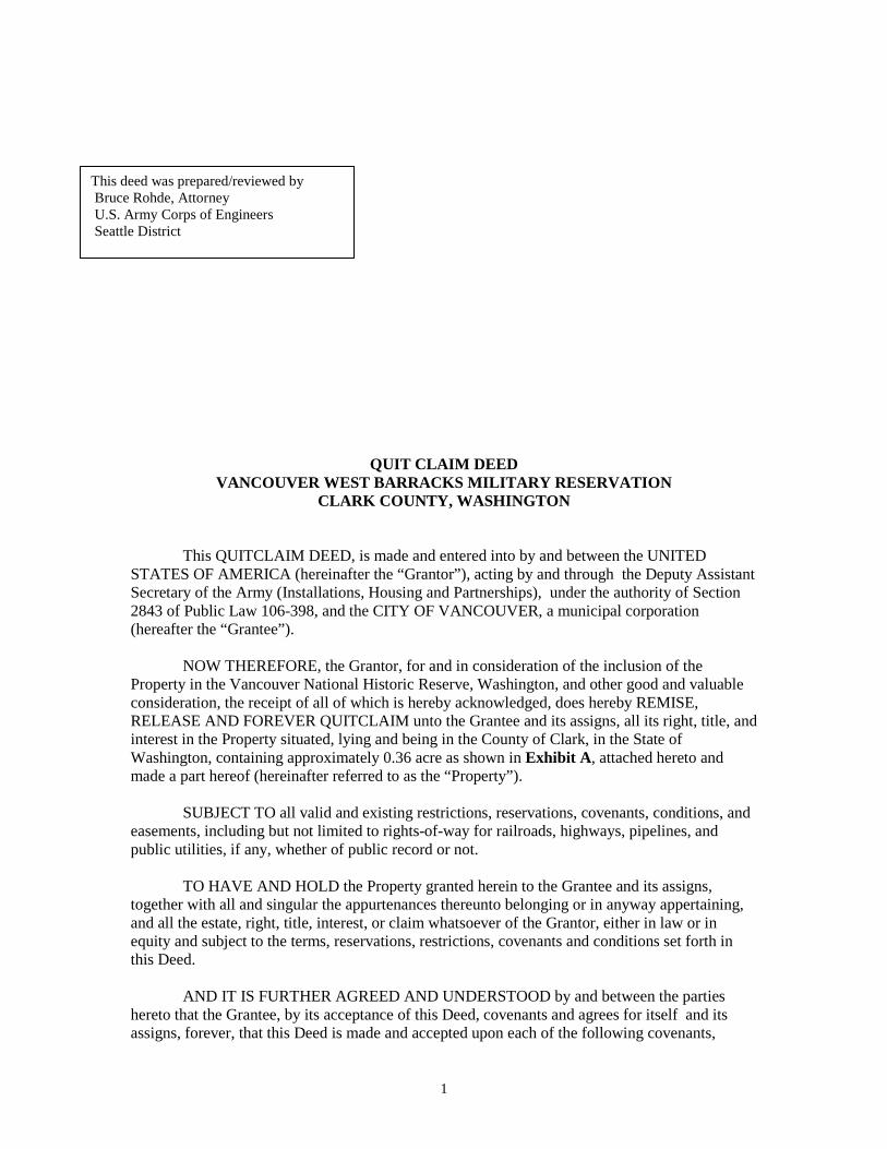
QUIT CLAIM DEED VANCOUVER WEST BARRACKS MILITARY RESERVATION
CLARK COUNTY, WASHINGTON
This QUITCLAIM DEED, is made and entered into by and between the UNITED STATES OF AMERICA (hereinafter the “Grantor”), acting by and through the Deputy Assistant Secretary of the Army (Installations, Housing and Partnerships), under the authority of Section 2843 of Public Law 106-398, and the CITY OF VANCOUVER, a municipal corporation (hereafter the “Grantee”).
NOW THEREFORE, the Grantor, for and in consideration of the inclusion of the
Property in the Vancouver National Historic Reserve, Washington, and other good and valuable consideration, the receipt of all of which is hereby acknowledged, does hereby REMISE, RELEASE AND FOREVER QUITCLAIM unto the Grantee and its assigns, all its right, title, and interest in the Property situated, lying and being in the County of Clark, in the State of Washington, containing approximately 0.36 acre as shown in Exhibit A, attached hereto and made a part hereof (hereinafter referred to as the “Property”). SUBJECT TO all valid and existing restrictions, reservations, covenants, conditions, and easements, including but not limited to rights-of-way for railroads, highways, pipelines, and public utilities, if any, whether of public record or not. TO HAVE AND HOLD the Property granted herein to the Grantee and its assigns, together with all and singular the appurtenances thereunto belonging or in anyway appertaining, and all the estate, right, title, interest, or claim whatsoever of the Grantor, either in law or in equity and subject to the terms, reservations, restrictions, covenants and conditions set forth in this Deed.
AND IT IS FURTHER AGREED AND UNDERSTOOD by and between the parties hereto that the Grantee, by its acceptance of this Deed, covenants and agrees for itself and its assigns, forever, that this Deed is made and accepted upon each of the following covenants,
This deed was prepared/reviewed by Bruce Rohde, Attorney U.S. Army Corps of Engineers Seattle District
1

which covenants shall be binding upon and enforceable against the Grantee and its assigns, in perpetuity by the United States and other interested parties as allowed by federal, state or local law; that the NOTICES, USE RESTRICTIONS, AND RESTRICTIVE COVENANTS set forth here are a binding servitude on the Property herein conveyed and shall be deemed to run with the land in perpetuity; and that the failure to include the NOTICES, USE RESTRICTIONS, AND RESTRICTIVE COVENANTS in subsequent conveyances does not abrogate the status of these restrictions as binding upon the parties and their assigns.
1. Property Covered by Covenant and Access Rights Made Pursuant to Section 120(h)(4)(D) of the Comprehensive Environmental Response, Compensation, and Liability Act of 1980 (42 U.S.C. § 9620(h)(4)(D)):
For the property, the Grantor provides the following covenants and retains the following access rights: A. Covenant Pursuant to Section 120(h)(4)(D)(i) of the Comprehensive Environmental Response, Compensation, and Liability Act of 1980 (42 U.S.C. § 9620(h)(4)(D)(i)):
Pursuant to section 120(h)(4)(D)(i) of the Comprehensive Environmental Response,
Compensation, and Liability Act of 1980 (42 U.S.C. § 9620(h)(4)(D)(i)), the United States warrants that any response action or corrective action found to be necessary after the date of this deed for contamination existing on the property prior to the date of this deed shall be conducted by the United States. B. Access Rights Pursuant to Section 120(h)(4)(D)(ii) of the Comprehensive Environmental Response, Compensation, and Liability Act of 1980 (42 U.S.C. § 9620(h)(4)(D)(ii)):
The United States retains and reserves a perpetual and assignable easement and right of access on, over, and through the property, to enter upon the property in any case in which an environmental response or corrective action is found to be necessary on the part of the United States, without regard to whether such environmental response or corrective action is on the property or on adjoining or nearby lands. Such easement and right of access includes, without limitation, the right to perform any environmental investigation, survey, monitoring, sampling, testing, drilling, boring, coring, testpitting, installing monitoring or pumping wells or other treatment facilities, response action, corrective action, or any other action necessary for the United States to meet its responsibilities under applicable laws and as provided for in this instrument. Such easement and right of access shall be binding on the grantee and its successors and assigns and shall run with the land.
In exercising such easement and right of access, the United States shall provide the
grantee or its successors or assigns, as the case may be, with reasonable notice of its intent to enter upon the property and exercise its rights under this clause, which notice may be severely curtailed or even eliminated in emergency situations. The United States shall use reasonable means to avoid and to minimize interference with the grantee’s and the grantee’s successors’ and assigns’ quiet enjoyment of the property. At the completion of work, the work site shall be reasonably restored. Such easement and right of access includes the right to obtain and use utility services, including water, gas, electricity, sewer, and communications services available on the property at a reasonable charge to the United States. Excluding the reasonable charges for such utility services, no fee, charge, or compensation will be due the grantee, nor its successors and
2
assigns, for the exercise of the easement and right of access hereby retained and reserved by the United States.
In exercising such easement and right of access, neither the grantee nor its successors and
assigns, as the case may be, shall have any claim at law or equity against the United States or any officer, employee, agent, contractor of any tier, or servant of the United States based on actions taken by the United States or its officers, employees, agents, contractors of any tier, or servants pursuant to and in accordance with this clause: Provided, however, that nothing in this paragraph shall be considered as a waiver by the grantee and its successors and assigns of any remedy available to them under the Federal Tort Claims Act.
2. “AS IS”
A. The Grantee acknowledges that it has inspected or has had the opportunity to inspect the Property and accepts the condition and state of repair of the Property. The Grantee understands and agrees that the Property and any part thereof is offered “AS IS” without any representation, warranty, or guaranty by the Grantor as to quantity, quality, title, character, condition, size, or kind, or that the same is in condition or fit to be used for the purpose(s) intended by the Grantee, and no claim for allowance or deduction upon such grounds will be considered.
B. No warranties, express or implied, are given with regard to the condition of the Property, including, without limitation, whether the Property does or does not contain asbestos or lead-based paint. The Grantee shall be deemed to have relied solely on its own judgment in assessing the overall condition of all or any portion of the Property, including, without limitation, any asbestos, lead-based paint, or other conditions on the Property. The failure of the Grantee to inspect or to exercise due diligence to be fully informed as to the condition of all or any portion of the Property offered, will not constitute grounds for any claim or demand against the United States.
C. Nothing in this “As Is” provision will be construed to modify or negate the Grantor’s obligation under the CERCLA Covenant or any other statutory obligations. 3. HOLD HARMLESS
A. To the extent authorized by law, the Grantee, and its assigns, covenant and agree to indemnify and hold harmless the Grantor, its officers, agents, and employees from (1) any and all claims, damages, judgments, losses, and costs, including fines and penalties, arising out of the violation of the NOTICES, USE RESTRICTIONS, AND RESTRICTIVE COVENANTS in this Deed by the Grantee and its assigns, and (2) any and all claims, damages, and judgments arising out of, or in any manner predicated upon, exposure to asbestos, lead-based paint, or other condition on any portion of the Property after the date of conveyance.
B. The Grantee, and its assigns, covenant and agree that the Grantor shall not be
responsible for any costs associated with modification or termination of the NOTICES, USE RESTRICTIONS, AND RESTRICTIVE COVENANTS in this Deed, including without limitation, any costs associated with additional investigation or remediation of asbestos, lead-based paint, or other condition on any portion of the Property.
3
C. Nothing in this Hold Harmless provision will be construed to modify or negate the Grantor’s obligation under the CERCLA Covenant or any other statutory obligations. 4. POST-TRANSFER DISCOVERY OF CONTAMINATION A. If an actual or threatened release of a hazardous substance or petroleum product is discovered on the Property after the date of conveyance, Grantee and its assigns, shall be responsible for such release or newly discovered substance unless Grantee is able to demonstrate that such release or such newly discovered substance was due to Grantor’s activities, use, or ownership of the Property. If the Grantee and its assigns believe the discovered hazardous substance is due to Grantor’s activities, use or ownership of the Property, Grantee will immediately secure the site and notify the Grantor of the existence of the hazardous substances, and Grantee will not further disturb such hazardous substances without the written permission of the Grantor. B. Grantee, and its assigns, as consideration for the conveyance of the Property, agree to release Grantor from any liability or responsibility for any claims arising solely out of the release of any hazardous substance or petroleum product on the Property occurring after the date of the delivery and acceptance of this Deed, where such substance or product was placed on the Property by the Grantee, or its assigns, employees, invitees, agents or contractors, after the conveyance. This paragraph shall not affect the Grantor’s responsibilities to conduct response actions or corrective actions that are required by applicable laws, rules and regulations, or the Grantor’s indemnification obligations under applicable laws. 5. ENVIRONMENTAL PROTECTION PROVISIONS
The Grantee shall neither transfer the Property, lease the Property, nor grant any interest, privilege, or license whatsoever in connection with the Property without the inclusion of the Environmental Protection Provisions, attached hereto as Exhibit B and fully incorporated herein by this reference, and shall require the inclusion of the Environmental Protection Provisions in all further deeds, easements, transfers, leases, or grant of any interest, privilege, or license.
6. NON-DISCRIMINATION
The Grantee covenants for itself, and its assigns, and for every interest in the Property hereby conveyed, or any part thereof, that the said Grantee and its assigns shall not discriminate upon the basis of race, color, religion, age, gender, or national origin in the use, occupancy, sale, or lease of the Property, or in their employment practices conducted thereon. This covenant shall not apply, however, to the lease or rental of a room or rooms within a family dwelling unit; nor shall it apply with respect to religion to premises used primarily for religious purposes. The United States of America shall be deemed a beneficiary of this covenant without regard to whether it remains the owner of any land or interest therein in the locality of the Property hereby conveyed and shall have the sole right to enforce this covenant in any court of competent jurisdiction. 7. ANTI-DEFICIENCY ACT
The Grantor’s obligation to pay or reimburse any money under this Deed is subject to the availability of funds appropriated for this purpose to the Department of the Army, and nothing in this Deed shall be interpreted to require obligations or payments by the Grantor in violation of the Anti-Deficiency Act, 31 U.S.C. §1341.
4

8. NO WAIVER The failure of the Government to insist in any one or more instances upon complete performance of any of the said notices, covenants, conditions, restrictions, or reservations shall not be construed as a waiver or a relinquishment of the future performance of any such covenants, conditions, restrictions, or reservations; but the obligations of the Grantee and assigns, with respect to such future performance shall continue in full force and effect.
IN WITNESS WHEREOF, the GRANTOR has caused this Deed to be executed in its name by the Deputy Assistant Secretary of the Army, Installations, Housing and Partnerships this _____ day of __________________ 2015. UNITED STATES OF AMERICA By: _________________________________
PAUL D. CRAMER Deputy Assistant Secretary of the Army
Installations, Housing and Partnerships
NOTARIAL CERTIFICATE ) ) ss. DISTRICT OF COLUMBIA )
I, the undersigned, a Notary Public in and for the District of Columbia, do hereby certify that this __________ day of _______________________________, 2015, Paul D. Cramer, Deputy Assistant Secretary of the Army, Installations, Housing and Partnerships, known to me or proven through satisfactory evidence of identity to be the person whose name is subscribed to the foregoing document, appeared in person and acknowledged before me that the signature on the document was voluntarily affixed by him for the purposes therein stated and that he had due authority to sign the document in the capacity therein stated. __________________________________ Notary Public My Commission expires the _________ day of _____________________, 20 __.
5
ACCEPTANCE BY GRANTEE The City of Vancouver, GRANTEE, hereby accepts this Quitclaim Deed for itself, its successors and assigns, subject to all of the conditions, reservations, restrictions and terms contained therein, this _____ day of __________________ 2015. THE CITY OF VANCOUVER
By: _______________________ Eric J. Holmes Title: __City Manager_________
Attest: __________________________ R. Lloyd Tyler, City Clerk By: Carrie Lewellen, Deputy City Clerk Approved as to form: ___________________________ E. Bronson Potter, City Attorney STATE OF WASHINGTON ) ) SS: COUNTY OF CLARK ) On this ____ day of _________________, 2015, before me the undersigned, a Notary Public for the State of Washington, personally appeared _Eric John Holmes who stated on oath that he is the __City Manager___ of the City of Vancouver, a municipal corporation, and authorized to execute the within instrument on behalf of said corporation and acknowledged said instrument as the free and voluntary act of the corporation for the uses and purposes mentioned therein. IN WITNESS WHEREOF, I have hereunto set my hand and affixed my official seal the day and year hereinabove first written.
_______________________________________ Notary Public for the State of Washington Residing at:_____________________________ My Commission expires: __________________
6

Vancouver Barracks, Disposal of Excluded West Barracks Area
Tr. A ± 0.36 acs
By: Chkd: Rev. Map: CAD/GIS: Doc:
JEF 7 March 2011 OJV 8 March 2011 Changed Tr Number & Map Name (2 Mar 2015) Tract A(revertment) Disposal.mxd Military\VANBK – VANCOUVER BARRACKS\Disposal\WSDOT 002230.docx
1 (1)
LEGAL DESCRIPTION
A parcel of land situated in the northeast quarter of the southeast quarter (NE¼, SE¼)
of Section 27, Township 2 North, Range 1 East, W.M., Clark County, Washington; more particularly described as follows:
Commencing at the point of intersection of the westerly line of the Fort Vancouver Military Reservation and the easterly line of the Amos Short Donation Land Claim, said point being marked with a 3½” brass disk in a monument box, thence north 24°11’39” east, along said west line, for a distance of 1473.96 feet to the intersection of the westerly prolongation of the north Right-of-Way of N.E. 5th Street as described in book 474, at page 580 Records of Clark County and said westerly line of the military reservation; thence south 81°34’59” east, along said westerly prolongation, for a distance of 231.19 feet to the easterly Right-of-Way of SR 5, said point also being the southwest corner of the Federal Highway Administration tract as described in Auditor’s file No. 8610200075 records of said county; thence north 30°23’01” east, a distance of 273.93 feet to the northwest corner of the Federal Highway Administration tract; thence along said easterly Right-of-Way of Interstate 5, north 30°23’01” east, a distance of 26.33 feet; thence north 24°42’41" east, a distance of 412.03 feet; thence north 27°24’29" east, a distance of 200.25 feet; thence north 21°58’50" east, a distance of 50.05 feet; thence north 30°22’42" east, a distance of 112.24 feet to the southwest corner of the Washington State Highway Patrol tract as described in Auditor’s file No. 9705220254, records of said County, and the POINT OF BEGINNING
Thence north 83°58’06” east, 133.07 feet; Thence south 69°35’24” east, 305.60 feet; Thence north 24°17’06” east, 168.04 feet to the start of a non-tangent curve to the left; Thence along said non-tangent curve to the left with a radius of 167.00 feet, for an arc length of 40.22 feet, the chord bearing south 70°10’21” west a distance of 40.19 feet, more or less; Thence south 18°30’19” west, 117.30 feet; Thence north 69°40’21” west, 388.50 feet; Thence south 20°20’14” west, 41.00 feet: Thence south 65°20’14” west 23.20 feet; Thence south 30°25’22” west 26.18 feet to the POINT OF BEGINNING
Contains 0.36 acre, more or less.
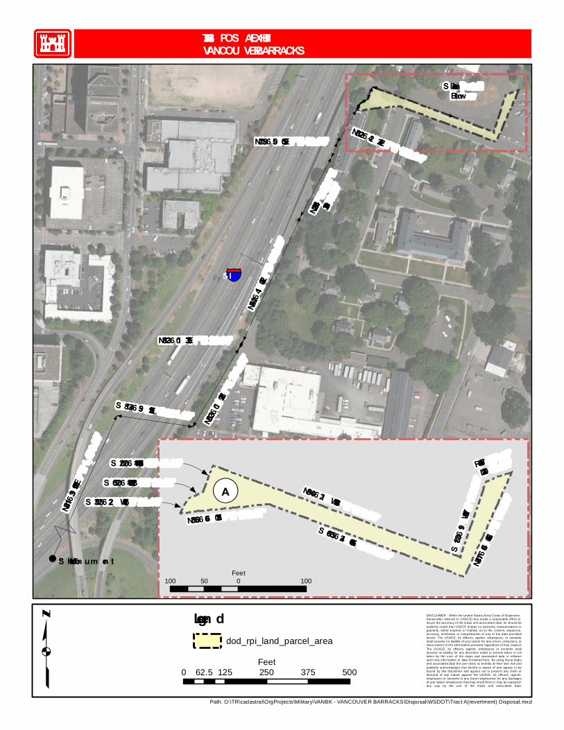
Source: Esri, DigitalGlobe, GeoEye, i-cubed, USDA, USGS, AEX,Getmapping, Aerogrid, IGN, IGP, swisstopo, and the GIS User Community
TR. A DIS POS AL EXHIBITVANCOU VER BARRACKS
pDISCLAIMER - While the United States Army Corps of Engineers, (hereinafter refer red to USACE) has made a reasonable effor t to insure the accuracy of the maps and associa ted data, its should beexplicitly noted that USACE m akes no warranty, representation orguaranty, e ither express or impl ied, as to the content, sequence,accuracy, timeliness or completeness of any of the data providedherein. The USACE, its officers, agents, employees, or servantsshall assume no liabil ity o f any nature for any errors, omissions, orinaccuracies in the information provided regardless of how caused.The USACE, its officers, agents, employees or servants shallassume no liability for any decisions made or actions taken or nottaken by the user of the maps and associated data in rel ianceupon any information or data furnished here. By using these mapsand associated data the user does so enti rely at the ir own risk andexplicitly acknowledges that he/she is aware of and agrees to bebound by this discla imer and agrees not to present any cla im ordemand of any nature against the USACE, its officers, agents,employees or servants in any forum whatsoever for any damagesof any nature whatsoever that may result from or may be caused inany way by the use of the maps and associated data.
Path: O:\TR\cadastral\OrgProjects\Military\VANBK - VANCOUVER BARRACKS\Disposal\WSDOT\Tract A(revertment) Disposal.mxd
N24°11’39”E 1,473.96'
"S hort" Mon um en t
S 81°34’59”E 231.19' N30°23’01”E 273.93'
N24°42’41”E 412.03'
N30°23’01”E 26.33'
N27°24'29"E
200.25'
N21°58’50”E 50.05'N30°22’42”E 112.24'
R=167.00'
L=40.22'
S18°30’19”W 117.30'
N69°40’21”W 388.50'
S ee DetailBelow
0 125 250 375 50062.5Feet
100 0 10050Feet
Legen ddod_rpi_land_parcel_area
§̈¦I-5
N24°17’06”E 168.04'
S 69°35’24”E 305.60'
N83°58’06”E 133.07'
¬«AS 30°25’22”W 26.18'S 65°20’14W 23.20'S 20°20’14W 41.00'

Exhibit B
1
ENVIRONMENTAL PROTECTION PROVISIONS
1. NOTICE OF THE POTENTIAL PRESENCE OF MUNITIONS AND EXPLOSIVES OF CONCERN (MEC) A. The Grantee is hereby notified that due to the former use of the Property as a military installation, the Property may contain munitions and explosives of concern (MEC). The term MEC means specific categories of militia munitions that may pose unique explosives safety risks and includes: (1) Unexploded Ordnance (UXO), as defined in 10 U.S.C. §101(e)(5); (2) Discarded military munitions (DMM) as defined in 10 U.S.C. §2710(e)(2); or (3) Munitions constituents (e.g., TNT, RDX), as defined in 10 U.S.C. §2710(e)(3), present in high enough concentrations to pose an explosive hazard. B. The Property was previously used primarily as a cantonment area. No MEC has been discovered on the property and no munitions response actions have been conducted. Based on available information, none of the land proposed for transfer are known to contain MEC. C. The Grantor represents that, to the best of its knowledge, no MEC is currently present on the Property. Notwithstanding the Grantor’s determination, the parties acknowledge that there is a possibility that MEC may exist on the Property. If the Grantee, any subsequent owner, or any other person should find any MEC on the Property, they shall immediately stop any intrusive or ground-disturbing work in the area or in any adjacent areas and shall not attempt to disturb, remover, or destroy it, but shall immediately notify the Local Police Department so that appropriate explosive ordnance disposal personnel can be dispatched to address such MEC as required under applicable law and regulations. 2. PESTICIDE NOTIFICATION A. The Grantee is hereby notified and acknowledges that registered pesticides have been applied to the property conveyed herein and may continue to be present thereon. The Grantee further acknowledges that where a pesticide was applied by the Grantor or at the Grantor’s direction, the pesticide was applied in accordance with its intended purpose and consistently with the Federal Insecticide, Fungicide, and Rodenticide Act (FIFRA)(7 U.S.C. § 136, et seq.) and other applicable laws and regulations.
B. The Grantee covenants and agrees that if the Grantee takes any action with regard to the property, including demolition of structures or any disturbance or removal of soil that may expose, or cause a release of, a threatened release of, or an exposure to, any such pesticide, Grantee assumes all responsibility and liability therefore. 3. NOTICE OF PRESENCE OF HISTORIC PROPERTY
2
The Vancouver West Barracks Military Reservation (hereinafter the
"Property") represents an integral part of the Vancouver National Historic Reserve (hereinafter the "VNHR") established by Congress. In accordance with 36 CFR Part 800.5 the transfer of properties that are eligible for or listed on the National Register of Historic Places (hereinafter the "NRHP"), out of federal ownership without protective covenants constitutes an adverse effect. To ensure the appropriate treatment of said Historic Properties, protective covenants are required. The deed restrictions set forth below include, but are not limited to, restrictions on the management of the Property in accordance with Washington State Archaeological Sites and Resources (RCW 27.53, 27.44 & 25.48) legislation and other applicable federal, state, and local laws and regulations.
The Grantee shall consult with Indian tribes and Native Hawaiian
Organizations (hereinafter "NHO") to allow access to identified sacred sites at times and under conditions mutually agreed upon between the Grantee, Indian tribes and/or NHOs.
The Superintendent of Fort Vancouver National Historic Site, of the
National Park Service, Department of the Interior (hereinafter "NPS") agrees to administer, monitor and enforce these covenants.
The Grantee agrees that the NPS may at its discretion, with 30-days prior
notice to the Grantee, convey and assign all or part of its rights and responsibilities contained herein to a third party.
The failure of the NPS to exercise any right or remedy granted under this
instrument shall not have the effect of waiving or limiting the exercise of any other right or remedy or the use of such right or remedy at any other time.
These covenants are binding on the Grantee, its heirs, successors, and
assigns in perpetuity. Restrictions, stipulations, and covenants contained herein shall be inserted by the Grantee verbatim or by express reference in any deed/easement or other legal instrument by which it divests itself of either the fee simple title or any other lesser estate in the Property or any part thereof.
These covenants shall be binding servitudes upon the Property and shall be deemed to run with the land. Execution of these covenants shall constitute conclusive evidence that the Grantee agrees to be bound by the foregoing conditions and restrictions and to perform the obligations herein set forth. 4. ARCHAEOLOGICAL AND PRESERVATION COVENANT
A. The following definitions apply to this covenant: "Adverse Effect" An Adverse Effect is found when an undertaking may alter, directly or indirectly, any of the characteristic of a Historic Property that qualify the property
3
for inclusion in the National Register in a manner that would diminish the integrity of the property's location, design, setting, materials, workmanship, feeling or association. "Consulting Parties" Means the State Historic Preservation Officer, Indian tribes and Native Hawaiian Organizations, representatives of the City of Vancouver, the National Park Service and certain individuals and organizations with a demonstrated interest in the undertaking who may participate due to the nature of their legal and economic relation to the undertaking or affected properties, or their concern with the undertaking's effects on historic properties. "Primary Stakeholders" For the purpose of Sections 8, 9 and 10 of this document, the use of the term Primary Stakeholders applies only to the National Park Service and the Grantee. "Grantee" Means the organization, individual or government that holds the legal title to the West Barracks tract, and is therefore responsible for all activities that take place within the property boundaries that could impact the West Barracks' historic properties, or cause effect to the larger VNHR cultural resources. "Historic Property" Means any building, object, archaeological site or district that is eligible for or listed in the National Register of Historic Places. "Item of Cultural Patrimony" Means an object having ongoing historical, traditional, or cultural importance central to the Native American group or culture itself, rather than property owned by an individual Native American, and which, therefore, cannot be alienated, appropriated, or conveyed by any individual regardless of whether or not the individual is a member of the Indian tribe or Native Hawaiian organization and such object shall have been considered inalienable by such Native American group at the time the object was separated from such group. "Preservation" or "historic preservation" Includes identification, evaluation, recordation, documentation, curation, acquisition, protection, management, rehabilitation, restoration, stabilization, maintenance, research, interpretation, conservation, and education and training regarding the foregoing activities or any combination of the foregoing activities. "Archaeological resources" Means any remains of human life or activities which are at least 50 years of age, and which are of archaeological interest. “Indian tribe" Means any tribe, band, nation, or other organized group or community of Indians, including any Alaska Native village (as defined in, or established pursuant to, the Alaska Native Claims Settlement Act), which is recognized as eligible for the special programs and services provided by the United States to Indians because of their status as Indians and who have evidenced affiliation and/or cultural attachment to the VNHR.

4
"Native Hawaiian Organizations" Means any organization which has evidenced affiliation and/or cultural attachment to the VNHR, serves and represents the interests of Native Hawaiians, has as a primary and stated purpose the provision of services to Native Hawaiians, has expertise in Native Hawaiian Organization Affairs, and shall include the Office of Hawaiian Affairs and Hui Malama I Na Kupuna 0 Hawai'i Nei. "Office of Hawaiian Affairs" Means the Office of Hawaiian Affairs established by the constitution of the State of Hawaii. "Minor repairs and routine maintenance" Means activities that by their nature have little or no potential to affect the historic character defining features of the West Barracks and the surrounding Vancouver National Historic Reserve. Such activities could include, but are not limited to: interior and exterior painting, HVAC maintenance, roofing repairs, landscape maintenance, minor repairs that involve in-kind replacement of materials that are not considered character defining. Minor ground disturbing activities may include but not be limited to: landscaping, signage maintenance, replacement of existing utilities without new trenching and repaving of existing roads and parking areas. B. In consideration of the conveyance of the Property, the Grantee hereby covenants on behalf of itself, its heirs, successors, and assigns at all times to the NPS to observe all state and federal statutory requirements that may apply to the management of archeological resources and to the intentional excavation or inadvertent discovery of human remains, in accordance with the provisions of paragraphs C and E of this section of the covenant, in order to preserve and enhance those qualities that make the Property’s Historic Properties eligible for inclusion in the NRHP (36 CFR Part 60). All cultural resources activities performed on the Property shall be undertaken by qualified personnel meeting the Secretary of the Interior’s Professional Qualifications (36 CFR Part 61). If the Grantee desires to deviate from these standards, the Grantee will notify and consult with the NPS in accordance with paragraphs C through E of this section. C. The Grantee shall make every reasonable effort to prohibit any person from vandalizing or otherwise disturbing any archaeological resources. Any such vandalism or disturbance shall promptly be reported to the National Park Service (NPS), Indian Tribes, Native Hawaiian Organizations (NHOs) and the State Historic Preservation Office (SHPO). D. When ground disturbing activities are proposed that may have an adverse effect on any archeological site or any area within the Property not previously surveyed for archaeology, the Grantee will provide notice to the NPS, who will notify the Indian tribes and NHO’s and engage in consultation to determine if development proposals, infrastructure, or other improvements meet the criteria of adverse effect, for any one or more Historic Properties. If the Grantee determines that an adverse effect will occur, the Grantee shall consult with the NPS, the SHPO, Indian tribes and NHOs to develop

5
measures to avoid, reduce, or mitigate the adverse effect. If preservation of these sites is infeasible, as determined by the Grantee based on engineering, economic evaluations, and other consideration of development alternatives, the Grantee will develop and implement a treatment plan with input from Indian tribes and NHOs to resolve the adverse effects. The treatment plan shall be responsive to the Secretary of Interiors Standards and Guidelines for Treatment of Historic Properties, and Washington state laws, as amended (27.44.27.53 and the implementing regulations 25.48). If the Grantee, NPS, SHPO, Indian tribes and/or NHOs cannot agree on the treatment plan, the matter shall be referred to the SHPO for dispute resolution. E. If the Grantee, the NPS, Indian tribes or NHOs determine that a disagreement exists regarding the treatment of a Historic Property within said Property, or if the parties are unable to resolve adverse effects, agree upon mitigation measures, National Register eligibility or significance of a Historic Property, the Grantee shall consult in good faith with the objecting party to resolve the objection. If the disagreement cannot be resolve, the Grantee shall contact the SHPO and request their involvement to resolve the disagreement. The Grantee shall forward all documentation relevant to the objection to the SHPO. Upon request of the SHPO, the Grantee shall provide additional information concerning the dispute. The Grantee shall take into account the SHPO’s and other Consulting Parties comments in reaching a final decision on the dispute and within 30 days from the receipt of the SHPO’s comments, the Grantee shall document its decision and provide copies of that decision in writing to the SHPO, the NPS, Indian tribes, and NHOs, before proceeding. F. At any location within the Property, the Grantee will preserve and protect any discoveries of human remains, burial objects, sacred objects, and items of cultural patrimony. Upon discovery of any human remains, objects, or items, the Grantee will implement the procedures of the NPS “West Barracks Inadvertent Discovery Policy”. If the Consulting Parties concur, the human remains, sacred objects, burial objects, and/or objects of cultural patrimony, may be reinterred on the Army cemetery located on East 4th Plain Boulevard, Vancouver, Washington, or other mutually agreed upon locations, after appropriate consultation.