Embed Size (px)
Citation preview

Staff report for action – Request for Direction - 2376 and 2388 Dundas Street West 1 V.01/11
STAFF REPORT ACTION REQUIRED
2376 and 2388 Dundas Street West - Zoning Amendment Application - Request for Direction Report
Date: January 14, 2013
To: Toronto and East York Community Council
From: Director, Community Planning, Toronto and East York District
Wards: Ward 14 – Parkdale-High Park
Reference Number:
11 317575 STE 14 OZ
SUMMARY
The owner of the site at 2376 and 2388 Dundas Street West has appealed its zoning amendment application to the Ontario Municipal Board (the “OMB”) due to Council's failure to make a decision within the time allotted by the Planning Act.
This application proposes to amend the former City of Toronto Zoning By-law No. 438-86. The application would permit the construction of a new 8-storey mixed-use building fronting on Dundas Street West and a 23-storey tower on the eastern portion of the site adjacent to the rail corridor. The proposed development would include a total of 375 residential units and 466 square metres of retail uses. Two levels of below-grade parking are proposed with 242 parking spaces. Two hundred and eighty-eight bicycle parking spaces are proposed. Vehicular access will be provided from a driveway off Dundas Street West along the northern boundary of the site.
The proposal also includes a pedestrian walkway at the southern edge of the site to provide a connection to the Bloor GO Transit / Airport Rail Link (ARL) Station.

Staff report for action – Request for Direction - 2376 and 2388 Dundas Street West 2 V.01/11
The built form provisions of Zoning By-law No. 438-86 were amended for this area in December 2009 by By-law No. 1222-2009, (the "Avenue By-law") which resulted from the Bloor-Dundas Avenue Study. The proposed development is not permitted by these built form provisions, which recommends a mid-rise built form. The approval of the development would set a negative precedent for future development that would undermine the vision for this area of the City as established by Council's approval of the Bloor-Dundas Avenue Study and implemented by the Avenue By-law, by introducing a tall building. The approval of the 23-storey tower as proposed would open the door to similar tower proposals to the north, south and west of the subject site.
The purpose of this report is to seek City Council's direction for the City Solicitor to oppose the proposed development.
RECOMMENDATIONS
The City Planning Division recommends that:
1. City Council authorize the City Solicitor, together with City Planning staff and any other appropriate staff, to oppose the applicant’s appeal respecting the Zoning By-law Amendment application for 2376 and 2388 Dundas Street West (File No. 11 317575 STE 14 OZ), and attend any Ontario Municipal Board hearings in opposition to such appeal, and retain such experts as the City Solicitor may determine are appropriate in support of the position recommended in the report dated January 14, 2013 from the Director, Community Planning, Toronto and East York District.
2. City Council direct the City Solicitor to also advise the OMB that City Council’s position is that any redevelopment of the Site, if approved by the OMB, should secure such services, facilities or matters pursuant to Section 37 of the Planning Act, as may be recommended by the Chief Planner and Executive Director, in consultation with the Ward Councillor, including a pedestrian connection to the GO Transit Station and lands and capital improvements to provide for the proposed second access to the Dundas West Subway Station.
3. City Council authorize the City Solicitor and other City staff to take any necessary steps to implement the foregoing.
DECISION HISTORY
1997 OMB Decision
The site was the subject of a 1988 proposal for a 24-storey residential tower. The proposal was reduced to two 12-storey towers and further reduced to two 8-storey towers when it was approved by Council in 1994. The approval was appealed by a local
Staff report for action – Request for Direction - 2376 and 2388 Dundas Street West 3 V.01/11
residents association resulting in a 1997 OMB decision which determined that the development of a 5-storey building on Dundas Street West and an 11-storey building on the eastern portion of the property would be appropriate. This 1997 OMB decision noted that the 5-storey and 11-storey proposal was appropriate in part because the 11-storey building represented an appropriate transition from the 29-storey Crossways building to the south of the site to the lower scale buildings on the west side of Dundas Street West. The OMB didn't issue a final order and the proposed Official Plan amendment and Zoning By-law amendment were not implemented.
Avenue Study
More recently, this site was included within the boundary of the Bloor-Dundas Avenue Study, which was completed in September, 2009. That Study and the implementing Avenue By-law were the result of a three year consultation process with the area residents by City Planning staff. Council adopted the Avenue By-law at its meeting on Nov. 30, Dec. 1, 2, 4 and 7, 2009.
The Avenue By-law provides for heights of up to 20 metres on the western portion of the site (approximately 6 storeys) and 23 metres (approximately 7 storeys) on the eastern portion of the property, with a density formula of MCR T4.0 C1.5 R3.0.
Pre-Application Consultation Pre-application consultation meetings were held on September 21, 2010 and June 21, 2011. A community meeting hosted by the local Councillor and attended by the applicant and their consultants, was held on October 20, 2011. At the community meeting the applicant presented a proposal for an 8-storey building on Dundas Street West and a 29-storey building on the eastern portion of the property adjacent the railway corridor. The proposal also included a vehicular pick-up/drop-off area for the GO Transit Station to serve the proposed Air Rail Link. The public was critical of the height of the proposed 29-storey building and also raised concerns regarding the increased traffic resulting from the development and the pick-up/drop-off associated with the GO Transit station.
ISSUE BACKGROUND
Discussions with the Applicant Subsequent to the application being filed on November 29, 2011, City Planning staff met with the applicant on several occasions.
Proposal The development proposal as submitted on November 29, 2011 proposed a 9-storey mixed-use building on Dundas Street West with commercial uses at grade, a 3-storey link building and a 26-storey tower. The proposal was subsequently revised to an 8-storey building fronting on Dundas Street West which extends into the site acting as a podium or base building for a 23-storey tower. The proposed vehicular access and pick-up/drop-

Staff report for action – Request for Direction - 2376 and 2388 Dundas Street West 4 V.01/11
off area for the GO Transit Station that was included as part of the pre-application presentation to the public in October of 2011 was not included in the original or revised submission.
The project would include 375 residential units and retail uses at grade on Dundas Street West. The proposed unit breakdown is as follows: 104 one-bedroom units; 144 one-bedroom plus den units; and 127 two-bedroom units. The proposed buildings would have a gross floor area of approximately 25,212 square metres, of which 466 square metres would be allocated to retail uses at grade.
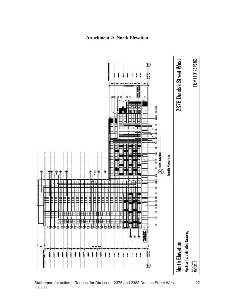
The height of the 8-storey building is approximately 28.0 metres. The building steps back from the street at the 5th and 7th storeys by approximately 5.5 metres and 9 metres respectively (excluding balcony projections). The height of the proposed building at the street (4-storeys) is approximately 13.4 metres. The proposed 23-storey building would be approximately 72.0 metres in height with an additional 5.0 metres for the mechanical penthouse for an overall height of approximately 77.0 metres. The proposed density would be 4.3 times the lot area.
The applicant proposes to provide 242 parking spaces to serve this development, all of which would be provided below-grade in a two-level parking garage. The proposal includes 288 bicycle parking spaces (all visitor spaces and 5% of occupant spaces to be provided at-grade). Proposed indoor and outdoor amenity space would meet the By-law requirement of 2 square metres per unit of each.
Site and Surrounding Area The site is located on the east side of Dundas Street West and is immediately north of the Crossways apartment buildings at the north-east corner of the Bloor/Dundas intersection. It is rectangular in shape with: a frontage of approximately 53 metres on Dundas Street West; an irregular depth of approximately 100 to 122 metres; and an area of approximately 5,860 square metres. The western half was recently occupied by a used car dealership, but is now vacant. The eastern portion has been vacant for several years.
The site is surrounded by the following uses:
North: The site is bounded to the north by a retail plaza and associated parking. Further north are warehouse buildings of 2-5 storeys.
South: To the south of the site, at 2340-2360 Dundas Street West, are two 29-storey apartment buildings known as “The Crossways”, approximately 81 metres in height, connected at their base by an indoor mall within a two-storey podium. with a density of 4.95 times the area of the lot.
A variety of commercial, institutional and residential uses are on the south side of Bloor Street West. The south-east corner contains a school and the south-west

Staff report for action – Request for Direction - 2376 and 2388 Dundas Street West 5 V.01/11
corner has a 12-storey building on a 1-storey podium, with the tower element set back 16 metres from the property line.
West: To the west the site is bounded by Dundas Street West. On the west side of Dundas Street are residential and main-street commercial buildings of 2-3 storeys and a three and a half storey apartment building. Many of the residential units on Dundas Street West are grade-related units. The TTC Dundas West Subway Station which has streetcar, bus and pedestrian entrances is located to the south-west of the subject site.
East: The eastern edge of the site is defined by the CN/GO Transit rail corridor with a low-rise residential neighbourhood on the east side of the corridor.
Provincial Policy Statement and Provincial Plans The Provincial Policy Statement (PPS) provides policy direction on matters of provincial interest related to land use planning and development. The PPS sets the policy foundation for regulating the development and use of land. The key objectives include: building strong communities; wise use and management of resources; and, protecting public health and safety. City Council’s planning decisions are required to be consistent with the PPS.
The Growth Plan for the Greater Golden Horseshoe provides a framework for managing growth in the Greater Golden Horseshoe including: directions for where and how to grow; the provision of infrastructure to support growth; and protecting natural systems and cultivating a culture of conservation. City Council’s planning decisions are required to conform, or not conflict, with the Growth Plan for the Greater Golden Horseshoe.
Official Plan The subject site is designated “Mixed Use Areas” in the City of Toronto Official Plan. This designation permits a broad range of commercial, residential and institutional uses and includes policies and development criteria to guide development and its transition between areas of different development intensity and scale.
The development criteria in “Mixed Use Areas” include, but are not limited to:
- creating a balance of high quality commercial, residential, institutional and open space uses that reduces automobile dependency and meets the needs of the local community;
- providing for new jobs and homes for Toronto’s growing population on underutilized lands;
- locating and massing new buildings to provide a transition between areas of different development intensity and scale;
- locating and massing new buildings to frame the edges of streets and parks;
- providing an attractive, comfortable and safe pedestrian environment;

Staff report for action – Request for Direction - 2376 and 2388 Dundas Street West 6 V.01/11
- providing good site access and circulation and an adequate supply of parking for residents and visitors;
- locating and screening service areas, ramps and garbage storage to minimize the impact on adjacent streets and residences; and
- providing indoor and outdoor recreation space for building residents in every significant multi-residential development.
The site is located on an Avenue, as shown on Map 2 – Urban Structure of the Official Plan.
Section 2.2.3 of the Plan specifies that Avenues are “important corridors along major streets where reurbanization is anticipated and encouraged to create new housing and job opportunities, while improving the pedestrian environment, the look of the street, shopping opportunities and transit service for community residents.”
The Plan specifies that Avenues will be transformed incrementally. They will change building-by-building over a number of years. The framework for new development on each Avenue will be established through an Avenue Study, resulting in appropriate zoning and design guidelines created in consultation with the local community. The implementing zoning by-law will set out the mix of uses, heights, densities, setbacks and other zoning standards.
Midrise Guidelines Toronto City Council, at its meeting of July 8, 2010, adopted the recommendations contained in the staff report prepared by City Planning entitled "Avenues and Mid-Rise Buildings Study", with modifications. The main objective of this City-wide study is to encourage future intensification along Toronto's Avenues that is compatible with the adjacent neighbourhoods through appropriately scaled and designed mid-rise buildings. The Avenues and Mid-rise Buildings Study identifies a list of best practices, categorizes the Avenues based on historic, cultural and built form characteristics, establishes a set of performance standards for new mid-rise buildings and identifies areas where the performance standards should be applied.
The Performance Standards are intended to be used as tools to implement both the Official Plan’s Avenues and Neighbourhoods policies, while maintaining a balance between reurbanization and stability. The Performance Standards give guidance about the size, shape and quality of mid-rise buildings and are intended to respect Section 2.3.1 of the Official Plan.
As noted below, this site has been the subject of an Avenue Study and the appropriate built form has been carefully set out in the implementing Avenue By-law.

Staff report for action – Request for Direction - 2376 and 2388 Dundas Street West 7 V.01/11
Bloor Visioning and Bloor-Dundas Avenue Study
Bloor Visioning Initiative In response to community and development interest, City Planning staff with the Ward Councillor began the Bloor Visioning initiative in October 2007. The intent of the visioning initiative was to inform and engage the community to assist City Planning staff by examining the larger context and the implications of development within the Avenue Segment in the absence of an Avenue Study. The Bloor Visioning initiative produced seven guiding principles that are intended to promote responsible intensification, to foster and support a compact, complete community that is well designed and offers transportation choices. These principles include:
1. Encourage community vitality through a mix of uses that includes retail/commercial at-grade;
2. Enhance the pedestrian and cyclist experience along Bloor Street West. 3. Encourage opportunities to green the public and private realms; 4. Improve and integrate transit services and facilities; 5. Encourage development at an appropriate scale and density that is compatible
with the existing built form, street width and neighbourhood context; 6. Encourage high quality architecture that builds upon the positive attributes of the
area; and 7. Protect existing Neighbourhoods from negative impacts.
The report on the Bloor Visioning initiative recommended that City Council forward the results of the initiative to the retained consultant to inform the Avenue Study for the Bloor Street West and Dundas Street West area. A copy of the Bloor Visioning report is available on the City’s website at:
http://www.toronto.ca/legdocs/mmis/2008/te/bgrd/backgroundfile-14044.pdf
Bloor Dundas Avenue Study At its March 2008 meeting, City Council directed that an Avenue Study be undertaken for the portion of Bloor Street West between Keele Street and Dundas Street West and for Dundas Street West between Glenlake Avenue and Boustead Avenue.
City Planning staff and the consulting team established and consulted with a Local Advisory Committee (LAC). The LAC was comprised of local stakeholders including residents, business owners and property owners. The role of the LAC was to advise City Planning staff and the consulting team of issues and opportunities within the area and to provide feedback throughout the study process. The LAC met on four occasions between June 2008 and March 2009 to discuss issues specific to the development of the Avenue Study and to review and comment on the evolving built form recommendations.

Staff report for action – Request for Direction - 2376 and 2388 Dundas Street West 8 V.01/11
The Avenue Study provides a long-term plan for the area that integrates a community vision. It also creates an updated and defensible policy framework for assessing future development applications.
The final report on the Bloor Dundas Avenue Study is available on the City’s website at:
http://www.toronto.ca/planning/bloordundas.htm
Zoning Zoning By-law No. 1222-2009 (the "Avenue By-law"), which implements the recommendations of the Avenues Study provides for heights of up to 20 metres on the western portion of the site (approximately 6 storeys) and 23 metres (approximately 7 storeys) on the eastern portion of the property. The Zoning provides a density formula of MCR T4.0 C1.5 R3.0. The Avenue By-law was appealed by the owner of a nearby site at 1540 Bloor Street West. By its decision dated March 9, 2010, the OMB dismissed that owner's site specific appeal of its own zoning application and the owner subsequently withdrew its appeal of the Avenue By-law, which was then deemed to come into force on the day it was passed, being Dec. 4, 2009.
Site Plan Control The proposed development is subject to site plan approval. No site plan submission has been made to date.
Reasons for the Application The applicant has submitted a Zoning By-law Amendment application to permit a building that exceeds the permitted maximum building height of 20 metres on the western portion of the property and 23 metres for the eastern portion of the property by approximately 8 metres and 49 metres respectively. In addition, the proposed building does not comply with other zoning standards that are in effect on the lands.
Ontario Municipal Board Appeal On November 1, 2012 the City Clerk’s Office received notification that the applicant filed an appeal of the Zoning By-law Amendment application to the OMB, citing Council’s failure to make a decision on the application within the prescribed timelines of the Planning Act. No date has been set for the hearing.
Community Consultation A community consultation meeting was held on June 11, 2012 to present the application. The applicant indicated that they would be revising their proposal to reduce the height of the building on Dundas Street from 9 to 8-storeys (although the building would extend into the site to act as a base building for the proposed tower) and reduce the height of the tower from 26-storeys to 23-storeys. This would result in a reduction in density from 4.7 to 4.3 times the area of the lot.
Staff report for action – Request for Direction - 2376 and 2388 Dundas Street West 9 V.01/11
Comments and concerns included the following:
- The height of the building is not what residents expected to see subsequent to the Avenues Study and the extensive consultation undertaken as part of the Bloor Visioning exercise.
- The development at the Crossways was a mistake and should not be repeated. - The proposed development is not consistent with the warehouse and industrial
character of the east side of Dundas Street West to the north of the subject site. - Is there an opportunity for families to be accommodated in the development? - If the development has insufficient visitor parking there will be competition with
other residents and visitors for on-street parking space. - This is a bad intersection for traffic, especially with people trying to cross Dundas
Street West north of Bloor Street to enter or exit the TTC Station. - The sidewalks are already crowded. - There is a shortage of school capacity in the neighbourhood.
Agency Circulation The application was circulated to all appropriate agencies and City divisions. Responses received have been used to assist in evaluating the application.
COMMENTS
Provincial Policy Statement and Provincial Plans The Provincial Policy Statement (2005) includes policies to manage and direct land use to achieve efficient development and land use patterns. Municipal planning decisions are required to be “consistent with” the PPS. The PPS promotes wise management of change and promotes efficient land use and development patterns. Efficient land use and development patterns support strong, liveable and healthy communities, protect the environment and public health and safety, and facilitate economic growth.
The PPS promotes intensification and redevelopment opportunities through a more compact building form, mix of uses and densities that allow for the efficient use of land, infrastructure and public service facilities. Although the PPS encourages intensification, it also refers to the wise management of change and promotion of healthy, liveable communities. This proposal does not set a positive precedent for intensification in this context.
The Growth Plan for the Greater Golden Horseshoe prepared by the Ministry of Public Infrastructure Renewal guides decisions on a wide range of issues such as transportation, infrastructure planning, land-use planning, urban form, housing, natural heritage and resource protection. City Council’s decisions are required to conform, or not conflict, with the Growth Plan for the Greater Golden Horseshoe.
Staff report for action – Request for Direction - 2376 and 2388 Dundas Street West 10 V.01/11
Under the Growth Plan, the site generally meets the definition of a greyfield site, is located in an area that is classified as a Built Up Area on Schedule 2, is located in close proximity to several Improved Higher Order Transit lines such as the Bloor-Danforth Subway and two GO rail lines and within a Major Transit Station Area.
Section 2.2.5 states that Major Transit Station Areas and Intensification Corridors will be planned to achieve: (a) increased residential and employment densities that support and ensure the viability of existing and planned transit service levels, and (b) a mix of residential, office, institutional, and economic development wherever appropriate.
The redevelopment and intensification of this site represents the type of development that is consistent with the intent of the Growth Plan for the Greater Golden Horseshoe, however, the proposed built form is not consistent with the built form policies contained within the Official Plan, which the PPS refers to as the most important vehicle for implementing the PPS (and the Growth Plan). Staff is supportive of redevelopment of the site in a manner that is consistent with the objectives of the Growth Plan, however the built form must be respectful of its existing and planned contexts.
Land Use The proposed mix of residential and commercial uses is consistent with the land use provisions of the Official Plan and the Zoning By-law as amended by By-law 1222-2009.
Bloor-Dundas Avenue Study The Official Plan recognizes that Avenues such as Bloor Street West and Dundas Street West are to develop incrementally and that each Avenue is different. A framework for change will be tailored to the situation of each Avenue through a local Avenue Study that will involve local residents, businesses and other stakeholders.
At its November 30, 2009 meeting, City Council approved Zoning By-law No. 1222-2009, which implements the findings and recommendations of the Bloor-Dundas Avenue Study.
The Bloor Dundas Avenue Study was prepared by BMI/Pace in association with Poulos + Chung Ltd. in consultation with the Ward Councillor, City Planning staff, local stakeholders (including residents, business owners and property owners). The Avenue Study establishes a Community Framework which provides for significant intensification across the Study Area. It directs that new development should be designed in a context-appropriate and sensitive manner, while building upon the area’s existing urban fabric to create a vibrant, mixed use, mid-rise community. While the Community Framework identifies opportunities for some additional height in the form of taller mid-rise buildings (10-15 storeys) at specific locations, it otherwise recommends a 20 metre (6-storey) building envelope for the Study Area. This approach provides for significant intensification in a manner that is consistent with the City’s desire for focused urban growth along Bloor Street West and Dundas Street West. Intensification will be in a

Staff report for action – Request for Direction - 2376 and 2388 Dundas Street West 11 V.01/11
form that supports the City’s focus on investment in quality of life, the promotion of transit use, and the preservation and enhancement of adjacent stable neighbourhoods.
With respect to the Crossways building the OMB in its decision on the 1540 Bloor Street West appeal stated:
"The Crossways when built in the early 1970’s, was permitted as an apartment hotel at a time when the zoning by-law did not have a height limit. In 1973, the City eliminated that loop-hole as a result of developments such as The Crossways. Since then, a development similar to the Crossways has not been replicated. Even if one accepts the proposition that the existence of The Crossways is appropriate justification for the proposed 27 storey structure, I would point out that the lot upon which The Crossways are built is ten times greater than the area of the subject site. If building heights comparable to The Crossways were perceived as desirable or appropriate, the general zoning regulations enacted in 1986 and 1993 would have reflected this desire but they did not. Certain comments set out on pages 36 and 37 of the Avenue Study aptly describe, in my view, the manner in which The Crossways should be viewed from a planning perspective. The relevant passage reads as follows:
Within the surrounding context, The Crossways complex is the exception in terms of building height, massing and relationship to street frontages. It relates poorly to the prevailing character and scale of the Study Area, and as such, exemplifies
what is to be avoided in new development. (Board emphasis added)."
The tower element of the proposed building would be a tall building, which is not permitted by the Avenue By-law. In addition, Section 3.1.3 of the Official Plan contains specific policies on tall buildings and built form principles to be applied to the location and design of tall buildings. The background text in Section 3.1.3, which provides context for the policies, is clear in stating that tall buildings do not belong everywhere. Tall buildings are generally limited to areas in which they are permitted by a Secondary Plan, an area specific policy, a comprehensive zoning by-law, or site specific zoning. Tall buildings will only be permitted in other areas on the basis of appropriate planning justification consistent with the policies of the Official Plan. As noted above, in the case of the subject site, the appropriate built form had been studied and determined to be mid-rise.
Midrise Guidelines The podium element of the proposed building would be a mid-rise building. The Avenue By-law would permit a mid-rise building with heights of up to 20 metres on the western portion of the site (approximately 6 storeys) and 23 metres (approximately 7 storeys) on the eastern portion of the property, with a density formula of MCR T4.0 C1.5 R3.0.
Subsequent to the passage of the implementing Avenue By-law in December, 2009, City Council, at its meeting of July 8, 2010, adopted, with modifications, the recommendations contained in the staff report prepared by City Planning entitled

Staff report for action – Request for Direction - 2376 and 2388 Dundas Street West 12 V.01/11
"Avenues and Mid-Rise Buildings Study." More specifically, Council requested staff to use the "Mid-Rise Building Performance Standards" contained in Section 3 of the report entitled "Avenues & Mid-Rise Buildings Study (May 2010)" and appended as Attachment 5 to the report (May 4, 2010) from the Chief Planner and Executive Director, City Planning, in the evaluation of all new and current mid-rise development proposals on the Avenues and in the implementation of future Avenue studies so that the Avenues “vision” can be realized more quickly and effectively.
The main objective of this City-wide Study was to encourage future intensification along Toronto's Avenues that is compatible with the adjacent neighbourhoods through appropriately scaled and designed mid-rise buildings. The Avenues and Mid-rise Buildings Study identifies a list of best practices, categorizes the Avenue based on historic, cultural and built form characteristics, establishes a set of performance standards for new mid-rise buildings and identifies areas where the performance standards should be applied.
The Performance Standards are intended to be used as tools to implement both the Official Plan’s Avenues and Neighbourhoods policies, maintaining a balance between reurbanization and stability. The Performance Standards give guidance about the size, shape and quality of mid-rise buildings and are intended to respect Section 2.3.1 of the Official Plan.
However, as noted above, in the case of this site, the appropriate built form had been studied and determined through the recent Avenue Study and implementing Avenue By-law and the Mid-Rise Building Performance Standards are therefore of limited relevance to assessing the subject application. This is reflected in Council's decision not to include sites such as this (as it is within a completed Avenue Study) in the approved Study Area Map.
If applied to this site, the midrise guidelines would limit the Dundas Street building to 20 metres in height which corresponds with the Zoning By-law for the Dundas portion of the site. The midrise guidelines also define midrise as being a maximum of 11-storeys in height, which corresponds to the OMB decision for the site from 1998.
Density The proposed development would result in a density of 4.3 times the area of the lot (25,212 square metres). Of the 4.0 total density currently permitted by the Zoning By-law, a maximum of 1.5 times the area of the lot is permitted to be commercial and 3.0 times the area of the lot is permitted to be residential. The applicant is proposing a commercial density of 0.08 times the area of the lot (466.3 square metres) and a residential density 4.2 times the area of the lot (24,745.2 square metres). This proposal represents a significant increase in density over the planned context as envisioned in the Bloor-Dundas Avenue Study, is not appropriate in the form and intensity proposed and represents over-development of the site.

Staff report for action – Request for Direction - 2376 and 2388 Dundas Street West 13 V.01/11
Height and Massing The proposed 23-storey building does not adequately respect and relate to its existing context. The Official Plan directs new buildings to be designed to fit harmoniously into their existing and/or planned contexts by ensuring that the massing of new buildings is appropriate in relationship to neighbouring development (Policy 3.1.2.1). The proposed siting, height and massing of the proposed building does not provide an adequate transition in scale to existing buildings along Dundas Street. This proposal will set a negative precedent for future development in this area by exceeding the proposed height for mid-rise buildings on Dundas Street West and by opening the door to future applications for tall buildings along the rail corridor to the north, south and west of the subject site.
As part of the Avenues Study, an exercise was undertaken to identify sites with sufficient width and depth to accommodate development within the short to medium term. The subject site was not considered as an Opportunity Site. The recommendations of the Study, however, would support the site being developed in a similar manner to that approved by the OMB, namely a mid-rise building on Dundas Street West and a taller mid-rise building on that portion of the site adjacent the rail corridor. The 1998 OMB decision was based in part on the finding of the Board that "The 11-storey building to the rear is a good transition from the 29-storeys of the Crossways to the south and the sequence of 11-storys followed by 5-storey forms a more compatible sequence with the lower building forms found on the west side of Dundas Street West." Planning staff, in the context of the Avenue Study, concurs with this conclusion.
The Avenue Study identifies the property to the north of the subject site as an Opportunity Site for redevelopment, based upon its size and the fact that a significant portion of the site is used for surface parking. The Avenues Study identified a maximum built form envelope based upon the recommendations in the Study and the context of those identified sites. Opportunity Site 7, which is currently occupied by a Shoppers Drug Mart and Price Chopper grocery store, was identified by the Study as being appropriately developed with buildings of 20 metres (6-storeys) in height. The rationale for 6-storey buildings on this property was based upon the recommendations of the Study and the desire to relate to the warehouse buildings to the north of the site. These buildings have heights of 2 to 5-storeys.
The applicant's consultant relies, in part, on the existence of The Crossways towers, but ignores that fact that the OMB has noted (in its 2010 Decision regarding 1540 Bloor Street West) that, "The Crossways complex is the exception in terms of building height, massing and relationship to street frontages. It relates poorly to the prevailing character and scale of the Study Area, and as such, exemplifies what is to be avoided in new development. (Board emphasis added)."
The applicant's planning consultant has submitted a Planning Rationale Report, dated November 2011 in support of a 9-storey building along Dundas Street West with a 26-storey building at the rear (eastern portion of the property), and a Planning Rationale

Staff report for action – Request for Direction - 2376 and 2388 Dundas Street West 14 V.01/11
Update, dated June 2012, for a revised 8-storey building along Dundas Street West with a 23-storey building at the rear. Staff have considered the reasons advanced in support of a tall building on the east part of the site and are of the view that they do not justify departing from the recommendations of the Avenue Study and the resulting implementing Avenue By-law, which clearly address an appropriate height and transition in this context. Any approval of a tall building on the east side of this site would also serve to undermine those recommendations of the Avenue Study and set a precedent for sites along the east side of the rail corridor, including the larger Opportunity site 8 (Loblaw's Site) south of Bloor Street.
However, if a tall building were to be permitted by the OMB the question would still remain as to the appropriate height. Planning staff have considered all of the reasons advanced by the applicants planning consultant in support of the proposed height and could not, even if a tall building were approved for the site, offer any support for a tower element taller than 15-storeys. The possibility of taller building elements, up to 15-storeys, was referenced in the Bloor-Dundas Avenue Study. The study stated that these taller building elements could be considered "…at specific locations to meet broader planning objectives."
In support of the then proposed height of 26-storeys, the applicant's Planning Rationale Report dated November 2011, notes "the existing heights as contained in the zoning would only (allow) for approximately half the density otherwise permitted " and then attempts to argue that only a tall building would employ all of the permitted density in an acceptable built form. This argument, however, ignores the fact that the permitted residential density on the site is 3.0 times the lot area, well below the proposed residential density of 4.2 times the lot area.
The applicants current proposal for a 23-storey tower at the eastern end of the site at a height of 77 metres (including the mechanical penthouse) also represents an inadequate transition from the Crossways. Although it is a 29-storey building at 81 metres in height, it is only slightly taller that the applicants proposed 23-storey tower. The net result will be a barely discernable difference in height between the proposed tower on the subject site and the Crossways towers. The proposed 23-storey tower, therefore, does not serve to create a meaningful transition from the Crossways to the neighbouring properties.
North Side-Yard Setback
With regard to appropriate side-yard setbacks for the Dundas Street building, the north side-yard setback could be reduced and span over the proposed driveway to provide continuous streetwall buildings on Dundas Street West.
Staff report for action – Request for Direction - 2376 and 2388 Dundas Street West 15 V.01/11
South Side-Yard Setback (Pedestrian Connection to the GO Transit Air Rail Link Station)
Regarding the south side-yard setback, currently proposed are units with principle windows facing the south lot line at less than 5.5 metres. This setback is based upon the premise that the proposed pedestrian walkway will be approximately 2.4 metres in width and located on the lands which are subject to mutual right-of-ways in favour of the subject site and the City. As described later in this report, it may not be possible to locate the pedestrian walkway on these lands.
Tower Setbacks
The tower as proposed is set back approximately 10.5 metres from the south lot line and 20.6 metres from the rail corridor . Although this site is not appropriate for a tall building, a setback of 12.5 metres is required using the Criteria for the Review of Tall Buildings Proposals, as Council-approved in 2007.
Sun, Shadow and Wind For March shadows, approximately 22 Neighbourhood properties to the northeast of the site are shadowed in the early morning and late afternoon. The massing shown in the Avenue Study as per the 1998 OMB decision, with buildings at 5 and 11 storeys, does not shadow Neighbourhood properties.
Furthermore, of note, the development site as it exists is severely shadowed by the Crossways, an anomaly that was deemed in the applicants study "exemplifies what is to be avoided in new development". The proposed tower cumulatively with the Crossways, further limits access to sunlight for neighbouring properties.
The applicants wind study (prepared in support of the originally submitted 26-storey tower proposal) indicated that the pedestrian level wind conditions resulting from the proposed development would be acceptable for walking and standing, with the exception of the outdoor area south of the proposed tower. The report recommended that wind conditions in this area could be addressed with a combination of architectural barriers and/or dense planting. Given that the proposed pedestrian connection may be moved closer to the building (and within the area identified as a concern by the Wind Study) it may be necessary for a revised wind study to be completed as part of a site plan control application to identify required mitigation measures in this area. RESIDENTIAL ZON
Site Servicing Technical Services staff have requested that the applicant submit revised Functional Servicing and Stormwater Management reports. Detailed comments regarding additional information required to assess the proposed site servicing was provided to the applicant's engineering consultant in a letter dated August 16, 2012. The letter provided a

Staff report for action – Request for Direction - 2376 and 2388 Dundas Street West 16 V.01/11
breakdown of those issues to be addressed at the zoning approval stage and those which could be addressed at the site plan control stage.
Traffic, Access, Parking and Loading The vehicular access and servicing for the site is off Dundas Street West at the north end of the site (see Attachment 1, Site Plan). The applicant's plans call for the provision of 242 vehicular parking spaces and 288 bicycle parking spaces. One Type-B and one Type-G loading space are also proposed.
The City's Transportation Services Division requires additional information to be able to evaluate the traffic impact of the proposed development. Detailed comments regarding the required information were provided to the applicants transportation consultant on October 3, 2012. The City's approval of the proposed site access is dependent upon the acceptance of the traffic impacts of the proposal.
Transportation Services staff have requested that detailed turning path drawings be provided to ensure that the proposed loading spaces will be able to operate effectively. Compliance with the parking space dimensional requirements of the Zoning By-law has also been identified as an outstanding issue.
TTC Second Exit The Toronto Transit Commission (TTC) has indicated that Dundas West subway station is a high priority station for a second exit from the Bloor-Dundas (Dundas West) Subway Station. Additional property rights will be required at the east end of the station to provide a connection from the underground subway platform level to the surface. The south east corner of the subject development site is ideally located in the vicinity of a proposed access to the GO Transit Bloor Station and future Union Pearson Express (Airport Rail Link), and likely a pedestrian walkway that would connect the GO station to the east with the TTC bus and streetcar platforms to the west.
Current TTC plans are for a full-time exit although an automatic entrance would be more useful if additional funding could be obtained. Without additional funding, TTC will proceed with an exit, which would result in a request for protection of property rights as a condition of approval for future use, of approximately 280 sq. m of the surface and 160 sq. metres at the P1 level below-grade, of the proponent's site.
The approval of the development in any form needs to recognize the TTC requirements to provide the second access to the Dundas West Subway Station.
Access to GO Transit Air/Rail Link
Pedestrian Walkway There have been a number of discussions and studies that recommend an improved pedestrian connection between the TTC Dundas West subway station and the Bloor GO Station, which will, in future, also provide access to the Union Pearson Express train
Staff report for action – Request for Direction - 2376 and 2388 Dundas Street West 17 V.01/11
service (Air Rail Link). A permanent east-west at-grade pedestrian connection at the south end of the subject development site is required to protect this improved interconnection between the two transit stations.
The current and original submissions of the applicant's proposal, as well as the original proposal presented to the public prior to the submission of the application, have all featured a proposal for a pedestrian connection at the south end of the site. The applicant proposes a pedestrian walkway approximately 2.4 metres wide along the southern boundary of the property. Based upon the applicants submitted site plan, only approximately 1.22 metres of the walkway is on the applicants property, the balance of the proposed walkway is located on City-owned lands to the south that are leased to the owners of the Crossways apartment complex. The most northerly portion (1.22 metres wide) of these City-owned lands is subject to a right-of-way in favour of the property to the north (the subject site). Likewise, the most southerly portion of the applicant's property (again, 1.22 metres in width) is subject to a right-of-way in favour of the City-owned lands. Together, these rights-of-way form a mutual right-of-way for the benefit of the occupants of the adjoining lands to the north and the south. Neither the owners nor the tenants of either parcel of land may unilaterally erect any fences, or place any other obstructions on the right-of-way lands, such as landscaping or planting that would prevent the occupants of the other property from being able to access and use the mutual right-of-way.
City staff and the TTC would require a pedestrian access to be a minimum of 3.0 metres wide and to provide an adequate pedestrian clearway as well as appropriate landscape and pedestrian scale lighting. Transportation Services staff have indicated that they would require that a pedestrian connection be conveyed to the City as a requirements of any future site plan control application. Given the restrictions on the use of land noted above, it will not be possible to use the City-owned lands for this purpose without the consent of the City's tenant and even the 1.22 metres on the applicant's property may not be suitable for this purpose without the approval of the City's tenant of the adjacent City-owned lands. If the walkway has to be shifted north to the portion of the subject site which is not subject to a right-of-way and if the walkway is required to have a minimum clear walking width of 3.0 metres (with additional lands required for landscaping and pedestrian scale lighting), a portion of the proposed building would have to be shifted to the north to accommodate the pedestrian connection.
It will be necessary to determine the ultimate location and width of the proposed pedestrian connection across the site and the required landscaping for this public area to determine where the proposed building can be located and what façade treatments and/or screening is required. This issue will need to be resolved prior to the approval of a site-specific zoning By-law amendment to establish building setbacks.
Passenger pick-up /drop-off The applicant's proposal as presented at an October 2011 Community Meeting hosted by the ward Councillor, featured a passenger pick-up and drop-off area adjacent the rail

Staff report for action – Request for Direction - 2376 and 2388 Dundas Street West 18 V.01/11
corridor at the east end of the building. This area included vehicle parking and passenger loading/unloading areas to facilitate access to the Bloor-Dundas GO Transit Station and the proposed Airport Rail Link (ARL). The passenger pick-up and drop off area was envisioned in the second phase of the Metrolinx Mobility Hub Study. The applicant removed the proposed passenger pick-up/drop-off area from their plans, subsequent to the pre-application community meeting in October 2011 as a result of resident concerns regarding the traffic generated by such a facility. The traffic study submitted by the applicant does not take into account the impact of an on-site passenger pick-up/drop-off facility. If such a facility is ultimately proposed by the applicant, the traffic study would have to be revised accordingly.
Metrolinx has requested that City Planning staff consider the value of a passenger pick-up/drop-off facility associated with this development. However, as the current proposal does not include such a facility and as no supporting information has been submitted to allow City staff to evaluate the traffic impacts associated with a passenger pick-up/drop-off facility, City staff are not able to provide comments on such a facility, beyond recognizing the value of providing it to users of GO Transit and the ARL service. The approval of a development which would incorporate a passenger pick-up and drop-off facility must acknowledge and plan for the associated vehicular and pedestrian traffic.
Adjacency to Rail Corridor The applicants proposal provides for a setback of 20 metres between the rail corridor and the closest part of the 23-storey building at the east end of the subject site. The proposed setback falls short of the typical GO Transit residential setback requirement of 30 metres. GO Transit/Metrolinx is currently reviewing the proposed mitigation measures for the development, including the berm proposed to constructed on the site adjacent the rail corridor. GO Transit/Metrolinx approval of the proposed setback and the mitigation measures proposed by the applicant will need to be provided prior to the approval of any development.
The applicants submitted noise and vibration studies are being reviewed by both the City and GO Transit/Metrolinx. City Planning recommends that measures to mitigate the impacts of the proposed development as outlined in the applicants submitted noise and vibration study be secured through the site plan control process.
Open Space, Parkland The Official Plan contains policies to ensure that Toronto’s system of parks and open spaces are maintained, enhanced and expanded. Map 8B of the Toronto Official Plan shows local parkland provisions across the City. The lands which are the subject of this application are in an area with 0 to 0.42 hectares of local parkland per 1,000 people. The site is located in the lowest quintile of current provision of parkland. The site is in a parkland priority area, as per Parkland Dedication By-law 1020-2010.
The application proposes 375 residential units and 466 square metres of commercial space on a site with a net area of 5,860 square metres. At the alternative rate of 0.4
Staff report for action – Request for Direction - 2376 and 2388 Dundas Street West 19 V.01/11
hectares per 300 units specified in By-law 1020-2010, the parkland dedication would be 0.518 hectares (88.5% of the site area). However, for sites of less than 1 hectare in size a cap of 10% applies for residential uses and 2% for the proposed non-residential use. In total, the parkland dedication requirement is 580 square metres.
The applicant is required to satisfy the parkland dedication requirement through cash-in-lieu. This is appropriate as an on-site parkland dedication requirement of 580 square metres would be encumbered with below grade parking.
The actual amount of cash-in-lieu to be paid would be determined at the time of issuance of the building permit if an approval of any project is granted.
Section 37 Section 37 of the Planning Act allows the City to authorize increased density and/or height in return for the provision of services, facilities or matters. The Official Plan contains provisions authorizing these Section matters, provided the density and/or height increase are consistent with the objectives of the Official Plan regarding building form and physical environment.
Given the increase in proposed height, the Official Plan would require the provision of Section 37 matters. Discussions regarding Section 37 benefits between the applicant and the City did not occur as there was not an agreement on appropriate development for the site. However, as this matter has been appealed to the OMB, the City Solicitor would need to address Section 37 matters in the event the OMB approved development on this site. This report therefore recommends that the City Solicitor secure such services, facilities or matters including a pedestrian connection to the GO Transit Station and lands and capital improvements to provide for the proposed second access to the Dundas West Subway Station pursuant to Section 37 of the Planning Act, as may be required by the Chief Planner if a development is approved for the site.
Conclusion The site is located within close proximity to transit, retail, service and entertainment facilities and to places of employment. The Avenue and Mixed Use Areas designation speak to the intensification and reurbanization of this site in a manner that is consistent with its existing and planned context.
City Planning staff are supportive of the redevelopment of the site but only in a manner that is respectful of the existing and evolving context. Staff do not support the proposed 23-storey building at this location as it does not meet the City’s built form and polices and is not consistent with the findings of the Bloor Dundas Avenue study. The proposed podium building should also be modified to reflect the maximum height of 20 metres as proposed in the Avenues Study and reflected in the Avenues By-law.
One of the principle objectives of staff in this exercise has been to maintain the objective of developing the Bloor-Dundas neighbourhood with a mid-rise built form and, with

Staff report for action – Request for Direction - 2376 and 2388 Dundas Street West 20 V.01/11
specific regard to this site, accomplishing the objective of creating a meaningful transition in height from the Crossway buildings.
The proposal does not adequately respect and relate to its existing context. The height and massing of the tower portion of the building does not fit harmoniously into the existing and planned context. The proposed height and density would, if approved, create a negative precedent and undermine the planning framework for the development of the area as proposed in the recently approved Avenue Study and the area wide Avenue By-law (1222-2009). It is for these reasons that staff recommend that the application be refused and that staff be directed to attend the OMB hearing is defence of this position.
This report also recommends that any redevelopment of the site should be conditional upon securing Section 37 matters.
CONTACT Dan Nicholson, Senior Planner Tel. No. (416) 397-4077 Fax No. (416) 392-1330 E-mail: [email protected]
SIGNATURE
_______________________________
Gregg Lintern, MCIP, RPP Director, Community Planning Toronto and East York District
(p:\2013\Cluster B\pln\TEYCC\32012314007.doc) - at
ATTACHMENTS Attachment 1: Site Plan Attachment 2: North Elevation Attachment 3: South Elevation Attachment 4: East and West Elevations Attachment 5: Zoning Attachment 6: Application Data Sheet

Staff report for action – Request for Direction - 2376 and 2388 Dundas Street West 21 V.01/11
Attachment 1: Site Plan
Staff report for action – Request for Direction - 2376 and 2388 Dundas Street West 22 V.01/11
Attachment 2: North Elevation
Staff report for action – Request for Direction - 2376 and 2388 Dundas Street West 23 V.01/11
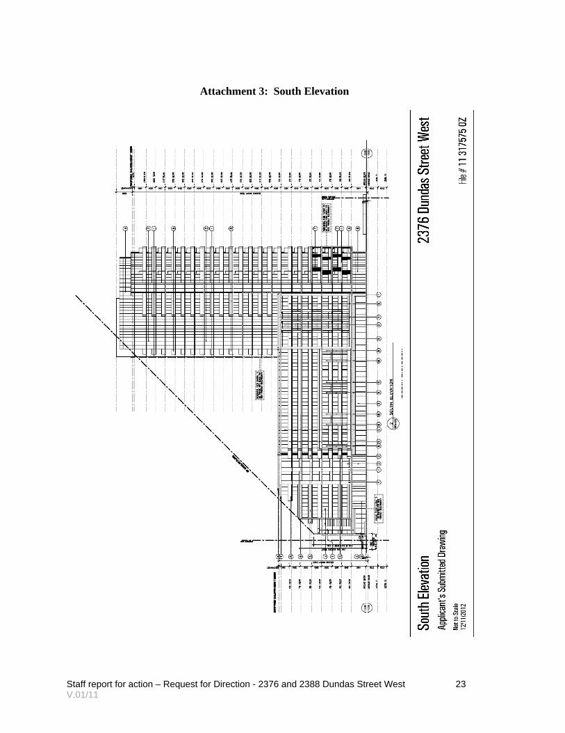
Attachment 3: South Elevation
Staff report for action – Request for Direction - 2376 and 2388 Dundas Street West 24 V.01/11
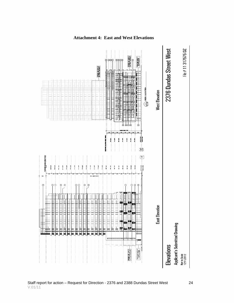
Attachment 4: East and West Elevations

Staff report for action – Request for Direction - 2376 and 2388 Dundas Street West 25 V.01/11
Attachment 5: Zoning
Staff report for action – Request for Direction - 2376 and 2388 Dundas Street West 26 V.01/11
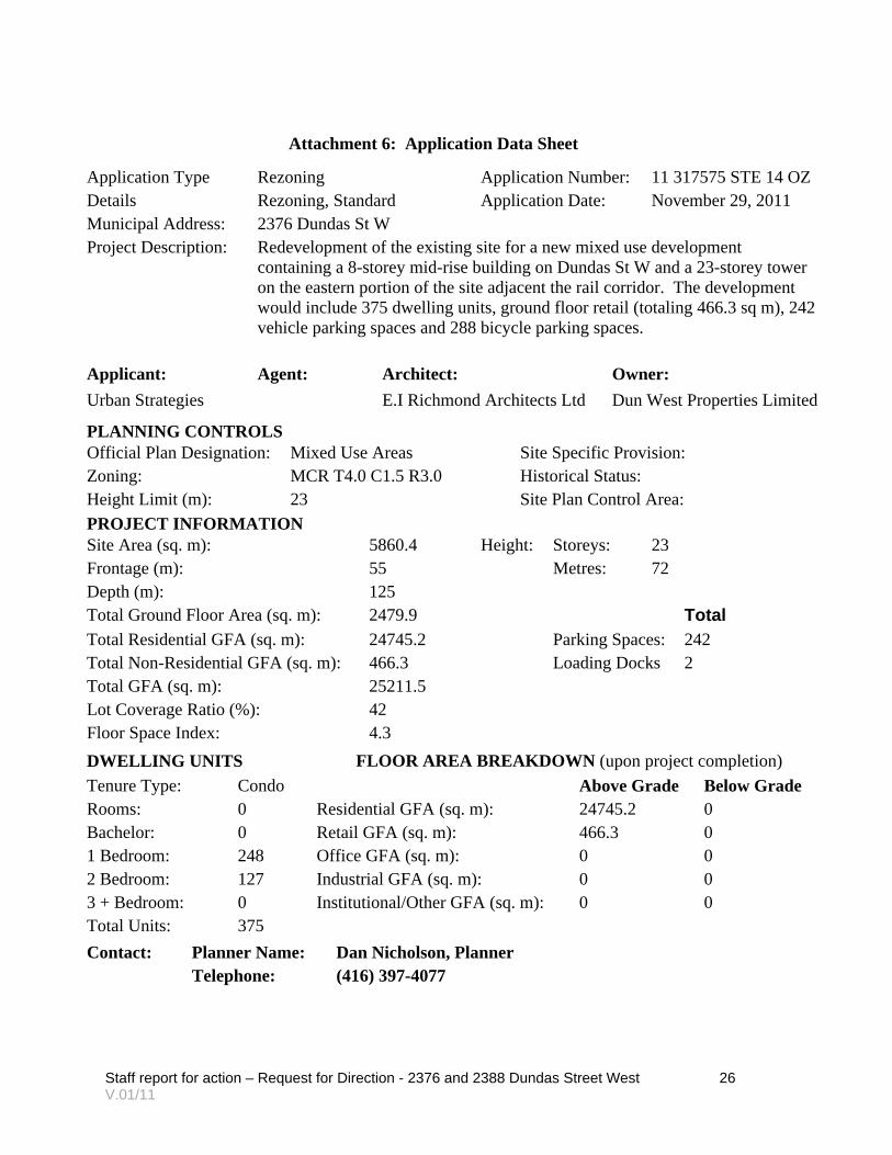
Attachment 6: Application Data Sheet
Application Type Rezoning Application Number: 11 317575 STE 14 OZ Details Rezoning, Standard Application Date: November 29, 2011 Municipal Address: 2376 Dundas St W Project Description: Redevelopment of the existing site for a new mixed use development
containing a 8-storey mid-rise building on Dundas St W and a 23-storey tower on the eastern portion of the site adjacent the rail corridor. The development would include 375 dwelling units, ground floor retail (totaling 466.3 sq m), 242 vehicle parking spaces and 288 bicycle parking spaces.
Applicant: Agent: Architect: Owner:
Urban Strategies E.I Richmond Architects Ltd Dun West Properties Limited
PLANNING CONTROLS Official Plan Designation: Mixed Use Areas Site Specific Provision: Zoning: MCR T4.0 C1.5 R3.0 Historical Status: Height Limit (m): 23 Site Plan Control Area:
PROJECT INFORMATION Site Area (sq. m): 5860.4 Height: Storeys: 23 Frontage (m): 55 Metres: 72 Depth (m): 125 Total Ground Floor Area (sq. m): 2479.9 Total Total Residential GFA (sq. m): 24745.2 Parking Spaces: 242 Total Non-Residential GFA (sq. m): 466.3 Loading Docks 2 Total GFA (sq. m): 25211.5 Lot Coverage Ratio (%): 42 Floor Space Index: 4.3
DWELLING UNITS FLOOR AREA BREAKDOWN (upon project completion)
Tenure Type: Condo Above Grade Below Grade Rooms: 0 Residential GFA (sq. m): 24745.2 0 Bachelor: 0 Retail GFA (sq. m): 466.3 0 1 Bedroom: 248 Office GFA (sq. m): 0 0 2 Bedroom: 127 Industrial GFA (sq. m): 0 0 3 + Bedroom: 0 Institutional/Other GFA (sq. m): 0 0 Total Units: 375
Contact: Planner Name: Dan Nicholson, Planner
Telephone: (416) 397-4077