Embed Size (px)
Citation preview

Melanie Daneluk
From: Stacey Mouille [[email protected]]
Sent: Thursday, May 03, 2012 3:43 PM
To: AENV Environmental Assessment
Cc: Shaun Janvier; [email protected]; [email protected]; [email protected]; Rory.O'[email protected]; Corinne Kristensen; [email protected]; Amit Banerjee; [email protected]; [email protected]; [email protected]; [email protected]
Subject: Chipewyan Prairie Dene First Nation Review of MEG Energy Proposed Terms of Reference
Attachments: Surmont ToR cover letter CPDFN.pdf; Surmont pTOR CPDFN comments.pdf; Surmont pTOR CPDFN comments.doc
5/18/2012
Attention: Director, Environmental Assessment The Chipewyan Prairie Dene First Nation Industry Relations Corporation (CPIRC), representing the Chipewyan Prairie Dene First Nation (CPDFN) is providing the attached review of the MEG Surmont Proposed Terms of Reference and associated cover letter for your consideration. Best Regards, Stacey Mouille B.Sc, Dipl. ECR Environmental Coordinator Chipewyan Prairie Industry Relation Corporation T: 780-715-3401 F: 780-715-3463 C: 780-404-6226 This email and any attachments to it may be confidential and are intended solely for the use of the individual to whom it is addressed. Any views or opinions expressed are solely those of the author and do not necessarily represent those of Chipewyan Prairie Industry Relations Corporation.If you are not the intended recipient of this email, you must neither take any action based upon its contents, nor copy or show it to anyone. Please contact the sender if you believe you have received this email in error.
1 | P a g e
Chipewyan Prairie Industry Relations
Corporation Suite 205, 10020 Franklin Avenue, Ft. McMurray, AB, T9H 2K6
Phone: (780) 715-3401 Fax: (780) 715-3463
May 3, 2012
Director, Environmental Assessment, Regional Integration, Alberta Environment and Water
111 Twin Atria Bldg., 4999 – 98 Avenue
Edmonton, Alberta T6B 2X3 0R4
Attention: Director, Environmental Assessment
RE: Chipewyan Prairie Dene First Nation Review of MEG Energy Proposed Terms of Reference
Dear Sir/Madam:
Chipewyan Prairie Dene First Nation Industry Relations Corporation (IRC), representing the Chipewyan
Prairie Dene First Nation (CPDFN) is providing the attached review of the MEG Surmont Proposed Terms
of Reference for your consideration. For ease of review, we are providing our input using track changes
in Microsoft Word.
The MEG Surmont Project is of interest and concern to CPDFN, as it lies wholly within our traditional
territory and is located approximately 5km north of our community, Janvier. We look forward to
working with MEG as well as the regulators as the Project moves through the regulatory process. Please
contact me directly at 780-881-9206 or [email protected] or, alternatively Lisa Schaldemose at 780-714-
2396 or [email protected] should you have any questions or wish to discuss our review further.
Sincerely,
Shaun Janvier
Director, CPDFN IRC
Cc Vern Janvier, Chief, Chipewyan Prairie Dene First Nation [email protected]

2 | P a g e
Stacey Mouille, Environmental Coordinator, CPDFN IRC [email protected]
Lisa Schaldemose, Schaldemose & Associates Inc. [email protected]
Karin Buss, Ackroyd Law LPP [email protected]
Rory O’Connor, Manager, Community Relations, MEG Energy
Rory.O’[email protected]
Corinne Kristensen, Acting Team Leader, Environmental Assessment
Amit Banerjee, Regional Approvals Manager, Alberta Environment and Water:
Ammar Baig, Oil Sands and Coal Branch, In Situ Applications Group [email protected]
1
PROPOSED TERMS OF REFERENCE
ENVIRONMENTAL IMPACT ASSESSMENT REPORT
FOR MEG ENERGY CORP.’s PROPOSED
SURMONT PROJECT
Approximately 85 km south from Fort McMurray, Alberta
ISSUED BY: MEG Energy Corp.
DATE: March 08, 2012

2
TABLE OF CONTENTS
PURPOSE OF THE TERMS OF REFERENCE ............................................................................ 3
1 PUBLIC ENGAGEMENT AND ABORIGINAL CONSULTATION .............................. 3
2 PROJECT DESCRIPTION ................................................................................................. 4
2.1 Overview ........................................................................................................................ 4
2.2 Constraints...................................................................................................................... 5
2.3 Regional and Cooperative Efforts ................................................................................ 65
2.4 Transportation Infrastructure ....................................................................................... 65
2.5 Air Emissions Management ......................................................................................... 75
2.6 Water Management ...................................................................................................... 76
2.7 Waste Management ...................................................................................................... 97
2.8 Conservation and Reclamation .................................................................................... 97
3 ENVIRONMENTAL ASSESSMENT ........................................................................... 108
3.1 Air Quality, Climate and Noise .................................................................................. 108
3.2 Hydrogeology ............................................................................................................. 118
3.3 Hydrology .................................................................................................................. 139
3.4 Surface Water Quality .............................................................................................. 1310
3.5 Aquatic Ecology ....................................................................................................... 1410
3.6 Vegetation ................................................................................................................ 1511
3.7 Wildlife .................................................................................................................... 1612
3.8 Biodiversity .............................................................................................................. 1812
3.9 Terrain and Soils ...................................................................................................... 1913
3.10 Land Use and Management ...................................................................................... 2013
4 HISTORIC RESOURCES ............................................................................................ 2114
5 TRADITIONAL ECOLOGICAL KNOWLEDGE AND LAND USE ........................ 2115
6 PUBLIC HEALTH AND SAFETY.............................................................................. 2315
6.1 Public Health ............................................................................................................ 2315
6.2 Public Safety ............................................................................................................ 2415
7 SOCIO-ECONOMIC ASSESSMENT ......................................................................... 2416
7.1 Baseline Information ................................................................................................ 2416
7.2 Impact Assessment ................................................................................................... 2416
8 MITIGATION MEASURES ........................................................................................ 2517
9 RESIDUAL IMPACTS ................................................................................................ 2617
10 MONITORING ............................................................................................................. 2617

3
PURPOSE OF THE TERMS OF REFERENCE
The purpose of this document is to identify for MEG Energy Corp (the Proponent), Aboriginal
communities and appropriate stakeholders the information required by government agencies for
an Environmental Impact Assessment (EIA) report prepared under the Environmental Protection
and Enhancement Act (EPEA) for the Surmont Project (the Project).
MEG Energy Corp. (MEG) is a publicly traded company based in Calgary, Alberta, focused on
sustainable in situ oil sands development and production in the southern Athabasca region of
Alberta. MEG is proposing to develop the Surmont Project (the Project) in Townships 81 and 82,
Range 5 W4M. The Project will use steam assisted gravity drainage (SAGD) bitumen recovery
technology. The Project has a planned capacity of approximately 120,000 barrels per day of
bitumen. The Project will be built in phases and will consist of a Central Processing Facility
(CPF), SAGD wells and additional infrastructure.
The main components of the CPF include makeup water treatment, steam generation including
natural gas-fired cogeneration, vapour recovery, bitumen treating, produced water recycling,
produced gas sweetening and sulphur recovery. Field facilities include multi-well production
pads, source and disposal wells, pumping stations, on-site power/utilities corridors, access roads,
and borrow pits. The Project will be accessed from Highway 881 to the west, via a new access
road.
SCOPE OF THE EIA REPORT
The Proponent shall prepare and submit an EIA report that examines the direct, induced and
cumulative environmental and socio-economic effects of the Project.
The EIA report shall be prepared considering all applicable provincial and federal legislation,
codes of practice, guidelines, standards and directives.
The EIA report shall be prepared in accordance with these Terms of Reference and the
environmental information requirements prescribed under EPEA and associated regulations, and
the Canadian Environmental Assessment Act if applicable. The EIA report will form part of the
Proponent’s application to the Energy Resources Conservation Board (ERCB). An EIA report
summary will also be included as part of the ERCB Application.
The Proponent shall refer to the Guide to Preparing Environmental Impact Assessment Reports
in Alberta published by Alberta Environment (the Guide) and these Terms of Reference when
preparing the Environmental Impact Assessment report. In any case where there is a difference
in requirements between the Guide and these Terms of Reference, the Terms of Reference shall
take precedence.
CONTENT OF THE EIA REPORT
1 PUBLIC ENGAGEMENT AND ABORIGINAL CONSULTATION
[A] Describe the concerns and issues expressed by the public and the actions taken to address
those concerns and issues, including how public input was incorporated into the Project
development, impact mitigation and monitoring.
[B] Describe the concerns and issues expressed by Aboriginal communities and the actions
taken to address those concerns and issues, including how Aboriginal community input
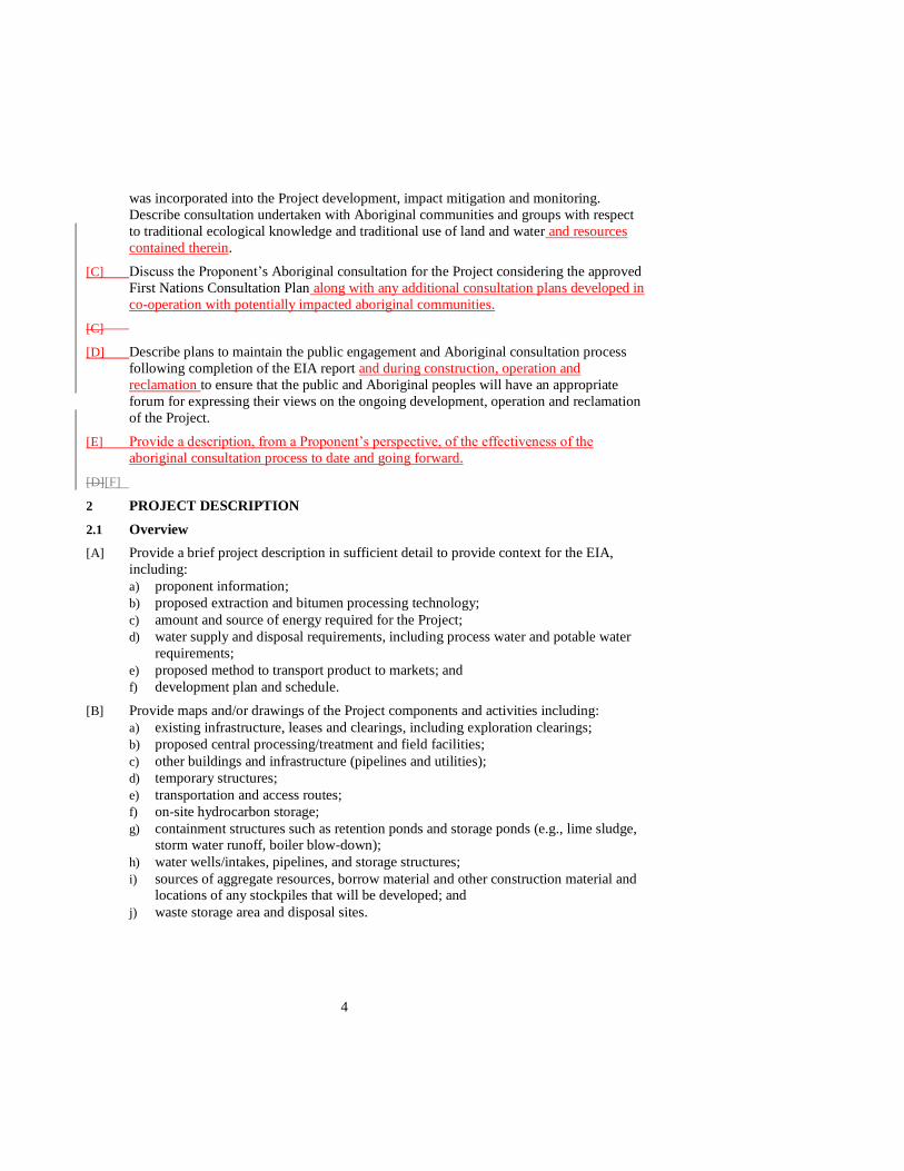
4
was incorporated into the Project development, impact mitigation and monitoring.
Describe consultation undertaken with Aboriginal communities and groups with respect
to traditional ecological knowledge and traditional use of land and water and resources
contained therein.
[C] Discuss the Proponent’s Aboriginal consultation for the Project considering the approved
First Nations Consultation Plan along with any additional consultation plans developed in
co-operation with potentially impacted aboriginal communities.
[C]
[D] Describe plans to maintain the public engagement and Aboriginal consultation process
following completion of the EIA report and during construction, operation and
reclamation to ensure that the public and Aboriginal peoples will have an appropriate
forum for expressing their views on the ongoing development, operation and reclamation
of the Project.
[E] Provide a description, from a Proponent’s perspective, of the effectiveness of the
aboriginal consultation process to date and going forward.
[D][F]
2 PROJECT DESCRIPTION
2.1 Overview
[A] Provide a brief project description in sufficient detail to provide context for the EIA,
including:
a) proponent information;
b) proposed extraction and bitumen processing technology;
c) amount and source of energy required for the Project;
d) water supply and disposal requirements, including process water and potable water
requirements;
e) proposed method to transport product to markets; and
f) development plan and schedule.
[B] Provide maps and/or drawings of the Project components and activities including:
a) existing infrastructure, leases and clearings, including exploration clearings;
b) proposed central processing/treatment and field facilities;
c) other buildings and infrastructure (pipelines and utilities);
d) temporary structures;
e) transportation and access routes;
f) on-site hydrocarbon storage;
g) containment structures such as retention ponds and storage ponds (e.g., lime sludge, storm water runoff, boiler blow-down);
h) water wells/intakes, pipelines, and storage structures;
i) sources of aggregate resources, borrow material and other construction material and locations of any stockpiles that will be developed; and
j) waste storage area and disposal sites.

5
[C] Discuss how environmental, socio-economic, traditional use and traditional
environmental knowledge criteria influenced the evaluation of alternatives and the
selection of the proposed project components.
[C][D] Discuss the implications of a delay in proceeding with the Project, or any phase of the
Project, or not going ahead with the Project.
[D][E] Describe the benefits of the project, including jobs created, local training, employment
and business opportunities, and royalties and taxes generated that accrue to:
a) the Proponent;
b) local and regional communities, including Aboriginal communities;
c) the local authority;
d) Alberta; and
e) Canada.
[E][F] Provide the adaptive management approach that will be implemented throughout the life
of the Project. Include how monitoring, mitigation, accomodation and evaluation were
incorporated.
2.2 Constraints
[A] Discuss the process and criteria used to identify constraints to development, and how the
Project has been designed to accommodate those constraints. Include the following:
a) any applicable Alberta Land Stewardship Act Regional Plan;
b) land use policies and resource management initiatives that pertain to the Project;
c) Aboriginal traditional land and water use and resources contained therein, including
the potential infringement of Treaty and aboriginal rights;
d) all known trap lines;
e) the environmental setting;
f) cumulative environmental impacts in the region;
g) cumulative social impacts in the region;
h) results of Project-specific or regional monitoring;
i) potential for new or additional technology to increase resource recovery at later
times; and
j) potential for changes in the regulatory regime.
[B] Discuss the selection criteria used, including energy and water efficiencies, options
considered, and rationale for selecting:
a) location of facilities and infrastructure (including pipelines, roads and utilities);
b) thermal energy and electric power required for the Project;
c) water supply sources;
d) wastewater treatment, wastewater management and wastewater disposal;
e) air emissions and air quality management systems, including the environmental,
health and cumulative effects management considerations behind the selections and
how the selections reflect best energy efficiency practices and best available
emission control technologies; and
b)f) waste disposal.
6
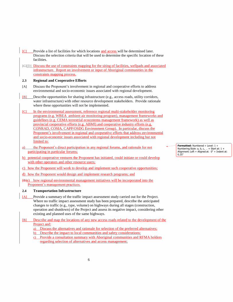
[C] Provide a list of facilities for which locations and access will be determined later.
Discuss the selection criteria that will be used to determine the specific location of these
facilities.
[C][D] Discuss the use of constraints mapping for the siting of facilities, wellpads and associated
infrastructure. Report on involvement or input of Aboriginal communities in the
constraints mapping process.
2.3 Regional and Cooperative Efforts
[A] Discuss the Proponent’s involvement in regional and cooperative efforts to address
environmental and socio-economic issues associated with regional development.
[B] Describe opportunities for sharing infrastructure (e.g., access roads, utility corridors,
water infrastructure) with other resource development stakeholders. Provide rationale
where these opportunities will not be implemented.
[C] In the environmental assessment, reference regional multi-stakeholder monitoring
programs (e.g. WBEA ambient air monitoring program), management frameworks and
guidelines (e.g. CEMA terrestrial ecosystems management framework) as well as
provincial cooperative efforts (e.g. ABMI) and cooperative industry efforts (e.g.
CONRAD, COSIA, CAPP/OSDG Environment Group). In particular, discuss the
Proponent’s involvement in regional and cooperative efforts that address environmental
and socio-economic issues associated with regional development including but not
limited to:
a) the Proponent’s direct participation in any regional forums, and rationale for not
participating in particular forums;
b) potential cooperative ventures the Proponent has initiated, could initiate or could develop
with other operators and other resource users;
c) how the Proponent will work to develop and implement such cooperative opportunities;
d) how the Proponent would design and implement research programs; and
[B]e) how regional environmental management initiatives will be incorporated into the
Proponent’s management practices.
2.4 Transportation Infrastructure
[A] Provide a summary of the traffic impact assessment study carried out for the Project.
Where no traffic impact assessment study has been prepared, describe the anticipated
changes to traffic (e.g., type, volume) on highways during all stages (construction,
operation and shutdown) of the Project and assess its negative impact, considering other
existing and planned uses of the same highways.
[B] Describe and map the locations of any new access roads related to the development of the
Project and:
a) Discuss the alternatives and rationale for selection of the preferred alternatives;
b) Describe the impact to local communities and safety considerations;
c) Provide a consultation summary with Aboriginal communities and RFMA holders regarding selection of alternatives and access management;
Formatted: Numbered + Level: 1 +Numbering Style: a, b, c, … + Start at: 1 +Alignment: Left + Aligned at: 0" + Indent at: 0.25"

7
d) Provide an access management plan for any proposed access roads including
consideration of: (1) ability of Aboriginal land users to access areas in and around
the Project area for traditional land use; and (2) management of increased non-
aboriginal land users access to areas in and around the Project area.
[C] Identify the type, volume, location and availability of construction and reclamation
materials for all road construction and/or road improvement work, related to the development of
the Project, within and outside of the Project area.
2.5 Air Emissions Management
[A] Provide emission profiles (type, composition, rate and source) for the Project’s operating
and construction emissions including point and non-point sources and fugitive emissions.
Consider both normal and upset conditions. Discuss:
a) odorous or and visible emissions from the proposed facilities;
b) annual and total greenhouse gas emissions during all stages of the Project. Identify
the primary sources and provide detailed calculations;
b)c) annual and total greenhouse gas emissions during all stages of the Project. Identify the primary sources and provide examples of calculations;
c)d) the intensity of greenhouse gas emissions per unit of bitumen produced;
d)e) the Project’s contribution to total provincial and national greenhouse gas emissions on an annual basis;
e)f) the Proponent’s overall greenhouse gas management plans;
f)g) amount and nature of Criteria and Trace Air Contaminants emissions;
h) the amount and nature of acidifying and eutrophying emissions, probable deposition
patterns and rates;
g)i) air emission control technologies evaluated to minimize point and area air emissions and the rationale considering these as best available control strategies or technologies
economically achievable;
h)j) emergency flaring scenarios (e.g., frequency and duration) and proposed measures to
ensure flaring events are minimized;
i)k) upset condition scenarios (e.g., frequency and duration) and proposed measures to ensure upset conditions are minimized;
j)l) gas collection and conservation, and the applicability of vapour recovery technology;
k)m) applicability of sulphur recovery, acid gas re-injection or flue gas desulphurization to reduce sulphur emissions; and
l)n) fugitive emissions control technology to detect, measure and control emissions and
odours from equipment leaks.
2.6 Water Management
2.6.1 Water Supply
[A] Describe the water supply requirements for the Project, including:
a) the criteria used, options considered and rationale for selection of water supply source(s);
b) the expected water balance during all stages of the Project. Discuss assumptions
made or methods chosen to arrive at the water balances;
Formatted: List Number 2, Numbered + Level:1 + Numbering Style: a, b, c, … + Start at: 1 +Alignment: Left + Aligned at: 0.5" + Tab after: 0.8" + Indent at: 0.8"
Formatted: Indent: Left: 0.04"

8
c) the process water, potable water, and non-potable water requirements and sources for
construction (including but not limited to road construction, winter road
construction, lease construction, production well drilling and dust suppression), start-
up, normal and emergency operating situations, decommissioning and reclamation.
Identify the volume of water to be withdrawn from each source, considering plans
for wastewater reuse including criteria and rationale for selection of water sources as
described;
d) the location of sources/intakes and associated infrastructure (e.g., pipelines for water supply);
e) the variability in the amount of water required on an annual and seasonal basis as the
Project is implemented;
f) the expected cumulative effects on water losses/gains resulting from the Project operations;
f)g) contingency plans in the event of restrictions on water withdrawal due to license
conditions or cumulative impact water deficits;
g)h) potable water treatment systems for all stages of the Project;
h)i) type and quantity of potable water treatment chemicals used; and
i)j) measures for ensuring efficient use of water including alternatives to reduce the consumption of non-saline water such as water use minimization, recycling,
conservation, and technological improvements.
2.6.2 Surface Water
[A] Describe the surface water management strategy for all stages of the Project, including:
a) design factors considered; and
b) permanent or temporary alterations of watercourses, wetlands and other water bodies and mitigation measures to prevent effects on fish and fish habitat.
[B] Describe crossings of watercourses or water bodies (including bridges, culverts and
pipelines) required and provide example diagrams of each type of crossing.
2.6.3 Wastewater Management
[A] Describe the wastewater management strategy, including:
a) the source, quantity and composition of each wastewater stream from each
component of the proposed operation (e.g., bitumen extraction and associated
facilities) for all Project conditions, including normal, start-up, worst-case and upset
conditions;
b) the proposed disposal locations and methods for each wastewater stream;
c) formations for the disposal of wastewaters;
d) design of facilities that will collect, treat, store and release wastewater streams and evaluation done to determine that the facilities represent best management or
treatment practices;
e) type and quantity of chemicals used in wastewater treatment; and
f) sewage treatment and disposal.

9
2.7 Waste Management
[A] Characterize and quantify the anticipated dangerous goods, and hazardous, non-
hazardous, and recyclable wastes generated by the Project, and:
a) describe the composition and volume of specific waste streams and discuss how each stream will be managed;
a)b) identify the amount of drilling wastes and the options considered for disposal and the
option chosen;
b)c) describe how the disposal sites and sumps will be constructed; and
d) describe plans for pollution prevention, waste minimization, recycling, and
management to reduce waste quantities for all stages of the Project; and.
c)e) describe the location of off-site disposal, including landfills and deep well disposal sites if any are in the Regional Municipality of Wood Buffalo.
2.8 Conservation and Reclamation
[A] Provide a conceptual conservation and reclamation plan for the Project. Describe and
map as applicable:
a) current land use and capability and proposed post-development land use and
capability from a number of perspectives including but not limited to traditional land
use, wildlife and forest productivity;
b) anticipated timeframes for completion of reclamation stages and release of lands back to the Crown and for Aboriginal land traditional land use including an outline
of the key milestone dates for reclamation and how progress to achieve these targets
will be measured. Provide a table and graph that shows cumulatively, for each year
and for the entire life of the Project, the land disturbed by clearing, land disturbed
through drainage alterations, land disturbed by soil removal or covering, the total
land reclaimed and the land that remains unreclaimed. Describe how project design
and reclamation planning has contributed to and an accelerated pace of reclamation
in comparison to existing projects;
c) constraints to reclamation such as timing of activities, availability of reclamation
materials and influence of natural processes and cycles including natural disturbance
regimes;
d) revegetation plan for the disturbed terrestrial and aquatic areas and wetlands;
e) discuss how the proposed reclamation methods have performed in similar situations
including ecosite and ecosite phases diversity establishment and re-population of
these areas by plant and wildlife species of importance. Include in this discussion
the plants and animals important to Aboriginal communities;
d)
f) reclamation material salvage, storage areas and handling procedures:
(i) describe reclamation material salvage plans, including soil resources from the entire development footprint;
(ii) describe the volumes of soil to be salvaged and the length of time to be stored before
use; for organic soil materials, describe the expected soil decomposition and how this
will be managed and how any volume changes will be accommodated in the
reclamation plan;
(iii)include a description of LFH depth and volume and an assessment of the potential to strip LFH separately from the topsoil; and
Formatted: Indent: Left: 0.8", No bullets ornumbering
Formatted: Numbered + Level: 1 +Numbering Style: i, ii, iii, … + Start at: 1 +Alignment: Left + Aligned at: 0.5" + Indent at: 0.75"

10
e)(iv) discuss the use of a certified soil scientist to supervise soil salvage and placement;
and and
g) existing and final reclaimed site drainage plans including for wetlands.
f) .
[B] Discuss, from an ecological perspective, the expected timelines for establishment and
recovery of vegetative communities and wildlife habitat, the expected success of
establishment and recovery, and the expected differences in the resulting communities.
[C] Describe how the Proponent considered the use of progressive reclamation in project
design and reclamation planning
[D] Discuss the Proponent’s involvement in any in-situ reclamation initiatives or reclamation
working groups.
[D][E] Discuss how the Proponent has consulted with Aboriginal communities in reclamation
planning.
[E][F] Discuss uncertainties related to the conceptual reclamation plan.
3 ENVIRONMENTAL ASSESSMENT
3.1 Assessment Cases
[A] In addition to the assessment scenarios set out in the AENV Guidance to Preparing
Environmental Assessment Reports in Alberta, assess the following scenarios:
a) pre-development case (approximately mid 1960’s); and
b) current case (approximately 2011) assessment case.
The pre-development case as describe in (a) above should serve as the baseline case upon
which all other cases, including the application case, are compared.
[B] Cumulative effects Case:
a) assess effects of past, present and future developments and activities that might interact
with the effects of the proposed project considering;
3.1 i) existing, approved and reasonably foreseeable anthropogenic and natural events
(eg. forest fires, climate change); and
ii) a time horizon that will exposes any transient and residual permanent effects.
3.2 Air Quality, Climate and Noise
3.2.1 Baseline Information
[A] Discuss the baseline climatic and air quality conditions including:
a) the type and frequency of meteorological conditions that may result in poor air quality;
a)b) current regional air quality and air quality issues and trends; and
b)c) appropriate ambient air quality parameters including SO2, CO, H2S, other RSCs, NOx, PAHs, VOCs, NH3, individual hydrocarbons of concern (e.g. odours and
health related in the THC and VOC mixtures, O3 (ground level), heavy metals and
particulates (TSP, PM10 and PM 2.5).
Formatted: Normal
Formatted: Normal, Indent: Left: 0.5"

11
3.2.2 Impact Assessment
[A] Identify components of the Project that will affect air quality, and:
a) describe the potential for reduced air quality (including odours and visibility) resulting from the Project and discuss any implications of the expected air quality for
environmental protection, quality of life (e.g. odours) and public health;
b) estimate ground-level concentrations of appropriate air quality parameters including
odorants and ozone;
c) discuss any expected changes to particulate deposition, nitrogen deposition or acidic deposition patterns;
d) identify areas that are predicted to exceed Potential Acid Input (PAI) critical loading
criteria;
d)e) identify nitrogen deposition and rates and patterns and the areas that are expected to exceed 8 kg N/ha/yr; and
e)f) discuss interactive effects that may occur resulting from co-exposure of a receptor to
all emissions.
[B] Identify stages or elements of the Project that are sensitive to changes or variability in
climate parameters, including frequency and severity of extreme weather events. Discuss
what impacts the change to climate parameters may have on elements of the Project.
[C] Summarize the results of the noise assessment conducted for the ERCB, and:
a) identify the nearest receptor used in the assessment and all receptors within 5 km of the proposed development; and
b) discuss the design, construction and operational factors to be incorporated into the
Project to comply with the ERCB’s Directive 38: Noise Control; and
c) discuss the predicted sound levels within 5km of the perimeter of the development area.
[D] Describe the plans for monitoring noise in the community of Janvier, located
approximately 5km south of the project boundary.
[E] Estimate the impacts of any pure tonal sound sources (e.g. vehicle back up beepers) or
any intermittent noise sources (e.g. steam venting) from the Project on areas in the
vicinity that they are used by aboriginal peoples or the public.
[F] Discuss accommodation or mitigation strategies and how best practices will be applied to
minimize the potential impact of the Project on air quality and noise.
b)
3.3 Hydrogeology
3.3.1 Baseline Information
[A] Provide an overview of the existing geologic and hydrogeologic setting from the ground
surface down to, and including, the oil producing zones and disposal zones, and:
a) present regional and Project Area geology to illustrate depth, thickness and spatial extent of lithology, stratigraphic units and structural features; and
b) present regional and Project Area hydrogeology describing:
i) the major aquifers, aquitards and aquicludes (Quaternary and bedrock), their spatial distribution, properties, hydraulic connections between aquifers,
Formatted: Indent: Left: 0.8", No bullets ornumbering

12
hydraulic heads, gradients, groundwater flow directions and velocities.
Include maps and cross sections,
ii) the chemistry of groundwater aquifers including baseline concentrations of major ions, metals and hydrocarbon indicators,
iii) the potential discharge zones, potential recharge zones and sources, areas of
groundwater-surface water interaction and areas of Quaternary aquifer-
bedrock groundwater interaction,
iv) water well development and groundwater use, including an a field-verified inventory of groundwater users,
v) the recharge potential for Quaternary aquifers,
vi) potential hydraulic connection between bitumen production zones, deep disposal formations and other aquifers resulting from Project operations,
vii) the characterization of formations chosen for deep well disposal, including
chemical compatibility and containment potential, injection capacity,
hydrodynamic flow regime, and water quality assessments, and
viii) the locations of major facilities associated with the Project including facilities for waste storage, treatment and disposal (e.g., deep well disposal) and
describe site-specific aquifer and shallow groundwater conditions beneath
these proposed facilities. Provide supporting geological information.
3.3.2 Impact Assessment
[A] Describe Project components and activities that have the potential to affect groundwater
resource quantity and quality at all stages of the Project.
[B] Describe the nature and significance of the potential Project impacts on groundwater with
respect to:
a) inter-relationship between groundwater and surface water in terms of both
groundwater and surface water quantity and quality, including as it relates to winter
stream flow in affected streams and rivers;
b) implications for terrestrial or riparian vegetation, wildlife and aquatic resources including wetlands;
c) changes in groundwater quality and quantity and flow;
d) conflicts with other groundwater users, and proposed resolutions to these conflicts;
e) potential implications of seasonal variations and climate change; and
f) groundwater withdrawal for Project operations, including any expected alterations in the groundwater flow regime during and following Project operations.
[C] Discuss ground water issues with Aboriginal people and review existing relevant TEK
and TLU information to indicate how this information has influenced the assessment
process.
[D] Discuss the accommodation or mitigation strategies to minimize the potential impact of
the Project on hydrogeology.
[C]

13
3.4 Hydrology
3.4.1 Baseline Information
[A] Describe and map the surface hydrology in the Project Area.
[B] Identify any surface water users who have existing approvals, permits or licenses or users
who have indicated traditional uses of surface water.
3.4.2 Impact Assessment
[A] Describe the extent of hydrological changes that will result from disturbances to
groundwater and surface water movement:
a) include changes to the quantity of surface flow, water levels and channel regime in watercourses (during minimum, average and peak flows) and water levels in water
bodies, including as it relates to winter conditions;
b) assess the potential impact of any alterations in flow on the hydrology and identify
all temporary and permanent alterations, channel re-alignments, disturbances or
surface water withdrawals;
c) discuss the effect of these changes on hydrology (e.g., timing, volume, peak and minimum flow rates, river regime and lake levels), including the significance of
effects for downstream watercourses; and
c)d) quantify the rate, volume and timing of any storm water releases to local surface
waters; and
d)e) identify any potential erosion problems in watercourses resulting from the Project.
[B] Describe impacts on other surface water users resulting from the Project. Identify any
potential water use conflicts.
[C] Discuss the impact of low flow conditions and in-stream flow needs on water supply and
water and wastewater management strategies.
[D] Discuss surface water issues with Aboriginal people and review existing relevant TEK
and TLU information to indicate how this information has influenced the assessment
process.
[C][E] Discuss the accommodation or mitigation strategies to prevent or minimize the potential
impact of the Project on hydrology.
3.5 Surface Water Quality
3.5.1 Baseline Information
[A] Describe the baseline water quality of watercourses and water bodies.
3.5.2 Impact Assessment
[A] Describe the potential impacts of the Project on surface water and sediment quality and
proposed accommodation or mitigation measures to maintain surface water quality at all
stages of the Project. Consider appropriate water quality parameters (e.g. temperature,
pH, conductivity, cations and anions, metals, dissolved oxygen, suspended sediment,
dissolved solids, nutrients and other oil sands water contaminants (such as napthenic
acids) and potential tainting compounds.

14
[B] Assess the potential Project-related and cumulative impacts of acidifying and other
contaminants in air emissions on surface water and sediment quality.
[C] Discuss the effect of changes in surface runoff and/or groundwater
withdrawalgroundwater withdrawal on water and sediment quality in surface water
bodies.
[D] Describe the effects if any, on water withdrawals considered, including cumulative
effects on fish, fish habitat or other aquatic resources.
[A][E] Describe how waterbodies and areas of importance to traditional users were identified
and addressed in the assessment.
3.6 Aquatic Ecology
3.6.1 Baseline Information
[A] Describe the pre-development and existing fish and other aquatic resources. Identify
species composition, distribution, relative abundance, movements and general life history
parameters.
[A][B] Describe and map the fish, fish habitat and aquatic resources (e.g., aquatic and benthic
invertebrates) of the lakes, rivers, ephemeral water bodies and other waters. Describe the
species composition, distribution, relative abundance, movements and general life history
parameters of fish resources. Also identify any species that are:
a) listed as “at Risk, May be at Risk and Sensitive” in General Status of Alberta Wild Species (Alberta Sustainable Resource Development);
a)b) listed as species of special concern, threatened or according to Alberta’s Endangered
Species Conservation Committee (ESCC);
b)c) listed in Schedule 1 of the federal Species at Risk Act; and
c)d) listed as “at risk” by COSEWIC.
d)e) traditionally used species
[B][C] Describe and map existing critical or sensitive areas such as spawning, rearing, and over-
wintering habitats, seasonal habitat use including migration and spawning routes.
[D] Describe the current and potential use of the fish resources by Aboriginal, sport or
commercial fisheries.
[C][E] Describe TEK and TLU information as provided through Aboriginal consultation.
3.6.2 Impact Assessment
[A] Identify the key aquatic indicators that the Proponent used to asses project impacts.
Discuss the rationale for their selection.
[B] Describe and assess the potential impacts of the Project to fish, fish habitat, and other
aquatic resources, considering:
a) potential habitat loss and alteration including fish tainting, survival of eggs and fry,
chronic or acute health effects (based on whole effluent toxicity tests), and increased
stress on fish populations from release of contaminants, sedimentation, flow
alterations, temperature and habitat changes;
b) potential water quality and quantity changes
Formatted: Numbered + Level: 1 +Numbering Style: A, B, C, … + Start at: 1 +Alignment: Left + Aligned at: 0" + Tab after: 0.5" + Indent at: 0.5"

15
c) potential impacts on riparian areas that could affect aquatic biological resources and
productivity;
d) changes to benthic invertebrate communities that might affect food quality and availability for fish;
e) potential increased fishing pressures in the region that could arise from the increased
workforce and improved access from the Project. Provide mitigation options
considered in a project access management plan.;.
f) potential increased habitat fragmentation;
g) potential acidification;
h) potential for groundwater surface water interactions.
[C] Describe the effects of any water withdrawals considered, including cumulative effects
on fish, fish habitat and other aquatic resources.
[D] Discuss accommodation or mitigation measures to minimize potential impacts of the
Project on fish, fish habitat and other aquatic resources. Clearly identify those
accommodation or mitigation measures that will be implemented and provide rationale
for their selection.
[E] Identify plans proposed to offset any loss in the productivity of fish habitat. Indicate how
environmental protection plans address applicable provincial and federal policies on fish
habitat including the development of a “No Net Loss” fish habitat objective.
[C][F] Describe the residual impacts of the Project on fish, fish habitat, and other aquatic
resources and discuss their significance in the context of local and regional fisheries,.
Describe, describe the Proponent’s plans to manage or accommodate those impacts.
3.7 Vegetation
3.7.1 Baseline Information
[A] Describe and map the vegetation communities, wetlands, rare plants, old growth forests,
and communities of limited distribution. Identify the occurrence, relative abundance and
distribution of any species that are:
a) listed as “at Risk, May be at Risk and Sensitive” in General Status of Alberta Wild
Species (Alberta Sustainable Resource Development);
b) listed in Schedule 1 of the federal Species at Risk Act; and
c) listed as “at risk’ by COSEWIC; and
c)d) as appropriate, use the Alberta Vegetation Inventory (AVI) Standard AVI 2.1 The Field Guide to Ecosites of Northern Alberta and the Alberta Wetland Inventory
Standards Manual (AWI) Version 1.0. Map the project development footprint at a
scale of 1:20,000. Conduct verification of vegetation mapping to provide reliability
equivalent to the soils mapping..
[B] Describe and quantify the current extent of habitat fragmentation.
[C] Identify key vegetation indicators used to assess the Project impacts. Discuss how
impacts will be monitored and the rationale for their indicator selection.

16
3.7.2 Impact Assessment
[A] Identify key vegetation indicators used to assess the Project impacts. Discuss the
rationale for the indicator’s selectionIdentify the vegetation and wetland communities
that will be disturbed by all stages of the Project. Discuss the number of impacted
traditional use sites as identified in community-specific traditional land use information.
[B] Describe and assess the potential impacts of the Project on vegetation communities,
wetlands, rare plants, old growth forests and communities of limited distribution and
plants for traditional, medicinal and cultural purposes in the project area considering:
a) both temporary (include timeframe) and permanent impacts;
b) species richness and abundance;
b)
c) the potential for introduction and colonization of weeds and non-native invasive
species;
d) potential increased fragmentation and loss of upland, riparian and wetland habitats; and
e) implications of vegetation changes for other environmental resources (e.g., terrestrial
and aquatic habitat diversity and quantity, water quality and quantity, erosion
potential); and
f) the effects and their implications to recreation, Aboriginal and other uses.
e) Discuss the accommodation or mitigation measures to minimize impacts on vegetation
communities, wetlands, rare plants, old growth forests and communites of limited
distribution. Clearly identify those accommodation or mitigation measures that will be
implemented and provide the rationale for their selection..
[C] DiscussDiscuss weeds and non-native invasive species and how they will be controlled
prior to and during operation and reclamation.
[D] Discuss how TEK and TLU information that was collected and indicate how this
information has influenced the assessment process.
3.8 Wildlife
3.8.1 Baseline Information
[A] Describe and map the wildlife resources (amphibians, reptiles, birds, and terrestrial and
aquatic mammals). Describe the species relative abundance, distribution and their use and
potential use of habitats. Also identify any species that are:
a) listed as “at Risk, May be at Risk and Sensitive” in General Status of Alberta Wild
Species (Alberta Sustainable Resource Development);
b) listed in Schedule 1 of the federal Species at Risk Act; and
c) listed as “at risk” by COSEWIC.
d) Traditionally used species
Formatted: List Number, Numbered + Level: 1+ Numbering Style: A, B, C, … + Start at: 1 +Alignment: Left + Aligned at: 0" + Tab after: 0.5" + Indent at: 0.5"
Formatted: List Number, Indent: Left: 0.5"

17
[B] Describe and map existing wildlife habitat and habitat disturbance (including exploration
activities). Identify those habitat disturbances that are related to existing and approved
Project operations.
[C] Identify the key wildlife and habitat indicators used to assess Project impacts. Discuss
the rationale for their selection.
[D] Provide rationale behind sampling protocols and field methods implemented. Include
information on number, timing and locations of surveys as well as statistical parameters
used to determine population estimates. Indicate to what extent information is based on
actual survey data or hunting and trapping data, TEK, scientific peer-reviewed literature,
consultants reports or modeling.
[C][E] Discuss use of TEK or TLU information and/or participation of local
AborignalAboriginal communities in base line field studies to inform baseline data
collection.
3.8.2 Impact Assessment
[A] Identify the key wildlife and habitat indicators used to assess Project impacts. Discuss the
rationale for their selection.
[B] Describe and assess the potential impacts of the Project to wildlife and wildlife habitats,
considering:
a) how the Project will affect wildlife relative abundance, movement patterns, and distribution for all stages of the Project;
b) how improved or altered access may affect wildlife, including potential obstruction
of daily and seasonal movements, increased vehicle-wildlife collisions, increased
hunting pressure and increased predator-prey interactions;
c) how increased habitat fragmentation may affect wildlife considering edge effects and the influence the availability of core and critical habitat and the influence of linear
features and infrastructure on wildlife movements, predator-prey interactions
(particularly on wolf-caribou interactions) and other population parameters;
c)d) the spatial and temporal changes to habitat availability and habitat effectiveness
(types, quality, quantity, diversity and distribution);
d)e) potential effects on wildlife resulting from changes to air and water quality, including both acute and chronic effects to animal health; and
f) potential effects on wildlife from the Proponent’s proposed and planned exploration,
seismic and core hole activities, including monitoring/4D seismic; and
g) the resilience and recovery capabilities of wildlife populations and habitats to disturbance, in particular with regard to listed species and for those species with
which a federal and/or provincial recovery strategy applies..
e) Comment on the availability and quantity of traditionally used species considering habitat
loss, habitat avoidance, vehicle-wildlife collisions, increased non-Aboriginal hunting
pressure, increased predator-prey interactions and other Project related effects on wildlife
populations.
[C] Discuss the accommodation or mitigation measures to avoid or minimize the potential
impact of the Project on wildlife and wildlife habitat for all stages of the Project and to
return productive wildlife habitat to the area. Clearly identify those accommodation or
Formatted: List Number, Numbered + Level: 1+ Numbering Style: A, B, C, … + Start at: 1 +Alignment: Left + Aligned at: 0" + Tab after: 0.5" + Indent at: 0.5"

18
mitigation measures, including buffers and offsets, to ensure that wildlife populations are
maintained within their natural range of variability and are available for traditional use.
Consider:
a) Consistency of any plans with applicable regional, provincial and federal
wildlife habitat objectives, policies, frameworks and strategies;
b) A schedule for the return of habitat capability to areas impacted by the
Project;
c) The use of setbacks to protect riparian habitats and wildlife corridors,
interconnectivity of such habitat and the unimpeded movement by wildlife
species using the habitat;
d) Anticipated access controls to or other management strategies to protect
wildlife during and after pProjectproject construction and operation;
e) Measures to prevent habituation of wildlife to minimize the potential for
human-wildlife encounters and consequent destruction of wildlife, including
any staff or contractor training program, fencing camps, garbage containment
measures or regular follow-up;
f) Measures to mitigate habitat fragmentation considering impacts to habitat
connectivity and wildlife movements resulting from linear features and other
Project infrastructure and activities; and
g) Measures to minimize the impacts of light pollution on wildlife.
[D] Describe the Project’s residual impacts on wildlife and wildlife habitat and the
Proponent’s plans to manage those impacts.
3.9 Biodiversity
3.9.1 Baseline Information
[A] Describe and map the existing biodiversity including any unique features that affect the
Project area’s biodiversity in comparison to the Local Study Area.
[B] Identify the biodiversity metrics, biotic and abiotic indicators that are used to characterize
the baseline biodiversity and to assess project impacts. Discuss the rationale for their
selection.
3.9.2 Impact Assessment
[A] Describe and assess the potential impacts of the Project to biodiversity considering:
a) The biodiversity metrics, biotic and abiotic indicators selected;
b) the effects of fragmentation on biodiversity potential;
c) the contribution of the Project to any anticipated changes in regional biodiversity and the potential impact to local and regional ecosystems; and
d) effects during construction, operations and post-reclamation and the significance of
these changes in a local and regional context.
[B] Discuss accommodation or mitigation measures to minimize the potential impact of the
Project on biodiversity. Clearly identify those accommodation or mitigation measures
that will be implemented and provide rationale for their selection.
Formatted: List Number, Numbered + Level: 1+ Numbering Style: a, b, c, … + Start at: 1 +Alignment: Left + Aligned at: 1" + Indent at: 1.25"
Formatted: List Number, Numbered + Level: 1+ Numbering Style: A, B, C, … + Start at: 1 +Alignment: Left + Aligned at: 0" + Tab after: 0.5" + Indent at: 0.5"

19
d)
3.10 Terrain and Soils
3.10.1 Baseline Information
[A] Describe and map the terrain and soils conditions in the Project Area. Discuss the
reliability of the soil survey maps, both boundaries and map unit descriptions.
[B] Describe and map soil types in the areas that are predicted in 3.1.2[A]d) to exceed
Potential Acid Input (PAI) critical loading criteria.
3.10.2 Impact Assessment
[A] Describe Project activities and other related issues that could affect soil quality
(e.g., compaction, contaminants) and:
a) indicate the amount (ha) of surface disturbance from plant, field (pads, pipelines, access roads), aggregate and borrow sites, construction camps, drilling waste
disposal and other infrastructure-related construction activities;
b) discuss the relevance of any changes for the local and regional landscapes,
biodiversity, productivity, ecological integrity, aesthetics and future use resulting
formfrom disturbance for all stages of the Project;
b)c) describe the effect on soils in the Local Study Area from changes to surface water flow and shallow groundwater flow;
c)d) identify the potential acidification and eutrophication impact on soils and discuss the
significance of predicted impacts by acidifying emissions; and
d)e) describe potential sources of soil contamination.
[B] Discuss:
a) the environmental effects of proposed drilling methods on the landscape and surficial
and bedrock geology;
b) the potential for changes in the ground surface during steaming and recovery operations (e.g., ground heave and/or subsidence) and their environmental
implications; and
c) the potential impacts caused by the mulching and storage of woody debris
considering, but not limited to vulnerability to fire, degradation of soil quality,
increased footprint, etc.

20
[C] Include an assessment of soil types for reclamation suitability. Discuss reclamation
material salvage, storage areas and handling procedures.
[D] Provide a mitigation plan to:
a) Minimize surface disturbance including the use of existing clearings for the
Project;
b) Address potential effects of acid and nitrogen deposition;
c) Mitigate changes to ground surface during operations (temperature, heave and
subsidence); and
d) Address impacts to land capability including for traditional uses, wildlife and
forest productivity.
[E] Discuss accommodation or mitigation strategies to minimize the potential impact of the
Project on soils or terrain.
c)
3.11 Land Use and Management
3.11.1 Baseline Information
[A] Describe and map the current land uses in the Project Area, including all Crown land and
Crown Reservations (Holding Reservation, Protective Notation, Consultative Notation)
and traditional land uses by Aboriginal communities.
[B] Indicate where Crown land dispositions may be needed for roads or other infrastructure
for the Project.
[C] Identify and map unique sites or special features in the Project Area and Local Study
Area such as Parks and Protected Areas, Heritage Rivers, Historic Sites, Environmentally
Significant Areas, culturally significant sites and areas and other designations (World
Heritage Sites, Ramsar Sites, Internationally Important Bird Areas, etc.).
[C][D] Describe and map any federally or provincially identified critical habitat for listed
wildlife species;
[E] Describe and map land clearing activities, showing the timing of the activities.
[F] Describe topographically project infrastructure and other features that may lead to visual
impacts to the public and neighboring communities.
[D]
[E][G] Describe the status of timber harvesting arrangements, including species and timing.
[F][H] Describe access control measures proposed for the Project Area.
3.11.2 Impact Assessment
[A] Identify the potential impact of the Project on land uses, including:
a) unique sites or special features;
b) changes in public access arising from linear development, including secondary effects related to increased hunter, angler and other recreational access and
facilitated predator movement;
Formatted: Numbered + Level: 1 +Numbering Style: a, b, c, … + Start at: 1 +Alignment: Left + Aligned at: 1" + Indent at: 1.25"

21
c) aggregate reserves that may be located on land under the Proponent’s control and
reserves in the region;
d) development and reclamation on commercial forest harvesting and fire management in the Project Area;
e) the amount of commercial and non-commercial forest land base that will be
disturbed by the Project, including the Timber Productivity Ratings for the Project
Area. Compare the reclaimed percentages and distribution of all forested
communities in the Project Area;
f) how the Project impacts Annual Allowable Cuts and quotas within the Forest Management Agreement area;
g) anticipated changes (type and extent) to the pre-disturbance topography, elevation
and drainage pattern within the Project Area; and
h) access control for public access, regional recreational activities, Aboriginal land use and other land uses during and after development activities.
[B] Describe any visual impacts the Project may have on neighboring communities or from
nearby public areas, including transportation routes. Identify accommodation or
mitigation measures taken to minimize any visual impacts.
[B][C] Provide a fire control plan highlighting:
a) measures taken to ensure continued access for firefighters to adjacent wild land
areas;
b) forest fire prevention, detection, reporting, and suppression measures, including proposed fire equipment;
c) measures for determining the clearing width of power line rights-of-way; and
d) required mitigative measures for areas adjacent to the Project Area based on the FireSmart Wildfire Assessment System.
4 HISTORIC RESOURCES
[A] Describe the Historic Resource Impact Assessment (HRIA) work done to date for the
Project, and provide a schedule for any future work.
[B] Describe the impacts of the findings of the HRIA work on Project design and scheduling.
[C] Describe any Project uncertainties arising from the need for future HRIA work.
[C][D] Describe the use of TEK and TLU information and/or participation of local Aboriginal
communities in the HRIA work completed or planned to inform Project design.
5 TRADITIONAL ECOLOGICAL KNOWLEDGE AND LAND USE
[A] During project planning and design, consult with Aboriginal communities to ensure that
TEK and TLU information informs project plans and mitigation considerations.
[A][B] Provide:
a) a map and description of traditional land use areas including fishing, hunting,
trapping and nutritional, medicinal or cultural plant harvesting by affected
Aboriginal peoples (if the Aboriginal community or group is willing to have these
locations disclosed);
Formatted: Indent: Left: 0.5", No bullets ornumbering
22
b) a map of cabin sites, spiritual sites, cultural sites, graves and other traditional use
sites considered historic resources under the Historical Resources Act (if the
Aboriginal community or group is willing to have these locations disclosed), as well
as traditional trails and resource activity patterns; and
c) a discussion of:
i) the availability of vegetation, fish and wildlife species for food, traditional,
medicinal and cultural purposes in the identified traditional land use areas
considering all Project related impacts,
ii) access to traditional lands in the Project Area during all stages of the Project, and
iii) Aboriginal views on land reclamation.
d) a description of traditional land use extent in both the project footprint and Local Study Area including hunting, fishing, trapping, nutritional and medicinal plant
harvesting and cultural use by affected AborginalAboriginal peoples;
e) a quantitative assessment of impacts to traditionally important wildlife species
including accommodation or mitigation strategies to address those impacts;
f) a list of culturally important plant species that will be used in reclamation and indicate the species that are currently available commercially and canand can be
used successfully in reclamation.
g) an assessment of the richness, abundance and vigour of culturally important species
collected during project vegetation surveys and include a summary of that
information in both the vegetation and traditional land use sections of the EIA.
Discuss project development impacts on those species (and the ecosites that support
them) was well as accommodation, mitigation and reclamation strategies that will be
employed to address those impacts;
h) include a discussion of:
i. the access to traditional lands in the Project area pre-development
((1960s), currently and during all stages of the Project;
ii. the vegetation and wildlife used for traditional, food, ceremonial, medicinal and other purposes;
iii. impacts to traditional lands and culture, including considering the impacts
of existing development on changes to access and traditional-use patterns;
iv. trapper consultation; and
v. Aboriginal views on traditionally and culturally meaningful land
reclamation.
iii)
[B][C] Describe how TEK and TLU information was incorporated into the Project, EIA
development, the conservation and reclamation plan, monitoring and accommodation or
mitigation.
[D] Determine the impact of the Project and cumulative effects on traditional, medicinal and
cultural purposes and identify possible mitigation strategies. land use, culture and
Aboriginal and Treaty rights from the perspective of Aboriginal communities and
identify possible accommodation or mitigation strategies.
[E] Describe the results of consultation with Aboriginal communities with respect to
traditional environmental knowledge and traditional land use.
Formatted: Numbered + Level: 1 +Numbering Style: i, ii, iii, … + Start at: 1 +Alignment: Left + Aligned at: 1" + Indent at: 1.5", Don't keep with next
23
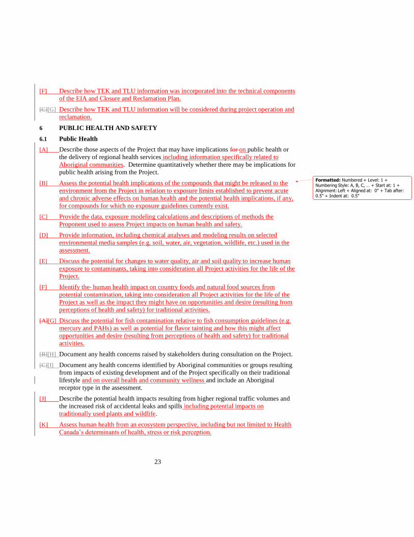
[F] Describe how TEK and TLU information was incorporated into the technical components
of the EIA and Closure and Reclamation Plan.
[C][G] Describe how TEK and TLU information will be considered during project operation and
reclamation.
6 PUBLIC HEALTH AND SAFETY
6.1 Public Health
[A] Describe those aspects of the Project that may have implications for on public health or
the delivery of regional health services including information specifically related to
Aboriginal communities. Determine quantitatively whether there may be implications for
public health arising from the Project.
[B] Assess the potential health implications of the compounds that might be released to the
environment from the Project in relation to exposure limits established to prevent acute
and chronic adverse effects on human health and the potential health implications, if any,
for compounds for which no exposure guidelines currently exist.
[C] Provide the data, exposure modeling calculations and descriptions of methods the
Proponent used to assess Project impacts on human health and safety.
[D] Provide information, including chemical analyses and modeling results on selected
environmental media samples (e.g. soil, water, air, vegetation, wildlife, etc.) used in the
assessment.
[E] Discuss the potential for changes to water quality, air and soil quality to increase human
exposure to contaminants, taking into consideration all Project activities for the life of the
Project.
[F] Identify the human health impact on country foods and natural food sources from
potential contamination, taking into consideration all Project activities for the life of the
Project as well as the impact they might have on opportunities and desire (resulting from
perceptions of health and safety) for traditional activities.
[A][G] Discuss the potential for fish contamination relative to fish consumption guidelines (e.g.
mercury and PAHs) as well as potential for flavor tainting and how this might affect
opportunities and desire (resulting from perceptions of health and safety) for traditional
activities.
[B][H] Document any health concerns raised by stakeholders during consultation on the Project.
[C][I] Document any health concerns identified by Aboriginal communities or groups resulting
from impacts of existing development and of the Project specifically on their traditional
lifestyle and on overall health and community wellness and include an Aboriginal
receptor type in the assessment.
[J] Describe the potential health impacts resulting from higher regional traffic volumes and
the increased risk of accidental leaks and spills including potential impacts on
traditionally used plants and wildlife.
[K] Assess human health from an ecosystem perspective, including but not limited to Health
Canada’s determinants of health, stress or risk perception.
Formatted: Numbered + Level: 1 +Numbering Style: A, B, C, … + Start at: 1 +Alignment: Left + Aligned at: 0" + Tab after: 0.5" + Indent at: 0.5"

24
[L] Discuss the accommodation or mitigation strategies to minimize the potential impact of
the Project on human health.
[D]
6.2 Public Safety
[A] Describe those aspects of the Project that may have implications for public safety.
Determine whether there may be implications for public safety arising from the Project.
Specifically:
a) describe the Proponent’s emergency response plan, including public notification protocol and safety procedures, to minimize adverse environmental effects, including
emergency reporting procedures for spill containment and management;
b) document any safety concerns raised by stakeholders during consultation on the
Project, particularly by those communities in close proximity to the project;
c) describe how local residents will be contacted during an emergency and the type of information that will be communicated to them, particularly the community of
Janvier located approximately 5km south of the project boundary;
d) describe the existing agreements with area municipalities or industry groups such as
safety cooperatives, emergency response associations, regional mutual aid programs
and municipal emergency response agencies; and
e) describe the potential safety impacts resulting from higher regional traffic volumes.
7 SOCIO-ECONOMIC ASSESSMENT
7.1 Baseline Information
[A] Describe the existing socio-economic conditions in the region and in the communities in
the region.
[B] Describe factors that may affect existing socio-economic conditions including:
a) population changes;
b) workforce requirements for the Project, including a description of when peak activity periods will occur;
c) planned accommodations for the workforce for all stages of the Project;
d) the Proponent’s policies and programs regarding the use of regional and Alberta goods and services;
e) the project schedule; and
f) the overall engineering and contracting plan for the Project.
[C] In consultation with Aboriginal communities, provide community-specific socio-
economic baseline information commensurate with that of the Fort McMurray and
including cultural and lifestyle information unique to those communities.
f)g)
7.2 Impact Assessment
[A] Describe the effects of construction and operation of the Project and its contribution to
cumulative socio-economic effects in the region on:
a) housing;
b) availability and quality of health care services;
c) local and regional infrastructure and community services;
Formatted: Indent: Left: 0.5", No bullets ornumbering
25
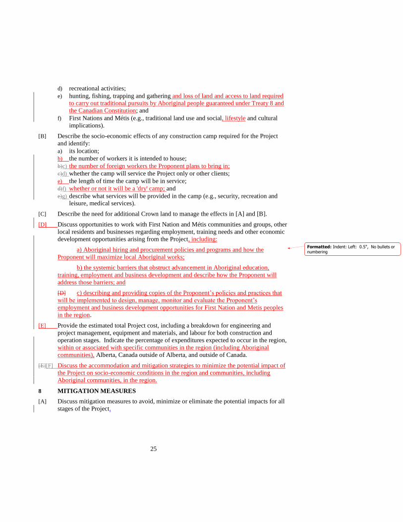
d) recreational activities;
e) hunting, fishing, trapping and gathering and loss of land and access to land required to carry out traditional pursuits by Aboriginal people guaranteed under Treaty 8 and
the Canadian Constitution; and
f) First Nations and Métis (e.g., traditional land use and social, lifestyle and cultural
implications).
[B] Describe the socio-economic effects of any construction camp required for the Project
and identify:
a) its location;
b) the number of workers it is intended to house;
b)c) the number of foreign workers the Proponent plans to bring in;
c)d) whether the camp will service the Project only or other clients;
e) the length of time the camp will be in service;
d)f) whether or not it will be a 'dry' camp; and
e)g) describe what services will be provided in the camp (e.g., security, recreation and leisure, medical services).
[C] Describe the need for additional Crown land to manage the effects in [A] and [B].
[D] Discuss opportunities to work with First Nation and Métis communities and groups, other
local residents and businesses regarding employment, training needs and other economic
development opportunities arising from the Project, including:
a) Aboriginal hiring and procurement policies and programs and how the
Proponent will maximize local Aboriginal works;
b) the systemic barriers that obstruct advancement in Aboriginal education,
training, employment and business development and describe how the Proponent will
address those barriers; and
[D] c) describing and providing copies of the Proponent’s policies and practices that
will be implemented to design, manage, monitor and evaluate the Proponent’s
employment and business development opportunities for First Nation and Metis peoples
in the region.
[E] Provide the estimated total Project cost, including a breakdown for engineering and
project management, equipment and materials, and labour for both construction and
operation stages. Indicate the percentage of expenditures expected to occur in the region,
within or associated with specific communities in the region (including Aboriginal
communities), Alberta, Canada outside of Alberta, and outside of Canada.
[E][F] Discuss the accommodation and mitigation strategies to minimize the potential impact of
the Project on socio-economic conditions in the region and communities, including
Aboriginal communities, in the region.
8 MITIGATION MEASURES
[A] Discuss mitigation measures to avoid, minimize or eliminate the potential impacts for all
stages of the Project.
Formatted: Indent: Left: 0.5", No bullets ornumbering

26
[B] Identify those accommodation or mitigation measures that will be implemented and
provide rationale for their selection, including a discussion on the effectiveness of
proposed mitigation.
[B][C] Assess the risks (probability and hazard assessment) of mitigation ineffectiveness or
failure.
9 RESIDUAL IMPACTS
[A] Describe the residual impacts of the Project following implementation of the Proponent’s
accommodation or mitigation measures and the Proponent’s plans to manage those
residual impacts. Evaluate potential effectiveness of the accommodation or mitigation
proposed and the associated risks. Provide contingency plans for ineffective or partially
effective accommodation or mitigation performance.
10 MONITORING
[A] Describe the Proponent’s current and proposed monitoring programs including:
a) how the monitoring programs will assess any Project impacts and measure the effectiveness of mitigation plans and validity of the impacts predicted in the
environmental assessment. Discuss how the proponent will address any project
impacts identified through the monitoring program;
b) how the proponent will contribute to current and proposed regional monitoring
programs including:
i. regional monitoring that will be undertaken to assist in managing environmental effects, confirm performance of mitigation measures and improve environmental
protection strategies;
b) ii. monitoring done independently by the Proponent;
c) iii. monitoring performed in conjunction with other stakeholders, including Aboriginal communities and groups; and
d) iv.new monitoring initiatives that may be required as a result of the
Project.
e) regional monitoring that will be undertaken to assist in managing environmental effects and improve environmental protection strategies;
f)c) discuss how monitoring data will be disseminated to the public, Aboriginal
communities or other interested parties; and
d) discuss how the results of monitoring programs and publicly available monitoring information will be integrated with the Proponent’s environmental management
system; and
g)e) discuss how Aboriginal communities might be involved in monitoring programs
such as through community-based monitoring programs..
Formatted: Indent: Left: 0.8", No bullets ornumbering

Melanie Daneluk
From: Corinne Kristensen
Sent: Friday, May 04, 2012 8:34 AM
To: Camille Almeida
Subject: FW: MEG Energy - Surmont Project PTOR
Attachments: MEG PTOR Submission May 04 2012_final.pdf
5/18/2012
FYI
Corinne Kristensen Environmental Assessment Environmental Operations Alberta Environment and Water (780) 427-9116 Phone (780) 222-5318 Cell
From: Bonnie Evans [mailto:[email protected]] Sent: Friday, May 04, 2012 8:33 AM To: Ken Schuldhaus; Randall Barrett Cc: Amit Banerjee; Corinne Kristensen; [email protected]; Neil Barker; Rory O'Connor; [email protected] Subject: MEG Energy - Surmont Project PTOR Dear Ken and Randall, Once again, Please find attached the Conklin Metis Local #193 Letter form PTOR review for the Meg Energy Surmont Project. Please confirm receipt of this email and I will follow‐up with a call if I have not had confirmation by 4:00pm today. Also please forward to any individuals in your organization that require this information and thank you in advance for your assistance in getting this to where it need to be in your organizations. If you have any questions please do not hesitate to give me a call. Cheers, and have a nice weekend. Bonnie Evans 306‐481‐4486 Any intelligent fool can make things bigger and more complex... It takes a touch of genius - and a lot of courage to move in the opposite direction. Albert Einstein

Conklin Resource Development Advisory Committee
PO Box 118
Conklin AB T0P 1H0
Phone (780) 559-2221
May 4, 2012
Randall Barrett Ken Schuldhaus
Acting Director Manager, In Situ Oil Sands
Alberta Environment Oil Sands Branch
1st floor, Twin Atria Building Energy Resources Conservation Board
4999 – 98 Avenue 640 – 5 Avenue SW
Edmonton, AB T6B 2X3 Calgary, AB T2P 3G4
Fax: 780-427-7824 Fax: 403-297-2474
Email: [email protected] Email: [email protected]
Re: MEG Application – Review of the Surmount Project PTOR
Dear Sirs:
Once again, here is a summary of our understanding of this development proposal and the
community’s needs as directed to provide on behalf of the Conklin Community Leadership. Work
load and capacity issues restrict our ability to provide a 3rd
party detailed PTOR review at this
time.
Conklin Resource Development Advisory Committee (CRDAC) accepts that MEG Energy Corp.
recognizes the need for capacity building and interim assistance. Although the Conklin
Community does not fully understand all the complexities of the approval process for resource
development, they acknowledge the MEG endorses the process to develop a joint action plan that
allows them to have technical advisers to assist them in developing capacity. This process
ensures a better understanding of the current and proposed project and also assists both parties in
identifying the issues both direct and in direct of the proposed development. Review of the draft
PTOR is one of the activities in that process. This step provides the Conklin community with a
broad understanding of the project and also provides the opportunity for feedback to the
developer and the regulators early in the process and on an ongoing basis.
As stated earlier in all our previous correspondence, the Conklin community members are faced
with a high degree of uncertainly with respect o the rapid rate of regional development and
increased pressures from industrial developments on their community. The CRDAC and the
CML #193 are very concerned with the magnitude, pace and potentially unanticipated effects of
development in the Conklin area.
When the CRADAC and the CML #193 met with regional developers on January 27, 2010, the
CRDAC and CML #193 described three paths forward, each of which are connected yet separate
from the others. Our preferred approach as a community is to take the path of community
development, capacity building and good governance (i.e., a cooperative approach). The CML
#193, through the CRDAC, need to work with individual companies on ways to manage (avoid,
mitigate or offset) the impact of development on their people and community. They also need to
work with regional developers and Government on effective ways to manage the cumulative
impacts.

Conklin Resource Development Advisory Committee
PO Box 118
Conklin AB T0P 1H0
Phone (780) 559-2221
The CRDAC and its members wish to build long-term mutually beneficial relationships with each
Company, to develop capacity with CRDAC, to understand the impacts of development, to find
balance as an aboriginal community, and also to benefit from industrial development.
MEG has committed to work with the community on its project-specific impacts. That is a step
forward. As yet, MEG has not committed to work with the CRDAC to identify and to address the
cumulative effects of all industrial development on the Conklin community. Again, this matter
remains unresolved although the CRDAC remain hopeful that our discussions will continue and
the next step can be taken.
As CRDAC has limited resources, meeting the consultation needs of developers and Government
should not be a burden that CRDAC are expected to bear. Conklin Leadership will not be able to
meet with those developers that are not covering engagement costs. We will continue to meet
with the developers like MEG that will cover off technical support costs.
Inefficiencies
The agreement the community has through the CRDAC with MEG provides fixed dollar amounts
to participate in reviews of their projects. This is testing our ability to identify critical issues and
focus limited resources. Reviewing all these applications individually and opposed to
cumulatively must be equally taxing on all parties.
However even with these resource limitations, we are quickly identifying inefficiencies that exist
in the EIA process that are creating extra costs. In the review of this EIA, there were a few items
that need to be improved. The most problematic EIAs are those that are submitted and sent to
affected parties for review that are not a reasonable attempt at meeting the Terms of Reference
(TOR).
As our previous correspondence states, examples from recent deficient EIAs include:
a) An EIA was submitted with no data on connectivity between aquifers and surface
water. The company did no testing and claimed the lack of evidence of a connection
was proof so monitoring isn’t needed. Lack of testing does not give the right to make
assumptions.
b) An EIA was submitted without inventory on direction of aquifer flow.
c) An EIA was submitted without surveys of fish habitat or spawning locations even
though it’s explicitly required.
d) EIAs were submitted ignoring the need for restoration of habitat disturbances. The
excuse for this decision was that no caribou would be left alive in this area by the
time they reclaim the project.
We could provide many more examples given the number of supplemental questions that are
asked of the same companies and the same consultants project after project. This action is
deliberate. It may be motivated by the desire to defer costs and pressure regulators, but it is
costly and limits our participation.
Alberta should expect a professional standard before the EIA is accepted for circulation and
review. We need quality EIAs early in the process; this would allow aboriginal communities,
regulatorys, and other affected parties to question how the information is used in project design

Conklin Resource Development Advisory Committee
PO Box 118
Conklin AB T0P 1H0
Phone (780) 559-2221
decisions rather than asking, “Where is the baseline information?” It is time to refuse EIAs that
are missing significant information. People working for affected parties have to bring these
issues to their client. Despite it being required in the TOR, incomplete EIAs create inflammatory
issues and additional costs for affected parties even if Alberta resolves them in the end.
Specific Recommended Changes to Terms of Reference
Pg 4 1. Public Engagement and Aboriginal Consultation
[D] – In this clause, Alberta is recognizing that there is a need for ongoing consultation. CML
#193 supports this process and is actively engaging in the type of consultation. Unfortunately, we
have found that regulators are not interested in receiving the product. The Board and
Departments need to be considering the ongoing issues that are significant to environmental
safety or ineffective monitoring issues.
Pg 8 3.1.2 Impact assessment
[A] – The potential effects of acidification and nitrification on harvesting, and shifts in ecosystem
populations are not clear in the terms of reference. The EIA should include map products
indicating soils sensitive to acidification or nitrification. The predicted changes in native and
non-native plant species densities, productivity and presence should be identified. Implications
for wildlife based on these vegetation changes should be included.
Pg 11 3.6.2 Impact assessment
Our community knows the pre-development baseline prior to the arrival of the highway and the
oil companies. The activities of developers including MEG have been accumulating on the lease
area as they explored for oil sands to determine their subsurface lease. Oil sands exploration is the
largest disturbance in the area. The in situ development itself does not reflect the entire
disturbance that was a part of developing the project. If companies do not take financial
responsibility we will not see the potential of innovation reducing the impact of exploration. The
solution for the ecological changes affecting caribou; deer, wolves and moose balances in the area
depend on work being done to restore linear disturbances. Only the oil sands leaseholder can
request an exploratory program, and there is no one else to hold the responsible for the impacts of
this process. All industry developers must work together to accomplish sustainability. Regulators
need to communicate a clear expectation that the pre the disturbance (pre oil sands exploration for
the associated leases) is the baseline for measuring restoration of habitat effectiveness.
General Recommended Changes to the Terms of Reference
The regulators need to acknowledge (explicitly) that cumulative effects of existing development
already adversely affect the Conklin community now. Current local production levels are less
that 100 bbl/d; it is projected that these numbers will escalate to 1 million bbl/d, or more, in less
than a decade.
Our community is using GIS tools to house traditional land use information. Alberta regulators
and industry are familiar with the tools but have not brought these tools into the EIA process.

Conklin Resource Development Advisory Committee
PO Box 118
Conklin AB T0P 1H0
Phone (780) 559-2221
The use of spatially corrected GIS files should be applied to all “maps” included in an EIA. The
requirement of this standard should be included in all EIA Terms of Reference. This will make
more efficient use of the limited human resources we all have.
In summary, the CML #193 members are very concerned about the air, land, and water where
they work and live for today, tomorrow and for all future generations. CML #193 expects the
applicant (MEG in this case) to consider ways of working with the community outside of the
regulatory process. CML #193 also expects the regulators to do their job with respect to
recognition of aboriginal rights (as documented by Neil Reddekopp) and to provide CML #193
with standing at any subsequent hearings in this vicinity. No part of this input should be
construed as a willingness to reduce or even to discuss the traditional aboriginal rights of this
community.
Cut and paste now part of the process we are also are following; I question why making change to
make something work better is such a challenge. Again, as we have stated in other
correspondence, industry has the power, the pen and the purse strings and government has the
authority yet we continue to be left to find the solutions on our own with limited capacity and
resources. The same message for the last four years is repeated again today – if economic
assimilation is to be avoided; immediate interaction of governments and industry to assist the
development of a model to address cumulative impact must occur. As aboriginal people it is
infringement on our rights and as responsible leaders we wish to work with all parties to find a
mutually beneficial road forward.
In closing, I trust this documentation meets with your satisfaction and adds value to the EIA and
approval processes. This letter has been sent from the CRDAC because MEG has a community
agreement that defines our process to engage on complex consultation. Reviews with developers
without agreements will be filed from the Conklin Metis Local # 193. Should you have any
questions, please contact me at 306-481-4486.
Yours truly,
B. Evans
Bonnie Evans
Technical Advisor, CRDAC
Cc CRDAC Board
CML #193 Board
Don Sutherland/Rory O’Conner MEG Energy
Melanie Daneluk
From: Dennis Vroom [[email protected]]
Sent: Thursday, May 03, 2012 4:47 PM
To: AENV Environmental Assessment
Subject: MEG Surmont proposed terms of reference comments
Attachments: RMWB comments on MEG Surmont draft TOR.pdf
5/18/2012
Please find the attached comments from the Regional Municipality of Wood Buffalo for the proposed MEG Surmont EIA Terms of Reference. Thank you, Dennis Dennis Vroom Manager Industry Relations Branch Regional Municipality of Wood Buffalo
T: 780-743-7047 F: 780-743-7028 C: 780-881-7116 [email protected] www.woodbuffalo.ab.ca

1
Regional Municipality of Wood Buffalo 9909 Franklin Avenue Fort McMurray, Alberta T9H 2K4
May 3, 2012 Director, Environmental Assessment Environmental Assessment Team Alberta Environment #111 Twin Atria, 4999-98th Avenue Edmonton, Alberta T6B 2X3 Subject: Comments on Proposed Terms of Reference for MEG’s proposed Surmont Creek Phase 2 Project Attn: Director, Environmental Assessment: In response to the proposed Terms of Reference for the MEG Surmont Project, the Regional Municipality of Wood Buffalo (the “Municipality”) submits the following comments to be included in the final Terms of Reference.
1. Describe how this project supports the Comprehensive Regional Infrastructure Sustainability Plan for the Athabasca Oil Sands Area. Ensure that the analysis involves transportation, general infrastructure and consolidated project accommodations.
2. For all identified socio-economic impacts, ensure that impacts are assessed for all
residential areas that are reasonably close to the project or can be reasonably expected to experience impacts due to the project.
3. For all identified socio-economic impacts, discuss/delineate the impacts for the
following geographic areas: a. The Regional Municipality of Wood Buffalo b. Province of Alberta c. The rest of Canada d. Outside of Canada
4. In section 3.2.2 [B] add: e) the impacts of using non-saline water on local users of the aquifer(s)
intended for use, including the potential effects on quality and quantity. f) impacts on human health arising from changes to non-saline water
sources affected by the Project.
5. In Section 7.1 [C] include the italicised portions below

2
a) population changes, delineated by total number, timeframe when significant changes will occur , location and demographic variables (such as gender, age and family status);
b) workforce requirements for the Project delineated by construction and operations phases. Include when peak activity will occur;
c) planned accommodations for the workforce for all stages of the Project, including the rationale for the accommodation plan;
6. In Section 7.2 include the italicized portions below
[A] Describe the effects of construction and operation of the Project on: a) housing, including availability, price and market rental rates - all delineated by community; c) local and regional infrastructure and community services, including local non-profit organizations;
[B] Describe the socio-economic effects of any construction and
operations camp, including third party “open camps”, required for the Project and identify:
e) describe what services will be provided in the camp (e.g., security, recreation and leisure, medical services), including an analysis of the impact on Municipal or other external services.
7. Add Section 7.3
If there is a determination of no impact in sections 7.1 or 7.2, discuss how this determination was made.
8. In Section 8 include the italicized portion below
[A] Discuss mitigation measures that MEG is committing to implement to avoid, minimize or eliminate the potential negative Project-specific impacts for all stages of the Project.
[B] Identify those mitigation measures that MEG will implement and provide rationale for their selection, including a discussion on the effectiveness of the proposed mitigation.
9. Add Section 9 [B]
What criteria did MEG use to determine that the potential socio-economic effects predicted after mitigation was employed would be acceptable?
10. In Section 10 [A] include the italicized portion below
For all identified socio-economic and environmental impacts, describe the Proponent’s current and proposed monitoring programs including…

3
Please feel free to contact the undersigned if further information and/or clarification are required. Sincerely, Dennis Vroom Manager Industry Relations Branch Regional Municipality of Wood Buffalo 780-743-7047 [email protected]