Embed Size (px)
Citation preview
Safety Continued5. Blastomycosis is a fungal infection that is commonly contracted by dogs and sometimes by humans. Avoid digging in moist soils.
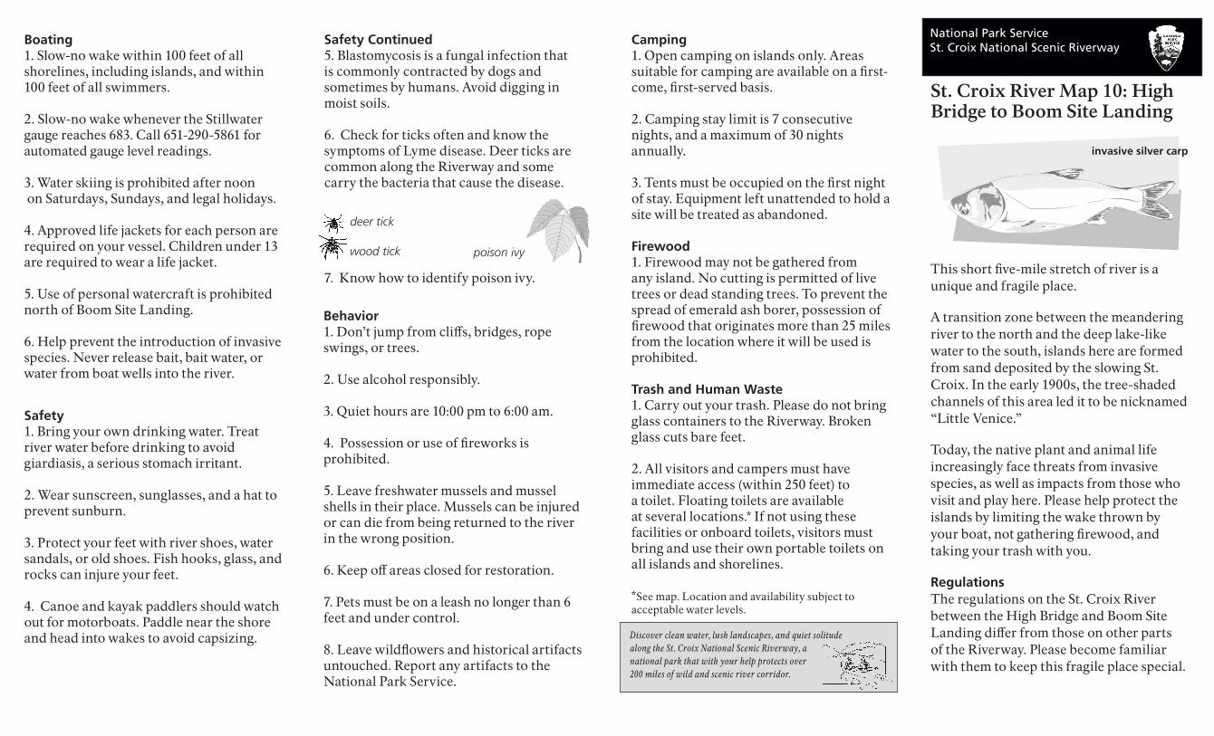
6. Check for ticks often and know the symptoms of Lyme disease. Deer ticks are common along the Riverway and some carry the bacteria that cause the disease.
7. Know how to identify poison ivy.
deer tick
wood tick poison ivy
National Park ServiceSt. Croix National Scenic Riverway
St. Croix River Map 10: High Bridge to Boom Site Landing
This short five-mile stretch of river is a unique and fragile place. A transition zone between the meandering river to the north and the deep lake-like water to the south, islands here are formed from sand deposited by the slowing St. Croix. In the early 1900s, the tree-shaded channels of this area led it to be nicknamed “Little Venice.” Today, the native plant and animal life increasingly face threats from invasive species, as well as impacts from those who visit and play here. Please help protect the islands by limiting the wake thrown by your boat, not gathering firewood, and taking your trash with you. RegulationsThe regulations on the St. Croix River between the High Bridge and Boom Site Landing differ from those on other parts of the Riverway. Please become familiar with them to keep this fragile place special.
Behavior1. Don’t jump from cliffs, bridges, rope swings, or trees.
2. Use alcohol responsibly.
3. Quiet hours are 10:00 pm to 6:00 am.
4. Possession or use of fireworks is prohibited.
5. Leave freshwater mussels and mussel shells in their place. Mussels can be injured or can die from being returned to the river in the wrong position.
6. Keep off areas closed for restoration.
7. Pets must be on a leash no longer than 6 feet and under control.
8. Leave wildflowers and historical artifacts untouched. Report any artifacts to the National Park Service.
Boating1. Slow-no wake within 100 feet of all shorelines, including islands, and within 100 feet of all swimmers.
2. Slow-no wake whenever the Stillwater gauge reaches 683. Call 651-290-5861 for automated gauge level readings.
3. Water skiing is prohibited after noon on Saturdays, Sundays, and legal holidays.
4. Approved life jackets for each person are required on your vessel. Children under 13 are required to wear a life jacket.
5. Use of personal watercraft is prohibited north of Boom Site Landing.
6. Help prevent the introduction of invasive species. Never release bait, bait water, or water from boat wells into the river.
Camping1. Open camping on islands only. Areas suitable for camping are available on a first-come, first-served basis.
2. Camping stay limit is 7 consecutive nights, and a maximum of 30 nights annually.
3. Tents must be occupied on the first night of stay. Equipment left unattended to hold a site will be treated as abandoned.
Firewood1. Firewood may not be gathered from any island. No cutting is permitted of live trees or dead standing trees. To prevent the spread of emerald ash borer, possession of firewood that originates more than 25 miles from the location where it will be used is prohibited.
Trash and Human Waste1. Carry out your trash. Please do not bring glass containers to the Riverway. Broken glass cuts bare feet.
2. All visitors and campers must have immediate access (within 250 feet) to a toilet. Floating toilets are available at several locations.* If not using these facilities or onboard toilets, visitors must bring and use their own portable toilets on all islands and shorelines.
*See map. Location and availability subject to acceptable water levels.
Safety1. Bring your own drinking water. Treat river water before drinking to avoid giardiasis, a serious stomach irritant.
2. Wear sunscreen, sunglasses, and a hat to prevent sunburn.
3. Protect your feet with river shoes, water sandals, or old shoes. Fish hooks, glass, and rocks can injure your feet.
4. Canoe and kayak paddlers should watch out for motorboats. Paddle near the shore and head into wakes to avoid capsizing.
invasive silver carp
Discover clean water, lush landscapes, and quiet solitude along the St. Croix National Scenic Riverway, a national park that with your help protects over 200 miles of wild and scenic river corridor.
MINNESOTAWASHINGTON COUNTY
96
11
5
95
WISCONSINST. CROIX COUNTY
S30
S28
S29
S27
S26
S25
Stillwater
Boom SiteWayside
to North Hudson
to Somerset
to Marine on St. Croix
St. C
roix
Riv
er
Pillars
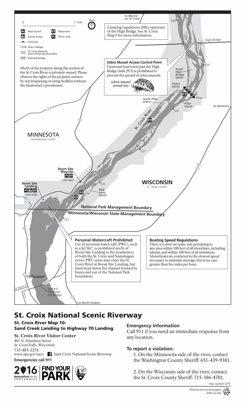
Zebra Mussel Access Control PointUpstream boat travel past the HighBridge (mile 29.5) is prohibited toprevent the spread of zebra mussels.
zebra musselactual size
Historic StillwaterLift Bridge
Camping regulations differ upstream of the High Bridge. See St. Croix Map 9 for more information.
SouthHigh BridgeIsland
PillarIsland
FosterIsland
South PillarIsland
MileLongIsland
35
64
35
64
95
95
W Myrtle St.
3rd St.
High Bridge
St. Croix NationalScenic Riverway Boundary
Boat launch
Canoe access
Overlook
River mileageS30
North0 1 mile
Railroad bridge
Restrooms
Picnic area
Boating Speed RegulationsThere is a slow-no wake rule pertaining to any area within 100 feet of all shorelines, includingislands, and within 100 feet of all swimmers. Motorboats are restricted to the slowest speed necessary to maintain steerage, but in no case greater than five miles per hour.
Emergency InformationCall 911 if you need an immediate response from any location.
To report a violation:1. On the Minnesota side of the river, contact the Washington County Sheriff: 651-439-9381.
2. On the Wisconsin side of the river, contact the St. Croix County Sheriff: 715-386-4701.
National Park Management BoundaryMinnesota/Wisconsin State Management Boundary
(MN DNR)
Much of the property along this section ofthe St. Croix River is privately owned. Pleaseobserve the rights of the property ownersby not trespassing or using facilities withoutthe landowner’s permission.
(MN DNR)Boom Site
Landing
Printed on recycled paperwith soy ink
Personal Watercraft ProhibitedUse of personal watercraft (PWC), such as a Jet Ski®, is prohibited north of Boom Site Landing to the headwaters of both the St. Croix and Namekagon rivers. PWC users may enter the St. Croix River at Boom Site Landing, but must head down the channel formed by buoys and out of the National Park boundaries.
Map updated 2016
St. Croix River Visitor Center
Emergencies call 911
401 N. Hamilton StreetSt. Croix Falls, Wisconsin715-483-2274
St. Croix River Map 10: Sand Creek Landing to Highway 70 Landing
St. Croix National Scenic Riverway
www.nps.gov/sacn Saint Croix National Scenic Riverway