Embed Size (px)
Citation preview
Springs of New Jersey: Characterization and Assessment
May 19, 2016
presented by
Steven Domber,
Ted Pallis and
Ray Bousenberry NJ Water Monitoring Council Meeting
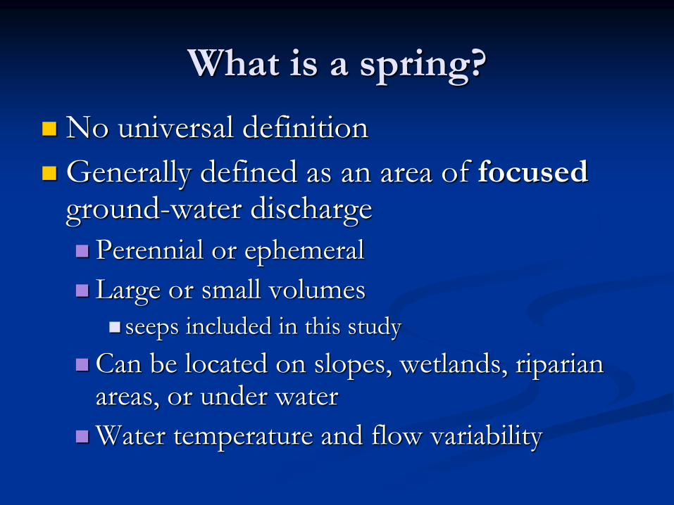
What is a spring?
No universal definition
Generally defined as an area of focused ground-water discharge
Perennial or ephemeral
Large or small volumes
seeps included in this study
Can be located on slopes, wetlands, riparian areas, or under water
Water temperature and flow variability
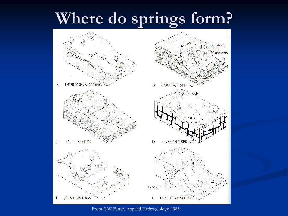
Where do springs form?
From C.W. Fetter, Applied Hydrogeology, 1988
Why study springs?
Springs are known to have unique hydrologic,
ecologic, geologic, socio-economic, and
historical attributes
Unlike lakes and wetlands, comprehensive
assessments of springs have not typically been
conducted
Many people know of a spring, but few people
know much about a spring and its geologic,
hydrologic, and biologic attributes

O.E. Meinzer, USGS, Large Springs in the United
States, 1927:
“What are the largest springs in the United States, how much
water do they discharge and what geologic conditions produce
them are questions of much popular interest and considerable
scientific and economic importance. Yet the information in
regard to large springs has been so widely scattered and so
difficult to interpret that most people have only very vague
notions on the subject.”
Same could be said today
Project History
2009 NJGWS Spring Study Workplan
2011-2016 EPA Grant “Developing a Wetland
Condition Monitoring Network for New Jersey”
Spring Classification and Identification section
Importance of springs/seeps to headwater wetlands
NJ spring classification system and database
14 springs selected for monitoring
2014 Montclair State University Master’s Thesis
Macroinvertebrate Composition of NJ Springs
August 2014 detailed water quality sampling
Office of Science funded
2015 BFBM Aquatic Vertebrate Study
EPA Funded Study
Included section on importance of springs to wetlands
Spring classification system and database developed
Characterization scheme for springs
NJ Springs relational database: physical, discharge,
geomorphic, chemical, emergence, geologic, cultural, and
ecologic data
Field sheets for basic site characterization
Over 500 potential springs identified
~50 with site visits and basic site characterization
Quarterly water quality sampling at 14 springs
pH, conductivity, temperature, dissolved oxygen, nitrate,
phosphate
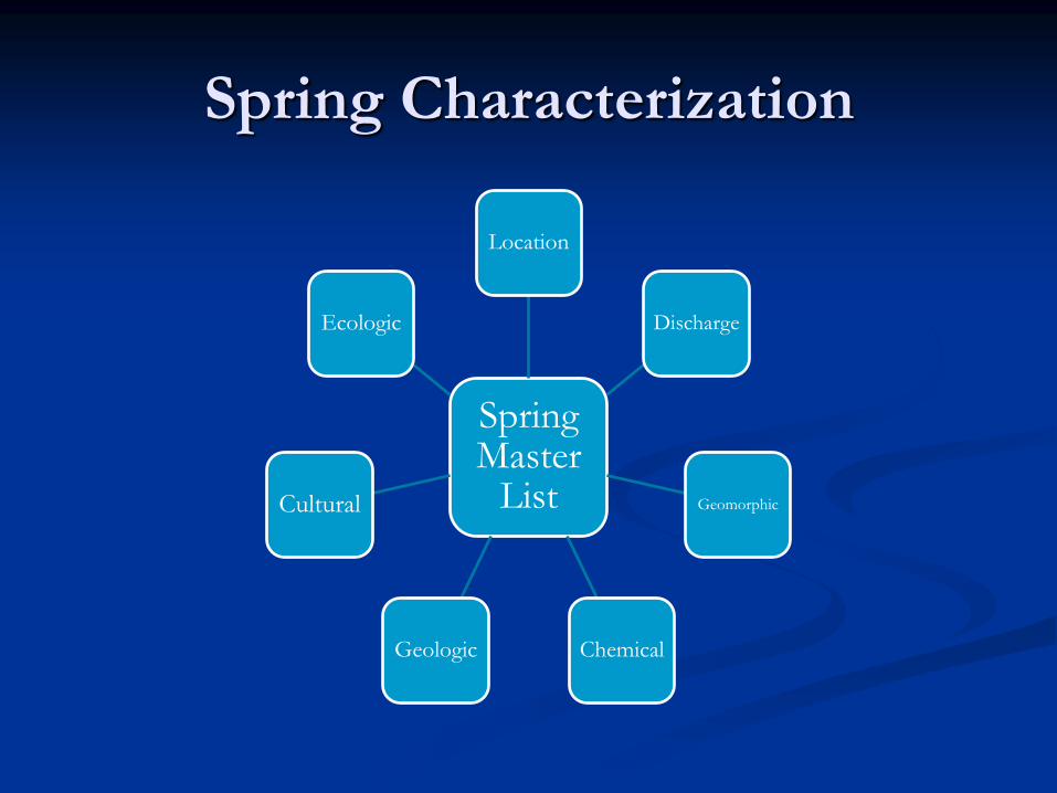
Spring Characterization
Spring Master
List
Location
Discharge
Geomorphic
Chemical Geologic
Cultural
Ecologic
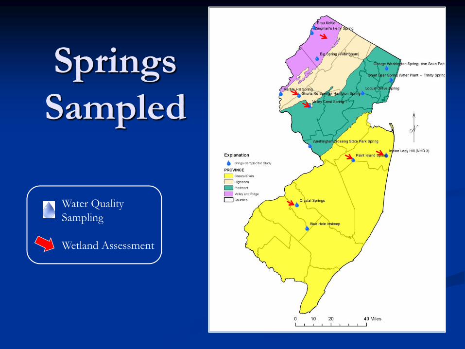
Springs
Sampled
Water Quality
Sampling
Wetland Assessment
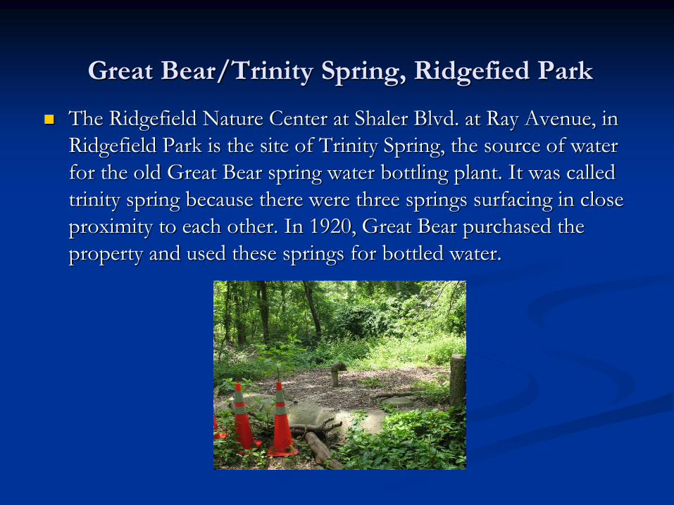
Great Bear/Trinity Spring, Ridgefied Park
The Ridgefield Nature Center at Shaler Blvd. at Ray Avenue, in
Ridgefield Park is the site of Trinity Spring, the source of water
for the old Great Bear spring water bottling plant. It was called
trinity spring because there were three springs surfacing in close
proximity to each other. In 1920, Great Bear purchased the
property and used these springs for bottled water.
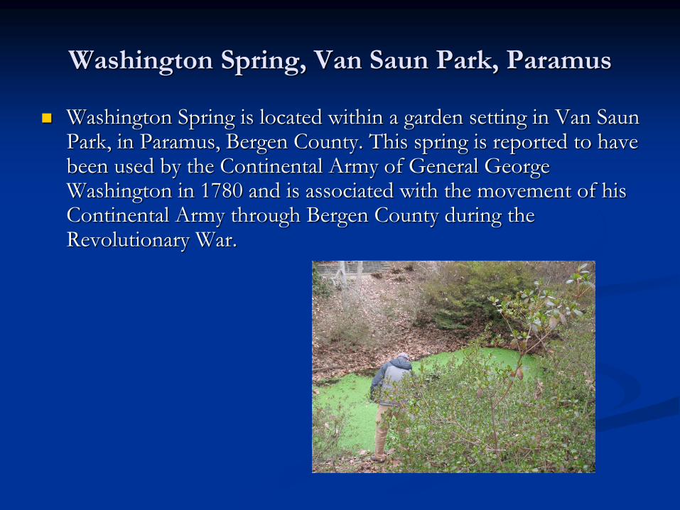
Washington Spring, Van Saun Park, Paramus
Washington Spring is located within a garden setting in Van Saun
Park, in Paramus, Bergen County. This spring is reported to have been used by the Continental Army of General George Washington in 1780 and is associated with the movement of his Continental Army through Bergen County during the Revolutionary War.
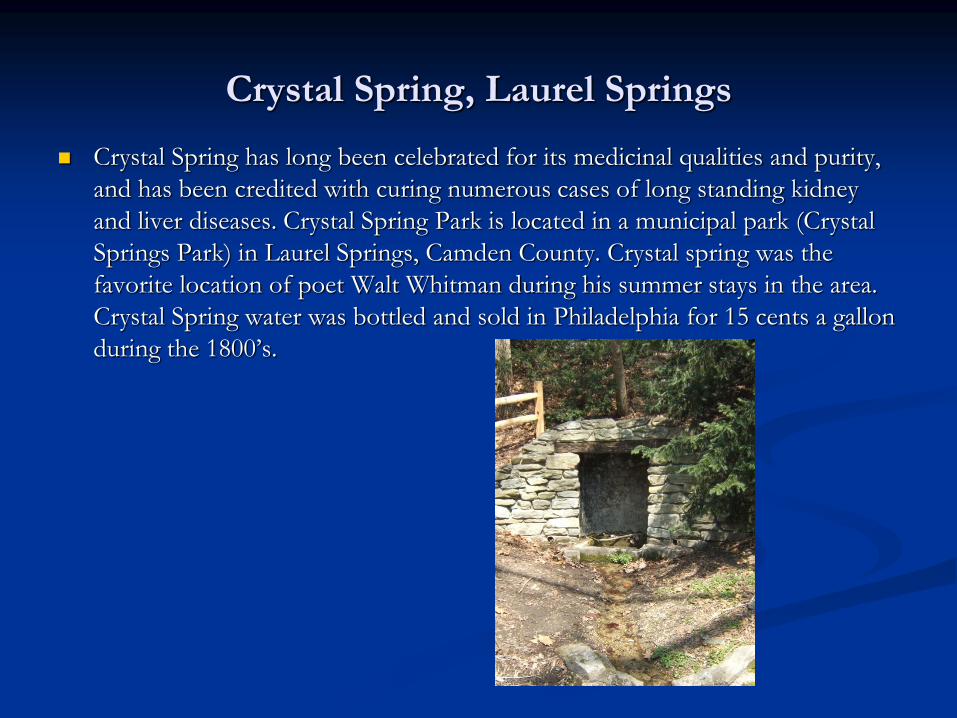
Crystal Spring, Laurel Springs
Crystal Spring has long been celebrated for its medicinal qualities and purity,
and has been credited with curing numerous cases of long standing kidney
and liver diseases. Crystal Spring Park is located in a municipal park (Crystal
Springs Park) in Laurel Springs, Camden County. Crystal spring was the
favorite location of poet Walt Whitman during his summer stays in the area.
Crystal Spring water was bottled and sold in Philadelphia for 15 cents a gallon
during the 1800’s.
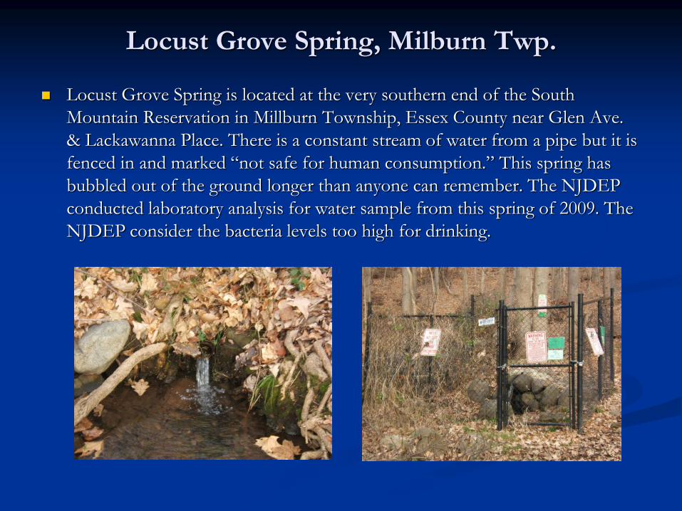
Locust Grove Spring, Milburn Twp.
Locust Grove Spring is located at the very southern end of the South
Mountain Reservation in Millburn Township, Essex County near Glen Ave.
& Lackawanna Place. There is a constant stream of water from a pipe but it is
fenced in and marked “not safe for human consumption.” This spring has
bubbled out of the ground longer than anyone can remember. The NJDEP
conducted laboratory analysis for water sample from this spring of 2009. The
NJDEP consider the bacteria levels too high for drinking.
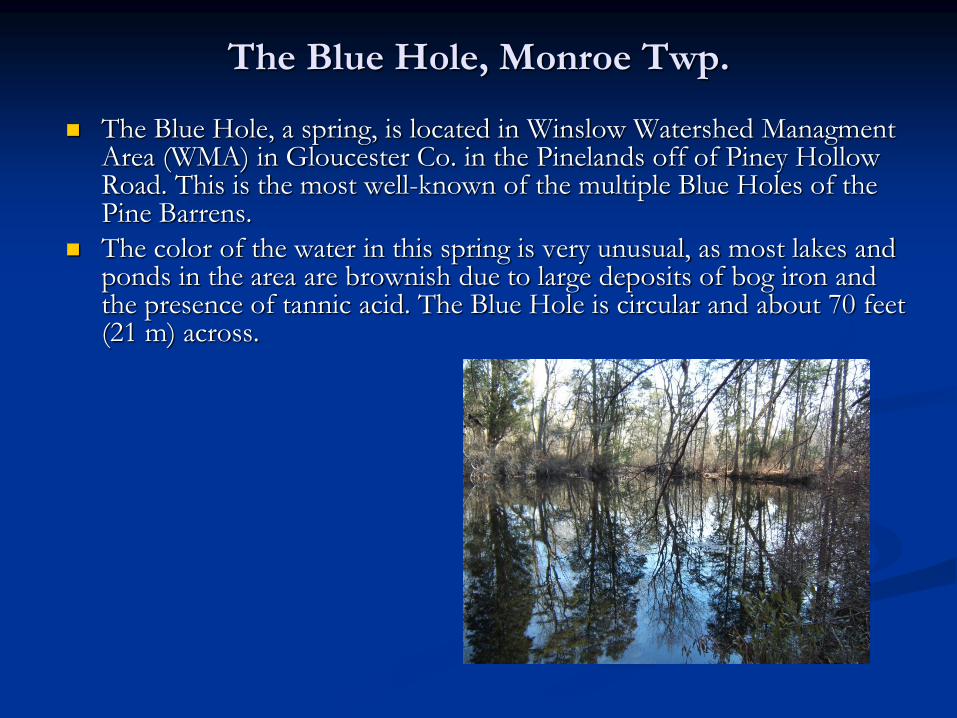
The Blue Hole, Monroe Twp.
The Blue Hole, a spring, is located in Winslow Watershed Managment
Area (WMA) in Gloucester Co. in the Pinelands off of Piney Hollow Road. This is the most well-known of the multiple Blue Holes of the Pine Barrens.
The color of the water in this spring is very unusual, as most lakes and ponds in the area are brownish due to large deposits of bog iron and the presence of tannic acid. The Blue Hole is circular and about 70 feet (21 m) across.
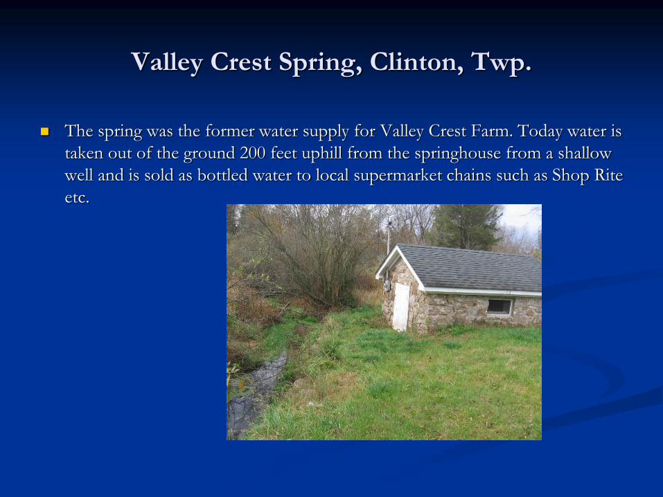
Valley Crest Spring, Clinton, Twp.
The spring was the former water supply for Valley Crest Farm. Today water is
taken out of the ground 200 feet uphill from the springhouse from a shallow
well and is sold as bottled water to local supermarket chains such as Shop Rite
etc.
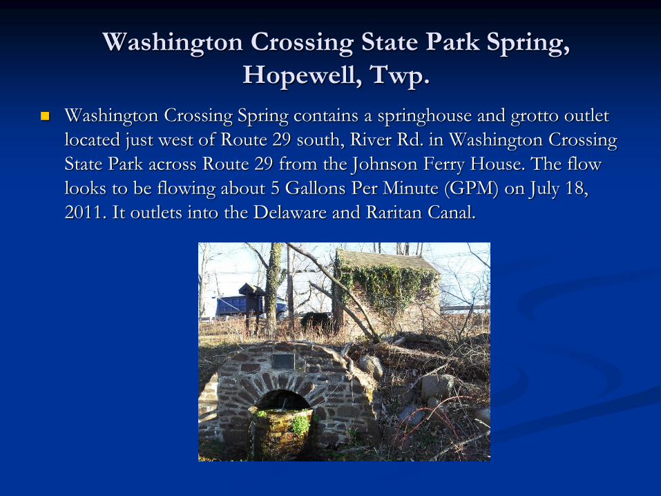
Washington Crossing State Park Spring,
Hopewell, Twp.
Washington Crossing Spring contains a springhouse and grotto outlet
located just west of Route 29 south, River Rd. in Washington Crossing
State Park across Route 29 from the Johnson Ferry House. The flow
looks to be flowing about 5 Gallons Per Minute (GPM) on July 18,
2011. It outlets into the Delaware and Raritan Canal.
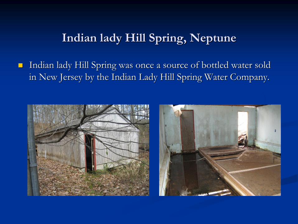
Indian lady Hill Spring, Neptune
Indian lady Hill Spring was once a source of bottled water sold
in New Jersey by the Indian Lady Hill Spring Water Company.
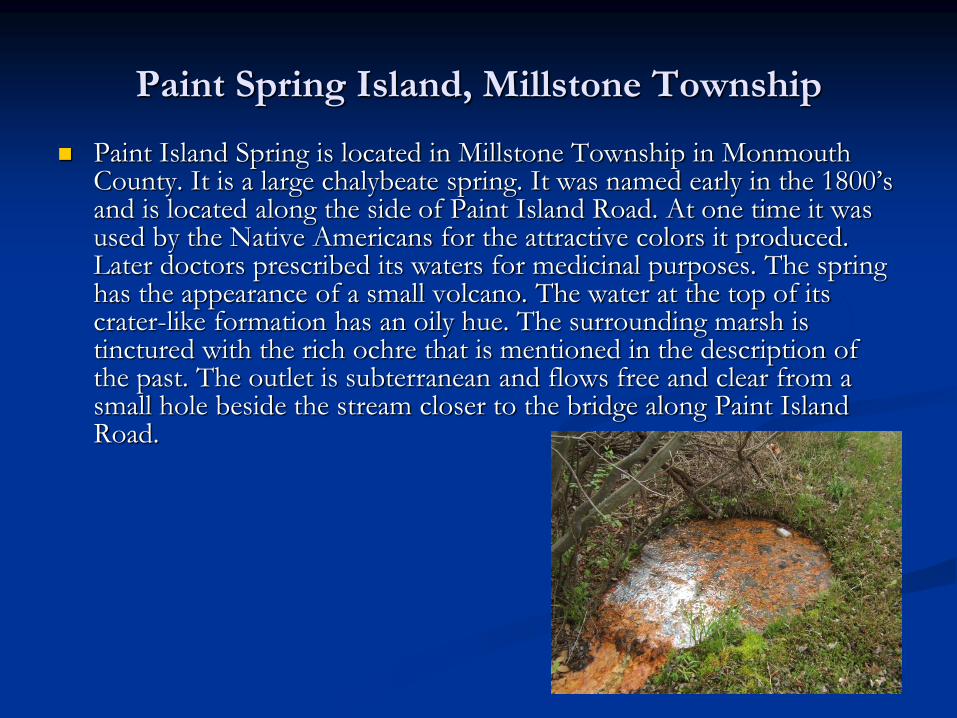
Paint Spring Island, Millstone Township
Paint Island Spring is located in Millstone Township in Monmouth County. It is a large chalybeate spring. It was named early in the 1800’s and is located along the side of Paint Island Road. At one time it was used by the Native Americans for the attractive colors it produced. Later doctors prescribed its waters for medicinal purposes. The spring has the appearance of a small volcano. The water at the top of its crater-like formation has an oily hue. The surrounding marsh is tinctured with the rich ochre that is mentioned in the description of the past. The outlet is subterranean and flows free and clear from a small hole beside the stream closer to the bridge along Paint Island Road.
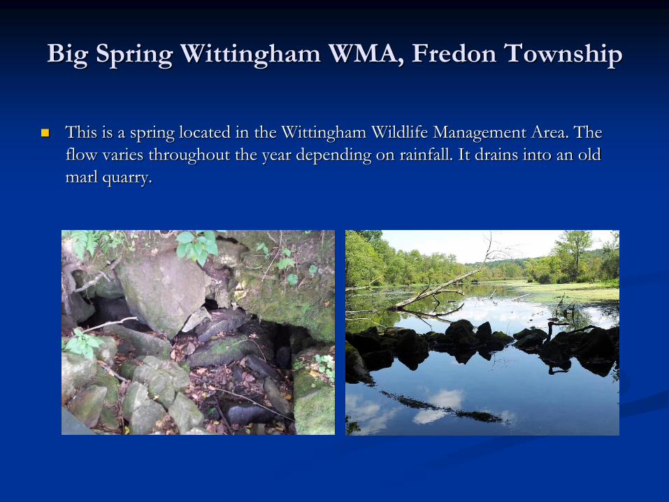
Big Spring Wittingham WMA, Fredon Township
This is a spring located in the Wittingham Wildlife Management Area. The
flow varies throughout the year depending on rainfall. It drains into an old
marl quarry.
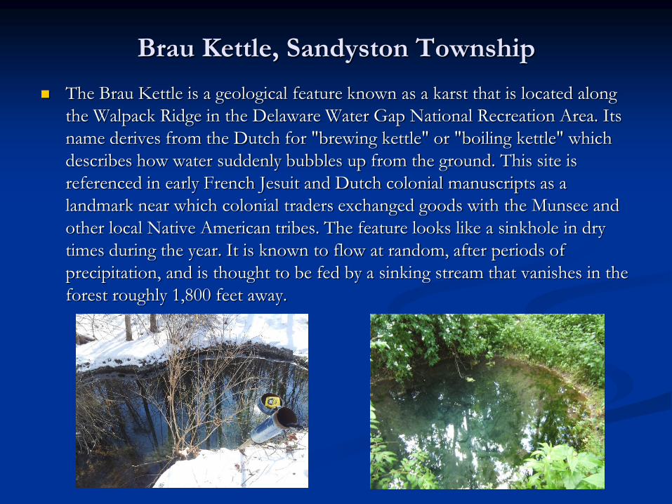
Brau Kettle, Sandyston Township
The Brau Kettle is a geological feature known as a karst that is located along
the Walpack Ridge in the Delaware Water Gap National Recreation Area. Its
name derives from the Dutch for "brewing kettle" or "boiling kettle" which
describes how water suddenly bubbles up from the ground. This site is
referenced in early French Jesuit and Dutch colonial manuscripts as a
landmark near which colonial traders exchanged goods with the Munsee and
other local Native American tribes. The feature looks like a sinkhole in dry
times during the year. It is known to flow at random, after periods of
precipitation, and is thought to be fed by a sinking stream that vanishes in the
forest roughly 1,800 feet away.
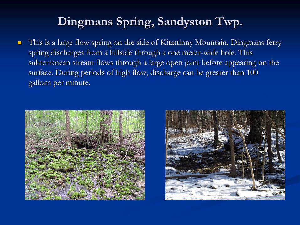
Dingmans Spring, Sandyston Twp.
This is a large flow spring on the side of Kitattinny Mountain. Dingmans ferry
spring discharges from a hillside through a one meter-wide hole. This
subterranean stream flows through a large open joint before appearing on the
surface. During periods of high flow, discharge can be greater than 100
gallons per minute.
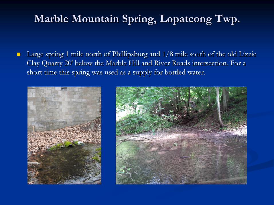
Marble Mountain Spring, Lopatcong Twp.
Large spring 1 mile north of Phillipsburg and 1/8 mile south of the old Lizzie
Clay Quarry 20' below the Marble Hill and River Roads intersection. For a
short time this spring was used as a supply for bottled water.
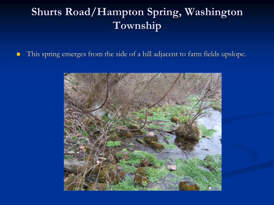
Shurts Road/Hampton Spring, Washington
Township
This spring emerges from the side of a hill adjacent to farm fields upslope.
Detailed Water Quality Sampling
June 2014 Office of Science funded $11,409.39
for one round of detailed water quality sampling
14 EPA study springs sampled in August of
2014 by NJWGS staff
Parameters included general chemistry, metals,
microbiological, pesticides, radon, and VOCs
Results and findings completed June 2015
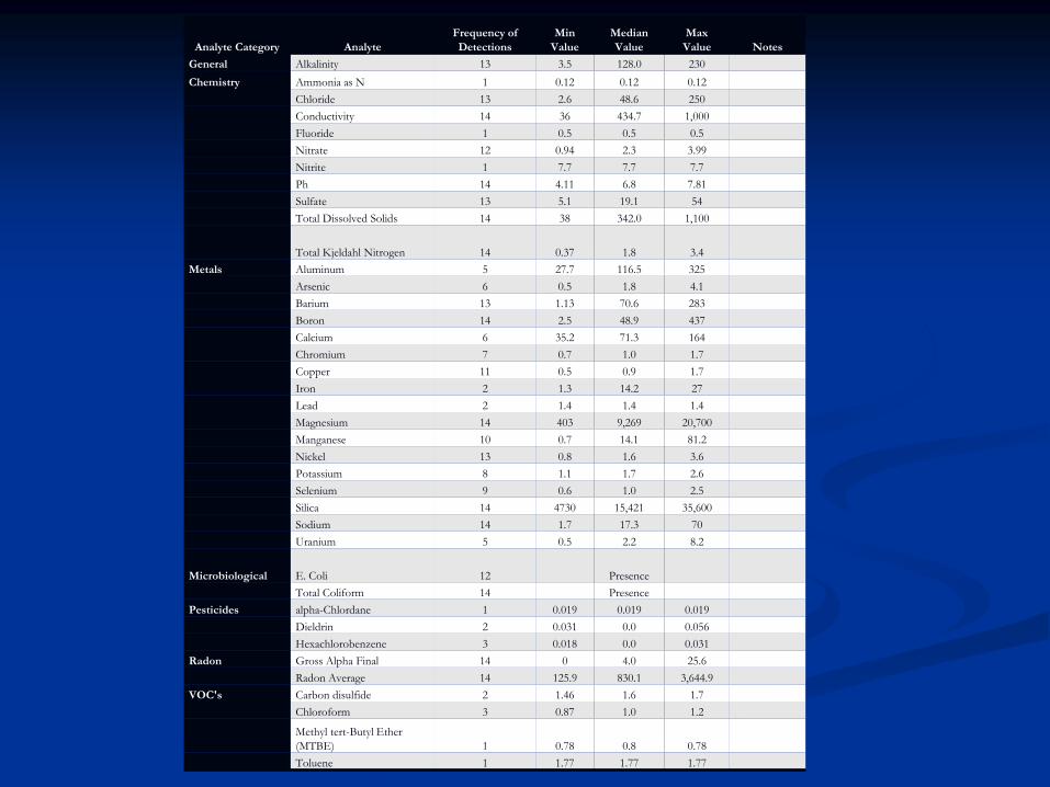
Analyte Category Analyte
Frequency of
Detections
Min
Value
Median
Value
Max
Value Notes
General Alkalinity 13 3.5 128.0 230
Chemistry Ammonia as N 1 0.12 0.12 0.12
Chloride 13 2.6 48.6 250
Conductivity 14 36 434.7 1,000
Fluoride 1 0.5 0.5 0.5
Nitrate 12 0.94 2.3 3.99
Nitrite 1 7.7 7.7 7.7
Ph 14 4.11 6.8 7.81
Sulfate 13 5.1 19.1 54
Total Dissolved Solids 14 38 342.0 1,100
Total Kjeldahl Nitrogen 14 0.37 1.8 3.4
Metals Aluminum 5 27.7 116.5 325
Arsenic 6 0.5 1.8 4.1
Barium 13 1.13 70.6 283
Boron 14 2.5 48.9 437
Calcium 6 35.2 71.3 164
Chromium 7 0.7 1.0 1.7
Copper 11 0.5 0.9 1.7
Iron 2 1.3 14.2 27
Lead 2 1.4 1.4 1.4
Magnesium 14 403 9,269 20,700
Manganese 10 0.7 14.1 81.2
Nickel 13 0.8 1.6 3.6
Potassium 8 1.1 1.7 2.6
Selenium 9 0.6 1.0 2.5
Silica 14 4730 15,421 35,600
Sodium 14 1.7 17.3 70
Uranium 5 0.5 2.2 8.2
Microbiological E. Coli 12 Presence
Total Coliform 14 Presence
Pesticides alpha-Chlordane 1 0.019 0.019 0.019
Dieldrin 2 0.031 0.0 0.056
Hexachlorobenzene 3 0.018 0.0 0.031
Radon Gross Alpha Final 14 0 4.0 25.6
Radon Average 14 125.9 830.1 3,644.9
VOC's Carbon disulfide 2 1.46 1.6 1.7
Chloroform 3 0.87 1.0 1.2
Methyl tert-Butyl Ether
(MTBE) 1 0.78 0.8 0.78
Toluene 1 1.77 1.77 1.77
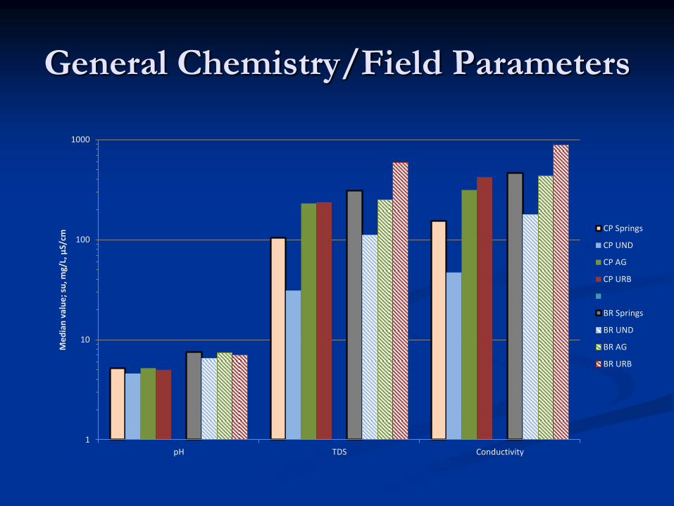
General Chemistry/Field Parameters
1
10
100
1000
pH TDS Conductivity
Me
dia
n v
alu
e;
su, m
g/L,
µS/
cm CP Springs
CP UND
CP AG
CP URB
BR Springs
BR UND
BR AG
BR URB
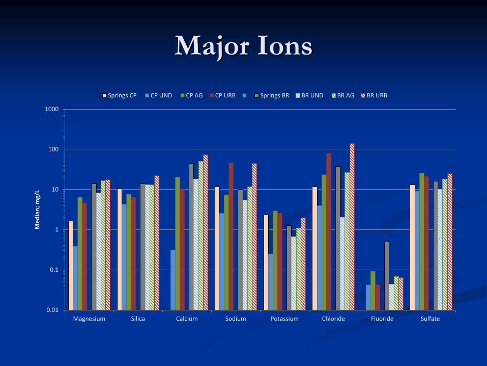
Major Ions
0.01
0.1
1
10
100
1000
Magnesium Silica Calcium Sodium Potassium Chloride Fluoride Sulfate
Me
dia
n;
mg/
L
Springs CP CP UND CP AG CP URB Springs BR BR UND BR AG BR URB
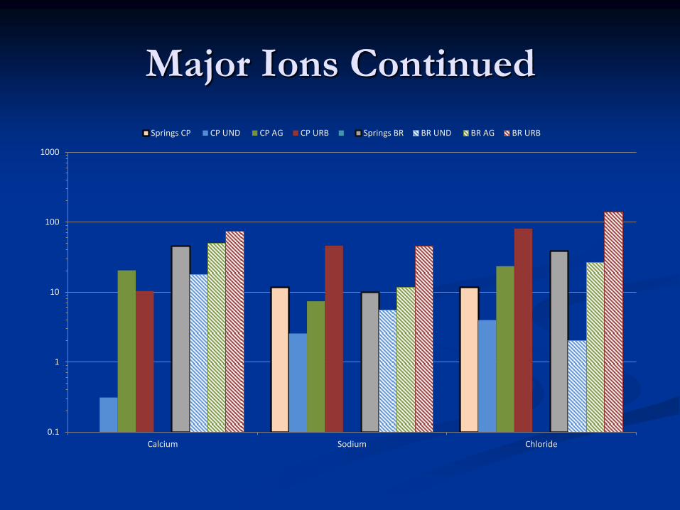
Major Ions Continued
0.1
1
10
100
1000
Calcium Sodium Chloride
Springs CP CP UND CP AG CP URB Springs BR BR UND BR AG BR URB
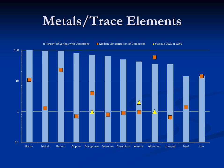
Metals/Trace Elements
1
2
1
0.1
1
10
100
Boron Nickel Barium Copper Manganese Selenium Chromium Arsenic Aluminum Uranium Lead Iron
Percent of Springs with Detections Median Concentration of Detections # above DWS or GWS
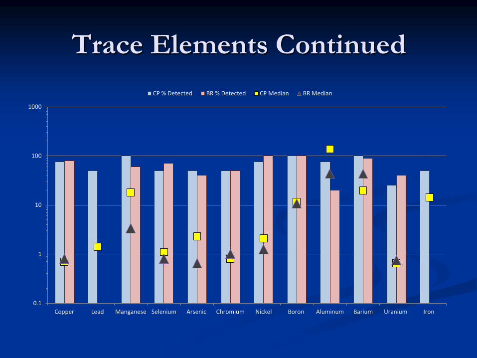
Trace Elements Continued
0.1
1
10
100
1000
Copper Lead Manganese Selenium Arsenic Chromium Nickel Boron Aluminum Barium Uranium Iron
CP % Detected BR % Detected CP Median BR Median
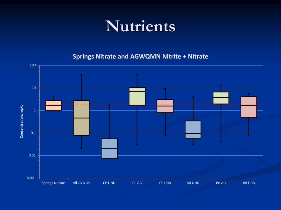
Nutrients
0.001
0.01
0.1
1
10
100
Springs Nitrate All C3 N+N CP UND CP AG CP URB BR UND BR AG BR URB
Co
nce
ntr
atio
n; m
g/L
Springs Nitrate and AGWQMN Nitrite + Nitrate
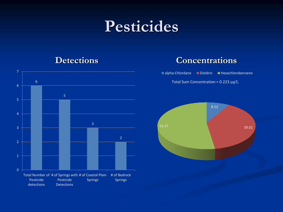
Pesticides
Detections Concentrations
6
5
3
2
0
1
2
3
4
5
6
7
Total Number ofPesticide
detections
# of Springs withPesticide
Detections
# of Coastal PlainSprings
# of BedrockSprings
8.52
39.01 52.47
alpha-Chlordane Dieldrin Hexachlorobenzene
Total Sum Concentration = 0.223 µg/L
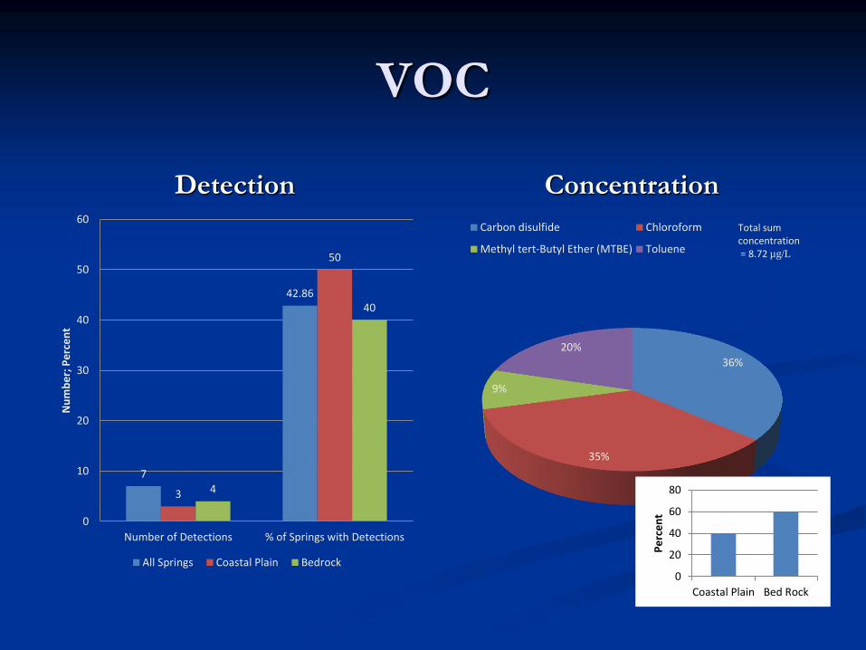
VOC
Detection Concentration
7
42.86
3
50
4
40
0
10
20
30
40
50
60
Number of Detections % of Springs with Detections
Nu
mb
er;
Pe
rce
nt
All Springs Coastal Plain Bedrock
36%
35%
9%
20%
Carbon disulfide Chloroform
Methyl tert-Butyl Ether (MTBE) Toluene
Total sum concentration = 8.72 µg/L
0
20
40
60
80
Coastal Plain Bed Rock
Pe
rce
nt
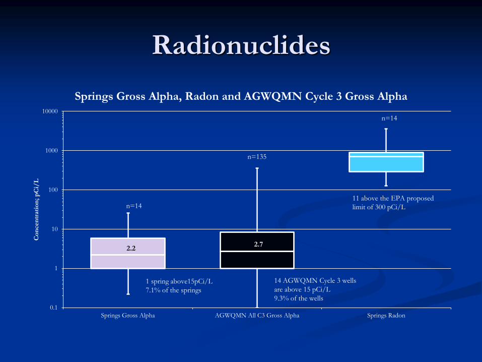
Radionuclides
0.1
1
10
100
1000
10000
Springs Gross Alpha AGWQMN All C3 Gross Alpha Springs Radon
Co
ncen
trati
on
; p
Ci/
L
Springs Gross Alpha, Radon and AGWQMN Cycle 3 Gross Alpha
n=14
n=135
n=14
1 spring above15pCi/L
7.1% of the springs
14 AGWQMN Cycle 3 wells
are above 15 pCi/L
9.3% of the wells
11 above the EPA proposed
limit of 300 pCi/L
2.2 2.7
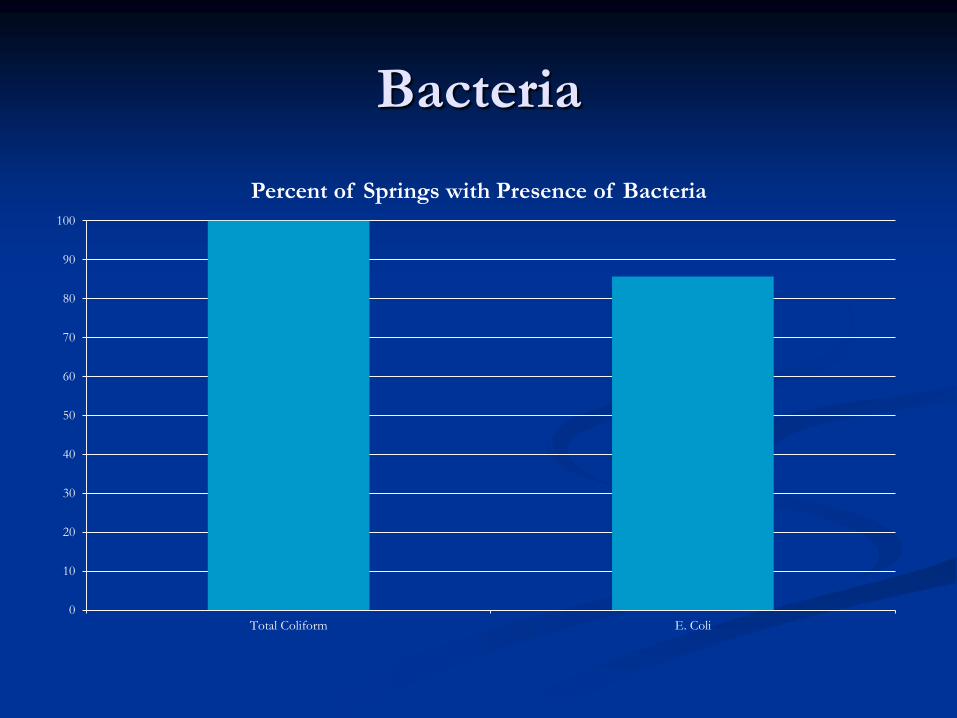
Bacteria
0
10
20
30
40
50
60
70
80
90
100
Total Coliform E. Coli
Percent of Springs with Presence of Bacteria
Spring Water Chemistry
Observations The spring water quality is determined by the ground-
water quality.
The spring’s water quality is impacted by natural and anthropogenic sources like observed in the AGWQMN.
The springs’ water quality may not be as recently and locally influenced as the AGWQMN monitoring wells.
To properly characterize spring water quality, more spatial and temporal data is needed.
To assess if the anthropogenic influences are recent/local, age dating of the spring water would be beneficial or the ability to compare data with an adjacent ground-water monitoring well.