Embed Size (px)
Citation preview

FORMERLY USED DEFENSE SITE
FORMER CAMP BEALE MRS03 PROJECT COMMUNITY MEETING
MARCH 22, 2016 SIERRA NEVADA MEETING ROOM 7:00 – 8:00 P.M. CALIFORNIA DEPARTMENT OF TRANSPORTATION
703 B ST. MARYSVILLE, CA
AGENDA 7:00 p.m. I. Project Team Introductions
7:10 p.m. II. Project Status and Planning Background Purpose of the Remedial Investigation Planned Field Activities Project Safety Current Schedule
7:30 p.m. III. Community Relations
Community Relations Plan Purpose Community Interviews Current Plan for Community Outreach Options to Establish a Community Restoration Advisory Board (RAB)
7:50 p.m. IV. Public Comments and Questions
8:00 p.m. VI. Adjourn
US Army Corps of Engineers
BUILDING STRONG®
Formerly Used Defense Sites (FUDS) Former Camp
Beale Munitions Response Site (MRS) 03,
Southwest Combined Use Area,
Remedial Investigation (RI) /
Feasibility Study (FS)
Yuba and Nevada Counties, California
FUDS Project Number J09CA013605
Public MeetingMarch 22, 2016
BUILDING STRONG®
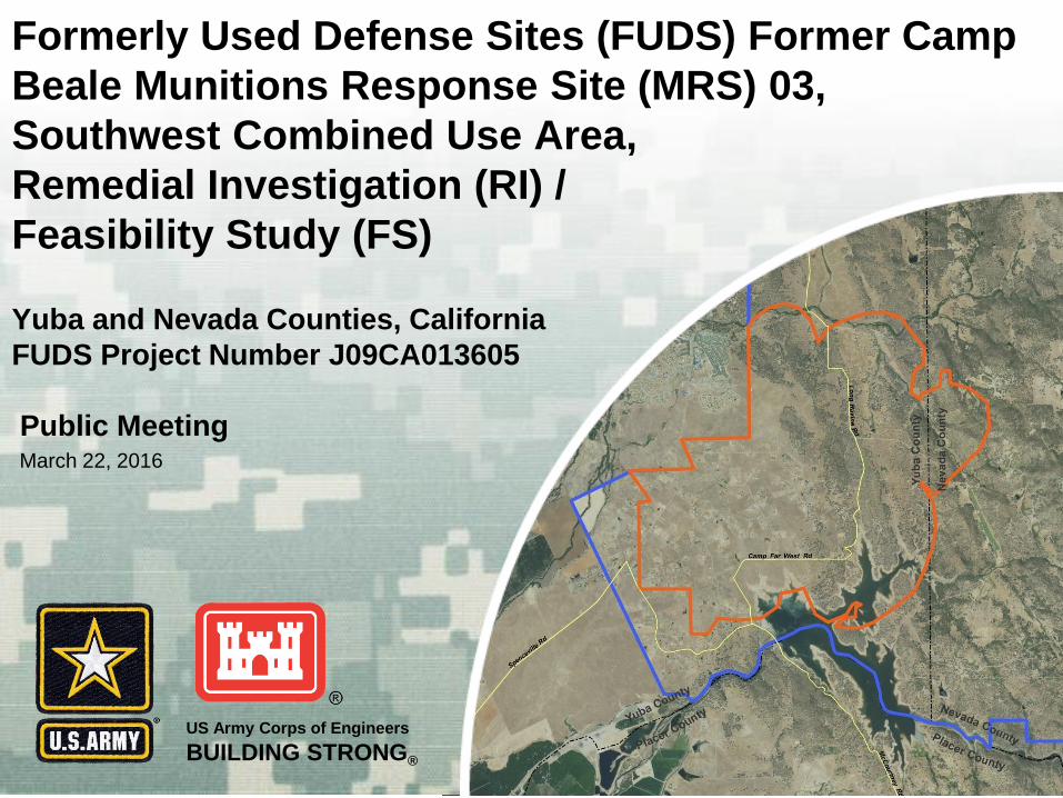
INTRODUCTION
USACE, Sacramento District
• Has administrative control and is managing all aspects of this project
California Department of Toxic Substance Control (DTSC)
• Provides regulatory support of the Former Camp Beale MRS03 RI/FS
State of California, California Department of Fish and Wildlife
• Portions of the MRS are located on property that is currently owned by
the State of California
Bristol Environmental Remediation Services, LLC (Bristol)
• Executes project with support from InDepth Corporation, Neptune and
Company, Inc., Black Tusk Geophysics, and NOREAS, Inc. as
subcontractors

BUILDING STRONG®
RI/FS PROCESS OVERVIEW FOR FUDS
Project is currentlyat this stage
BUILDING STRONG®
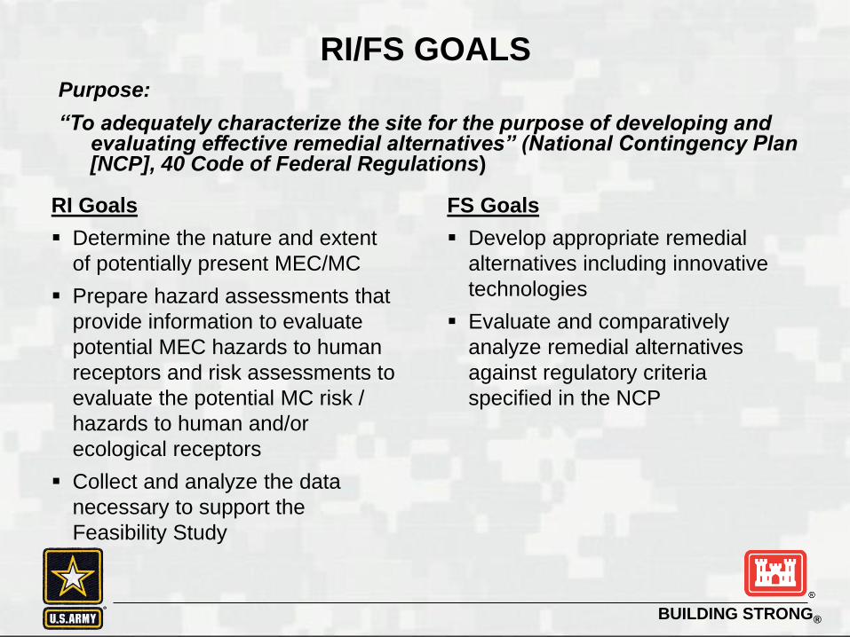
RI/FS GOALSPurpose:
“To adequately characterize the site for the purpose of developing and evaluating effective remedial alternatives” (National Contingency Plan [NCP], 40 Code of Federal Regulations)
FS Goals
Develop appropriate remedial
alternatives including innovative
technologies
Evaluate and comparatively
analyze remedial alternatives
against regulatory criteria
specified in the NCP
RI Goals
Determine the nature and extent
of potentially present MEC/MC
Prepare hazard assessments that
provide information to evaluate
potential MEC hazards to human
receptors and risk assessments to
evaluate the potential MC risk /
hazards to human and/or
ecological receptors
Collect and analyze the data
necessary to support the
Feasibility Study
BUILDING STRONG®
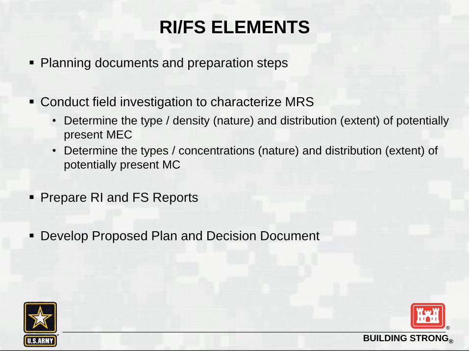
RI/FS ELEMENTS
Planning documents and preparation steps
Conduct field investigation to characterize MRS
• Determine the type / density (nature) and distribution (extent) of potentially
present MEC
• Determine the types / concentrations (nature) and distribution (extent) of
potentially present MC
Prepare RI and FS Reports
Develop Proposed Plan and Decision Document
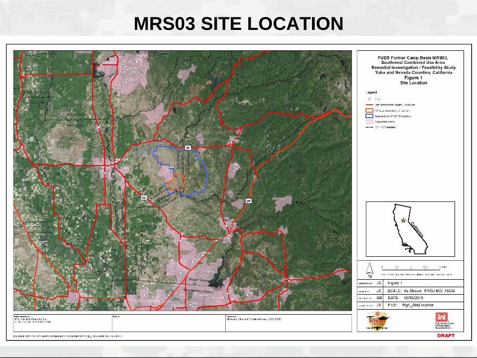
MRS03 SITE LOCATION
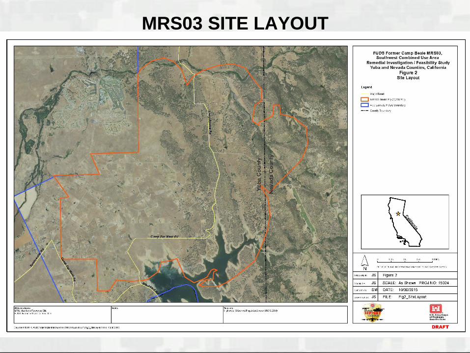
MRS03 SITE LAYOUT
BUILDING STRONG®
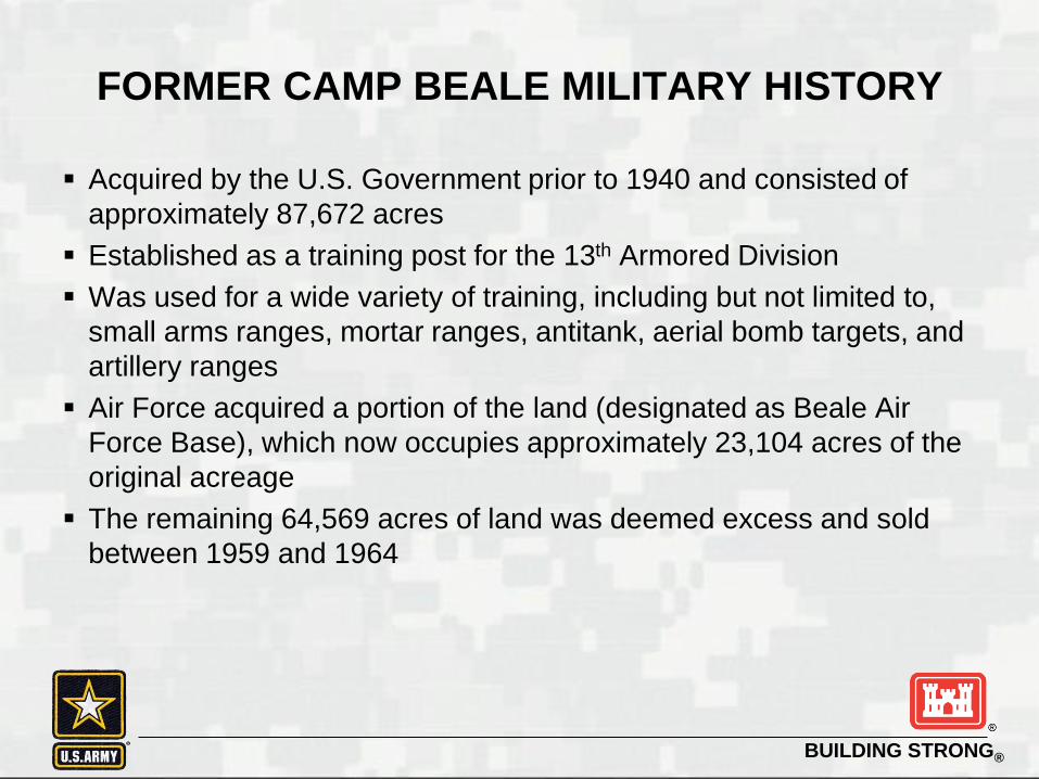
FORMER CAMP BEALE MILITARY HISTORY
Acquired by the U.S. Government prior to 1940 and consisted of
approximately 87,672 acres
Established as a training post for the 13th Armored Division
Was used for a wide variety of training, including but not limited to,
small arms ranges, mortar ranges, antitank, aerial bomb targets, and
artillery ranges
Air Force acquired a portion of the land (designated as Beale Air
Force Base), which now occupies approximately 23,104 acres of the
original acreage
The remaining 64,569 acres of land was deemed excess and sold
between 1959 and 1964
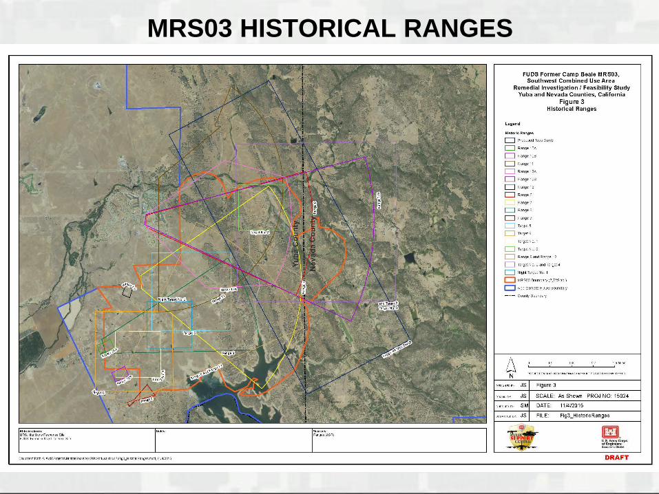
MRS03 HISTORICAL RANGES
BUILDING STRONG®
PREVIOUS INVESTIGATIONS
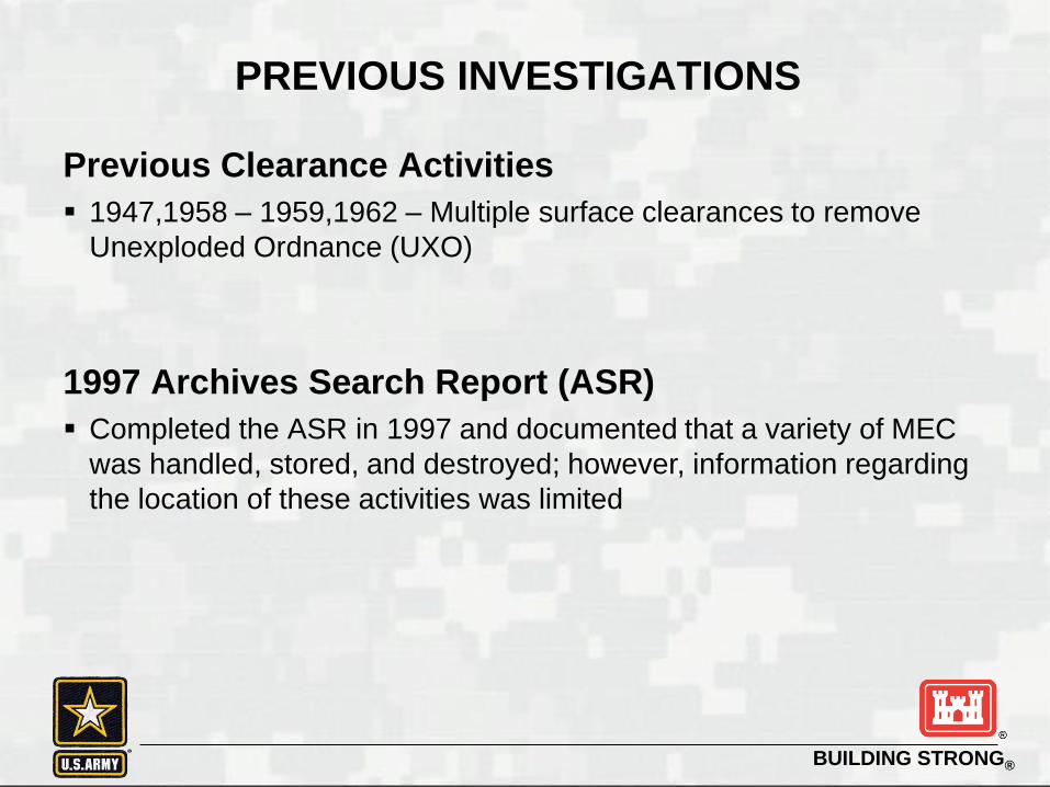
Previous Clearance Activities
1947,1958 – 1959,1962 – Multiple surface clearances to remove
Unexploded Ordnance (UXO)
1997 Archives Search Report (ASR)
Completed the ASR in 1997 and documented that a variety of MEC
was handled, stored, and destroyed; however, information regarding
the location of these activities was limited
BUILDING STRONG®
PREVIOUS INVESTIGATIONS
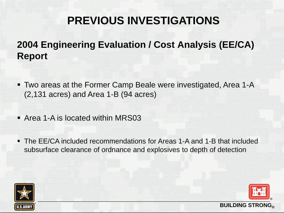
2004 Engineering Evaluation / Cost Analysis (EE/CA)
Report
Two areas at the Former Camp Beale were investigated, Area 1-A
(2,131 acres) and Area 1-B (94 acres)
Area 1-A is located within MRS03
The EE/CA included recommendations for Areas 1-A and 1-B that included
subsurface clearance of ordnance and explosives to depth of detection
BUILDING STRONG®
PREVIOUS INVESTIGATIONS
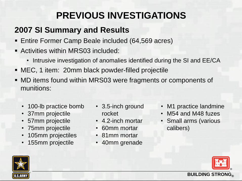
2007 SI Summary and Results
Entire Former Camp Beale included (64,569 acres)
Activities within MRS03 included:
• Intrusive investigation of anomalies identified during the SI and EE/CA
MEC, 1 item: 20mm black powder-filled projectile
MD items found within MRS03 were fragments or components of
munitions:
• 100-lb practice bomb
• 37mm projectile
• 57mm projectile
• 75mm projectile
• 105mm projectiles
• 155mm projectile
• 3.5-inch ground
rocket
• 4.2-inch mortar
• 60mm mortar
• 81mm mortar
• 40mm grenade
• M1 practice landmine
• M54 and M48 fuzes
• Small arms (various
calibers)

BUILDING STRONG®
PREVIOUS INVESTIGATIONS
2007 SI Summary and Results
Soil samples were not collected during the SI
12 Munitions Response Sites were identified within the Former Camp
Beale FUDS
• Total acreage of all 12 MRSs is 43,227 acres
• MRS03 identified as 7,725 acres
• MRS03 recommended for RI to further quantify the nature and extent of
MEC
PREVIOUS INVESTIGATIONS

BUILDING STRONG®
RIGHTS OF ENTRY
USACE currently working on obtaining ROEs
Several ROEs have been granted to date for the current RI field
activities
MRS03 parcel summary
• 278 total parcels
• 47 of the total parcels are currently having ROEs being pursued

RIGHTS OF ENTRY

BUILDING STRONG®
PROPOSED RI FIELD WORK OVERVIEW
Field Project Elements
Combination of analog geophysical surveys (i.e., real-time mag
and dig approach) / digital geophysical mapping (DGM)
Proposed DGM transects in data gap investigation area after statistical
analysis results in 35.4 line miles
Advanced classification surveys
Intrusive investigations
MEC/MD disposal
MC sampling
PROPOSED RI FIELD WORK OVERVIEW
BUILDING STRONG®
PROPOSED RI FIELD WORK OVERVIEW
MEC Characterization – Geophysical Surveys
Analog Geophysical Surveys
• Conduct surveys using all-metals detectors in areas that DGM cannot
access the pre-determined transect due to terrain, dense vegetation, tree
canopy, etc.
• Anomalies will be intrusively investigated as team advances or flagged
and investigated later
BUILDING STRONG®
PROPOSED RI FIELD WORK OVERVIEW
MEC Characterization – Geophysical Surveys
DGM Surveys
• EM61-MK2 DGM technology (e.g., towed-array and/or litter) will be used
to complete transects
• Digital geophysical data will be processed and interpreted for subsurface
anomalies
BUILDING STRONG®
PROPOSED RI FIELD WORK OVERVIEW
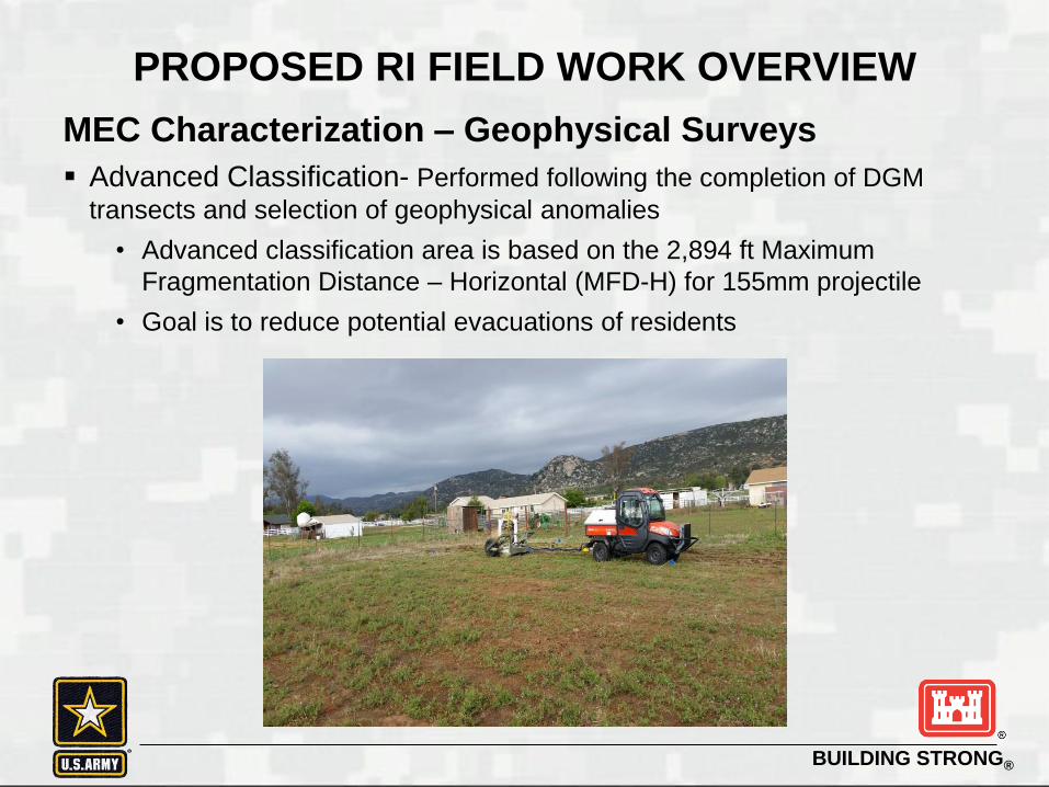
MEC Characterization – Geophysical Surveys
Advanced Classification- Performed following the completion of DGM
transects and selection of geophysical anomalies
• Advanced classification area is based on the 2,894 ft Maximum
Fragmentation Distance – Horizontal (MFD-H) for 155mm projectile
• Goal is to reduce potential evacuations of residents
BUILDING STRONG®
PROPOSED RI FIELD WORK OVERVIEW
MEC Characterization – Intrusive Investigations
Intrusive and MEC Demilitarization / Disposal activities will be
conducted in accordance with project work / safety plans and
government-approved Explosives Site Plan
Ground disturbance will be limited to the size of the target being
intrusively investigated
BUILDING STRONG®
PROPOSED RI FIELD WORK OVERVIEW
MC Characterization
• If the following is encountered that may represent a potential MC
source, soil and potentially sediment samples will be collected
• In areas where MEC is identified
• In areas where MD is present that may represent a density similar to a
target / impact area
Based on results of geophysical investigation, soil sampling will be
used to accurately define background metals concentrations,
potential MC metals concentrations and potential explosives
concentrations in soil
Detections of MC in soil will be compared to human health and
ecological screening criteria and any results above criteria will be
further evaluated by a human and/or ecological screening level risk
assessment(s)
BUILDING STRONG®
PROPOSED SCHEDULE
August / September 2016 – RI field work mobilization
August - October 2016 – DGM and advanced classification work
October 2016 - November 2016 – Intrusive investigations
November / December 2016 – RI field work complete
2017- RI and FS Reports

BUILDING STRONG®
SAFETY REMINDER
Remember the 3Rs of Military Munitions Safety:
Recognize:
you may have encountered a munitions item.
Retreat:
from munitions item. Do not touch or disturb it; instead move away
carefully, walking out the same way you entered the area. Do not use
two-way radios or cell phones within 100 feet of the item.
Report:
what you saw and where you saw it by calling 911.
BUILDING STRONG®
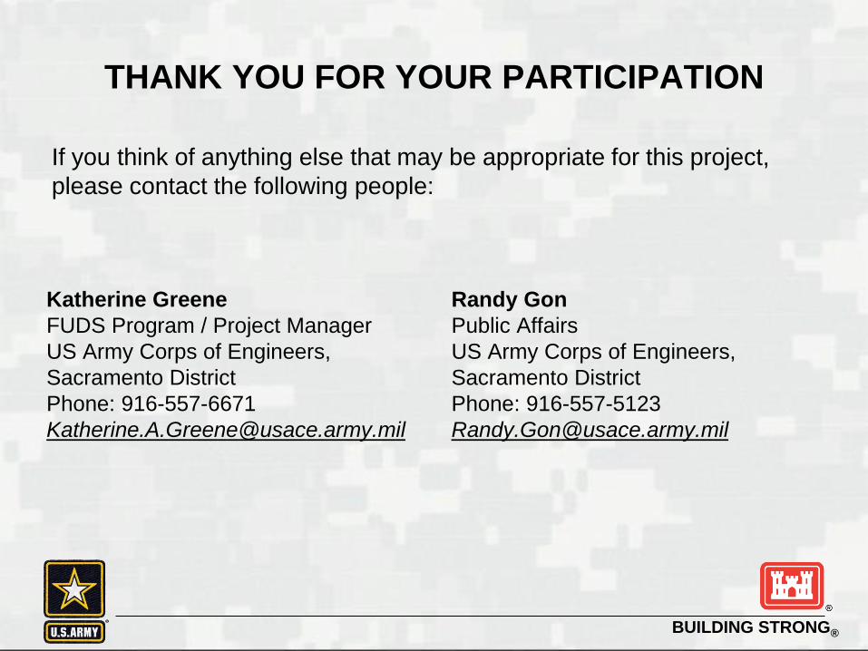
If you think of anything else that may be appropriate for this project,
please contact the following people:
Katherine Greene
FUDS Program / Project Manager
US Army Corps of Engineers,
Sacramento District
Phone: 916-557-6671
Randy Gon
Public Affairs
US Army Corps of Engineers,
Sacramento District
Phone: 916-557-5123
THANK YOU FOR YOUR PARTICIPATION

BUILDING STRONG®
CLOSING REMARKS
QUESTIONS?

US Army Corps of Engineers
BUILDING STRONG®
Formerly Used Defense Site
Former Camp Beale
US Army Corps of Engineers
BUILDING STRONG®
Community MeetingMarch 22, 2016
Munitions Response Site
(MRS) 03 Project and
Planned Community
Relations
BUILDING STRONG®
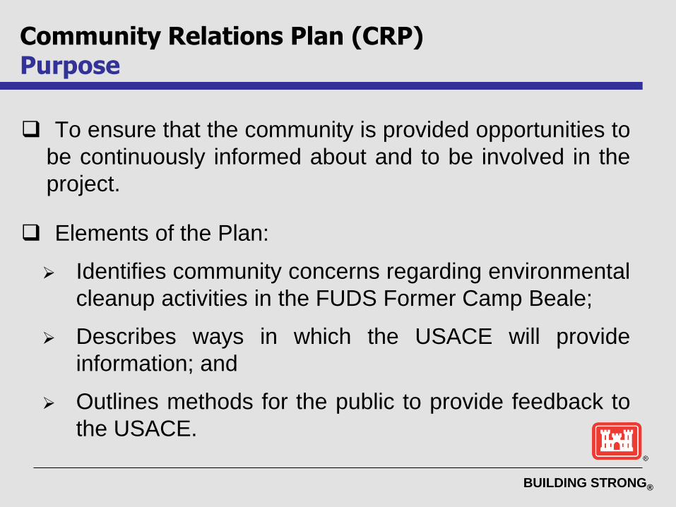
To ensure that the community is provided opportunities to
be continuously informed about and to be involved in the
project.
Elements of the Plan:
Identifies community concerns regarding environmental
cleanup activities in the FUDS Former Camp Beale;
Describes ways in which the USACE will provide
information; and
Outlines methods for the public to provide feedback to
the USACE.
Community Relations Plan (CRP)Purpose

BUILDING STRONG®
Working to complete an updated CRP to support
upcoming project activities
The updated CRP will be made available in the Information
Repositories located at the Yuba and Nevada County Libraries
Major inputs included conducting community interviews
to inform the planning for community involvement.
Requested feedback included:
Current concerns and information interests about the project
Methods used to obtain project information,
Preferences for public participation including forming a Restoration
Advisory Board
Community Relations PlanInputs
BUILDING STRONG®
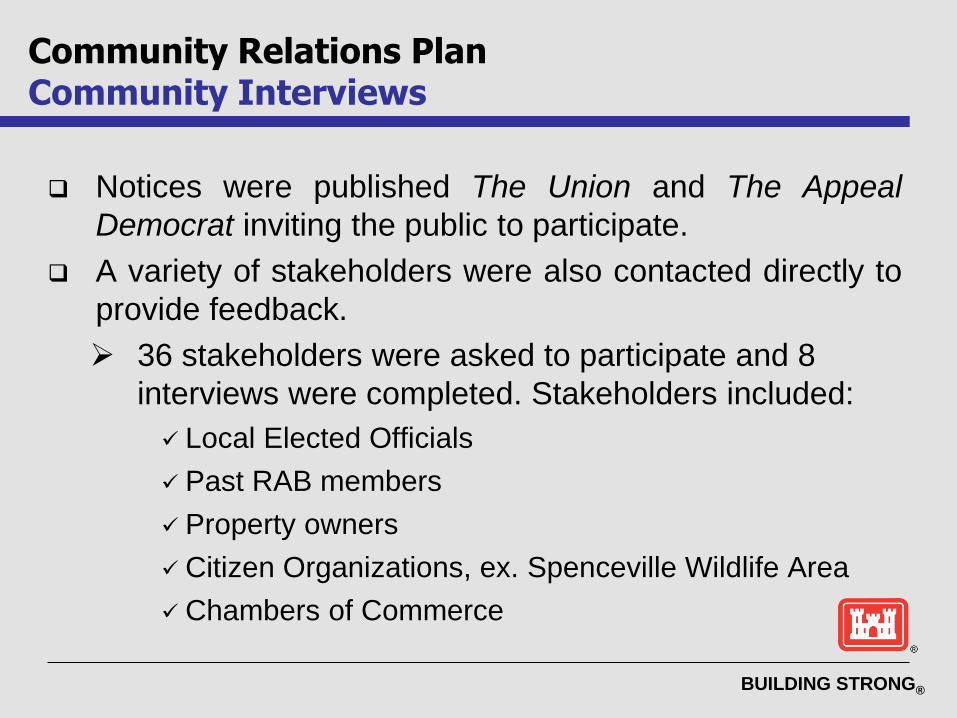
Notices were published The Union and The Appeal
Democrat inviting the public to participate.
A variety of stakeholders were also contacted directly to
provide feedback.
36 stakeholders were asked to participate and 8
interviews were completed. Stakeholders included:
Local Elected Officials
Past RAB members
Property owners
Citizen Organizations, ex. Spenceville Wildlife Area
Chambers of Commerce
Community Relations PlanCommunity Interviews

BUILDING STRONG®
Concerns:
Risks of building on their land; impacts to residential
areas/proposed residential areas; impacts on resale
value of land; land usability; liability if someone got hurt
from a UXO either on their property or in Spenceville
Wildlife Area.
Information interests:
Safety including what to do if a munition is
encountered;
Progress updates on the project including findings; and
Schedule for when USACE will be done.
Community Relations PlanFeedback from Interviews
BUILDING STRONG®
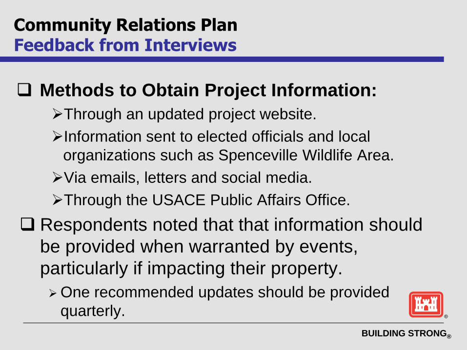
Methods to Obtain Project Information:
Through an updated project website.
Information sent to elected officials and local
organizations such as Spenceville Wildlife Area.
Via emails, letters and social media.
Through the USACE Public Affairs Office.
Respondents noted that that information should
be provided when warranted by events,
particularly if impacting their property.
One recommended updates should be provided
quarterly.
Community Relations PlanFeedback from Interviews
BUILDING STRONG®
Interests in Community Participation:
Majority of participants were unsure whether the
community would like to be more involved but agreed
that more information was desired.
One respondent recommended public meetings and
another recommended opportunities to meet with
project staff and talk with independent experts.
Two respondents recommended Restoration Advisory
Board (RAB) meetings; however five participants noted
that they would not attend a RAB and did not see the
need to form one.
Community Relations PlanFeedback from Interviews
BUILDING STRONG®
Letters: Sent to effected property owners to provide
project updates as warranted by events
Emails: Sent to interested stakeholders and property
owners to provide project updates and information
Public Information Repositories: Yuba and Nevada
County Libraries
Project website:http://www.spk.usace.army.mil/Missions/MilitaryProjects/FUDS.aspx
Public Notices: Published in local newspapers
Community Meetings: Held twice a year
Meeting Announcements: Posted to Yubanet.com
Community Relations PlanCurrent Approach

BUILDING STRONG®
USACE has not identified sufficient interest at this
time to re-establish a Restoration Advisory Board
(RAB).
USACE remains open to re-establishing a
community RAB if the level of interest changes.
Interest will be assessed at least every two
years during the project.
Community Relations PlanOptions to Establish a RAB

BUILDING STRONG®
Community Relations PlanOptions to Establish a RAB
Function and purpose of a RAB, if one were
formed:
RABs are the cornerstone of Department of Defense’s
(DoD) approach to formally involve stakeholders in the
cleanup process.
The RAB is a forum of representatives of the Army,
regulatory agencies, and community to discuss and
exchange information about the DoD’s environmental
restoration program.
BUILDING STRONG®
Community Relations PlanConclusion
The Community Relations Plan is a ‘living’
document and may be updated based on feedback
from the community.
Community Questionnaires are available tonight for
members of the public to provide final inputs for
inclusion in the CRP update.
BUILDING STRONG®
FUDS Former Camp BealeCommunity Meeting
Questions?
Contact Randy Gon, USACE Public Affairs
Office for additional information:
Phone: 916-557-5123
Email: [email protected]
BUILDING STRONG®
GLOSSARY
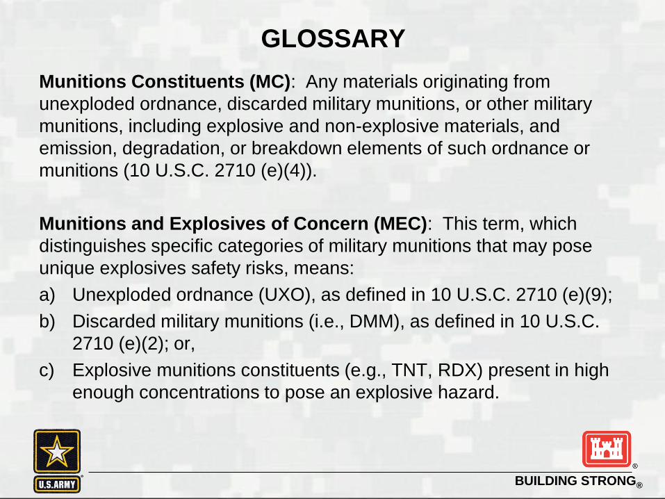
Munitions Constituents (MC): Any materials originating from
unexploded ordnance, discarded military munitions, or other military
munitions, including explosive and non-explosive materials, and
emission, degradation, or breakdown elements of such ordnance or
munitions (10 U.S.C. 2710 (e)(4)).
Munitions and Explosives of Concern (MEC): This term, which
distinguishes specific categories of military munitions that may pose
unique explosives safety risks, means:
a) Unexploded ordnance (UXO), as defined in 10 U.S.C. 2710 (e)(9);
b) Discarded military munitions (i.e., DMM), as defined in 10 U.S.C.
2710 (e)(2); or,
c) Explosive munitions constituents (e.g., TNT, RDX) present in high
enough concentrations to pose an explosive hazard.
BUILDING STRONG®
GLOSSARY (continued)
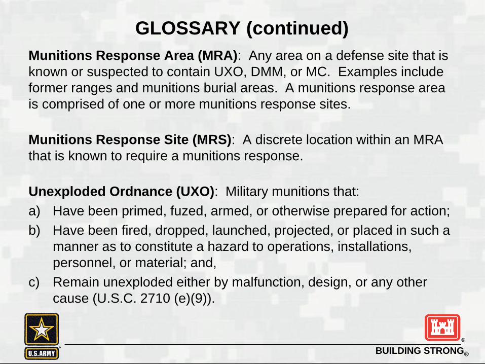
Munitions Response Area (MRA): Any area on a defense site that is
known or suspected to contain UXO, DMM, or MC. Examples include
former ranges and munitions burial areas. A munitions response area
is comprised of one or more munitions response sites.
Munitions Response Site (MRS): A discrete location within an MRA
that is known to require a munitions response.
Unexploded Ordnance (UXO): Military munitions that:
a) Have been primed, fuzed, armed, or otherwise prepared for action;
b) Have been fired, dropped, launched, projected, or placed in such a
manner as to constitute a hazard to operations, installations,
personnel, or material; and,
c) Remain unexploded either by malfunction, design, or any other
cause (U.S.C. 2710 (e)(9)).

BUILDING STRONG®
ACRONYMSASR Archives Search Report
Bristol Bristol Environmental Remediation Services, LLC
BSP Blind Seeding Plan
CSEM Conceptual Site Exposure Model
CSM Conceptual Site Model
DGM Digital Geophysical Mapping
DTSC Department of Toxic Substances Control
EE/CA Engineering Evaluation / Cost Analysis
FS Feasibility Study
FUDS Formerly Used Defense Sites
GIS Geographic Information System
GPS Global Positioning System
GSV Geophysical System Verification
HE High Explosive
IVS Instrument Verification Strip
MC Munitions Constituent
MD Munitions Debris
MEC Munitions and Explosives of Concern
MFD-H Maximum Fragmentation Distance – Horizontal
MRA Munitions Response Area
MRS Munitions Response Site
NCP National Contingency Plan
PM Project Manger
QC Quality Control
RI Remedial Investigation
ROE Right of Entry
RTK Real-Time Kinematic
SI Site Inspection
TNT Trinitrotoluene
TOI Target of Interest
TPP Technical Project Planning
UFP-QAPP Uniform Federal Policy-Quality Assurance Project Plan
USACE U.S. Army Corps of Engineers
UXO Unexploded Ordnance
VSP Visual Sample Plan
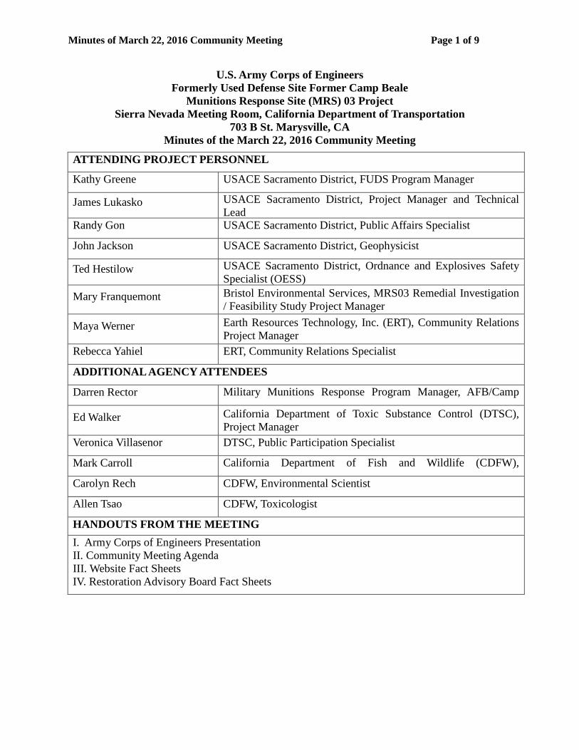
Minutes of March 22, 2016 Community Meeting Page 1 of 9
U.S. Army Corps of Engineers Formerly Used Defense Site Former Camp Beale
Munitions Response Site (MRS) 03 Project Sierra Nevada Meeting Room, California Department of Transportation
703 B St. Marysville, CA Minutes of the March 22, 2016 Community Meeting
ATTENDING PROJECT PERSONNEL Kathy Greene USACE Sacramento District, FUDS Program Manager
James Lukasko USACE Sacramento District, Project Manager and Technical Lead Randy Gon USACE Sacramento District, Public Affairs Specialist
John Jackson USACE Sacramento District, Geophysicist
Ted Hestilow USACE Sacramento District, Ordnance and Explosives Safety Specialist (OESS)
Mary Franquemont Bristol Environmental Services, MRS03 Remedial Investigation / Feasibility Study Project Manager
Maya Werner Earth Resources Technology, Inc. (ERT), Community Relations Project Manager
Rebecca Yahiel ERT, Community Relations Specialist
ADDITIONAL AGENCY ATTENDEES
Darren Rector Military Munitions Response Program Manager, AFB/Camp
Ed Walker California Department of Toxic Substance Control (DTSC), Project Manager
Veronica Villasenor DTSC, Public Participation Specialist
Mark Carroll California Department of Fish and Wildlife (CDFW),
Carolyn Rech CDFW, Environmental Scientist
Allen Tsao CDFW, Toxicologist
HANDOUTS FROM THE MEETING I. Army Corps of Engineers Presentation II. Community Meeting Agenda III. Website Fact Sheets IV. Restoration Advisory Board Fact Sheets
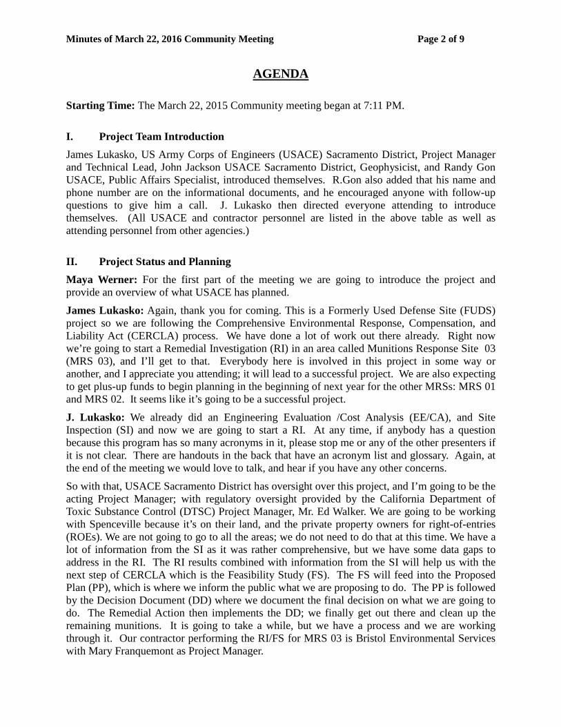
Minutes of March 22, 2016 Community Meeting Page 2 of 9
AGENDA
Starting Time: The March 22, 2015 Community meeting began at 7:11 PM.
I. Project Team Introduction James Lukasko, US Army Corps of Engineers (USACE) Sacramento District, Project Manager and Technical Lead, John Jackson USACE Sacramento District, Geophysicist, and Randy Gon USACE, Public Affairs Specialist, introduced themselves. R.Gon also added that his name and phone number are on the informational documents, and he encouraged anyone with follow-up questions to give him a call. J. Lukasko then directed everyone attending to introduce themselves. (All USACE and contractor personnel are listed in the above table as well as attending personnel from other agencies.)
II. Project Status and Planning Maya Werner: For the first part of the meeting we are going to introduce the project and provide an overview of what USACE has planned.
James Lukasko: Again, thank you for coming. This is a Formerly Used Defense Site (FUDS) project so we are following the Comprehensive Environmental Response, Compensation, and Liability Act (CERCLA) process. We have done a lot of work out there already. Right now we’re going to start a Remedial Investigation (RI) in an area called Munitions Response Site 03 (MRS 03), and I’ll get to that. Everybody here is involved in this project in some way or another, and I appreciate you attending; it will lead to a successful project. We are also expecting to get plus-up funds to begin planning in the beginning of next year for the other MRSs: MRS 01 and MRS 02. It seems like it’s going to be a successful project.
J. Lukasko: We already did an Engineering Evaluation /Cost Analysis (EE/CA), and Site Inspection (SI) and now we are going to start a RI. At any time, if anybody has a question because this program has so many acronyms in it, please stop me or any of the other presenters if it is not clear. There are handouts in the back that have an acronym list and glossary. Again, at the end of the meeting we would love to talk, and hear if you have any other concerns.
So with that, USACE Sacramento District has oversight over this project, and I’m going to be the acting Project Manager; with regulatory oversight provided by the California Department of Toxic Substance Control (DTSC) Project Manager, Mr. Ed Walker. We are going to be working with Spenceville because it’s on their land, and the private property owners for right-of-entries (ROEs). We are not going to go to all the areas; we do not need to do that at this time. We have a lot of information from the SI as it was rather comprehensive, but we have some data gaps to address in the RI. The RI results combined with information from the SI will help us with the next step of CERCLA which is the Feasibility Study (FS). The FS will feed into the Proposed Plan (PP), which is where we inform the public what we are proposing to do. The PP is followed by the Decision Document (DD) where we document the final decision on what we are going to do. The Remedial Action then implements the DD; we finally get out there and clean up the remaining munitions. It is going to take a while, but we have a process and we are working through it. Our contractor performing the RI/FS for MRS 03 is Bristol Environmental Services with Mary Franquemont as Project Manager.
Minutes of March 22, 2016 Community Meeting Page 3 of 9
J. Lukasko: The goals of the RI and FS are to determine the nature and extent of the munitions in MRS 03. If the munitions released any components; like metals or explosives referred to as munitions constituents (MC), we will look at that as well. We will do hazard assessments to evaluate the risks to the environment and human health. We will also do ordnance munitions assessments. We need to collect enough information to support the FS, and determine the cost and possible options out there. Options evaluated in the FS will range from doing nothing to complete removal of soil.
J. Lukasko: The FS is where we develop these remedial alternatives and we analyze them with all kinds of different criteria, to come up with options that are acceptable to government, the public, the land owners, and the regulatory agency.
J. Lukasko: Right now we are in the middle of the RI and once we are done with the RI, then we will do the FS, and that will be another year or two out. We are going to be conducting the field investigation hopefully later this year. We are developing our work plans right now and then we will submit them to the state for review, and the stakeholders in this room. Anybody else that wants to comment, review, or ask questions, they are more than welcome to do. We will do an FS report after the RI report which will be another document a little bit later. Then as I was talking about, the PP is where we tell the public what we are proposing to do in layman’s terms. The plan is then finalized with the lawyers.
J. Lukasko: This is an MRS, that’s a Munitions Response Site [Referring to Slide 6]. This one happens to be 03, it was one of the highest priority ones out there, that is why we are out there. I just happen to be color blind, but you see Camp Far West and then it’s just above it. Maybe I can show it better if you see the Camp Far West sites in here.
J. Lukasko: So again, MRS 03 is this orange boundary, is that right? Or is that the FUDS boundary, I’m sorry; I’m not seeing it right now?
M. Werner: Yes.
J. Lukasko: Ok. So the majority of the work will occur in here [referring to Spenceville Wildlife Area]. There are a lot of private parcels over here [referring to the southwest portion of the MRS] and we did work over there during the EE/CA, so we know the nature and extent there. But we want to go over here more in Spenceville [Wildlife Area] and fill in the data gaps. Eventually we will go back up into the next MRSs which are 01 and 02, and there are several other MRSs in the area that we’ll eventually get to. We’re going to target the highest risk first.
J. Lukasko: A little bit about Former Camp Beale. The big part is they trained out there for several years and they had all kinds of munitions. Then they sold off half of it, Beale retained half of it and the other half was sold to the public. We do have handouts out here and we also information on our website that talks about the cultural resources in history in detail. This just shows all the different ranges. So the Army, the Air Force and other people have operated extensively in the area over several years. We have historical records; they’re not perfect, but we have a good idea where theses ranges were. This could be the firing point [Referring to the figure on Slide 9], and the target could be out here anywhere. They had maneuver areas, and all kinds of ranges. So essentially the whole area has been used by the military in some way, shape, or form. There have been cleanup efforts called surface cleanups. The government would go out there for surface clearance rather. In these years they removed several items off the surface.
Minutes of March 22, 2016 Community Meeting Page 4 of 9
They did not remove items from the subsurface. So there are potential conditions on the subsurface, there could be quite a few of them.
J. Lukasko: In 1997 USACE did what is called an Archives Search Report (ASR). We looked at the available documentation to determine where and what was used to define the site. Anybody have a question yet? Ok.
J. Lukasko: We did this EE/CA [Referring to Slide 10]. This was when they first went out to the site they did a lot of work. On this slide there is a site down here, 1A; and then 1B is on the border between the two counties up there. They looked at that and determined there was a problem. I do not think it took very long to figure out there was a problem, they just had to quantify it, study it, and figure out options. They came out with the recommendations that have been included for subsurface clearance, ordnance explosives and depth of detection.
J. Lukasko: John will talk about this, he is the project geophysicist. The technology is not perfect. Small items are hard to recover, large items are easier to find. We have better technology and methods than we did then, so we have a better idea of how to characterize the extent of the potential Munitions and Explosives of Concern (MEC).
Question from Audience Member: What’s the depth of detection?
J. Lukasko: A large item would be several feet, but I’m pretty sure we can see most things to about 3 feet.
John Jackson: Most things. We do have some known 37mms in the area. We generally say we can see those down to a foot, but we can actually see them down to almost 2 feet, depending on the orientation of the 37mm. But the good news is the smaller munitions generally don’t penetrate into the subsurface as far either, so they should be nearer the surface.
J. Lukasko: With all the work they have done, they have only found one item considered MEC, essentially Unexploded Ordnance (UXO). They found a 20mm black powder-filled projectile. MD stands for Munition Debris. You can see this list of extensive types of munitions they’ve found out there. They found quite a bit over the years in those different activities between surface cleanups, the EE/CA, and they found quite a few in the SI. The SI on this project was kind of interesting because they actually did do some work. That’s a little different than how we do things now. That is why we are doing a RI to fill in the data gaps and complete that. During the SI soil samples were not collected so we have to go do that. If we find a release from a MEC or UXO item, then we will do that to characterize the problems and establish a background and how we are going to address that problem. Those details will be presented in the workplan.
J. Lukasko: There are 12 MRSs out there in the FUDS. They total 43,000 acres. This one is 7,700 acres. We’re going to do the RI and quantify the nature and extent of the MEC. If we find MC, we will sample those to determine the nature and extent of those as well.
J. Lukasko: This is a busy slide. The intent was to show you that they have done a lot of work out here and we have found MD just about everywhere. To refine the studies so we can get the costs down, we will use better technology and a few other things. We do need to do this RI. It’s more than just a desktop RI; it is a rather extensive SI. We are going to do this RI to learn more that will help us in future stages.
J. Lukasko: For the government to go on your land, we have to have a ROE. I have been asking for two years, but we are not going to be on your land for two years. It is so hard to get it and

Minutes of March 22, 2016 Community Meeting Page 5 of 9
plan it, that I have been doing that. We have coordinated with the landowners, and right now I think we have got a third of them back. It says that we’ve requested 47 total parcels and I think we’ve got more than a third back. I have not checked the real estate in the last couple days, but the key one is going to be the Spenceville Wildlife Refuge ROE.
J. Lukasko: This area here we are not pursuing [Referring to the green shaded areas on Slide 16]. We are pursuing the blue region here. These are individual property lots, smaller lots. We have previous information and we have already gone down the path of what we need to do there so we do not need to go back there for the RI. We do need to go out here to the areas in blue. John Jackson has determined, along with Mary Franquemont, where we should go to collect information based on the ranges and the previous knowledge.
J. Jackson: So as Jim said we are in the investigation phase, the RI phase. We have got a series of phases planned, so the next series of slides are just to show you what you might expect to see out in the field. These are all with the intent of finding something in the subsurface that might be an indication of a munition, an UXO, or MD, indicating we had fired there or in the vicinity. We are using a combination of approaches. One is called analog, and then you have two different methods that fall in the digital realm. Analog just means there is a person walking along and swinging the same metal detector you might see somebody combing the beach with, looking for buried treasure. The digital ones are a bit more advanced; they are usually towed behind a vehicle of some sort, or like a lawn mower a person pushes along. That allows us to actually read the responses and then process that data later. So that is a bit more ideal for a situation like this. And then the more advanced digital type is called Advanced Classification. We will actually be using that at this site as well during the RI phase, but that is really a tool we want to use during the cleanup phase down the road. Once we find potential munitions, we are obviously going to dig them up and find out what they actually are. If we do find a UXO item or some sort of munition that had been placed in the area, we will dispose of it, which usually requires some sort of blow-in-place methodology. We will put sandbags on it, put some explosives on it, and render it safe. Then finally we will do some MC sampling. MCs are the explosives that came from that type of munition.
J. Jackson: So as Jim said we are not pursuing ROEs in these areas and that is because after an assessment of the SI and the EE/CA data, we determined that we would likely have enough information to just move that area on anyway. There would be no benefit to doing additional work in this area. Plus there is the challenge of additional ROEs needing to be pursued. There just was not a lot of benefit. So we are looking at these outside areas [Referring to the blue shaded areas on Slide 18]. We are trying to hopefully make the MRS a little bit smaller that might need remedial action, but if that is not the case there are still some data gaps out here. We have got a series of proposed transects out here as well and those are in purple.
J. Jackson: The analog survey is shown on slide 19. This is a little hard to see, but it’s just a person carrying a stick, a magnetometer. They swing it along as they walk along. Out here we are planning on only using it in areas where we have terrain issues or vegetation issues. It is not an ideal instrument, but we use it when we have to. The key issue with this is as they are moving along, if they hear a noise that indicates there is metal in the subsurface, they will stop and actually dig it up to determine what was causing that anomaly.
J. Jackson: This is probably the more common instrument you might see out there [Referring to Slide 20]. It will be behind some sort of tow vehicle. This is the instrument itself. It is called an

Minutes of March 22, 2016 Community Meeting Page 6 of 9
EM61. This gives us a nice pretty picture of the subsurface, in colors. We’ll see blues and pinks on the map, and we can go back and later intrusively investigate them at a more ideal time. You do not actually have to do it in real time. More importantly we can actually plot them on a map and look at everything on a figure down the road.
J. Jackson: [Referring to Slide 21] The Advance Classification, same concept with the vehicle towing it, but it’s a much bigger, fancier looking piece of equipment. The nice thing with this is it not only paints a pretty picture of the subsurface, but it will actually tell you ‘it’s a 105mm buried at 30cm’. It gives you that capability to classify the data. The reason why we are using it here in the investigation phase is because we do have a potential issue with evacuations. If we do find an anomaly or something of interest near these residences, it might be necessary to evacuate those residences. In order to have less of an impact to the public, we are proposing this methodology, which will allow us to only dig the ones we have to dig. This will limit the number of evacuations and might eliminate them entirely.
Question from the Audience: This Advanced Classification instrument, is that what you use along with the EM61, or will each instrument be used in different areas?
J. Jackson: That is a good question. We are planning on using the Advance Classification in areas that could potentially cause an evacuation. So that’s how that area would be defined. There will be a nice figure in the workplan that clearly defines what areas those are. We would rather investigate all of the anomalies during the investigation phase if we can. There will be a boundary line for that. That’s also a good question because we will be using the EM61 first in those areas, and then coming back later with the metal mapper [Advanced Classification instrument].
Question from the Audience: Based on the results of the EM61?
J. Jackson: Based on the results from the EM61, correct. So again, with real time analog, we will actually be digging them as we walk along. For the digital areas, we will actually be coming back at a later date and intrusively investigating those things. We have an approved Explosive Siting Plan that’s already gone through the process, and has been approved by the Department of Defense (DoD) Explosive Safety Board. Everybody’s going to be working under the DoD approved safety methodologies. We always get the question of, “are we tearing up all of your plots of land”, or “are we digging up your backyards?” The answer is, no. It is really about the width of a couple of shovels. That is all of the ground disturbance we will be getting in most cases.
J. Jackson: Finally we will do some MC Characterization. We are hoping this is somewhat limited, but it will be in areas where there’s indication of munitions use, and areas where we do find MEC. Then we will be analyzing them for explosives down the road. The final part is we will be providing the risk assessment both for human and ecological.
J. Jackson: Here is our general schedule. We did not want to provide too detailed a schedule, but we are hoping to be mobilizing to the field in the August/ September time frame. Collecting data for a couple of months, and then the dig teams will really be moving in around the mid to late fall range. That’s our general schedule for the area. Then 2017 we will have the reports.
J. Jackson: We always end with this slide when we give an USACE presentation. It is the Three R’s: Recognize, Retreat, Report. It’s always important that you recognize a possible munition
Minutes of March 22, 2016 Community Meeting Page 7 of 9
item, you then retreat. Do not use cell phones or two way radios within 100 feet of the item, and then report what you saw by calling the sheriff or 911.
M. Werner: There is some contact information here in the handouts, and what I will be talking about is really another facet of the planning that has gone on for the RI, and that is the planning for community participation.
M. Werner: It is documented in what is called a Community Relations Plan, and that plan is to insure that the community is provided opportunities to stay informed and be involved in the project, in a way that’s tailored to the community here. It identifies community concerns, and describes ways that USACE will provide information to the public, and outlines methods that communication will be conveyed.
M. Werner: Part of putting together a Community Relations Plan includes doing something called community interviews. So we reached out to members of the public and elected officials, in order to put the plan together and actually understand what the community needs are. That feedback is documented in the Plan to show what the current concerns are and the methods that folks are interested in using in the Plan.
M. Werner: We published notices in two newspapers and contacted a variety of stakeholders. A total of 36 were contacted, and represented a variety of community groups, including: elected officials, RAB members, property owners, citizen organizations, and the chambers of commerce.
M. Werner: We just wanted to summarize a little bit of what we heard from the interviews that we were able to obtain during the process. One of the main things was, in terms of concerns; risks of building on private land, impacts to residential areas and where the work would be done, and what if someone got hurt during the process. The interest that we heard from the community was safety; what to do if a munition is encountered. John reviewed the three R’s and there is information here about the three R’s as well, and it is posted on the USACE website. As well members of the public were interested in getting updated on project findings and understanding the overall schedule of when USACE would be done with different phases of the project. We heard how the community would like to get this information: through website, and as long as providing that information to local elected officials, and Spenceville. Also through emails and letters directed to residents and the public, and through the USACE Public Affairs Office. In terms of how often information is provided, we heard members of the public would like updated when it was warranted. So, on an as-needed basis. As we all get so many emails every day. We want to minimize that and focus on just when we feel there is a major update to be provided for upcoming events, schedule, the start of fieldwork, things like that.
M. Werner: We asked community interview participants’ interest in community participation; whether there was an interest in getting involved in something called a Restoration Advisory Board (RAB). The majority of participants were unsure that the community would really like to be more involved at this time. We did get feedback that public meetings were a good venue for providing information and hearing from experts on the subject. Two respondents, I believe both of them were elected officials, said you could do a RAB. However, other participants noted that they would not attend the RAB if it was formed, and one participant that had been involved in the RAB the past, was not interested in participating in another RAB at this time.
M. Werner: What our current approach is, based on this information that we obtained during the interview process, our current plan for reaching out to the community, is to provide letters to

Minutes of March 22, 2016 Community Meeting Page 8 of 9
affected property owners, send emails out, make sure the public information repositories are updated, make sure there is current information on the project website, and we will be issuing public notices in local newspapers, and the plans to hold community meetings like this twice a year. Also based on feedback, posting meeting announcements on the local calendar on Yubanet.com. This is based on feedback from the interview respondents that we heard from, so if there is additional feedback we welcome that, and would work to try to incorporate it into the plan for community relations as well.
M. Werner: At this time USACE has identified that there is likely not sufficient interest to establish a RAB. There are information sheets here if you are interested in understanding when sufficient interest would be warranted to start a RAB. USACE will remain interested in re-establishing a RAB based on the level of interest. If it grows over the next couple years, and community relations plans are updated every two years during the RI process. So it will be formally re-evaluated in two years from this point.
M. Werner: Just to review a little bit about what a RAB is. The function is to involve stakeholders in the clean-up process, again if there is interest in doing so. It is a forum for the community to have discussions with the USACE as well as with regulators about the restoration program; and in this case, Camp Beale.
M. Werner: Community Relations Plan is something that is a living document. So we did the interviews in the last few months and are working to update and get that feedback into the plan and implement it for this project. The USACE will continue to remain open to community feedback and questions. The point of contact of course is Randy Gon with USACE Public Affairs Office.
R. Gon: Just to capitalize on what Maya said; I am available, and that is my phone number there if you need to get a hold of me directly, or you can send me an email, that’s our email address right there [Referring to Slide 39]. Again, our primary responsibility here is, it is a long process, obviously, but if you have property, sir, and you find something, and you go through the Three R’s, and you want us to get out there, we’ll be available. Also our idea is to keep everybody safe, and to try to get this process done in a timely manner. If you have any questions, please feel free to call me at any time.
M. Werner: The sign-in sheet has a request for emails, if you would like to receive email updates. That’s how we’ll be able to get your information to send those updates.
R. Gon: As John mentioned, as things continue, we may get out there and try to publish some of the things on our website, to keep the public informed as well. Certain things that happen later in the fall, and spring as well.
M. Werner: Any questions?
Ed Walker: Do you have a public administrative record, where the RI workplan or the SI is available for public viewing?
M. Werner: The administrative record file is in both information repository locations and also in the District. We checked today, so they are both there in the reference section of the libraries.
Allen Tsao: Did you say there is an online repository for it?
M. Werner: No, it’s not online.
Minutes of March 22, 2016 Community Meeting Page 9 of 9
J. Lukasko: No, those documents on the table over there will be online. These are rather large reports, and we do not post them on the web. We have them electronically at the two locations, and if you need more information, we will be glad to get it for you.
V. Closing Remarks J. Lukasko: Anyone want to add anything? Having said that, it does not look like we’re going to have a RAB, because we do not have enough interest at this time. We are going to have public meetings, and they may be in a little different form, where we get out the information to people, and present results. It might not be quite this formal, but we want to get interest engaged while we are doing this. I guess everybody in this room will be talking to us. I appreciate everybody coming, and it impacts each one of us in a different way. I don’t want to be crosswise with your program, I want to be on same page. We’re going to be working with regulatory agencies and Spenceville, to help you understand what’s going on and informed on what we are going to try to do. We will all be able to work together and get this done. It will take a while, but we are making pretty good headway. We have got really good people on the project helping us get it done. Unless somebody else has something to say, I would like to thank you all. We can talk afterwards.
R. Gon: Thanks very much for coming out, I appreciate everybody’s time
The meeting was adjourned at 7:45 PM.