Embed Size (px)
Citation preview
1
Sporadic-E Morphology from GPS-CHAMP Radio Occultation Dong L. Wu, Chi O. Ao, George A. Hajj, Manuel de la Torre Juarez, and Anthony J. Mannucci Jet Propulsion Laboratory, California Institute of Technology, Pasadena, California January 7, 2004
Keywords: Sporadic-E, radio occultation, GPS, ionosphere, scintillation, electron density.
Submitted to: Journal of Atmospheric and Solar-Terrestrial Physics

2
Abstract
Irregular electron density layers in the E-region ionosphere, the so-called sporadic E
(Es), can produce strong fluctuations in signal amplitude (SNR or signal-to-noise ratio)
and phase in satellite-satellite radio links. A variance technique is described here and
applied to GPS/CHAMP radio occultation data to study global Es morphology. With this
method we can reasonably extract Es variances from the radio occultation SNR and phase
data for scintillations of vertical scales equal or greater than the Fresnel scale. The SNR
and phase variances yield valuable new information on Es structures, distributions and
variations. The Es climatology from the CHAMP SNR and phase data is presented as
monthly zonal means, seasonal maps, diurnal and long-term variations. The zonal-mean
variances reveal strong, extended Es activities at summertime mid-latitudes but weak,
confined activities in wintertime high-latitudes, peaking at ~105 km. Global maps at 105
km altitude show clear dependence of Es activities on the geomagnetic dip angle, where
the summertime mid-latitude Es occurs mostly at dip angles of 30-60º and the wintertime
high-latitude enhancement occurs mostly at dip angles greater than 80º. The mid-latitude
Es variances exhibit a strong semidiurnal variation with peak hours near 8:00-10:00 and
20:00 LST, respectively. The peak hours are delayed slightly with decreasing height,
suggesting influences from the semidiurnal tide. To provide more insights on the
observed SNR and phase variances, we model radio wave propagation for the CHAMP
observing geometry under several perturbed cases in the E-region ionosphere. The model
simulations indicate that the SNR variance has the maximum response to Es perturbations
at vertical wavelengths of ~1.2 km whereas the phase response maximizes at ~2 km for
the 1-second variance analysis. The characteristic scale depends little on the truncation

3
time used in the SNR variance analysis but it increases with the truncation time for the
phase variances. Initial studies show that reasonable global Es morphology can be
produced on a monthly and seasonal basis with the CHAMP one-antenna occultations.
Better results from other existing and upcoming GPS occultation missions are anticipated
in the future studies, and they will significantly improve our understanding of this
important phenomenon.
4
1. Introduction Sporadic E (Es) is known as a transient phenomenon where high density ion layers
form in a narrow altitude region in the E-region ionosphere. Knowledge of global Es
properties and effects has profound impacts on radio communications and navigations (in
both satellite-to-ground and satellite-to-satellite). Physical and statistical descriptions of
the Es processes, especially from a global view, are essential for understanding their
formation and variations, and ultimately for improving numerical forecasts with space
weather models.
Observations of Es in the past were mostly from ground-based remote sensing,
sometimes in-situ techniques, and only recently from satellite sensors (e.g., Farley, 1985;
Whitehead, 1989; Kelly, 1989; Mathews, 1998; Hocke et al., 2001, and references
therein). As reported from ionosonde and incoherent scatter radar (ISR) data (i.e.,
electron density, electric field, etc.), Es layers usually occur around 90-110 km altitudes
with thickness of 0.5-5 km and a horizontal extent of 10-1000 km. The thin-and-patchy
layers of enhanced electron density, sometimes also called Es clouds, may last from
minutes to hours causing radio signal interruption or frequency drift. Strong local time
and seasonal variations of mid-latitude Es have been observed, showing the maximums in
daytime hours and during summer months. Es observations remain limited to a few
geographical locations, and theories (including the well-known wind-shear theory) still
have difficulties to quantitatively explain Es formation and variability in many situations.
Es variabilities exist over broad temporal and spatial scales, which are believed to be
related to other atmospheric and ionospheric processes. For instance, radar observations
show strong short-period field-aligned structures imbedded in long-period Es
5
irregularities, which are consistent with gravity wave (GW) characteristics in that region
(Tsunoda et al., 1994; Fukao, et al., 1998). Pancheva et al. (2003) reported considerable
correlation between radar wind measurements and Es variations near 100 km, and
attributed it to planetary and tidal wave modulations. Es occurrences are also influenced
by solar activities (Baggaley, 1984; Maksyutin et al, 2001) and convective systems in the
troposphere (Shrestha, 1971; Leftin, 1971; Datta, 1972). Hocke et al. (2001) studied Es
irregularities using GPS/MET (GPS/Meteorology) phase measurements and found that
strong activities occur mostly at heights between 95-105 km at summertime mid-
latitudes. These Es irregularities appear to correlate with deep convective and
topography-induced processes in the troposphere (Hocke and Tsuda, 2001; Hocke et al.,
2002). In addition, links of Es to other ionospheric phenomena, including spread F and
traveling ionospheric disturbance (TID), have also been investigated (Tsunoda and
Cosgrove, 2001).
Techniques for Es observations have been advanced remarkably in recent years.
Satellite-to-satellite radio communications, such as GPS-LEO (Global Positioning
System - Low Earth Orbiter) occultations, provides an ideal geometry for observing
layered structures like Es with many advantages over GPS-ground links. In order to
observe Es layers, ground-based GPS receivers need to make over-horizon measurements
(Coco et al., 1995), which are often contaminated by large multipath errors. The satellite-
to-satellite links have no multipath problem with the surrounding environment and high-
rate (50 Hz and 100 Hz) vertical sampling now can adequately resolve thin layered
structures. Es signals in satellite-to-satellite links are much stronger than those in ground-
to-satellite links, and are distinguishable from F-region fluctuations. More importantly,
6
GPS-ground measurements are regional whereas GPS-LEO occultations are global with
~200-250 daily profiles on a single antenna.
The GPS constellation consists of about 29 satellites (canonically 24 plus a few
spares) that are distributed roughly in six circular orbital planes with ~55° inclination at
20200-km altitude. Each GPS satellite continuously broadcasts at two L-band
frequencies: 1.6 GHz (L1) and 1.2 GHz (L2) (Spilker, 1980). Precise measurements of
time delay between GPS transmitters and LEO receivers can be used to obtain profiles of
atmospheric pressure, temperature and water vapor (e.g., Kursinski et al., 1997) or
electron density (Hajj and Romans, 1998). These profiles generally have good vertical
resolution, benefiting from very high sampling rates (e.g., 50 and 100 Hz) in the
occultation measurements. Remote sensing of Earth's atmosphere with the GPS
occultation technique was first demonstrated in GPS/MET (GPS meteorology) mission
during 1995-1997 (Ware et al., 1996). The recent missions, such as the German
Challenging Mini-satellite Payload (CHAMP) (Wicket et al., 2001), the Argentinean
SAC-C (Satelite de Aplicaciones Cientificas-C) (Hajj et al., 2002b), and the DoD
Ionospheric Experiment (IOX) (Straus et al., 2003) are producing a total of ~600
occultations per day. Future GPS occultation missions, such as COSMIC (Constellation
Observing System for Meteorology, Ionosphere, and Climate) and C/NOFS
(Communications/Navigation Outage Forecasting System), will provide over 3000
profiles per day with dense geographical and local time coverage.
This paper describes a novel variance analysis method for extracting Es information
from the signal fluctuations in satellite radio occultations, and compiles a climatology of
Es with recent measurements from GPS/CHAMP. The paper is organized as follows:
7
Section 2 describes GPS/CHAMP data collected during 2001-2003 and the analysis
method. Section 3 presents the global Es morphology to show its geographical, vertical
and local time variations. These initial results reveal many interesting features and open
the door for further modeling and theoretical investigations. In section 4 we model radio
wave propagation through a perturbed ionosphere to characterize the sensitivity of
occultation measurements to perturbation vertical and horizontal scales. A conclusion is
given in section 5.
2. Data and Analysis In most applications, high-frequency oscillations in the signal’s amplitude (measured
by signal-to-noise ratio or SNR) and phase data are usually treated as measurement noise
for its fussy nature and potential degradation to communication quality. This “noise”,
however, contains valuable information on physical and statistical properties and
variabilities about Es, which can be used to study and understand their occurrences.
The SNR and phase scintillations in satellite-to-satellite links can be directly related to
electron density fluctuations associated with Es. The atmosphere/ionosphere interacts
with radio wave propagation through atmospheric refractivity, N=(n-1)×106, for the index
of refraction n. The refractivity depends on atmospheric temperature T, total and water
vapor pressure (P and Pw), electron density ne , and radio frequency f, namely,
5 72 277.6 3.73 10 4.03 10w eP nPN
T T f= + × − × (1)
where P and Pw are in hPa, T is in K, ne is in m-3, and f is in Hz. Important
atmospheric/ionospheric effects on the GPS occultation measurements are summarized in
Hajj et al. (2002a) as follows:
8
1. Bending effect: Atmospheric refraction introduces bending to radio wave
propagation from GPS to LEO, causing an excess phase delay. The bending effect
increases with air, water vapor and electron densities. Because of this bending, the signal
can be received even when the transmitter is slightly behind the Earth. The bending
contributions from air/water are generally small at tangent heights above ~50 km,
compared to electron density effects.
2. Defocusing/Focusing effect: Vertical gradients of the bending angle cause the
transmitted beam to diverge or converge, which reduces/increases signal power at the
area-constant receiver antenna. The defocusing/focusing effect increases with air pressure
as the vertical gradient increases, causing the receiver power decreasing gradually with
pressure at tangent heights below ~30 km. Sharp vertical structures, such as ones near the
planetary boundary layer, can even cause a temporary loss of signal.
3. Diffraction effect: Diffraction occurs when the transmitted signal encounters the
irregularities of scales near or less than the Fresnel diameter of the transmitted radio
wave. For typical GPS-LEO occultation applications (at an 800-km orbit), the Fresnel
diameter is ~1.5 km in the E-region and 100s of meters in the troposphere.
4. Multipath effect: Very sharp-and-thin vertical structures in the
atmosphere/ionosphere may cause strong differential bending among the transmitted rays.
As a result, the signals may reach the receiver from different paths. In this case,
interference among the rays from different paths must be considered.
Es-induced scintillations are not new in satellite-satellite communications but
amplified in the high-rate (50 or 100 Hz) GPS occultation observations. Strong Es
features in the high-rate data can be readily extracted after instrument/measurement
9
errors are carefully analyzed. There are many advantages to analyze the raw SNR and
phase measurements instead of retrieved quantities (such as TEC, or total electron
content). First, Es information can be obtained directly from the high-rate L1 data without
smoothing the data, relying on the noisier L2 data, and solving GPS orbits or clocks. Any
smoothing on the L1 and L2 data priori to analyses may lose some of the information on
small-scale Es features. Second, traditional retrieval processes (e.g., the Abel inversion)
often assume spherical symmetry, which is not valid for Es structures, and make the
retrieved quantities more difficult to interpret (Hajj and Romans, 1998). Third,
measurement noise is relatively simple to analyze in the raw data and not subject to
various errors introduced during data reduction. This leads to a larger number of useful
occultations.
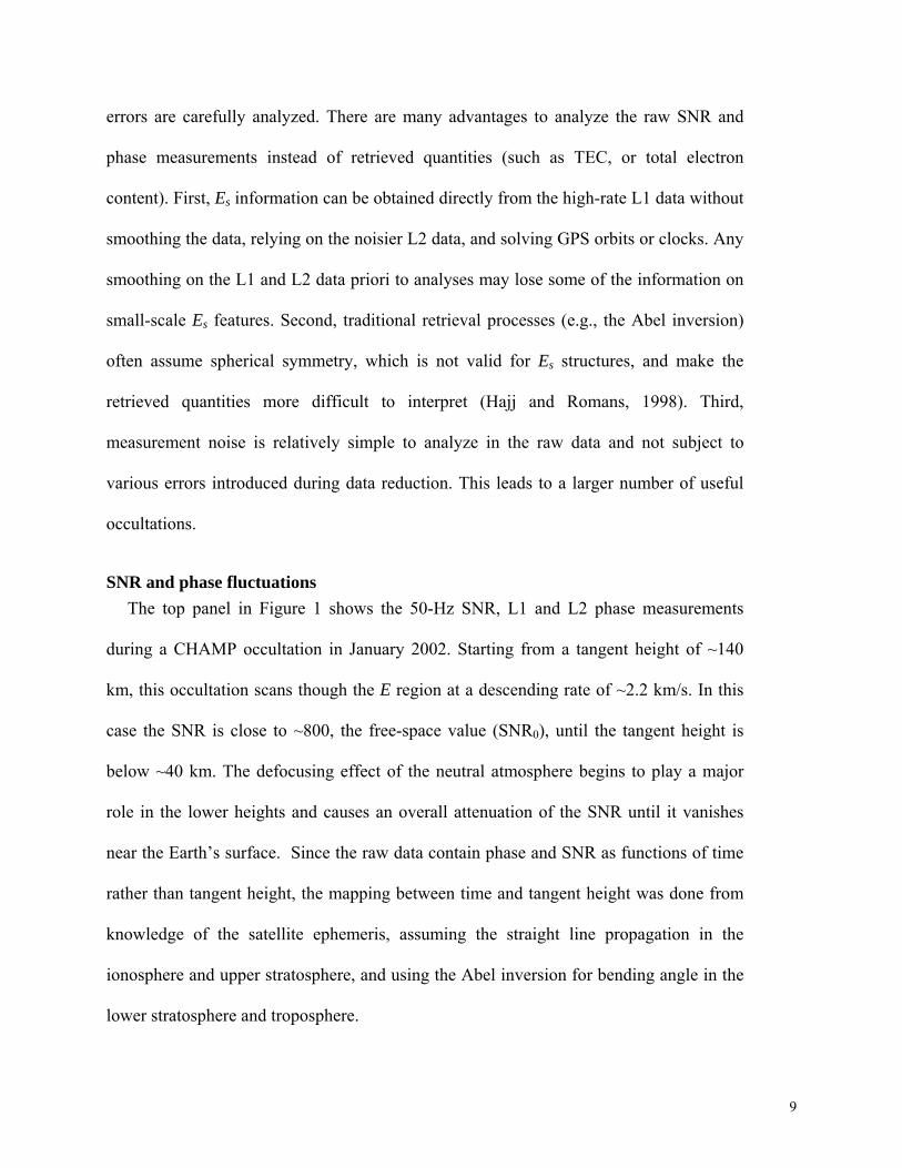
SNR and phase fluctuations The top panel in Figure 1 shows the 50-Hz SNR, L1 and L2 phase measurements
during a CHAMP occultation in January 2002. Starting from a tangent height of ~140
km, this occultation scans though the E region at a descending rate of ~2.2 km/s. In this
case the SNR is close to ~800, the free-space value (SNR0), until the tangent height is
below ~40 km. The defocusing effect of the neutral atmosphere begins to play a major
role in the lower heights and causes an overall attenuation of the SNR until it vanishes
near the Earth’s surface. Since the raw data contain phase and SNR as functions of time
rather than tangent height, the mapping between time and tangent height was done from
knowledge of the satellite ephemeris, assuming the straight line propagation in the
ionosphere and upper stratosphere, and using the Abel inversion for bending angle in the
lower stratosphere and troposphere.
10
The SNR fluctuates slightly about SNR0 above ~50 km for normal quiet ionospheric
conditions but the SNR0 can vary substantially from occultation to occultation, depending
on the viewing angle of the GPS satellite with respect to the LEO antenna. In the normal
cases the L1 and L2 excess delays (corrected for satellite motions and clocks) vary
gradually at tangent heights above ~40 km due to the weak bending by the ionosphere but
increase exponentially below ~40 km due to the strong bending of the neutral
atmosphere. In this example (Figure 1), the excess delays and the SNR exhibit abrupt
variations at tangent heights between 80 and 120 km, which are indicative of sharp
structures in that region.
To extract short-scale SNR and phase perturbations, we first detrend the data with an
N-point running window. This detrending method outputs the difference between the data
sequence and the N-point smoothed sequence as a filtered result. It is an equivalent high-
passed filtering processing where slowly varying or large-scale components are removed.
Because the phase measurements vary exponentially with height, this filtering process is
applied twice when detrending the phase data.
The detrended data are shown in the bottom panel of Figure 1, where the SNR
perturbations are normalized by SNR0. In this case, large oscillations due to Es are clearly
evident in SNR/SNR0 and phase perturbations at tangent heights of 80-120 km. The SNR
perturbations reach as high as 50% while L1 and L2 phase perturbations show maxima of
5 and 8 cm respectively. Both SNR and phase fluctuations reduce substantially at tangent
heights between 30-70 km, where they are mostly dominated by the measurement noise.
In the enhanced Es region, fluctuations can be much greater than the instrument noise. At
tangent heights below ~40 km, fluctuations are complicated by neutral atmospheric

11
variabilities in temperature, pressure and water vapor, and they are outside the scope of
this paper and will be investigated in a separate study.
Es-induced fluctuations in the SNR, L1 and L2 phase measurements exhibit great
coherency in most parts of the Es event [Figure 2]. The correlations between L1 SNR and
phase fluctuations are sometimes complicated by the detailed Es structure but the L1-L2
phase correlations generally obey the frequent-dependence described in Eq.(1) for
electron density perturbations. As shown in the right panels of Figure 2, the L1-L2 phase
fluctuations are linearly correlated with a slope close to (f1/f2)2, where f1 and f2 correspond
to the L1 and L2 frequencies, respectively. An interesting scenario appears at 103-107
km altitudes where L2 phase oscillations lag L1 by ~150 m. This lag manifests itself as
the circular pattern in the L1-L2 phase correlation (right middle panel of Figure 2), which
is likely caused by the frequency-dependent bending associated with sharp vertical
structures of these Es layers. Typically100-500 meters, the bending separation between
L1 and L2 phase measurements depends on the vertical gradient of electron density (Hajj
and Romans, 1998). Because Es layers are often thin, large vertical gradients in electron
density are readily present over a few kilometers and cause a noticeable separation in the
high-rate measurements. By carefully modeling radio waves propagation through highly-
structured media, it is possible to re-construct a high-resolution vertical profile of Es
layers from the 50-Hz SNR and phase measurements (Igarashi et al., 2002; Gorbunov
2002; Ao et al.; 2003).
Sampling and coverage To cover the typical height range of Es phenomena (80-120 km), GPS receivers need
to start tracking at a tangent height above Es layers. During the early CHAMP operation
12
in 2001-2002, occultations did not start sufficiently high to sample the entire Es region.
Figure 3 shows that the high-rate occultations were only as high as ~100-110 km before
February 2002, which was later raised to 140-150 km specifically for Es studies.
Normal CHAMP operation produces 200-250 daily occultations but the number of
profiles in the Level 2 data is significantly less than that in the Level 1 data because of
tighter quality controls needed for the Level 2 retrievals (i.e., density and temperature
profiles in the stratosphere and troposphere). This study uses the SNR and phase data
released in the Level 2 files, which appear to have a sufficient number of profiles for
monthly and seasonal climatologies. In future studies, the algorithm will be modified to
directly use the Level 1 data and hence increase the number of daily occultations.
CHAMP orbit precesses in local time with a rate of ~5.6 min./day at the equator,
sampling a complete 24-h cycle every ~130 days with both ascending and descending
nodes. However, this revisit period is not exactly 130 days since occultations are spread
by ~2 h for each node [Figure 4]. This spreading is caused by nature of the GPS-LEO
occultation geometry and the broad antenna field of view (~70°) that allows the receiver
to view occultations from many directions where GPS satellites may appear. The
spreading in local time is more discrete at the equator than at mid-and-high latitudes.
This spread time coverage causes the effective repeat period (for covering 24-h local
time) to be ~108 days, and therefore helps slightly to reduce aliasing between diurnal and
seasonal variations.
Variance analysis and noise removal The SNR and phase fluctuations contain not only Es perturbations but also
instrument/measurement noise and other ionospheric variations at higher altitudes. The
13
instrument/measurement noise sometimes shows up as spikes in SNR and phase
perturbations, and can vary from occultation to occultation. The deduced variances from
SNR and phase measurements, σ2, can be written as a sum of these sources
2222FEs
σσσσ ε ++= (2)
where 2Esσ , 2
εσ , and 2Fσ are respectively Es, noise, and F-region variances. The noise,
including instrument radiometric and clock errors, may not completely behave as a
random and stationary sequence. Because these errors vary from occultation to
occultation, we must remove them on a profile-by-profile basis. The clock error tends to
generate small periodic spikes in the phase data, contributing significant spectral power at
high frequencies (>10 Hz). To remove these clock spikes, we apply the 3-point high-pass
filter to the phase data and subtract the 3-point filtered sequence from the N-point filtered
one. We refer this process to as the (N, 3) band-pass filtering. As shown in Figure 5, the
(N, 3) band-filter can significantly reduce the noise power at frequencies greater than 10
Hz, and removing the noise is particularly important for the phase variances where Es
amplitudes are weak.
As the standard variance products, we process the 50-Hz SNR and phase data with
several band-pass filters: (401, 3), (201, 3), (101, 3), (51, 3) and (21, 3) to study Es
variabilities at different vertical scales. The noise removal with the 3-point filter also
helps to eliminate possible F-region contaminations (Straus et al. 2003). F-region
fluctuations can generate very noisy measurements over a broad range of tangent heights,
extending above and below the Es region. Profiles are discarded if the averaged 3-point
variance is 20 times greater than its monthly mean at tangent heights above 120 km or
14
between 40 and 80 km. Furthermore, L1 and L2 phase measurements are analyzed
between 40-60 km. Because the L2 phase measurements are noisier than L1, a looser
tolerance is applied for L2 quality control.
For CHAMP occultations, the 51-point truncation corresponds to a vertical scale of
~2.2 km. The vertical scale used in Hocke et al. (2001) is equivalent to the 201-point (or
4 seconds) truncation. However, there are three key differences between our approach
and the one used in Hocke et al. (2001): (a) They did not analyze the SNR data but the
horizontal total electron content (hTEC) deduced from L1-L2 phase differences. (b) They
chose to measure the average rather than the variance of the fluctuations, which may
significantly change the Es strength and morphology. (c) They did not consider
measurement noise or calibration errors in their analysis.
3. Results
Zonal means Monthly mean variances (June 2002 and January 2003) in Figure 6 show clearly that
Es features dominate the summer hemisphere. The maxima in the SNR and phases
fluctuations are aligned with the Es layers and represent approximately the vertical
distribution of Es variability. In the summer hemisphere, Es activities are enhanced
mostly at altitudes of 80-120 km with the peak at ~105 km near 45°S in January and at
~102 km near 45°N in June. The summertime Es variances correlate well with the
background mean zonal wind in latitude, which reaches ~40 m/s in the CIRA'86
climatology. The Es variances in June appear slightly greater in amplitude than those in
January, and occur in a broader height range.

15
Es variances are much weaker but significant in the winter hemisphere as revealed in
CHAMP phase data. Wintertime Es activities occur at latitudes 60° poleward in both
January and June zonal means and the maximum is near ~100 km. Unlike the
summertime variances, which decrease rapidly at altitudes above 110 km, the wintertime
polar variances extend well above 120 km. Equatorial Es variances are generally weak,
confined in a narrow altitude region around 100 km, and may be more prominent in June
than in January. Besides, large variances at lower altitudes (<20 km) reflect sharp
variations of atmospheric refractivity associated with temperature and water vapor
changes in the troposphere.
Seasonal variations Figure 7 shows the daily averages of CHAMP SNR and phase variances for an annual
cycle using data collected between May 2001 and July 2003. Both ascending and
descending samples are used for averaging so as to reduce the aliasing effects from
diurnal variations. However, semidiurnal and seasonally variations can still alias to each
other, which could explain the periodical (~65 days) modulations seen in the seasonal
variations.
As shown in Figure 7, the Es variances exhibit strong seasonal variations at all
latitudes and have slightly different morphologies at 95, 105 and 112 km. Near 95 km,
mid-latitude Es activities in the Northern Hemisphere (NH) last 6 months from April to
October and the largest variance appears in late May and early June. The peak variance
moves in latitude from ~20ºN in April to ~40ºN in June, and back to ~20ºN in August
before shifting to ~40ºN again in September. The NH high-latitude (around 75ºN)
activity prevails in almost all seasons except for the short break in March. The mid-
16
latitude Es activities in the Southern Hemisphere (SH) occur mostly in October and
November with many weaker enhancements spread over other periods (January-
February, April, and September). The SH high-latitude (around 60ºS) variances are
spread between October and February with the most active ones in December and
January.
At 105 km, where the Es variances are strongest, the NH mid-latitude Es shows greater
enhancements during May-August and peaks in mid-June. At the NH high latitudes Es
activity appears mainly in the off-summer months (October-March) and the summertime
activity is diminished compared to the one at 95 km. In the SH the mid- and high-latitude
activities are blurred together during October-March period and weak variances are
present near ~60ºS for the rest of the period. Equatorial Es activities are significant for the
January-February, May-June, and August-October periods.
At 112 km, the seasonal variation of the NH mid-latitude Es varies not only with time
but also with latitude as the maximum shifts from 30ºN in May to ~50ºN in late July. The
strongest variance here occurs in late July and early August, further delayed from the
peak times at the lower heights. The NH high-latitude activity becomes weaker but
remains significant over the period from October to March. The SH Es activities are split
into two periods (November-December and January-February) with the stronger one in
the first period. The equatorial Es in late January and early February remain more
prominent than those during the transition (equinoctial) periods.
Es variance maps The GPS-LEO occultation technique can provide global maps of Es variances, which
are important for studying the dependence of Es on the background winds and the
17
geomagnetic field. Figure 8 shows the 105-km maps of L1 SNR/SNR0 and phase
variances during June-August 2002 (JJA) and December 2002-February 2003 (DJF)
when the summertime Es are maximized. These maps reflect the stationary component of
Es at planetary scales that may be related to the geomagnetic field. Because CHAMP
satellite drifts slowly in local time as mentioned above, the three-month averages can be
contaminated somewhat by fast traveling planetary waves.
In JJA Es irregularities appear strongly in the summer hemisphere, mostly over China,
northwestern Pacific, western United States, northern Atlantic, and southern Europe.
However, they mostly fall into the latitude band where the geomagnetic-field dip angles
are between 30° and 70°. This dip-angle dependence is quite striking for the summertime
activities as they move north and south in latitude following the dip angle changes. The
strong longitudinal variations in the 30º-70º dip angle band can not be simply related to
the geomagnetic field. Other variabilities, such the background winds and ion sources,
must be taken into account. The wintertime Es activities in JJA are weak and coincide
mostly with the dip angles greater than 80°, the region between Australia and Antarctica.
Patchy Es activities are evident in the phase variance at dip angles greater than 80° in the
summer pole. Equatorial Es activities are generally weak and patchy, not showing any
dependence on the geomagnetic equator.
In DJF the strongest summertime Es activity is over southern Pacific with variances as
high as ~(15 %)2 in SNR/SNR0 and ~1.6 cm2 in L1 phase. Other active regions are over
the southern Andes and the east and west Australian coasts. In the region south to Indian
Ocean and South Africa (between 30ºS and 60ºS), there is a weak but significant Es
appearance. Similar to the dip-angle dependence in the JJA season, the strong variances
18
are basically confined to the 20°-60° latitude band, whereas the weak variances occur
almost everywhere in the summer hemisphere. In the winter hemisphere, again, Es
activities become weak and mostly restricted to the region of dip angles greater than 80º.
Diurnal cycle To study the local time variation of Es activity, we use three months of CHAMP data
and average them into each hourly bin. Latitudinal and height dependence of Es diurnal
cycle is of particular interest for studying potential tidal influences because of unique
tidal structures. During the JJA season, the summer mid-latitude Es exhibits a strong
semidiurnal variation at 105 km with peaks around 10:00 and 20:00 LST [Figure 9]. The
semidiurnal variation in the CHAMP variances is generally consistent with ground-based
observations from a number of sites in the NH (Whitehead, 1989). Figure 9 also shows a
downward progression with height at 45ºN in both SNR and phase variances at 70-115
km. Equatorial Es and the wintertime activities, on the other hand, are dominated by a
diurnal variation, showing the peak time between 14:00 and 18:00 LST.
In DJF the diurnal variation dominates summertime Es activities with the maximum
enhancement around 20:00 LST. In the winter hemisphere Es activity is still dominated
by a semidiurnal variation with maximums around 8:00 and 20:00 LST. Equatorial Es is
weak with a diurnal variation and peaks around 18:00 LST. The time-height relation at
45ºS reveals only slight downward progression for the enhancement near 20:00 LST.
4. Simulation of E-region radio occultation scintillations To better understand the SNR and phase variances, we carry out a series of radio wave
propagation calculations using a Multiple Phase Screen (MPS) model to simulate the
SNR and phase fluctuations under observing conditions similar to those in GPS-CHAMP

19
occultations. The simulated SNR and phase fluctuations are analyzed with the same
variance method to study the sensitivity of GPS occultation to layered ionospheric
structures.
Multiple Phase Screen (MPS) model The MPS model in this study uses an effective approach for solving the propagation
properties of radio waves through the atmosphere [Levy, 2000]. It divides the
atmosphere into a series of “phase screens” where the propagating signal is delayed
subsequently by an amount determined from the index of refraction at those locations.
From one phase screen to the next, the wave propagates as if in vacuum. Computational
parameters, including the distance between phase screens as well as the spacing between
discretization points in each phase screen, are adjustable according to the needs for model
resolution.
The MPS model can compute diffraction effects from sub-Fresnel scale structures and
produce accurate amplitude and phase in the presence of atmospheric multipath
structures. It has been widely used for wave scintillation calculations through
atmospheric turbulence (Martin and Flatté, 1988) and is the de facto standard for
simulating GPS occultations. The model and geometric parameters are chosen as in
Sokolovskiy (2001) to ensure that the refractivity structures considered here are
adequately resolved.
Simulations of SNR and phase fluctuations In simulating Es-induced scintillations we insert wave-like refractivity perturbations
near the 100 km altitude and compute signal SNR and phase sequences along the
sampling path similar to the CHAMP instrument. We then calculate the SNR and phase

20
variances using the same method as described in Section 2 for the real data. The SNR and
phase variances are studied against various input perturbation parameters. Of most
important is the variance dependence on the vertical and horizontal perturbation scales.
This property is critical for interpreting the Es variances observed by CHAMP. In the
presence of both horizontally and vertically varying structures, the long LOS path
associated with GPS occultation may impose strong smoothing on the Es layers, making
small-scale and localized layers undistinguishable. Similarly, altitude and orientation of
thin Es layers with respect to the LOS direction can change the variance substantially, all
of which can be investigated in detail with the MPS model.
In the first set of simulations [Figure 11(a)], a packet of perturbing layers (with a
Gaussian envelop) in terms of refractivity are inserted near the ~100 km altitude. All the
perturbing layers have the same horizontal lengths, centered at the tangent point. Three
horizontal lengths (200, 400, 1000 km) and 7 vertical wavelengths (0.1, 0.2, 0.5, 1, 2, 4
and 8 km) used for the sensitivity study, and as an example, the results for 200-km is
shown in Figure 12. For short vertical wavelengths (0.1 and 0.2 km), the MPS model
produces some fuzzy SNR and phase fluctuations at sub-km scales. Note that these
fluctuations are confined mostly in the height region where the perturbation is inserted
with a broader spread in the cases of shorter vertical wavelengths (0.1 and 0.2 km). In
fact, the SNR and phase responses to the Es–like perturbations depend largely on the
vertical wavelength of the layers inserted. Such scale-dependence in SNR and phase
variances, which we call the “observational filter”, is an important property to
characterize the sensitivity of occultation techniques to layered perturbations. For the
cases of horizontal scales of 400 km and 1000 km (not shown), the SNR and phase
21
fluctuations are evident at lower tangent heights due to the extension of thin layers, which
reside quite far away from the tangent point. When Es layers extend uniformly over
several hundred kilometers, spherical symmetry can be applied to retrieve sub-Fresnel
structures of the refractivity perturbations using methods like the canonical transform
[Gorbunov, 2002] or radio holography [Igarashi et al., 2002]. However, the reality is
associated with non-uniform layers with patchy distribution in between. The next set of
simulations illustrates the effects of horizontally-inhomogeneous layers.
In the second group of simulations [Figure 11(b)], we split the perturbing layers into
two parts and place them symmetrically about the tangent point with a gap (~1000 km) in
between. Like the first set of simulations, the packet of perturbations is placed near 100
km altitude. Now, the simulated Es fluctuations appear at the tangent heights below 100
km as the LOS still intersects with these layers when tangent heights are below 100 km.
However, influence of the far-side Es layers on SNR and phase decreases rapidly as the
tangent height descends because the LOS is intersecting these layers at increasing angles
(in other words, causing less diffraction). These simulation results imply that the SNR
and phase variances must be treated with caution as the ambiguity arises from small-scale
inhomogeneous horizontal and vertical structures.
“Observational filters” “Observational filters” also point out limitations associated with the radio occultation
technique in terms of resolving vertical and horizontal scales of Es layers. Compared to
ground-based techniques, which offer good vertical resolution and time coverage, GPS
occultation technique can provide a comparable vertical resolution but coarse horizontal
resolution. To quantify the sensitivity of the SNR and phase measurements to
22
ionospheric fluctuations, we define the “observational filter” as the variance response to
perturbations of different vertical or horizontal scales, and compute these filter functions
from the simulations with the MPS model.
Figure 13 shows the “1-second observational filters” of CHAMP SNR and phase
variances as a function of perturbation vertical wavelength. Because the other input
perturbations are held constant, the variance responses in Figure 13 depict mainly effects
of the perturbation vertical wavelength on the SNR and phase variances. Each of these
filter functions has a characteristic vertical scale where the variance maximizes. In the
SNR case the variance response maximizes for perturbations at a vertical wavelength of
~1.2 km, whereas in the phase case it is ~2 km. It is interesting to note that the
characteristic scale of 1.2 km in the SNR response is insensitive to the truncation length
used (i.e., 51 points), which is very different from the phase variance response. The
characteristic scale of the phase response shifts to a greater vertical wavelength for larger
truncation lengths. Hence, the phase variances can be used to infer the vertical
wavelength spectrum of Es power, which would be an interesting study in the future.
The characteristic scale of “observational filter” is determined by the method used to
compute the variance and by the physical processes (such as focusing/defocusing,
refraction and diffraction effects) affecting radio wave propagation. At small scales, the
SNR and phase variances are controlled by the diffraction effect of the perturbing layers,
which tend to spread the perturbation power to a broader height (or angular) range in the
observing plane, causing both reduced SNR and phase variances. Such spreading effect
can be seen in the 0.2 km case of Figure 12. At large scales, the phase variance is tapered
by the truncation length used in the variance analysis. The characteristic scale of the

23
phase variance is a result of the filtering at both large and small scales, but it increases
with the truncation length as more power is allowed from long wavelengths. On the other
hand, the SNR variances at large scales are determined primarily by the vertical gradient
of refractivity perturbations (Karayel and Hinson, 1997) and depends weakly on the
truncation length used. As a result, the SNR variance decreases with vertical wavelength
(approximately λz-2 if horizontal Es scales are held constant) to yield the unique
characteristic scale of ~1.2 km.
5. Discussions The preliminary Es climatology from CHAMP ratio occultation is generally consistent
with reports from ground-based observations. Global Es variance maps from CHAMP
exhibit clear dependence on the geomagnetic dip angle and the background winds. Most
of the mid-latitude Es variances can be qualitatively explained within the framework of
the classical wind-shear theory (Whitehead, 1961), whereas the high-latitude variances
remain to be investigated thoroughly. More physical modeling work is needed to make
realistic comparisons between the observed and modeled Es morphologies in the mid-
latitudes. In addition to the background winds, impacts from other ionospheric and
atmospheric variables must be considered, including magnetic field orientations, ion-
neutral collision, electric field and ion sources. A simple model for Es layer generation
(Mathews, 1998), which is based on the wind-shear theory but neglecting electric and
eastward magnetic fields, is able to expresses the ion vertical velocity in the form as
follows
( )IUIIVwz cossincos1
12 γ
γ+
+= (2)
24
where γ is the ratio of ion-neutral collision frequency to ion gyro-frequency, I is the
geomagnetic dip angle, U and V are the background zonal and meridional winds. It is
generally believed that the zonal (meridional) wind is more efficient to affect ion motions
at altitudes below (above) ~130 km as the ratio γ becomes greater (smaller) than unity.
Nevertheless, γ can vary largely with height at 100-150 km altitudes as well as with
latitude. Such transition is evident in global model simulations with realistic background
winds (Carter and Forbes, 1999).
The dip-angle dependent Es variances from CHAMP suggest that the influence of the
meridional wind might extend far below 130 km. As seen in both DJF and JJA seasons,
the Es variances appear to maximize near │I│=45º, which agrees with the maximum
produced from the first term in (2). In other words, the geomagnetic-field-controlled
conductivity may play a dominant role in the formation of Es layers. In addition, the local
time variation of these variances seems also consistent with the strong influence of the
background meridional wind. The 10:00 and 20:00 LST peaks is in phase with the
semidiurnal nodes of the meridional wind at 105 km (Zhang et al., 2003), which indicates
that the semidiurnal tide might play a direct role in modulating the Es layers at 100 km.
However, the global model simulations (Carter and Forbes, 1999) did not show the
extended influence of the semidiurnal tide at 100 km where only a diurnal variation is
present. Clearly, the CHAMP observations can be used as strong constraints on these
physical models to refine the mechanisms that control Es. Our speculation about the
semidiurnal tidal modulation in the Es variances is a simplistic explanation and does not
consider potential influences from other variables, such as electric field and eastward
component of the geomagnetic field.

25
Above ~110 km the Es variances from CHAMP reduce sharply at summertime mid-
latitudes, implying a lack of layered electron density structures at 110-140 km (the
nominal top of occultation profiles). A question immediately arises regarding the so-
called intermediate layer, a descending ion layer from the bottom F region and often
observed in Arecibo and other radar data (e.g., Mathews et al., 1993). Some numerical
models have reproduced these descending layers by imposing tidal-like modulations in
the background winds (Earle et al., 1998; Carter and Forbes, 1999). However, the
signatures of these descending ion layers are absent in CHAMP Es variances. One
explanation is that these intermediate layers might be so transient, lacking stability and
coherency (over 10s-100s of kilometers) to produce scintillations in the CHAMP data. As
indicated in radar observations, these intermediate layers exhibit various stabilities and
tend to fluctuate frequently over a much shorter time scale while descending. Thus, the
occultation technique may not be suitable for observing electron density fluctuations
associated with these intermediate layers.
For the similar reason, small-scale field-aligned perturbations, like those due to gravity
wave perturbations, are difficult for the GPS occultation technique to detect. As observed
in ground-based radar echoes, these field-aligned oscillations are often embedded in Es
layers and have horizontal scales of 10s of km and temporal scales of minutes. The long
LOS path of GPS occultation will likely smear out most fluctuations of these kinds.
CHAMP orbit is not ideal for sampling diurnal variations because of the long
revisiting period (108 days). The CHAMP sampling can hardly resolve the aliasing
between seasonal and diurnal/semidiurnal variations. In studying the diurnal variation, we
carefully chose a period when the Es variances are large and relatively stable over a three-
26
month period. This allowed us to deduce the semidiurnal variation without being
significantly influenced by the seasonal variation. However, the strong
diurnal/semidiurnal variations become a problem when studying the seasonal variations,
causing an artificial modulation in the latter due to the CHAMP sampling cycle [Figure
7]. Combining the measurements from ascending and descending orbits helps reducing
impacts of the diurnal variation but does little correction for influences from the
semidiurnal variation (the dominant component of Es). Multi-year averaging may remove
some of the semidiurnal influence on the seasonal variation by taking advantages of
uncorrelated semidiurnal phases from year to year. An effective way to improve local
time sampling is to combine existing SAC/C (Sun-synchronous) and CHAMP
measurements. Complete removal of the aliasing between the seasonal and semidiurnal
variations requires a better sampling which will become available with future missions
such as COSMIC (6 satellites) or EQUARS (low-inclination with rapid precession).
Finally, CHAMP Es variances in the enhanced regions are often significantly greater
than the instrument/measurement noise. However, the noise treatment with the (51, 3)
truncation in the variance analysis is proven useful in detecting weak Es variances. By
removing large spikes from clock errors, the Es variance maps have showed fewer patchy
spots and more consistent patterns between the SNR and phase results.
6. Summary and Future Work In this paper we described a novel variance analysis on the 50-Hz SNR and phase
measurements from satellite radio occultation. The method is applied to GPS/CHAMP
data and produces new information on global Es morphology. The important results are
summarized as follows:

27
1. The 51-point (or 1-second) variances from CHAMP SNR and phase data reveal
strong Es enhancements at summertime mid-latitudes. The maximum Es variance
appears at ~105 km near 45°S in January 2003 and ~102 km near 45°N in June
2002.
2. The seasonal variation of the Es variances shows a height-dependent morphology.
The time when the variance peaks is delayed slightly at higher altitudes in the NH
summer.
3. Global Es variance maps show strong dependence of the Es strength on the
geomagnetic dip angle at 105 km. The summertime mid-latitude Es occurs mostly at
│I│= 30-60º while the wintertime polar Es occurs at │I│> 80º.
4. CHAMP also observes a strong semidiurnal variation in the mid-latitude Es
variances with peak hours around 8:00-10:00 and 20:00 LST at 100 km for the JJA
season. The peak hours are delayed as height decreases and the 20:00 LST variance
maximum extends to a slightly lower height. For the DJF season the summertime Es
enhancement is dominated by a diurnal variation with the peak hour near 20:00
LST.
5. Simulations using a radio-wave propagation model suggest that the SNR and phase
variances have different characteristics in the “observational filter” for Es–induced
perturbations. The SNR variance has the maximum response at a vertical scale of
~1.2 km, and this characteristic scale is nearly independent of the truncation length
used. On the other hand, the characteristic vertical scale of the phase variance
increases with the truncation length, varying from 2 km in 51-point truncation to 8
km in 201-point truncation.

28
The initial results from GPS/CHAMP occultation reveal great potentials for observing
global Es phenomena. We anticipate more exciting results from other existing and
upcoming GPS occultation missions, including SAC-C, GRACE, and COSMIC. With the
improved global coverage and sampling (~250 occultations/antenna), the seasonal and
diurnal variations of Es can be fully resolved, along with the dependence on geomagnetic
field and background winds. Studies similar to this variance analysis can be readily
extended to other GPS occultation measurements, and the joint analysis with the recent
wind measurements from TIMED satellite will be very useful for understanding the role
of the background winds. Global Es observations from GPS radio occultation now raise
many challenging issues for current Es theory and models. The reliable statistics of global
Es morphology will add strong constraints on the mechanisms responsible for Es
generation and variations.
7. Acknowledgments We would like to thank Tom Meehan and Byron Iijima for modifying CHAMP
operation algorithm to enable Es observations at high tangent heights. This research was
performed at the Jet Propulsion Laboratory, California Institute of Technology, under
contract with the National Aeronautics and Space Administration (NASA).
Reference:
Ao, C. O., et al. , 2003. Lower troposphere refractivity bias in GPS occultation retrievals, J. Geophys.
Res., 108, 4577, doi:10.1029/2002JD003216.
Baggaley, W. J., 1984. Ionospheric sporadic-E parameters: longterm trends, Sicence, 225, 830.
29
Carter, L. N., and J. M. Forbes, 1999. Global transport and localized layering of metallic ions in the upper
atmosphere, Ann. Geophys., 17, 190 –209.
Coco, D. S., T. L. Gaussiran II, and C. Coker, 1995. Passive detection of sporadic E using GPS phase
measurements, Radio Sci., 30, 1869-1874.
Earle, G. D., R. L. Bishop, Q. H. Zhou, and S. P. Wallace, 1998. A comparative study of in-situ and
remote intermediate layer measurements against wind model predictions of vertical ion drift, J Atmos.
Solar-Terr. Phys., 60, 1313-1330.
Fukao S, Yamamoto M, Tsunoda RT, Hayakawa H, Mukai T, 1998. The SEEK (sporadic-E experiment
over Kyushu) campaign, GEOPHYS. RES. LETTS. 25 (11): 1761-1764.
Gorbunov, M. E., 2002. Canonical transform method for processing radio occultation data in the lower
troposphere. RADIO SCIENCE, 37 (5), art. no. 1076, doi:10.1029/2000RS002592.
Hajj, G. A., and L. J. Romans, 1998. Ionospheric electron density profiles obtained with the Global
Positioning System: Results from the GPS/MET experiment, Radio Sci., 33, 175-190.
Hajj, GA, et al., 2002a. A technical description of atmospheric sounding by GPS occultation, J. Atmos.
Sol. Terr. Phys., 64, 451-469.
Hajj, G. A., et al., 2002b CHAMP and SAC-C Atmospheric Occultation Results and Intercomparisons, J.
Geophys. Res., in press.
Hocke, K. et al. , 2001. Global sounding of sporadic E layers by the GPS/MET radio occultation
experiment, J. Atmos. Solar-Terr. Phys., 63, 1973-1980.
Hocke, K. and T. Tsuda, 2001. Gravity waves and ionospheric irregularities over tropical convection
zones observed by GPS/MET radio occultation, GEOPHYS. RES. LETT. 28 (14): 2815-2818.
Hocke K., K. Igarashi, and A. Pavelyev, 2002. Irregularities of the topside ionosphere observed by
GPS/MET radio occultation, RADIO SCI. 37 (6): art. no. 1101.
Igarashi, K, A. Pavelyev, J. Wickert, et al., 2002. Application of radio holographic method for
observation of altitude variations of the electron density in the mesosphere/lower thermosphere using
GPS/MET radio occultation data, J. ATMOS. SOL-TERR. PHY. 64 (8-11): 959-969..

30
Karayel, E. T. and D. P. Hinson, 1997. Sub-Fresnel-scale vertical resolution in atmospheric profiles from
radio occultation. Radio Sci., 32, 411-423.
Kelly, M. S., 1989, The earth's ionosphere, International Geophys. Series 43, Academic Press.
Kursinski, et al., 1997. Observing Earth's atmosphere with radio occultation measurements using the
Global Positioning System, J. Geophys. Phys., 102, 23429-23465.
Levy, M., 2000. Parabolic Equation Methods for Electromagnetic Wave Propagation. The Institution of
Electrical Engineers, London.
Maksyutin, S. V., O. N. Sherstyukov, and A. N. Fahrutdinova, 2001. Dependence of sporadic-E layer and
lower thermosphere dynamics on solar activity. Adv. Space Res., 27, 1265-1270.
Martin, J. M., and S. M. Flatte, 1988. Intensity images and statistics from numerical simulation of wave
propagation in 3-D random media, Applied Optics, vol. 27, no. 11, pp. 2111--2126.
Mathews, J. D., 1998. Sporadic E: current views and recent progress, J. Atmos. Terr. Phys., 60, 413-435.
Mathews, J. D., Y. T. Morton, and Q. Zhou, 1993. Observations of ion layer motions during the AIDA
Campaign, J. Atmos. Terr. Phys., 55, 447–457.
Pancheva D., C. Haldoupis, C. E. Meek, A. H. Manson, and N. J. Mitchell, 2003. Evidence of a role for
modulated atmospheric tides in the dependence of sporadic E layers on planetary waves. J.
GEOPHYS. RES. 108 (A5): art. no. 1176.
Sokolovskiy, S. V., 2001. Modeling and inverting radio occultation signals in the moist troposphere,
Radio Sci., 36, no. 3, pp. 441--458.
Spilker, J. J., 1980. GPS signal structure and performance characteristics, Global Positioning System,
Institute of Navigation, Washington, D.C., pp.29-54.
Straus, P. R., P. C., Anderson, and J. E. Danaher, 2003. GPS occultation sensor observations of
ionospheric scintillation. GEOPHYS RES LETT 30 (8): art. no. 1436.
Tsunoda, R. T., S. Fukao, and M. Yamamoto, 1994. On the origin of quasi-periodic radar backscatter
from mid-latitude sporadic-E, Radio Sci., 29, 349.
31
Tsunoda, R. T., and R. B. Cosgrove, 2001. Coupled electrodynamics in the nighttime midlatitude
ionosphere, Geophys. Res. Lett., 28, 4171-4174.
Ware, R. et al., 1996. GPS sounding of the atmosphere from low Earth orbit: Preliminary results, Bull.
Am. Meteor. Soc., 77, 19-40.
Whitehead, J. D., 1961. The formation of the Sporadic-E layer in the temperate zones, J. Atmos. Terr.
Phys., 20, 49– 58.
Whitehead, J. D., 1989. Recent work on mid-latitude and equatorial sporadic E. J. Atmos. Terr. Phys., 51,
401-424.
Wickert, J. et al., 2001. Atmosphere sounding by GPS ratio occultation: First results from CHAMP.
Geophys. Res. Lett., 28, 3263-3266.
Wu, D. L., and J. W. Waters, 1996. Satellite observations of atmospheric variances: A possible indication
of gravity waves, Geophys. Res. Lett, 23, 3631-3634.
Zhang, S. P., et al., 2003. Climatology of neutral winds in the lower thermosphere over Millstone Hill
(42.6°N) observed from ground and from space, J. Geophs. Res., 108, NO. A1, 1051, doi:
10.1029/2002JA009512.
32
Figure Captions
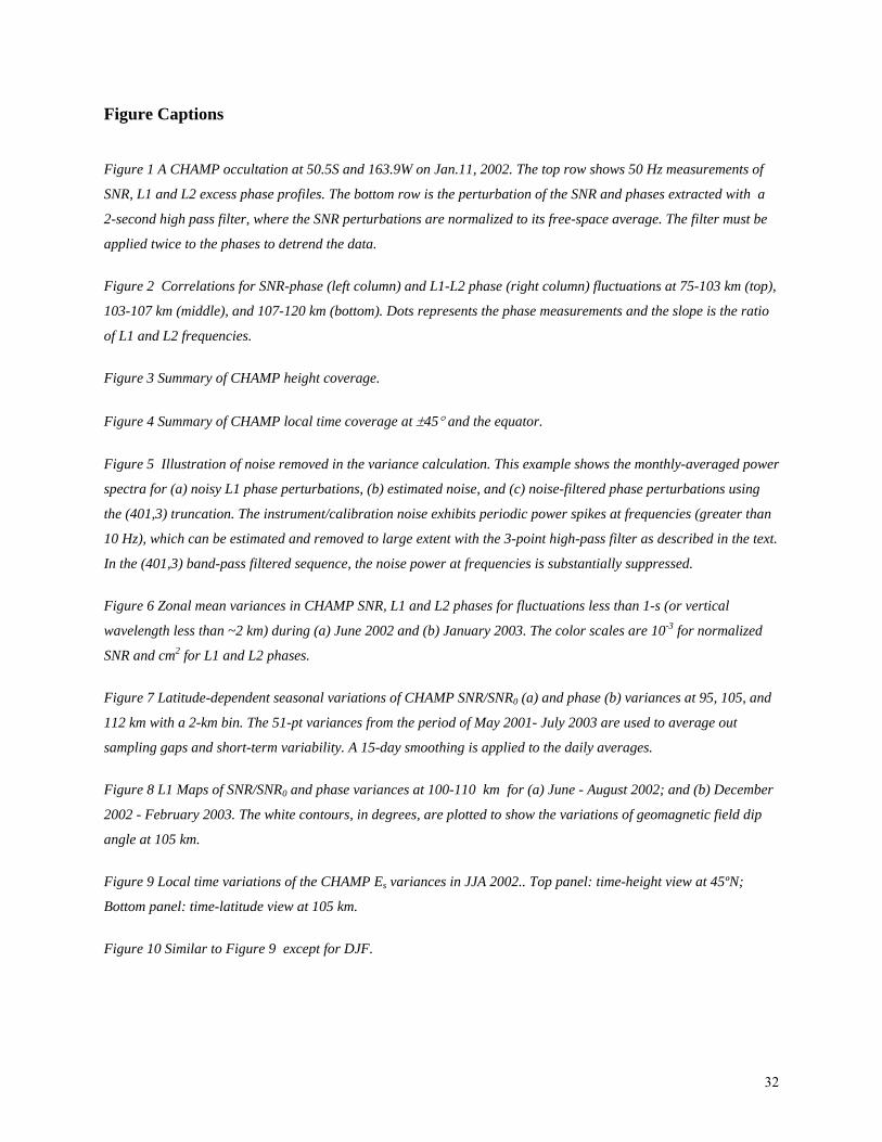
Figure 1 A CHAMP occultation at 50.5S and 163.9W on Jan.11, 2002. The top row shows 50 Hz measurements of
SNR, L1 and L2 excess phase profiles. The bottom row is the perturbation of the SNR and phases extracted with a
2-second high pass filter, where the SNR perturbations are normalized to its free-space average. The filter must be
applied twice to the phases to detrend the data.
Figure 2 Correlations for SNR-phase (left column) and L1-L2 phase (right column) fluctuations at 75-103 km (top),
103-107 km (middle), and 107-120 km (bottom). Dots represents the phase measurements and the slope is the ratio
of L1 and L2 frequencies.
Figure 3 Summary of CHAMP height coverage.
Figure 4 Summary of CHAMP local time coverage at ±45° and the equator.
Figure 5 Illustration of noise removed in the variance calculation. This example shows the monthly-averaged power
spectra for (a) noisy L1 phase perturbations, (b) estimated noise, and (c) noise-filtered phase perturbations using
the (401,3) truncation. The instrument/calibration noise exhibits periodic power spikes at frequencies (greater than
10 Hz), which can be estimated and removed to large extent with the 3-point high-pass filter as described in the text.
In the (401,3) band-pass filtered sequence, the noise power at frequencies is substantially suppressed.
Figure 6 Zonal mean variances in CHAMP SNR, L1 and L2 phases for fluctuations less than 1-s (or vertical
wavelength less than ~2 km) during (a) June 2002 and (b) January 2003. The color scales are 10-3 for normalized
SNR and cm2 for L1 and L2 phases.
Figure 7 Latitude-dependent seasonal variations of CHAMP SNR/SNR0 (a) and phase (b) variances at 95, 105, and
112 km with a 2-km bin. The 51-pt variances from the period of May 2001- July 2003 are used to average out
sampling gaps and short-term variability. A 15-day smoothing is applied to the daily averages.
Figure 8 L1 Maps of SNR/SNR0 and phase variances at 100-110 km for (a) June - August 2002; and (b) December
2002 - February 2003. The white contours, in degrees, are plotted to show the variations of geomagnetic field dip
angle at 105 km.
Figure 9 Local time variations of the CHAMP Es variances in JJA 2002.. Top panel: time-height view at 45ºN;
Bottom panel: time-latitude view at 105 km.
Figure 10 Similar to Figure 9 except for DJF.
33
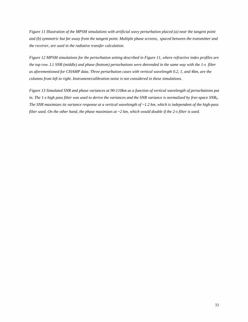
Figure 11 Illustration of the MPSM simulations with artificial wavy perturbation placed (a) near the tangent point
and (b) symmetric but far away from the tangent point. Multiple phase screens, spaced between the transmitter and
the receiver, are used in the radiative transfer calculation.
Figure 12 MPSM simulations for the perturbation setting described in Figure 11, where refractive index profiles are
the top row. L1 SNR (middle) and phase (bottom) perturbations were detrended in the same way with the 1-s filter
as aforementioned for CHAMP data. Three perturbation cases with vertical wavelength 0.2, 1, and 4km, are the
columns from left to right. Instrument/calibration noise is not considered in these simulations.
Figure 13 Simulated SNR and phase variances at 90-110km as a function of vertical wavelength of perturbations put
in. The 1-s high pass filter was used to derive the variances and the SNR variance is normalized by free-space SNR0.
The SNR maximizes its variance response at a vertical wavelength of ~1.2 km, which is independent of the high-pass
filter used. On the other hand, the phase maximizes at ~2 km, which would double if the 2-s filter is used.