Embed Size (px)
Citation preview
Specific parameterization of a boreal forest for a3-D radiative transfer modeling approach based
on imaging spectrometer data and highresolution LIDAR data
Koetz, B.a*, Morsdorf, F. a, Schaepman, M. b, Meier, E. a, Itten, K. a, and Allgoewer, B. c
a Remote Sensing Laboratories (RSL), Dept. of Geography, University of Zurich, Winterthurerstrasse190, CH-8057 Zurich, Switzerland, Email: [email protected] Centre for Geo-Information, Wageningen University and Research Centre, Droevendaalsesteeg 3,NL-6708 PB Wageningen, The Netherlands,c Geographic Information Systems, Dept. of Geography, University of Zurich, Winterthurerstrasse 190,CH-8057 Zurich, Switzerland
Coniferous forests represent canopies with a high heterogeneity in the horizontal andas well in the vertical dimension. Consequently the interaction of incident radiation isdominated by the complex 3-D canopy structure and architecture. Radiative transferapproaches based on coupled leaf and canopy radiative transfer models (RTM) stillallow the simulation of the multi-directional canopy reflectance as a function of leafoptical properties, canopy structure and viewing geometry as well as the retrieval ofbiophysical and biochemical canopy variables.High resolution imaging spectrometry supported by LIDAR data and the complex 3-Dradiative transfer model FLIGHT (1) are employed to assess the influence of canopyheterogeneity and structure on canopy reflection. Exhaustive ground measurements ofbiochemical and biophysical parameters combined with the geometry of single treesderived from LIDAR data provide the possibility of a realistic scene parameterizationof a boreal forest in Switzerland.This study is based on an extensive field campaign in the Swiss National Park (SNP)during summer 2002 (2). Unique ground based characterization of the canopystructure, biochemistry and optical properties of the canopy elements were conductedusing various instruments, ranging from non-destructive spectroradiometricmeasurements to dry biomass estimation of needles. The field data have beencollected on four core test sites each subdivided in 9 plots spaced in a grid of 10meters. For the presented study we selected two test sites (LWF1 and STA1)representing different canopy densities. The imaging spectrometer data were acquiredin parallel to the ground measurements with the imaging spectrometer DAIS. Theimaging spectrometer data were geo-atmospherically processed to obtain geocodedtop-of-canopy reflectance. In October 2002 also an airborne LIDAR survey of the testsite in the Swiss National Park was carried out to derive structural forest parameters.The sensor used was the FALCON, a push-broom laser altimeter operated by thecompany Toposys. This system recorded more than 30 points per m2 with a footprintsize of about 60 cm in diameter. The segmentation of the single LIDAR returns intotree crowns allowed for the retrieval of the geometric properties of single trees, suchas tree position, height, crown radius and crown height.The 3-D radiative transfer model FLIGHT coupled to the leaf model PROSPECT (3)is employed to simulate multi-directional and hyperspectral canopy reflectance.FLIGHT is able to explicitly represent the complex scene of a heterogeneous forest bytaking into account the geometry of single trees composing the scene, as provided by
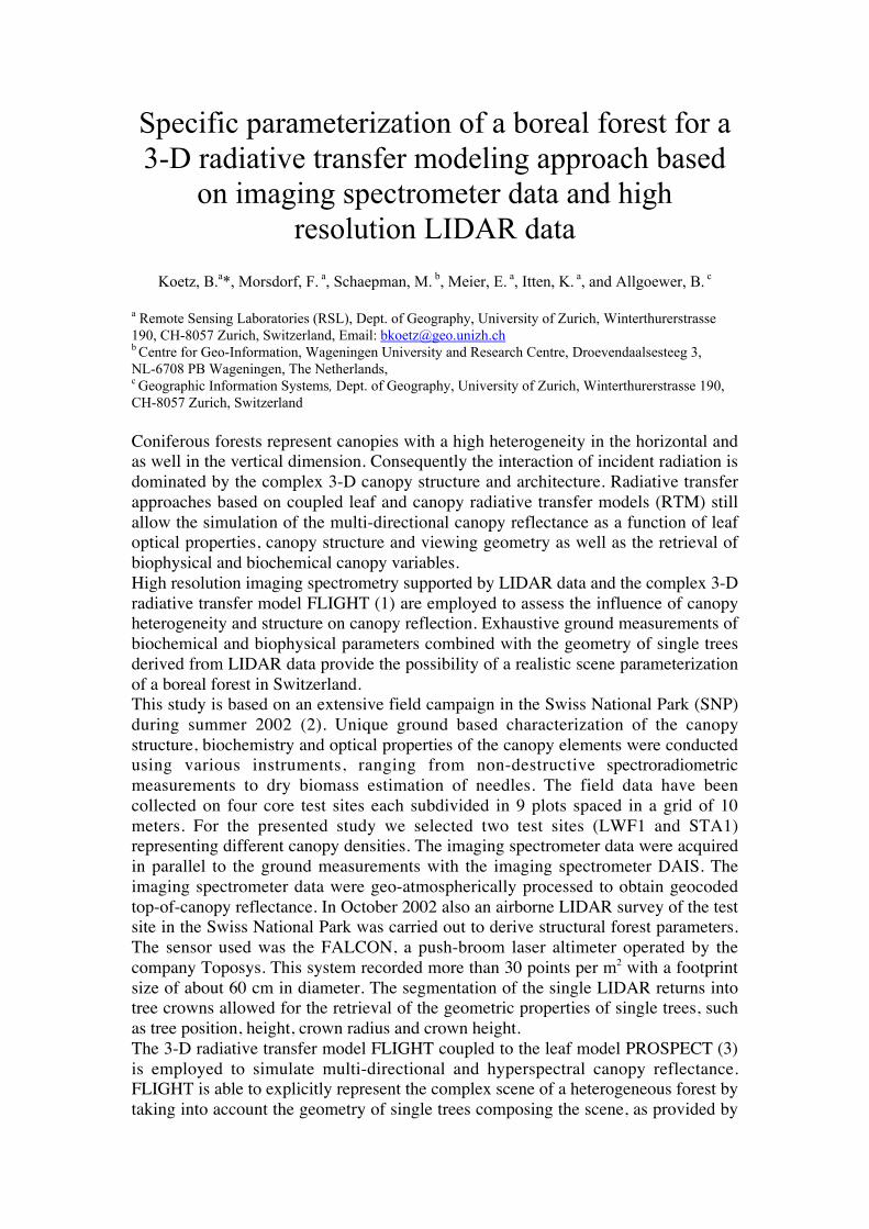
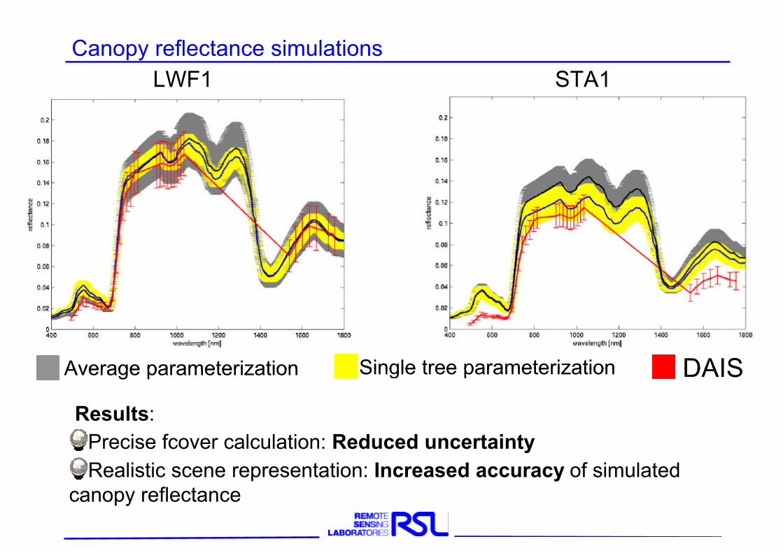
the LIDAR data set (cf., Fig.1a). The reconstruction of the observed forest scenebased on the LIDAR derived tree geometry allowed consequently to consider theactual canopy structure as well as the detailed heterogeneity of the canopy within theradiative transfer. Important processes as for example shadowing of the background,mutual crown shadowing and multiple scattering between crowns could be soexplicitly described (4).Canopy reflectance has been extracted from the imaging spectrometry data over thearea (30x30 m2) of the two selected test sites LWF1 and STA1 and has been averagedto represent the complete scene of the respective site. Subsequently canopyreflectance for the two sites have been simulated by the coupled RTM taking intoaccount an average scene as well as an explicit scene representation. The comparisonof simulated and measured canopy reflectance revealed a reasonable performance ofthe radiative transfer model for both scene representations confirming the appropriatechoice of the RTM relative to the complexity of canopy structure. The explicit scenerepresentation still could improve significantly the accuracy and uncertainty ofsimulated canopy reflectance relative to the average scene representation (cf., Fig.1b).The presented study demonstrated the potential of the combination of high resolutionimaging spectrometry and LIDAR data to data to map forest canopy parameters. Wealso provided a strategy to resolve explicitly the heterogeneity of a coniferous forestscene, which will lead to more reliable and robust RTM retrieval algorithms.
Figure1: a) Nadir view of the explicit geometric representation of the scenes LWF1 and STA1 b) Mean canopy reflectance and associated uncertainties of the scenes LWF1 andSTA1 (DAIS: red, average scene: black/grey, explicit scene: blue/yellow)
(1) PRJ North: Three-dimensional forest light interaction model using a Monte Carlo method. Ieee Transactions onGeoscience and Remote Sensing 34 (1996) 946-56.
(2) B Kötz, M Schaepman, F Morsdorf, P Bowyer, K Itten, B Allgöwer: Radiative Transfer Modeling within aHeterogeneous Canopy for Estimation of Forest Fire Fuel Properties. Remote Sensing of Environment (submitted).
(3) S Jacquemoud, SL Ustin, J Verdebout, G Schmuck, G Andreoli, B Hosgood: Estimating leaf biochemistry using thePROSPECT leaf optical properties model. Remote Sensing of Environment 56 (1996) 194-202.
(4) FF Gerard, PRJ North: Analyzing the effect of structural variability and canopy gaps on forest BRDF using ageometric-optical model. Remote Sensing of Environment 62 (1997) 46-62.
Specific parameterization of a boreal forest for a 3-D radiative transfer modeling approach based on imaging spectrometer data and high resolution LIDAR data
B. Kötz, F. Morsdorf, M. Schaepman, E. Meier, K. Itten, and B. Allgöwer
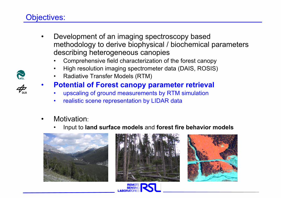
• Development of an imaging spectroscopy based methodology to derive biophysical / biochemical parameters describing heterogeneous canopies• Comprehensive field characterization of the forest canopy• High resolution imaging spectrometer data (DAIS, ROSIS)• Radiative Transfer Models (RTM)
• Potential of Forest canopy parameter retrieval• upscaling of ground measurements by RTM simulation• realistic scene representation by LIDAR data
• Motivation:• Input to land surface models and forest fire behavior models
Objectives:
Radiative Transfer Modeling within heterogeneous canopies
Data basis–field data–Imaging Spectrometry data–LIDAR data
RTM–FLIGHT parameterization–scene reconstruction–forward simulation
Conclusion / Outlook
Overview
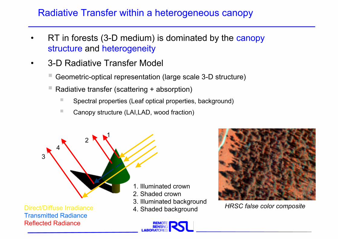
Radiative Transfer within a heterogeneous canopy
• RT in forests (3-D medium) is dominated by the canopy structure and heterogeneity
• 3-D Radiative Transfer Model§ Geometric-optical representation (large scale 3-D structure)
§ Radiative transfer (scattering + absorption)
§ Spectral properties (Leaf optical properties, background)
§ Canopy structure (LAI,LAD, wood fraction)
Direct/Diffuse IrradianceTransmitted RadianceReflected Radiance
12
43
1. Illuminated crown2. Shaded crown3. Illuminated background4. Shaded background HRSC false color composite
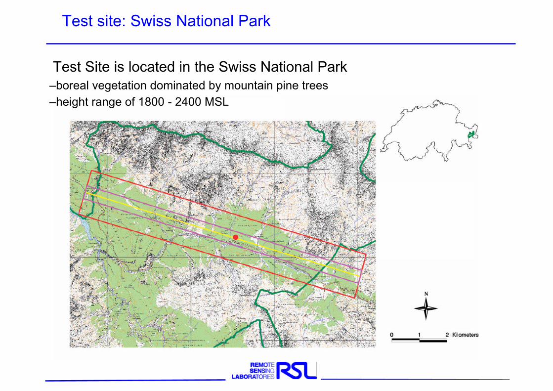
Test site: Swiss National Park
Test Site is located in the Swiss National Park–boreal vegetation dominated by mountain pine trees –height range of 1800 - 2400 MSL
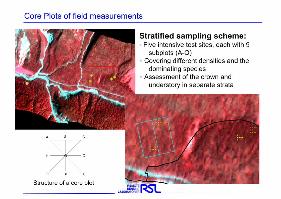
Structure of a core plot
Stratified sampling scheme:§ Five intensive test sites, each with 9
subplots (A-O)§ Covering different densities and the
dominating species § Assessment of the crown and
understory in separate strata
Core Plots of field measurements
A B C
D
EFG
H O
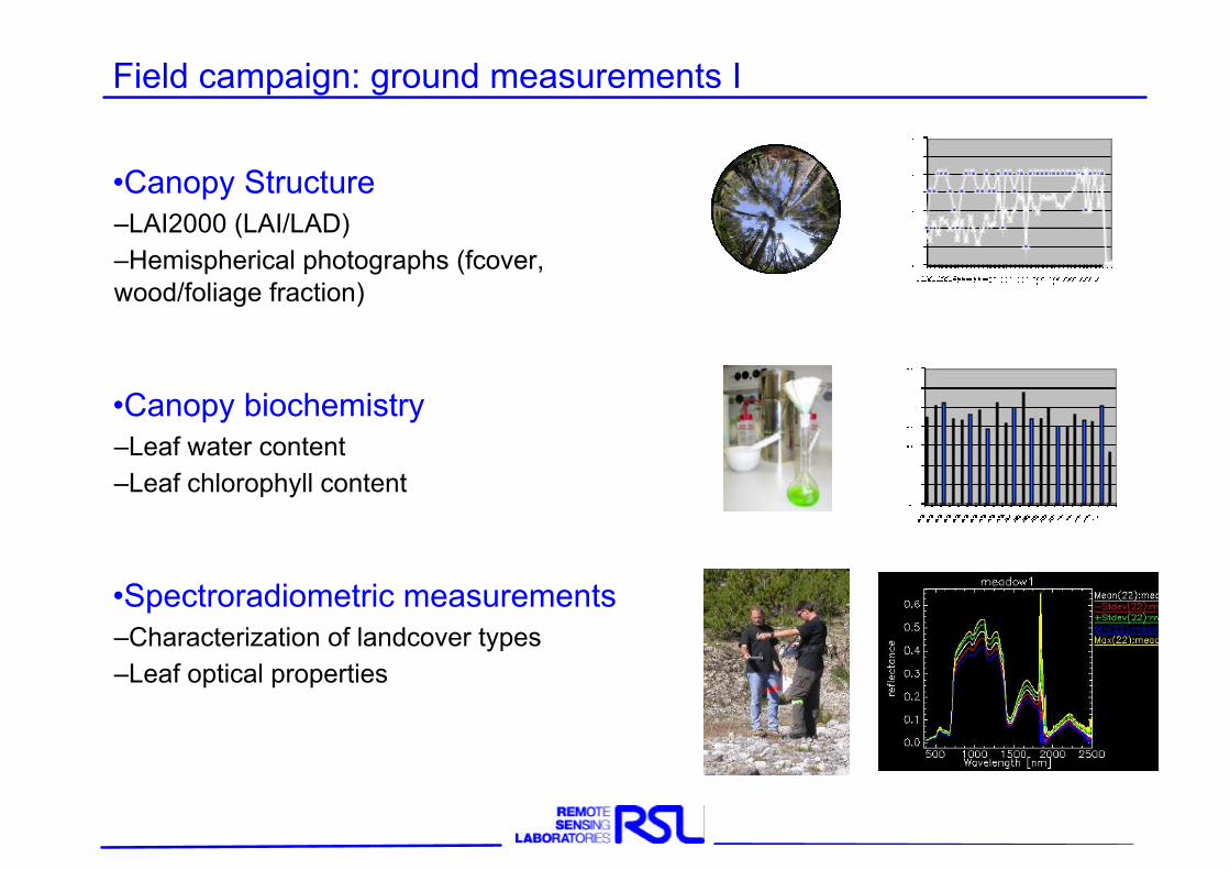
•Canopy Structure–LAI2000 (LAI/LAD)–Hemispherical photographs (fcover, wood/foliage fraction)
•Canopy biochemistry–Leaf water content–Leaf chlorophyll content
•Spectroradiometric measurements–Characterization of landcover types–Leaf optical properties
Field campaign: ground measurements I
1 2
3
4
5
6
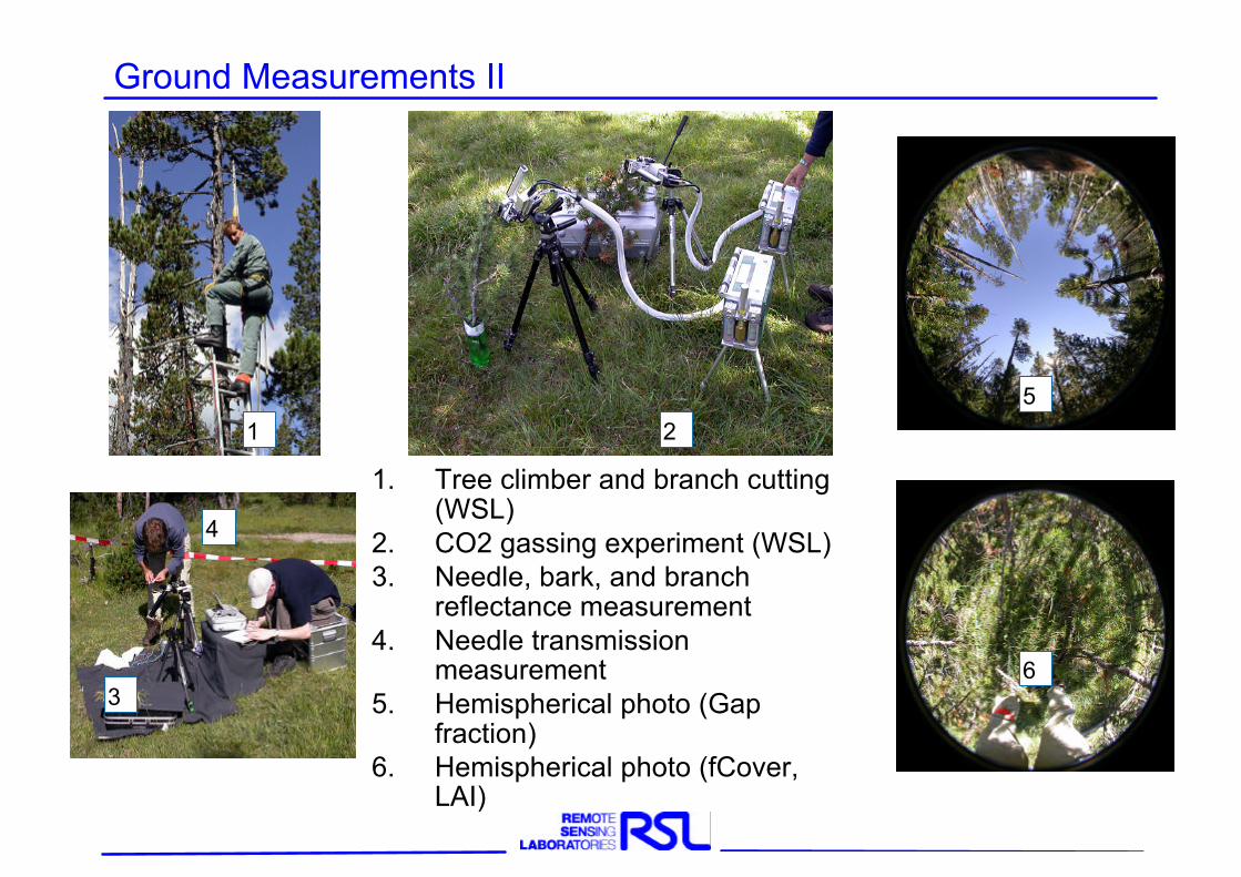
Ground Measurements II
1. Tree climber and branch cutting (WSL)
2. CO2 gassing experiment (WSL)3. Needle, bark, and branch
reflectance measurement4. Needle transmission
measurement5. Hemispherical photo (Gap
fraction)6. Hemispherical photo (fCover,
LAI)
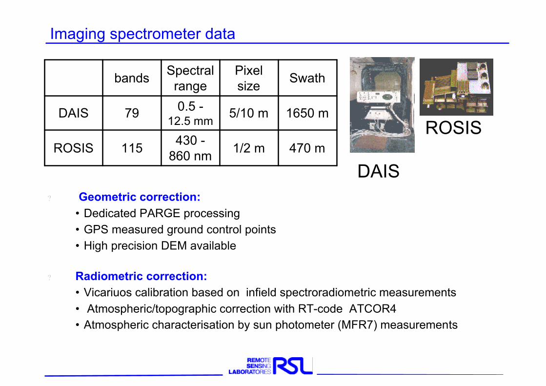
Imaging spectrometer data
? Geometric correction: • Dedicated PARGE processing • GPS measured ground control points• High precision DEM available
? Radiometric correction:• Vicariuos calibration based on infield spectroradiometric measurements• Atmospheric/topographic correction with RT-code ATCOR4• Atmospheric characterisation by sun photometer (MFR7) measurements
DAIS
ROSIS
bands Spectral range
Pixel size
Swath
DAIS 79 0.5 -12.5 mm
5/10 m 1650 m
ROSIS 115 430 -860 nm 1/2 m 470 m
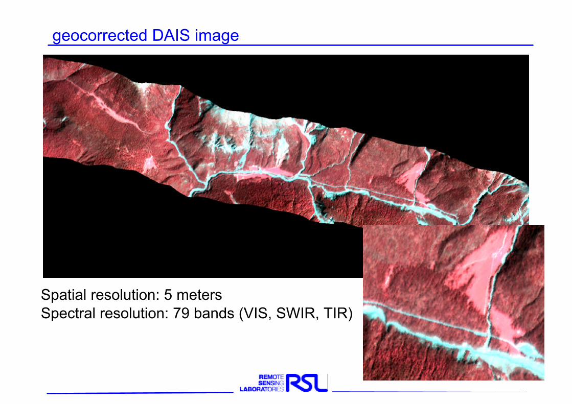
geocorrected DAIS image
Spatial resolution: 5 metersSpectral resolution: 79 bands (VIS, SWIR, TIR)
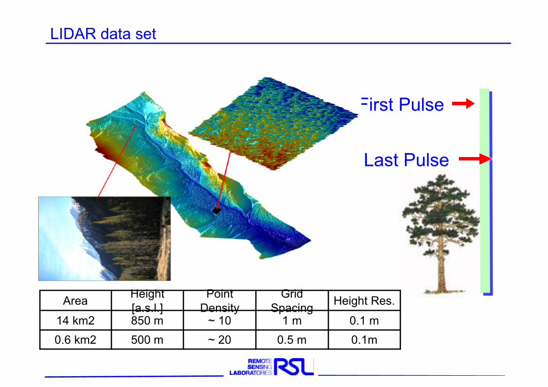
LIDAR data set
Field Data Site
First Pulse
Last Pulse
Area Height [a.s.l.]
Point Density
Grid Spacing
Height Res.
14 km2 850 m ~ 10 1 m 0.1 m
0.6 km2 500 m ~ 20 0.5 m 0.1m
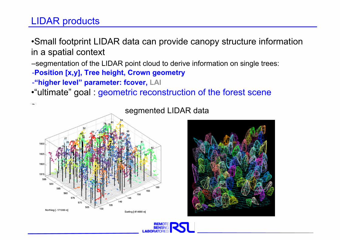
•Small footprint LIDAR data can provide canopy structure information in a spatial context–segmentation of the LIDAR point cloud to derive information on single trees:-Position [x,y], Tree height, Crown geometry-“higher level” parameter: fcover, LAI•“ultimate” goal : geometric reconstruction of the forest scene
LIDAR products
segmented LIDAR data
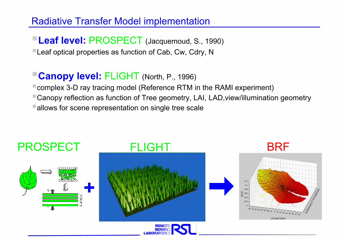
§Leaf level: PROSPECT (Jacquemoud, S., 1990)§Leaf optical properties as function of Cab, Cw, Cdry, N
§Canopy level: FLIGHT (North, P., 1996)§complex 3-D ray tracing model (Reference RTM in the RAMI experiment)§Canopy reflection as function of Tree geometry, LAI, LAD,view/illumination geometry§allows for scene representation on single tree scale
Radiative Transfer Model implementation
PROSPECT FLIGHT BRF
+
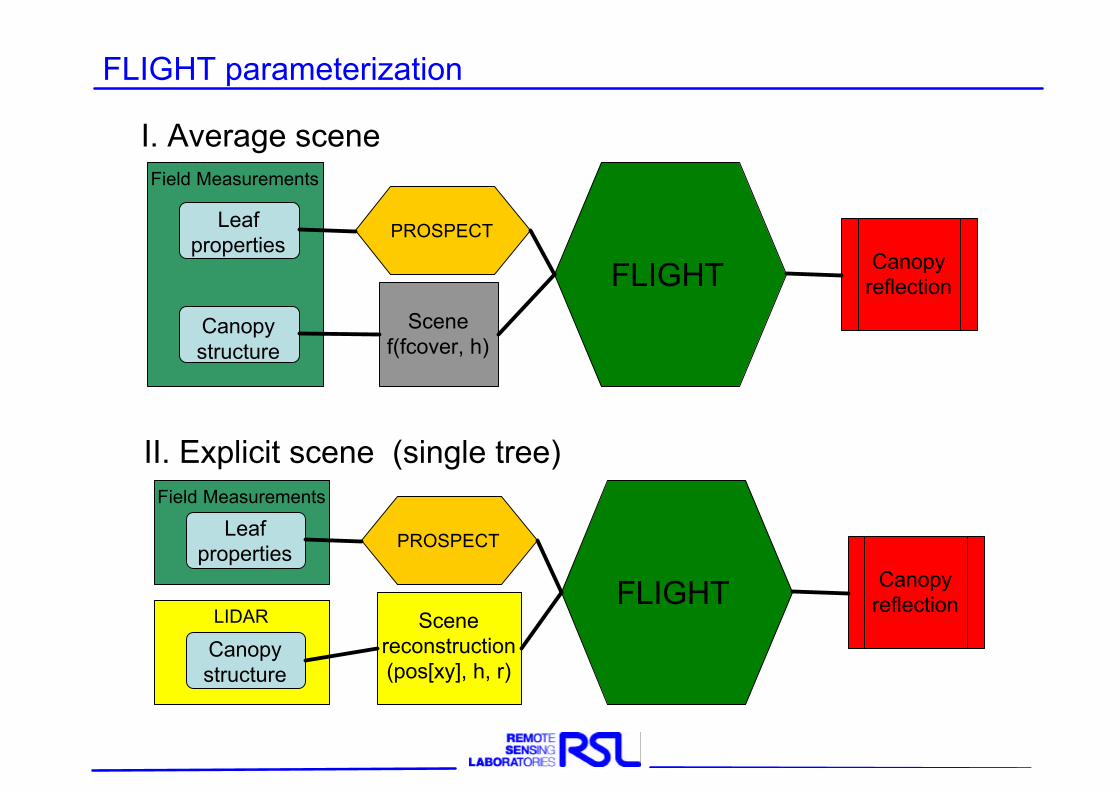
FLIGHT parameterization
I. Average scene
II. Explicit scene (single tree)
LIDAR
Field Measurements
Canopy reflection
Scene reconstruction(pos[xy], h, r)
PROSPECTLeaf
properties
Canopy structure
FLIGHT
Field Measurements
Canopy reflection
Scenef(fcover, h)
PROSPECTLeaf properties
Canopy structure
FLIGHT
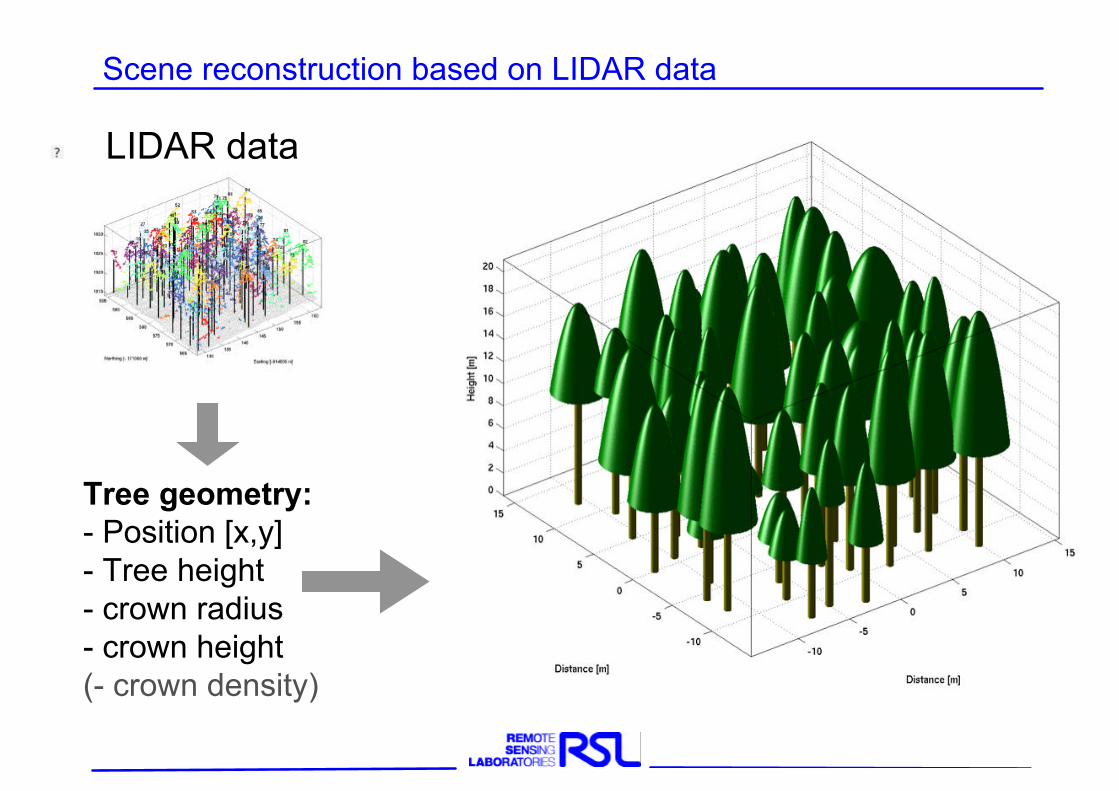
Scene reconstruction based on LIDAR data
LIDAR data
Tree geometry:- Position [x,y]- Tree height- crown radius- crown height(- crown density)
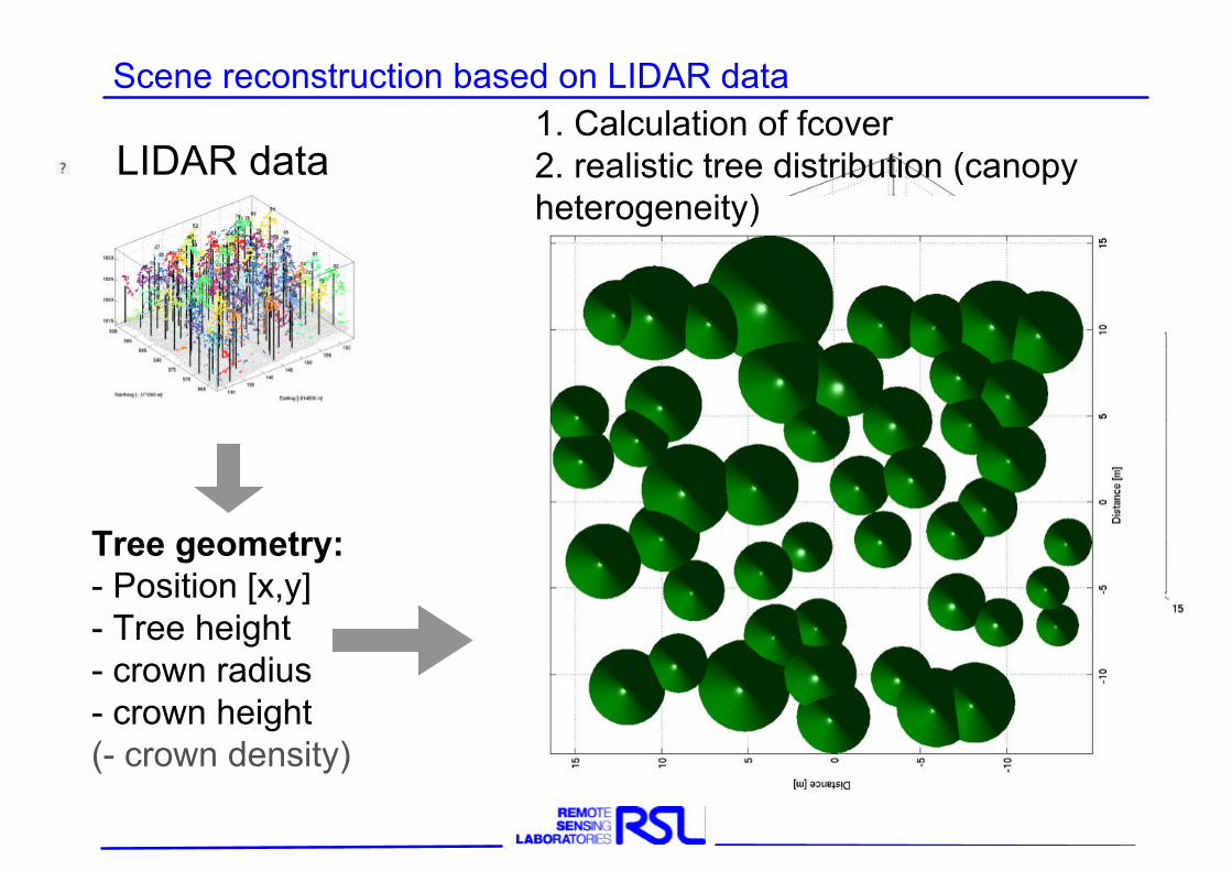
Scene reconstruction based on LIDAR data
LIDAR data
Tree geometry:- Position [x,y]- Tree height- crown radius- crown height(- crown density)
1. Calculation of fcover2. realistic tree distribution (canopy heterogeneity)
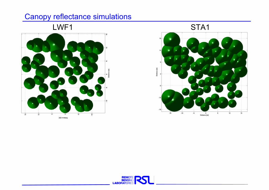
Canopy reflectance simulationsLWF1 STA1
Canopy reflectance simulationsLWF1 STA1
Average parameterization Single tree parameterization DAIS
Results:Precise fcover calculation: Reduced uncertaintyRealistic scene representation: Increased accuracy of simulated
canopy reflectance
Average parameterization Single tree parameterization DAIS
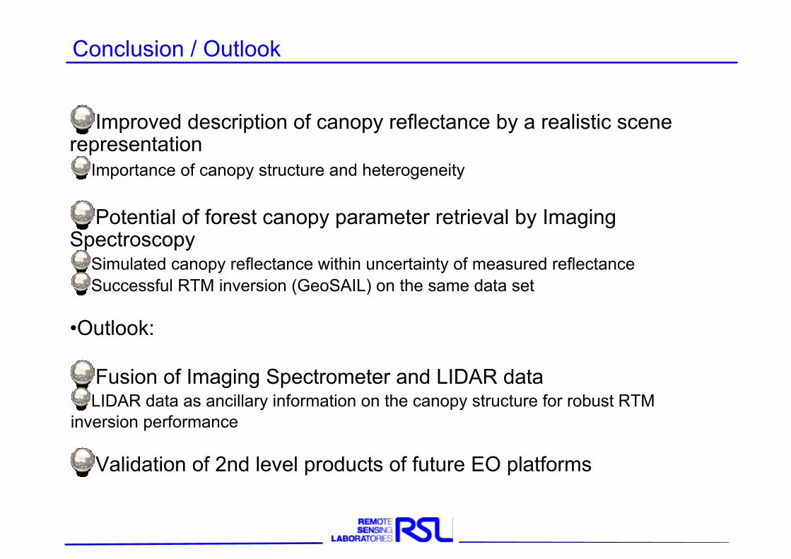
Improved description of canopy reflectance by a realistic scene representation
Importance of canopy structure and heterogeneity
Potential of forest canopy parameter retrieval by Imaging Spectroscopy
Simulated canopy reflectance within uncertainty of measured reflectanceSuccessful RTM inversion (GeoSAIL) on the same data set
•Outlook:
Fusion of Imaging Spectrometer and LIDAR dataLIDAR data as ancillary information on the canopy structure for robust RTM
inversion performance
Validation of 2nd level products of future EO platforms
Conclusion / Outlook