Embed Size (px)
Citation preview
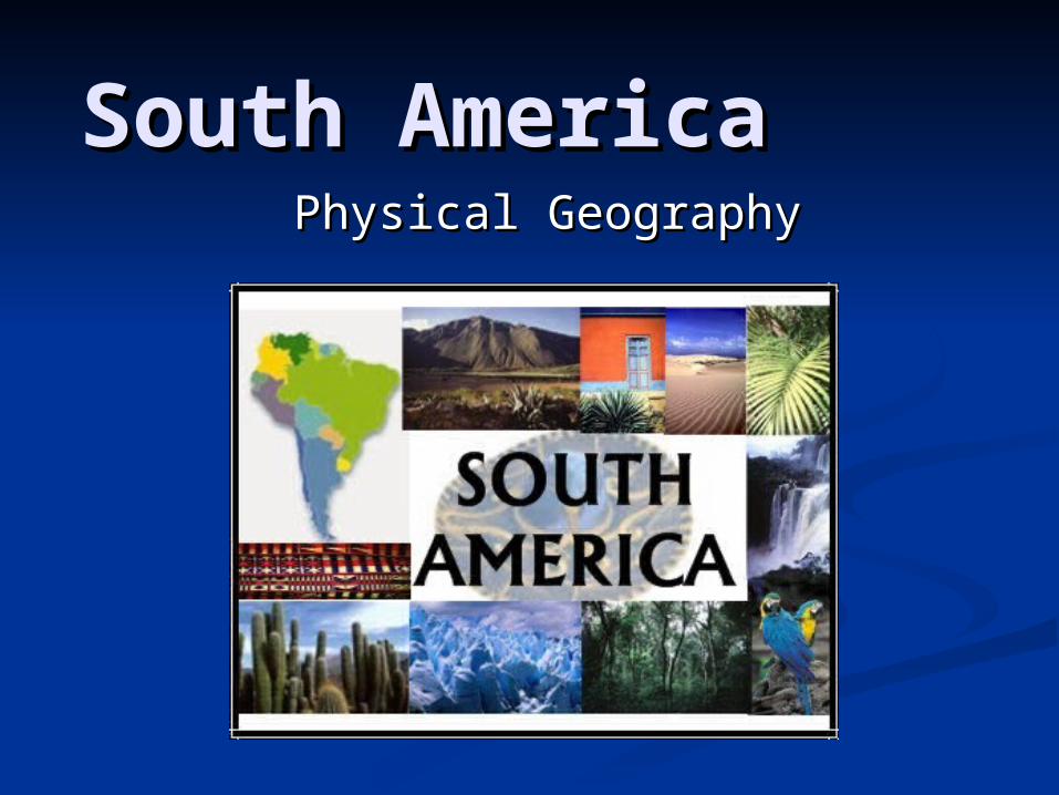
South America South America Physical GeographyPhysical Geography
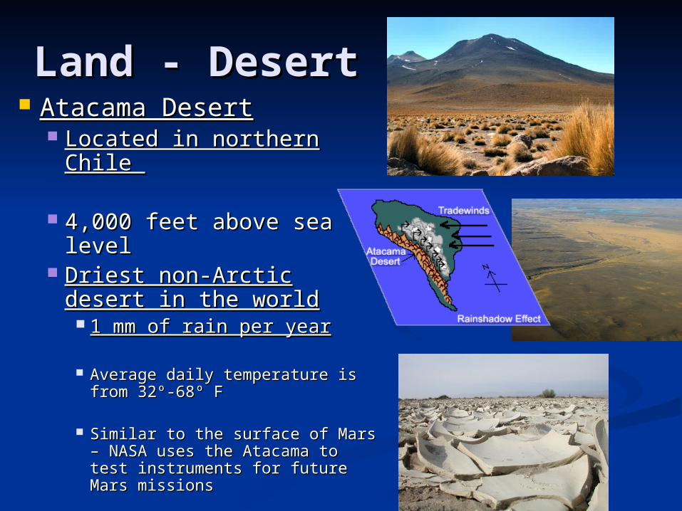
Land - DesertLand - Desert Atacama DesertAtacama Desert
Located in northern Chile Located in northern Chile
4,000 feet above sea level4,000 feet above sea level Driest non-Arctic desert Driest non-Arctic desert
in the worldin the world 1 mm of rain per year1 mm of rain per year
Average daily temperature is Average daily temperature is from 32º-68º Ffrom 32º-68º F
Similar to the surface of Mars – Similar to the surface of Mars – NASA uses the Atacama to test NASA uses the Atacama to test instruments for future Mars instruments for future Mars missionsmissions
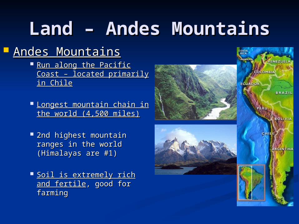
Land – Andes MountainsLand – Andes Mountains Andes MountainsAndes Mountains
Run along the Pacific Run along the Pacific Coast – located primarily Coast – located primarily in Chilein Chile
Longest mountain chain Longest mountain chain in the world (4,500 miles)in the world (4,500 miles)
2nd highest mountain 2nd highest mountain ranges in the world ranges in the world (Himalayas are #1)(Himalayas are #1)
Soil is extremely rich and Soil is extremely rich and fertilefertile, good for farming, good for farming
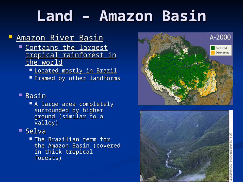
Land – Amazon BasinLand – Amazon Basin Amazon River BasinAmazon River Basin
Contains the largest Contains the largest tropical rainforest in the tropical rainforest in the worldworld
Located mostly in BrazilLocated mostly in Brazil Framed by other Framed by other
landformslandforms
BasinBasin A large area completely A large area completely
surrounded by higher surrounded by higher ground (similar to a ground (similar to a valley)valley)
SelvaSelva The Brazilian term for the The Brazilian term for the
Amazon Basin (covered in Amazon Basin (covered in thick tropical forests)thick tropical forests)
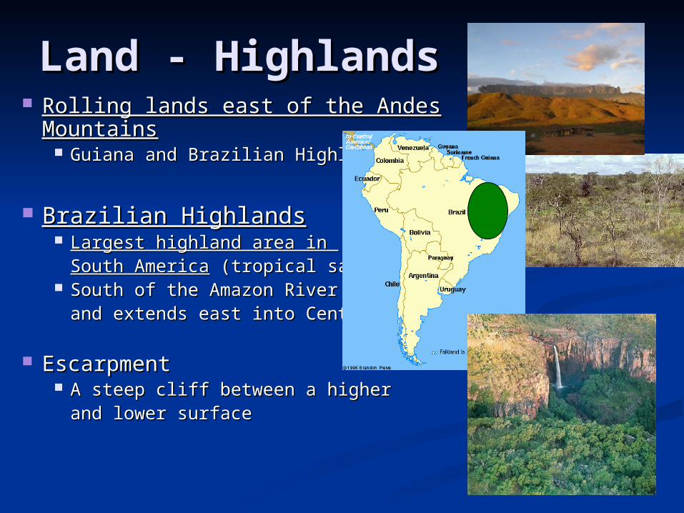
Land - HighlandsLand - Highlands Rolling lands east of the Andes Rolling lands east of the Andes
MountainsMountains Guiana and Brazilian HighlandsGuiana and Brazilian Highlands
Brazilian HighlandsBrazilian Highlands Largest highland area in Largest highland area in
South AmericaSouth America (tropical savanna) (tropical savanna) South of the Amazon River Basin South of the Amazon River Basin
and extends east into Central Braziland extends east into Central Brazil
EscarpmentEscarpment A steep cliff between a higher A steep cliff between a higher
and lower surfaceand lower surface
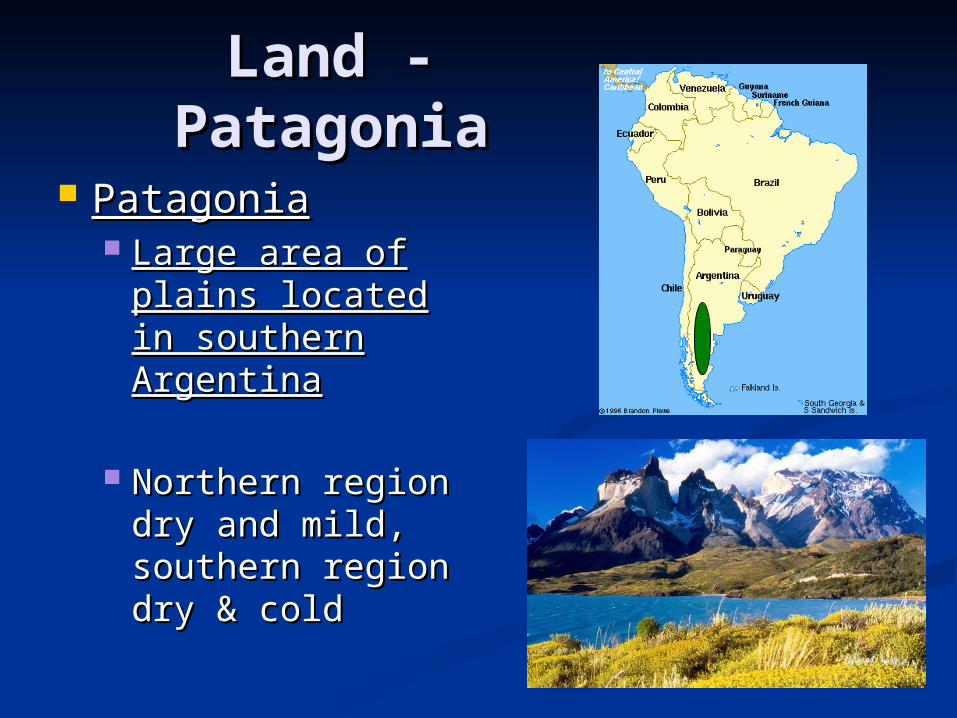
Land - Land - PatagoniaPatagonia
PatagoniaPatagonia Large area of Large area of
plains located in plains located in southern southern ArgentinaArgentina
Northern region Northern region dry and mild, dry and mild, southern region southern region dry & colddry & cold
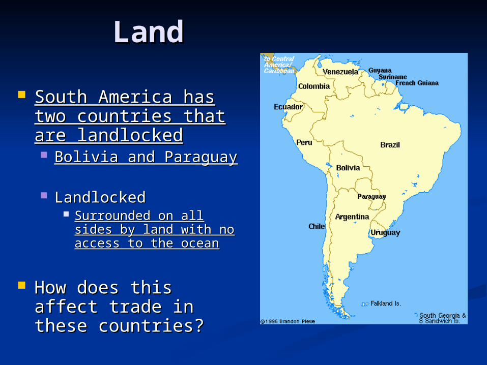
LandLand
South America has South America has two countries that two countries that are landlockedare landlocked Bolivia and ParaguayBolivia and Paraguay
LandlockedLandlocked Surrounded on all Surrounded on all
sides by land with no sides by land with no access to the oceanaccess to the ocean
How does this affect How does this affect trade in these trade in these countries?countries?
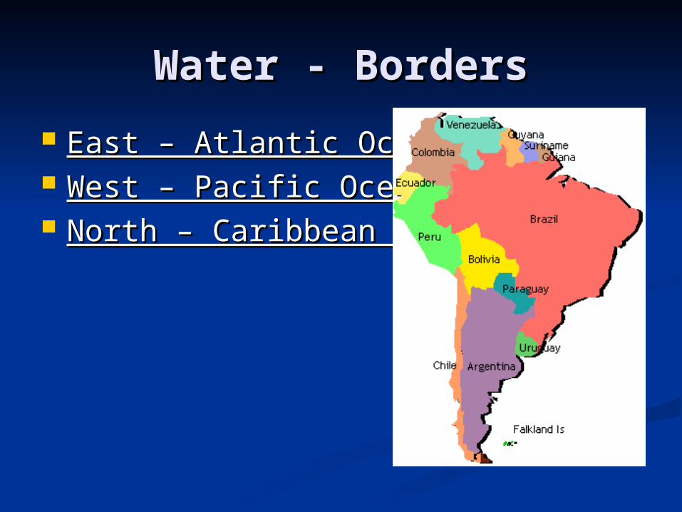
Water - BordersWater - Borders
East – Atlantic OceanEast – Atlantic Ocean West – Pacific OceanWest – Pacific Ocean North – Caribbean SeaNorth – Caribbean Sea
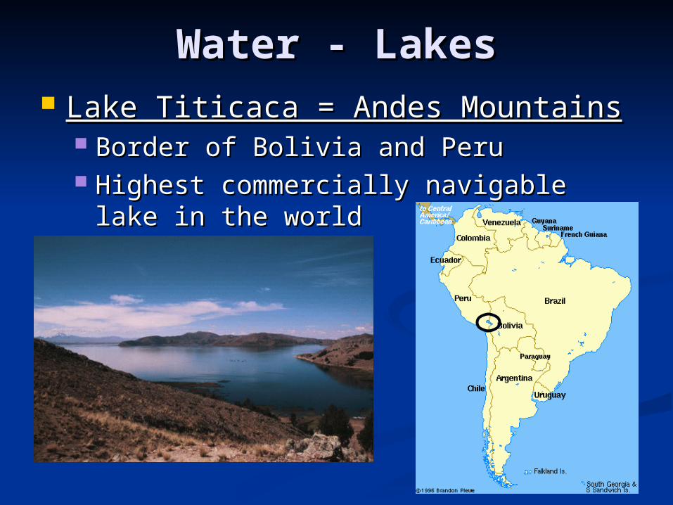
Water - LakesWater - Lakes Lake Titicaca = Andes MountainsLake Titicaca = Andes Mountains
Border of Bolivia and PeruBorder of Bolivia and Peru Highest commercially navigable lake in Highest commercially navigable lake in
the world the world
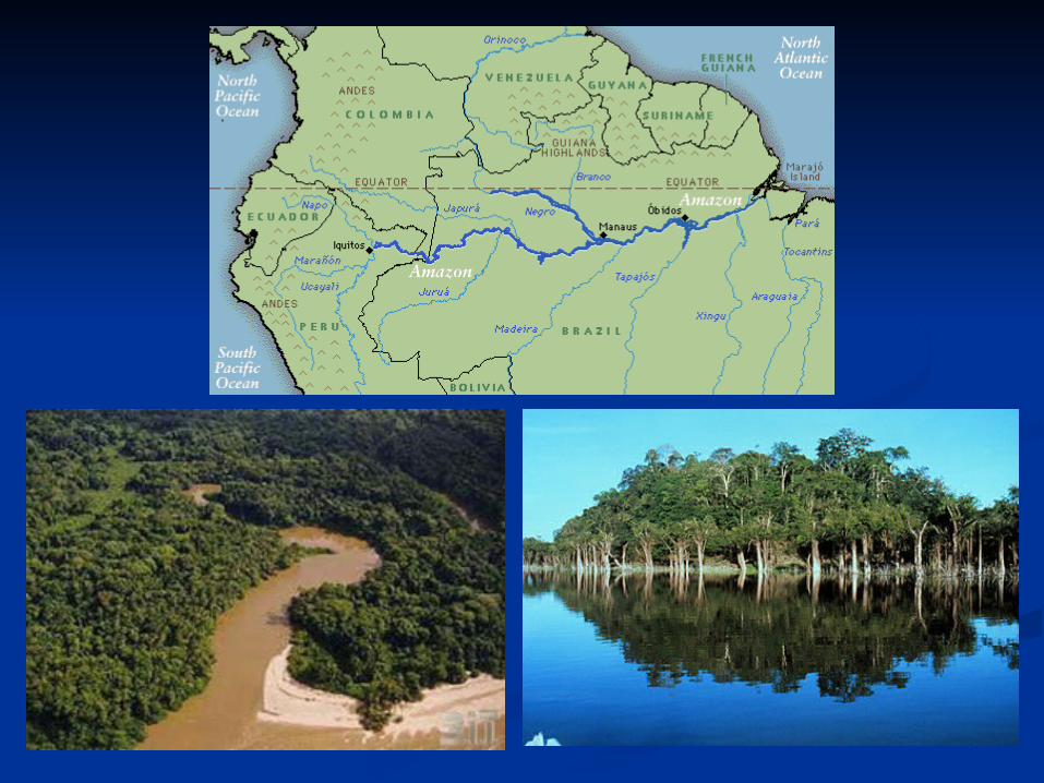
Water - RiversWater - Rivers Amazon RiverAmazon River
2nd longest river in the world2nd longest river in the world (largest in volume) (largest in volume) (4,000 miles long) – (Nile River is #1)(4,000 miles long) – (Nile River is #1)
Carries more water than any other river in the Carries more water than any other river in the worldworld
Extends from the Andes Mountains to the Atlantic Ocean Extends from the Andes Mountains to the Atlantic Ocean (across the entire continent)(across the entire continent)
Contains 20% of all fresh water in the worldContains 20% of all fresh water in the world More than 1,000 tributaries extend from the Amazon More than 1,000 tributaries extend from the Amazon
RiverRiver Tributaries – smaller river that flow into a larger riverTributaries – smaller river that flow into a larger river
Located primarily in BrazilLocated primarily in Brazil
Serves as a major trade route inland and creates Serves as a major trade route inland and creates fertile landfertile land
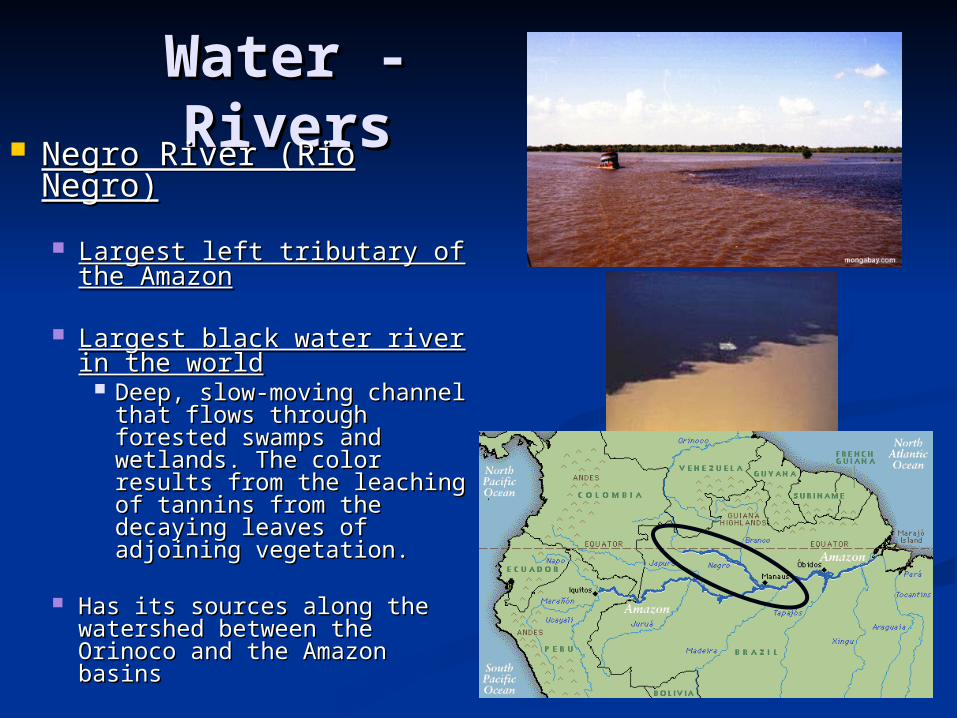
Water - Water - RiversRivers Negro River (Rio Negro)Negro River (Rio Negro)
Largest left tributary of the Largest left tributary of the AmazonAmazon
Largest black water river in Largest black water river in the worldthe world
Deep, slow-moving channel Deep, slow-moving channel that flows through forested that flows through forested swamps and wetlands. The swamps and wetlands. The color results from the color results from the leaching of tannins from leaching of tannins from the decaying leaves of the decaying leaves of adjoining vegetation. adjoining vegetation.
Has its sources along the Has its sources along the watershed between the watershed between the Orinoco and the Amazon Orinoco and the Amazon basins basins
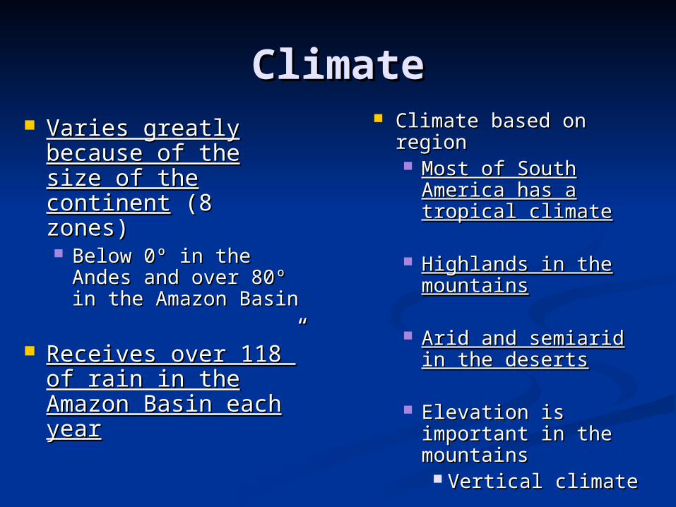
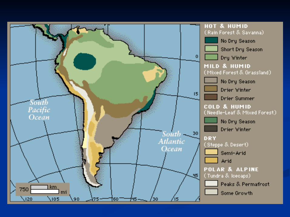
ClimateClimate Varies greatly Varies greatly
because of the size because of the size of the continentof the continent (8 (8 zones)zones) Below 0º in the Below 0º in the
Andes and over 80º Andes and over 80º in the Amazon Basinin the Amazon Basin
Receives over 118” Receives over 118” of rain in the of rain in the Amazon Basin each Amazon Basin each yearyear
Climate based on regionClimate based on region Most of South Most of South
America has a America has a tropical climatetropical climate
Highlands in the Highlands in the mountainsmountains
Arid and semiarid in Arid and semiarid in the desertsthe deserts
Elevation is important Elevation is important in the mountainsin the mountains
Vertical climateVertical climate
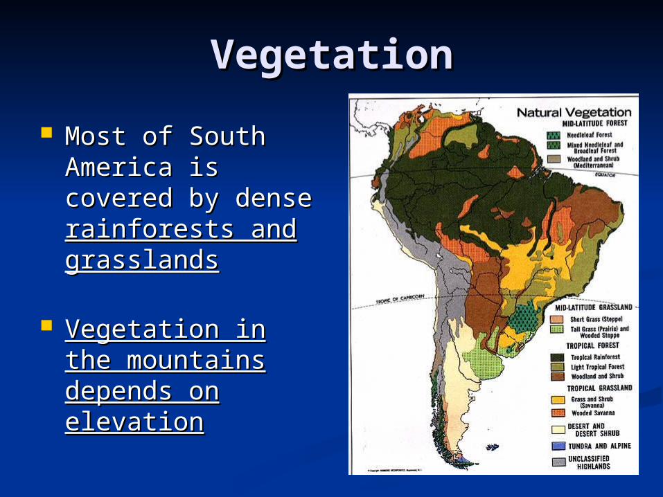
VegetationVegetation
Most of South Most of South America is covered America is covered by dense by dense rainforests and rainforests and grasslandsgrasslands
Vegetation in the Vegetation in the mountains mountains depends on depends on elevationelevation
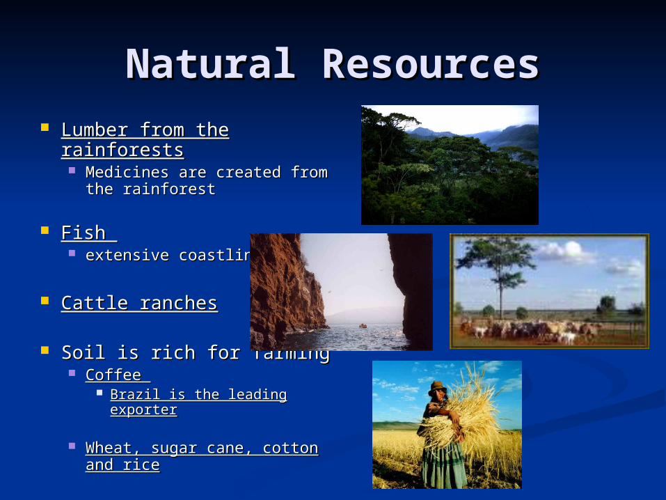
Natural ResourcesNatural Resources Lumber from the Lumber from the
rainforestsrainforests Medicines are created from Medicines are created from
the rainforestthe rainforest
Fish Fish extensive coastlinesextensive coastlines
Cattle ranchesCattle ranches
Soil is rich for farmingSoil is rich for farming Coffee Coffee
Brazil is the leading exporterBrazil is the leading exporter
Wheat, sugar cane, cotton Wheat, sugar cane, cotton and riceand rice
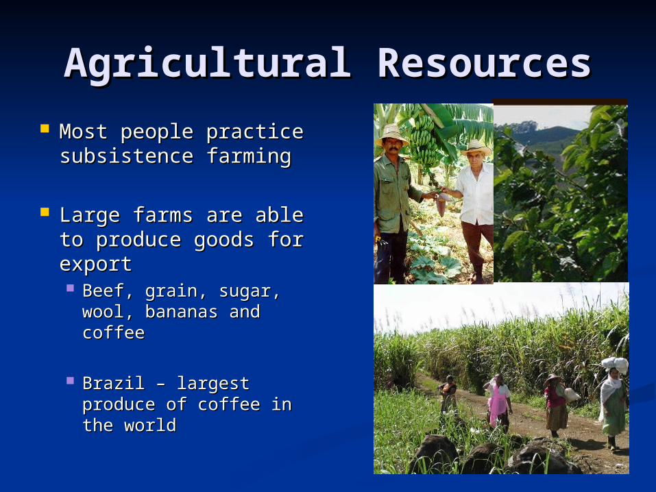
Agricultural ResourcesAgricultural Resources Most people practice Most people practice
subsistence farmingsubsistence farming
Large farms are able Large farms are able to produce goods for to produce goods for exportexport Beef, grain, sugar, wool, Beef, grain, sugar, wool,
bananas and coffeebananas and coffee
Brazil – largest produce Brazil – largest produce of coffee in the worldof coffee in the world
Population DistributionPopulation Distribution& &
TradeTrade
Valuable VenezuelaValuable Venezuela Location, climate and natural resources affect where people live Location, climate and natural resources affect where people live
and work. and work. Physical Features . . . Physical Features . . .
Coastline gives them easy access to trade with othersCoastline gives them easy access to trade with others 4 major port cities4 major port cities
Mountains, grassy plains & tropical junglesMountains, grassy plains & tropical jungles
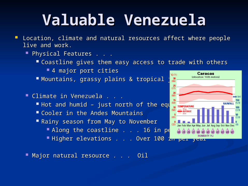
Climate in Venezuela . . . Climate in Venezuela . . . Hot and humid – just north of the equatorHot and humid – just north of the equator Cooler in the Andes MountainsCooler in the Andes Mountains Rainy season from May to NovemberRainy season from May to November
Along the coastline . . . 16 in per yearAlong the coastline . . . 16 in per year Higher elevations . . . Over 100 in per yearHigher elevations . . . Over 100 in per year
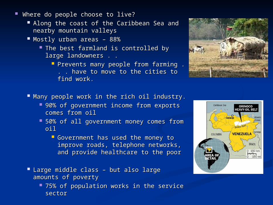
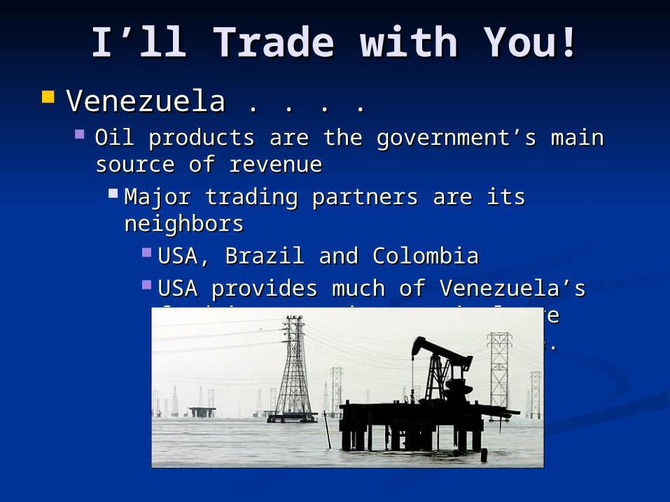
Major natural resource . . . OilMajor natural resource . . . Oil
Where do people choose to live?Where do people choose to live? Along the coast of the Caribbean Sea and Along the coast of the Caribbean Sea and
nearby mountain valleysnearby mountain valleys Mostly urban areas – 88%Mostly urban areas – 88%
The best farmland is controlled by large The best farmland is controlled by large landowners . . landowners . .
Prevents many people from farming . . Prevents many people from farming . . . have to move to the cities to find . have to move to the cities to find work.work.
Many people work in the rich oil industry.Many people work in the rich oil industry. 90% of government income from exports 90% of government income from exports
comes from oilcomes from oil 50% of all government money comes from 50% of all government money comes from
oiloil Government has used the money to Government has used the money to
improve roads, telephone networks, improve roads, telephone networks, and provide healthcare to the poorand provide healthcare to the poor
Large middle class – but also large amounts Large middle class – but also large amounts of povertyof poverty
75% of population works in the service 75% of population works in the service sectorsector
What’s happening in What’s happening in Brazil?Brazil?
Brazil is the largest country on South America . . . Brazil is the largest country on South America . . . Highest population . . . Healthiest economyHighest population . . . Healthiest economy
Physical FeaturesPhysical Features HUGE coastline . . . 7 major ports increase HUGE coastline . . . 7 major ports increase
tradetrade Mostly low elevation . . . .except for a Mostly low elevation . . . .except for a
mountain range along the eastern coastmountain range along the eastern coast Central area . . . Amazon Rainforest . . . . Central area . . . Amazon Rainforest . . . .
Covers 2/3 of the countryCovers 2/3 of the country
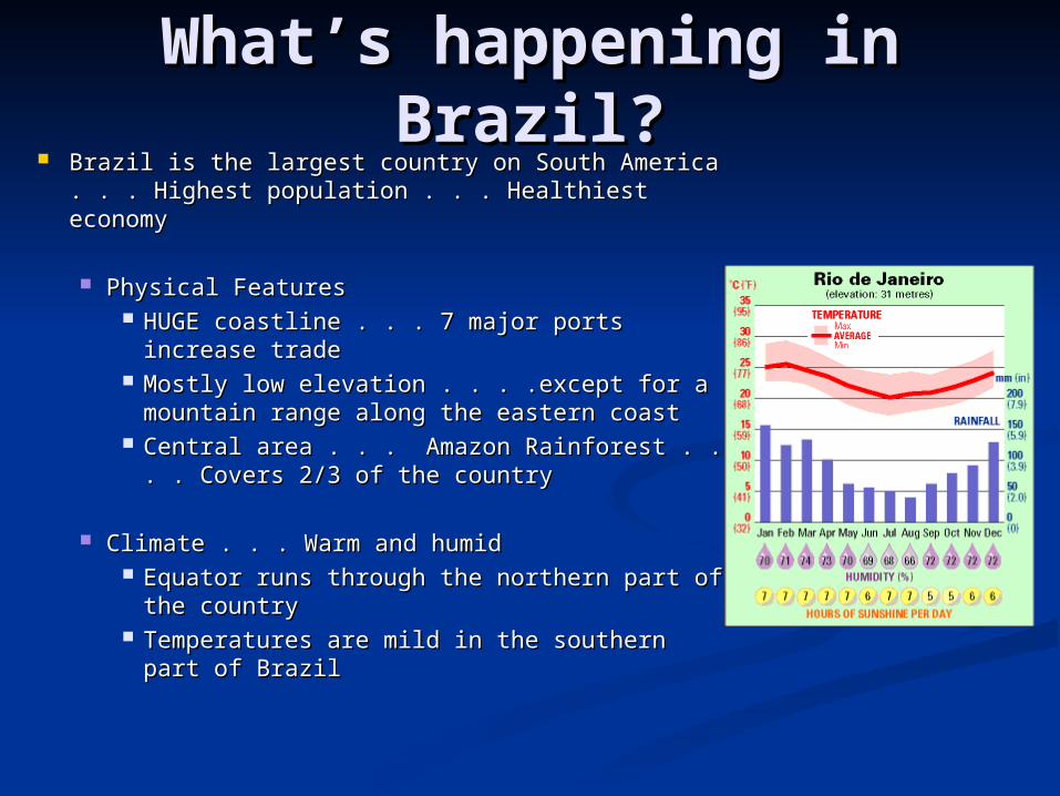
Climate . . . Warm and humidClimate . . . Warm and humid Equator runs through the northern part of Equator runs through the northern part of
the countrythe country Temperatures are mild in the southern part Temperatures are mild in the southern part
of Brazilof Brazil
Where do people choose to live?Where do people choose to live? Most live near the Atlantic coast in urban areas . . . Most live near the Atlantic coast in urban areas . . .
85% in cities like Sao Paulo and Rio de Janeiro85% in cities like Sao Paulo and Rio de Janeiro 80% live within 200 miles of the coast80% live within 200 miles of the coast
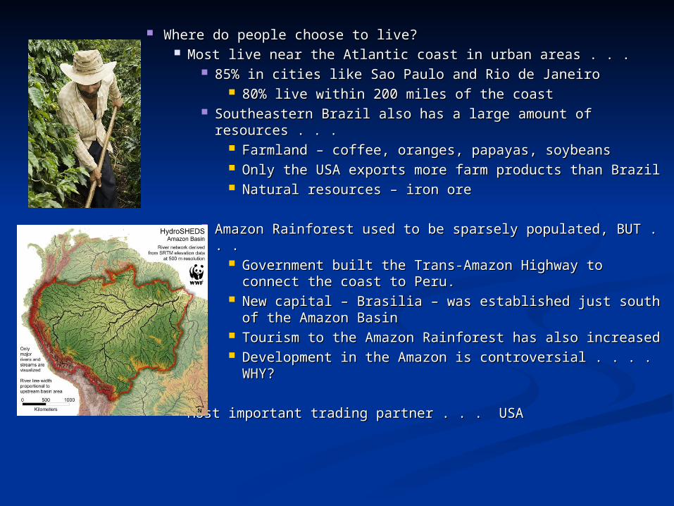
Southeastern Brazil also has a large amount of resources . . Southeastern Brazil also has a large amount of resources . . . .
Farmland – coffee, oranges, papayas, soybeansFarmland – coffee, oranges, papayas, soybeans Only the USA exports more farm products than BrazilOnly the USA exports more farm products than Brazil Natural resources – iron oreNatural resources – iron ore
Amazon Rainforest used to be sparsely populated, BUT . . . Amazon Rainforest used to be sparsely populated, BUT . . . Government built the Trans-Amazon Highway to Government built the Trans-Amazon Highway to
connect the coast to Peru.connect the coast to Peru. New capital – Brasilia – was established just south of New capital – Brasilia – was established just south of
the Amazon Basinthe Amazon Basin Tourism to the Amazon Rainforest has also increasedTourism to the Amazon Rainforest has also increased Development in the Amazon is controversial . . . . WHY?Development in the Amazon is controversial . . . . WHY?
Most important trading partner . . . USAMost important trading partner . . . USA
I’ll Trade with You!I’ll Trade with You! Venezuela . . . .Venezuela . . . .
Oil products are the government’s main Oil products are the government’s main source of revenuesource of revenue
Major trading partners are its neighborsMajor trading partners are its neighbors USA, Brazil and ColombiaUSA, Brazil and Colombia USA provides much of Venezuela’s food USA provides much of Venezuela’s food
imports since agriculture isn’t a strong imports since agriculture isn’t a strong industry there.industry there.
Brazil . . . Brazil . . . Key location along the Atlantic Ocean . . . Key location along the Atlantic Ocean . . .
Allows shipment of goods around the worldAllows shipment of goods around the world Top 2 trading partners . . . USA and ArgentinaTop 2 trading partners . . . USA and Argentina
Agricultural Products . . . Agricultural Products . . . Sugarcane and orangesSugarcane and oranges Coffee – world’s largest producerCoffee – world’s largest producer
Natural Resources . . . Natural Resources . . . Iron ore – produces steel to make cars, trucks Iron ore – produces steel to make cars, trucks
and other goods in Brazilian factories near the and other goods in Brazilian factories near the iron ore depositsiron ore deposits
Environmental IssuesEnvironmental Issues Oil-related pollution – VenezuelaOil-related pollution – Venezuela
Water pollution along both coasts and Lake Water pollution along both coasts and Lake MaracaiboMaracaibo
Severe deforestation, oil spills and air pollutionSevere deforestation, oil spills and air pollution Oil spills have hurt the fishing industry and closed tourist Oil spills have hurt the fishing industry and closed tourist
resortsresorts Contaminated oil pits (collect waste from oil wells) Contaminated oil pits (collect waste from oil wells)
threaten to seep into the water supplythreaten to seep into the water supply Air pollution results from the burning of fossil fuels – Air pollution results from the burning of fossil fuels –
health risks?health risks?
Oil is main source of incomeOil is main source of income, so people are , so people are motivated to keep drilling, producing, and burning motivated to keep drilling, producing, and burning oil…and polluting.oil…and polluting.
55thth largest oil produce in the world - 15% of US oil is from largest oil produce in the world - 15% of US oil is from VenezuelaVenezuela
Venezuelan oil companies are government controlledVenezuelan oil companies are government controlled
Environmental IssuesEnvironmental Issues
Destruction of rainforests in Destruction of rainforests in Brazil…Brazil…