Soil Data Join Recorrelation (SDJR) - USDA€¦ · Soil Data Join Recorrelation (SDJR) ... ranges...
19
Soil Data Join Recorrelation (SDJR) a.k.a. “Harmonization” David Gehring – Kentucky NRCS
Soil Data Join Recorrelation (SDJR) - USDA€¦ · Soil Data Join Recorrelation (SDJR) ... ranges of variabilit對y which could be observed within the soil catena or setting in any
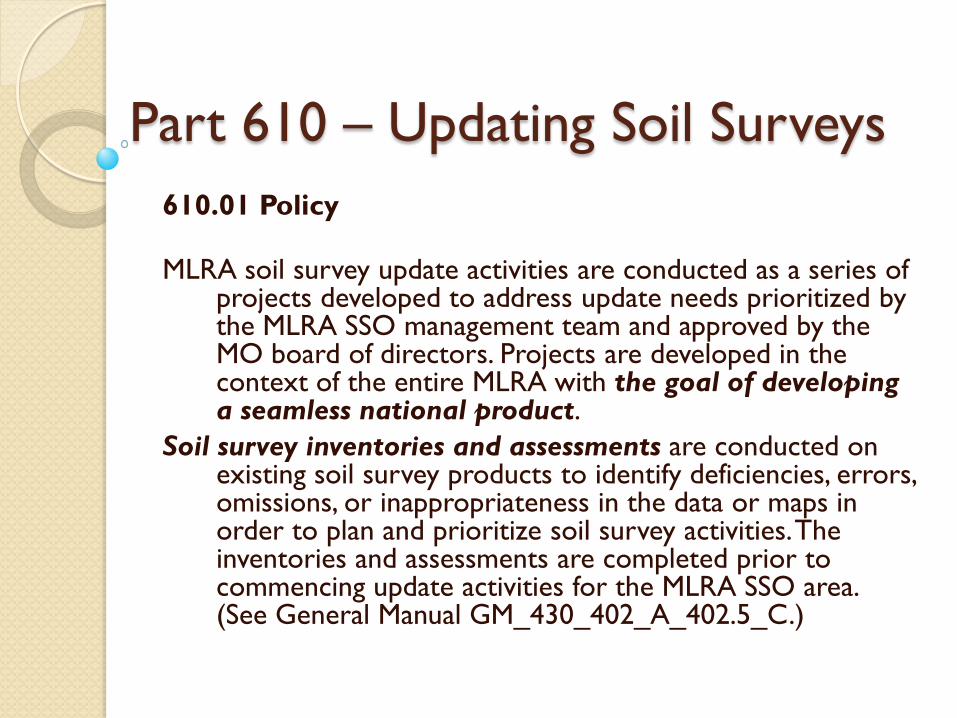
610.01 Policy MLRA soil survey update activities are conducted as a series of
projects developed to address update needs prioritized by the MLRA SSO management team and approved by the MO board of directors. Projects are developed in the context of the entire MLRA with the goal of developing a seamless national product.
Soil survey inventories and assessments are conducted on existing soil survey products to identify deficiencies, errors, omissions, or inappropriateness in the data or maps in order to plan and prioritize soil survey activities. The inventories and assessments are completed prior to commencing update activities for the MLRA SSO area. (See General Manual GM_430_402_A_402.5_C.)
Part 610 – Updating Soil Surveys
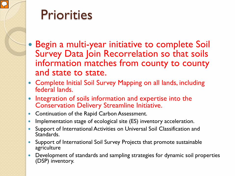
Priorities
Begin a multi-year initiative to complete Soil Survey Data Join Recorrelation so that soils information matches from county to county and state to state.
Complete Initial Soil Survey Mapping on all lands, including federal lands.
Integration of soils information and expertise into the Conservation Delivery Streamline Initiative.
Continuation of the Rapid Carbon Assessment. Implementation stage of ecological site (ES) inventory acceleration. Support of International Activities on Universal Soil Classification and
Standards. Support of International Soil Survey Projects that promote sustainable
agriculture Development of standards and sampling strategies for dynamic soil properties
(DSP) inventory.
Presenter
Presentation Notes
Micheal Golden has sent to the StC and SSS a list of the Division’s priorities. SDJR is but one of the priorities and is the harmonization of the attribute database. This has been discussed for many years as part of the MLRA update, however it is now a Division priority.
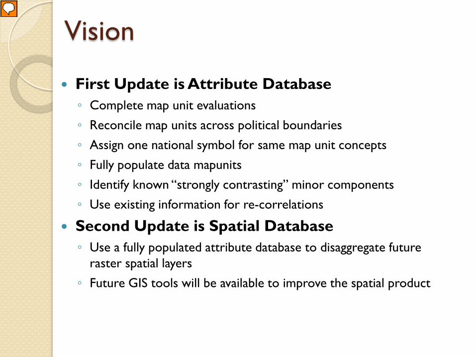
Vision
First Update is Attribute Database ◦ Complete map unit evaluations ◦ Reconcile map units across political boundaries ◦ Assign one national symbol for same map unit concepts ◦ Fully populate data mapunits ◦ Identify known “strongly contrasting” minor components ◦ Use existing information for re-correlations
Second Update is Spatial Database ◦ Use a fully populated attribute database to disaggregate future
raster spatial layers ◦ Future GIS tools will be available to improve the spatial product
Presenter
Presentation Notes
Many are still trying to understand the goal of the MLRA update. The update has been divided in two parts to focus the needs of the soil survey. The first update will focus on improving the quality of the attribute database. The intent is to fully populate all components, the major components and their strongly contrasting minor components. The database should be populated well enough so that each component can be located on the landform. Named minor components are the priority and fully populated major components can be copied and pasted to fully populate a DMU with all components. The attribute database must be reviewed and populated to produce a seamless coverage. This will include a review of all map units within the MLRA and reconciling the map unit names. Much of this work is completed using historical documentation. A thorough review of the like map units and their DMUs will uncover similar datasets for each map unit. The goal is not so much to “generalize” the data but to make the data flow creating a seamless coverage. The second update will then utilize the attribute database to refine the line work, or raster. Understanding the components, where they occur and their basic soil properties will be critical for the second update.
Objective
Evaluate the map units within the MLRA Use existing information to update map
unit composition and soil properties migrating individual survey area map unit concepts into an MLRA soil survey area map unit concept Document future MLRA projects
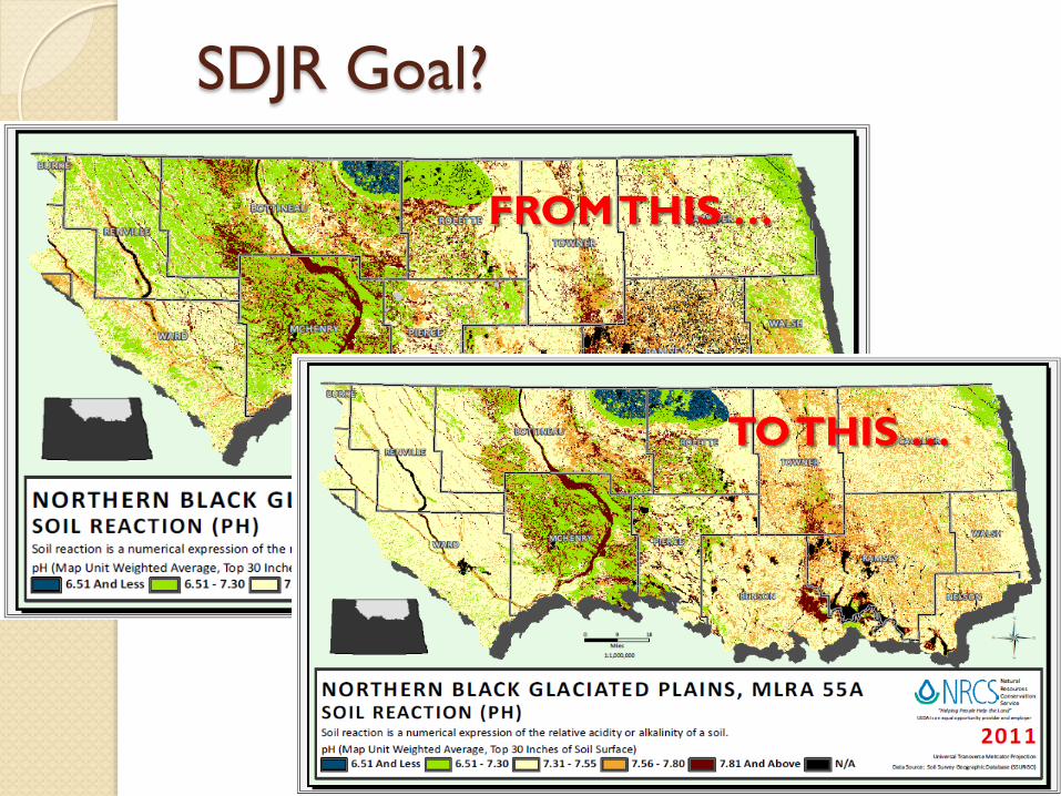
SDJR Goal?
FROM THIS …
TO THIS …
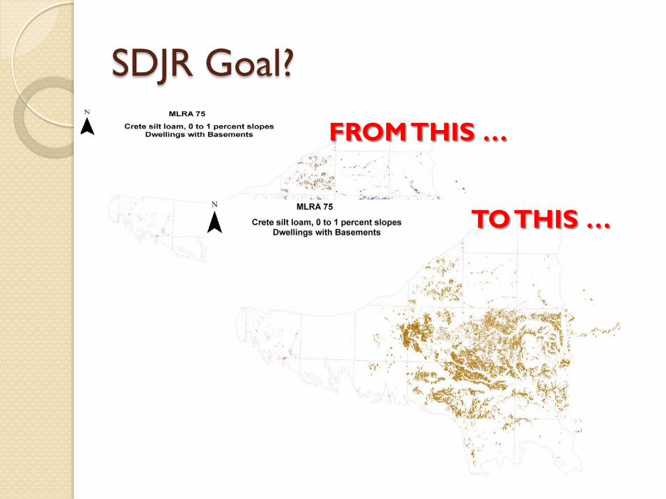
SDJR Goal?
FROM THIS …
TO THIS …
Why are there mis-joins?
Survey History ◦ Various survey ages (vintages) ◦ Surveys historically mapped as islands ◦ Database history SOI-5 data (series/phase concepts) SOI-6 data (survey area TUD layer depths)
◦ State Soil Survey Database developed from SOI5/SOI6 data ◦ NASIS data contains SSSD
Presenter
Presentation Notes
There is a distinction that must be made between the manuscripts and the database. Although the vintage of the survey may be pre-1970s, the properties within the database came from the Soils-5 data for the given series/phase. Understand that the database came long after the publication of the surveys and the data used to populate the database came from the SOI-5. Therefore the age of the data is the date of the SOI-5, not the date of the manuscript. A careful review of the database, which I will show in this presentation, will prove that regardless of the manuscript date, the data all came from the same SOI-5. The only differences in the data are the horizons and their depths which were identified on the SOI-6 and based on the “county” TUD depths. In many cases, the interpretive differences seen between similarly named map units arises from the normal ranges of variability which could be observed within the soil catena or setting in any of the survey areas in which it was described.
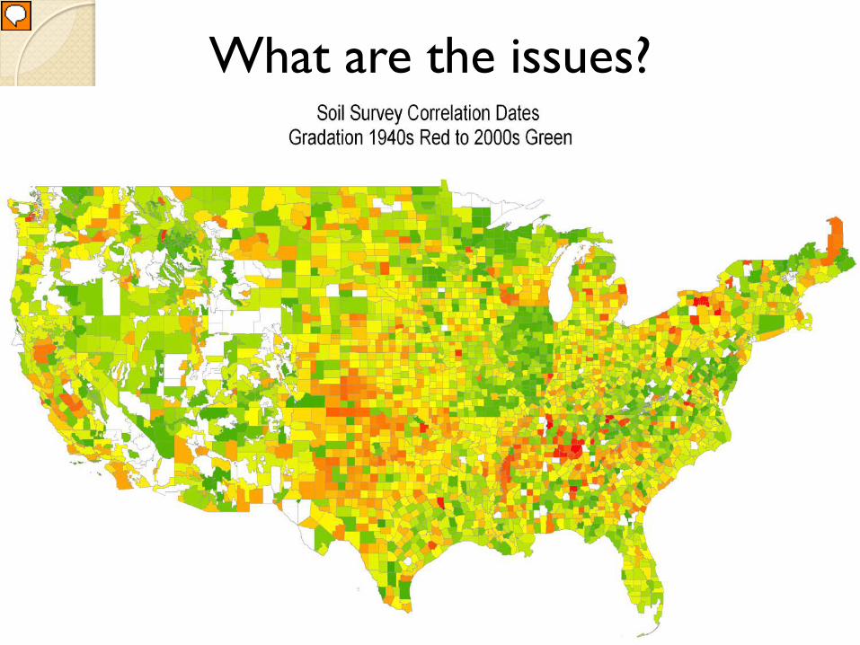
What are the issues?
Presenter
Presentation Notes
This initiative is a result of the 100+ years of soil survey activity and the various vintages of soil surveys. Much of the information needed to reconcile the map unit names, components, and their properties is recorded in the soil surveys and databases. All that is needed is the focused review of the data.
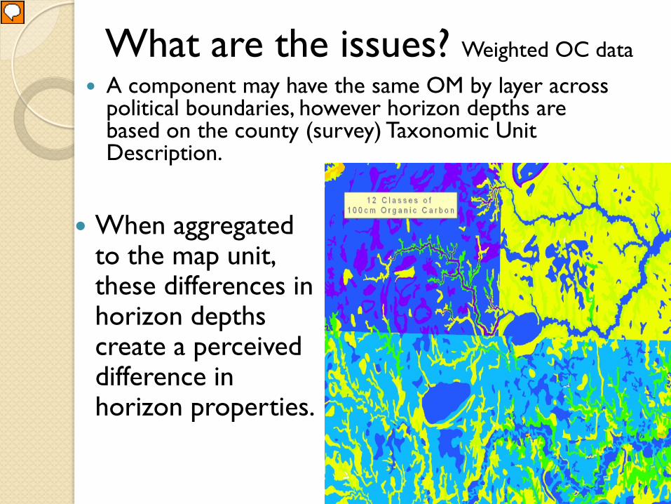
What are the issues? Weighted OC data
When aggregated to the map unit, these differences in horizon depths create a perceived difference in horizon properties.
A component may have the same OM by layer across political boundaries, however horizon depths are based on the county (survey) Taxonomic Unit Description.
Presenter
Presentation Notes
So, if the data is essentially the same, then what are the issues? To create thematic maps, the horizon data is aggregated to the map unit level. To do so, the soil property (in this case Organic Matter) must be aggregated based on the horizon depths and on the component percentages. If all the map units contained the exact same components, with the exact same percentages, and each component had the exact same horizons and depths, then the data would show no difference. However, each component is based on how it was mapped for the specific survey area and its depths are based on the survey area taxonomic unit description represented for that survey area. So depths and percentages will be different based on the survey areas, even though it is the same component in the various surveys.
What are the issues?
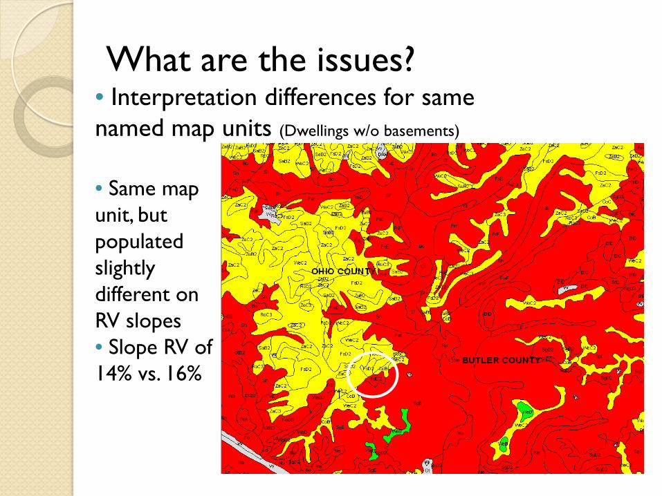
• Same map unit, but populated slightly different on RV slopes • Slope RV of 14% vs. 16%
• Interpretation differences for same named map units (Dwellings w/o basements)
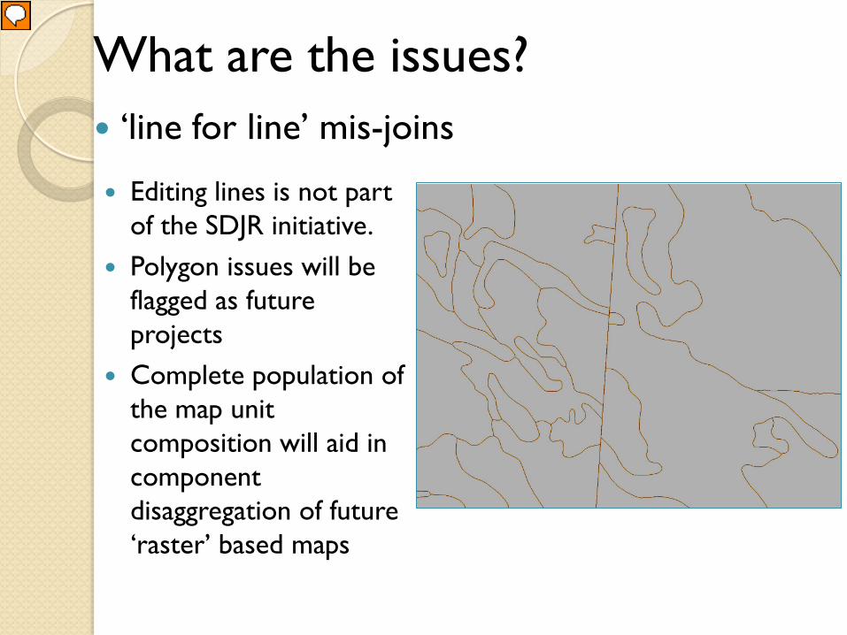
What are the issues? ‘line for line’ mis-joins
Editing lines is not part of the SDJR initiative.
Polygon issues will be flagged as future projects
Complete population of the map unit composition will aid in component disaggregation of future ‘raster’ based maps
Presenter
Presentation Notes
For many surveys, during the creation of the SSURGO spatial database, the spatial lines were digitized as captured from the original survey. Others made attempts to create a line for line join between the surveys. This will be encountered during the harmonization effort. The jury has not convened an answer as to whether these constitute an immediate fix or a future fix. Will let this one go for now.
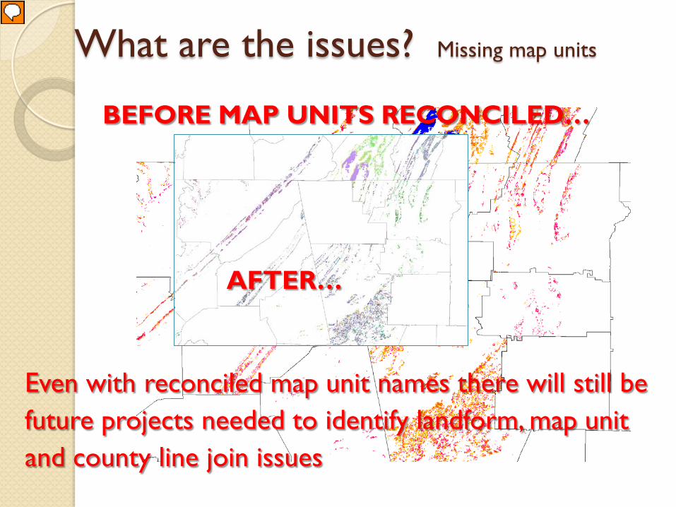
What are the issues? Missing map units
Even with reconciled map unit names there will still be future projects needed to identify landform, map unit and county line join issues
BEFORE MAP UNITS RECONCILED…
AFTER…
Presenter
Presentation Notes
Although unable to be viewed at this scale, the Fullerton series has been mapped with many phase criteria within MLRA 128. Even after studying the manuscripts and database to reconcile the map unit names, there will remain issues that must be set up as future projects. Issues such as county line joins, map units missing on adjoining landforms across survey boundaries, erosion phases based on the vintage of the survey. All these issues will be developed as future projects since they will require field investigation.
Soil Survey Data Join Recorrelation Purpose: ◦ Provide mapunit information that flows across
political boundaries ◦ reduce the total number of mapunits, components,
and horizons in the database ◦ develop a complete set of soil horizon depths and
properties for the map unit component ◦ soil properties based on analyzed data ◦ document map unit decisions and deficiencies ◦ identify future field projects
Presenter
Presentation Notes
This method will still focus on the component – not the series. However, the component is now part of a MLRA map unit instead of individual “county” map units. The intent is to read the manuscripts in the first step. The manuscripts contain the map unit concept – the database “typically” contains only the S5 properties or a series/phase concept. It is the manuscripts where the soil scientist will learn about how the series was mapped as a component in a map unit. Those components must be studied within the context of their map units and decisions made in populating the component properties. This will constitute a MRLA Taxonomic Unit Description for that component – be it a “representative pedon” or a “component concept”, regardless the result will migrate the product from a county by county or “survey by survey” TUD to one that represents the component as analyzed for the MLRA. The review will consider the OSD and the NSSL lab data. Whether these are brought up to date or set up as a separate project will depend on the amount of time required.
SDJR Process Create spatial distribution maps Compile historical information Populate Project Mapunit table Enter Pedons into NASIS Review historical mapunits and DMUs Create a new MLRA map unit and DMU Document the MLRA map unit Identify future field projects Official series description and NSSL data QC/QA/Publish
OSD and Lab data
Survey office will review and update the OSD
Lab data site, name and taxonomy information will be reviewed and updated
All updates are forwarded to the MLRA Regional Office
Summary
QC completed by SSL QA completed by SDQS Correlate new map unit into Legends If it can’t be harmonized using existing