Embed Size (px)
Citation preview

Hong, S.Y.*, Kim, Y.H., Lee, Y.J., Zhang, Y.S., Hyun, B.K., Ha, S.K.
Soil and Environmental Information Soil and Environmental Information System of KoreaSystem of Korea
International Conference Advancing the Science and Technology of Soil Information in Asia — Launch of the Global Soil Partnership’s Asia Soil Science Network and GlobalSoilMap.net East Asia Node , 8-11 February, 2012, Nanjing, China
National Academy of Agricultural Science (NAAS)Rural Development Administration (RDA)
Suwon, South Korea
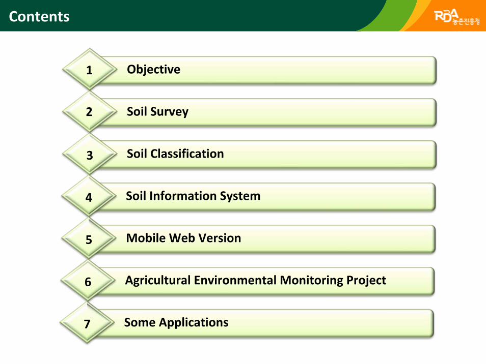
1) 홍보 성과Soil Classification3
Soil Survey2
Objective1
1) 홍보 성과Soil Information System4
Contents
1) 홍보 성과Mobile Web Version5
1) 홍보 성과Agricultural Environmental Monitoring Project6
1) 홍보 성과Some Applications7
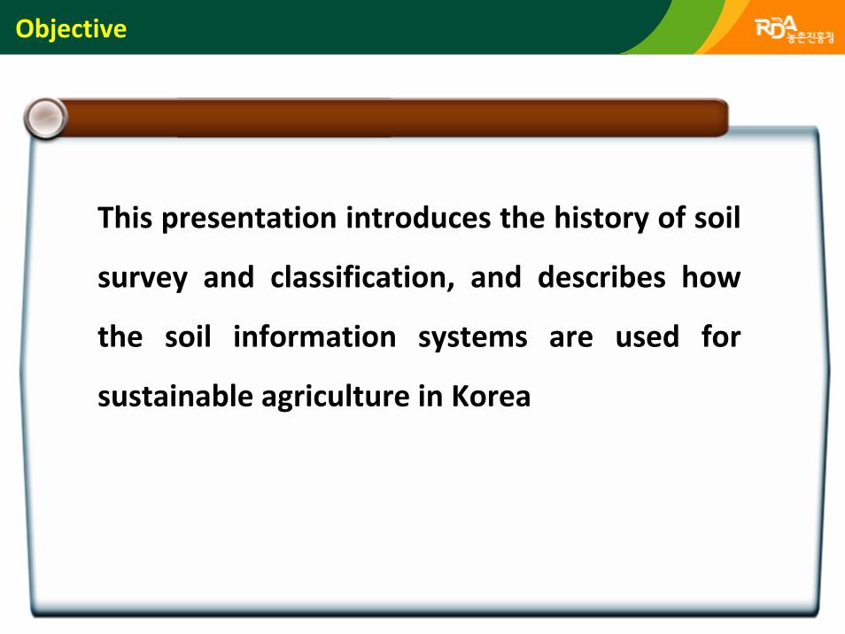
Objective
This presentation introduces the history of soil
survey and classification, and describes how
the soil information systems are used for
sustainable agriculture in Korea
5
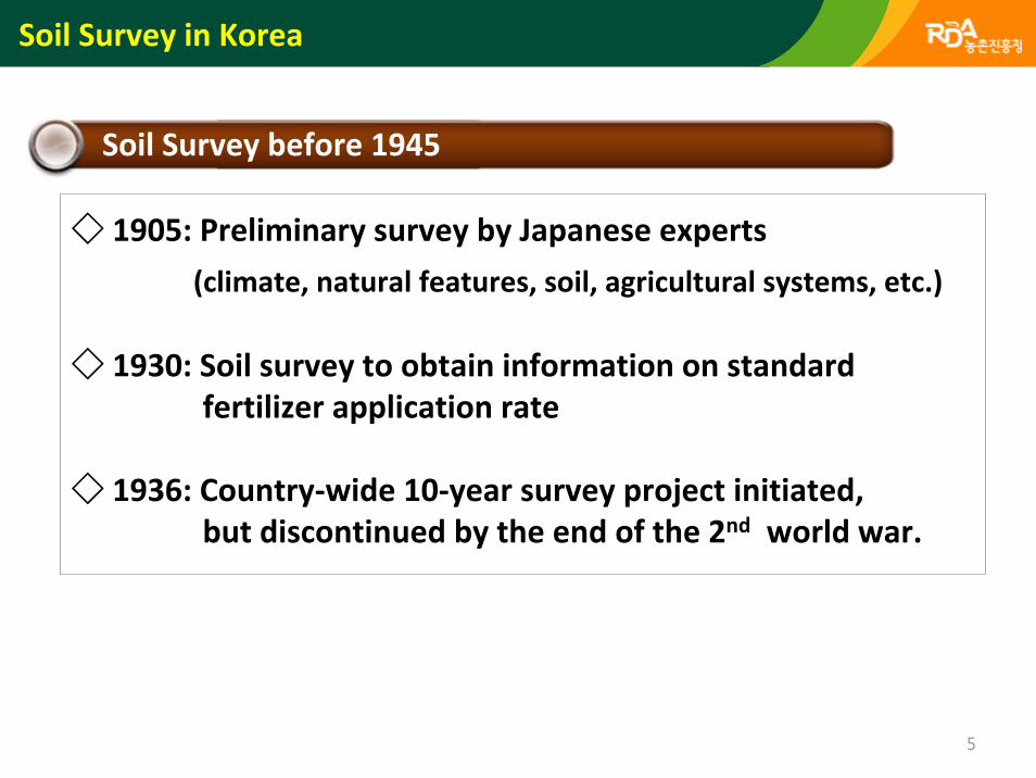
Soil Survey before 1945
Soil Survey in Korea
◇ 1905: Preliminary survey by Japanese experts
(climate, natural features, soil, agricultural systems, etc.)
◇ 1930: Soil survey to obtain information on standardfertilizer application rate
◇ 1936: Country‐wide 10‐year survey project initiated, but discontinued by the end of the 2nd world war.
6
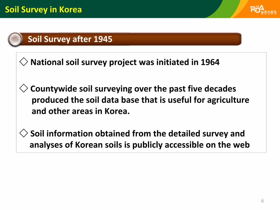
Soil Survey after 1945
◇ National soil survey project was initiated in 1964
◇ Countywide soil surveying over the past five decades produced the soil data base that is useful for agricultureand other areas in Korea.
◇ Soil information obtained from the detailed survey and analyses of Korean soils is publicly accessible on the web
Soil Survey in Korea
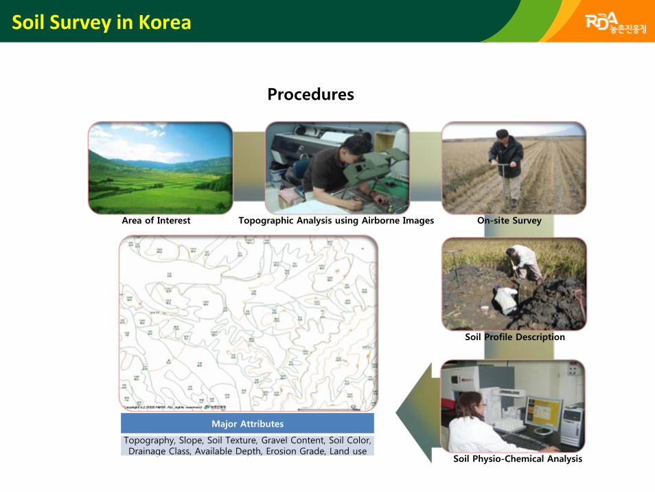
Soil Physio-Chemical Analysis
Area of Interest Topographic Analysis using Airborne Images On-site Survey
Soil Profile Description
Major Attributes
Topography, Slope, Soil Texture, Gravel Content, Soil Color, Drainage Class, Available Depth, Erosion Grade, Land use
Procedures
Soil Survey in Korea
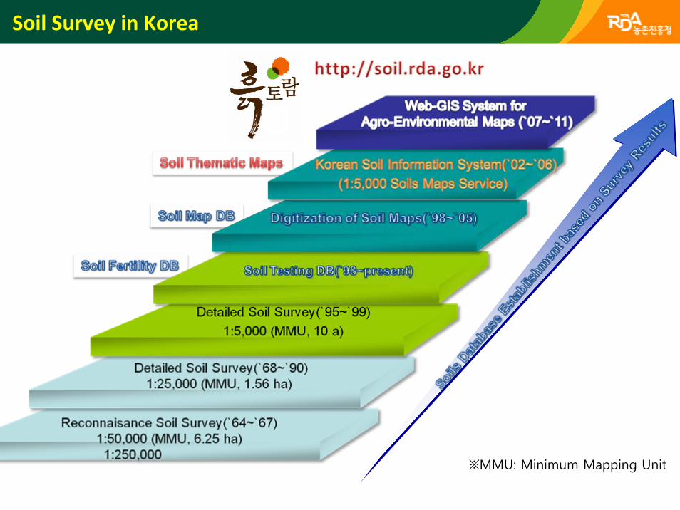
Soil Survey in Korea
※MMU: Minimum Mapping Unit
Soil Classification
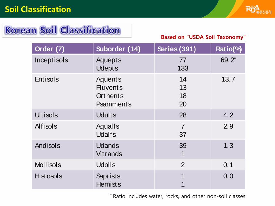
Order (7) Suborder (14) Series (391) Ratio(%)
Inceptisols AqueptsUdepts
77133
69.2*
Entisols AquentsFluventsOrthentsPsamments
14131820
13.7
Ultisols Udults 28 4.2
Alfisols AqualfsUdalfs
737
2.9
Andisols UdandsVitrands
391
1.3
Mollisols Udolls 2 0.1
Histosols SapristsHemists
11
0.0
* Ratio includes water, rocks, and other non-soil classes
Based on “USDA Soil Taxonomy”
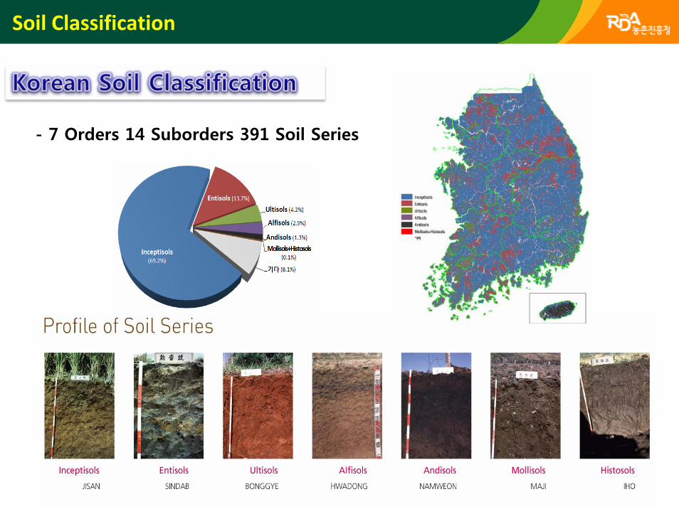
Soil Classification
- 7 Orders 14 Suborders 391 Soil Series
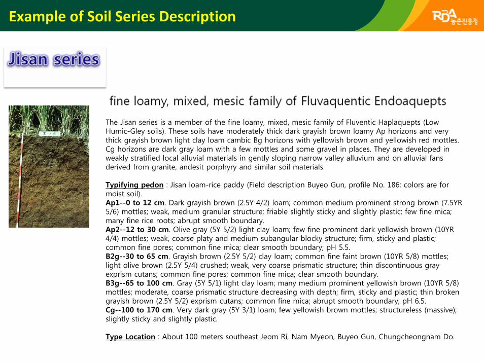
The Jisan series is a member of the fine loamy, mixed, mesic family of Fluventic Haplaquepts (Low Humic-Gley soils). These soils have moderately thick dark grayish brown loamy Ap horizons and very thick grayish brown light clay loam cambic Bg horizons with yellowish brown and yellowish red mottles. Cg horizons are dark gray loam with a few mottles and some gravel in places. They are developed in weakly stratified local alluvial materials in gently sloping narrow valley alluvium and on alluvial fans derived from granite, andesit porphyry and similar soil materials.
Typifying pedon : Jisan loam-rice paddy (Field description Buyeo Gun, profile No. 186; colors are for moist soil).Ap1--0 to 12 cm. Dark grayish brown (2.5Y 4/2) loam; common medium prominent strong brown (7.5YR 5/6) mottles; weak, medium granular structure; friable slightly sticky and slightly plastic; few fine mica; many fine rice roots; abrupt smooth boundary.Ap2--12 to 30 cm. Olive gray (5Y 5/2) light clay loam; few fine prominent dark yellowish brown (10YR 4/4) mottles; weak, coarse platy and medium subangular blocky structure; firm, sticky and plastic; common fine pores; common fine mica; clear smooth boundary; pH 5.5.B2g--30 to 65 cm. Grayish brown (2.5Y 5/2) clay loam; common fine faint brown (10YR 5/8) mottles; light olive brown (2.5Y 5/4) crushed; weak, very coarse prismatic structure; thin discontinuous gray exprism cutans; common fine pores; common fine mica; clear smooth boundary.B3g--65 to 100 cm. Gray (5Y 5/1) light clay loam; many medium prominent yellowish brown (10YR 5/8) mottles; moderate, coarse prismatic structure decreasing with depth; firm, sticky and plastic; thin broken grayish brown (2.5Y 5/2) exprism cutans; common fine mica; abrupt smooth boundary; pH 6.5.Cg--100 to 170 cm. Very dark gray (5Y 3/1) loam; few yellowish brown mottles; structureless (massive); slightly sticky and slightly plastic.
Type Location : About 100 meters southeast Jeom Ri, Nam Myeon, Buyeo Gun, Chungcheongnam Do.
Example of Soil Series Description
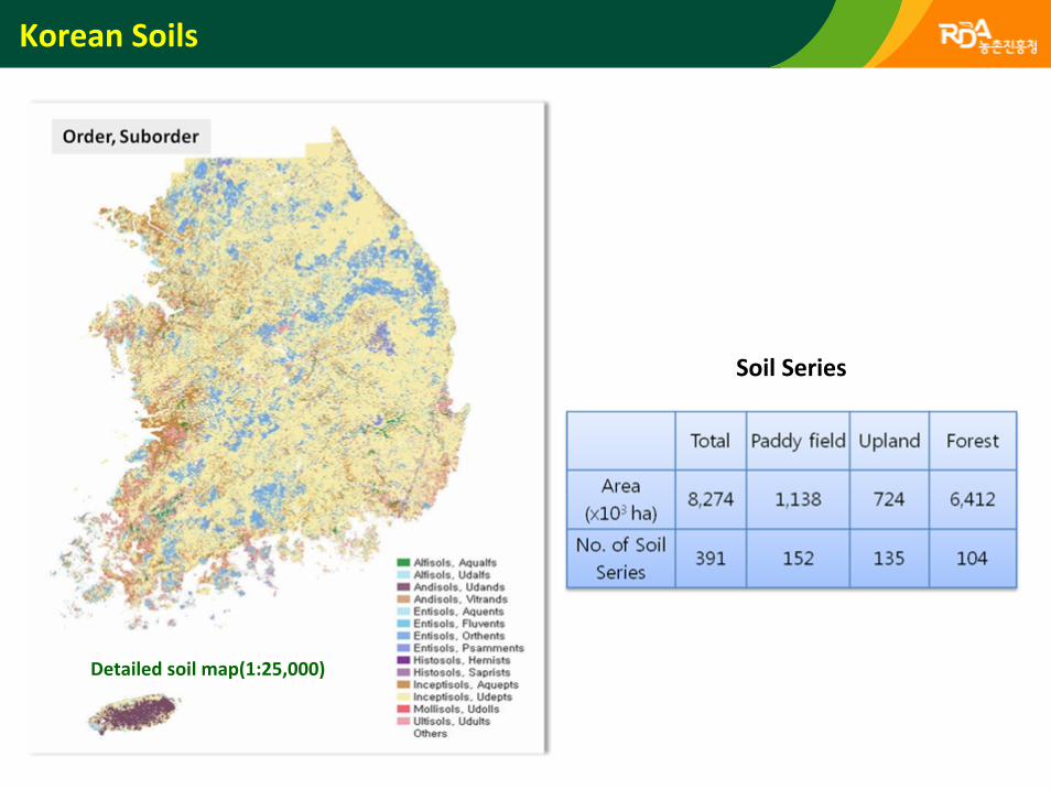
Korean Soils
Detailed soil map(1:25,000)
Soil Series
Korean Soils
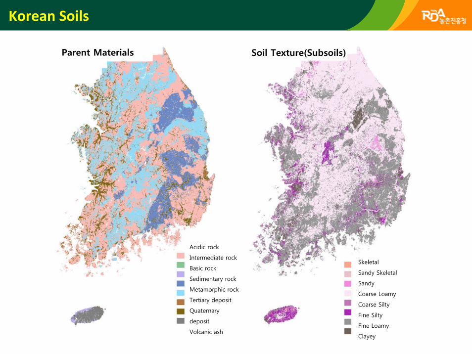
Parent Materials
Acidic rock
Intermediate rock
Basic rock
Sedimentary rock
Metamorphic rock
Tertiary deposit
Quaternary
deposit
Volcanic ash
Skeletal
Sandy Skeletal
Sandy
Coarse Loamy
Coarse Silty
Fine Silty
Fine Loamy
Clayey
Soil Texture(Subsoils)
Korean Soils
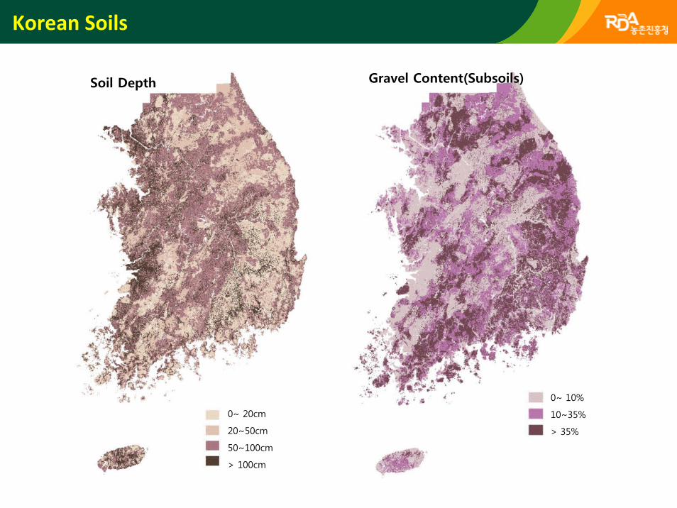
Soil Depth
0~ 20cm
20~50cm
50~100cm
> 100cm
Gravel Content(Subsoils)
0~ 10%
10~35%
> 35%

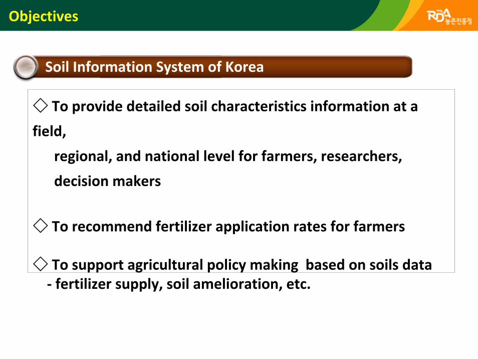
Objectives
Soil Information System of Korea
◇ To provide detailed soil characteristics information at a
field,
regional, and national level for farmers, researchers,
decision makers
◇ To recommend fertilizer application rates for farmers
◇ To support agricultural policy making based on soils data‐ fertilizer supply, soil amelioration, etc.
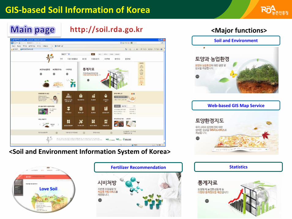
GIS‐based Soil Information of Korea
<Soil and Environment Information System of Korea>
Soil and Environment
Web‐based GIS Map Service
Fertilizer Recommendation Statistics
<Major functions>
Love Soil
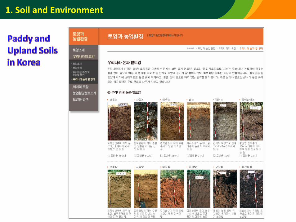
1. Soil and Environment
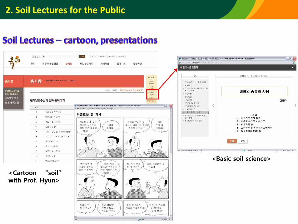
2. Soil Lectures for the Public
<Cartoon “soil”with Prof. Hyun>
<Basic soil science>
3. Web‐based GIS Map Service
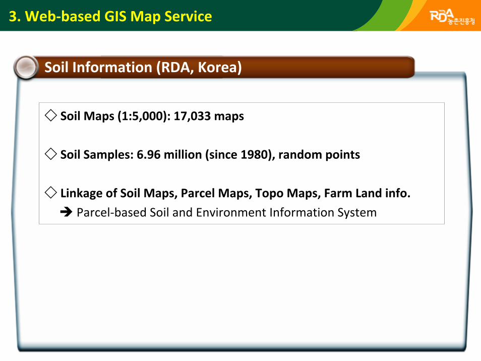
Soil Information (RDA, Korea)
◇ Soil Maps (1:5,000): 17,033 maps
◇ Soil Samples: 6.96 million (since 1980), random points
◇ Linkage of Soil Maps, Parcel Maps, Topo Maps, Farm Land info.
Parcel‐based Soil and Environment Information System
3. Web‐based GIS Map Service
3. Web‐based GIS Map Service
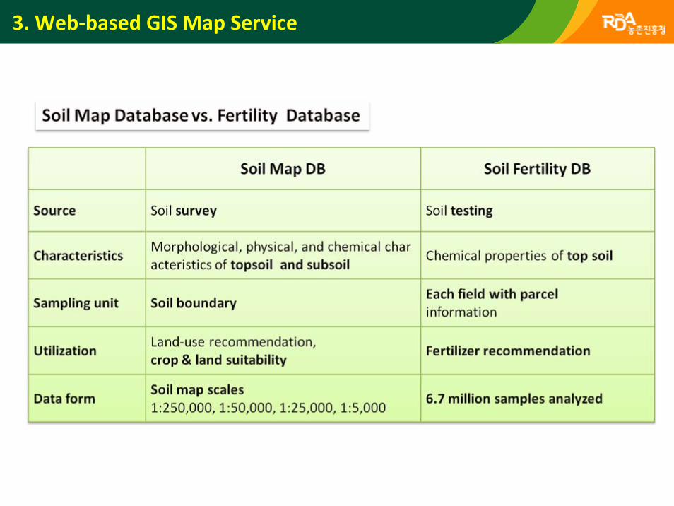
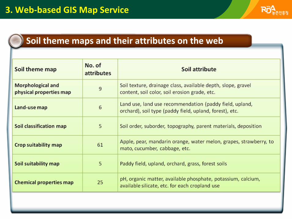
Soil theme maps and their attributes on the web
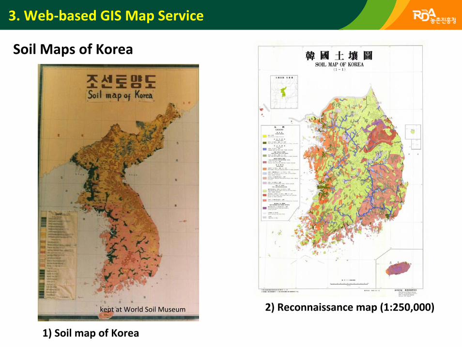
Soil Maps of Korea
2) Reconnaissance map (1:250,000)kept at World Soil Museum
1) Soil map of Korea
3. Web‐based GIS Map Service
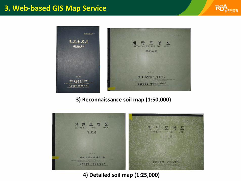
3) Reconnaissance soil map (1:50,000)
4) Detailed soil map (1:25,000)
3. Web‐based GIS Map Service
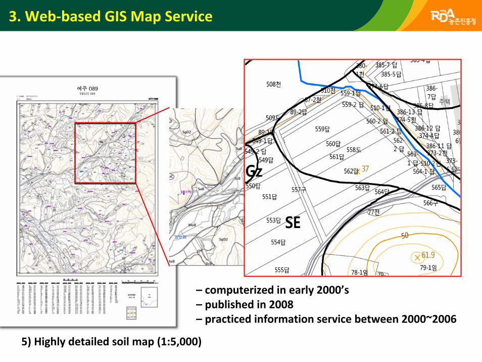
– computerized in early 2000’s– published in 2008– practiced information service between 2000~2006
5) Highly detailed soil map (1:5,000)
3. Web‐based GIS Map Service
3. Web‐based GIS Map Service
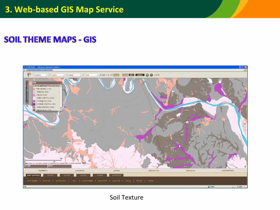
Soil Texture
3. Web‐based GIS Map Service
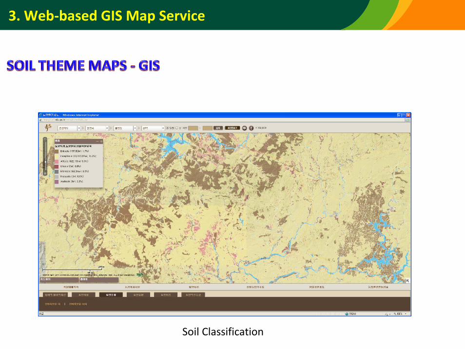
Soil Classification
3. Web‐based GIS Map Service
Drainage
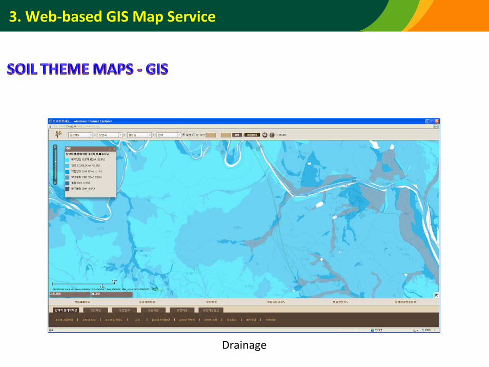
3. Web‐based GIS Map Service
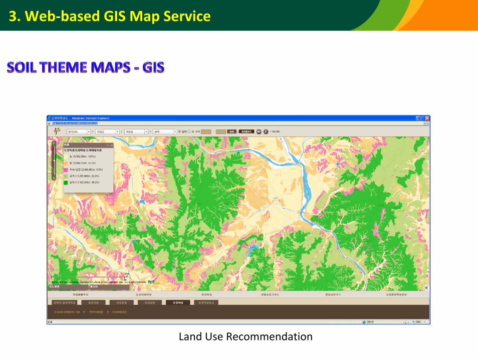
Land Use Recommendation
3. Web‐based GIS Map Service
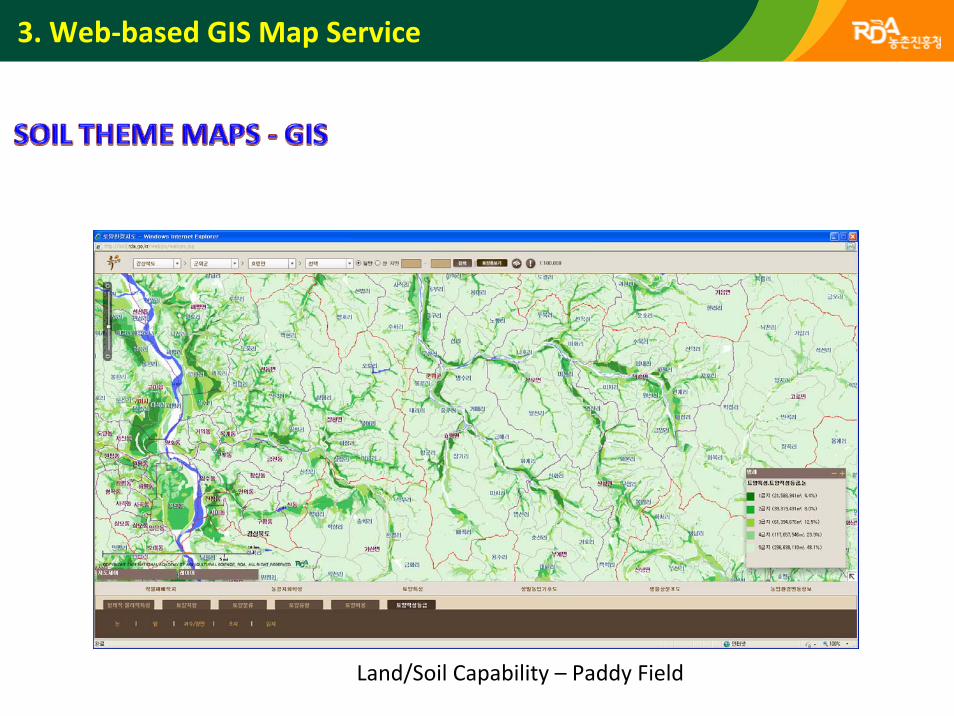
Land/Soil Capability – Paddy Field
3. Web‐based GIS Map Service
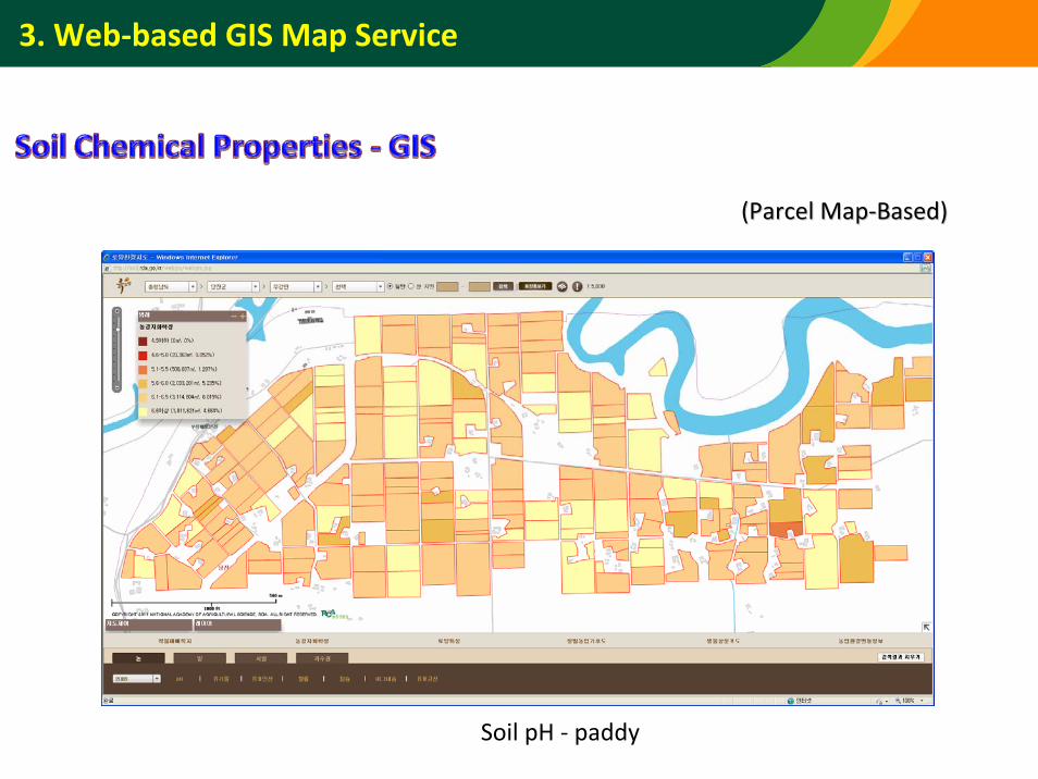
Soil pH ‐ paddy
(Parcel Map(Parcel Map‐‐Based)Based)
3. Web‐based GIS Map Service
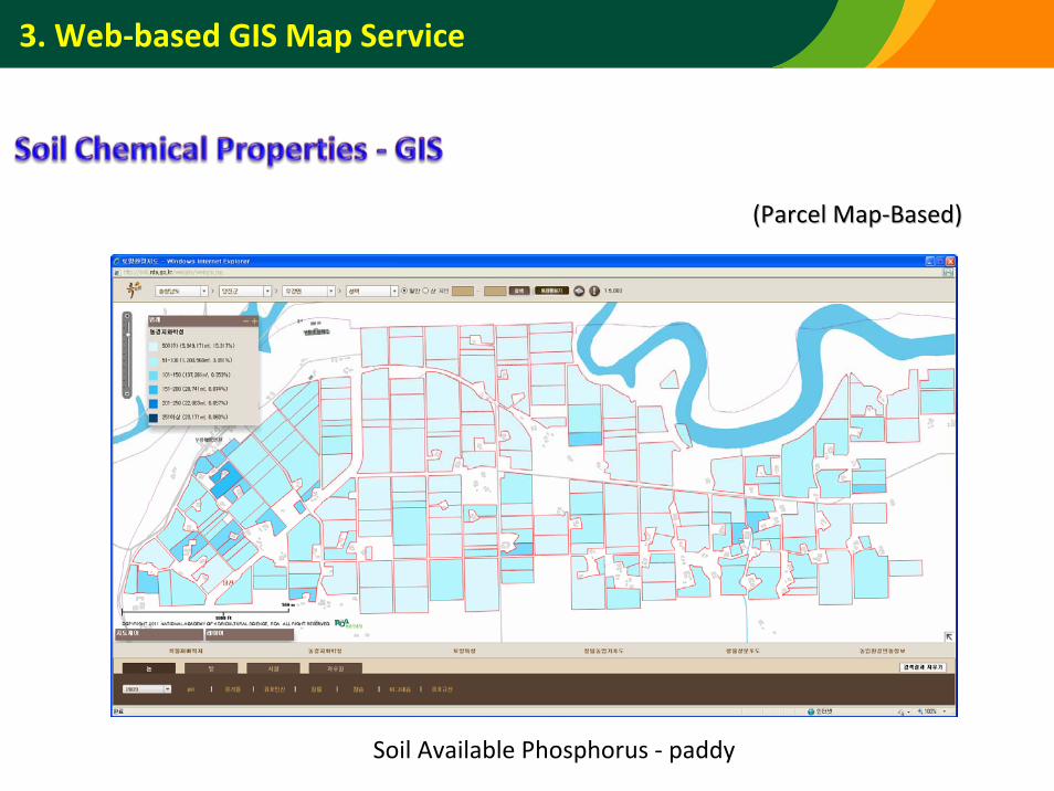
Soil Available Phosphorus ‐ paddy
(Parcel Map(Parcel Map‐‐Based)Based)
3. Web‐based GIS Map Service
3. Web‐based GIS Map Service
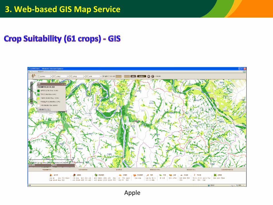
Apple
3. Web‐based GIS Map Service
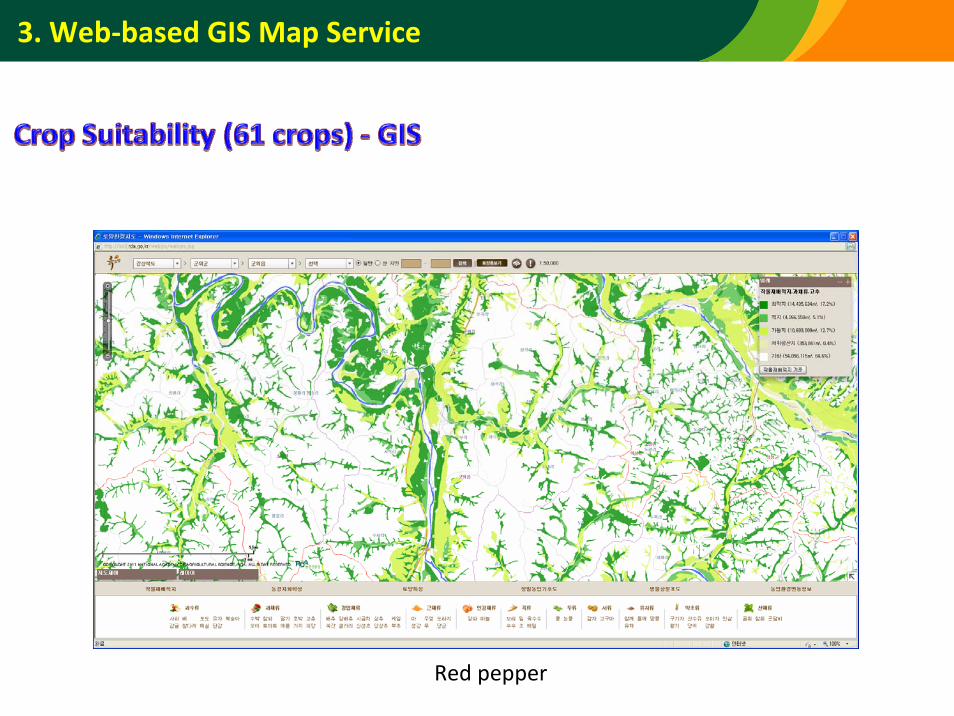
Red pepper
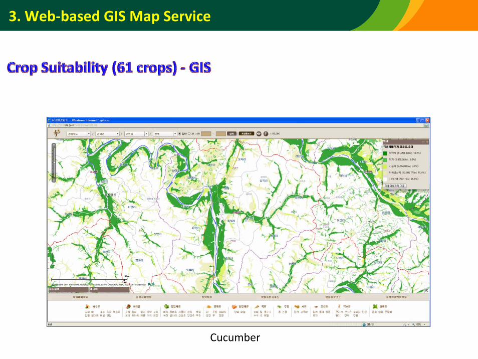
3. Web‐based GIS Map Service
Cucumber
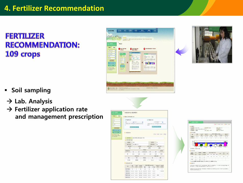
4. Fertilizer Recommendation
Soil sampling
Lab. AnalysisFertilizer application rateand management prescription
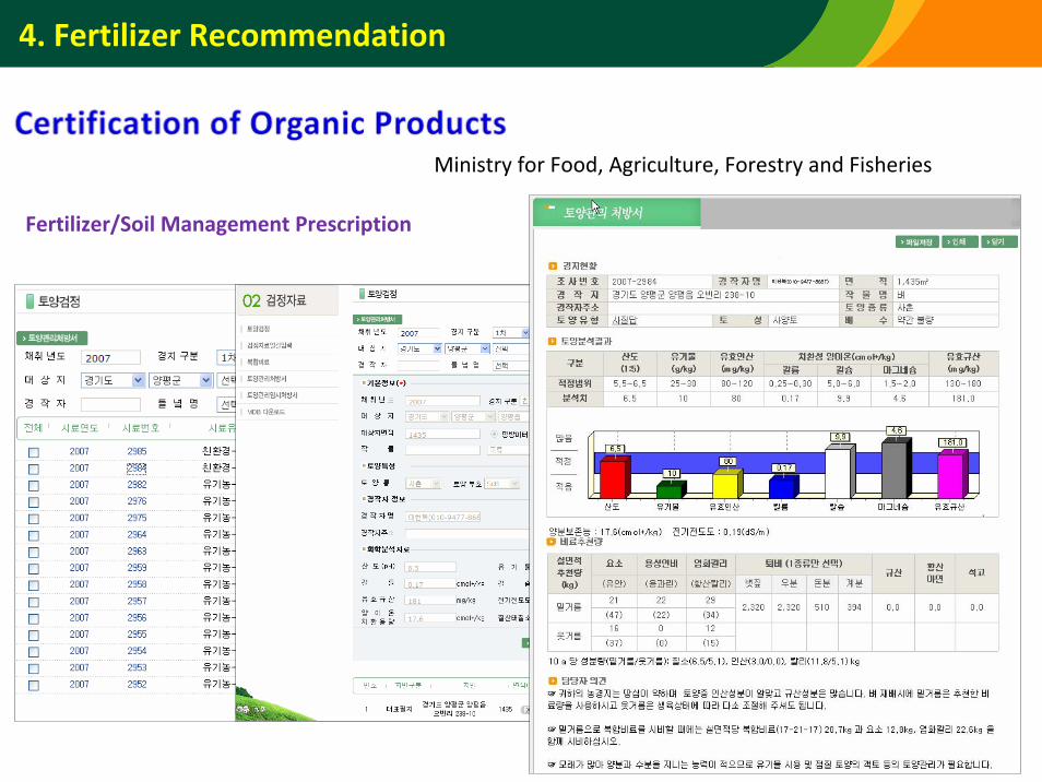
4. Fertilizer Recommendation
Ministry for Food, Agriculture, Forestry and Fisheries
Fertilizer/Soil Management Prescription
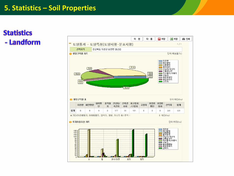
5. Statistics – Soil Properties

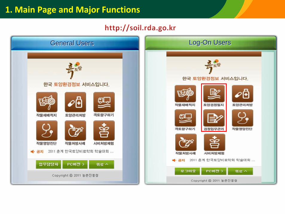
1. Main Page and Major Functions
General UsersGeneral Users Log-On UsersLog-On Users
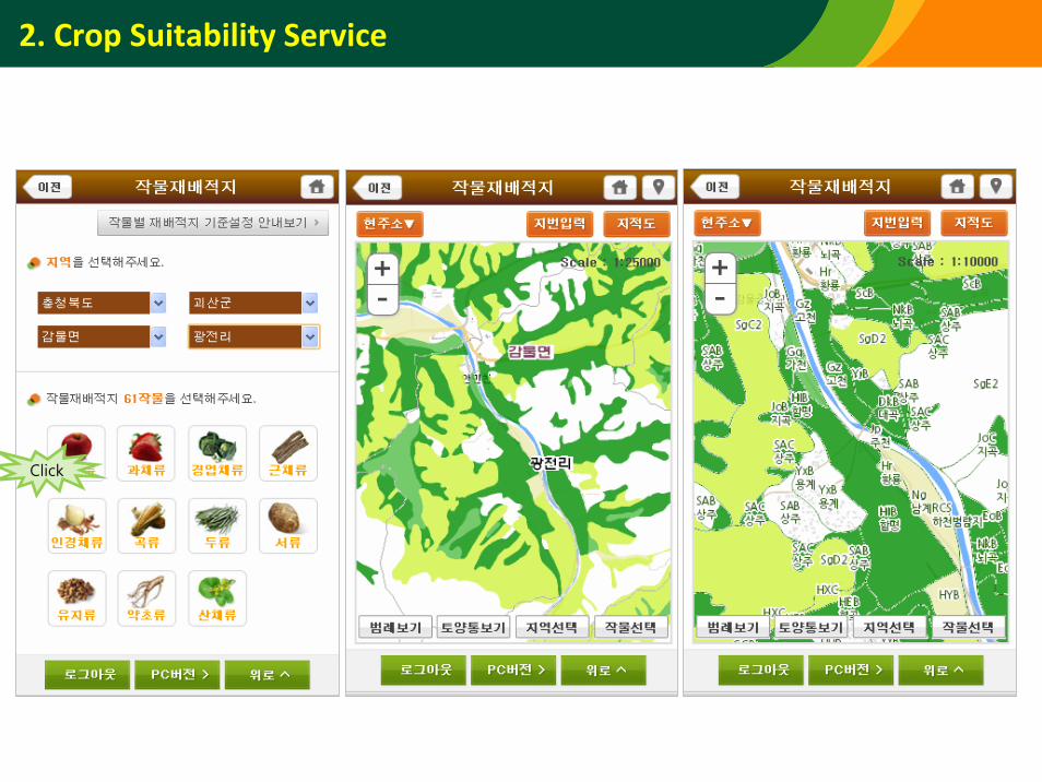
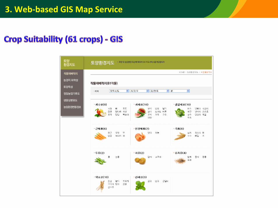
2. Crop Suitability Service
Click
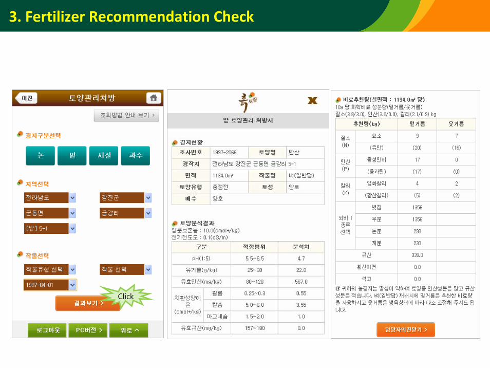
3. Fertilizer Recommendation Check
Click
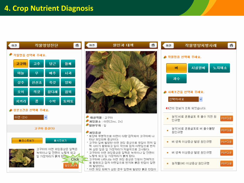
4. Crop Nutrient Diagnosis
Click
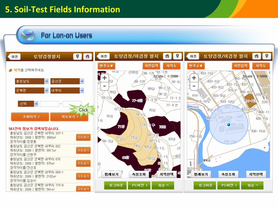
5. Soil‐Test Fields Information
For Lon-on UsersFor Lon-on Users
Click
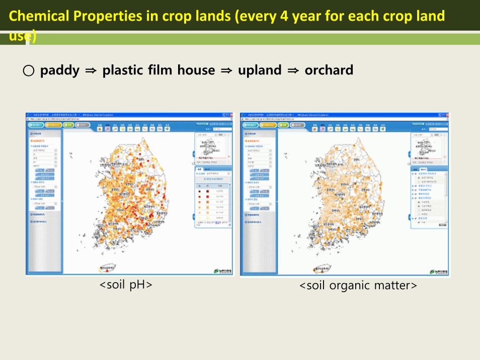
Chemical Properties in crop lands (every 4 year for each crop land use)
<soil pH> <soil organic matter>
○ paddy ⇒ plastic film house ⇒ upland ⇒ orchard
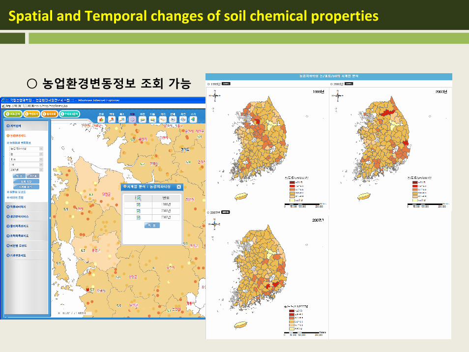
Spatial and Temporal changes of soil chemical properties
○ 농업환경변동정보 조회 가능
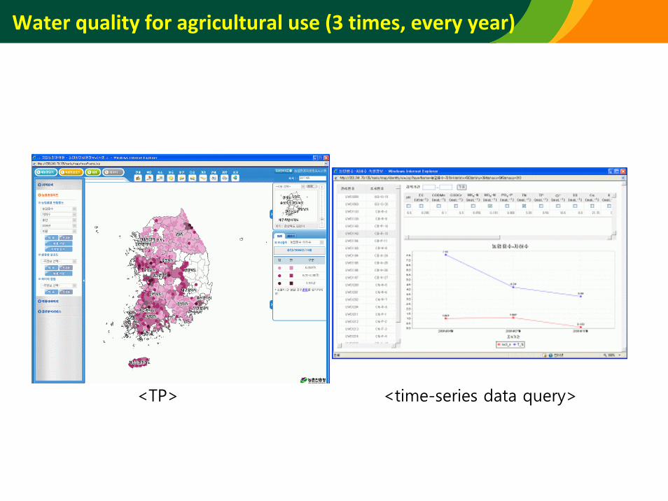
Water quality for agricultural use (3 times, every year)
<TP> <time-series data query>
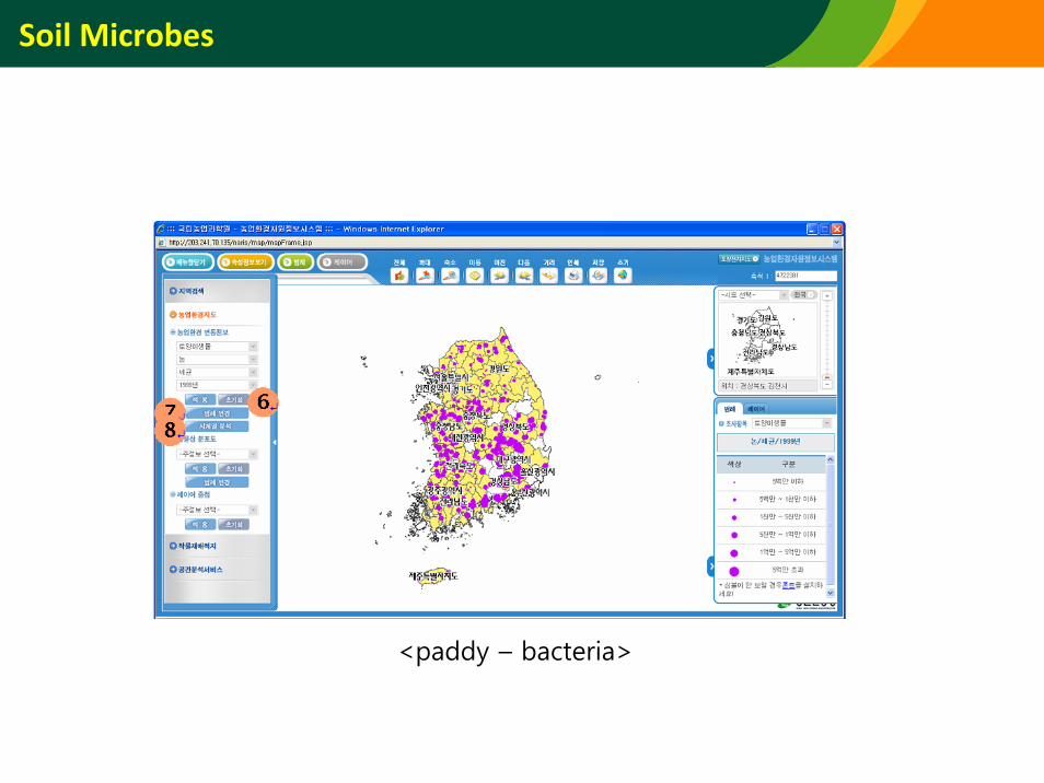
Soil Microbes
<paddy – bacteria>
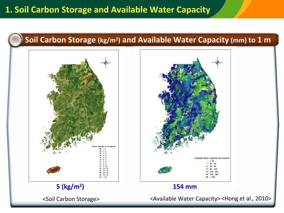
<Soil Carbon Storage> <Available Water Capacity>
Soil Carbon Storage (kg/m2) and Available Water Capacity (mm) to 1 m
5 (kg/m2) 154 mm
<Hong et al., 2010>
1. Soil Carbon Storage and Available Water Capacity
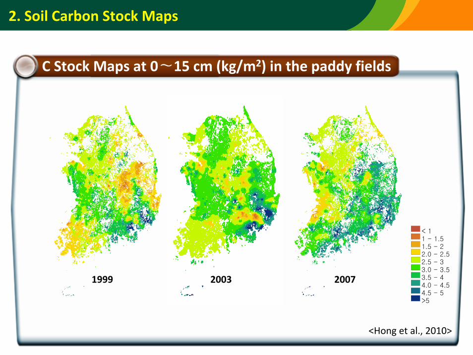
2. Soil Carbon Stock Maps
C Stock Maps at 0∼15 cm (kg/m2) in the paddy fields
< 11 - 1.51.5 - 22.0 - 2.52.5 - 33.0 - 3.53.5 - 44.0 - 4.54.5 - 5>5
1999 2003 2007
<Hong et al., 2010>
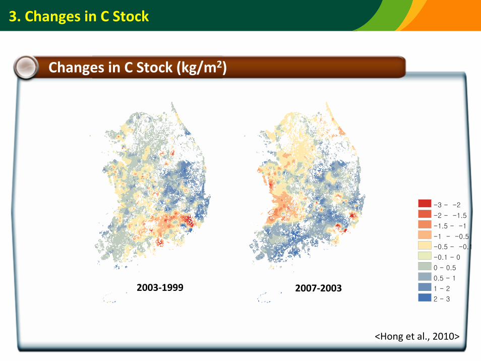
3. Changes in C Stock
Changes in C Stock (kg/m2)
2003‐1999 2007‐2003
-3 - -2
-2 - -1.5
-1.5 - -1
-1 - -0.5
-0.5 - -0.1
-0.1 - 0
0 - 0.5
0.5 - 1
1 - 2
2 - 3
<Hong et al., 2010>
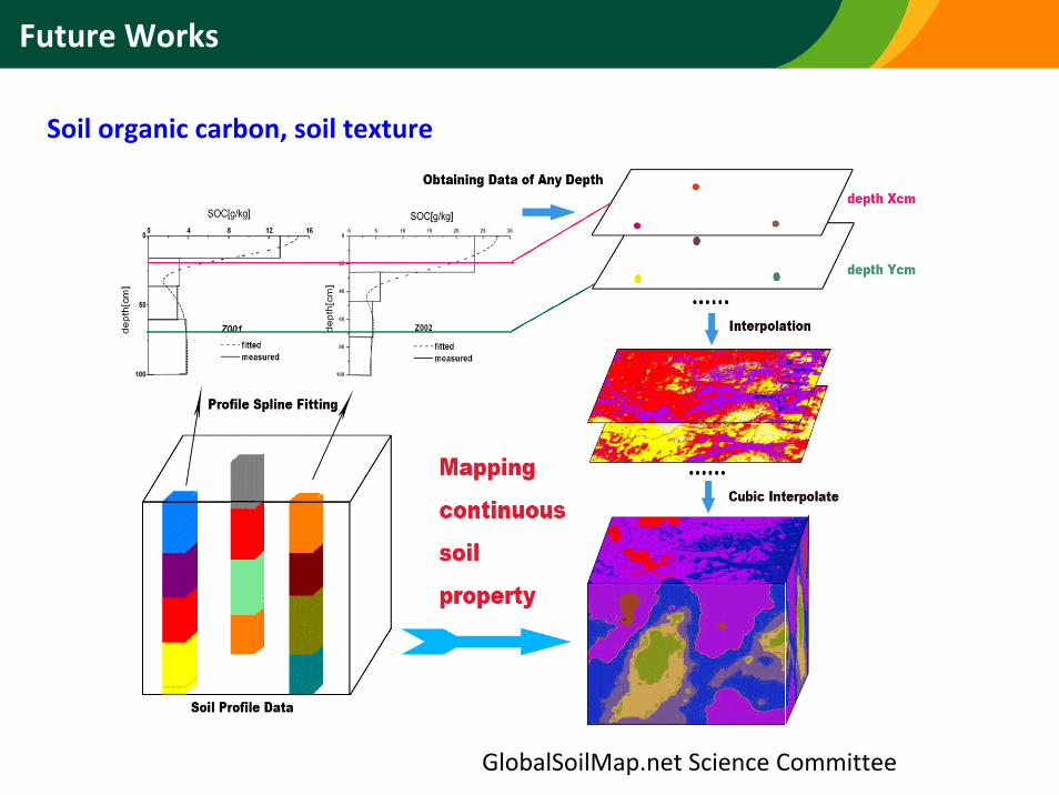
Future Works
GlobalSoilMap.net Science Committee
Soil organic carbon, soil texture
Conclusions
• Nation‐wide soil surveying over the past four decades produced the soil database that is useful for agriculture and other areas in Korea.
• Soil information obtained from the detailed survey and analyses of Korean soils is publicly accessible on the web.
• Soil is a dynamic resource of variable characteristics adaptable for its different use and management modes. Continued surveying of the changes in soil characteristics resulted from diverse land utilizations, environmental pollution, and intensive farming is strongly recommended.
• Soil serves not only as the base for food production, but also functions as an environmental purifier affecting climate, human health andecosystem, thus entailing interdisciplinary approaches to the research and preservation of soil.
Thank You!
謝謝 / Xie Xie