Embed Size (px)
Citation preview
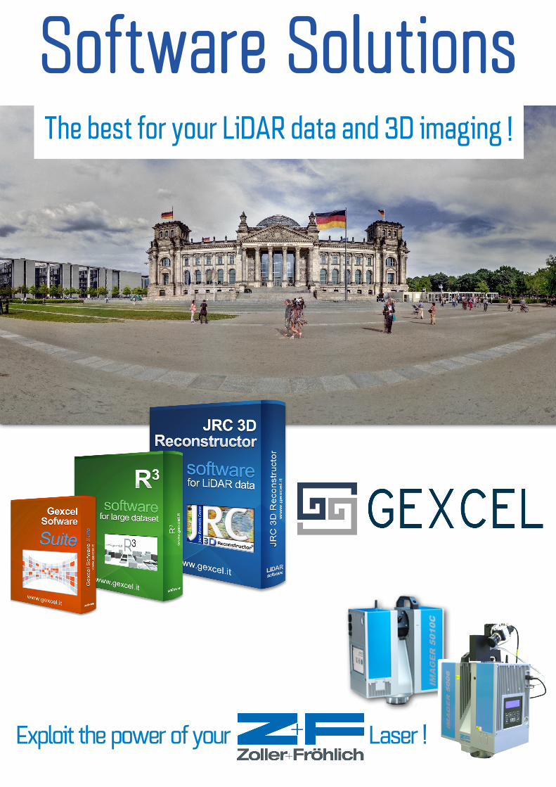
Sof tware Solut ionsThe best for your LiDAR data and 3D imaging !
Exploit the power of your Laser !
Sof tware Solut ions
Packages overview
www.gexcel.it© Gexcel Srl. All the names used in this sheets are registered trademarks. All rights reserved.
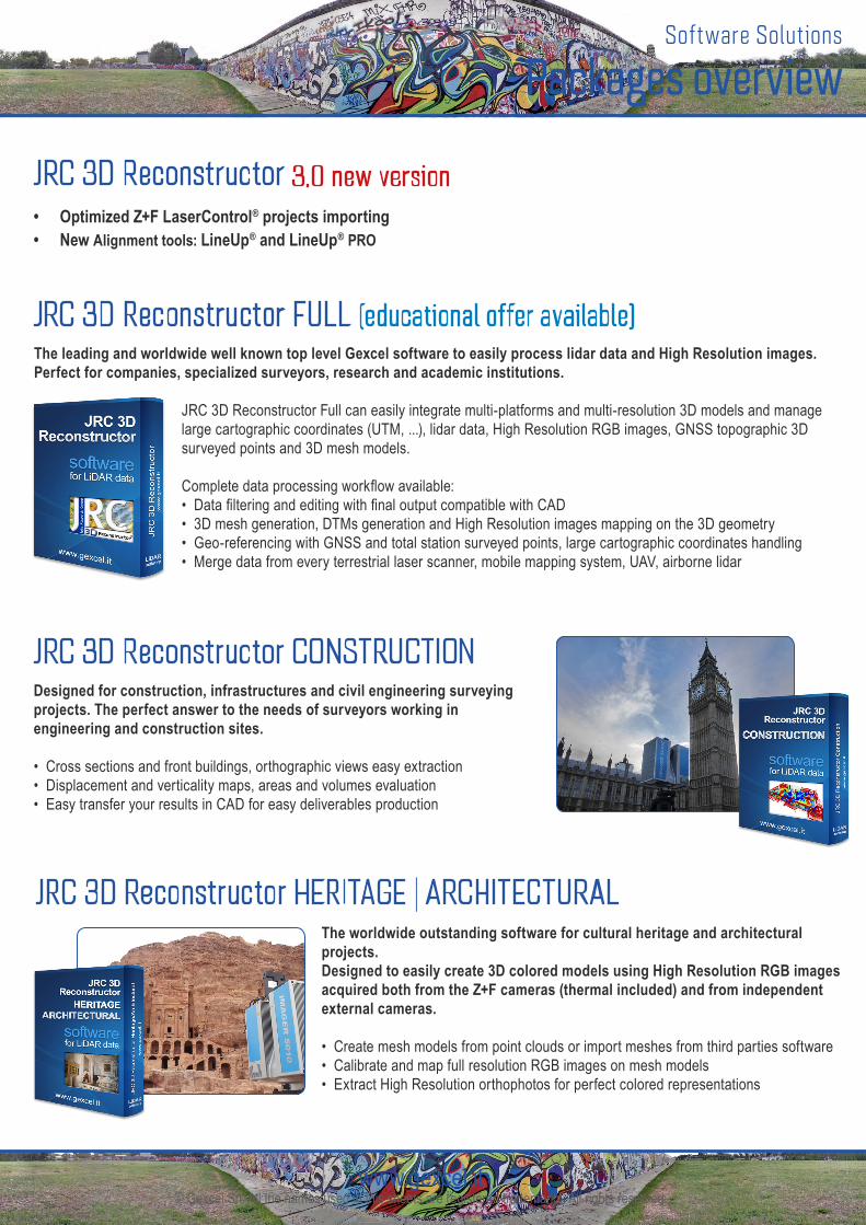
JRC 3D Reconstructor CONSTRUCTIONDesigned for construction, infrastructures and civil engineering surveying projects. The perfect answer to the needs of surveyors working in civil engineering and construction sites.
• Cross sections and front buildings, orthographic views easy extraction• Displacement and verticality maps, areas and volumes evaluation• Easy transfer your results in CAD for easy deliverables production
JRC 3D Reconstructor HERITAGE | ARCHITECTUR ALThe worldwide outstanding software for cultural heritage and architectural projects.Designed to easily create 3D colored models using High Resolution RGB images acquired both from the Z+F cameras (thermal included) and from independent external cameras.
• Create mesh models from point clouds or import meshes from third parties software• Calibrate and map full resolution RGB images on mesh models• Extract High Resolution orthophotos for perfect colored representations
JRC 3D Reconstructor 3.0 new version• Optimized Z+F LaserControl® projects importing• New Alignment tools: LineUp® and LineUp® PRO
JRC 3D Reconstructor FULL (educat ional of fer available)The leading and worldwide well known top level Gexcel software to easily process lidar data and High Resolution images. Perfect for companies, specialized surveyors, research and academic institutions.
JRC 3D Reconstructor Full can easily integrate multi-platforms and multi-resolution 3D models and manage large cartographic coordinates (UTM, ...), lidar data, High Resolution RGB images, GNSS topographic 3D surveyed points and 3D mesh models.
Complete data processing workflow available:• Data filtering and editing with final output compatible with CAD• 3D mesh generation, DTMs generation and High Resolution images mapping on the 3D geometry• Geo-referencing with GNSS and total station surveyed points, large cartographic coordinates handling• Merge data from every terrestrial laser scanner, mobile mapping system, UAV, airborne lidar
Sof tware Solut ions
Packages overview
www.gexcel.it© Gexcel Srl. All the names used in this sheets are registered trademarks. All rights reserved.
• Point clouds importing and filtering
• Automatic target detection
• Geo-referencing
• Scans alignment per groups
• Cloud to cloud best fitting alignment
• Bundle adjustment
New L ineUp®
• LineUp® fuctions included• Automatic alignment (target-free)
New L ineUp® pro
• Take notes and sketches of scanning projects• Simplify the automatic alignment procedure
• Note the position of scanner and targets
New L ineUp® notes for iPad
APPs andTOOLs• Import Solid Images with depth information in CAD
• Draw 3D polylines, profiles, edges and sections
gexcel CAD plug-in for PointR3
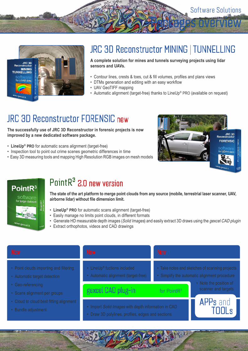
JRC 3D Reconstructor FORENSIC newThe successfully use of JRC 3D Reconstructor in forensic projects is now improved by a new dedicated software package.
• LineUp® PRO for automatic scans alignment (target-free)• Inspection tool to point out crime scenes geometric differences in time• Easy 3D measuring tools and mapping High Resolution RGB images on mesh models
JRC 3D Reconstructor MINING | TUNNELLINGA complete solution for mines and tunnels surveying projects using lidar sensors and UAVs.
• Contour lines, crests & toes, cut & fill volumes, profiles and plans views• DTMs generation and editing with an easy workflow• UAV GeoTIFF mapping• Automatic alignment (target-free) thanks to LineUp® PRO (available on request)
Poin t R 3 2.0 new versionThe state of the art platform to merge point clouds from any source (mobile, terrestrial laser scanner, UAV, airborne lidar) without file dimension limit.
• LineUp® PRO for automatic scans alignment (target-free)• Easily manage no limits point clouds, in different formats• Generate HD measurable depth images (Solid Images) and easily extract 3D draws using the gexcel CAD plugin• Extract orthophotos, videos and CAD drawings
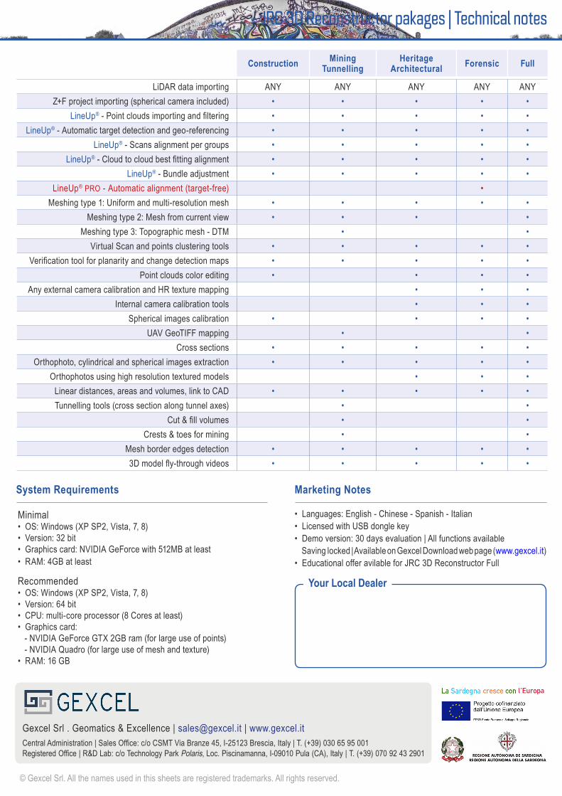
JRC 3D Reconstructor pakages | Technical notes
Your Local Dealer
Marketing Notes
• Languages: English - Chinese - Spanish - Italian• Licensed with USB dongle key• Demo version: 30 days evaluation | All functions available Saving locked | Available on Gexcel Download web page (www.gexcel.it)• Educational offer avilable for JRC 3D Reconstructor Full
Minimal• OS: Windows (XP SP2, Vista, 7, 8)• Version: 32 bit• Graphics card: NVIDIA GeForce with 512MB at least• RAM: 4GB at least
Recommended• OS: Windows (XP SP2, Vista, 7, 8)• Version: 64 bit• CPU: multi-core processor (8 Cores at least)• Graphics card: - NVIDIA GeForce GTX 2GB ram (for large use of points) - NVIDIA Quadro (for large use of mesh and texture)• RAM: 16 GB
System Requirements
© Gexcel Srl. All the names used in this sheets are registered trademarks. All rights reserved.
Gexcel Srl . Geomatics & Excellence | [email protected] | www.gexcel.itCentral Administration | Sales Office: c/o CSMT Via Branze 45, I-25123 Brescia, Italy | T. (+39) 030 65 95 001Registered Office | R&D Lab: c/o Technology Park Polaris, Loc. Piscinamanna, I-09010 Pula (CA), Italy | T. (+39) 070 92 43 2901
Construction MiningTunnelling
HeritageArchitectural Forensic Full
LiDAR data importing ANY ANY ANY ANY ANYZ+F project importing (spherical camera included) • • • • •
LineUp® - Point clouds importing and filtering • • • • •LineUp® - Automatic target detection and geo-referencing • • • • •
LineUp® - Scans alignment per groups • • • • •LineUp® - Cloud to cloud best fitting alignment • • • • •
LineUp® - Bundle adjustment • • • • •LineUp® PRO - Automatic alignment (target-free) •
Meshing type 1: Uniform and multi-resolution mesh • • • • •Meshing type 2: Mesh from current view • • • •
Meshing type 3: Topographic mesh - DTM • •Virtual Scan and points clustering tools • • • • •
Verification tool for planarity and change detection maps • • • • •Point clouds color editing • • • •
Any external camera calibration and HR texture mapping • • •Internal camera calibration tools • • •
Spherical images calibration • • • •UAV GeoTIFF mapping • •
Cross sections • • • • •Orthophoto, cylindrical and spherical images extraction • • • • •
Orthophotos using high resolution textured models • • •Linear distances, areas and volumes, link to CAD • • • • •Tunnelling tools (cross section along tunnel axes) • •
Cut & fill volumes • •Crests & toes for mining • •
Mesh border edges detection • • • • •3D model fly-through videos • • • • •