Embed Size (px)
Citation preview
Social Studies 9UNIT 2 – GEOGRAPHIC INFLUENCES
ON IDENTITY: PLACE AND PEOPLE
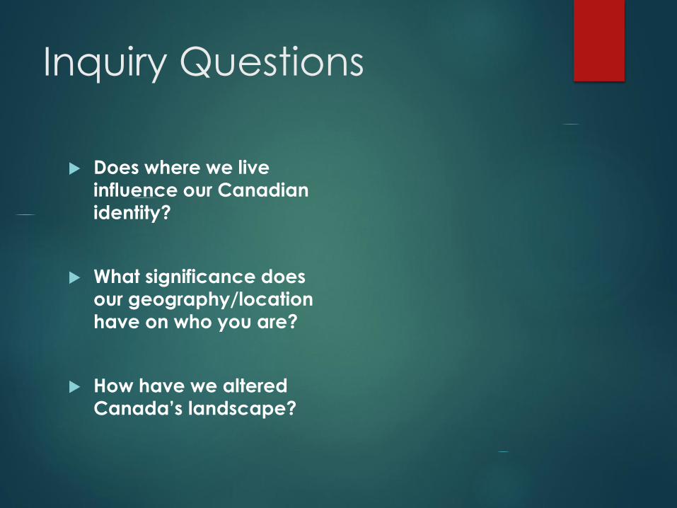
Inquiry Questions
Does where we live
influence our Canadian
identity?
What significance does
our geography/location
have on who you are?
How have we altered Canada’s landscape?

Canada
Canada is the world’s second largest country in area.
It borders three oceans and extends across six time zones. Canada is not only geographically large –- it is also incredibly diverse.
The size and variety of Canada’s geographic landscape, and the response of the diverse peoples who have inhabited it, have played a significant role in shaping Canadian identity(ies).

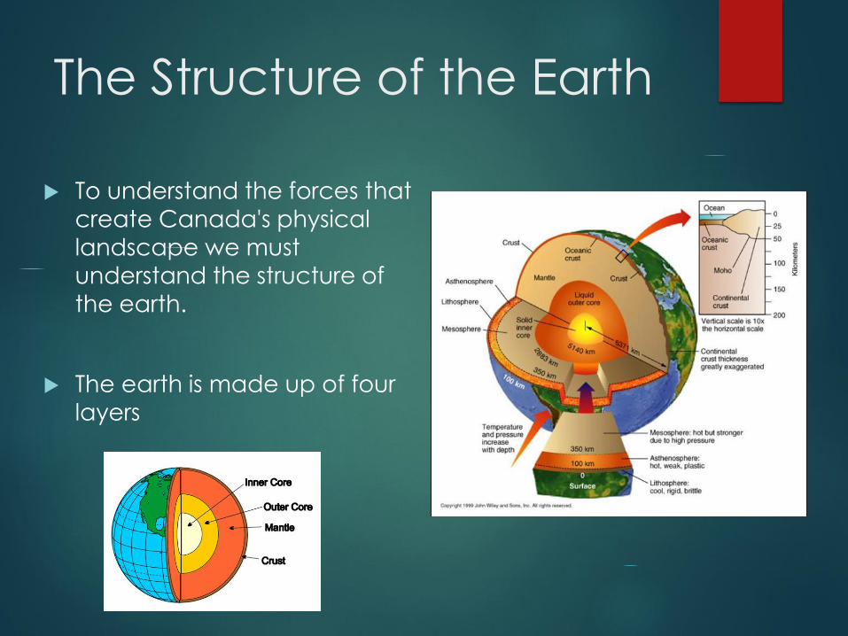
The Structure of the Earth
To understand the forces that
create Canada's physical
landscape we must
understand the structure of
the earth.
The earth is made up of four
layers
The Four Layers of the Earth
Inner Core: Solid and hot because it is under a lot of pressure.
Outer Core: Liquid material that surrounds the inner core.
Mantle: A liquid and semi liquid layer that exists between the outer core and crust the upper part is known as the
asthenosphere, this section is involved in plate tectonics.
Crust (Lithosphere): A solid but brittle outer layer of the planet
Video: Structure of Earth
The Theory of Continental
Drift
A theory suggested by German geologist Alfred Wagner
in 1915
He examined the shape of the continents, rock structures,
and recovered fossils to come up with his theory.
He proposed that the Earth’s crust is not solid but made
up of plates moving upon the mantle.
He believed there was once a super continent called
Pangea and one sea called Panthalassa
Video: Continental Drift
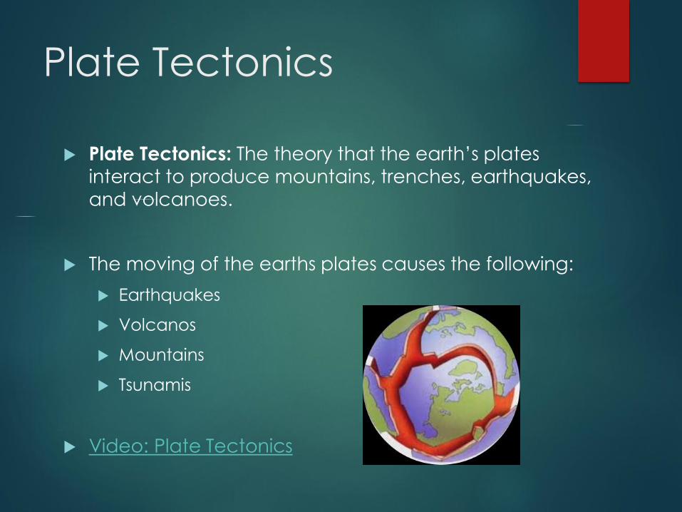
Plate Tectonics
Plate Tectonics: The theory that the earth’s plates
interact to produce mountains, trenches, earthquakes,
and volcanoes.
The moving of the earths plates causes the following:
Earthquakes
Volcanos
Mountains
Tsunamis
Video: Plate Tectonics

Tectonics and Canada
Canada is on the North American Plate
It moves West away from Europe at 2-4 cm per year
Mid Atlantic Ridge: Area of the Atlantic Ocean where the sea floor is expanding.
Off the west coast of Canada there is a subduction zone.
Subduction Zone: Area where one plate is pulled down beneath another creating volcanoes and earthquakes
Video: Mid Atlantic Ridge
Video: Subduction Zone

North American Plate

Tectonic Plates
Creating Landforms
Topography: The natural features of the land’s surface.
Topography is described using the following terms
Elevation: Height above sea level
Relief: The difference in elevation between points
Gradient: The steepness of slopes
Geology: Types of rocks and the history of them
General appearance: What do the features look like
Landscape: an areas landforms together with its cover of vegetation water, ice, and rock.
This includes all human features
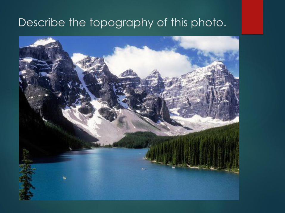
Describe the topography of this photo.
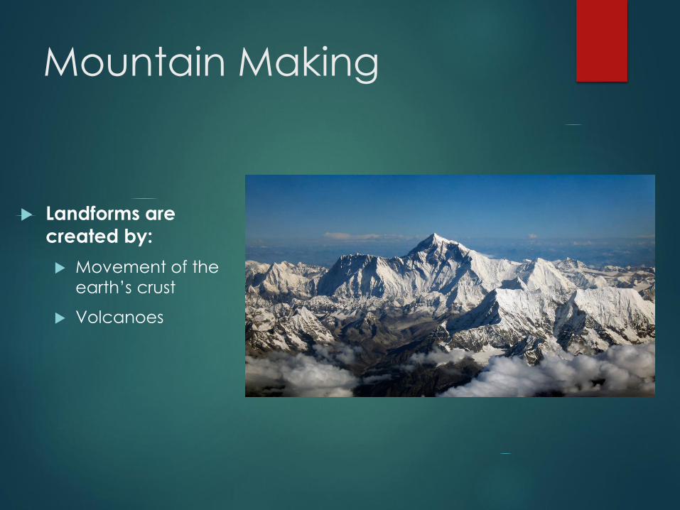
Mountain Making
Landforms are
created by:
Movement of the
earth’s crust
Volcanoes
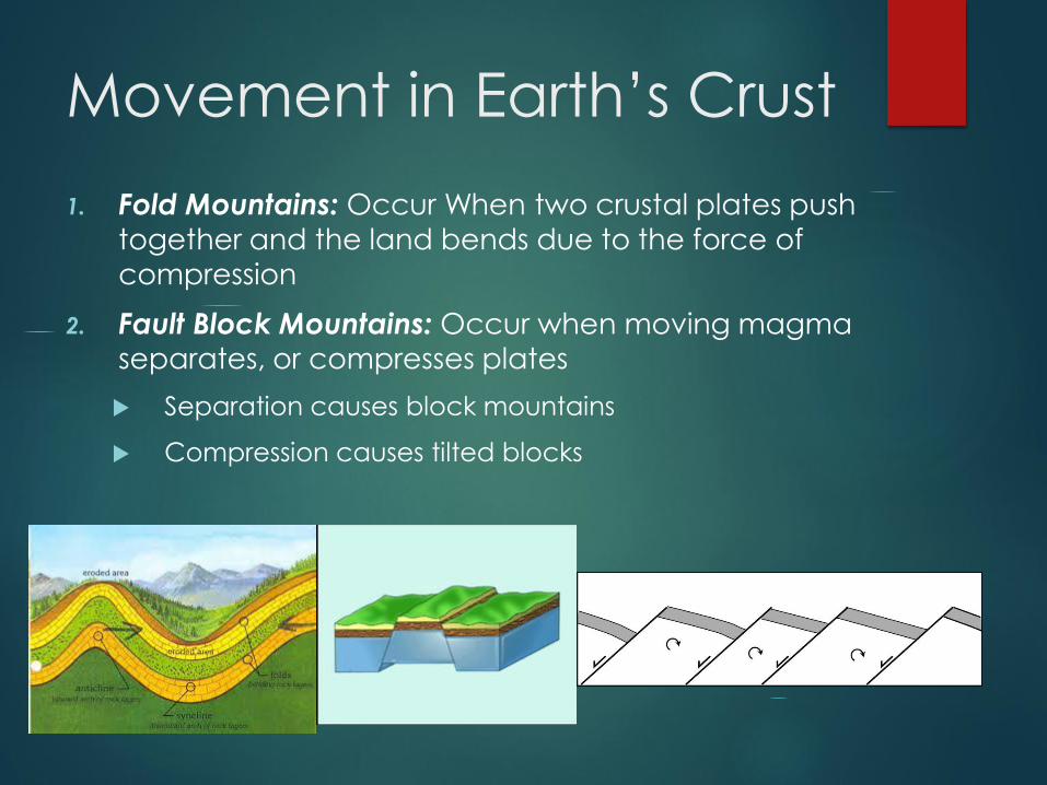
Movement in Earth’s Crust
1. Fold Mountains: Occur When two crustal plates push
together and the land bends due to the force of
compression
2. Fault Block Mountains: Occur when moving magma separates, or compresses plates
Separation causes block mountains
Compression causes tilted blocks

Volcanos
A volcano is most commonly a
conical hill or mountain built around
a vent that connects with reservoirs
of molten rock below the surface of
the Earth.
Lava (liquid rock), gases and
molten rock fragments called Ash
OR Cinders flow through a fracture in the crust.
These flows can be either violent
eruptions or mild, slow flows!

Convection currents in the
mantle
What causes them to
erupt?
Driven by buoyancy and gas pressure…
Molten rock, which is lighter than the surrounding solid rock, forces its way upward and may ultimately break though zones of weaknesses in the Earth's crust.
Molten rock below the surface of the Earth that rises in volcanic vents is known as magma.
After it erupts from a volcano it is called lava.

How Landforms are
Shaped
The topography we see is shaped by
four factors:
1. Mountain building: How landforms are
created
2. Weathering: the wearing down forces
of the atmosphere.
3. Erosion: The moving of weathered material
4. Deposition: Where eroded materials
are dropped create new forms
Canada’s Landform
Regions
Canada has eight landform regions that are
based on:
Age of rock
Type of rock
Relief
Gradient
Process that has shaped the area
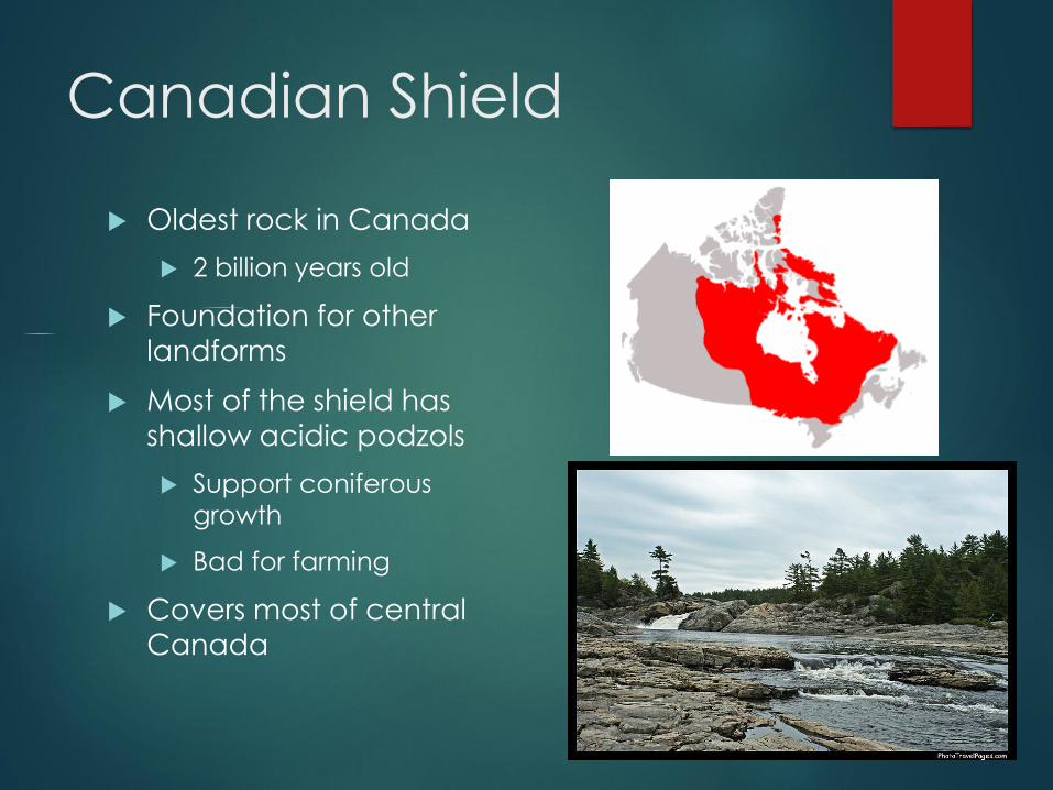
Canadian Shield
Oldest rock in Canada
2 billion years old
Foundation for other
landforms
Most of the shield has
shallow acidic podzols
Support coniferous
growth
Bad for farming
Covers most of central Canada

Appalachian Mountains
Formed around 375 million years ago when the Eurasian plate and the North American plate collided to form the super continent Pangea
Mountains have been worn down by ice and water
Typical height of the mountains is 1000m
Covered mostly by mixed forest
Found in most of Atlantic Canada
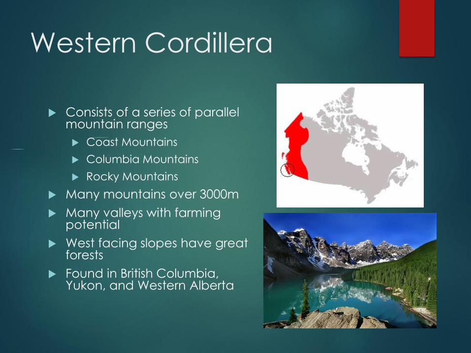
Western Cordillera
Consists of a series of parallel mountain ranges
Coast Mountains
Columbia Mountains
Rocky Mountains
Many mountains over 3000m
Many valleys with farming potential
West facing slopes have great forests
Found in British Columbia, Yukon, and Western Alberta

Innuitian Mountains
Found in the far North
Many over 2000m tall
Steep sided
Too cold for trees to
grow
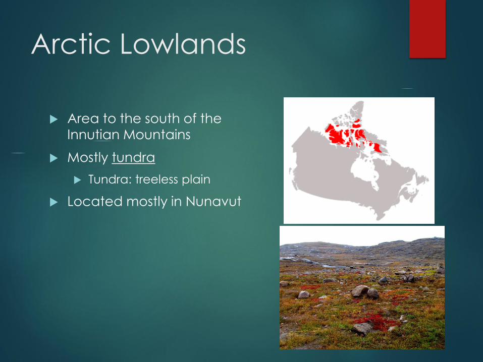
Arctic Lowlands
Area to the south of the
Innutian Mountains
Mostly tundra
Tundra: treeless plain
Located mostly in Nunavut
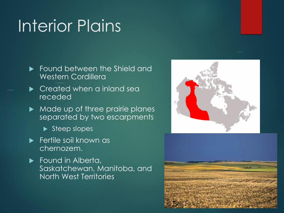
Interior Plains
Found between the Shield and Western Cordillera
Created when a inland sea receded
Made up of three prairie planes separated by two escarpments
Steep slopes
Fertile soil known as chernozem.
Found in Alberta, Saskatchewan, Manitoba, and North West Territories
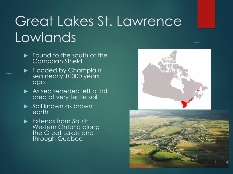
Great Lakes St. Lawrence
Lowlands Found to the south of the
Canadian Shield
Flooded by Champlain sea nearly 10000 years ago.
As sea receded left a flat area of very fertile soil
Soil known as brown earth
Extends from South Western Ontario along the Great Lakes and through Quebec
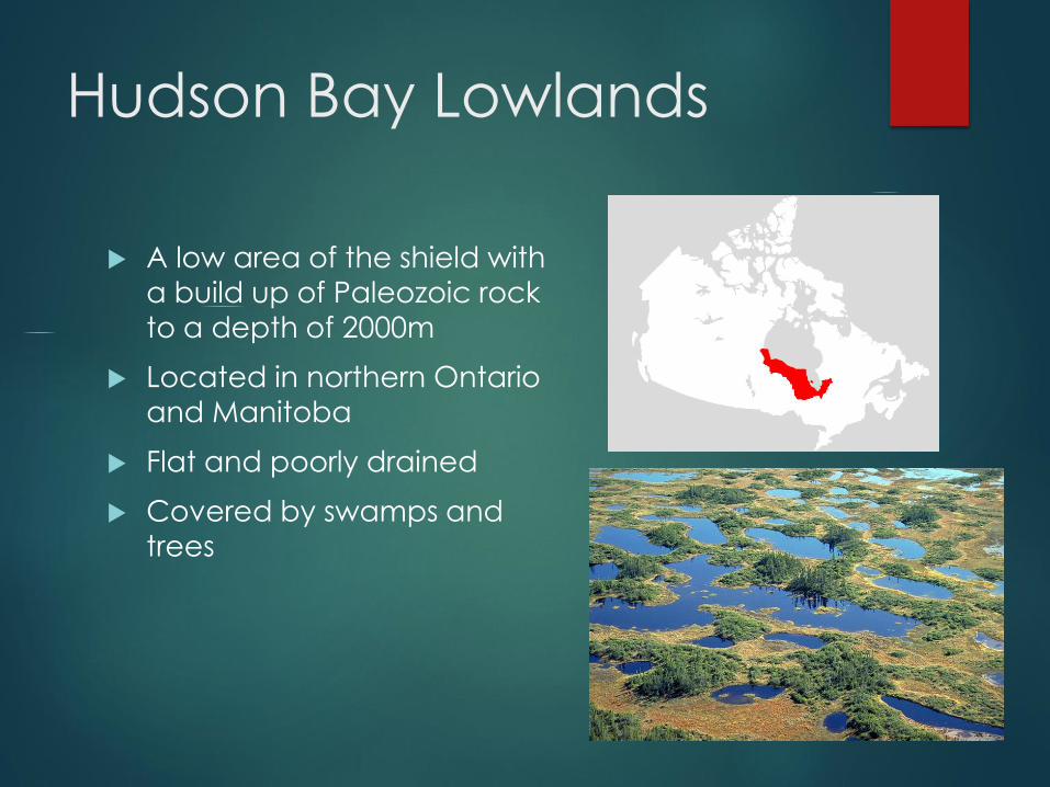
Hudson Bay Lowlands
A low area of the shield with
a build up of Paleozoic rock to a depth of 2000m
Located in northern Ontario
and Manitoba
Flat and poorly drained
Covered by swamps and
trees
Regionalism
What is regionalism?
How are Canada’s regions unique?
What are the regions of Canada?
How do you identify yourself?
How are the regions divided up?
Group Work- Each group will analyze one region
of Canada. Identify the location, physical and
cultural attributes and political perspective. Pg. 52- 54 textbook.