Embed Size (px)
Citation preview

Séminaire Partenaires Esri France 6 et 7 juin 2012 | Paris
ArcGIS API Web 3.0 Olivier Rossini
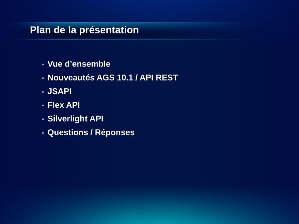
Plan de la présentation
• Vue d’ensemble • Nouveautés AGS 10.1 / API REST • JSAPI • Flex API • Silverlight API • Questions / Réponses
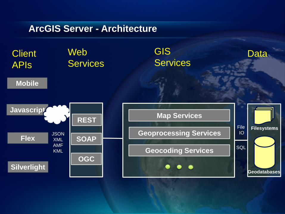
ArcGIS Server - Architecture
Client APIs
Web Services
GIS Services
Data
Javascript
Flex
Silverlight
Map Services
Geoprocessing Services
Geocoding Services
Filesystems
Geodatabases
SQL
File IO
REST
SOAP JSON XML AMF KML
OGC
Mobile
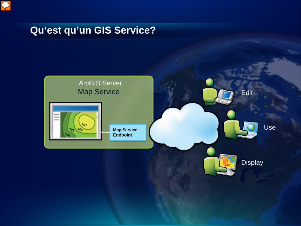
Qu’est qu’un GIS Service?
Map Service Endpoint
ArcGIS Server Map Service Edit
Use
Display

ArcGIS Server – GIS Services
Mapping
Feature
Geocode
Geoprocessing
Globe
Geodata
Geometry
Image
Network Analysis
Search
http://esriurl.com/arcgisservices
ArcGIS Server
OGC
KML
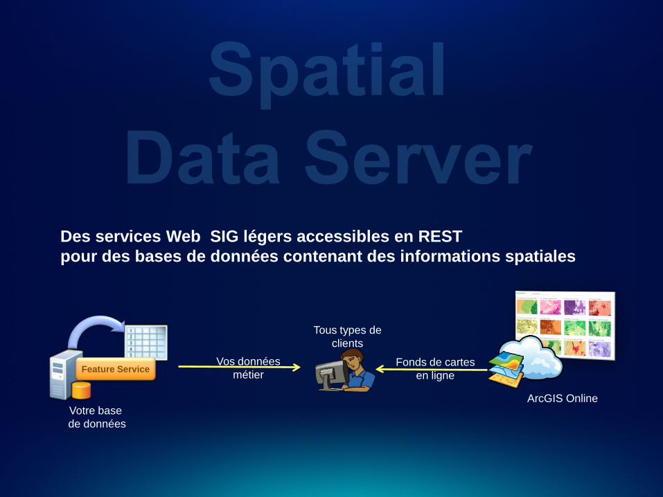
ArcGIS Online
Vos données métier
Fonds de cartes en ligne
Votre base de données
Feature Service
Tous types de clients
Des services Web SIG légers accessibles en REST pour des bases de données contenant des informations spatiales
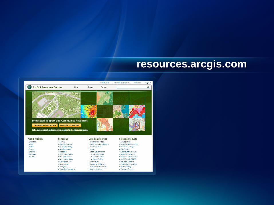
resources.arcgis.com
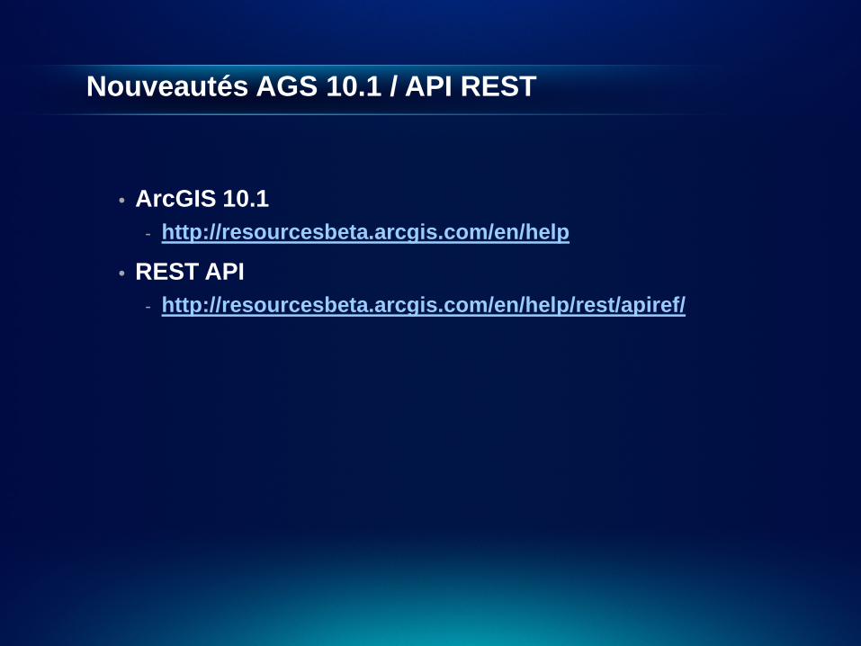
Nouveautés AGS 10.1 / API REST
• ArcGIS 10.1 - http://resourcesbeta.arcgis.com/en/help
• REST API - http://resourcesbeta.arcgis.com/en/help/rest/apiref/
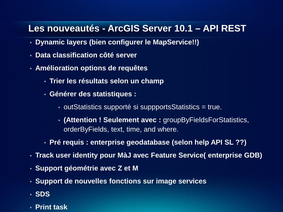
Les nouveautés - ArcGIS Server 10.1 – API REST • Dynamic layers (bien configurer le MapService!!)
• Data classification côté server
• Amélioration options de requêtes
• Trier les résultats selon un champ
• Générer des statistiques :
• outStatistics supporté si suppportsStatistics = true.
• (Attention ! Seulement avec : groupByFieldsForStatistics, orderByFields, text, time, and where.
• Pré requis : enterprise geodatabase (selon help API SL ??)
• Track user identity pour MàJ avec Feature Service( enterprise GDB)
• Support géométrie avec Z et M
• Support de nouvelles fonctions sur image services
• SDS
• Print task

API JavaScript

JavaScript API - rappels
• Nativement dans tous les navigateurs – no plug-in. • Facile à prendre en main • Différents frameworks disponibles.
- EXTJS, Dojo, jQuery, etc.
• Plusieurs environnements de développement possibles
- Notepad, Notepad++, Aptana, Visual Studio, etc.
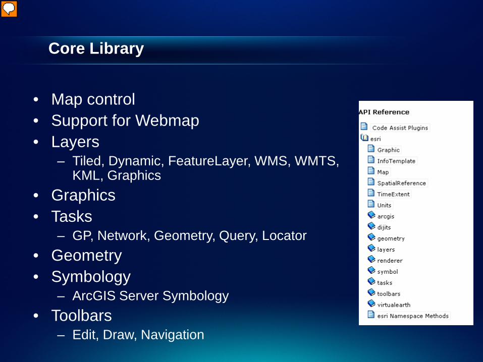
Core Library
• Map control • Support for Webmap • Layers
– Tiled, Dynamic, FeatureLayer, WMS, WMTS, KML, Graphics
• Graphics • Tasks
– GP, Network, Geometry, Query, Locator • Geometry • Symbology
– ArcGIS Server Symbology • Toolbars
– Edit, Draw, Navigation
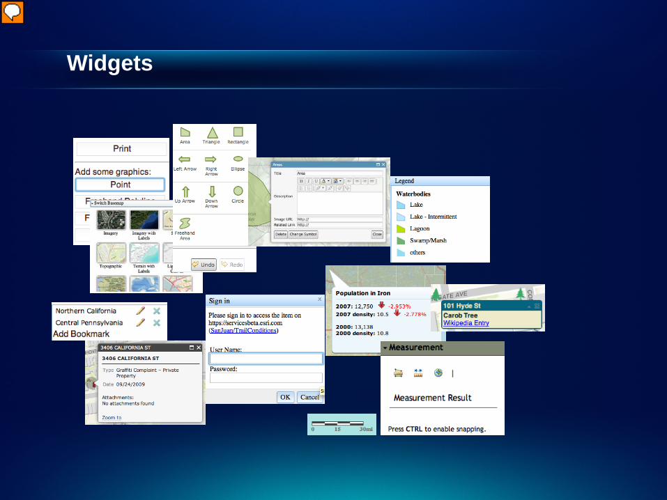
Widgets
Portal API
• Simple API for working the ArcGIS for Portal API - On Premise or ArcGIS Online
• Supports:
- Connecting to your Portal - Querying for items - Querying for Groups - Accessing user content - Get Notifications, comments

API Portal
Démonstration
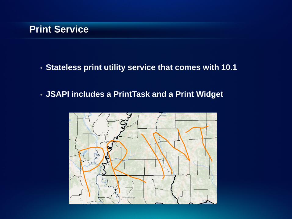
Print Service
• Stateless print utility service that comes with 10.1
• JSAPI includes a PrintTask and a Print Widget

Printing
Démonstration
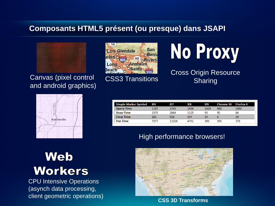
Composants HTML5 présent (ou presque) dans JSAPI
Canvas (pixel control and android graphics)
CSS3 Transitions Cross Origin Resource
Sharing
CPU Intensive Operations (asynch data processing, client geometric operations)
High performance browsers!
CSS 3D Transforms
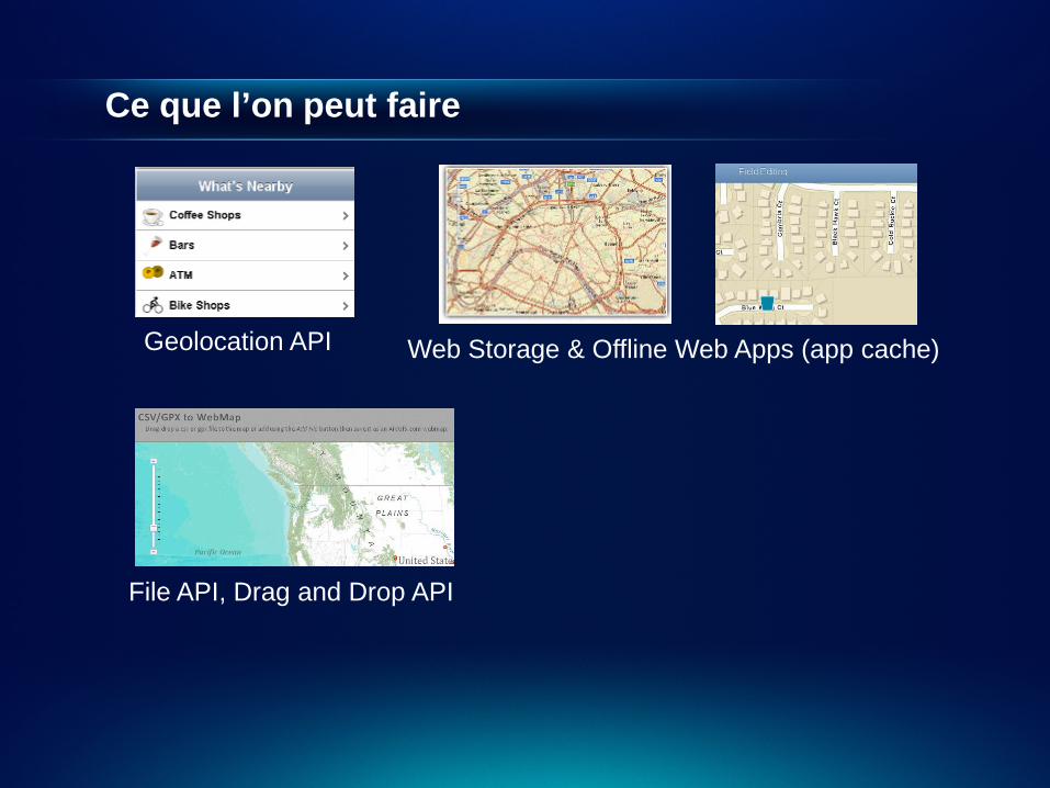
Ce que l’on peut faire
Geolocation API Web Storage & Offline Web Apps (app cache)
File API, Drag and Drop API
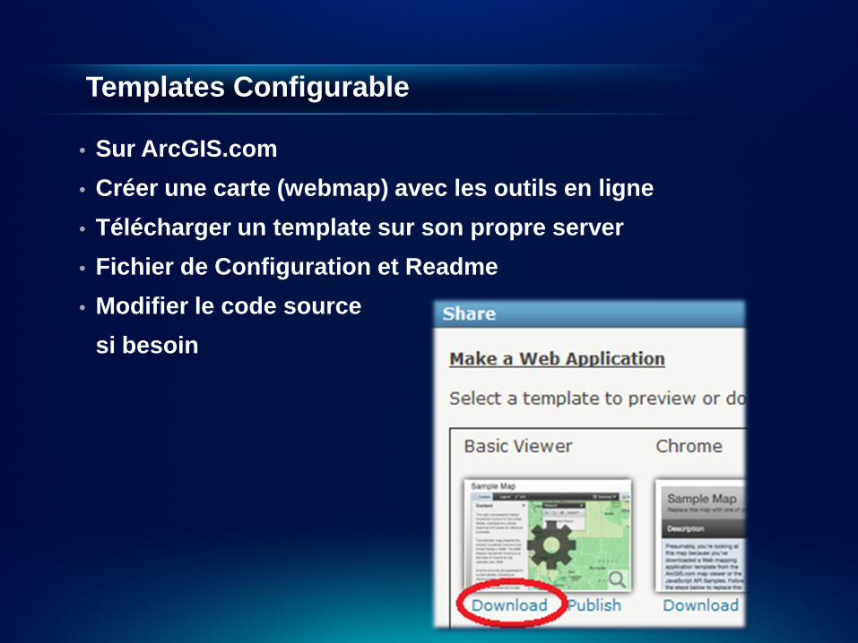
Templates Configurable
• Sur ArcGIS.com • Créer une carte (webmap) avec les outils en ligne • Télécharger un template sur son propre server • Fichier de Configuration et Readme • Modifier le code source si besoin

Templates
Démonstration

API Flex
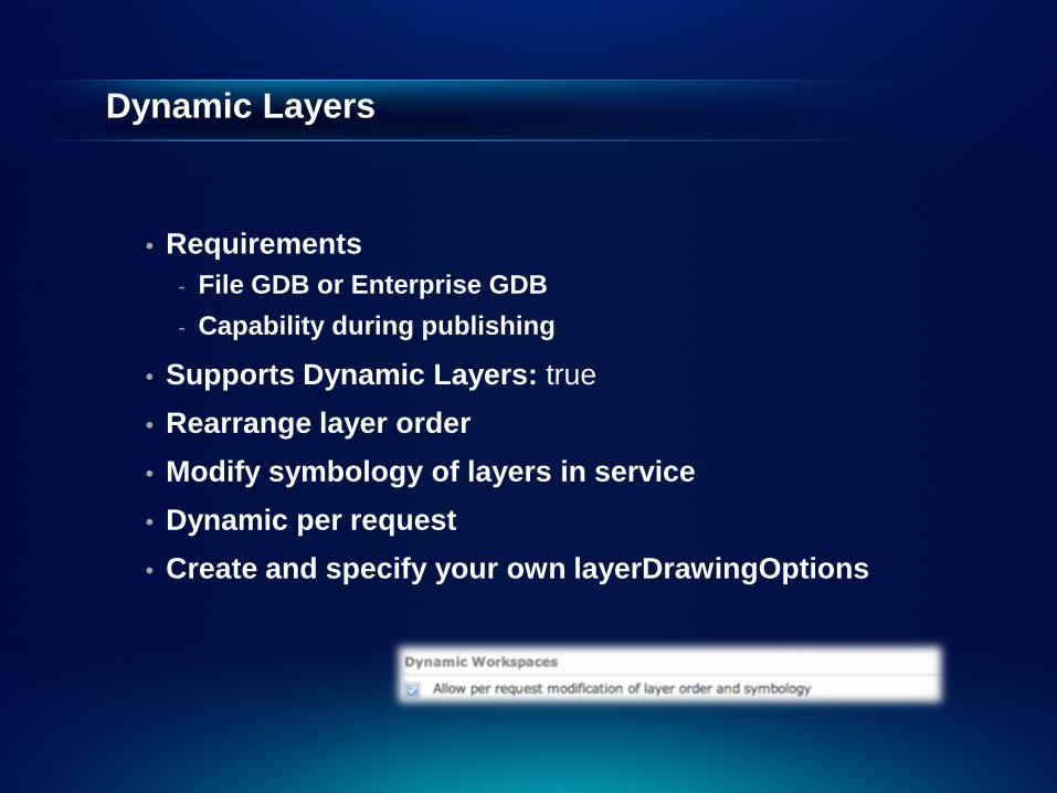
Dynamic Layers
• Requirements - File GDB or Enterprise GDB - Capability during publishing
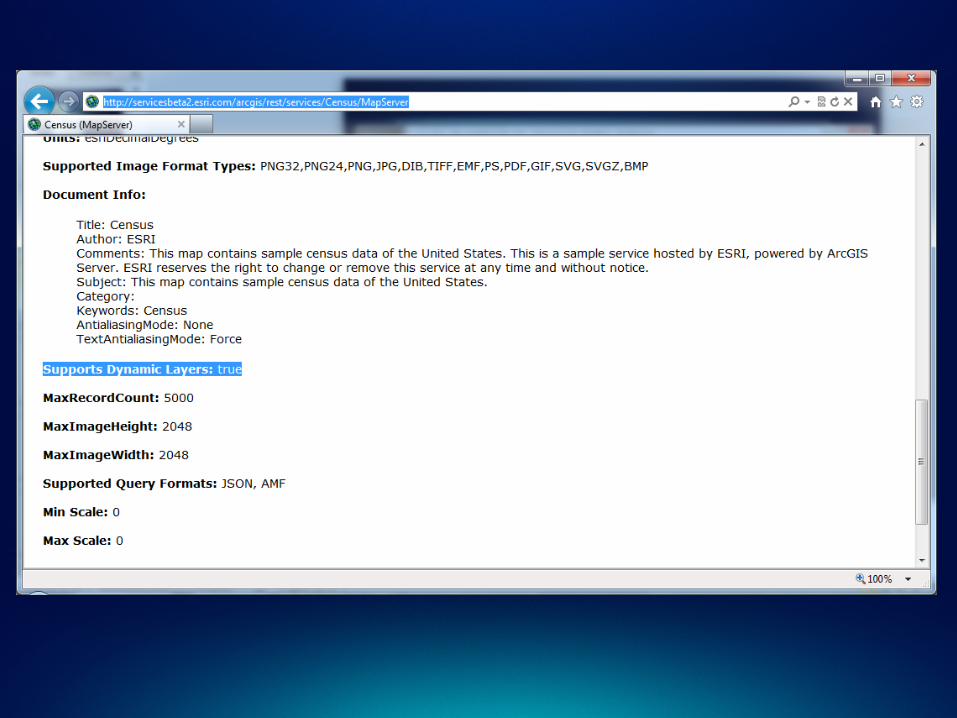
• Supports Dynamic Layers: true • Rearrange layer order • Modify symbology of layers in service • Dynamic per request • Create and specify your own layerDrawingOptions
Dynamic Workspaces
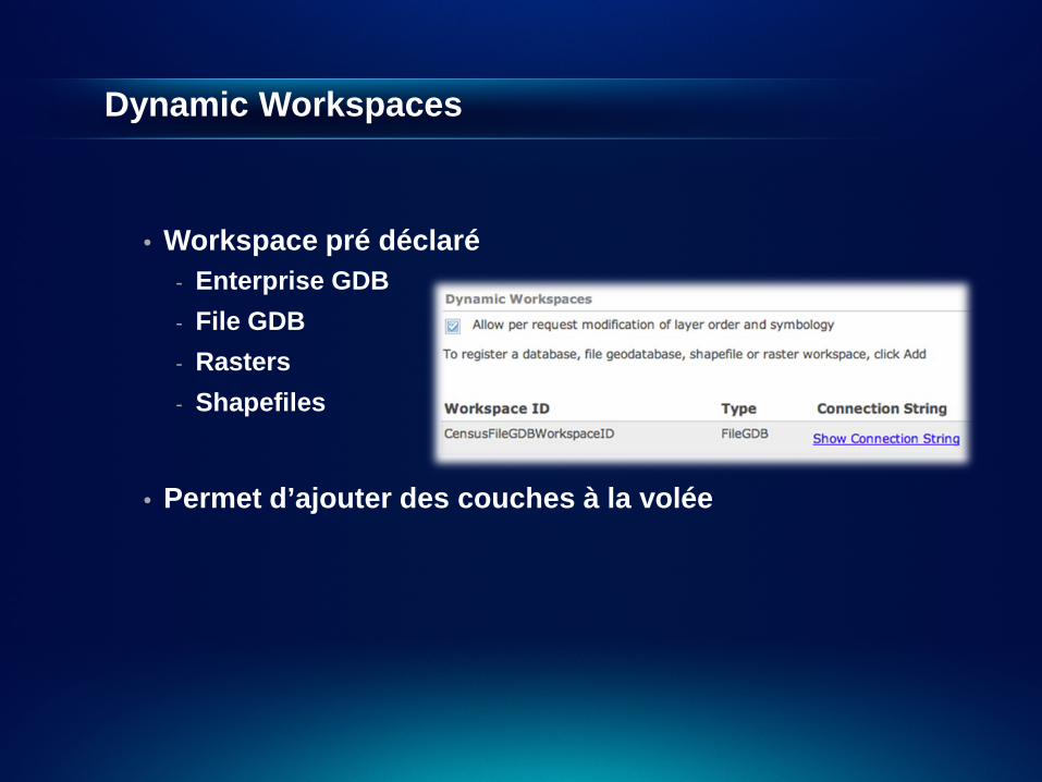
• Workspace pré déclaré - Enterprise GDB - File GDB - Rasters - Shapefiles
• Permet d’ajouter des couches à la volée

Dynamic Layer / Dynamic Workspace
Démonstration
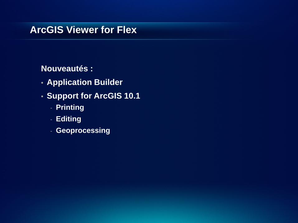
ArcGIS Viewer for Flex
Nouveautés : • Application Builder • Support for ArcGIS 10.1
- Printing - Editing - Geoprocessing

Viewer
Démonstration
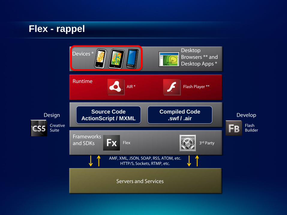
Flex - rappel
Design
AMF, XML, JSON, SOAP, RSS, ATOM, etc. HTTP/S, Sockets, RTMP, etc.
Runtime Flash Player ** AIR *
Creative Suite
Flash Builder
Servers and Services
Flex Frameworks and SDKs 3rd Party
Develop Source Code ActionScript / MXML
Compiled Code .swf / .air
Devices * Desktop Browsers ** and Desktop Apps *
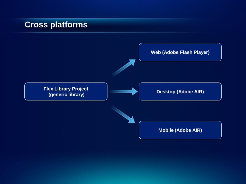
Cross platforms
Web (Adobe Flash Player)
Desktop (Adobe AIR)
Mobile (Adobe AIR)
Flex Library Project (generic library)
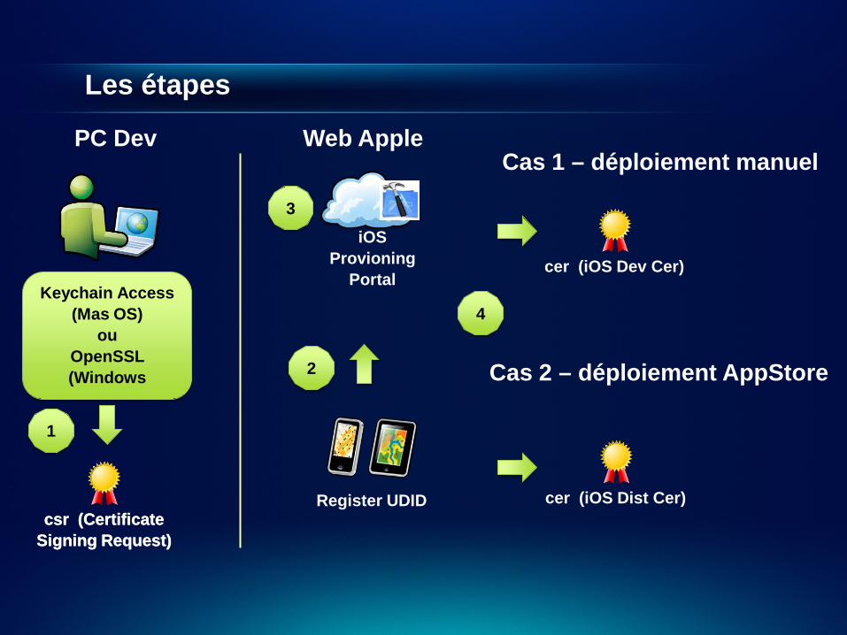
Les étapes
iOS Provioning
Portal
Register UDID csr (Certificate
Signing Request)
Keychain Access (Mas OS)
ou OpenSSL (Windows
PC Dev Web Apple
1
2
Cas 1 – déploiement manuel
Cas 2 – déploiement AppStore
3
csr (Certificate Signing Request)
cer (iOS Dev Cer)
cer (iOS Dist Cer)
4
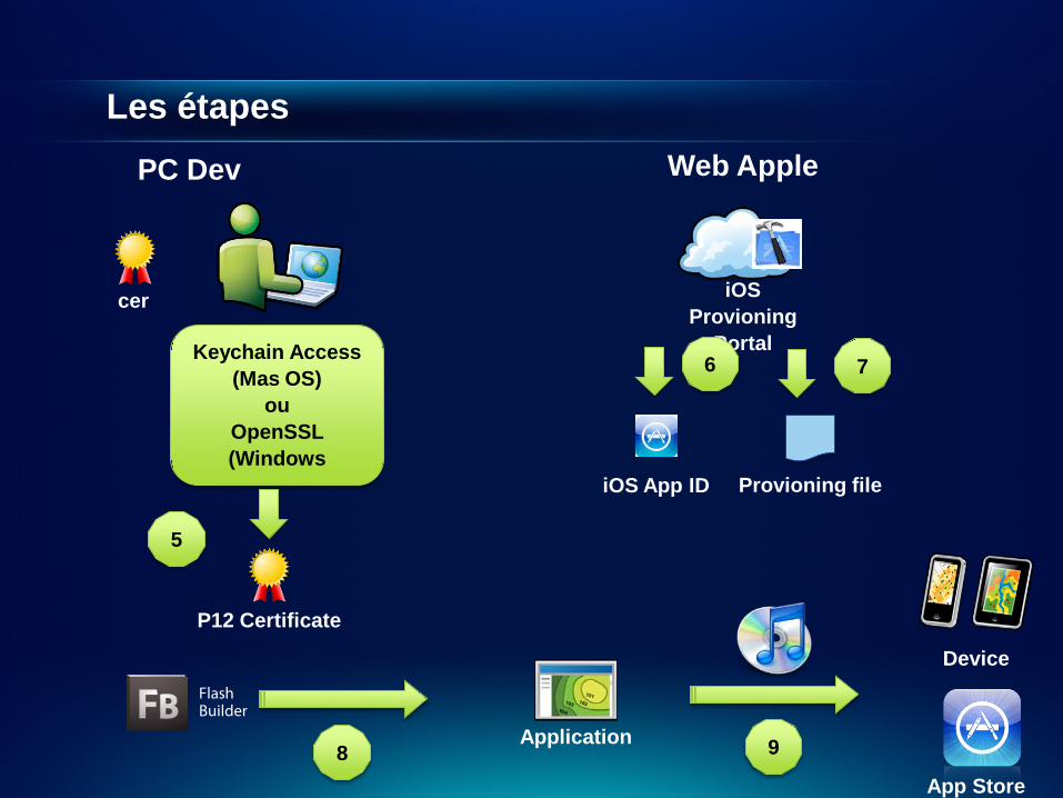
Les étapes
cer
Keychain Access (Mas OS)
ou OpenSSL (Windows
5
P12 Certificate
iOS Provioning
Portal
Web Apple PC Dev
6
iOS App ID
7
Provioning file
Flash Builder
Device
8 App Store
Application 9

Mobile
Démonstration

API Silverlight
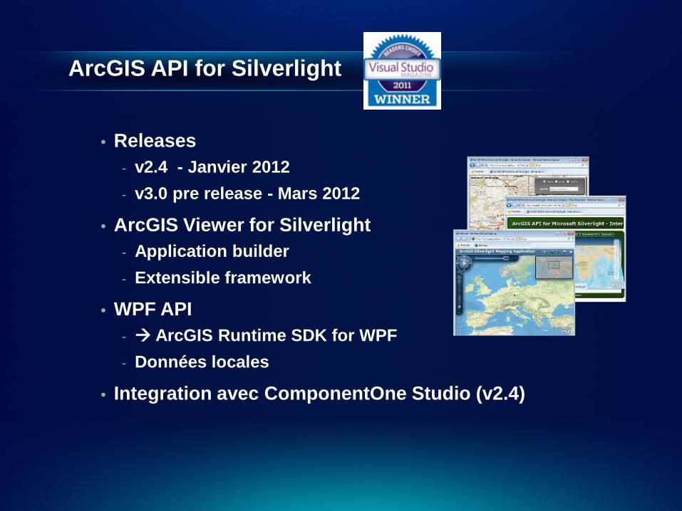
ArcGIS API for Silverlight
• Releases - v2.4 - Janvier 2012 - v3.0 pre release - Mars 2012
• ArcGIS Viewer for Silverlight - Application builder - Extensible framework
• WPF API - ArcGIS Runtime SDK for WPF - Données locales
• Integration avec ComponentOne Studio (v2.4)
Nouveautés 2.4
• WebMap - CSV, KML, WMS - Popups avec media
• DataSources • GraphicsDataSource • Auto-projection • ArcGIS Extensibility SDK for Silverlight
- Viewer - SharePoint
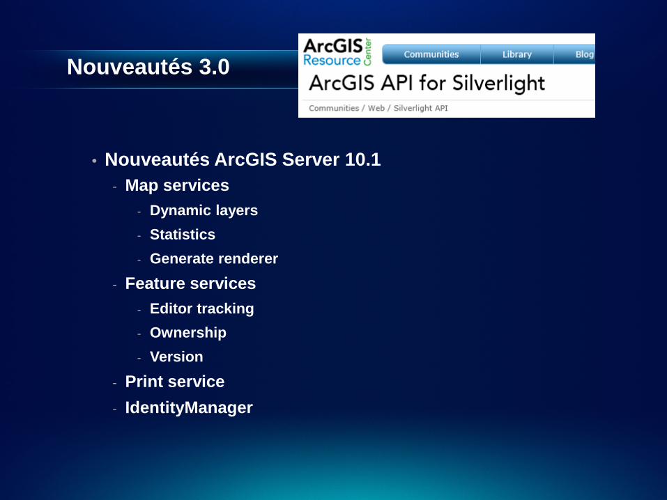
Nouveautés 3.0
• Nouveautés ArcGIS Server 10.1 - Map services
- Dynamic layers - Statistics - Generate renderer
- Feature services - Editor tracking - Ownership - Version
- Print service - IdentityManager
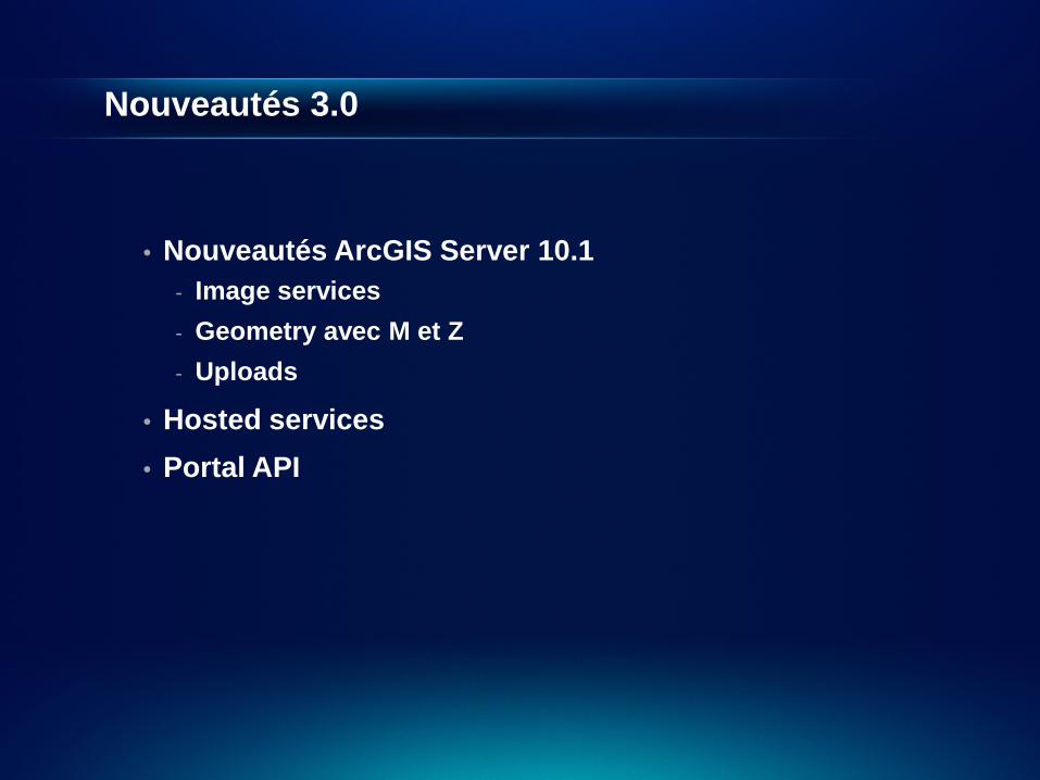
Nouveautés 3.0
• Nouveautés ArcGIS Server 10.1 - Image services - Geometry avec M et Z - Uploads
• Hosted services • Portal API
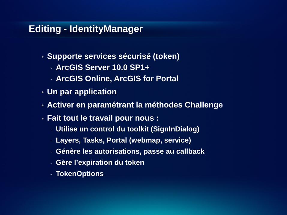
Editing - IdentityManager
• Supporte services sécurisé (token) - ArcGIS Server 10.0 SP1+ - ArcGIS Online, ArcGIS for Portal
• Un par application • Activer en paramétrant la méthodes Challenge • Fait tout le travail pour nous :
- Utilise un control du toolkit (SignInDialog) - Layers, Tasks, Portal (webmap, service) - Génère les autorisations, passe au callback - Gère l’expiration du token - TokenOptions

Editing (securité / M & Z)
Démonstration
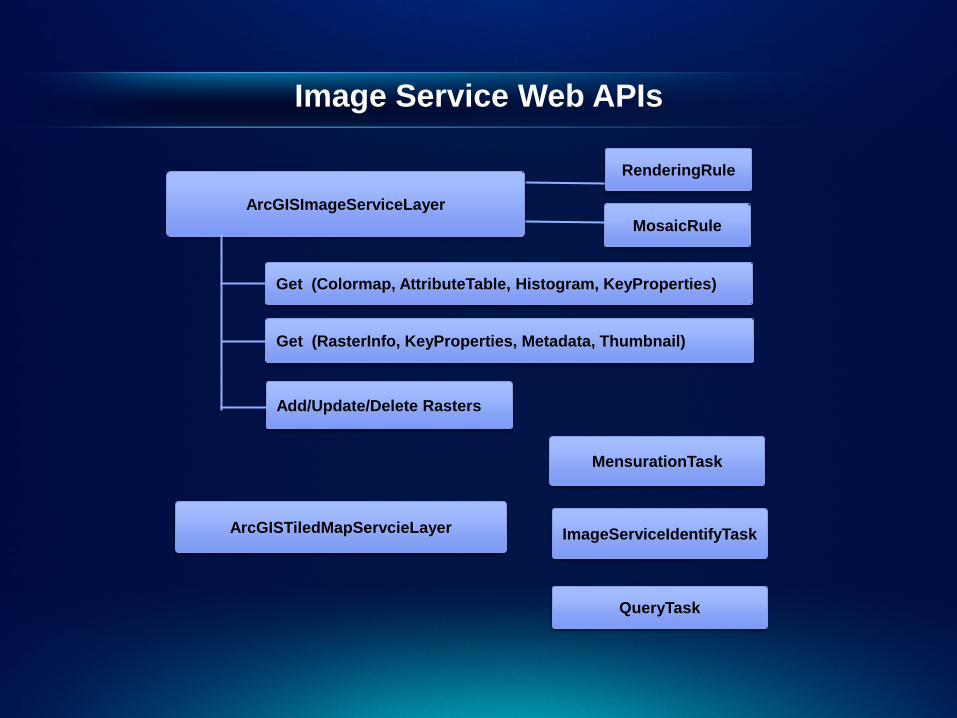
Image Service Web APIs
ArcGISImageServiceLayer
ArcGISTiledMapServcieLayer
MosaicRule
RenderingRule
ImageServiceIdentifyTask
MensurationTask
Add/Update/Delete Rasters
Get (RasterInfo, KeyProperties, Metadata, Thumbnail)
Get (Colormap, AttributeTable, Histogram, KeyProperties)
QueryTask
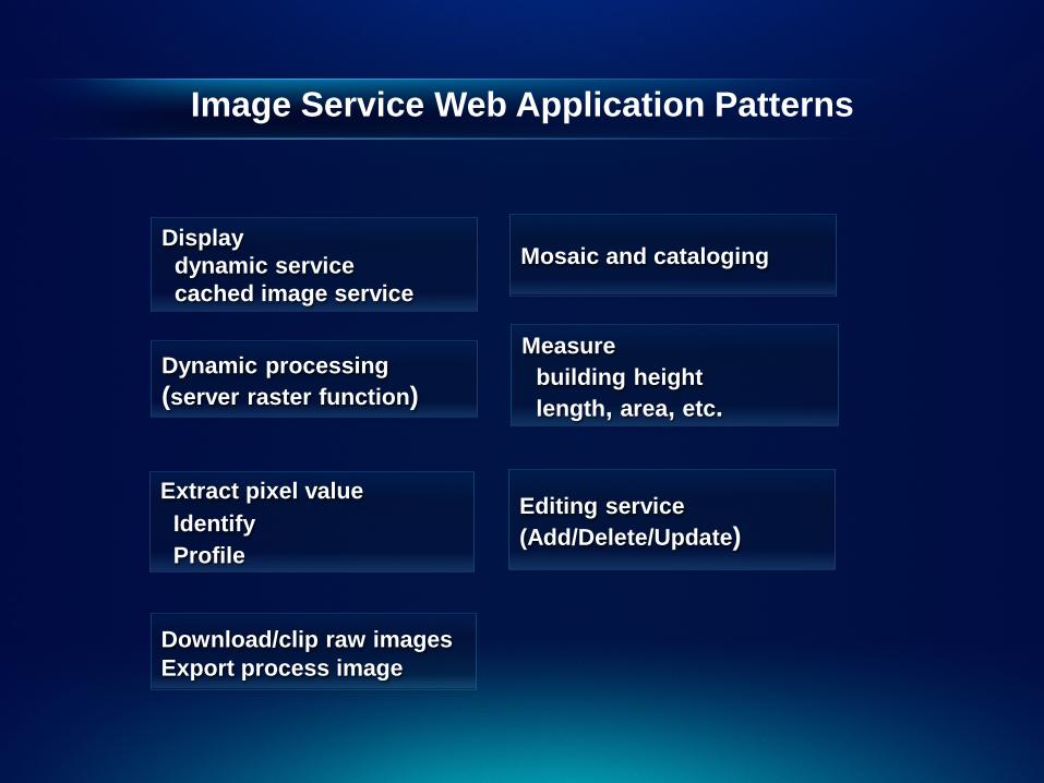
Image Service Web Application Patterns
Extract pixel value Identify Profile
Display dynamic service cached image service Dynamic processing (server raster function)
Measure building height length, area, etc.
Mosaic and cataloging
Editing service (Add/Delete/Update)
Download/clip raw images Export process image
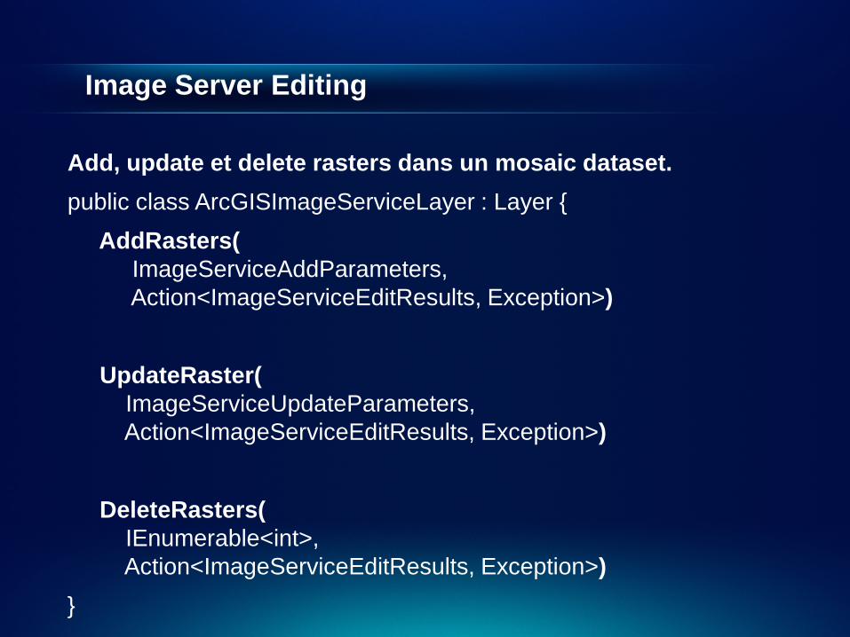
Image Server Editing
Add, update et delete rasters dans un mosaic dataset. public class ArcGISImageServiceLayer : Layer { AddRasters( ImageServiceAddParameters, Action<ImageServiceEditResults, Exception>) UpdateRaster( ImageServiceUpdateParameters, Action<ImageServiceEditResults, Exception>) DeleteRasters( IEnumerable<int>, Action<ImageServiceEditResults, Exception>) }
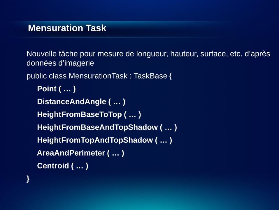
Mensuration Task
Nouvelle tâche pour mesure de longueur, hauteur, surface, etc. d’après données d’imagerie public class MensurationTask : TaskBase { Point ( … ) DistanceAndAngle ( … ) HeightFromBaseToTop ( … ) HeightFromBaseAndTopShadow ( … ) HeightFromTopAndTopShadow ( … ) AreaAndPerimeter ( … ) Centroid ( … ) }

Img Svc
Démonstration

Viewer
Démonstration

Questions / Réponses