Embed Size (px)
Citation preview
Site-specific water management Site-specific water management in in Mediterranean AgricultureAgriculture
Ioannis Manakos and Christos KarydasIoannis Manakos and Christos Karydas
Department of Environmental ManagementDepartment of Environmental Management
Athens, May 2005
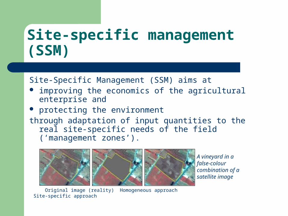
Site-specific management (SSM)
Site-Specific Management (SSM) aims at improving the economics of the agricultural enterprise
and protecting the environmentthrough adaptation of input quantities to the real site-
specific needs of the field (‘management zones’).
Original image (reality) Homogeneous approach Site-specific approach
A vineyard in a false-colour combination of a satellite image
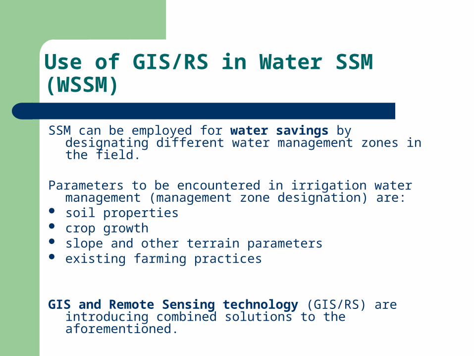
Use of GIS/RS in Water SSM (WSSM)
SSM can be employed for water savings by designating different water management zones in the field.
Parameters to be encountered in irrigation water management (management zone designation) are:
soil properties crop growth slope and other terrain parameters existing farming practices
GIS and Remote Sensing technology (GIS/RS) are introducing
combined solutions to the aforementioned.
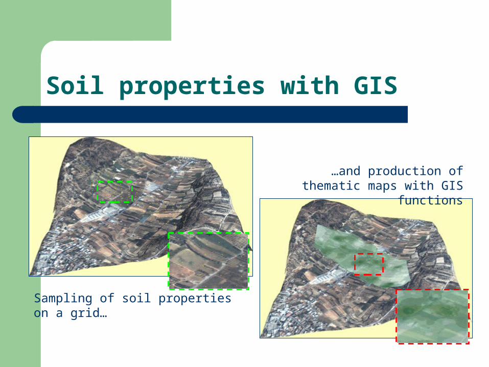
Soil properties with GIS
Sampling of soil properties on a grid…
…and production of thematic maps with GIS functions
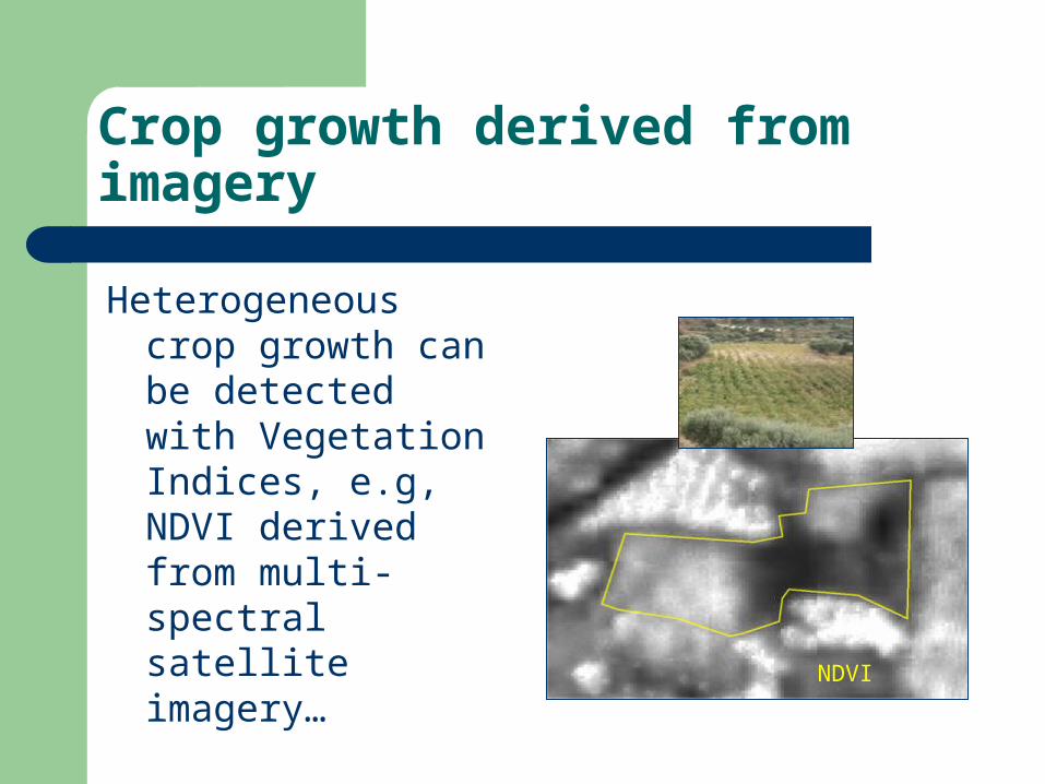
Crop growth derived from imagery
Heterogeneous crop growth can be detected with Vegetation Indices, e.g, NDVI derived from multi-spectral satellite imagery…
NDVI

Crop growth derived from a ground sensor
… or with a special sensor by registering reflection samples on the ground.
Legend Photographic plots20 60 Rel. coordinates (m)NDVI values:
SensorSystem
GPS
Application Unit
SensorSystem
GPS
Application Unit
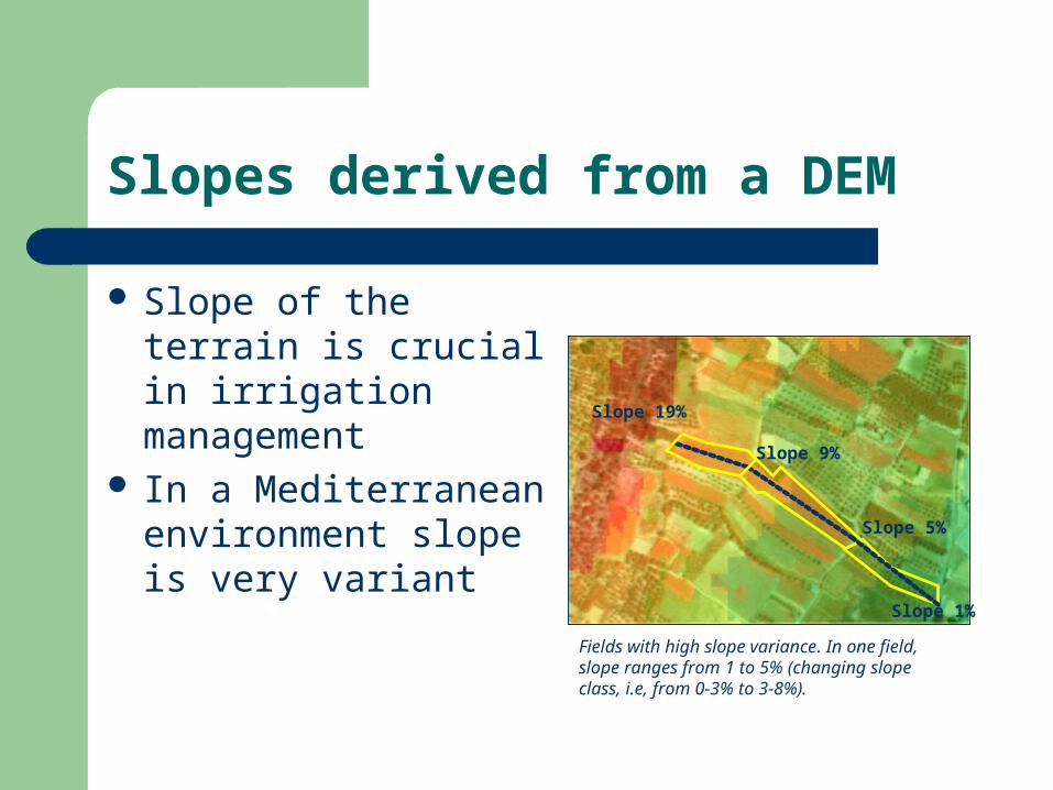
Slopes derived from a DEM
Slope of the terrain is crucial in irrigation management
In a Mediterranean environment slope is very variant
Slope 5%
Slope 9%
Slope 19%
Slope 1%
Fields with high slope variance. In one field, slope ranges from 1 to 5% (changing slope class, i.e, from 0-3% to 3-8%).
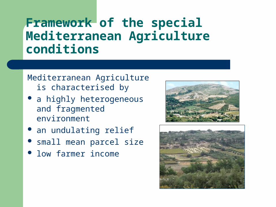
Framework of the special Mediterranean Agriculture conditions
Mediterranean Agriculture is characterised by
a highly heterogeneous and fragmented environment
an undulating relief small mean parcel size low farmer income
WSSM for Mediterranean farmers
SSM for Mediterranean farmers must be cheap to invest on cheap to apply easy to adopt (user-friendly techniques and
short training) beneficial in economizing water and/ or
improving the farmer’s income
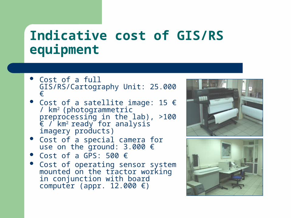
Indicative cost of GIS/RS equipment
Cost of a full GIS/RS/Cartography Unit: 25.000 €
Cost of a satellite image: 15 € / km2
(photogrammetric preprocessing in the lab), >100 € / km2 ready for analysis imagery products)
Cost of a special camera for use on the ground: 3.000 €
Cost of a GPS: 500 € Cost of operating sensor system
mounted on the tractor working in conjunction with board computer (appr. 12.000 €)
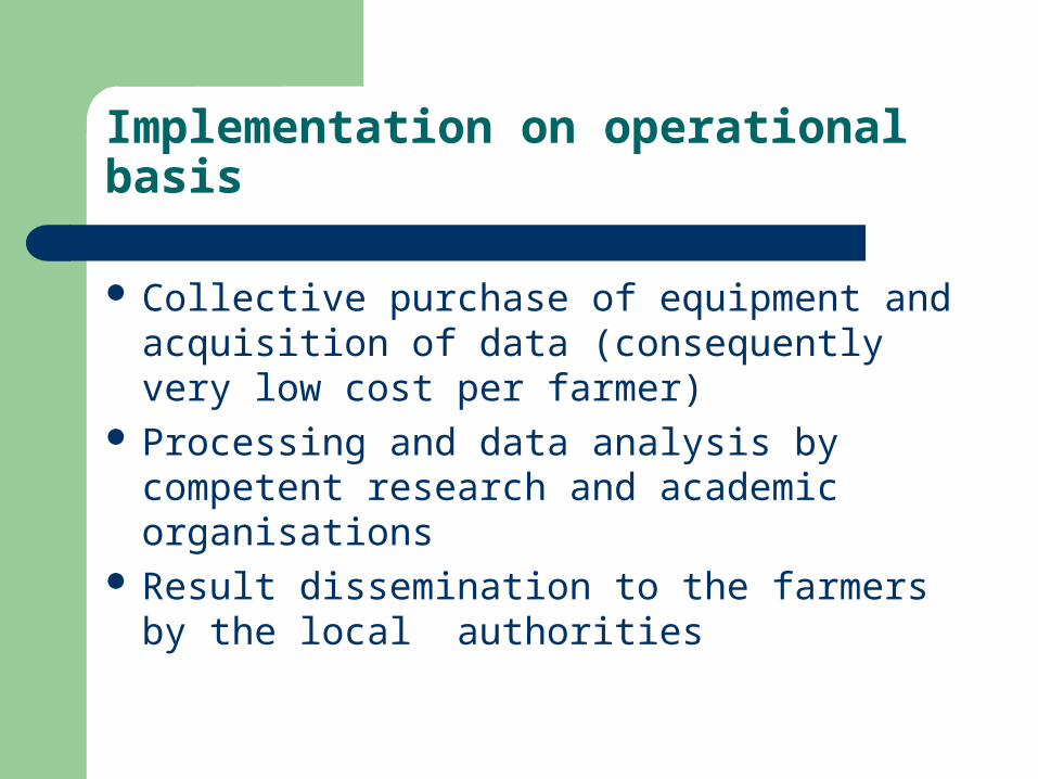
Implementation on operational basis
Collective purchase of equipment and acquisition of data (consequently very low cost per farmer)
Processing and data analysis by competent research and academic organisations
Result dissemination to the farmers by the local authorities

Thanks for your attention!!

![PRECISION AGRICULTURE: MODELING AND SIMULATION · Precision Agriculture (PA) aims to support sustainable agriculture [10]. It aims to develop more efficient and site-specific crop](https://img.pdfslide.us/doc/110x75/5ead42ae80125b28f02a2914/precision-agriculture-modeling-and-precision-agriculture-pa-aims-to-support-sustainable.jpg)