Embed Size (px)
Citation preview
Site 1915
History Erected by the Ulster Canal Company. This line of canal opened in the period 1838-41.
Type Mile marker
County Co Monaghan OS 6-inch map MO009
Survey date 03/01/2008 Surveyor Fred Hamond
Completeness No visible remain Condition N/A Use N/A
Evaluation No industrial heritage significance.
Significance Record only
Component 1915
Surveyed? Y
Interest None
Y
263070 332454
Description No evident traces of this milestone, on the north bank of the canal, survive. Had itexisted, it would have read: "Charlemont 28/ Caledon 14/ Monaghan 3/ Clones 11/Wattle Bridge 18".
Grid AghaliskTownland
Original feature?
Carson's BridgeSite 1916
History Built by the Ulster Canal Company. This line of canal opened in the period 1838-41.Cited as Carson's Bridge on the 1858 OS six-inch map. It was replaced by thepresent bridge sometime after the canal was abandoned (probably in the mid 1900s).
Type Bridge (road/canal)
County Co Monaghan OS 6-inch map MO009
Survey date 30/05/2008 Surveyor Fred Hamond
Completeness Complete Condition Fair Use Disused
Protection RPSMonaghan41400953
Evaluation This bridge is included in the Co Monaghan Record of Protected Structures (RPS41400953).
Significance Regional
Component 1916 1
Surveyed? Y
Interest Architectural; Historical
Other dbases WI Ulster B64
Y
262849 332507
Description A masonry arch bridge carries a now abandoned line of road over the canal. Theabutments are of squared random rubble. The arch is of semicircular profile andspans 6.09m. Its voussoirs and soffit are of dressed stone blocks. A 1.90m widetowpath runs along its north abutment; the actual channel is 4.19m wide (13ft 9in).The spandrels and parapets are squared random rubble. The latter are 3.48m apartand terminate in square out-projecting piers. A string course runs over the archcrown. There was formerly a ramped approach of "ball alley" configuration at thenorth end of the bridge down to the main road, but it has been removed in order towiden the latter and make the junction safer. A new bridge (component 2) has beenbuilt a short distance to its east.
Grid Annagola (Monaghan BY)Townland
Original feature?
Type Bridge (road/canal)
County Co Monaghan OS 6-inch map MO009
Survey date 03/01/2008 Surveyor Fred Hamond
Completeness Complete Condition Good Use Road bridge
Evaluation This bridge is of no special industrial heritage significance.
Significance Record only
Component 1916 2
Surveyed? Y
Interest None
Other dbases WI Ulster B63
N
262881 332500
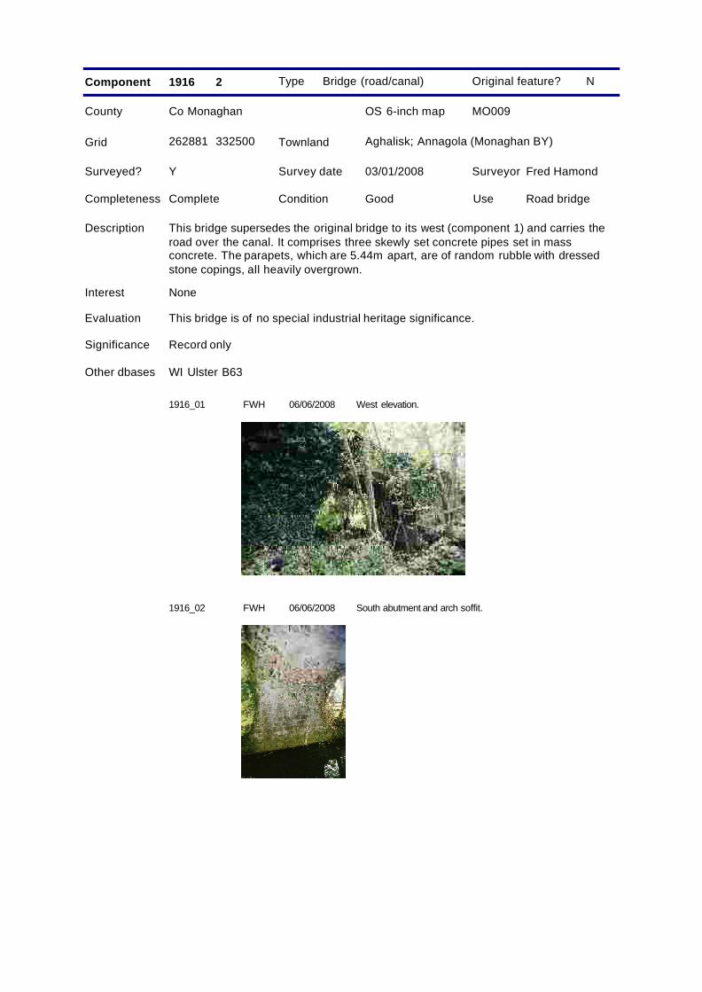
Description This bridge supersedes the original bridge to its west (component 1) and carries theroad over the canal. It comprises three skewly set concrete pipes set in massconcrete. The parapets, which are 5.44m apart, are of random rubble with dressedstone copings, all heavily overgrown.
Grid Aghalisk; Annagola (Monaghan BY)Townland
Original feature?
1916_01 FWH West elevation.06/06/2008
1916_02 FWH South abutment and arch soffit.06/06/2008
Site 1917
History The original bridge was erected by the Ulster Canal Company. This line of canalopened in the period 1838-41. The present structure is a later 20th centuryreplacement.
Type Bridge (road/canal)
County Co Monaghan OS 6-inch map MO009
Survey date 03/01/2008 Surveyor Fred Hamond
Completeness No visible remain Condition N/A Use N/A
Evaluation No industrial heritage significance.
Significance Record only
Component 1917 1
Surveyed? Y
Interest None
Y
262208 332661
Description The original accommodation bridge over the canal has been replaced by component2.
Grid DrummaconorTownland
Original feature?
Type Bridge (road/canal)
County Co Monaghan OS 6-inch map MO009
Survey date 03/01/2008 Surveyor Fred Hamond
Completeness No visible remain Condition N/A Use N/A
Evaluation No industrial heritage significance.
Significance Record only
Component 1917 2
Surveyed? Y
Interest None
Other dbases WI Ulster B65
N
262208 332661
Description This replacement bridge comprises a concrete pipe set in hardcore. The canal bankshave been narrowed on both sides.
Grid DrummaconorTownland
Original feature?
Site 1918
History This bridge dates from the later 20th century and is not related to the canal.
Type Bridge (road/canal)
County Co Monaghan OS 6-inch map MO009
Survey date 03/01/2008 Surveyor Fred Hamond
Completeness Complete Condition Good Use Road bridge
Evaluation No special industrial heritage significance.
Significance Record only
Component 1918
Surveyed? Y
Interest None
N
262106 332571
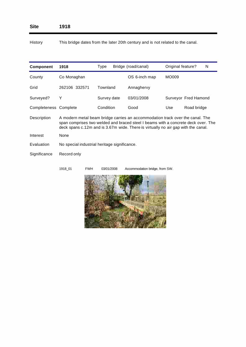
Description A modern metal beam bridge carries an accommodation track over the canal. Thespan comprises two welded and braced steel I beams with a concrete deck over. Thedeck spans c.12m and is 3.67m wide. There is virtually no air gap with the canal.
Grid AnnaghervyTownland
Original feature?
1918_01 FWH Accommodation bridge, from SW.03/01/2008
Drummaconor BridgeSite 1919
History Built by the Ulster Canal Company. This line of canal opened in the period 1838-41.
Type Bridge (road/canal)
County Co Monaghan OS 6-inch map MO009
Survey date 03/01/2008 Surveyor Fred Hamond
Completeness Complete Condition Fair Use Road bridge
Evaluation This bridge is a good example of its type and has an historical association with thecanal. It is of regional industrial heritage significance and merits inclusion in theRecord of Protected Structures.
Significance Regional
Component 1919
RPSAction
Surveyed? Y
Interest Architectural; Historical
Other dbases WI Ulster B66
Y
261864 332229
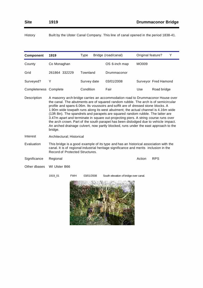
Description A masonry arch bridge carries an accommodation road to Drummaconor House overthe canal. The abutments are of squared random rubble. The arch is of semicircularprofile and spans 6.06m. Its voussoirs and soffit are of dressed stone blocks. A1.90m wide towpath runs along its west abutment; the actual channel is 4.16m wide(13ft 8in). The spandrels and parapets are squared random rubble. The latter are3.47m apart and terminate in square out-projecting piers. A string course runs overthe arch crown. Part of the south parapet has been dislodged due to vehicle impact.An arched drainage culvert, now partly blocked, runs under the east approach to thebridge.
Grid DrummaconorTownland
Original feature?
1919_01 FWH South elevation of bridge over canal.03/01/2008

1919_02 FWH South elevation of drainage culvert under east apporach.03/01/2008
Site 1920
History Erected by the Ulster Canal Company. This line of canal opened in the period 1838-41.
Type Mile marker
County Co Monaghan OS 6-inch map MO009
Survey date 03/01/2008 Surveyor Fred Hamond
Completeness No visible remain Condition N/A Use N/A
Evaluation No industrial heritage significance.
Significance Record only
Component 1920
Surveyed? Y
Interest None
Y
261849 332134
Description No vestiges survive of this milestone on the west side of the canal. Had it existed, itwould have read: "Charlemont 29/ Caledon 15/ Monaghan 4/ Clones 10/ WattleBridge 17".
Grid TullykennyTownland
Original feature?
Site 1921
History Not shown on the 1858 or 1907 OS maps. Not related to the canal and probably oflater 20th century date.
Type Bridge (road/canal)
County Co Monaghan OS 6-inch map MO009
Survey date 03/01/2008 Surveyor Fred Hamond
Completeness Complete Condition Fair Use Road bridge
Evaluation No special industrial heritage significance.
Significance Record only
Component 1921
Surveyed? Y
Interest None
Other dbases WI Ulster B67
N
261777 331594
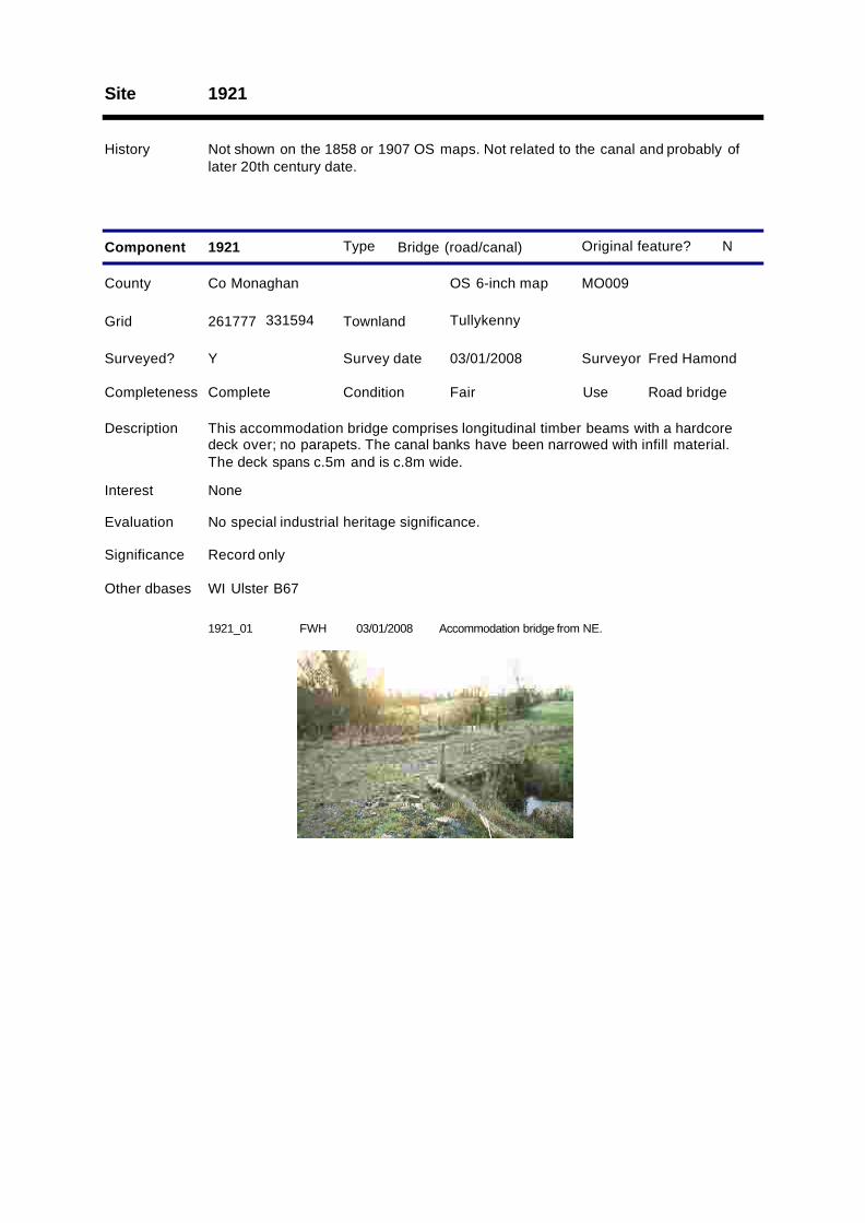
Description This accommodation bridge comprises longitudinal timber beams with a hardcoredeck over; no parapets. The canal banks have been narrowed with infill material.The deck spans c.5m and is c.8m wide.
Grid TullykennyTownland
Original feature?
1921_01 FWH Accommodation bridge from NE.03/01/2008
Cooldarragh BridgeSite 1922
History Built by the Ulster Canal Company. This line of canal opened in the period 1838-41.Cited as Cooldarragh Bridge on the 1858 OS six-inch map.
Type Bridge (road/canal)
County Co Monaghan OS 6-inch map MO013
Survey date 03/01/2008 Surveyor Fred Hamond
Completeness Complete Condition Fair Use Road bridge
Evaluation This bridge is a good example of its type and has an historical association with thecanal. It is of regional industrial heritage significance and merits inclusion in theRecord of Protected Structures.
Significance Regional
Component 1922
RPSAction
Surveyed? Y
Interest Architectural; Historical
Other dbases WI Ulster B68
Y
261409 331238
Description A masonry arch bridge carries a road over the canal. The abutments are of squaredrandom rubble. The arch is of semicircular profile and spans 6.14m. Its voussoirsand soffit are of dressed stone blocks. A 1.88 wide towpath runs along its northabutment; the actual channel is 4.26 wide (14ft 0in). The spandrels and parapets aresquared random rubble. The latter are 3.32m apart. The north end of the westparapet and south end of the east parapet have both been demolished through trafficimpact. A string course runs over the arch crown.
Grid Cooldarragh; TullykennyTownland
Original feature?
1922_01 FWH West elevation.03/01/2008
1922_02 FWH Demolished south end of east parapet.03/01/2008
Site 1923
History This small feeder and associated culvert under the towpath may date from theopening of this section of the canal in 1838-41, but could equally be of a later date.
Type Canal feeder
County Co Monaghan OS 6-inch map MO013
Survey date 08/01/2008 Surveyor Fred Hamond
Completeness Complete Condition Good Use Stream
Evaluation No special industrial heritage significance.
Significance Record only
Component 1923 1
Surveyed? Y
Interest None
Y
261251 331304
Description An active stream running along the east and south side of the road discharges intothe canal a short distance west of bridge 1922.
Grid Mullanacross (ED Drumsnat);Tullykenny
Townland
Original feature?
Type Bridge (foot/canalfeeder)
County Co Monaghan OS 6-inch map MO013
Survey date 08/01/2008 Surveyor Fred Hamond
Completeness No visible remain Condition N/A Use N/A
Evaluation No industrial heritage significance.
Significance Record only
Component 1923 2
Surveyed? Y
Interest None
Y
261388 331234
Description A culvert formerly carried a canal feeder under the towpath. The feeder channel hasrecently been deepened and the bank/culvert removed hereabouts.
Grid Mullanacross (ED Drumsnat);Tullykenny
Townland
Original feature?
1923_01 FWH Looking NW up feeder from point of discharge into canal.08/01/2008
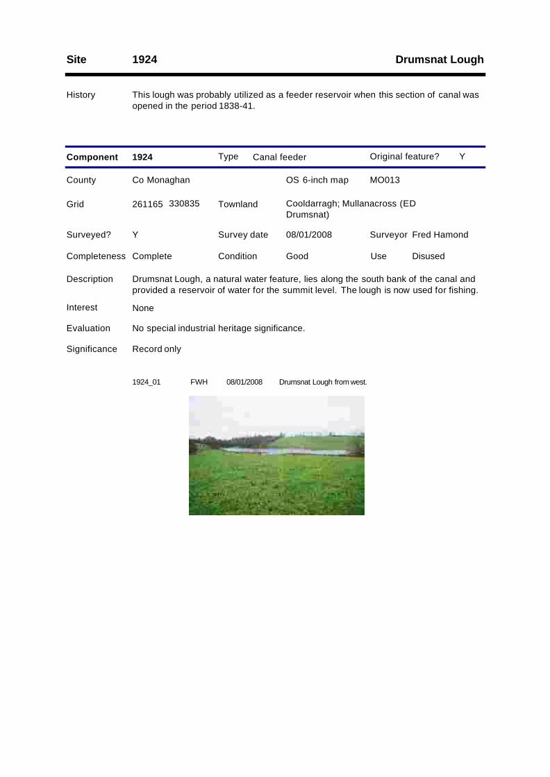
Drumsnat LoughSite 1924
History This lough was probably utilized as a feeder reservoir when this section of canal wasopened in the period 1838-41.
Type Canal feeder
County Co Monaghan OS 6-inch map MO013
Survey date 08/01/2008 Surveyor Fred Hamond
Completeness Complete Condition Good Use Disused
Evaluation No special industrial heritage significance.
Significance Record only
Component 1924
Surveyed? Y
Interest None
Y
261165 330835
Description Drumsnat Lough, a natural water feature, lies along the south bank of the canal andprovided a reservoir of water for the summit level. The lough is now used for fishing.
Grid Cooldarragh; Mullanacross (EDDrumsnat)
Townland
Original feature?
1924_01 FWH Drumsnat Lough from west.08/01/2008
Site 1925
History Erected by the Ulster Canal Company. This line of canal opened in the period 1838-41.
Type Mile marker
County Co Monaghan OS 6-inch map MO013
Survey date 08/01/2008 Surveyor Fred Hamond
Completeness No visible remain Condition N/A Use N/A
Evaluation No industrial heritage significance.
Significance Record only
Component 1925
Surveyed? Y
Interest None
Y
261102 330894
Description Nothing of this milepost, on the north bank of the canal, survives. Had it existed, itwould have read: "Charlemont 30/ Caledon 16/ Monaghan 5/ Clones 9/ WattleBridge 16".
Grid Mullanacross (ED Drumsnat)Townland
Original feature?
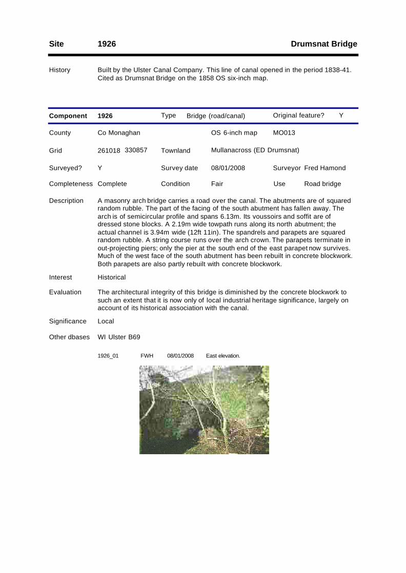
Drumsnat BridgeSite 1926
History Built by the Ulster Canal Company. This line of canal opened in the period 1838-41.Cited as Drumsnat Bridge on the 1858 OS six-inch map.
Type Bridge (road/canal)
County Co Monaghan OS 6-inch map MO013
Survey date 08/01/2008 Surveyor Fred Hamond
Completeness Complete Condition Fair Use Road bridge
Evaluation The architectural integrity of this bridge is diminished by the concrete blockwork tosuch an extent that it is now only of local industrial heritage significance, largely onaccount of its historical association with the canal.
Significance Local
Component 1926
Surveyed? Y
Interest Historical
Other dbases WI Ulster B69
Y
261018 330857
Description A masonry arch bridge carries a road over the canal. The abutments are of squaredrandom rubble. The part of the facing of the south abutment has fallen away. Thearch is of semicircular profile and spans 6.13m. Its voussoirs and soffit are ofdressed stone blocks. A 2.19m wide towpath runs along its north abutment; theactual channel is 3.94m wide (12ft 11in). The spandrels and parapets are squaredrandom rubble. A string course runs over the arch crown. The parapets terminate inout-projecting piers; only the pier at the south end of the east parapet now survives.Much of the west face of the south abutment has been rebuilt in concrete blockwork.Both parapets are also partly rebuilt with concrete blockwork.
Grid Mullanacross (ED Drumsnat)Townland
Original feature?
1926_01 FWH East elevation.08/01/2008
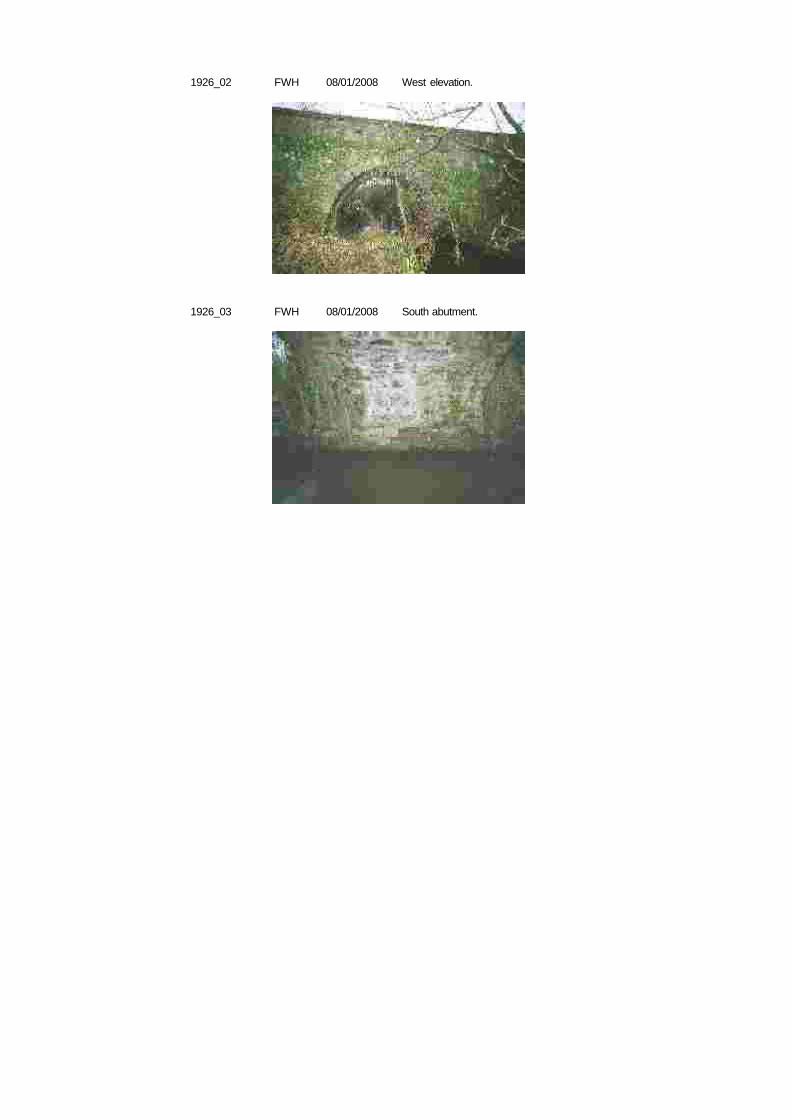
1926_02 FWH West elevation.08/01/2008
1926_03 FWH South abutment.08/01/2008
Site 1927
History Erected by the Ulster Canal Company. This line of canal opened in the period 1838-41.
Type Mile marker
County Co Monaghan OS 6-inch map MO012
Survey date 08/01/2008 Surveyor Fred Hamond
Completeness No visible remain Condition N/A Use N/A
Evaluation No industrial heritage significance.
Significance Record only
Component 1927
Surveyed? Y
Interest None
Y
259807 330650
Description No traces of this milepost, on the west bank of the canal, survive. Had it existed, itwould have read: "Charlemont 31/ Caledon 17/ Monaghan 6/ Clones 8/ WattleBridge 15".
Grid SkervanTownland
Original feature?
Skervan BridgeSite 1928
History Built by the Ulster Canal Company. This line of canal opened in the period 1838-41.
Type Bridge (road/canal)
County Co Monaghan OS 6-inch map MO012
Survey date 08/01/2008 Surveyor Fred Hamond
Completeness Complete Condition Fair Use Disused
Evaluation This bridge is a good example of its type and has an historical association with thecanal. It is of regional industrial heritage significance and merits inclusion in theRecord of Protected Structures.
Significance Regional
Component 1928
RPSAction
Surveyed? Y
Interest Architectural; Historical
Other dbases WI Ulster B70
Y
259822 330587
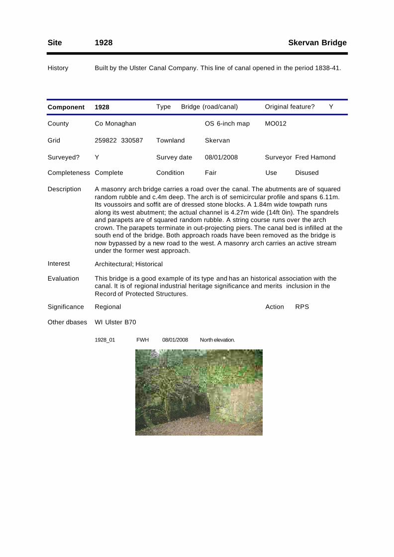
Description A masonry arch bridge carries a road over the canal. The abutments are of squaredrandom rubble and c.4m deep. The arch is of semicircular profile and spans 6.11m.Its voussoirs and soffit are of dressed stone blocks. A 1.84m wide towpath runsalong its west abutment; the actual channel is 4.27m wide (14ft 0in). The spandrelsand parapets are of squared random rubble. A string course runs over the archcrown. The parapets terminate in out-projecting piers. The canal bed is infilled at thesouth end of the bridge. Both approach roads have been removed as the bridge isnow bypassed by a new road to the west. A masonry arch carries an active streamunder the former west approach.
Grid SkervanTownland
Original feature?
1928_01 FWH North elevation.08/01/2008
Lock 20; Killykeeragh LockSite 2001
History Built by the Ulster Canal Company. This line of canal opened in 1841.
Type Lock
County Co Monaghan OS 6-inch map MO012
Survey date 08/01/2008 Surveyor Fred Hamond
Completeness Substantial remai Condition Fair Use Disused
Evaluation This well constructed lock chamber has an association with the canal and also groupinterest with the adjoining lock house (2001.2). It is of regional industrial heritagesignificance. It merits inclusion in the Record of Protected Structures.
Significance Regional
Component 2001
RPSAction
1
Surveyed? Y
Interest Architectural; Historical; Group
Other dbases WI Ulster L20
Y
259626 329979
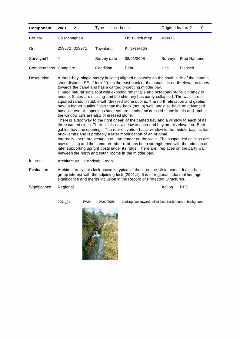
Description The lock chamber survives, but not the actual gates. It is at the west end of thecanal's summit level. The walls are of dressed masonry blocks, laid to courses, andcoped along their top edges. The walls are 3.67m apart (12ft 0in). The lock gateemplacements are visible at both ends. The breast gate emplacements, at the eastend of the lock, have openings for ground sluices above and below the cill. The tailgate emplacements have recesses to accommodate the gate sluices when open.There is a stop groove up each sidewall of the chamber below the bottom gateemplacements. A stream now flows through the lock.
Grid KillykeeraghTownland
Original feature?
Type Lock house
County Co Monaghan OS 6-inch map MO012
Survey date 08/01/2008 Surveyor Fred Hamond
Completeness Complete Condition Poor Use Disused
Evaluation Architecturally, this lock house is typical of those on the Ulster canal. It also hasgroup interest with the adjoining lock (2001.1). It is of regional industrial heritagesignificance and merits inclusion in the Record of Protected Structures.
Significance Regional
Component 2001
RPSAction
2
Surveyed? Y
Interest Architectural; Historical; Group
Y
259672 329971
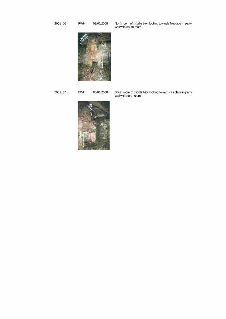
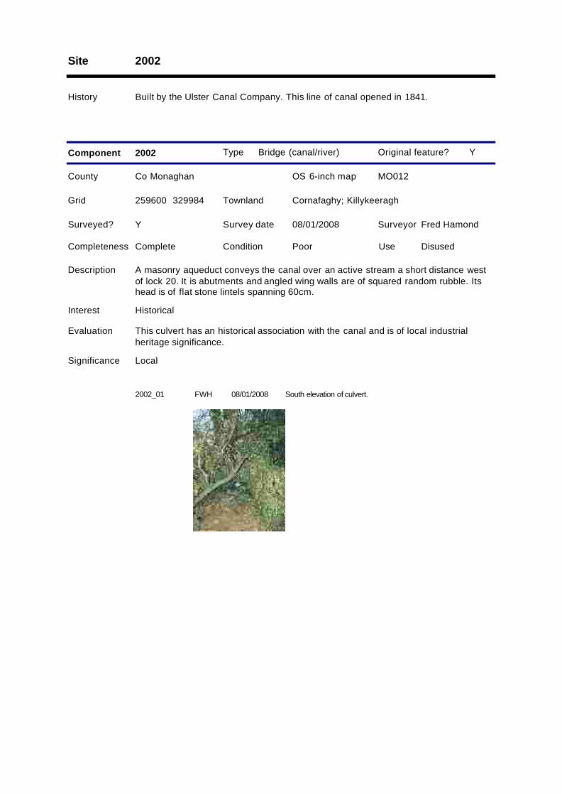
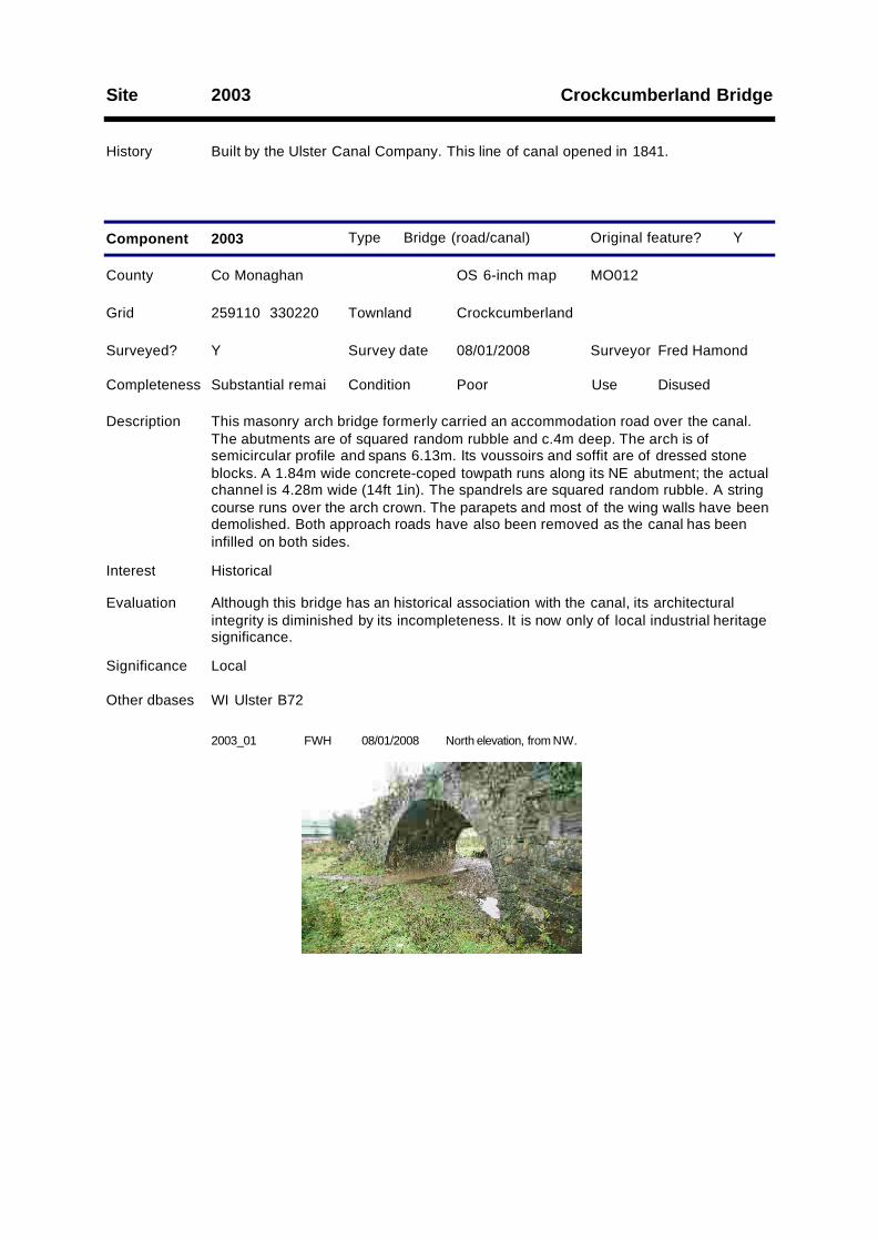
Description A three-bay, single-storey building aligned east-west on the south side of the canal ashort distance SE of lock 20, on the east bank of the canal. Its north elevation facestowards the canal and has a canted projecting middle bay.Hipped natural slate roof with exposed rafter tails and octagonal stone chimney tomiddle. Slates are missing and the chimney has partly collapsed. The walls are ofsquared random rubble with dressed stone quoins. The north elevation and gableshave a higher quality finish than the back (south) wall, and also have an advancedbasal course. All openings have square heads and dressed stone lintels and jambs;the window cills are also of dressed stone.There is a doorway to the right cheek of the canted bay and a window to each of itsthree canted sides. There is also a window to each end bay on this elevation. Bothgables have no openings. The rear elevation has a window to the middle bay; its hasbrick jambs and is probably a later modification of an original.Internally, there are vestiges of lime render on the walls. The suspended ceilings arenow missing and the common rafter roof has been strengthened with the addition oflater supporting upright posts under its ridge. There are fireplaces on the party wallbetween the north and south rooms in the middle bay.
Grid KillykeeraghTownland
Original feature?
2001_01 FWH Looking east towardscill of lock. Lock house in background.08/01/2008
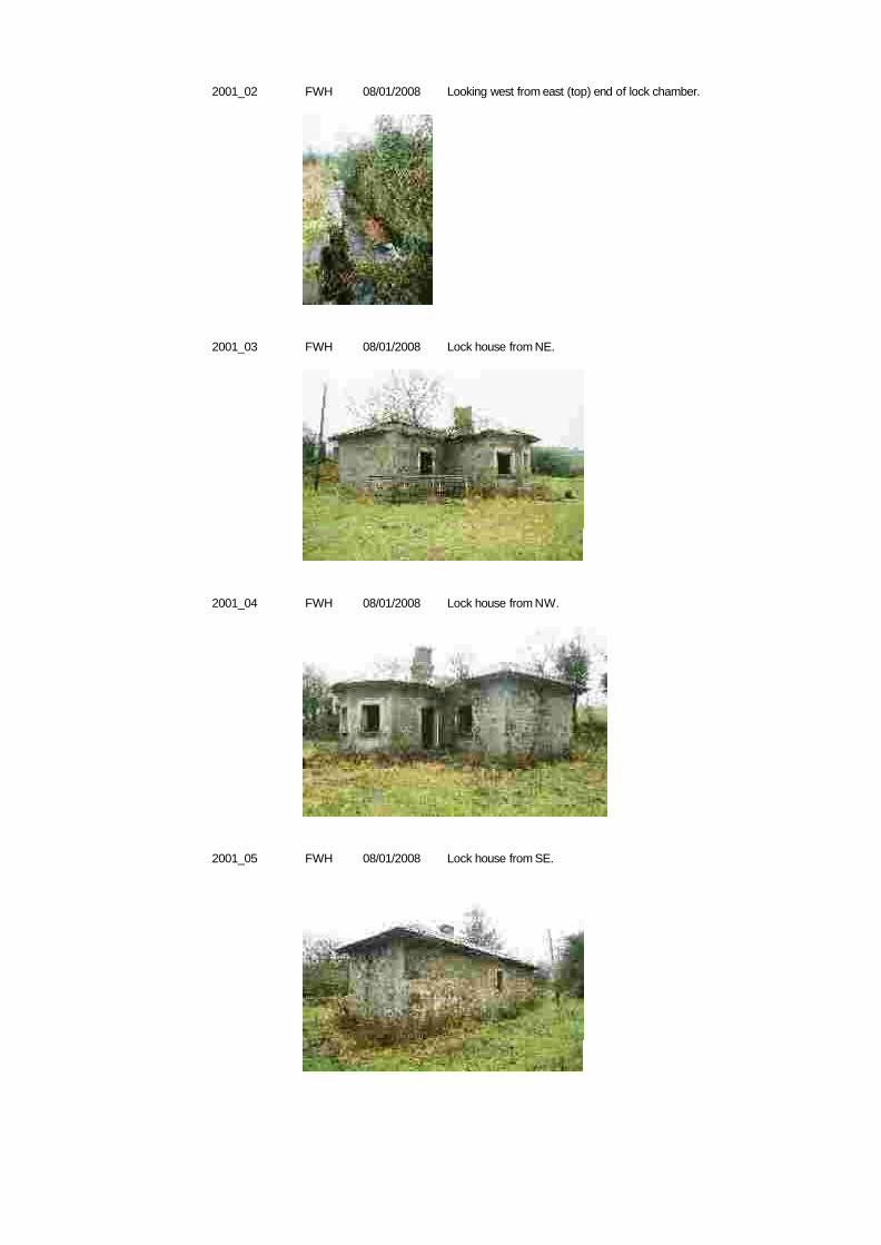
2001_02 FWH Looking west from east (top) end of lock chamber.08/01/2008
2001_03 FWH Lock house from NE.08/01/2008
2001_04 FWH Lock house from NW.08/01/2008
2001_05 FWH Lock house from SE.08/01/2008
2001_06 FWH North room of middle bay, looking towards fireplace in partywall with south room.
08/01/2008
2001_07 FWH South room of middle bay, looking towards fireplace in partywall with north room.
08/01/2008
Site 2002
History Built by the Ulster Canal Company. This line of canal opened in 1841.
Type Bridge (canal/river)
County Co Monaghan OS 6-inch map MO012
Survey date 08/01/2008 Surveyor Fred Hamond
Completeness Complete Condition Poor Use Disused
Evaluation This culvert has an historical association with the canal and is of local industrialheritage significance.
Significance Local
Component 2002
Surveyed? Y
Interest Historical
Y
259600 329984
Description A masonry aqueduct conveys the canal over an active stream a short distance westof lock 20. It is abutments and angled wing walls are of squared random rubble. Itshead is of flat stone lintels spanning 60cm.
Grid Cornafaghy; KillykeeraghTownland
Original feature?
2002_01 FWH South elevation of culvert.08/01/2008
Crockcumberland BridgeSite 2003
History Built by the Ulster Canal Company. This line of canal opened in 1841.
Type Bridge (road/canal)
County Co Monaghan OS 6-inch map MO012
Survey date 08/01/2008 Surveyor Fred Hamond
Completeness Substantial remai Condition Poor Use Disused
Evaluation Although this bridge has an historical association with the canal, its architecturalintegrity is diminished by its incompleteness. It is now only of local industrial heritagesignificance.
Significance Local
Component 2003
Surveyed? Y
Interest Historical
Other dbases WI Ulster B72
Y
259110 330220
Description This masonry arch bridge formerly carried an accommodation road over the canal.The abutments are of squared random rubble and c.4m deep. The arch is ofsemicircular profile and spans 6.13m. Its voussoirs and soffit are of dressed stoneblocks. A 1.84m wide concrete-coped towpath runs along its NE abutment; the actualchannel is 4.28m wide (14ft 1in). The spandrels are squared random rubble. A stringcourse runs over the arch crown. The parapets and most of the wing walls have beendemolished. Both approach roads have also been removed as the canal has beeninfilled on both sides.
Grid CrockcumberlandTownland
Original feature?
2003_01 FWH North elevation, from NW.08/01/2008
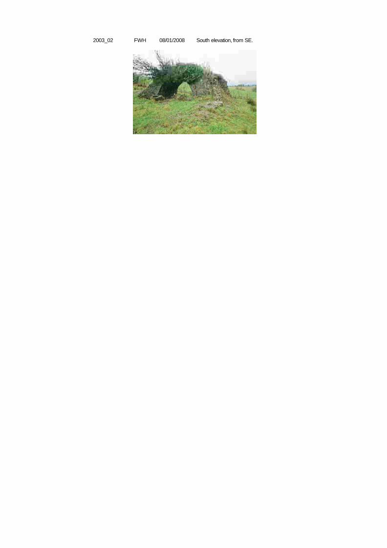
2003_02 FWH South elevation, from SE.08/01/2008
Site 2004
History Erected by the Ulster Canal Company. This line of canal opened in 1841.
Type Mile marker
County Co Monaghan OS 6-inch map MO012
Survey date 08/01/2008 Surveyor Fred Hamond
Completeness No visible remain Condition N/A Use N/A
Evaluation No industrial heritage significance.
Significance Record only
Component 2004
Surveyed? Y
Interest None
Y
259023 330349
Description No traces of this milestone, on the north bank of the canal, survive. Had it existed, itwould have read: "Charlemont 32/ Caledon 18/ Monaghan 7/ Clones 7/ WattleBridge 14".
Grid CrockcumberlandTownland
Original feature?
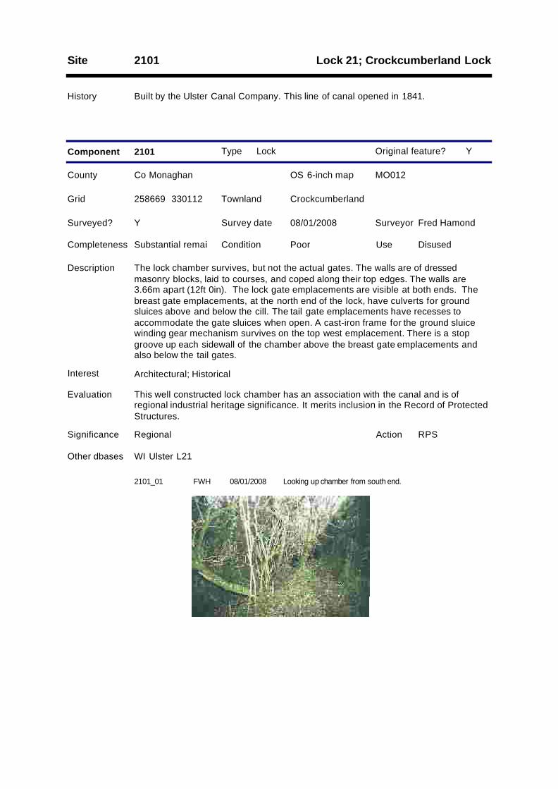
Lock 21; Crockcumberland LockSite 2101
History Built by the Ulster Canal Company. This line of canal opened in 1841.
Type Lock
County Co Monaghan OS 6-inch map MO012
Survey date 08/01/2008 Surveyor Fred Hamond
Completeness Substantial remai Condition Poor Use Disused
Evaluation This well constructed lock chamber has an association with the canal and is ofregional industrial heritage significance. It merits inclusion in the Record of ProtectedStructures.
Significance Regional
Component 2101
RPSAction
Surveyed? Y
Interest Architectural; Historical
Other dbases WI Ulster L21
Y
258669 330112
Description The lock chamber survives, but not the actual gates. The walls are of dressedmasonry blocks, laid to courses, and coped along their top edges. The walls are3.66m apart (12ft 0in). The lock gate emplacements are visible at both ends. Thebreast gate emplacements, at the north end of the lock, have culverts for groundsluices above and below the cill. The tail gate emplacements have recesses toaccommodate the gate sluices when open. A cast-iron frame for the ground sluicewinding gear mechanism survives on the top west emplacement. There is a stopgroove up each sidewall of the chamber above the breast gate emplacements andalso below the tail gates.
Grid CrockcumberlandTownland
Original feature?
2101_01 FWH Looking up chamber from south end.08/01/2008
2101_02 FWH Land gate sluice mechansim housing at west side of north(top) end.
08/01/2008
2101_03 FWH Cill at top end.08/01/2008
2101_04 FWH Lower gate emplacement on west side.08/01/2008

Site 2102
History Built by the Ulster Canal Company. This line of canal opened in 1841.
Type Bridge (canal/river)
County Co Monaghan OS 6-inch map MO012
Survey date 08/01/2008 Surveyor Fred Hamond
Completeness No visible remain Condition N/A Use N/A
Evaluation No industrial heritage significance.
Significance Record only
Component 2102
Surveyed? Y
Interest None
Y
258625 330020
Description No traces of this aqueduct are now evident. The land has been reclaimed hereaboutsand the stream diverted.
Grid Ballintoppan; CrockcumberlandTownland
Original feature?
Site 2103
History Built by the Ulster Canal Company. This line of canal opened in 1841.
Type Bridge (canal/river)
County Co Monaghan OS 6-inch map MO012
Survey date 08/01/2008 Surveyor Fred Hamond
Completeness Complete Condition Fair Use Disused
Evaluation This culvert has an historical association with the canal and is of local industrialheritage significance.
Significance Local
Component 2103
Surveyed? Y
Interest Historical
Y
258431 329748
Description A masonry aqueduct conveys the canal over an active stream. Its abutments andwing walls are of squared random rubble. Its head comprises flat stone lintels andspans c.90cm. It is now very overgrown.
Grid Templetate (ED Clones); TulleevinTownland
Original feature?
Templetate BridgeSite 2104
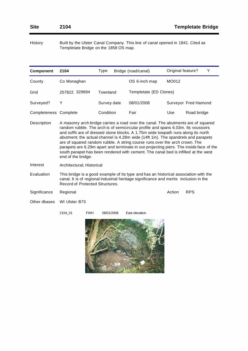
History Built by the Ulster Canal Company. This line of canal opened in 1841. Cited asTempletate Bridge on the 1858 OS map.
Type Bridge (road/canal)
County Co Monaghan OS 6-inch map MO012
Survey date 08/01/2008 Surveyor Fred Hamond
Completeness Complete Condition Fair Use Road bridge
Evaluation This bridge is a good example of its type and has an historical association with thecanal. It is of regional industrial heritage significance and merits inclusion in theRecord of Protected Structures.
Significance Regional
Component 2104
RPSAction
Surveyed? Y
Interest Architectural; Historical
Other dbases WI Ulster B73
Y
257822 329694
Description A masonry arch bridge carries a road over the canal. The abutments are of squaredrandom rubble. The arch is of semicircular profile and spans 6.03m. Its voussoirsand soffit are of dressed stone blocks. A 1.75m wide towpath runs along its northabutment; the actual channel is 4.28m wide (14ft 1in). The spandrels and parapetsare of squared random rubble. A string course runs over the arch crown. Theparapets are 6.29m apart and terminate in out-projecting piers. The inside face of thesouth parapet has been rendered with cement. The canal bed is infilled at the westend of the bridge.
Grid Templetate (ED Clones)Townland
Original feature?
2104_01 FWH East elevation.08/01/2008
Site 2105
History Erected by the Ulster Canal Company. This line of canal opened in 1841.
Type Mile marker
County Co Monaghan OS 6-inch map MO012
Survey date 08/01/2008 Surveyor Fred Hamond
Completeness No visible remain Condition N/A Use N/A
Evaluation No industrial heritage significance.
Significance Record only
Component 2105
Surveyed? Y
Interest None
Y
257756 329676
Description Nothing remains of this milestone on the north bank of the canal. Had it existed, itwould have read: "Charlemont 33/ Caledon 19/ Monaghan 8/ Clones 6/ WattleBridge 13".
Grid Templetate (ED Clones)Townland
Original feature?
Lock 22; Templetate LockSite 2201
History Built by the Ulster Canal Company. This line of canal opened in 1841. Cited asTempletate Lock on the 1858 OS map.
Type Lock
County Co Monaghan OS 6-inch map MO012
Survey date 08/01/2008 Surveyor Fred Hamond
Completeness Substantial remai Condition Fair Use Disused
Evaluation This well constructed lock chamber has an association with the canal and also groupinterest with the adjoining lock house (2201.2). Judging by the lack of undergrowth, itis one of the few to be actively maintained by its owner. It is of regional industrialheritage significance and merits inclusion in the Record of Protected Structures.
Significance Regional
Component 2201
RPSAction
1
Surveyed? Y
Interest Architectural; Historical; Group
Other dbases WI Ulster L22
Y
257701 329622
Description Although the canal is infilled hereabouts, the lock chamber survives, but without itsgates. The bed of the chamber has been infilled to just above cill level. The sidewalls are of dressed masonry blocks, laid to courses, and coped along their topedges. The walls are 3.82m apart (12ft 6in). The lock gate emplacements are visibleat both ends. The breast gate emplacement, at the NE end of the lock, has culvertsfor ground sluices above the cill (and doubtless below as well). The tail gateemplacements have recesses to accommodate gate sluices when open. A cast-ironframe for the ground sluice winding gear survives on the top NW emplacement. Allfour wrought-iron gate collars survive. There is a stop groove up each sidewall of thechamber above the breast gate emplacements and also below the tail gates.
Grid Templetate (ED Clones)Townland
Original feature?
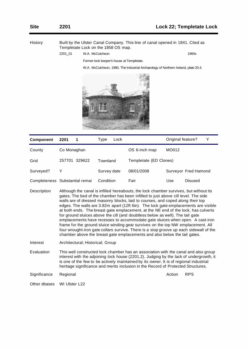
2201_01 W.A. McCutcheon
Former lock keeper's house at Templetate.
1960s
W.A. McCutcheon, 1980, The Industrial Archaeology of Northern Ireland, plate 20.4.
Type Lock house
County Co Monaghan OS 6-inch map MO012
Survey date 08/01/2008 Surveyor Fred Hamond
Completeness Complete Condition Poor Use Disused
Evaluation This typical lock house has an historical association with the canal and groupinterest with the adjoining lock (2201.1). It is of regional industrial heritagesignificance and merits inclusion in the Record of Protected Structures.
Significance Local
Component 2201 2
Surveyed? Y
Interest Architectural; Historical; Group
Y
257724 329666
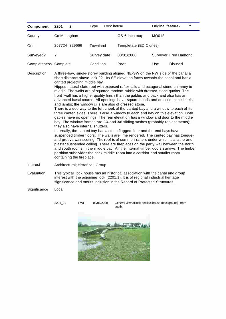
Description A three-bay, single-storey building aligned NE-SW on the NW side of the canal ashort distance above lock 22. Its SE elevation faces towards the canal and has acanted projecting middle bay.Hipped natural slate roof with exposed rafter tails and octagonal stone chimney tomiddle. The walls are of squared random rubble with dressed stone quoins. Thefront wall has a higher quality finish than the gables and back and also has anadvanced basal course. All openings have square heads and dressed stone lintelsand jambs; the window cills are also of dressed stone.There is a doorway to the left cheek of the canted bay and a window to each of itsthree canted sides. There is also a window to each end bay on this elevation. Bothgables have no openings. The rear elevation has a window and door to the middlebay. The window frames are 2/4 and 3/6 sliding sashes (probably replacements);they also have internal shutters.Internally, the canted bay has a stone flagged floor and the end bays havesuspended timber floors. The walls are lime rendered. The canted bay has tongue-and-groove wainscoting. The roof is of common rafters under which is a lathe-and-plaster suspended ceiling. There are fireplaces on the party wall between the northand south rooms in the middle bay. All the internal timber doors survive. The timberpartition subdivides the back middle room into a corridor and smaller roomcontaining the fireplace.
Grid Templetate (ED Clones)Townland
Original feature?
2201_01 FWH General view of lock and lockhouse (background), fromsouth.
08/01/2008
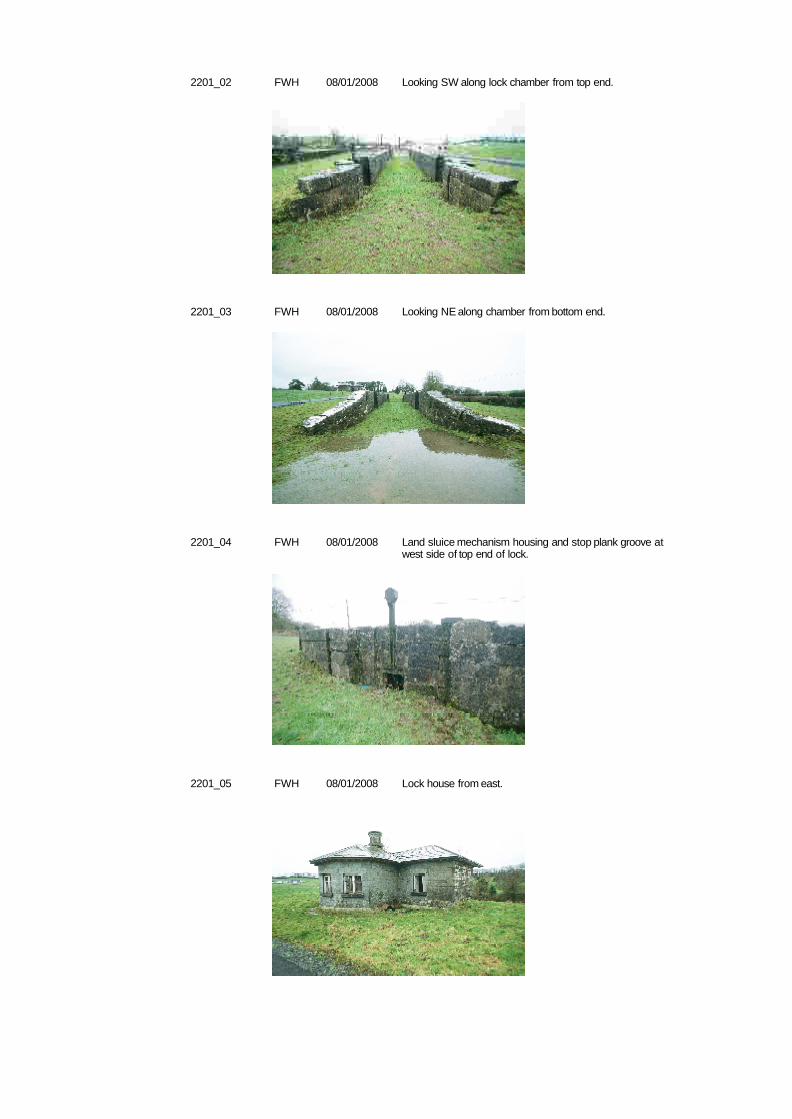
2201_02 FWH Looking SW along lock chamber from top end.08/01/2008
2201_03 FWH Looking NE along chamber from bottom end.08/01/2008
2201_04 FWH Land sluice mechanism housing and stop plank groove atwest side of top end of lock.
08/01/2008
2201_05 FWH Lock house from east.08/01/2008
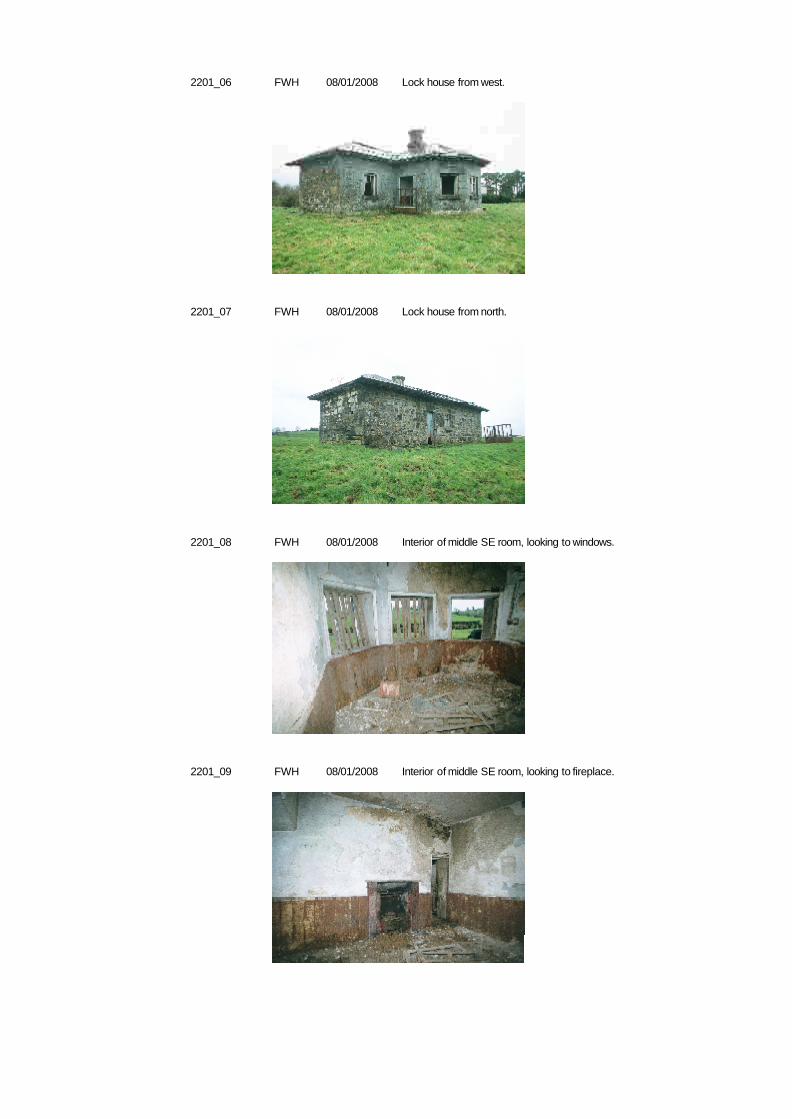
2201_06 FWH Lock house from west.08/01/2008
2201_07 FWH Lock house from north.08/01/2008
2201_08 FWH Interior of middle SE room, looking to windows.08/01/2008
2201_09 FWH Interior of middle SE room, looking to fireplace.08/01/2008
Site 2202
History Erected by the Ulster Canal Company. This line of canal opened in 1841.
Type Bridge (canal/river)
County Co Monaghan OS 6-inch map MO012
Survey date 08/01/2008 Surveyor Fred Hamond
Completeness Complete Condition Fair Use Disused
Evaluation This bridge has an historical association with the canal. Its sloping soffits are ofnote. It is of local industrial heritage significance.
Significance Local
Component 2202
Surveyed? Y
Interest Historical
Y
257112 328777
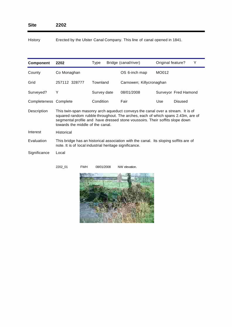
Description This twin-span masonry arch aqueduct conveys the canal over a stream. It is ofsquared random rubble throughout. The arches, each of which spans 2.43m, are ofsegmental profile and have dressed stone voussoirs. Their soffits slope downtowards the middle of the canal.
Grid Carnowen; KillycronaghanTownland
Original feature?
2202_01 FWH NW elevation.08/01/2008
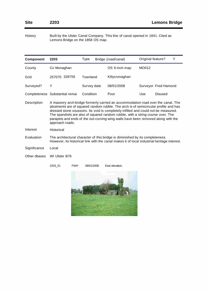
Lemons BridgeSite 2203
History Built by the Ulster Canal Company. This line of canal opened in 1841. Cited asLemons Bridge on the 1858 OS map.
Type Bridge (road/canal)
County Co Monaghan OS 6-inch map MO012
Survey date 08/01/2008 Surveyor Fred Hamond
Completeness Substantial remai Condition Poor Use Disused
Evaluation The architectural character of this bridge is diminished by its completeness.However, its historical link with the canal makes it of local industrial heritage interest.
Significance Local
Component 2203
Surveyed? Y
Interest Historical
Other dbases WI Ulster B76
Y
257070 328755
Description A masonry arch bridge formerly carried an accommodation road over the canal. Theabutments are of squared random rubble. The arch is of semicircular profile and hasdressed stone voussoirs. Its void is completely infilled and could not be measured.The spandrels are also of squared random rubble, with a string course over. Theparapets and ends of the out-curving wing walls have been removed along with theapproach roads.
Grid KillycronaghanTownland
Original feature?
2203_01 FWH East elevation.08/01/2008

2203_02 FWH West elevation.08/01/2008
Site 2204
History Erected by the Ulster Canal Company. This line of canal opened in 1841.
Type Mile marker
County Co Monaghan OS 6-inch map MO012
Survey date 11/01/2008 Surveyor Fred Hamond
Completeness No visible remain Condition N/A Use N/A
Evaluation No industrial heritage significance.
Significance Record only
Component 2204
Surveyed? Y
Interest None
Y
256696 328574
Description No traces survives of this milepost on the NW side of the canal. Had it existed, itwould have read: "Charlemont 34/ Caledon 20/ Monaghan 9/ Clones 5/ WattleBridge 12".
Grid KillycronaghanTownland
Original feature?
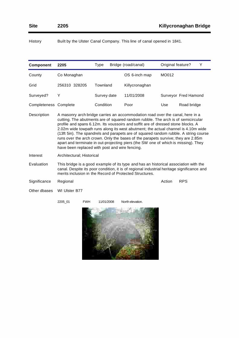
Killycronaghan BridgeSite 2205
History Built by the Ulster Canal Company. This line of canal opened in 1841.
Type Bridge (road/canal)
County Co Monaghan OS 6-inch map MO012
Survey date 11/01/2008 Surveyor Fred Hamond
Completeness Complete Condition Poor Use Road bridge
Evaluation This bridge is a good example of its type and has an historical association with thecanal. Despite its poor condition, it is of regional industrial heritage significance andmerits inclusion in the Record of Protected Structures.
Significance Regional
Component 2205
RPSAction
Surveyed? Y
Interest Architectural; Historical
Other dbases WI Ulster B77
Y
256310 328205
Description A masonry arch bridge carries an accommodation road over the canal, here in acutting. The abutments are of squared random rubble. The arch is of semicircularprofile and spans 6.12m. Its voussoirs and soffit are of dressed stone blocks. A2.02m wide towpath runs along its west abutment; the actual channel is 4.10m wide(13ft 5in). The spandrels and parapets are of squared random rubble. A string courseruns over the arch crown. Only the bases of the parapets survive; they are 2.85mapart and terminate in out-projecting piers (the SW one of which is missing). Theyhave been replaced with post and wire fencing.
Grid KillycronaghanTownland
Original feature?
2205_01 FWH North elevation.11/01/2008
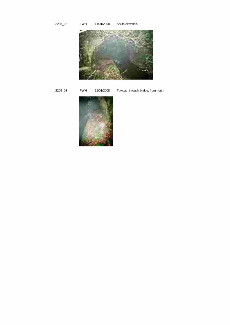
2205_02 FWH South elevation.11/01/2008
2205_03 FWH Towpath through bridge, from north.11/01/2008
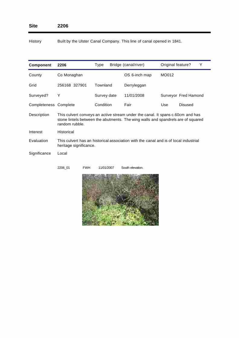
Site 2206
History Built by the Ulster Canal Company. This line of canal opened in 1841.
Type Bridge (canal/river)
County Co Monaghan OS 6-inch map MO012
Survey date 11/01/2008 Surveyor Fred Hamond
Completeness Complete Condition Fair Use Disused
Evaluation This culvert has an historical association with the canal and is of local industrialheritage significance.
Significance Local
Component 2206
Surveyed? Y
Interest Historical
Y
256168 327901
Description This culvert conveys an active stream under the canal. It spans c.60cm and hasstone lintels between the abutments. The wing walls and spandrels are of squaredrandom rubble.
Grid DerrylegganTownland
Original feature?
2206_01 FWH South elevation.11/01/2007
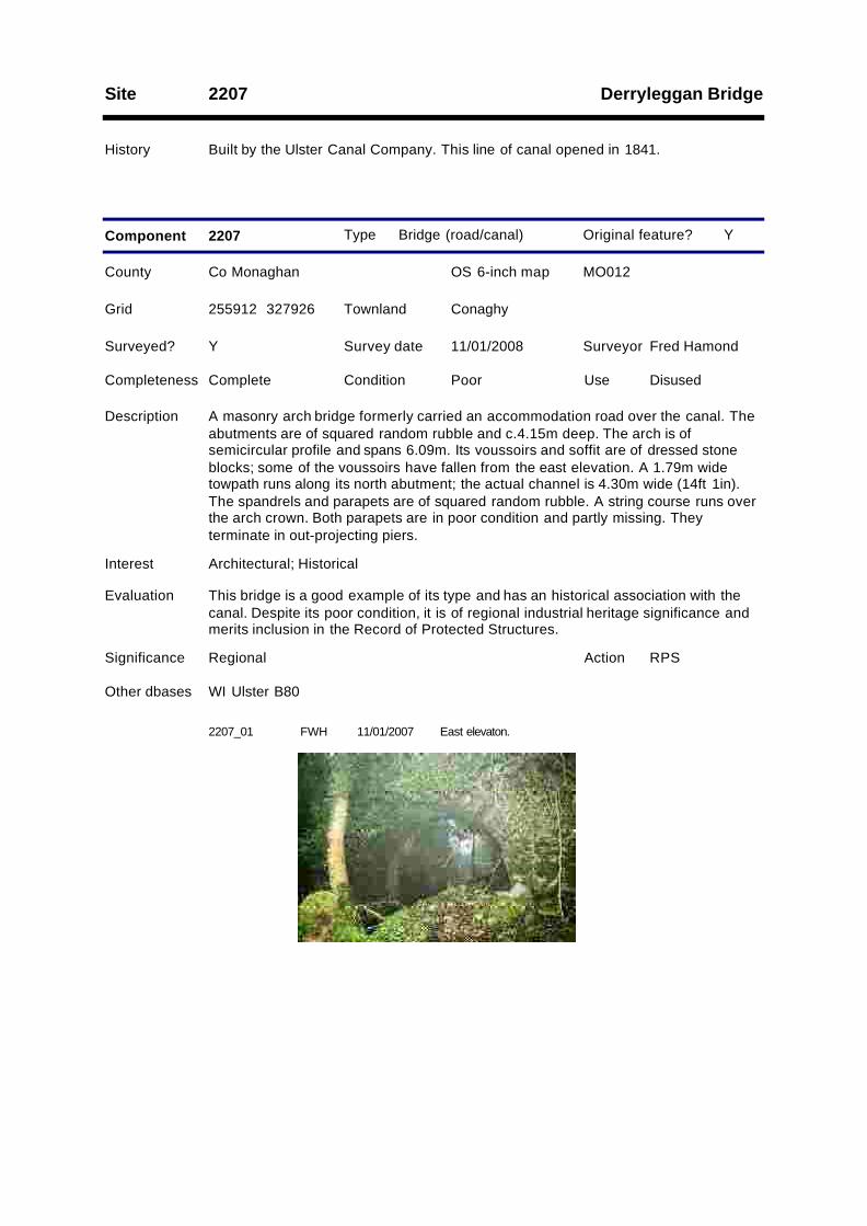
Derryleggan BridgeSite 2207
History Built by the Ulster Canal Company. This line of canal opened in 1841.
Type Bridge (road/canal)
County Co Monaghan OS 6-inch map MO012
Survey date 11/01/2008 Surveyor Fred Hamond
Completeness Complete Condition Poor Use Disused
Evaluation This bridge is a good example of its type and has an historical association with thecanal. Despite its poor condition, it is of regional industrial heritage significance andmerits inclusion in the Record of Protected Structures.
Significance Regional
Component 2207
RPSAction
Surveyed? Y
Interest Architectural; Historical
Other dbases WI Ulster B80
Y
255912 327926
Description A masonry arch bridge formerly carried an accommodation road over the canal. Theabutments are of squared random rubble and c.4.15m deep. The arch is ofsemicircular profile and spans 6.09m. Its voussoirs and soffit are of dressed stoneblocks; some of the voussoirs have fallen from the east elevation. A 1.79m widetowpath runs along its north abutment; the actual channel is 4.30m wide (14ft 1in).The spandrels and parapets are of squared random rubble. A string course runs overthe arch crown. Both parapets are in poor condition and partly missing. Theyterminate in out-projecting piers.
Grid ConaghyTownland
Original feature?
2207_01 FWH East elevaton.11/01/2007
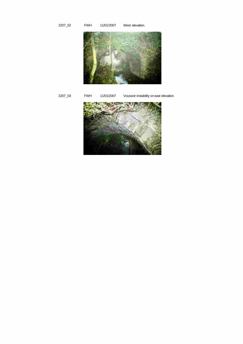
2207_02 FWH West elevation.11/01/2007
2207_03 FWH Voussoir instability on east elevation.11/01/2007
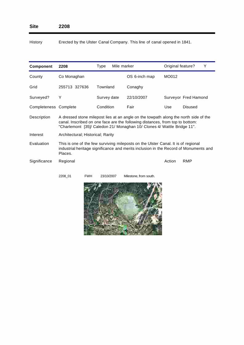
Site 2208
History Erected by the Ulster Canal Company. This line of canal opened in 1841.
Type Mile marker
County Co Monaghan OS 6-inch map MO012
Survey date 22/10/2007 Surveyor Fred Hamond
Completeness Complete Condition Fair Use Disused
Evaluation This is one of the few surviving mileposts on the Ulster Canal. It is of regionalindustrial heritage significance and merits inclusion in the Record of Monuments andPlaces.
Significance Regional
Component 2208
RMPAction
Surveyed? Y
Interest Architectural; Historical; Rarity
Y
255713 327636
Description A dressed stone milepost lies at an angle on the towpath along the north side of thecanal. Inscribed on one face are the following distances, from top to bottom:"Charlemont [35]/ Caledon 21/ Monaghan 10/ Clones 4/ Wattle Bridge 11".
Grid ConaghyTownland
Original feature?
2208_01 FWH Milestone, from south.23/10/2007

Conaghy BridgeSite 2209
History Built by the Ulster Canal Company. This line of canal opened in 1841. The line of thetowpath as marked on the 25-inch OS amps indicates that this was a 'cross-over'bridge where the towpath crossed the canal. The towpaths and ramps therefrom upto the road were configured in such a way that dray horses crossing the bridge didnot have to be unhitched from their tow ropes.
Type Bridge (road/canal)
County Co Monaghan OS 6-inch map MO012
Survey date 22/10/2007 Surveyor Fred Hamond
Completeness Complete Condition Good Use Road bridge
Evaluation This bridge is a good example of a road-over-canal bridge and has an historicalassociation with the canal. It is also one of only three cross-over type bridges on theMonaghan stretch of the canal (there is a fourth example at Benburb, Co Tyrone). Itis of regional industrial heritage significance and merits inclusion in the Record ofProtected Structures.
Significance Regional
Component 2209
RPSAction
Surveyed? Y
Interest Architectural; Historical
Other dbases WI Ulster B81
Y
255530 327599
Description A masonry arch bridge carries a road over the canal. The abutments are of dressedstone blocks, laid to courses. The arch is of semicircular profile and the voussoirs ofdressed stone blocks; it spans 6.07m. A 2.01m wide towpath runs along its northabutment; the actual channel is 4.06m wide (13ft 4in). The spandrels and parapetsare of squared random rubble. The latter are 3.31m apart and have dressed stonecopings. A string course runs along their base, over the arch crown. The parapetscurve outwards at both ends and terminate in out-projecting piers. The approaches tothis bridge are dog-legged. The underside of the arch has been partly infilled.
Grid ConaghyTownland
Original feature?
2209_01 FWH East elevation.23/10/2007
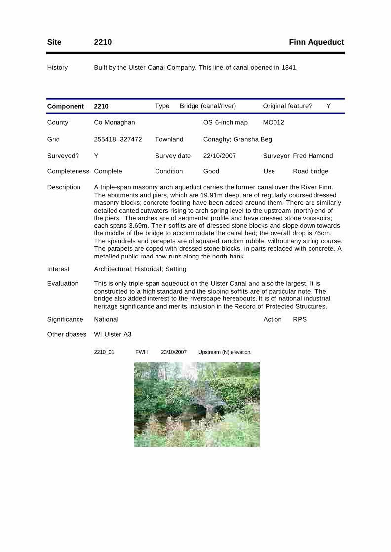
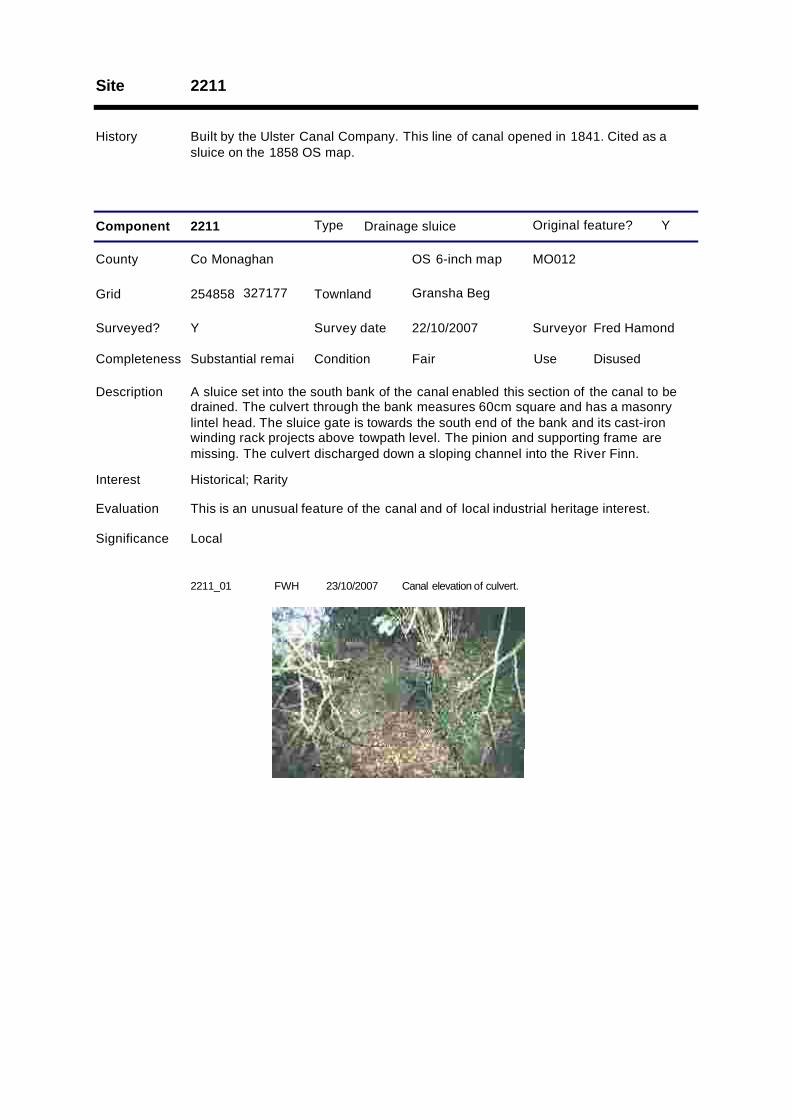
Finn AqueductSite 2210
History Built by the Ulster Canal Company. This line of canal opened in 1841.
Type Bridge (canal/river)
County Co Monaghan OS 6-inch map MO012
Survey date 22/10/2007 Surveyor Fred Hamond
Completeness Complete Condition Good Use Road bridge
Evaluation This is only triple-span aqueduct on the Ulster Canal and also the largest. It isconstructed to a high standard and the sloping soffits are of particular note. Thebridge also added interest to the riverscape hereabouts. It is of national industrialheritage significance and merits inclusion in the Record of Protected Structures.
Significance National
Component 2210
RPSAction
Surveyed? Y
Interest Architectural; Historical; Setting
Other dbases WI Ulster A3
Y
255418 327472
Description A triple-span masonry arch aqueduct carries the former canal over the River Finn.The abutments and piers, which are 19.91m deep, are of regularly coursed dressedmasonry blocks; concrete footing have been added around them. There are similarlydetailed canted cutwaters rising to arch spring level to the upstream (north) end ofthe piers. The arches are of segmental profile and have dressed stone voussoirs;each spans 3.69m. Their soffits are of dressed stone blocks and slope down towardsthe middle of the bridge to accommodate the canal bed; the overall drop is 76cm.The spandrels and parapets are of squared random rubble, without any string course.The parapets are coped with dressed stone blocks, in parts replaced with concrete. Ametalled public road now runs along the north bank.
Grid Conaghy; Gransha BegTownland
Original feature?
2210_01 FWH Upstream (N) elevation.23/10/2007
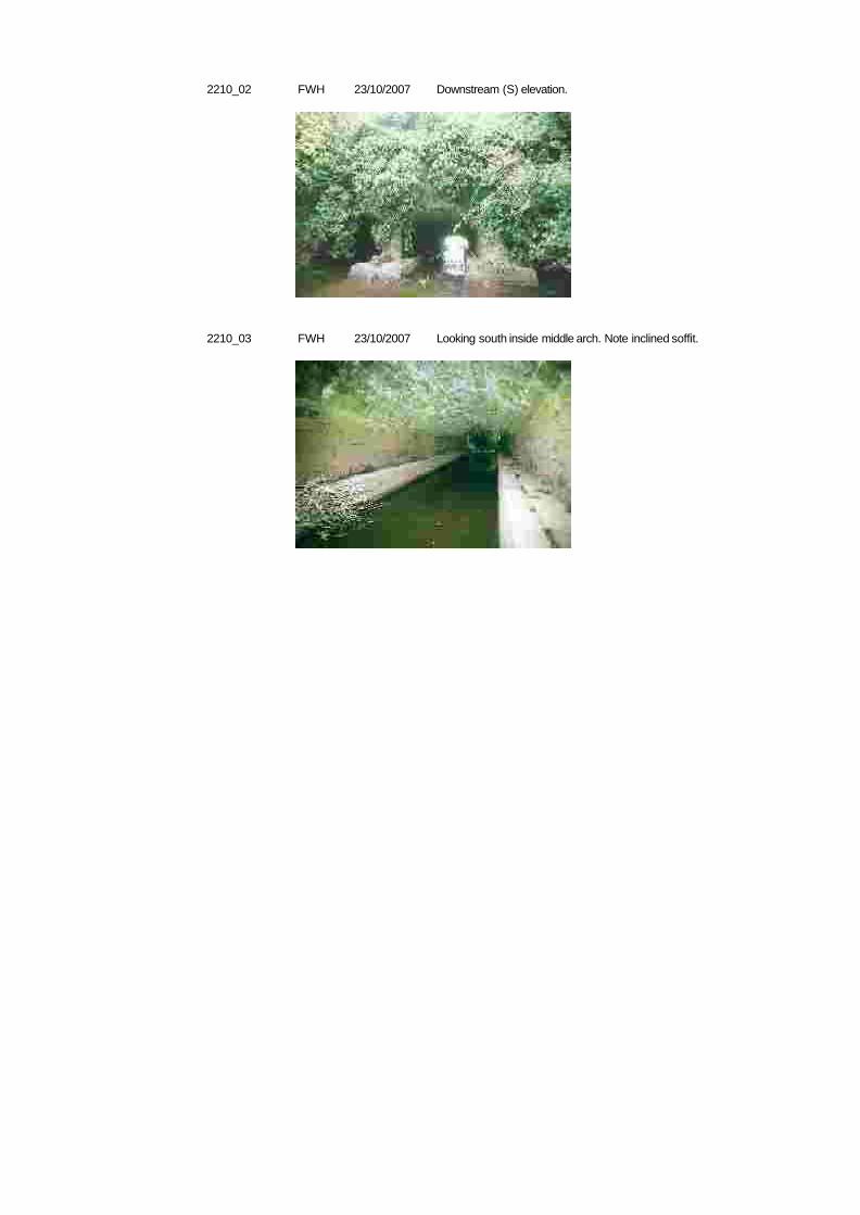
2210_02 FWH Downstream (S) elevation.23/10/2007
2210_03 FWH Looking south inside middle arch. Note inclined soffit.23/10/2007
Site 2211
History Built by the Ulster Canal Company. This line of canal opened in 1841. Cited as asluice on the 1858 OS map.
Type Drainage sluice
County Co Monaghan OS 6-inch map MO012
Survey date 22/10/2007 Surveyor Fred Hamond
Completeness Substantial remai Condition Fair Use Disused
Evaluation This is an unusual feature of the canal and of local industrial heritage interest.
Significance Local
Component 2211
Surveyed? Y
Interest Historical; Rarity
Y
254858 327177
Description A sluice set into the south bank of the canal enabled this section of the canal to bedrained. The culvert through the bank measures 60cm square and has a masonrylintel head. The sluice gate is towards the south end of the bank and its cast-ironwinding rack projects above towpath level. The pinion and supporting frame aremissing. The culvert discharged down a sloping channel into the River Finn.
Grid Gransha BegTownland
Original feature?
2211_01 FWH Canal elevation of culvert.23/10/2007
Gransha Beg BridgeSite 2212
History Built by the Ulster Canal Company. This line of canal opened in 1841.
Type Bridge (road/canal)
County Co Monaghan OS 6-inch map MO012
Survey date 22/10/2007 Surveyor Fred Hamond
Completeness Complete Condition Good Use Road bridge
Evaluation This bridge is a good example of its type and has an historical association with thecanal. It is of regional industrial heritage significance and merits inclusion in theRecord of Protected Structures.
Significance Regional
Component 2212
RPSAction
Surveyed? Y
Interest Architectural; Historical
Other dbases WI Ulster B82
Y
254537 327143
Description A skew masonry arch bridge carries a road over the canal. The abutments are ofsquared random rubble. The arch is of semicircular profile and the voussoirs ofdressed stone blocks; it spans 6.13m, measured orthogonally/ 6.44m on the skew.The soffit blocks are set orthogonally. A 2.04m wide towpath runs along its southabutment; the actual channel is 4.09m wide (13ft 5in). The spandrels and parapetsare also of squared random rubble. The latter have dressed stone copings and are4.79m apart. A string course runs along their base, over the arch crown. They curveoutwards at both ends to terminate in out-projecting piers. The approaches to thisbridge are dog-legged.
Grid Gransha BegTownland
Original feature?
2212_01 FWH East elevation, from NE.23/10/2007
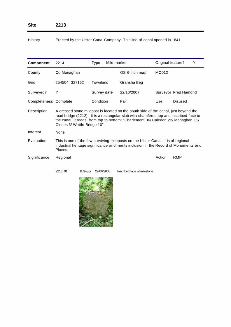
Site 2213
History Erected by the Ulster Canal Company. This line of canal opened in 1841.
Type Mile marker
County Co Monaghan OS 6-inch map MO012
Survey date 22/10/2007 Surveyor Fred Hamond
Completeness Complete Condition Fair Use Disused
Evaluation This is one of the few surviving mileposts on the Ulster Canal. It is of regionalindustrial heritage significance and merits inclusion in the Record of Monuments andPlaces.
Significance Regional
Component 2213
RMPAction
Surveyed? Y
Interest None
Y
254504 327162
Description A dressed stone milepost is located on the south side of the canal, just beyond theroad bridge (2212). It is a rectangular slab with chamfered top and inscribed face tothe canal. It reads, from top to bottom: "Charlemont 36/ Caledon 22/ Monaghan 11/Clones 3/ Wattle Bridge 10".
Grid Gransha BegTownland
Original feature?
2213_01 B.Goggi Inscribed face of milestone.29/06/2008
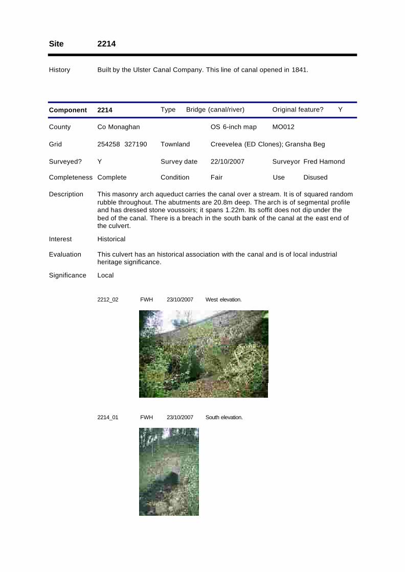
Site 2214
History Built by the Ulster Canal Company. This line of canal opened in 1841.
Type Bridge (canal/river)
County Co Monaghan OS 6-inch map MO012
Survey date 22/10/2007 Surveyor Fred Hamond
Completeness Complete Condition Fair Use Disused
Evaluation This culvert has an historical association with the canal and is of local industrialheritage significance.
Significance Local
Component 2214
Surveyed? Y
Interest Historical
Y
254258 327190
Description This masonry arch aqueduct carries the canal over a stream. It is of squared randomrubble throughout. The abutments are 20.8m deep. The arch is of segmental profileand has dressed stone voussoirs; it spans 1.22m. Its soffit does not dip under thebed of the canal. There is a breach in the south bank of the canal at the east end ofthe culvert.
Grid Creevelea (ED Clones); Gransha BegTownland
Original feature?
2212_02 FWH West elevation.23/10/2007
2214_01 FWH South elevation.23/10/2007
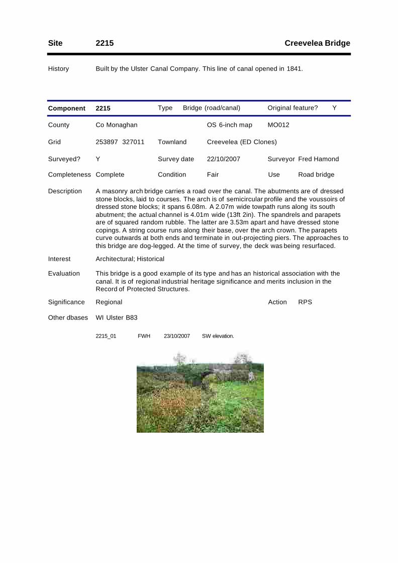
Creevelea BridgeSite 2215
History Built by the Ulster Canal Company. This line of canal opened in 1841.
Type Bridge (road/canal)
County Co Monaghan OS 6-inch map MO012
Survey date 22/10/2007 Surveyor Fred Hamond
Completeness Complete Condition Fair Use Road bridge
Evaluation This bridge is a good example of its type and has an historical association with thecanal. It is of regional industrial heritage significance and merits inclusion in theRecord of Protected Structures.
Significance Regional
Component 2215
RPSAction
Surveyed? Y
Interest Architectural; Historical
Other dbases WI Ulster B83
Y
253897 327011
Description A masonry arch bridge carries a road over the canal. The abutments are of dressedstone blocks, laid to courses. The arch is of semicircular profile and the voussoirs ofdressed stone blocks; it spans 6.08m. A 2.07m wide towpath runs along its southabutment; the actual channel is 4.01m wide (13ft 2in). The spandrels and parapetsare of squared random rubble. The latter are 3.53m apart and have dressed stonecopings. A string course runs along their base, over the arch crown. The parapetscurve outwards at both ends and terminate in out-projecting piers. The approaches tothis bridge are dog-legged. At the time of survey, the deck was being resurfaced.
Grid Creevelea (ED Clones)Townland
Original feature?
2215_01 FWH SW elevation.23/10/2007
Site 2216
History Erected by the Ulster Canal Company. This line of canal opened in 1841.
Type Mile marker
County Co Monaghan OS 6-inch map MO012
Survey date 22/10/2007 Surveyor Fred Hamond
Completeness No visible remain Condition N/A Use N/A
Evaluation No industrial heritage significance.
Significance Record only
Component 2216
Surveyed? Y
Interest None
Y
253204 326444
Description There are no visible traces of this milepost which formerly stood on the south bank.Had it existed, it would have read: "Charlemont 37/ Caledon 23/ Monaghan 12/Clones 2/ Wattle Bridge 9".
Grid TanderageeTownland
Original feature?
Glear BridgeSite 2217
History Built by the Ulster Canal Company. This line of canal opened in 1841.
Type Bridge (road/canal)
County Co Monaghan OS 6-inch map MO012
Survey date 22/10/2007 Surveyor Fred Hamond
Completeness Complete Condition Fair Use Road bridge
Evaluation This bridge is a good example of its type and has an historical association with thecanal. It is of regional industrial heritage significance and merits inclusion in theRecord of Protected Structures.
Significance Regional
Component 2217
RPSAction
Surveyed? Y
Interest Architectural; Historical
Other dbases WI Ulster B85
Y
253186 326458
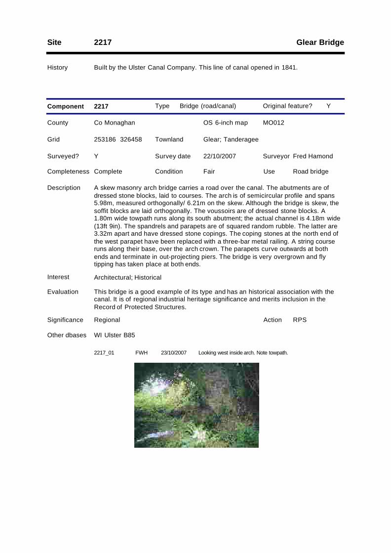
Description A skew masonry arch bridge carries a road over the canal. The abutments are ofdressed stone blocks, laid to courses. The arch is of semicircular profile and spans5.98m, measured orthogonally/ 6.21m on the skew. Although the bridge is skew, thesoffit blocks are laid orthogonally. The voussoirs are of dressed stone blocks. A1.80m wide towpath runs along its south abutment; the actual channel is 4.18m wide(13ft 9in). The spandrels and parapets are of squared random rubble. The latter are3.32m apart and have dressed stone copings. The coping stones at the north end ofthe west parapet have been replaced with a three-bar metal railing. A string courseruns along their base, over the arch crown. The parapets curve outwards at bothends and terminate in out-projecting piers. The bridge is very overgrown and flytipping has taken place at both ends.
Grid Glear; TanderageeTownland
Original feature?
2217_01 FWH Looking west inside arch. Note towpath.23/10/2007
Lock 23; Glear East LockSite 2301
History Built by the Ulster Canal Company. This line of canal opened in 1841. Cited as 23rdlock on the 1858 OS map. The lock house served locks 23 and 24.
Type Lock
County Co Monaghan OS 6-inch map MO012
Survey date 22/10/2007 Surveyor Fred Hamond
Completeness Substantial remai Condition Fair Use Disused
Evaluation This lock chamber is substantially intact and has an historical association with thecanal. It also has group value with the adjoining lock house and lock 24 (F2401). It isof regional industrial heritage significance and merits inclusion in the Record ofProtected Structures.
Significance Regional
Component 2301
RPSAction
1
Surveyed? Y
Interest Architectural; Historical; Group
Other dbases WI Ulster L23
Y
252971 326460
Description The side walls and gate emplacements of this lock chamber survive, but not theactual gates. The walls are of dressed masonry blocks, laid to courses, and copedalong their top edges. They are 3.63m apart (11ft 11in).
Grid GlearTownland
Original feature?
Type Lock house
County Co Monaghan OS 6-inch map MO012
Survey date 22/10/2007 Surveyor Fred Hamond
Completeness Complete Condition Fair Use Disused
Evaluation Although internally refurbished, this building retains its original external character. Italso has an historical association with the canal and has group value with theadjoining lock 23 and nearby lock 24 (feature 2401). It is of regional industrialheritage significance and merits inclusion in the Record of Protected Structures.
Significance Regional
Component 2301
RPSAction
2
Surveyed? Y
Interest Architectural; Historical; Group
Y
252945 326433
Description A three-bay, single-storey former lock keeper's house aligned east-west on the southside of the canal, just south-west of the lock chamber. Hipped natural slate roof, withoctagonal stone chimney. Half-round plastic gutters. Walls are painted, randomly-sized masonry blocks, brought to courses. All openings have square dressed stoneheads. The window openings have shouldered stone cills and replacement timbercasements.There is a projecting canted bay to the middle of the north elevation, facing thecanal. There is a tongue-and-groove sheeted door to its right-hand cheek and awindow to each cant (that to middle now infilled). The end bays each have a window.A small shed abuts the east gable. It has a monopitched corrugated-metal roof(collapsed), random rubble walls and a doorway on its south elevation. The southelevation has two windows to the middle bay (one is probably a modern insertion).The west gable is devoid of openings.The interior has been completely refurbished and there are no original features.The house has been vacated in the recent past and is falling into dereliction.
Grid GlearTownland
Original feature?
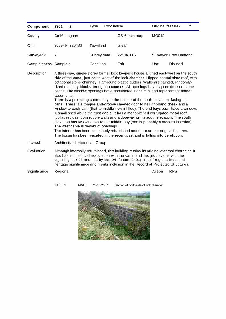
2301_01 FWH Section of north side of lock chamber.23/10/2007
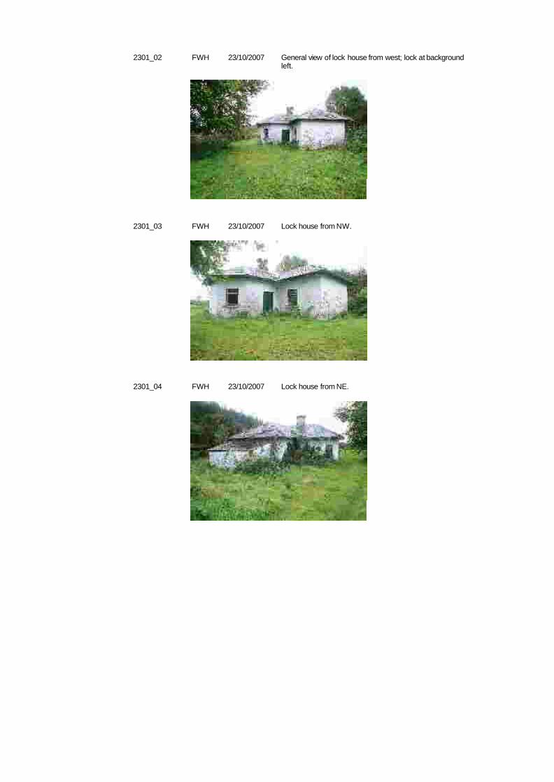
2301_02 FWH General view of lock house from west; lock at backgroundleft.
23/10/2007
2301_03 FWH Lock house from NW.23/10/2007
2301_04 FWH Lock house from NE.23/10/2007
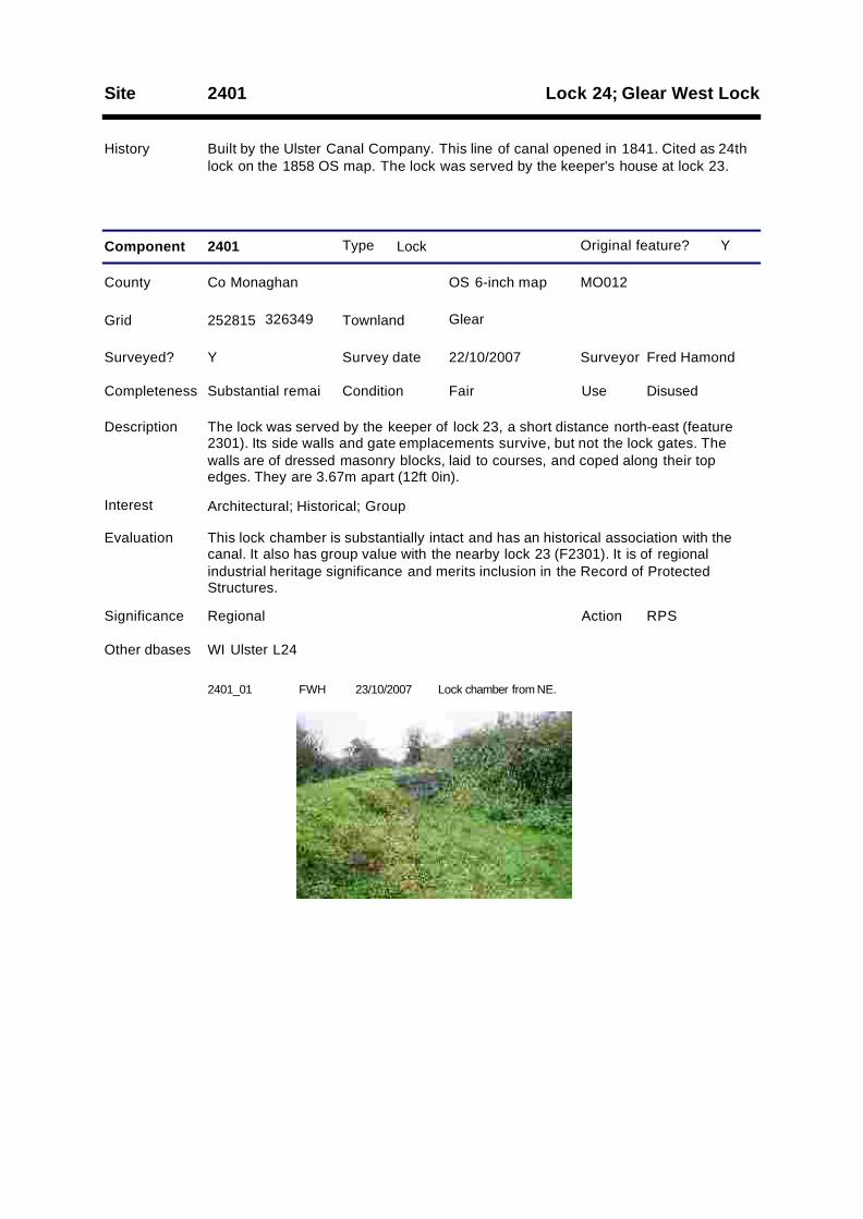
Lock 24; Glear West LockSite 2401
History Built by the Ulster Canal Company. This line of canal opened in 1841. Cited as 24thlock on the 1858 OS map. The lock was served by the keeper's house at lock 23.
Type Lock
County Co Monaghan OS 6-inch map MO012
Survey date 22/10/2007 Surveyor Fred Hamond
Completeness Substantial remai Condition Fair Use Disused
Evaluation This lock chamber is substantially intact and has an historical association with thecanal. It also has group value with the nearby lock 23 (F2301). It is of regionalindustrial heritage significance and merits inclusion in the Record of ProtectedStructures.
Significance Regional
Component 2401
RPSAction
Surveyed? Y
Interest Architectural; Historical; Group
Other dbases WI Ulster L24
Y
252815 326349
Description The lock was served by the keeper of lock 23, a short distance north-east (feature2301). Its side walls and gate emplacements survive, but not the lock gates. Thewalls are of dressed masonry blocks, laid to courses, and coped along their topedges. They are 3.67m apart (12ft 0in).
Grid GlearTownland
Original feature?
2401_01 FWH Lock chamber from NE.23/10/2007
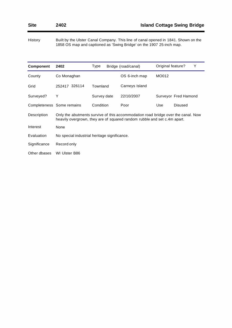
Island Cottage Swing BridgeSite 2402
History Built by the Ulster Canal Company. This line of canal opened in 1841. Shown on the1858 OS map and captioned as 'Swing Bridge' on the 1907 25-inch map.
Type Bridge (road/canal)
County Co Monaghan OS 6-inch map MO012
Survey date 22/10/2007 Surveyor Fred Hamond
Completeness Some remains Condition Poor Use Disused
Evaluation No special industrial heritage significance.
Significance Record only
Component 2402
Surveyed? Y
Interest None
Other dbases WI Ulster B86
Y
252417 326114
Description Only the abutments survive of this accommodation road bridge over the canal. Nowheavily overgrown, they are of squared random rubble and set c.4m apart.
Grid Carneys IslandTownland
Original feature?
Site 2403
History Built by the Ulster Canal Company. This line of canal opened in 1841.
Type Bridge (canal/river)
County Co Monaghan OS 6-inch map MO012
Survey date 22/10/2007 Surveyor Fred Hamond
Completeness No visible remain Condition N/A Use N/A
Evaluation No industrial heritage significance.
Significance Record only
Component 2403
Surveyed? Y
Interest None
Y
252275 326025
Description Nothing survives of this aqueduct which carried the canal over a stream.
Grid Carneys Island; GlebeTownland
Original feature?

Site 2404
History Built by the Ulster Canal Company. This line of canal opened in 1841.
Type Bridge (canal/river)
County Co Monaghan OS 6-inch map MO012
Survey date 22/10/2007 Surveyor Fred Hamond
Completeness No visible remain Condition N/A Use N/A
Evaluation No industrial heritage significance.
Significance Record only
Component 2404
Surveyed? Y
Interest None
Y
252011 325852
Description Nothing survives of this aqueduct which carried the canal over a stream.
Grid Clonavilla; GlebeTownland
Original feature?
Clonavilla BridgeSite 2405
History Built by the Ulster Canal Company. This line of canal opened in 1841. The presentbridge is a mid/later 20th century replacement of the original.
Type Bridge (road/canal)
County Co Monaghan OS 6-inch map MO012
Survey date 22/10/2007 Surveyor Fred Hamond
Completeness No visible remain Condition N/A Use N/A
Evaluation No industrial heritage significance.
Significance Record only
Component 2405 1
Surveyed? Y
Interest None
Y
251849 325740
Description This road bridge over the canal has been demolished and a new one erected (seecomponent 2).
Grid ClonavillaTownland
Original feature?
Type Bridge (road/canal)
County Co Monaghan OS 6-inch map MO012
Survey date 22/10/2007 Surveyor Fred Hamond
Completeness No visible remain Condition N/A Use N/A
Evaluation No industrial heritage significance.
Significance Record only
Component 2405 2
Surveyed? Y
Interest None
Other dbases WI Ulster B87
N
251849 325741
Description Three skew concrete pipes carry the road over the Ulster Canal. The pipes are set inmass concrete, and the parapets are also of this material. The present bridge isundoubtedly wider that the original bridge (component 1), which would also have hadramped approaches. The canal is infilled at the south-west end of the bridge.
Grid ClonavillaTownland
Original feature?

2405_01 FWH Replacement bridge from north.23/10/2007
Site 2406
History Erected by the Ulster Canal Company. This line of canal opened in 1841.
Type Mile marker
County Co Monaghan OS 6-inch map MO012
Survey date 22/10/2007 Surveyor Fred Hamond
Completeness No visible remain Condition N/A Use N/A
Evaluation No industrial heritage significance.
Significance Record only
Component 2406
Surveyed? Y
Interest None
Y
251817 325708
Description This milepost has disappeared from the SE bank of the canal. Had it existed, itwould have read: "Charlemont 38/ Caledon 24/ Monaghan 13/ Clones 1/ WattleBridge 8".
Grid ClonavillaTownland
Original feature?
Site 2407
History The railway line which crosses the canal at this point was opened by the Dundalk &Enniskillen Railway in July 1858. The original bridge was replaced with plate girderspans on cylindrical piers by the GNR(I) in 1925. Closed to passengers by GreatNorthern Railway Board in October 1957 and to goods traffic by Córas IompairÉireann in December 1959.
Type Bridge (rail/canal)
County Co Monaghan OS 6-inch map MO012
Survey date 22/10/2007 Surveyor Fred Hamond
Completeness Some remains Condition Fair Use Disused
Evaluation This is the only example of a multi-span railway bridge over the Co Monaghansection of the canal. It adds interest to the landscape. Because of itsincompleteness, it is now only of local industrial heritage significance.
Significance Local
Component 2407
Surveyed? Y
Interest Architectural; Historical; Setting; Rarity
Other dbases LOMO Railways 3822
N
251637 325568
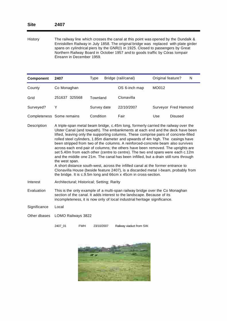
Description A triple-span metal beam bridge, c.45m long, formerly carried the railway over theUlster Canal (and towpath). The embankments at each end and the deck have beenlifted, leaving only the supporting columns. These comprise pairs of concrete-filledrolled steel cylinders, 1.85m diameter and upwards of 4m high. The casings havebeen stripped from two of the columns. A reinforced-concrete beam also survivesacross each end pair of columns; the others have been removed. The uprights areset 5.40m from each other (centre to centre). The two end spans were each c.12mand the middle one 21m. The canal has been infilled, but a drain still runs throughthe west span.A short distance south-west, across the infilled canal at the former entrance toClonavilla House (beside feature 2407), is a discarded metal I-beam, probably fromthe bridge. It is c.9.5m long and 66cm x 45cm in cross-section.
Grid ClonavillaTownland
Original feature?
2407_01 FWH Railway viaduct from SW.23/10/2007
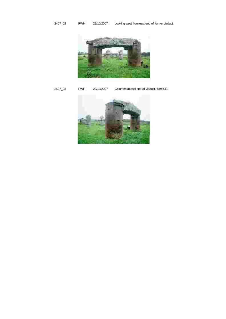
2407_02 FWH Looking west from east end of former viaduct.23/10/2007
2407_03 FWH Columns at east end of viaduct, from SE.23/10/2007

Site 2408
History Built by the Ulster Canal Company. This line of canal opened in 1841.
Type Bridge (canal/river)
County Co Monaghan OS 6-inch map MO012
Survey date 22/10/2007 Surveyor Fred Hamond
Completeness No visible remain Condition N/A Use N/A
Evaluation No industrial heritage significance.
Significance Record only
Component 2408
Surveyed? Y
Interest None
Y
251507 325439
Description Nothing survives of this aqueduct which carried the canal over a stream.
Grid Clonavilla; LegarhillTownland
Original feature?

Legarhill BridgeSite 2409
History Built by the Ulster Canal Company. This line of canal opened in 1841.
Type Bridge (road/canal)
County Co Monaghan OS 6-inch map MO012
Survey date 22/10/2007 Surveyor Fred Hamond
Completeness No visible remain Condition N/A Use N/A
Evaluation No industrial heritage significance.
Significance Record only
Component 2409
Surveyed? Y
Interest None
Y
251412 325354
Description All remains of the road bridge over the canal have been removed. The canal is nowinfilled to facilitate a wider level road.
Grid LegarhillTownland
Original feature?

Site 2410
History Built by the Ulster Canal Company. This line of canal opened in 1841.
Type Bridge (canal/river)
County Co Monaghan OS 6-inch map MO012
Survey date 22/10/2007 Surveyor Fred Hamond
Completeness No visible remain Condition N/A Use N/A
Evaluation No industrial heritage significance.
Significance Record only
Component 2410
Surveyed? Y
Interest None
Y
251055 325211
Description Nothing survives of this aqueduct which carried the canal over a drain.
Grid LegarhillTownland
Original feature?
Site 2411
History Erected by the Ulster Canal Company. This line of canal opened in 1841.
Type Mile marker
County Co Monaghan OS 6-inch map MO011
Survey date 14/05/2007 Surveyor Fred Hamond
Completeness Complete Condition Fair Use Disused
Evaluation This is one of the few surviving mile posts on the Ulster Canal. It is of regionalindustrial heritage significance and merits inclusion in the Record of Monuments andPlaces.
Significance Regional
Component 2411
RMPAction
Surveyed? Y
Interest Architectural; Historical; Rarity
Y
250388 325390
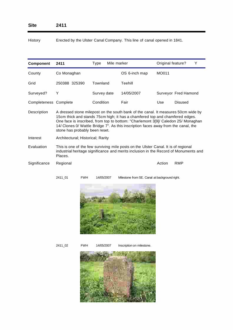
Description A dressed stone milepost on the south bank of the canal. It measures 50cm wide by15cm thick and stands 75cm high; it has a chamfered top and chamfered edges.One face is inscribed, from top to bottom: "Charlemont 3[9]/ Caledon 25/ Monaghan14/ Clones 0/ Wattle Bridge 7". As this inscription faces away from the canal, thestone has probably been reset.
Grid TeehillTownland
Original feature?
2411_01 FWH Milestone from SE. Canal at background right.14/05/2007
2411_02 FWH Inscription on milestone.14/05/2007
Whitehall Street Bridge; McCurtain Street BridgeSite 2412
History Built by the Ulster Canal Company. This line of canal opened in 1841. A woodenbridge is captioned on the 1858 OS map. The present bridge is a mid 20th centuryreplacement.
Type Bridge (road/canal)
County Co Monaghan OS 6-inch map MO011
Survey date 14/05/2007 Surveyor Fred Hamond
Completeness No visible remain Condition N/A Use N/A
Evaluation No industrial heritage significance.
Significance Record only
Component 2412 1
Surveyed? Y
Interest None
Y
250229 325499
Description This road bridge over the canal has been demolished and a replacement one erected(see component 2).
Grid Crossmoyle; TeehillTownland
Original feature?
Type Bridge (road/canal)
County Co Monaghan OS 6-inch map MO011
Survey date 14/05/2007 Surveyor Fred Hamond
Completeness Complete Condition Good Use Road bridge
Evaluation No special industrial heritage significance.
Significance Record only
Component 2412 2
Surveyed? Y
Interest None
Other dbases WI Ulster B89
N
250229 325499
Description A replacement concrete bridge carries a road over the canal. The canal has beeninfilled on the west side and fly tipping has taken place on its east face, nowobscuring the pipes which carry any seepage under the road. The spandrels are ofconcrete blocks. The parapets, which are 13.16m apart, are also of concrete andterminate in square terminal piers. There are structural cracks in both parapets.
Grid Crossmoyle; TeehillTownland
Original feature?

2412_01 FWH East parapet from NW.14/05/2007
Clones Stores; Clones QuaySite 2413
History Built by the Ulster Canal Company. This line of canal opened in 1841.
Type Canal store
County Co Monaghan OS 6-inch map MO011
Survey date 14/05/2007 Surveyor Fred Hamond
Completeness Complete Condition Good Use Offices
Evaluation Although refurbished internally, the external character of this building has largelybeen respected. Together with the adjoining office, with which it is contemporary, it isa prominent local feature. It is of regional industrial heritage significance and meritsinclusion in the Record of Protected Structures.
Significance Regional
Component 2413
RPSAction
1
Surveyed? Y
Interest Architectural; Historical; Group; Setting
Y
249925 325473
Description A three-bay, two-storey building aligned east-west on the north bank of the canal.Pitched natural slate roof with raised stone verges. Half-round gutters. Ventilatorgablet in middle of roof on canal-facing pitch. Walls of squared random rubble , withadvanced stone eaves, dressed stone quoins and dressed heads and jambs to thedoor and window openings.The south elevation is symmetrical. There are two segmental-headed doorways,flanked by square-headed windows (with stone cills), to the ground floor (these wereprobably shuttered originally). There are two loading doors and three windows to thefirst floor, all with flat heads. The middle window opening contains a louveredventilator. Above the ground floor doors are two projecting stones, probably tosupport a canopy or balcony.The west gable has a segmental-headed doorway at first floor level, accessed by aramp with rubble stone walls on both sides.The north elevation is also symmetrical. There is a segmental-headed doorway tothe centre of the ground floor (now with louvered shutters), with a window to its leftand doorway to its right (both with square heads). There is a loading door and twowindows to the first floor.The east gable is devoid of openings save for a doorway at ground floor right. Itsconcrete jambs and head indicate a later insertion.The interior has been gutted of all original features save for the king-post truss roofbeams. It has been by refurbished by Clones Community Development Society Ltdrefurbished as a café, exhibition area (on Clones lace) and community space.
Grid CrossmoyleTownland
Original feature?
Type Canal office
County Co Monaghan OS 6-inch map MO011
Survey date 14/05/2007 Surveyor Fred Hamond
Completeness Complete Condition Poor Use Disused
Evaluation Although derelict, this building is a significant element of this complex and ofhistorical merit. Together with the adjoining store, with which it is contemporary, it isa prominent local feature. It is of regional industrial heritage significance and meritsinclusion in the Record of Protected Structures.
Significance Regional
Component 2413
RPSAction
2
Surveyed? Y
Interest Architectural; Historical; Group; Setting
Y
249928 325492
Description A three-bay, two-storey house aligned north-south to the north of the canal store.Pitched natural slate roof with brick chimney at each end and raised stone verges.Squared random rubble walls with advanced stone eaves, dressed quoins anddressed stone lintels and jambs to all openings (all square-headed).The west elevation is symmetrical. There are three doors to the ground floor, withthree windows (with stone cills) directly above at first floor level.The north gable is abutted by a modern single-storey mass concrete shed.The east elevation is abutted by single-storey lean-tos at left and right. The roof andwalls of the left hand one are detailed as the main block. There is a doorway on itseast elevation and window to its south cheek. The right-hand shed is a modern massconcrete addition. There is a doorway at ground floor middle of the main block and awindow to its right (both hidden by the lean-tos). There is also a window at first floorright.The south gable is abutted by a single-storey lean-to detailed as the main block. Thisaddition has a door and window on its west elevation and window at south.Along the inside face of the wall against the road is the vestige of a single-storeylean-to building. Elsewhere in the yard are ruinous modern concrete block buildings.At the north-east corner of the site is a pair of dressed square stone gate pillars withdressed stone copings.Internally, the walls are plastered and painted. The middle bay contains a timberstairway up to the first floor and a doorway, now infilled to the north bay. The lattercontains an infilled fireplace. The south bay is accessible only from outside and isempty, as are the lean-tos. The first floor could not be accessed. This building waslatterly used as a byre.
Grid CrossmoyleTownland
Original feature?
Type Quay
County Co Monaghan OS 6-inch map MO011
Survey date 14/05/2007 Surveyor Fred Hamond
Completeness No visible remain Condition N/A Use N/A
Evaluation No industrial heritage significance.
Significance Record only
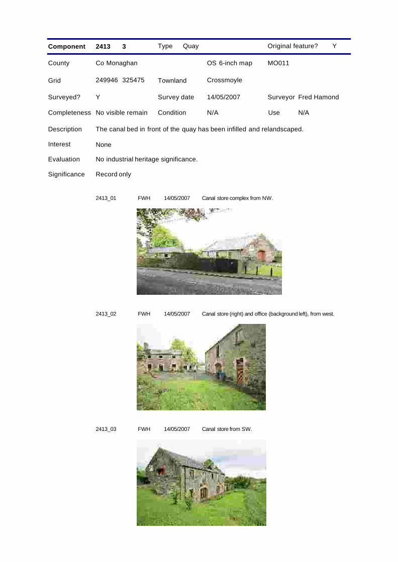
Component 2413 3
Surveyed? Y
Interest None
Y
249946 325475
Description The canal bed in front of the quay has been infilled and relandscaped.
Grid CrossmoyleTownland
Original feature?
2413_01 FWH Canal store complex from NW.14/05/2007
2413_02 FWH Canal store (right) and office (background left), from west.14/05/2007
2413_03 FWH Canal store from SW.14/05/2007
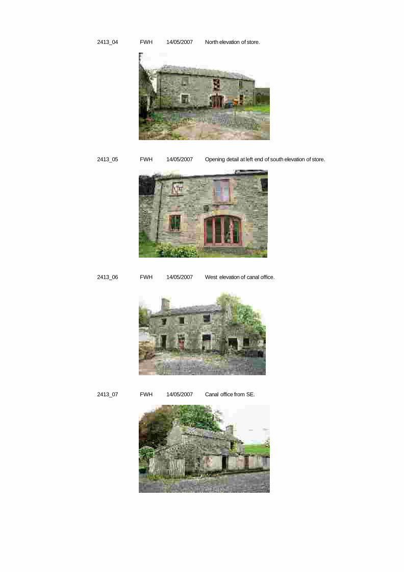
2413_04 FWH North elevation of store.14/05/2007
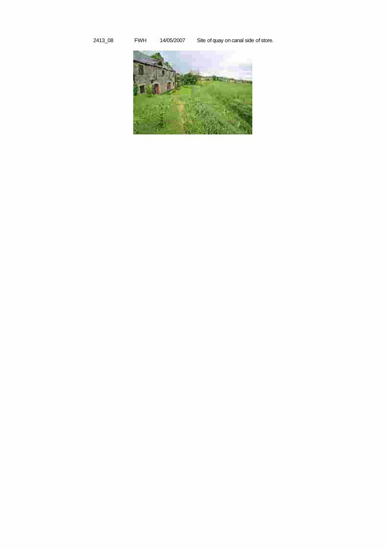
2413_05 FWH Opening detail at left end of south elevation of store.14/05/2007
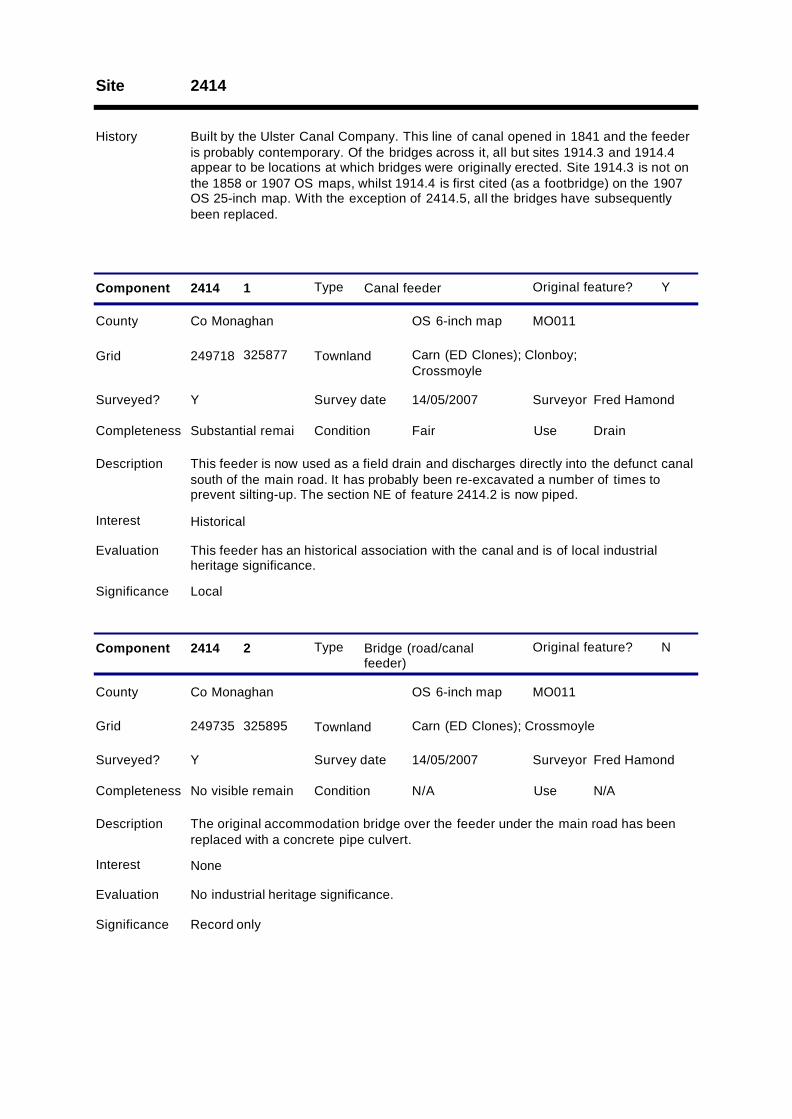
2413_06 FWH West elevation of canal office.14/05/2007
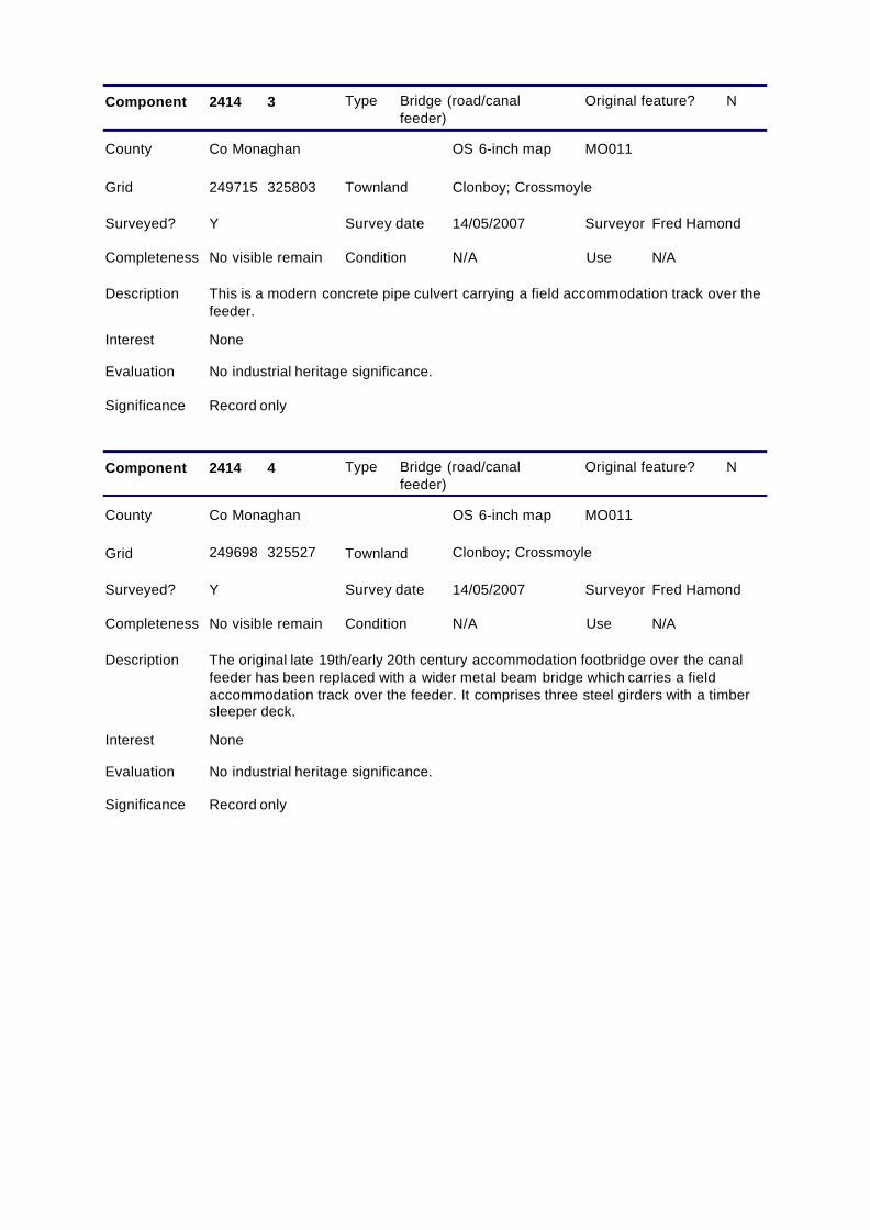
2413_07 FWH Canal office from SE.14/05/2007
2413_08 FWH Site of quay on canal side of store.14/05/2007
Site 2414
History Built by the Ulster Canal Company. This line of canal opened in 1841 and the feederis probably contemporary. Of the bridges across it, all but sites 1914.3 and 1914.4appear to be locations at which bridges were originally erected. Site 1914.3 is not onthe 1858 or 1907 OS maps, whilst 1914.4 is first cited (as a footbridge) on the 1907OS 25-inch map. With the exception of 2414.5, all the bridges have subsequentlybeen replaced.
Type Canal feeder
County Co Monaghan OS 6-inch map MO011
Survey date 14/05/2007 Surveyor Fred Hamond
Completeness Substantial remai Condition Fair Use Drain
Evaluation This feeder has an historical association with the canal and is of local industrialheritage significance.
Significance Local
Component 2414 1
Surveyed? Y
Interest Historical
Y
249718 325877
Description This feeder is now used as a field drain and discharges directly into the defunct canalsouth of the main road. It has probably been re-excavated a number of times toprevent silting-up. The section NE of feature 2414.2 is now piped.
Grid Carn (ED Clones); Clonboy;Crossmoyle
Townland
Original feature?
Type Bridge (road/canalfeeder)
County Co Monaghan OS 6-inch map MO011
Survey date 14/05/2007 Surveyor Fred Hamond
Completeness No visible remain Condition N/A Use N/A
Evaluation No industrial heritage significance.
Significance Record only
Component 2414 2
Surveyed? Y
Interest None
N
249735 325895
Description The original accommodation bridge over the feeder under the main road has beenreplaced with a concrete pipe culvert.
Grid Carn (ED Clones); CrossmoyleTownland
Original feature?
Type Bridge (road/canalfeeder)
County Co Monaghan OS 6-inch map MO011
Survey date 14/05/2007 Surveyor Fred Hamond
Completeness No visible remain Condition N/A Use N/A
Evaluation No industrial heritage significance.
Significance Record only
Component 2414 3
Surveyed? Y
Interest None
N
249715 325803
Description This is a modern concrete pipe culvert carrying a field accommodation track over thefeeder.
Grid Clonboy; CrossmoyleTownland
Original feature?
Type Bridge (road/canalfeeder)
County Co Monaghan OS 6-inch map MO011
Survey date 14/05/2007 Surveyor Fred Hamond
Completeness No visible remain Condition N/A Use N/A
Evaluation No industrial heritage significance.
Significance Record only
Component 2414 4
Surveyed? Y
Interest None
N
249698 325527
Description The original late 19th/early 20th century accommodation footbridge over the canalfeeder has been replaced with a wider metal beam bridge which carries a fieldaccommodation track over the feeder. It comprises three steel girders with a timbersleeper deck.
Grid Clonboy; CrossmoyleTownland
Original feature?
Type Bridge (road/canalfeeder)
County Co Monaghan OS 6-inch map MO011
Survey date 14/05/2007 Surveyor Fred Hamond
Completeness No visible remain Condition N/A Use N/A
Evaluation No industrial heritage significance.
Significance Record only
Component 2414 5
Surveyed? Y
Interest None
N
249768 325361
Description The original culvert which carried the feeder under the main road has been replacedwith two concrete pipes.
Grid TeehillTownland
Original feature?
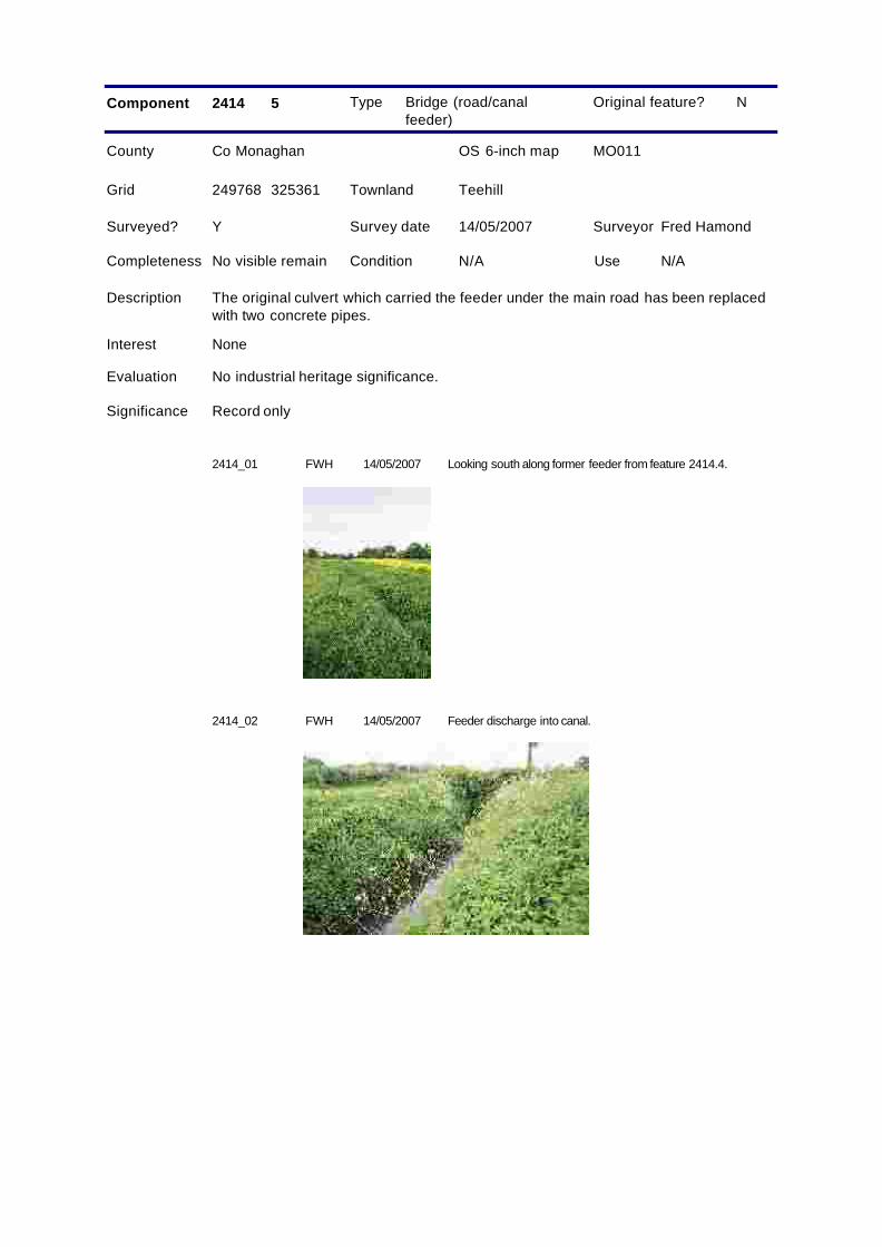
2414_01 FWH Looking south along former feeder from feature 2414.4.14/05/2007
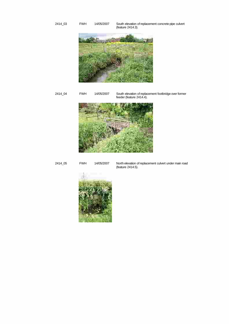
2414_02 FWH Feeder discharge into canal.14/05/2007
2414_03 FWH South elevation of replacement concrete pipe culvert(feature 2414.3).
14/05/2007
2414_04 FWH South elevation of replacement footbridge over formerfeeder (feature 2414.4).
14/05/2007
2414_05 FWH North elevation of replacement culvert under main road(feature 2414.5).
14/05/2007
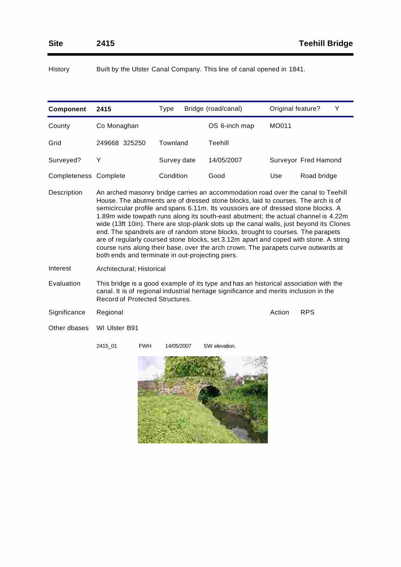
Teehill BridgeSite 2415
History Built by the Ulster Canal Company. This line of canal opened in 1841.
Type Bridge (road/canal)
County Co Monaghan OS 6-inch map MO011
Survey date 14/05/2007 Surveyor Fred Hamond
Completeness Complete Condition Good Use Road bridge
Evaluation This bridge is a good example of its type and has an historical association with thecanal. It is of regional industrial heritage significance and merits inclusion in theRecord of Protected Structures.
Significance Regional
Component 2415
RPSAction
Surveyed? Y
Interest Architectural; Historical
Other dbases WI Ulster B91
Y
249668 325250
Description An arched masonry bridge carries an accommodation road over the canal to TeehillHouse. The abutments are of dressed stone blocks, laid to courses. The arch is ofsemicircular profile and spans 6.11m. Its voussoirs are of dressed stone blocks. A1.89m wide towpath runs along its south-east abutment; the actual channel is 4.22mwide (13ft 10in). There are stop-plank slots up the canal walls, just beyond its Clonesend. The spandrels are of random stone blocks, brought to courses. The parapetsare of regularly coursed stone blocks, set 3.12m apart and coped with stone. A stringcourse runs along their base, over the arch crown. The parapets curve outwards atboth ends and terminate in out-projecting piers.
Grid TeehillTownland
Original feature?
2415_01 FWH SW elevation.14/05/2007
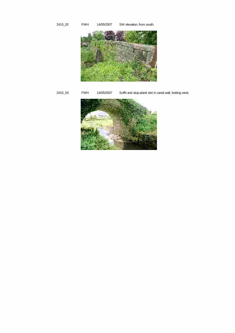
2415_02 FWH SW elevation, from south.14/05/2007
2415_03 FWH Soffit and stop-plank slot in canal wall, looking west.14/05/2007
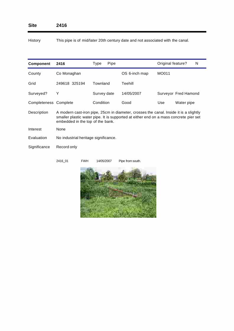
Site 2416
History This pipe is of mid/later 20th century date and not associated with the canal.
Type Pipe
County Co Monaghan OS 6-inch map MO011
Survey date 14/05/2007 Surveyor Fred Hamond
Completeness Complete Condition Good Use Water pipe
Evaluation No industrial heritage significance.
Significance Record only
Component 2416
Surveyed? Y
Interest None
N
249618 325194
Description A modern cast-iron pipe, 25cm in diameter, crosses the canal. Inside it is a slightlysmaller plastic water pipe. It is supported at either end on a mass concrete pier setembedded in the top of the bank.
Grid TeehillTownland
Original feature?
2416_01 FWH Pipe from south.14/05/2007
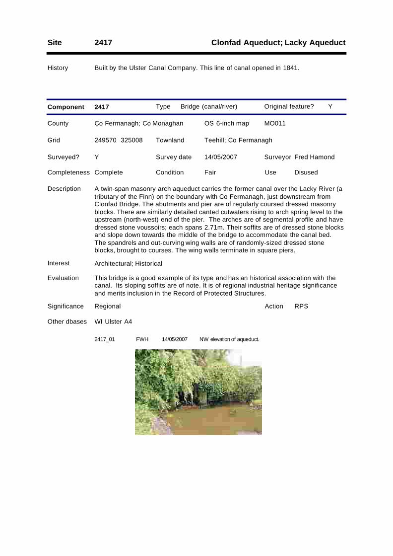
Clonfad Aqueduct; Lacky AqueductSite 2417
History Built by the Ulster Canal Company. This line of canal opened in 1841.
Type Bridge (canal/river)
County Co Fermanagh; Co Monaghan OS 6-inch map MO011
Survey date 14/05/2007 Surveyor Fred Hamond
Completeness Complete Condition Fair Use Disused
Evaluation This bridge is a good example of its type and has an historical association with thecanal. Its sloping soffits are of note. It is of regional industrial heritage significanceand merits inclusion in the Record of Protected Structures.
Significance Regional
Component 2417
RPSAction
Surveyed? Y
Interest Architectural; Historical
Other dbases WI Ulster A4
Y
249570 325008
Description A twin-span masonry arch aqueduct carries the former canal over the Lacky River (atributary of the Finn) on the boundary with Co Fermanagh, just downstream fromClonfad Bridge. The abutments and pier are of regularly coursed dressed masonryblocks. There are similarly detailed canted cutwaters rising to arch spring level to theupstream (north-west) end of the pier. The arches are of segmental profile and havedressed stone voussoirs; each spans 2.71m. Their soffits are of dressed stone blocksand slope down towards the middle of the bridge to accommodate the canal bed.The spandrels and out-curving wing walls are of randomly-sized dressed stoneblocks, brought to courses. The wing walls terminate in square piers.
Grid Teehill; Co FermanaghTownland
Original feature?
2417_01 FWH NW elevation of aqueduct.14/05/2007

Site 2418
History Erected by the Ulster Canal Company. This line of canal opened in 1841.
Type Mile marker
County Co Monaghan OS 6-inch map MO016
Survey date 14/05/2007 Surveyor Fred Hamond
Completeness No visible remain Condition N/A Use N/A
Evaluation No industrial heritage significance.
Significance Record only
Component 2418
Surveyed? Y
Interest None
Y
246590 322697
Description There are no traces of the milestone which stood on the south bank of the canal.Had it existed, it would have read: "Charlemont 40/ Caledon 26/ Monaghan 15/Clones 1/ Wattle Bridge 6".
Grid ClonnagoreTownland
Original feature?
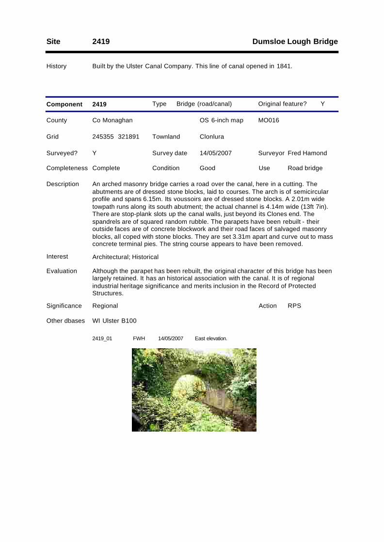
Dumsloe Lough BridgeSite 2419
History Built by the Ulster Canal Company. This line of canal opened in 1841.
Type Bridge (road/canal)
County Co Monaghan OS 6-inch map MO016
Survey date 14/05/2007 Surveyor Fred Hamond
Completeness Complete Condition Good Use Road bridge
Evaluation Although the parapet has been rebuilt, the original character of this bridge has beenlargely retained. It has an historical association with the canal. It is of regionalindustrial heritage significance and merits inclusion in the Record of ProtectedStructures.
Significance Regional
Component 2419
RPSAction
Surveyed? Y
Interest Architectural; Historical
Other dbases WI Ulster B100
Y
245355 321891
Description An arched masonry bridge carries a road over the canal, here in a cutting. Theabutments are of dressed stone blocks, laid to courses. The arch is of semicircularprofile and spans 6.15m. Its voussoirs are of dressed stone blocks. A 2.01m widetowpath runs along its south abutment; the actual channel is 4.14m wide (13ft 7in).There are stop-plank slots up the canal walls, just beyond its Clones end. Thespandrels are of squared random rubble. The parapets have been rebuilt - theiroutside faces are of concrete blockwork and their road faces of salvaged masonryblocks, all coped with stone blocks. They are set 3.31m apart and curve out to massconcrete terminal pies. The string course appears to have been removed.
Grid ClonluraTownland
Original feature?
2419_01 FWH East elevation.14/05/2007

Site 2420
History Erected by the Ulster Canal Company. This line of canal opened in 1841.
Type Mile marker
County Co Monaghan OS 6-inch map MO016
Survey date 14/05/2007 Surveyor Fred Hamond
Completeness No visible remain Condition N/A Use N/A
Evaluation No industrial heritage significance.
Significance Record only
Component 2420
Surveyed? Y
Interest None
Y
245235 321839
Description There are no traces of the milestone which stood on the south bank of the canal.Had it existed, it would have read: "Charlemont 41/ Caledon 27/ Monaghan 16/Clones 2/ Wattle Bridge 5".
Grid ClonluraTownland
Original feature?
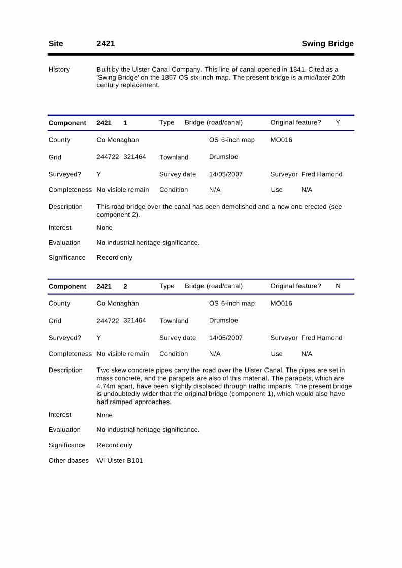
Swing BridgeSite 2421
History Built by the Ulster Canal Company. This line of canal opened in 1841. Cited as a'Swing Bridge' on the 1857 OS six-inch map. The present bridge is a mid/later 20thcentury replacement.
Type Bridge (road/canal)
County Co Monaghan OS 6-inch map MO016
Survey date 14/05/2007 Surveyor Fred Hamond
Completeness No visible remain Condition N/A Use N/A
Evaluation No industrial heritage significance.
Significance Record only
Component 2421 1
Surveyed? Y
Interest None
Y
244722 321464
Description This road bridge over the canal has been demolished and a new one erected (seecomponent 2).
Grid DrumsloeTownland
Original feature?
Type Bridge (road/canal)
County Co Monaghan OS 6-inch map MO016
Survey date 14/05/2007 Surveyor Fred Hamond
Completeness No visible remain Condition N/A Use N/A
Evaluation No industrial heritage significance.
Significance Record only
Component 2421 2
Surveyed? Y
Interest None
Other dbases WI Ulster B101
N
244722 321464
Description Two skew concrete pipes carry the road over the Ulster Canal. The pipes are set inmass concrete, and the parapets are also of this material. The parapets, which are4.74m apart, have been slightly displaced through traffic impacts. The present bridgeis undoubtedly wider that the original bridge (component 1), which would also havehad ramped approaches.
Grid DrumsloeTownland
Original feature?
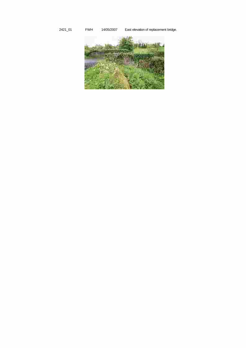
2421_01 FWH East elevation of replacement bridge.14/05/2007
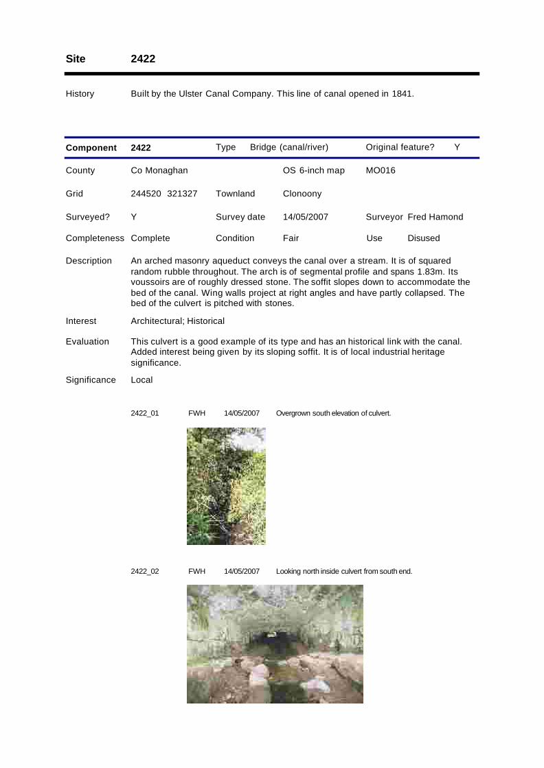
Site 2422
History Built by the Ulster Canal Company. This line of canal opened in 1841.
Type Bridge (canal/river)
County Co Monaghan OS 6-inch map MO016
Survey date 14/05/2007 Surveyor Fred Hamond
Completeness Complete Condition Fair Use Disused
Evaluation This culvert is a good example of its type and has an historical link with the canal.Added interest being given by its sloping soffit. It is of local industrial heritagesignificance.
Significance Local
Component 2422
Surveyed? Y
Interest Architectural; Historical
Y
244520 321327
Description An arched masonry aqueduct conveys the canal over a stream. It is of squaredrandom rubble throughout. The arch is of segmental profile and spans 1.83m. Itsvoussoirs are of roughly dressed stone. The soffit slopes down to accommodate thebed of the canal. Wing walls project at right angles and have partly collapsed. Thebed of the culvert is pitched with stones.
Grid ClonoonyTownland
Original feature?
2422_01 FWH Overgrown south elevation of culvert.14/05/2007
2422_02 FWH Looking north inside culvert from south end.14/05/2007