Embed Size (px)
Citation preview
SISTEM INFORMASI GEOGRAFI
TKW 303
DR. SUPRAJAKAFakultas Teknik
Universitas Indonusa Esa Unggul
PERTEMUAN 2GIS in Resource Assessment and Planning
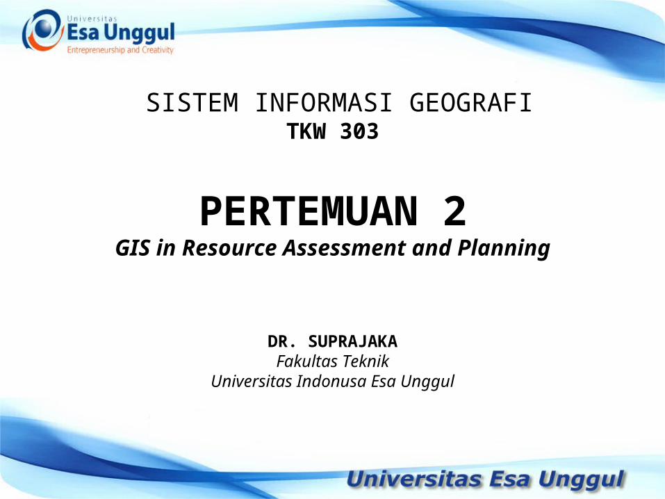
GeospaGeospattialial InformaInformationtion
. . . . . . Menyajikan pendekatan Menyajikan pendekatan berbasis ilmiah dan keruanganberbasis ilmiah dan keruangan
SystematisHolistisAnalytisQuantitativeVisual
action
Planning
Analityc
Quantitative
visualisation
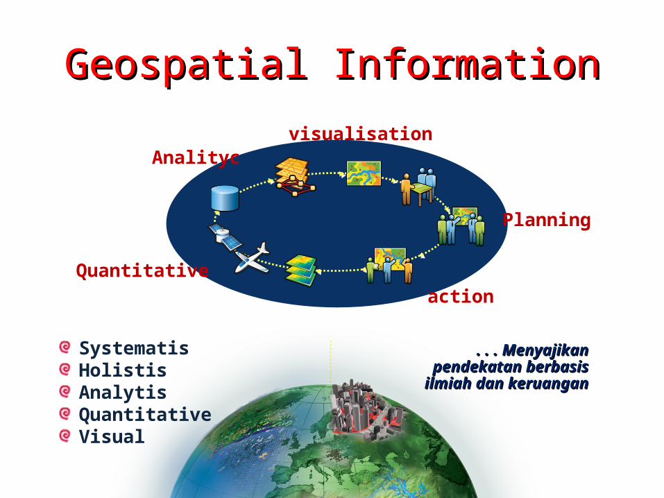
Banyak Aktor Banyak Aktor ddan Banyak Layeran Banyak Layer
PERLUNYA PERLUNYA REFERENSI SPASIAL TUNGGAL REFERENSI SPASIAL TUNGGAL SEBAGAI ACUAN SELURUH INSTANSISEBAGAI ACUAN SELURUH INSTANSI
INFORMASI GEOSPASIAL INFORMASI GEOSPASIAL DIBUAT OLEH BANYAK DIBUAT OLEH BANYAK INSTANSIINSTANSI
PERLU ADANYA IG DASAR PERLU ADANYA IG DASAR SEBAGAI REFERENSI SEMUA IG SEBAGAI REFERENSI SEMUA IG TEMATIK.TEMATIK.
KUNCI SUKSES: KUNCI SUKSES: KESAMAAN KESAMAAN GERAK ANTAR INSTANSIGERAK ANTAR INSTANSI DALAM PEMBANGUNAN DATA DALAM PEMBANGUNAN DATA & & INFORMASI GEOSPASIAL INFORMASI GEOSPASIAL TERMASUK KEGIATAN SURVEI TERMASUK KEGIATAN SURVEI && PEMETAANNYA PEMETAANNYA (SURTA) (SURTA)
Kontur 3-dKontur 3-d
GeologiGeologi
CitraCitra
Blok SensusBlok Sensus
Jaringan JalanJaringan Jalan
ToponimiToponimi

Mountain Landscape
Padi Field
Meander Landscape
Coastal Landscape
Small Island Landscape
Urban Landscape
Jaring Kontrol Geodesi Nasional

5
Resource Allocation -Its Major Considerations
Resource Allocation -Its Major Considerations
• Resource allocation should be done on a rational basis;
• Resource allocation should avoid the adverse effects (efek yang merugikan) of one resource use on another resource or on the human communities.
6
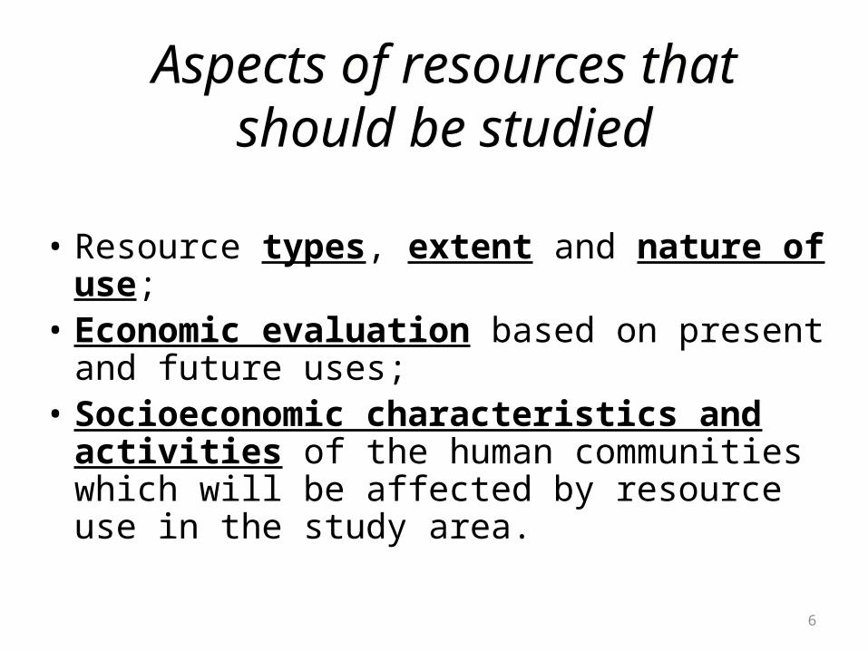
Aspects of resources that should be studied
Aspects of resources that should be studied
• Resource types, extent and nature of use;• Economic evaluation based on present and
future uses;• Socioeconomic characteristics and activities of
the human communities which will be affected by resource use in the study area.
7
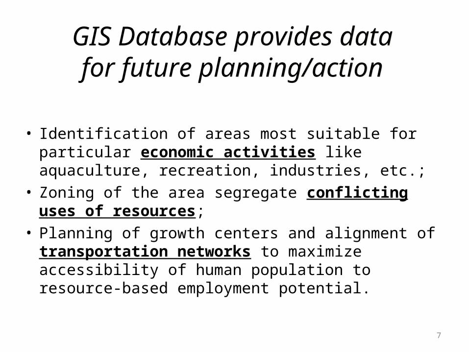
GIS Database provides data for future planning/action
GIS Database provides data for future planning/action
• Identification of areas most suitable for particular economic activities like aquaculture, recreation, industries, etc.;
• Zoning of the area segregate conflicting uses of resources;• Planning of growth centers and alignment of
transportation networks to maximize accessibility of human population to resource-based employment potential.
8
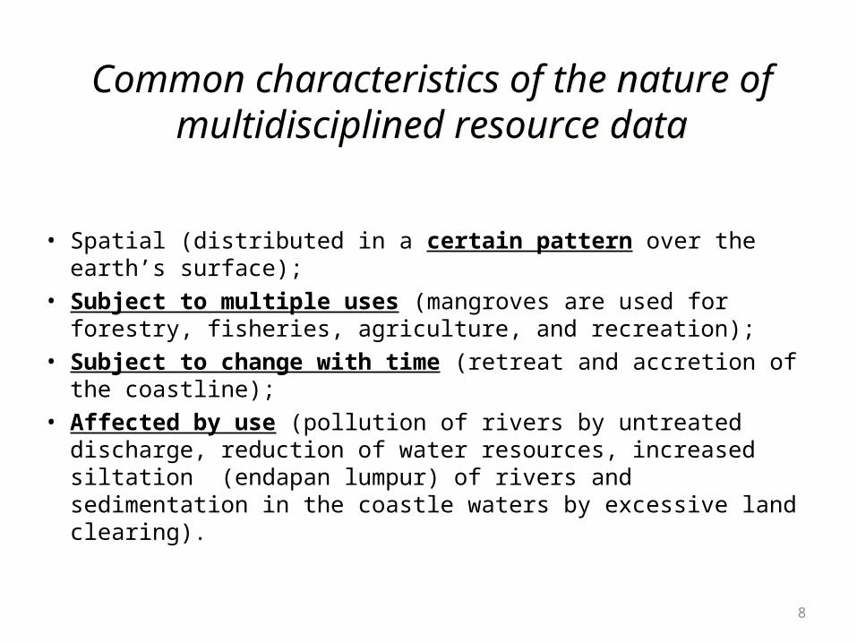
Common characteristics of the nature of multidisciplined resource data
Common characteristics of the nature of multidisciplined resource data
• Spatial (distributed in a certain pattern over the earth’s surface); • Subject to multiple uses (mangroves are used for forestry,
fisheries, agriculture, and recreation);• Subject to change with time (retreat and accretion of the
coastline);• Affected by use (pollution of rivers by untreated discharge,
reduction of water resources, increased siltation (endapan lumpur) of rivers and sedimentation in the coastle waters by excessive land clearing).
9
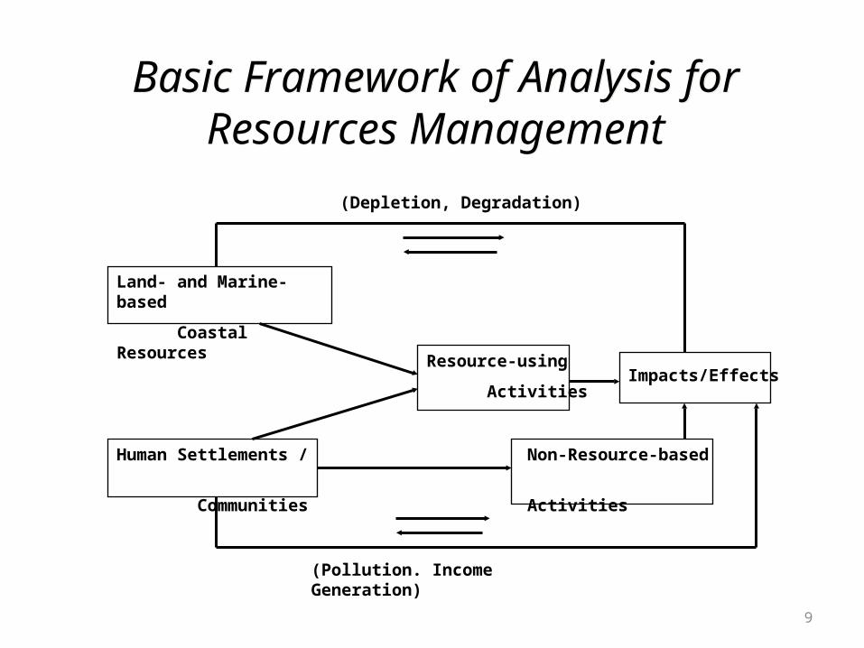
Basic Framework of Analysis forResources Management
Basic Framework of Analysis forResources Management
Land- and Marine-based
Coastal Resources
Human Settlements /
Communities
Resource-using
ActivitiesImpacts/Effects
(Depletion, Degradation)
Non-Resource-based
Activities
(Pollution. Income Generation)
TERIMAKASIH.....................