Embed Size (px)
Citation preview
DISCOVERING THE SIS
FLORIDA’S STRATEGIC INTERMODAL SYSTEM D E C E M B E R 2 0 1 7
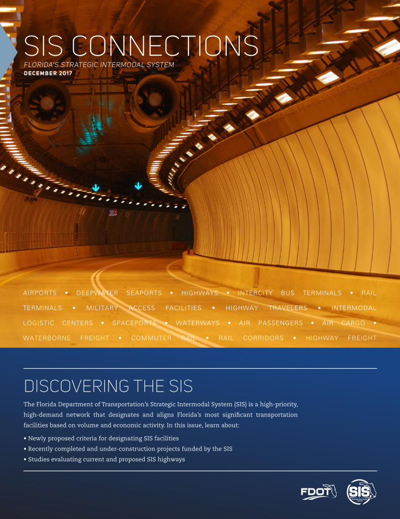
SIS CONNECTIONS
The Florida Department of Transportation’s Strategic Intermodal System (SIS) is a high-priority,
high-demand network that designates and aligns Florida’s most significant transportation
facilities based on volume and economic activity. In this issue, learn about:
• Newly proposed criteria for designating SIS facilities
• Recently completed and under-construction projects funded by the SIS
• Studies evaluating current and proposed SIS highways
AIRPORTS • DEEPWATER SEAPORTS • HIGHWAYS • INTERCITY BUS TERMINALS • RAIL
TERMINALS • MILITARY ACCESS FACILITIES • HIGHWAY TRAVELERS • INTERMODAL
LOGISTIC CENTERS • SPACEPORTS • WATERWAYS • AIR PASSENGERS • AIR CARGO •
WATERBORNE FREIGHT • COMMUTER RAIL • RAIL CORRIDORS • HIGHWAY FREIGHT
2 SIS CONNECTIONS | DECEMBER 2017
CONTENTS
WHAT’S HAPPENING
05 DIVERGING DIAMOND INTERCHANGES
SIS POLICY PLAN UPDATE04
US HIGHWAY 98BLUETOOTH STUDY03
STATE ROAD 60CORRIDOR STUDY08
The 2045 Long Range Cost Feasible Plan (CFP) is currently in development. This plan, which is updated every three years, identifiers projects on the SIS which are considered financially feasible during the last fifteen years (years 11 to 25) of the State’s Strategic Intermodal System’s (SIS) Long Rage Transportation Plan, based on current revenue forecasts.
As the Florida Department of Transportation (FDOT) prepares to maintain the nation’s highest rated infrastructure, and accommodate long-term demands, the CFP is key to identifying those transportation needs
with the greatest overall impact to the state’s economic prosperity. The FDOT works diligently to foster a highly-collaborative process for the SIS projectsby working with Metropolitan Planning Organizations (MPOs), regional planning entities, local governments, modal partners, businesses and other stakeholder organizations.
We encourage you to read on about the CFP in this issue of SIS Connections and get involved with your local FDOT District Office. The new Plan is slated for release in June of 2018 and your input is integral to shaping the future of Florida.
09 I-4 ULTIMATE IMPROVEMENT PROJECT
10 SIS IMPLEMENTATION
3SIS CONNECTIONS | DECEMBER 2017
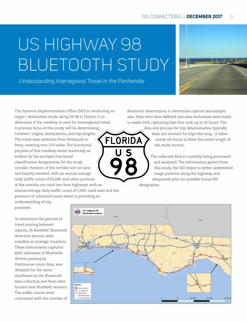
US HIGHWAY 98 BLUETOOTH STUDY
The Systems Implementation Office (SIO) is conducting an
origin / destination study along US 98 in District 3, to
determine if the roadway is used for interregional travel.
A primary focus of this study will be determining
travelers’ origins, destinations, and trip lengths.
The study area stretches from Pensacola to
Perry, covering over 270 miles. The functional
purpose of this roadway varies drastically as
evident by the multiple functional
classification designations for the study
corridor. Portions of the corridor are six-lane
and heavily traveled, with an annual average
daily traffic count of 60,000, and other portions
of the corridor are rural two-lane highways with an
annual average daily traffic count of 2,000. Land uses and the
presence of urbanized areas assist in providing an
understanding of trip
purposes.
To determine the percent of
travel moving between
regions, 26 BlueMAC Bluetooth
detection devices were
installed at strategic locations.
These instruments captured
MAC addresses of Bluetooth
devices passing by.
Continuous count data, was
obtained for the same
timeframe as the Bluetooth
data collection and from sites
located near BlueMAC sensors,
The traffic counts were
contrasted with the number of
Bluetooth observations to determine capture rate/sample
size. Trips were then defined and data exclusions were made
to assist with capturing trips that took up to 24 hours. The
data and process for trip determination typically
does not account for trips this long - it takes
nearly six hours to drive the entire length of
the study section.
The collected data is currently being processed
and analyzed. The information gained from
this study, the SIO hopes to better understand
usage patterns along the highway, and
adequately plan for possible future SIS
designation.
Understanding Interregional Travel in the Panhandle
4 SIS CONNECTIONS | DECEMBER 2017
SIS POLICY PLAN UPDATENew SIS Designation Structure
The SIS Policy Plan sets strategies to guide decisions about
the designation of SIS facilities, where future SIS
investments should occur, and how to prioritize those
investments. Since the SIS was originally developed in
2004-2005, three new facility types have been added due to
legislative mandate (Military Access Facilities, General
Aviation Airports, and Intermodal Logistic Centers), and
two through SIS Plan updates (Urban Fixed Guideway
Transit Corridor and/or Terminals Hub-to-Hub Connectors).
During the SIS Designation update, the 35-member
steering committee and partners recommended
reaffirming the original intent of the SIS through focusing
on the largest, most strategic facilities by combining the
SIS & Emerging SIS components. This would allow for the
importance of smaller and high-growth facilities that are
projected to soon meet SIS criteria to be recognized. This
new component is called “Strategic Growth.” Potential
facilities meeting the following criteria can be eligible for
the proposed Strategic Growth category:
• Projected to meet SIS minimum activity levels within
three years of designation, OR
• Determined by FDOT to be of compelling state interest,
such as creating a significant economic development
opportunity or potentially becoming the most strategic
facility in a region without a designated SIS facility; AND
• Has a current Master Plan including prioritized list of
production ready projects;
• Is identified in a local government comprehensive plan,
Long Range Transportation Plan (LRTP), Comprehensive
Economic Development Strategy (CEDS), Transit
Development Plan (TDP) or equivalent;
• Has partner and public consensus on viability of a new or
significantly expanded facility; and
• Meets community and environment screening criteria.
Support for more co-located facilities and intermodal
facilities has also been emphasized. This focus supports
improved mobility and last mile/first mile connectivity,
such as:
• Freight Hubs – Support global and domestic trade flows
-Include facilities that support the freight network
differently than an intermodal freight rail terminal,
such as:
-Intermodal Logistics Centers (ILCs); warehousing or
logistics clusters, etc.
-Proposed designations such as SIS Freight Activity
Areas (FAAs), which are clusters or groups of freight
facilities which generate, distribute or attract
significant freight activity; and
-SIS Freight Access Facilities (FAFs), which are roadway
segments with significant freight activity which
connect FAAs to existing SIS corridors.
An FDOT pilot study is currently underway in Polk County
to identify and designate potential FAAs/FAFs and evaluate
their impact on freight mobility.
• Passenger Hubs – Better integrate modal infrastructure,
services, information, and business processes;
-Support improved first mile/last mile connectivity
-Require Interregional Bus and Rail Terminals to
co-locate with another facility; consider retaining only
those standalone Greyhound or Amtrak terminals that
move 100,000 passengers a year or more.
The proposed SIS designation structure is currently
undergoing re-development and is estimated to be
completed and ready for FDOT management adoption in
December 2018. There will be a public and partner
comment period prior to the approval of FDOT
management adoption.
5SIS CONNECTIONS | DECEMBER 2017
DIVERGING DIAMOND INTERCHANGESKeeping Florida Drivers Safe
What can help with congestion and save on construction
costs for interchange highway improvements and calls for
driving on the wrong side of the road? The answer: using a
diverging diamond interchange (DDI). A relatively new
concept for designing interchanges in the United States, in
the DDI, drivers cross-over from the right side of the road
to the left side of the road as they cross the interchange.
The crossing then switches back to standard right side
driving on the other side of the interchange.
This interchange has more benefits than just the
operational attractor of reducing congestion on the
roadway, it also is safer and less expensive than traditional
interchanges. The premise behind the DDI is that by
eliminating the need for left-turn arrow signals will have
maximum efficiency; create fewer conflict points (14 rather
than 26), and being able to serve more traffic with better
safety and less congestion. It is also easier to convert
existing diamonds to DDI’s, meaning it can often be
achieved at a lower cost. The street segment between the
crossovers can be designed as an underpass or overpass
depending on the site.
This year Florida’s first DDI, the largest in the nation with
12 lanes, opened in Sarasota County at I-75 and University
Parkway outside of Lakewood Ranch. Florida has 38
additional DDIs under development throughout the state.
Miami, Palm Bay, and Yulee currently have DDI’s under
construction, while Polk, Orange, Seminole, Volusia, Duval,
Clay, Broward, and St. Johns counties have DDIs in the
design phase. The cities of Fort Myers, Jacksonville,
Sarasota, Viera, and Wesley Chapel are also designing DDIs.
Safety Operations Cost
Fewer conflict points Unique phase combinations Retrofit
Conflict points spaced apart throughout interchange
Free of simple left and right turns from all directions
Existing bridge can usually be used
Better sight distance at turnsIncreases left turn lane capacity without needing more lanes
Additional right-of-way rarely needed
Virtually no driver confusion (Based on FHWA studies)
Only two phases needed, shorter cycle length Construction time is reduced
Traffic calming features when desired Lanes with multiple assignments in all directionsMaintenance of traffic is simplified during construction
Wrong way entry to ramps extremely difficult
Better storage between the ramp terminals New Construction
Pedestrian crossings are shorter More functional during a power outage Fewer lanes than other interchange forms
U-turns from highway are accommodated well Less bridge structure
Better signal network synchronization Less right-of-way than standard interchanges
6 SIS CONNECTIONS | DECEMBER 2017
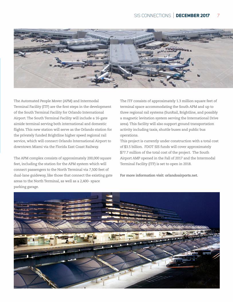
ORLANDO INTERNATIONAL
AIRPORT’S INTERMODAL TERMINAL FACILITY
The Automated People Mover bring technological innovation to central Florida’s largest airport
Images courtesy of Greater Orlando Aviation Authority
7SIS CONNECTIONS | DECEMBER 2017
The Automated People Mover (APM) and Intermodal
Terminal Facility (ITF) are the first steps in the development
of the South Terminal Facility for Orlando International
Airport. The South Terminal Facility will include a 16-gate
airside terminal serving both international and domestic
flights. This new station will serve as the Orlando station for
the privately funded Brightline higher speed regional rail
service, which will connect Orlando International Airport to
downtown Miami via the Florida East Coast Railway.
The APM complex consists of approximately 200,000 square
feet, including the station for the APM system which will
connect passengers to the North Terminal via 7,500 feet of
dual-lane guideway, like those that connect the existing gate
areas to the North Terminal, as well as a 2,400- space
parking garage.
The ITF consists of approximately 1.3 million square feet of
terminal space accommodating the South APM and up to
three regional rail systems (SunRail, Brightline, and possibly
a magnetic levitation system serving the International Drive
area). This facility will also support ground transportation
activity including taxis, shuttle buses and public bus
operations.
This project is currently under construction with a total cost
of $3.5 billion. FDOT SIS funds will cover approximately
$77.7 million of the total cost of the project. The South
Airport AMP opened in the Fall of 2017 and the Intermodal
Terminal Facility (ITF) is set to open in 2018.
For more information visit: orlandoairports.net.
8 SIS CONNECTIONS | DECEMBER 2017
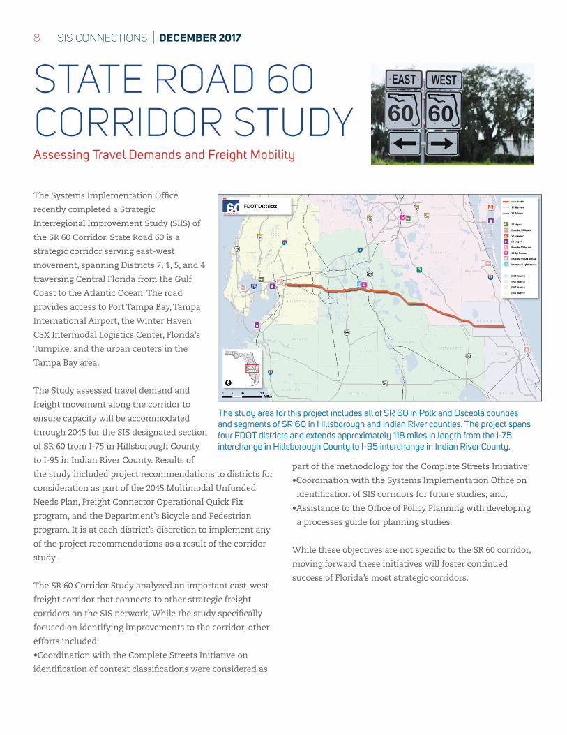
The Systems Implementation Office
recently completed a Strategic
Interregional Improvement Study (SIIS) of
the SR 60 Corridor. State Road 60 is a
strategic corridor serving east-west
movement, spanning Districts 7, 1, 5, and 4
traversing Central Florida from the Gulf
Coast to the Atlantic Ocean. The road
provides access to Port Tampa Bay, Tampa
International Airport, the Winter Haven
CSX Intermodal Logistics Center, Florida’s
Turnpike, and the urban centers in the
Tampa Bay area.
The Study assessed travel demand and
freight movement along the corridor to
ensure capacity will be accommodated
through 2045 for the SIS designated section
of SR 60 from I-75 in Hillsborough County
to I-95 in Indian River County. Results of
the study included project recommendations to districts for
consideration as part of the 2045 Multimodal Unfunded
Needs Plan, Freight Connector Operational Quick Fix
program, and the Department’s Bicycle and Pedestrian
program. It is at each district’s discretion to implement any
of the project recommendations as a result of the corridor
study.
The SR 60 Corridor Study analyzed an important east-west
freight corridor that connects to other strategic freight
corridors on the SIS network. While the study specifically
focused on identifying improvements to the corridor, other
efforts included:
•Coordination with the Complete Streets Initiative on
identification of context classifications were considered as
part of the methodology for the Complete Streets Initiative;
•Coordination with the Systems Implementation Office on
identification of SIS corridors for future studies; and,
•Assistance to the Office of Policy Planning with developing
a processes guide for planning studies.
While these objectives are not specific to the SR 60 corridor,
moving forward these initiatives will foster continued
success of Florida’s most strategic corridors.
STATE ROAD 60 CORRIDOR STUDYAssessing Travel Demands and Freight Mobility
The study area for this project includes all of SR 60 in Polk and Osceola counties and segments of SR 60 in Hillsborough and Indian River counties. The project spans four FDOT districts and extends approximately 118 miles in length from the I-75 interchange in Hillsborough County to I-95 interchange in Indian River County.
9SIS CONNECTIONS | DECEMBER 2017
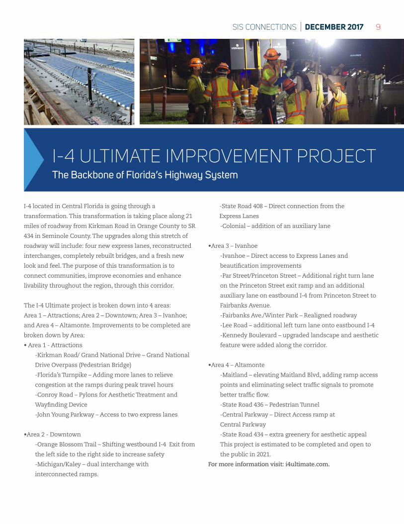
I-4 ULTIMATE IMPROVEMENT PROJECTThe Backbone of Florida’s Highway System
I-4 located in Central Florida is going through a
transformation. This transformation is taking place along 21
miles of roadway from Kirkman Road in Orange County to SR
434 in Seminole County. The upgrades along this stretch of
roadway will include: four new express lanes, reconstructed
interchanges, completely rebuilt bridges, and a fresh new
look and feel. The purpose of this transformation is to
connect communities, improve economies and enhance
livability throughout the region, through this corridor.
The I-4 Ultimate project is broken down into 4 areas:
Area 1 – Attractions; Area 2 – Downtown; Area 3 – Ivanhoe;
and Area 4 – Altamonte. Improvements to be completed are
broken down by Area:
• Area 1 - Attractions
-Kirkman Road/ Grand National Drive – Grand National
Drive Overpass (Pedestrian Bridge)
-Florida’s Turnpike – Adding more lanes to relieve
congestion at the ramps during peak travel hours
-Conroy Road – Pylons for Aesthetic Treatment and
Wayfinding Device
-John Young Parkway – Access to two express lanes
•Area 2 - Downtown
-Orange Blossom Trail – Shifting westbound I-4 Exit from
the left side to the right side to increase safety
-Michigan/Kaley – dual interchange with
interconnected ramps.
-State Road 408 – Direct connection from the
Express Lanes
-Colonial – addition of an auxiliary lane
•Area 3 – Ivanhoe
-Ivanhoe – Direct access to Express Lanes and
beautification improvements
-Par Street/Princeton Street – Additional right turn lane
on the Princeton Street exit ramp and an additional
auxiliary lane on eastbound I-4 from Princeton Street to
Fairbanks Avenue.
-Fairbanks Ave./Winter Park – Realigned roadway
-Lee Road – additional left turn lane onto eastbound I-4
-Kennedy Boulevard – upgraded landscape and aesthetic
feature were added along the corridor.
•Area 4 – Altamonte
-Maitland – elevating Maitland Blvd, adding ramp access
points and eliminating select traffic signals to promote
better traffic flow.
-State Road 436 – Pedestrian Tunnel
-Central Parkway – Direct Access ramp at
Central Parkway
-State Road 434 – extra greenery for aesthetic appeal
This project is estimated to be completed and open to
the public in 2021.
For more information visit: i4ultimate.com.
10 SIS CONNECTIONS | DECEMBER 2017
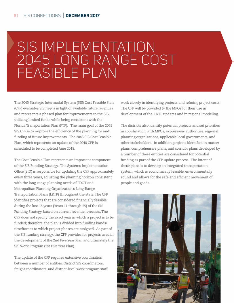
The 2045 Strategic Intermodal System (SIS) Cost Feasible Plan
(CFP) evaluates SIS needs in light of available future revenues
and represents a phased plan for improvements to the SIS,
utilizing limited funds while being consistent with the
Florida Transportation Plan (FTP). The main goal of the 2045
SIS CFP is to improve the efficiency of the planning for and
funding of future improvements. The 2045 SIS Cost Feasible
Plan, which represents an update of the 2040 CFP, is
scheduled to be completed June 2018.
The Cost Feasible Plan represents an important component
of the SIS Funding Strategy. The Systems Implementation
Office (SIO) is responsible for updating the CFP approximately
every three years, adjusting the planning horizon consistent
with the long-range planning needs of FDOT and
Metropolitan Planning Organization’s Long-Range
Transportation Plans (LRTP) throughout the state. The CFP
identifies projects that are considered financially feasible
during the last 15 years (Years 11 through 25) of the SIS
Funding Strategy, based on current revenue forecasts. The
CFP does not specify the exact year in which a project is to be
funded; therefore, the plan is divided into funding bands/
timeframes to which project phases are assigned. As part of
the SIS funding strategy, the CFP provides for projects used in
the development of the 2nd Five Year Plan and ultimately the
SIS Work Program (1st Five Year Plan).
The update of the CFP requires extensive coordination
between a number of entities. District SIS coordinators,
freight coordinators, and district-level work program staff
work closely in identifying projects and refining project costs.
The CFP will be provided to the MPOs for their use in
development of the LRTP updates and in regional modeling.
The districts also identify potential projects and set priorities
in coordination with MPOs, expressway authorities, regional
planning organizations, applicable local governments, and
other stakeholders. In addition, projects identified in master
plans, comprehensive plans, and corridor plans developed by
a number of these entities are considered for potential
funding as part of the CFP update process. The intent of
these plans is to develop an integrated transportation
system, which is economically feasible, environmentally
sound and allows for the safe and efficient movement of
people and goods.
SIS IMPLEMENTATION2045 LONG RANGE COST FEASIBLE PLAN
11SIS CONNECTIONS | DECEMBER 2017
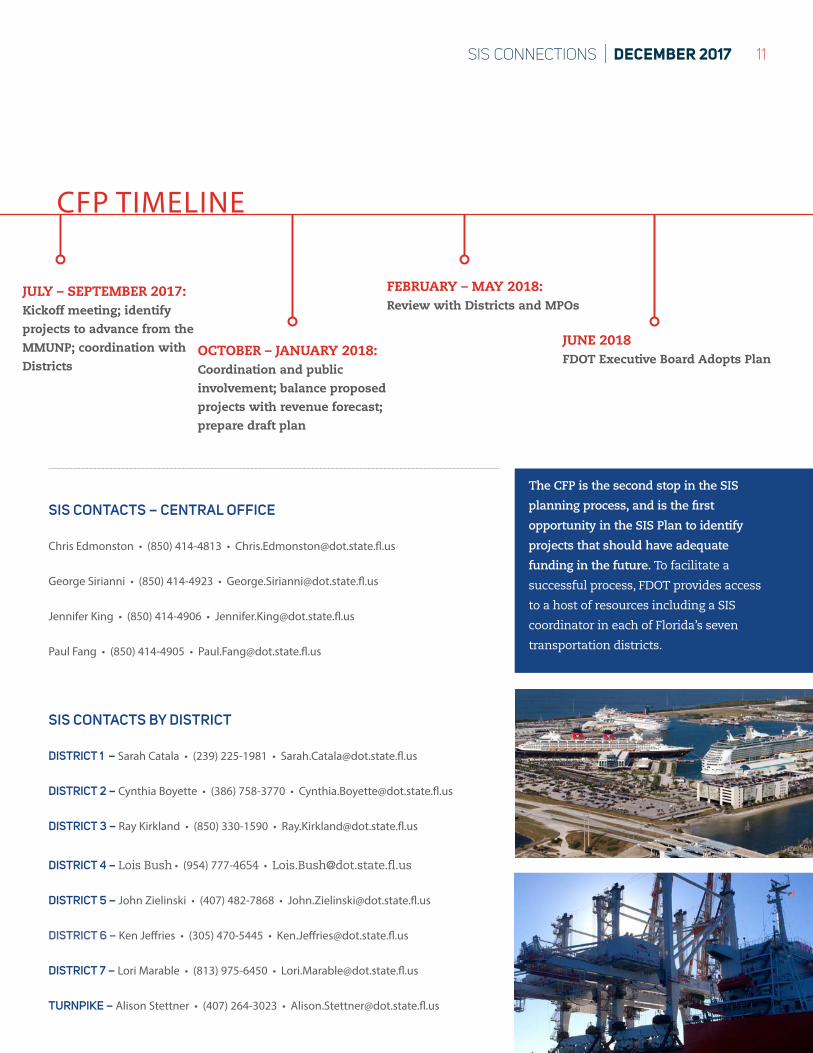
JUNE 2018FDOT Executive Board Adopts Plan
CFP TIMELINE
JULY – SEPTEMBER 2017: Kickoff meeting; identify projects to advance from the MMUNP; coordination with Districts
OCTOBER – JANUARY 2018:Coordination and public involvement; balance proposed projects with revenue forecast; prepare draft plan
FEBRUARY – MAY 2018:Review with Districts and MPOs
SIS CONTACTS BY DISTRICT
DISTRICT 1 – Sarah Catala • (239) 225-1981 • [email protected]
DISTRICT 2 – Cynthia Boyette • (386) 758-3770 • [email protected]
DISTRICT 3 – Ray Kirkland • (850) 330-1590 • [email protected]
DISTRICT 4 – Lois Bush • (954) 777-4654 • [email protected]
DISTRICT 5 – John Zielinski • (407) 482-7868 • [email protected]
DISTRICT 6 – Ken Jeffries • (305) 470-5445 • [email protected]
DISTRICT 7 – Lori Marable • (813) 975-6450 • [email protected]
TURNPIKE – Alison Stettner • (407) 264-3023 • [email protected]
SIS CONTACTS – CENTRAL OFFICE
Chris Edmonston • (850) 414-4813 • [email protected]
George Sirianni • (850) 414-4923 • [email protected]
Jennifer King • (850) 414-4906 • [email protected]
Paul Fang • (850) 414-4905 • [email protected]
The CFP is the second stop in the SIS
planning process, and is the first
opportunity in the SIS Plan to identify
projects that should have adequate
funding in the future. To facilitate a
successful process, FDOT provides access
to a host of resources including a SIS
coordinator in each of Florida’s seven
transportation districts.
www.fdot.gov/planning/sis
SYSTEMS IMPLEMENTATION OFFICE
WE WANT TO HEAR FROM YOUWhat would you like to read about in SIS Connections?
Share your feedback for our next issue by emailing [email protected]