Embed Size (px)
Citation preview
1
Simultaneous Localization and Mapping (SLAM)
RSS Lecture 16April 8, 2013Prof. Teller
Text: Siegwart and Nourbakhsh S. 5.8
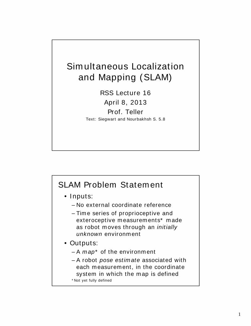
SLAM Problem Statement• Inputs:
–No external coordinate reference–Time series of proprioceptive and
exteroceptive measurements* made as robot moves through an initially unknown environment
• Outputs:–A map* of the environment–A robot pose estimate associated with
each measurement, in the coordinate system in which the map is defined
*Not yet fully defined
2
SLAM Problem -- Incremental• State/Output:
–Map of env’t observed “so far”–Robot pose estimate w.r.t. map
• Action/Input:–Move to a new position/orientation–Acquire additional observation(s)
• Update State:–Re-estimate the robot’s pose–Revise the map appropriately
SLAM Aspects• What is a measurement?• What is a map?• How are map, pose coupled?• How should robot move?• What is hard about SLAM?
• But first: some intuition
3
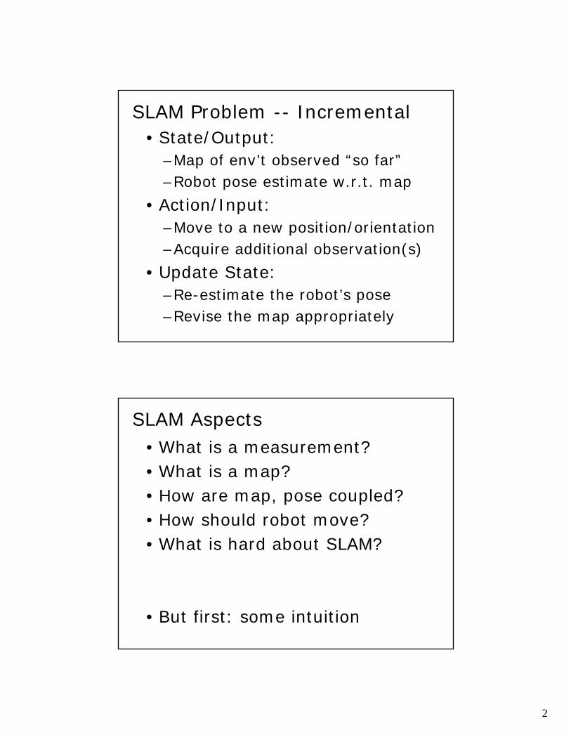
Intuition: SLAM without Landmarks
Using only dead reckoning, vehicle pose uncertainty (and thus the uncertainty of map features) grows without bound
With Landmark Measurements
• First position: two features observed
4
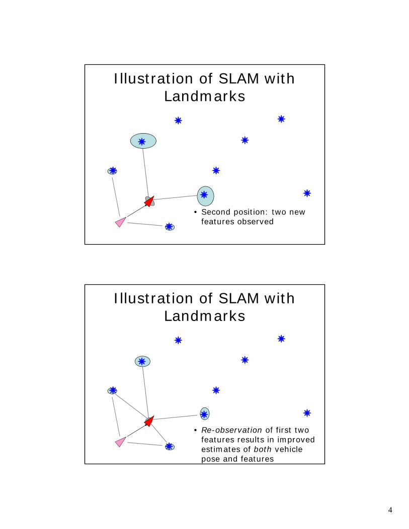
Illustration of SLAM with Landmarks
• Second position: two new features observed
Illustration of SLAM with Landmarks
• Re-observation of first two features results in improved estimates of both vehicle pose and features
5
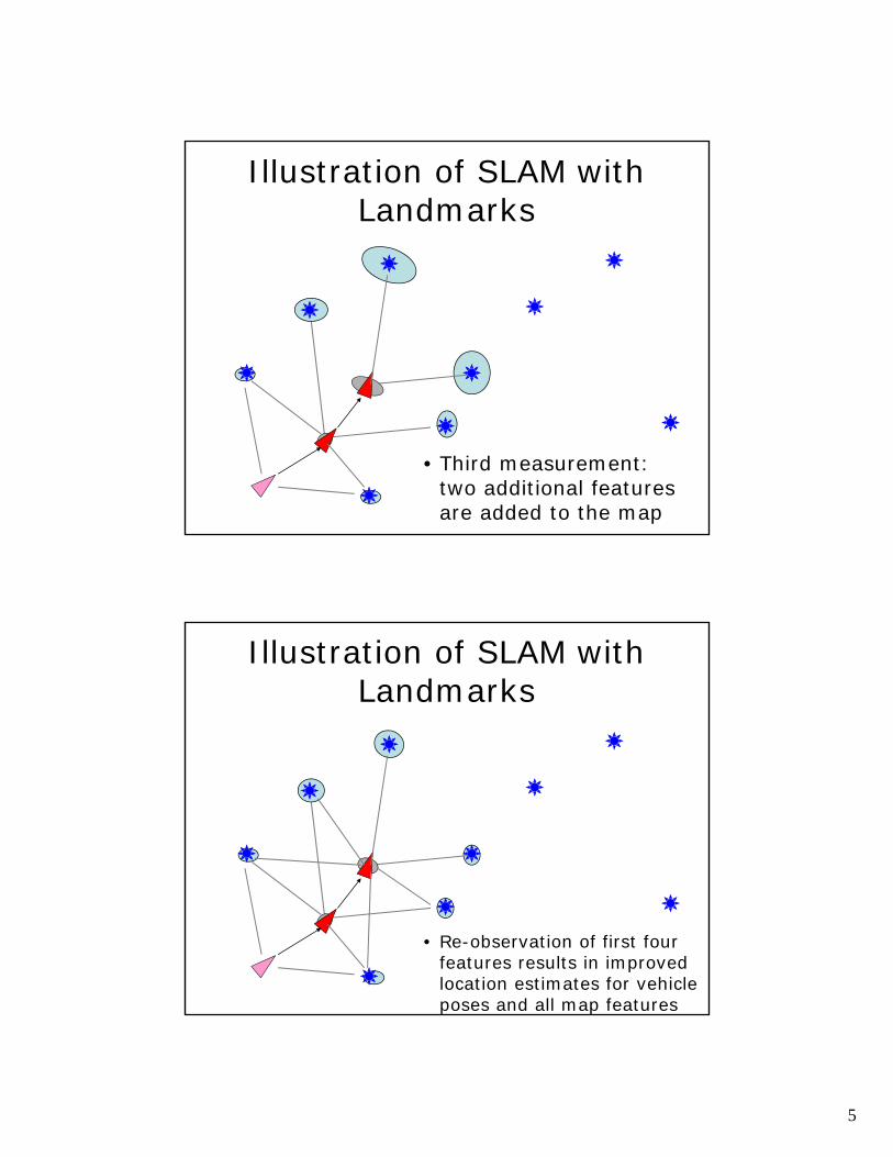
Illustration of SLAM with Landmarks
• Third measurement: two additional features are added to the map
Illustration of SLAM with Landmarks
• Re-observation of first four features results in improved location estimates for vehicle poses and all map features
6
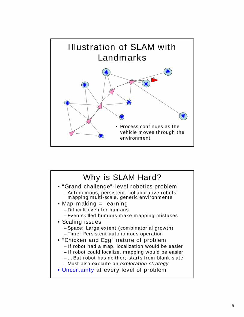
Illustration of SLAM with Landmarks
• Process continues as the vehicle moves through the environment
Why is SLAM Hard?• “Grand challenge”-level robotics problem
–Autonomous, persistent, collaborative robots mapping multi-scale, generic environments
• Map-making = learning–Difficult even for humans–Even skilled humans make mapping mistakes
• Scaling issues–Space: Large extent (combinatorial growth)–Time: Persistent autonomous operation
• “Chicken and Egg” nature of problem–If robot had a map, localization would be easier– If robot could localize, mapping would be easier–… But robot has neither; starts from blank slate–Must also execute an exploration strategy
• Uncertainty at every level of problem
7
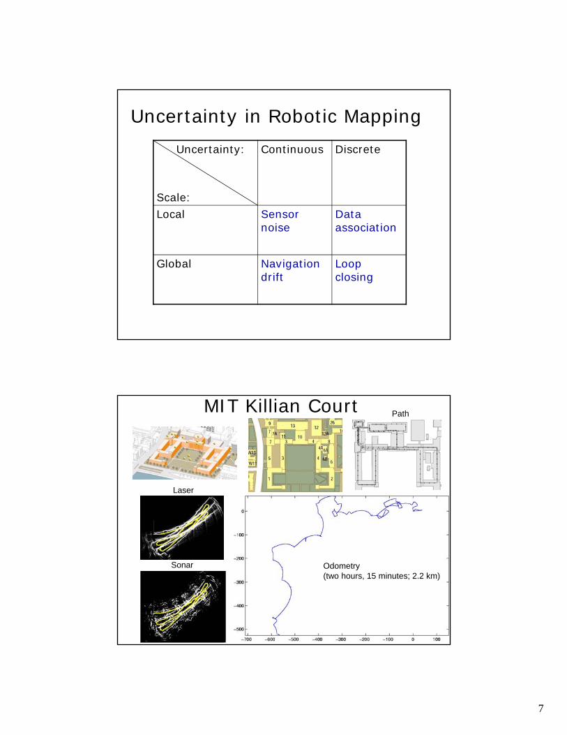
Uncertainty in Robotic MappingUncertainty:
Scale:
Continuous Discrete
Local Sensor noise
Data association
Global Navigation drift
Loop closing
MIT Killian Court
Odometry (two hours, 15 minutes; 2.2 km)
Path
Laser
Sonar
8
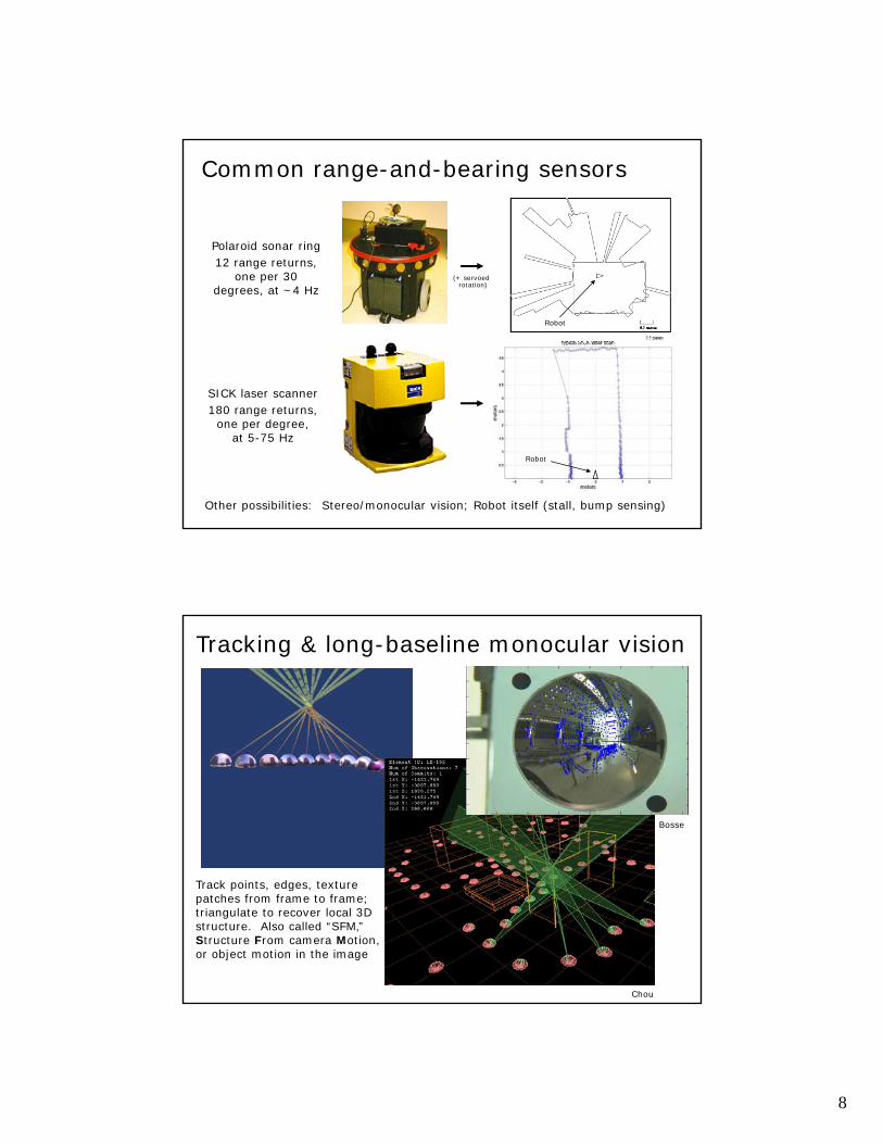
SICK laser scanner180 range returns,
one per degree, at 5-75 Hz
Polaroid sonar ring12 range returns,
one per 30 degrees, at ~4 Hz
Common range-and-bearing sensors
Other possibilities: Stereo/monocular vision; Robot itself (stall, bump sensing)
Robot
Robot
(+ servoed rotation)
Tracking & long-baseline monocular vision
Chou
Track points, edges, texture patches from frame to frame; triangulate to recover local 3D structure. Also called “SFM,” Structure From camera Motion, or object motion in the image
Bosse
9
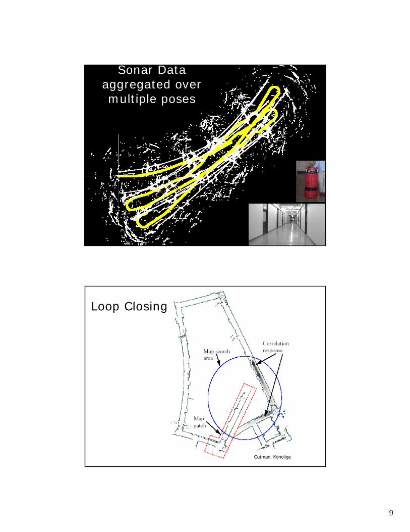
Sonar Dataaggregated over multiple poses
Gutman, Konolige
Loop Closing
10
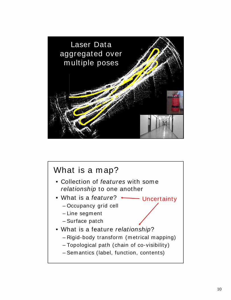
Laser Dataaggregated over multiple poses
What is a map?• Collection of features with some
relationship to one another• What is a feature?
–Occupancy grid cell– Line segment–Surface patch
• What is a feature relationship?–Rigid-body transform (metrical mapping)–Topological path (chain of co-visibility)–Semantics (label, function, contents)
Uncertainty
11
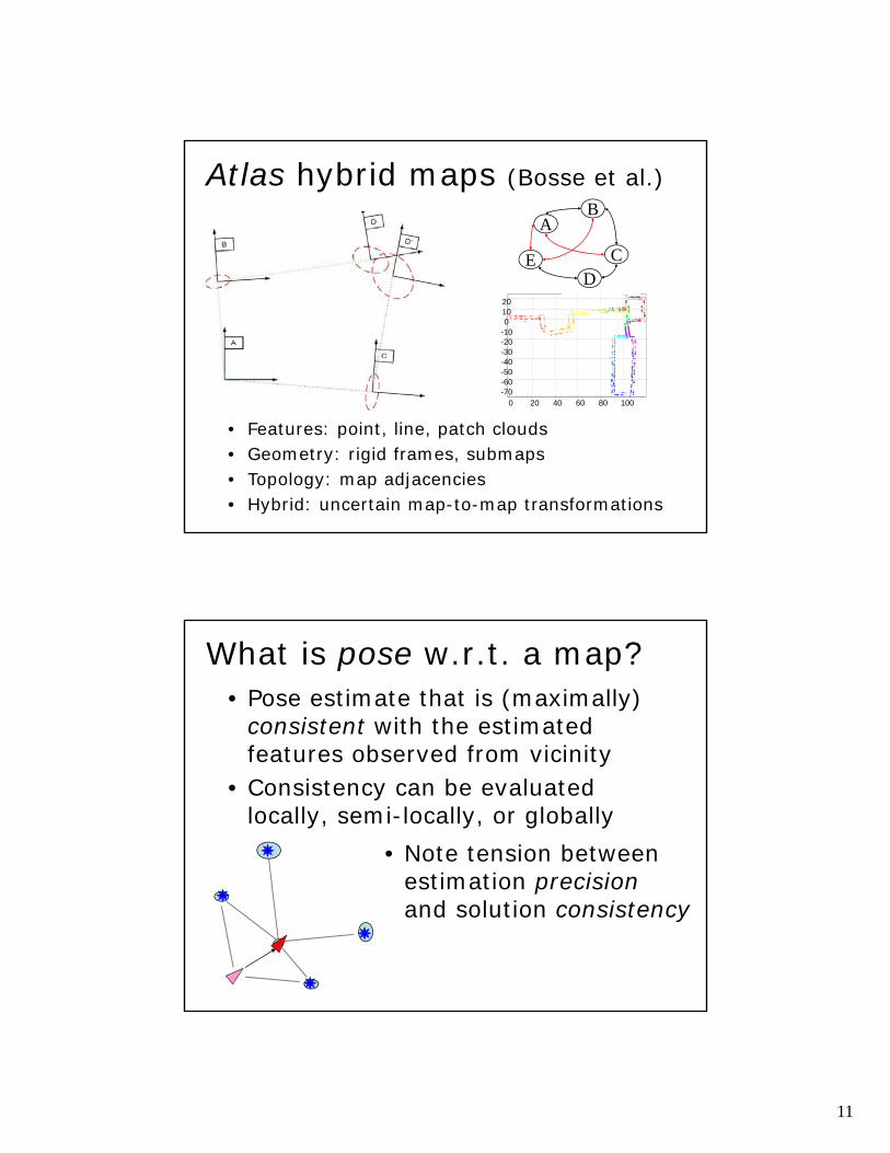
Atlas hybrid maps (Bosse et al.)
• Features: point, line, patch clouds• Geometry: rigid frames, submaps• Topology: map adjacencies• Hybrid: uncertain map-to-map transformations
A
C
B
ED
0 20 40 60 80 100-70-60-50-40-30-20-1001020
What is pose w.r.t. a map?• Pose estimate that is (maximally)
consistent with the estimated features observed from vicinity
• Consistency can be evaluated locally, semi-locally, or globally
• Note tension betweenestimation precisionand solution consistency
12
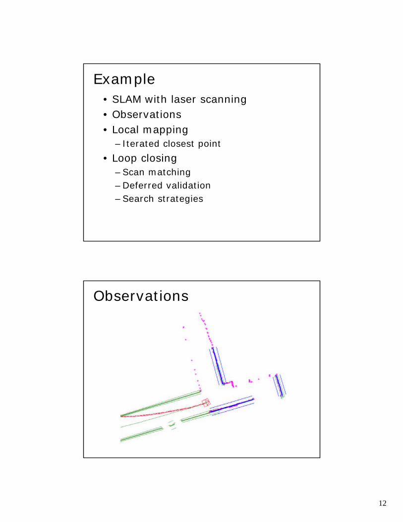
Example• SLAM with laser scanning• Observations• Local mapping
– Iterated closest point• Loop closing
–Scan matching–Deferred validation–Search strategies
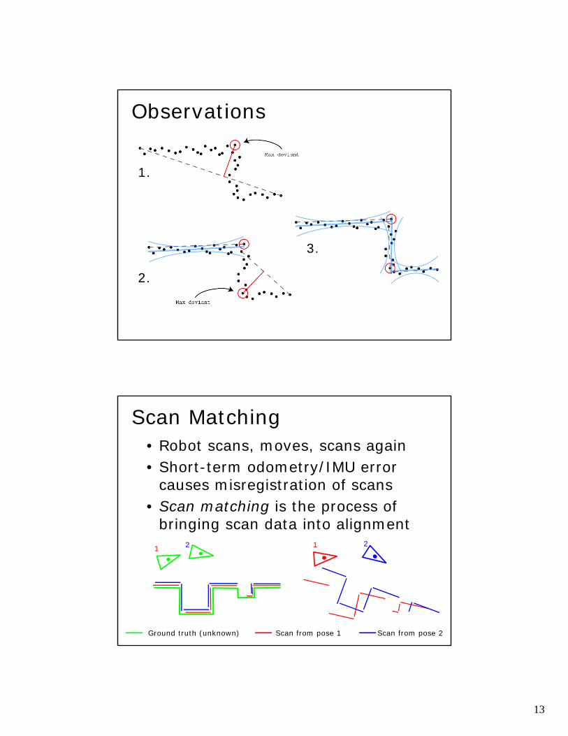
Observations
13
Observations
1.
2.
3.
Scan Matching• Robot scans, moves, scans again• Short-term odometry/IMU error
causes misregistration of scans• Scan matching is the process of
bringing scan data into alignment
Ground truth (unknown)
1 2 1 2
Scan from pose 1 Scan from pose 2
14
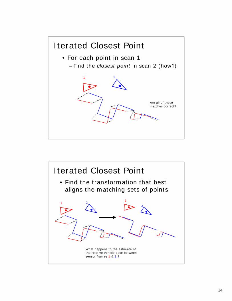
Iterated Closest Point• For each point in scan 1
–Find the closest point in scan 2 (how?)
1 2
Are all of these matches correct?
Iterated Closest Point• Find the transformation that best
aligns the matching sets of points
21 2
What happens to the estimate of the relative vehicle pose between sensor frames 1 & 2 ?
15
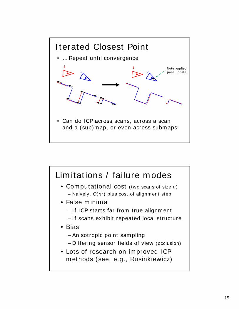
Iterated Closest Point• … Repeat until convergence
• Can do ICP across scans, across a scan and a (sub)map, or even across submaps!
22Note appliedpose update
Limitations / failure modes• Computational cost (two scans of size n)
– Naively, O(n2) plus cost of alignment step
• False minima– If ICP starts far from true alignment– If scans exhibit repeated local structure
• Bias–Anisotropic point sampling–Differing sensor fields of view (occlusion)
• Lots of research on improved ICPmethods (see, e.g., Rusinkiewicz)
16
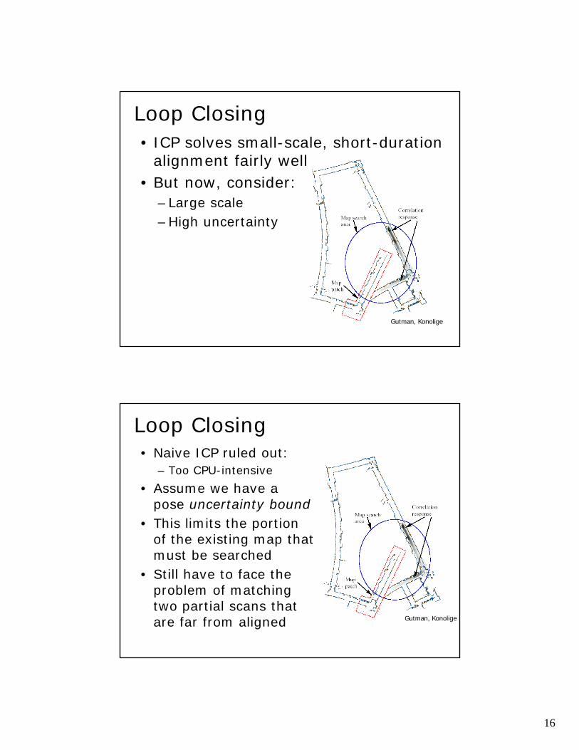
Loop Closing
Gutman, Konolige
• ICP solves small-scale, short-durationalignment fairly well
• But now, consider:–Large scale–High uncertainty
Loop Closing• Naive ICP ruled out:
– Too CPU-intensive• Assume we have a
pose uncertainty bound• This limits the portion
of the existing map that must be searched
• Still have to face theproblem of matchingtwo partial scans thatare far from aligned Gutman, Konolige
17
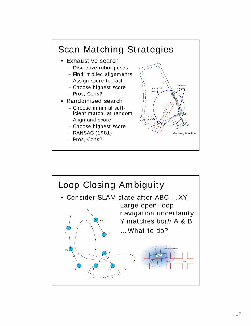
Scan Matching Strategies• Exhaustive search
– Discretize robot poses– Find implied alignments– Assign score to each– Choose highest score– Pros, Cons?
• Randomized search– Choose minimal suff-
icient match, at random– Align and score– Choose highest score– RANSAC (1981)– Pros, Cons?
Gutman, Konolige
Loop Closing Ambiguity• Consider SLAM state after ABC … XY
Large open-loop navigation uncertaintyY matches both A & B… What to do?
18
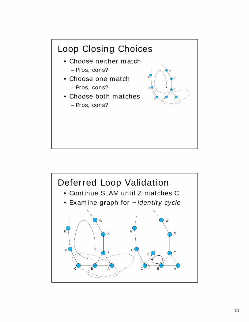
Loop Closing Choices• Choose neither match
–Pros, cons?• Choose one match
–Pros, cons?• Choose both matches
–Pros, cons?
Deferred Loop Validation• Continue SLAM until Z matches C• Examine graph for ~identity cycle
19
Some SLAM results• See rvsn.csail.mit.edu group page
… But what’s missing?• Is topology enough?• Are topology and geometry enough?• … What else is there?
20
Localization from a Prior Map(Just the “L” part of SLAM)
The method shown here uses only a single Kinect
Method (Fallon et al.)
Expository Video
Summary• SLAM is a hard robotics problem:
– Requires sensor fusion over large areas– Scaling issues arise quickly with real data
• Key issue is managing uncertainty– At both low level and high level– Both continuous and discrete
• Saw several SLAM strategies– Local and global alignment– Randomization– Deferred validation
• SLAM is only part of the solution for most applications (need names, semantics)


![Long-Term Simultaneous Localization and Mapping …robots.engin.umich.edu/publications/ncarlevaris-2013b.pdfGraph-based simultaneous localization and mapping (SLAM) [1]–[7] has been](https://img.pdfslide.us/doc/110x75/5f4f36e99f96d02d0d627705/long-term-simultaneous-localization-and-mapping-graph-based-simultaneous-localization.jpg)


![Decoupled Localization and Sensing ... - vision.cornell.edu · with vision-based Simultaneous Localization and Mapping (SLAM) (e.g., [10,11]) or ICP-based tracking with RGBD input](https://img.pdfslide.us/doc/110x75/5f0e8cc37e708231d43fc81b/decoupled-localization-and-sensing-with-vision-based-simultaneous-localization.jpg)