Embed Size (px)
Citation preview
SHIPWRECKED? DEFINING THE ST. AUGUSTINE STORM WRECK
By
Jason A. Griffin
Submitted to the Faculty of
The Archaeological Studies Program Department of Sociology and Archaeology
In partial fulfillment of the requirements for the degree of Bachelors of Science
University of Wisconsin-La Crosse
2013

ii
Copyright ©2013 by Jason A. Griffin
All rights reserved.
iii
SHIPWRECKED? DEFINING THE ST. AUGUSTINE STORM WRECK
Jason A. Griffin B.S.
University of Wisconsin-La Crosse, 2013
This is a comparative study of the Storm Wreck site in St. Augustine, Fl. The purpose of this study is to better define what kind of site the Storm Wreck is. I looked at three different types of maritime sites; shipwreck, emergency weight dump, and salvage sites. I created standards of what should be in each of these sites to be compared to known shipwrecks, emergency weight dumps, and salvage site. Finally I use my standards and determine that the Storm Wreck is a shipwreck.

iv
ACKNOWLEDGEMENTS I would fist like to thank my soon to be wife Holly Felter for her constructive criticisms, moral
support, and patience through this stressful process of thesis writing. I would also like to thank
my soon to be mother-in-law Rachel Felter and sister-in-law Sarah Felter for their interest in my
subject and critical insight.
I would also like to thank my adviser Dr. David Anderson for putting up with me for four
years, as well as for being my advisor and giving me direction in this journey of thesis
development. Equally important people to mention would be my student colleagues, Sarah
Breiter and Alison Boll who gave me perspective and critiques throughout the writing process.
I am great full to the Lighthouse Archaeological Maritime Program director Chuck Meide
and Dr. Sam Turner for the opportunity to join and be apart of the 2012 field school. Finally
without Bill and Elizabeth Noorlander, who sponsored my ability to attend the LAMP maritime
field school I would never have had the inspiration to do my thesis on the St. Augustine Storm
Wreck.

1
INTRODUCTION When the word shipwreck is mentioned, initially the image of treasure chests filled with gold and
pearls lying on the ocean floor enters most people’s minds. In reality, the majority of maritime
shipwreck sites will not reveal gold treasures; instead, maritime remains give us information on
ship construction and technology, country of origin, and the mission of the vessel.
When a maritime remains site is found, it can, under certain conditions, be described as a
shipwreck (e.g. Ulu Burun or the Lion Wreck). Known shipwrecks are designated as such
because not only were material remains of the cargo and possessions that they were carrying
recovered from the site, but also parts of the actual ships were found. A maritime site can also
consist of remains of cargo that was thrown overboard during an emergency in an attempt to
lighten and lift a ship off of a sandy sea bottom or a reef. Maritime sites can also be difficult to
define due to human interaction, when people have tampered with the archaeological remains,
such as legal or illegal salvage operations performed on vessels to return lost material or sell for
profit (Bowens 2009:6). Maritime sites, rich with cargo and resources, could have also been
visited by salvagers from the time it sank. Sites that have been tampered with in this way are
known as salvage sites. Since the seventeenth century, there have been traces left of salvaging
attempts to reclaim cargo, masts, and sails, which were expensive and could be used on other
vessels (Eriksson 2011:22). Another type of human interaction with maritime sites happens
when recreational divers are exploring a well-known shipwreck and they take artifacts from the
site to have a memento of their vacation.
2
During the summer of 2012, I was able to attend a maritime field school in St. Augustine,
Florida through the Lighthouse Archaeological Maritime Program (LAMP). The main project
that LAMP has been working on since 2010 is a maritime site call the Storm Wreck. The site is
located 1.6 kilometers off Anastasia Island in St. Augustine. LAMP believes that the Storm
Wreck site is a shipwreck. After diving on the site and looking at the artifacts, I wanted to know
what parameters define the Storm Wreck site as a shipwreck and whether it could be defined as a
different type of site.
In this study, I will attempt to better define what type of site the Storm Wreck is. I have
created a list, based on study of maritime practices, of what I would expect to find on the three
different types of maritime sites, and I will perform a comparative study on known maritime sites
in order to confirm or revise my expectations. The sites examined include the known shipwrecks
the Lion’s Wreck, found off the coast of Stockholm, Sweden and the Ulu Burun site near Kaş,
Turkey. I have also examined the known emergency weight dumpsite, the HMS Pandora that
struck the Great Barrier Reef. The final type of maritime site that I have examined is a salvaged
ship, the Mystery Wreck off the Florida Keys. Using the list of characteristics that I have
verified through the study of each of these site types, the remains from the Storm Wreck site will
then be compared to the known sites to determine the origin of the site.
3
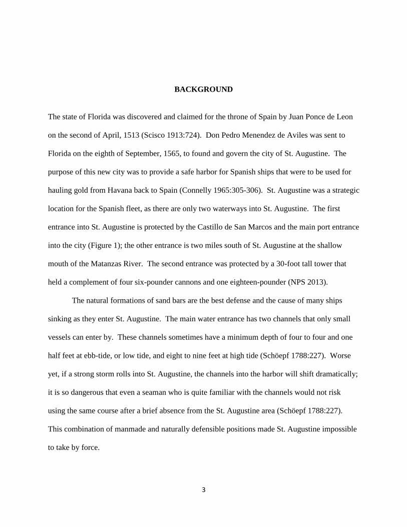
BACKGROUND The state of Florida was discovered and claimed for the throne of Spain by Juan Ponce de Leon
on the second of April, 1513 (Scisco 1913:724). Don Pedro Menendez de Aviles was sent to
Florida on the eighth of September, 1565, to found and govern the city of St. Augustine. The
purpose of this new city was to provide a safe harbor for Spanish ships that were to be used for
hauling gold from Havana back to Spain (Connelly 1965:305-306). St. Augustine was a strategic
location for the Spanish fleet, as there are only two waterways into St. Augustine. The first
entrance into St. Augustine is protected by the Castillo de San Marcos and the main port entrance
into the city (Figure 1); the other entrance is two miles south of St. Augustine at the shallow
mouth of the Matanzas River. The second entrance was protected by a 30-foot tall tower that
held a complement of four six-pounder cannons and one eighteen-pounder (NPS 2013).
The natural formations of sand bars are the best defense and the cause of many ships
sinking as they enter St. Augustine. The main water entrance has two channels that only small
vessels can enter by. These channels sometimes have a minimum depth of four to four and one
half feet at ebb-tide, or low tide, and eight to nine feet at high tide (Schöepf 1788:227). Worse
yet, if a strong storm rolls into St. Augustine, the channels into the harbor will shift dramatically;
it is so dangerous that even a seaman who is quite familiar with the channels would not risk
using the same course after a brief absence from the St. Augustine area (Schöepf 1788:227).
This combination of manmade and naturally defensible positions made St. Augustine impossible
to take by force.

4
Figure 1. 1783 map of St. Augustine (adapted from LAMP 2012).
Control of St. Augustine has changed hands on only three different occasions. The first
changeover followed treaty talks between England and Spain, when St. Augustine was traded to
England for control of Cuba in 1762 (Wyllie 1897:16). This led to England gaining control of
the Florida colony for twenty years. In 1783, Florida was re-ceded back to Spain so that the
British could gain control of the Bahamas (Wyllie 1897:20). On the nineteenth of February,
1821, Florida was once again traded during negotiations with America (Wyllie 1897:20) and
became a state in March, 1845.
During the different occupations, the port of St. Augustine has claimed ships from many
nations. The site that will be the focus of this study might have been a casualty of the St.
Augustine area. Discovered in 2009 by LAMP, the Storm Wreck site is located approximately
5
1.6 km offshore of Anastasia Island and at a depth ranging from 7.6 to 9.1 meters (Meide
2013:17). As of the summer of 2012, LAMP has excavated and mapped approximately 10
square meters of the site and is expected to be much larger.
The Storm Wreck site has functioned as an underwater field training school for maritime
archaeologists, and during the 2010 and 2011 sessions, LAMP staff, interns, and students
excavated an area of ten square meters. After the first two field seasons of excavation, LAMP
discovered and cataloged 195 artifacts (Meide 2013:17), of which four were four-pound long gun
cannons and two were nine-pound carronades. Most of these artifacts are in a concretion form,
which is a hard, solid mass of material that has gathered together.
Based on the artifacts recovered, LAMP has dated the site to the late eighteenth century.
The terminus post quem of the site is 1780, based on a manufacturing date of one of the nine-
pound carronade. For the terminus ante quem, LAMP believes it to be no older than 1812
(Meide 2013:17-23). The ship itself is believed to be a British Loyalist merchant ship that was
lost trying to enter the harbor after fleeing Charleston or Savannah in the last years of the
Revolutionary War (Meide 2013:17). Schöepf can shed light on this theory through his writings
in the Travels of the Confederation.
It has become so common at St. Augustine to see ships aground on this bar and this coast generally, that disasters of the sort have ceased to arouse sympathy or wonder. After the surrender of Charleston in 1782, within two days no less than 16 vessels, bearing refugees and their effects, went to pieces here and many persons lost their lives (Schöepf 1788:227-228).
6
METHODS The question I will attempt to answer through this research is whether the Storm Wreck is a
classic example of a shipwreck site or another type of maritime site. Toward this end, I have
examined three different types of nautical maritime sites from which I have developed a set of
standards for what one would find at each type of site in order to compare them with known
maritime sites. The three site types that I have used are known shipwrecks, emergency weight
dump sites, and salvaged shipwrecks. Each of these sites leave specific remains on the seafloor
that identifies them as a specific type of site.
The sites I will be looking at to compare to my standards for a shipwreck will be the Ulu
Burun shipwreck off the coast of Turkey and the Lion Wreck that was found off the coast of
Sweden. For the Emergency Weight Dump Site comparison, I will be looking at the H.M.S.
Pandora that ran aground on the Great Barrier Reef of Australia. Finally, for the Salvaged site I
will be comparing my standards to the Mystery Wreck near the Florida Keys.
The outcome that I am looking for in my comparative analysis is to find a type of site that
the Storm Wreck best represents. If the known sites that I looked at match a majority of my
standards of the three sites, I will then take my expectations and compare them to the Storm
Wreck site. From the data that has been collected from LAMP studies since 2010 I should have
enough data to define the Storm Wreck.
7
Shipwrecks Initially, the most apparent remains, that should be found in order to classify a site as a
shipwreck, would be the discovery of the hull of the ship. This could be the complete ship with
planks, ribbing, and keel, but this is not always possible, especially with wooden ships. Damage
or degradation may be caused by currents, wood boring worms, fungi, and bacteria (Bowens
2009:30). The last part of a ship to disappear would be the keel because this is the spine and
support structure of a ship, so it would have been built from the thickest and strongest wood
used.
The subsequent defining factor one might find at a shipwreck site would be intact cargo,
assuming, of course, that biological organisms or natural processes have not affected the
integrity of the cargo. If cargo was to be found, ideally it would be found in the hold, either still
secured or shifted to one side when the ship was sinking. Along with the cargo, if the ship had
not been balanced, or if it had no cargo, we should also expect to find some ballast weights in the
hold to prevent the ship from capsizing. William Falconer defines ballast as “A certain portion
of stone, iron, gravel, or such like materials, deposited in a vessels hold, when she has either no
cargo, or too little to bring her sufficiently low in the water” (Falconer 1780:28).
The following criteria that should be found at a shipwreck would be armament. A ship
that sank during combat or due to bad weather would have gone down with her full complement
of cannon and firearms. If, for example, a thirty gun Frigate had met its demise and if it had not
been salvaged before its archaeological discovery, in time we should uncover all thirty cannons.
If rifles are found, only the barrels of the rifles might remain. Most likely, because of the time
spent in the salt water, concretions may have formed around both the cannons and rifles (Figure

8
2). Even if this were to happen, the rough shape of the items should still be visible enough to
easily identify them as arms of combat.
Figure 2. Musket set in concretion from the Storm Wreck (photo by Brian McNamara 2012).
The fourth expectation of remains that one should look for on a shipwreck would be the
personal effects of the sailors. Examples of personal property would be currency, pipes, spoons,
buckles for belts or footgear, and buttons. At times, and in the cold, deep depths of the ocean,
human remains have been uncovered (Gesner 200:43).
The final items that would identify a shipwreck site that I will use in my comparisons are
the ship’s bell and the ship’s anchors. The ship’s bell was very important to its crew, as it was
rung to alert the men to warnings and to tell time, and it also carried the name of the ship from

9
the time the bell was first cast. If the ship’s name is known to the archeologist, we can find out
what nation the ship came from and then can determine who should have ownership of the vessel
(Bowens 2009:48). The anchor is also important, not only in its past use of securing the ship but
also, if there are no remains of the hull, to estimate the type of the ship based on the size of the
anchor.
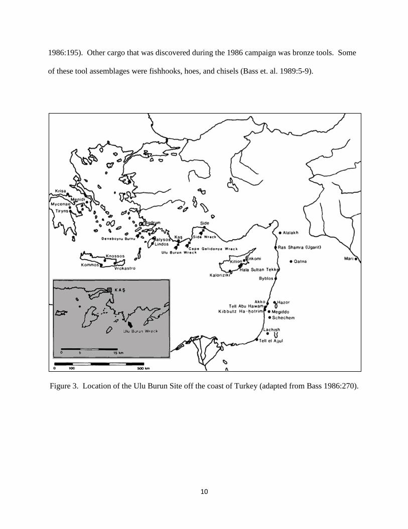
Ulu Burun A local sponge diver initiated the discovery of the late Bronze Age Ulu Burun shipwreck in
1982. The site was 50 meters off the shore of Kaş, Turkey (Figure 3) and one kilometer from the
northeast tip of Ulu Burun. The Bodrum Museum of Underwater Archaeology contacted the
Institute of Nautical Archaeology (INA) in 1983 to conduct a survey of this possible shipwreck.
The INA sent a team of investigators and found the wreck on a steep slope at a depth of 44 to 51
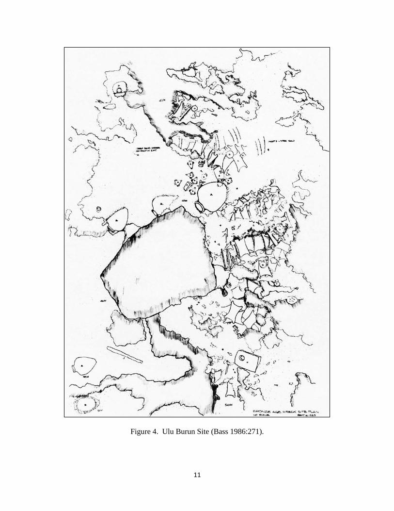
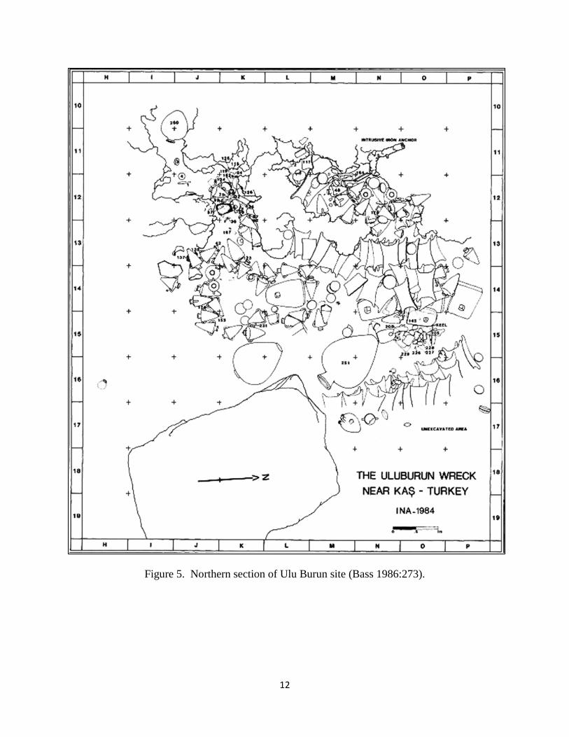
meters, and the site was in an area of 10×18 meters, shown in Figure 4(Bass 1986:269-270).
During the 1984 field season, which lasted from July to the end of August, the excavation team
worked on the upper half of the 10×18 meter area of the Ulu Burun site (Figure 5).
The Ulu Burun site is one of the few sites that completely match my expectations of the
definition of a shipwreck. The first criteria that it meets is the abundance of cargo material from
the late Bronze Age. This ship seems to have been a trading vessel for the east to west trade
route of the Mediterranean. The ship has artifacts from Mycenae, Syria, Cypriot (Bass
1986:274), and Egypt (Bass et. al. 1989:92). The cargo that was recorded was mainly pottery of
different shapes and origin (i.e. Syro-Palestinian amorphas, Cypriote milk-bowl, and Cypriote
juglet). Along with pottery, George Bass and his team uncovered ingots of various metals, many
in the shape of dried hides, this could have been used as a kind of premonitory currency (Bass
10
1986:195). Other cargo that was discovered during the 1986 campaign was bronze tools. Some
of these tool assemblages were fishhooks, hoes, and chisels (Bass et. al. 1989:5-9).
Figure 3. Location of the Ulu Burun Site off the coast of Turkey (adapted from Bass 1986:270).
11
Figure 4. Ulu Burun Site (Bass 1986:271).
12
Figure 5. Northern section of Ulu Burun site (Bass 1986:273).
13
Also discovered at the Ulu Burun site were weapons from the late Bronze Age. Though
these are not projectile weapons, they were tools that people would have used in combat, so I
would still consider this a match to my third expectation, weaponry, taking into account its time
frame. These were stone mace heads, bronze daggers and knives (Bass 1986:274, 283, 292, and
293).
The last expectation that the Ulu Burun shipwreck met was the first in my list, in that
there were remnants of its hull intact under all of the sand sediment, concretions, cargo, and
ballast stones (Bass 1986:265). It is always a good thing when a hull is found from a
seventeenth century ship, but finding a good portion of a late Bronze Age wooden hull at the
bottom of the Mediterranean Sea is great luck. To give a perspective, Dr. George Bass worked
on a shipwreck not too far from the Ulu Burun wreck in 1960 in the Cape of Gelidonya. There
were no hull remains at the Gelidonya wreck, but there was evidence of there once being one
from the positions of the cargo artifacts found (Bass 1961:270).
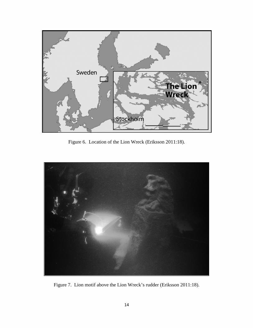
The Lion Wreck The Lion Wreck is a seventeenth century Dutch merchant ship that had met its end in the Baltic
Sea on a known merchant trade route, twenty kilometers northeast of Stockholm Archipelago
(Figure 6). Recreational divers discovered the site in 2009 at a depth of 50 meters. The ship’s
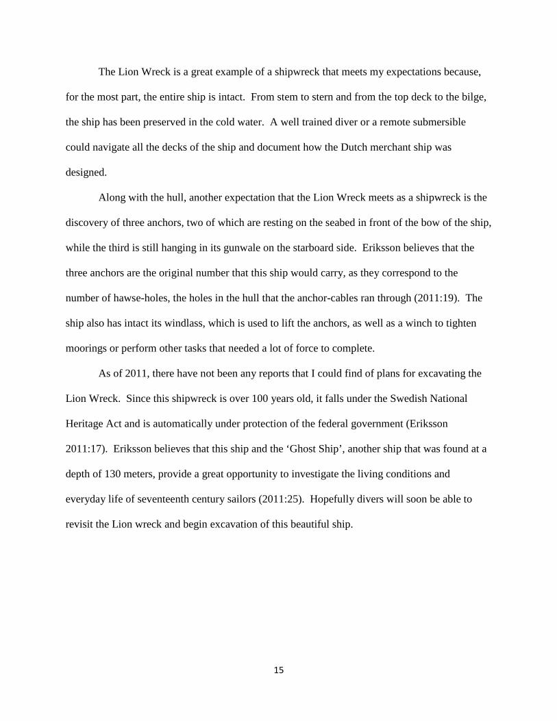
name is still unknown, but it was given the moniker “The Lion Wreck” from the detailed design
of a grinning lion (Figure 7) above the rudder (Eriksson 2011:17).
14
Figure 6. Location of the Lion Wreck (Eriksson 2011:18).
Figure 7. Lion motif above the Lion Wreck’s rudder (Eriksson 2011:18).
15
The Lion Wreck is a great example of a shipwreck that meets my expectations because,
for the most part, the entire ship is intact. From stem to stern and from the top deck to the bilge,
the ship has been preserved in the cold water. A well trained diver or a remote submersible
could navigate all the decks of the ship and document how the Dutch merchant ship was
designed.
Along with the hull, another expectation that the Lion Wreck meets as a shipwreck is the
discovery of three anchors, two of which are resting on the seabed in front of the bow of the ship,
while the third is still hanging in its gunwale on the starboard side. Eriksson believes that the
three anchors are the original number that this ship would carry, as they correspond to the
number of hawse-holes, the holes in the hull that the anchor-cables ran through (2011:19). The
ship also has intact its windlass, which is used to lift the anchors, as well as a winch to tighten
moorings or perform other tasks that needed a lot of force to complete.
As of 2011, there have not been any reports that I could find of plans for excavating the
Lion Wreck. Since this shipwreck is over 100 years old, it falls under the Swedish National
Heritage Act and is automatically under protection of the federal government (Eriksson
2011:17). Eriksson believes that this ship and the ‘Ghost Ship’, another ship that was found at a
depth of 130 meters, provide a great opportunity to investigate the living conditions and
everyday life of seventeenth century sailors (2011:25). Hopefully divers will soon be able to
revisit the Lion wreck and begin excavation of this beautiful ship.

16
Emergency Weight Dump Sites This type of site would result from a vessel having run aground on a reef or sand bar or taking on
water from damage done to the hull under the surface. In an emergency such as running
aground, a ship would need to shed weight so the vessel could rise off the bottom and continue to
a safe harbor. All hands would either be throwing overboard everything heavy that was not
essential to the ship or at the bilge pump draining the water in the ship.
At an emergency weight dump site, an investigator should look for either one pile of
artifacts, two piles that would represent where the port and starboard sides of the ship would be,
or a trail of artifacts over a distance from the ship having to continually shed weight. What could
be found would be items of least importance to their continued survival, like the cargo that
would be the cheapest to sell or ballast weight, if there was any; the last thing to be thrown
overboard would be the cannons. If cannons had been thrown overboard, the entire complement
of cannons would not be found at the dump site, only enough of them to lose enough weight to
allow them to sail to safety.
HMS Pandora The HMS Pandora was a naval frigate of the British Royal Navy that was dispatched to
apprehend the mutineers of the HMS Bounty in 1789. After capturing 16 of the original 25
mutineers, the homeward-bound Pandora wrecked on the Great Barrier Reef in 1791 (Gesner
2000:1). What makes the Pandora an example of an emergency weight dump was that the entire
voyage, from leaving harbor to the sinking of the ship, was documented in the personal logs of
Captain Edward Edwards and ship’s surgeon George Hamilton. Their accounts of the Pandora
are reprinted in Basil Thomson’s edition of The Voyage of the HMS Pandora (1915).
17
After running aground on the reef, the ship began taking on water. Captain Edwards
ordered men to the pumps, repairing equipment or heaving guns overboard. What follows is a
written account from the ship’s surgeon about sending items overboard. Hamilton wrote,
The guns were ordered to be thrown overboard; and what hands could be spared from the pumps, were employed thrumbing a topsail to haul under her bottom, to endeavour to fodder her…we baled between life and death; for had she gone down before day-light, every soul must have perished (Thomson 1915:143).
A little before midnight, high tide came to the area where the Pandora had run aground.
With the deeper water, the ship was able to rise off the reef and the crew continued bailing,
repairing, and hauling items overboard until the morning. Early the next morning the crew knew
that nothing else could be done, and the order to abandon ship was given (Gesner 2000:12). The
ship sank soon after, and four of the prisoners and 31 sailors died on the voyage of the Pandora.
The site lay undisturbed until 1977, when SCUBA divers from the Royal Australian Air
Force happened to find the hull of what is now known to be the HMS Pandora (Gesner 2000:2).
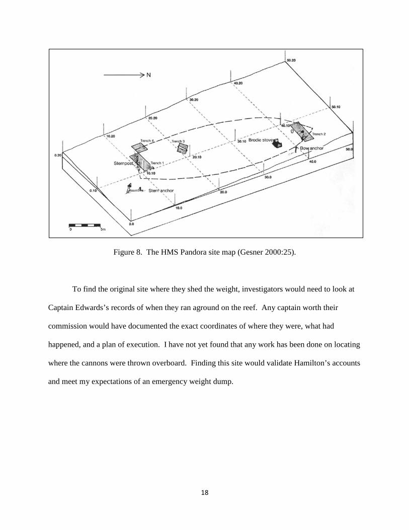
Since its discovery, archaeological work has been performed on the Pandora wreck. The site is
a 20×50 meter area (Figure 8) and at a depth of 30 to 35 meters (Gesner 2000:21). The
archaeological team that has worked on the site for five different field seasons has only
excavated a good portion of the bow and stern of the ship; the mid-ship has not, as of Gesner’s
2000 report, seen any excavations. This is where we would find the cargo hold and where the
cannons would be stowed. If this military frigate is missing some of its cannons, then what
Hamilton wrote would be confirmed, and we would find them at the spot where the ship struck
the reef.
18
Figure 8. The HMS Pandora site map (Gesner 2000:25).
To find the original site where they shed the weight, investigators would need to look at
Captain Edwards’s records of when they ran aground on the reef. Any captain worth their
commission would have documented the exact coordinates of where they were, what had
happened, and a plan of execution. I have not yet found that any work has been done on locating
where the cannons were thrown overboard. Finding this site would validate Hamilton’s accounts
and meet my expectations of an emergency weight dump.

19
Salvage Sites Salvage sites can also be a subcategory of a shipwreck. They occur where humans have
disturbed a shipwreck, either not long after the vessel’s original sinking or later, by treasure-
hunters, amateur divers, or earlier archaeological excavations. Traces of salvaging, such as saw
marks on the hull, made when removing the planking or ribbing, and saw marks on a mast post
where the salvagers took a large portion of the mast, can be visible today (Eriksson 2011:22).
Sediment stratigraphy is also another way to determine if the site has been disturbed or
salvaged. Sediment is kept in continual motion by surrounding currents; if a site has been
excavated and then abandoned, the portion that was excavated would be covered by new
stratigraphic layer. In the maritime record, stratigraphy is used in the same way as in the
terrestrial record. “The principles of stratigraphy are used to establish a sequence of above-
below relationships and place the contexts (and, therefore, events) in order in which they
occurred” (Bowens 2009:27).
The Mystery Wreck The Mystery Wreck is a shipwreck that was discovered at the edge of the Hawk Channel of the
Florida Keys. A contracted salvage team originally worked on the site in 1972 in hopes that this
site was part of the missing Spanish fleet of 1733. The site appeared to be a large grouping of
ballast stones that was covered with soft and hard coral. Some of the artifacts that the salvage
team recovered were ballast stones, 208 musket balls, 127 grapeshot, 34 lead shot, three cannon
balls, firebrick, and several fragments of wood (McKinnon and Scott-Ireton 2006:187). It was
determined that the Mystery Wreck was not part of the 1733 fleet, and the salvage team lost
interest in the site. In the years following, visitors asking about places to dive would be directed
to the Mystery Wreck by locals. These recreational divers impacted the site by disturbing
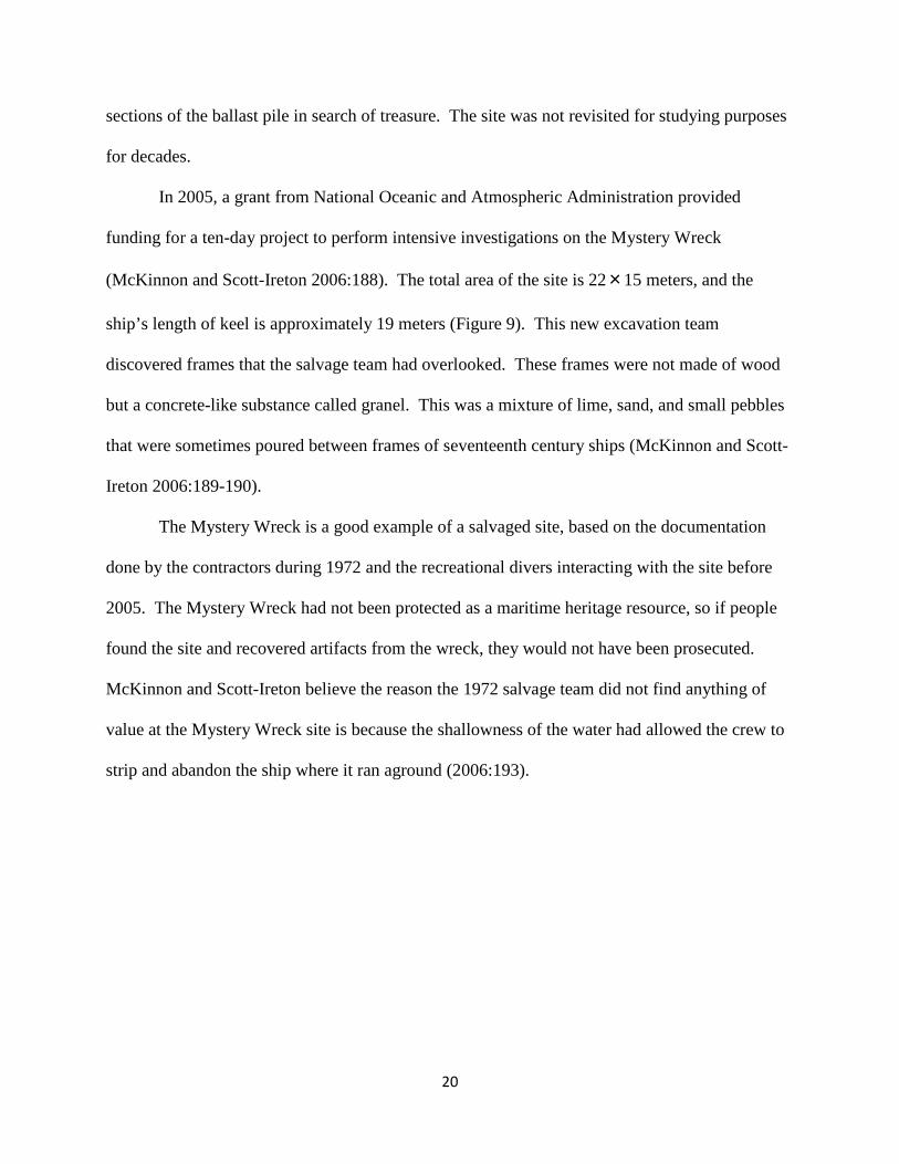
20
sections of the ballast pile in search of treasure. The site was not revisited for studying purposes
for decades.
In 2005, a grant from National Oceanic and Atmospheric Administration provided
funding for a ten-day project to perform intensive investigations on the Mystery Wreck
(McKinnon and Scott-Ireton 2006:188). The total area of the site is 22×15 meters, and the
ship’s length of keel is approximately 19 meters (Figure 9). This new excavation team
discovered frames that the salvage team had overlooked. These frames were not made of wood
but a concrete-like substance called granel. This was a mixture of lime, sand, and small pebbles
that were sometimes poured between frames of seventeenth century ships (McKinnon and Scott-
Ireton 2006:189-190).
The Mystery Wreck is a good example of a salvaged site, based on the documentation
done by the contractors during 1972 and the recreational divers interacting with the site before
2005. The Mystery Wreck had not been protected as a maritime heritage resource, so if people
found the site and recovered artifacts from the wreck, they would not have been prosecuted.
McKinnon and Scott-Ireton believe the reason the 1972 salvage team did not find anything of
value at the Mystery Wreck site is because the shallowness of the water had allowed the crew to
strip and abandon the ship where it ran aground (2006:193).

21
Figure 9. Site map of Mystery Wreck (adapted from McKinnon and Scott-Ireton 2006:192).
22
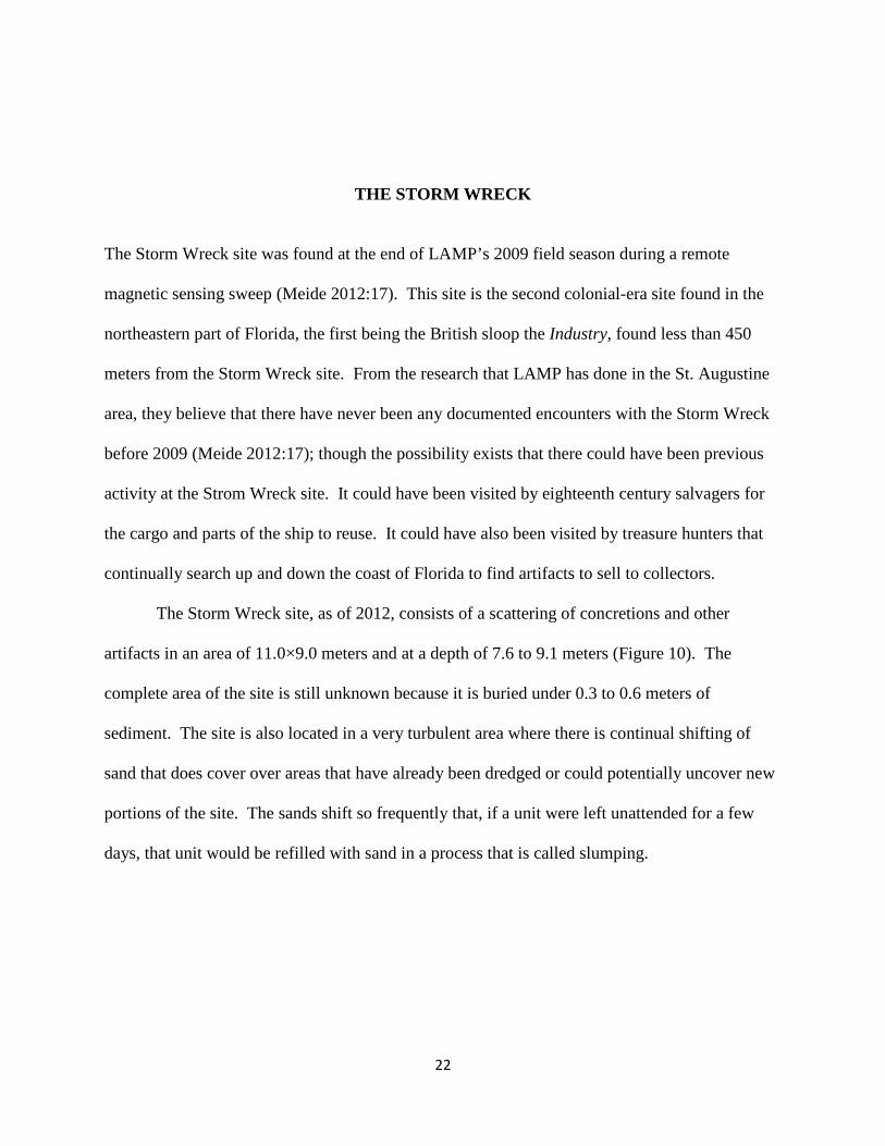
THE STORM WRECK The Storm Wreck site was found at the end of LAMP’s 2009 field season during a remote
magnetic sensing sweep (Meide 2012:17). This site is the second colonial-era site found in the
northeastern part of Florida, the first being the British sloop the Industry, found less than 450
meters from the Storm Wreck site. From the research that LAMP has done in the St. Augustine
area, they believe that there have never been any documented encounters with the Storm Wreck
before 2009 (Meide 2012:17); though the possibility exists that there could have been previous
activity at the Strom Wreck site. It could have been visited by eighteenth century salvagers for
the cargo and parts of the ship to reuse. It could have also been visited by treasure hunters that
continually search up and down the coast of Florida to find artifacts to sell to collectors.
The Storm Wreck site, as of 2012, consists of a scattering of concretions and other
artifacts in an area of 11.0×9.0 meters and at a depth of 7.6 to 9.1 meters (Figure 10). The
complete area of the site is still unknown because it is buried under 0.3 to 0.6 meters of
sediment. The site is also located in a very turbulent area where there is continual shifting of
sand that does cover over areas that have already been dredged or could potentially uncover new
portions of the site. The sands shift so frequently that, if a unit were left unattended for a few
days, that unit would be refilled with sand in a process that is called slumping.
23
Figure 10. Storm Wreck site map (Meide 2012:20).

24
The diving conditions on the Storm Wreck site are very challenging. The visibility on the
site is very poor. When the seas are rough and a storm is coming in from offshore, visibility
would be nearly zero. On a good day, when there are calm seas, the visibility might be only a
meter. Since the site is in a very turbulent area, divers are pushed and pulled by the strong
currents. Finally, what makes diving on this site challenging is that the St. Augustine area is
prone to rapid changes in weather, and a storm can form out of nowhere.
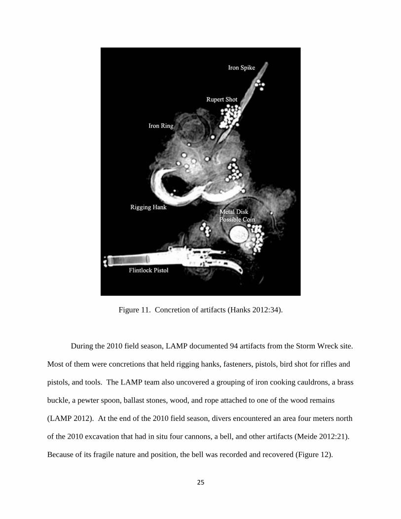
Artifacts Recovered During the 2010 and 2011 field seasons, LAMP was able to complete sixteen individual 1×1
meter units. LAMP discovered 195 artifacts, with many of the artifacts recovered in a concretion
form and subjected to x-ray and CT scans. An x-ray image was taken on a concretion of
artifacts, we can see that the concretion contains a long iron spike, a forged iron ring, a rigging
hank, lead Rupert shot, a circular disc of dense metal which may be a coin, and a small flintlock
pistol (Figure 11).
From the long list of artifacts that LAMP has recovered from the Storm Wreck site, I will
only refer to those that pertain to my expectations of what I should find when defining the type
of site that the Storm Wreck will be. From quick excavation of the Storm Wreck in 2009, LAMP
was able to document and recover four artifacts. These artifacts are a ballast stone, a concretion
that was x-rayed to reveal an axe head and partial handle, a second concretion that x-ray revealed
to be a knife/dirk sheath, and a piece of wood (LAMP 2012). Another object that was recovered
was a Pepsi bottle, the year of which has not been identified.
25
Figure 11. Concretion of artifacts (Hanks 2012:34).
During the 2010 field season, LAMP documented 94 artifacts from the Storm Wreck site.
Most of them were concretions that held rigging hanks, fasteners, pistols, bird shot for rifles and
pistols, and tools. The LAMP team also uncovered a grouping of iron cooking cauldrons, a brass
buckle, a pewter spoon, ballast stones, wood, and rope attached to one of the wood remains
(LAMP 2012). At the end of the 2010 field season, divers encountered an area four meters north
of the 2010 excavation that had in situ four cannons, a bell, and other artifacts (Meide 2012:21).
Because of its fragile nature and position, the bell was recorded and recovered (Figure 12).

26
Figure 12. Storm Wreck bell with x-ray (Jasper 2012:51).
The 2011 field season was a shorter season, due to bad weather, and LAMP was only on
site for the month of June and three days in August (Meide 2012:22). In the 23 days of diving on
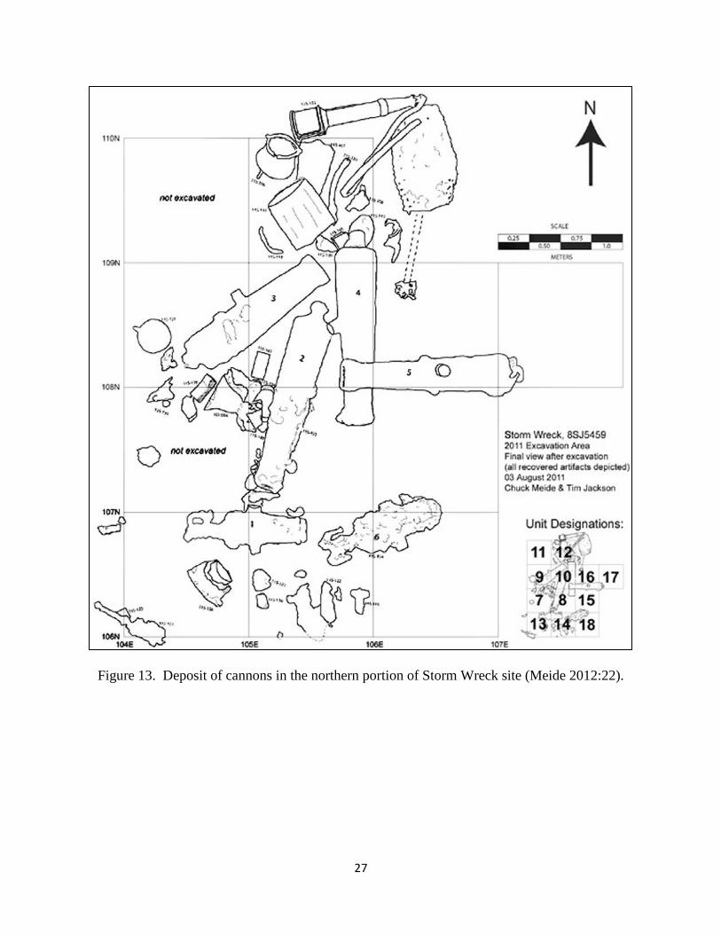
the Storm Wreck site, LAMP was able to record and recover 96 artifacts, two of them being one
four-pound long gun cannon, Cannon 2, and a nine-pound Carronade, Cannon 6 (Figure 13).
The rest of the recovered artifacts were personal firearms, musket shot, cannon balls, ballast
stone, cauldrons, and concretions of nails, cannon balls, a shoe buckle, and small objects. The
2012 field season was shorter yet, again due to bad weather, but the LAMP team was able to
recover a musket.
27
Figure 13. Deposit of cannons in the northern portion of Storm Wreck site (Meide 2012:22).
28
CONCLUSION In just a few field seasons, LAMP has been able to document and recover a good portion of the
Storm Wreck site. It goes without saying that there can always be more work done to not only
excavate the Storm Wreck site but to also go through documents of Meide’s time frame to find
the name of the ship (2012:24). LAMP is planning to continue work of the Storm Wreck site for
the 2013 field season with hopes of good weather that would allow work on the site all season.
Taking into account the artifacts that have been recorded so far, I have been able to
narrow down which type of maritime site would best describe the Storm Wreck. I believe that
the Storm Wreck most likely represents a shipwreck site. This conclusion is based on the
discovery of ballast stones, the personal items such as the brass buckle, parts from the ship such
as the rigging hanks, and the uncovering of four long-gun cannons and two carronades. Each of
those examples match with my expectations of what a shipwreck site should contain.
Items that further present the Storm Wreck as a stronger candidate for being defined as a
shipwreck include the large piece of wood and the bell that were recovered from the site. The
large wood piece that was recovered and is now undergoing conservation was a plank that
measured 2.7 meters long, 18.5 centimeters wide, and 3.0 centimeters thick. Meide believes that
this plank of wood is too slender to represent the Storm Wreck’s hull or ceiling planking and that
it is more likely part of the deck or the superstructure of the ship (2012:21).
The bell that was recovered was an important discovery because it could have been the
ship’s bell and could give this site the Storm Wreck’s name. After cleaning off the concretions,
the LAMP conservation team discovered that the bell had no inscriptions that would give any
29
indication of the ship’s name. Jasper hypothesizes that this is a generic bell that was used on a
thrifty merchant ship to save cost (2012:52). If the Storm Wreck had run aground, the bell
would never be thrown overboard because of its minimal weight when compared to that of the
ship. Removing it would have done little good in an effort to lift a ship off of a bank.
From these two examples, along with other artifacts recovered from the Storm Wreck, I
believe that the best definition for the site as of now would be a shipwreck. It goes without
saying that there is still a lot more work that needs to be done with the site. I believe that more
parts of the hull are in the vicinity of the current site and are waiting to be found.
Even though I believe that the Storm Wreck is a shipwreck, I would not rule out the
possibility that this site could have been salvaged. When the ship went down and settled on the
seabed, it would have only been at depth of 7.6 to 9.0 meters; if the ship were a schooner or
brigantine (Meide 2012:23) the mast would still be visible above the water from the shore. It
would have been plausible for a salvage team during that time, equipped with diving gear of the
eighteenth century (Eriksson 2011:22), to have reached the ship and recovered items of great
value. Further field investigations may shed light on the possibility of the Storm Wreck fitting
with my expectations of a salvaged site or not.

30
BIBILIOGRAPHY Bass, George
1961 The Cape Gelidonya Wreck: Preliminary Report. American Journal of Archaeology 65(3):267-276.
1986 A Bronze Age Shipwreck at Ulu Burun(Kaş): 1984 Campaign. American Journal
of Archaeology 90(3):269-296. Bass, George, Cemal Pulak, Dominique Collon, and James Weinstein
1989 The Bronze Age Shipwreck at Ulu Burun: 1986 Campaign. American Journal of Archaeology, 93(1):1-29.
Bowens, Amanda (editor)
2009 Underwater Archaeology The NAS Guide to Principles and Practice. Blackwell Publishing, West Sussex, United Kingdom.
Connolly, Matthew J.
1965 Four Contemporary Narratives of the Founding of St. Augustine. The Catholic Historical Review 50(3):305-334.
Eriksson, Niklas
2011 The Lion Wreck: a survey of a 17th-century Dutch merchant ship- an interim report. The International Journal of Nautical Archaeology 41(1):17-25.
Falconer, William
1780 Universal Dictionary of the Marine. 4th ed. London: Newton Abbot, 1970. Gesner, Peter
2000 HMS Pandora Project-A Report On Stage 1: Five Seasons of Excavation. Memoirs of the Queensland Museum, Cultural Heritage Series 2(1):1-52.
Hanks, Matthew L.
2012 The Storm Wreck Concretions: A Look Beneath the Surface. In ACUA Underwater Archaeology Proceedings 2012, edited by Brian Jordon and Troy J. Nowak. p. 32-37. Advisory Consul of Underwater Archaeology Publishing.
31
Jasper, Michael
2012 Ship’s Fittings and Equipment Recovered from the Storm Wreck, A Late Eighteenth Century Shipwreck Off the Coast of St. Augustine. In ACUA Underwater Archaeology Proceedings 2012, edited by Brian Jordon and Troy J. Nowak. pp. 51-59. Advisory Consul of Underwater Archaeology Publishing.
Lighthouse Archaeology Maritime Program (LAMP)
2012 Complete Artifact Catalog. Electronic document. http://www.staugustinelighthouse.org/LAMP/Research/Storm%20Wreck/Reports%20Pages/Artifact%20Catalog_Storm%20Wreck_30MAR12.pdf, Accessed April 10, 2013.
McKinnon, Jennifer F. and Della A. Scott-Ireton
2006 Florida’s Mystery Wreck. The International Journal of Nautical Archaeology 35(2):187-194.
Meide, Chuck
2013 Investigation of the Storm Wreck, a Late Eighteenth Century Shipwreck Off the Coast of St. Augustine, Florida: Results of the First Two Excavation Seasons. 2010-2011. In ACUA Underwater Archaeology Proceedings 2012, edited by Brian Jordon and Troy J. Nowak. pp. 17-25. Advisory Consul of Underwater Archaeology Publishing.
The National Park Service
2013 Fort Matanzas Official Broacher. Electronic Document, http://www.nps.gov/foma/loader.cfm?scModule=security/getfile&pageid=472003, Accessed March 2, 2013.
Schöepf, Johann D.
1788 Travels in the Confederation [1783-1784]. Translated by Alfred J. Morrison. New York: Bergman Publishers.
Scisco, L.D.
1913 The Track of Ponce de Leon in 1513. Bulletin of the American Geographical Society 45(10):721-735.
Thomson, Basil (editor)
1915 Voyage of H.M.S. Pandora; Being the Narratives of Captain Edward Edwards and George Hamilton. London.
Wyllie, Henry S.
1897 St. Augustine Under Three Flags. In Black and White. St. Augustine, Florida.