Embed Size (px)
Citation preview
SHARC II Focusing Data2002 November 21-24
D. Dowell (Caltech)
2002 December 6
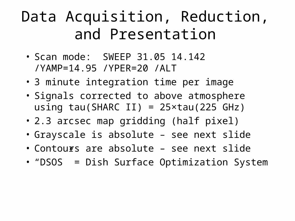
Data Acquisition, Reduction, and Presentation
• Scan mode: SWEEP 31.05 14.142 /YAMP=14.95 /YPER=20 /ALT
• 3 minute integration time per image• Signals corrected to above atmosphere using
tau(SHARC II) = 25×tau(225 GHz)• 2.3 arcsec map gridding (half pixel)• Grayscale is absolute – see next slide• Contours are absolute – see next slide• “DSOS” = Dish Surface Optimization System
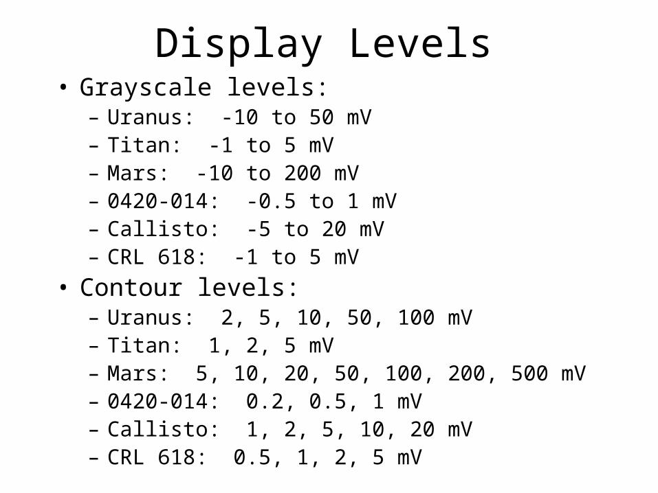
Display Levels• Grayscale levels:
– Uranus: -10 to 50 mV– Titan: -1 to 5 mV– Mars: -10 to 200 mV– 0420-014: -0.5 to 1 mV– Callisto: -5 to 20 mV– CRL 618: -1 to 5 mV
• Contour levels:– Uranus: 2, 5, 10, 50, 100 mV– Titan: 1, 2, 5 mV– Mars: 5, 10, 20, 50, 100, 200, 500 mV– 0420-014: 0.2, 0.5, 1 mV– Callisto: 1, 2, 5, 10, 20 mV– CRL 618: 0.5, 1, 2, 5 mV
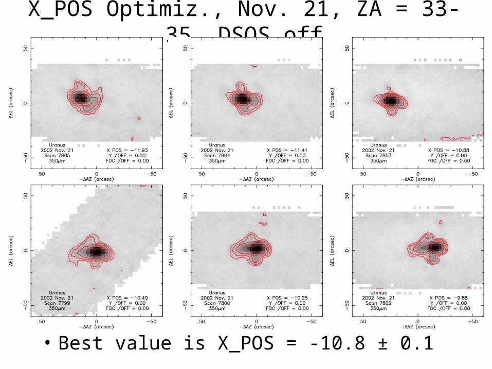
X_POS Optimiz., Nov. 21, ZA = 33-35, DSOS off
• Best value is X_POS = -10.8 ± 0.1
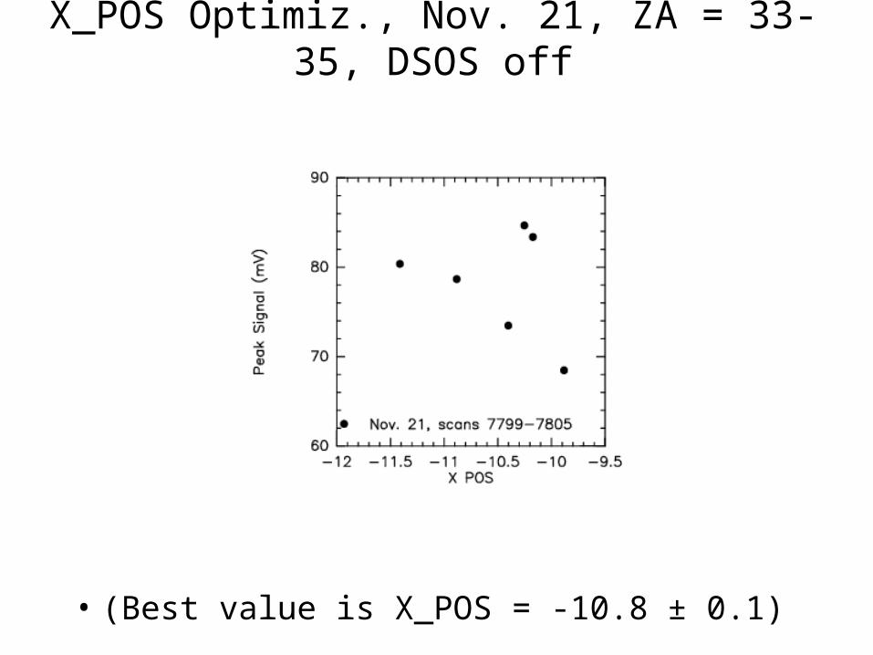
X_POS Optimiz., Nov. 21, ZA = 33-35, DSOS off
• (Best value is X_POS = -10.8 ± 0.1)
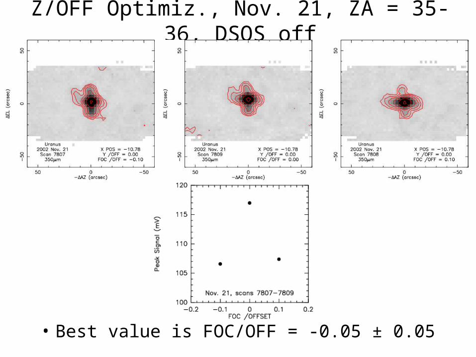
Z/OFF Optimiz., Nov. 21, ZA = 35-36, DSOS off
• Best value is FOC/OFF = -0.05 ± 0.05
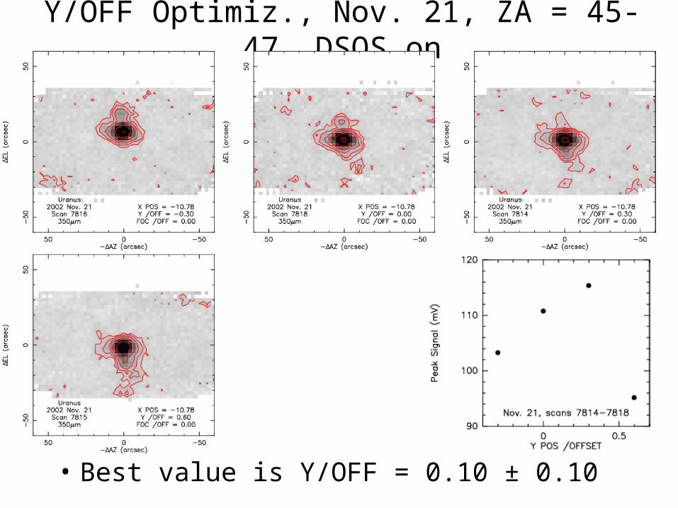
Y/OFF Optimiz., Nov. 21, ZA = 45-47, DSOS on
• Best value is Y/OFF = 0.10 ± 0.10
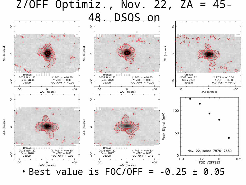
Z/OFF Optimiz., Nov. 22, ZA = 45-48, DSOS on
• Best value is FOC/OFF = -0.25 ± 0.05
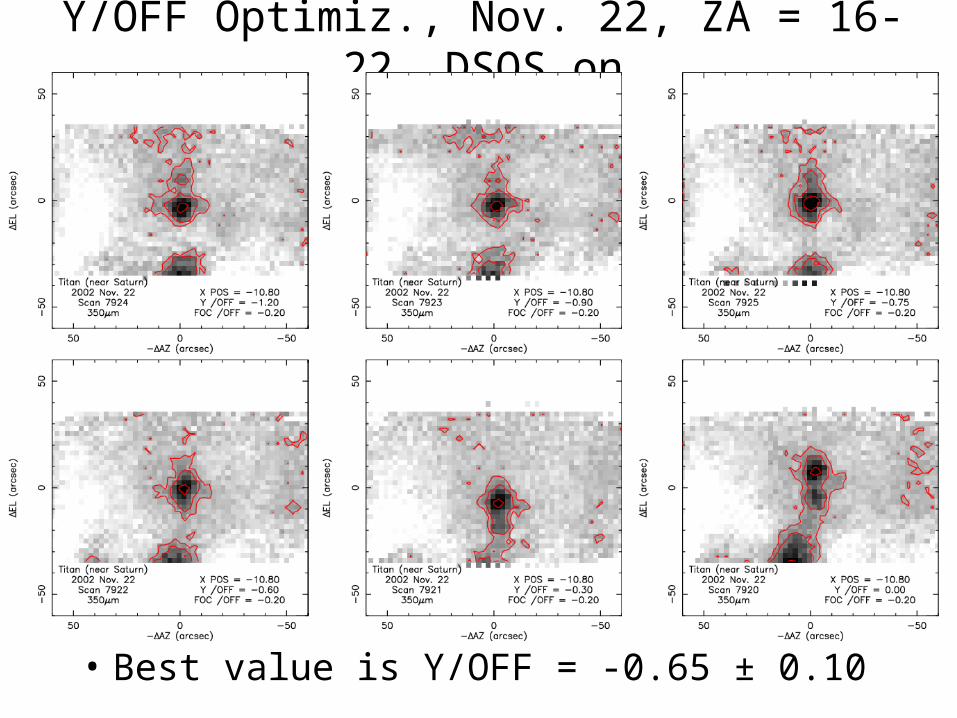
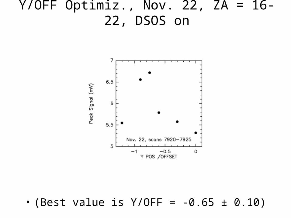
Y/OFF Optimiz., Nov. 22, ZA = 16-22, DSOS on
• Best value is Y/OFF = -0.65 ± 0.10
Y/OFF Optimiz., Nov. 22, ZA = 16-22, DSOS on
• (Best value is Y/OFF = -0.65 ± 0.10)
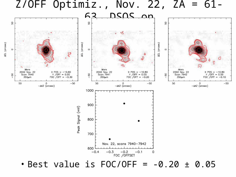
Z/OFF Optimiz., Nov. 22, ZA = 61-63, DSOS on
• Best value is FOC/OFF = -0.20 ± 0.05
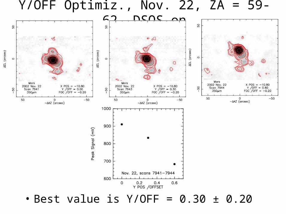
Y/OFF Optimiz., Nov. 22, ZA = 59-62, DSOS on
• Best value is Y/OFF = 0.30 ± 0.20
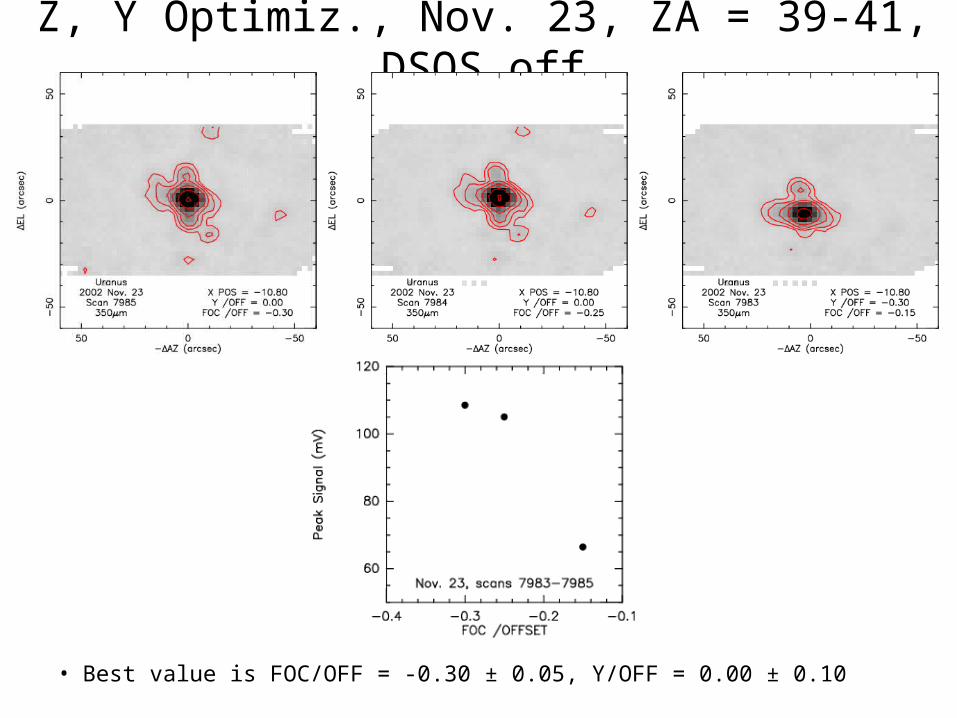
Z, Y Optimiz., Nov. 23, ZA = 39-41, DSOS off
• Best value is FOC/OFF = -0.30 ± 0.05, Y/OFF = 0.00 ± 0.10
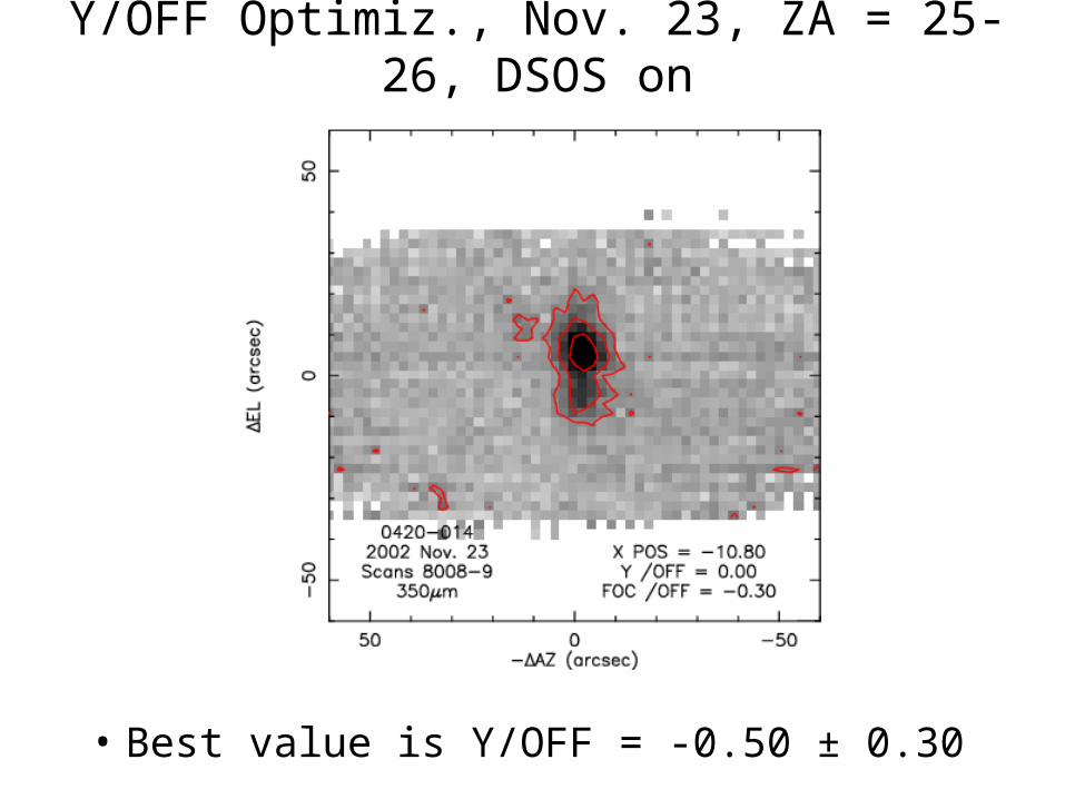
Y/OFF Optimiz., Nov. 23, ZA = 25-26, DSOS on
• Best value is Y/OFF = -0.50 ± 0.30
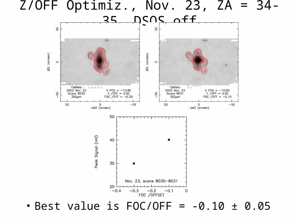
Z/OFF Optimiz., Nov. 23, ZA = 34-35, DSOS off
• Best value is FOC/OFF = -0.10 ± 0.05
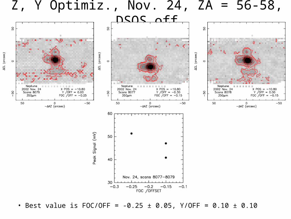
Z, Y Optimiz., Nov. 24, ZA = 56-58, DSOS off
• Best value is FOC/OFF = -0.25 ± 0.05, Y/OFF = 0.10 ± 0.10
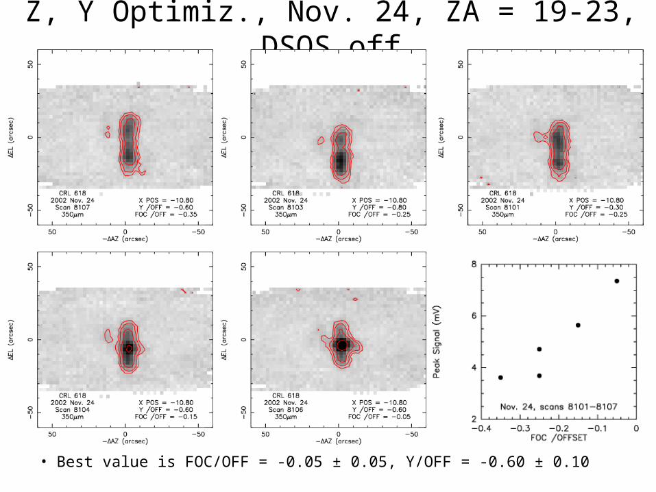
Z, Y Optimiz., Nov. 24, ZA = 19-23, DSOS off
• Best value is FOC/OFF = -0.05 ± 0.05, Y/OFF = -0.60 ± 0.10
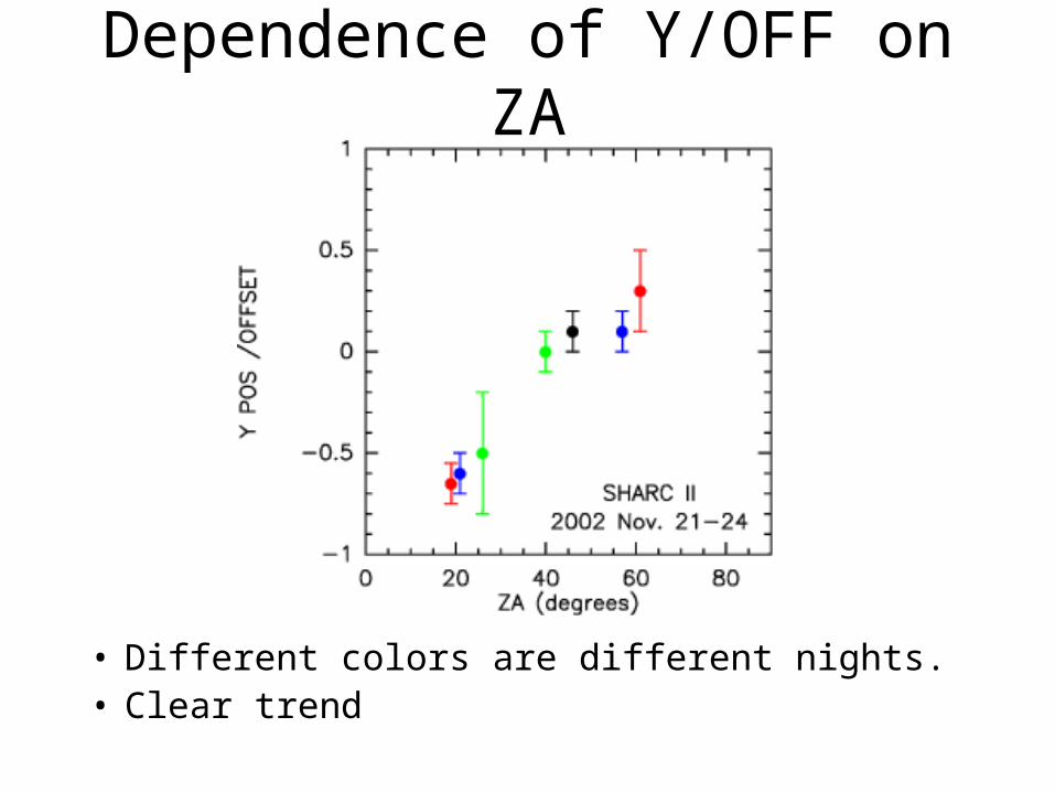
Dependence of Y/OFF on ZA
• Different colors are different nights.• Clear trend
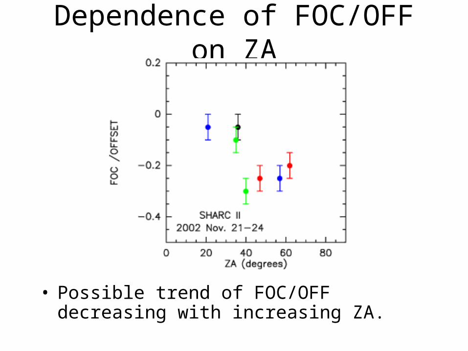
Dependence of FOC/OFF on ZA
• Possible trend of FOC/OFF decreasing with increasing ZA.