Embed Size (px)
Citation preview
Making Social Studies Come Alive with Google Earth and Discovery
Education
Shannon Wentworth Instructional Technology TeacherSixth Avenue Elementary School
Aurora, Colorado
Gwynn Moore Instructional Technology Teacher
Paris Elementary SchoolAurora, Colorado
TIE Conference 2009
Google Earth 5.0 can be downloaded for free at http://earth.google.com/.
Installing Google Earth
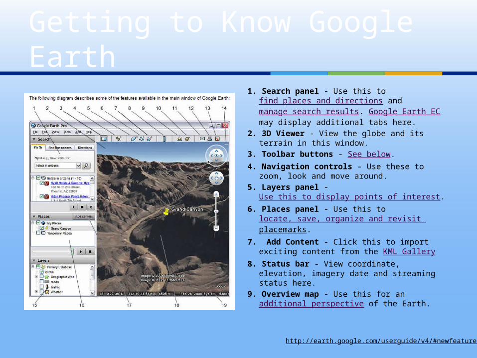
1. Search panel - Use this to find places and directions and manage search results. Google Earth EC may display additional tabs here.
2. 3D Viewer - View the globe and its terrain in this window.
3. Toolbar buttons - See below. 4. Navigation controls - Use these to
zoom, look and move around. 5. Layers panel -
Use this to display points of interest. 6. Places panel - Use this to
locate, save, organize and revisit placemarks.
7. Add Content - Click this to import exciting content from the KML Gallery
8. Status bar - View coordinate, elevation, imagery date and streaming status here.
9. Overview map - Use this for an additional perspective of the Earth.
Getting to Know Google Earth
http://earth.google.com/userguide/v4/#newfeatures

More Tools
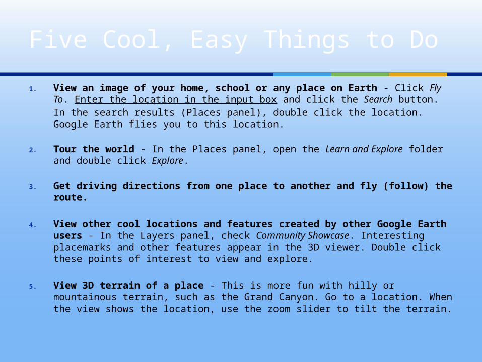
1. View an image of your home, school or any place on Earth - Click Fly To. Enter the location in the input box and click the Search button. In the search results (Places panel), double click the location. Google Earth flies you to this location.
2. Tour the world - In the Places panel, open the Learn and Explore folder and double click Explore.
3. Get driving directions from one place to another and fly (follow) the route.
4. View other cool locations and features created by other Google Earth users - In the Layers panel, check Community Showcase. Interesting placemarks and other features appear in the 3D viewer. Double click these points of interest to view and explore.
5. View 3D terrain of a place - This is more fun with hilly or mountainous terrain, such as the Grand Canyon. Go to a location. When the view shows the location, use the zoom slider to tilt the terrain.
Five Cool, Easy Things to Do
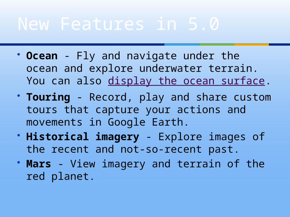
Ocean - Fly and navigate under the ocean and explore underwater terrain. You can also display the ocean surface.
Touring - Record, play and share custom tours that capture your actions and movements in Google Earth.
Historical imagery - Explore images of the recent and not-so-recent past.
Mars - View imagery and terrain of the red planet.
New Features in 5.0
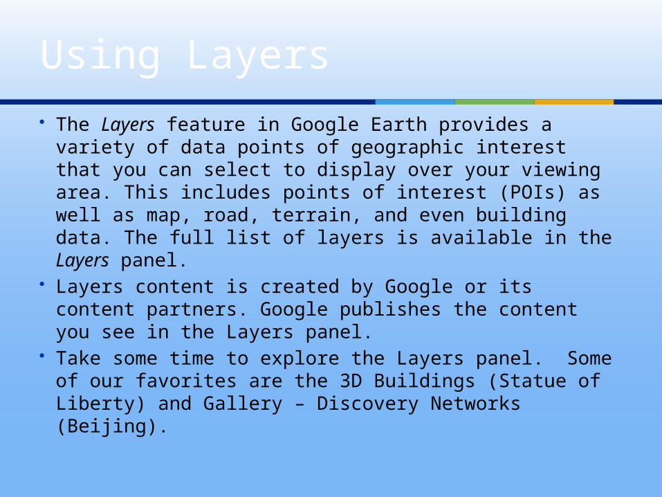
The Layers feature in Google Earth provides a variety of data points of geographic interest that you can select to display over your viewing area. This includes points of interest (POIs) as well as map, road, terrain, and even building data. The full list of layers is available in the Layers panel.
Layers content is created by Google or its content partners. Google publishes the content you see in the Layers panel.
Take some time to explore the Layers panel. Some of our favorites are the 3D Buildings (Statue of Liberty) and Gallery – Discovery Networks (Beijing).
Using Layers
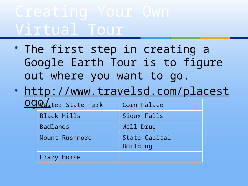
The first step in creating a Google Earth Tour is to figure out where you want to go.
http://www.travelsd.com/placestogo/
Creating Your Own Virtual Tour
Custer State Park Corn Palace
Black Hills Sioux Falls
Badlands Wall Drug
Mount Rushmore State Capital Building
Crazy Horse
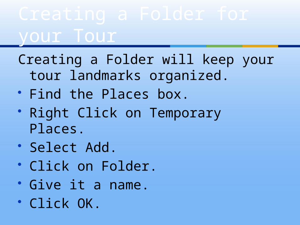
Creating a Folder will keep your tour landmarks organized.
Find the Places box. Right Click on Temporary Places. Select Add. Click on Folder. Give it a name. Click OK.
Creating a Folder for your Tour
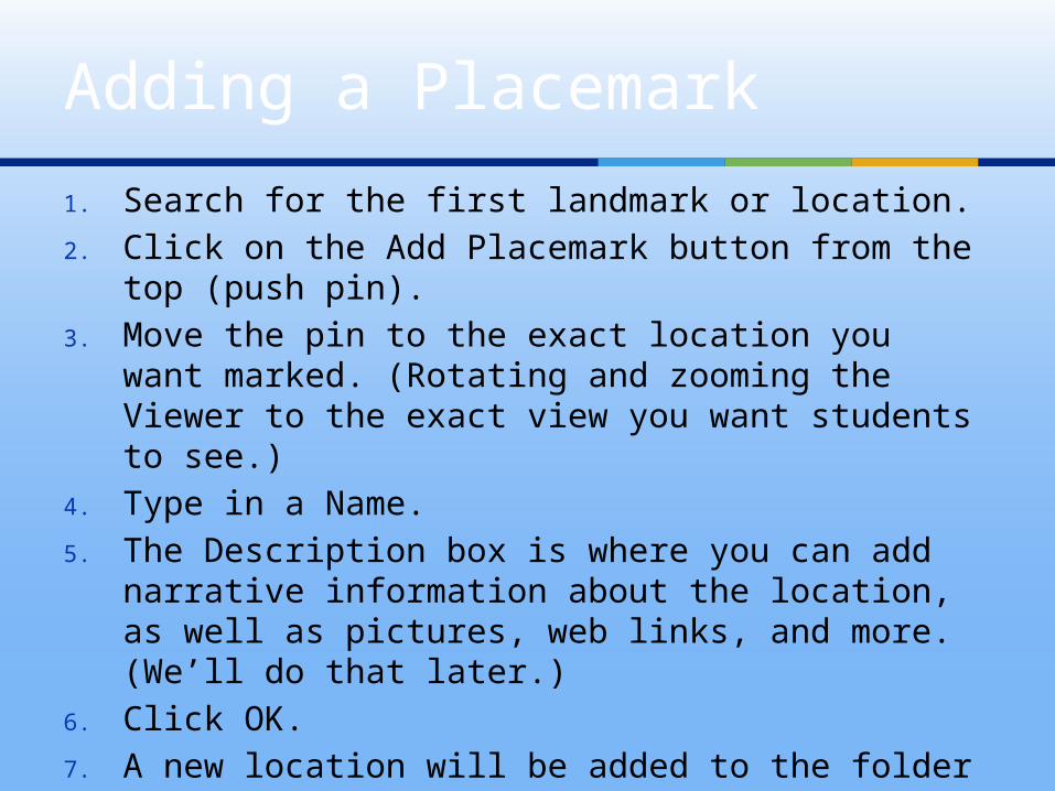
1. Search for the first landmark or location.2. Click on the Add Placemark button from the top
(push pin).3. Move the pin to the exact location you want
marked. (Rotating and zooming the Viewer to the exact view you want students to see.)
4. Type in a Name.5. The Description box is where you can add
narrative information about the location, as well as pictures, web links, and more. (We’ll do that later.)
6. Click OK.7. A new location will be added to the folder you
created in Temporary Places.8. Repeat these steps until all locations have been
added.
Adding a Placemark
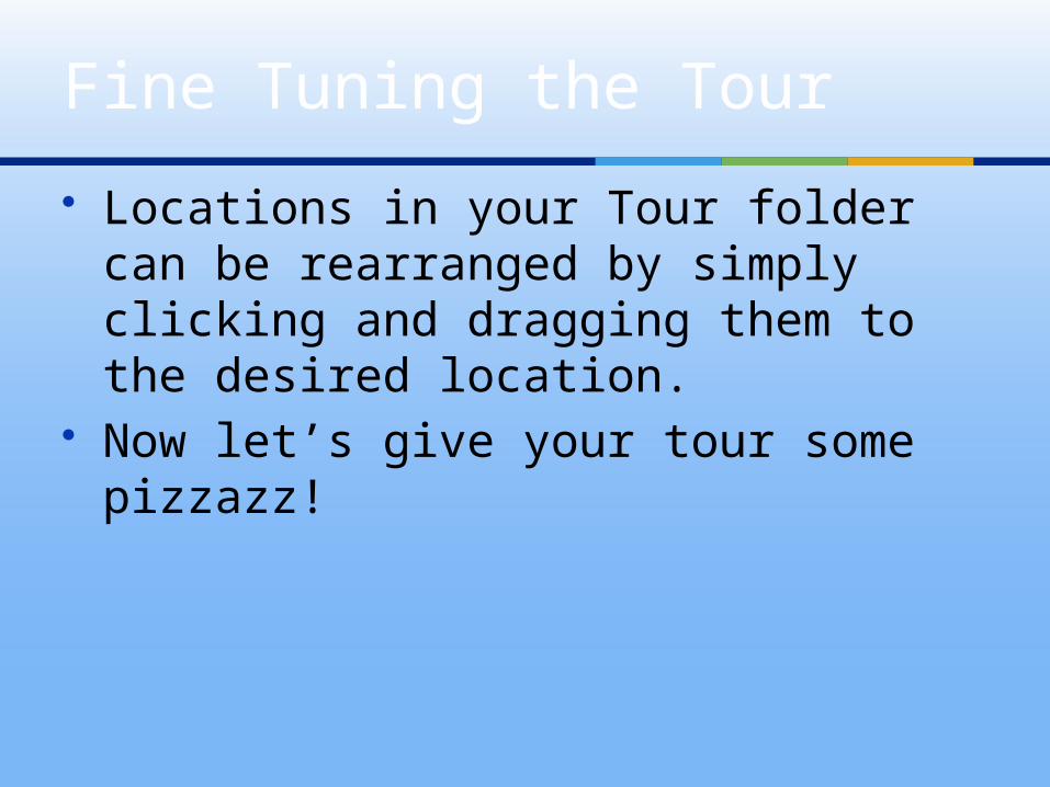
Locations in your Tour folder can be rearranged by simply clicking and dragging them to the desired location.
Now let’s give your tour some pizzazz!
Fine Tuning the Tour
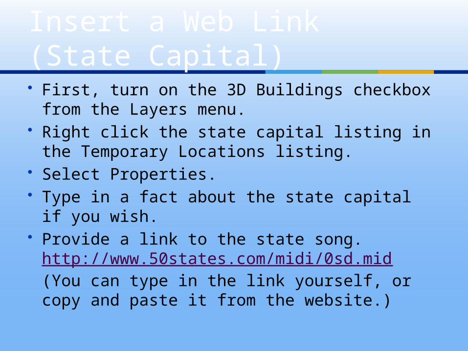
First, turn on the 3D Buildings checkbox from the Layers menu.
Right click the state capital listing in the Temporary Locations listing.
Select Properties. Type in a fact about the state capital if you
wish. Provide a link to the state song.
http://www.50states.com/midi/0sd.mid (You can type in the link yourself, or copy and paste it from the website.)
Insert a Web Link (State Capital)
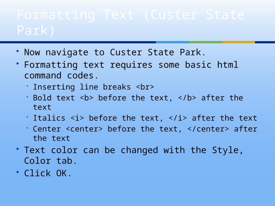
Now navigate to Custer State Park. Formatting text requires some basic html
command codes. Inserting line breaks <br> Bold text <b> before the text, </b> after the text Italics <i> before the text, </i> after the text Center <center> before the text, </center> after
the text Text color can be changed with the Style,
Color tab. Click OK.
Formatting Text (Custer State Park)
You can insert an image into a Google Earth bubble as long as it has been posted to a website. There are many free image hosting sites.
You can also use royalty free images. http://images2.pics4learning.com/cat
alog/m/mt.rushmore3.jpg Right click on the photo and go to
Properties.
Inserting Images (Mt Rushmore)
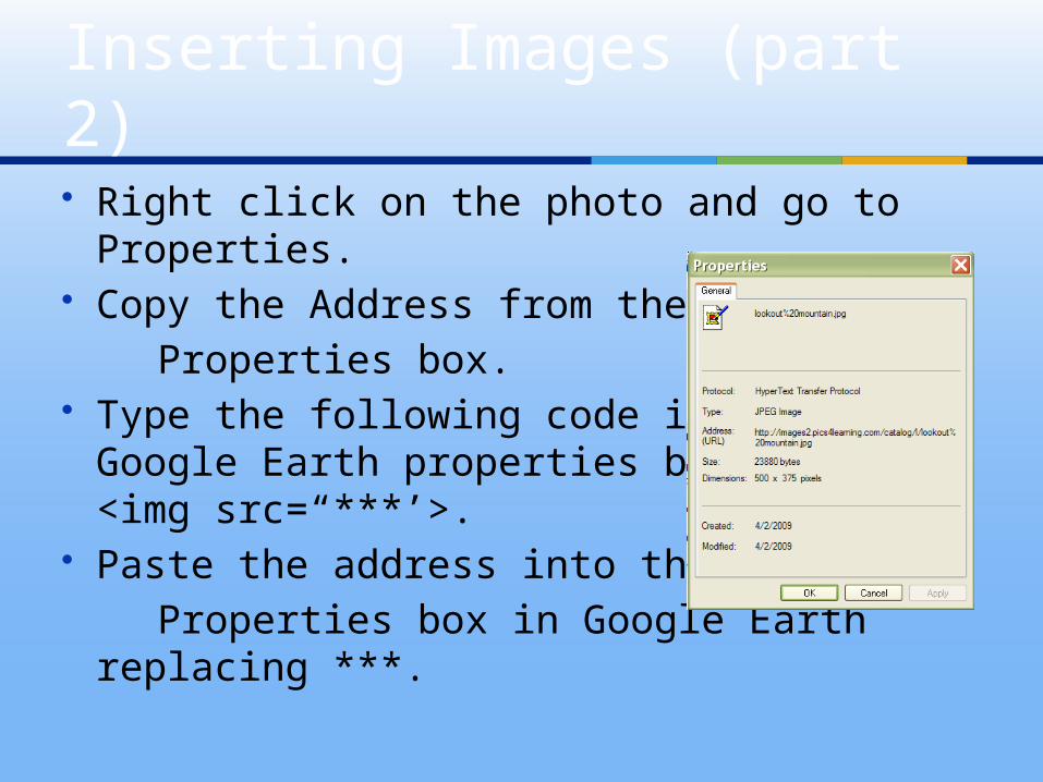
Right click on the photo and go to Properties.
Copy the Address from the Properties box. Type the following code into the
Google Earth properties box <img src=“***’>.
Paste the address into the Properties box in Google Earth replacing
***.
Inserting Images (part 2)
Discovery Education (United) Streaming is a great place to locate images.
Go to http://player.discoveryeducation.com/index.cfm?guidAssetId=28D37C7B-89B3-4D40-AC82-DDD0EFDE0A9F&blnFromSearch=1&productcode=US
Right click on the image and select Properties.
Copy the file address from the properties box. (Note: If the address/name is too long, you will also have to copy the name at the top.)
Discovery Ed Images (Badlands)
Type the following code into the Google Earth properties box <img src=“***’>.
Replace the astericks *** with the address for the image you wish to use.
Note – if the address is too long, it may not contain the whole file name. If that is the case, simply click back to Discovery Education Streaming and copy the rest of the file name from the top of the property box.
Don’t forget to copy and paste the citation from DE Streaming into your Google Earth bubble.
Discovery Ed Images part 2
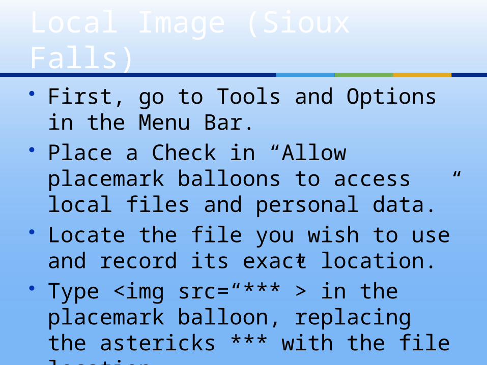
First, go to Tools and Options in the Menu Bar.
Place a Check in “Allow placemark balloons to access local files and personal data.”
Locate the file you wish to use and record its exact location.
Type <img src=“***”> in the placemark balloon, replacing the astericks *** with the file location.
Local Image (Sioux Falls)
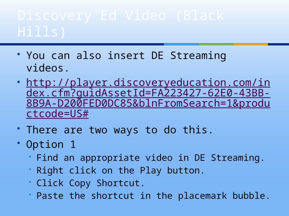
You can also insert DE Streaming videos. http://player.discoveryeducation.com/ind
ex.cfm?guidAssetId=FA223427-62E0-43BB-8B9A-D200FED0DC85&blnFromSearch=1&productcode=US#
There are two ways to do this. Option 1
Find an appropriate video in DE Streaming. Right click on the Play button. Click Copy Shortcut. Paste the shortcut in the placemark bubble.
Discovery Ed Video (Black Hills)
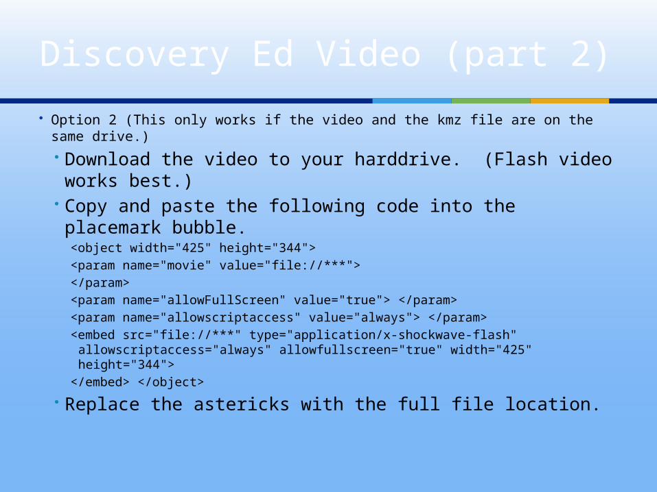
Option 2 (This only works if the video and the kmz file are on the same drive.) Download the video to your harddrive. (Flash video
works best.) Copy and paste the following code into the
placemark bubble.<object width="425" height="344"><param name="movie" value="file://***"></param><param name="allowFullScreen" value="true"> </param><param name="allowscriptaccess" value="always"> </param><embed src="file://***" type="application/x-shockwave-flash"
allowscriptaccess="always" allowfullscreen="true" width="425" height="344">
</embed> </object>
Replace the astericks with the full file location.
Discovery Ed Video (part 2)
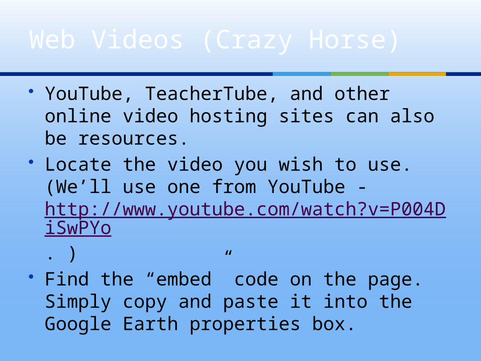
YouTube, TeacherTube, and other online video hosting sites can also be resources.
Locate the video you wish to use. (We’ll use one from YouTube - http://www.youtube.com/watch?v=P004DiSwPYo. )
Find the “embed” code on the page. Simply copy and paste it into the Google Earth properties box.
Web Videos (Crazy Horse)
Video can also come from live Webcams. These are inserted the same way still images
are. Type in the following code… <img src=“***”> Replace the astericks (***) with the link to the
Webcam. Note – some Webcams (Corn Palace) are actually
still shots that refresh every 30 seconds or so, while others (Sioux Falls) are constant video.
Webcams (Corn Palace)
Right click on the location from the side panel. Click Add then Image Overlay. This will open a
new window. Give the overlay a name and then navigate to
the web based image you wish to use. http://www.walldrug.com/images/wdmap_newweb.jpg
Adjust the transparency. You may also add a description. Click the OK button. (The overlay will show as a
separate item in the side panel.)
Image Overlays (Wall Drug)
Select your Tour Folder. Click File – Save As – Save Place As. Save your file as a .kmz file. It is now ready to be emailed, posted
on the Internet, or saved to a shared network drive for others to access.
Saving Your Tour
Select the Tour Folder. Click the Play Tour button from the
Sidebar. The Control Bar will appear at the
bottom left corner.
Playing Your Tour
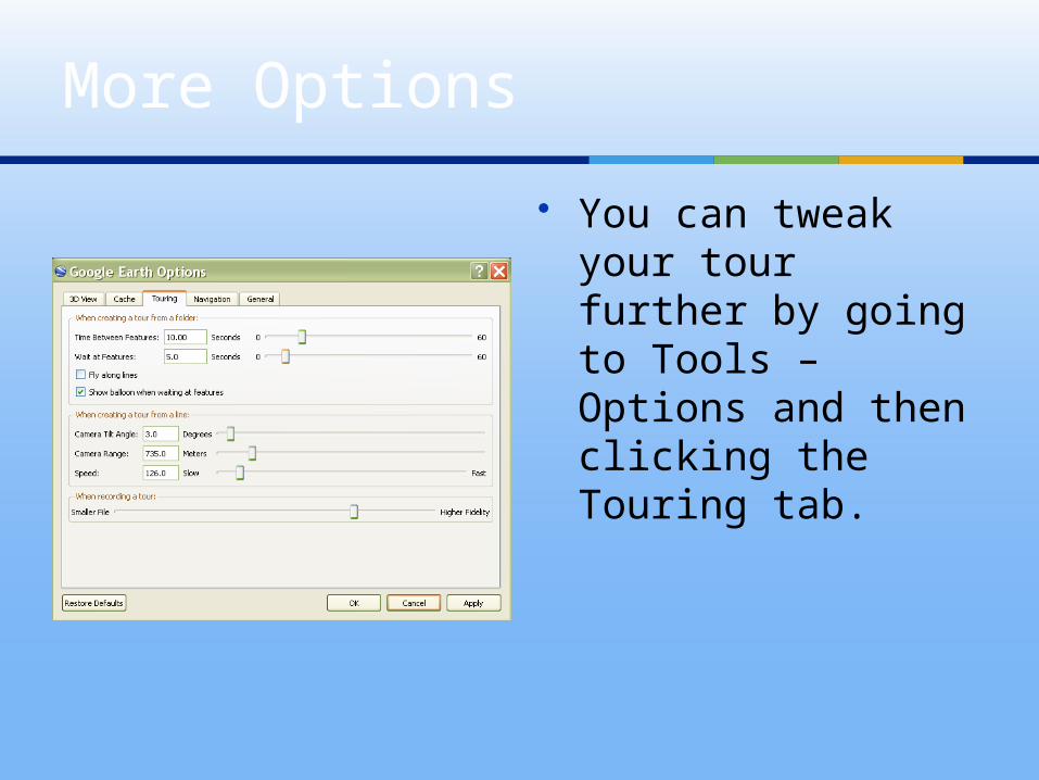
You can tweak your tour further by going to Tools – Options and then clicking the Touring tab.
More Options
Google Lit Trips http://www.googlelittrips.com
Plot your vacation
Family Tree Locations from
fiction or nonfiction books.
State history timeline
Other Lesson Ideas