Embed Size (px)
Citation preview

The SW Ecodistrict in Washington, D.C.Adding Energy, Water and Waste
to the Land Use / Transportation Equation
Otto Condon, Principal ZGF Architects LLP
Session
Transitcentric
Community Strengthening
Monday 10/15/2012
2:00 – 3:30PM

DOEDOE
DOE
FAA
FAA
GSA
HUD
Education
Cotton
Annex
USPS
NPS
NPS
The National Mall
SW Freeway
The SW Ecodistrict

An Existing “Transitcentric” Area
External PM Peak Hour Trips
L’Enfant Metro Station - 23,000 daily boardings* Smithsonian – 16,000 daily boardings (*not including rail-to-rail transfers)
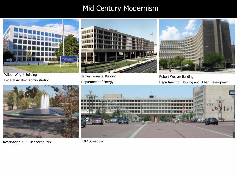
Wilbur Wright Building
Federal Aviation AdministrationJames Forrestal Building
Department of Energy
Robert Weaver Building
Department of Housing and Urban Development
Reservation 719 - Banneker Park
Mid Century Modernism
10th Street SW

Urban Renewal - 1955
10th Street, SW

Southwest After Urban Renewal
Residential Section
Federal/Office Section

7
Monumental Core Framework Plan - 2009
Southwest Rectangle
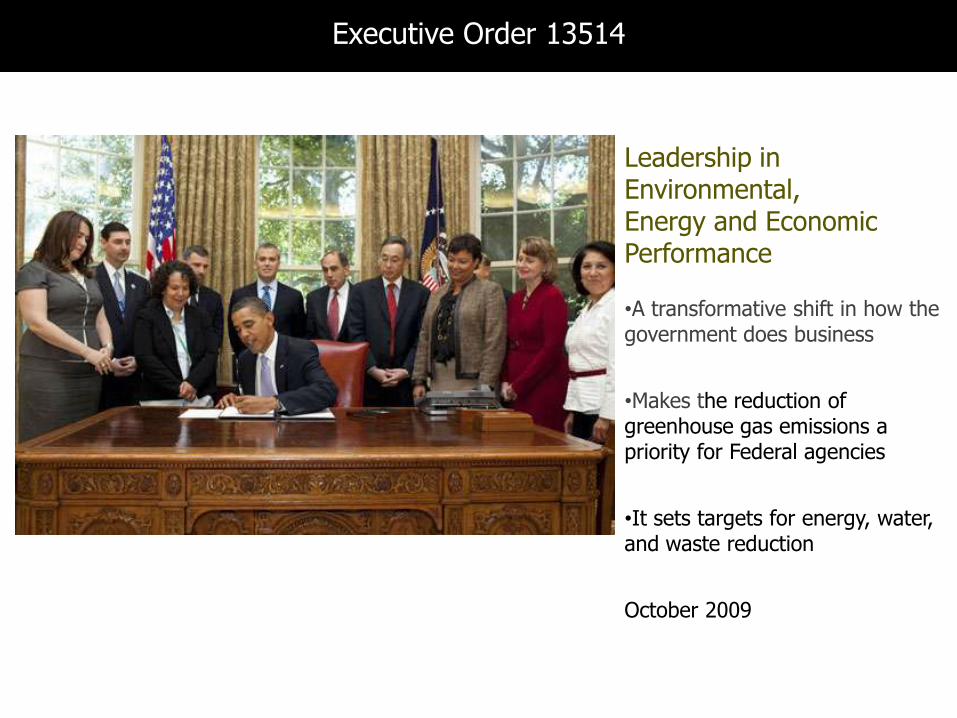
Leadership in Environmental, Energy and Economic Performance
•A transformative shift in how the government does business
•Makes the reduction of greenhouse gas emissions a priority for Federal agencies
•It sets targets for energy, water, and waste reduction
October 2009
Executive Order 13514

SW Ecodistrict Initiative Partnership
The SW Ecodistrict Task Force
DC Deputy Mayor for Planning & Economic Development District Department of the EnvironmentDistrict Department of TransportationFederal Aviation Administration National Park ServiceSmithsonian InstitutionU.S. Commission of Fine ArtsU.S. Congress, Architect of the Capitol U.S. Department of AgricultureU.S. Department of EducationU.S. Department of EnergyU.S. Environmental Protection Agency U.S. Department of Housing and Urban DevelopmentU.S. General Services AdministrationU.S. Postal Service
Lead Agency:
National Capital Planning Commission (NCPC)
in coordination with:
District Office of Planning
Consultant Team:
ZGF Architects, LLP Principal Consultant, Urban Design and Sustainability
ARUP Sustainability and Engineering
HR+A Advisors Economic Strategy
Kittelson & Associates Transportation
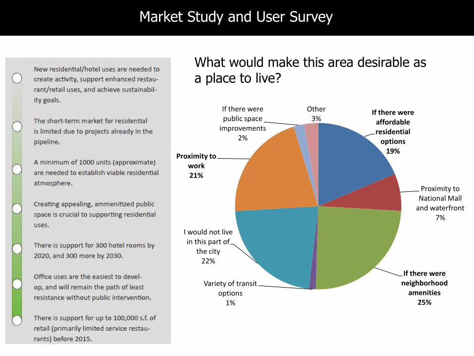
If there were affordable residential
options19%
Proximity to National Mall
and waterfront7%
If there were neighborhood
amenities 25%
Variety of transit options
1%
I would not live in this part of
the city22%
Proximity to work21%
If there were public space
improvements 2%
Other 3%
What would make this area desirable as a place to live?
Market Study and User Survey
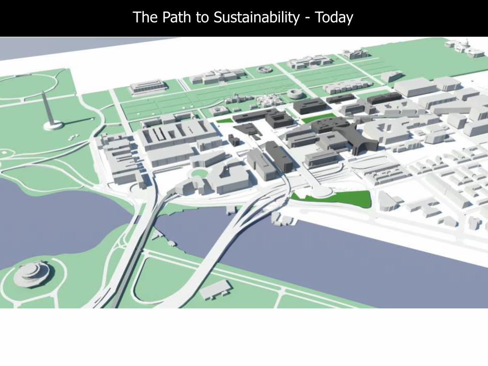
The Path to Sustainability - Today

Light RehabFull RehabRepurposeInfillRedevelopment
Solar CanopyCentral Utility PlantPark Space
The Path to Sustainability – Multiple Development Strategies
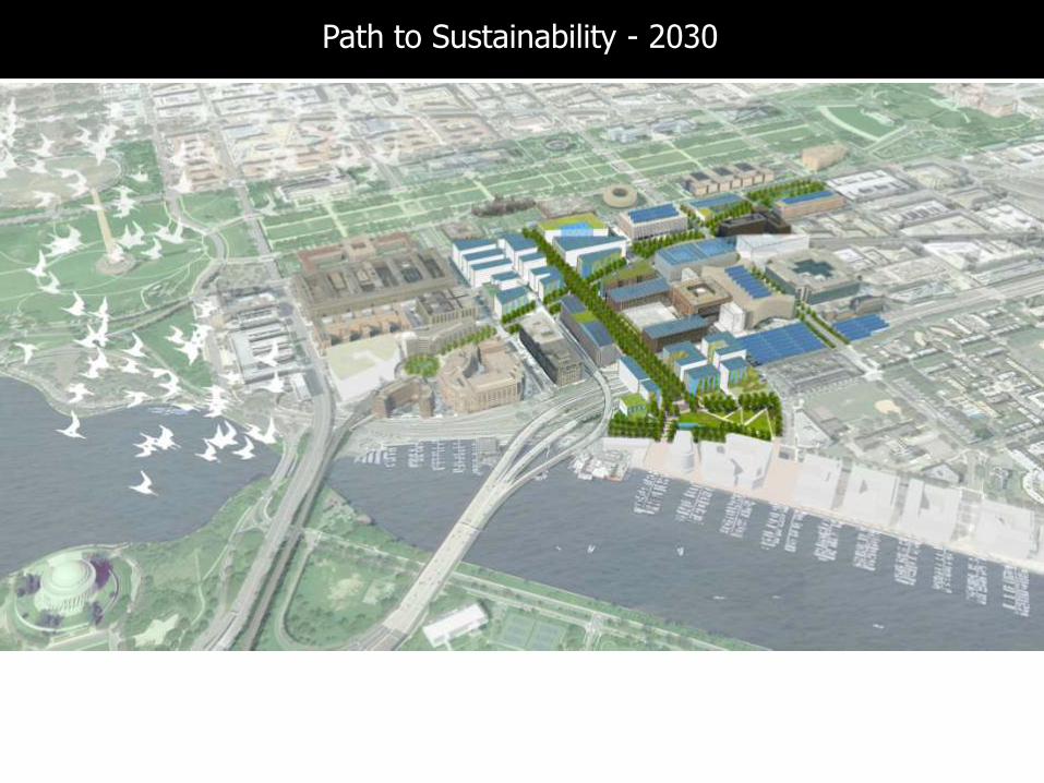
Guiding Successful RevitalizationPath to Sustainability - 2030

Land Use Public Spaces
Cultural
Facilities
Street
Network,
Function, and
Character
Transportation
14
Sustainability Framework – Neighborhood Development
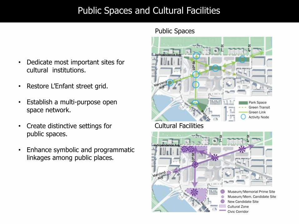
Museum/Memorial Prime Site
Museum/Mem. Candidate Site
New Candidate Site
Cultural Zone
Civic Corridor
Park Space
Green Transit
Green Link
Activity Node
• Dedicate most important sites for cultural institutions.
• Restore L’Enfant street grid.
• Establish a multi-purpose open space network.
• Create distinctive settings for public spaces.
• Enhance symbolic and programmatic linkages among public places.
Cultural Facilities
Public Spaces
Independence Ave
10
thS
t
7th
St
4th
St
Independence Ave
7th
St
4th
St
10
thS
t
Public Spaces and Cultural Facilities
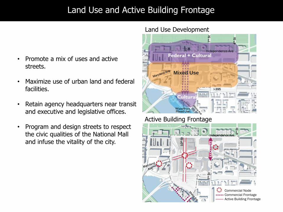
• Promote a mix of uses and active streets.
• Maximize use of urban land and federal facilities.
• Retain agency headquarters near transit and executive and legislative offices.
• Program and design streets to respect the civic qualities of the National Mall and infuse the vitality of the city.
Federal + Cultural
Mixed Use
Cultural
Independence Ave10
th
St
7th
St
4th
St
I-395
Independence Ave
10
thS
t
7th
St
4th
St
Commercial Node
Commercial Frontage
Active Building Frontage
Active Building Frontage
WaterfrontMixed Use
Land Use Development
Land Use and Active Building Frontage
• Maximize transportation choices.
• Maximize use of the rail corridor and transit network.
• Create an intermodal transit center.
• Provide easy pedestrian connections between types of transit.
• Study tour bus parking locations.
Metro Bus Route
Potential Bus Route
Potential Tour Bus Layover
Improved Access
Proposed Access
Existing Access
Bikeshare
Future
StreetcarBuses
Independence Ave
10
thS
t
7th
St
4th
St
Metro O.
Metro B.
Metro Y.
Metro G.
VRE
Commuter Rail Expansion
Transit Hub
Independence Ave
10
thS
t
7th
St
4th
St
Transit
Transportation
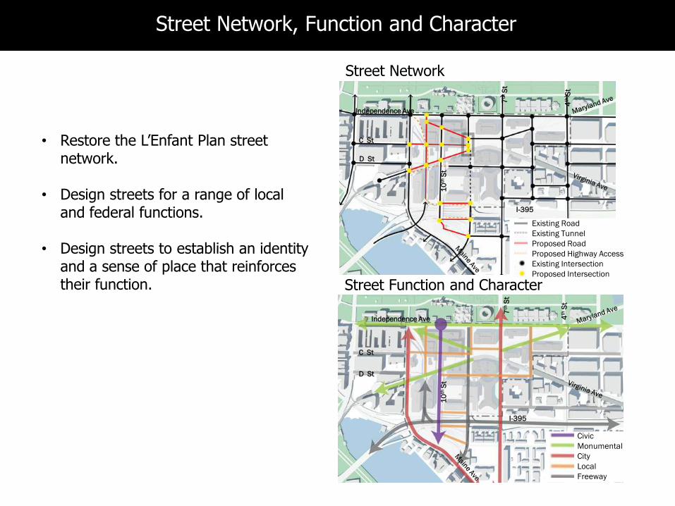
• Restore the L’Enfant Plan street network.
• Design streets for a range of local and federal functions.
• Design streets to establish an identity and a sense of place that reinforces their function.
Independence Ave
10
thS
t
7th
St
4th
St
I-395
Independence Ave
10
thS
t
7th
St
4th
St
I-395
Existing Road
Existing Tunnel
Proposed Road
Proposed Highway Access
Existing Intersection
Proposed Intersection
Civic
Monumental
City
Local
Freeway
Street Function and Character
C St
D St
C St
D St
Street Network
Street Network, Function and Character

WasteWaterEnergy Green
Infrastructure
Environmental Sustainability Framework

The District Energy Today
Coal generated electricity
SW Ecodistrict Goal
Strive for a zero net energy district as measured in carbon
Renewable Energy
Natural Gas
Central Utility Plant(burns natural gas)
SW Ecodistrict - Energy Goal

Energy
Potential Federal/ Mixed Use Microgrid
Potential Private Microgrid
Central Utility Plant
Existing System
Potential Expansion
Sewer Mining –Heat
10
thS
t
D St
C St
7th
St
4th
St
I-395
Energy – District Scale Strategy

Energy – Block and Building Scale Strategy

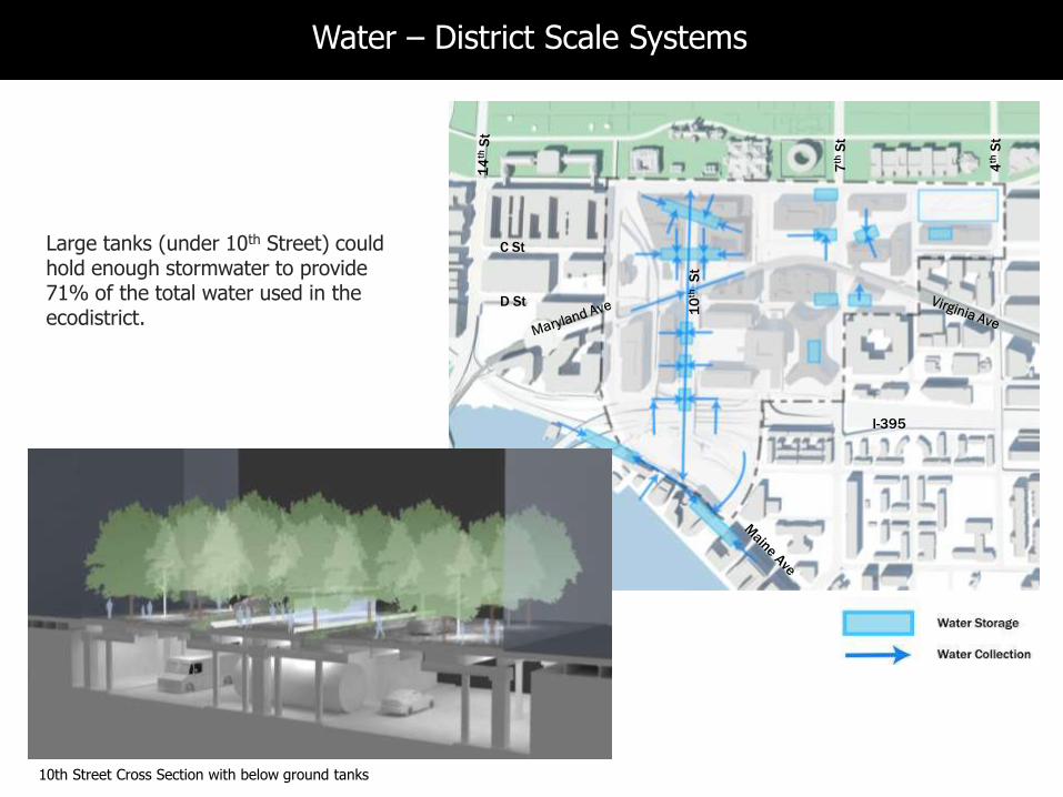
How much rain falls in the study area?
Retain/Reuse the rainfall from a 95th percentile rain event (1.7”)
92.4 million gallons
per year
Reduce potable water use to half of what we use now (per sf)
and
22 11gallons/sf/yr
Stormwater
Potable Water
SW Ecodistrict – Water Goals
7th
St
4th
St
I-395
D St
C StLarge tanks (under 10th Street) could hold enough stormwater to provide 71% of the total water used in the ecodistrict.
10th Street Cross Section with below ground tanks
10
thS
t
Water – District Scale Systems
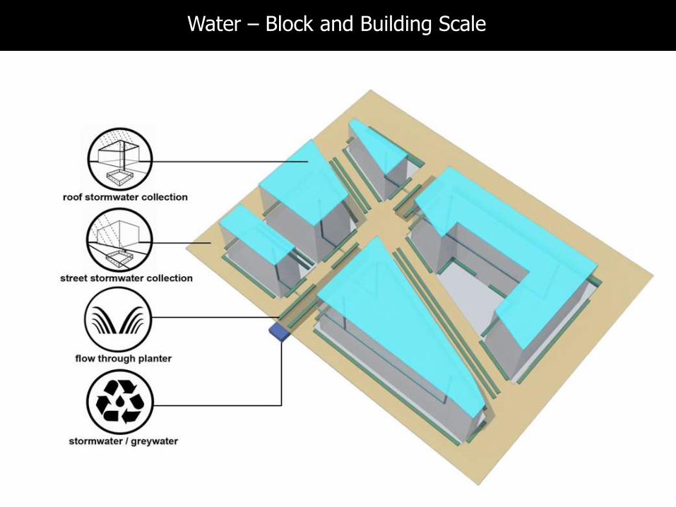
Water – Block and Building Scale
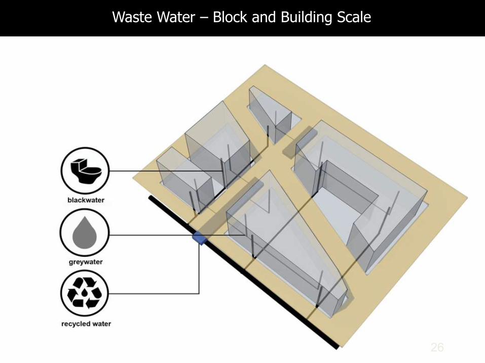
26
Waste Water – Block and Building Scale
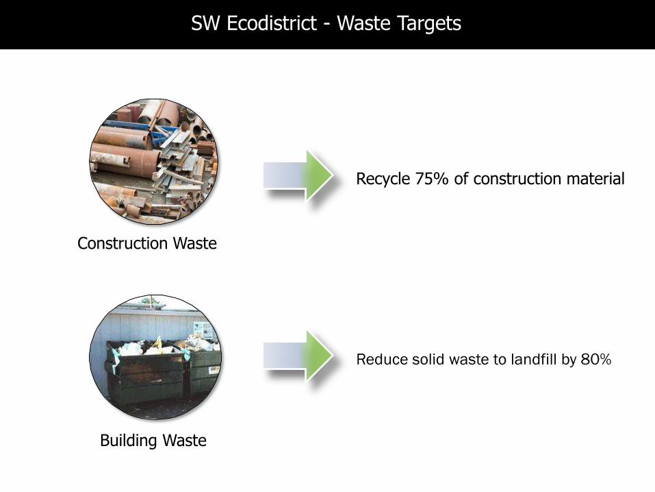
Construction Waste
Building Waste
SW Ecodistrict Goal
Reduce solid waste to landfill by 80%
Recycle 75% of construction material
SW Ecodistrict - Waste Targets
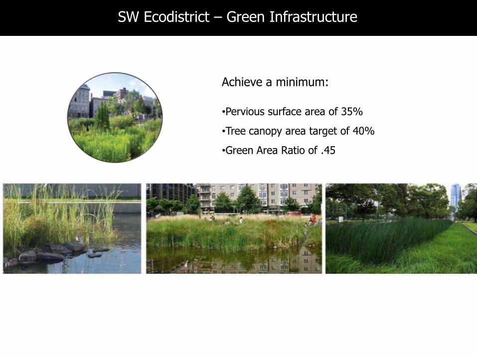
Achieve a minimum:
•Pervious surface area of 35%
•Tree canopy area target of 40%
•Green Area Ratio of .45
SW Ecodistrict – Green Infrastructure
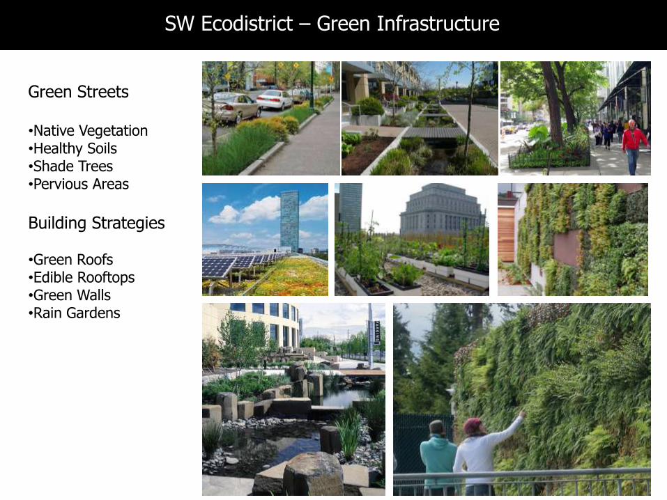
Green Streets
•Native Vegetation•Healthy Soils•Shade Trees •Pervious Areas
Building Strategies
•Green Roofs•Edible Rooftops•Green Walls•Rain Gardens
SW Ecodistrict – Green Infrastructure
30
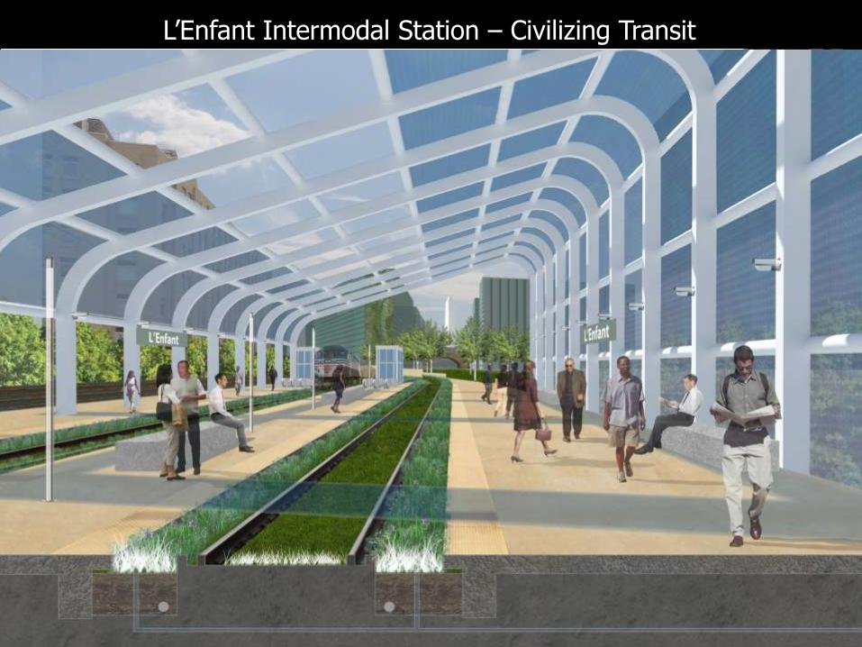
CSX/VRE/Virginia Ave Conceptual Study(ZGF)
L’Enfant Intermodal Station – Civilizing Transit
31
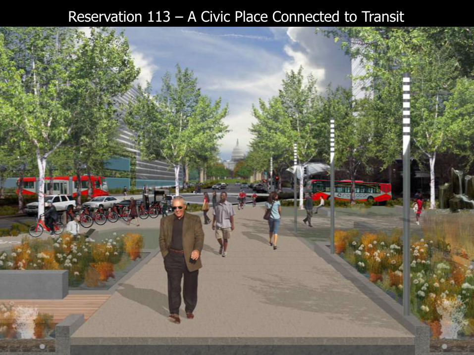
Reservation 113 – A Civic Place Connected to Transit

32
10th Street, SW – A High Performance Street
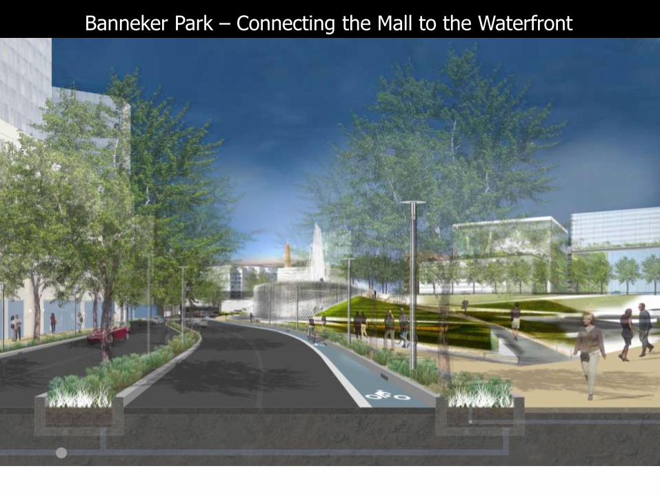
Banneker Park – Connecting the Mall to the Waterfront
834
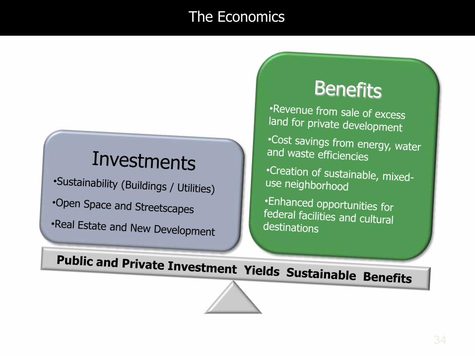
The Economics
8
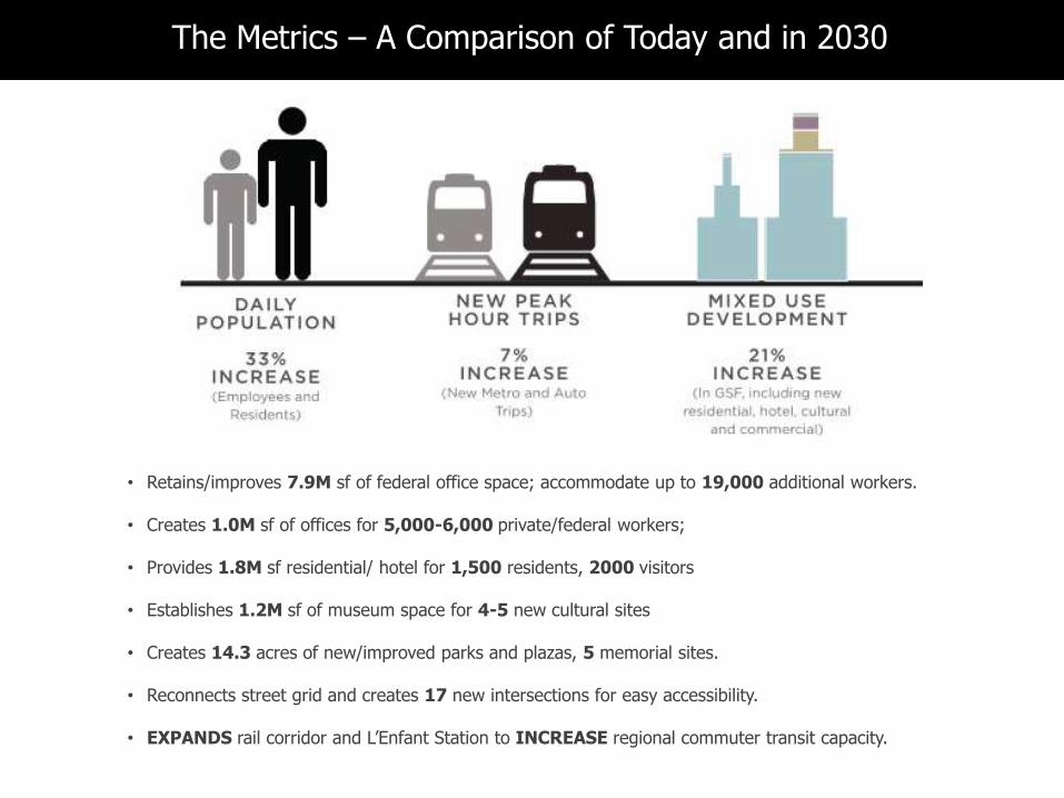
• Retains/improves 7.9M sf of federal office space; accommodate up to 19,000 additional workers.
• Creates 1.0M sf of offices for 5,000-6,000 private/federal workers;
• Provides 1.8M sf residential/ hotel for 1,500 residents, 2000 visitors
• Establishes 1.2M sf of museum space for 4-5 new cultural sites
• Creates 14.3 acres of new/improved parks and plazas, 5 memorial sites.
• Reconnects street grid and creates 17 new intersections for easy accessibility.
• EXPANDS rail corridor and L’Enfant Station to INCREASE regional commuter transit capacity.
The Metrics – A Comparison of Today and in 2030

8
The Metrics – A Comparison of Today and in 2030
• Allows for the capture and reuse of ALL the rainwater in the Ecodistrict throughout the year.
• Transforms the federally-owned central utility plant into a HIGHLY EFFICIENT and FINANCIALLY SUCCESSFUL energy model.
8
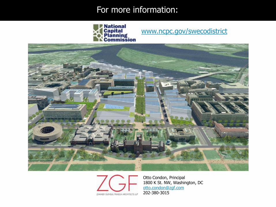
www.ncpc.gov/swecodistrict
For more information:
Otto Condon, Principal1800 K St. NW, Washington, DC [email protected]