Embed Size (px)
Citation preview
Semantic Evolution of Geospatial Semantic Evolution of Geospatial Web Services:Web Services:
Use Cases and Experiments in the Use Cases and Experiments in the Geospatial Semantic WebGeospatial Semantic Web
Joshua Lieberman, Todd Pehle, Mike DeanTraverse Technologies, Inc.,
Northrop Grumman Information Technology / TASC, BBN Technologies
© 2004 Traverse Technologies Inc.
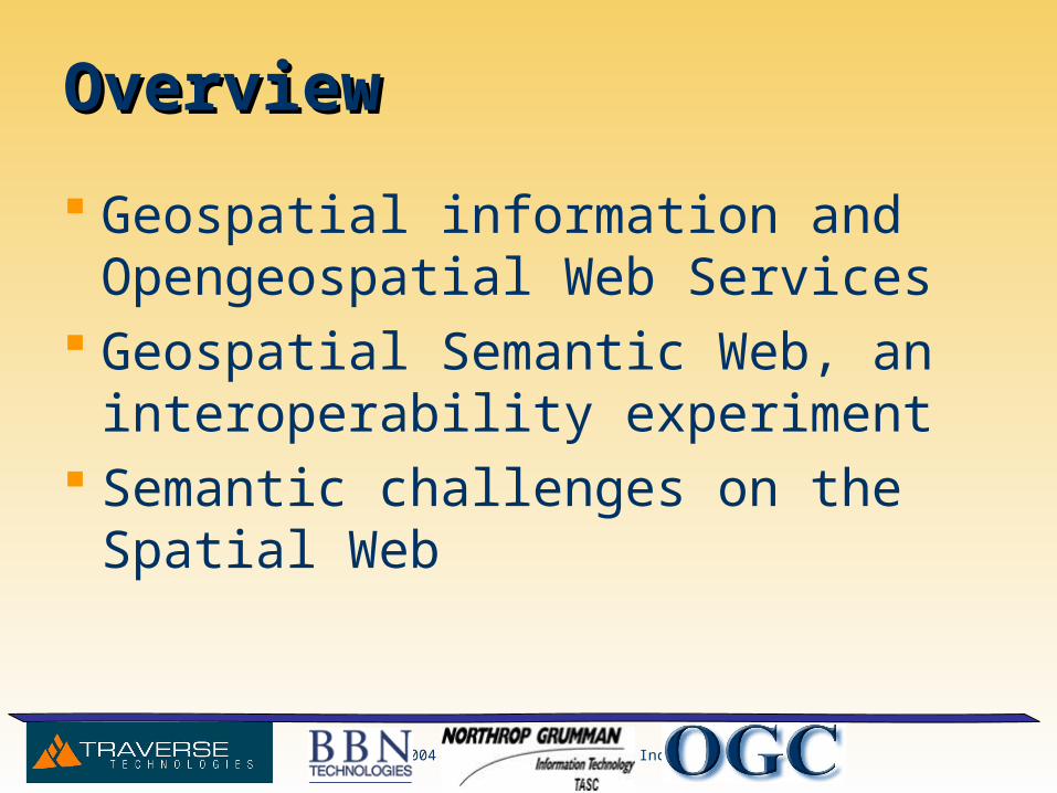
OverviewOverview
Geospatial information and Opengeospatial Web Services
Geospatial Semantic Web, an interoperability experiment
Semantic challenges on the Spatial Web
© 2004 Traverse Technologies Inc.
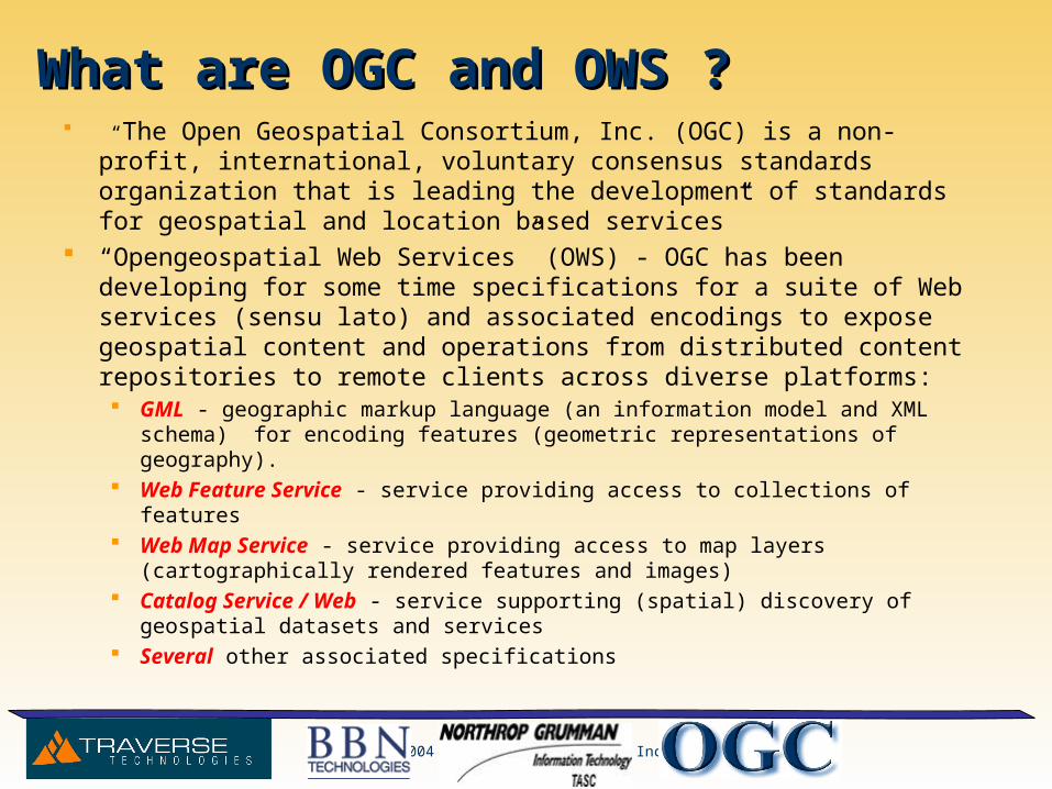
What are OGC and OWS ?What are OGC and OWS ? “The Open Geospatial Consortium, Inc. (OGC) is a non-profit,
international, voluntary consensus standards organization that is leading the development of standards for geospatial and location based services”
“Opengeospatial Web Services” (OWS) - OGC has been developing for some time specifications for a suite of Web services (sensu lato) and associated encodings to expose geospatial content and operations from distributed content repositories to remote clients across diverse platforms: GML - geographic markup language (an information model and XML
schema) for encoding features (geometric representations of geography). Web Feature Service - service providing access to collections of features Web Map Service - service providing access to map layers
(cartographically rendered features and images) Catalog Service / Web - service supporting (spatial) discovery of
geospatial datasets and services Several other associated specifications
© 2004 Traverse Technologies Inc.
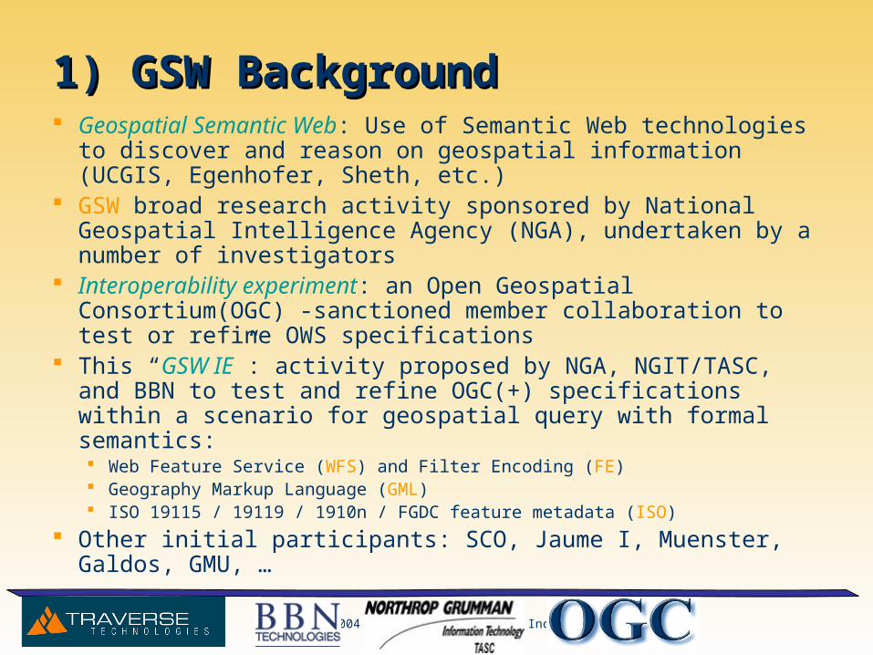
1) GSW Background1) GSW Background Geospatial Semantic Web: Use of Semantic Web technologies to
discover and reason on geospatial information (UCGIS, Egenhofer, Sheth, etc.)
GSW broad research activity sponsored by National Geospatial Intelligence Agency (NGA), undertaken by a number of investigators
Interoperability experiment: an Open Geospatial Consortium(OGC) -sanctioned member collaboration to test or refine OWS specifications
This “GSW IE”: activity proposed by NGA, NGIT/TASC, and BBN to test and refine OGC(+) specifications within a scenario for geospatial query with formal semantics: Web Feature Service (WFS) and Filter Encoding (FE) Geography Markup Language (GML) ISO 19115 / 19119 / 1910n / FGDC feature metadata (ISO)
Other initial participants: SCO, Jaume I, Muenster, Galdos, GMU, …
© 2004 Traverse Technologies Inc.
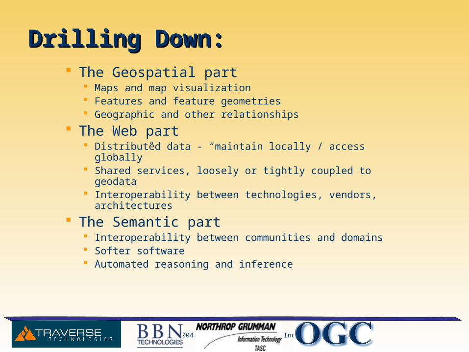
Drilling Down:Drilling Down: The Geospatial part
Maps and map visualization Features and feature geometries Geographic and other relationships
The Web part Distributed data - “maintain locally / access globally” Shared services, loosely or tightly coupled to geodata Interoperability between technologies, vendors, architectures
The Semantic part Interoperability between communities and domains Softer software Automated reasoning and inference
© 2004 Traverse Technologies Inc.
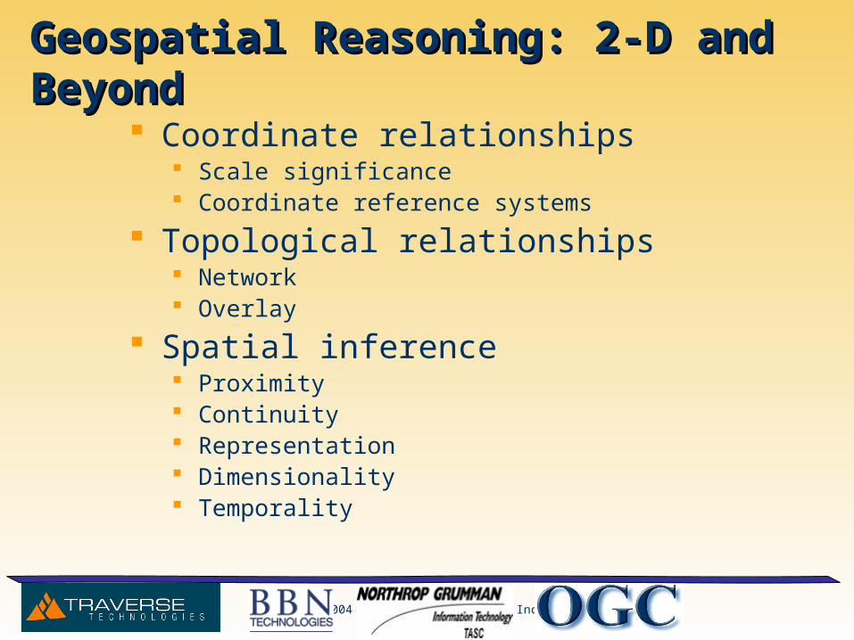
Geospatial Reasoning: 2-D and BeyondGeospatial Reasoning: 2-D and Beyond
Coordinate relationships Scale significance Coordinate reference systems
Topological relationships Network Overlay
Spatial inference Proximity Continuity Representation Dimensionality Temporality
© 2004 Traverse Technologies Inc.
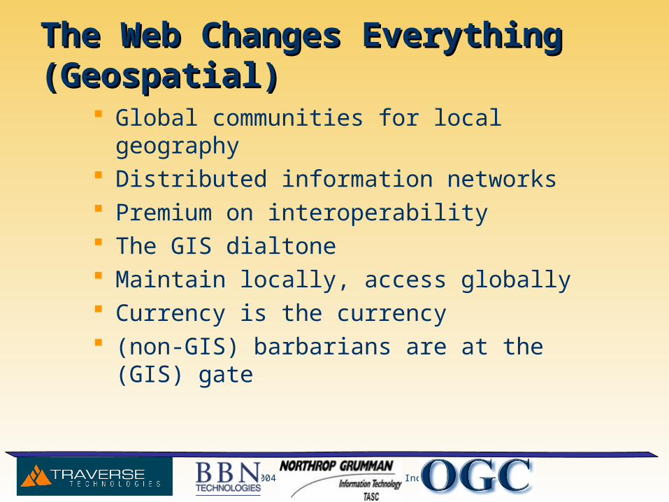
The Web Changes Everything (Geospatial)The Web Changes Everything (Geospatial)
Global communities for local geography Distributed information networks Premium on interoperability The GIS dialtone Maintain locally, access globally Currency is the currency (non-GIS) barbarians are at the (GIS) gate
© 2004 Traverse Technologies Inc.
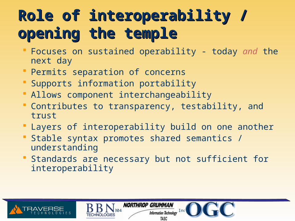
Role of interoperability / opening the templeRole of interoperability / opening the temple
Focuses on sustained operability - today and the next day Permits separation of concerns Supports information portability Allows component interchangeability Contributes to transparency, testability, and trust Layers of interoperability build on one another Stable syntax promotes shared semantics / understanding Standards are necessary but not sufficient for
interoperability
© 2004 Traverse Technologies Inc.
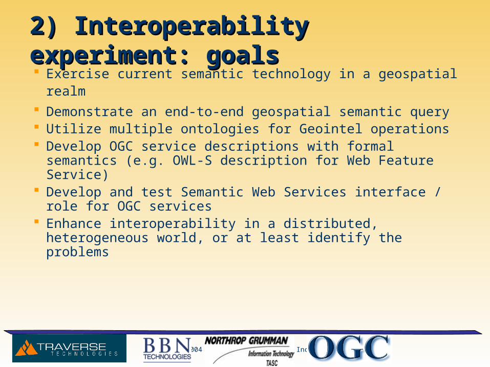
2) Interoperability experiment: goals2) Interoperability experiment: goals Exercise current semantic technology in a geospatial realm Demonstrate an end-to-end geospatial semantic query Utilize multiple ontologies for Geointel operations Develop OGC service descriptions with formal semantics (e.g.
OWL-S description for Web Feature Service) Develop and test Semantic Web Services interface / role for OGC
services Enhance interoperability in a distributed, heterogeneous world, or
at least identify the problems
© 2004 Traverse Technologies Inc.
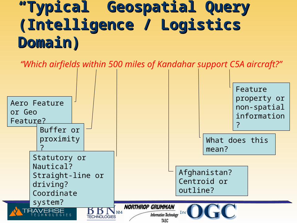
““Typical” Geospatial Query Typical” Geospatial Query (Intelligence / Logistics Domain)(Intelligence / Logistics Domain)
“Which airfields within 500 miles of Kandahar support C5A aircraft?”
Aero Feature or Geo Feature?
Buffer or proximity?
Statutory or Nautical?Straight-line or driving?Coordinate system? Afghanistan?
Centroid or outline?
What does this mean?
Feature property or non-spatial information?
© 2004 Traverse Technologies Inc.
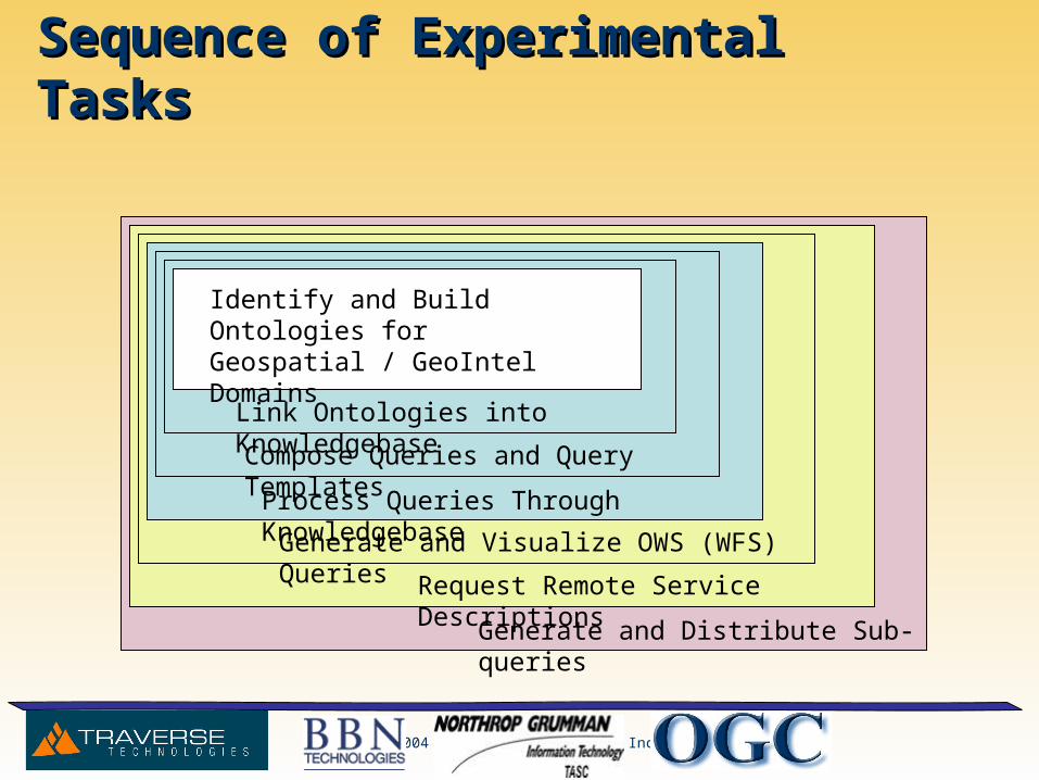
Sequence of Experimental TasksSequence of Experimental Tasks
Link Ontologies into Knowledgebase
Generate and Visualize OWS (WFS) Queries
Request Remote Service Descriptions
Process Queries Through Knowledgebase
Compose Queries and Query Templates
Generate and Distribute Sub-queries
Identify and Build Ontologies for Geospatial / GeoIntel Domains
© 2004 Traverse Technologies Inc.
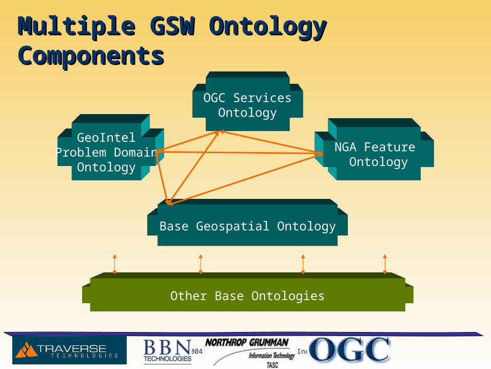
Multiple GSW Ontology ComponentsMultiple GSW Ontology Components
GeoIntelProblem Domain
Ontology
Base Geospatial Ontology
NGA Feature Ontology
OGC ServicesOntology
Other Base Ontologies

© 2004 Traverse Technologies Inc.
Initial ECDM Selections for ExperimentInitial ECDM Selections for Experiment
AirportAirport
RunwayRunway
TaxiwayTaxiwayApronApron
ObstructionObstructionThresholdThreshold
RouteRoute
PlanePlane
ItineraryItinerary
RepairRepair
WeatherWeather
Nav AidsNav AidsServiceService
FuelFuel
LightingLighting
VORVOR
NDBNDBILSILS
MLSMLS
TACANTACAN
© 2004 Traverse Technologies Inc.
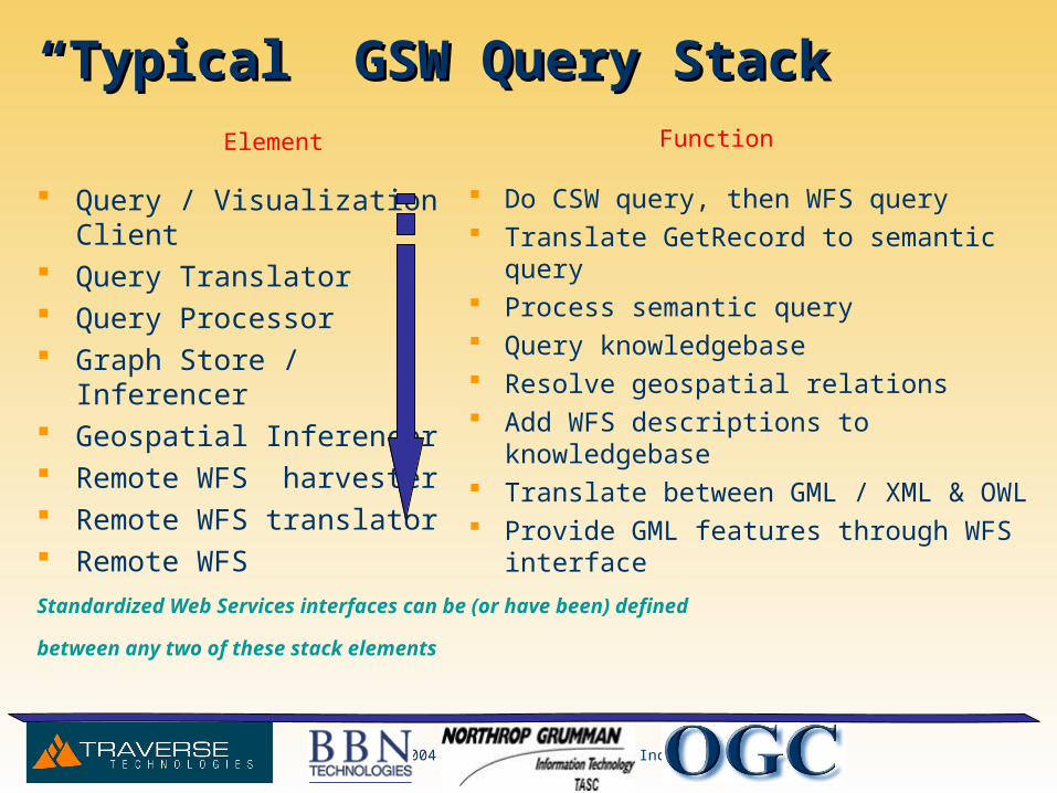
““Typical” GSW Query StackTypical” GSW Query Stack
Query / Visualization Client Query Translator Query Processor Graph Store / Inferencer Geospatial Inferencer Remote WFS harvester Remote WFS translator Remote WFS
Do CSW query, then WFS query Translate GetRecord to semantic query Process semantic query Query knowledgebase Resolve geospatial relations Add WFS descriptions to knowledgebase Translate between GML / XML & OWL Provide GML features through WFS interface
Standardized Web Services interfaces can be (or have been) defined
between any two of these stack elements
Element Function
© 2004 Traverse Technologies Inc.
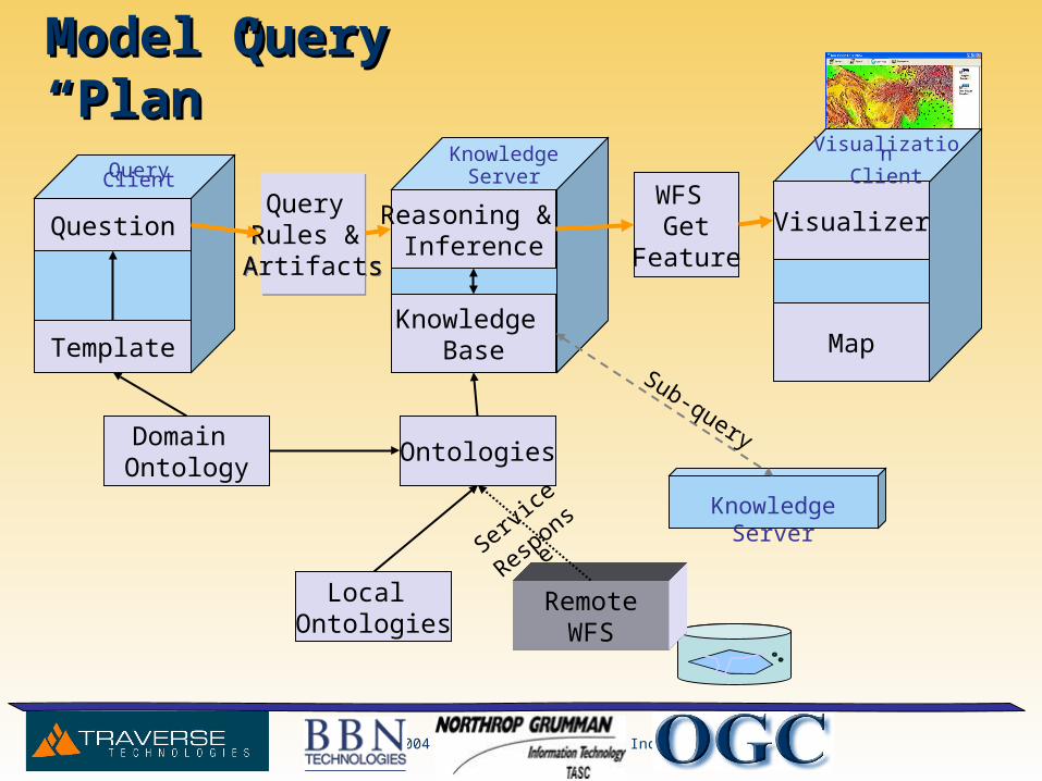
Model Query “Plan”Model Query “Plan”
Question
Template
Query Rules & Artifacts
Query Rules & Artifacts
Knowledge Base
Reasoning & Inference
Domain Ontology
Ontologies
RemoteWFS
WFS Get
Feature
Local Ontologies
Visualizer
Map
KnowledgeServer
Knowledge Server
Sub-query
Service Response
Query ClientVisualization
Client
© 2004 Traverse Technologies Inc.
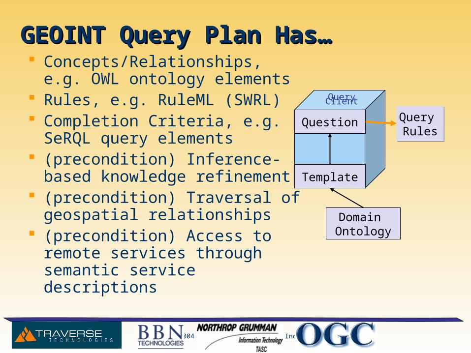
GEOINT Query Plan Has…GEOINT Query Plan Has… Concepts/Relationships, e.g. OWL
ontology elements Rules, e.g. RuleML (SWRL) Completion Criteria, e.g. SeRQL
query elements (precondition) Inference-based
knowledge refinement (precondition) Traversal of geospatial
relationships (precondition) Access to remote
services through semantic service descriptions
Question
Template
Query Rules
Query Rules
Domain Ontology
Query Client
© 2004 Traverse Technologies Inc.
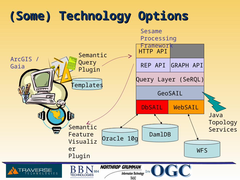
(Some) Technology Options(Some) Technology Options
ArcGIS / Gaia
Semantic Feature Visualizer Plugin
Semantic Query Plugin
DbSAIL WebSAIL
GeoSAIL
Query Layer (SeRQL)
HTTP API
Sesame Processing Framework
DamlDB
WFS
Java Topology Services
Templates
REP API GRAPH API
Oracle 10g
© 2004 Traverse Technologies Inc.
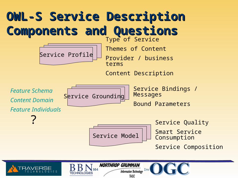
OWL-S Service Description Components and OWL-S Service Description Components and QuestionsQuestions
Type of Service
Themes of Content
Provider / business terms
Content Description
Service Bindings / Messages
Bound Parameters
Service Quality
Smart Service Consumption
Service Composition
Service Profile
Service Grounding
Service Model
Feature Schema
Content Domain
Feature Individuals
?
© 2004 Traverse Technologies Inc.
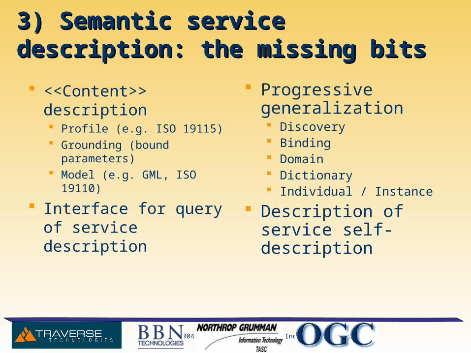
3) Semantic service description: the missing 3) Semantic service description: the missing bitsbits
<<Content>> description Profile (e.g. ISO 19115) Grounding (bound parameters) Model (e.g. GML, ISO 19110)
Interface for query of service description
Progressive generalization Discovery Binding Domain Dictionary Individual / Instance
Description of service self-description
© 2004 Traverse Technologies Inc.
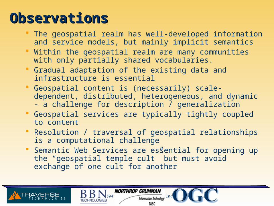
ObservationsObservations The geospatial realm has well-developed information and service
models, but mainly implicit semantics Within the geospatial realm are many communities with only partially
shared vocabularies. Gradual adaptation of the existing data and infrastructure is essential Geospatial content is (necessarily) scale-dependent, distributed,
heterogeneous, and dynamic - a challenge for description / generalization
Geospatial services are typically tightly coupled to content Resolution / traversal of geospatial relationships is a computational
challenge Semantic Web Services are essential for opening up the “geospatial
temple cult” but must avoid exchange of one cult for another