Embed Size (px)
Citation preview
Selecting and Selecting and
Displaying FeaturesDisplaying Features
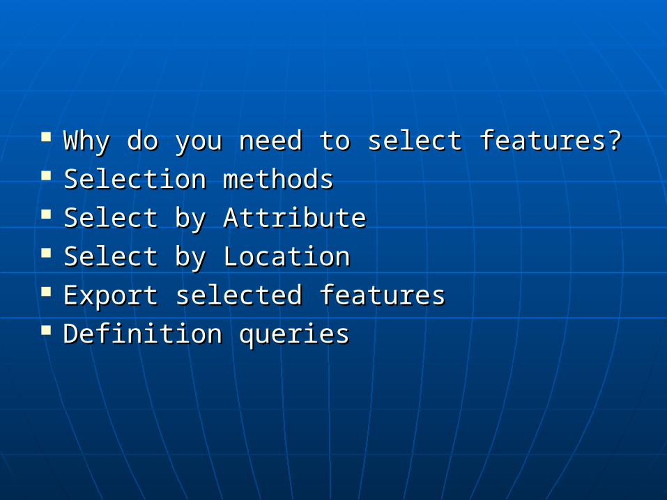
Why do you need to select features?Why do you need to select features? Selection methodsSelection methods Select by AttributeSelect by Attribute Select by LocationSelect by Location Export selected featuresExport selected features Definition queriesDefinition queries
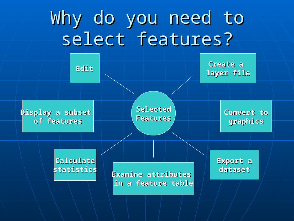
Why do you need to select Why do you need to select features?features?
SelectedSelectedFeaturesFeatures
Create a Create a layer filelayer fileEditEdit
CalculateCalculatestatisticsstatistics
Export aExport adatasetdataset
Display a subset Display a subset of featuresof features
Convert toConvert tographicsgraphics
Examine attributes Examine attributes in a feature tablein a feature table
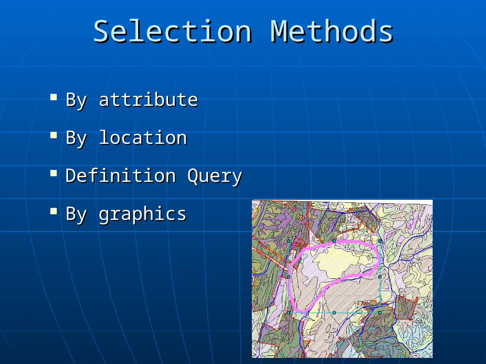
By attributeBy attribute
By locationBy location
Definition QueryDefinition Query
By graphicsBy graphics
Selection MethodsSelection Methods
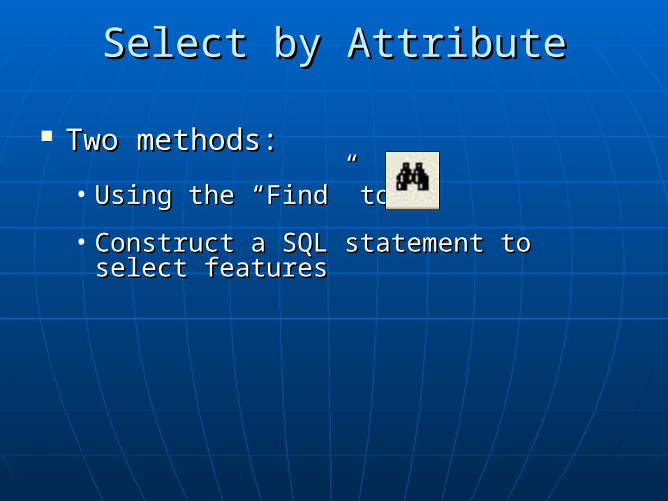
Two methods:Two methods:
• Using the “Find” tool Using the “Find” tool
• Construct a SQL statement to select Construct a SQL statement to select featuresfeatures
Select by AttributeSelect by Attribute
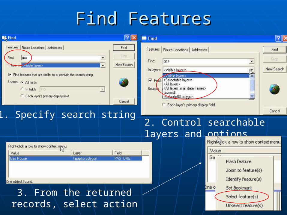
Find FeaturesFind Features
1. Specify search string2. Control searchable layers and options
3. From the returned records, select action
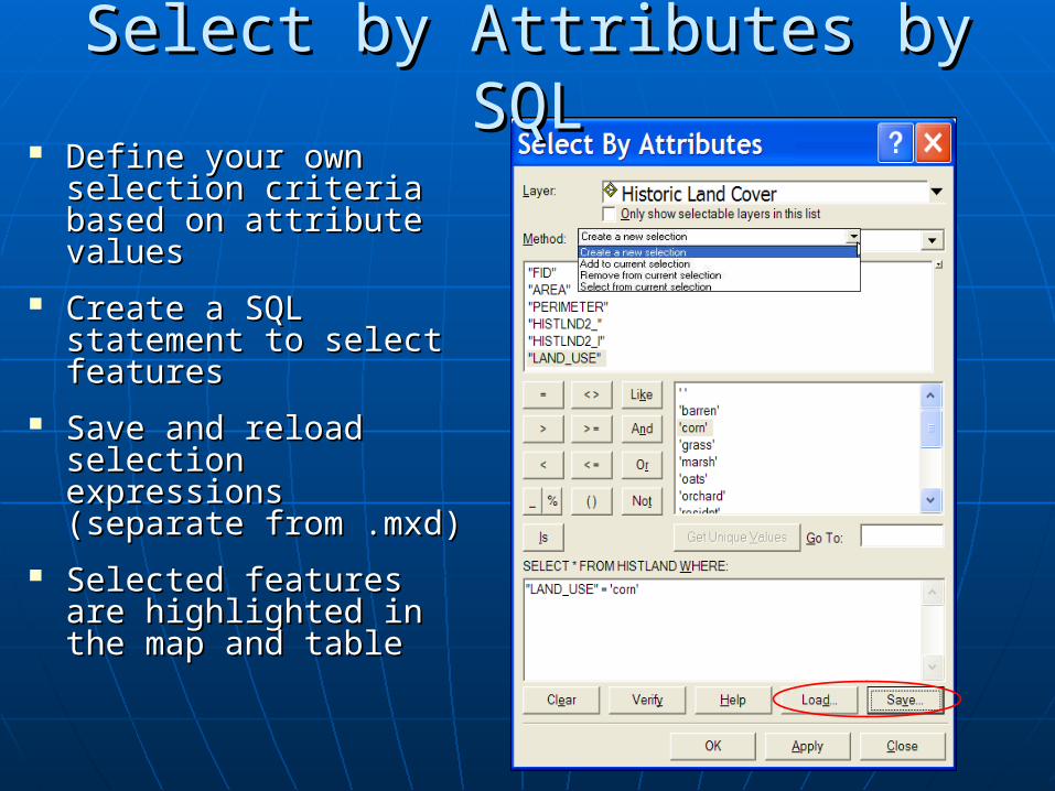
Define your own Define your own selection criteria selection criteria based on attribute based on attribute valuesvalues
Create a SQL Create a SQL statement to select statement to select featuresfeatures
Save and reload Save and reload selection expressions selection expressions (separate from .mxd)(separate from .mxd)
Selected features are Selected features are highlighted in the map highlighted in the map and tableand table
Select by Attributes Select by Attributes byby SQL SQL
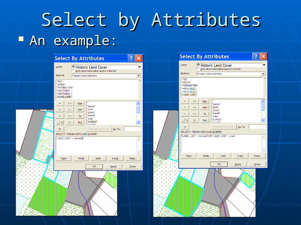
Select by AttributesSelect by Attributes An example:An example:
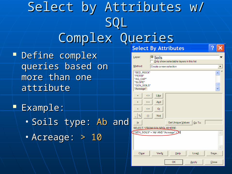
Select by Attributes w/ SQLSelect by Attributes w/ SQLComplex QueriesComplex Queries
Define complex queries Define complex queries based on more than based on more than one attributeone attribute
Example:Example:
• Soils type: Soils type: Ab Ab andand
• Acreage: Acreage: > 10> 10
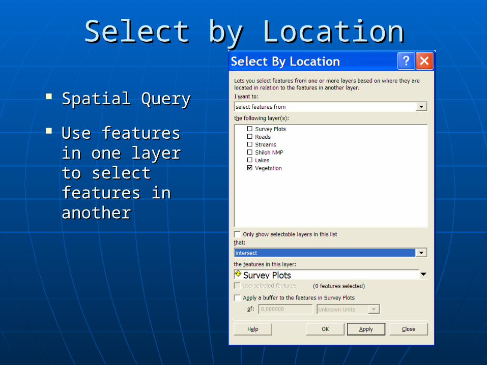
Spatial QuerySpatial Query
Use features in Use features in one layer to one layer to select features select features in anotherin another
Select by LocationSelect by Location
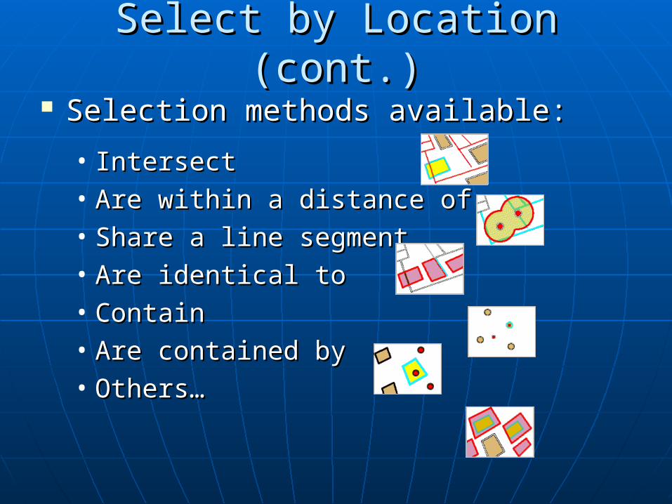
Selection methods available:Selection methods available:
• IntersectIntersect• Are within a distance ofAre within a distance of• Share a line segmentShare a line segment• Are identical toAre identical to• ContainContain• Are contained byAre contained by• Others…Others…
Select by Location (cont.)Select by Location (cont.)
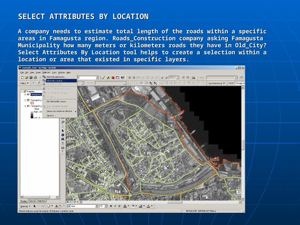
SELECT ATTRIBUTES BY LOCATIONSELECT ATTRIBUTES BY LOCATION
A company needs to estimate total length of the roads within a specific areas A company needs to estimate total length of the roads within a specific areas in Famagusta region. Roads_Construction company asking Famagusta in Famagusta region. Roads_Construction company asking Famagusta Municipality how many meters or kilometers roads they have in Old_City? Municipality how many meters or kilometers roads they have in Old_City? Select Attributes By Location tool helps to create a selection within a location Select Attributes By Location tool helps to create a selection within a location or area that existed in specific layers.or area that existed in specific layers.
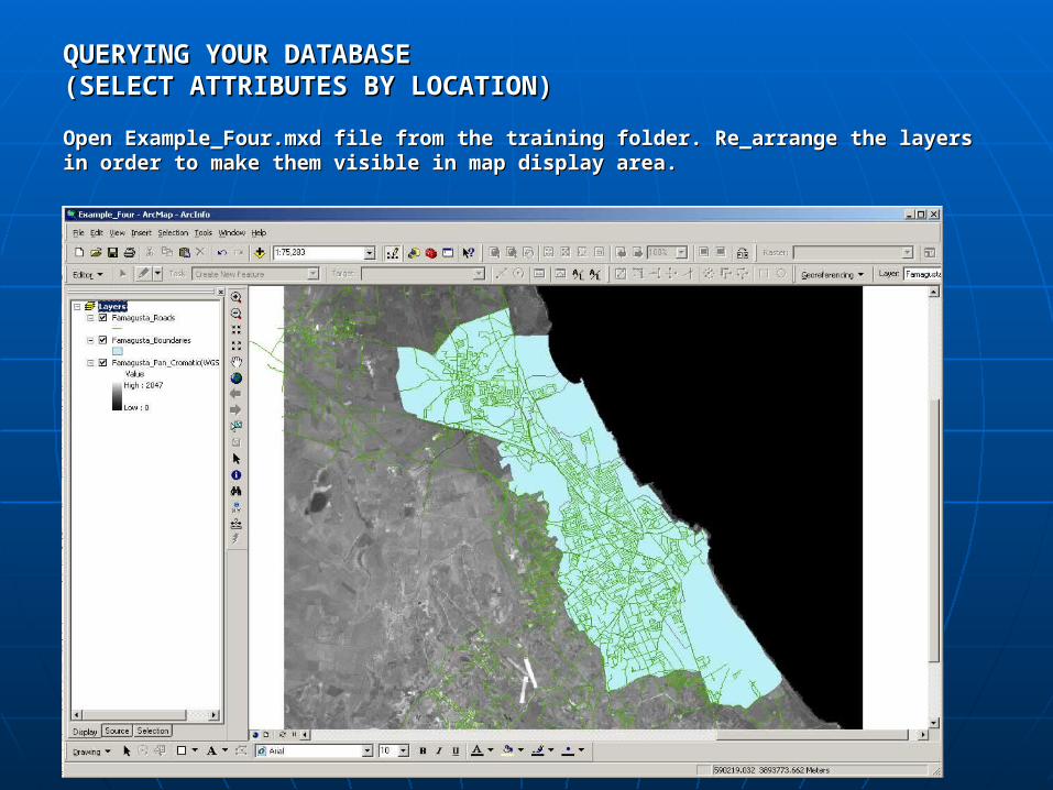
QUERYING YOUR DATABASEQUERYING YOUR DATABASE(SELECT ATTRIBUTES BY LOCATION)(SELECT ATTRIBUTES BY LOCATION)
Open Example_Four.mxd file from the training folder. Re_arrange the layers in Open Example_Four.mxd file from the training folder. Re_arrange the layers in order to make them visible in map display area.order to make them visible in map display area.
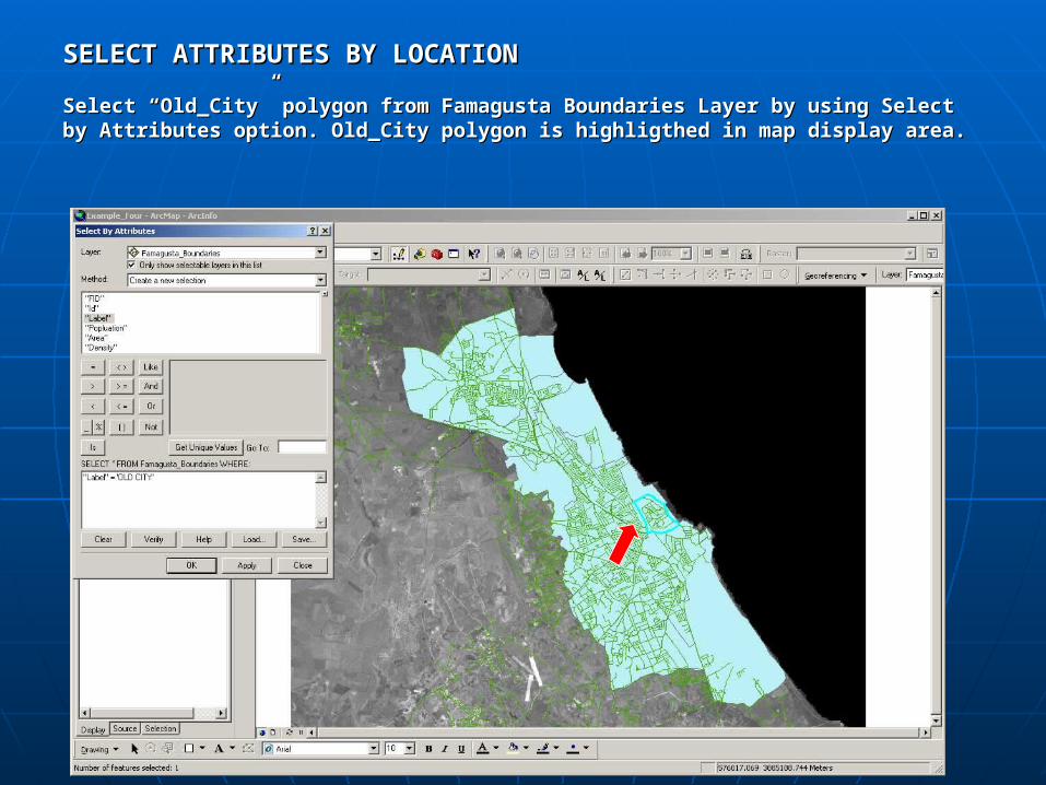
SELECT ATTRIBUTES BY LOCATIONSELECT ATTRIBUTES BY LOCATION
Select “Old_City” polygon from Famagusta Boundaries Layer by using Select by Select “Old_City” polygon from Famagusta Boundaries Layer by using Select by Attributes option. Old_City polygon is highligthed in map display area.Attributes option. Old_City polygon is highligthed in map display area.
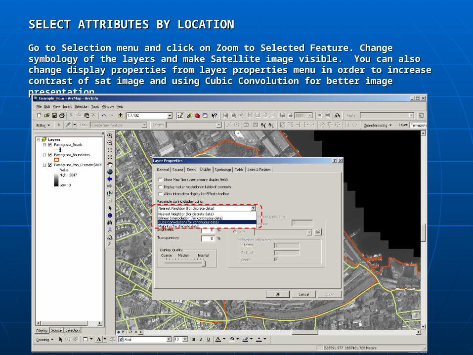
SELECT ATTRIBUTES BY LOCATIONSELECT ATTRIBUTES BY LOCATION
Go to Selection menu and click on Zoom to Selected Feature. Change Go to Selection menu and click on Zoom to Selected Feature. Change symbology of the layers and make Satellite image visible. You can also change symbology of the layers and make Satellite image visible. You can also change display properties from layer properties menu in order to increase contrast of display properties from layer properties menu in order to increase contrast of sat image and using Cubic Convolution for better image presentation.sat image and using Cubic Convolution for better image presentation.
SELECT ATTRIBUTES BY LOCATIONSELECT ATTRIBUTES BY LOCATION
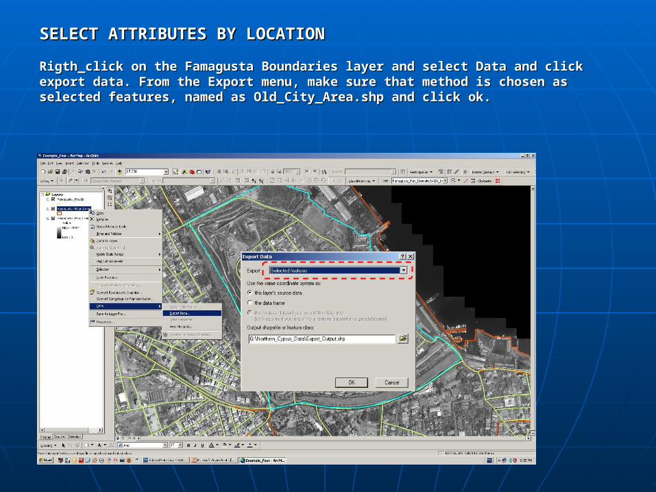
Rigth_click on the Famagusta Boundaries layer and select Data and click export Rigth_click on the Famagusta Boundaries layer and select Data and click export data. From the Export menu, make sure that method is chosen as selected data. From the Export menu, make sure that method is chosen as selected features, named as Old_City_Area.shp and click ok.features, named as Old_City_Area.shp and click ok.
SELECT ATTRIBUTES BY LOCATIONSELECT ATTRIBUTES BY LOCATION
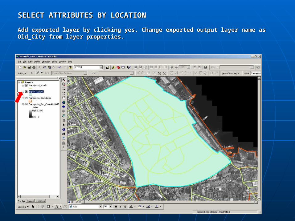
Add exported layer by clicking yes. Change exported output layer name as Add exported layer by clicking yes. Change exported output layer name as Old_City from layer properties.Old_City from layer properties.
SELECT ATTRIBUTES BY LOCATIONSELECT ATTRIBUTES BY LOCATION
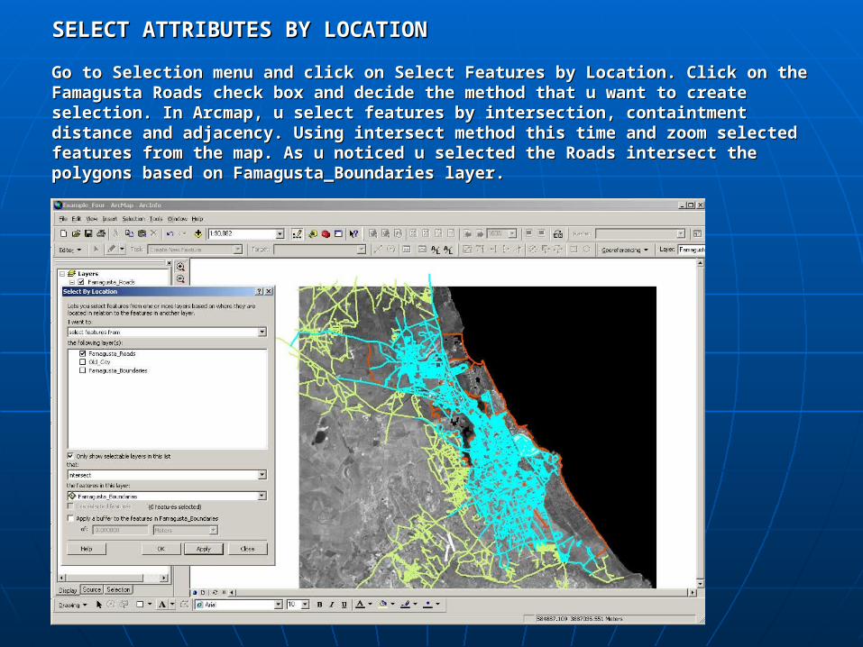
Go to Selection menu and click on Select Features by Location. Click on the Go to Selection menu and click on Select Features by Location. Click on the Famagusta Roads check box and decide the method that u want to create Famagusta Roads check box and decide the method that u want to create selection. In Arcmap, u select features by intersection, containtment distance selection. In Arcmap, u select features by intersection, containtment distance and adjacency. Using intersect method this time and zoom selected features and adjacency. Using intersect method this time and zoom selected features from the map. As u noticed u selected the Roads intersect the polygons based from the map. As u noticed u selected the Roads intersect the polygons based on Famagusta_Boundaries layer.on Famagusta_Boundaries layer.
SELECT ATTRIBUTES BY LOCATIONSELECT ATTRIBUTES BY LOCATION
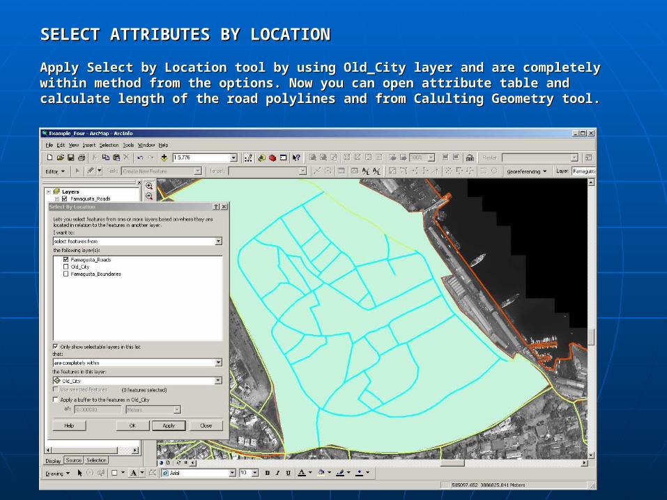
Apply Select by Location tool by using Old_City layer and are completely within Apply Select by Location tool by using Old_City layer and are completely within method from the options. Now you can open attribute table and calculate method from the options. Now you can open attribute table and calculate length of the road polylines and from Calulting Geometry tool.length of the road polylines and from Calulting Geometry tool.
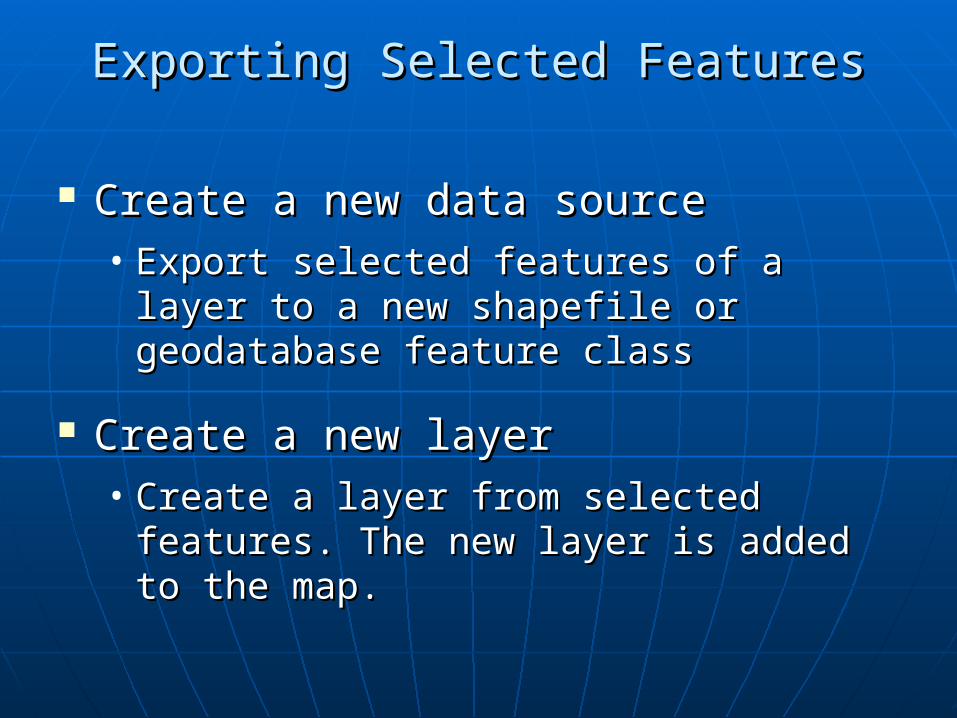
Create a new data sourceCreate a new data source• Export selected features of a layer to a Export selected features of a layer to a
new shapefile or geodatabase feature new shapefile or geodatabase feature class class
Create a new layerCreate a new layer• Create a layer from selected features. Create a layer from selected features.
The new layer is added to the map. The new layer is added to the map.
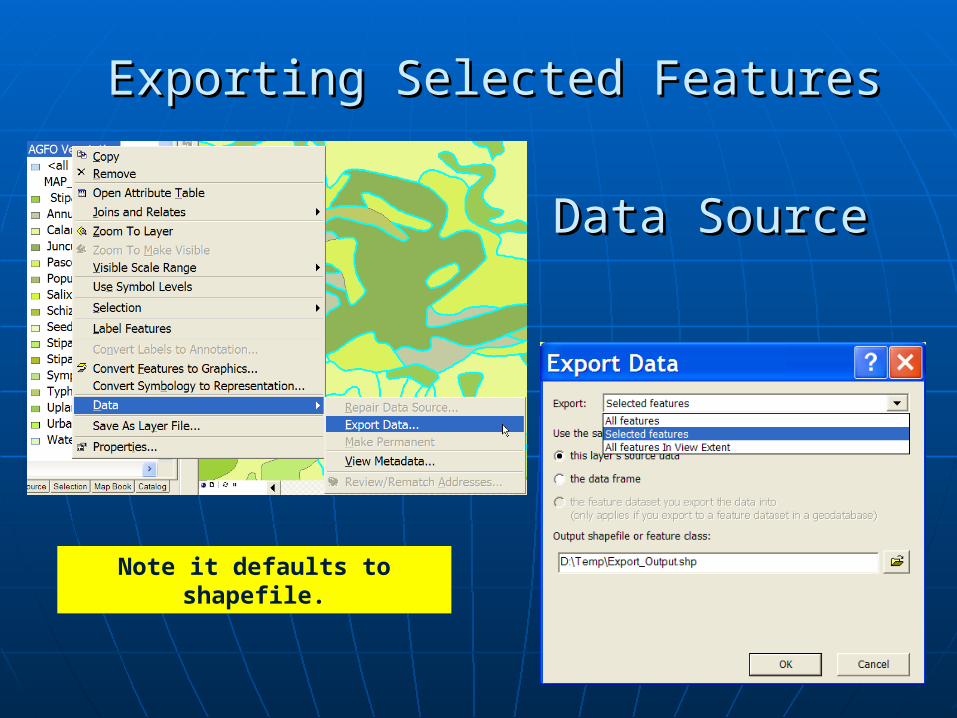
Exporting Selected FeaturesExporting Selected Features
Data SourceData Source
Exporting Selected FeaturesExporting Selected Features
Note it defaults to shapefile.
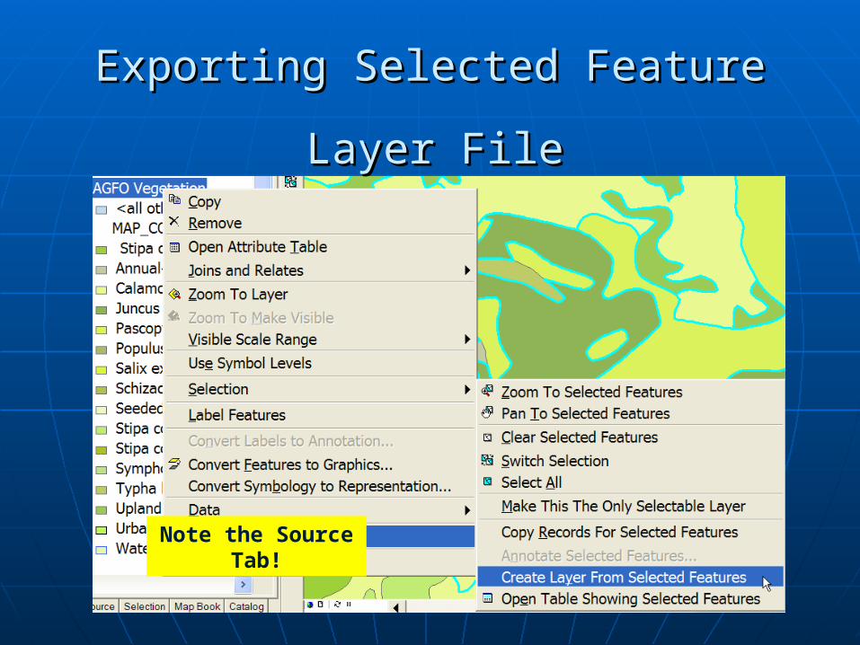
Exporting Selected FeatureExporting Selected Feature
Layer FileLayer File
Note the Source Tab!
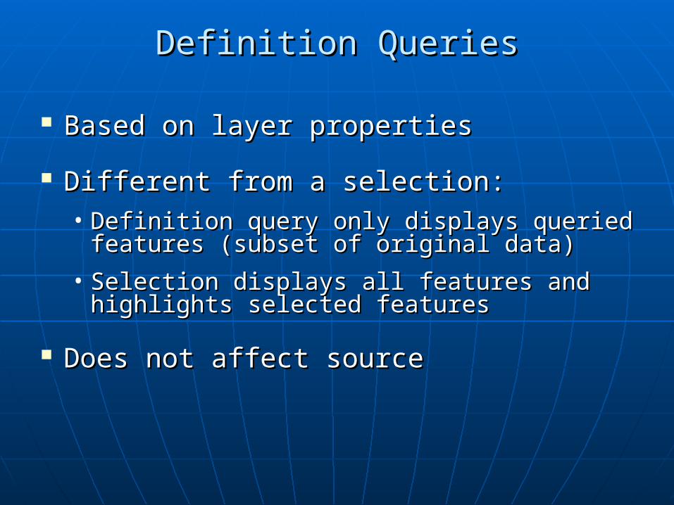
Based on layer propertiesBased on layer properties
Different from a selection:Different from a selection:• Definition query only displays queried Definition query only displays queried
features (subset of original data)features (subset of original data)
• Selection displays all features and Selection displays all features and highlights selected featureshighlights selected features
Does not affect sourceDoes not affect source
Definition QueriesDefinition Queries