Embed Size (px)
Citation preview
Seismic hazard and earthquake loss estimates for Greater Victoria
Martin P. Zaleski P.Geo., CEG
M.Sc. Candidate Department of Earth Sciences
Simon Fraser University
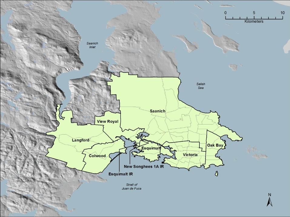
Modified after: Monahan, P.A., Levson, V.M., Henderson, P., & Sy, A. (2000). Quaternary geological map of Greater Victoria. BC Geological Survey Branch, Geoscience Map 2000-2.

Based on mapping by Monahan et al. (2000).
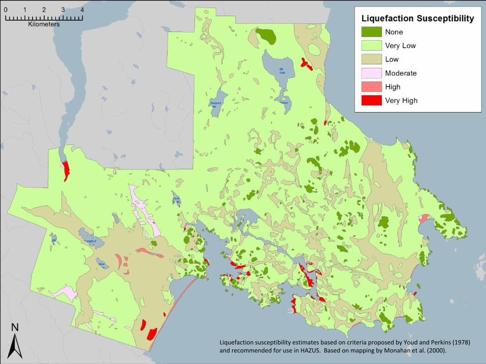
Liquefaction susceptibility estimates based on criteria proposed by Youd and Perkins (1978) and recommended for use in HAZUS. Based on mapping by Monahan et al. (2000).
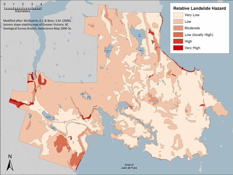
Modified after: McQuarrie, E.J. & Bean, S.M. (2000). Seismic slope stability map of Greater Victoria. BC Geological Survey Branch, Geoscience Map 2000-3c.
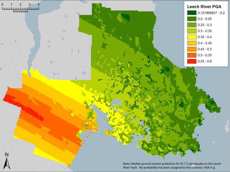
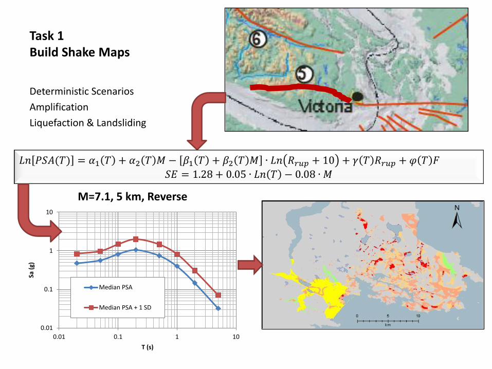
Note: Median ground motion prediction for M 7.2 earthquake on the Leech River Fault. No probability has been assigned to this scenario. PGA in g.
0.01
0.1
1
10
0.01 0.1 1 10
Sa (
g)
T (s)
M=7.1, 5 km, Reverse
Median PSA
Median PSA + 1 SD
Task 1 Build Shake Maps
Deterministic Scenarios
Amplification
Liquefaction & Landsliding
𝐿𝑛 𝑃𝑆𝐴(𝑇) = 𝛼1 𝑇 + 𝛼2 𝑇 𝑀 − 𝛽1 𝑇 + 𝛽2 𝑇 𝑀 ∙ 𝐿𝑛 𝑅𝑟𝑢𝑝 + 10 + 𝛾 𝑇 𝑅𝑟𝑢𝑝 + 𝜑 𝑇 𝐹 𝑆𝐸 = 1.28 + 0.05 ∙ 𝐿𝑛 𝑇 − 0.08 ∙ 𝑀
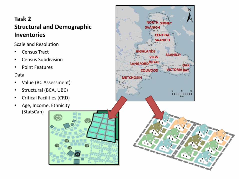
Task 2 Structural and Demographic Inventories
Scale and Resolution
• Census Tract
• Census Subdivision
• Point Features
Data
• Value (BC Assessment)
• Structural (BCA, UBC)
• Critical Facilities (CRD)
• Age, Income, Ethnicity (StatsCan)

HAZARD VULNERABILITY
ELEMENTS AT RISK
SHAKE MAPS
Task 3 HAZUS Loss Estimation
Damage • Damage Functions
(loss to intensity)
COUNTS AND VALUE
DAMAGE FUNCTIONS
Losses – Dollar Value • GBS by Dissemination Area or Tract • Point Features using AEBM
Recovery • Debris • Shelter Needs