Embed Size (px)
Citation preview

Presentation for Southern Coastal Group
Sediment Tracer Study
The River Hamble to Portchester Coastal Flood & Erosion Risk
Management Strategy
David Picksley – Coastal Engineer

• Introduction to the study
• Method
• Deployment sites
• Results to date
• Future monitoring
• Questions
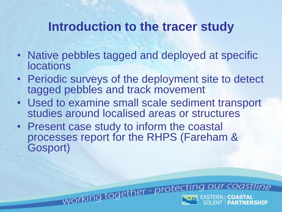
Introduction to the tracer study
• Native pebbles tagged and deployed at specific locations
• Periodic surveys of the deployment site to detect tagged pebbles and track movement
• Used to examine small scale sediment transport studies around localised areas or structures
• Present case study to inform the coastal processes report for the RHPS (Fareham & Gosport)

Pebbles laid out in a
tray ready to be jetted
Method
Native pebbles collected from potential deployment sites

Side View
Plan View
Example RFID tags
Radio-frequency identification (RFID) is the wireless non-contact use of
radio-frequency electromagnetic fields to transfer data
‘Life expectancy’ of
approximately 50 years
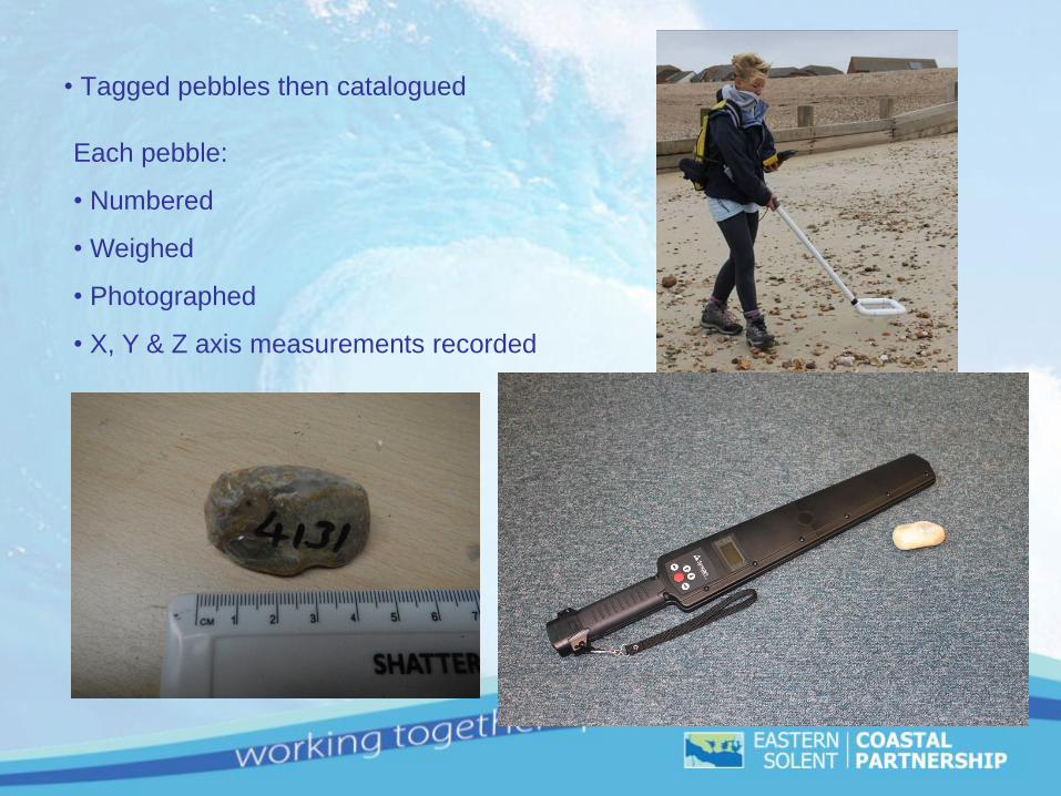
• Tagged pebbles then catalogued
Each pebble:
• Numbered
• Weighed
• Photographed
• X, Y & Z axis measurements recorded
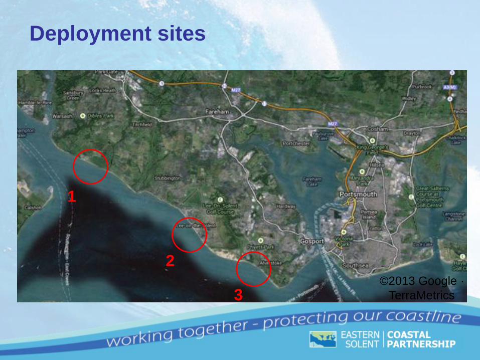
Deployment sites
©2013 Google ·
TerraMetrics
1
2
3

Stokes Bay Lee-on-the-Solent Solent Breezes
Example deployment locations
500 pebbles deployed in 5 batches of 100 at each of the 3 deployment sites
during March 2013
Pebbles deployed at MSL along existing Regional Monitoring profile lines


Results to date
Pebbles deployed in March 2013
1st survey after 1 week
2nd survey after 4 weeks (April 2013)
3rd survey after 12 weeks (May 2013)
4th survey after 24 weeks (August 2013)
Survey extents increased proportionally for each successive survey
Location Detection Rates (%)
Survey 1
March
Survey 2
April
Survey 3
May
Survey 4
August
Solent Breezes 14.6 9.8 11.8 11.6
Lee-On-The-Solent 17.8 5.2 13.6 11
Stokes Bay 13.8 9.4 13 13.8
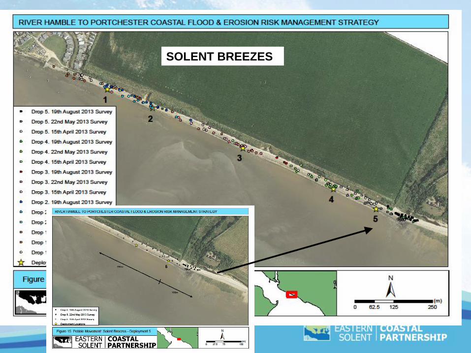
SOLENT BREEZES

LEE ON THE SOLENT
STOKES BAY

Lee-on-the-Solent
•Notable movement of pebbles to the east at all deployments
•Pebbles free to move beyond rock groyne structures in to adjacent groyne bays
•Results suggest there is continuous sediment transport along this frontage,
predominately from west to east.
Tracer study findings
Solent Breezes
•General trend for westerly movement towards the Solent Breezes holiday park, for
deployments 1, 2 and 3. Easterly movement at deployment 5.
•The slipway at the caravan site may be acting as a potential barrier. No pebbles
were found west of this point.
• Pebbles have moved in both directions at deployment 4 (possible drift divide near
this location)

•Movement of pebbles to the east at deployment site 1 & 2, adjacent to River Alver
outlet, suggests strong easterly current around this headland
•Evidence for offshore transport of material as pebbles transported offshore within
River Alver tidal delta.
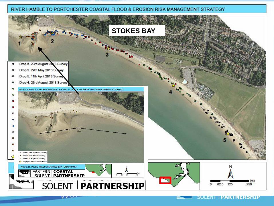
•Pebble movement both east and west along central Stokes Bay beach frontage.
•Lifeboat station slipway may act as a barrier to sediment transport further east
Stokes Bay
Note:
Prolonged period of easterly winds after initial deployments may have
influenced early survey results
Future Monitoring
• Next survey planned for March 2014
- one year after initial deployments
• Additional 500 pebbles already tagged and available for
future deployments as and when necessary
• Current working with Phd student at Sussex University

Questions or Comments?