Embed Size (px)
Citation preview
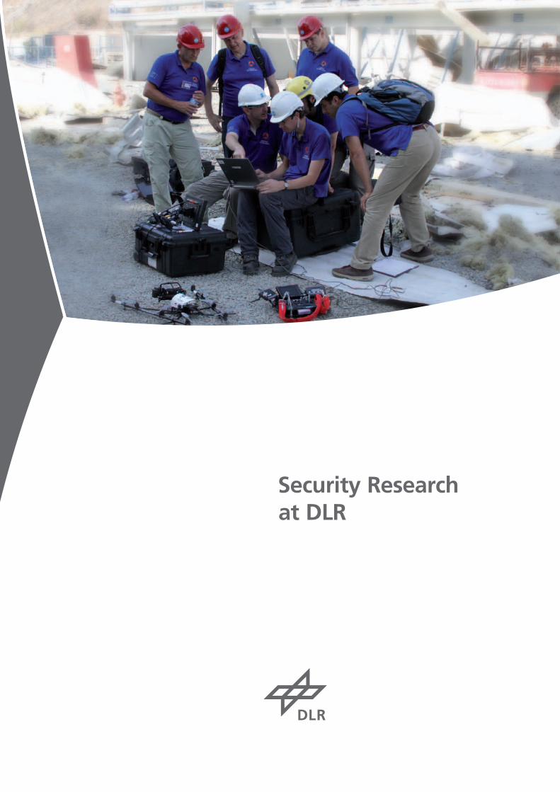
Security Research at DLR
222
3
Dr. Philipp RöslerFederal Minister of Economics and Technology
Germany is one of the world’s most secure countries. At the same time, the fact that we are an open society, rank among the world’s leading trading nations, are integrated into many international networks and possess a highly sophisticated infrastructure makes us vulnerable to the threats of international terrorism and organised crime, but also to natural catastrophes and major industrial accidents. The challenge facing scientists, industry and politicians is to find new answers to these risks, which offer people greater security without at the same time imposing restrictions on our culture of freedom. I will, in fact, go one step further: the security technologies, systems and concepts we are looking for must be able to reextend our scope of freedom. Security today, more than ever before, is a strategically relevant economic factor. A country that can guarantee factors like a steady supply of energy, reliable telecommunication services and a secure transport infrastructure has a major advantage in the competition for international investment. Growth rates in the world markets for security technologies and services are high. In November 2010, the Federal Ministry of Economics and Technology unveiled its industrial policy initiative “Civil Security: A Key Future Market”. This initiative creates the necessary policy environment to strengthen Germany’s competitiveness in this field, thereby enhancing the ability of firms based in Germany to expand their leading international business position. This new export initiative will especially benefit small and mediumsized businesses by helping them position themselves on thirdcountry markets. The DIN Institute’s recently established Coordination Office for Civil Security will no doubt be helpful in stepping up our influence on European and international standardisation processes. Security research is an essential ingredient in the German government’s Hightech Strategy. Our decision to extend our National Security Research Programme, which was originally launched in 2007, will encourage research institutions, companies, and their private and publicsector clients to tackle new areas of technology; at the same time it will increase our chances to participate successfully in the European Security Research Programme. The introduction of new security technologies often has consequences that effect citizens’ privacy. Conducting a social dialogue, upholding civil rights and safeguarding transparency are therefore indispensable elements of our security architecture. We must consistently follow our path, carefully considering the ethical and social implications of all our research projects. DLR’s expertise will make an essential contribution to our future security structure. I therefore very much welcome DLR’s decision to step up its commitment in this field, which is, after all, crucial for our economy.
Sincerely,
Federal Minister of Economics and Technology
44
Contents
Title
Foreword
Contents
Editorial
Security at Mass Events –Support from the Air
How DLR Uses High Technology to FightForest Fires
A Step Ahead of Future Tsunamis
Detecting Concealed Explosive Devices andBuried Landmines
DLR Software Helps on Police Duty
Satellitebased Maritime Security
DMT – a Box for Rapid Relief
Terahertz Technology to Search for Arms and Narcotics
Unmanned Aircraft Systems for Civil Security
How DLR Laser Systems Will Detect Hazardous Substances to Protect the Population
Effective Communication in a Crisis – eTriage
Using Satellite Data to Combat Disasters
Analysing the Atmosphere – LIDAR Technology Improves Safety in Air Transport
Enhancing Airport Security
Improving the Protection of Critical Infrastructures
Quick Access for the Rescue Teams – DLR Develops Emergency Traffic Management System
Telematics to Support Rescue Coordination
Clearing the Way for Satellites
Civil Security Research: A PhD in in Three Years
Imprint
Page
3
4
5
6
8
12
14
16
18
22
24
26
30
32
34
38
40
44
46
50
52
56
58
5
Dear readers,
To live in safety and security is one of the basic human needs. Consequently, security rates high among our society’s values. Classically, we distinguish between internal and external security. Internal security is about protection against crime, terrorism, and similar threats coming from within a society. In external security, the focus is on defending a country against military threats by another.
The end of the Cold War has blurred the borderline between internal and external security. Our need for security today calls for solutions other than those of 20 years ago. Organised crime and religiously motivated terrorism have taken on an international dimension, as have human trafficking and economic espionage. What is more, there are environmental catastrophes and growing competition for dwindling resources, factors that equally require new, comprehensive answers. In a nutshell: What is required today is an entirely new security philosophy.
The German Aerospace Center (DLR) recognised this early. We have been studying innovative defence and security technologies for years. In the spring of 2010, we set up the new crosssectional Defence and Security research programme to pool all our securityrelated specialist knowledge. This programme brings together core competences from our established research programmes Aviation, Space, Energy, and Transport. Interdisciplinary collaboration has been creating new synergies and helped us to work out innovative defence and security solutions that make our lives noticeably more secure.
One research focus is on defence applications: DLR has its own body of competences in technologies of military relevance. Besides, we are able to assess each technology’s operational merits and advise clients on its suitability for military security purposes. On the other hand, we do research in civilian applications and projects through which DLR is making a relevant contribution towards crisis management, disaster control, and security from attack.
Our strategy in military and civil security research is guided by Europe’s current and future security and defence policy, taking into account a set of internationally defined capability profiles for protecting the population and securing peace. As a byproduct of our work, we sustainably secure Germany’s position in the international and European competitive environment.
We are pleased to present a brief synopsis of DLR‘s current security related research to you in this booklet. The wealth of examples shown and the large number of DLR research centres and institutes involved demonstrate that DLR’s role in security research is both a driving force and a guarantee for cuttingedge quality of research, true to our motto:
“Knowledge for Tomorrow”.
This guiding principle, by the way, implies more than merely supplying knowledge. It also relates to systems and services that are even now being used in the field and will be used in the future, backed by knowledge and expertise of DLR’s staff. A telling example is our Centre for SatelliteBased Crisis Information (ZKI), which is offering its humanitarian aid services worldwide around the clock.
Security is a topic of the future. This view is shared by the Federal Ministry of Economics and Technology. We thank Federal Minister Dr. Philipp Rösler for his introductory remarks and for encouraging us on our chosen course.
Hoping that this booklet will offer you interesting insights into DLR’s futureoriented security research, we wish you a pleasant reading.
Prof. Dr.-Ing. Johann-Dietrich Wörner Dr.-Ing. Dennis Göge
Prof. Dr.-Ing. Johann-Dietrich WörnerChairman of the DLR Executive Board
Dr.-Ing. Dennis Göge Executive Board Representative for Defence and Security Research
6
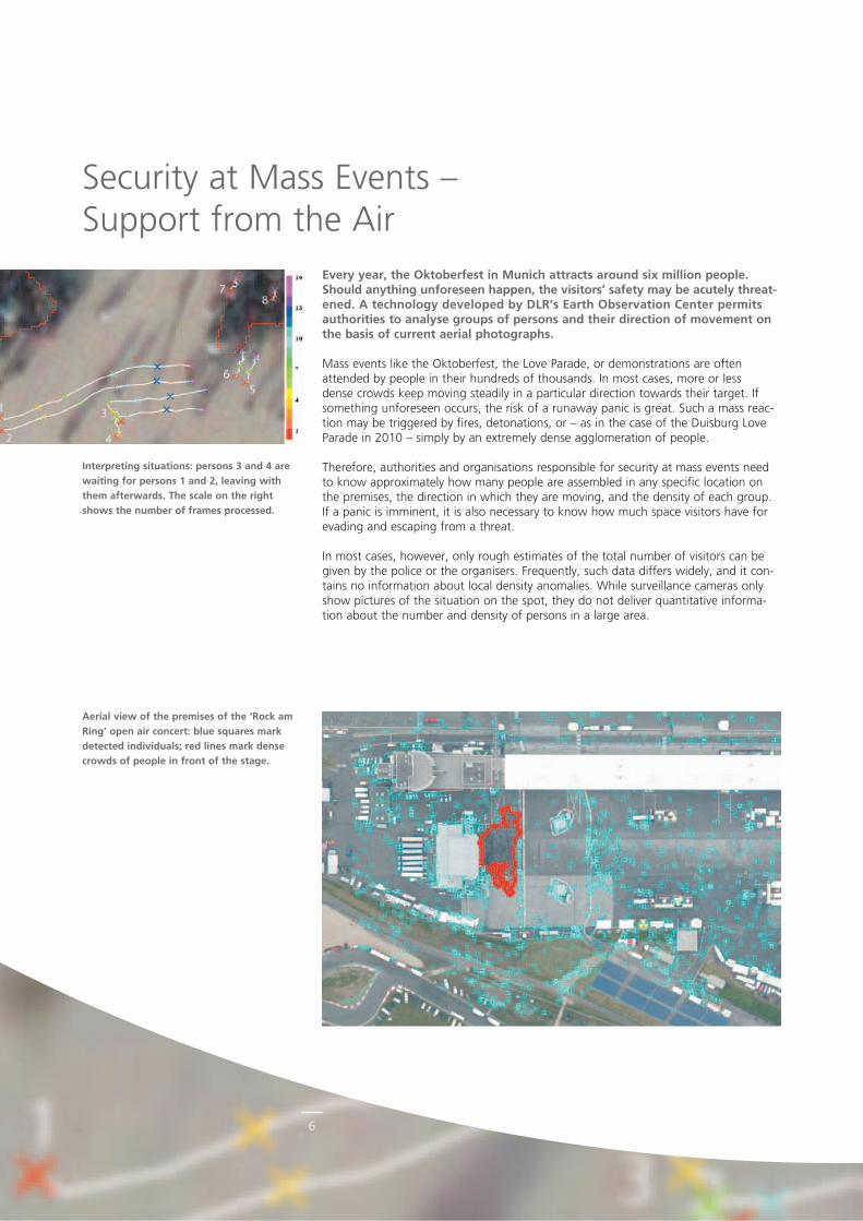
Aerial view of the premises of the ‘Rock am Ring’ open air concert: blue squares mark detected individuals; red lines mark dense crowds of people in front of the stage.
Every year, the Oktoberfest in Munich attracts around six million people. Should anything unforeseen happen, the visitors’ safety may be acutely threat-ened. A technology developed by DLR’s Earth Observation Center permits authorities to analyse groups of persons and their direction of movement on the basis of current aerial photographs.
Mass events like the Oktoberfest, the Love Parade, or demonstrations are often attended by people in their hundreds of thousands. In most cases, more or less dense crowds keep moving steadily in a particular direction towards their target. If something unforeseen occurs, the risk of a runaway panic is great. Such a mass reaction may be triggered by fires, detonations, or – as in the case of the Duisburg Love Parade in 2010 – simply by an extremely dense agglomeration of people.
Therefore, authorities and organisations responsible for security at mass events need to know approximately how many people are assembled in any specific location on the premises, the direction in which they are moving, and the density of each group. If a panic is imminent, it is also necessary to know how much space visitors have for evading and escaping from a threat.
In most cases, however, only rough estimates of the total number of visitors can be given by the police or the organisers. Frequently, such data differs widely, and it contains no information about local density anomalies. While surveillance cameras only show pictures of the situation on the spot, they do not deliver quantitative information about the number and density of persons in a large area.
Interpreting situations: persons 3 and 4 are waiting for persons 1 and 2, leaving with them afterwards. The scale on the right shows the number of frames processed.
Security at Mass Events –Support from the Air
7
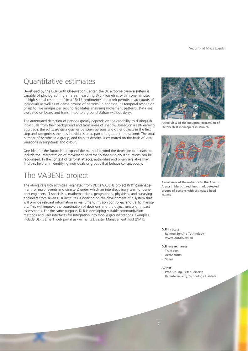
Quantitative estimatesDeveloped by the DLR Earth Observation Center, the 3K airborne camera system is capable of photographing an area measuring 3x5 kilometres within one minute. Its high spatial resolution (circa 15x15 centimetres per pixel) permits head counts of individuals as well as of dense groups of persons. In addition, its temporal resolution of up to five images per second facilitates analysing movement patterns. Data are evaluated on board and transmitted to a ground station without delay.
The automated detection of persons greatly depends on the capability to distinguish individuals from their background and from areas of shadow. Based on a selflearning approach, the software distinguishes between persons and other objects in the first step and categorises them as individuals or as part of a group in the second. The total number of persons in a group, and thus its density, is estimated on the basis of local variations in brightness and colour.
One idea for the future is to expand the method beyond the detection of persons to include the interpretation of movement patterns so that suspicious situations can be recognised. In the context of terrorist attacks, authorities and organisers alike may find this helpful in identifying individuals or groups that behave conspicuously.
The VABENE projectThe above research activities originated from DLR’s VABENE project (traffic management for major events and disasters) under which an interdisciplinary team of transport engineers, IT specialists, mathematicians, geographers, physicists, and surveying engineers from seven DLR institutes is working on the development of a system that will provide relevant information in real time to mission controllers and traffic managers. This will improve the coordination of decisions and the objectiveness of impact assessments. For the same purpose, DLR is developing suitable communication methods and user interfaces for integration into mobile ground stations. Examples include DLR‘s EmerT web portal as well as its Disaster Management Tool (DMT).
Aerial view of the entrance to the Allianz Arena in Munich: red lines mark detected groups of persons with estimated head counts.
Security at Mass Events
Aerial view of the inaugural procession of Oktoberfest innkeepers in Munich
DLR Institute- Remote Sensing Technology
www.DLR.de/caf/en
DLR research areas- Transport- Aeronautics- Space
Author- Prof. Dr.-Ing. Peter Reinartz
Remote Sensing Technology Institute
8
© IQ
wire
less
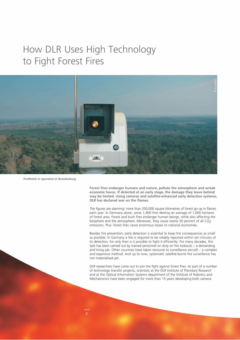
FireWatch in operation in Brandenburg.
Forest fires endanger humans and nature, pollute the atmosphere and wreak economic havoc. If detected at an early stage, the damage they leave behind may be limited. Using cameras and satellite-enhanced early detection systems, DLR has declared war on the flames.
The figures are alarming: more than 200,000 square kilometres of forest go up in flames each year. In Germany alone, some 1,400 fires destroy an average of 1,000 hectares of forest area. Forest and bush fires endanger human beings, while also affecting the biosphere and the atmosphere. Moreover, they cause nearly 30 percent of all CO2 emissions. Plus: forest fires cause enormous losses to national economies.
Besides fire prevention, early detection is essential to keep the consequences as small as possible. In Germany a fire is required to be reliably reported within ten minutes of its detection, for only then is it possible to fight it efficiently. For many decades, this task has been carried out by trained personnel on duty on fire lookouts – a demanding and tiring job. Other countries have taken recourse to surveillance aircraft – a complex and expensive method. And up to now, systematic satelliteborne fire surveillance has not materialised yet.
DLR researchers have come out to join the fight against forest fires. As part of a number of technology transfer projects, scientists at the DLR Institute of Planetary Research and at the Optical Information Systems department of the Institute of Robotics and Mechatronics have been engaged for more than 15 years developing both camera
How DLR Uses High Technology to Fight Forest Fires
FireWatch in operation in Brandenburg
9
© Ip
ictu
rea
llian
ce/d
pa
Fighting Forest Fires
assisted and satelliteborne methods of early forest fire detection. In both cases, the sensor technology used was originally developed for planetary missions to Mars and some comets.
Take FireWatch: the system is modular. It uses a configuration of highresolution optical sensors installed on towers or masts to monitor forest areas of up to 700 square kilometres. Using its special software, FireWatch automatically and in real time scans its digital images for signs of fire, analysing smoke plumes with regard to motion patterns, structure, and brightness. A special red filter attached to the lens enhances the contrast ratio between the forest and the smoke. And yet: various local conditions sometimes make smoke detection difficult. Forest structure, topography, land forma tion and weather situation vary widely and can thus corrupt measurement data. This may trigger false alarms, a contingency that needs to be kept as infrequent as possi ble.
Keener than the human eyeThe technology was developed by and patented for DLR and the IQ Wireless company. In case of a suspected fire, it transmits both images and the coordinates of the fire source automatically to an alarm centre. Staff at the forestry authorities evaluate the data and report them to the fire service. FireWatch has been successfully tried and tested and offers a demonstrable benefit over landbased surveillance of forest areas, guaranteeing a quick response and gapless coverage. The system of optical sensors used for early detection of smoke is more reliable than the human eye and clearly
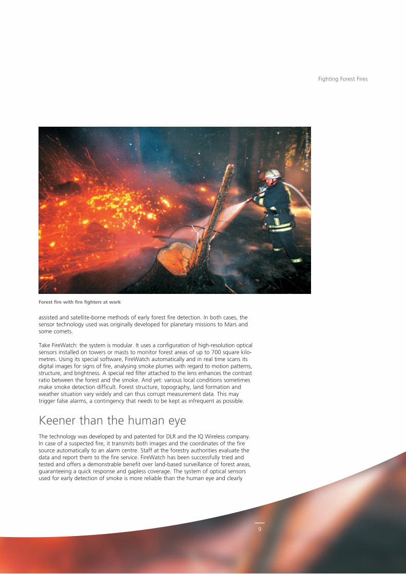
Forest fire with fire fighters at work
10
Fighting Forest Fires
more sensitive, particularly during night times. It will detect a smoke plume measuring only ten metres in diameter. For a full 360degree scan including its evaluation the system requires no more than about eight minutes.
FireWatch is already in use or on trial at about 200 locations in Germany, the European Union, United States and Australia. The system is thus monitoring circa 2.3 million square kilometres of forest. In Germany, nearly eighty percent of all areas with a forest fire hazard are monitored using this technology. Unquestionably, thanks to FireWatch there has been a significant reduction in the damage done by forest fires, and thus a reduction in costs. Moreover, the health and safety situation of employees working in forest fire surveillance has seen significant improvement. This has made jobs with the forestry authorities very attractive. Given that the system is modular, it can also be used for other surveillance functions once the necessary modifications have been made.
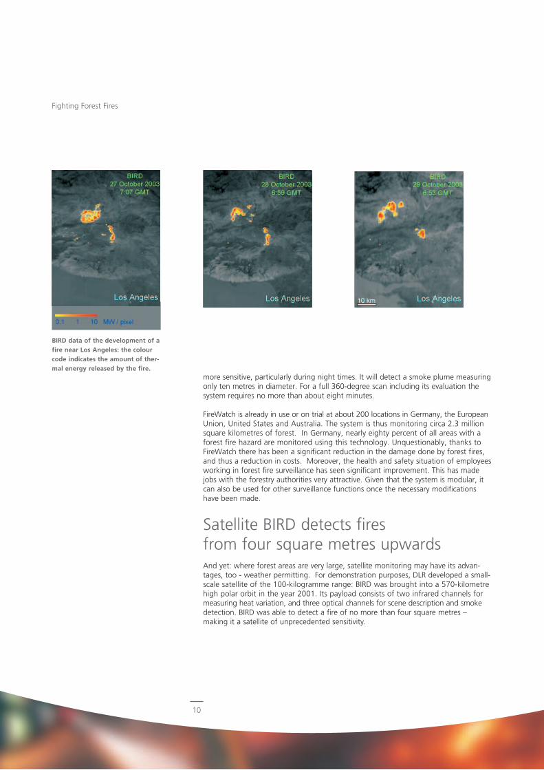
Satellite BIRD detects fires from four square metres upwardsAnd yet: where forest areas are very large, satellite monitoring may have its advantages, too weather permitting. For demonstration purposes, DLR developed a smallscale satellite of the 100kilogramme range: BIRD was brought into a 570kilometre high polar orbit in the year 2001. Its payload consists of two infrared channels for measuring heat variation, and three optical channels for scene description and smoke detection. BIRD was able to detect a fire of no more than four square metres – making it a satellite of unprecedented sensitivity.
BIRD data of the development of a fire near Los Angeles: the colour code indicates the amount of ther-mal energy released by the fire.
11
The power of this DLR technology, innovative instruments aside, lies in two patented innovations. For one, DLR scientists were able to develop a specific way in which the two infrared channels are connected. This is how a quantitative evaluation becomes feasible even for very small fires. Following a successful test phase with BIRD, the method made its way as an internationally recognised data product in remote sensing. And: ESA’s ECOFIRE study, which was based on BIRD data, was able to indicate methods whereby quantitative measurements of fire parameters permit conclusions concerning the quantity of greenhouse gases emitted. The data thus found has the potential for substantial simplifications in emissions trading.
Obviously, unlike FireWatch, satelliteassisted fire surveillance deals with global problems. While, in theory, satellites could also be used to detect individual local forest fires, the data from local observation systems would usually become available to the personnel faster, since satellite systems do not continuously monitor the same area. On the other hand, major, long lasting forest fires, especially in difficult, unfamiliar terrain, require a multitude of information. And this is what satellites from orbit can deliver more fully. In that respect, the two systems complement each other.
BIRD successors will further improve early fire detectionTwo BIRD followup satellite projects with similar onboard instruments are in preparation. These projects, which involve tetrahedral explorer technologies (TET), will be ready for launch before the end of this year. BIROS will follow in 2013. The tandem of satellites will provide a significant improvement in the spacebased detection of forest fires and the monitoring of their propagation. Furthermore, DLR is currently discussing with international partners concerning further components of a multisatellite system. Putting in place such a constellation would be a further improvement of spacebased fire monitoring. A welcome side effect would be the important contribution that the instruments could make to climate research, too – such as the mapping of urban microclimates.
Fighting Forest Fires
DLR Institutes- Planetary Research
www.DLR.de/pf/en- Robotics and Mechatronics
www.DLR.de/rm/en
DLR research area- Space
Authors- Dr. rer. nat. Ekkehard Kührt
Institute of Planetary Research- Dr. rer. nat. Eckehard Lorenz
Institute of Robotics and Mechatronics
12
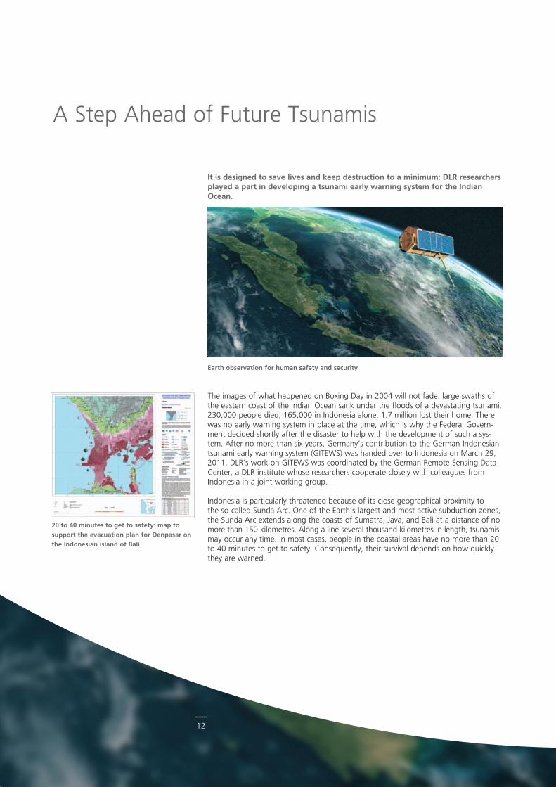
The images of what happened on Boxing Day in 2004 will not fade: large swaths of the eastern coast of the Indian Ocean sank under the floods of a devastating tsunami. 230,000 people died, 165,000 in Indonesia alone. 1.7 million lost their home. There was no early warning system in place at the time, which is why the Federal Government decided shortly after the disaster to help with the development of such a system. After no more than six years, Germany’s contribution to the GermanIndonesian tsunami early warning system (GITEWS) was handed over to Indonesia on March 29, 2011. DLR’s work on GITEWS was coordinated by the German Remote Sensing Data Center, a DLR institute whose researchers cooperate closely with colleagues from Indonesia in a joint working group.
Indonesia is particularly threatened because of its close geographical proximity to the socalled Sunda Arc. One of the Earth‘s largest and most active subduction zones, the Sunda Arc extends along the coasts of Sumatra, Java, and Bali at a distance of no more than 150 kilometres. Along a line several thousand kilometres in length, tsunamis may occur any time. In most cases, people in the coastal areas have no more than 20 to 40 minutes to get to safety. Consequently, their survival depends on how quickly they are warned.
Earth observation for human safety and security
A Step Ahead of Future Tsunamis
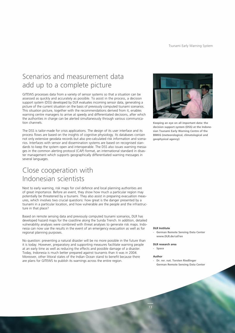
20 to 40 minutes to get to safety: map to support the evacuation plan for Denpasar on the Indonesian island of Bali
It is designed to save lives and keep destruction to a minimum: DLR researchers played a part in developing a tsunami early warning system for the Indian Ocean.
13
Keeping an eye on all important data: the decision support system (DSS) at the Indone-sian Tsunami Early Warning Centre of the BMKG (meteorological, climatological and geophysical agency)
Scenarios and measurement data add up to a complete pictureGITEWS processes data from a variety of sensor systems so that a situation can be assessed as quickly and accurately as possible. To assist in the process, a decision support system (DSS) developed by DLR evaluates incoming sensor data, generating a picture of the current situation on the basis of previously computed tsunami scenarios. This situation picture, together with the recommendations derived from it, enables warning centre managers to arrive at speedy and differentiated decisions, after which the authorities in charge can be alerted simultaneously through various communication channels.
The DSS is tailormade for crisis applications. The design of its user interface and its process flows are based on the insights of cognitive physiology. Its databases contain not only extensive geodata records but also precalculated risk information and scenarios. Interfaces with sensor and dissemination systems are based on recognised standards to keep the system open and interoperable. The DSS also issues warning messages in the common alerting protocol (CAP) format, an international standard in disaster management which supports geographically differentiated warning messages in several languages.
Close cooperation with Indonesian scientistsNext to early warning, risk maps for civil defence and local planning authorities are of great importance. Before an event, they show how much a particular region may potentially be threatened by a tsunami. They also assist in preparing evacuation measures, which involves two crucial questions: how great is the danger presented by a tsunami in a particular location, and how vulnerable are the people and the infrastructure in that place?
Based on remote sensing data and previously computed tsunami scenarios, DLR has developed hazard maps for the coastline along the Sunda Trench. In addition, detailed vulnerability analyses were combined with threat analyses to generate risk maps. Indonesia can now use the results in the event of an emergency evacuation as well as for regional planning purposes.
No question: preventing a natural disaster will be no more possible in the future than it is today. However, preparatory and supporting measures facilitate warning people at an early time as well as reducing the effects and possible damage of a disaster. Today, Indonesia is much better prepared against tsunamis than it was in 2004. Moreover, other littoral states of the Indian Ocean stand to benefit because there are plans for GITEWS to publish its warnings across the entire region.
Tsunami Early Warning System
DLR Institute- German Remote Sensing Data Center
www.DLR.de/caf/en
DLR research area- Space
Author- Dr. rer. nat. Torsten Riedlinger
German Remote Sensing Data Center
14
They are invisible and life-threatening: landmines cause a vast death toll every year. A technology developed by DLR can offer a desirable improve-ment in the detection of dangerous explosive devices: microwaves and optical sensors become valuable helpers in the retrieval of objects buried in the ground as well as for concealed weapons. The innovative detection systems might soon be considered in other security-related applications, too.
Land infested with mines and unexploded ordnance is a lethal hazard to its residents. Over and over again, booby traps planted in conflict areas cause injury and death. What makes these devices particularly hazardous is that they are intentionally hidden in very inconspicuous places. The loss of arable land and ageold habitats makes it difficult for the resident civilian population to return to a life in peace and security.
The detection and removal of mines and booby traps requires great effort and has so far mainly relied on metal detectors, dogs, and mine ploughs. These conventional methods are inefficient and timeconsuming, which means they are also rather costly. What is more, there are no solutions in place that permit the work to be done at any daytime and in adverse ambient conditions, where there is no alternative.
Microwave remote sensing, a helpful technologyThe DLR Microwaves and Radar Institute is working on the development of hightech sensors that can detect mines and other explosive devices even under adverse circumstances. The technology is based on the use of microwaves (MW) and millimetre waves (MMW). Passive MW sensors, referred to as MW radiometers, have the capability to detect hidden objects by distinguishing different materials without using artificial radiation.
DLR scientists are currently experimenting with various imaging methods to combine high performance with low cost and complexity. Here are some examples of systems developed by DLR so far:
HOPE (circa 1.5 to 7 gigahertz): a handheld system for nearground use for an improved detection of buried objects such as landmines, using a multifrequency data record ing technology.
LPAS (~ 90 gigahertz): a fullymechanical scanning system capable of producing closerange millimetrewave images of humans to detect objects hidden under clothing.
SUMIRAD (~ 90 gigahertz): used as part of a multisensor solution, this fullymechanical scanning system is intended for mobile or stationary operation. It helps operating personnel to gain a clearer picture of the situation with regard to possible threats in a radius of up to a few hundred metres.
VESAS (circa 32 to 40 gigahertz): this system produces images by combining several spatial sampling methods, such as aperture synthesis and frequency scanning. However, such fully electronic systems like VESAS are still rather complex and costly.
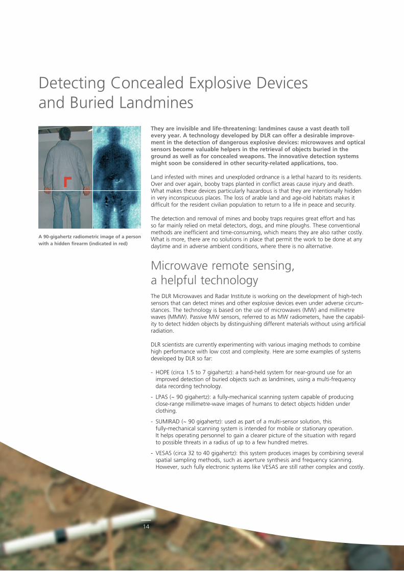
A 90-gigahertz radiometric image of a person with a hidden firearm (indicated in red)
Detecting Concealed Explosive Devices and Buried Landmines
15
© S
ebas
tian
Seib
el/O
STK
REU
Z.
A deminer in protective clothing, carefully excavating a mine for de-fusing
There is a wide variety of potential applications of radiometric MW and MMW sensors. Beyond detecting explosive devices, they can also be used for material surface and structural analysis in industry and geoscience, as well as for the detection of icy roads, for instance.
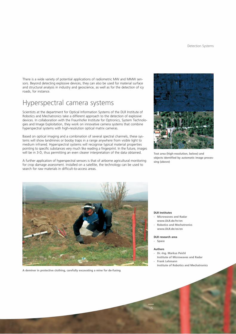
Hyperspectral camera systemsScientists at the department for Optical Information Systems of the DLR Institute of Robotics and Mechatronics take a different approach to the detection of explosive devices. In collaboration with the Fraunhofer Institute for Optronics, System Technologies and Image Exploitation, they work on innovative camera systems that combine hyperspectral systems with highresolution optical matrix cameras.
Based on optical imaging and a combination of several spectral channels, these systems will show landmines or booby traps in a range anywhere from visible light to medium infrared. Hyperspectral systems will recognise typical material properties point ing to specific substances very much like reading a fingerprint. In the future, images will be in 3D, thus permitting an even clearer interpretation of the data obtained.
A further application of hyperspectral sensors is that of airborne agricultural monitoring for crop damage assessment. Installed on a satellite, the technology can be used to search for raw materials in difficulttoaccess areas.
DLR Institutes- Microwaves and Radar
www.DLR.de/hr/en- Robotics and Mechatronics
www.DLR.de/os/en
DLR research area- Space
Authors- Dr.-Ing. Markus Peichl
Institute of Microwaves and Radar- Frank Lehmann
Institute of Robotics and Mechatronics
Test area (high-resolution, below) and objects identified by automatic image proces-sing (above)
Detection Systems
16
© F
otol
ia.c
om
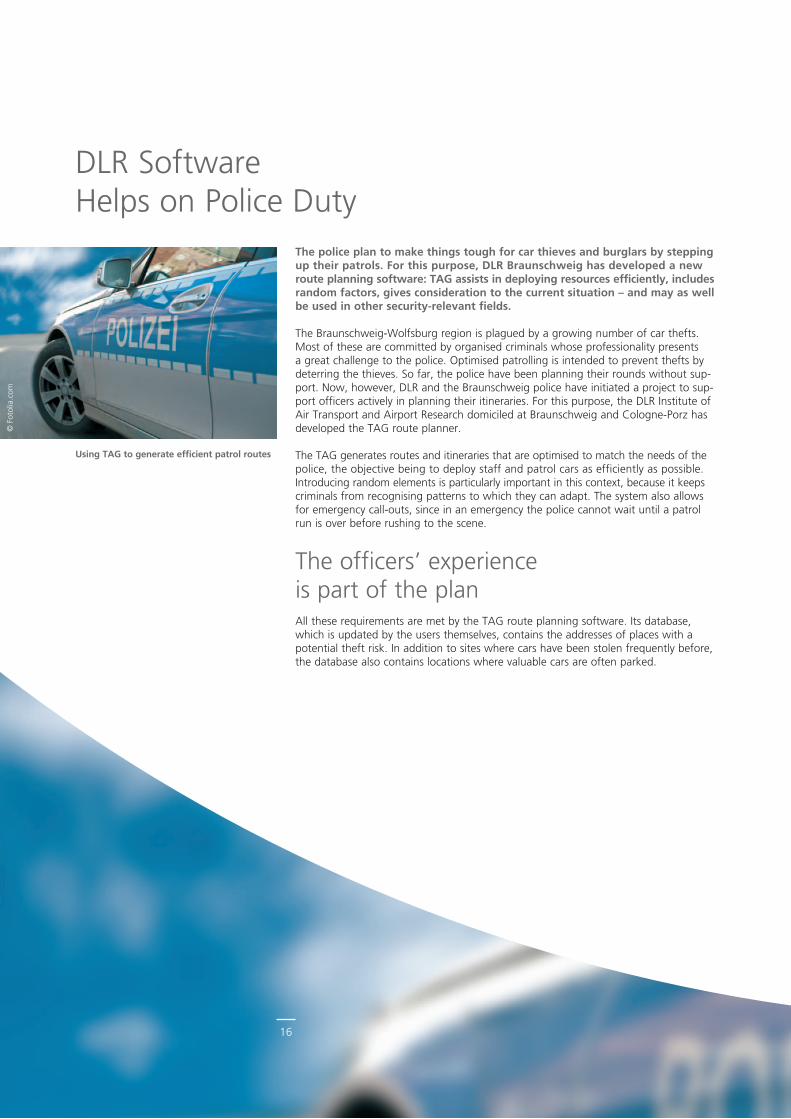
Using TAG to generate efficient patrol routes
The police plan to make things tough for car thieves and burglars by stepping up their patrols. For this purpose, DLR Braunschweig has developed a new route planning software: TAG assists in deploying resources efficiently, includes random factors, gives consideration to the current situation – and may as well be used in other security-relevant fields.
The BraunschweigWolfsburg region is plagued by a growing number of car thefts. Most of these are committed by organised criminals whose professionality presents a great challenge to the police. Optimised patrolling is intended to prevent thefts by deterring the thieves. So far, the police have been planning their rounds without support. Now, however, DLR and the Braunschweig police have initiated a project to support officers actively in planning their itineraries. For this purpose, the DLR Institute of Air Transport and Airport Research domiciled at Braunschweig and ColognePorz has developed the TAG route planner.
The TAG generates routes and itineraries that are optimised to match the needs of the police, the objective being to deploy staff and patrol cars as efficiently as possible. In troducing random elements is particularly important in this context, because it keeps criminals from recognising patterns to which they can adapt. The system also allows for emergency callouts, since in an emergency the police cannot wait until a patrol run is over before rushing to the scene.
The officers’ experience is part of the planAll these requirements are met by the TAG route planning software. Its database, which is updated by the users themselves, contains the addresses of places with a potential theft risk. In addition to sites where cars have been stolen frequently before, the database also contains locations where valuable cars are often parked.
DLR Software Helps on Police Duty
17
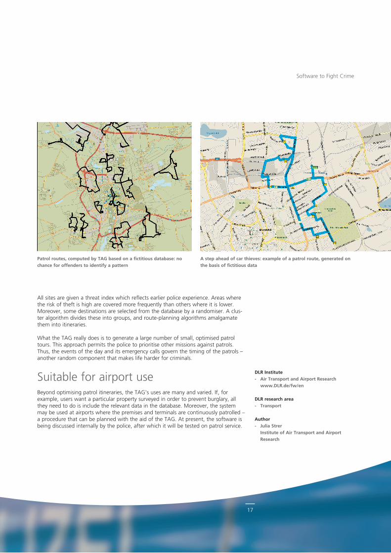
All sites are given a threat index which reflects earlier police experience. Areas where the risk of theft is high are covered more frequently than others where it is lower. Moreover, some destinations are selected from the database by a randomiser. A cluster algorithm divides these into groups, and routeplanning algorithms amalgamate them into itineraries.
What the TAG really does is to generate a large number of small, optimised patrol tours. This approach permits the police to prioritise other missions against patrols. Thus, the events of the day and its emergency calls govern the timing of the patrols – another random component that makes life harder for criminals.
Suitable for airport useBeyond optimising patrol itineraries, the TAG’s uses are many and varied. If, for example, users want a particular property surveyed in order to prevent burglary, all they need to do is include the relevant data in the database. Moreover, the system may be used at airports where the premises and terminals are continuously patrolled – a procedure that can be planned with the aid of the TAG. At present, the software is being discussed internally by the police, after which it will be tested on patrol service.
Software to Fight Crime
DLR Institute- Air Transport and Airport Research
www.DLR.de/fw/en
DLR research area- Transport
Author- Julia Strer
Institute of Air Transport and Airport Research
A step ahead of car thieves: example of a patrol route, generated on the basis of fictitious data
Patrol routes, computed by TAG based on a fictitious database: no chance for offenders to identify a pattern
18
DLR’s satellite “AISat” monitoring world-wide marine traffic
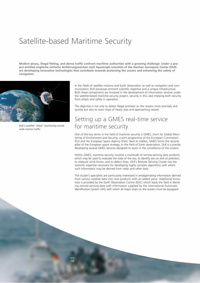
In the fields of satellite missions and Earth observation as well as navigation and communication, DLR possesses eminent scientific expertise and a unique infrastructure. Both these components are involved in the development of information services under the satellitebased maritime security project, security in this case implying both security from attack and safety in operation.
The objective is not only to detect illegal activities on the oceans more precisely and quickly but also to warn ships of heavy seas and approaching vessels.
Setting up a GMES realtime service for maritime securityOne of the key terms in the field of maritime security is GMES, short for Global Monitoring of Environment and Security, a joint programme of the European Commission (EU) and the European Space Agency (ESA). Next to Galileo, GMES forms the second pillar of the European space strategy. In the field of Earth observation, DLR is currently developing several GMES services designed to assist in the surveillance of the oceans.
Within GMES, maritime security involves a multitude of remotesensing data products which may be used to evaluate the state of the sea, to identify sea ice and oil pollution, to measure wind forces, and to detect ships. DLR’s Remote Sensing Cluster has the scientific expertise necessary for developing highly complex algorithms with which such information may be derived from radar and other data.
The cluster’s specialists are particularly interested in amalgamating information derived from various satellite data into new products with an added value. Additional knowhow is provided by the Earth Observation Centre (EOC) which leads the field in blending remotesensing data with information supplied by the international Automatic Identification System (AIS) with which all major ships on the oceans must be equipped.
Satellitebased Maritime Security
Modern piracy, illegal fishing, and dense traffic confront maritime authorities with a growing challenge. Under a pro-ject entitled englische einfache Anführungszeichen statt Apostroph scientists of the German Aerospace Center (DLR) are developing innovative technologies that contribute towards protecting the oceans and enhancing the safety of navigation.
19
© p
ictu
rea
llian
ce/d
pa
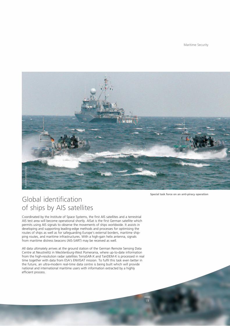
Global identification of ships by AIS satellitesCoordinated by the Institute of Space Systems, the first AIS satellites and a terrestrial AIS test area will become operational shortly. AISat is the first German satellite which permits using AIS signals to observe the movements of ships worldwide. It assists in developing and supporting leadingedge methods and processes for optimising the routes of ships as well as for safeguarding Europe’s external borders, maritime shipping routes, and maritime infrastructures. With a highgain helix antenna, signals from maritime distress beacons (AISSART) may be received as well.
All data ultimately arrives at the ground station of the German Remote Sensing Data Centre at Neustrelitz in MecklenburgWest Pomerania, where uptodate information from the highresolution radar satellites TerraSARX and TanDEMX is processed in real time together with data from ESA’s ENVISAT mission. To fulfil this task even better in the future, an ultramodern realtime data centre is being built which will provide na tional and international maritime users with information extracted by a highly efficient process.
Maritime Security
Special task force on an anti-piracy operation
20
© p
ictu
rea
llian
ce/d
pa
Maritime Security
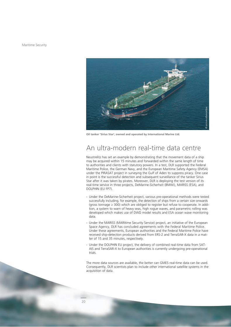
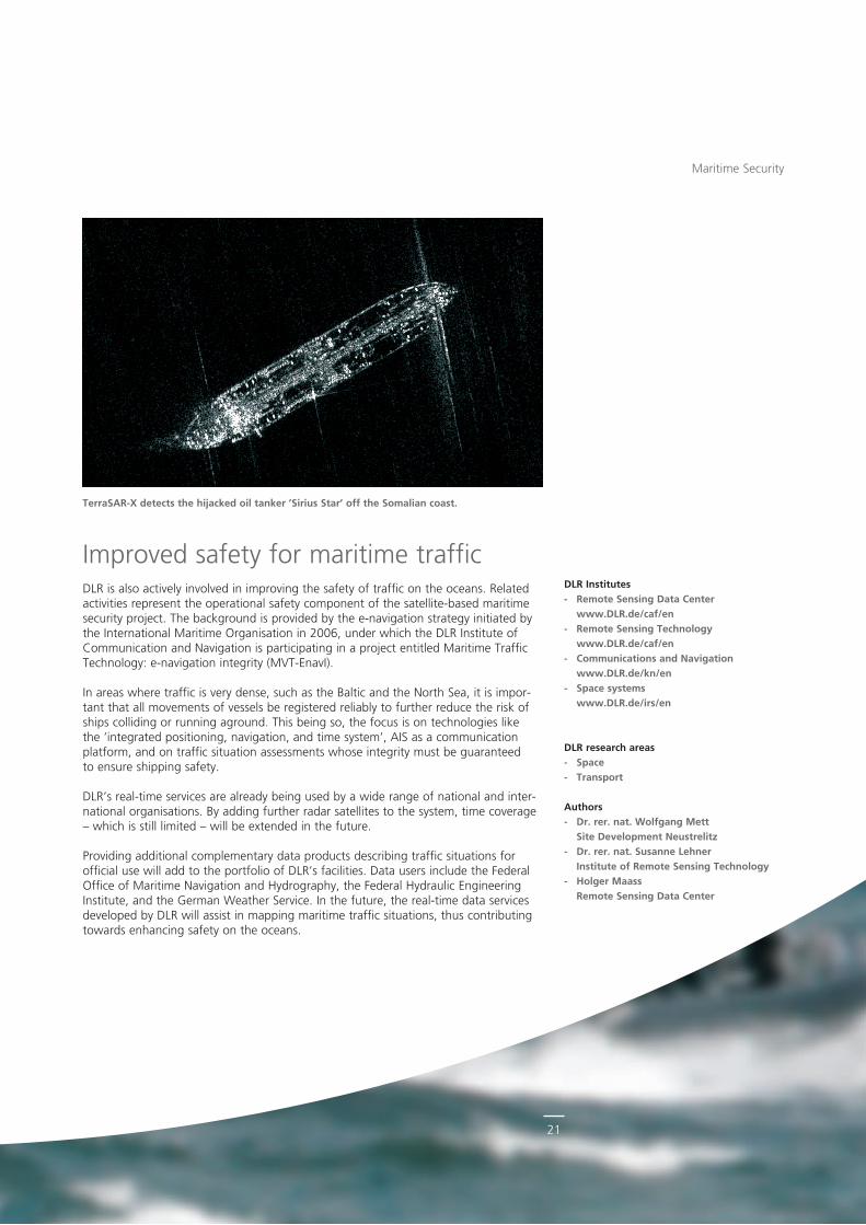
An ultramodern realtime data centreNeustrelitz has set an example by demonstrating that the movement data of a ship may be acquired within 15 minutes and forwarded within the same length of time to authorities and clients with statutory powers. In a test, DLR supported the Federal Maritime Police, the German Navy, and the European Maritime Safety Agency (EMSA) under the PIRASAT project in surveying the Gulf of Aden to suppress piracy. One case in point is the successful detection and subsequent surveillance of the tanker Sirius Star after it was taken by pirates. Moreover, DLR is deploying the test version of its realtime service in three projects, DeMarineSicherheit (BMWi), MARISS (ESA), and DOLPHIN (EU FP7).
Under the DeMarineSicherheit project, various preoperational methods were tested successfully including, for example, the detection of ships from a certain size onwards (gross tonnage ≥ 300) which are obliged to register but refuse to cooperate. In addition, a system to warn of heavy seas, high rogue waves, and parametric rolling was developed which makes use of DWD model results and ESA ocean wave monitoring data.
Under the MARISS (MARItime Security Service) project, an initiative of the European Space Agency, DLR has concluded agreements with the Federal Maritime Police. Under these agreements, European authorities and the Federal Maritime Police have received shipdetection products derived from ERS2 and TerraSARX data in a matter of 15 and 35 minutes, respectively.
Under the DOLPHIN EU project, the delivery of combined realtime data from SATAIS and TerraSARX to European authorities is currently undergoing preoperational trials.
The more data sources are available, the better can GMES realtime data can be used. Consequently, DLR scientists plan to include other international satellite systems in the acquisition of data.
Oil tanker ’Sirius Star’, owned and operated by International Marine Ltd.
21
Maritime Security
Improved safety for maritime trafficDLR is also actively involved in improving the safety of traffic on the oceans. Related activities represent the operational safety component of the satellitebased maritime security project. The background is provided by the enavigation strategy initiated by the International Maritime Organisation in 2006, under which the DLR Institute of Communication and Navigation is participating in a project entitled Maritime Traffic Technology: enavigation integrity (MVTEnavI).
In areas where traffic is very dense, such as the Baltic and the North Sea, it is important that all movements of vessels be registered reliably to further reduce the risk of ships colliding or running aground. This being so, the focus is on technologies like the ’integrated positioning, navigation, and time system’, AIS as a communication platform, and on traffic situation assessments whose integrity must be guaranteed to ensure shipping safety.
DLR’s realtime services are already being used by a wide range of national and international organisations. By adding further radar satellites to the system, time coverage – which is still limited – will be extended in the future.
Providing additional complementary data products describing traffic situations for official use will add to the portfolio of DLR’s facilities. Data users include the Federal Office of Maritime Navigation and Hydrography, the Federal Hydraulic Engineering Institute, and the German Weather Service. In the future, the realtime data services developed by DLR will assist in mapping maritime traffic situations, thus contributing towards enhancing safety on the oceans.
TerraSAR-X detects the hijacked oil tanker ’Sirius Star’ off the Somalian coast.
DLR Institutes- Remote Sensing Data Center
www.DLR.de/caf/en- Remote Sensing Technology
www.DLR.de/caf/en- Communications and Navigation
www.DLR.de/kn/en- Space systems
www.DLR.de/irs/en
DLR research areas- Space- Transport
Authors- Dr. rer. nat. Wolfgang Mett
Site Development Neustrelitz- Dr. rer. nat. Susanne Lehner
Institute of Remote Sensing Technology- Holger Maass
Remote Sensing Data Center
22
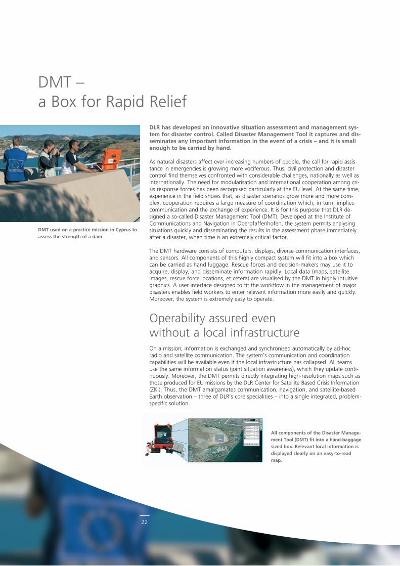
DLR has developed an innovative situation assessment and management sys-tem for disaster control. Called Disaster Management Tool it captures and dis-seminates any important information in the event of a crisis – and it is small enough to be carried by hand.
As natural disasters affect everincreasing numbers of people, the call for rapid assistance in emergencies is growing more vociferous. Thus, civil protection and disaster control find themselves confronted with considerable challenges, nationally as well as internationally. The need for modularisation and international cooperation among crisis response forces has been recognised particularly at the EU level. At the same time, experience in the field shows that, as disaster scenarios grow more and more complex, cooperation requires a large measure of coordination which, in turn, implies communication and the exchange of experience. It is for this purpose that DLR de signed a socalled Disaster Management Tool (DMT). Developed at the Institute of Communications and Navigation in Oberpfaffenhofen, the system permits analysing situations quickly and disseminating the results in the assessment phase immediately after a disaster, when time is an extremely critical factor.
The DMT hardware consists of computers, displays, diverse communication interfaces, and sensors. All components of this highly compact system will fit into a box which can be carried as hand luggage. Rescue forces and decisionmakers may use it to acquire, display, and disseminate information rapidly. Local data (maps, satellite imag es, rescue force locations, et cetera) are visualised by the DMT in highly intuitive graphics. A user interface designed to fit the workflow in the management of major disasters enables field workers to enter relevant information more easily and quickly. Moreover, the system is extremely easy to operate.
Operability assured even without a local infrastructureOn a mission, information is exchanged and synchronised automatically by adhoc radio and satellite communication. The system’s communication and coordination capabilities will be available even if the local infrastructure has collapsed. All teams use the same information status (joint situation awareness), which they update continuously. Moreover, the DMT permits directly integrating highresolution maps such as those produced for EU missions by the DLR Center for Satellite Based Crisis Information (ZKI). Thus, the DMT amalgamates communication, navigation, and satellitebased Earth observation – three of DLR’s core specialities – into a single integrated, problemspecific solution.
DMT used on a practice mission in Cyprus to assess the strength of a dam
All components of the Disaster Manage-ment Tool (DMT) fit into a hand-baggage sized box. Relevant local information is displayed clearly on an easy-to-read map.
DMT – a Box for Rapid Relief
23
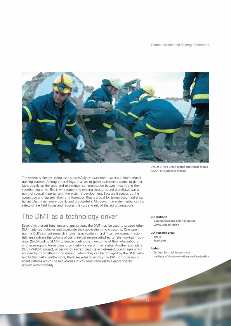
One of THW’s urban search and rescue teams (USAR) on a practice mission
The system is already being used successfully by assessment experts in international training courses. Among other things, it serves to guide assessment teams, to gather facts quickly on the spot, and to maintain communication between teams and their coordinating units. This is why supporting existing structures and workflows was a point of special importance in the system’s development. Because it speeds up the acquisition and dissemination of information that is crucial for taking action, relief can be launched much more quickly and purposefully. Moreover, the system enhances the safety of the field forces and reduces the cost and risk of the aid organisations.
The DMT as a technology driverBeyond its present functions and applications, the DMT may be used to support other DLRmade technologies and accelerate their application in civil security. One case in point is DLR’s current research interest in navigation in a difficult environment: scientists are studying the options of using inertial sensors attached to relief workers’ footwear (NavShoe/FootSLAM) to enable continuous monitoring of their whereabouts, and receiving and forwarding instant information on their status. Another example is DLR’s VABENE project, under which aircraft crews take highresolution images which are directly transmitted to the ground, where they can be displayed by the DMT without further delay. Furthermore, there are plans to employ the DMT in future multiagent systems which use minidrones (micro aerial vehicles) to explore specific regions autonomously.
Communication and Sharing Information
DLR Institute- Communications and Navigation
www.DLR.de/kn/en
DLR research areas- Space- Transport
Author- Dr.-Ing. Michael Angermann
Institute of Communications and Navigation
24
Whether at airports or at mass events, terahertz technology can enhance the effectiveness of security checks. DLR is developing innovative methods to detect arms and hazardous substances.
All airplane passengers are familiar with the security checks at the entrance to the restricted area. So far, screening has largely been confined to metallic objects which metal detectors can identify. In addition, authorities and security companies rely on patdown checks. Now, contactfree examination methods become mature. One of the emerging technologies, terahertz (THz) imaging and spectroscopy, is even capable of discovering nonmetallic objects.
Arms and substances like pharmaceuticals, narcotics, and explosives are often hidden on the human body or in letters. In the terahertz spectral range, such dangerous objects and substances can be tracked down particularly well. In the electromagnetic spectrum, the terahertz band is located between the millimetrewave and the infrared range, which corresponds to frequencies between 300 gigahertz and 10 terahertz and wavelengths of between 1millimetre and 30 micrometres. Thanks to the technological progress made in recent years, the terahertz technology is now ready to make its great leap from purely academic research to practical application.
Shorter than millimetre wavesThere are several reasons why this should be so. First, terahertz radiation is capable of penetrating clothing as well as many packaging materials. The fact that the wavelength of terahertz rays is shorter than that of millimetre waves permits building systems and scanners that are more compact and have a greater range. This opens up entirely new application potentials, possibilities the stationary body scanners currently on trial using millimetre waves are not capable of. Another advantage that terahertz rays have over millimetre waves: in the terahertz range, many substances, including explosives and pharmaceuticals, have their own characteristic absorption and reflection signatures called fingerprint spectra by which they can be identified. Moreover, unlike Xrays, terahertz radiation has no ionising effect, which, from what we know today, makes it safe to use on humans.
At the Institute of Planetary Research in BerlinAdlershof, DLR has been systematically investigating the advantages of using Terahertz radiation in security applications for years. Scientists aim to develop serviceable system demonstrators with a focus on Terahertz scanners that are capable of detecting hidden objects from distances in excess of five metres. More than that: under favourable conditions, researchers were able to detect hidden objects from a distance of no less than 20 metres. Another research focus is on developing Terahertz spectrometers to identify explosives. Yet another is to combine Terahertz sensors with other detection methods.
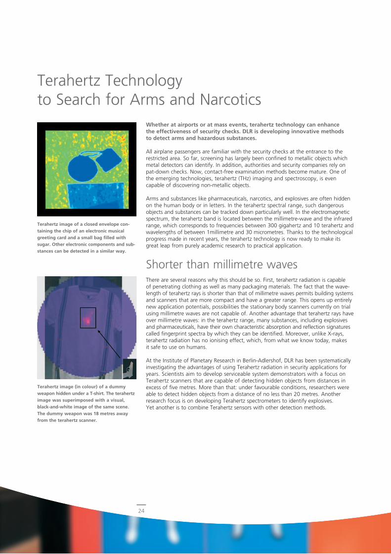
Terahertz image of a closed envelope con-taining the chip of an electronic musical greeting card and a small bag filled with sugar. Other electronic components and sub-stances can be detected in a similar way.
Terahertz image (in colour) of a dummy weapon hidden under a T-shirt. The terahertz image was superimposed with a visual, black-and-white image of the same scene. The dummy weapon was 18 metres away from the terahertz scanner.
Terahertz Technology to Search for Arms and Narcotics
25
© p
ictu
rea
llian
ce/d
pa
Cooperation with partners at home and abroadIn terahertz research, DLR cooperates with leading research institutions, industrial partners, and small and mediumsized enterprises at home and abroad. It manages or participates in security research projects of the Federal Ministry of Education and Research (BMBF), the European Commission, and other organisations. Thus, for example, the TeraSec project, one of the European Commission’s first security research projects, was coordinated by DLR. More than a dozen partners from five member countries participated in TeraSec, six from the industrial sector, seven universities, and three research institutions. Their shared objective is to improve terahertz technology as a means to maintain both security and mobility.
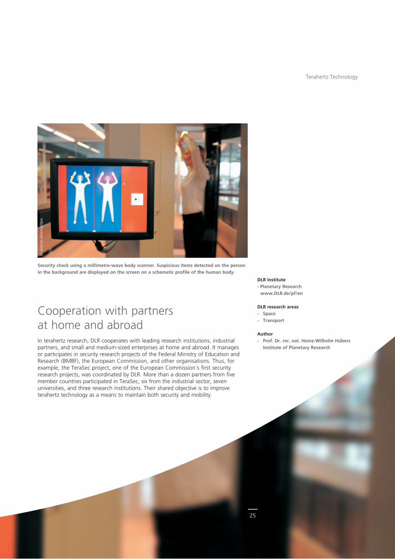
Security check using a millimetre-wave body scanner. Suspicious items detected on the person in the background are displayed on the screen on a schematic profile of the human body.
Terahertz Technology
DLR Institute- Planetary Research
www.DLR.de/pf/en
DLR research areas- Space - Transport
Author- Prof. Dr. rer. nat. Heinz-Wilhelm Hübers
Institute of Planetary Research
26
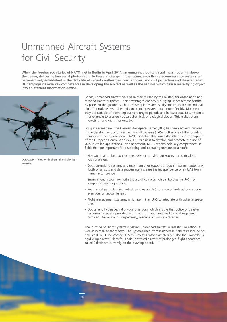
Octocopter fitted with thermal and daylight sensors
Unmanned Aircraft Systems for Civil SecurityWhen the foreign secretaries of NATO met in Berlin in April 2011, an unmanned police aircraft was hovering above the venue, delivering live aerial photographs to those in charge. In the future, such flying reconnaissance systems will become firmly established in the daily life of security authorities, rescue forces, and civil protection and disaster relief. DLR employs its own key competences in developing the aircraft as well as the sensors which turn a mere flying object into an efficient information device.
So far, unmanned aircraft have been mainly used by the military for observation and reconnaissance purposes. Their advantages are obvious: flying under remote control by pilots on the ground, such uncrewed planes are usually smaller than conventional aircraft, produce less noise and can be manoeuvred much more flexibly. Moreover, they are capable of operating over prolonged periods and in hazardous circumstances – for example to analyse nuclear, chemical, or biological clouds. This makes them in teresting for civilian missions, too.
For quite some time, the German Aerospace Center (DLR) has been actively involved in the development of unmanned aircraft systems (UAS). DLR is one of the founding members of the international UAVNet initiative that was established with the support of the European Commission in 2001. Its aim is to develop and promote the use of UAS in civilian applications. Even at present, DLR’s experts hold key competences in fields that are important for developing and operating unmanned aircraft:
Navigation and flight control, the basis for carrying out sophisticated missions with precision.
Decisionmaking systems and maximum pilot support through maximum autonomy (both of sensors and data processing) increase the independence of an UAS from human interference.
Environment recognition with the aid of cameras, which liberates an UAS from waypointbased flight plans.
Mechanical path planning, which enables an UAS to move entirely autonomously even over unknown terrain.
Flight management systems, which permit an UAS to integrate with other airspace users.
Optical and hyperspectral onboard sensors, which ensure that police or disaster response forces are provided with the information required to fight organised crime and terrorism, or, respectively, manage a crisis or a disaster.
The Institute of Flight Systems is testing unmanned aircraft in realistic simulations as well as in reallife flight tests. The systems used by researchers in field tests include not only small ARTIS helicopters (0.5 to 3 metres rotor diameter) but also the Prometheus rigidwing aircraft. Plans for a solarpowered aircraft of prolonged flight endurance called Solitair are currently on the drawing board.
27
Airborne Reconnaissance Systems
Among other things, scientists are focusing on finding solutions that enable un manned flying objects to react automatically to other airspace users so as to avoid colli sions (sense & avoid). Another field of research is the operation of manned and unmanned aircraft together in the same airspace (mannedunmanned teaming), which opens up new fields of application such as search and rescue missions.
Operation in buildingsThe Institute of Communications and Navigation studies and develops systems comprising of particularly small aircraft called micro aerial vehicles (MAVs). What is special about these systems is that a multitude of MAVs flying simultaneously may be combined into a multiagent system. With their decentralised organisation, these systems are very agile and robust, which makes them perfect for civil security and disaster management missions, where they may serve to explore situations or set up communication relays. Because of their small dimensions, MAVs may be deployed in cities and even buildings.
The challenges confronting the developers are many and varied. Ideally, MAVs should be capable of operating for several days in a multiagent system. To provide themselves with energy during that period, they must be capable of flying to a recharging station autonomously. And although a multitude of MAVs are employed in a system, it is not desirable to increase the number of operators. Simultaneous interaction between an operator and a large number of highly dynamic MAVs calls for new concepts of interaction between humans and multiagent systems.
The Institute of Communications and Navigation operates a fleet of MAVs with which it runs operational tests of MAVbased multiagent systems under controlled laboratory conditions. In addition, the institute has extensive experience in the implementation of outdoor experiments with MAV swarms. DLR has been cooperating with international civil protection organisations for years.
Remote sensing in real timeUnmanned multirotor systems offer new remote sensing applications to the police and disaster response forces. Scientists of the DLR Institute of Robotics and Mechatronics are currently testing various types of sensors against a variety of operational scenarios at the institute’s Sensor Concepts and Applications department.
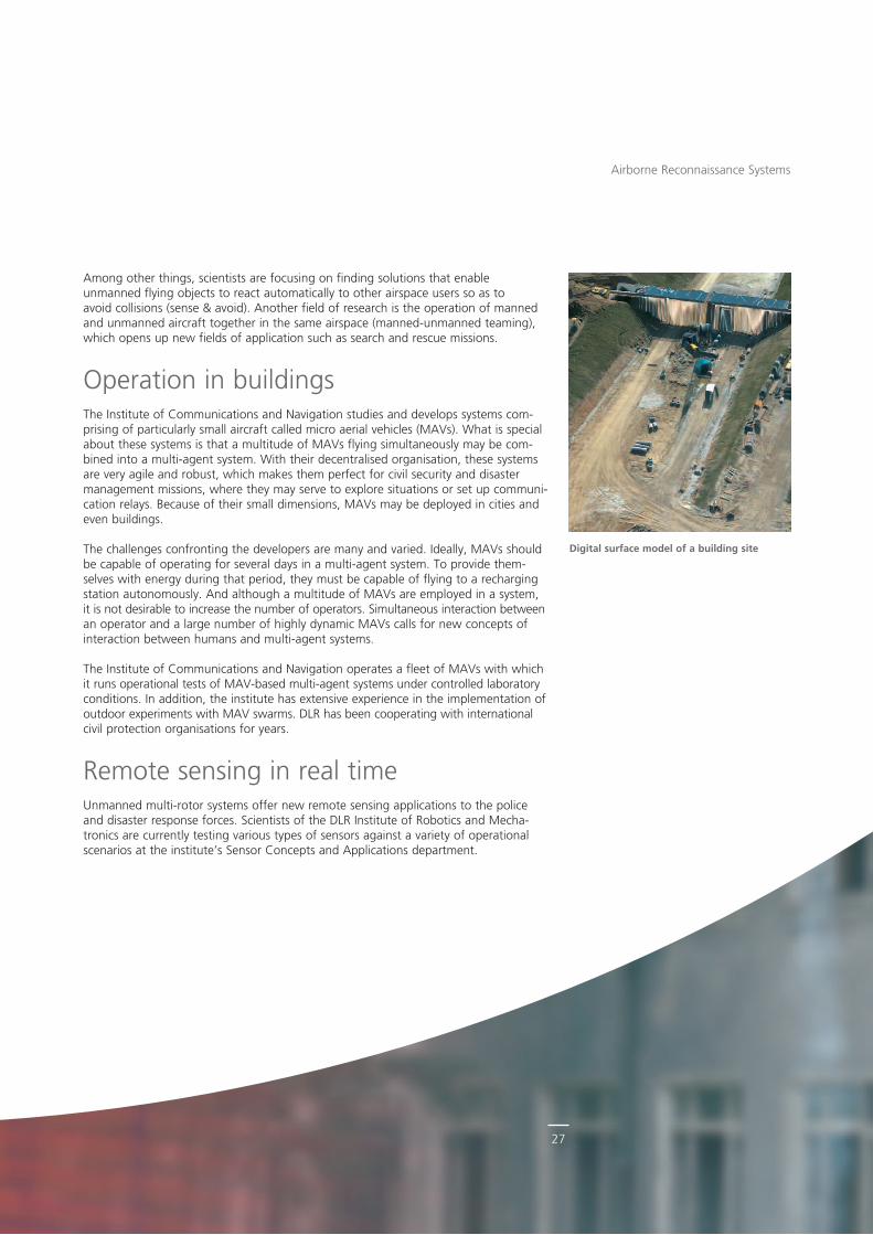
Digital surface model of a building site
28
© A
TO
ne E
EIG
Airborne Reconnaissance Systems
Research activities focus on innovative ways of evaluating aerial images and automatically generating digital terrain models. Since the maximum payload any of these aircraft can carry is about one kilogramme, developers find themselves confronted with novel constraints regarding the design of the sensor systems being used. The department’s expertise covers integrating and georeferencing cameras that are highly sensitive in the visible, thermal, and shortwave infrared spectra as in well as evaluating and validating experimental sensor configurations.
Research aims at developing a method of processing, in real time, georeferenced live image data from various optical sensors into live image mosaics and digital terrain models. In the future, such systems will be used mainly to survey and document accident and disaster scenarios promptly. For this purpose, further finetuning of the aircraft, its optical sensors, and the data processing system will be required.
Challenges of the futureDLR systems such as ARTIS or Prometheus are even now being used experimentally to generate terrain and obstacle maps, 3D versions included. New components and the quality of live CCTV transmissions to ground stations are being tested regularly. The new Solitair aircraft will add highaltitude observations and longrange missions to this portfolio. Another UAS issue is the surveillance of maritime areas, for instance to
Pilot controlling an unmanned aerial vehicle from a ground station
29
detect illegal pollution by shipping, and, in the more distant future, to secure the EU’s external borders. Because the UAS may also be employed in matters of internal security, the Federal Ministry of the Interior is cooperating with DLR on a variety of projects.
However, several challenges will have to be mastered before unmanned aircraft can become a part of our daily life. They are still banned from civilian airspace, and special permits are issued only under strict conditions and/or for very light aircraft. So far, the dependability of the aircraft and their automated flightcontrol systems has failed to measure up to the standards set by manned aircraft and human pilots.
The DLR Institute of Flight Guidance in Braunschweig deals with integrating unmanned aircraft with public airspace users, investigating all methods that are essential to ensure operational safety: flying a route in conformance with instrument flight regulations, approaching alternative airports, flying around bad weather, and emergency procedures. The tests are run with DLR’s experimental aircraft playing the part of quasiUAS, controlled by trained pilots working in a special ground control station but carrying backup pilots on board. The tests include a full simulation of the airspace and are carried out with the participation of air traffic controllers.
Airborne Reconnaissance Systems
DLR Institutes- Flight Guidance
www.DLR.de/fl/en- Flight Systems
www.DLR.de/ft/en- Communications and Navigation
www.DLR.de/kn/en- Robotics and Mechatronics
www.DLR.de/os/en
DLR research areas- Aeronautics- Space
Authors- Jörg Steffen Dittrich
Institute of Flight Systems- Dr.-Ing. Michael Angermann
Institute of Communications and Navigation - Frank Lehmann
Institute of Robotics and Mechatronics- Dr.-Ing. Dirk-Roger Schmitt
Institute of Flight Guidance
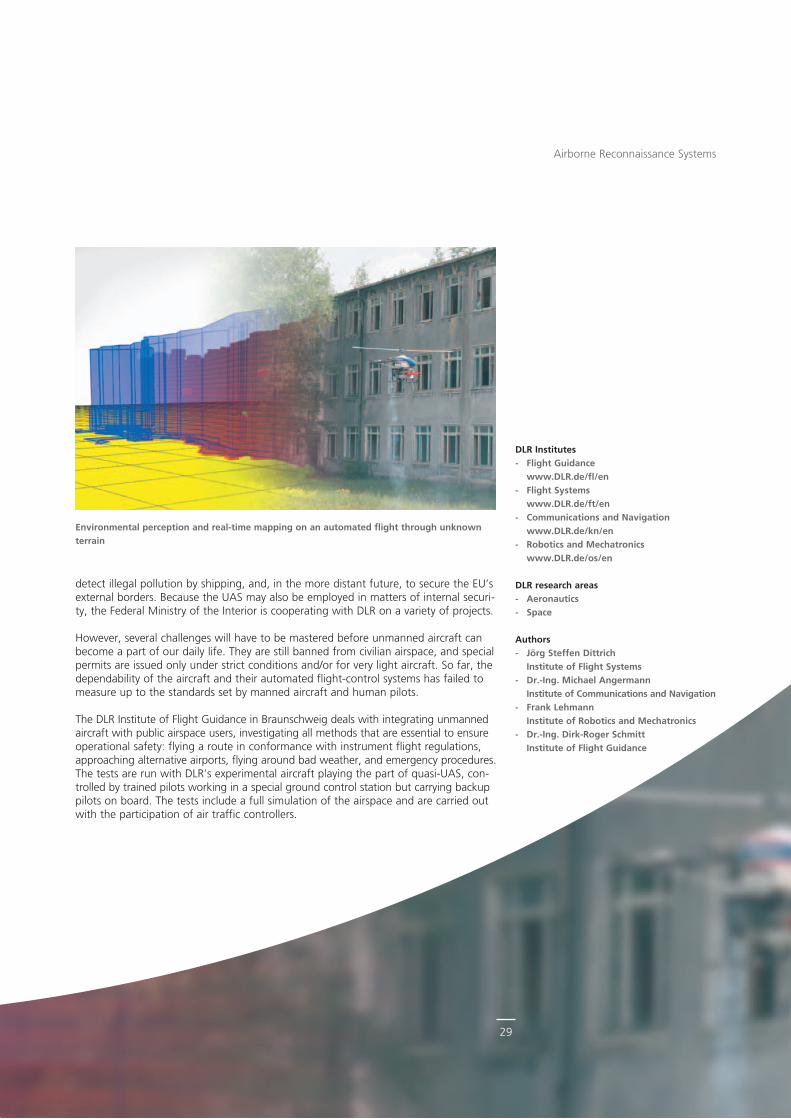
Environmental perception and real-time mapping on an automated flight through unknown terrain
© p
ictu
rea
llian
ce/d
pa.
30
How DLR Laser Systems Will Detect Hazardous Substances to Protect the PopulationWhether deliberate or unintentional, any release of hazardous chemical, biological, radioactive, nuclear, or explosive substances (CBRNE) may have devastating consequences. The DLR Institute of Technical Physics is developing innova-tive methods for tracking down and identifying such substances in time. Called standoff detection, these laser-based systems are designed to mitigate threats to the population in cases of crisis.
As part of its security research programme, DLR is developing innovative methods to detect hazardous substances. The concrete objective is to obtain a compact and mobile detection system that can be easily deployed and effectively used in a crisis. Such a system will obviously be based on the latest laser technology. At the Institute of Technical Physics in Stuttgart, DLR scientists are working on laserbased standoff detection. Its crucial advantage is that it permits examining dubious substances from a relatively long distance.
By contrast, most of the detection methods available today will work only in direct contact with a hazardous substance or within a radius of a few metres around the danger point. An ideal detection method, therefore, should work at greater distances and be capable of analysing potential hazardous substance categories quickly and discreetly.
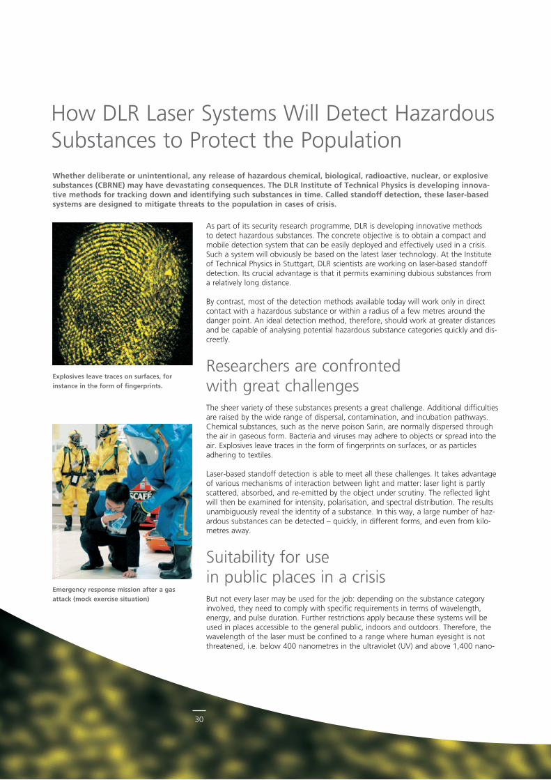
Researchers are confronted with great challengesThe sheer variety of these substances presents a great challenge. Additional difficulties are raised by the wide range of dispersal, contamination, and incubation pathways. Chemical substances, such as the nerve poison Sarin, are normally dispersed through the air in gaseous form. Bacteria and viruses may adhere to objects or spread into the air. Explosives leave traces in the form of fingerprints on surfaces, or as particles adhering to textiles.
Laserbased standoff detection is able to meet all these challenges. It takes advantage of various mechanisms of interaction between light and matter: laser light is partly scattered, absorbed, and reemitted by the object under scrutiny. The reflected light will then be examined for intensity, polarisation, and spectral distribution. The results unambiguously reveal the identity of a substance. In this way, a large number of hazardous substances can be detected – quickly, in different forms, and even from kilometres away.
Suitability for use in public places in a crisisBut not every laser may be used for the job: depending on the substance category involved, they need to comply with specific requirements in terms of wavelength, energy, and pulse duration. Further restrictions apply because these systems will be used in places accessible to the general public, indoors and outdoors. Therefore, the wavelength of the laser must be confined to a range where human eyesight is not threatened, i.e. below 400 nanometres in the ultraviolet (UV) and above 1,400 nano
Emergency response mission after a gas attack (mock exercise situation)
Explosives leave traces on surfaces, for instance in the form of fingerprints.
31
DLR Institute- Technical Physics
www.DLR.de/tp/en
DLR research area- Aeronautics
Author- Dr. Jürgen Handke
Institute of Technical Physics
metres in the infrared (IR). In the open air, interference can also come from weather conditions, dust, changes in the radiation background, or traces of matter resembling hazardous substances.
Suitable laser sources whose frequency is tunable to a great extent are being developed at the DLR Institute of Technical Physics in Stuttgart. Once they have been installed in standoff systems, they will be conveyed for testing to the DLR openair laser test range in Lampoldshausen where they will be examined under realistic conditions, evaluated, and finally optimised. One thing is certain: future laserbased standoff detection methods will be able not only to distinguish between different hazardous substances, they will also be weatherindependent and not dangerous to human eyes so that they can be deployed anywhere and at any time. After all, there are human lives at stake.
Disc Laser laboratory at the Institute of Technical Physics
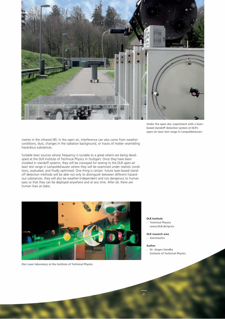
Under the open sky: experiment with a laser-based standoff detection system at DLR’s open-air laser test range in Lampoldshausen
32
© E
uro
DM
S/M
icha
el B
en A
mar
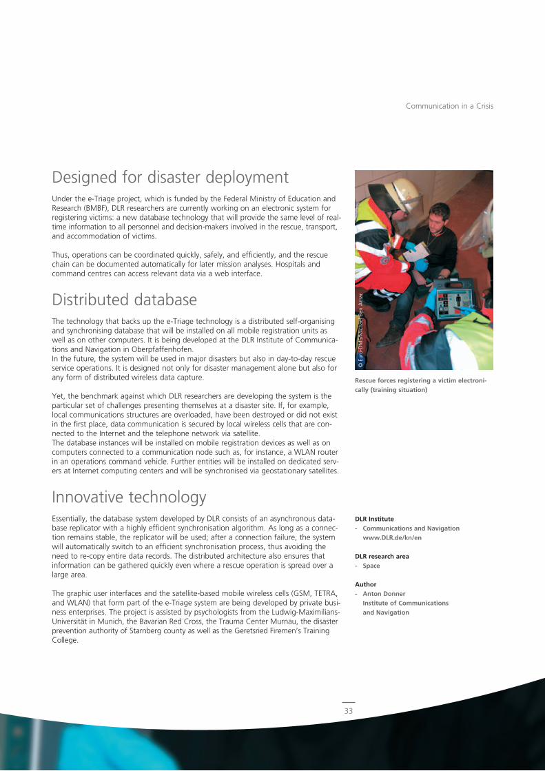
Schematic communication overview within the e-Triage system
Large-scale disasters call for effective crisis management. Rescue services must provide the best possible care for the injured or the sick. The DLR Institute of Communications and Navigation is developing an efficient distributed data-base system that will manage information reliably not only in disaster situa-tions.
Whether we are looking at the Duisburg Loveparade disaster (2010), the pileup on the A8 motorway (2010), or the chemical accident at Mönchengladbach (2008) – wherever the rescue forces are confronted with large numbers of injured or sick persons they need to classify the victims according to the severity of their injuries and the urgency of transport and hospital treatment. This survey process on the scene of an incident is called triage. Currently the entire information about a patient is recorded on a paper tag. Since these tags remain on the patient throughout the supply chain, the command centre can track the situation only with a lengthy timelag, which makes disaster management considerably more difficult.
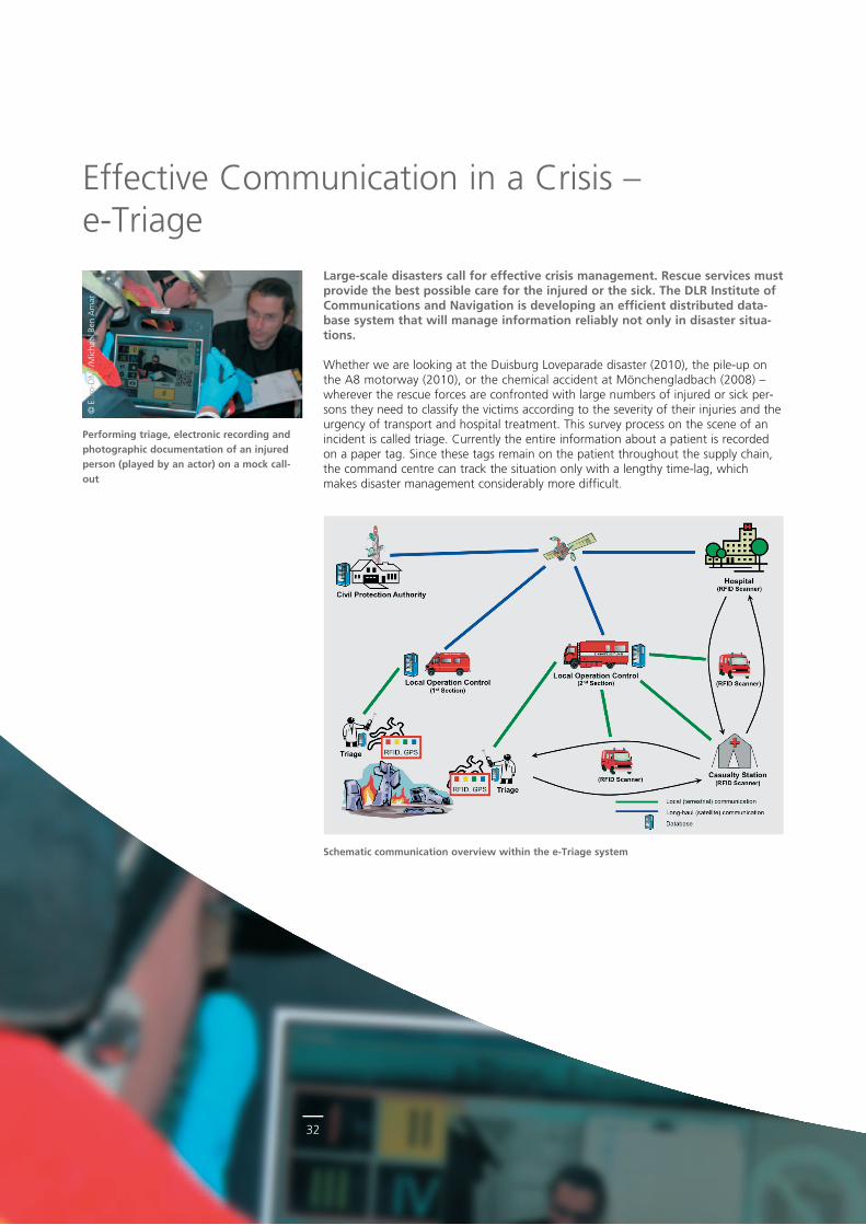
Performing triage, electronic recording and photographic documentation of an injured person (played by an actor) on a mock call-out
Effective Communication in a Crisis – eTriage
33
© E
uro
DM
S/M
icha
el B
en A
mar
Designed for disaster deploymentUnder the eTriage project, which is funded by the Federal Ministry of Education and Research (BMBF), DLR researchers are currently working on an electronic system for registering victims: a new database technology that will provide the same level of realtime information to all personnel and decisionmakers involved in the rescue, transport, and accommodation of victims.
Thus, operations can be coordinated quickly, safely, and efficiently, and the rescue chain can be documented automatically for later mission analyses. Hospitals and command centres can access relevant data via a web interface.
Distributed databaseThe technology that backs up the eTriage technology is a distributed selforganising and synchronising database that will be installed on all mobile registration units as well as on other computers. It is being developed at the DLR Institute of Communications and Navigation in Oberpfaffenhofen. In the future, the system will be used in major disasters but also in daytoday rescue service operations. It is designed not only for disaster management alone but also for any form of distributed wireless data capture.
Yet, the benchmark against which DLR researchers are developing the system is the particular set of challenges presenting themselves at a disaster site. If, for example, local communications structures are overloaded, have been destroyed or did not exist in the first place, data communication is secured by local wireless cells that are connected to the Internet and the telephone network via satellite. The database instances will be installed on mobile registration devices as well as on computers connected to a communication node such as, for instance, a WLAN router in an operations command vehicle. Further entities will be installed on dedicated servers at Internet computing centers and will be synchronised via geostationary satellites.
Innovative technologyEssentially, the database system developed by DLR consists of an asynchronous database replicator with a highly efficient synchronisation algorithm. As long as a connection remains stable, the replicator will be used; after a connection failure, the system will automatically switch to an efficient synchronisation process, thus avoiding the need to recopy entire data records. The distributed architecture also ensures that information can be gathered quickly even where a rescue operation is spread over a large area.
The graphic user interfaces and the satellitebased mobile wireless cells (GSM, TETRA, and WLAN) that form part of the eTriage system are being developed by private business enterprises. The project is assisted by psychologists from the LudwigMaximiliansUniversität in Munich, the Bavarian Red Cross, the Trauma Center Murnau, the disaster prevention authority of Starnberg county as well as the Geretsried Firemen’s Training College.
Communication in a Crisis
DLR Institute- Communications and Navigation
www.DLR.de/kn/en
DLR research area- Space
Author- Anton Donner
Institute of Communications and Navigation
Rescue forces registering a victim electroni-cally (training situation)
3434
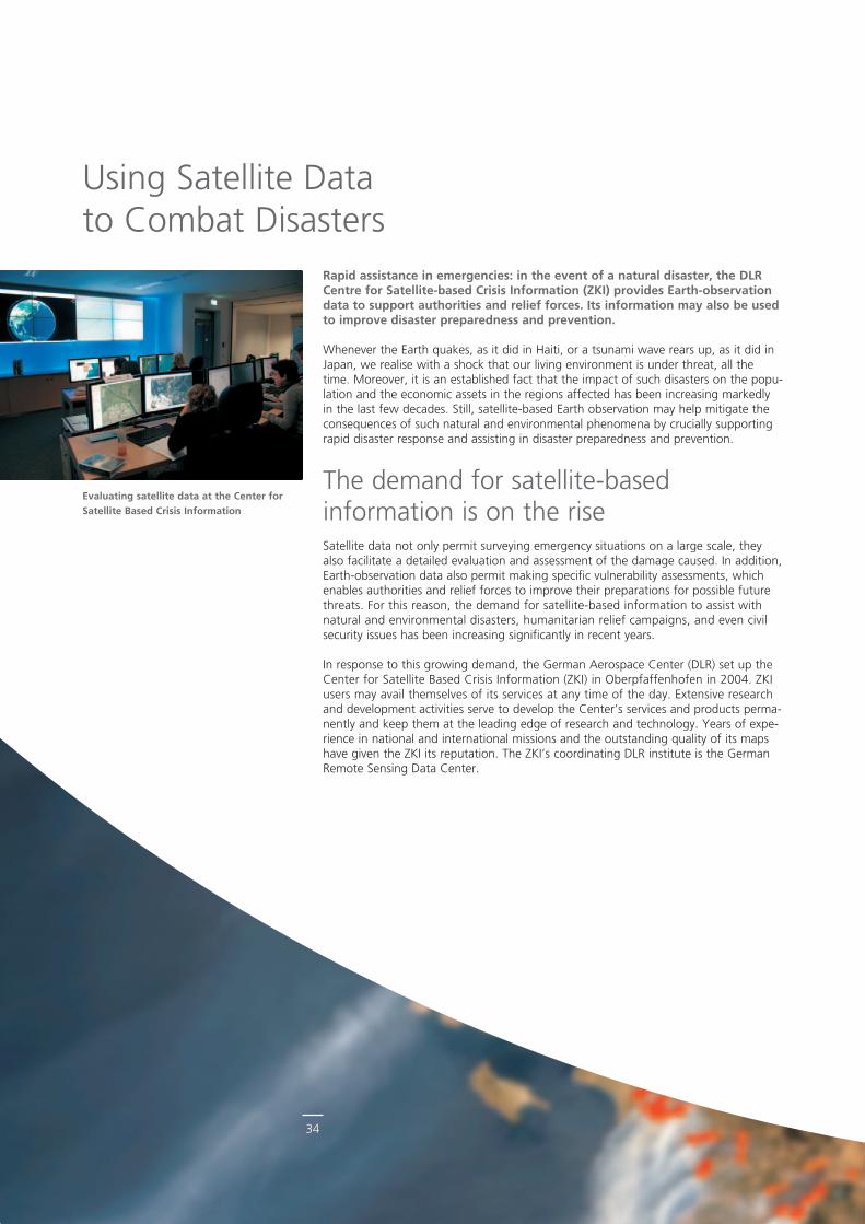
Evaluating satellite data at the Center for Satellite Based Crisis Information
Rapid assistance in emergencies: in the event of a natural disaster, the DLR Centre for Satellite-based Crisis Information (ZKI) provides Earth-observation data to support authorities and relief forces. Its information may also be used to improve disaster preparedness and prevention.
Whenever the Earth quakes, as it did in Haiti, or a tsunami wave rears up, as it did in Japan, we realise with a shock that our living environment is under threat, all the time. Moreover, it is an established fact that the impact of such disasters on the population and the economic assets in the regions affected has been increasing markedly in the last few decades. Still, satellitebased Earth observation may help mitigate the consequences of such natural and environmental phenomena by crucially supporting rapid disaster response and assisting in disaster preparedness and prevention.
The demand for satellitebased information is on the riseSatellite data not only permit surveying emergency situations on a large scale, they also facilitate a detailed evaluation and assessment of the damage caused. In addition, Earthobservation data also permit making specific vulnerability assessments, which enables authorities and relief forces to improve their preparations for possible future threats. For this reason, the demand for satellitebased information to assist with natural and environmental disasters, humanitarian relief campaigns, and even civil security issues has been increasing significantly in recent years.
In response to this growing demand, the German Aerospace Center (DLR) set up the Center for Satellite Based Crisis Information (ZKI) in Oberpfaffenhofen in 2004. ZKI users may avail themselves of its services at any time of the day. Extensive research and development activities serve to develop the Center’s services and products permanently and keep them at the leading edge of research and technology. Years of experience in national and international missions and the outstanding quality of its maps have given the ZKI its reputation. The ZKI’s coordinating DLR institute is the German Remote Sensing Data Center.
Using Satellite Data to Combat Disasters
35
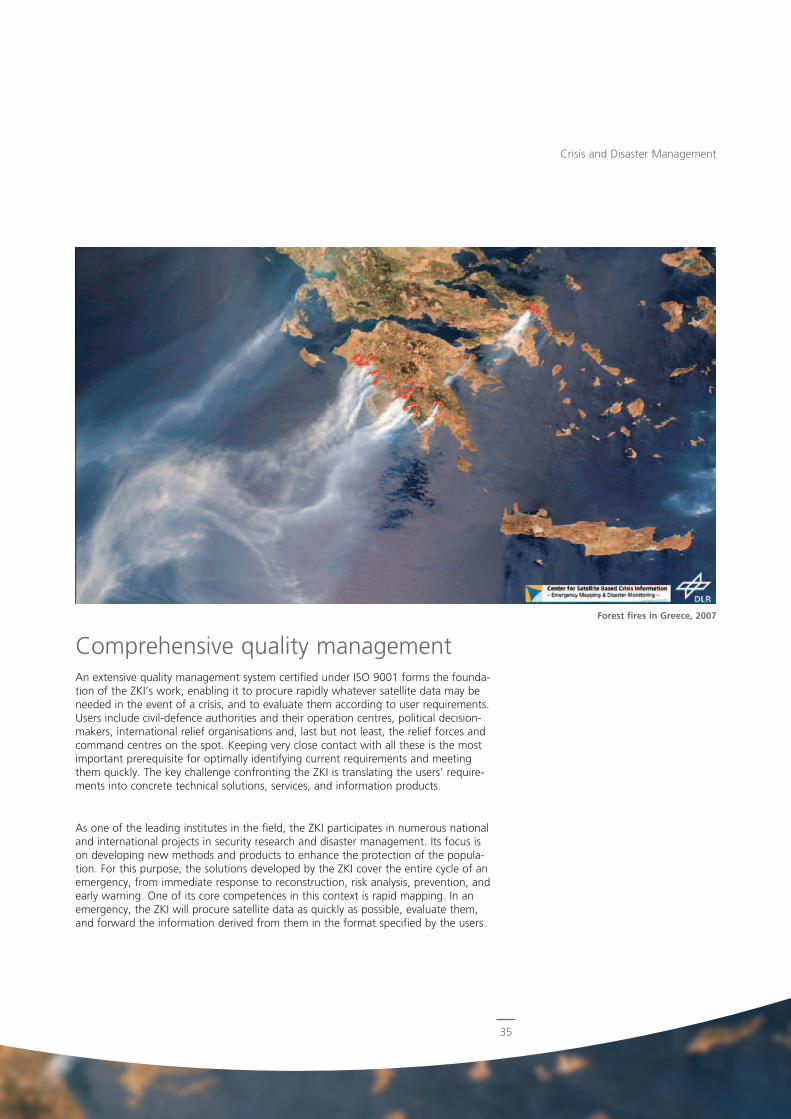
Forest fires in Greece, 2007
Comprehensive quality managementAn extensive quality management system certified under ISO 9001 forms the foundation of the ZKI’s work, enabling it to procure rapidly whatever satellite data may be needed in the event of a crisis, and to evaluate them according to user requirements. Users include civildefence authorities and their operation centres, political decisionmakers, international relief organisations and, last but not least, the relief forces and command centres on the spot. Keeping very close contact with all these is the most important prerequisite for optimally identifying current requirements and meeting them quickly. The key challenge confronting the ZKI is translating the users’ requirements into concrete technical solutions, services, and information products.
As one of the leading institutes in the field, the ZKI participates in numerous national and international projects in security research and disaster management. Its focus is on developing new methods and products to enhance the protection of the population. For this purpose, the solutions developed by the ZKI cover the entire cycle of an emergency, from immediate response to reconstruction, risk analysis, prevention, and early warning. One of its core competences in this context is rapid mapping. In an emergency, the ZKI will procure satellite data as quickly as possible, evaluate them, and forward the information derived from them in the format specified by the users.
Crisis and Disaster Management
36
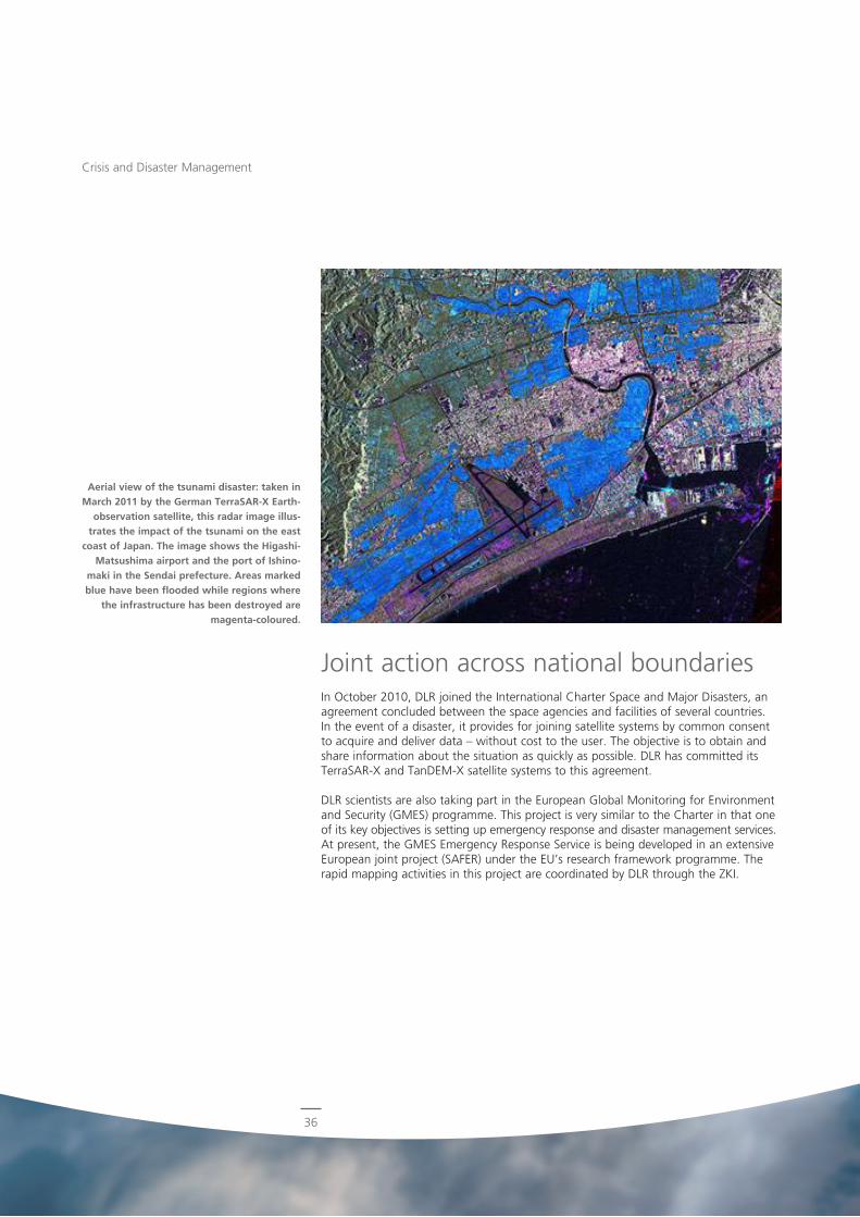
Joint action across national boundariesIn October 2010, DLR joined the International Charter Space and Major Disasters, an agreement concluded between the space agencies and facilities of several countries. In the event of a disaster, it provides for joining satellite systems by common consent to acquire and deliver data – without cost to the user. The objective is to obtain and share information about the situation as quickly as possible. DLR has committed its TerraSARX and TanDEMX satellite systems to this agreement.
DLR scientists are also taking part in the European Global Monitoring for Environment and Security (GMES) programme. This project is very similar to the Charter in that one of its key objectives is setting up emergency response and disaster management services. At present, the GMES Emergency Response Service is being developed in an extensive European joint project (SAFER) under the EU’s research framework programme. The rapid mapping activities in this project are coordinated by DLR through the ZKI.
Crisis and Disaster Management
Aerial view of the tsunami disaster: taken in March 2011 by the German TerraSAR-X Earth-
observation satellite, this radar image illus-trates the impact of the tsunami on the east
coast of Japan. The image shows the Higashi-Matsushima airport and the port of Ishino-
maki in the Sendai prefecture. Areas marked blue have been flooded while regions where
the infrastructure has been destroyed are magenta-coloured.
37
DLR expertise in demand worldwideVarious examples impressively show how great the worldwide demand is for the ZKI and its expertise. In 2010 alone, the center‘s map material was used in three of the worst disasters of the year: the devastating earthquake in Haiti, the largescale floods in Pakistan, and the forest fires in Russia that burned for weeks. In the spring of 2011, the ZKI provided maps to assist Japan in coping with the earthquake and the subsequent tsunami. Two German satellite systems, RapidEye and TerraSARX, took images showing the extent of the damage caused by the flood wave (see photo), the data being forwarded to the users in Japan immediately after their evaluation. In Germany, too, the ZKI’s services were employed on several occasions, mainly in connection with mapping flooded areas as in January 2011, when four federal states along the river Elbe demanded uptodate maps of the extent of the flood.
The ZKI provides not only quick emergency mapping but also information on crisis prevention. Thus, it assists in planning largescale events such as the 2009 NATO summit in Strasbourg. It was even involved in the 2010 World Cup in South Africa, for which it provided uptodate satellite maps and situation reports.
Thus, the ZKI has established itself in recent years as one of the leading institutes in satellitebased crisis information – nationally, in Europe, and in the wider international field. The factors that have been crucial for its success include its capability to provide information reliably and quickly, advise and train people competently, and keep in close contact with users. To be successful in the long run, however, the ZKI must keep on developing its services and adapting them to new requirements and technical resources on an ongoing basis. Needless to say, DLR researchers and scientists are working hard on that.
Crisis and Disaster Management
DLR Institute- German Remote Sensing Data Center
www.DLR.de/caf/en
DLR research areas- Space- Transport
Authors- Prof. Dr.-Ing. Günter Strunz
German Remote Sensing Data Center- Dr. rer. nat. Harald Mehl
German Remote Sensing Data Center- Dr. phil. nat. Stefan Voigt
German Remote Sensing Data Center
38
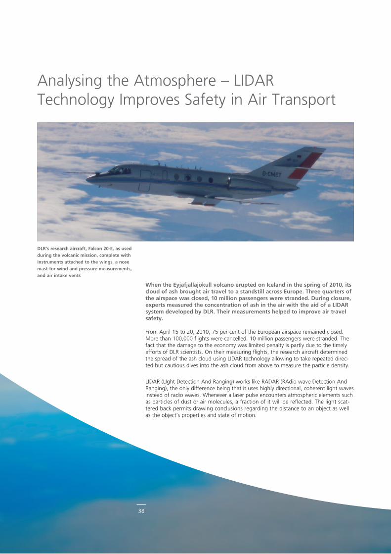
When the Eyjafjallajökull volcano erupted on Iceland in the spring of 2010, its cloud of ash brought air travel to a standstill across Europe. Three quarters of the airspace was closed, 10 million passengers were stranded. During closure, experts measured the concentration of ash in the air with the aid of a LIDAR system developed by DLR. Their measurements helped to improve air travel safety.
From April 15 to 20, 2010, 75 per cent of the European airspace remained closed. More than 100,000 flights were cancelled, 10 million passengers were stranded. The fact that the damage to the economy was limited penalty is partly due to the timely efforts of DLR scientists. On their measuring flights, the research aircraft determined the spread of the ash cloud using LIDAR technology allowing to take repeated directed but cautious dives into the ash cloud from above to measure the particle density.
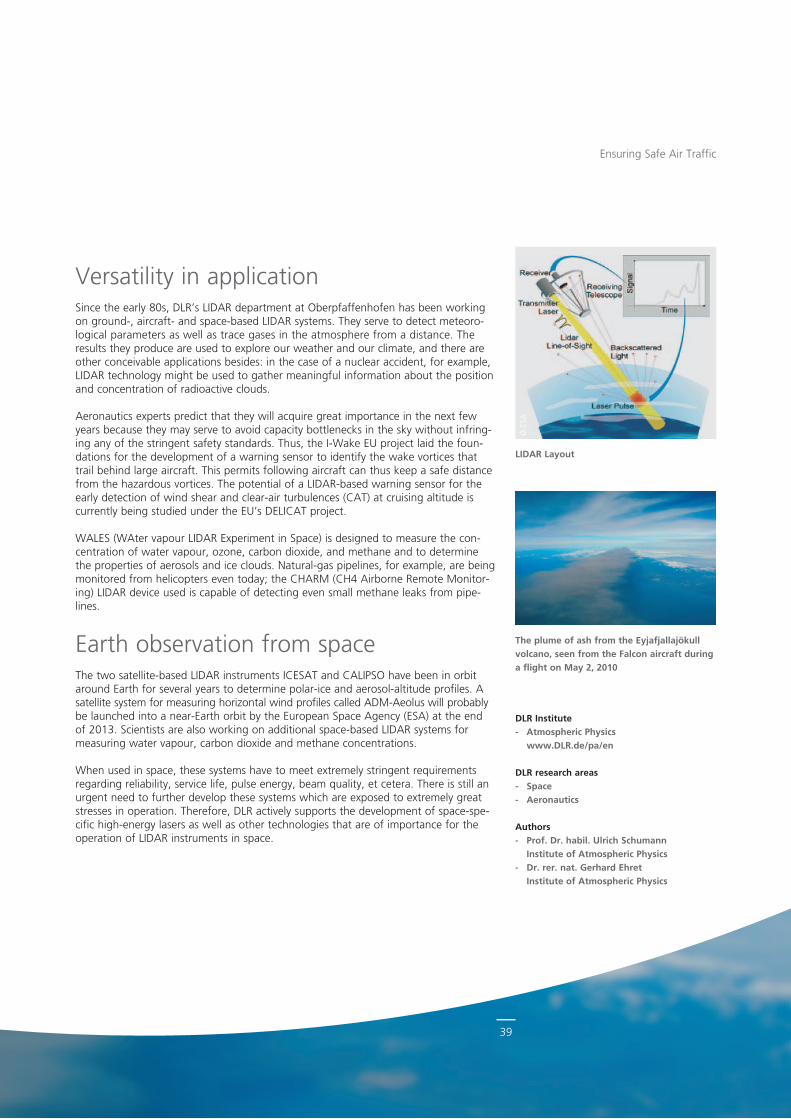
LIDAR (LIght Detection And Ranging) works like RADAR (RAdio wave Detection And Ranging), the only difference being that it uses highly directional, coherent light waves instead of radio waves. Whenever a laser pulse encounters atmospheric elements such as particles of dust or air molecules, a fraction of it will be reflected. The light scattered back permits drawing conclusions regarding the distance to an object as well as the object’s properties and state of motion.
Analysing the Atmosphere – LIDAR Technology Improves Safety in Air Transport
DLR’s research aircraft, Falcon 20-E, as used during the volcanic mission, complete with instruments attached to the wings, a nose mast for wind and pressure measurements, and air intake vents
39
© E
SA
Versatility in applicationSince the early 80s, DLR’s LIDAR department at Oberpfaffenhofen has been working on ground, aircraft and spacebased LIDAR systems. They serve to detect meteorological parameters as well as trace gases in the atmosphere from a distance. The results they produce are used to explore our weather and our climate, and there are other conceivable applications besides: in the case of a nuclear accident, for example, LIDAR technology might be used to gather meaningful information about the position and concentration of radioactive clouds.
Aeronautics experts predict that they will acquire great importance in the next few years because they may serve to avoid capacity bottlenecks in the sky without infringing any of the stringent safety standards. Thus, the IWake EU project laid the foundations for the development of a warning sensor to identify the wake vortices that trail behind large aircraft. This permits following aircraft can thus keep a safe distance from the hazardous vortices. The potential of a LIDARbased warning sensor for the early detection of wind shear and clearair turbulences (CAT) at cruising altitude is currently being studied under the EU’s DELICAT project.
WALES (WAter vapour LIDAR Experiment in Space) is designed to measure the concentration of water vapour, ozone, carbon dioxide, and methane and to determine the properties of aerosols and ice clouds. Naturalgas pipelines, for example, are being monitored from helicopters even today; the CHARM (CH4 Airborne Remote Monitoring) LIDAR device used is capable of detecting even small methane leaks from pipelines.
Earth observation from spaceThe two satellitebased LIDAR instruments ICESAT and CALIPSO have been in orbit around Earth for several years to determine polarice and aerosolaltitude profiles. A satellite system for measuring horizontal wind profiles called ADMAeolus will probably be launched into a nearEarth orbit by the European Space Agency (ESA) at the end of 2013. Scientists are also working on additional spacebased LIDAR systems for measuring water vapour, carbon dioxide and methane concentrations.
When used in space, these systems have to meet extremely stringent requirements regarding reliability, service life, pulse energy, beam quality, et cetera. There is still an urgent need to further develop these systems which are exposed to extremely great stresses in operation. Therefore, DLR actively supports the development of spacespecific highenergy lasers as well as other technologies that are of importance for the operation of LIDAR instruments in space.
The plume of ash from the Eyjafjallajökull volcano, seen from the Falcon aircraft during a flight on May 2, 2010
Ensuring Safe Air Traffic
DLR Institute- Atmospheric Physics
www.DLR.de/pa/en
DLR research areas- Space- Aeronautics
Authors- Prof. Dr. habil. Ulrich Schumann
Institute of Atmospheric Physics- Dr. rer. nat. Gerhard Ehret
Institute of Atmospheric Physics
LIDAR Layout
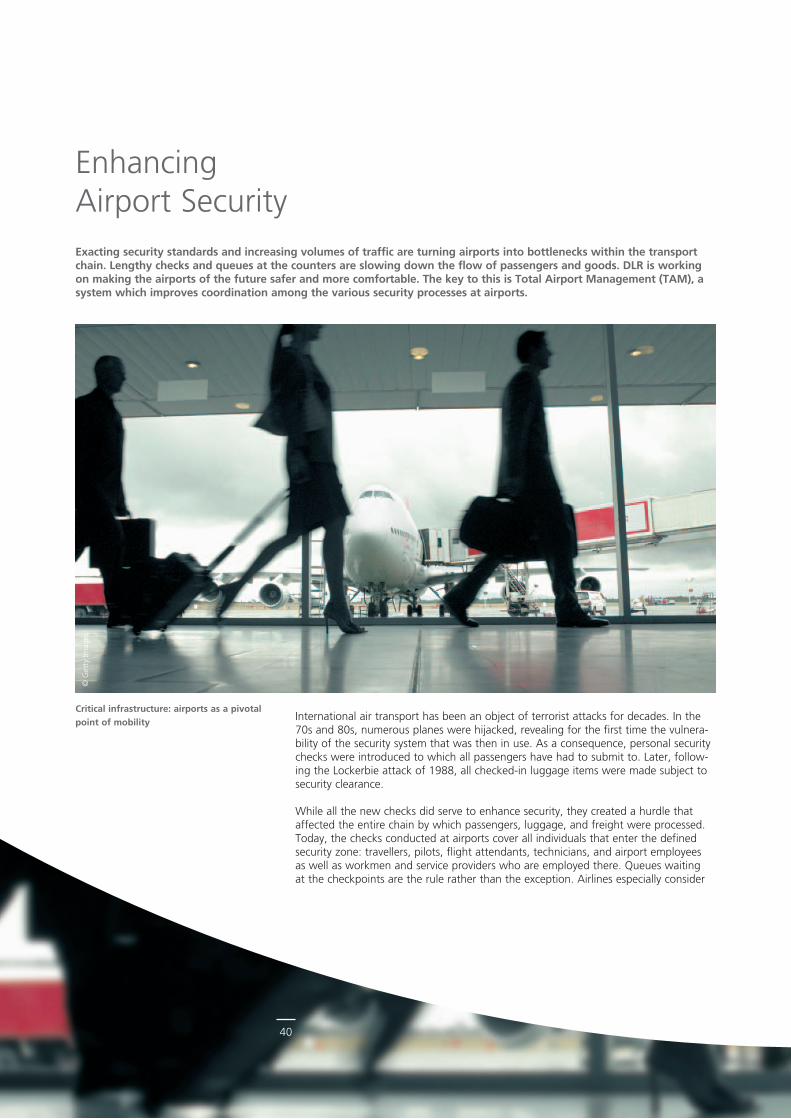
40
© G
etty
Imag
es
International air transport has been an object of terrorist attacks for decades. In the 70s and 80s, numerous planes were hijacked, revealing for the first time the vulnerability of the security system that was then in use. As a consequence, personal security checks were introduced to which all passengers have had to submit to. Later, following the Lockerbie attack of 1988, all checkedin luggage items were made subject to security clearance.
While all the new checks did serve to enhance security, they created a hurdle that affected the entire chain by which passengers, luggage, and freight were processed. Today, the checks conducted at airports cover all individuals that enter the defined security zone: travellers, pilots, flight attendants, technicians, and airport employees as well as workmen and service providers who are employed there. Queues waiting at the checkpoints are the rule rather than the exception. Airlines especially consider
Critical infrastructure: airports as a pivotal point of mobility
Enhancing Airport SecurityExacting security standards and increasing volumes of traffic are turning airports into bottlenecks within the transport chain. Lengthy checks and queues at the counters are slowing down the flow of passengers and goods. DLR is working on making the airports of the future safer and more comfortable. The key to this is Total Airport Management (TAM), a system which improves coordination among the various security processes at airports.
41
them a factor in the increasing difficulty of calculating when exactly passengers will arrive at the departure gates. At the same time, the patience of airport personnel working in the security zone is often put to a severe test at shiftchange time.
Essentially, it is the task of security research to develop new technologies for processing passengers, luggage, and freight. These are supposed to offer protection from potential dangers of the future, such as new explosives, for instance. One of the key concerns of the researchers is to adapt security technologies as perfectly as possible to the various processes at an airport.
Improving process coordinationAirport security is a constituent element of airport management and, as far as future research questions are concerned, of the Total Airport Management (TAM) project. The objective is to improve the coordination of airport processes so as to put available resources and information to the best possible use. DLR’s security research focuses on solutions that are of practical relevance to the police, security service providers, airports, airlines, and other stakeholders.
Thus, for example, scientists working on the FAMOUS project (Future Airport Management Operating Utility System) are concentrating on technical innovations to detect explosives and hazardous substances by, for example, analysing terahertz spectra and imaging data.
The Level of Security measuring system was developed for monitoring security at airport terminals and evaluating it objectively. To put the concept to the test, the first step taken was to map an airport in a simulation environment based on DLR’s simulation software TOMICS. Thus, realistic forecasts of passenger flows permit discovering optimisation potentials and deploying available resources more efficiently while maintaining or even enhancing the level of security.
Improve security, improve efficiencySponsored by the Federal Ministry of Education and Research (BMBF), the Critical Parts project is dedicated to the development of technologies specifically designed to support security checks of employees and goods. The objective is to develop a combination of processes and technologies that will enhance the reliability and efficiency of staff security checks at airports. Present and future technologies are being investigated to find out which technology configuration would cause the shortest waiting time at a checkpoint, given various load scenarios and performance characteristics of the partner technologies involved.
Airport Security
Simulation of an airport waiting area with adjoining passenger security checkpoint
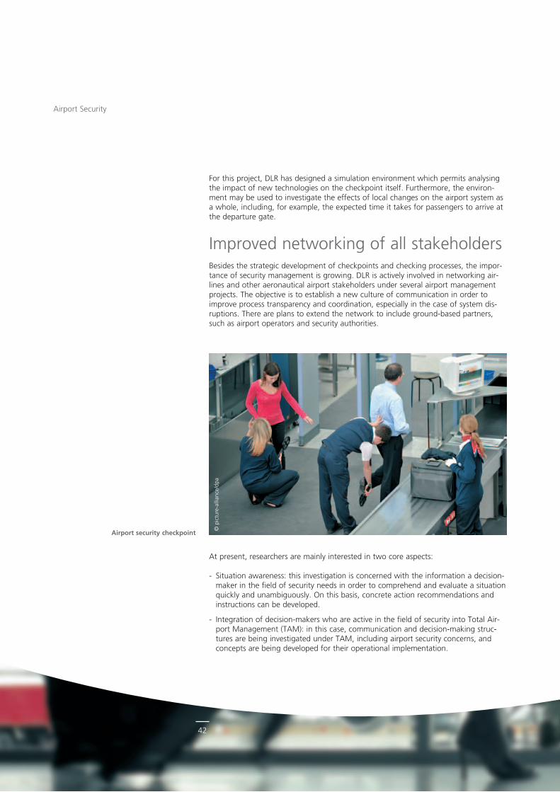
42
© p
ictu
rea
llian
ce/d
pa
Airport Security
At present, researchers are mainly interested in two core aspects:
Situation awareness: this investigation is concerned with the information a decisionmaker in the field of security needs in order to comprehend and evaluate a situation quickly and unambiguously. On this basis, concrete action recommendations and instructions can be developed.
Integration of decisionmakers who are active in the field of security into Total Airport Management (TAM): in this case, communication and decisionmaking structures are being investigated under TAM, including airport security concerns, and concepts are being developed for their operational implementation.
For this project, DLR has designed a simulation environment which permits analysing the impact of new technologies on the checkpoint itself. Furthermore, the environment may be used to investigate the effects of local changes on the airport system as a whole, including, for example, the expected time it takes for passengers to arrive at the departure gate.
Improved networking of all stakeholdersBesides the strategic development of checkpoints and checking processes, the importance of security management is growing. DLR is actively involved in networking airlines and other aeronautical airport stakeholders under several airport management projects. The objective is to establish a new culture of communication in order to improve process transparency and coordination, especially in the case of system disruptions. There are plans to extend the network to include groundbased partners, such as airport operators and security authorities.
Airport security checkpoint
43
Airport Security
DLR Institute- Air Transport and Airport Research
www.DLR.de/fw/en
DLR research areas- Aeronautics- Transport
Author- Andreas Deutschmann
Institute of Air Transport and Airport Research
A highly diverse threat potentialThe threats to which an airport is exposed are many and varied. Next to known risks, such as bomb attacks or aircraft hijacking, there are many other attack scenarios to be considered, ranging from the use of laser pointers to dazzle pilots and rocket attacks on aircraft taking off or landing to attacks on airport IT networks and logistical structures.
There are plans to use the current geopolitical situation as a basis for investigating the likelihood of each of these threat scenarios and prioritising them with the aid of an evaluation system yet to be developed. This will tell researchers what threat scenarios should be considered in TAM plans. Moreover, longrange trends may be derived that will show which technologies will be needed in the future and which processes should be modified.
Integrating all playersIn order to effectively and permanently safeguard airports as traffic hubs of economic relevance, certain security questions relating to the infrastructural environment will have to be answered. Consequently, road and rail transport operators and users will have to be integrated step by step into a permanently evolving security system.
Because threats change all the time, communication, decisionmaking, and implementation methods need to be constantly adapted. To develop effective security strategies, state and federal security agencies need to cooperate closely with security service providers, airport operators, airlines, airport service providers, and researchers.
DLR institutes have the experience and skills to design and evaluate securityrelated processes reliably and efficiently. The concepts developed by our scientists help police forces and security services cope with rising passenger numbers, carry out speedy security checks and make an adequate response to a large variety of threat scenarios.
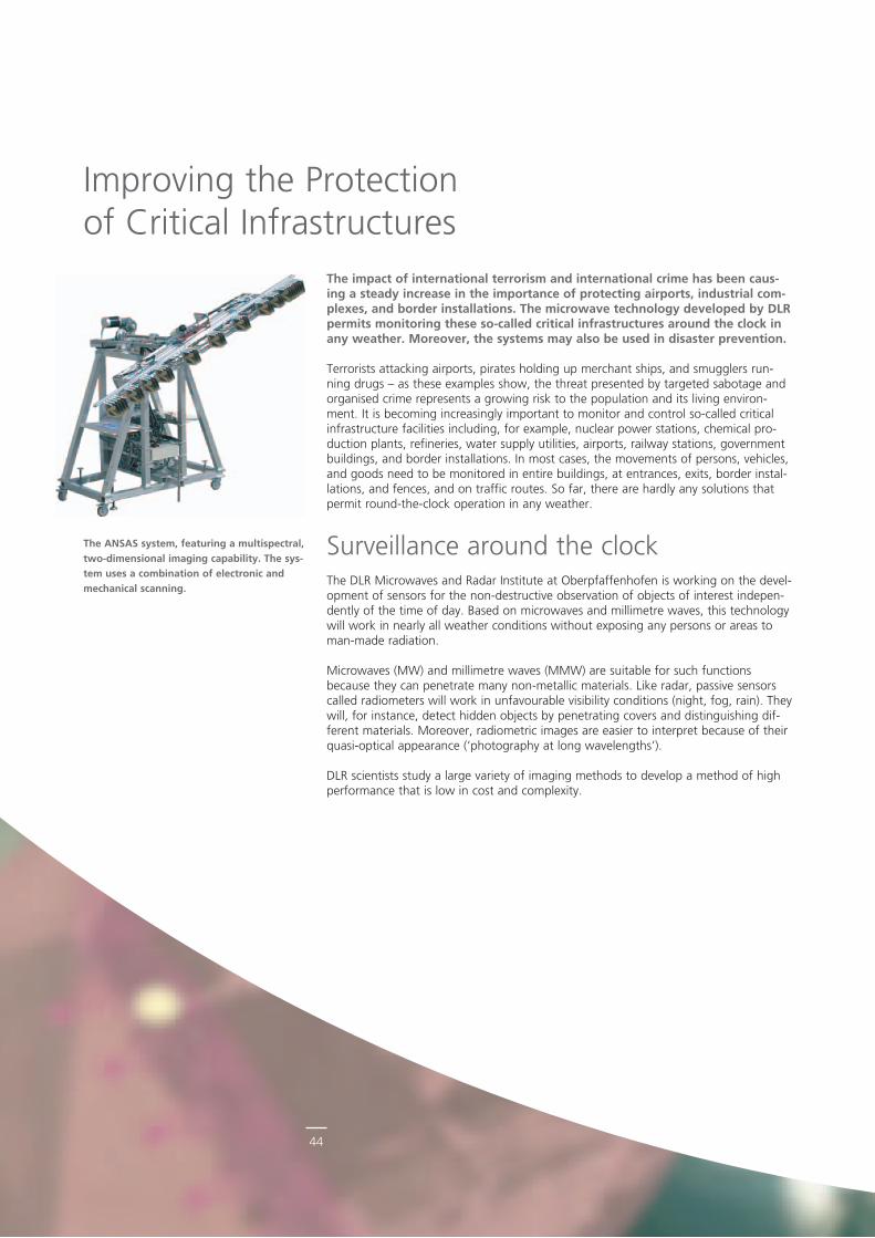
44
The impact of international terrorism and international crime has been caus-ing a steady increase in the importance of protecting airports, industrial com-plexes, and border installations. The microwave technology developed by DLR permits monitoring these so-called critical infrastructures around the clock in any weather. Moreover, the systems may also be used in disaster prevention.
Terrorists attacking airports, pirates holding up merchant ships, and smugglers running drugs – as these examples show, the threat presented by targeted sabotage and organised crime represents a growing risk to the population and its living environment. It is becoming increasingly important to monitor and control socalled critical infrastructure facilities including, for example, nuclear power stations, chemical production plants, refineries, water supply utilities, airports, railway stations, government buildings, and border installations. In most cases, the movements of persons, vehicles, and goods need to be monitored in entire buildings, at entrances, exits, border installations, and fences, and on traffic routes. So far, there are hardly any solutions that permit roundtheclock operation in any weather.
Surveillance around the clockThe DLR Microwaves and Radar Institute at Oberpfaffenhofen is working on the development of sensors for the nondestructive observation of objects of interest independently of the time of day. Based on microwaves and millimetre waves, this technology will work in nearly all weather conditions without exposing any persons or areas to manmade radiation.
Microwaves (MW) and millimetre waves (MMW) are suitable for such functions because they can penetrate many nonmetallic materials. Like radar, passive sensors called radiometers will work in unfavourable visibility conditions (night, fog, rain). They will, for instance, detect hidden objects by penetrating covers and distinguishing different materials. Moreover, radiometric images are easier to interpret because of their quasioptical appearance (‘photography at long wavelengths’).
DLR scientists study a large variety of imaging methods to develop a method of high performance that is low in cost and complexity.
The ANSAS system, featuring a multispectral, two-dimensional imaging capability. The sys-tem uses a combination of electronic and mechanical scanning.
Improving the Protection of Critical Infrastructures
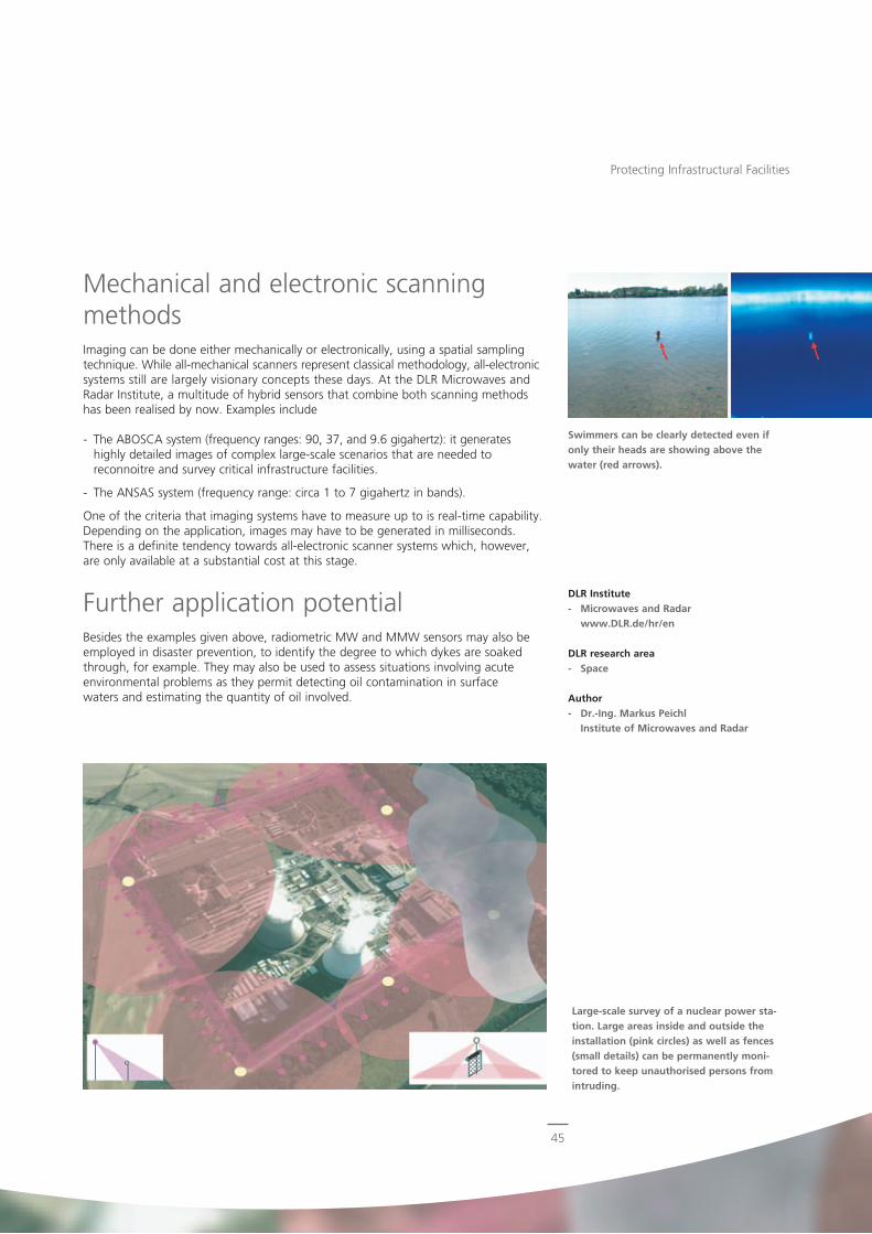
45
Mechanical and electronic scanning methodsImaging can be done either mechanically or electronically, using a spatial sampling technique. While allmechanical scanners represent classical methodology, allelectronic systems still are largely visionary concepts these days. At the DLR Microwaves and Radar Institute, a multitude of hybrid sensors that combine both scanning methods has been realised by now. Examples include
The ABOSCA system (frequency ranges: 90, 37, and 9.6 gigahertz): it generates highly detailed images of complex largescale scenarios that are needed to reconnoitre and survey critical infrastructure facilities.
The ANSAS system (frequency range: circa 1 to 7 gigahertz in bands).
One of the criteria that imaging systems have to measure up to is realtime capability. Depending on the application, images may have to be generated in milliseconds. There is a definite tendency towards allelectronic scanner systems which, however, are only available at a substantial cost at this stage.
Further application potentialBesides the examples given above, radiometric MW and MMW sensors may also be employed in disaster prevention, to identify the degree to which dykes are soaked through, for example. They may also be used to assess situations involving acute environmental problems as they permit detecting oil contamination in surface waters and estimating the quantity of oil involved.
Large-scale survey of a nuclear power sta-tion. Large areas inside and outside the installation (pink circles) as well as fences (small details) can be permanently moni-tored to keep unauthorised persons from intruding.
Swimmers can be clearly detected even if only their heads are showing above the water (red arrows).
Protecting Infrastructural Facilities
DLR Institute- Microwaves and Radar
www.DLR.de/hr/en
DLR research area- Space
Author- Dr.-Ing. Markus Peichl
Institute of Microwaves and Radar
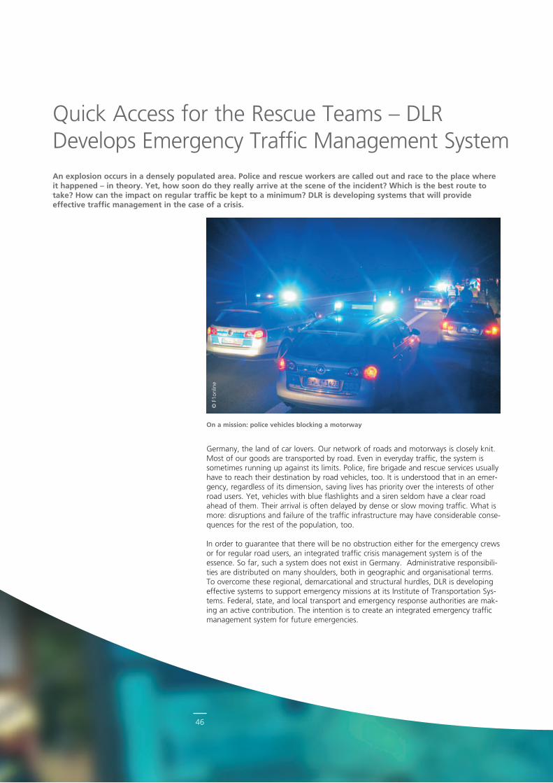
46
© F
1onl
ine
On a mission: police vehicles blocking a motorway
Germany, the land of car lovers. Our network of roads and motorways is closely knit. Most of our goods are transported by road. Even in everyday traffic, the system is sometimes running up against its limits. Police, fire brigade and rescue services usually have to reach their destination by road vehicles, too. It is understood that in an emergency, regardless of its dimension, saving lives has priority over the interests of other road users. Yet, vehicles with blue flashlights and a siren seldom have a clear road ahead of them. Their arrival is often delayed by dense or slow moving traffic. What is more: disruptions and failure of the traffic infrastructure may have considerable consequences for the rest of the population, too.
In order to guarantee that there will be no obstruction either for the emergency crews or for regular road users, an integrated traffic crisis management system is of the essence. So far, such a system does not exist in Germany. Administrative responsibilities are distributed on many shoulders, both in geographic and organisational terms. To overcome these regional, demarcational and structural hurdles, DLR is developing effective systems to support emergency missions at its Institute of Transportation Systems. Federal, state, and local transport and emergency response authorities are making an active contribution. The intention is to create an integrated emergency traffic management system for future emergencies.
Quick Access for the Rescue Teams – DLR Develops Emergency Traffic Management SystemAn explosion occurs in a densely populated area. Police and rescue workers are called out and race to the place where it happened – in theory. Yet, how soon do they really arrive at the scene of the incident? Which is the best route to take? How can the impact on regular traffic be kept to a minimum? DLR is developing systems that will provide effective traffic management in the case of a crisis.
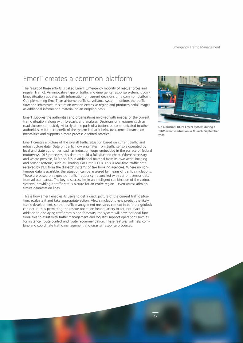
47
EmerT creates a common platformThe result of these efforts is called EmerT (Emergency mobility of rescue forces and regular Traffic). An innovative type of traffic and emergency response system, it combines situation updates with information on current decisions on a common platform. Complementing EmerT, an airborne traffic surveillance system monitors the traffic flow and infrastructure situation over an extensive region and produces aerial images as additional information material on an ongoing basis.
EmerT supplies the authorities and organisations involved with images of the current traffic situation, along with forecasts and analyses. Decisions on measures such as road closures can quickly, virtually at the push of a button, be communicated to other authorities. A further benefit of the system is that it helps overcome demarcation mentalities and supports a more processoriented practice.
EmerT creates a picture of the overall traffic situation based on current traffic and infrastructure data. Data on traffic flow originates from traffic sensors operated by local and state authorities, such as induction loops embedded in the surface of federal motorways. DLR processes this data to build a full situation chart. Where necessary and where possible, DLR also fills in additional material from its own aerial imaging and sensor systems, such as Floating Car Data (FCD). This is realtime traffic data received by DLR from the dispatch systems of taxi booking agencies. Where no continuous data is available, the situation can be assessed by means of traffic simulations. These are based on expected traffic frequency, reconciled with current sensor data from adjacent areas. The key to success lies in an intelligent combination of the various systems, providing a traffic status picture for an entire region – even across administrative demarcation lines.
This is how EmerT enables its users to get a quick picture of the current traffic situation, evaluate it and take appropriate action. Also, simulations help predict the likely traffic development, so that traffic management measures can cut in before a gridlock can occur, thus permitting the rescue operation headquarters to act, not react. In addition to displaying traffic status and forecasts, the system will have optional functionalities to assist with traffic management and logistics support operations such as, for instance, route control and route recommendation. These features will help combine and coordinate traffic management and disaster response processes.
On a mission: DLR’s EmerT system during a THW exercise situation in Munich, September 2009
Emergency Traffic Management
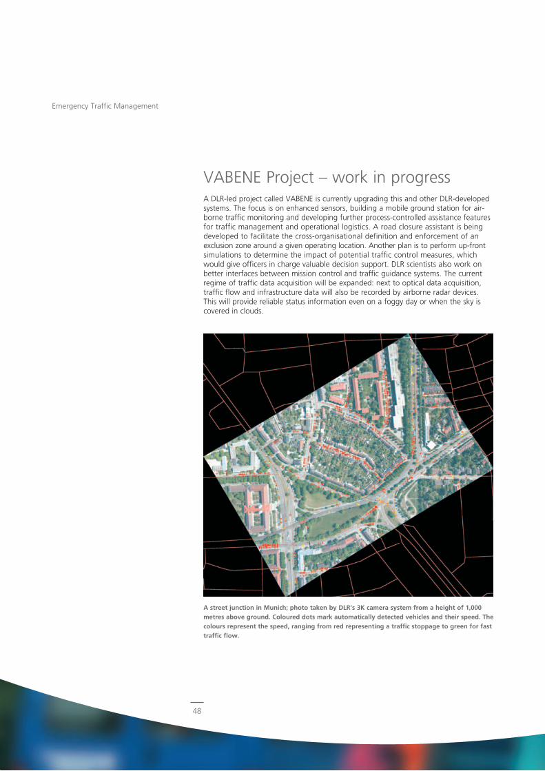
48
VABENE Project – work in progressA DLRled project called VABENE is currently upgrading this and other DLRdeveloped systems. The focus is on enhanced sensors, building a mobile ground station for airborne traffic monitoring and developing further processcontrolled assistance features for traffic management and operational logistics. A road closure assistant is being developed to facilitate the crossorganisational definition and enforcement of an exclusion zone around a given operating location. Another plan is to perform upfront simulations to determine the impact of potential traffic control measures, which would give officers in charge valuable decision support. DLR scientists also work on better interfaces between mission control and traffic guidance systems. The current regime of traffic data acquisition will be expanded: next to optical data acquisition, traffic flow and infrastructure data will also be recorded by airborne radar devices. This will provide reliable status information even on a foggy day or when the sky is covered in clouds.
Emergency Traffic Management
A street junction in Munich; photo taken by DLR’s 3K camera system from a height of 1,000 metres above ground. Coloured dots mark automatically detected vehicles and their speed. The colours represent the speed, ranging from red representing a traffic stoppage to green for fast traffic flow.
49
Vision: an adaptable response systemA disaster will not stop at the border of a state or a local district. This is why DLR recommends the technology to be used flexibly. The focus should be on crossstate forecasting and analytical functions but especially on crossdepartmental and crossterritorial processes. The system is all about simplifying data management. Harmonisation across any of these boundaries will result in valid datasets and help avoid inconsistencies. Welldefined interfaces and wellaligned data exchange processes can bring about a marked improvement in the way in which information is delivered to all responsible parties. Instead of having to handle a large variety of individual situation reports, status information would be comprehensive. A prototype of the system has been tested on several occasions such as largescale police operations and a disaster relief exercise of THW, the Federal Agency for Technical Relief. In essence, the system was shown to be ready for use. An initial pilot operation is now planned that will involve several federal states and regions.
Example: emergency callout and routing of a rescue teamIn the event of an explosion in a densely populated area, here is how EmerT could help bring rescue workers to the site:
Selecting the appropriate rescue vehicle depot: Clear areas can be identified and analysed by means of airborne monitoring. EmerT will then provide information on the current and expected traffic situation around the proposed depot. These data help the officer in charge assess the situation and make a correct decision. Once the choice has been made, the location of the depot is entered into the system, where it can be seen instantly by all relevant users.
Monitoring the current traffic situation: Police and the highway authorities can now take immediate action to ensure a smooth dispatch operation. Important parts of the itinerary, such as specific motorway sections, can be continuously monitored by EmerT. If travel time on these routes exceeds a given limit, the system automatically sets off an alert.
Selecting and deploying rescue workers: EmerT enables the leader of the rescue operations centre to select the team located the closest to the scene of the incident. The system calculates expected travel times for each team in the vicinity. The commander of the team that is eventually called out receives from EmerT a route recommendation based on the most recent information. The team’s current position can be continuously tracked on a digital map, and the team is kept informed about its expected time of arrival.
Setting up road closures: in the event that the rescue operations centre decides to close off a large area around the scene of the incident, the area is marked out in the system. Based on this decision, the police can immediately begin to set up the required closures. At the same time, the highway authorities involved can begin to divert the traffic and to inform the public.
DLR Institute- Transportation Systems
www.DLR.de/ts/en
DLR research area- Transport
Author- Michael Bonert
Institute of Transportation Systems
Emergency Traffic Management
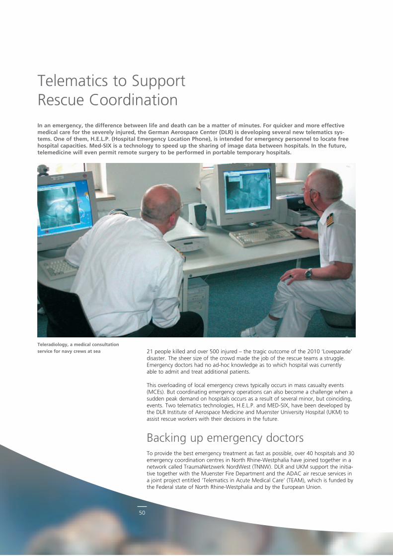
50
21 people killed and over 500 injured – the tragic outcome of the 2010 ’Loveparade’ disaster. The sheer size of the crowd made the job of the rescue teams a struggle. Emergency doctors had no adhoc knowledge as to which hospital was currently able to admit and treat additional patients.
This overloading of local emergency crews typically occurs in mass casualty events (MCEs). But coordinating emergency operations can also become a challenge when a sudden peak demand on hospitals occurs as a result of several minor, but coinciding, events. Two telematics technologies, H.E.L.P. and MEDSIX, have been developed by the DLR Institute of Aerospace Medicine and Muenster University Hospital (UKM) to assist rescue workers with their decisions in the future.
Backing up emergency doctorsTo provide the best emergency treatment as fast as possible, over 40 hospitals and 30 emergency coordination centres in North RhineWestphalia have joined together in a network called TraumaNetzwerk NordWest (TNNW). DLR and UKM support the initiative together with the Muenster Fire Department and the ADAC air rescue services in a joint project entitled ‘Telematics in Acute Medical Care’ (TEAM), which is funded by the Federal state of North RhineWestphalia and by the European Union.
Telematics to Support Rescue Coordination
Teleradiology, a medical consultation service for navy crews at sea
In an emergency, the difference between life and death can be a matter of minutes. For quicker and more effective medical care for the severely injured, the German Aerospace Center (DLR) is developing several new telematics sys-tems. One of them, H.E.L.P. (Hospital Emergency Location Phone), is intended for emergency personnel to locate free hospital capacities. Med-SIX is a technology to speed up the sharing of image data between hospitals. In the future, telemedicine will even permit remote surgery to be performed in portable temporary hospitals.
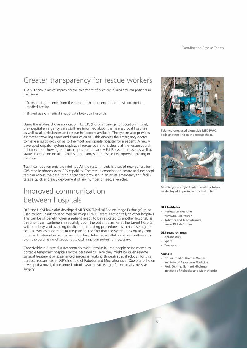
51
© In
go B
icke
r/Lu
ftw
affe
Greater transparency for rescue workersTEAM TNNW aims at improving the treatment of severely injured trauma patients in two areas:
Transporting patients from the scene of the accident to the most appropriate medical facility
Shared use of medical image data between hospitals
Using the mobile phone application H.E.L.P. (Hospital Emergency Location Phone), prehospital emergency care staff are informed about the nearest local hospitals as well as all ambulances and rescue helicopters available. The system also provides estimated travelling times and times of arrival. This enables the emergency doctor to make a quick decision as to the most appropriate hospital for a patient. A newly developed dispatch system displays all rescue operations clearly at the rescue coordination centre, showing the current position of each H.E.L.P. system in use, as well as status information on all hospitals, ambulances, and rescue helicopters operating in the area.
Technical requirements are minimal. All the system needs is a set of newgeneration GPS mobile phones with GPS capability. The rescue coordination centre and the hospitals can access the data using a standard browser. In an acute emergency this facilitates a quick and easy deployment of any number of rescue vehicles.
Improved communication between hospitalsDLR and UKM have also developed MEDSIX (Medical Secure Image Exchange) to be used by consultants to send medical images like CT scans electronically to other hospitals. This can be of benefit when a patient needs to be relocated to another hospital, as treatment can continue immediately upon the patient’s arrival at the target hospital, without delay and avoiding duplication in testing procedures, which cause higher costs as well as discomfort to the patient. The fact that the system runs on any computer with internet access makes a full hospitalwide installation of new software, or even the purchasing of special data exchange computers, unnecessary.
Conceivably, a future disaster scenario might involve injured people being moved to portable temporary hospitals by the paramedics. Here they might be given remote surgical treatment by experienced surgeons working through special robots. For this purpose, researchers at DLR’s Institute of Robotics and Mechatronics at Oberpfaffenhofen developed a novel, threearmed robotic system, MiroSurge, for minimally invasive surgery.
DLR Institutes- Aerospace Medicine
www.DLR.de/me/en- Robotics and Mechatronics
www.DLR.de/rm/en
DLR research areas- Aeronautics- Space- Transport
Authors- Dr. rer. medic. Thomas Weber
Institute of Aerospace Medicine- Prof. Dr.-Ing. Gerhard Hirzinger
Institute of Robotics and Mechatronics
Coordinating Rescue Teams
Telemedicine, used alongside MEDEVAC, adds another link to the rescue chain.
MiroSurge, a surgical robot, could in futurebe deployed in portable hospital units.
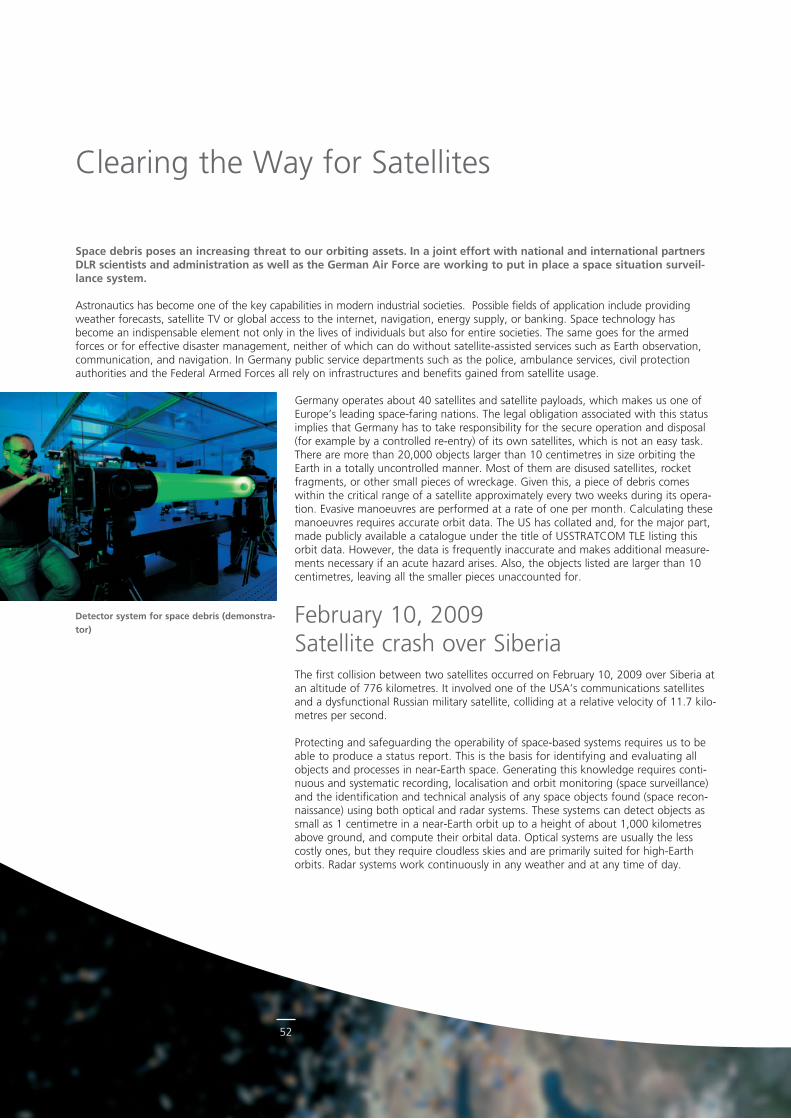
52
Space debris poses an increasing threat to our orbiting assets. In a joint effort with national and international partners DLR scientists and administration as well as the German Air Force are working to put in place a space situation surveil-lance system.
Astronautics has become one of the key capabilities in modern industrial societies. Possible fields of application include providing weather forecasts, satellite TV or global access to the internet, navigation, energy supply, or banking. Space technology has become an indispensable element not only in the lives of individuals but also for entire societies. The same goes for the armed forces or for effective disaster management, neither of which can do without satelliteassisted services such as Earth observation, communication, and navigation. In Germany public service departments such as the police, ambulance services, civil protection authorities and the Federal Armed Forces all rely on infrastructures and benefits gained from satellite usage.
Germany operates about 40 satellites and satellite payloads, which makes us one of Europe’s leading spacefaring nations. The legal obligation associated with this status implies that Germany has to take responsibility for the secure operation and disposal (for example by a controlled reentry) of its own satellites, which is not an easy task. There are more than 20,000 objects larger than 10 centimetres in size orbiting the Earth in a totally uncontrolled manner. Most of them are disused satellites, rocket fragments, or other small pieces of wreckage. Given this, a piece of debris comes within the critical range of a satellite approximately every two weeks during its operation. Evasive manoeuvres are performed at a rate of one per month. Calculating these manoeuvres requires accurate orbit data. The US has collated and, for the major part, made publicly available a catalogue under the title of USSTRATCOM TLE listing this orbit data. However, the data is frequently inaccurate and makes additional measurements necessary if an acute hazard arises. Also, the objects listed are larger than 10 centimetres, leaving all the smaller pieces unaccounted for.
February 10, 2009 Satellite crash over SiberiaThe first collision between two satellites occurred on February 10, 2009 over Siberia atan altitude of 776 kilometres. It involved one of the USA’s communications satellites and a dysfunctional Russian military satellite, colliding at a relative velocity of 11.7 kilometres per second.
Protecting and safeguarding the operability of spacebased systems requires us to be able to produce a status report. This is the basis for identifying and evaluating all objects and processes in nearEarth space. Generating this knowledge requires continuous and systematic recording, localisation and orbit monitoring (space surveillance) and the identification and technical analysis of any space objects found (space reconnaissance) using both optical and radar systems. These systems can detect objects as small as 1 centimetre in a nearEarth orbit up to a height of about 1,000 kilometres above ground, and compute their orbital data. Optical systems are usually the less costly ones, but they require cloudless skies and are primarily suited for highEarth orbits. Radar systems work continuously in any weather and at any time of day.
Clearing the Way for Satellites
Detector system for space debris (demonstra-tor)
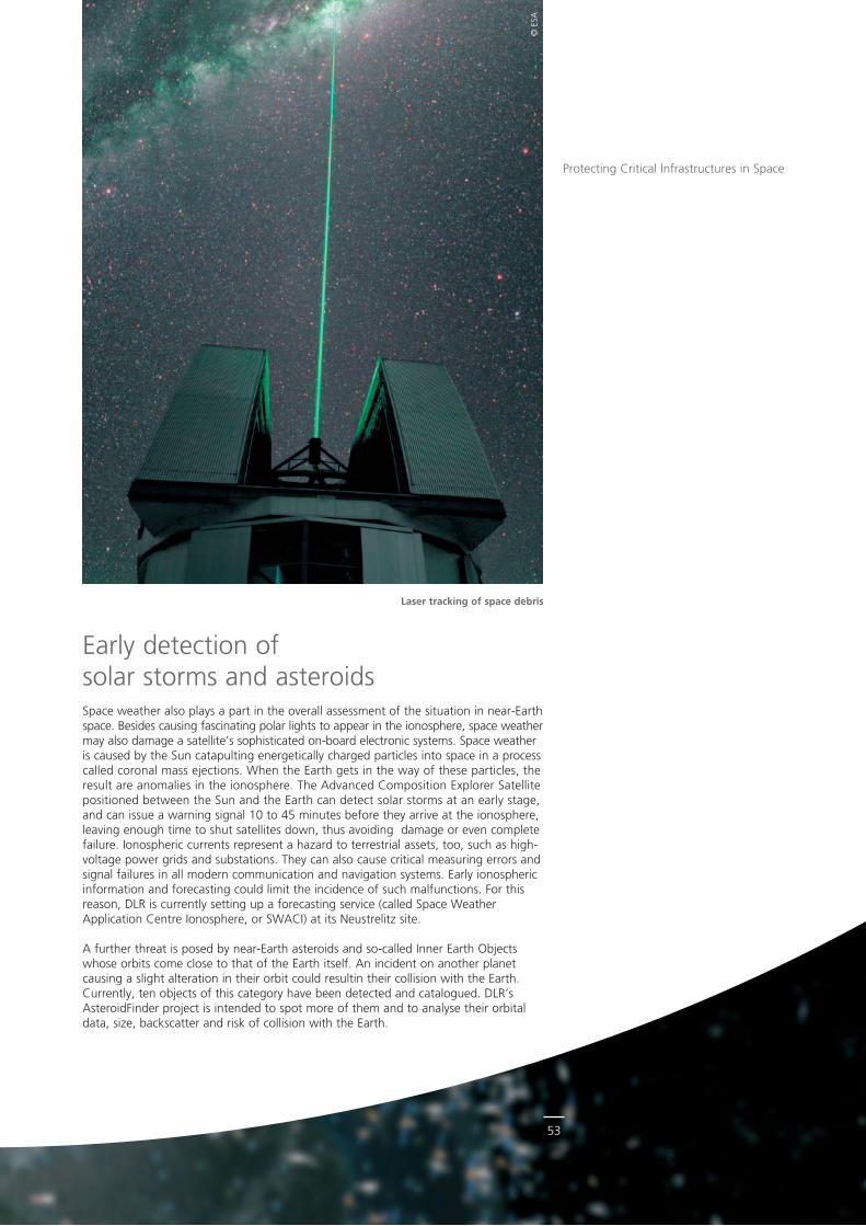
53
© E
SA
Early detection of solar storms and asteroidsSpace weather also plays a part in the overall assessment of the situation in nearEarth space. Besides causing fascinating polar lights to appear in the ionosphere, space weather may also damage a satellite’s sophisticated onboard electronic systems. Space weather is caused by the Sun catapulting energetically charged particles into space in a process called coronal mass ejections. When the Earth gets in the way of these particles, the result are anomalies in the ionosphere. The Advanced Composition Explorer Satellite positioned between the Sun and the Earth can detect solar storms at an early stage, and can issue a warning signal 10 to 45 minutes before they arrive at the ionosphere, leaving enough time to shut satellites down, thus avoiding damage or even complete failure. Ionospheric currents represent a hazard to terrestrial assets, too, such as highvoltage power grids and substations. They can also cause critical measuring errors and signal failures in all modern communication and navigation systems. Early ionospheric information and forecasting could limit the incidence of such malfunctions. For this reason, DLR is currently setting up a forecasting service (called Space Weather Application Centre Ionosphere, or SWACI) at its Neustrelitz site.
A further threat is posed by nearEarth asteroids and socalled Inner Earth Objects whose orbits come close to that of the Earth itself. An incident on another planet causing a slight alteration in their orbit could resultin their collision with the Earth. Currently, ten objects of this category have been detected and catalogued. DLR’s AsteroidFinder project is intended to spot more of them and to analyse their orbital data, size, backscatter and risk of collision with the Earth.
Laser tracking of space debris
Protecting Critical Infrastructures in Space
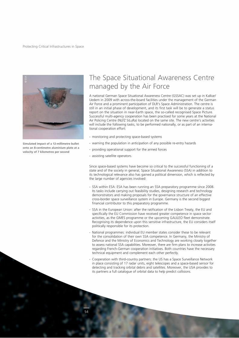
54
© E
SA
Protecting Critical Infrastructures in Space
The Space Situational Awareness Centre managed by the Air ForceA national German Space Situational Awareness Centre (GSSAC) was set up in Kalkar/Uedem in 2009 with acrosstheboard facilities under the management of the German Air Force and a prominent participation of DLR’s Space Administration. The centre is still in an initial phase of development, and its first task will be to generate a status report on the situation in nearEarth space, the socalled recognised Space Picture. Successful multiagency cooperation has been practised for some years at the National Air Policing Centre (NLFZ SiLuRa) located on the same site. The new centre’s activities will include the following tasks, to be performed nationally, or as part of an international cooperation effort:
monitoring and protecting spacebased systems
warning the population in anticipation of any possible reentry hazards
providing operational support for the armed forces
assisting satellite operators.
Since spacebased systems have become so critical to the successful functioning of a state and of the society in general, Space Situational Awareness (SSA) in addition to its technological relevance also has gained a political dimension, which is reflected by the large number of agencies involved:
SSA within ESA: ESA has been running an SSA preparatory programme since 2008. Its tasks include carrying out feasibility studies, designing research and technology demonstrators and making proposals for the governance structure of an effective crossborder space surveillance system in Europe. Germany is the second biggest financial contributor to this preparatory programme.
SSA in the European Union: after the ratification of the Lisbon Treaty, the EU and specifically the EU Commission have received greater competence in space sector activities, as the GMES programme or the upcoming GALILEO fleet demonstrate. Recognising its dependence upon this sensitive infrastructure, the EU considers itself politically responsible for its protection.
National programmes: individual EU member states consider these to be relevant for the consolidation of their own SSA competence. In Germany, the Ministry of Defence and the Ministry of Economics and Technology are working closely together to assess national SSA capabilities. Moreover, there are firm plans to increase activities regarding FrenchGerman cooperation initiatives. Both countries have the necessary technical equipment and complement each other perfectly.
Cooperation with thirdcountry partners: the US has a Space Surveillance Network in place consisting of 17 radar units, eight telescopes and a spacebased sensor for detecting and tracking orbital debris and satellites. Moreover, the USA provides to its partners a full catalogue of orbital data to help predict collisions.
Simulated impact of a 12-millimetre bullet onto an 8-centimetre aluminium plate at a velocity of 7 kilometres per second
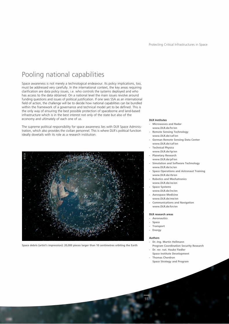
55
© E
SA
Protecting Critical Infrastructures in Space
Pooling national capabilitiesSpace awareness is not merely a technological endeavour. Its policy implications, too, must be addressed very carefully. In the international context, the key areas requiring clarification are data policy issues, i.e. who controls the systems deployed and who has access to the data obtained. On a national level the main issues revolve around funding questions and issues of political justification. If one sees SSA as an international field of action, the challenge will be to decide how national capabilities can be bundled within the framework of a governance and technical model yet to be defined. This is the only way of ensuring the best possible protection of spaceborne and landbased infrastructure which is in the best interest not only of the state but also of the economy and ultimately of each one of us.
The supreme political responsibility for space awareness lies with DLR Space Administration, which also provides the civilian personnel. This is where DLR‘s political function ideally dovetails with its role as a research institution.
DLR Institutes- Microwaves and Radar
www.DLR.de/hr/en- Remote Sensing Technology
www.DLR.de/caf/en- German Remote Sensing Data Center
www.DLR.de/caf/en- Technical Physics
www.DLR.de/tp/en- Planetary Research
www.DLR.de/pf/en- Simulation and Software Technology
www.DLR.de/sc/en - Space Operations and Astronaut Training
www.DLR.de/rb/en- Robotics and Mechatronics
www.DLR.de/os/en- Space Systems
www.DLR.de/irs/en- Aerospace Medicine
www.DLR.de/me/en- Communications and Navigation
www.DLR.de/kn/en
DLR research areas- Aeronautics- Space- Transport- Energy
Authors- Dr.-Ing. Martin Hellmann
Program Coordination Security Research- Dr. rer. nat. Hauke Fiedler
Space Institute Development- Thomas Cherdron
Space Strategy and Program
Space debris (artist’s impression): 20,000 pieces larger than 10 centimetres orbiting the Earth
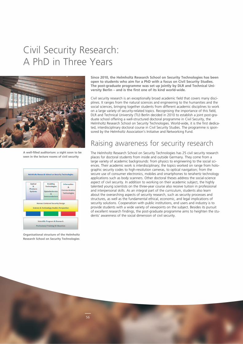
56
© P
rem
ium
Since 2010, the Helmholtz Research School on Security Technologies has been open to students who aim for a PhD with a focus on Civil Security Studies. The post-graduate programme was set up jointly by DLR and Technical Uni-versity Berlin – and is the first one of its kind world-wide.
Civil security research is an exceptionally broad academic field that covers many disciplines. It ranges from the natural sciences and engineering to the humanities and the social sciences, bringing together students from different academic disciplines to work on a large variety of securityrelated topics. Recognising the importance of this field, DLR and Technical University (TU) Berlin decided in 2010 to establish a joint postgraduate school offering a wellstructured doctoral programme in Civil Security, the Helmholtz Research School on Security Technologies. Worldwide, it is the first dedicated, interdisciplinary doctoral course in Civil Security Studies. The programme is sponsored by the Helmholtz Association’s Initiative and Networking Fund.
Raising awareness for security researchThe Helmholtz Research School on Security Technologies has 25 civil security research places for doctoral students from inside and outside Germany. They come from a large variety of academic backgrounds: from physics to engineering to the social sciences. Their academic work is interdisciplinary; the topics worked on range from holographic security codes to highresolution cameras, to optical navigation; from the secure use of consumer electronics, mobiles and smartphones to terahertz technology applications such as body scanners. Other doctoral theses address the socialscience aspect of civil security. In addition to working on their academic subject, the highly talented young scientists on the threeyear course also receive tuition in professional and interpersonal skills. As an integral part of the curriculum, students also learn about the overarching aspects of security research, such as security processes and structures, as well as the fundamental ethical, economic, and legal implications of security solutions. Cooperation with public institutions, end users and industry is to provide students with a wide variety of viewpoints on the subject. Besides its pursuit of excellent research findings, the postgraduate programme aims to heighten the students’ awareness of the social dimension of civil security.
A well-filled auditorium: a sight soon to be seen in the lecture rooms of civil security
Organisational structure of the Helmholtz Research School on Security Technologies
Civil Security Research: A PhD in Three Years
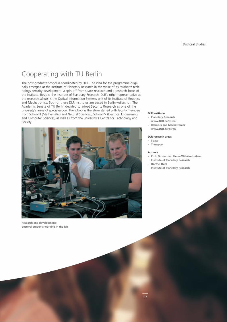
57
Cooperating with TU BerlinThe postgraduate school is coordinated by DLR. The idea for the programme originally emerged at the Institute of Planetary Research in the wake of its terahertz technology security development, a spinoff from space research and a research focus of the institute. Besides the Institute of Planetary Research, DLR’s other representative at the research school is the Optical Information Systems unit of its Institute of Robotics and Mechatronics. Both of these DLR institutes are based in BerlinAdlershof. The Academic Senate of TU Berlin decided to adopt Security Research as one of the university’s areas of specialisation. The school is therefore staffed with faculty members from School II (Mathematics and Natural Sciences), School IV (Electrical Engineer ing and Computer Sciences) as well as from the university’s Centre for Technology and Society.
Research and development: doctoral students working in the lab
Doctoral Studies
DLR Institutes- Planetary Research
www.DLR.de/pf/en- Robotics and Mechatronics
www.DLR.de/os/en
DLR research areas- Space- Transport
Authors- Prof. Dr. rer. nat. Heinz-Wilhelm Hübers
Institute of Planetary Research - Dörthe Thiel
Institute of Planetary Research
Imprint
Published by Deutsches Zentrum für Luft- und Raumfahrt e.V. (DLR) in der HelmholtzGemeinschaft
German Aerospace Center
Address Linder Höhe 51147 Köln
Editors Dr. Dennis Göge Annika Stangner
Design CD Werbeagentur GmbH, Troisdorf
Printing Druckerei Thierbach KG, Mülheim/Ruhr
Press date Cologne, January 2012
© Images from DLR archive unless otherwise stated
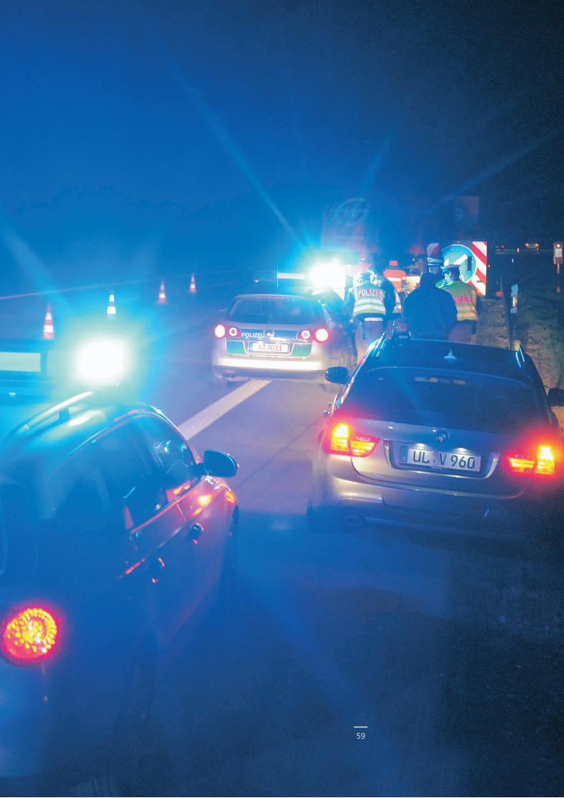
59
DLR at a glanceDLR is Germany’s national research centre for aeronautics and space. Its extensive research and development work in Aeronautics, Space, Energy, Transport and Security is integrated into national and international cooperative ventures. As Germany’s space agency, DLR has been given responsibility for the forward planning and the implementation of the German space programme by the German federal government as well as for the international representation of German interests. Furthermore, Germany’s largest project management agency is also part of DLR.
Approximately 7000 people are employed at 16 locations in Germany: Cologne (headquarters), Augsburg, Berlin, Bonn, Braunschweig, Bremen, Goettingen, Hamburg, Juelich, Lampoldshausen, Neustrelitz, Oberpfaffenhofen, Stade, Stuttgart, Trauen, and Weilheim. DLR also operates offices in Brussels, Paris, and Washington D.C.
DLR’s mission comprises the exploration of Earth and the Solar System, research for protecting the environment, for environmentfriendly technologies, and for promoting mobility, communication, and security. DLR’s research portfolio ranges from basic research to the development of tomorrow’s products. In that way DLR contributes the scientific and technical knowhow that it has gained to enhancing Germany’s industrial and technological reputation. DLR operates largescale research facilities for DLR’s own projects and as a service provider for its clients and partners. It also promotes the next generation of scientists, provides competent advisory services to government, and is a driving force in the local regions of its field centres.
Secu
rity
Rese
arch
GB
01/1
2
German Aerospace Center
Program Coordination Security Research
Linder Höhe51147 Cologne
Phone +49 (0)2203 6014031Fax +49 (0)2203 6014033
www.DLR.de/security