Embed Size (px)
Citation preview

Mark E. Luther, University of South Florida
Secure, Sustainable and
Resilient Maritime and Port
Operations and Infrastructure
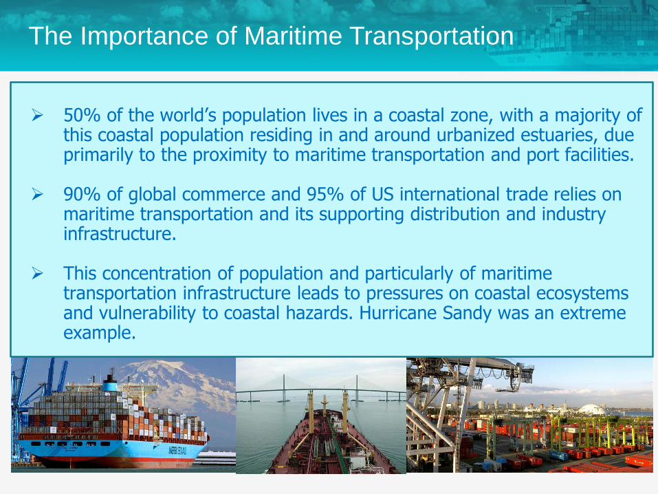
50% of the world’s population lives in a coastal zone, with a majority of this coastal population residing in and around urbanized estuaries, due primarily to the proximity to maritime transportation and port facilities.
90% of global commerce and 95% of US international trade relies on maritime transportation and its supporting distribution and industry infrastructure.
This concentration of population and particularly of maritime transportation infrastructure leads to pressures on coastal ecosystems and vulnerability to coastal hazards. Hurricane Sandy was an extreme example.
The Importance of Maritime Transportation
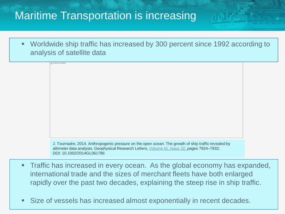
Maritime Transportation is increasing
Worldwide ship traffic has increased by 300 percent since 1992 according to
analysis of satellite data
Traffic has increased in every ocean. As the global economy has expanded,
international trade and the sizes of merchant fleets have both enlarged
rapidly over the past two decades, explaining the steep rise in ship traffic.
Size of vessels has increased almost exponentially in recent decades.
J. Tournadre, 2014. Anthropogenic pressure on the open ocean: The growth of ship traffic revealed by
altimeter data analysis. Geophysical Research Letters, Volume 41, Issue 22, pages 7924–7932;
DOI: 10.1002/2014GL061786
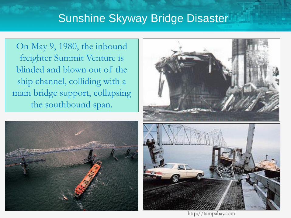
http://tampabay.com
On May 9, 1980, the inbound
freighter Summit Venture is
blinded and blown out of the
ship channel, colliding with a
main bridge support, collapsing
the southbound span.
Sunshine Skyway Bridge Disaster
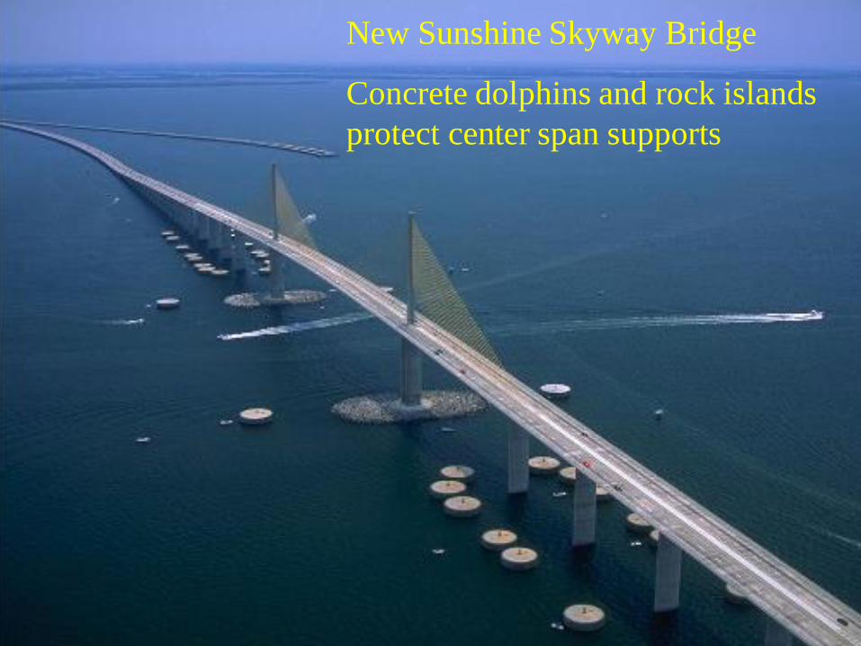
New Sunshine Skyway Bridge
Concrete dolphins and rock islands
protect center span supports
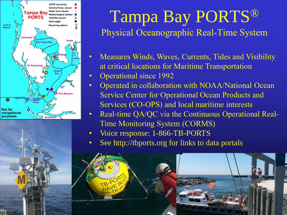
Tampa Bay PORTS®
Physical Oceanographic Real-Time System
• Measures Winds, Waves, Currents, Tides and Visibility
at critical locations for Maritime Transportation
• Operational since 1992
• Operated in collaboration with NOAA/National Ocean
Service Center for Operational Ocean Products and
Services (CO-OPS) and local maritime interests
• Real-time QA/QC via the Continuous Operational Real-
Time Monitoring System (CORMS)
• Voice response: 1-866-TB-PORTS
• See http://tbports.org for links to data portals

PORTS® are presently operational in 29 locations:
• Narragansett Bay
• Los Angeles/Long Beach
• New Haven, CT
• San Francisco Bay
• New York/New Jersey Harbor
• Lower Columbia River
• Delaware Bay and River
• Tacoma, WA
• Anchorage
• Tampa Bay
• Soo Locks, MI
• Houston/Galveston
• Gulfport
• Savannah
• Morgan City
Tampa Bay was the first and still is the most extensive
• Charleston Harbor
• Northern Chesapeake Bay
• Southern Chesapeake Bay
• Humboldt Bay
• Jacksonville
• New London
• Lake Charles
• Lower Mississippi River
• Mobile Bay
• Cherry Point
• Sabine Neches
• Pascagoula
• Cuyahoga
• Cape Cod
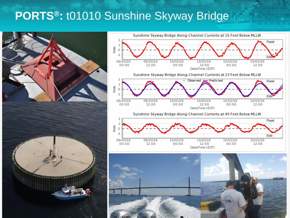
PORTS®: t01010 Sunshine Skyway Bridge
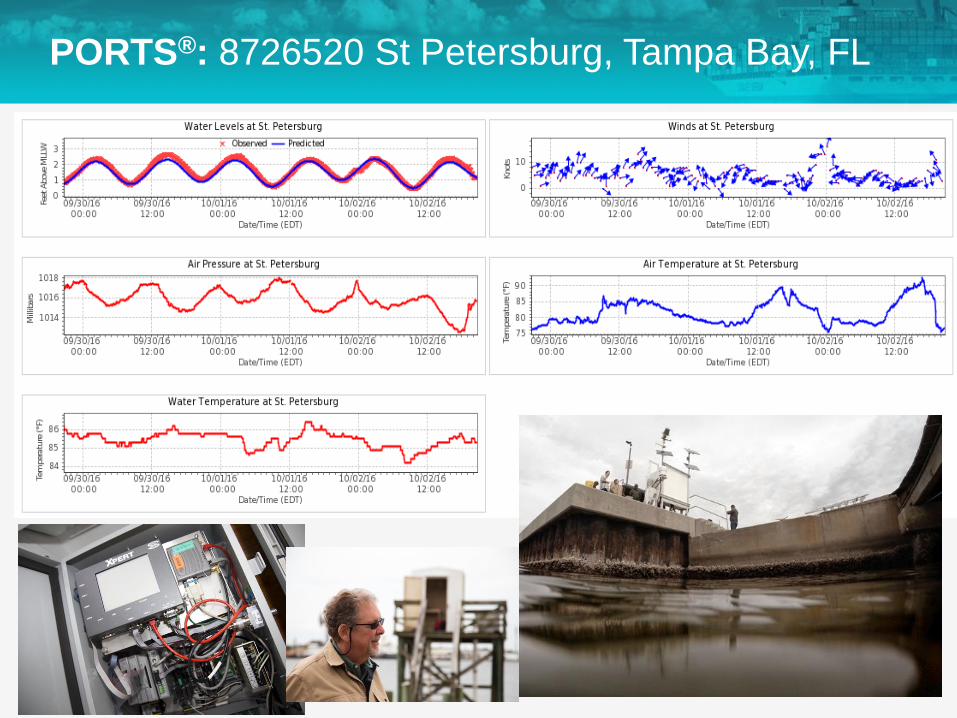
PORTS®: 8726520 St Petersburg, Tampa Bay, FL
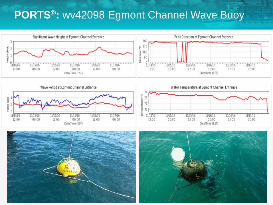
PORTS®: wv42098 Egmont Channel Wave Buoy

PORTS®: 8726412 Middle Tampa Bay, FL
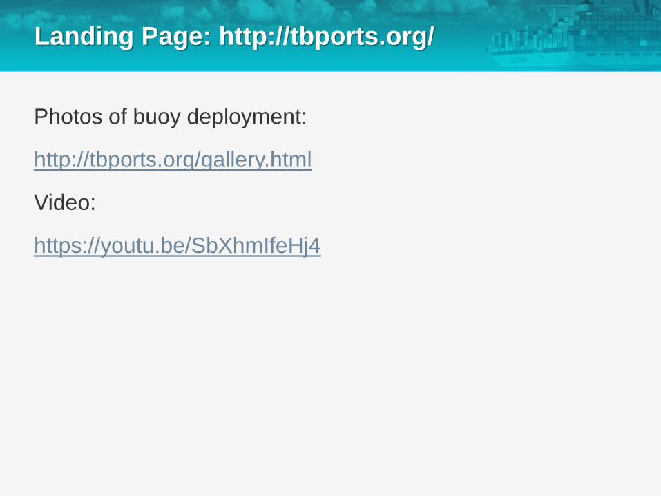
Landing Page: http://tbports.org/
Photos of buoy deployment:
http://tbports.org/gallery.html
Video:
https://youtu.be/SbXhmIfeHj4
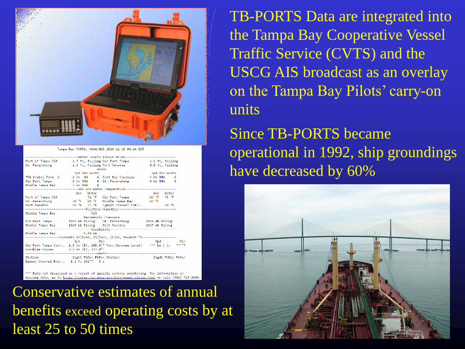
TB-PORTS Data are integrated into
the Tampa Bay Cooperative Vessel
Traffic Service (CVTS) and the
USCG AIS broadcast as an overlay
on the Tampa Bay Pilots’ carry-on
units
Since TB-PORTS became
operational in 1992, ship groundings
have decreased by 60%
Conservative estimates of annual
benefits exceed operating costs by at
least 25 to 50 times
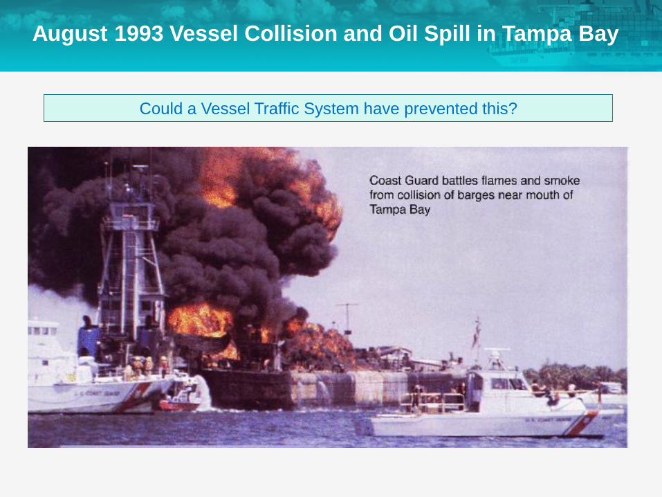
Could a Vessel Traffic System have prevented this?
August 1993 Vessel Collision and Oil Spill in Tampa Bay
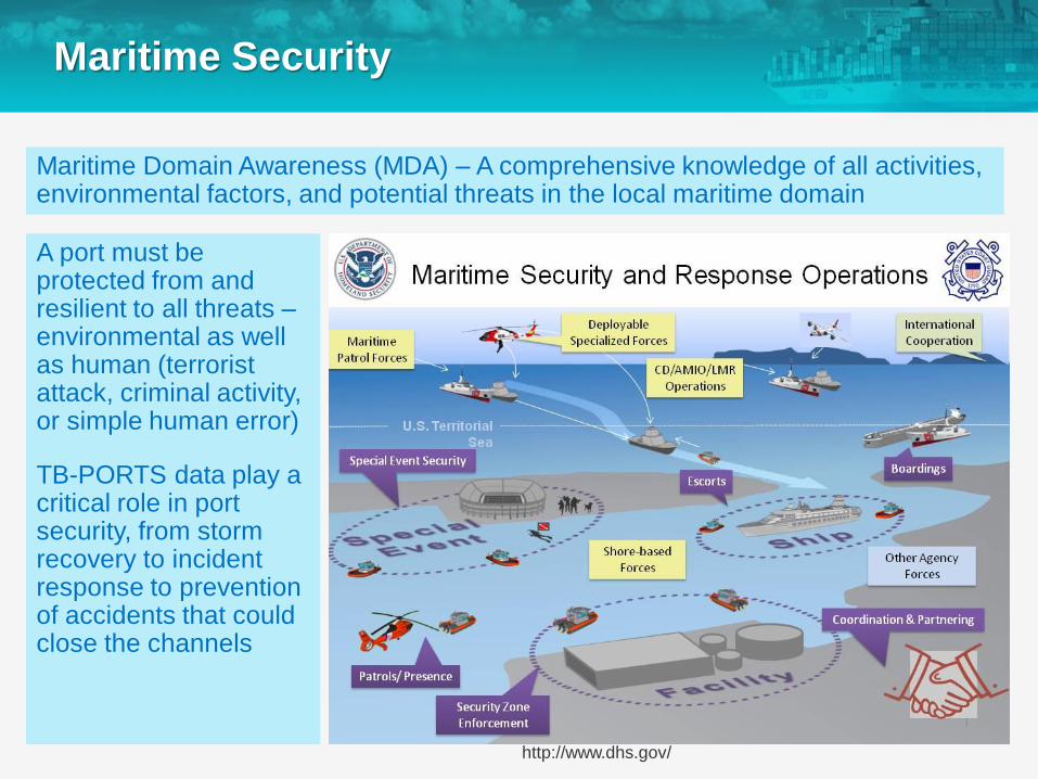
Maritime Security
A port must be protected from and resilient to all threats –environmental as well as human (terrorist attack, criminal activity, or simple human error)
TB-PORTS data play a critical role in port security, from storm recovery to incident response to prevention of accidents that could close the channels
http://www.dhs.gov/
Maritime Domain Awareness (MDA) – A comprehensive knowledge of all activities, environmental factors, and potential threats in the local maritime domain
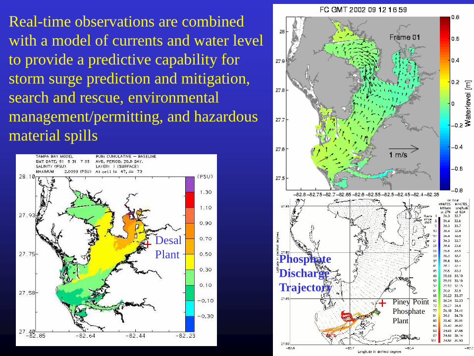
Real-time observations are combined
with a model of currents and water level
to provide a predictive capability for
storm surge prediction and mitigation,
search and rescue, environmental
management/permitting, and hazardous
material spills
Sewage Spill
Trajectory
Desal
Plant+
+ Piney Point
Phosphate
Plant
Phosphate
Discharge
Trajectory

The USF Center for Maritime and Port Studies
Objectives:
To promote workforce development for the
maritime transportation system industry,
To conduct research to foster sustainable,
secure, and resilient maritime and port
infrastructure, and
To provide independent test and evaluation of
maritime sensor technologies
USF College of Marine Science is located on the former campus of the U.S. Maritime Service Training
Station on Bayboro Harbor in downtown St. Petersburg – See http://www.usmm.org/stpetersburg.html

The Marine Discovery Center
Formerly the Pier Aquarium, the Marine Discovery Center will be the public face of
the St. Petersburg Ocean Team, located in the Port Terminal Building on Bayboro
Harbor in downtown St. Petersburg