Embed Size (px)
Citation preview
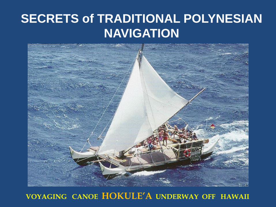
SECRETS of TRADITIONAL POLYNESIAN
NAVIGATION
VOYAGING CANOE HOKULE’A UNDERWAY OFF HAWAII
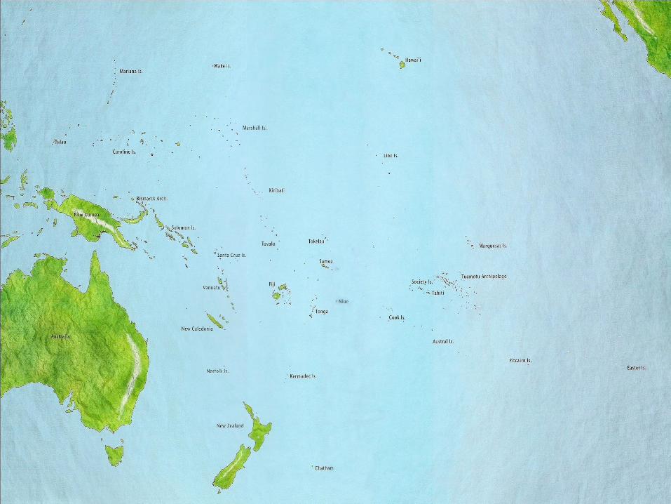
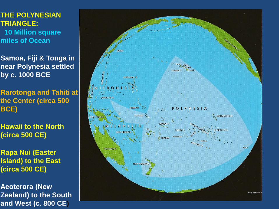
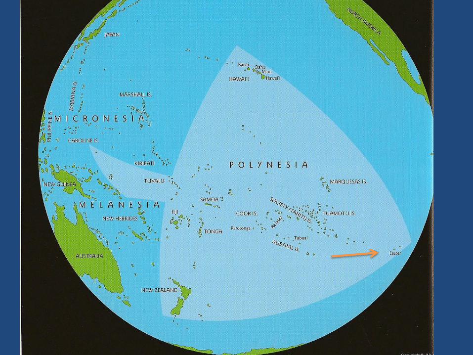
THE POLYNESIAN
TRIANGLE:
10 Million square
miles of Ocean
Samoa, Fiji & Tonga in
near Polynesia settled
by c. 1000 BCE
Rarotonga and Tahiti at
the Center (circa 500
BCE)
Hawaii to the North
(circa 500 CE)
Rapa Nui (Easter
Island) to the East
(circa 500 CE)
Aeoterora (New
Zealand) to the South
and West (c. 800 CE)
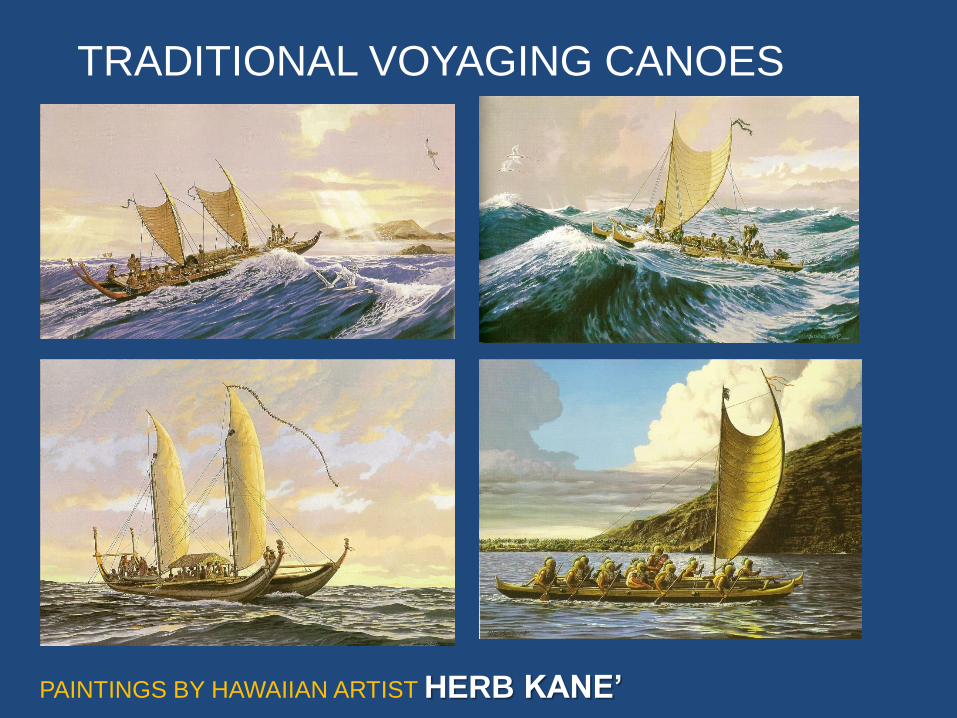
TRADITIONAL VOYAGING CANOES
PAINTINGS BY HAWAIIAN ARTIST HERB KANE’
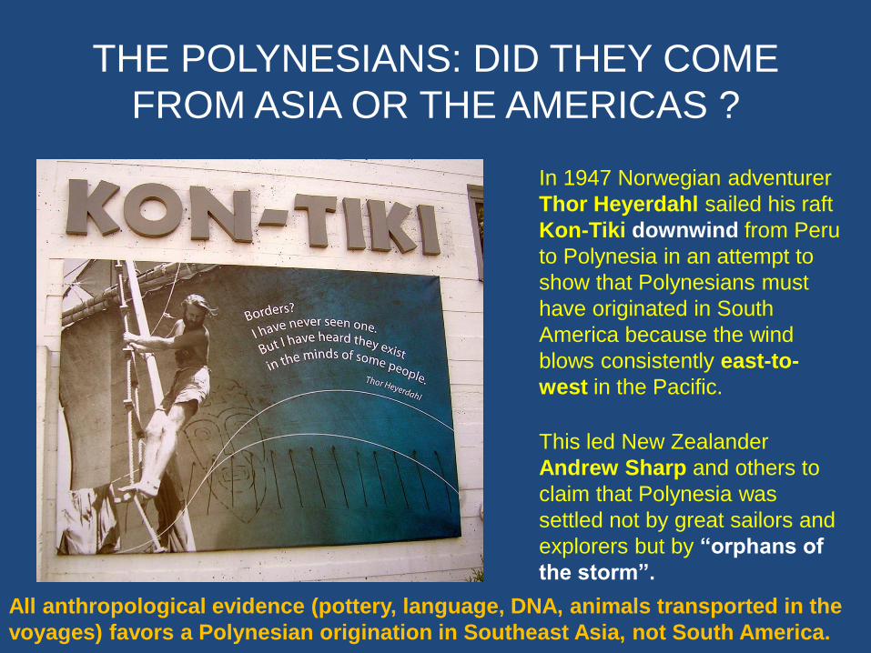
THE POLYNESIANS: DID THEY COME
FROM ASIA OR THE AMERICAS ?
In 1947 Norwegian adventurer
Thor Heyerdahl sailed his raft
Kon-Tiki downwind from Peru
to Polynesia in an attempt to
show that Polynesians must
have originated in South
America because the wind
blows consistently east-to-
west in the Pacific.
This led New Zealander
Andrew Sharp and others to
claim that Polynesia was
settled not by great sailors and
explorers but by “orphans of
the storm”.
All anthropological evidence (pottery, language, DNA, animals transported in the
voyages) favors a Polynesian origination in Southeast Asia, not South America.

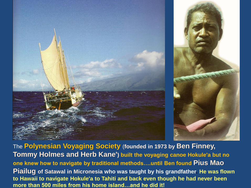
The Polynesian Voyaging Society (founded in 1973 by Ben Finney,
Tommy Holmes and Herb Kane') built the voyaging canoe Hokule'a but no
one knew how to navigate by traditional methods….until Ben found Pius Mao
Piailug of Satawal in Micronesia who was taught by his grandfather. He was flown
to Hawaii to navigate Hokule'a to Tahiti and back even though he had never been
more than 500 miles from his home island…and he did it!
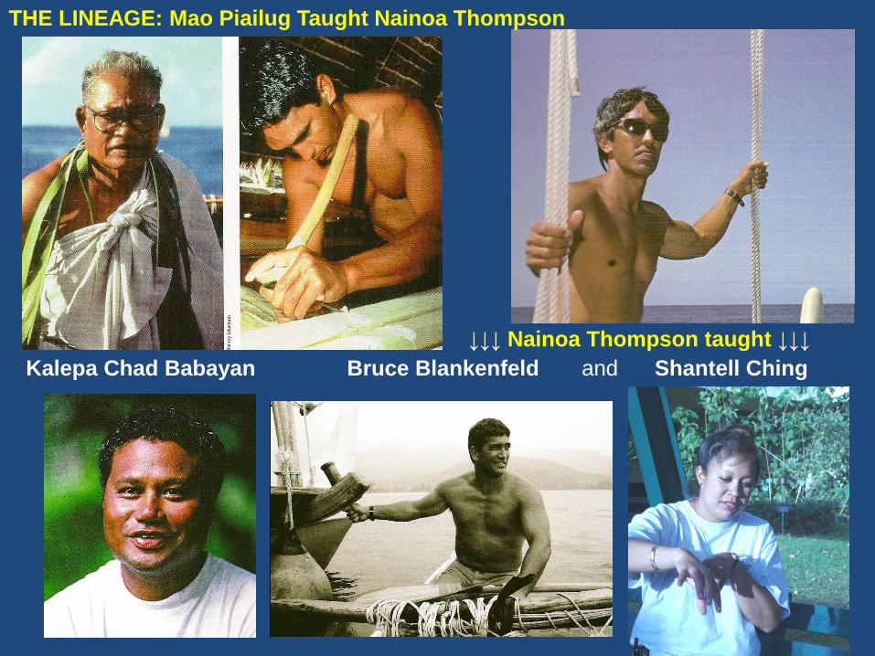
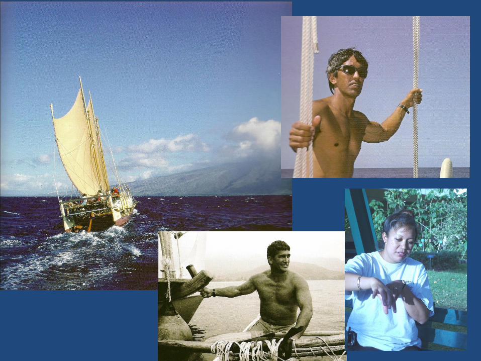
THE LINEAGE: Mao Piailug Taught Nainoa Thompson
↓↓↓ Nainoa Thompson taught ↓↓↓
Kalepa Chad Babayan Bruce Blankenfeld and Shantell Ching
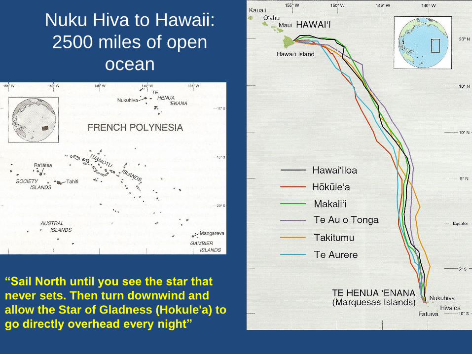
Nuku Hiva to Hawaii:
2500 miles of open
ocean
“Sail North until you see the star that
never sets. Then turn downwind and
allow the Star of Gladness (Hokule'a) to
go directly overhead every night”
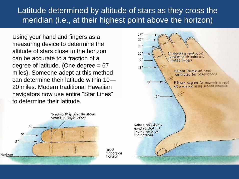
Latitude determined by altitude of stars as they cross the
meridian (i.e., at their highest point above the horizon)
Using your hand and fingers as a
measuring device to determine the
altitude of stars close to the horizon
can be accurate to a fraction of a
degree of latitude. {One degree = 67
miles}. Someone adept at this method
can determine their latitude within 10—
20 miles. Modern traditional Hawaiian
navigators now use entire “Star Lines”
to determine their latitude.
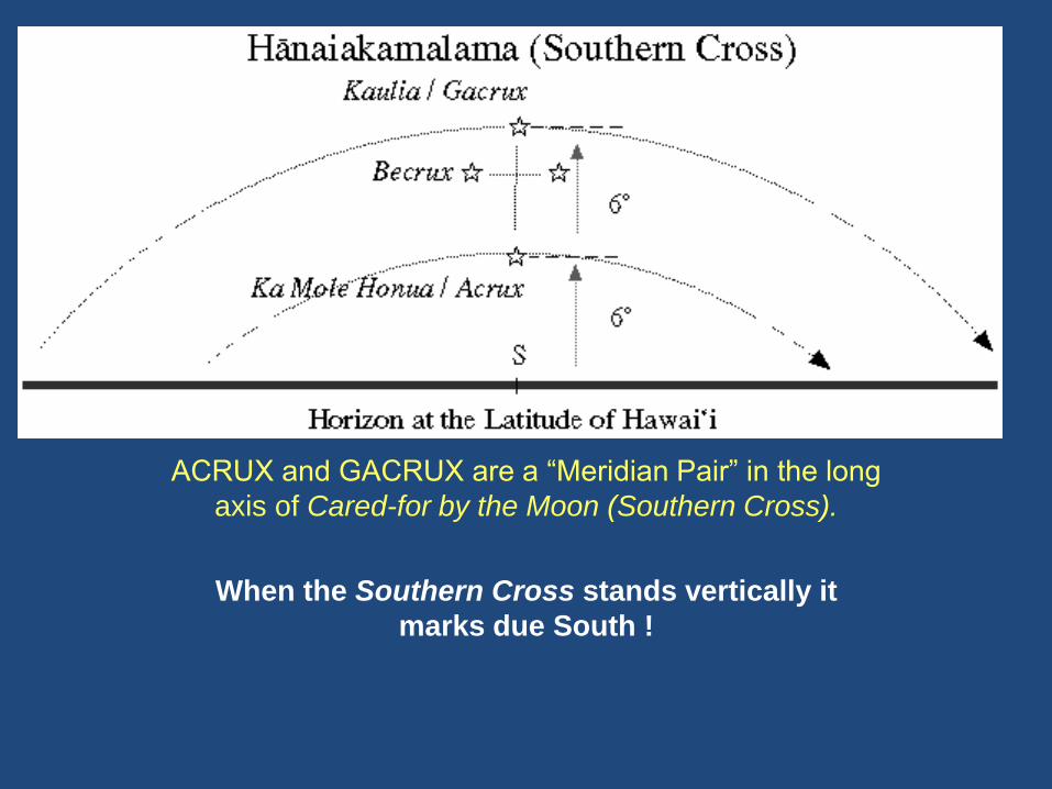
ACRUX and GACRUX are a “Meridian Pair” in the long
axis of Cared-for by the Moon (Southern Cross).
When the Southern Cross stands vertically it
marks due South !
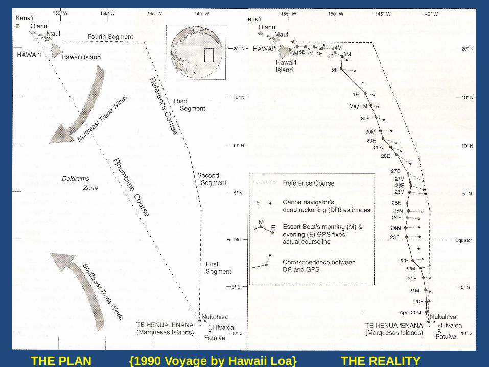
THE PLAN {1990 Voyage by Hawaii Loa} THE REALITY
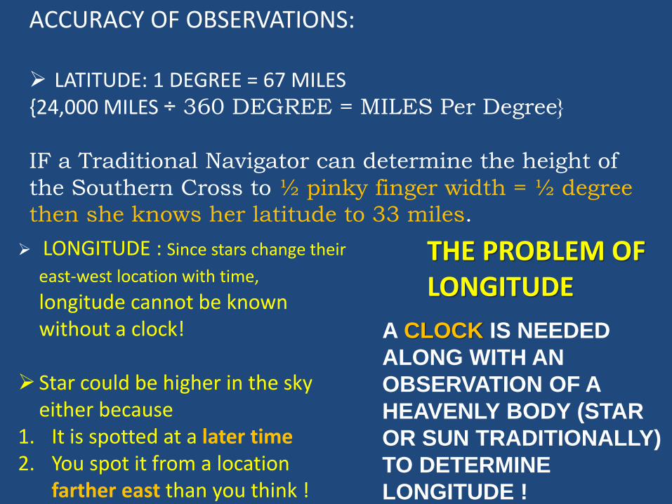
A CLOCK IS NEEDED
ALONG WITH AN
OBSERVATION OF A
HEAVENLY BODY (STAR
OR SUN TRADITIONALLY)
TO DETERMINE
LONGITUDE !
THE PROBLEM OF LONGITUDE
ACCURACY OF OBSERVATIONS:
LATITUDE: 1 DEGREE = 67 MILES {24,000 MILES ÷ 360 DEGREE = MILES Per Degree}
IF a Traditional Navigator can determine the height of
the Southern Cross to ½ pinky finger width = ½ degree
then she knows her latitude to 33 miles.
LONGITUDE : Since stars change their
east-west location with time,
longitude cannot be known without a clock!
Star could be higher in the sky either because
1. It is spotted at a later time2. You spot it from a location
farther east than you think !
QUESTIONS WHICH NATURALLY ARISE
1. WHAT HAPPENS WHEN IT IS CLOUDY? Or during the daytime?
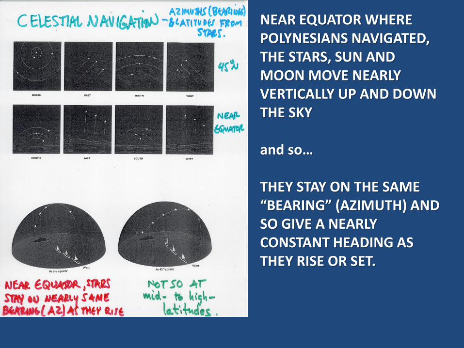
NEAR EQUATOR WHERE POLYNESIANS NAVIGATED, THE STARS, SUN AND MOON MOVE NEARLY VERTICALLY UP AND DOWN THE SKY
and so…
THEY STAY ON THE SAME “BEARING” (AZIMUTH) AND SO GIVE A NEARLY CONSTANT HEADING AS THEY RISE OR SET.
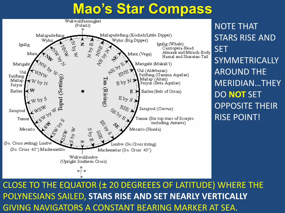
Mao’s Star CompassNOTE THAT STARS RISE AND SET SYMMETRICALLY AROUND THE MERIDIAN…THEY DO NOT SET OPPOSITE THEIR RISE POINT!
CLOSE TO THE EQUATOR (± 20 DEGREEES OF LATITUDE) WHERE THE POLYNESIANS SAILED, STARS RISE AND SET NEARLY VERTICALLY GIVING NAVIGATORS A CONSTANT BEARING MARKER AT SEA.
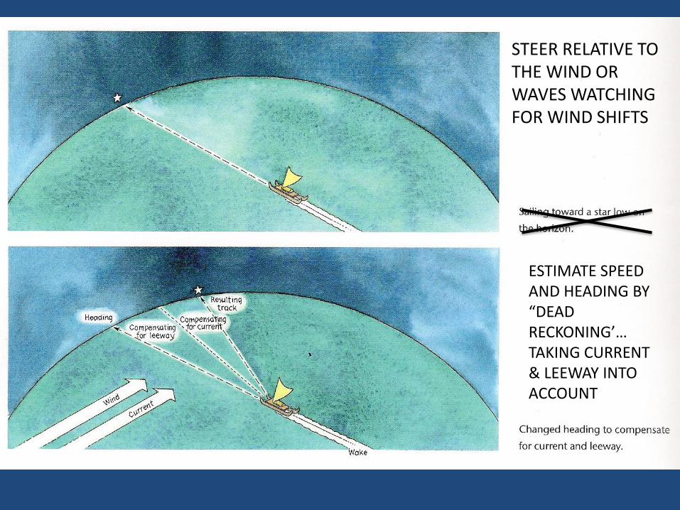
STEER RELATIVE TO THE WIND OR WAVES WATCHING FOR WIND SHIFTS
ESTIMATE SPEED AND HEADING BY “DEAD RECKONING’…TAKING CURRENT & LEEWAY INTO ACCOUNT
QUESTIONS WHICH NATURALLY ARISE
1. WHAT HAPPENS WHEN IT IS CLOUDY?
2. CELESTIAL NAVIGATION (POLYNESIAN STYLE) ONLY GETS YOU TO WITHIN ~ 30—60 MILES OF MAKING “LANDFALL”. WHAT THEN?
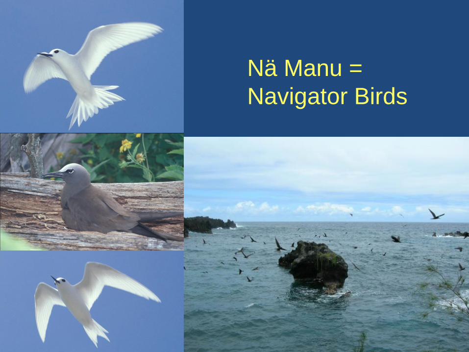
Nä Manu =
Navigator Birds
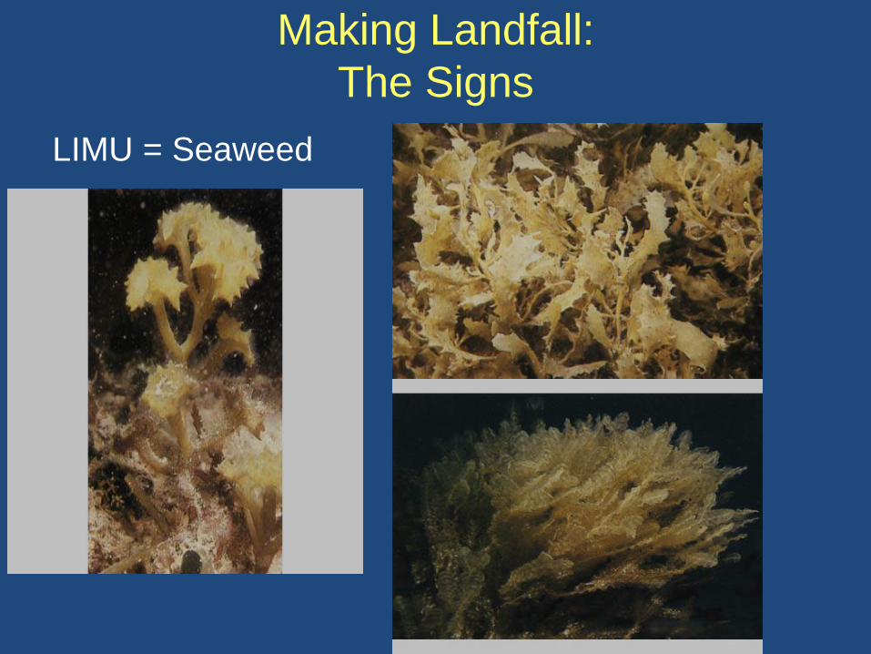
Making Landfall:
The Signs
LIMU = Seaweed
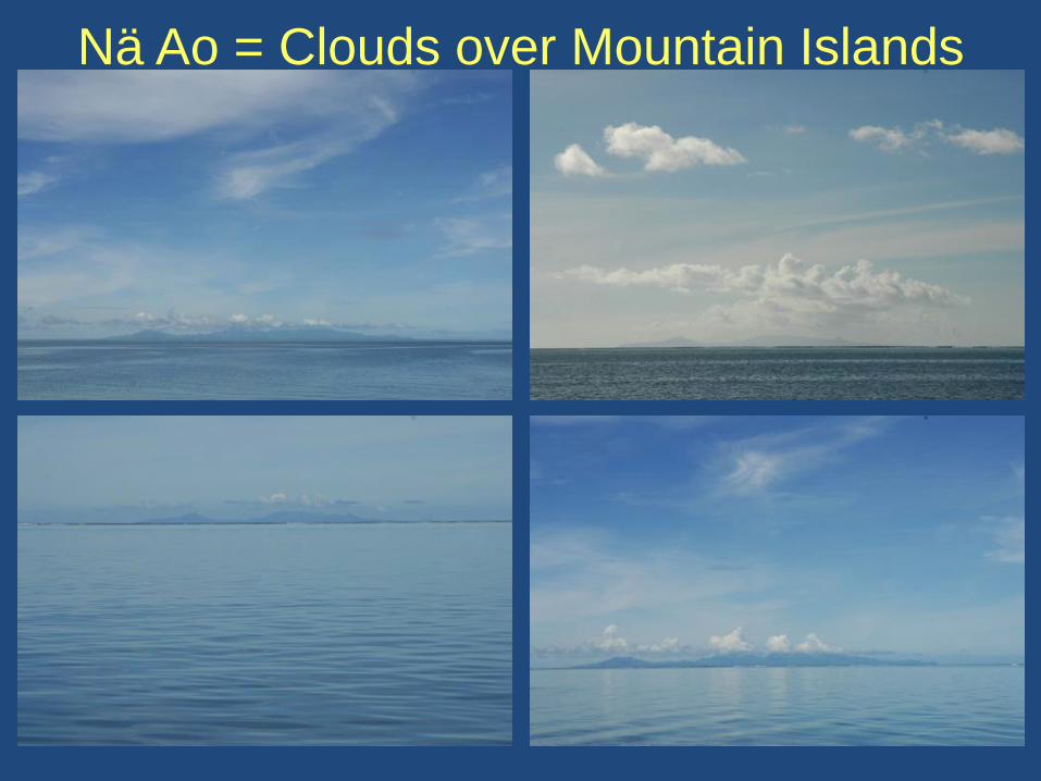
Nä Ao = Clouds over Mountain Islands
QUESTIONS WHICH NATURALLY ARISE
1. WHAT HAPPENS WHEN IT IS CLOUDY?
2. CELESTIAL NAV ONLY GETS YOU TO WITHIN ~ 30—60 MILES OF MAKING “LANDFALL”. WHAT THEN?
3. WHAT HAPPENS IF YOU MISS AND GET DOWNWIND OF THE ISLANDS ?
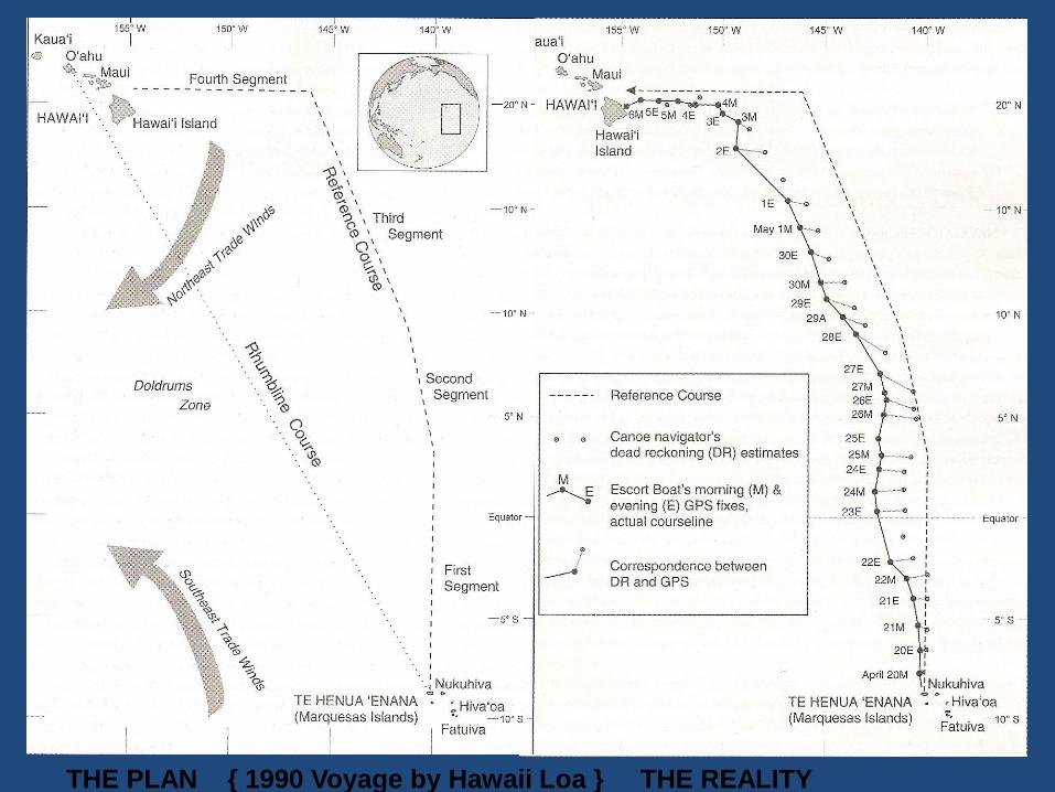
THE PLAN { 1990 Voyage by Hawaii Loa } THE REALITY
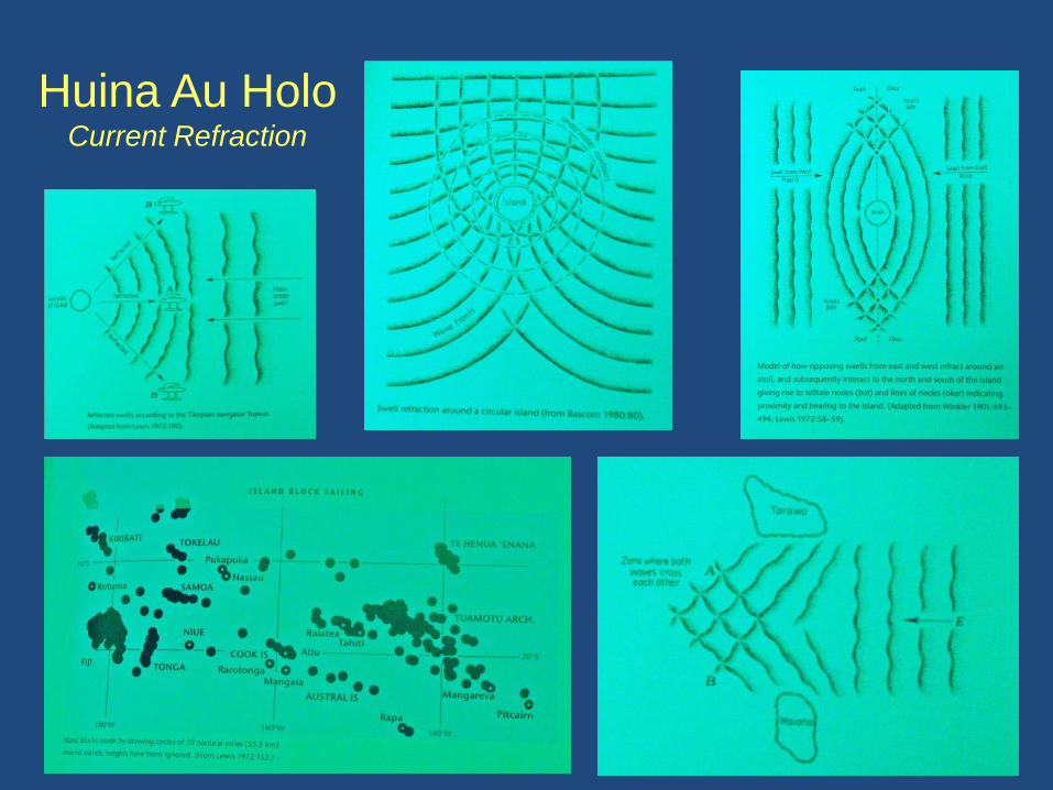
Huina Au HoloCurrent Refraction
QUESTIONS WHICH NATURALLY ARISE
1. WHAT HAPPENS WHEN IT IS CLOUDY?
2. CELESTIAL NAV ONLY GETS YOU TO WITHIN ~ 30—60 MILES OF MAKING “LANDFALL”. WHAT THEN?
3. WHAT HAPPENS IF YOU MISS AND GET DOWNWIND OF THE ISLANDS ?
4. WHAT HAPPENS WHEN YOU HAVE TO SAIL UPWIND TO GET TO YOUR DESTINATION?
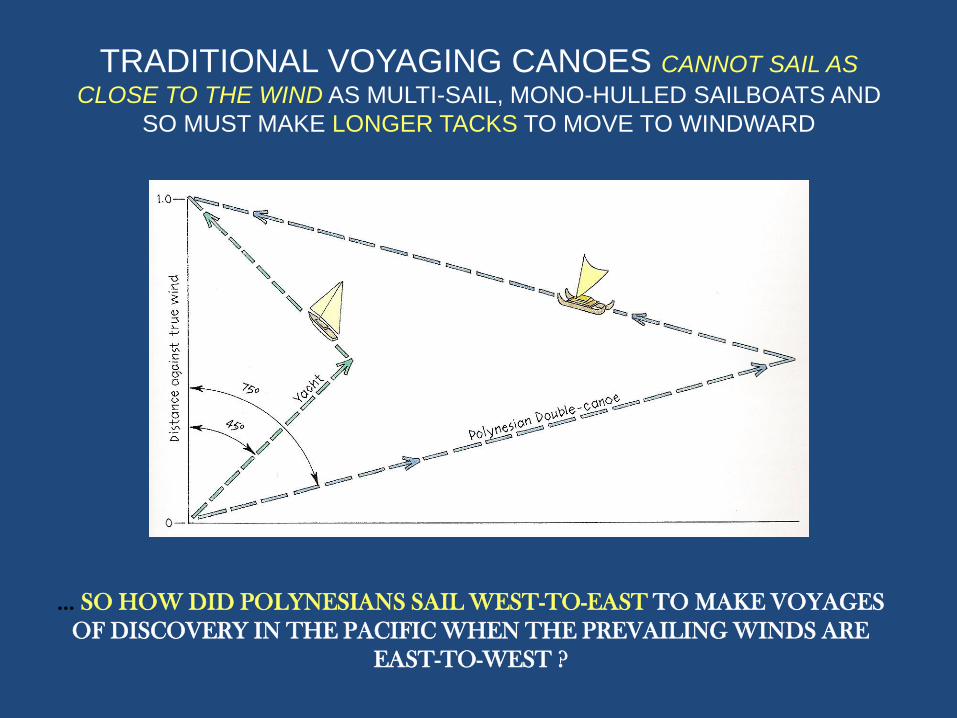
TRADITIONAL VOYAGING CANOES CANNOT SAIL AS
CLOSE TO THE WIND AS MULTI-SAIL, MONO-HULLED SAILBOATS AND
SO MUST MAKE LONGER TACKS TO MOVE TO WINDWARD
… SO HOW DID POLYNESIANS SAIL WEST-TO-EAST TO MAKE VOYAGES
OF DISCOVERY IN THE PACIFIC WHEN THE PREVAILING WINDS ARE
EAST-TO-WEST ?
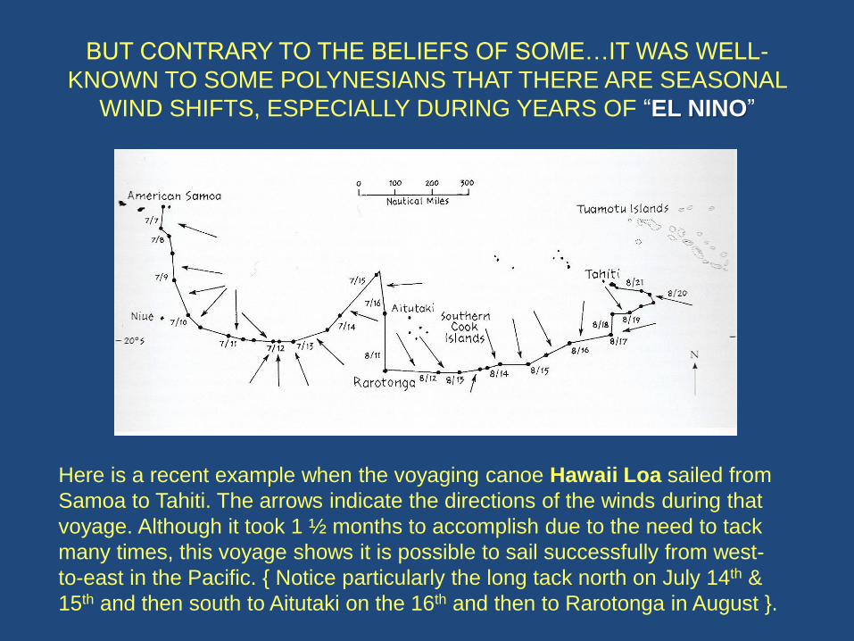
BUT CONTRARY TO THE BELIEFS OF SOME…IT WAS WELL-
KNOWN TO SOME POLYNESIANS THAT THERE ARE SEASONAL
WIND SHIFTS, ESPECIALLY DURING YEARS OF “EL NINO”
Here is a recent example when the voyaging canoe Hawaii Loa sailed from
Samoa to Tahiti. The arrows indicate the directions of the winds during that
voyage. Although it took 1 ½ months to accomplish due to the need to tack
many times, this voyage shows it is possible to sail successfully from west-
to-east in the Pacific. { Notice particularly the long tack north on July 14th &
15th and then south to Aitutaki on the 16th and then to Rarotonga in August }.
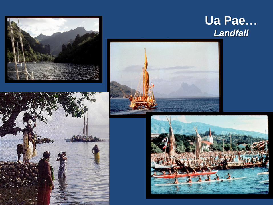
Ua Pae…Landfall
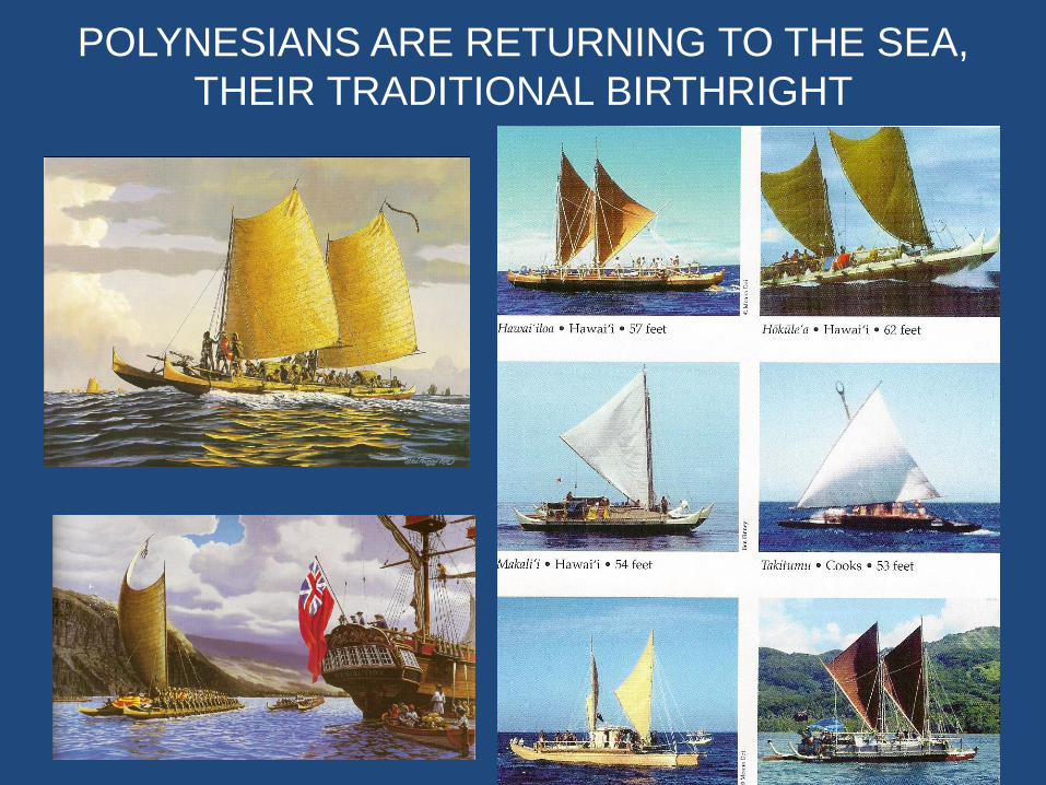
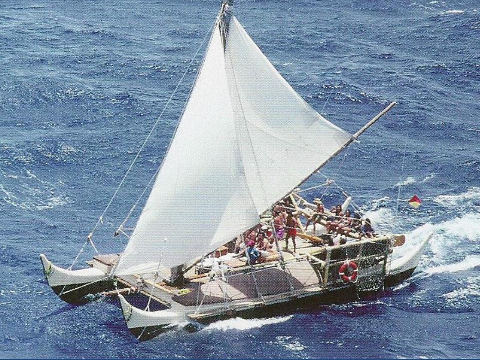
POLYNESIANS ARE RETURNING TO THE SEA,
THEIR TRADITIONAL BIRTHRIGHT
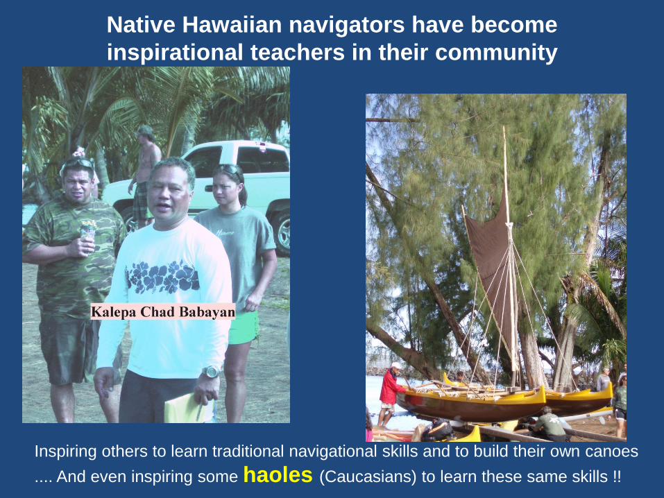
Native Hawaiian navigators have become
inspirational teachers in their community
Inspiring others to learn traditional navigational skills and to build their own canoes
.... And even inspiring some haoles (Caucasians) to learn these same skills !!
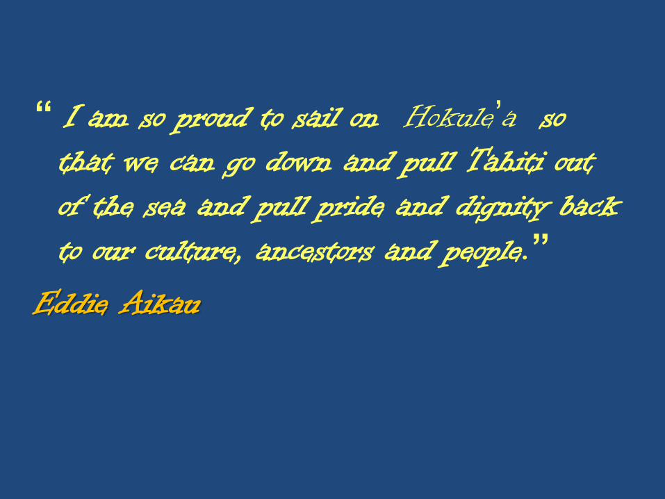
“ I am so proud to sail on Hokule’a so that we can go down and pull Tahiti out of the sea and pull pride and dignity back to our culture, ancestors and people.”
Eddie Aikau

POLYNESIANS ARE RETURNING TO THE SEA,
THEIR TRADITIONAL BIRTHRIGHT
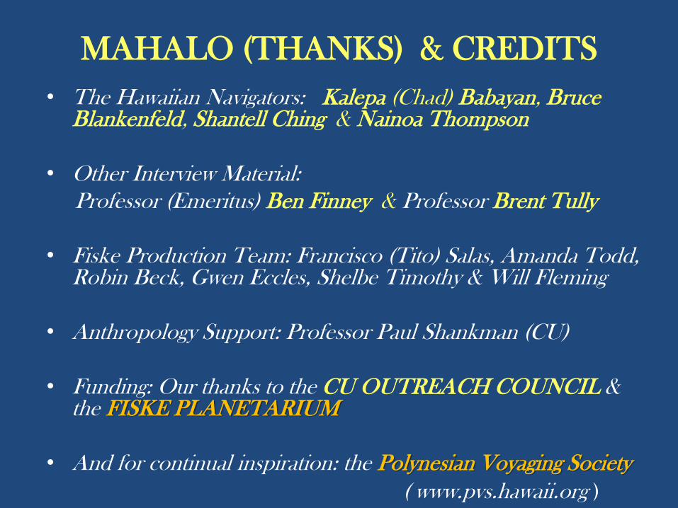
MAHALO (THANKS) & CREDITS
• The Hawaiian Navigators: Kalepa (Chad) Babayan, BruceBlankenfeld, Shantell Ching & Nainoa Thompson
• Other Interview Material:
Professor (Emeritus) Ben Finney & Professor Brent Tully
• Fiske Production Team: Francisco (Tito) Salas, Amanda Todd, Robin Beck, Gwen Eccles, Shelbe Timothy & Will Fleming
• Anthropology Support: Professor Paul Shankman (CU)
• Funding: Our thanks to the CU OUTREACH COUNCIL & the FISKE PLANETARIUM
• And for continual inspiration: the Polynesian Voyaging Society
( www.pvs.hawaii.org )