Embed Size (px)
Citation preview
Amendment A 7-1
Sec. 35-311. Use Regulations. * * * * *
TABLE 311-1 RESIDENTIAL USE MATRIX
PERMITTED
USE RP
R E
R- 2
0 N
P-15
NP-
10
NP-
8
R- 6
RM
-6
R- 5
RM
-5
R- 4
RM
-4
MF-
18
MF-
25
MF-
33
MF-
40
MF-
50 &
MF-
65
ERZ
D
LBCS
FU
NC
TIO
N
Residential Market Farming and Truck Garden
P P P P P P P P P P P P P P P P P P 9100
Greenhouse P P P P P P P P P P P P P P P P P P 9140
Urban Farm P P P P P P P P P P P P P P P P P P 8100
* * * * *
Amendment B 7-2
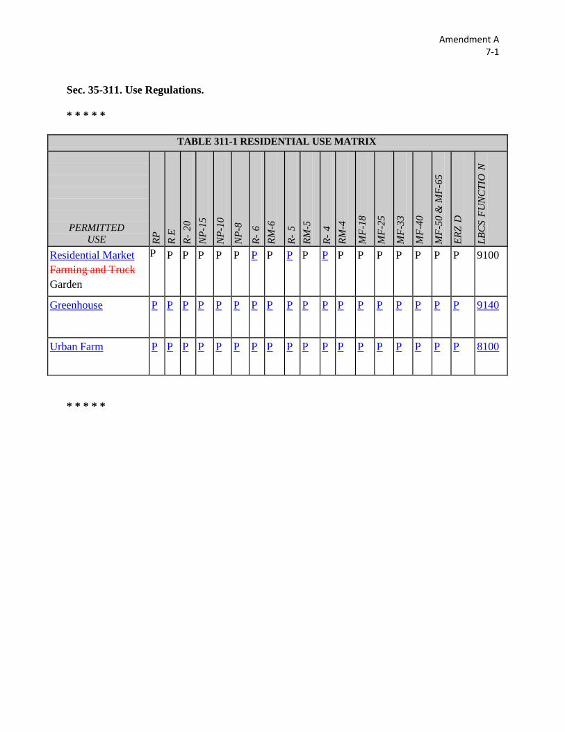
Sec. 35-311. Use Regulations. * * * * *
* * * * *
TABLE 311-2a NONRESIDENTIAL USE MATRIX Urban Rural Farm Mixed Industrial
PERMITTED USE
UD
Maj
or N
ode
UD
Min
or N
ode
RD
Maj
or N
ode
RD M
inor
Nod
e
FR A
g C
omm
erci
al
VILL
AGE
CEN
TER
FR/F
R M
inor
Nod
e
MI -
1
MI-
1 M
inor
Nod
e
VILL
AGE
CEN
TER
- M1
MI -
2
MI-
2 M
inor
Nod
e VI
LLAG
E C
ENTE
R -
M2
Farm And Ranch
Farming (Crops And Livestock) P P P P P P P P P P P P
Farm And Ranch Greenhouse - Non-Retail P P P P P P P P P P P P
Farm And Ranch Greenhouse –Retail P P P P P P P P P P P P
Farm And Ranch Orchard P P P P P P P P P P P P
Farm And Ranch Ranch P P P P P P P P P P P P
Farm And Urban Farm P P P P P P P P P P P P
TABLE 311-2 NONRESIDENTIAL USE MATRIX
PERMITTED USE
O-1
& O
-1.5
O-2
NC
C-1
C
-2
C-3
D
L I-
1 I-
2 ER
ZD
(LBC
S Fu
nctio
n)
Agriculture Greenhouse P P P P P P P P P P P 9140
Agriculture Indoor Growing P P P P P P P P P P P 9140
Agriculture Urban Farm P P P P P P P P P P P 8100

Amendment B 7-2
Ranch
Retail Nursery - Retail (Growing Plants On-site Permitted) P P P P P P P P P P P P
* * * * *
Amendment C 7-3
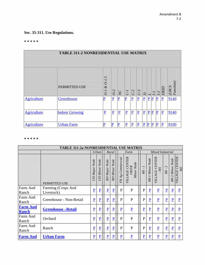
Sec. 35-378. – Home Occupations.
* * * * *
(a) General Requirements. Home occupations are permitted in any dwelling unit subject to the following provisions:
(1) The appearance of the dwelling unit shall not be altered nor shall the home occupation be conducted in a manner which would cause the premises to differ from its residential character either by the use of colors, materials, construction, lighting, signs, increased traffic or the emission of odors, sounds, or vibrations. The city's noise and nuisance regulations are also applicable. (2) No outdoor display of goods or outdoor storage of equipment or materials used in the home occupation shall be permitted. (3) The home occupation shall not involve the use of advertising signs on the premises or any other advertising media which calls attention to the fact that the dwelling unit is being used for a home occupation, with the exception of a telephone number listing. One (1) nameplate not exceeding one (1) square foot in area shall be allowed provided the nameplate is nonilluminated and attached flat to the dwelling unit or visible through a window. (4) The home occupation shall be conducted solely by resident occupants of the dwelling unit. No person not permanently residing on the premises shall be employed for hire or as a volunteer. (5) The home occupation shall be conducted entirely within the dwelling unit except for those necessary outdoor activities related to the care of children. No more than twenty-five (25) percent of the gross area of the dwelling unit shall be used for the home occupation. Use of accessory buildings, garages, or carports for a home occupation is prohibited. (6) The use of electrical or mechanical equipment that would change the fire rating of the dwelling or create visible or audible interference in radio or television receivers or cause fluctuations in line voltage outside the dwelling unit is prohibited. (7) The home occupation shall not involve the use of commercial vehicles for delivery of materials to and from the premises. (8) No direct on-premises selling of goods shall be allowed, except for cottage foods and produce as defined in this Chapter. ; however, telephone Telephone soliciting is permitted. (9) No certificate of occupancy is required for a home occupation.
(b) Prohibited Uses. The following uses are prohibited as home occupations: (1) Vehicle painting, service, or repair. (2) Barber and beauty shops; however, both beauty shops and barber shops are permitted as a specific use permit.
Amendment C 7-3
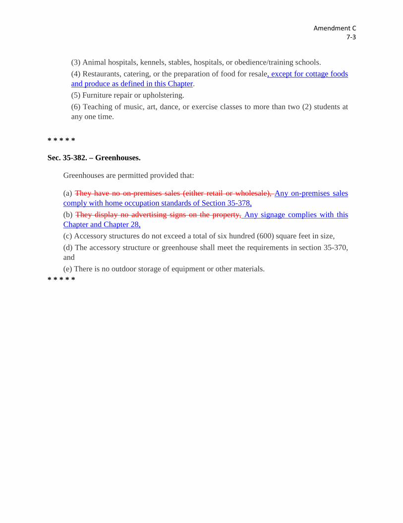
(3) Animal hospitals, kennels, stables, hospitals, or obedience/training schools. (4) Restaurants, catering, or the preparation of food for resale, except for cottage foods and produce as defined in this Chapter. (5) Furniture repair or upholstering. (6) Teaching of music, art, dance, or exercise classes to more than two (2) students at any one time.
* * * * *
Sec. 35-382. – Greenhouses.
Greenhouses are permitted provided that:
(a) They have no on-premises sales (either retail or wholesale), Any on-premises sales comply with home occupation standards of Section 35-378, (b) They display no advertising signs on the property, Any signage complies with this Chapter and Chapter 28, (c) Accessory structures do not exceed a total of six hundred (600) square feet in size, (d) The accessory structure or greenhouse shall meet the requirements in section 35-370, and (e) There is no outdoor storage of equipment or other materials.
* * * * *
Amendment D 7-4
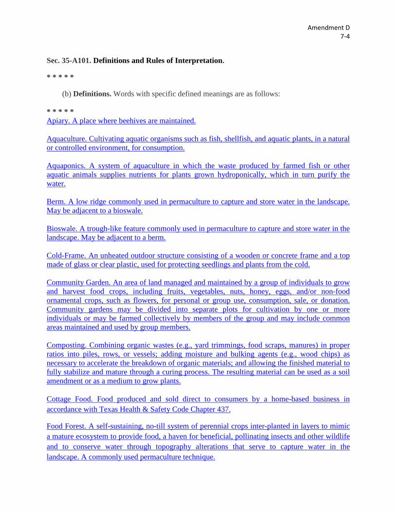
Sec. 35-A101. Definitions and Rules of Interpretation.
* * * * *
(b) Definitions. Words with specific defined meanings are as follows: * * * * * Apiary. A place where beehives are maintained. Aquaculture. Cultivating aquatic organisms such as fish, shellfish, and aquatic plants, in a natural or controlled environment, for consumption. Aquaponics. A system of aquaculture in which the waste produced by farmed fish or other aquatic animals supplies nutrients for plants grown hydroponically, which in turn purify the water. Berm. A low ridge commonly used in permaculture to capture and store water in the landscape. May be adjacent to a bioswale. Bioswale. A trough-like feature commonly used in permaculture to capture and store water in the landscape. May be adjacent to a berm. Cold-Frame. An unheated outdoor structure consisting of a wooden or concrete frame and a top made of glass or clear plastic, used for protecting seedlings and plants from the cold. Community Garden. An area of land managed and maintained by a group of individuals to grow and harvest food crops, including fruits, vegetables, nuts, honey, eggs, and/or non-food ornamental crops, such as flowers, for personal or group use, consumption, sale, or donation. Community gardens may be divided into separate plots for cultivation by one or more individuals or may be farmed collectively by members of the group and may include common areas maintained and used by group members. Composting. Combining organic wastes (e.g., yard trimmings, food scraps, manures) in proper ratios into piles, rows, or vessels; adding moisture and bulking agents (e.g., wood chips) as necessary to accelerate the breakdown of organic materials; and allowing the finished material to fully stabilize and mature through a curing process. The resulting material can be used as a soil amendment or as a medium to grow plants. Cottage Food. Food produced and sold direct to consumers by a home-based business in accordance with Texas Health & Safety Code Chapter 437.
Food Forest. A self-sustaining, no-till system of perennial crops inter-planted in layers to mimic a mature ecosystem to provide food, a haven for beneficial, pollinating insects and other wildlife and to conserve water through topography alterations that serve to capture water in the landscape. A commonly used permaculture technique.
Amendment D 7-4
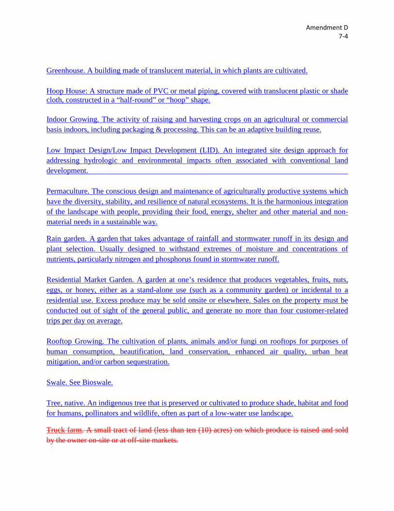
Greenhouse. A building made of translucent material, in which plants are cultivated. Hoop House: A structure made of PVC or metal piping, covered with translucent plastic or shade cloth, constructed in a “half-round” or “hoop” shape. Indoor Growing. The activity of raising and harvesting crops on an agricultural or commercial basis indoors, including packaging & processing. This can be an adaptive building reuse. Low Impact Design/Low Impact Development (LID). An integrated site design approach for addressing hydrologic and environmental impacts often associated with conventional land development. Permaculture. The conscious design and maintenance of agriculturally productive systems which have the diversity, stability, and resilience of natural ecosystems. It is the harmonious integration of the landscape with people, providing their food, energy, shelter and other material and non-material needs in a sustainable way.
Rain garden. A garden that takes advantage of rainfall and stormwater runoff in its design and plant selection. Usually designed to withstand extremes of moisture and concentrations of nutrients, particularly nitrogen and phosphorus found in stormwater runoff. Residential Market Garden. A garden at one’s residence that produces vegetables, fruits, nuts, eggs, or honey, either as a stand-alone use (such as a community garden) or incidental to a residential use. Excess produce may be sold onsite or elsewhere. Sales on the property must be conducted out of sight of the general public, and generate no more than four customer-related trips per day on average. Rooftop Growing. The cultivation of plants, animals and/or fungi on rooftops for purposes of human consumption, beautification, land conservation, enhanced air quality, urban heat mitigation, and/or carbon sequestration. Swale. See Bioswale. Tree, native. An indigenous tree that is preserved or cultivated to produce shade, habitat and food for humans, pollinators and wildlife, often as part of a low-water use landscape.
Truck farm. A small tract of land (less than ten (10) acres) on which produce is raised and sold by the owner on-site or at off-site markets.
Amendment D 7-4
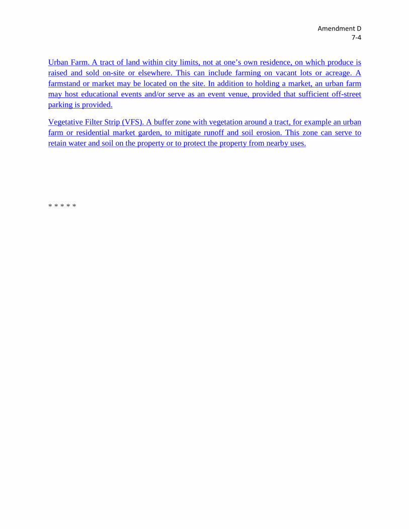
Urban Farm. A tract of land within city limits, not at one’s own residence, on which produce is raised and sold on-site or elsewhere. This can include farming on vacant lots or acreage. A farmstand or market may be located on the site. In addition to holding a market, an urban farm may host educational events and/or serve as an event venue, provided that sufficient off-street parking is provided.
Vegetative Filter Strip (VFS). A buffer zone with vegetation around a tract, for example an urban farm or residential market garden, to mitigate runoff and soil erosion. This zone can serve to retain water and soil on the property or to protect the property from nearby uses.
* * * * *
Amendment E 7-5
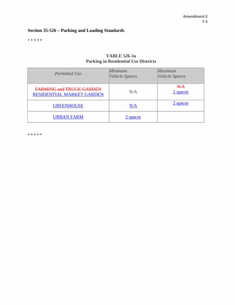
Section 35-526 – Parking and Loading Standards * * * * *
TABLE 526-3a Parking in Residential Use Districts
Permitted Use Minimum Vehicle Spaces
Maximum Vehicle Spaces
FARMING and TRUCK GARDEN RESIDENTIAL MARKET GARDEN N/A
N/A 2 spaces
GREENHOUSE N/A 2 spaces
URBAN FARM 2 spaces
* * * * *
Amendment F 22-3
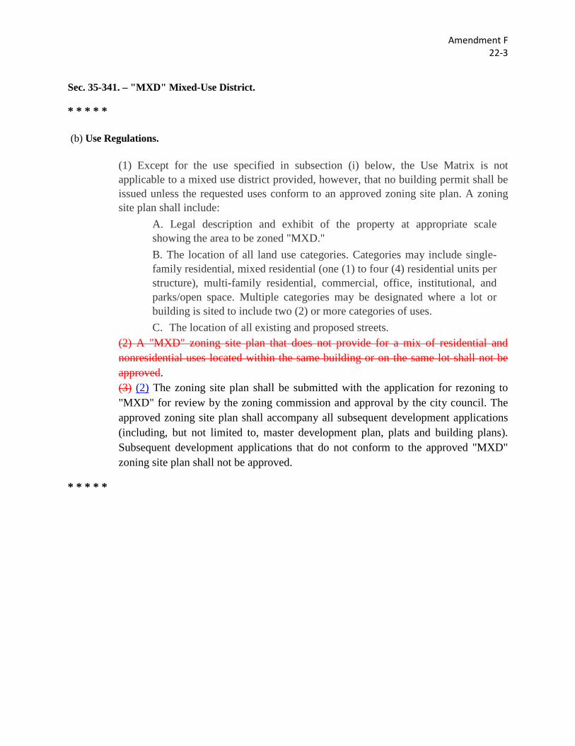
Sec. 35-341. – "MXD" Mixed-Use District.
* * * * *
(b) Use Regulations.
(1) Except for the use specified in subsection (i) below, the Use Matrix is not applicable to a mixed use district provided, however, that no building permit shall be issued unless the requested uses conform to an approved zoning site plan. A zoning site plan shall include:
A. Legal description and exhibit of the property at appropriate scale showing the area to be zoned "MXD." B. The location of all land use categories. Categories may include single-family residential, mixed residential (one (1) to four (4) residential units per structure), multi-family residential, commercial, office, institutional, and parks/open space. Multiple categories may be designated where a lot or building is sited to include two (2) or more categories of uses. C. The location of all existing and proposed streets.
(2) A "MXD" zoning site plan that does not provide for a mix of residential and nonresidential uses located within the same building or on the same lot shall not be approved. (3) (2) The zoning site plan shall be submitted with the application for rezoning to "MXD" for review by the zoning commission and approval by the city council. The approved zoning site plan shall accompany all subsequent development applications (including, but not limited to, master development plan, plats and building plans). Subsequent development applications that do not conform to the approved "MXD" zoning site plan shall not be approved.
* * * * *
Amendment G 22-4
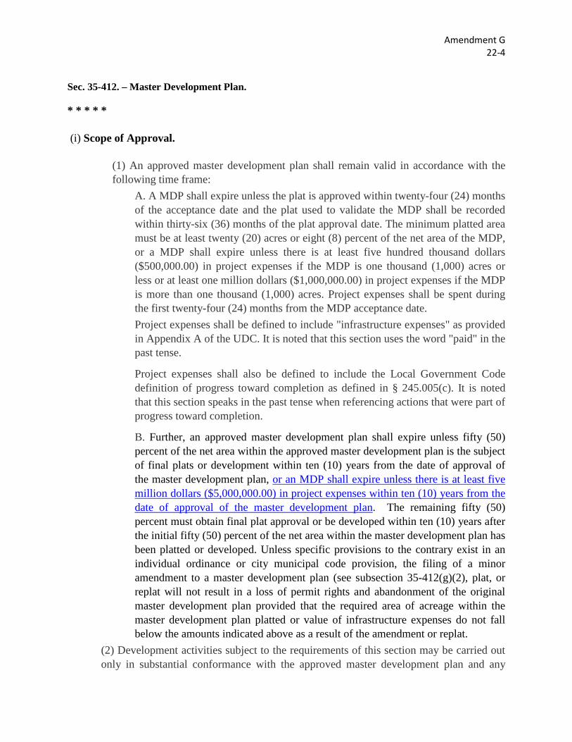
Sec. 35-412. – Master Development Plan.
* * * * *
(i) Scope of Approval.
(1) An approved master development plan shall remain valid in accordance with the following time frame:
A. A MDP shall expire unless the plat is approved within twenty-four (24) months of the acceptance date and the plat used to validate the MDP shall be recorded within thirty-six (36) months of the plat approval date. The minimum platted area must be at least twenty (20) acres or eight (8) percent of the net area of the MDP, or a MDP shall expire unless there is at least five hundred thousand dollars ($500,000.00) in project expenses if the MDP is one thousand (1,000) acres or less or at least one million dollars ($1,000,000.00) in project expenses if the MDP is more than one thousand (1,000) acres. Project expenses shall be spent during the first twenty-four (24) months from the MDP acceptance date. Project expenses shall be defined to include "infrastructure expenses" as provided in Appendix A of the UDC. It is noted that this section uses the word "paid" in the past tense.
Project expenses shall also be defined to include the Local Government Code definition of progress toward completion as defined in § 245.005(c). It is noted that this section speaks in the past tense when referencing actions that were part of progress toward completion.
B. Further, an approved master development plan shall expire unless fifty (50) percent of the net area within the approved master development plan is the subject of final plats or development within ten (10) years from the date of approval of the master development plan, or an MDP shall expire unless there is at least five million dollars ($5,000,000.00) in project expenses within ten (10) years from the date of approval of the master development plan. The remaining fifty (50) percent must obtain final plat approval or be developed within ten (10) years after the initial fifty (50) percent of the net area within the master development plan has been platted or developed. Unless specific provisions to the contrary exist in an individual ordinance or city municipal code provision, the filing of a minor amendment to a master development plan (see subsection 35-412(g)(2), plat, or replat will not result in a loss of permit rights and abandonment of the original master development plan provided that the required area of acreage within the master development plan platted or value of infrastructure expenses do not fall below the amounts indicated above as a result of the amendment or replat.
(2) Development activities subject to the requirements of this section may be carried out only in substantial conformance with the approved master development plan and any

Amendment G 22-4
conditions or restrictions attached thereto. No plat shall be considered for approval until the master development plan is accepted for subdivisions of two (2) or more phases. Any deviation from the approved master development plan unless approved in advance and in writing by the director of planning and development services, shall be deemed a violation of this chapter.
* * * * *
Amendment H 22-5
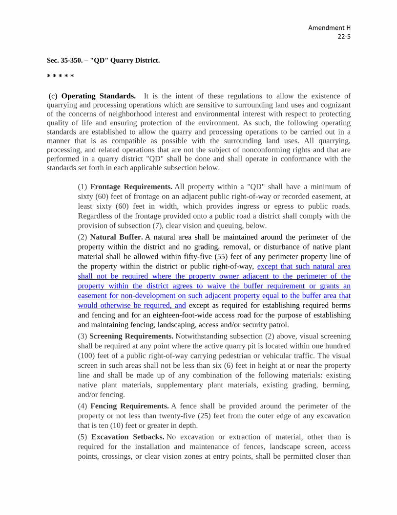
Sec. 35-350. – "QD" Quarry District.
* * * * *
(c) Operating Standards. It is the intent of these regulations to allow the existence of quarrying and processing operations which are sensitive to surrounding land uses and cognizant of the concerns of neighborhood interest and environmental interest with respect to protecting quality of life and ensuring protection of the environment. As such, the following operating standards are established to allow the quarry and processing operations to be carried out in a manner that is as compatible as possible with the surrounding land uses. All quarrying, processing, and related operations that are not the subject of nonconforming rights and that are performed in a quarry district "QD" shall be done and shall operate in conformance with the standards set forth in each applicable subsection below.
(1) Frontage Requirements. All property within a "QD" shall have a minimum of sixty (60) feet of frontage on an adjacent public right-of-way or recorded easement, at least sixty (60) feet in width, which provides ingress or egress to public roads. Regardless of the frontage provided onto a public road a district shall comply with the provision of subsection (7), clear vision and queuing, below. (2) Natural Buffer. A natural area shall be maintained around the perimeter of the property within the district and no grading, removal, or disturbance of native plant material shall be allowed within fifty-five (55) feet of any perimeter property line of the property within the district or public right-of-way, except that such natural area shall not be required where the property owner adjacent to the perimeter of the property within the district agrees to waive the buffer requirement or grants an easement for non-development on such adjacent property equal to the buffer area that would otherwise be required, and except as required for establishing required berms and fencing and for an eighteen-foot-wide access road for the purpose of establishing and maintaining fencing, landscaping, access and/or security patrol. (3) Screening Requirements. Notwithstanding subsection (2) above, visual screening shall be required at any point where the active quarry pit is located within one hundred (100) feet of a public right-of-way carrying pedestrian or vehicular traffic. The visual screen in such areas shall not be less than six (6) feet in height at or near the property line and shall be made up of any combination of the following materials: existing native plant materials, supplementary plant materials, existing grading, berming, and/or fencing. (4) Fencing Requirements. A fence shall be provided around the perimeter of the property or not less than twenty-five (25) feet from the outer edge of any excavation that is ten (10) feet or greater in depth. (5) Excavation Setbacks. No excavation or extraction of material, other than is required for the installation and maintenance of fences, landscape screen, access points, crossings, or clear vision zones at entry points, shall be permitted closer than
Amendment H 22-5
fifty-five (55) feet from the property line of any property adjoining the property located in the district that has been zoned for single-family residential use at the time such excavation or extraction has begun, or closer than fifty-five (55) feet from any public right-of-way, unless and except for any point at which a quarry or quarrying operations cross said public right-of-way. Such crossing shall not exceed the width limitations established by the governmental authority having jurisdiction of the applicable right-of-way. Due to the unique nature of quarries and their related operations, article V, division 3 of this chapter shall not apply within a "QD." (6) Facility Setbacks. All facilities for the production of finished products that are made from excavated materials (i.e., ready-mix concrete batch plants, lime plants, cement plants, concrete block plants, cement packaging plants, precast and prestressed yards, concrete pipe plants, and other similar facilities), which are constructed or installed after the effective date of this section, shall be located at least one hundred (100) feet from the property line of any adjoining property that is developed and/or zoned for residential uses at the time the facilities are constructed or installed, and at least fifty-five (55) feet from any public right-of-way on which pedestrian or vehicular access is allowed except for at points of crossing said right-of-way. (7) Clear Vision and Queuing Requirements. A triangular clear vision zone shall be provided at the intersection of all access points with public roads to provide an area of clear vision for vehicles. The zone shall be defined by a triangle consisting of three hundred (300) feet parallel with the public road and fifty (50) feet along the access road or drive measured from the intersection point of the two (2) rights-of-way. A queuing area sufficient to accommodate four (4) or more trucks of no less than two thousand four hundred (2,400) square feet shall be provided between the edge of the public right-of-way and the access point or gate station, whichever is nearest the public right-of-way. (8) Floodplain Protection. No building may be placed or excavation be conducted within one hundred fifty (150) feet from the outer limit of a 100-year floodplain. All NPDES and TEQC requirements must be met any time the quarry operations come within one hundred fifty (150) feet of a 100-year floodplain to prohibit silt or sediment from entering the creek or stream. These restrictions will not apply in any case where the floodplain is located more than one hundred fifty (150) feet inside the property line of the "QD." The buffer required by this provision shall in no case be wider than one hundred fifty (150) feet from the boundary line of the "QD." (9) Water Quality Protection. Operations within a "QD" shall comply with applicable water quality standards set forth in chapter 34 of the City Code. (10) Industrial Waste Monitoring. Upon request of the city fire department and/or solid waste management department, any person operating an activity within a "QD" shall provide, to the requesting agency's satisfaction, documentation evidencing the characterization, handling, and disposal of any industrial waste generated within the
Amendment H 22-5
"QD." Documentation which will satisfy the characterization inquiry includes process knowledge literature and/or waste analysis records. (11) Material Safety Data. Upon request of the city fire department, independent of the Federal Emergency Planning and Community Right to Know Act (EPCRA), any person operating an activity within a "QD" shall provide copies of material safety data sheets (MSDS) for material maintained, stored, or used within the "QD." The materials, subject of this section, are those materials whose properties for volatility, flammability, explosive potential, corrosiveness, radioactivity, or other toxic or hazardous property allow them to be listed in the North American Emergency Response Guidebook, current edition and as amended. (12) Blasting Setback. Blasting shall not be allowed within three hundred (300) feet of a residential structure under construction or completed at the time the "QD" is established. This requirement shall not apply in any case were the owner of such a residential structure has consented in writing to blasting occurring within less than three hundred (300) feet of the structure.
* * * * *
Amendment I 22-6
Sec. 35-A101. Definitions and Rules of Interpretation.
* * * * *
(b) Definitions. Words with specific defined meanings are as follows: * * * * *
Density, maximum. The maximum number of dwelling units that may be constructed where indicated in this chapter, stated as gross density unless otherwise indicated. When calculating the number of dwelling units that may be constructed, pursuant to density limitations otherwise provided in this Code, the City will employ standard practices for rounding the number to the nearest whole number.
* * * * *
Amendment J 22-7
Sec. 35-311. Use Regulations. * * * * *
* * * * *
Sec. 35-A101. Definitions and Rules of Interpretation.
* * * * *
(b) Definitions. Words with specific defined meanings are as follows: * * * * *
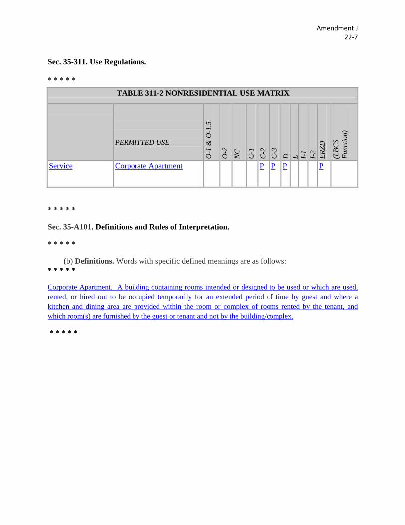
Corporate Apartment. A building containing rooms intended or designed to be used or which are used, rented, or hired out to be occupied temporarily for an extended period of time by guest and where a kitchen and dining area are provided within the room or complex of rooms rented by the tenant, and which room(s) are furnished by the guest or tenant and not by the building/complex.
* * * * *
TABLE 311-2 NONRESIDENTIAL USE MATRIX
PERMITTED USE
O-1
& O
-1.5
O-2
NC
C-1
C
-2
C-3
D
L I-
1 I-
2 ER
ZD
(LBC
S Fu
nctio
n)
Service Corporate Apartment P P P P
Amendment K 15-3
Sec. 35-523. – Tree Preservation.
* * * * *
(a) Applicability. To comply with the minimum final tree canopy cover requirements of subsection (e) an applicant shall elect either to perform a tree survey to identify trees for preservation in accordance with the provisions of this subsection below or to conduct a tree stand delineation as an alternative to the tree survey technique.
(4) Trees Exempt. This division shall not apply to: * * * * *
D. Trees or areas of tree canopy located in the clear vision area, as defined in the street improvement standards, Section 35-506(d)(5), Intersection Sight Distance.
* * * * *
Amendment L 15-4
Sec. 35-523. – Tree Preservation.
* * * * *
(b) Administration. The provisions of this section shall be implemented by the city arborist under the direction of the director of planning and development services. The city arborist shall oversee regulation of the maintenance and removal of significant or heritage trees or areas of tree canopy and shall enforce and administer the provisions of this section. The city arborist shall work closely with all city departments and governmental entities and licensees, and franchisees thereof in order to promote and ensure the maximum protection of trees by the implementation and administration of this section. City departments with which the city arborist is authorized to interact pursuant to subsection (p) of this section include, but are not limited to the following:
(1) Department of planning and development services shall coordinate: A. tree preservation in the review of master development plans, planned unit development plans, subdivision plats, permits and any grading filling and spoil activities when applicable. B. and m Maximize the preservation of tree(s) or areas of tree canopy through the implementation of the city's landscape and streetscape standards and through the approval process contained in this chapter.
(2) Public works and capital improvement management services (CIMS) transportation and capital improvements (TCI) departments shall maximize the preservation of trees or areas of tree canopy during public works and CIMS TCI projects for public improvements such as, but not limited to, utility installation, street construction and maintenance, drainage construction and maintenance, grading, filling, placement of soil, etc. and coordinate any projects that modify natural drainage areas in a way that negatively affects trees on private property or public property.
* * * * *
Amendment M 15-8
Sec. 35-523. – Tree Preservation.
* * * * *
(f) Minimum Tree Preservation Requirements. To comply with the minimum final tree canopy cover requirements of subsection (e) an applicant shall elect either to perform a tree survey to identify trees for preservation in accordance with the provisions of this subsection below or to conduct a tree stand delineation as an alternative to the tree survey technique.
(1) Protected Tree Designations. The significant or heritage tree designations establish a threshold trunk size, measured in diameter at breast height (DBH), for various tree species for purposes of applying the requirements of this chapter. A significant or heritage tree is defined by DBH as set forth below. Multi-trunk trees are to be measured with the largest trunk counting for full DBH inches plus 50% of the DBH sum of the additional trunks, if the tree is classified as significant. (Tree species listed below shall have at least one (1) trunk greater than five (5”) for small tree species and at least one (1) trunk greater than ten (10”) for large tree species to be considered significant). The value of the largest trunk is the value given to the small tree species listed below.
* * * * *
Amendment N 15-10
Sec. 35-523. – Tree Preservation.
* * * * *
(f) Minimum Tree Preservation Requirements. To comply with the minimum final tree canopy cover requirements of subsection (e) an applicant shall elect either to perform a tree survey to identify trees for preservation in accordance with the provisions of this subsection below or to conduct a tree stand delineation as an alternative to the tree survey technique.
(10) Historic Trees. In order to protect historic trees, as defined, the city arborist shall defer the approval of tree preservation plans to review by the historic preservation officer who shall seek the advice of the historic design and review commission Historic and Design Review Commission in instances where a historic tree is proposed to be removed. The commission may recommend additional replacement standards, recommend a cash payment to be deposited to the tree mitigation fund to offset the cost of future tree planting on public property, or recommend that the application for permit and tree preservation plan be denied. Provided, however that no later than thirty (30) days after the final application for removal of the historic tree was received, the historic preservation officer shall advise the applicant by certified mail, return requested, or hand delivery of his decision. The final application will be deemed approved if not acted upon by the historic preservation officer before the expiration of the thirty-day time period herein established. Such action may be appealed pursuant to section 35-481 of this chapter.
* * * * *
Amendment O 30-16
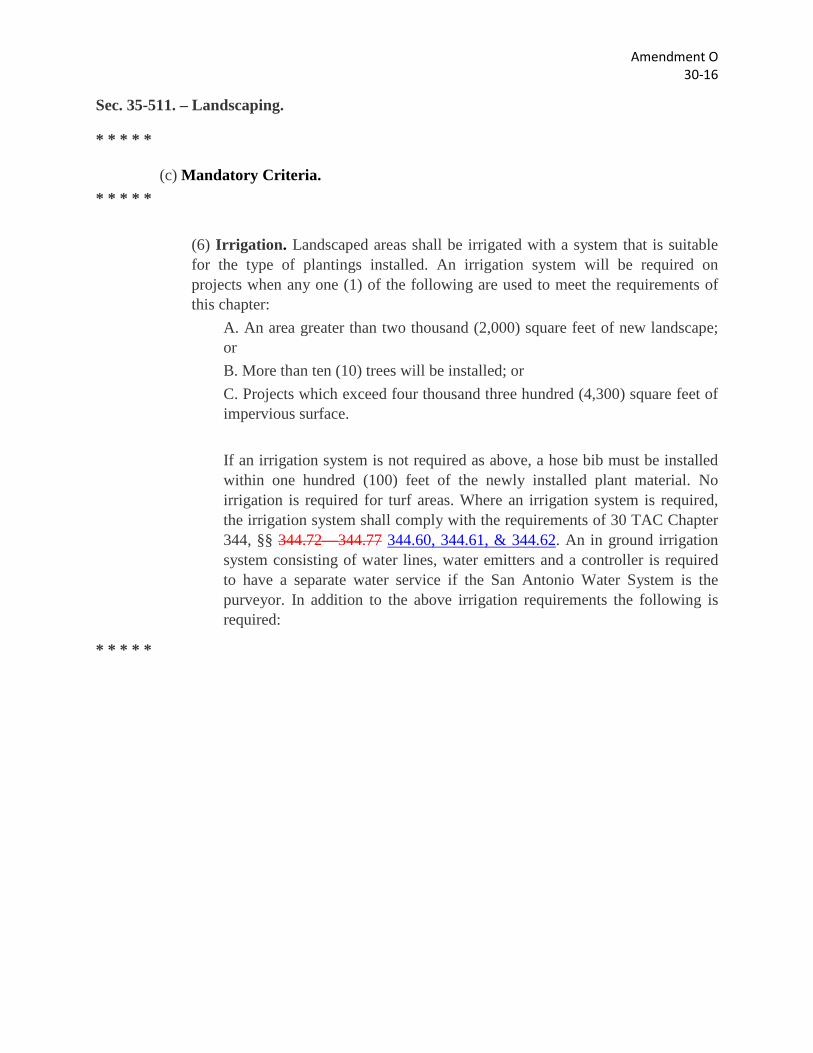
Sec. 35-511. – Landscaping.
* * * * *
(c) Mandatory Criteria. * * * * *
(6) Irrigation. Landscaped areas shall be irrigated with a system that is suitable for the type of plantings installed. An irrigation system will be required on projects when any one (1) of the following are used to meet the requirements of this chapter:
A. An area greater than two thousand (2,000) square feet of new landscape; or B. More than ten (10) trees will be installed; or C. Projects which exceed four thousand three hundred (4,300) square feet of impervious surface. If an irrigation system is not required as above, a hose bib must be installed within one hundred (100) feet of the newly installed plant material. No irrigation is required for turf areas. Where an irrigation system is required, the irrigation system shall comply with the requirements of 30 TAC Chapter 344, §§ 344.72—344.77 344.60, 344.61, & 344.62. An in ground irrigation system consisting of water lines, water emitters and a controller is required to have a separate water service if the San Antonio Water System is the purveyor. In addition to the above irrigation requirements the following is required:
* * * * *
Amendment P 28-80
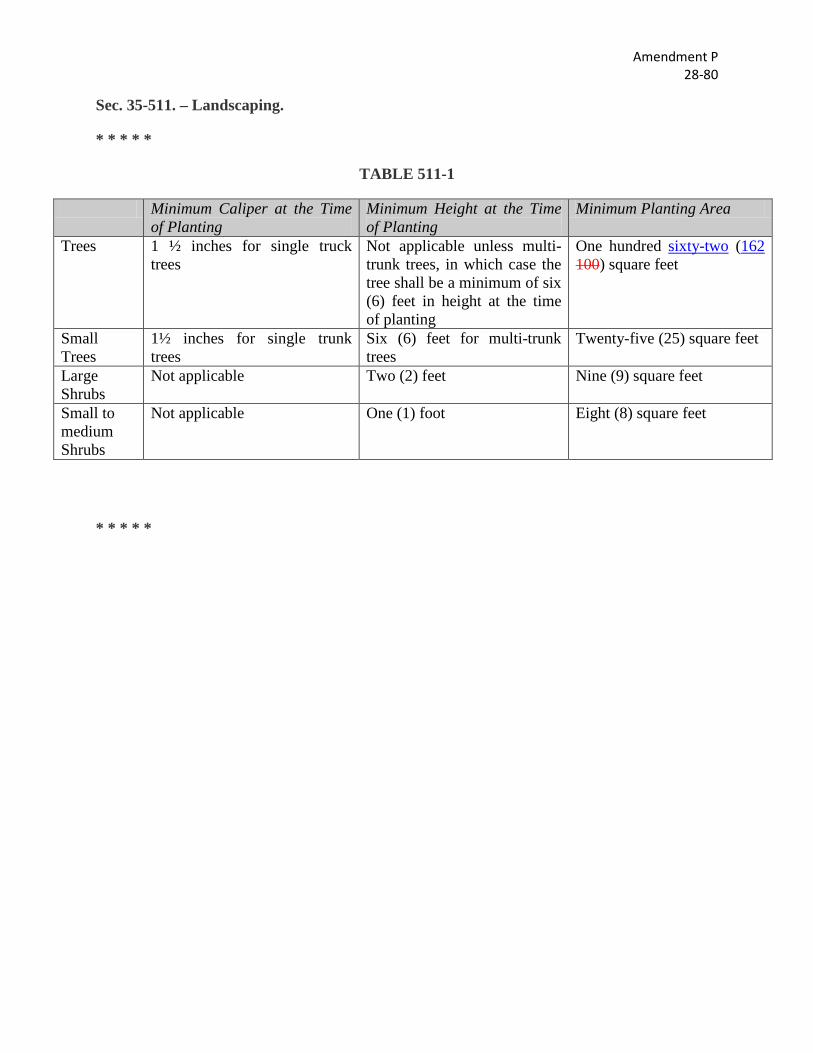
Sec. 35-511. – Landscaping.
* * * * *
TABLE 511-1
Minimum Caliper at the Time of Planting
Minimum Height at the Time of Planting
Minimum Planting Area
Trees 1 ½ inches for single truck trees
Not applicable unless multi-trunk trees, in which case the tree shall be a minimum of six (6) feet in height at the time of planting
One hundred sixty-two (162 100) square feet
Small Trees
1½ inches for single trunk trees
Six (6) feet for multi-trunk trees
Twenty-five (25) square feet
Large Shrubs
Not applicable Two (2) feet Nine (9) square feet
Small to medium Shrubs
Not applicable One (1) foot Eight (8) square feet
* * * * *
Amendment Q 28-75
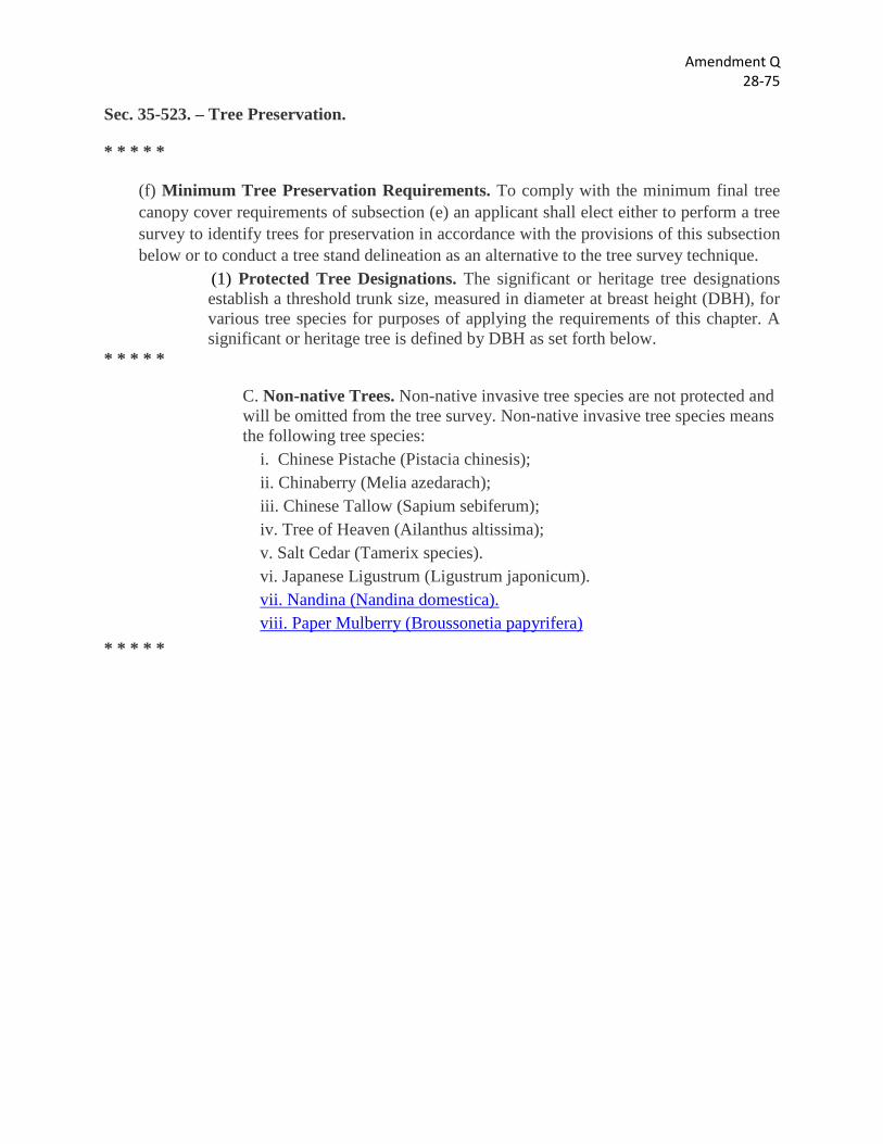
Sec. 35-523. – Tree Preservation.
* * * * *
(f) Minimum Tree Preservation Requirements. To comply with the minimum final tree canopy cover requirements of subsection (e) an applicant shall elect either to perform a tree survey to identify trees for preservation in accordance with the provisions of this subsection below or to conduct a tree stand delineation as an alternative to the tree survey technique.
(1) Protected Tree Designations. The significant or heritage tree designations establish a threshold trunk size, measured in diameter at breast height (DBH), for various tree species for purposes of applying the requirements of this chapter. A significant or heritage tree is defined by DBH as set forth below.
* * * * *
C. Non-native Trees. Non-native invasive tree species are not protected and will be omitted from the tree survey. Non-native invasive tree species means the following tree species:
i. Chinese Pistache (Pistacia chinesis); ii. Chinaberry (Melia azedarach); iii. Chinese Tallow (Sapium sebiferum); iv. Tree of Heaven (Ailanthus altissima); v. Salt Cedar (Tamerix species). vi. Japanese Ligustrum (Ligustrum japonicum). vii. Nandina (Nandina domestica). viii. Paper Mulberry (Broussonetia papyrifera)
* * * * *
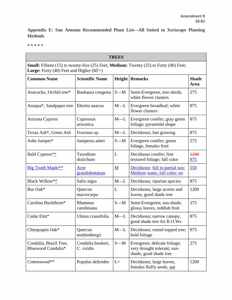
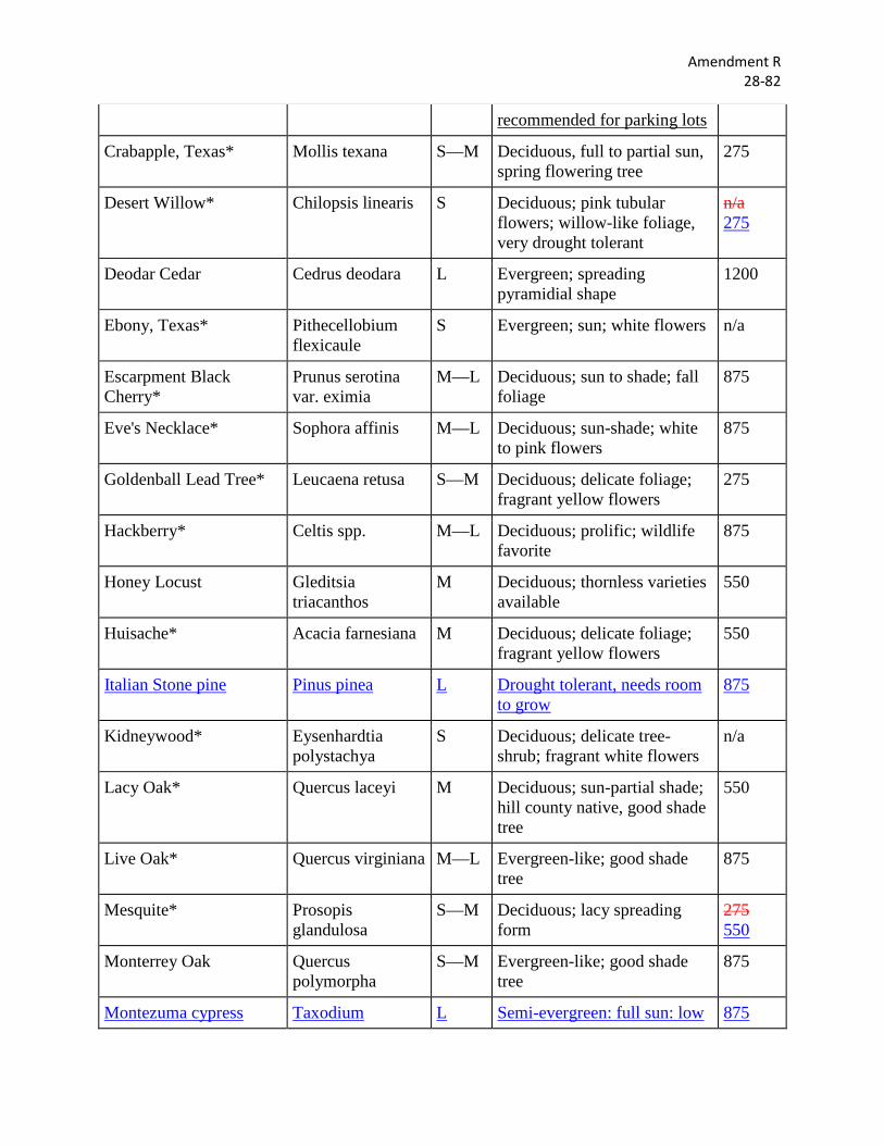
Amendment R 28-82
Appendix E: San Antonio Recommended Plant List—All Suited to Xeriscape Planting Methods
* * * * *
TREES
Small: Fifteen (15) to twenty-five (25) Feet; Medium: Twenty (25) to Forty (40) Feet; Large: Forty (40) Feet and Higher (60'+)
Common Name Scientific Name Height Remarks Shade Area
Anacacho, Orchid tree* Bauhania congesta S—M Semi-Evergreen, tree-shrub, white flower clusters
275
Anaqua*, Sandpaper tree Ehretia anacua M—L Evergreen broadleaf; white flower clusters
875
Arizona Cypress Cupressus arizonica
M—L Evergreen conifer; gray green foliage; pyramidal shape
875
Texas Ash*, Green Ash Fraxinus sp. M—L Deciduous; fast growing 875
Ashe Juniper* Juniperus ashei S—M Evergreen conifer; green foliage, females fruit
275
Bald Cypress** Taxodium distichum
L Deciduous conifer; fine textured foliage; fall color
1200 875
Big Tooth Maple** Acer grandidentatum
M Deciduous: full to partial sun: Medium water, fall color: no
550
Black Willow** Salix nigra M—L Deciduous; riparian species 875
Bur Oak* Quercus macrocarpa
L Deciduous; large acorns and leaves, good shade tree
1200
Carolina Buckthorn* Rhamnus caroliniana
S—M Semi-Evergreen; sun-shade, glossy leaves, reddish fruit
275
Cedar Elm* Ulmus crassifolia M—L Deciduous; narrow canopy, good shade tree for R.O.Ws
875
Chinquapin Oak* Quercus muhlenbergii
M—L Deciduous; round-topped tree; bold foliage
875
Condalia, Brazil Tree, Bluewood Condalia*
Condalia hookeri, C. viridis
S—M Evergreen; delicate foliage; very drought tolerant; sun-shade, good shade tree
275
Cottonwood** Populus deltoides L+ Deciduous; large leaves, females fluffy seeds, not
1200
Amendment R 28-82
recommended for parking lots
Crabapple, Texas* Mollis texana S—M Deciduous, full to partial sun, spring flowering tree
275
Desert Willow* Chilopsis linearis S Deciduous; pink tubular flowers; willow-like foliage, very drought tolerant
n/a 275
Deodar Cedar Cedrus deodara L Evergreen; spreading pyramidial shape
1200
Ebony, Texas* Pithecellobium flexicaule
S Evergreen; sun; white flowers n/a
Escarpment Black Cherry*
Prunus serotina var. eximia
M—L Deciduous; sun to shade; fall foliage
875
Eve's Necklace* Sophora affinis M—L Deciduous; sun-shade; white to pink flowers
875
Goldenball Lead Tree* Leucaena retusa S—M Deciduous; delicate foliage; fragrant yellow flowers
275
Hackberry* Celtis spp. M—L Deciduous; prolific; wildlife favorite
875
Honey Locust Gleditsia triacanthos
M Deciduous; thornless varieties available
550
Huisache* Acacia farnesiana M Deciduous; delicate foliage; fragrant yellow flowers
550
Italian Stone pine Pinus pinea L Drought tolerant, needs room to grow
875
Kidneywood* Eysenhardtia polystachya
S Deciduous; delicate tree-shrub; fragrant white flowers
n/a
Lacy Oak* Quercus laceyi M Deciduous; sun-partial shade; hill county native, good shade tree
550
Live Oak* Quercus virginiana M—L Evergreen-like; good shade tree
875
Mesquite* Prosopis glandulosa
S—M Deciduous; lacy spreading form
275 550
Monterrey Oak Quercus polymorpha
S—M Evergreen-like; good shade tree
875
Montezuma cypress Taxodium L Semi-evergreen: full sun: low 875
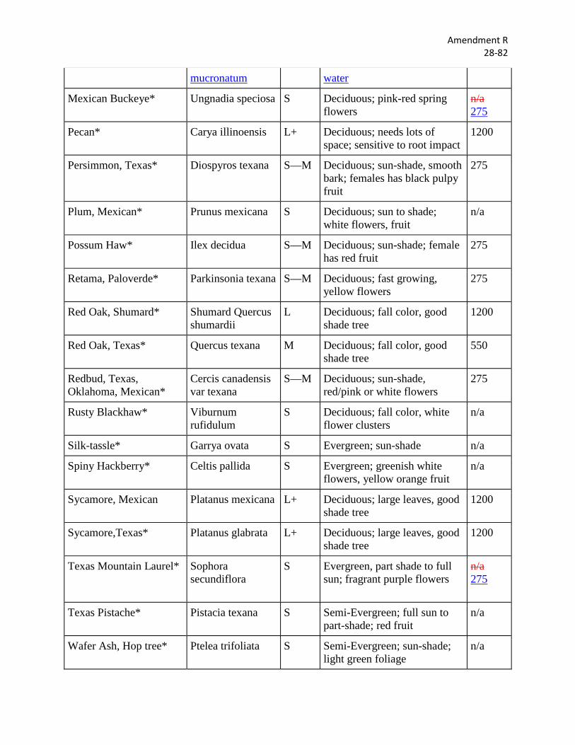
Amendment R 28-82
mucronatum water
Mexican Buckeye* Ungnadia speciosa S Deciduous; pink-red spring flowers
n/a 275
Pecan* Carya illinoensis L+ Deciduous; needs lots of space; sensitive to root impact
1200
Persimmon, Texas* Diospyros texana S—M Deciduous; sun-shade, smooth bark; females has black pulpy fruit
275
Plum, Mexican* Prunus mexicana S Deciduous; sun to shade; white flowers, fruit
n/a
Possum Haw* Ilex decidua S—M Deciduous; sun-shade; female has red fruit
275
Retama, Paloverde* Parkinsonia texana S—M Deciduous; fast growing, yellow flowers
275
Red Oak, Shumard* Shumard Quercus shumardii
L Deciduous; fall color, good shade tree
1200
Red Oak, Texas* Quercus texana M Deciduous; fall color, good shade tree
550
Redbud, Texas, Oklahoma, Mexican*
Cercis canadensis var texana
S—M Deciduous; sun-shade, red/pink or white flowers
275
Rusty Blackhaw* Viburnum rufidulum
S Deciduous; fall color, white flower clusters
n/a
Silk-tassle* Garrya ovata S Evergreen; sun-shade n/a
Spiny Hackberry* Celtis pallida S Evergreen; greenish white flowers, yellow orange fruit
n/a
Sycamore, Mexican Platanus mexicana L+ Deciduous; large leaves, good shade tree
1200
Sycamore,Texas* Platanus glabrata L+ Deciduous; large leaves, good shade tree
1200
Texas Mountain Laurel* Sophora secundiflora
S Evergreen, part shade to full sun; fragrant purple flowers
n/a 275
Texas Pistache* Pistacia texana S Semi-Evergreen; full sun to part-shade; red fruit
n/a
Wafer Ash, Hop tree* Ptelea trifoliata S Semi-Evergreen; sun-shade; light green foliage
n/a
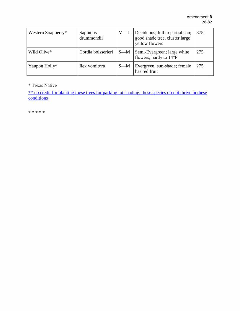
Amendment R 28-82
Western Soapberry* Sapindus drummondii
M—L Deciduous; full to partial sun; good shade tree, cluster large yellow flowers
875
Wild Olive* Cordia boisserieri S—M Semi-Evergreen; large white flowers, hardy to 14°F
275
Yaupon Holly* Ilex vomitora S—M Evergreen; sun-shade; female has red fruit
275
* Texas Native ** no credit for planting these trees for parking lot shading, these species do not thrive in these conditions * * * * *
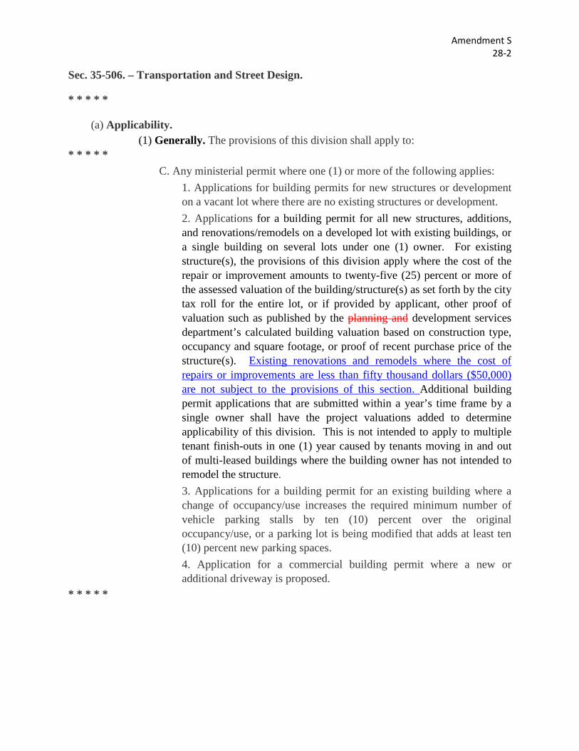
Amendment S 28-2
Sec. 35-506. – Transportation and Street Design.
* * * * *
(a) Applicability. (1) Generally. The provisions of this division shall apply to:
* * * * * C. Any ministerial permit where one (1) or more of the following applies:
1. Applications for building permits for new structures or development on a vacant lot where there are no existing structures or development. 2. Applications for a building permit for all new structures, additions, and renovations/remodels on a developed lot with existing buildings, or a single building on several lots under one (1) owner. For existing structure(s), the provisions of this division apply where the cost of the repair or improvement amounts to twenty-five (25) percent or more of the assessed valuation of the building/structure(s) as set forth by the city tax roll for the entire lot, or if provided by applicant, other proof of valuation such as published by the planning and development services department’s calculated building valuation based on construction type, occupancy and square footage, or proof of recent purchase price of the structure(s). Existing renovations and remodels where the cost of repairs or improvements are less than fifty thousand dollars ($50,000) are not subject to the provisions of this section. Additional building permit applications that are submitted within a year’s time frame by a single owner shall have the project valuations added to determine applicability of this division. This is not intended to apply to multiple tenant finish-outs in one (1) year caused by tenants moving in and out of multi-leased buildings where the building owner has not intended to remodel the structure. 3. Applications for a building permit for an existing building where a change of occupancy/use increases the required minimum number of vehicle parking stalls by ten (10) percent over the original occupancy/use, or a parking lot is being modified that adds at least ten (10) percent new parking spaces. 4. Application for a commercial building permit where a new or additional driveway is proposed.
* * * * *
Amendment T 28-119
Sec. 35-343. – “IDZ” Infill Development Zone. * * * * *
(c) Lot and Building Specifications. * * * * *
(2) Building Location. The requirements of this subsection shall apply to the construction of new buildings within the "IDZ" district whether used as an overlay or a base district. The provisions of this subsection shall not apply to the reuse and/or rehabilitation of existing structures provided however that these requirements shall apply to any additions, expansion or enlargement of any existing buildings.
A. Nonresidential. The side, front and rear setback provisions of the zoning regulations (article III) shall not apply to an approved infill development zone provided, however, that no new or existing building shall be erected, constructed or expanded to extend within the public right-of-way or within five (5) feet of the rear lot line. A 900 series lot, as defined in section 35-A101, may be provided in lieu of the required five-foot setback from the rear lot line provided that the 900 series lot provides a lot width at least equivalent to the required setback distance. B. Residential. On blocks where over fifty (50) percent of the blockface is occupied with existing single-family, duplex, triplex, and/or quadraplex residential units, the front setback within IDZ for uses zoned for single-family, duplex, triplex, and quadraplex uses shall be within ten (10) percent of the median setback of existing buildings on the block face. No new or existing building shall be erected, constructed or expanded to extend within the public right-of-way or within five (5) feet of the rear lot line. If there is a public street right-of-way, the front facade shall front the street. A 900 series lot, as defined in 35-A101, may be provided in lieu of the required front or rear setbacks provided that the 900 series lot provides a lot width at least equivalent to the minimum required setback distance.
On blocks where fifty (50) percent or less of the blockface is occupied with existing single-family, duplex, triplex, and/or quadraplex residential units, or the block is being redeveloped for over fifty (50) percent of the block face, the front, side and rear setback provisions of the zoning regulations (article III) shall not apply to an approved infill development zone provided, however, that no new or existing building shall be erected, constructed or expanded to extend within the public right-of-way or within five (5) feet of the rear lot line. A 900 series lot, as defined in section 35-A101, may be provided in lieu of the required five-foot setback from the
Amendment T 28-119
rear lot line provided that the 900 series lot provides a lot width at least equivalent to the required setback distance.
* * * * *
Sec. 35-516. – Setback and Frontage Regulations.
* * * * *
(g) Garages and Carports. There shall be a minimum of twenty (20) feet between the back of a sidewalk or the property line and any garage entry accessed from a street right-of-way. The garage setback requirement for garages accessed from an alley shall be in accordance with section 25-370. Carports may be erected behind the minimum front setback required in the applicable zoning district, so long as twenty (20) feet of total parking area depth is maintained within the lot. The minimum twenty (20) feet between back of sidewalk or property line and any garage access does not apply to townhouses, and does not apply to properties zoned IDZ where the front building setback is less than twenty (20) feet in compliance with Section 35-343(c)(2).
* * * * *
C. Any ministerial permit where one (1) or more of the following applies: 1. Applications for building permits for new structures or development on a vacant lot where there are no existing structures or development. 2. Applications for a building permit for all new structures, additions, and renovations/remodels on a developed lot with existing buildings, or a single building on several lots under one (1) owner. For existing structure(s), the provisions of this division apply where the cost of the repair or improvement amounts to twenty-five (25) percent or more of the assessed valuation of the building/structure(s) as set forth by the city tax roll for the entire lot, or if provided by applicant, other proof of valuation such as published by the planning and development services department’s calculated building valuation based on construction type, occupancy and square footage, or proof of recent purchase price of the structure(s). Existing renovations and remodels where the cost of repairs or improvements are less than fifty thousand dollars ($50,000) are not subject to the provisions of this section. Additional building permit applications that are submitted within a year’s time frame by a single owner shall have the project valuations added to determine applicability of this division. This is not intended to apply to multiple tenant finish-outs in one (1) year caused by tenants moving in and out
Amendment T 28-119
of multi-leased buildings where the building owner has not intended to remodel the structure. 3. Applications for a building permit for an existing building where a change of occupancy/use increases the required minimum number of vehicle parking stalls by ten (10) percent over the original occupancy/use, or a parking lot is being modified that adds at least ten (10) percent new parking spaces. 4. Application for a commercial building permit where a new or additional driveway is proposed.
* * * * *
Amendment U 28-105
Sec. 35-510. – Buffers.
* * * * *
(a) Applicability. * * * * *
(4) Reduction in Required Bufferyards. Table 510-2 indicates net minimum bufferyard widths. Such minimum widths shall be provided in a linear fashion along abutting properties where applicable. The width of the bufferyard at any point along its length may be greater or less than the minimum required by Table 510-2 provided that the total calculated area of the bufferyard must remain the same and further provided that the minimum width of the buffer yard at any point is not less than fifty (50) percent of the minimum width indicated by Table 510-2. The net bufferyard area for a property to be developed shall be reduced not less than fifty (50) percent where:
A. A bufferyard exists on an abutting property, and the net bufferyard satisfies the minimum bufferyard requirements of this section; or
B. The adjoining property owners have provided a written agreement restricting the use of an established or proposed use triggering the bufferyard requirement to the uses provided for in the current zoning district. Should the property that was subject to the bufferyard requirement be rezoned after the date of the written agreement, the adjoining property owner's written agreement shall be null and void and the applicable bufferyard shall be required.
C. The required bufferyard area may be reduced in width up to twenty (20) percent where a natural area is provided in accordance with Table 510-2 (Type N).
* * * * *
Amendment U 28-105
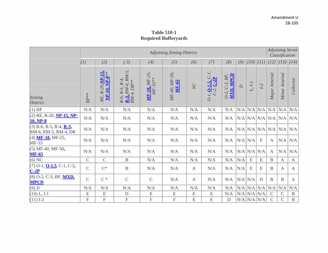
Table 510-1 Required Bufferyards
Zoning District
Adjoining Zoning District Adjoining Street Classification
(1) (2) ( 3) (4) (5) (6) (7) (8) (9) (10) (11) (12) (13) (14)
RP**
RE, R
-20,
NP-
15,
NP-
10, N
P-8*
*
R-6,
R-5
, R-4
, R
-3, R
M-6
, RM
-5,
RM-4
, DR*
*
MF
-18,
MF-
25,
MF-
33**
MF-
40, M
F-50
, M
F-6
5
NC
O-1
, O-1
.5, C
-1,
C-2
, C-2
P
O-2
, C-3
, BP,
M
XD
, MPC
D
D
L, I-
1
I-2
Maj
or A
rter
ial
Min
or A
rter
ial
Col
lect
or
(1) RP N/A N/A N/A N/A N/A N/A N/A N/A N/A N/A N/A N/A N/A N/A (2) RE, R-20, NP-15, NP-10, NP-8 N/A N/A N/A N/A N/A N/A N/A N/A N/A N/A N/A N/A N/A N/A
(3) R-6, R-5, R-4, R-3, RM-6, RM-5, RM-4, DR N/A N/A N/A N/A N/A N/A N/A N/A N/A N/A N/A N/A N/A N/A
(4) MF-18, MF-25, MF-33 N/A N/A N/A N/A N/A N/A N/A N/A N/A N/A F A N/A N/A
(5) MF-40, MF-50, MF-65 N/A N/A N/A N/A N/A N/A N/A N/A N/A N/A N/A A N/A N/A
(6) NC C C B N/A N/A N/A N/A N/A N/A E E B A A (7) O-1, O-1.5, C-1, C-2, C-2P C C* B N/A N/A A N/A N/A N/A E E B A A
(8) O-2, C-3, BP, MXD, MPCD C C * C C N/A A N/A N/A N/A N/A D B B A
(9) D N/A N/A N/A N/A N/A N/A N/A N/A N/A N/A N/A N/A N/A N/A (10) L, I-1 E E D E E E E N/A N/A N/A N/A C C B (11) I-2 F F F F F E E D N/A N/A N/A C C B
Amendment U 28-105
Notes: A, B, C, D, E, F: Bufferyard Type Designations as shown in Table 510-2 below. N/A: Not applicable—Bufferyard not required. * Where a use zoned "O-1," "C-1," "C-2" adjoins an existing platted subdivision zoned "RE" or "R-20" as of the effective date of this chapter, a type "D" buffer shall be applied. Where a use zoned "BP," "O-2" or "C-3" adjoins an existing platted subdivision zoned "RE" or "R-20" as of the effective date of this chapter, a type "F" buffer shall be applied. ** Where a nonresidential use is located in a single-family or multi-family district as indicated in Table 510-1 the required buffer is equivalent to that required of an O-1, C-1, C-2 use (column 7).
Amendment V 14-19
Sec. 35-506. - Transportation and Street Design.
* * * * *
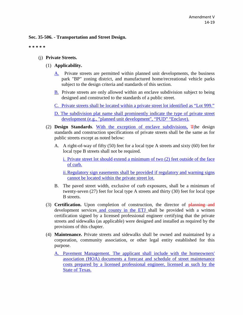
(j) Private Streets. (1) Applicability.
A. Private streets are permitted within planned unit developments, the business park "BP" zoning district, and manufactured home/recreational vehicle parks subject to the design criteria and standards of this section.
B. Private streets are only allowed within an enclave subdivision subject to being designed and constructed to the standards of a public street.
C. Private streets shall be located within a private street lot identified as “Lot 999.”
D. The subdivision plat name shall prominently indicate the type of private street development (e.g., "planned unit development", “PUD” “Enclave).
(2) Design Standards. With the exception of enclave subdivisions, Tthe design standards and construction specifications of private streets shall be the same as for public streets except as noted below:
A. A right-of-way of fifty (50) feet for a local type A streets and sixty (60) feet for local type B streets shall not be required.
i. Private street lot should extend a minimum of two (2) feet outside of the face of curb.
ii. Regulatory sign easements shall be provided if regulatory and warning signs cannot be located within the private street lot.
B. The paved street width, exclusive of curb exposures, shall be a minimum of twenty-seven (27) feet for local type A streets and thirty (30) feet for local type B streets.
(3) Certification. Upon completion of construction, the director of planning and development services and county in the ETJ shall be provided with a written certification signed by a licensed professional engineer certifying that the private streets and sidewalks (as applicable) were designed and installed as required by the provisions of this chapter.
(4) Maintenance. Private streets and sidewalks shall be owned and maintained by a corporation, community association, or other legal entity established for this purpose.
A. Pavement Management. The applicant shall include with the homeowners' association (HOA) documents a forecast and schedule of street maintenance costs prepared by a licensed professional engineer, licensed as such by the State of Texas.
Amendment V 14-19
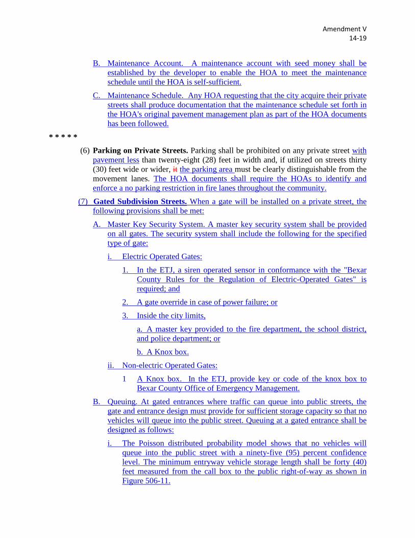
B. Maintenance Account. A maintenance account with seed money shall be established by the developer to enable the HOA to meet the maintenance schedule until the HOA is self-sufficient.
C. Maintenance Schedule. Any HOA requesting that the city acquire their private streets shall produce documentation that the maintenance schedule set forth in the HOA's original pavement management plan as part of the HOA documents has been followed.
* * * * * (6) Parking on Private Streets. Parking shall be prohibited on any private street with
pavement less than twenty-eight (28) feet in width and, if utilized on streets thirty (30) feet wide or wider, it the parking area must be clearly distinguishable from the movement lanes. The HOA documents shall require the HOAs to identify and enforce a no parking restriction in fire lanes throughout the community.
(7) Gated Subdivision Streets. When a gate will be installed on a private street, the following provisions shall be met:
A. Master Key Security System. A master key security system shall be provided on all gates. The security system shall include the following for the specified type of gate:
i. Electric Operated Gates:
1. In the ETJ, a siren operated sensor in conformance with the "Bexar County Rules for the Regulation of Electric-Operated Gates" is required; and
2. A gate override in case of power failure; or
3. Inside the city limits,
a. A master key provided to the fire department, the school district, and police department; or
b. A Knox box.
ii. Non-electric Operated Gates:
1 A Knox box. In the ETJ, provide key or code of the knox box to Bexar County Office of Emergency Management.
B. Queuing. At gated entrances where traffic can queue into public streets, the gate and entrance design must provide for sufficient storage capacity so that no vehicles will queue into the public street. Queuing at a gated entrance shall be designed as follows:
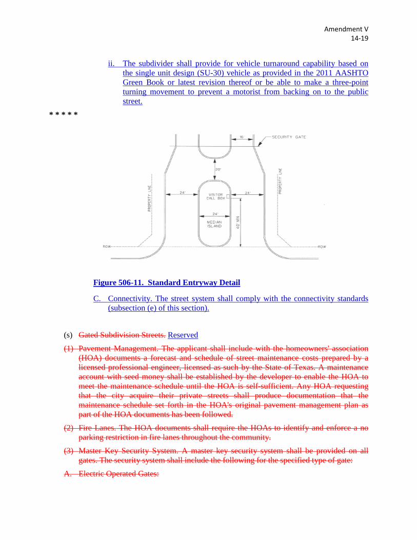
i. The Poisson distributed probability model shows that no vehicles will queue into the public street with a ninety-five (95) percent confidence level. The minimum entryway vehicle storage length shall be forty (40) feet measured from the call box to the public right-of-way as shown in Figure 506-11.
Amendment V 14-19
ii. The subdivider shall provide for vehicle turnaround capability based on the single unit design (SU-30) vehicle as provided in the 2011 AASHTO Green Book or latest revision thereof or be able to make a three-point turning movement to prevent a motorist from backing on to the public street.
* * * * *
Figure 506-11. Standard Entryway Detail
C. Connectivity. The street system shall comply with the connectivity standards (subsection (e) of this section).
(s) Gated Subdivision Streets. Reserved
(1) Pavement Management. The applicant shall include with the homeowners' association (HOA) documents a forecast and schedule of street maintenance costs prepared by a licensed professional engineer, licensed as such by the State of Texas. A maintenance account with seed money shall be established by the developer to enable the HOA to meet the maintenance schedule until the HOA is self-sufficient. Any HOA requesting that the city acquire their private streets shall produce documentation that the maintenance schedule set forth in the HOA's original pavement management plan as part of the HOA documents has been followed.
(2) Fire Lanes. The HOA documents shall require the HOAs to identify and enforce a no parking restriction in fire lanes throughout the community.
(3) Master Key Security System. A master key security system shall be provided on all gates. The security system shall include the following for the specified type of gate:
A. Electric Operated Gates:
Amendment V 14-19
(1) A gate override in case of power failure; and
(2) A siren operated sensor in conformance with the "Bexar County Rules for the Regulation of Electric-Operated Gates"; or
(3) Inside the city limits,
(i) A master key provided to the fire department, the school district, and police department; or
(ii) A Knox box.
B. Non-electric Operated Gates:
(1) A Knox box.
(4) Queuing. At gated entrances where traffic can queue into public streets, the gate and entrance design must provide for sufficient storage capacity so that no vehicles will queue into the public street. Queuing at a gated entrance shall be designed as follows:
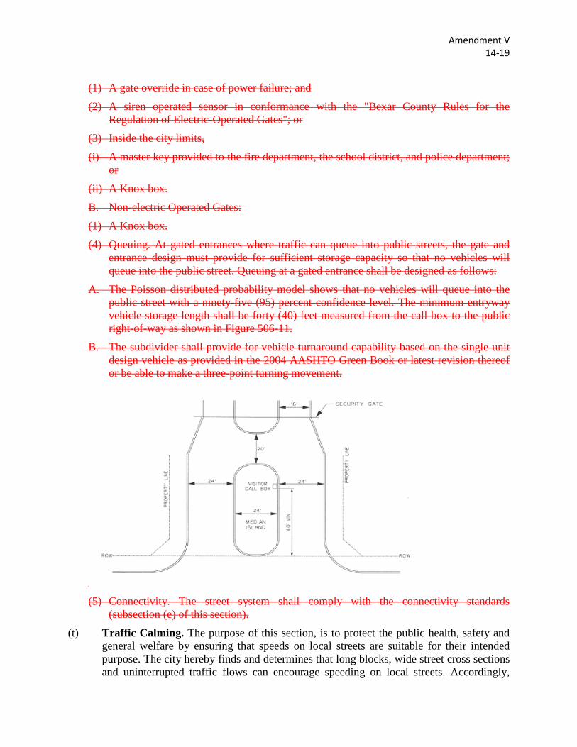
A. The Poisson distributed probability model shows that no vehicles will queue into the public street with a ninety-five (95) percent confidence level. The minimum entryway vehicle storage length shall be forty (40) feet measured from the call box to the public right-of-way as shown in Figure 506-11.
B. The subdivider shall provide for vehicle turnaround capability based on the single unit design vehicle as provided in the 2004 AASHTO Green Book or latest revision thereof or be able to make a three-point turning movement.
(5) Connectivity. The street system shall comply with the connectivity standards
(subsection (e) of this section).
(t) Traffic Calming. The purpose of this section, is to protect the public health, safety and general welfare by ensuring that speeds on local streets are suitable for their intended purpose. The city hereby finds and determines that long blocks, wide street cross sections and uninterrupted traffic flows can encourage speeding on local streets. Accordingly,

Amendment V 14-19
these design standards will slow traffic on local streets while allowing flexibility in design and offering applicants the choice of treatment that works best for the streets in a proposed development.
* * * * *
Amendment W 14-20
Sec. 35-506. - Transportation and Street Design.
* * * * *
(l) Horizontal Curvature.
* * * * *
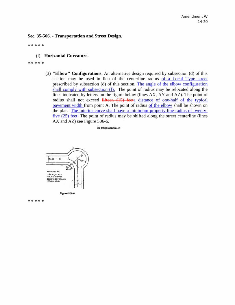
(3) "Elbow" Configurations. An alternative design required by subsection (d) of this section may be used in lieu of the centerline radius of a Local Type street prescribed by subsection (d) of this section. The angle of the elbow configuration shall comply with subsection (f). The point of radius may be relocated along the lines indicated by letters on the figure below (lines AX, AY and AZ). The point of radius shall not exceed fifteen (15) feeta distance of one-half of the typical pavement width from point A. The point of radius of the elbow shall be shown on the plat. The interior curve shall have a minimum property line radius of twenty-five (25) feet. The point of radius may be shifted along the street centerline (lines AX and AZ) see Figure 506-6.
* * * * *
Amendment X 14-22
Sec. 35-506. - Transportation and Street Design.
* * * * *
(n) Medians. (1) Openings. Medians shall be continuous. Openings in the median may be provided
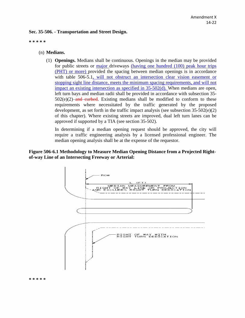
for public streets or major driveways (having one hundred (100) peak hour trips (PHT) or more) provided the spacing between median openings is in accordance with table 506-5.1, will not obstruct an intersection clear vision easement or stopping sight line distance, meets the minimum spacing requirements, and will not impact an existing intersection as specified in 35-502(d). When medians are open, left turn bays and median radii shall be provided in accordance with subsection 35-502(e)(2) and curbed. Existing medians shall be modified to conform to these requirements where necessitated by the traffic generated by the proposed development, as set forth in the traffic impact analysis (see subsection 35-502(e)(2) of this chapter). Where existing streets are improved, dual left turn lanes can be approved if supported by a TIA (see section 35-502).
In determining if a median opening request should be approved, the city will require a traffic engineering analysis by a licensed professional engineer. The median opening analysis shall be at the expense of the requestor.
Figure 506-6.1 Methodology to Measure Median Opening Distance from a Projected Right-of-way Line of an Intersecting Freeway or Arterial:
* * * * *
Amendment X 14-22
(2) Special Purpose Medians. Dividers constructed for aesthetic purposes such as entrances for subdivisions or landscaping shall be permitted. The minimum width for such dividers is fourteen (14) feet with minimum twenty (20) feet of pavement width on either side of the median. The divider shall maintain the full width for a minimum twenty-five (25) feet but not more than fifty (50) feet after which an appropriate transition shall be provided in accordance with standards for pavement and median transition (subsection (m), above). The twenty-five (25) feetlength of the median shall be measured from the edge of pavement of the ultimate width of the intersecting roadway. The nose or rounded portion of the divider shall be placed a minimum of two (2) feet off the edge of the traveled roadway of the intersecting street unless the turning radius of vehicular traffic or conflicts with an ADA street crossing indicates other modifications to the median nose are required. No signs, walls or fences, trees, shrubs or other ground cover shall be placed in the median which will obstruct the driver's sight distance (See Figure 506-7). The median design and exceptions to pavement width adjacent to median must be approved by the director of planning and development services in consultation with the director of public works. In addition, the director shall seek concurrence from the applicable county authority for all proposed medians located in the ETJ.
Landscaping shall be in accordance with current landscaping standards (section 35-511) design standards. In addition, appropriate maintenance agreements shall be made with the director of planning and development services.
* * * * *
Amendment Y 14-24
Sec. 35-506. - Transportation and Street Design. * * * * *
(r) Access and Driveways. (1) Applicability. The provisions of this section shall apply to all driveways. A
lot which is a part of an approved plat which does not otherwise limit access and which was approved by the city and filed for record as of the effective date of this section, and which does not have sufficient frontage to meet the driveway approach spacing requirements in this section, shall be allowed one (1) driveway approach.
(2) Single-Family Residential Subdivisions. A. Frontage and Access off a Collector or Major Thoroughfare. Where
a subdivision abuts a collector or major thoroughfare, lots for single-family residential use in the ETJ or in residential zoning districts shall not have direct access. The sole exception shall be lots Residential lots having direct access on a Collector or Major Thoroughfare may be platted only if:
i. All lots are greater than one (1) acre in size, have a minimum lot frontage of one hundred (100) feet and which provide for permanent vehicular turn around on the lot to prevent backing onto the roadway. and this restriction should be A noted shall be on the plat stating a permanent vehicular turn around shall be provided on each lot to prevent a vehicle from backing onto the roadway.
ii. Access points which would permit vehicular access to existing lots less than one acre in size from the thoroughfare or collector shall may be prohibitedallowed if. However, if conditions are such that vehicular access to such lots cannot be provided other than from the roadway, the director of planning and development services may permit the creation of a marginal access street or easement to serve two (2) or more lots spaced a minimum of two hundred (200) feet apart or 200 feet from an existing driveway or street is constructed. The marginal access street or easement shall be designed to permit entry to the roadway without requiring a motorist to execute a backing maneuver. Marginal access streets or easements shall be included on the subdivision plat and shall be constructed before recordation of the plat.
B. Marginal Access Streets. Where the subdivider furnishes a marginal access street on the subdivision side of an existing, improved primary or secondary arterial, the subdivider shall not be required to furnish any pavement, curbs, or sidewalks for the primary or secondary arterial. (see also: subsection 35-506(q)(5))
(C) Collector sections are required for a minimum of forty (40) feet off of an arterial to prevent construction of residential driveways closer than
Amendment Y 14-24
forty (40) feet from the arterial's end of property line return, or if a local type B section is designed, a A residential lot shall not side the arterial forbe located a minimum of forty (40) feet from an arterial right-of-way.
(3) Commercial, Industrial and Medium or High Density Residential Developments. Lots in proposed for commercial, industrial and medium or high-densitymulti-family residential developments in the ETJ or in the "MF," "NC," "O," "C," "I-1," or "I-2" zoning districts may have vehicular access from a thoroughfare or collector. However, the number of access points permitted will be based on the following criteria and following the driveway spacing requirements in subsection (7) below, if applicable.:
(A) For lots with less than two hundred (200) feet of unrestricted frontage, one (1) access point may be permitted;
(B) fFor lots with a frontage of two hundred (200) feet or more of unrestricted frontage, one (1) access point for every two hundred (200) feet of unrestricted frontage will may be permitted.
C Driveway spacing will be in accordance with subsection (7) below, if applicable. All lots proposed for commercial, development in the ETJ or in "NC," "O," and "C" zoning districts with less than four hundred (400) feet fronting an arterial street shall provide for shared cross access with adjacent lots fronting the arterial, by means of platted common access easement across the lot or recorded deed covenant providing common access across the lot with adjacent lot(s).
(4) Additional Access Points. The director of planning and development services (or the Texas Department of Transportation, or county authority, if appropriate) is authorized to permit additional access points under the following conditions:
(A) The additional land; and access points are necessary to ensure the property owner beneficial use of the land; and
(B) The resulting additional ingress and egress of vehicles will not seriously disrupt the flow of traffic on the thoroughfare.
(5) Location of Access Points. The specific location of access points will be determined by the director of planning and development services (or by the Texas Department of Transportation or county authority, if appropriate) at such time as a site plan is reviewed prior to the issuance of a building permit. The location shall be based on the following criteria:
(A) The location shall minimize conflicts with vehicle turning movements;
(B) The location shall be located as far as practicable from intersections; and
(C) The location shall be not less than fifty (50) feet from another driveway location.
Amendment Y 14-24
If this standard is not possible, based upon the frontage of the property, the location shall be directed as far as practicable from the other driveway locations. Driveways along an arterial within four hundred (400) feet of a major intersection, such as the intersection of two (2) arterial streets or the intersection of a collector and an arterial street, may be restricted to right turn movements.
(D) Not located within an auxiliary lane.
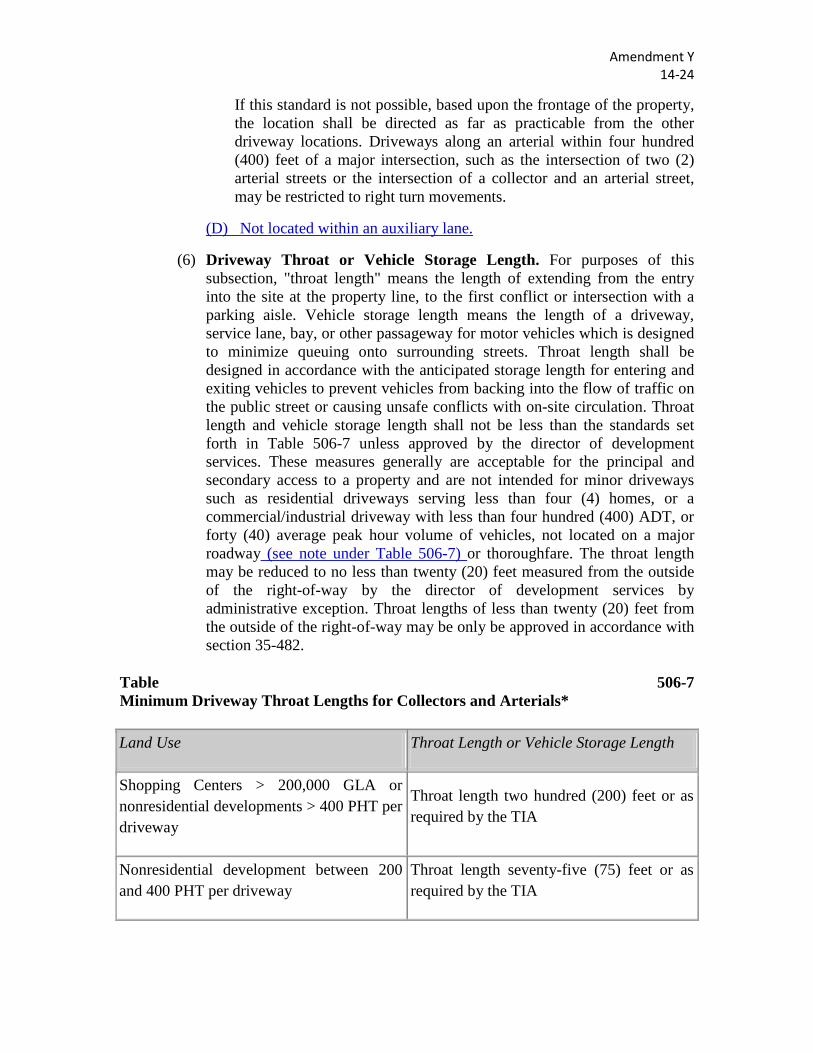
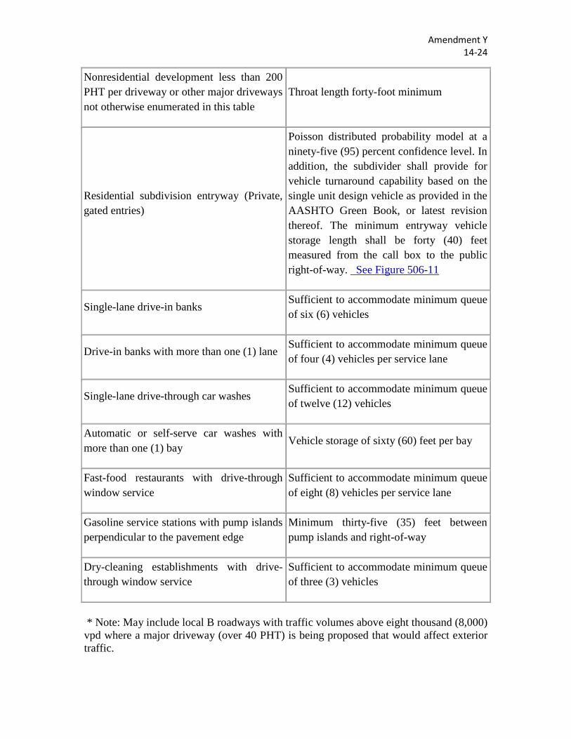
(6) Driveway Throat or Vehicle Storage Length. For purposes of this subsection, "throat length" means the length of extending from the entry into the site at the property line, to the first conflict or intersection with a parking aisle. Vehicle storage length means the length of a driveway, service lane, bay, or other passageway for motor vehicles which is designed to minimize queuing onto surrounding streets. Throat length shall be designed in accordance with the anticipated storage length for entering and exiting vehicles to prevent vehicles from backing into the flow of traffic on the public street or causing unsafe conflicts with on-site circulation. Throat length and vehicle storage length shall not be less than the standards set forth in Table 506-7 unless approved by the director of development services. These measures generally are acceptable for the principal and secondary access to a property and are not intended for minor driveways such as residential driveways serving less than four (4) homes, or a commercial/industrial driveway with less than four hundred (400) ADT, or forty (40) average peak hour volume of vehicles, not located on a major roadway (see note under Table 506-7) or thoroughfare. The throat length may be reduced to no less than twenty (20) feet measured from the outside of the right-of-way by the director of development services by administrative exception. Throat lengths of less than twenty (20) feet from the outside of the right-of-way may be only be approved in accordance with section 35-482.
Table 506-7 Minimum Driveway Throat Lengths for Collectors and Arterials*
Land Use Throat Length or Vehicle Storage Length
Shopping Centers > 200,000 GLA or nonresidential developments > 400 PHT per driveway
Throat length two hundred (200) feet or as required by the TIA
Nonresidential development between 200 and 400 PHT per driveway
Throat length seventy-five (75) feet or as required by the TIA
Amendment Y 14-24
Nonresidential development less than 200 PHT per driveway or other major driveways not otherwise enumerated in this table
Throat length forty-foot minimum
Residential subdivision entryway (Private, gated entries)
Poisson distributed probability model at a ninety-five (95) percent confidence level. In addition, the subdivider shall provide for vehicle turnaround capability based on the single unit design vehicle as provided in the AASHTO Green Book, or latest revision thereof. The minimum entryway vehicle storage length shall be forty (40) feet measured from the call box to the public right-of-way. See Figure 506-11
Single-lane drive-in banks Sufficient to accommodate minimum queue of six (6) vehicles
Drive-in banks with more than one (1) lane Sufficient to accommodate minimum queue of four (4) vehicles per service lane
Single-lane drive-through car washes Sufficient to accommodate minimum queue of twelve (12) vehicles
Automatic or self-serve car washes with more than one (1) bay
Vehicle storage of sixty (60) feet per bay
Fast-food restaurants with drive-through window service
Sufficient to accommodate minimum queue of eight (8) vehicles per service lane
Gasoline service stations with pump islands perpendicular to the pavement edge
Minimum thirty-five (35) feet between pump islands and right-of-way
Dry-cleaning establishments with drive-through window service
Sufficient to accommodate minimum queue of three (3) vehicles
* Note: May include local B roadways with traffic volumes above eight thousand (8,000) vpd where a major driveway (over 40 PHT) is being proposed that would affect exterior traffic.
Amendment Y 14-24
Commentary: The throat lengths in Table 506-7 are provided to assure adequate stacking space within driveways for general land use intensities. This helps prevent vehicles from stacking into the thoroughfare as they attempt to access the site. High traffic generators, such as large shopping plazas, need much greater throat length than smaller developments or those with unsignalized driveways. These standards refer to the primary access drive.
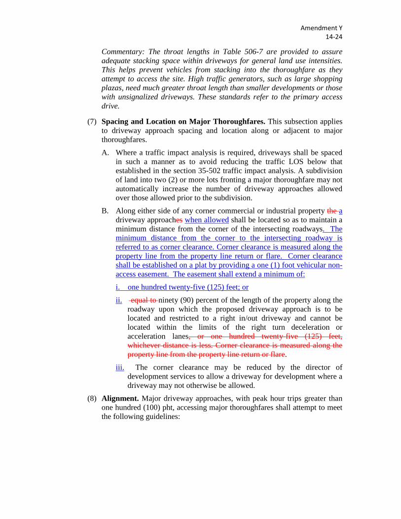
(7) Spacing and Location on Major Thoroughfares. This subsection applies to driveway approach spacing and location along or adjacent to major thoroughfares.
A. Where a traffic impact analysis is required, driveways shall be spaced in such a manner as to avoid reducing the traffic LOS below that established in the section 35-502 traffic impact analysis. A subdivision of land into two (2) or more lots fronting a major thoroughfare may not automatically increase the number of driveway approaches allowed over those allowed prior to the subdivision.
B. Along either side of any corner commercial or industrial property the a driveway approaches when allowed shall be located so as to maintain a minimum distance from the corner of the intersecting roadways. The minimum distance from the corner to the intersecting roadway is referred to as corner clearance. Corner clearance is measured along the property line from the property line return or flare. Corner clearance shall be established on a plat by providing a one (1) foot vehicular non-access easement. The easement shall extend a minimum of:
i. one hundred twenty-five (125) feet; or
ii. equal to ninety (90) percent of the length of the property along the roadway upon which the proposed driveway approach is to be located and restricted to a right in/out driveway and cannot be located within the limits of the right turn deceleration or acceleration lanes, or one hundred twenty-five (125) feet, whichever distance is less. Corner clearance is measured along the property line from the property line return or flare.
iii. The corner clearance may be reduced by the director of development services to allow a driveway for development where a driveway may not otherwise be allowed.
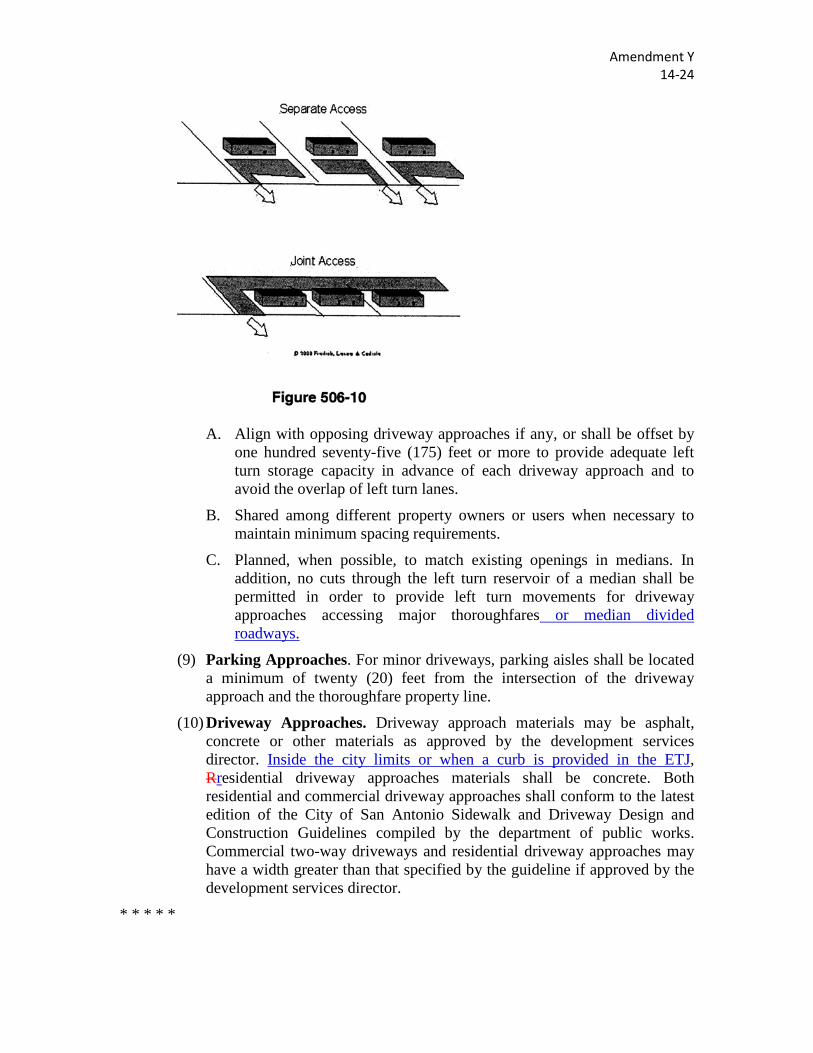
(8) Alignment. Major driveway approaches, with peak hour trips greater than one hundred (100) pht, accessing major thoroughfares shall attempt to meet the following guidelines:
Amendment Y 14-24
A. Align with opposing driveway approaches if any, or shall be offset by one hundred seventy-five (175) feet or more to provide adequate left turn storage capacity in advance of each driveway approach and to avoid the overlap of left turn lanes.
B. Shared among different property owners or users when necessary to maintain minimum spacing requirements.
C. Planned, when possible, to match existing openings in medians. In addition, no cuts through the left turn reservoir of a median shall be permitted in order to provide left turn movements for driveway approaches accessing major thoroughfares or median divided roadways.
(9) Parking Approaches. For minor driveways, parking aisles shall be located a minimum of twenty (20) feet from the intersection of the driveway approach and the thoroughfare property line.
(10) Driveway Approaches. Driveway approach materials may be asphalt, concrete or other materials as approved by the development services director. Inside the city limits or when a curb is provided in the ETJ, Rresidential driveway approaches materials shall be concrete. Both residential and commercial driveway approaches shall conform to the latest edition of the City of San Antonio Sidewalk and Driveway Design and Construction Guidelines compiled by the department of public works. Commercial two-way driveways and residential driveway approaches may have a width greater than that specified by the guideline if approved by the development services director.
* * * * *
Amendment Z 14-26
Sec. 35-B101. - Specifications for Documents to be Submitted.
* * * * *
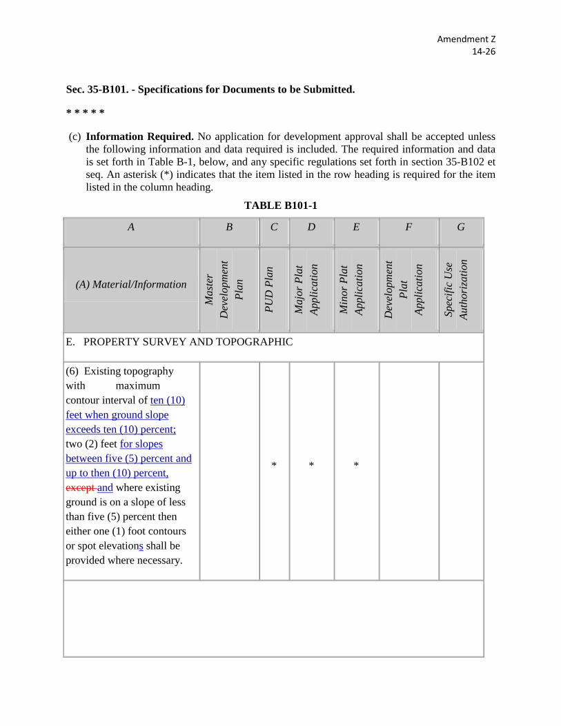
(c) Information Required. No application for development approval shall be accepted unless the following information and data required is included. The required information and data is set forth in Table B-1, below, and any specific regulations set forth in section 35-B102 et seq. An asterisk (*) indicates that the item listed in the row heading is required for the item listed in the column heading.
TABLE B101-1
A B C D E F G
(A) Material/Information
Mas
ter
Dev
elop
men
t Pl
an
PUD
Pla
n
Maj
or P
lat
Appl
icat
ion
Min
or P
lat
Appl
icat
ion
Dev
elop
men
t Pl
at
Appl
icat
ion
Spec
ific
Use
Au
thor
izat
ion
E. PROPERTY SURVEY AND TOPOGRAPHIC
(6) Existing topography with maximum contour interval of ten (10) feet when ground slope exceeds ten (10) percent; two (2) feet for slopes between five (5) percent and up to then (10) percent, except and where existing ground is on a slope of less than five (5) percent then either one (1) foot contours or spot elevations shall be provided where necessary.
* * *
Amendment Z 14-26
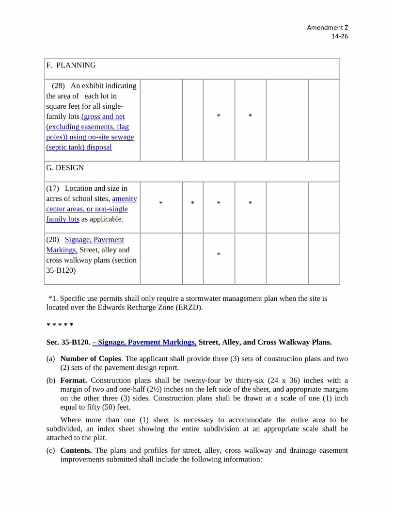
F. PLANNING
(28) An exhibit indicating the area of each lot in square feet for all single-family lots (gross and net (excluding easements, flag poles)) using on-site sewage (septic tank) disposal
* *
G. DESIGN
(17) Location and size in acres of school sites, amenity center areas, or non-single family lots as applicable.
* * * *
(20) Signage, Pavement Markings, Street, alley and cross walkway plans (section 35-B120)
*
*1. Specific use permits shall only require a stormwater management plan when the site is located over the Edwards Recharge Zone (ERZD).
* * * * *
Sec. 35-B120. – Signage, Pavement Markings, Street, Alley, and Cross Walkway Plans.
(a) Number of Copies. The applicant shall provide three (3) sets of construction plans and two (2) sets of the pavement design report.
(b) Format. Construction plans shall be twenty-four by thirty-six (24 x 36) inches with a margin of two and one-half (2½) inches on the left side of the sheet, and appropriate margins on the other three (3) sides. Construction plans shall be drawn at a scale of one (1) inch equal to fifty (50) feet.
Where more than one (1) sheet is necessary to accommodate the entire area to be subdivided, an index sheet showing the entire subdivision at an appropriate scale shall be attached to the plat.
(c) Contents. The plans and profiles for street, alley, cross walkway and drainage easement improvements submitted shall include the following information:
Amendment Z 14-26
(1) Typical sections showing the proposed pavement width, type, thickness and crown; the proposed curb and gutter type, location in relation to center line and exposure; the proposed parkway grading slopes; the proposed locations and type of wheelchair ramps; location of traffic signal conduit; and construction details of all drainage including dimensions, reinforcing and components such as grates and manhole covers. The information shall be given for each different type of streets and alleys in the subdivision.
(2) Alignment of each street, alley, cross walkway and drainage easement showing a beginning and ending station; each deflection angle of the center line and the station of the point of intersection; the station of the point of curvature and the point of tangency of each curve; the station and angle of intersection of each intersection with another street, alley or drainage easement; the station and radius of each curb return; the location of adjacent right-of-way lines; location and station of city limit or county lines; the location and limits of sidewalks and curbs of each street; the location and size of existing trees to remain in ROW; the location of each drainage structure; the location and size of all storm sewers; and the length, width, and thickness of cement stabilized base.
(3) The top of curb grade at each curb end, each fifty-foot station and each end of each curb return; the center line grade at each end and at each fifty-foot station of alleys and drainage ditches; the gradient of each tangent grade and the location and length of each vertical curve; the direction of storm drainage flow at each intersection; the flow line elevations of each drainage structure; the flow line elevation of each storm sewer at each point of change of grade, each end, and the intervening gradients. The profiles of streets, alleys and drainage ditches shall show the natural ground at adjacent property lines and the proposed center line.
(4) Scale, north arrow, date and plat number of the associated plat. Plans and profiles shall be drawn to scales of one (1) inch equals fifty (50) feet horizontally and one (1) inch equals five (5) feet vertically, unless different scales are approved by the director of planning and development services.
(5) Signage and pavement marking plans shall show the locations of street signs, warning, and regulatory signs, pavement markings and raised pavement markers and provide a summary table listing sign types, pavement markings types, and pavement marker types using TMUTCD designations with quantities.
(6) All signage, pavement markings, street and alley plans and profiles shall bear the seal of a licensed professional engineer.
Sec. 35-B121. - Subdivision Plat Applications.
* * * * *
(i) Military Overlay Area Limitations. Limitations on height, floor area ratios, land use, sound attenuation, and lighting shall be shown on the subdivision plat in cases where those limitations may affect the construction of a structure in this area. These limitations shall be shown in terms of height above ground elevations at appropriate
Amendment Z 14-26
locations on the plat and shall also include existing or finished elevations at those points; level of sound attenuation to be achieved, and limits on outdoor lighting.
When the above limitations are determined to be in effect within the boundaries of the proposed subdivision, the owner's certification shall include the following statement: "I understand that this subdivision is subject to the restrictions of the military overlay district ordinance and the maximum height of any proposed structure or building, sound attention, and outdoor lighting within this subdivision will be limited in accordance with the provisions of that ordinance."
Sec. 35-B122. – Traffic Impact Analysis.
* * * * *
(b) Study level TIAs shall consist of the following:
(7) Conclusions and Recommendations. A. A summary of the conclusions and recommendations for the transportation
network required to serve the proposed development.
B. Identification of peak hour trip (PHT) levels that will trigger mitigation actions identified.
C. A statement that each subsequent TIA submitted for the proposed development will be compared to the results of the Study Level TIA to determine if the overall roadway network remains adequate to serve the proposed development.
Sec. 35-B131. - Application for Plat Identification Number/Letters of Certification.
* * * * *
(b) Data Required for Letters of Certification. To obtain the required letters of certification, an applicant for plat approval shall submit the following data to the certifying agencies/departments. All data shall be annotated with the plat number of the associated plat.
* * * * *
(6) Bexar County.
A. Digital copy of plat.
B. Two (2) sets of storm water management plans.
C. Two (2) copies of TIA and disk of analysis.
D. Address plat.
E. If applicable, the following item(s):
1. Two (2) sets of utility plans.
Amendment Z 14-26
2. One (1) copy of approved POADP, MDP, PUD.
3. Final Geotech report.
4. Three (3) sets of streets and drainage plans.
5. Two (2) copies of cost estimates streets and drainage.
6. One (1) digital copy of construction plans.
7. Site evaluation form with required soil analysis.
8. Water purveyor documentation/letter.
9. Plan showing the proposed on-site sewage facility (OSSF) on the property and supporting documents required under 30 TAC §285.4(c) detailing the site’s suitability for on-site sewage facility systems.
* * * * *