Embed Size (px)
Citation preview
Sea Level Rise and Shifting Maritime Jurisdictional Limits
Clive Schofield
Australian National Centre for Ocean Resources and Security (ANCORS)
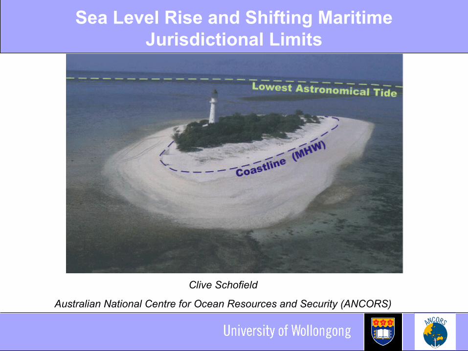
Sea Level Rise
• IPCC’s estimated range of sea level rise: 0.38-0.59m by the end of the century?
• Growing consensus that this estimate is overly conservative
• Great uncertainty over the critical questions of how much and how quickly?

Maritime Jurisdictions Zones
The Area
200 M
Sea Level
12 MContiguous
zone
Territorialsea
12 M
Exclusive Economic Zone (EEZ)
Water Column, Sea-bed, Subsoil
Rise Deep Ocean
Inte
rna
l w
ate
rs
Te
rrit
ori
al
Se
a B
as
eli
ne
(Extended Continental Shelf)
Continental ShelfSea-bed, Subsoil, Sedentary Species
High Sea
Shelf
[email protected] © 2008
UpperSlope Plateu
orTerrace
Migrating Baselines = Shifting Limits
• Maritime jurisdictional limits measured from baselines: Predominantly normal baselines, low-water line baselines
• Traditional interpretation: ambulatory baselines and consequently shifting limits Coastlines dynamic – low water line susceptible to change As normal baselines move, the limits drawn from them also
shift
• Not a new phenomenon• As sea level rises so the low-water line migrates inland • Dramatic horizontal shifts to normal baselines possible
from slight changes to sea level vertically
Impacts on Islands
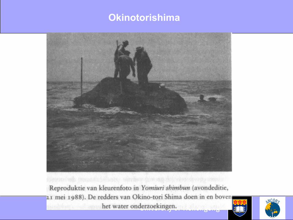
• Sea level rise/shifting baselines will also impact on the classification of insular features
• Most common normal baseline used, Lowest Astronomical Tide (LAT) – a very low low water line
• Critical basepoints may be unstable or ephemeral insular features Vulnerable to sea level rise leading to downgrading of
islands to mere rocks or low-tide elevations Impact on capacity to generate claims to maritime
jurisdiction
Implications
• Implications for: Extent and limits of maritime claims Enforcement issues Delimitation of maritime boundaries
• Loss of jurisdiction over vital marine resources• Jurisdictional uncertainty• Potential for conflict
Potential Responses
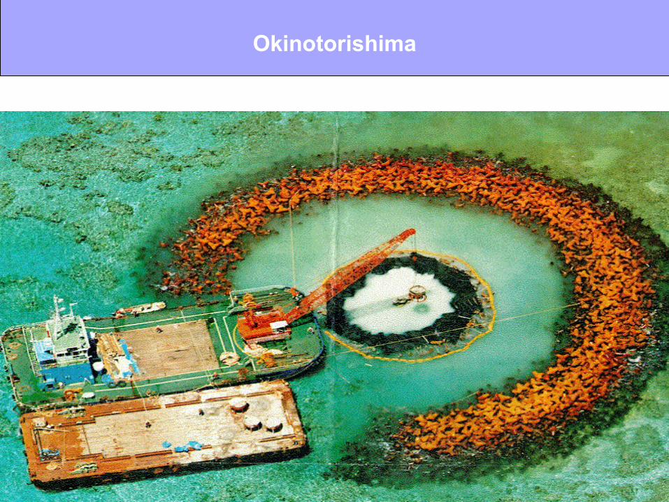
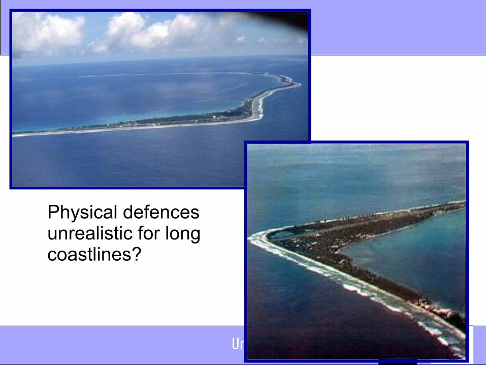
• Fix normal baselines physically Can key basepoints be preserved through sea
defences, ‘building-up’ and/or reclamation? Long tradition and an option for critical basepoints but
unrealistic for long coastlines?
• Fix normal baselines legally• Fix the limits of maritime zones

Fix Normal Baselines Legally
• Choice of chart depicting normal baseline left up to the coastal State (LOSC, Article 5)
• Chart the legal document• Can a coastal State therefore choose a chart that is
advantageous to it? What if there is a difference between the low water line shown
on the chart and reality?
• The drafters of the Convention did not anticipate sea level rise
• BUT: Ambulatory baselines may be fixed with straight baselines on unstable coasts Connection to the low water line still required
Fixing Limits and Boundaries
• Once agreed maritime boundaries remain fixed even though the baselines used to construct them may regress What if the territory in question disappears entirely?
• The outer limits of the continental shelf may also be fixed as “final and binding”
• Fix (declare) maritime limits Provides the advantage of certainty and the
preservation of existing maritime claims BUT: Increasing tension between fixed limit and
receding or disappearing normal baseline it is measured from