Embed Size (px)
Citation preview
1
Science, Settlement, and Remote Sensing; Locating the Remains of the Lost Colony of Northeast North Carolina
Marquis L. Dennis, Zaccheaus R. Eley, Jeremy Emanuel,
Danielle Graves, Jennifer Jenkins
Mentor: Dr. Dwayne Williams
Elizabeth City State University Campus Box 672, Elizabeth City, NC 27909
Abstract- In the fields of oceanography, meteorology, and marine biology, remote sensing technology has emerged as a primary tool for retrieving and interpreting geographical data. In a research project entitled, “Science, Settlement, and Remote Sensing: Locating the Remains of the ‘Lost Colony’ of Northeast North Carolina,” the Lost Colony team uses remote sensing technology to assist in addressing the important question: What happened to the “Lost Colony of Roanoke?” The research takes an interdisciplinary approach to this 400-year old question by drawing on a wide-range of primary and secondary historical sources maritime history, geography, geology and most importantly, remote sensing technology. Challenging one of the key scholarly assumptions about the fate of the “Lost Colony,” namely that the relics of the “Lost Colony” are in Virginia. Instead we argue that the remnants of the “Lost Colony” can be found in Northeastern North Carolina. In particular, research strongly suggests that the final fate of the “Lost Colony” can be traced back to Buck Ridge near Roanoke Island on the Outer Banks of North Carolina. I. Introduction
In 1587, 117 people from England set sail across the Atlantic Ocean headed for Chesapeake Bay with the idea of settling and developing an English colony in the “New World.” Lead by the Spaniard navigator Simon Ferdinando and John White an Englishmen, the colony reached the New World (Roanoke Island) late in August of 1587.
Immediately upon their arrival settlers encounter difficult relations with the local Native American communities. Previous voyages made relationship with the Native Americans bad. In particular, the English maritime expeditions to the region in 1584 and 1585 resulted in members of the Secotan community being killed by English mariners. On the 1584 voyage Captain Arthur Barlow, Philip Amadas confiscated the land from the Secotan Native Americans. On the 1585 voyage, lead by Sir Richard Greenville and Ralph Lane, the English attacked and killed the Native American. These earlier conflicts were almost ensured that relations with local Native Americans would prove difficult for the 1587 expedition.
As months passed by and supplies became depleted, the community threatened the survival of the 1587 settlers. Fearing they might not survive the winter, the colonists elected
2
to send Governor John White, back to England to retrieve supplies for the colony. He left the colony in 1587 and was expected to return in three months. However, upon his return to England John White was not able to secure a vessel for his return to the colonists for three years. He had problem securing a vessel because England was starting to go to war with Spain.
When Governor John White finally returns in the year of 1590 to Roanoke Island, he found the letters “CRO” carved on a post. Upon further observation he found the word “CROATOAN” in big letters, carved on a post. Which suggest that they may have moved to the Croatoan area?
II. Hypothesis
Several hypotheses have been
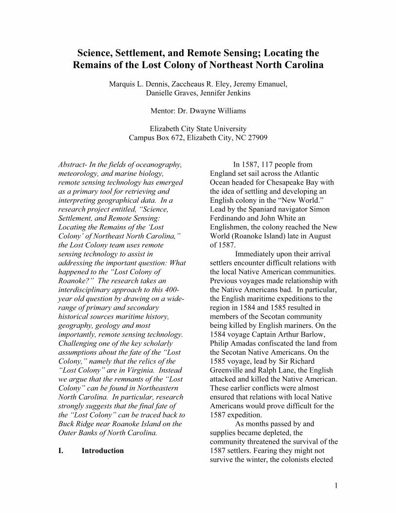
advanced by scholars about the fate of the “Lost Colony”. Some scholars such as David Quinn, suggest that the colony only went to Virginia. There is limited evidence to support the theory. Other scholars such as Fred Willard and Lee Miller claim that people of English decent settled in the northeastern part of North Carolina. The hypothesis of this research project is that the “Lost Colony” moved 50 miles up the Alligator River and settled in northeast North Carolina, near what is today Chocowinity County.
This hypothesis is supported by a range of primary documents from the fields of history, geography, archeology, and
remote sensing. Important artifacts such as Native/English pottery and a signet ring have been found at the Croatan site.
The signet ring can be traced back by to an English noble family: The Kendalls. The
Kendall surname was included on the ship’s manifest that carried the “Lost Colony” to northeast North Carolina. The Kendall signet ring is an important piece of evidence that supports the claim that English settlement existed in the part of northeast North Carolina that is the focus of this research project.
Other important evidence such
as the land deeds of Samuel Elks and Henry Gibbs further support our hypothesis. The Elks deed is significant because it shows that English settlement was in that area was continuous for over two hundred years.
Perhaps the most important
evidence to support this hypothesis is the remote sensing data gathered. In particular, the IKONOS multispectural maps of northeastern North Carolina.
The preponderance of all the evidence that has been gathered by our research team strongly supports the hypothesis that the remains of the “Lost Colony” are likely to be found in northeastern North Carolina. III. Discussion of Methods Remote sensing is defined as the science and art of obtaining information about features or phenomena from data acquired by a device that records reflected, emitted, or diffracted electromagnetic energy.
3
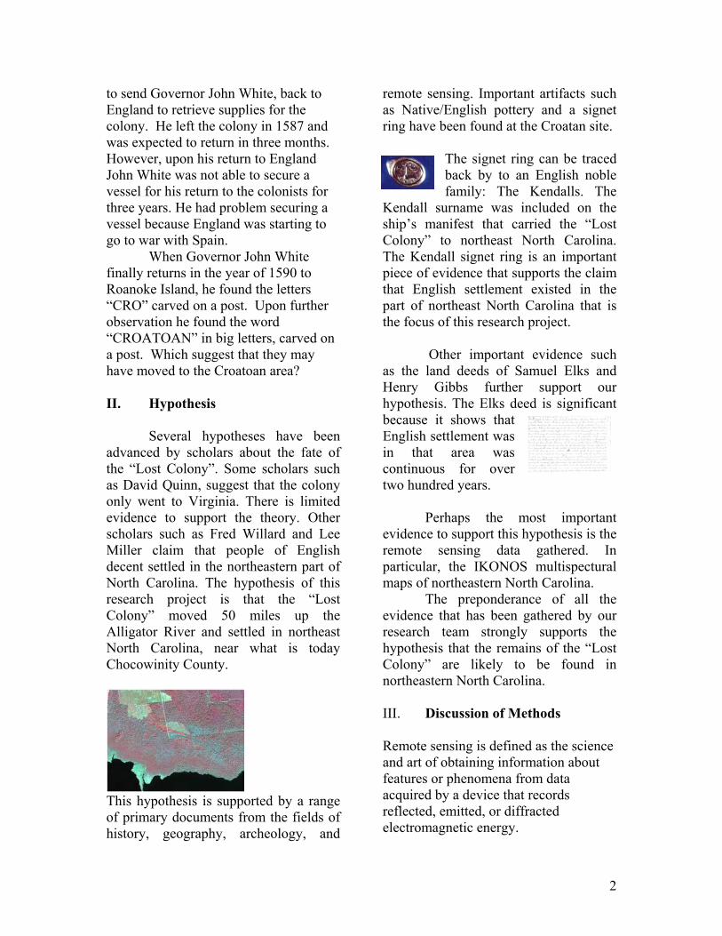
Remotely sensed IKONOS geotiff images of the area of northeastern North Carolina were provided by the Center of Excellence in Remote Sensing Education and Research (CERSER) located on the campus of Elizabeth City State University. Using Earth 2.2, an image processing software package, these images were manipulated in order to refine and investigate the intended areas of concentration. IKONOS satellites are capable of producing one-meter panchromatic, four-meter multispectral and one-meter color-enhanced Earth images. IKONOS satellites show levels of detail that are far more superior to current operational commercial satellites. When using IKONOS data, there are five bands that can be used: red, green, blue, near infrared (NIR), and panchromatic.
Figure 3.1 IKONOS Satellite
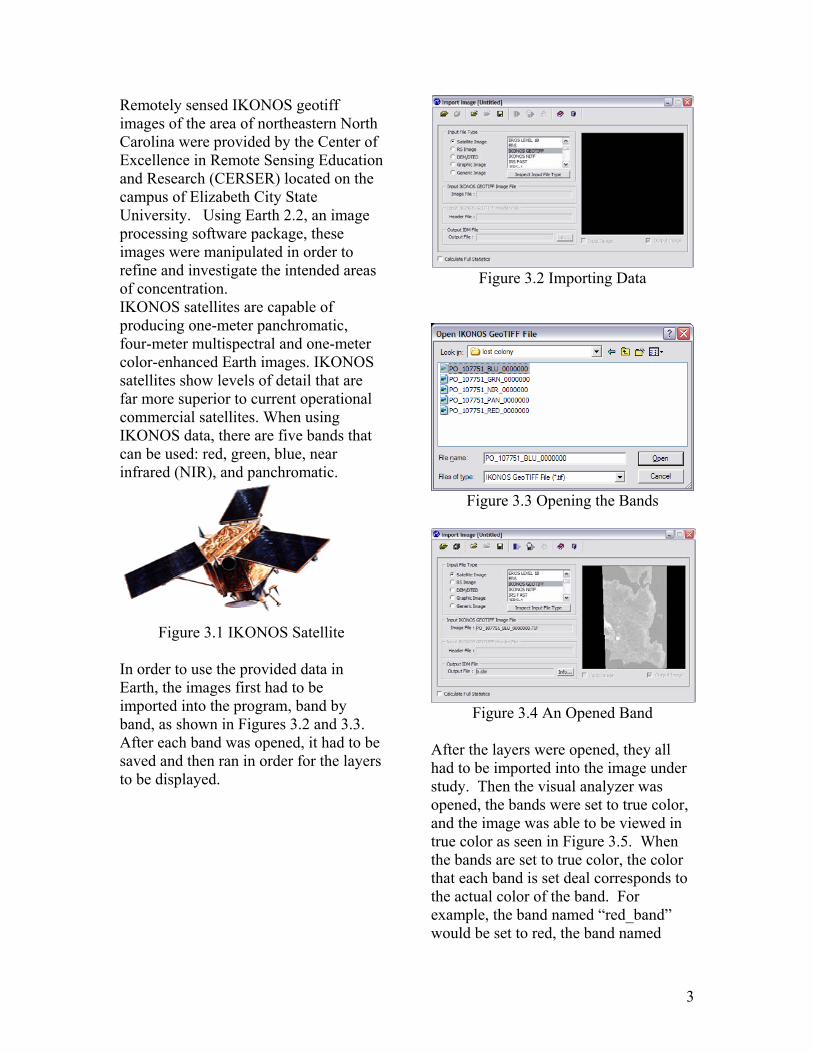
In order to use the provided data in Earth, the images first had to be imported into the program, band by band, as shown in Figures 3.2 and 3.3. After each band was opened, it had to be saved and then ran in order for the layers to be displayed.
Figure 3.2 Importing Data
Figure 3.3 Opening the Bands
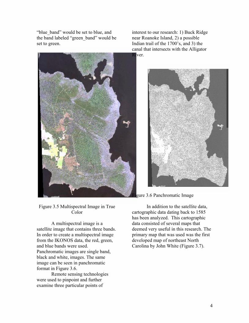
Figure 3.4 An Opened Band After the layers were opened, they all had to be imported into the image under study. Then the visual analyzer was opened, the bands were set to true color, and the image was able to be viewed in true color as seen in Figure 3.5. When the bands are set to true color, the color that each band is set deal corresponds to the actual color of the band. For example, the band named “red_band” would be set to red, the band named
4
“blue_band” would be set to blue, and the band labeled “green_band” would be set to green.
Figure 3.5 Multispectral Image in True Color
A multispectral image is a
satellite image that contains three bands. In order to create a multispectral image from the IKONOS data, the red, green, and blue bands were used. Panchromatic images are single band, black and white, images. The same image can be seen in panchromatic format in Figure 3.6.
Remote sensing technologies were used to pinpoint and further examine three particular points of
interest to our research: 1) Buck Ridge near Roanoke Island, 2) a possible Indian trail of the 1700’s, and 3) the canal that intersects with the Alligator River.
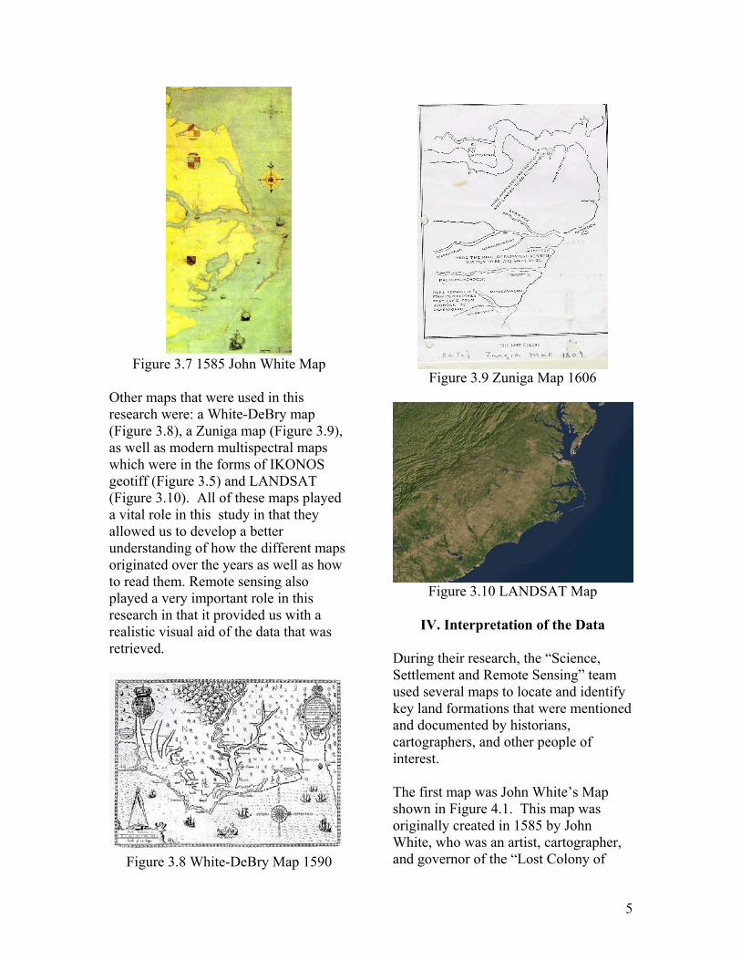
Figure 3.6 Panchromatic Image In addition to the satellite data, cartographic data dating back to 1585 has been analyzed. This cartographic data consisted of several maps that deemed very useful in this research. The primary map that was used was the first developed map of northeast North Carolina by John White (Figure 3.7).
5
Figure 3.7 1585 John White Map
Other maps that were used in this research were: a White-DeBry map (Figure 3.8), a Zuniga map (Figure 3.9), as well as modern multispectral maps which were in the forms of IKONOS geotiff (Figure 3.5) and LANDSAT (Figure 3.10). All of these maps played a vital role in this study in that they allowed us to develop a better understanding of how the different maps originated over the years as well as how to read them. Remote sensing also played a very important role in this research in that it provided us with a realistic visual aid of the data that was retrieved.
Figure 3.8 White-DeBry Map 1590
Figure 3.9 Zuniga Map 1606
Figure 3.10 LANDSAT Map
IV. Interpretation of the Data
During their research, the “Science, Settlement and Remote Sensing” team used several maps to locate and identify key land formations that were mentioned and documented by historians, cartographers, and other people of interest. The first map was John White’s Map shown in Figure 4.1. This map was originally created in 1585 by John White, who was an artist, cartographer, and governor of the “Lost Colony of
6
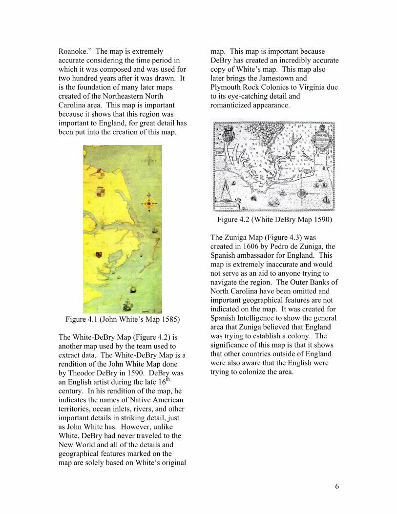
Roanoke.” The map is extremely accurate considering the time period in which it was composed and was used for two hundred years after it was drawn. It is the foundation of many later maps created of the Northeastern North Carolina area. This map is important because it shows that this region was important to England, for great detail has been put into the creation of this map.
Figure 4.1 (John White’s Map 1585)
The White-DeBry Map (Figure 4.2) is another map used by the team used to extract data. The White-DeBry Map is a rendition of the John White Map done by Theodor DeBry in 1590. DeBry was an English artist during the late 16th century. In his rendition of the map, he indicates the names of Native American territories, ocean inlets, rivers, and other important details in striking detail, just as John White has. However, unlike White, DeBry had never traveled to the New World and all of the details and geographical features marked on the map are solely based on White’s original
map. This map is important because DeBry has created an incredibly accurate copy of White’s map. This map also later brings the Jamestown and Plymouth Rock Colonies to Virginia due to its eye-catching detail and romanticized appearance.
Figure 4.2 (White DeBry Map 1590)
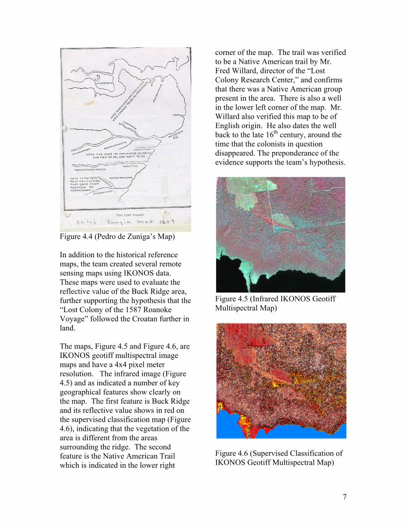
The Zuniga Map (Figure 4.3) was created in 1606 by Pedro de Zuniga, the Spanish ambassador for England. This map is extremely inaccurate and would not serve as an aid to anyone trying to navigate the region. The Outer Banks of North Carolina have been omitted and important geographical features are not indicated on the map. It was created for Spanish Intelligence to show the general area that Zuniga believed that England was trying to establish a colony. The significance of this map is that it shows that other countries outside of England were also aware that the English were trying to colonize the area.
7
Figure 4.4 (Pedro de Zuniga’s Map) In addition to the historical reference maps, the team created several remote sensing maps using IKONOS data. These maps were used to evaluate the reflective value of the Buck Ridge area, further supporting the hypothesis that the “Lost Colony of the 1587 Roanoke Voyage” followed the Croatan further in land. The maps, Figure 4.5 and Figure 4.6, are IKONOS geotiff multispectral image maps and have a 4x4 pixel meter resolution. The infrared image (Figure 4.5) and as indicated a number of key geographical features show clearly on the map. The first feature is Buck Ridge and its reflective value shows in red on the supervised classification map (Figure 4.6), indicating that the vegetation of the area is different from the areas surrounding the ridge. The second feature is the Native American Trail which is indicated in the lower right
corner of the map. The trail was verified to be a Native American trail by Mr. Fred Willard, director of the “Lost Colony Research Center,” and confirms that there was a Native American group present in the area. There is also a well in the lower left corner of the map. Mr. Willard also verified this map to be of English origin. He also dates the well back to the late 16th century, around the time that the colonists in question disappeared. The preponderance of the evidence supports the team’s hypothesis.
Figure 4.5 (Infrared IKONOS Geotiff Multispectral Map)
Figure 4.6 (Supervised Classification of IKONOS Geotiff Multispectral Map)
8
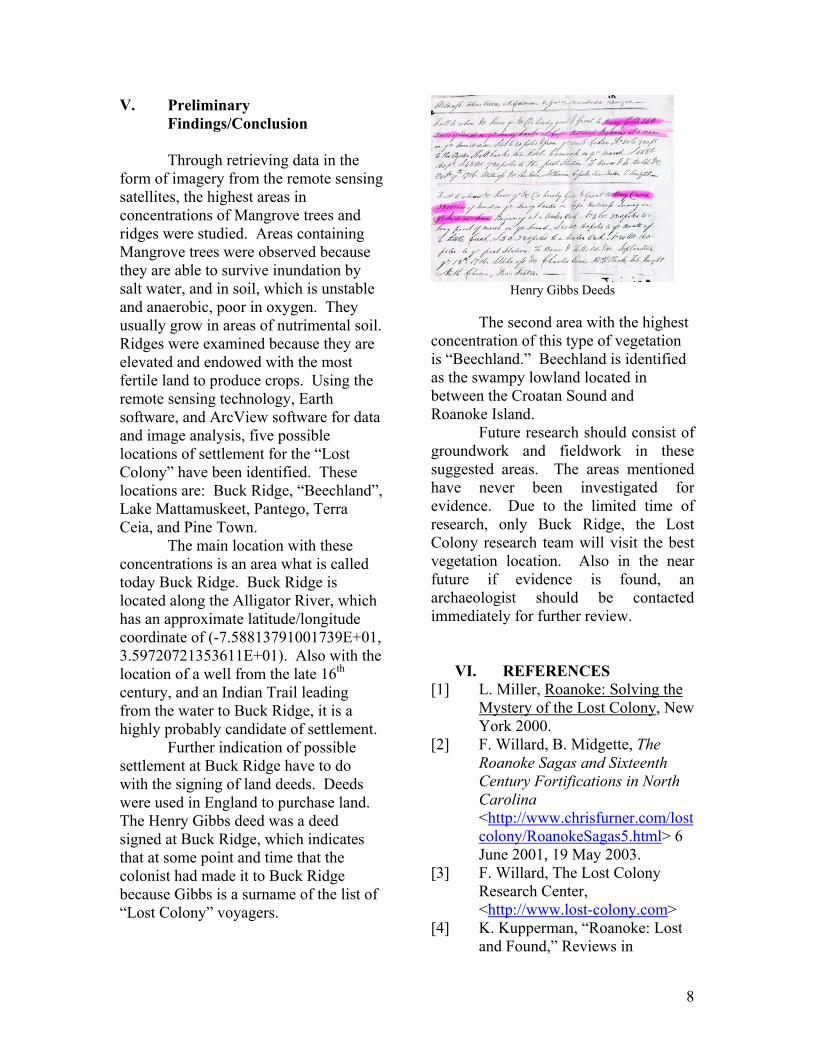
V. Preliminary Findings/Conclusion Through retrieving data in the form of imagery from the remote sensing satellites, the highest areas in concentrations of Mangrove trees and ridges were studied. Areas containing Mangrove trees were observed because they are able to survive inundation by salt water, and in soil, which is unstable and anaerobic, poor in oxygen. They usually grow in areas of nutrimental soil. Ridges were examined because they are elevated and endowed with the most fertile land to produce crops. Using the remote sensing technology, Earth software, and ArcView software for data and image analysis, five possible locations of settlement for the “Lost Colony” have been identified. These locations are: Buck Ridge, “Beechland”, Lake Mattamuskeet, Pantego, Terra Ceia, and Pine Town. The main location with these concentrations is an area what is called today Buck Ridge. Buck Ridge is located along the Alligator River, which has an approximate latitude/longitude coordinate of (-7.58813791001739E+01, 3.59720721353611E+01). Also with the location of a well from the late 16th century, and an Indian Trail leading from the water to Buck Ridge, it is a highly probably candidate of settlement. Further indication of possible settlement at Buck Ridge have to do with the signing of land deeds. Deeds were used in England to purchase land. The Henry Gibbs deed was a deed signed at Buck Ridge, which indicates that at some point and time that the colonist had made it to Buck Ridge because Gibbs is a surname of the list of “Lost Colony” voyagers.
Henry Gibbs Deeds
The second area with the highest concentration of this type of vegetation is “Beechland.” Beechland is identified as the swampy lowland located in between the Croatan Sound and Roanoke Island. Future research should consist of groundwork and fieldwork in these suggested areas. The areas mentioned have never been investigated for evidence. Due to the limited time of research, only Buck Ridge, the Lost Colony research team will visit the best vegetation location. Also in the near future if evidence is found, an archaeologist should be contacted immediately for further review.
VI. REFERENCES
[1] L. Miller, Roanoke: Solving the Mystery of the Lost Colony, New York 2000.
[2] F. Willard, B. Midgette, The Roanoke Sagas and Sixteenth Century Fortifications in North Carolina <http://www.chrisfurner.com/lostcolony/RoanokeSagas5.html> 6 June 2001, 19 May 2003.
[3] F. Willard, The Lost Colony Research Center, <http://www.lost-colony.com>
[4] K. Kupperman, “Roanoke: Lost and Found,” Reviews in
9
American History 14, March 1986.
[5] D. Quinn, The Roanoke Voyages, 1584-1590. ed., vol. 2. London: Cambridge University Press, 1955.
[6] D. Quinn, ed. Set Fair for Roanoke: Voyages and Colonies, 1584-1606, Chapel Hill: University of North Carolina Press, 1985.
[7] T. Schoenbaum, Islands, Capes, and Sounds; The North Carolina Coast, Winston-Salem: John F. Blair, 1982.
[8] D. Stick, The Outer Banks of North Carolina, 1584-1958, Chapel Hill: the University of North Carolina Press, 1958.
[9] D. Stick, Roanoke Island, The Beginnings of English America, Chapel Hill; The University of North Carolina Press, 1983.