Embed Size (px)
Citation preview

03-09-2014
1
#
History and Development of Surveying
and Measurement in Malaysia
Sr Dr. Azhari bin MOHAMED
Sr Mohammad Zaki bin MOHD GHAZALI
Department of Survey and Mapping Malaysia
Commission: IIHSM
#
Scan Through
History of surveying and measurements
Highlight important events
State of the positioning framework
History of Department of
Survey & Mapping Malaysia - JUPEM
03-09-2014
2
#
Administration
#
Geography
Effective British
control
Involvement into
administration,
leases, supply
chainEra coincide
with
development in
survey works
5 entities: SS, FMS, UFMS, NB and Sarawak
1824 1832 1840 1848 1856 1864 1872 1880 1888 1896 1904
Anglo-Siamese Treaty. Northern Malaya -British Protectorate
1909
Federated Malay States -British Protectorate
1896
Anglo-Dutch Convention BNB/DEI
1891
North Borneo & Sarawak -British Protectorate
1888
Incorporation of BNB Company
1881
Straits Settlements -Crown Colony
1867
Anglo-Dutch Treaty -"British Malaya"
1824
Large scale tin and rubber
03-09-2014
3
#
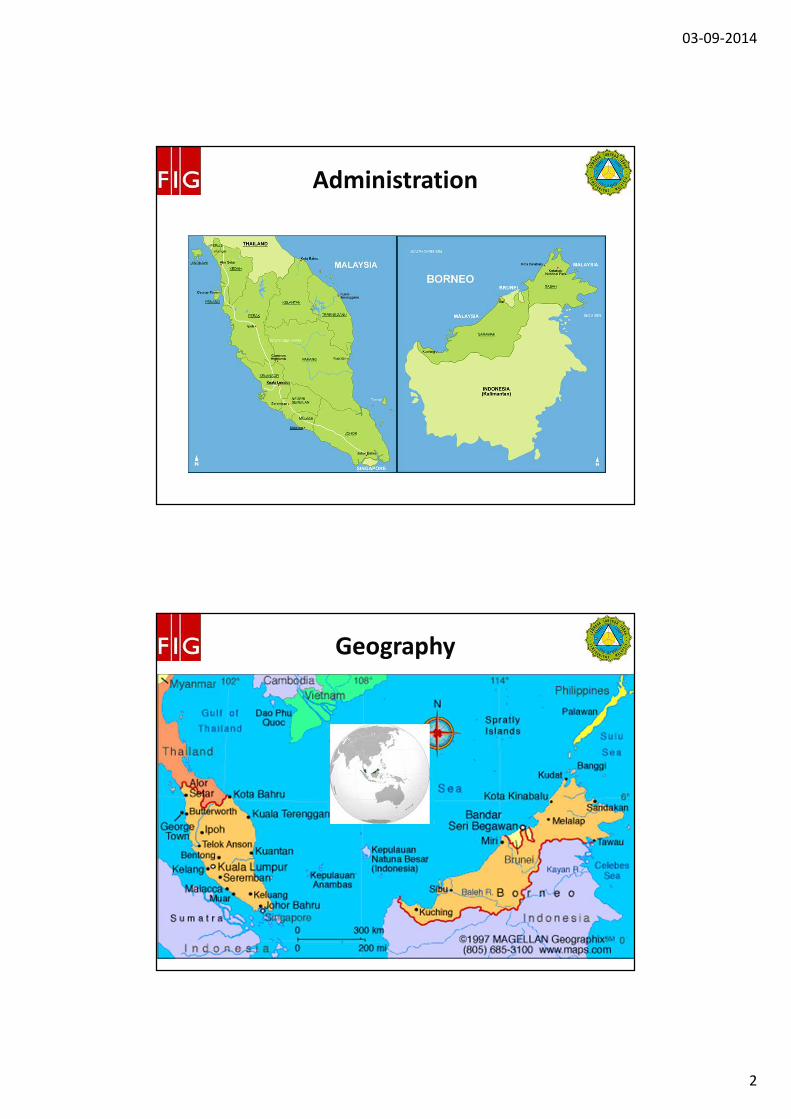
Ancient East West Trade Route
#
Ibn Battuta Voyages
03-09-2014
4
#
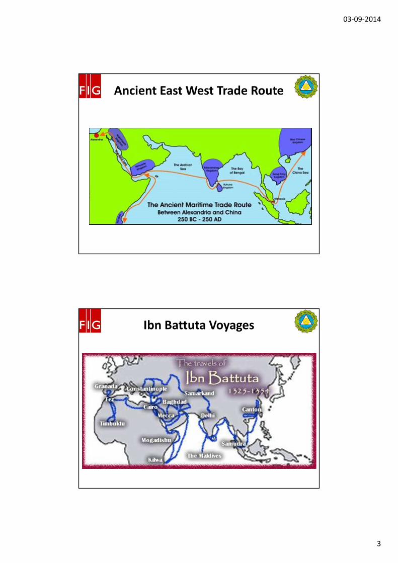
Voyages of Zheng He 1405-1433
#
03-09-2014
5
#
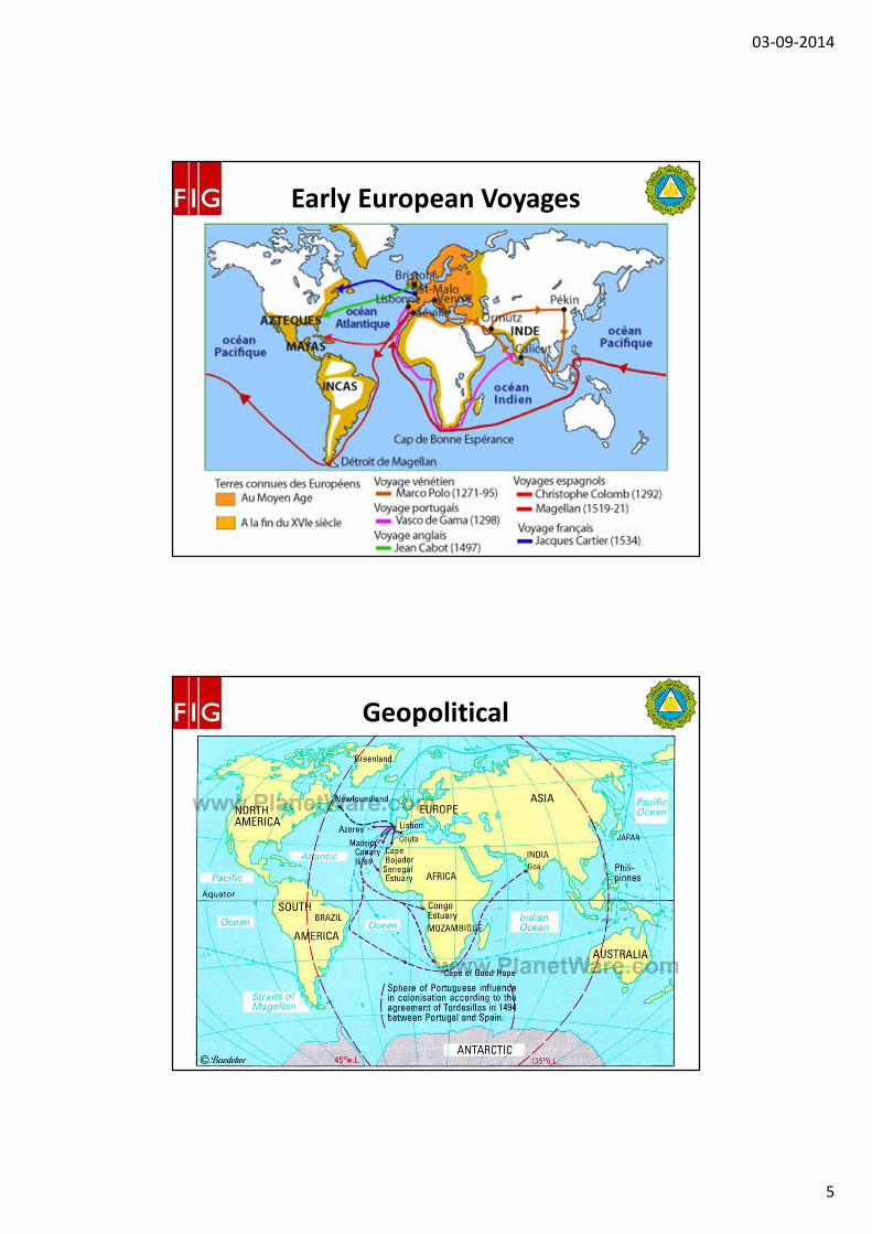
Early European Voyages
#
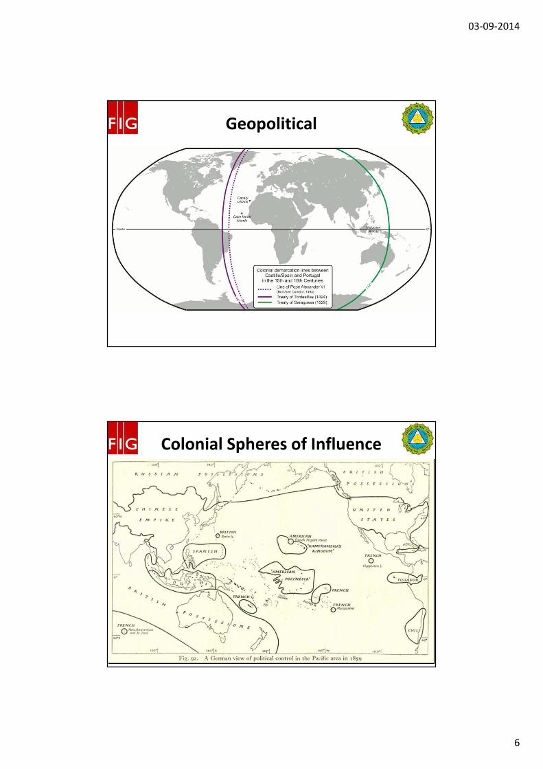
Geopolitical
03-09-2014
6
#
Geopolitical
#
Colonial Spheres of Influence
03-09-2014
7
#
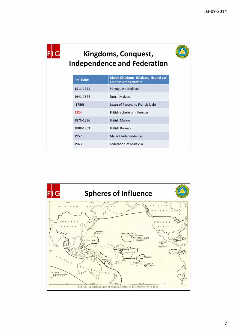
Pre-1500sMalay Kingdoms (Malacca, Brunei etc)
Chinese Arabs traders
1511-1641 Portuguese Malacca
1641-1824 Dutch Malacca
(1786) Lease of Penang to Francis Light
1824 British sphere of influence
1876-1896 British Malaya
1888-1963 British Borneo
1957 Malaya Independence
1963 Federation of Malaysia
Kingdoms, Conquest,
Independence and Federation
#
Spheres of Influence
03-09-2014
8
#
British Malaya-British Borneo
Effective British
control
Involvement into
administration,
leases, supply
chainEra coincide
with
development in
survey works
5 entities: SS, FMS, UFMS, NB and Sarawak
1824 1832 1840 1848 1856 1864 1872 1880 1888 1896 1904
Anglo-Siamese Treaty. Northern Malaya -British Protectorate
1909
Federated Malay States -British Protectorate
1896
Anglo-Dutch Convention BNB/DEI
1891
North Borneo & Sarawak -British Protectorate
1888
Incorporation of BNB Company
1881
Straits Settlements -Crown Colony
1867
Anglo-Dutch Treaty -"British Malaya"
1824
Large scale tin and rubber
#
British Malaya
03-09-2014
9
#
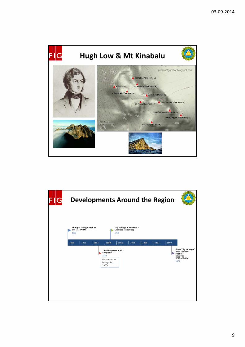
Hugh Low & Mt Kinabalu
#
Developments Around the Region
introduced in
Malaya in
1900s
1853 1855 1857 1859 1861 1863 1865 1867 1869
Great Trig Survey of India - Survey science+Malaysia 1/10 of India!
1870
Trig Surveys in Australia –Localised (expertise)
1860
Torrens System in SA -Simplicity
1858
Principal Triangulation of GB - 1”/3PPM!
1853
03-09-2014
10
#
19th Century Survey Activities –
The Straits Settlements
1858 1862 1866 1870 1874 1878 1882 1886 1890 1894
Maps of Penang - F W Kelly
1894
Trig Survey of Balik Pulau, Penang - Laceron & Peters
1890
Survey of Malacca - Major MacCallum
1886
Trig Survey of Malacca -Major MacCallum
1886
Plane table survey of Malacca - Quinton
1858
#
19th Century Surveying Activities
– Johor and British BorneoKudat, 1st capital of BNB
1863 1866 1869 1872 1875 1878 1881 1884
1st Cadastral Plan in Gunong Pulai, Johor
1885
16-chain scale map of Kurau and Krian of Perak by H L Pemberton
1883
1st Cadastral Plan in North Borneo "
1883
State of Johor Map by Mohamed Salleh Prang
1877
1st Sarawak Land Regulation
1863
03-09-2014
11
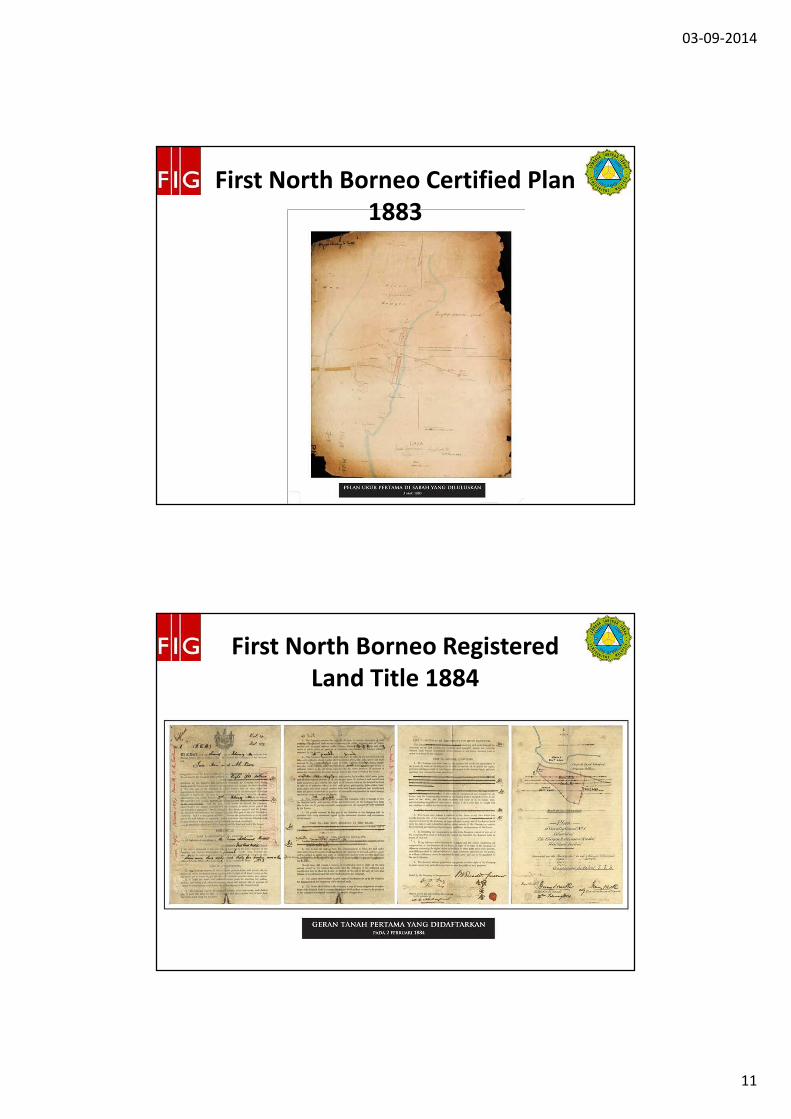
#
First North Borneo Certified Plan
1883
#
First North Borneo Registered
Land Title 1884
03-09-2014
12
#
JUPEM –The Early Years
Responsible for trig surveys in FMS
1885 1891 1897 1903 1909 1915 1921
Terengganu joins FMS Survey Dept.
1926
Kelantan joins FMS Survey Dept.
1923
Penang, Malacca & Singapore Survey Depts joins FMS Survey Dept.
1920
Perlis under Kedah Survey Dept.
1918
Kedah & Kelantan Survey Depts(secondments)
1910
FMS Survey Dept -Surveyor General
1909
Trig. Survey Dept of FMS (fmr. Perak)
1902
Indie Surveyor Office of Batu Gajah, Perak - C A Baker
1899
Negeri Sembilan Survey Dept.
1897Selangor Survey Dept.
1891
Pahang Survey Dept.
1889
Revenue Survey Depart. of Perak - J P Harper
1887
Trig. Survey Dept. Perak -G A Lefroy (orig. PWD)
1887
Johore Survey Dept. -Yahaya Awal-ed-din CS
1885
#
JUPEM – The Post War Period
1942 1948 1954 1960 1966 1972 1978 1984 1990
DSMM Perlis
1995
Sarawak Topo. Section
1989
DSMM of FT Labuan
1984
Sabah Topo. Section
1983
DSMM of FT Kuala Lumpur
1979
Directorate of National Mapping Malaysia under DSMM
1965
Department of Survey and Mapping Malaysia -TS Mohd Yatim Yahaya as SG
1963
Assistance by Directorate of Colonial Surveys (RSO)
1947
WWII disruption
1942
03-09-2014
13
#
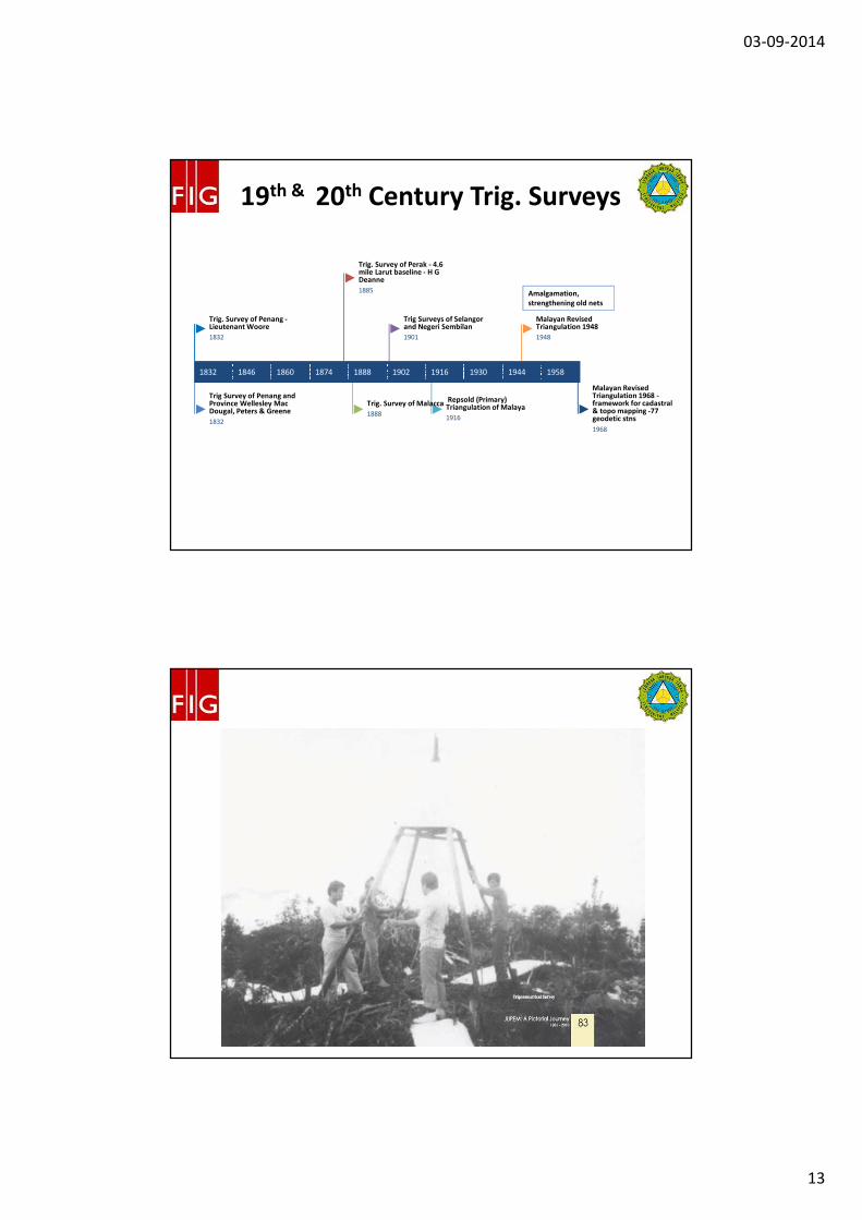
19th & 20th Century Trig. Surveys
Amalgamation,
strengthening old nets
1832 1846 1860 1874 1888 1902 1916 1930 1944 1958
Malayan Revised Triangulation 1968 -framework for cadastral & topo mapping -77 geodetic stns
1968
Malayan Revised Triangulation 1948
1948
Repsold (Primary) Triangulation of Malaya
1916
Trig Surveys of Selangor and Negeri Sembilan
1901
Trig. Survey of Malacca
1888
Trig. Survey of Perak - 4.6 mile Larut baseline - H G Deanne
1885
Trig Survey of Penang and Province Wellesley Mac Dougal, Peters & Greene
1832
Trig. Survey of Penang -Lieutenant Woore
1832
#
03-09-2014
14
#
20th Century Trig. Surveys
British Borneo
1930 1934 1938 1942 1946 1950 1954 1958 1962 1966
DOS readjusttment BT68- 145 stations
1968
Borneo East Coast Triangulation 1960
1960
DOS readjustment of Borneo Primary Triangulation - BT48
1948
Borneo West Coast Triangulation 1942
1942
Sarawak Primary Triangulation 1935
1935
Borneo West Coast Triangulation 1930
1930
#
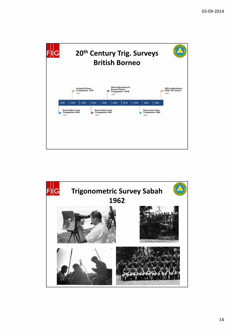
Trigonometric Survey Sabah
1962
03-09-2014
15
#
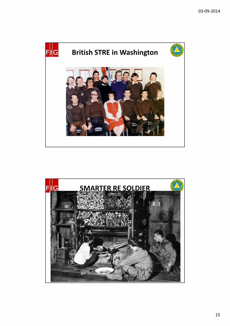
British STRE in Washington
#
SMARTER RE SOLDIER
03-09-2014
16
#
Satellite-based Positioning
Framework
Sumatran quakes. 1-25cm CCW
1994 1996 1998 2000 2002 2004 2006 2008
GDM2000 (2009)
2009
cm level Real-time Kinematic GNSS -MyRTKNet -78 Ref Stns
2008
GDM2000 launched
2003
MASS - 18 tracking Stns (1998-2002 - GDM2000)
1998
EMGSN97 - 171 Stns
1997
PMGSN94 - 238 Stns
1994
#
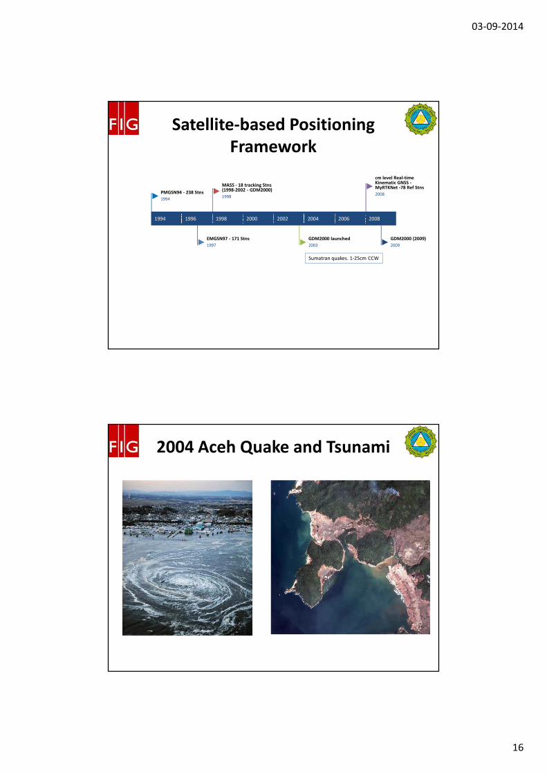
2004 Aceh Quake and Tsunami
03-09-2014
17
#
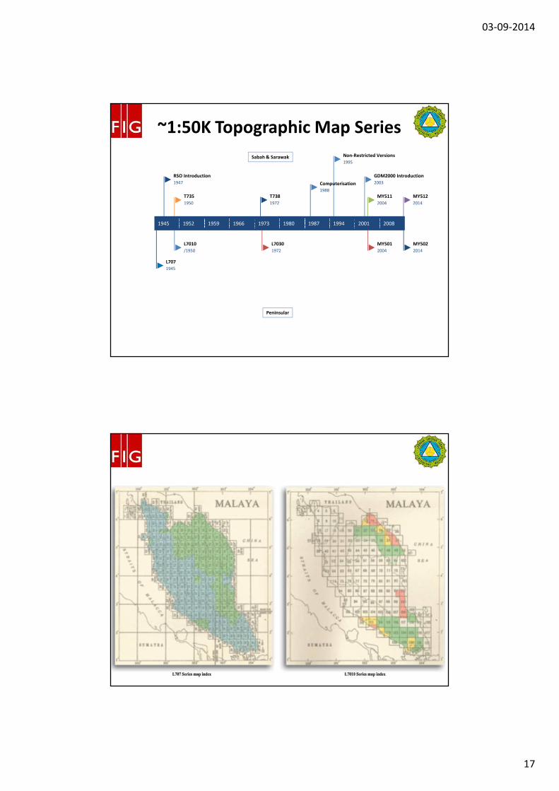
~1:50K Topographic Map Series
Sabah & Sarawak
Peninsular
1945 1952 1959 1966 1973 1980 1987 1994 2001 2008
MY502
2014
MY512
2014
MY501
2004
MY511
2004
GDM2000 Introduction
2003
Non-Restricted Versions
1995
L7030
1972
Computerisation
1988
T738
1972
T735
1950
L7010
/1950
RSO Introduction
1947
L707
1945
#

03-09-2014
18
#
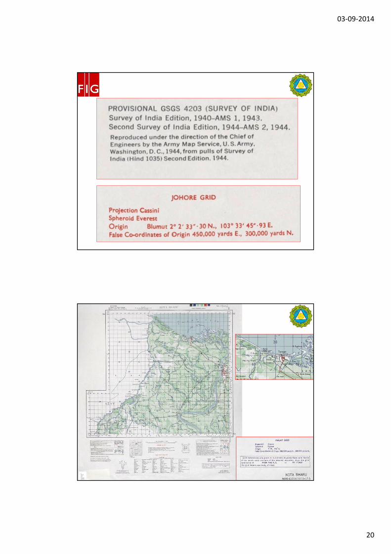
AMS Index – US Army Series
#
03-09-2014
19
#
Sappers Geonaming Dilemma
#
03-09-2014
20
#
#
03-09-2014
21
#
Brown, Blue and Black Ticks and
Grid
#
03-09-2014
22
#
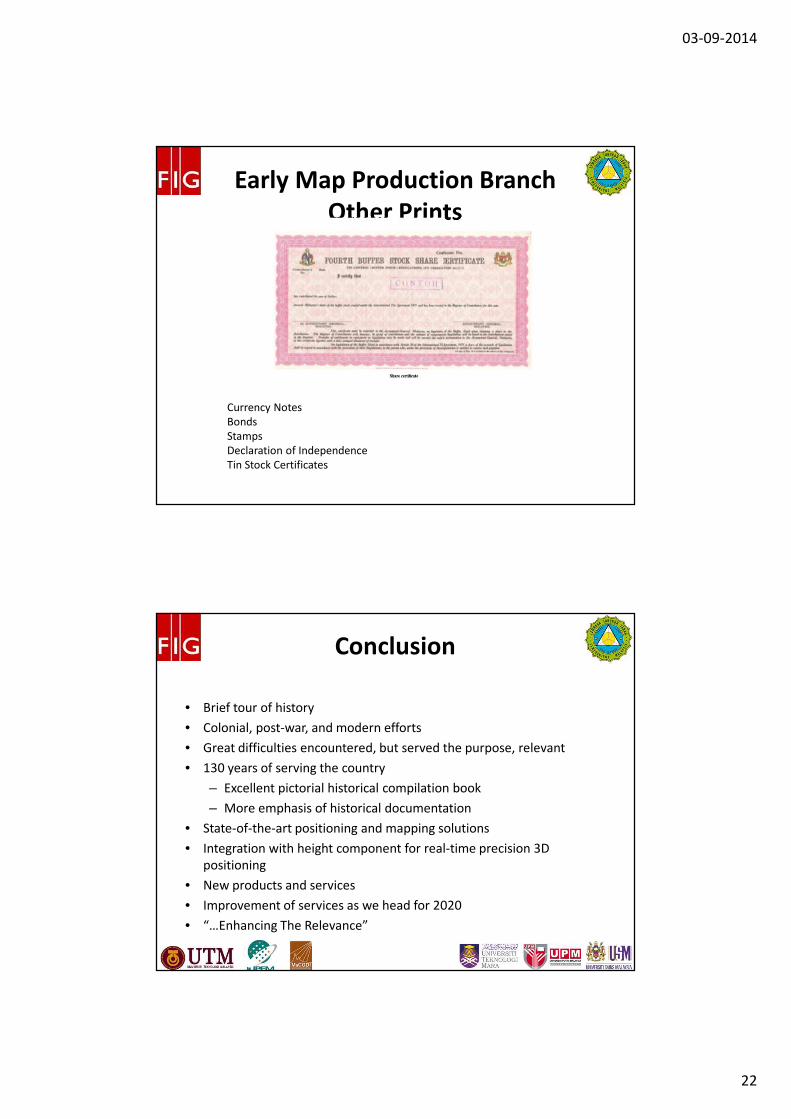
Early Map Production Branch
Other Prints
Currency Notes
Bonds
Stamps
Declaration of Independence
Tin Stock Certificates
#
• Brief tour of history
• Colonial, post-war, and modern efforts
• Great difficulties encountered, but served the purpose, relevant
• 130 years of serving the country
– Excellent pictorial historical compilation book
– More emphasis of historical documentation
• State-of-the-art positioning and mapping solutions
• Integration with height component for real-time precision 3D
positioning
• New products and services
• Improvement of services as we head for 2020
• “…Enhancing The Relevance”
Conclusion
03-09-2014
23
#
Thank you for your
attention and have a good
trip back home!
Sr Dr. Azhari bin MOHAMED
Sr Mohammad Zaki bin MOHD GHAZALI
Department of Survey and Mapping Malaysia


![Book - Dire Straits - Dire Straits [Pvc 74p]](https://img.pdfslide.us/doc/110x75/563db8e4550346aa9a97f371/book-dire-straits-dire-straits-pvc-74p.jpg)