Embed Size (px)
Citation preview
San Francisco Police Department District Station Boundary Analysis
Police Commission Presentation
December 10, 2014
Project Overview
• The San Francisco Police Department and Controller’s Office issued an RFP in 2013 to analyze the police district boundary lines
• The project required a data driven approach to developing potential line changes as a collaborative effort between the vendor and the City
2
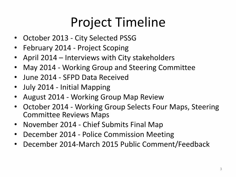
Project Timeline • October 2013 - City Selected PSSG • February 2014 - Project Scoping • April 2014 – Interviews with City stakeholders • May 2014 - Working Group and Steering Committee • June 2014 - SFPD Data Received • July 2014 - Initial Mapping • August 2014 - Working Group Map Review • October 2014 - Working Group Selects Four Maps, Steering
Committee Reviews Maps • November 2014 - Chief Submits Final Map • December 2014 - Police Commission Meeting • December 2014-March 2015 Public Comment/Feedback
3
Project Drivers
• New Southern District Police Station
• Anticipated population growth
• Imbalanced SFPD workload between districts
• Board of Supervisors legislation requires a district station boundary analysis study every 10 years
4
Project Objectives
• Develop data driven boundary restructuring options that will:
– Consider parity across the districts
– Preserve neighborhoods and constructed and natural boundaries
– Adjust for district specific operational considerations
– Minimize response time, if possible
– Consider alignment with political boundaries
– Allow for short-term implementation given SFPD facilities and IT constraints
5
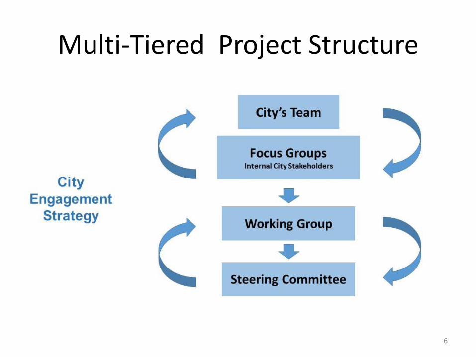
Multi-Tiered Project Structure
6
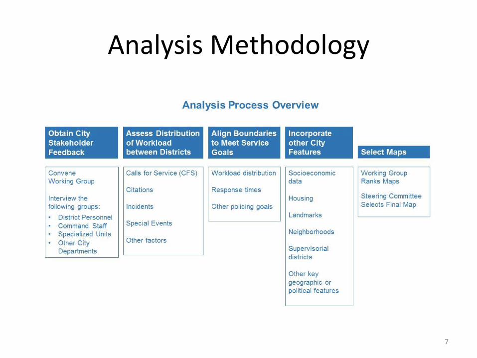
Analysis Methodology
7
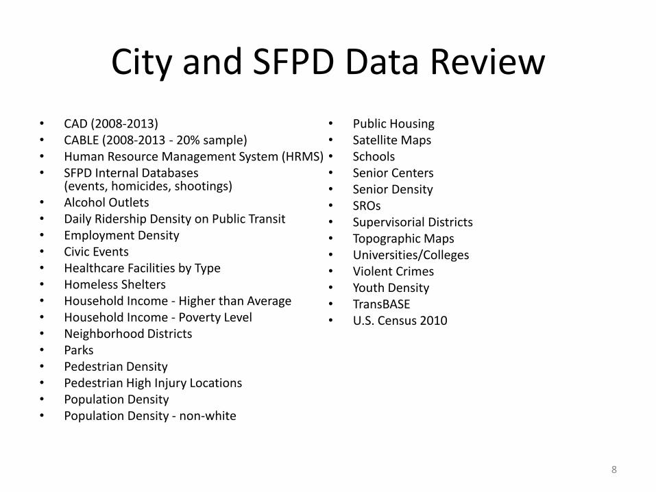
City and SFPD Data Review
• CAD (2008-2013) • CABLE (2008-2013 - 20% sample) • Human Resource Management System (HRMS) • SFPD Internal Databases
(events, homicides, shootings) • Alcohol Outlets • Daily Ridership Density on Public Transit • Employment Density • Civic Events • Healthcare Facilities by Type • Homeless Shelters • Household Income - Higher than Average • Household Income - Poverty Level • Neighborhood Districts • Parks • Pedestrian Density • Pedestrian High Injury Locations • Population Density • Population Density - non-white
• Public Housing • Satellite Maps • Schools • Senior Centers • Senior Density • SROs • Supervisorial Districts • Topographic Maps • Universities/Colleges • Violent Crimes • Youth Density • TransBASE • U.S. Census 2010
8
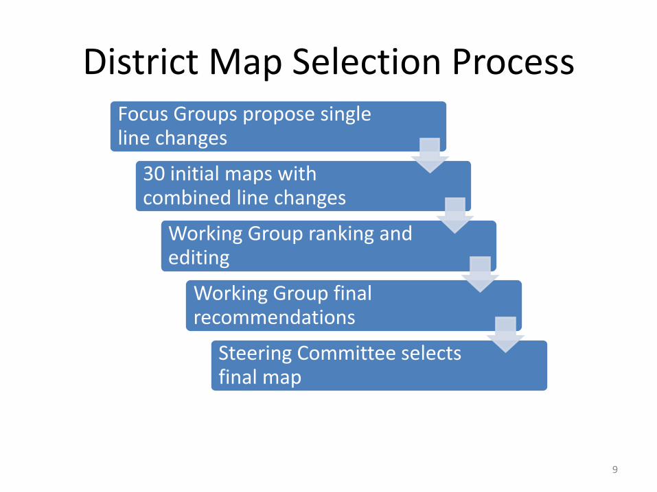
District Map Selection Process
Focus Groups propose single line changes
30 initial maps with combined line changes
Working Group ranking and editing
Working Group final recommendations
Steering Committee selects final map
9
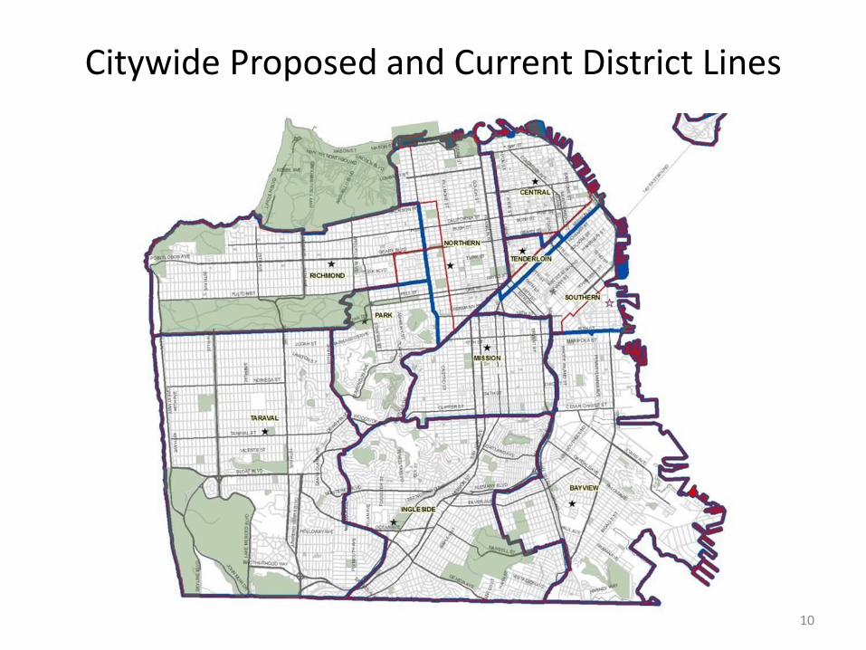
Citywide Proposed and Current District Lines
10
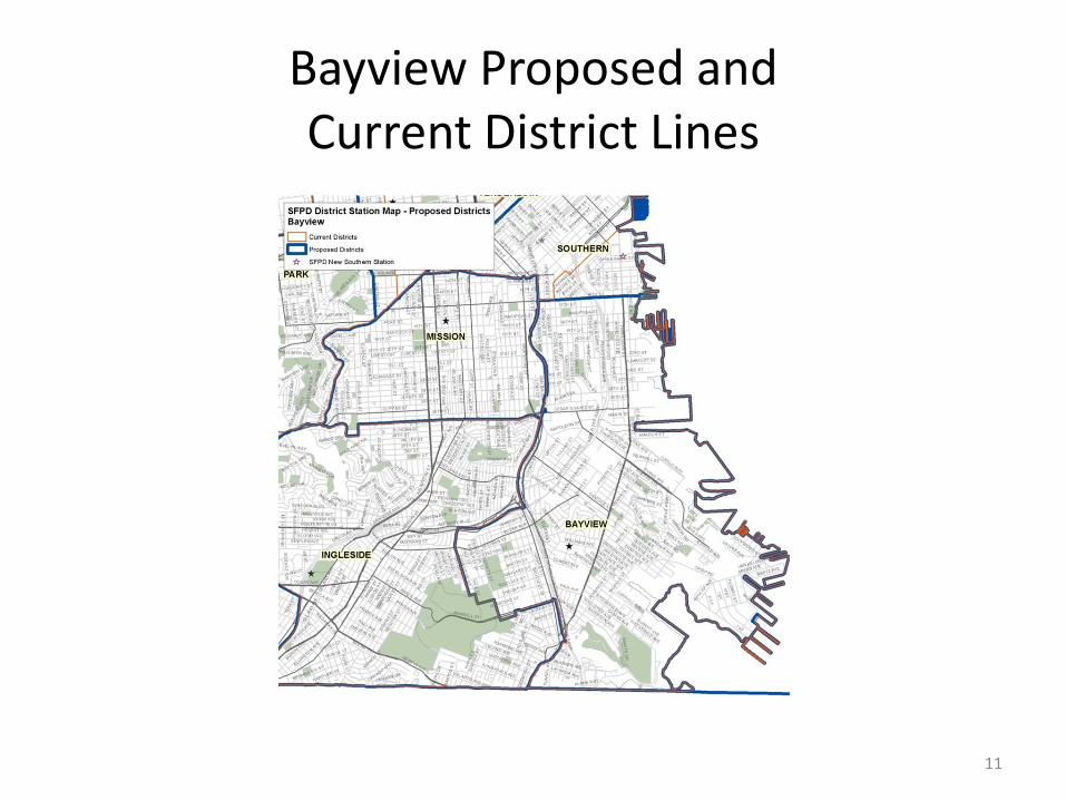
Bayview Proposed and Current District Lines
11
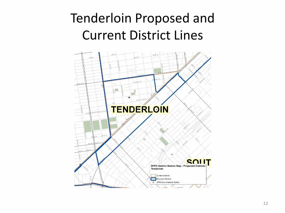
Tenderloin Proposed and Current District Lines
12
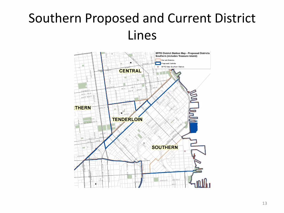
Southern Proposed and Current District Lines
13
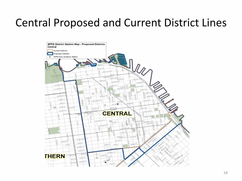
Central Proposed and Current District Lines
14
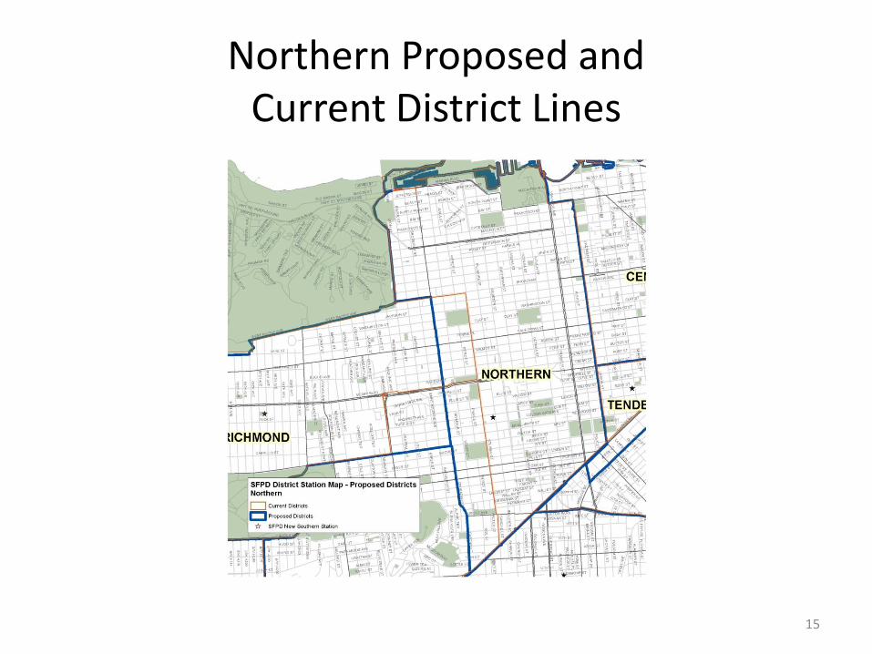
Northern Proposed and Current District Lines
15
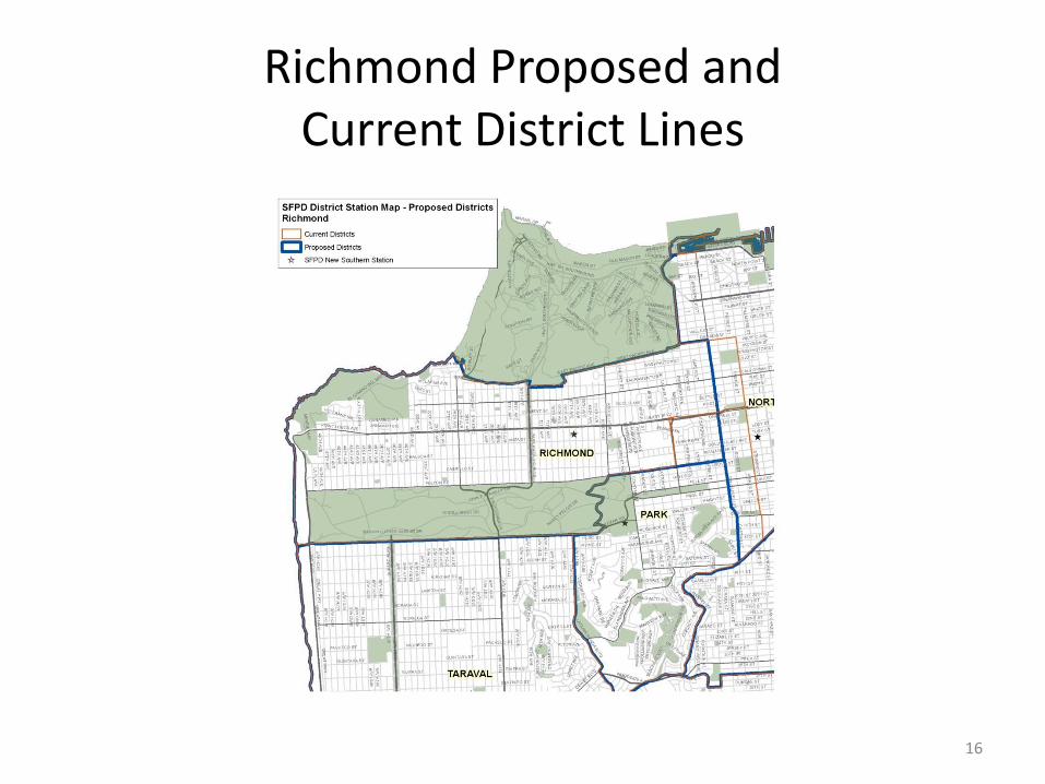
Richmond Proposed and Current District Lines
16
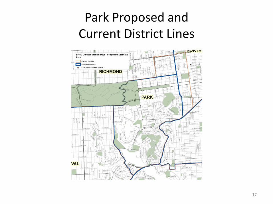
Park Proposed and Current District Lines
17

Impact of Line Changes
on CAD and CABLE
Comparisons Between Maps
Citywide Calls for Service and Crime Incidents
Map
Standard Deviation Range
CAD CABLE CAD CABLE
Current 2.5 3.7 7.0 12.5
Proposed 2.9 3.4 10.1 9.4
18