Embed Size (px)
Citation preview
A N E W S L E T T E R O F T H E T E X A S M A P S O C I E T Y Spring 2018
For meeting details, please see page 3.
Texas Map Society Spring 2018 MeetingMay 25 - 26, 2018
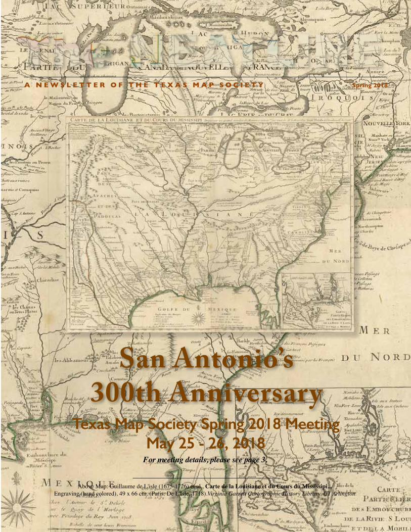
San Antonio’s 300th Anniversary
Above Map: Guillaume de L'isle (1675-1726) et al., Carte de la Louisiane et du Cours du Mississipi...Engraving (hand colored), 49 x 66 cm. (Paris: De L'Isle, 1718).Virginia Garrett Cartographic History Library, UT Arlington
2 • The Neatline
–- FROM THE PRESIdENT FROM THE EdITOR
The Neatline is published semi-annually by the Texas Map Societyc/o Special Collections • The University of Texas at Arlington LibraryBox 19497 • 902 Planetarium Place • Arlington, TX 76019-0497http://www.TexasMapSociety.orgFor more information contact David Finfrock - Editor, Texas Map Society. Email: [email protected] Map Society members and others who helped produce this issue are: David Finfrock, James Harkins, Ben Huseman, Russell Martin, Brenda McClurkin, Jeffrey Mills, Walt Wilson, and our artist and graphics designer Carol Lehman.
A Neatline is the outermost drawn line surrounding a map. It defines the height and width of the map and usually constrains the cartographic images.
3 • The Neatline
The spring meeting this May is shaping up to be an exciting time, thanks to the hard work of James Harkins, Walt Wilson, Brenda McClurkin, Mylynka Cardona, Gerald Saxon, and Ben Huseman.
We’ll start with a special tour of the new Daughters of the Republic of Texas Library at 2 pm on Friday afternoon. (The DRT Library is located in the Bexar County Archive Building at 126 East Nueva St. Best parking is in the County Garage located on the corner of West Nueva St. and South Flores St.) Then we’ll have an optional dinner that night, arranged by Dianne Powell, at Club Giraud.
Saturday will be a full day at the Witte Museum, starting with registration and continental breakfast at 8:30, with speakers Ben Huseman, Brandice Nelson, Mylynka Cardona, and James Harkins in the morning, followed by a tour of the GLO’s extraordinary exhibit, “Connecting Texas: 300 Years of Trails, Rails, and Roads.” After a catered lunch (included in your registration), in the afternoon Andres Tijerina will talk about the other blockbuster exhibit at the Witte Museum, “Confluence and Culture: 300 Years of San Antonio History,” with a guided tour of that show ending the day.
Our hotel, located on the River Walk, is the Hilton Palacio del Rio. Use the group code “TMS” when registering online. For more information about all these events, see elsewhere in the Neatline and on the TMS web page. Thanks to both David Finfrock and James Harkins for their editorial skill.
There are several maps that can lead you to San Antonio this spring: some might prefer the De Lisle of 1718, others a Melish of 1816, a Transcontinental Highways of 1918, or the Google Maps of 2018. No matter your guide and route, our destination is the same: San Antonio! I look forward to seeing everyone there, as we continue to learn more about cartographic history and at the same time enjoy fellowship with other collectors and scholars.
Keep in mind that the Witte is also hosting a 5K run Saturday morning. However, they have assured me that TMS members will not be required to join the race—our meeting promises to be just as invigorating! You may want to wear running shoes in any event: we have a lot of exhibit space and history to cover.See you soon!- Russell L. Martin III, TMS President
I missed the fall meeting of the Texas Map Society in Huntsville, as it coincided with my previously planned volunteer trip to Guadalupe Mountains National Park in west Texas. There I joined with 20 other like-minded individuals from the Sierra Club and spent the week volunteering with the National Park Service, repairing back country trails across the park.
In the past, I have also missed most spring TMS meetings, because of my employment as a meteorologist with KXAS-TV, NBC 5 in Dallas-Fort Worth. I always had to stay in town to be available to cover severe weather when it develops.
But my status changed last December 31st. At that time I retired from full time employment. I am still working for NBC 5, but as a part-time freelance contractor. I am scheduled to work 100 days during the calendar year, an average of just over two days per week. That should give me much greater flexibility in scheduling. I will still do my share of severe weather coverage. But I am pleased to say that I should now be able to attend more of the spring TMS meetings going forward.
Always remember that all of the archived editions of The Neatline, and much more information on the Texas Map Society can always be found at our website at: www.TexasMapSociety.org.
- David Finfrock, Editor of The Neatline
3 • The Neatline
Texas Map Society Spring 2018 Meeting PROGRAM
Friday, May 25 2:00 pmTour new Daughters of the Republic of Texas Library 126 East Nueva St., San Antonio, Texas 78204(best parking is located in the county Garage located on the corner of West Nueva St. and South Flores St.)
6:30 pmOptional Dinner at Club Giraud707 North St. Mary’s St., San AntonioReservations and proper attire required.(arranged by Dianne Powell)
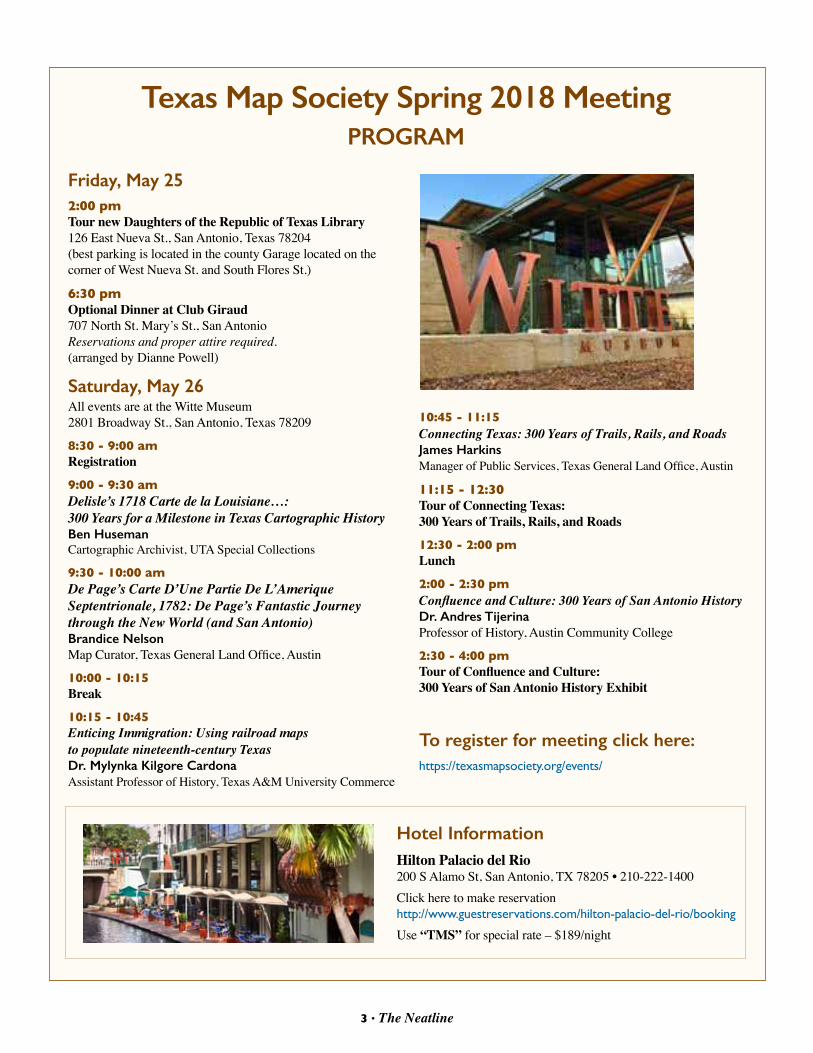
Saturday, May 26All events are at the Witte Museum2801 Broadway St., San Antonio, Texas 78209
8:30 - 9:00 amRegistration
9:00 - 9:30 amDelisle’s 1718 Carte de la Louisiane…: 300 Years for a Milestone in Texas Cartographic HistoryBen HusemanCartographic Archivist, UTA Special Collections
9:30 - 10:00 amDe Page’s Carte D’Une Partie De L’Amerique Septentrionale, 1782: De Page’s Fantastic Journey through the New World (and San Antonio)Brandice NelsonMap Curator, Texas General Land Office, Austin
10:00 - 10:15Break
10:15 - 10:45Enticing Immigration: Using railroad maps to populate nineteenth-century TexasDr. Mylynka Kilgore Cardona Assistant Professor of History, Texas A&M University Commerce
Hotel InformationHilton Palacio del Rio200 S Alamo St, San Antonio, TX 78205 • 210-222-1400Click here to make reservation http://www.guestreservations.com/hilton-palacio-del-rio/booking
Use “TMS” for special rate – $189/night
10:45 - 11:15Connecting Texas: 300 Years of Trails, Rails, and RoadsJames HarkinsManager of Public Services, Texas General Land Office, Austin
11:15 - 12:30Tour of Connecting Texas: 300 Years of Trails, Rails, and Roads
12:30 - 2:00 pmLunch
2:00 - 2:30 pmConfluence and Culture: 300 Years of San Antonio HistoryDr. Andres TijerinaProfessor of History, Austin Community College
2:30 - 4:00 pmTour of Confluence and Culture: 300 Years of San Antonio History Exhibit
To register for meeting click here:https://texasmapsociety.org/events/
2017 Fall Meeting in HuntsvilleBy Walter E. Wilson
Continued on page 5
4 • The Neatline
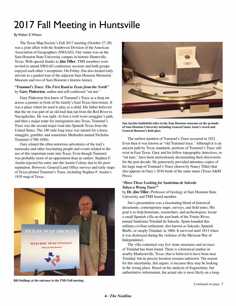
The Texas Map Society’s Fall 2017 meeting (October 27-28) was a joint affair with the Southwest Division of the American Association of Geographers (SWAAG). Our venue was on the Sam Houston State University campus in historic Huntsville, Texas. With special thanks to Jim Tiller, TMS members were invited to attend SWAAG conference sessions and both groups enjoyed each other’s receptions. On Friday, Jim also treated early arrivals to a guided tour of the adjacent Sam Houston Memorial Museum and two of Sam Houston’s historic homes.
“Trammel’s Trace: The First Road to Texas from the North” by Gary Pinkerton, author and self-confessed “rut nut.”
Gary Pinkerton first knew of Trammel’s Trace as a deep rut across a pasture in front of his family’s East Texas farm house. It was a place where he used to play as a child. His father believed that the rut was part of an old trail that ran from the Red River to Nacogdoches. He was right. At first a well-worn smuggler’s path, and then a major route for immigration into Texas, Trammel’s Trace was the second major road into Spanish Texas from the United States. The 180 mile long trace was named for a horse smuggler, gambler, and sometimes Methodist named Nicholas Trammel (1780-1856).
Gary related the often notorious adventures of the trail’s namesake and other fascinating people and events related to the use of this important route into Texas. Even though Trammel was probably more of an opportunist than an outlaw, Stephen F. Austin rejected his entry into the Austin Colony due to his poor reputation. However, General Land Office surveys and early maps of Texas plotted Trammel’s Trace, including Stephen F. Austin’s 1839 map of Texas.
The earliest mention of Trammel’s Trace occurred in 1821. Even then it was known as “old Trammel trace.” Although it is an ancient path by Texas standards, portions of Trammel’s Trace still exist in East Texas. Gary and his fellow topographic detectives, or “rut nuts,” have been meticulously documenting their discoveries for the past decade. He generously provided attendees copies of his large map of Trammel’s Trace (drawn by Nancy Tiller) that also appears in Gary’s 2016 book of the same name (Texas A&M Press). “Have Those Looking for Santisima de Salcedo Taken a Wrong Turn?” by Dr. Jim Tiller, Professor of Geology at Sam Houston State University and TMS board member.
Jim’s presentation was a fascinating blend of historical documents, contemporary maps, surveys, and field notes. His goal is to help historians, researchers, and archeologists, locate a small Spanish villa on the east bank of the Trinity River, named Santísima Trinidad de Salcedo. Spain founded this military-civilian settlement, also known as Salcedo, Spanish Bluffs, or simply Trinidad, in 1806. It survived until 1813 when it was destroyed during the violence of the Mexican War of Independence.
The villa contained very few stone structures and no trace of Trinidad has been found. There is a historical marker in nearby Madisonville, Texas, that is believed to have been near Trinidad, but its precise location remains unknown. The reason for this uncertainty, Jim argues, is because they may be looking in the wrong place. Based on his analysis of fragmentary, but authoritative information, the actual site is most likely on a long-
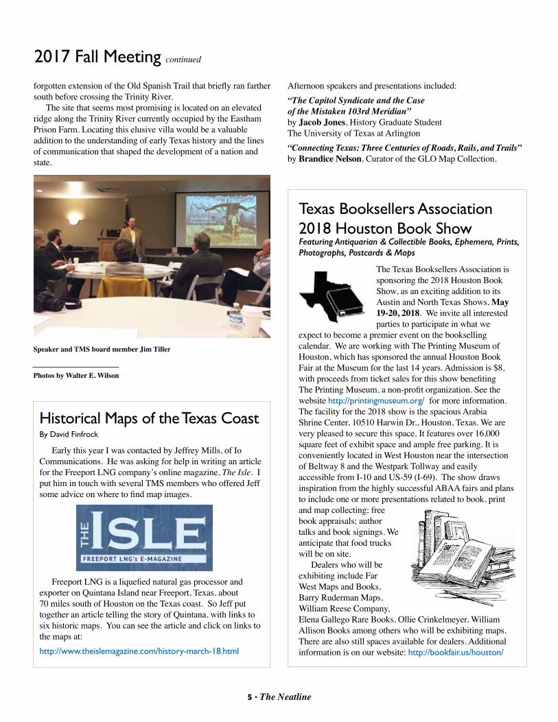
Bill Stallings at the entrance to the TMS Fall meeting
San Jacinto battlefield relics in the Sam Houston museum on the grounds of Sam Houston University including General Santa Anna’s sword and General Houston’s field glass
5 • The Neatline
forgotten extension of the Old Spanish Trail that briefly ran farther south before crossing the Trinity River.
The site that seems most promising is located on an elevated ridge along the Trinity River currently occupied by the Eastham Prison Farm. Locating this elusive villa would be a valuable addition to the understanding of early Texas history and the lines of communication that shaped the development of a nation and state.
2017 Fall Meeting continued
Speaker and TMS board member Jim Tiller
Photos by Walter E. Wilson
Historical Maps of the Texas CoastBy David Finfrock
Early this year I was contacted by Jeffrey Mills, of Io Communications. He was asking for help in writing an article for the Freeport LNG company’s online magazine, The Isle. I put him in touch with several TMS members who offered Jeff some advice on where to find map images.
Freeport LNG is a liquefied natural gas processor and exporter on Quintana Island near Freeport, Texas, about 70 miles south of Houston on the Texas coast. So Jeff put together an article telling the story of Quintana, with links to six historic maps. You can see the article and click on links to the maps at: http://www.theislemagazine.com/history-march-18.html
The Texas Booksellers Association is sponsoring the 2018 Houston Book Show, as an exciting addition to its Austin and North Texas Shows, May 19-20, 2018. We invite all interested parties to participate in what we
expect to become a premier event on the bookselling calendar. We are working with The Printing Museum of Houston, which has sponsored the annual Houston Book Fair at the Museum for the last 14 years. Admission is $8, with proceeds from ticket sales for this show benefiting The Printing Museum, a non-profit organization. See the website http://printingmuseum.org/ for more information. The facility for the 2018 show is the spacious Arabia Shrine Center, 10510 Harwin Dr., Houston, Texas. We are very pleased to secure this space. It features over 16,000 square feet of exhibit space and ample free parking. It is conveniently located in West Houston near the intersection of Beltway 8 and the Westpark Tollway and easily accessible from I-10 and US-59 (I-69). The show draws inspiration from the highly successful ABAA fairs and plans to include one or more presentations related to book, print and map collecting; free book appraisals; author talks and book signings. We anticipate that food trucks will be on site.
Dealers who will be exhibiting include Far West Maps and Books, Barry Ruderman Maps, William Reese Company, Elena Gallego Rare Books, Ollie Crinkelmeyer, William Allison Books among others who will be exhibiting maps. There are also still spaces available for dealers. Additional information is on our website: http://bookfair.us/houston/
Texas Booksellers Association 2018 Houston Book ShowFeaturing Antiquarian & Collectible Books, Ephemera, Prints, Photographs, Postcards & Maps
Afternoon speakers and presentations included:“The Capitol Syndicate and the Case of the Mistaken 103rd Meridian”by Jacob Jones, History Graduate StudentThe University of Texas at Arlington “Connecting Texas: Three Centuries of Roads, Rails, and Trails”by Brandice Nelson, Curator of the GLO Map Collection.
6 • The Neatline
Continued on page 7
7 • The Neatline
When traveling, whether for business or pleasure, you’ve probably been in the same position that I’ve found myself in recently while on vacation, and asked yourself a serious question – What kind of knickknack, tchotchke, bauble, or other miscellaneous stuff should you get as a souvenir? Whether shopping for a family member, friend, or even yourself, it’s hard not to pick up something to remind you of where you were visiting – especially if it was a good vacation!
Recently, my wife and I went to New York City – a first for both of us. I won’t bore you with the details about the Broadway play we saw (The Waitress was fantastic in case you are wondering), the late-night television show that we stood in line for, or our trip through Central Park. I won’t thrill you with our weird adventure on the subway, the amazing museums, the ferry ride past the Statue of Liberty, or visiting the Freedom Tower and site of the World Trade Center attack in 2001. And I certainly won’t gloat about the several amazing restaurants that we went to (including, of course, the pizza). It all made for an incredibly memorable experience.
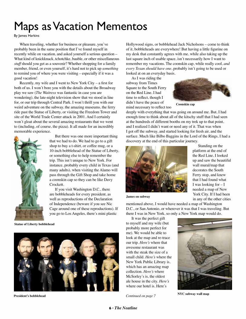
But there was one more important thing that we had to do. We had to go to a gift shop to buy a t-shirt, or coffee mug, or a 10-inch bobblehead of the Statue of Liberty, or something else to help remember the trip. This isn’t unique to New York. For instance, probably every child in Texas (and many adults), when visiting the Alamo will pass through the Gift Shop and take home a coonskin cap so they can be like Davy Crockett.
If you visit Washington D.C., there are bobbleheads for every president, as well as reproductions of the Declaration of Independence (beware if you see Nic Cage around one of these reproductions). If you go to Los Angeles, there’s mini plastic
Hollywood signs, or bobblehead Jack Nicholsons – come to think of it, bobbleheads are everywhere! But having a little figurine on my desk that constantly agrees with me, while also taking up the last square inch of usable space, isn’t necessarily how I want to remember my vacations. The coonskin cap, while really cool, and every Texan should have one, probably isn’t going to be used or looked at on an everyday basis.
As I was riding the subway from Times Square to the South Ferry on the Red Line, I had time to reflect, though I didn’t have the peace of mind necessary to reflect too deeply with everything that was going on around me. But, I had enough time to think about all of the kitschy stuff that I had seen at the hundreds of different booths on my trek up to that point, and I realized I didn’t want or need any of it. That was when I got off the subway, and started looking for fresh air, and the surface. Much like Bilbo Baggins in the Lord of the Rings, I had a discovery at the end of this particular journey.
Standing on the platform at the end of the Red Line, I looked up and saw the beautiful wall mural/map that decorates the South Ferry stop, and knew that I had found what I was looking for – I needed a map of New York City. If I had been in any of the other cities
mentioned above, I would have needed a map of Washington D.C., or San Antonio, or wherever it was that I was traveling. But there I was in New York, so only a New York map would do.
It was the perfect gift to myself and my wife (but probably more perfect for me). We would be able to look at the map and re-trace our trip. Here’s where that awesome restaurant was with the steak the size of a small child. Here’s where the New York Public Library is, which has an amazing map collection. Here’s where McSorley’s is, the oldest ale house in the city. Here’s where our hotel is. Here’s
Maps as Vacation MementosBy James Harkins
Statue of Liberty bobblehead
President’s bobblehead
Coonskin cap
James on subway
NYC subway wall map
6 • The Neatline 7 • The Neatline
Maps as vacation mementos continued
where we got stuck trying to cross the street through the incredibly long Polish parade. You get the point.
So that’s my advice. When in doubt, get a map. If you, or a friend, are traveling to a city in Texas, the General Land Office probably has a map for that, and can send you an affordable reproduction for $20-$40. If you’re traveling outside of Texas, it’s less likely that the GLO will have a map of that city, or state, or country available – but it’s possible, due to the several historic world atlases in the collection, and other miscellaneous items that aren’t exclusive to Texas.
Each unique map has the potential to offer a different perspective on your travels. While this may not offer the immediate satisfaction of finding the perfect bobblehead that encapsulates your life on vacation, it does offer an affordable alternative, and something that you will always be able to enjoy. Plus, 100% of the money goes towards conserving other maps at the GLO. Who would have thought that your vacation across the world would end up helping Texas history?
Of course, another alternative would be that you can buy an original map of the city that you traveled to, or better yet, it gives you an excuse to go into that funky little antique store, or old book store, to see if you can find an old map there. Or, you can always contact one of the many map dealers who would be more than happy to sell you a map. This may not be as affordable as a reproduction, but it still gives you something impressive to hang on the wall, and something to remember your vacation.
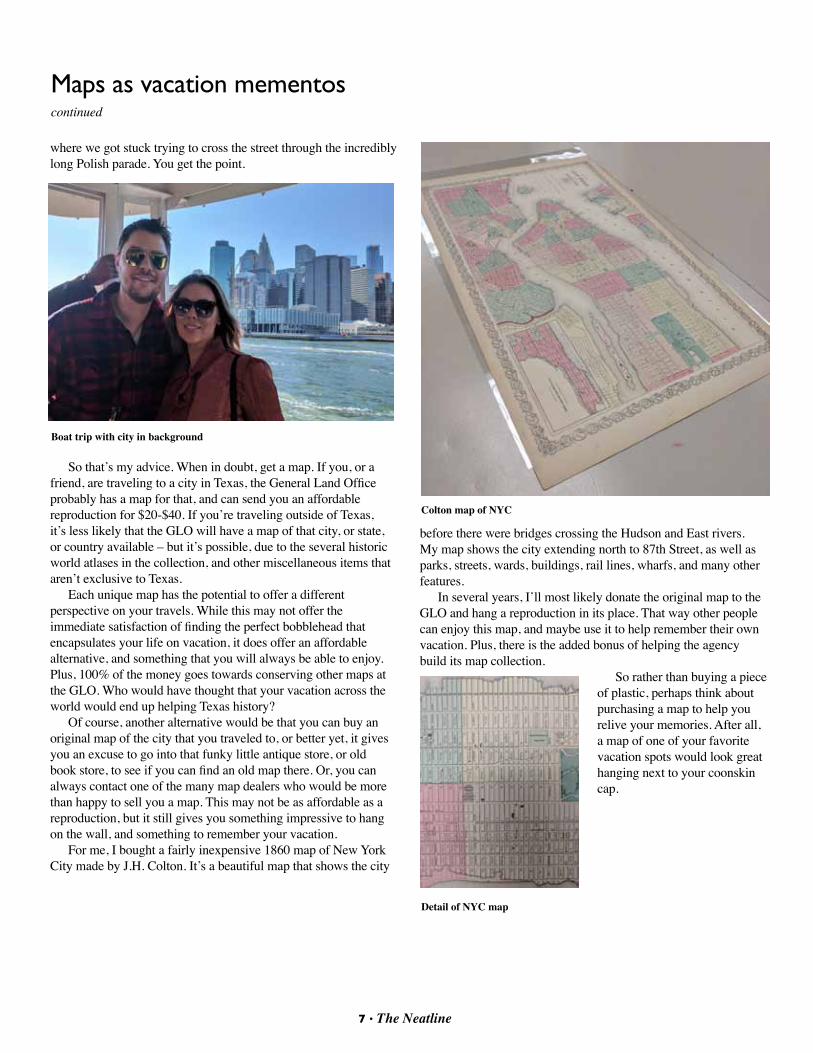
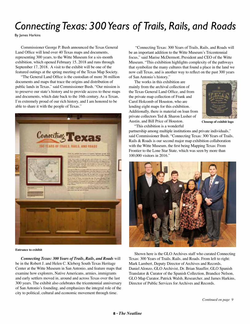
For me, I bought a fairly inexpensive 1860 map of New York City made by J.H. Colton. It’s a beautiful map that shows the city
Boat trip with city in background
before there were bridges crossing the Hudson and East rivers. My map shows the city extending north to 87th Street, as well as parks, streets, wards, buildings, rail lines, wharfs, and many other features.
In several years, I’ll most likely donate the original map to the GLO and hang a reproduction in its place. That way other people can enjoy this map, and maybe use it to help remember their own vacation. Plus, there is the added bonus of helping the agency build its map collection.
So rather than buying a piece of plastic, perhaps think about purchasing a map to help you relive your memories. After all, a map of one of your favorite vacation spots would look great hanging next to your coonskin cap.
Colton map of NYC
Detail of NYC map
8 • The Neatline 9 • The Neatline
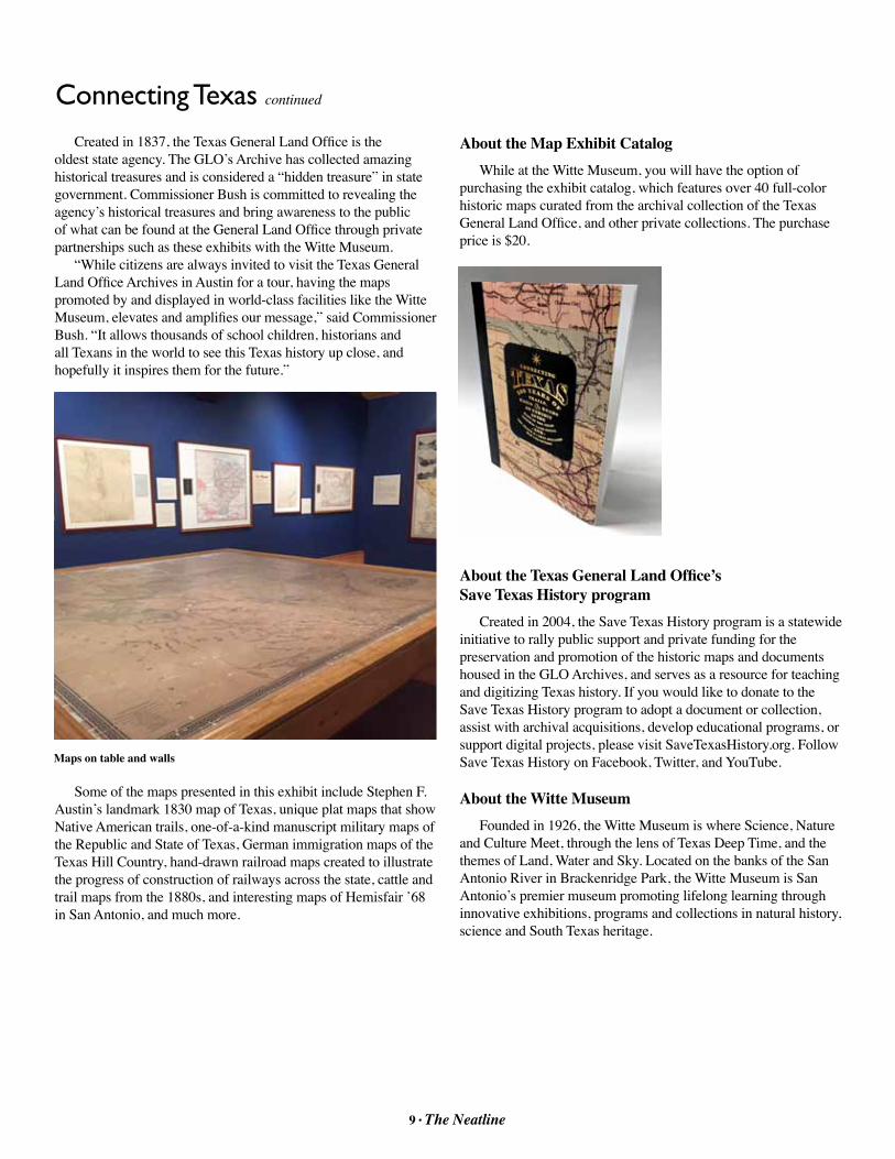
Commissioner George P. Bush announced the Texas General Land Office will lend over 40 Texas maps and documents, representing 300 years, to the Witte Museum for a six-month exhibition, which opened February 15, 2018 and runs through September 17, 2018. A visit to the exhibit will be one of the featured outings at the spring meeting of the Texas Map Society.
“The General Land Office is the custodian of more 36 million documents and maps that trace the origins and distribution of public lands in Texas,” said Commissioner Bush. “Our mission is to preserve our state’s history and to provide access to these maps and documents, which date back to the 16th century. As a Texan, I’m extremely proud of our rich history, and I am honored to be able to share it with the people of Texas.”
Connecting Texas: 300 Years of Trails, Rails, and Roads will be in the Robert J. and Helen C. Kleberg South Texas Heritage Center at the Witte Museum in San Antonio, and feature maps that examine how explorers, Native Americans, armies, immigrants and early settlers moved in, around and across Texas over the last 300 years. The exhibit also celebrates the tricentennial anniversary of San Antonio’s founding, and emphasizes the integral role of the city to political, cultural and economic movement through time.
“Connecting Texas: 300 Years of Trails, Rails, and Roads will be an important addition to the Witte Museum’s Tricentennial focus,” said Marise McDermott, President and CEO of the Witte Museum. “This exhibition highlights complexity of the pathways that symbolize the many cultures that found a place in the land we now call Texas, and is another way to reflect on the past 300 years of San Antonio’s history.”
The works in this exhibition are mainly from the archival collection of the Texas General Land Office, and from the private map collection of Frank and Carol Holcomb of Houston, who are lending eight maps for this exhibition. Additionally, there is material on loan from private collectors Ted & Sharon Lusher of Austin, and Bill Price of Houston.
“This exhibition is a wonderful partnership among multiple institutions and private individuals,” said Commissioner Bush. “Connecting Texas: 300 Years of Trails, Rails & Roads is our second major map exhibition collaboration with the Witte Museum, the first being Mapping Texas: From Frontier to the Lone Star State, which was seen by more than 100,000 visitors in 2016.”
Shown here is the GLO Archives staff who curated Connecting Texas: 300 Years of Trails, Rails, and Roads. From left to right: Mark Lambert, Deputy Director of Archives and Records, Daniel Alonzo, GLO Archivist, Dr. Brian Stauffer, GLO Spanish Translator & Curator of the Spanish Collection, Brandice Nelson, GLO Map Curator, Patrick Walsh, Researcher, and James Harkins, Director of Public Services for Archives and Records.
Connecting Texas: 300 Years of Trails, Rails, and RoadsBy James Harkins
Closeup of exhibit logo
Entrance to exhibit
Continued on page 9
8 • The Neatline 9 • The Neatline
Created in 1837, the Texas General Land Office is the oldest state agency. The GLO’s Archive has collected amazing historical treasures and is considered a “hidden treasure” in state government. Commissioner Bush is committed to revealing the agency’s historical treasures and bring awareness to the public of what can be found at the General Land Office through private partnerships such as these exhibits with the Witte Museum.
“While citizens are always invited to visit the Texas General Land Office Archives in Austin for a tour, having the maps promoted by and displayed in world-class facilities like the Witte Museum, elevates and amplifies our message,” said Commissioner Bush. “It allows thousands of school children, historians and all Texans in the world to see this Texas history up close, and hopefully it inspires them for the future.”
Some of the maps presented in this exhibit include Stephen F. Austin’s landmark 1830 map of Texas, unique plat maps that show Native American trails, one-of-a-kind manuscript military maps of the Republic and State of Texas, German immigration maps of the Texas Hill Country, hand-drawn railroad maps created to illustrate the progress of construction of railways across the state, cattle and trail maps from the 1880s, and interesting maps of Hemisfair ’68 in San Antonio, and much more.
Maps on table and walls
About the Map Exhibit CatalogWhile at the Witte Museum, you will have the option of
purchasing the exhibit catalog, which features over 40 full-color historic maps curated from the archival collection of the Texas General Land Office, and other private collections. The purchase price is $20.
About the Texas General Land Office’s Save Texas History program
Created in 2004, the Save Texas History program is a statewide initiative to rally public support and private funding for the preservation and promotion of the historic maps and documents housed in the GLO Archives, and serves as a resource for teaching and digitizing Texas history. If you would like to donate to the Save Texas History program to adopt a document or collection, assist with archival acquisitions, develop educational programs, or support digital projects, please visit SaveTexasHistory.org. Follow Save Texas History on Facebook, Twitter, and YouTube.
About the Witte MuseumFounded in 1926, the Witte Museum is where Science, Nature
and Culture Meet, through the lens of Texas Deep Time, and the themes of Land, Water and Sky. Located on the banks of the San Antonio River in Brackenridge Park, the Witte Museum is San Antonio’s premier museum promoting lifelong learning through innovative exhibitions, programs and collections in natural history, science and South Texas heritage.
Connecting Texas continued
10 • The Neatline 11 • The Neatline
School Atlases of Roswell C. Smith, 1797-1875 By Walter E. Wilson
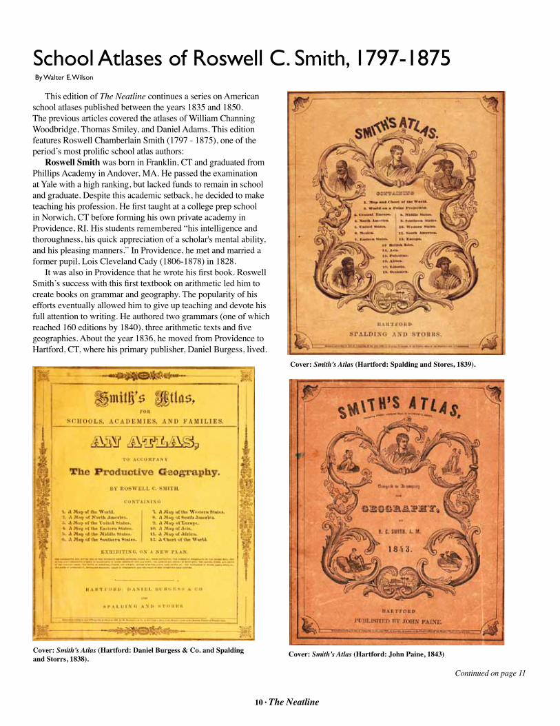
This edition of The Neatline continues a series on American school atlases published between the years 1835 and 1850. The previous articles covered the atlases of William Channing Woodbridge, Thomas Smiley, and Daniel Adams. This edition features Roswell Chamberlain Smith (1797 - 1875), one of the period’s most prolific school atlas authors:
Roswell Smith was born in Franklin, CT and graduated from Phillips Academy in Andover, MA. He passed the examination at Yale with a high ranking, but lacked funds to remain in school and graduate. Despite this academic setback, he decided to make teaching his profession. He first taught at a college prep school in Norwich, CT before forming his own private academy in Providence, RI. His students remembered “his intelligence and thoroughness, his quick appreciation of a scholar's mental ability, and his pleasing manners.” In Providence, he met and married a former pupil, Lois Cleveland Cady (1806-1878) in 1828.
It was also in Providence that he wrote his first book. Roswell Smith’s success with this first textbook on arithmetic led him to create books on grammar and geography. The popularity of his efforts eventually allowed him to give up teaching and devote his full attention to writing. He authored two grammars (one of which reached 160 editions by 1840), three arithmetic texts and five geographies. About the year 1836, he moved from Providence to Hartford, CT, where his primary publisher, Daniel Burgess, lived.
Cover: Smith’s Atlas (Hartford: Daniel Burgess & Co. and Spalding and Storrs, 1838).
Cover: Smith’s Atlas (Hartford: Spalding and Stores, 1839).
Cover: Smith’s Atlas (Hartford: John Paine, 1843)
Continued on page 11

10 • The Neatline 11 • The Neatline
Between 1835 and 1850 Smith published two of his books on geography. Another was purely an atlas that appeared under three different title variations in several unnumbered editions. Initially titled Smith’s Atlas for Schools, Academies, and Families, an Atlas to Accompany the Productive Geography, he soon shortened it to simply Smith’s Atlas, and finally Smith’s Atlas Designed to Accompany the Geography. All were designed to accompany his first geography text book. The maps in Smith’s atlases only had printing on one side leaving the verso blank.
In 1846, Smith introduced his second atlas. It is a combination textbook and atlas that he titled Smith’s Quarto, or Second Book in Geography. It includes map engravings that had appeared in the earlier atlases and continued to appear simultaneously in Smith’s Atlases through 1847. The Quarto Atlases include geography text and has printing on both sides of each page.
Like his fellow authors and cartographers of this era, Smith frequently modified a map without changing the copyright or registration date. He also revised maps without making any changes to the atlas cover or title page. With the issue of his second, or Quarto, geography and atlas in 1846, Smith began to provide edition numbers on the title page in addition to publishing dates on the cover and title page. By 1850, the Quarto had reached 13 editions. However, sometimes the date on the cover and title page did not match, and there would be variations in content within the same edition number.
These seemingly random changes are challenging when trying to accurately identify and date the publication of a particular
map or atlas. Another variable is the overlapping and interrelated publishing houses that printed Smith’s atlases during this period. His first publisher was Daniel Burgess (1803 – 1856) who had been publishing in Hartford with his partner Gordis Spalding under the name Daniel Burgess & Co. since at least 1835.
In 1838, Burgess and Spalding dissolved their partnership and operated separate bookstores and publishing houses in Hartford. Spalding took Amariah Storrs as a partner and published under the name Spalding & Storrs. Both businesses failed in 1841, and John Paine took over Daniel Burgess’ publishing interests in Hartford. Paine and Burgess had been partners in the grocery business and were managers of the Connecticut Lottery. In 1844, Paine sold out his Hartford business to Flavius Brown and E.W. Parsons. Brown & Parsons briefly co-published Smith’s atlases in Hartford with Paine and Burgess. 1
In 1845, Burgess renewed his publishing partnership with John Paine in New York. Two years later, Paine sold his interest to Isaac Hutchins Cady (1801-1867), the older brother of Roswell Smith’s wife, Lois. Cady and Burgess continued to publish Smith’s atlases through 1852. There were other companies that also co-published and sold Smith’s atlases in other cities. The first was William Marshall & Co. in Philadelphia, who also had a bookstore, printing office and bindery in Providence, RI. In 1842, Gladding & Proud succeeded Marshall’s company at the Providence location.2 In addition to Brown and Parsons, another co-publisher was Sanborn & Carter of Portland, ME. All of these houses produced Smith’s atlases between 1835 and 1850.
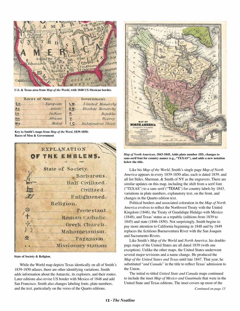
Smith’s naturally catered to the interests of his audience. His atlases include detailed maps of the New England and Mid-Atlantic states and frequent updates that illustrated American’s westward expansion. Although there are no separate maps of Texas, it is featured prominently as both a republic and an over-sized state. The US and North American maps in Smith’s Atlases published between 1835 and 1838 all depict Texas as part of Mexico. Beginning in 1839, however, Smith labels and outlines Texas as either an independent republic or US state in the following maps:
Map of the World and Chart double page 1839-1850Map of North America single page 1839-1850Map of the United States and Texas double page 1839-1847 Map of the United States and Canada double page 1847-1850Map of the Southern States double page 1839-1847Map No. 6. United States single page 1847-1850Map of Oceanica single page 1839-1848
The “Map of the World and Chart” is common to all of Smith’s atlases beginning in 1839. Each has the same title, inset maps (The World on a Polar Projection and Central Europe), and labels. They are all dated 1839 and engraved by Stiles, Sherman & Smith N.Y. Texas is labeled and outlined as a large republic and shows Austin is a national capital. The symbols reflect that Texas is both enlightened and savage (indicated by a bow and arrow) and is populated by “1/5 m” (200,000) “Indians” and “Europeans.” It has a republican government and is a protestant country with a missionary station near Galveston Bay.
Cover: Smith’s Quarto (New York: Cady & Burgess, 1848)s
Continued on page 12
12 • The Neatline 13 • The Neatline
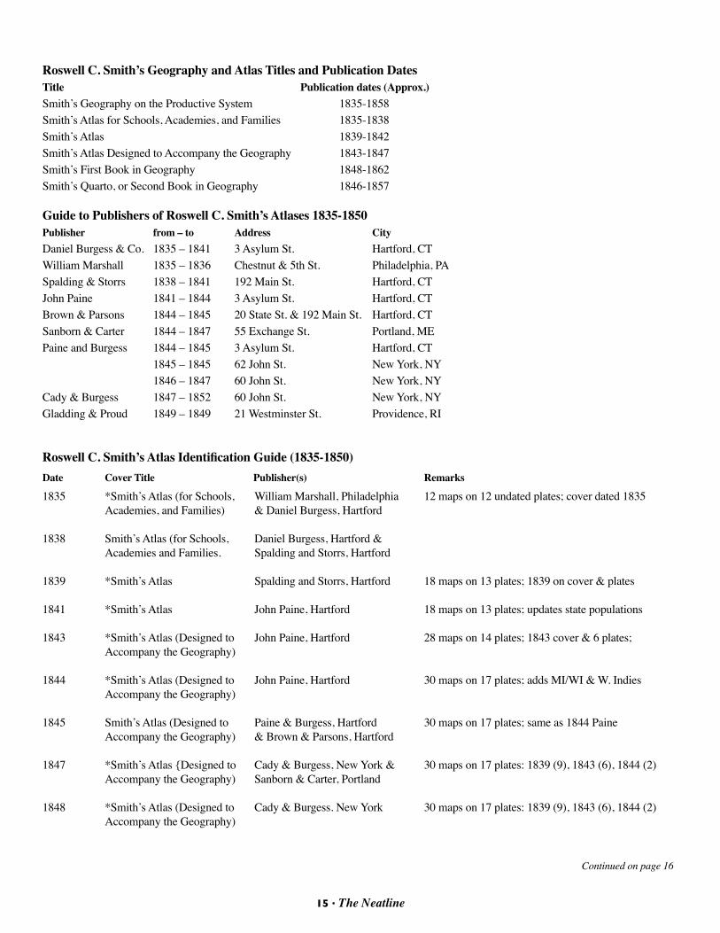
Like his Map of the World, Smith’s single page Map of North America appears in every 1839-1850 atlas, each is dated 1839, and all list Stiles, Sherman, & Smith of NY as the engravers. There are similar updates on this map, including the shift from a serif font (“TEXAS”) to a sans serif (“TEXAS”) for country labels by 1843, variations in plate numbers, explanatory text, on the front, and changes in the Quarto edition text.
Political borders and associated coloration in the Map of North America evolves to reflect the Northwest Treaty with the United Kingdom (1846), the Treaty of Guadalupe Hidalgo with Mexico (1848), and Texas’ status as a republic (editions from 1839 to 1845) and state (1846-1850). Not surprisingly, Smith begins to pay more attention to California beginning in 1848 and by 1849 replaces the fictitious Buenaventura River with the San Joaquin and Sacramento Rivers.
Like Smith’s Map of the World and North America, his double-page maps of the United States are all dated 1839 (with one exception). Unlike the other maps, the United States underwent several major revisions and a name change. He produced the Map of the United States and Texas until late 1847. That year, he substituted “and Canada” in the title to reflect Texas’ admission to the Union.
The initial re-titled United State and Canada maps continued to include the inset Map of Mexico and Guatimala that were in the United State and Texas editions. The inset covers up most of the
While the World map depicts Texas identically on all of Smith’s 1839-1850 atlases, there are other identifying variations. Smith adds information about the Antarctic, its explorers, and their routes. Later editions also revise US border with Mexico of 1848 and add San Francisco. Smith also changes labeling fonts, plate numbers, and the text, particularly on the verso of the Quarto editions.
U.S. & Texas area from Map of the World, with 1848 US-Mexican border.
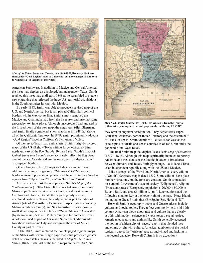
Key to Smith’s maps from Map of the Word, 1839-1850: Races of Men & Government
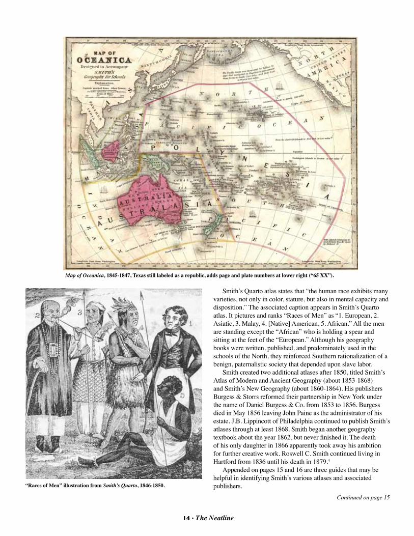
State of Society & Religion.
Map of North American, 1843-1845, Adds plate number (III), changes to sans-serif font for country names (e.g., “TEXAS”), and adds a new notation below the title.
Continued on page 13
12 • The Neatline 13 • The Neatline
Continued on page 14
American Southwest. In addition to Mexico and Central America, the inset map depicts an uncolored, but independent Texas. Smith retained this inset map until early 1848 as he scrambled to create a new engraving that reflected the huge U.S. territorial acquisitions in the Southwest after its war with Mexico,
By early 1848, Smith was able to produce a revised map of the U.S. and North America, but it still placed California’s political borders within Mexico. At first, Smith simply removed the Mexico and Guatimala map from the inset area and inserted some geography text in its place. Although unaccredited and undated in the first editions of the new map, the engravers Stiles, Sherman, and Smith finally completed a new map later in 1848 that shows all of the California Territory. In 1849, Smith prominently added a “Gold Region” label in California’s Sacramento Valley.
Of interest to Texas map enthusiasts, Smith’s brightly colored maps of the US all show Texas with its large territorial claim north and east of the Rio Grande. By late 1848, Smith’s maps of United States and Canada more accurately reflect the Big Bend area of the Rio Grande and are the only ones that depict Texas’ “stovepipe” borders.
Other changes to his US maps include state and territory additions, spelling changes (e.g., “Minnisota” to “Minesota”), border revisions, population updates, and the renaming of Canadian regions from “Upper” and “Lower” to “East” and “West.”
A small slice of East Texas appears in Smith’s Map of the Southern States (1839 – 1847). It features Arkansas, Louisiana, Mississippi, Tennessee, Alabama, Georgia, and most of South Carolina and Florida. Despite the depicting only a small, uncolored portion of Texas, the early versions plot the cities of Aurora (site of Port Arthur), Beaumont, Jasper, Sabine (probably Milam in Sabine County), and San Augustine. It also shows a small steam ship in the Gulf labeled “New Orleans to Galveston (by steam vessel) 500 m.” Miller County in far northeast Texas is color outlined as part of Arkansas. Subsequent editions add Jonesboro and Sabine City and recognize the area of Miller County as part of Texas.
In late 1847, Smith replaced the double paged regional maps of the States with several single page maps that presented greater detail of fewer states. Texas is included in Map No. 6. United States (1847-1850). All of the No. 6 maps are dated 1847, but
they omit an engraver accreditation. They depict Mississippi, Louisiana, Arkansas, part of Indian Territory and the eastern half of Texas. In Texas, Smith identifies 40 cities as far west as the state capital at Austin and Texas counties as of 1843, but omits the panhandle and West Texas.
The final Smith map that depicts Texas is his Map of Oceanica (1839 – 1848). Although this map is primarily intended to portray Australia and the islands of the Pacific, it covers a broad area between Sumatra and Texas. Fittingly enough, it also labels Texas as an independent republic along with the US and Mexico.
Like his maps of the World and North America, every edition of Smith’s Oceanica map is dated 1839. Some editions have plate number variations, but the fonts are constant. Smith soon added his symbols for Australia’s state of society (Enlightened), religion (Protestant), races (European), population (170,000 + 80,000 in Botany Bay), and area (3 million sq. mi.). Later editions add the following notation key at the lower right of the map, “Note: Islands belonging to Great Britain thus (Br) Spain (Sp), Holland (D)”. Roswell Smith’s geography books and Quarto atlases include cultural and social topics. They reflect commonly held, mid-19th century American views about race and culture that are clearly at odds with modern science and views toward social justice. American educators and authors like Smith generally accepted the notion of a hierarchy of “races,” a term that blended race and ethnic origin with culture. American textbooks of the period typically depict the “African” race as uncivilized and lacking in intellectual capacity. Roswell C. Smith is no exception.3
Map of the United States and Canada, late 1849-1850, like early 1849 ver-sions, adds “Gold Region” label to California, but also changes “Minnisota” to “Minesota” in last line of insert text.
Map No. 6. United States, 1847-1850. This version is from the Quarto edition with printing on verso and page number at the top left (“34”).
14 • The Neatline
Smith’s Quarto atlas states that “the human race exhibits many varieties, not only in color, stature, but also in mental capacity and disposition.” The associated caption appears in Smith’s Quarto atlas. It pictures and ranks “Races of Men” as “1. European, 2. Asiatic, 3. Malay, 4. [Native] American, 5. African.” All the men are standing except the “African” who is holding a spear and sitting at the feet of the “European.” Although his geography books were written, published, and predominately used in the schools of the North, they reinforced Southern rationalization of a benign, paternalistic society that depended upon slave labor.
Smith created two additional atlases after 1850, titled Smith’s Atlas of Modern and Ancient Geography (about 1853-1868) and Smith’s New Geography (about 1860-1864). His publishers Burgess & Storrs reformed their partnership in New York under the name of Daniel Burgess & Co. from 1853 to 1856. Burgess died in May 1856 leaving John Paine as the administrator of his estate. J.B. Lippincott of Philadelphia continued to publish Smith’s atlases through at least 1868. Smith began another geography textbook about the year 1862, but never finished it. The death of his only daughter in 1866 apparently took away his ambition for further creative work. Roswell C. Smith continued living in Hartford from 1836 until his death in 1879.4
Appended on pages 15 and 16 are three guides that may be helpful in identifying Smith’s various atlases and associated publishers.
Map of Oceanica, 1845-1847, Texas still labeled as a republic, adds page and plate numbers at lower right (“65 XX”).
“Races of Men” illustration from Smith’s Quarto, 1846-1850.
Continued on page 15
14 • The Neatline 15 • The Neatline
Roswell C. Smith’s Geography and Atlas Titles and Publication DatesTitle Publication dates (Approx.)Smith’s Geography on the Productive System 1835-1858Smith’s Atlas for Schools, Academies, and Families 1835-1838Smith’s Atlas 1839-1842Smith’s Atlas Designed to Accompany the Geography 1843-1847Smith’s First Book in Geography 1848-1862Smith’s Quarto, or Second Book in Geography 1846-1857
Guide to Publishers of Roswell C. Smith’s Atlases 1835-1850Publisher from – to Address City Daniel Burgess & Co. 1835 – 1841 3 Asylum St. Hartford, CTWilliam Marshall 1835 – 1836 Chestnut & 5th St. Philadelphia, PASpalding & Storrs 1838 – 1841 192 Main St. Hartford, CT John Paine 1841 – 1844 3 Asylum St. Hartford, CT Brown & Parsons 1844 – 1845 20 State St. & 192 Main St. Hartford, CTSanborn & Carter 1844 – 1847 55 Exchange St. Portland, MEPaine and Burgess 1844 – 1845 3 Asylum St. Hartford, CT 1845 – 1845 62 John St. New York, NY 1846 – 1847 60 John St. New York, NYCady & Burgess 1847 – 1852 60 John St. New York, NYGladding & Proud 1849 – 1849 21 Westminster St. Providence, RI
Roswell C. Smith’s Atlas Identification Guide (1835-1850)Date Cover Title Publisher(s) Remarks
1835 *Smith’s Atlas (for Schools, William Marshall, Philadelphia 12 maps on 12 undated plates; cover dated 1835 Academies, and Families) & Daniel Burgess, Hartford
1838 Smith’s Atlas (for Schools, Daniel Burgess, Hartford & Academies and Families. Spalding and Storrs, Hartford
1839 *Smith’s Atlas Spalding and Storrs, Hartford 18 maps on 13 plates; 1839 on cover & plates
1841 *Smith’s Atlas John Paine, Hartford 18 maps on 13 plates; updates state populations
1843 *Smith’s Atlas (Designed to John Paine, Hartford 28 maps on 14 plates; 1843 cover & 6 plates; Accompany the Geography)
1844 *Smith’s Atlas (Designed to John Paine, Hartford 30 maps on 17 plates; adds MI/WI & W. Indies Accompany the Geography) 1845 Smith’s Atlas (Designed to Paine & Burgess, Hartford 30 maps on 17 plates; same as 1844 Paine Accompany the Geography) & Brown & Parsons, Hartford
1847 *Smith’s Atlas {Designed to Cady & Burgess, New York & 30 maps on 17 plates: 1839 (9), 1843 (6), 1844 (2) Accompany the Geography) Sanborn & Carter, Portland 1848 *Smith’s Atlas (Designed to Cady & Burgess. New York 30 maps on 17 plates: 1839 (9), 1843 (6), 1844 (2) Accompany the Geography)
Continued on page 16
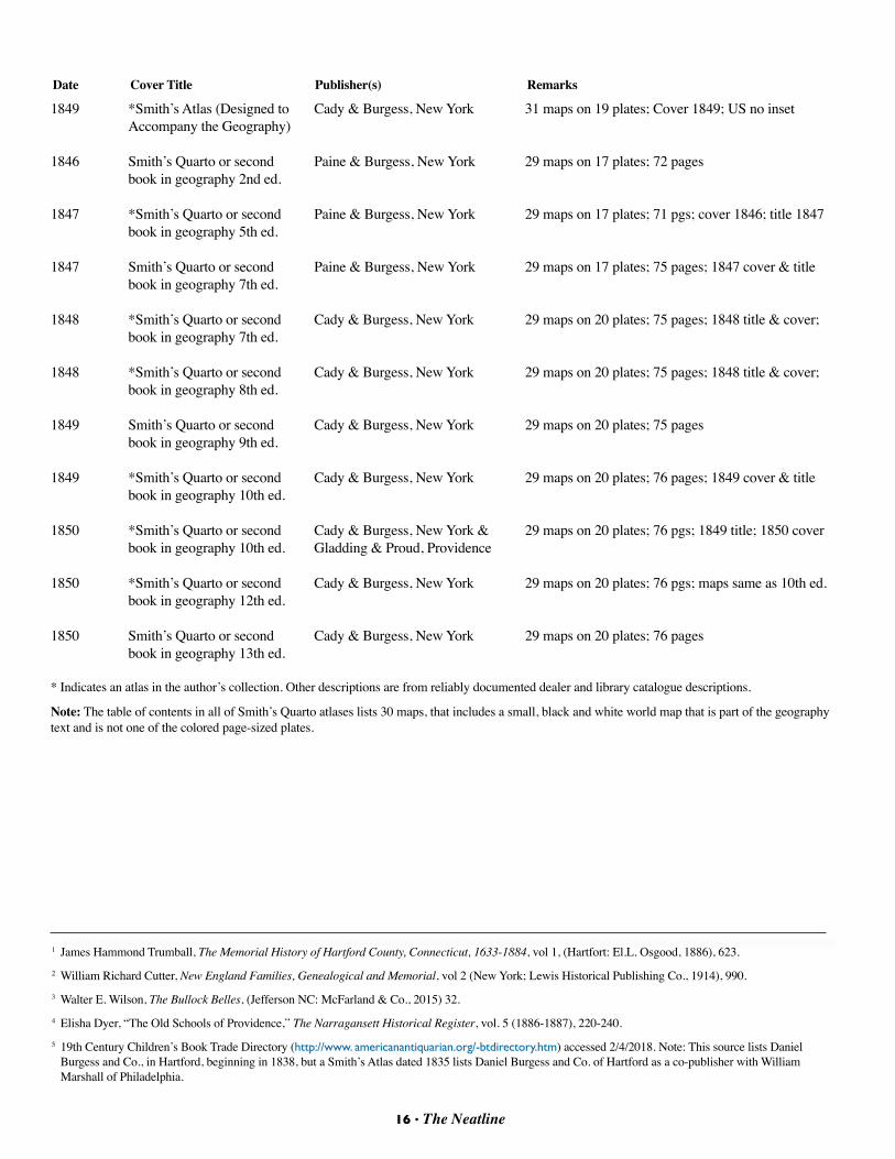
16 • The Neatline
1849 *Smith’s Atlas (Designed to Cady & Burgess, New York 31 maps on 19 plates; Cover 1849; US no inset Accompany the Geography)
1846 Smith’s Quarto or second Paine & Burgess, New York 29 maps on 17 plates; 72 pages book in geography 2nd ed. 1847 *Smith’s Quarto or second Paine & Burgess, New York 29 maps on 17 plates; 71 pgs; cover 1846; title 1847 book in geography 5th ed. 1847 Smith’s Quarto or second Paine & Burgess, New York 29 maps on 17 plates; 75 pages; 1847 cover & title book in geography 7th ed. 1848 *Smith’s Quarto or second Cady & Burgess, New York 29 maps on 20 plates; 75 pages; 1848 title & cover; book in geography 7th ed.
1848 *Smith’s Quarto or second Cady & Burgess, New York 29 maps on 20 plates; 75 pages; 1848 title & cover; book in geography 8th ed. 1849 Smith’s Quarto or second Cady & Burgess, New York 29 maps on 20 plates; 75 pages book in geography 9th ed. 1849 *Smith’s Quarto or second Cady & Burgess, New York 29 maps on 20 plates; 76 pages; 1849 cover & title book in geography 10th ed.
1850 *Smith’s Quarto or second Cady & Burgess, New York & 29 maps on 20 plates; 76 pgs; 1849 title; 1850 cover book in geography 10th ed. Gladding & Proud, Providence 1850 *Smith’s Quarto or second Cady & Burgess, New York 29 maps on 20 plates; 76 pgs; maps same as 10th ed. book in geography 12th ed. 1850 Smith’s Quarto or second Cady & Burgess, New York 29 maps on 20 plates; 76 pages book in geography 13th ed. * Indicates an atlas in the author’s collection. Other descriptions are from reliably documented dealer and library catalogue descriptions.
Note: The table of contents in all of Smith’s Quarto atlases lists 30 maps, that includes a small, black and white world map that is part of the geography text and is not one of the colored page-sized plates.
Date Cover Title Publisher(s) Remarks
1 James Hammond Trumball, The Memorial History of Hartford County, Connecticut, 1633-1884, vol 1, (Hartfort: El.L. Osgood, 1886), 623.2 William Richard Cutter, New England Families, Genealogical and Memorial, vol 2 (New York; Lewis Historical Publishing Co., 1914), 990.3 Walter E. Wilson, The Bullock Belles, (Jefferson NC: McFarland & Co., 2015) 32.4 Elisha Dyer, “The Old Schools of Providence,” The Narragansett Historical Register, vol. 5 (1886-1887), 220-240.5 19th Century Children’s Book Trade Directory (http://www. americanantiquarian.org/-btdirectory.htm) accessed 2/4/2018. Note: This source lists Daniel
Burgess and Co., in Hartford, beginning in 1838, but a Smith’s Atlas dated 1835 lists Daniel Burgess and Co. of Hartford as a co-publisher with William Marshall of Philadelphia.
SAVE THE DATE • OCTOBER 5-6, 2018
16 • The Neatline 17 • The Neatline
2018 Virginia Garrett Lectures and TMS Fall Meetingand
Joint Meeting with the Phillip Lee Phillips SocietyBy Brenda McClurkin
Plan to head to UT Arlington’s Central Library on October 5-6, 2018, for the Eleventh Biennial Virginia Garrett Lectures on the History of Cartography and the Fall 2018 meeting of the Texas Map Society. It will also be a joint meeting with members of the Philip Lee Phllips Society as well.
The event kicks off on Friday, October 5, with the 2018 Garrett Lectures. The theme Paths to Highways: Routes of Exploration, Settlement and Commerce is broadly based and provides expansive opportunities for our five speakers – Will Bagley, Wes Brown, David Buisseret, Glen Ely, and Jason Wiese – to explore.
Utah historian and author Will Bagley will present Summary of “One Great National Highway Across the Continent:” Maps and the Overland Road, 1821-1912. He will examine the time period from the 1821 publication of Robert Stuart’s “Carte de la Partie Occidental des États-Unis,” a map of his 1812 transcontinental trek and discovery of what would become the Oregon Trail, to the passage of the last wagon train bound for Oregon via the Lander Cutoff in 1912. He will include the work of the National Old Trails Association founded in 1912 to promote the development of a transcontinental highway from Baltimore to Los Angeles, with connecting branches to New York and San Francisco, following “old trails” such as the National Road and the Santa Fe Trail.
Denver banker and map collector Wes Brown has chosen Taken from Texas: How the 1859 Gold Rush Put Colorado on the Map as his subject. By the close of 1859, Colorado’s Front Range area from Pueblo to the Wyoming border, previously uncharted, had been thoroughly explored by 100,000 fortune seekers. In their quest for gold, they established dozens of settlements and blazed numerous trails. This presentation will examine Colorado’s gold rush and how this important chapter of history influenced Colorado maps of today.
Retired UTA professor and VGL favorite David Buisseret, now affiliated with Chicago’s Newberry Library, will trace all of the Indian trails marked on the earliest European maps of the fifty Chicago townships and relate them to regional
topography/hydrography as well as the European settlement of the Chicago area.
Texas historian Glen Ely, now of Grand Junction, Colorado, will present Overland Routes through Western Texas, 1850-1891 & the Role of Maps in Promoting Exploration and Exploitation of Natural Resources. The establishment of overland routes and railroads through western Texas during 1850-1890 opened up the area to exploration, settlement, and exploitation of the area’s arid and fragile ecosystem. Period maps played a pivotal role in this process by identifying choice
natural resources suitable for commercial exploitation, including water, minerals, and grasslands. Ely will examine the legacy of this widespread exploitation and offers insights that current and future generations can take from this environmental tragedy.
Jason Wiese, Associate Director of the Williams Research Center of the Historic New Orleans Collection will present Chemins des Voyageurs: Pathways and Stories from Three Early Maps of Louisiana, featuring Guillaume de L’Isle’s 1718 “Carte de la Louisiane et du Cours de Mississipi,” and Nicolas de Fer’s “Le Cours du Mississipi ou de St. Louis,” produced the same year for the Company of the Indies. Both of these maps document early French colonization of parts of North America, and are crisscrossed by depictions of overland roads or pathways, often labeled with names of early explorers of the region. Herman Moll’s “Florida Called by Ye French Louisiana,” will also be included. Wiese will also comment on the (mis)adventures of explorers such as Hernando de Soto, Louis Juchereau de St. Denis, and others and the information sources used by these three cartographers to create their maps.
The program for the October 6 Texas Map Society meeting has not yet been determined and will be distributed when available.
Conference registration and hotel reservation information will be provided in the near future. Please contact Ben Huseman (817.272.0633, [email protected]) or Brenda McClurkin (817.272.7512, [email protected]) with any questions you might have.-
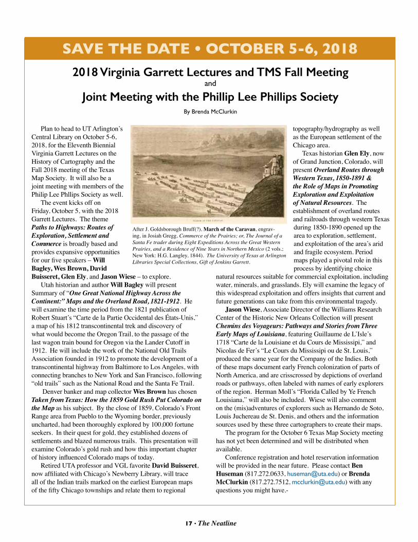
After J. Goldsborough Bruff(?), March of the Caravan, engrav-ing, in Josiah Gregg, Commerce of the Prairies; or, The Journal of a Santa Fe trader during Eight Expeditions Across the Great Western Prairies, and a Residence of Nine Years in Northern Mexico (2 vols.; New York: H.G. Langley, 1844). The University of Texas at Arlington Libraries Special Collections, Gift of Jenkins Garrett.
The Texas Map Society is pleased to announce our first annual Essay Contest for undergraduate and graduate students from universities and colleges in Texas and adjoining states (New Mexico, Oklahoma, Arkansas, and Louisiana). Our purpose is to recognize outstanding students who can help share our excitement about the study, application, and appreciation of maps.
The essay should reflect original research and analysis that has not been previously published. It may include the output resulting from a community college, 4-year undergraduate, or graduate class assignment or individual research.
Suggested topics may include: • History of Cartography• History of an individual map or map-maker, cartographer • Surveying, Geosciences/GIS (e.g., Historical Geography, Environmental
Studies, Meteorology, Oceanography)• Application of maps to understanding the cultural, geo-political, or physical
characteristics of an area, era or event • Visual Arts (e.g., engraving, map-making techniques, artistry)
Length: 1,000 to 2,000 words, plus footnotes and bibliography. Illustrations and footnotes required. Citation format: Chicago Manual of Style. Submission of an essay for consideration will also constitute permission to edit (as needed) and publish it in the Texas Map Society (TMS) newsletter, The Neatline and post it on the TMS website https://texasmapsociety.org/
All entrants must also include the following information:
Name: ________________________________________________________________________
Enrolled at:__________________________________________________ (University or College)
Mailing Address: ____________________________________________________ Apt: _______
City: ______________________________________________ State: _____ Zip: ___________
Cell and/or Home/Business phone: __________________________________________________
E-Mail Address: ________________________________________________________________
Submit all entries to the editor of Texas Map Society The Neatline in Word (text) and JPG or TIF (image; 300 dpi minimum) formats at: [email protected]
Deadline: December 1, 2018 (entries received after this date will not be eligible for consideration). A panel of TMS Members will select three winning essays: a first prize and two runners up. Essays will be judged on their originality, analytical insight, clarity of expression, and creative use cartography.
Prizes: All qualified entrants will receive a free one-year membership in the Texas Map Society. The first prize winner will receive a $200 stipend and the two runners up will each receive a $100 stipend. All winners will have their winning essays published in The Neatline, receive a two year TMS membership, and have the option of attending and presenting their paper at a future TMS event. The judges may select additional essays for honorable mention recognition, publication, and membership awards.
We look forward to hearing from interested students and are excited about helping to advance your academic, professional, and personal goals.
18 • The Neatline 19 • The Neatline
Texas Map Society Essay ContestBy Walt Wilson
18 • The Neatline 19 • The Neatline
TMS Officers and Board MembersOFFICERS (2017-2018)
BOARD MEMBERS (2017-2019)
UNELECTED OFFICERS
Editor, The NeatlineDavid FinfrockCedar Hill, [email protected]
Website Manager James HarkinsAustin, [email protected]
President Dr. Russell MartinPlano, [email protected]
First Vice President Brenda McClurkinWeatherford, [email protected]
Second Vice PresidentWalt WilsonSan Antonio, [email protected]
Secretary Ben HusemanCarollton, [email protected]
Treasurer Lynne StarnesDallas, TX [email protected]
John PhillipsStillwater, [email protected]
Pamalla AndersonDallas, [email protected]
Dr. Mylynka CardonaGrand Prairie, [email protected]
BOARD MEMBERS (2016-2018)
Stephanie MillerArlington, [email protected]
Bill StallingsIrving, [email protected]
Jim TillerNew Braunfels, [email protected]
James HarkinsAustin, [email protected]
BOARD MEMBERS (2018-2020)
Dr. John M. ParkerPlano, [email protected]
David FinfrockCedar Hill, [email protected]
Please help us keep our signals straight! Send updates of your contact information (email address & physical address) to [email protected] or to
Ben HusemanSecretary, Texas Map Societyc/o Cartographic ArchivistUT Arlington Library Special Collections • Box 19497702 Planetarium PlaceArlington, Texas 76019-0497 Phone: 817 272-0633 • FAX: 817 272-3360
Advisor (Ex Officio):Stuart GleichenhausDallas, [email protected]
Texas Map Society MissionThe mission of the organization is: “The Texas Map Society supports and promotes map collecting, cartography, and the study of cartographic history.” According to the “Who We Are” section of the website, which is language that came from the previous web page: “The Texas Map Society was organized in November 1996 to foster the study, understanding, preservation, restoration, and collection of historical maps as well as the general history of cartography. Membership only requires an interest in maps of any nature or focus. Members participate in special events and programs. TMS is one of only a few such societies in the United States and the only one in Texas.”