Embed Size (px)
Citation preview
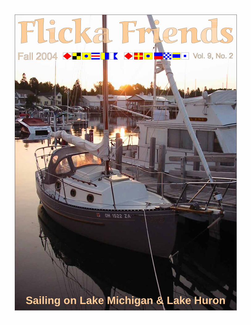
Sailing on Lake Michigan & Lake Huron

������������� �����������
������
The reflection of BEN MAIN, Jr. in the window of a gas station. Photo: Tom Davison ©
From the Editor Contents ...................................... 2 From The Editor ........................ 2 The End of Another Season ....... 3 About Flicka Friends .................. 3 Suttons Bay ................................. 4 Omena Point ............................... 5 Northport ................................... 6 Beaver Island Crossing .............. 7 Exploring Beaver Island ............. 9 Leaving Beaver Island ................ 11 Gray’s Reef / White Shoal .......... 12 Mackinac Bridge ........................ 13 Mackinac City ............................ 14 Mackinac Island ......................... 16 On to Hessel, Michigan .............. 17 Hessel, Michigan ......................... 18 Martin Reef Light ...................... 20 Heading For DeTour Passage .... 21 St. Mary’s River ......................... 22 DeTour, Michigan ..................... 23 Loading BEN MAIN, Jr. ............ 24 Back at Suttons Bay ................... 25
Contents
Sunset and s/y BEN MAIN, Jr. in Detour, Michigan. The marina is
located along the shore of the St. Mary’s River which connects
Lake Superior with Lake Huron. Photo by Tom Davison ©
Back Cover
Sunrise behind Tom Grime’s Flicka s/y BEN MAIN, Jr. docked in Hessel,
Michigan. One of the buildings in the background is Mertauh Marine, the first Chris-Craft dealership in the
United States. There are plenty of old Chris-Craft, Garwood, and other great
old mahogany boats in the area. Photo by Tom Davison ©
Front Cover
The gas mileage was OK for the Dodge truck and a V-10 engine, but we joked that the only thing this truck could not pass is a gas station.
Photo: Tom Davison ©
��������������
������
Flicka Friends is a newsletter written for the people who own, crew aboard or are interested in the Flicka, a 20 foot sailing vessel designed by Bruce P. Bingham. Based on the Newport boats of Block Island Sound, this little ship has been built from various materials since the 1970’s. This includes Flickas constructed from plans obtained directly from Bruce’s California office. About 400 sets of plans were sold. According to Bruce Bingham, many Flickas can be found in New Zealand Australia and Sweden. A number of hulls were built by Nor’star and some were completed by Westerly Marine. The manufacturer of the bulk of the class is Pacific Seacraft Corporation who built 434 hulls in California. Flicka Friends is published on a quarterly basis, with issues being mailed in March, June, September and December. Articles, letters, comments and photos relating to the Flicka are welcomed and encouraged. © Copyright 2004 Dennis Pratt/Flicka Friends Dennis Pratt - Publisher 685 Spring Street, #191 Friday Harbor, WA 98250 (360) 370-5133 [email protected] Tom Davison - Editor P.O. Box 462 Empire, MI 49630 (231) 228-7044 [email protected]
http://www.coslink.net/personal/flickafriends/mainpage/index.html
�
�
About Flicka Friends
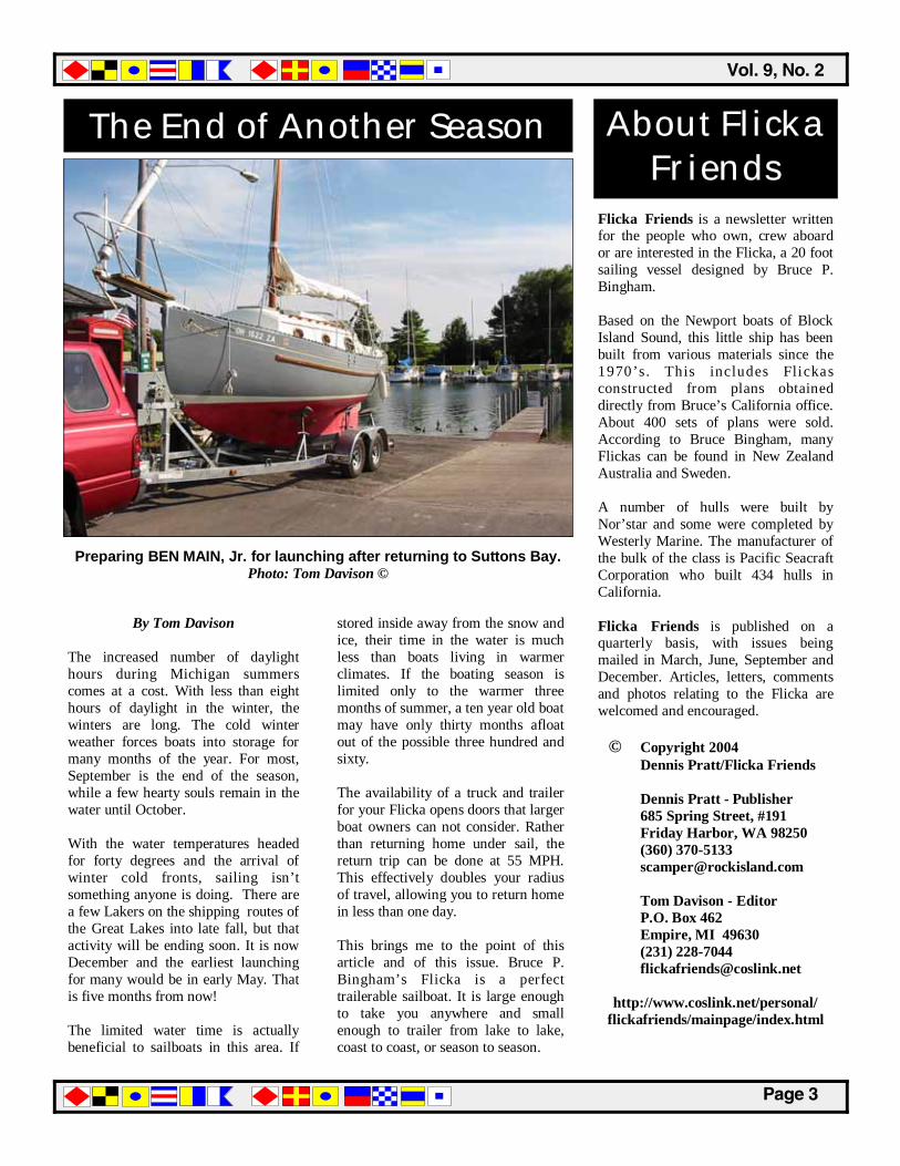
The End of Another Season
By Tom Davison The increased number of daylight hours during Michigan summers comes at a cost. With less than eight hours of daylight in the winter, the winters are long. The cold winter weather forces boats into storage for many months of the year. For most, September is the end of the season, while a few hearty souls remain in the water until October. With the water temperatures headed for forty degrees and the arrival of winter cold fronts, sailing isn’t something anyone is doing. There are a few Lakers on the shipping routes of the Great Lakes into late fall, but that activity will be ending soon. It is now December and the earliest launching for many would be in early May. That is five months from now! The limited water time is actually beneficial to sailboats in this area. If
stored inside away from the snow and ice, their time in the water is much less than boats living in warmer climates. If the boating season is limited only to the warmer three months of summer, a ten year old boat may have only thirty months afloat out of the possible three hundred and sixty. The availability of a truck and trailer for your Flicka opens doors that larger boat owners can not consider. Rather than returning home under sail, the return trip can be done at 55 MPH. This effectively doubles your radius of travel, allowing you to return home in less than one day. This brings me to the point of this article and of this issue. Bruce P. Bingham’s Flicka is a perfect trailerable sailboat. It is large enough to take you anywhere and small enough to trailer from lake to lake, coast to coast, or season to season.
Preparing BEN MAIN, Jr. for launching after returning to Suttons Bay. Photo: Tom Davison ©
������������� �����������
������
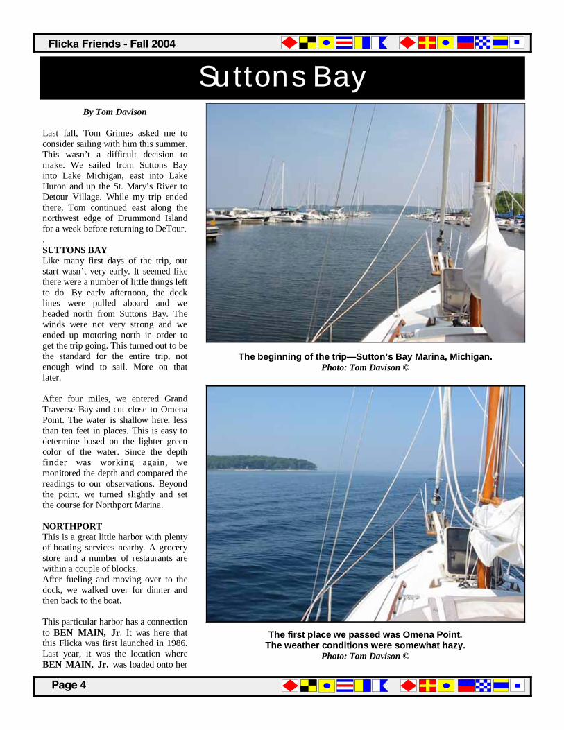
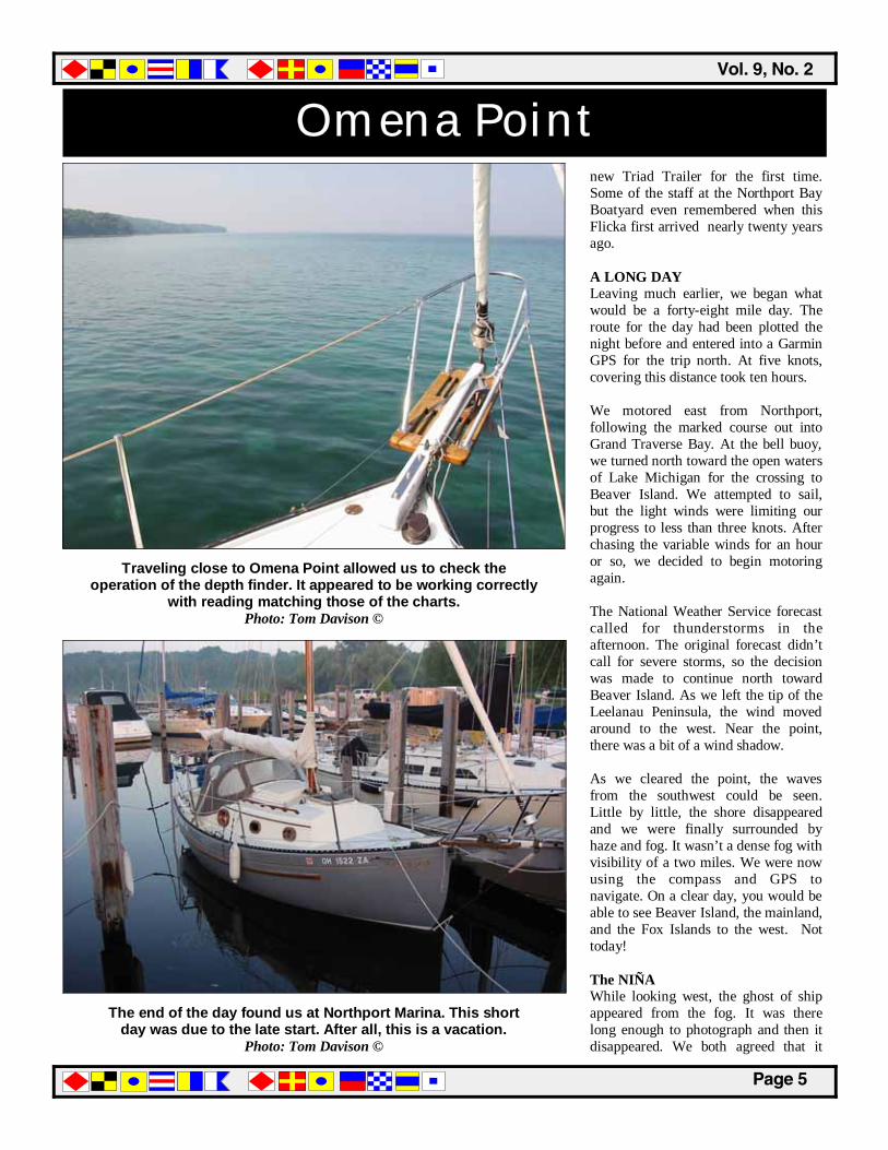
By Tom Davison Last fall, Tom Grimes asked me to consider sailing with him this summer. This wasn’t a difficult decision to make. We sailed from Suttons Bay into Lake Michigan, east into Lake Huron and up the St. Mary’s River to Detour Village. While my trip ended there, Tom continued east along the northwest edge of Drummond Island for a week before returning to DeTour. . SUTTONS BAY Like many first days of the trip, our start wasn’t very early. It seemed like there were a number of little things left to do. By early afternoon, the dock lines were pulled aboard and we headed north from Suttons Bay. The winds were not very strong and we ended up motoring north in order to get the trip going. This turned out to be the standard for the entire trip, not enough wind to sail. More on that later. After four miles, we entered Grand Traverse Bay and cut close to Omena Point. The water is shallow here, less than ten feet in places. This is easy to determine based on the lighter green color of the water. Since the depth finder was working again, we monitored the depth and compared the readings to our observations. Beyond the point, we turned slightly and set the course for Northport Marina. NORTHPORT This is a great little harbor with plenty of boating services nearby. A grocery store and a number of restaurants are within a couple of blocks. After fueling and moving over to the dock, we walked over for dinner and then back to the boat. This particular harbor has a connection to BEN MAIN, Jr. It was here that this Flicka was first launched in 1986. Last year, it was the location where BEN MAIN, Jr. was loaded onto her
Suttons Bay
The beginning of the trip—Sutton’s Bay Marina, Michigan. Photo: Tom Davison ©
The first place we passed was Omena Point. The weather conditions were somewhat hazy.
Photo: Tom Davison ©
��������������
������
Omena Point new Triad Trailer for the first time. Some of the staff at the Northport Bay Boatyard even remembered when this Flicka first arrived nearly twenty years ago. A LONG DAY Leaving much earlier, we began what would be a forty-eight mile day. The route for the day had been plotted the night before and entered into a Garmin GPS for the trip north. At five knots, covering this distance took ten hours. We motored east from Northport, following the marked course out into Grand Traverse Bay. At the bell buoy, we turned north toward the open waters of Lake Michigan for the crossing to Beaver Island. We attempted to sail, but the light winds were limiting our progress to less than three knots. After chasing the variable winds for an hour or so, we decided to begin motoring again. The National Weather Service forecast called for thunderstorms in the afternoon. The original forecast didn’t call for severe storms, so the decision was made to continue north toward Beaver Island. As we left the tip of the Leelanau Peninsula, the wind moved around to the west. Near the point, there was a bit of a wind shadow. As we cleared the point, the waves from the southwest could be seen. Little by little, the shore disappeared and we were finally surrounded by haze and fog. It wasn’t a dense fog with visibility of a two miles. We were now using the compass and GPS to navigate. On a clear day, you would be able to see Beaver Island, the mainland, and the Fox Islands to the west. Not today! The NIÑA While looking west, the ghost of ship appeared from the fog. It was there long enough to photograph and then it disappeared. We both agreed that it
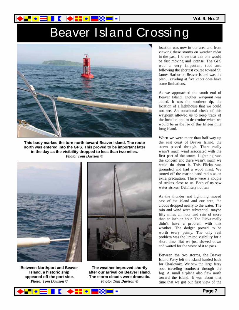
The end of the day found us at Northport Marina. This short day was due to the late start. After all, this is a vacation.
Photo: Tom Davison ©
Traveling close to Omena Point allowed us to check the operation of the depth finder. It appeared to be working correctly
with reading matching those of the charts. Photo: Tom Davison ©

������������� �����������
������
Northport could be the Niña, a replica of the smallest of Christopher Columbus’s fleet that crossed the Atlantic in 1492. Since the sails were furled, they had to be using a more modern means of propulsion. They didn’t answer a hail on the marina band. The fog also prevented us was seeing two islands to the southwest: South Fox and North Fox. Both are located southwest of Beaver Island. Note: After returning home, I checked their webpage (www.thenina.com) to confirm their location. They were traveling between Port Huron and St. Joseph, Michigan. After the trip, I stopped by the Niña in Traverse City for a visit. This would be her last trip to the Great Lakes. The Niña will be moving to Puerto Vallarta this fall and will be permanently based there after thirteen years of sailing. One of the crew told me that the Nina could reach eleven knots on a reach with the main sail. Impressive to say the least. THUNDERSTORM The weather forecast called for thunderstorms along a certain line on the Michigan mainland. This initially sounded like it would be well south of our position and the decision was made to continue north to Beaver Island. The alternate would have been to detour into Charlevoix, Michigan. This proved to be a mistake later in the day. Determining the location of the thunderstorms was made more difficult due to the simple fact that the National Weather Service was using land based locations. Some of the town names were unknown to us and this made the decision more difficult to make. While we had all chartbooks and charts for the entire area, the one thing we didn’t have with us was a Michigan road map. We continued north to the sound of the weather service adjusting the forecast to include severe thunderstorms. The
Red sky in the morning, maybe we should have paid attention to this. The beginning of a hazy day on the waters of Lake Michigan.
Photo: Tom Davison ©
As the sun begins to burn off the dew, it is time to head out. With forty miles ahead of us, time would be a factor.
Photo: Tom Davison ©
��������������
������
Beaver Island Crossing location was now in our area and from viewing these storms on weather radar in the past, I knew that this one would be fast moving and intense. The GPS was a very important tool and following the shortest course toward St. James Harbor on Beaver Island was the plan. Traveling at five knots does have some limitations. As we approached the south end of Beaver Island, another waypoint was added. It was the southern tip, the location of a lighthouse that we could not see. An occasional check of this waypoint allowed us to keep track of the location and to determine when we would be in the lee of this fifteen mile long island. When we were more than half-way up the east coast of Beaver Island, the storm passed through. There really wasn’t much wind associated with the first part of the storm. Lightning was the concern and there wasn’t much we could do about it. This Flicka was grounded and had a wood mast. We turned off the marine band radio as an extra precaution. There were a couple of strikes close to us. Both of us saw water strikes. Definitely not fun. As the thunder and lightning moved east of the island and our area, the clouds dropped nearly to the water. The rain and wind were substantial, maybe fifty miles an hour and rain of more than an inch an hour. The Flicka really didn’t have a problem with this weather. The dodger proved to be worth every penny. The only real problem was the limited visibility for a short time. But we just slowed down and waited for the worst of it to pass. Between the two storms, the Beaver Island Ferry left the island headed back for Charlevoix. We saw the large ferry boat traveling southeast through the fog. A small airplane also flew north toward the island. It was about that time that we got our first view of the
Between Northport and Beaver Island, a historic ship
appeared off the port side. Photo: Tom Davison ©
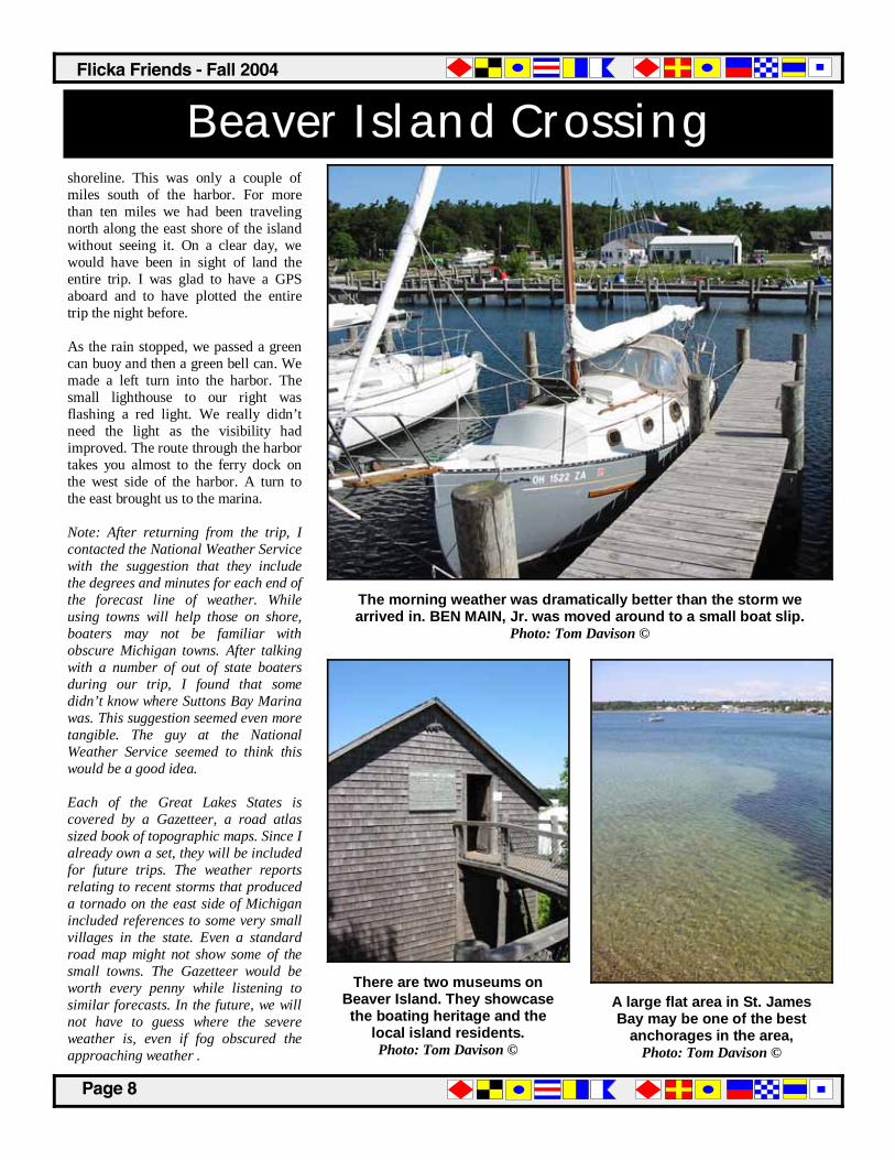
This buoy marked the turn north toward Beaver Island. The route north was entered into the GPS. This proved to be important later
in the day as the visibility dropped to less than two miles. Photo: Tom Davison ©
The weather improved shortly after our arrival on Beaver Island. The storm clouds were dramatic.
Photo: Tom Davison ©
������������� �����������
������
Beaver Island Crossing shoreline. This was only a couple of miles south of the harbor. For more than ten miles we had been traveling north along the east shore of the island without seeing it. On a clear day, we would have been in sight of land the entire trip. I was glad to have a GPS aboard and to have plotted the entire trip the night before. As the rain stopped, we passed a green can buoy and then a green bell can. We made a left turn into the harbor. The small lighthouse to our right was flashing a red light. We really didn’t need the light as the visibility had improved. The route through the harbor takes you almost to the ferry dock on the west side of the harbor. A turn to the east brought us to the marina. Note: After returning from the trip, I contacted the National Weather Service with the suggestion that they include the degrees and minutes for each end of the forecast line of weather. While using towns will help those on shore, boaters may not be familiar with obscure Michigan towns. After talking with a number of out of state boaters during our trip, I found that some didn’t know where Suttons Bay Marina was. This suggestion seemed even more tangible. The guy at the National Weather Service seemed to think this would be a good idea. Each of the Great Lakes States is covered by a Gazetteer, a road atlas sized book of topographic maps. Since I already own a set, they will be included for future trips. The weather reports relating to recent storms that produced a tornado on the east side of Michigan included references to some very small villages in the state. Even a standard road map might not show some of the small towns. The Gazetteer would be worth every penny while listening to similar forecasts. In the future, we will not have to guess where the severe weather is, even if fog obscured the approaching weather .
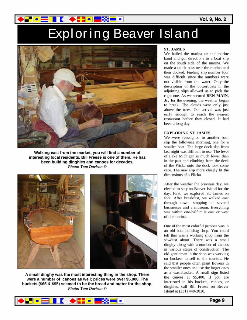
The morning weather was dramatically better than the storm we arrived in. BEN MAIN, Jr. was moved around to a small boat slip.
Photo: Tom Davison ©
There are two museums on Beaver Island. They showcase the boating heritage and the
local island residents. Photo: Tom Davison ©
A large flat area in St. James Bay may be one of the best
anchorages in the area, Photo: Tom Davison ©
��������������
������
Exploring Beaver Island ST. JAMES We hailed the marina on the marine band and got directions to a boat slip on the south side of the marina. We made a quick pass near the marina and then docked. Finding slip number four was difficult since the numbers were not visible from the water. Only the description of the powerboats in the adjoining slips allowed us to pick the right one. As we secured BEN MAIN, Jr. for the evening, the weather began to break. The clouds were only just above the trees. Our arrival was just early enough to reach the nearest restaurant before they closed. It had been a long day. EXPLORING ST. JAMES We were reassigned to another boat slip the following morning, one for a smaller boat. The large dock slip from last night was difficult to use. The level of Lake Michigan is much lower than in the past and climbing from the deck of the Flicka onto the dock took some care. The new slip more closely fit the dimensions of a Flicka. After the weather the previous day, we elected to stay on Beaver Island for the day. First, we explored St. James on foot. After breakfast, we walked east through town, stopping at several businesses and a museum. Everything was within one-half mile east or west of the marina. One of the most colorful persons was in an old boat building shop. You could tell this was a working shop from the sawdust about. There was a small dinghy along with a number of canoes in various states of construction. The old gentleman in the shop was working on buckets to sell to the tourists. He said that people often plant flowers in the smaller ones and use the larger ones as a wastebasket. A small sign listed the canoes at $5,400. If you are interested in his buckets, canoes, or dinghies, call Bill Freese on Beaver Island at (231) 448-2810.
A small dinghy was the most interesting thing in the shop. There were a number of canoes as well; prices were over $5,000. The
buckets ($65 & $95) seemed to be the bread and butter for the shop. Photo: Tom Davison ©
Walking east from the market, you will find a number of interesting local residents. Bill Freese is one of them. He has
been building dinghies and canoes for decades. Photo: Tom Davison ©
������������� �����������
�������
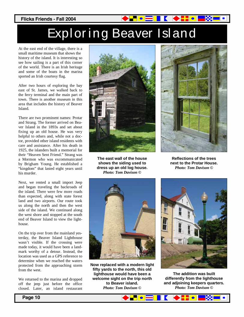
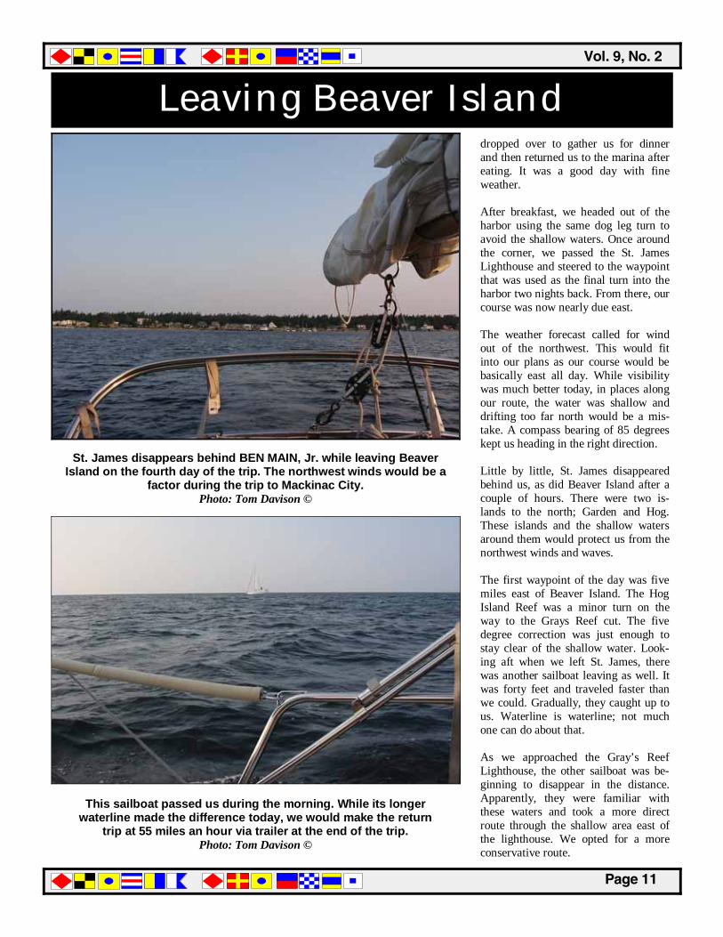
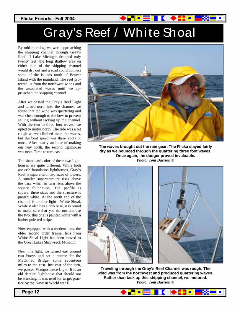
Exploring Beaver Island At the east end of the village, there is a small maritime museum that shows the history of the island. It is interesting so see how sailing is a part of this corner of the world. There is an Irish heritage and some of the boats in the marina sported an Irish courtesy flag. After two hours of exploring the bay east of St. James, we walked back to the ferry terminal and the main part of town. There is another museum in this area that includes the history of Beaver Island. There are two prominent names: Protar and Strang. The former arrived on Bea-ver Island in the 1893s and set about fixing up an old house. He was very helpful to others and, while not a doc-tor, provided other island residents with care and assistance. After his death in 1925, the islanders built a memorial for their “Heaven Sent Friend.” Strang was a Mormon who was excommunicated by Brigham Young. He established a “kingdom” that lasted eight years until his murder. Next, we rented a small import Jeep and began traveling the backroads of the island. There were few more roads than expected, along with state forest land and two airports. Our route took us along the north and then the west side of the island. We continued along the west shore and stopped at the south end of Beaver Island to view the light-house. On the trip over from the mainland yes-terday, the Beaver Island Lighthouse wasn’t visible. If the crossing were made today, it would have been a land-mark worthy of a detour. Instead, the location was used as a GPS reference to determine when we reached the waters protected from the approaching storm from the west. We returned to the marina and dropped off the jeep just before the office closed. Later, an island restaurant
The east wall of the house shows the siding used to
dress up an old log house. Photo: Tom Davison ©
Now replaced with a modern light fifty yards to the north, this old lighthouse would have been a
welcome sight on the trip north to Beaver island.
Photo: Tom Davison ©
Reflections of the trees next to the Protar House.
Photo: Tom Davison ©
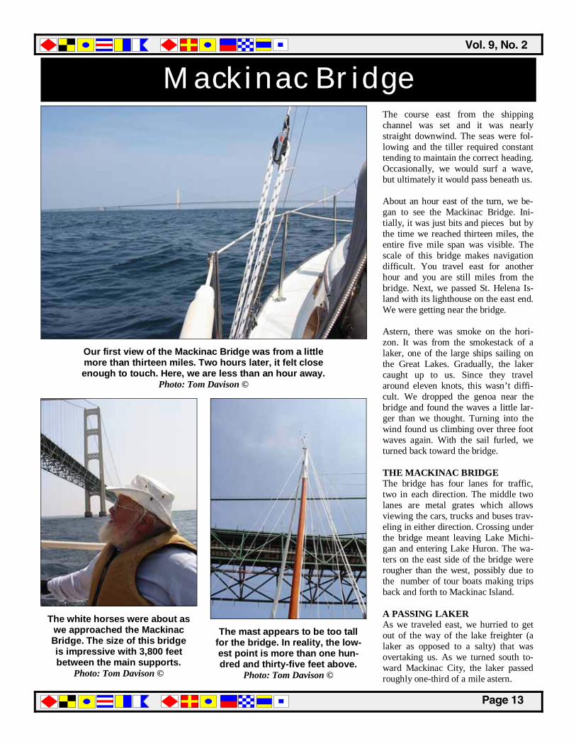
The addition was built differently from the lighthouse
and adjoining keepers quarters. Photo: Tom Davison ©
��������������
�������
Leaving Beaver Island
This sailboat passed us during the morning. While its longer waterline made the difference today, we would make the return
trip at 55 miles an hour via trailer at the end of the trip. Photo: Tom Davison ©
St. James disappears behind BEN MAIN, Jr. while leaving Beaver Island on the fourth day of the trip. The northwest winds would be a
factor during the trip to Mackinac City. Photo: Tom Davison ©
dropped over to gather us for dinner and then returned us to the marina after eating. It was a good day with fine weather. After breakfast, we headed out of the harbor using the same dog leg turn to avoid the shallow waters. Once around the corner, we passed the St. James Lighthouse and steered to the waypoint that was used as the final turn into the harbor two nights back. From there, our course was now nearly due east. The weather forecast called for wind out of the northwest. This would fit into our plans as our course would be basically east all day. While visibility was much better today, in places along our route, the water was shallow and drifting too far north would be a mis-take. A compass bearing of 85 degrees kept us heading in the right direction. Little by little, St. James disappeared behind us, as did Beaver Island after a couple of hours. There were two is-lands to the north; Garden and Hog. These islands and the shallow waters around them would protect us from the northwest winds and waves. The first waypoint of the day was five miles east of Beaver Island. The Hog Island Reef was a minor turn on the way to the Grays Reef cut. The five degree correction was just enough to stay clear of the shallow water. Look-ing aft when we left St. James, there was another sailboat leaving as well. It was forty feet and traveled faster than we could. Gradually, they caught up to us. Waterline is waterline; not much one can do about that. As we approached the Gray’s Reef Lighthouse, the other sailboat was be-ginning to disappear in the distance. Apparently, they were familiar with these waters and took a more direct route through the shallow area east of the lighthouse. We opted for a more conservative route.
������������� �����������
�������
Gray’s Reef / White Shoal By mid-morning, we were approaching the shipping channel through Grey’s Reef. If Lake Michigan dropped only twenty feet, the long shallow area on either side of the shipping channel would dry out and a road could connect some of the islands north of Beaver Island with the mainland. The reef pro-tected us from the northwest winds and the associated waves until we ap-proached the shipping channel. After we passed the Gray’s Reef Light and turned north into the channel, we found that the wind was quartering and was close enough to the bow to prevent sailing without tacking up the channel. With the two to three foot waves, we opted to motor north. The ride was a bit rough as we climbed over the waves, but the boat speed was three knots or more. After nearly an hour of making our way north, the second lighthouse was near. Time to turn east. The shape and color of these two light-houses are quite different. While both are crib foundation lighthouses, Gray’s Reef is square with two sizes of towers. A smaller superstructure rises above the base which in turn rises above the square foundation. The profile is square, three sizes and the structure is panted white. At the north end of the channel is another light—White Shoal. While it also has a crib base, it is round to make sure that you do not confuse the two; this one is painted white with a barber pole red stripe. Now equipped with a modern lens, the older second order fresnel lens from White Shoal Light has been moved to the Great Lakes Shipwreck Museum. Near this light, we turned east around two buoys and set a course for the Mackinac Bridge, some seventeen miles to the east. Just east of the turn, we passed Waugoshance Light. It is an old derelict lighthouse that should not be standing. It was used for target prac-tice by the Navy in World war II.
The waves brought out the rain gear. The Flicka stayed fairly dry as we bounced through the quartering three foot waves.
Once again, the dodger proved invaluable. Photo: Tom Davison ©
Traveling through the Gray’s Reef Channel was rough. The wind was from the northwest and produced quartering waves.
Rather than tack up this shipping channel, we motored. Photo: Tom Davison ©
��������������
�������
Mackinac Bridge The course east from the shipping channel was set and it was nearly straight downwind. The seas were fol-lowing and the tiller required constant tending to maintain the correct heading. Occasionally, we would surf a wave, but ultimately it would pass beneath us. About an hour east of the turn, we be-gan to see the Mackinac Bridge. Ini-tially, it was just bits and pieces but by the time we reached thirteen miles, the entire five mile span was visible. The scale of this bridge makes navigation difficult. You travel east for another hour and you are still miles from the bridge. Next, we passed St. Helena Is-land with its lighthouse on the east end. We were getting near the bridge. Astern, there was smoke on the hori-zon. It was from the smokestack of a laker, one of the large ships sailing on the Great Lakes. Gradually, the laker caught up to us. Since they travel around eleven knots, this wasn’t diffi-cult. We dropped the genoa near the bridge and found the waves a little lar-ger than we thought. Turning into the wind found us climbing over three foot waves again. With the sail furled, we turned back toward the bridge. THE MACKINAC BRIDGE The bridge has four lanes for traffic, two in each direction. The middle two lanes are metal grates which allows viewing the cars, trucks and buses trav-eling in either direction. Crossing under the bridge meant leaving Lake Michi-gan and entering Lake Huron. The wa-ters on the east side of the bridge were rougher than the west, possibly due to the number of tour boats making trips back and forth to Mackinac Island. A PASSING LAKER As we traveled east, we hurried to get out of the way of the lake freighter (a laker as opposed to a salty) that was overtaking us. As we turned south to-ward Mackinac City, the laker passed roughly one-third of a mile astern.
Our first view of the Mackinac Bridge was from a little more than thirteen miles. Two hours later, it felt close enough to touch. Here, we are less than an hour away.
Photo: Tom Davison ©
The white horses were about as we approached the Mackinac Bridge. The size of this bridge is impressive with 3,800 feet between the main supports.
Photo: Tom Davison ©
The mast appears to be too tall for the bridge. In reality, the low-est point is more than one hun-dred and thirty-five feet above.
Photo: Tom Davison ©
������������� �����������
�������
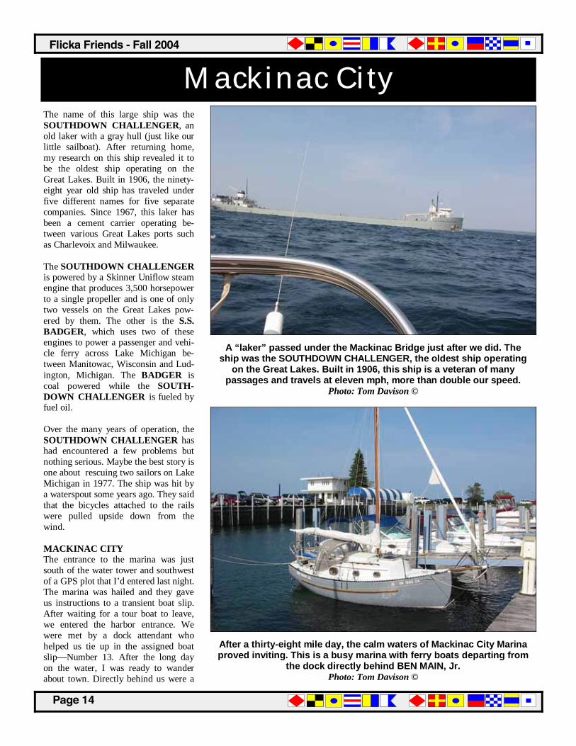
Mackinac City The name of this large ship was the SOUTHDOWN CHALLENGER, an old laker with a gray hull (just like our little sailboat). After returning home, my research on this ship revealed it to be the oldest ship operating on the Great Lakes. Built in 1906, the ninety-eight year old ship has traveled under five different names for five separate companies. Since 1967, this laker has been a cement carrier operating be-tween various Great Lakes ports such as Charlevoix and Milwaukee. The SOUTHDOWN CHALLENGER is powered by a Skinner Uniflow steam engine that produces 3,500 horsepower to a single propeller and is one of only two vessels on the Great Lakes pow-ered by them. The other is the S.S. BADGER, which uses two of these engines to power a passenger and vehi-cle ferry across Lake Michigan be-tween Manitowac, Wisconsin and Lud-ington, Michigan. The BADGER is coal powered while the SOUTH-DOWN CHALLENGER is fueled by fuel oil. Over the many years of operation, the SOUTHDOWN CHALLENGER has had encountered a few problems but nothing serious. Maybe the best story is one about rescuing two sailors on Lake Michigan in 1977. The ship was hit by a waterspout some years ago. They said that the bicycles attached to the rails were pulled upside down from the wind. MACKINAC CITY The entrance to the marina was just south of the water tower and southwest of a GPS plot that I’d entered last night. The marina was hailed and they gave us instructions to a transient boat slip. After waiting for a tour boat to leave, we entered the harbor entrance. We were met by a dock attendant who helped us tie up in the assigned boat slip—Number 13. After the long day on the water, I was ready to wander about town. Directly behind us were a
A “laker” passed under the Mackinac Bridge just after we did. The ship was the SOUTHDOWN CHALLENGER, the oldest ship operating
on the Great Lakes. Built in 1906, this ship is a veteran of many passages and travels at eleven mph, more than double our speed.
Photo: Tom Davison ©
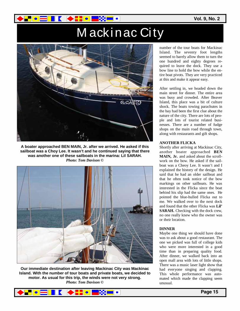
After a thirty-eight mile day, the calm waters of Mackinac City Marina proved inviting. This is a busy marina with ferry boats departing from
the dock directly behind BEN MAIN, Jr. Photo: Tom Davison ©
��������������
�������
Mackinac City number of the tour boats for Mackinac Island. The seventy foot lengths seemed to barely allow them to turn the one hundred and eighty degrees re-quired to leave the dock. They use a bow line to hold the bow while the en-tire boat pivots. They are very practiced at this and make it appear easy. After settling in, we headed down the main street for dinner. The entire area was busy and crowded. After Beaver Island, this place was a bit of culture shock. The boats towing parachutes in the bay had been the first clue about the nature of the city. There are lots of peo-ple and lots of tourist related busi-nesses. There are a number of fudge shops on the main road through town, along with restaurants and gift shops. ANOTHER FLICKA Shortly after arriving at Mackinac City, another boater approached BEN MAIN, Jr. and asked about the scroll-work on the bow. He asked if the sail-boat was a Cheoy Lee. It wasn’t and I explained the history of the design. He said that he had an older sailboat and that he often took notice of the bow markings on other sailboats. He was interested in the Flicka since the boat behind his slip had the same ones. He pointed the blue-hulled Flicka out to me. We walked over to the next dock and found that the other Flicka was Lil’ SARAH. Checking with the dock crew, no one really knew who the owner was or their location. DINNER Maybe one thing we should have done was to ask about a good restaurant. The one we picked was full of college kids who were more interested in a good time than in preparing quality food. After dinner, we walked back into an open mall area with lots of little shops. There was a music laser light show that had everyone singing and clapping. This whole performance was auto-mated which made the clapping seem unusual.
Our immediate destination after leaving Mackinac City was Mackinac Island. With the number of tour boats and private boats, we decided to
motor. As usual for this trip, the winds were not very strong. Photo: Tom Davison ©
A boater approached BEN MAIN, Jr. after we arrived. He asked if this sailboat was a Choy Lee. It wasn’t and he continued saying that there
was another one of these sailboats in the marina: Lil SARAH. Photo: Tom Davison ©
������������� �����������
�������
Mackinac Island The trip over to Mackinac Island from Mackinac City was done under power. Besides being a shipping channel, three tour boat companies race to and from this island on a short schedule. Being able to move around their wakes meant using the engine. Besides, the winds were not favorable. Most of the tour boats seemed to travel along the ferry route shown on the NOAA chart. This put them around the east side of Majors Reef. So, our course was around the opposite side. As you might guess, this area had the most ves-sel traffic of the entire trip. While it was easy to stay away from the larger vessels, keeping a good watch was im-portant. MACKINAC ISLAND As we approached Mackinac Island, we heard another sailboat hail the Macki-nac Marina on the marine radio to re-quest a boat slip for lunch. The marina responded that none were available. Since we both had been to Mackinac Island before, we planned to bypass the island altogether. I did want to make quick loop through the harbor for a brief look. With limited dock space, we could have opted to take one of the fer-ryboats over to the island the evening before. Ferryboats returned from the island late into the evening. CRUISE SHIP The harbor was crowded and passenger ferryboats were arriving and departing quickly. Looking over your shoulder was a good idea. The passenger ship ORION was easily the largest vessel present. At 337’ LOA, a 46’ beam, and a 12’ draft, I’m sure that getting into this little harbor would have been something to watch. With a crew of 70, they almost outnumber the 106 passen-gers aboard. The service should be great at $4,500 to $10,000 for an eight day trip. After a quick visit through the harbor, we turned and headed northeast again.
Another boatload of tourists arriving at Mackinac Island. Because of all the fudge produced in small shops around the harbor, the local residents refer to the tourists as “Fudgies.”
Photo: Tom Davison ©
The fort protected the harbor during the War of 1812. The British landed on the other side of the island and took the fort without a fight.
Photo: Tom Davison ©
The largest vessel in the harbor was the Canadian based Orion. At 337 feet, this passenger ship was the largest in the harbor.
Photo: Tom Davison ©
��������������
�������
On To Hessel, Michigan As we moved east from the marina, the boat traffic dropped considerably. Ex-cept for a couple of small fishing boats, the path was clear once again. At first, we were in the wind shadow of Macki-nac Island. While we initially thought we could sail once clear of the island, the wind continued to drop. The wind was nearly zero, making this portion of the trip the warmest. Sun block and hats were in order. THUNDERSTORMS The weather report included isolated thunderstorms in our area. After the events of a couple of days back, we didn’t want to repeat the encounter with a storm. As it turned out, the larg-est thunder-boomer appeared to be building above our destination. We pressed on under diesel power and motor-sailing hoping to reach the West Entrance of Les Cheneaux Islands be-fore the weather did. The distance cov-ered today was 16 miles with 9.1 miles lying between Mackinac Island and the West Entrance into Les Cheneaux Is-land. WEST ENTRANCE Two hours after leaving Mackinac Is-land, we entered the West Entrance. There is a long shallow point that ex-tends half way across the entrance be-tween Brulee and Coats Points. The first green can marked the corner. Given all the warnings from other boat-ers about the “thin” water on the ap-proach to Hessel, we followed the buoys carefully. One unusual sight along the way in was a wood block house located on a small point to the southeast. This wood his-torical appearing structure would have been used to defend yourself from at-tack. Maybe the tourists must be re-pelled at times. After finding that the marina was very easy to reach, I had to wonder how well the power boater could read charts. Our arrival in Hessel took a little bit less than five hours.
A number of boaters commented about the difficult approach into the marina at Hessel, Michigan. If you have a chart and follow the buoys,
navigation is a simple task. The shallow areas are easy to miss. Photo: Tom Davison ©
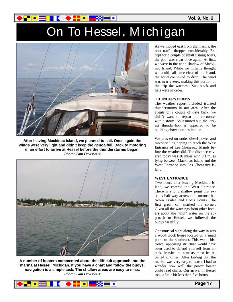
After leaving Mackinac Island, we planned to sail. Once again the winds were very light and didn’t keep the genoa full. Back to motoring
in an effort to arrive at Hessel before the thunderstorms began. Photo: Tom Davison ©

������������� �����������
�������
Hessel, Michigan After radioing the Hessel marina, we were immediately directed to a vacant transient boat slip, number 13 again. Several of the marina crew were there to assist. Next to us was a Grand Banks trawler owned by an older couple from the lower peninsula of Michigan. This was their 27th summer in Hessel. This looked like a great place to spend your summers while the rest of the world was busy hurrying about. The rest of the day was spent looking about the marina, dining out, and gen-erally enjoying the simple fact that we didn’t have to be anywhere in particu-lar. A couple of marina chairs provided us with a perfect vantage point to watch the comings and goings of the boats of the marina. This might be boring in other cruising areas but there were plenty of old classic powerboats to see. The number of Chris-Craft, Garwood and other old mahogany powerboats here is higher than just about any other location. These beautiful powerboats seem to be the standard mode of transportation for many of the people living on the thirty-four of the thirty-six islands in Les Cheneaux Islands. The other two is-lands are connected to the mainland by roads and bridges. Hessel Marina is the location of a large wooden boat show on the second Satur-day in August each year. The marina doesn’t accept reservations for boat slips during this event and all of the available space is taken up by these beautiful old mahogany wood power-boats. There are a few sailboats attend-ing as well. The next morning, we walked through town, up to the corner and east along the road to reach the local bakery. Along the way back, we stopped at a sign shop. While they specialize in boat names, they appear to cover a wide range of art including the posters used to announce the wooden boat show.
We settled into a boat slip in the southwestern corner of Hessel Marina next to an older Grand Banks trawler. After talking with our
neighbors, I found that this was their twenty-seventh year at Hessel. Photo: Tom Davison ©
BEN MAIN, Jr. was assigned a transient slip in the corner
of the marina. After Mackinac City, this was a welcome change.
Photo: Tom Davison ©
Sunset from Hessel Marina in Les Cheneaux Island, a quiet
place to watch the world. Photo: Tom Davison ©
��������������
�������
Hessel, Michigan After another stop at a bookstore, we were back at the marina. This had been a great day. CEDARVILLE, MICHIGAN One of the marina crew was headed east toward Cedarville and offered us a ride to the boat museum. We accepted and spent an hour wandering through the various exhibits and into their ship-building area. They were raffling a fine little rowing shell built at the museum. The museum had a range of craft on display, including an early Old Town boat for duck hunting. We walked back into Cedarville and down to the marina. We just missed the closing time of the second museum. Continuing down to the water, we stopped to take a look at the marina and launch ramp. Cedarville seemed to be a bit busier than Hessel. The ride back was via taxi and the rates were based on moving merchant mari-ners from one port to another. That ap-peared to be the taxi’s main source of income. Just east of Cedarville, there is a dolomite mining operation with a large ship loading dock. Back in Hessel, we settled in for an-other lazy evening. After dinner, we enjoyed watching the marina and the sunset. We talked with a few other boaters, including the owners of a Pa-cific Seacraft Orion that had recently been shipped from Washington State. It was a nice looking sailboat. Just after sunset, I worked on the route for the next day. The route was plotted and then entered into the G.P.S. While the weather forecast didn’t seem to call for G.P.S. navigation, the waypoint en-try gave us the total mileage for the day. This allowed us to select the start-ing time for the following day. Nothing complicated, but a lot of toggling to fill in the names and numbers for each waypoint. A laptop computer would make this much faster.
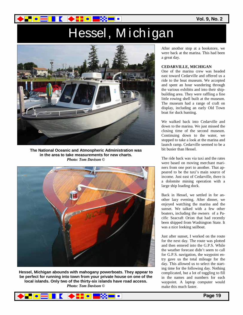
The National Oceanic and Atmospheric Administration was in the area to take measurements for new charts.
Photo: Tom Davison ©
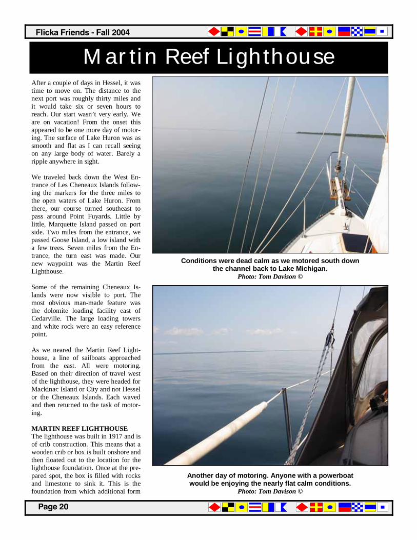
Hessel, Michigan abounds with mahogany powerboats. They appear to be perfect for running into town from your private house on one of the
local islands. Only two of the thirty-six islands have road access. Photo: Tom Davison ©
������������� �����������
�������
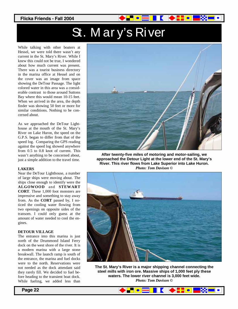
Martin Reef Lighthouse After a couple of days in Hessel, it was time to move on. The distance to the next port was roughly thirty miles and it would take six or seven hours to reach. Our start wasn’t very early. We are on vacation! From the onset this appeared to be one more day of motor-ing. The surface of Lake Huron was as smooth and flat as I can recall seeing on any large body of water. Barely a ripple anywhere in sight. We traveled back down the West En-trance of Les Cheneaux Islands follow-ing the markers for the three miles to the open waters of Lake Huron. From there, our course turned southeast to pass around Point Fuyards. Little by little, Marquette Island passed on port side. Two miles from the entrance, we passed Goose Island, a low island with a few trees. Seven miles from the En-trance, the turn east was made. Our new waypoint was the Martin Reef Lighthouse. Some of the remaining Cheneaux Is-lands were now visible to port. The most obvious man-made feature was the dolomite loading facility east of Cedarville. The large loading towers and white rock were an easy reference point. As we neared the Martin Reef Light-house, a line of sailboats approached from the east. All were motoring. Based on their direction of travel west of the lighthouse, they were headed for Mackinac Island or City and not Hessel or the Cheneaux Islands. Each waved and then returned to the task of motor-ing. MARTIN REEF LIGHTHOUSE The lighthouse was built in 1917 and is of crib construction. This means that a wooden crib or box is built onshore and then floated out to the location for the lighthouse foundation. Once at the pre-pared spot, the box is filled with rocks and limestone to sink it. This is the foundation from which additional form
Conditions were dead calm as we motored south down the channel back to Lake Michigan.
Photo: Tom Davison ©
Another day of motoring. Anyone with a powerboat would be enjoying the nearly flat calm conditions.
Photo: Tom Davison ©

��������������
�������
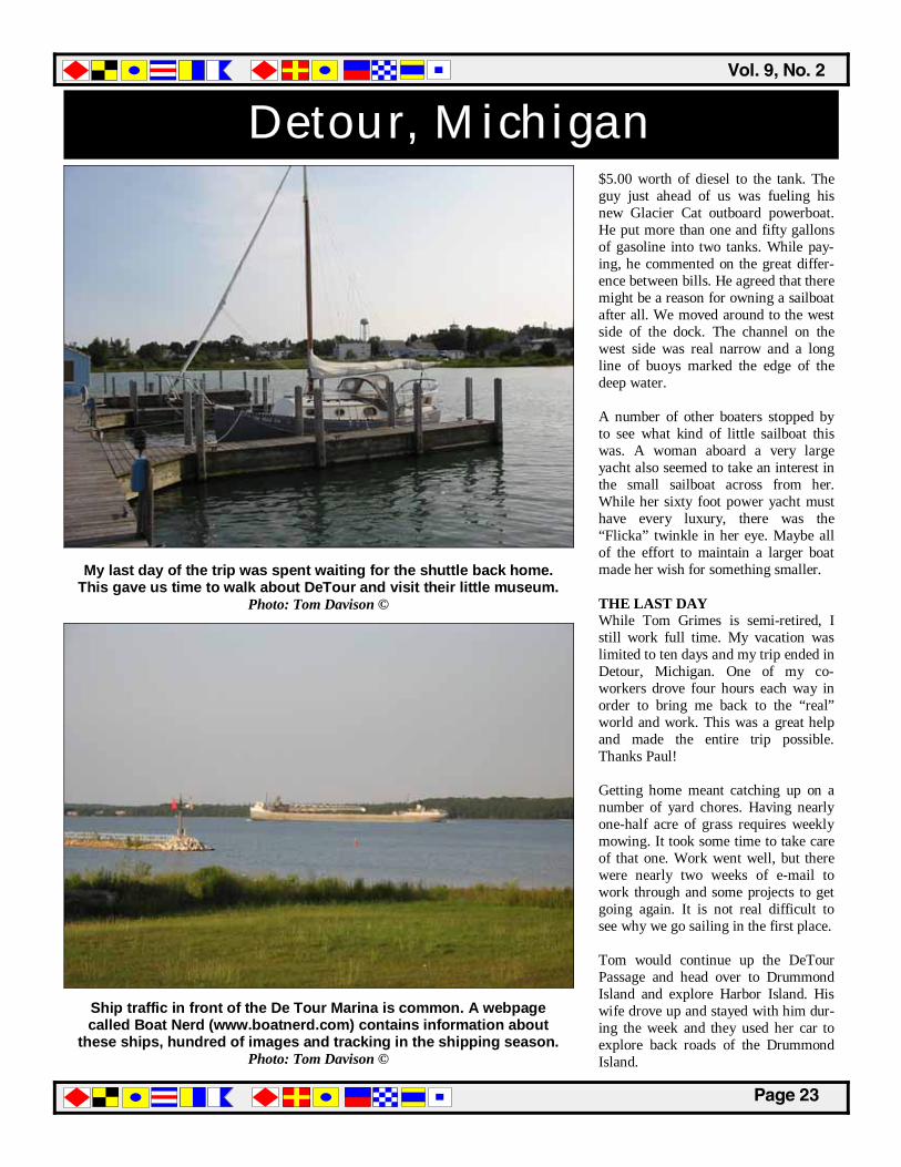
Heading for Detour Passage walls are built and the concrete is added. Crib construction was used in number of the lights we passed on this trip, including Grey’s Reef, White Shoal, Martin’s Reef and DeTour Pas-sage. The museum in Cedarville sold a small book about the construction of the Mar-tins Reef lighthouse. The author was ten years old at the time of construction and was asked to prepare the book late in his life to insure that the story of the construction was not lost. He was the son of the project foreman. Along our route, we passed fifteen lighthouses. Weather obscured a couple of them. The lighthouse list included: • Old Mission Point—1870 • Grand Traverse—1853 • South Fox Island—1868 • Beaver Island—1852 • St. James—1856 • Ile aux Galets—1888 • Gray’s Reef—1936 • White Shoal—1910 • Waugoshance—1851 • St. Helena—1873 • McGulpin Point—1869 • Old Mackinac Point—1892 • Round Island—1896 • Martin’s Reef—1927 • DeTour Lighthouse—1931 Some of the lighthouses were not here when the SOUTHDOWN CHAL-LENGER began sailing these waters. The LV57 was anchored Grays Reef, from 1891 to 1923. The winds picked up a little east of the lighthouse and the genoa was set. It added roughly one knot of speed. Still, the next ten miles were slow. Not much to do but maintain the heading. A few powerboats caught up to us and there were some ships in the area. For me, tomorrow was the end of the trip and I was content to travel eastward aboard a Flicka.
All of the other sailboats were motoring or motor-sailing today. The winds were too light and in the wrong direction for any sailing.
Motor...motor...motor! Photo: Tom Davison ©
As we neared the Martin Reef Lighthouse, the winds picked
up enough to allow the genoa to be unfurled for motor sailing.
Photo: Tom Davison ©
After the Martin Reef Lighthouse, the light wind allowed for nearly
an extra knot of speed. Photo: Tom Davison ©
������������� �����������
�������
St. Mary’s River While talking with other boaters at Hessel, we were told there wasn’t any current in the St. Mary’s River. While I knew this could not be true, I wondered about how much current was present. There was a tourist business directory in the marina office at Hessel and on the cover was an image from space showing the DeTour Passage. The light colored water in this area was a consid-erable contrast to those around Suttons Bay where this would mean 10-15 feet. When we arrived in the area, the depth finder was showing 50 feet or more for similar conditions. Nothing to be con-cerned about. As we approached the DeTour Light-house at the mouth of the St. Mary’s River on Lake Huron, the speed on the G.P.S. began to differ from that of the speed log. Comparing the GPS reading against the speed log showed anywhere from 0.5 to 0.8 knot of current. This wasn’t anything to be concerned about, just a simple addition to the travel time. LAKERS Near the DeTour Lighthouse, a number of large ships were moving about. The ships close enough to identify were the ALGOWOOD and STEWART CORT. These 1,000 foot monsters are impressive and something to stay away from. As the CORT passed by, I no-ticed the cooling water flowing from two openings on opposite sides of the transom. I could only guess at the amount of water needed to cool the en-gines. DETOUR VILLAGE The entrance into this marina is just north of the Drummond Island Ferry dock on the west shore of the river. It is a modern marina with a large stone breakwall. The launch ramp is south of the entrance, the marina and fuel docks were to the north. Reservations were not needed as the dock attendant said they rarely fill. We decided to fuel be-fore heading to the transient boat dock. While fueling, we added less than
After twenty-five miles of motoring and motor-sailing, we approached the Detour Light at the lower end of the St. Mary’s
River. This river flows from Lake Superior into Lake Huron. Photo: Tom Davison ©
The St. Mary’s River is a major shipping channel connecting the steel mills with iron ore. Massive ships of 1,000 feet ply these
waters. The lower river channel is 3,000 feet wide. Photo: Tom Davison ©
��������������
�������
Detour, Michigan $5.00 worth of diesel to the tank. The guy just ahead of us was fueling his new Glacier Cat outboard powerboat. He put more than one and fifty gallons of gasoline into two tanks. While pay-ing, he commented on the great differ-ence between bills. He agreed that there might be a reason for owning a sailboat after all. We moved around to the west side of the dock. The channel on the west side was real narrow and a long line of buoys marked the edge of the deep water. A number of other boaters stopped by to see what kind of little sailboat this was. A woman aboard a very large yacht also seemed to take an interest in the small sailboat across from her. While her sixty foot power yacht must have every luxury, there was the “Flicka” twinkle in her eye. Maybe all of the effort to maintain a larger boat made her wish for something smaller. THE LAST DAY While Tom Grimes is semi-retired, I still work full time. My vacation was limited to ten days and my trip ended in Detour, Michigan. One of my co-workers drove four hours each way in order to bring me back to the “real” world and work. This was a great help and made the entire trip possible. Thanks Paul! Getting home meant catching up on a number of yard chores. Having nearly one-half acre of grass requires weekly mowing. It took some time to take care of that one. Work went well, but there were nearly two weeks of e-mail to work through and some projects to get going again. It is not real difficult to see why we go sailing in the first place. Tom would continue up the DeTour Passage and head over to Drummond Island and explore Harbor Island. His wife drove up and stayed with him dur-ing the week and they used her car to explore back roads of the Drummond Island.
My last day of the trip was spent waiting for the shuttle back home. This gave us time to walk about DeTour and visit their little museum.
Photo: Tom Davison ©
Ship traffic in front of the De Tour Marina is common. A webpage called Boat Nerd (www.boatnerd.com) contains information about
these ships, hundred of images and tracking in the shipping season. Photo: Tom Davison ©
������������� �����������
�������
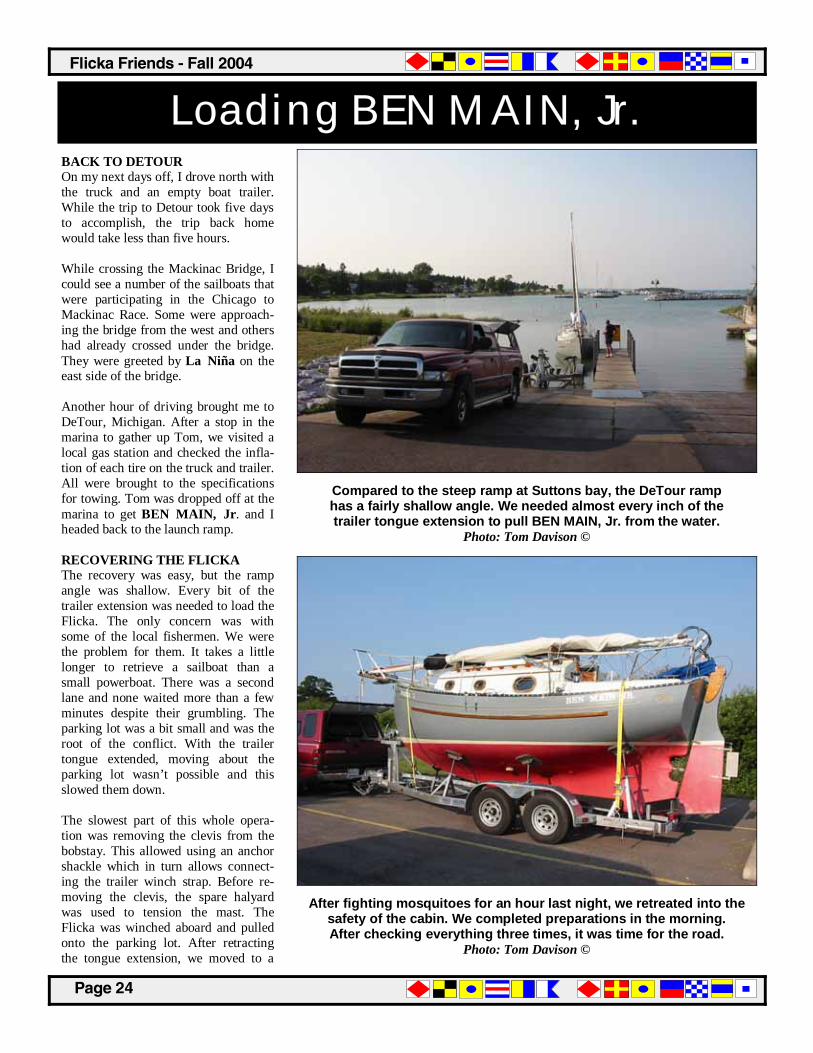
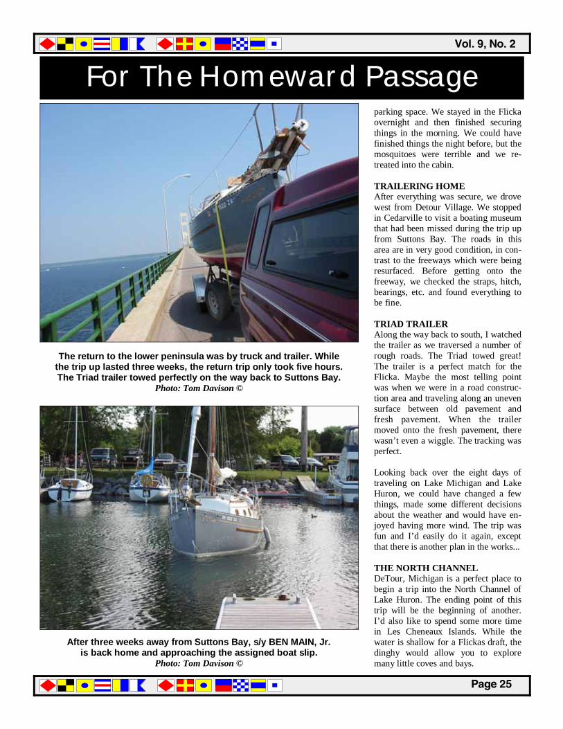
Loading BEN MAIN, Jr. BACK TO DETOUR On my next days off, I drove north with the truck and an empty boat trailer. While the trip to Detour took five days to accomplish, the trip back home would take less than five hours. While crossing the Mackinac Bridge, I could see a number of the sailboats that were participating in the Chicago to Mackinac Race. Some were approach-ing the bridge from the west and others had already crossed under the bridge. They were greeted by La Niña on the east side of the bridge. Another hour of driving brought me to DeTour, Michigan. After a stop in the marina to gather up Tom, we visited a local gas station and checked the infla-tion of each tire on the truck and trailer. All were brought to the specifications for towing. Tom was dropped off at the marina to get BEN MAIN, Jr. and I headed back to the launch ramp. RECOVERING THE FLICKA The recovery was easy, but the ramp angle was shallow. Every bit of the trailer extension was needed to load the Flicka. The only concern was with some of the local fishermen. We were the problem for them. It takes a little longer to retrieve a sailboat than a small powerboat. There was a second lane and none waited more than a few minutes despite their grumbling. The parking lot was a bit small and was the root of the conflict. With the trailer tongue extended, moving about the parking lot wasn’t possible and this slowed them down. The slowest part of this whole opera-tion was removing the clevis from the bobstay. This allowed using an anchor shackle which in turn allows connect-ing the trailer winch strap. Before re-moving the clevis, the spare halyard was used to tension the mast. The Flicka was winched aboard and pulled onto the parking lot. After retracting the tongue extension, we moved to a
Compared to the steep ramp at Suttons bay, the DeTour ramp has a fairly shallow angle. We needed almost every inch of the trailer tongue extension to pull BEN MAIN, Jr. from the water.
Photo: Tom Davison ©
After fighting mosquitoes for an hour last night, we retreated into the safety of the cabin. We completed preparations in the morning. After checking everything three times, it was time for the road.
Photo: Tom Davison ©
��������������
�������
For The Homeward Passage parking space. We stayed in the Flicka overnight and then finished securing things in the morning. We could have finished things the night before, but the mosquitoes were terrible and we re-treated into the cabin. TRAILERING HOME After everything was secure, we drove west from Detour Village. We stopped in Cedarville to visit a boating museum that had been missed during the trip up from Suttons Bay. The roads in this area are in very good condition, in con-trast to the freeways which were being resurfaced. Before getting onto the freeway, we checked the straps, hitch, bearings, etc. and found everything to be fine. TRIAD TRAILER Along the way back to south, I watched the trailer as we traversed a number of rough roads. The Triad towed great! The trailer is a perfect match for the Flicka. Maybe the most telling point was when we were in a road construc-tion area and traveling along an uneven surface between old pavement and fresh pavement. When the trailer moved onto the fresh pavement, there wasn’t even a wiggle. The tracking was perfect. Looking back over the eight days of traveling on Lake Michigan and Lake Huron, we could have changed a few things, made some different decisions about the weather and would have en-joyed having more wind. The trip was fun and I’d easily do it again, except that there is another plan in the works... THE NORTH CHANNEL DeTour, Michigan is a perfect place to begin a trip into the North Channel of Lake Huron. The ending point of this trip will be the beginning of another. I’d also like to spend some more time in Les Cheneaux Islands. While the water is shallow for a Flickas draft, the dinghy would allow you to explore many little coves and bays.
The return to the lower peninsula was by truck and trailer. While the trip up lasted three weeks, the return trip only took five hours. The Triad trailer towed perfectly on the way back to Suttons Bay.
Photo: Tom Davison ©
After three weeks away from Suttons Bay, s/y BEN MAIN, Jr. is back home and approaching the assigned boat slip.
Photo: Tom Davison ©
������������� �����������
�������