Embed Size (px)
Citation preview
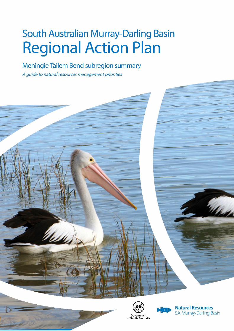
SA Murray-Darling Basin Regional Action Plan - Meningie-Tailem Bend subregion 1
SA Murray-Darling Basin Regional Action Plan - Meningie-Tailem Bend subregion 2
March 2017
This document should be cited as:
South Australian Murray-Darling Basin Natural Resources Management Board, 2017. Regional Action Plan: A guide to natural
resource management priorities in the South Australian Murray-Darling Basin, Meningie – Tailem Bend subregion summary.
URL: www.naturalresources.sa.gov.au/samurraydarlingbasin-rap
For more information about this plan please contact:
South Australian Murray-Darling Basin Natural Resources Management Board
PO Box 2343
Murray Bridge SA 5253
Phone: (08) 8532 9100
Email: [email protected]
Website: www.naturalresources.sa.gov.au/samurraydarlingbasin-rap
The South Australian Murray-Darling Basin Natural Resources Management Board and the Government of South Australia, their
employees and their servants do not warrant, or make any representation, regarding the use or results of the information
contain herein as to its correctness, accuracy, currency or otherwise. The South Australian Murray-Darling Basin Natural
Resources Management Board and the Government of South Australia, their employees and their servants expressly disclaim all
liability or responsibility to any person using the information or advice herein.
This work is licensed under a Creative Commons Attribution 4.0 International License
SA Murray-Darling Basin Regional Action Plan - Meningie-Tailem Bend subregion 3
The diverse soils, water resources, biodiversity and landscapes of the SA Murray-
Darling Basin (SAMDB) are the foundation of many of the things we value; our
livelihoods, lifestyles and our wellbeing.
We all play a role in managing these natural resources.
About this document
This document is a summary of the Meningie-Tailem Bend subregion of the Regional Action Plan for the South
Australian Murray-Darling Basin Natural Resources Management region. It contains an overview of the subregion,
what is valued about the area, information on its landscapes, livelihoods and lifestyles, and a list of the natural
resources management issues, including their impacts and their priority status. For more detail on specific issues
and suggested actions to address them or to find out more about how the plan was developed, please follow the
links in this document or visit the Regional Action Plan online at
www.naturalresources.sa.gov.au/samurraydarlingbasin-rap.
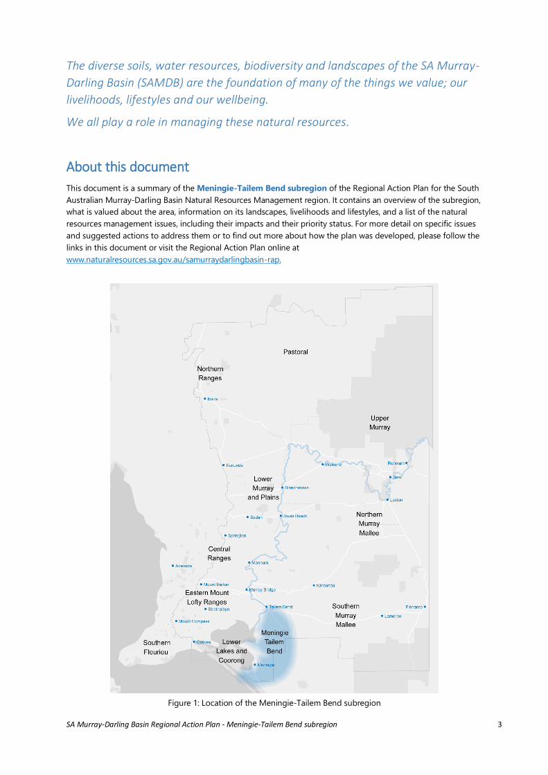
Figure 1: Location of the Meningie-Tailem Bend subregion
SA Murray-Darling Basin Regional Action Plan - Meningie-Tailem Bend subregion 4
What do we value about this area?
Lifestyle values: rural-living, family history, understanding each other, strong community cohesion and water-
related activities61, 69
Natural beauty and spiritual values of the Ramsar wetlands63, 64, 65
Secure freshwater supplies from the Lower Lakes for domestic and industrial use69
Cultural, social and economic values of the Ngarrindjeri People113
Agricultural production from dryland farming; cropping and grazing69
Commercial and recreational fishing64,69
Tourism associated with Ramsar wetlands85, European and indigenous history
Biodiversity conservation.64, 66, 67, 69
Meningie - Tailem Bend subregion Overview
The Meningie-Tailem Bend subregion
comprises the agricultural lands on the eastern
side of Lakes Alexandrina and Albert and the
Coorong within the SAMDB region. The main
towns in the area are Meningie and Tailem
Bend, which are socially distinct from the
communities centred around Milang, Clayton
and Goolwa. However, this area is also a part of
the Lake Alexandrina and Lake Albert Ramsar
Wetland of International Importance.64 The
Ngarrindjeri are the Traditional Owners of this
sub region113 and the area is almost wholly
within the Ngarrindjeri and Others Native Title
Claim area.114 Detailed information on
Ngarrindjeri values and perspectives can be
found in the Ngarrindjeri Nation Yarluwar-Ruwe Plan.65
The agriculture and tourism of the Meningie-Tailem Bend subregion is centred on the Lower River Murray, the
Lower Lakes and the Coorong. As such, the key water resources are the surface water inflows from the River
Murray. Groundwater resources are also significant, with use depending on quality and depth. The ‘naturally’63, 65
freshwaters of the Lower Lakes are separated from the estuarine-marine environments of the Coorong and
Murray Mouth by a series of five barrages, which are operated for ecological, social and economic benefit72. Tidal
variations are important for water quality in the estuary and connectivity in the estuarine-marine components.
Prior to the Millennium Drought, the area supported substantial irrigated dairy farming but the lasting impacts of
that drought and commodity prices have seen a shift to dryland farming although some irrigated dairy farms
remain.69
The Lower Lakes and Coorong have exceptional ecological diversity and functions, qualifying against 8 out of 9
criteria as a Ramsar Wetland of International Importance (first listed in 1985).64 As such, Australia has accepted a
range of obligations in relation to protecting these wetlands, including the ecosystem services they provide, and
managing the impacts of major water-based tourism and multi-species fishing (commercial and recreational)
industries.64
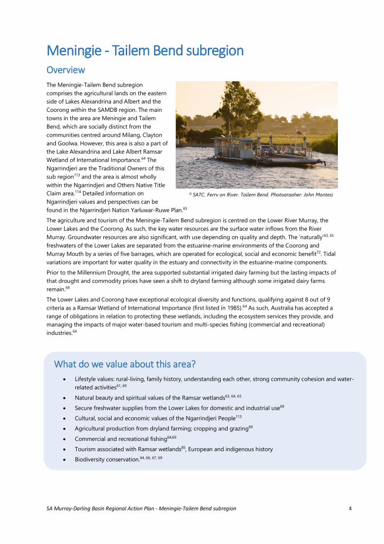
© SATC, Ferry on River, Tailem Bend, Photographer: John Montesi
SA Murray-Darling Basin Regional Action Plan - Meningie-Tailem Bend subregion 5
Socio-economic drivers of
change
Markets/commodity prices
Basin-wide weather patterns
Climate change (affecting amount
and variability of rainfall and lake
inflows)
Basin-wide water extraction and use
(affecting water quantity and quality).
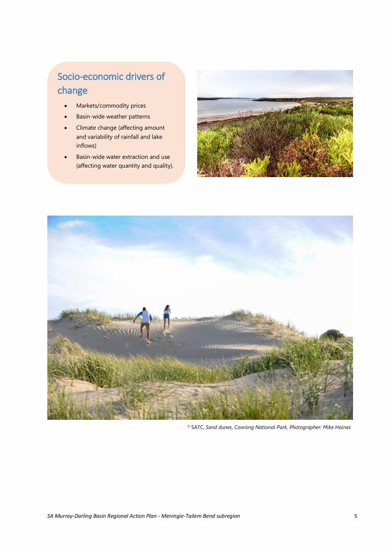
© SATC, Sand dunes, Coorong National Park, Photographer: Mike Haines

SA Murray-Darling Basin Regional Action Plan - Meningie-Tailem Bend subregion 6
Profile of the Meningie – Tailem Bend subregion
Landscapes
The Meningie-Tailem Bend subregion comprises
corridor plains between relict coastal dunes,
adjacent to the lakes.78 The lakes are freshwater and
provide an important biophysical transition between
the River Murray, the Coorong and the Southern
Ocean.72 Rainfall is low to moderate (350-500mm),
hence there is a heavy reliance on the freshwaters of
the river and lakes. The bulk of the surface water is
received from the River Murray, which is transferred
between Lakes Alexandrina and Albert through a
narrow channel, the Narrung Narrows. Lake Albert is
typically more saline than Lake Alexandrina, which
can affect its usefulness for irrigation.77 Water of
varying volumes and salinities flow into the
southern end of the Coorong from the Upper
South-East Drainage Scheme, outside of this
subregion.
Many of the values of the Meningie – Tailem Bend
subregion are closely tied to the ecological, cultural
and economic values of the Lower Lakes and
Coorong, a Ramsar-listed wetland ecosystem of
international and national imporatance.64, 65, 69, 72
The many ecological values of the Lower Lakes and
Coorong are noted in the summary document for
that subregion within the Regional Action Plan.
The Meningie – Tailem Bend subregion crosses the
Southern Mallee and Tintinara biophysical
landscapes. Once dominated by open and shrubby
mallee woodlands, native vegetation of this
subregion is now 'relictual' - cleared to less than 10
per cent of its original extent. Prominent canopy
species of remnant vegetation include cypress pine
(Callitris gracilis), and mallee eucalypts (such as
Eucalyptus gracilis and E. oleosa). A number of
Heritage Agreements exist in this area, providing
protection for remnant mallee woodlands and
grasslands.87 These ecosystems are at risk due to
historic clearance and fragmentation, threatening a
number of species including malleefowl (Leipoa
ocellata), metallic sun orchid (Thelymitra
epipactoides), sand hill greenhood (Pterostylis
arenicola), and a suite of woodland bird species
including hooded robin (Melanodryas cucullata),
brown treecreeper (Climacteris picumnus) and
restless flycatcher (Myiagra inquieta).69 A total of 33
state listed threatened flora species and 79 state
listed threatened fauna species have been recorded
in the Meningie - Tailem Bend subregion. Seven
flora and 20 fauna species are also listed nationally
under the Environment Protection and Biodiversity
Conservation Act 1999. A full list of threatened
species found in this subregion can be downloaded
here. Recovery plans have been developed at a
national or regional level for some threatened
species and ecological communities, including the
malleefowl and metallic sun orchid. Iron-grass
Natural Temperate Grassland communities may also
occur.88 Restoration of the open woodlands and
grasslands associated with these western calcareous
soils is a nature conservation priority in this
landscape.110
Aboriginal creation ancestor stories (sometimes
called Dreamtime or Dreaming Stories) explain how
natural elements in the landscape were formed or
how certain species came to be. The stories describe
how creation ancestors shaped and shifted the
landscape, how they crafted its beauty and natural
resources and then gifted these places to specific
groups of people across South Australia.116
Aboriginal Heritage is an important part of the
landscape. The Aboriginal Heritage Act 1988
protects Aboriginal sites, objects and remains in all
areas of South Australia117 and the Kungun
Ngarrindjeri Yunnan Agreement (KNYA) 2009, an
agreement with the State of South Australia
meaning ‘listen to Ngarrindjeri speaking’, also
establishes proper consideration by State
Government Departments of Aboriginal Heritage
matters. Under this Agreement the Ngarrindjeri
people are represented by the Ngarrindjeri Regional
Authority (NRA) whose role is to progress the caring
for country objectives of the Ngarrindjeri in the
protection of land, water and marine environments
and achieving culturally appropriate outcomes for
soils, water resources, geological features and
landscapes, native vegetation, animals, other
organisms and ecosystems.113
Recreation, tourism and commercial fishing rely on
the ongoing health of the freshwater and estuarine-
SA Murray-Darling Basin Regional Action Plan - Meningie-Tailem Bend subregion 7
marine ecosystems, with fishing especially reliant on
native fish such as Coorong yellow eye mullet
(Aldrichetta forsteri) , golden perch (Macquaria
ambigua) and mulloway (Argyrosomus japonicas),
and the introduced redfin perch (Perca fluviatilis)
and European carp (Cyprinus carpio).69, 128, 129
Conditions experienced during the Millennium
Drought have highlighted the consequences of
inappropriate water management for the Meningie-
Tailem Bend subregion; a wide range of emergency
activities were required to prevent harm and
manage acid sulfate soils oxidation products.73
Soils vary across the subregion and include
calcareous soils, sand over clay, deep sands and
areas of shallow soils overlying calcrete that are still
under native vegetation.69,79 The floodplains of Lake
Albert also contain very unusual clay over sand soils,
known as Poltalloch soils.86 The soils under the lakes
have been affected by prolonged inundation since
river regulation such that now there is an estimated
89,220 ha of acid sulfate soils in the lower lakes.75
Models indicate that there would be widespread
acidification if the water levels in Lakes Alexandrina
and Albert dropped to -1.5 mAHD and -1 mAHD,
respectively.76
Livelihoods
The Ngarrindjeri people have used and actively
managed the natural resources of this subregion for
many thousands of years. The KNYA (2009)
acknowledges the importance of Ngarrindjeri
gaining economic benefit from the management of
protected areas.113 A relatively large number of
Ngarrindjeri people have been employed in natural
resources management roles through Kungun
Ngarrindjeri Yunnan-related programs118 and other
local projects. Significant capacity has been built
within the community to continue playing a key role
in natural resources management into the future,
for example, through Ngarrindjeri Ruwe Contracting
(NRC).119
The majority of the area in the Meningie-Tailem
Bend subregion is used for grazing of modified
pastures (76,000 ha) and cropping (38,000 ha).81
This is a mixed farming region including sheep and
cattle grazing, broad-acre cropping and dairies. The
Millennium Drought had a lasting and significant
effect on the local industries, leading to business
losses, especially in the dairy and tourism sectors.69
Some farms had access to the community pipeline
but water costs were very high and did not enable
continuation of former dairy enterprises, especially
in southern Lake Albert.62 Semi-rural living is also
popular in this subregion due to relatively
affordable land prices.78 Nature conservation is a
major land use (24,000 ha), and there is increasing
interest in nature-based tourism initiatives in the
Coorong National Park and surrounding region.
This subregion also supports the Lakes and
Coorong Fishery, a Marine Stewardship Council
Certified Sustainable Fishery.27 The fishery is
represented by the Lakes and Coorong Fishery
Consultative Committee comprising members from:
the fishing industry, Coorong National Park
management (DEWNR), Ngarrindjeri people, local
government and the Conservation Council of South
Australia.82
Lifestyles
The Meningie-Tailem Bend subregion has a total
population of 5,218 people (2011 figures) and
experienced a population decline from 2001 to
2011.61 Compared to other areas of the state, this
area has a high proportion of elderly people and
lone person households.61
The local government responsibilities are shared
between Rural City of Murray Bridge in the north
and Coorong and Districts Council. There is a strong
social connection between people in the south east
of this subregion to the South East NRM region,
more so than their social connection to Murray
Bridge and the River Murray.78 The majority of the
subregion is dryland farming but there are small
lifestyle properties around the main townships.27
There are relatively large Aboriginal populations in
both Meningie and Tailem Bend as well as in the
nearby towns of Raukkan and Murray Bridge, which
are just outside of this subregion.. Ngarrindjeri
consider the protection and maintenance of their
culture and cultural sites central in every respect to
their community wellbeing and existence.113 This
subregion includes Camp Coorong, an important
education centre for Ngarrindjeri heritage and
culture. Ngarrindjeri have rights, interests and ©SATC, Tailem Bend (cows),
Photographer: John Montesi
© SATC
SA Murray-Darling Basin Regional Action Plan - Meningie-Tailem Bend subregion 8
obligations to speak and care for their traditional
country, lands and waters in accordance with their
laws, customs, beliefs and traditions.113 The KNYA
(2009) recognises the role and ability of the
Ngarrindjeri in the management of natural
resources.113
The level of volunteering in the area is well above
average, which is an indication of a highly
connected and socially cohesive community.61 An
example of this volunteering effort and cohesion, is
the participation by a large number of community
and Ngarrindjeri groups in propagating and
planting local native plant species through the
DEWNR Coorong Lower Lakes and Murray Mouth
(CLLMM) Recovery Project, aimed at building NRM
and stewardship capacity amongst the local
community. More than 5.2 million plants have been
planted through this program since 2009. Of these
plants, more than 1.4 million were grown and
planted by the local community.
Local NRM activities are also co-ordinated by the
Coorong Tatiara District Local Action Planning
Association, who have been operating since 1992.
However, although the volunteering cohort is
strong, the risk of ‘burn-out’ is significant, as
CLLMM Recovery Project support comes to a close
in 2016.107
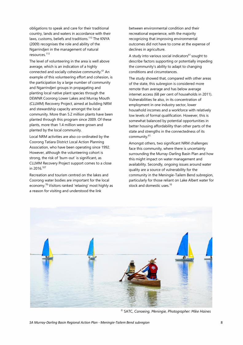
Recreation and tourism centred on the lakes and
Coorong water bodies are important for the local
economy.78 Visitors ranked ‘relaxing’ most highly as
a reason for visiting and understood the link
between environmental condition and their
recreational experience, with the majority
recognizing that improving environmental
outcomes did not have to come at the expense of
declines in agriculture.
A study into various social indicators61 sought to
describe factors supporting or potentially impeding
the community’s ability to adapt to changing
conditions and circumstances.
The study showed that, compared with other areas
of the state, this subregion is considered more
remote than average and has below average
internet access (68 per cent of households in 2011).
Vulnerabilities lie also, in its concentration of
employment in one industry sector, lower
household incomes and a workforce with relatively
low levels of formal qualification. However, this is
somewhat balanced by potential opportunities in
better housing affordability than other parts of the
state and strengths in the connectedness of its
community.61.
Amongst others, two significant NRM challenges
face this community, where there is uncertainty
surrounding the Murray-Darling Basin Plan and how
this might impact on water management and
availability. Secondly, ongoing issues around water
quality are a source of vulnerability for the
community in the Meningie-Tailem Bend subregion,
particularly for those reliant on Lake Albert water for
stock and domestic uses.10
© SATC, Canoeing, Meningie, Photographer: Mike Haines
SA Murray-Darling Basin Regional Action Plan - Meningie-Tailem Bend subregion 9
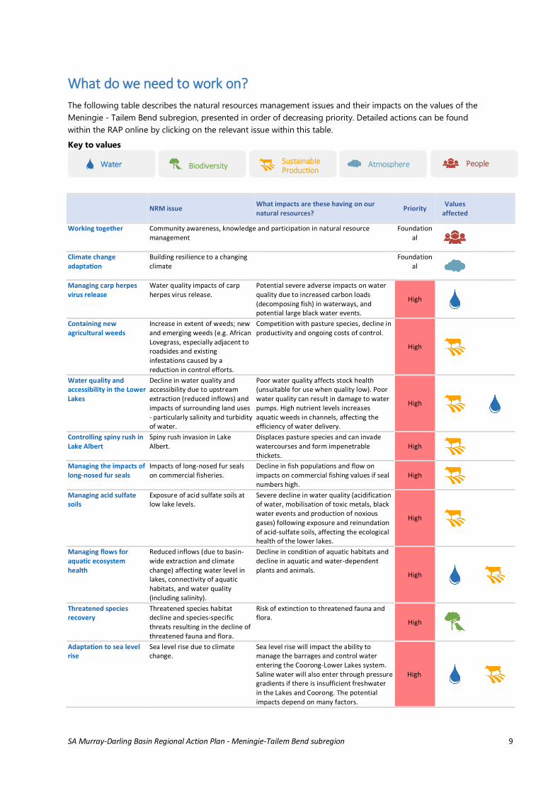
What do we need to work on?
The following table describes the natural resources management issues and their impacts on the values of the
Meningie - Tailem Bend subregion, presented in order of decreasing priority. Detailed actions can be found
within the RAP online by clicking on the relevant issue within this table.
Key to values
NRM issue What impacts are these having on our natural resources?
Priority Values
affected
Working together Community awareness, knowledge and participation in natural resource management
Foundational
Climate change adaptation
Building resilience to a changing climate
Foundational
Managing carp herpes virus release
Water quality impacts of carp herpes virus release.
Potential severe adverse impacts on water quality due to increased carbon loads (decomposing fish) in waterways, and potential large black water events.
High
Containing new agricultural weeds
Increase in extent of weeds; new and emerging weeds (e.g. African Lovegrass, especially adjacent to roadsides and existing infestations caused by a reduction in control efforts.
Competition with pasture species, decline in productivity and ongoing costs of control.
High
Water quality and accessibility in the Lower Lakes
Decline in water quality and accessibility due to upstream extraction (reduced inflows) and impacts of surrounding land uses - particularly salinity and turbidity of water.
Poor water quality affects stock health (unsuitable for use when quality low). Poor water quality can result in damage to water pumps. High nutrient levels increases aquatic weeds in channels, affecting the efficiency of water delivery.
High
Controlling spiny rush in Lake Albert
Spiny rush invasion in Lake Albert.
Displaces pasture species and can invade watercourses and form impenetrable thickets.
High
Managing the impacts of long-nosed fur seals
Impacts of long-nosed fur seals on commercial fisheries.
Decline in fish populations and flow on impacts on commercial fishing values if seal numbers high.
High
Managing acid sulfate soils
Exposure of acid sulfate soils at low lake levels.
Severe decline in water quality (acidification of water, mobilisation of toxic metals, black water events and production of noxious gases) following exposure and reinundation of acid-sulfate soils, affecting the ecological health of the lower lakes.
High
Managing flows for aquatic ecosystem health
Reduced inflows (due to basin-wide extraction and climate change) affecting water level in lakes, connectivity of aquatic habitats, and water quality (including salinity).
Decline in condition of aquatic habitats and decline in aquatic and water-dependent plants and animals.
High
Threatened species recovery
Threatened species habitat decline and species-specific threats resulting in the decline of threatened fauna and flora.
Risk of extinction to threatened fauna and flora.
High
Adaptation to sea level rise
Sea level rise due to climate change.
Sea level rise will impact the ability to manage the barrages and control water entering the Coorong-Lower Lakes system. Saline water will also enter through pressure gradients if there is insufficient freshwater in the Lakes and Coorong. The potential impacts depend on many factors.
High
Water Sustainable Production
Biodiversity People Atmosphere
SA Murray-Darling Basin Regional Action Plan - Meningie-Tailem Bend subregion 10
(cont.)
NRM issue What impacts are these having on our natural resources?
Priority Values
affected
Managing dryland salinity
Dryland salinity. Loss of productive land, decline in land condition. Med
Controlling environmental weeds
Environmental weeds (such as boxthorn, Acacia cyclops, bridal creeper, perennial veldt grass, African love grass, bridal veil)
Competition with native flora; decline in the condition of remnant habitat, including threatened species habitat.
Med
Preventing and managing herbicide resistance
Emergence of herbicide resistant weeds, especially under continuous cropping.
Direct impacts on capacity for weed control and profitability of cropping; indirect threat to soil health if the management alternative results in increasing cultivation and erosion risk.
Med
Managing plague animal outbreaks
Pest animals (particularly plagues of mice and locusts).
Reduced profitability of farming enterprises due to costs of control and impacts on production.
Med
Soil health for sustainable production
Management of soil health (i.e. nutrition, fertility, biology) affecting production capacity and susceptibility to additional soil degradation processes.
Affects the profitability and sustainability of production. Poor soil health can lead to on site degradative processes such as soil acidity, erosion, compaction, and sodicity as well as off-site impacts on adjacent lands, watercourses and groundwater systems
Med
Containing new environmental weeds
New and emerging weeds. Competition with native flora; decline in the condition of remnant habitat, including threatened species habitat.
Med
Reducing the impacts of pest animals
Over-grazing/damage by kangaroos, deer and rabbits (unmanaged).
Decline in condition of native vegetation and suitability of habitat for native species; increased risk of erosion and weed invasion, affecting the capacity of vegetation to recover and affecting water quality.
Med
Managing fire regimes for biodiversity
Inappropriate fire regime, including fire suppression near built-up areas.
Lack of recruitment of fire-dependent species; decline in condition of native vegetation if fires too frequent or absent.
Med
Protecting and restoring habitat
Loss and fragmentation of habitat due to historic clearing.
Loss of habitat for native species and increased vulnerability of native plant and animals populations to other threats (such as climate change, pests, weeds).
Med
Managing risks to biodiversity from wildfire
Catastrophic loss of biodiversity due to wildfire.
Potential loss of significant populations of plants at patch scale due to a wildfire burning through large or particularly significant areas.
Med
Reducing soil erosion risk
Soil erosion risk associated with vulnerable soil types, inappropriate land management practices and seasonal conditions (likely to be exacerbated under climate change).
Decline in land condition, sustainability of production, and capacity to recover after drought, especially on shallow soils and marginal country.
Med
Managing disease risk from pest animals
Pest animals (especially deer) spreading disease (Ovine Johnes and Leptospirosis).
Reduced fertility of sheep; decline in profitability of farming enterprise. Med
Maintaining flows through the Narrows
Constriction of flows by reeds between Lakes Albert and Alexandrina, due to low flows.
Potential for rapid decline in water quality in Lake Albert. Med
Controlling agricultural weeds
Spread of agricultural weeds. Reduced profitability of farming enterprises due to costs of control and impacts on product quality.
Med
Improving water quality in the lower lakes
Decline in surface water quality flowing from the eastern tributaries and overland into the Lakes and Coorong due to impacts of local land uses - particularly salinity and turbidity of water.
Decline in water quality affects condition of aquatic habitat, lifestyle values and suitability of water for consumptive uses (stock, domestic and irrigation). Med
Adaptation to sea level rise
Sea level rise due to climate change.
Med
SA Murray-Darling Basin Regional Action Plan - Meningie-Tailem Bend subregion 11
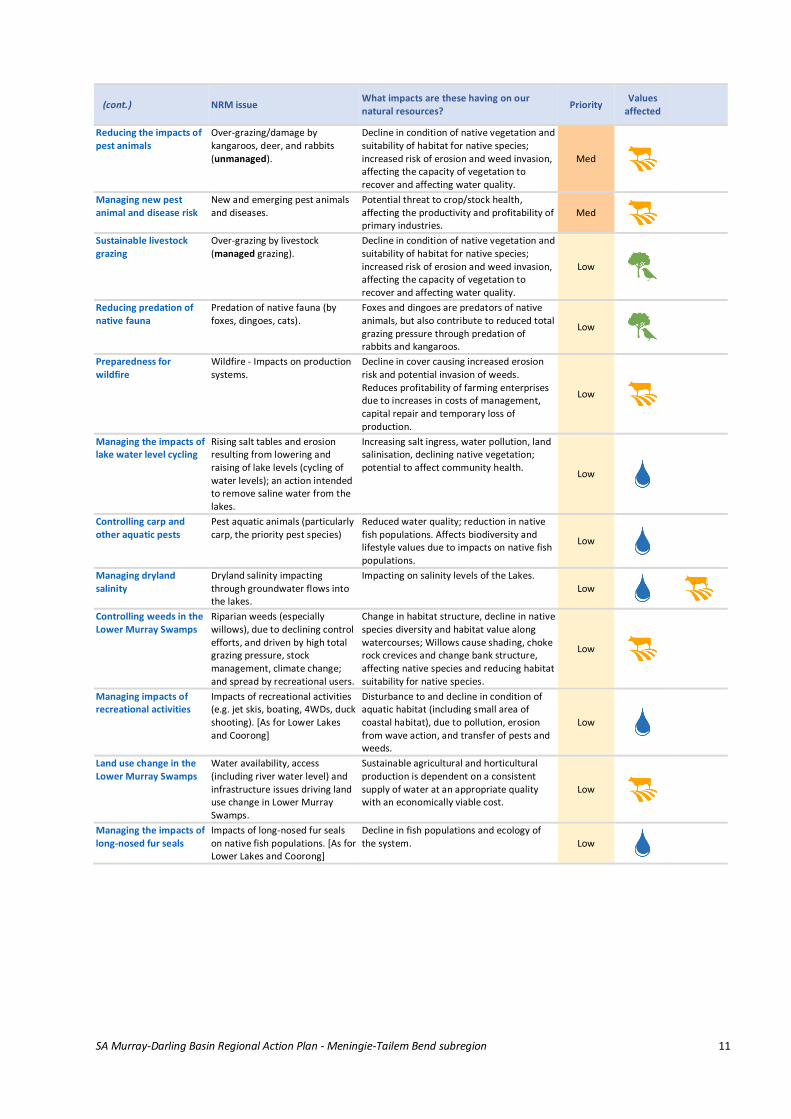
(cont.)
NRM issue What impacts are these having on our natural resources?
Priority Values
affected
Reducing the impacts of pest animals
Over-grazing/damage by kangaroos, deer, and rabbits (unmanaged).
Decline in condition of native vegetation and suitability of habitat for native species; increased risk of erosion and weed invasion, affecting the capacity of vegetation to recover and affecting water quality.
Med
Managing new pest animal and disease risk
New and emerging pest animals and diseases.
Potential threat to crop/stock health, affecting the productivity and profitability of primary industries.
Med
Sustainable livestock grazing
Over-grazing by livestock (managed grazing).
Decline in condition of native vegetation and suitability of habitat for native species; increased risk of erosion and weed invasion, affecting the capacity of vegetation to recover and affecting water quality.
Low
Reducing predation of native fauna
Predation of native fauna (by foxes, dingoes, cats).
Foxes and dingoes are predators of native animals, but also contribute to reduced total grazing pressure through predation of rabbits and kangaroos.
Low
Preparedness for wildfire
Wildfire - Impacts on production systems.
Decline in cover causing increased erosion risk and potential invasion of weeds. Reduces profitability of farming enterprises due to increases in costs of management, capital repair and temporary loss of production.
Low
Managing the impacts of lake water level cycling
Rising salt tables and erosion resulting from lowering and raising of lake levels (cycling of water levels); an action intended to remove saline water from the lakes.
Increasing salt ingress, water pollution, land salinisation, declining native vegetation; potential to affect community health.
Low
Controlling carp and other aquatic pests
Pest aquatic animals (particularly carp, the priority pest species)
Reduced water quality; reduction in native fish populations. Affects biodiversity and lifestyle values due to impacts on native fish populations.
Low
Managing dryland salinity
Dryland salinity impacting through groundwater flows into the lakes.
Impacting on salinity levels of the Lakes. Low
Controlling weeds in the Lower Murray Swamps
Riparian weeds (especially willows), due to declining control efforts, and driven by high total grazing pressure, stock management, climate change; and spread by recreational users.
Change in habitat structure, decline in native species diversity and habitat value along watercourses; Willows cause shading, choke rock crevices and change bank structure, affecting native species and reducing habitat suitability for native species.
Low
Managing impacts of recreational activities
Impacts of recreational activities (e.g. jet skis, boating, 4WDs, duck shooting). [As for Lower Lakes and Coorong]
Disturbance to and decline in condition of aquatic habitat (including small area of coastal habitat), due to pollution, erosion from wave action, and transfer of pests and weeds.
Low
Land use change in the Lower Murray Swamps
Water availability, access (including river water level) and infrastructure issues driving land use change in Lower Murray Swamps.
Sustainable agricultural and horticultural production is dependent on a consistent supply of water at an appropriate quality with an economically viable cost.
Low
Managing the impacts of long-nosed fur seals
Impacts of long-nosed fur seals on native fish populations. [As for Lower Lakes and Coorong]
Decline in fish populations and ecology of the system. Low
SA Murray-Darling Basin Regional Action Plan - Meningie-Tailem Bend subregion 12
References
27 Department of Planning and Local Government, 2011. Murray and Mallee Regional Plan: A volume for the SA
Planning Strategy January 2011
28 SAMDB NRM Board, 2012. Landscape Conservation Priorities Fact Sheets - November 2012
61 Econsearch, 2015. Community Adaptive Capacity Index for the SAMDB NRM Region.
62 Muller, K.L., 2012. Learning from lakeshore graziers. A report for the Goolwa to Wellington Local Action
Planning Association, Strathalbyn, South Australia.
63 Sim, T., and Muller, K.L., 2005. A fresh history of the lakes: Wellington to barrages, 1800s to 1935. River Murray
Catchment Water Management Board, Berri, South Australia.
64 Phillips, B., and Muller, K.L., 2006. Ecological Character of the Coorong, Lakes Alexandrina and Albert Wetland
of International Importance. South Australian Department for Environment and Heritage.
65 Ngarrindjeri Tendi et al., 2007. Ngarrindjeri Nation Yarluwar-Ruwe Plan: Caring for Ngarrindjeri Sea Country
and Culture.
66 Department of Environment, Water and Natural Resources, 2015. Long term watering plan for the South
Australian River Murray Water Resource Plan Area. Draft for consultation.
69 SAMDB NRM Board, 2014. SA Murray-Darling Basin natural resources management plan: - Volume A,
Strategic plan. South Australian Murray-Darling Basin Natural Resources Management Board, Murray Bridge,
South Australia.
72 Murray Darling Basin Authority, 2014. The Living Murray Lower Lakes Coorong and Murray Mouth
Environmental watering plan.
73 MDBA, 2014. Drought Emergency Framework for Lakes Alexandrina and Albert. Publication no. 23/14, June
2014, Murray-Darling Basin Authority, Canberra.
75 Fitzpatrick, R.W., Grealish, G., Chappell, A., Marvanek, S., and Shand, P., 2010. Spatial variability of
subaqueous and terrestrial acid sulfate soils and their properties, for the Lower Lakes South Australia. Prepared
by the Commonwealth Scientific and Industrial Research Organisation (CSIRO) Land and Water for the SA
Department of Environment and Natural Resources, Adelaide.
76 Muller K.L., 2011. Ecological consequences of managing water levels to prevent acidification in Lakes
Alexandrina and Albert: Technical Report. Prepared for Department of Environment and Natural Resources,
Adelaide, South Australia.
77 Department of Environment and Heritage, 2010. Securing the Future. Long-Term Plan for the Coorong, Lower
Lakes and Murray Mouth. Department for Environment and Heritage: Adelaide, South Australia.
78 SAMDB subregion mapping workshop, Murray Bridge, 16th February 2015.
78 SAMDB subregion mapping workshop, Murray Bridge, 16th February 2015.
79 Hall, J., Maschmedt, D., and Billing, B., 2009. The Soils of Southern South Australia. Department of Water,
Land and Biodiversity Conservation, Government of South Australia: Adelaide, SA.
81 NRSAMDB, 2015. Analysis of Land use data from 2008. Summary data only.
85 Dyack, B., et al., 2007. Valuing recreation in the Murray: an assessment of the non-market recreational values
at Barmah Forest and the Coorong. CSIRO: Water for a Healthy Country National Research Flagship
87 Natural Resources SAMDB, 2013. Landscape conservation priorities – Southern Murray Mallee Landscape.
Information sheet.
88 Turner, J., 2012. National Recovery Plan for the Iron-grass Natural Temperate Grassland of South Australia
ecological community 2012. Department of Environment and Natural Resources, South Australia.
107 N. Buckley pers comm. 17th November, 2015.
110 Bonifacio, R.S., Hobbs, T.J., Rogers, D., Jellinek, S., Willoughby, N. and Thompson, D., 2016. An assessment of
ecosystems within the Coorong, Lower Lakes and Murray Mouth (CLLMM) region. DEWNR Technical Note
2016/32, Government of South Australia, Department of Environment, Water and Natural Resources,
Adelaide. URL - https://data.environment.sa.gov.au/Content/Publications/DEWNR-TR-2016-32.pdf
113 KNYA, 2009. Kungun Ngarrindjeri Yunnan Agreement.
http://www.environment.sa.gov.au/files/sharedassets/public/cllmm/cllmm-gen-
kungunngarrindjeriyunnanagreement.pdf
SA Murray-Darling Basin Regional Action Plan - Meningie-Tailem Bend subregion 13
114 National Native Title Tribunal 2016, Native title Applications and Determination Areas. As per the Federal
Court (30 June 2016) – Commonwealth of Australia map
116 DSD 2016. Department of State Development, Aboriginal Affairs and Reconciliation website.
http://www.statedevelopment.sa.gov.au/aboriginal-affairs/aboriginal-affairs-and-reconciliation/aboriginal-
heritage. [Accessed: Sept, 2016].
117 DSD 2015. Aboriginal Heritage Guideline 10 – Risk Management, Department of State Development,
Aboriginal Affairs and Reconciliation, South Australia.
http://www.statedevelopment.sa.gov.au/upload/aard/heritage/Risk_Management.pdf?t=1474958967890
[Accessed: Sept, 2016].
118 DEWNR & NRA 2015. KNYA Listening to Ngarrindjeri People talking Report 2014 and 2015.
119 NRC 2016 Capability Statement. Ngarrindjeri Ruwe Contracting Pty Ltd.
128 Coorong Wild Seafood website URL - http:\\www.coorongwildseafood.com.au [Accessed 29 Sept 2016].
129 Fisheries Research and Development Corporation website URL -http:\\www.frdc.com.au [Accessed 29 Sept.
2016).