Embed Size (px)
Citation preview
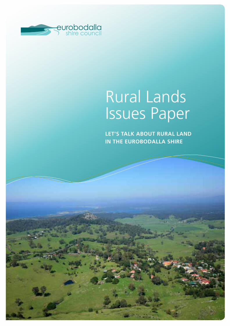
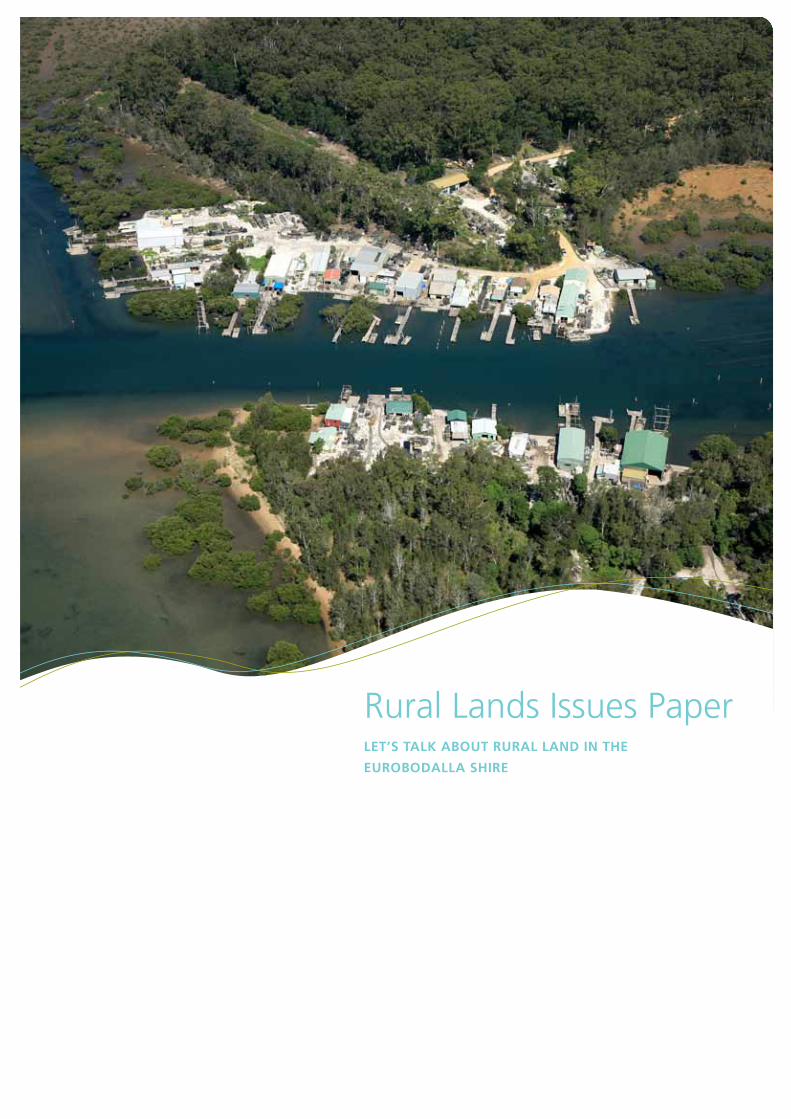
Rural Lands Issues Paper Let’s taLk about ruraL Land in the eurobodaLLa shire
How to contact us
In person Customer Service Centre Corner Vulcan & Campbell Streets, Moruya Monday to Friday, 8.30am to 4.30pm
Rural Lands Strategy Hotline: 02 4474 7486
Fax 02 4474 1234
Mail PO Box 99, Moruya NSW 2537
DX DX 4871
Email [email protected]
Web www.esc.nsw.gov.au and click “Eurobodalla Rural Lands Strategy”
Councillors See contact details on our website, and on Council’s Noticeboard page in local papers.
How you can have your say?The Rural Lands Strategy Steering Committee seeks your input and ideas on the subjects outlined within this paper and any other matter related to the development of a strategy for the rural lands of the Eurobodalla Shire. This will assist the Committee to advise Council in the preparation and completion of a revised Local Environment Plan which ensures the social, economic and environmental wellbeing of the Shire.
All the information you need to know to have your say about the issues and outlook for rural lands in the Eurobodalla is available on page 27 of this paper or online at www.esc.nsw.gov.au, by clicking on Rural Lands Strategy.
Rural Lands Issues Paper Let’s taLk about ruraL Land in the
eurobodaLLa shire
1Achieving the PlAn
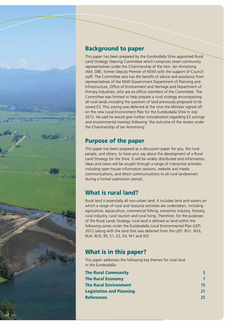
Background to paperThis paper has been prepared by the Eurobodalla Shire appointed Rural Land Strategy Steering Committee which comprises seven community representatives under the Chairmanship of the Hon. Ian Armstrong (AM, OBE, former Deputy Premier of NSW) with the support of Council staff. The Committee also has the benefit of advice and assistance from representatives of the NSW Government Department of Planning and Infrastructure, Office of Environment and Heritage and Department of Primary Industries, who are ex-officio members of the Committee. The Committee was formed to help prepare a rural strategy encompassing all rural lands including the question of land previously proposed to be zoned E3. This zoning was deferred at the time the Minister signed off on the new Local Environment Plan for the Eurobodalla Shire in July 2012. He said he would give further consideration regarding E3 zonings and environmental overlays following ‘the outcome of the review under the Chairmanship of Ian Armstrong’.
Purpose of the paperThis paper has been prepared as a discussion paper for you, the rural people, and others, to have your say about the development of a Rural Land Strategy for the Shire. It will be widely distributed and information, ideas and views will be sought through a range of interactive activities including open house information sessions, website and media communications, and direct communications to all rural landowners during a formal submission period.
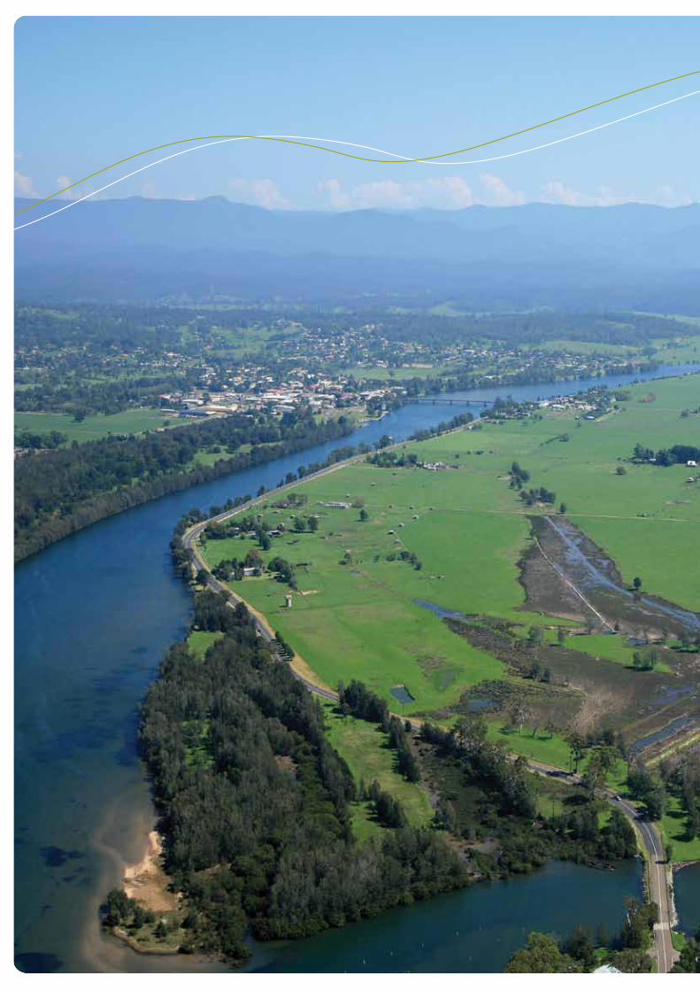
What is rural land?Rural land is essentially all non-urban land. It includes land and waters on which a range of rural and resource activities are undertaken, including agriculture, aquaculture, commercial fishing, extractive industry, forestry, rural industry, rural tourism and rural living. Therefore, for the purposes of the Rural Lands Strategy, rural land is defined as land within the following zones under the Eurobodalla Local Environmental Plan (LEP) 2012 (along with the land that was deferred from the LEP): RU1, RU3, RU4, RU5, R5, E1, E2, E4, W1 and W2.
What is in this paper?This paper addresses the following key themes for rural land in the Eurobodalla:
The Rural Community 3The Rural Economy 7The Rural Environment 15Legislation and Planning 21References 25
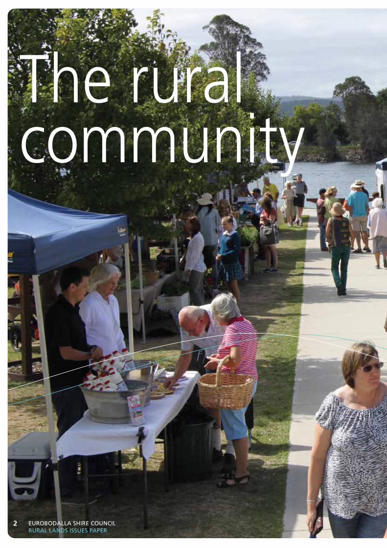
The rural community
Eurobodalla ShirE CounCil rural landS iSSuES PaPEr
2
3Achieving the PlAn
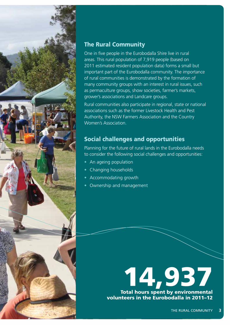
The Rural CommunityOne in five people in the Eurobodalla Shire live in rural areas. This rural population of 7,919 people (based on 2011 estimated resident population data) forms a small but important part of the Eurobodalla community. The importance of rural communities is demonstrated by the formation of many community groups with an interest in rural issues, such as permaculture groups, show societies, farmer’s markets, grower’s associations and Landcare groups.
Rural communities also participate in regional, state or national associations such as the former Livestock Health and Pest Authority, the NSW Farmers Association and the Country Women’s Association.
Social challenges and opportunitiesPlanning for the future of rural lands in the Eurobodalla needs to consider the following social challenges and opportunities:
• An ageing population
• Changing households
• Accommodating growth
• Ownership and management
3ThE rural CoMMuniTY
14,937Total hours spent by environmental
volunteers in the Eurobodalla in 2011–12
Eurobodalla ShirE CounCil rural landS iSSuES PaPEr
4
Population and growthThe main features of the Shire population are set out below:
• The estimated resident population of the Eurobodalla Shire in 2011 was 36,993, an increase of 409 people since 2006. Our current growth rate is approximately 0.2% per annum; much lower than the previous five-year growth rate of 1.5%.
• The Eurobodalla’s rural population represents approximately 21% of the total population. This population declined by 182 people in the five years between 2006 and 2011, particularly in the southern part of the Shire.
• The Eurobodalla’s rural people are younger than their urban neighbours. This could be because retirees choose to settle in urban areas close to services such as hospitals, rather than in rural or remote areas.
• The family and household composition in the Eurobodalla’s rural areas is very different from the urban areas. There is a greater proportion of traditional families (couples with children) and fewer single person households in rural areas.
For more information about the demographic profile of the Eurobodalla and its rural areas, visit Council’s Community Profile website.[1]
Population in eurobodalla’s rural areas, 2001-2011
Population forecasts• The population of the rural areas of the Eurobodalla is
forecast to grow to 8,849 people by 2031 at an average rate of 0.6% per annum.
• An additional 930 people, or 16.3% of the Eurobodalla’s total projected population increase between 2011 and 2031, are predicted to go to rural areas of the Shire. The majority of the growth in rural areas will be within existing urban expansion areas on the edges of the major towns, such as those north of Batemans Bay and south of Narooma.
• The proportion of the Eurobodalla’s total population living in rural communities is predicted to decline from 21.4% in 2011 to 20.8% in 2031.
For more information about the population forecasts for the Eurobodalla and its rural areas, visit Council’s Population Forecast website.[2].
Population forecasts for eurobodalla’s rural areas, 2016–2031
6.00%
8.00%
7.00%
5.00%
4.00%
3.00%
2.00%
1.00%
8.00%
Ave
rage
Ann
ual %
cha
nge
2016 2021 2026 2031
Batemans Bay Rural Hinterland
Moruya Rural Hinterland
Narooma Rural Hinterland
Urban
2450
2550
2600
2650
2500
2400
2350
2300
2250
2200
2150
Popu
latio
n
2001 2006 2011
Batemans Bay Rural Hinterland
Moruya Rural Hinterland
Narooma Rural Hinterland
5ThE rural CoMMuniTY 5
930forecast rural population
growth to 2031
Social Challenges and Opportunities
an ageing PopulationIn past decades there has been a well-documented ageing of the Australian population and the Eurobodalla is no exception. In fact the Eurobodalla population’s median age of 50 is 12 years higher than the NSW state average of 38 [3] and if the current trend continues will rise even higher in the years to come.
A significant consequence of the ageing population is an increasing dependency of older people on a declining workforce. In 2011, there were 2.23 persons of working age to support each person aged over 65 (a reduction from 2.59 in 2006). Data from Council’s Population Forecast website reveals that this will continue to decline to 1.77 persons of working age for every older person in 2031. Across Australia, according to the Intergenerational Report, Australia to 2050: Future Challenges released by the federal government in January 2010, there were 5 persons of working age for every older person. This is predicted to decline to 2.7 persons by 2050 [4].
Whilst the Eurobodalla’s rural population is younger on average than the urban population, the ageing of the population as a whole may impact on the availability of labour for agricultural activities.
Changing householdsThe Eurobodalla and state-wide trend for households displays a steady decrease in the average number of people per dwelling. The increase in numbers of unoccupied dwellings, as well as couples without children and lone person households, is largely responsible for this decrease.[1]
These changes to housing composition are placing increased demand for more affordable, medium density housing in the Eurobodalla’s urban areas. This demand has been translated into an increased supply of flats and semi-detached housing. These dwelling types increased by 17% and 10% between 2006 and 2011 respectively, whilst separated houses only increased by 5%.[5] It is anticipated these trends will continue into the future. In rural areas, these trends may translate into greater demand for rural lifestyle subdivision, dual occupancies and secondary dwellings (granny flats).
accommodating growthThe South Coast Regional Strategy predicts that almost three-quarters of the 10,700 new dwellings required to cater for population growth in the Eurobodalla between 2006 and 2031 can be located on existing vacant urban land.[6] The remaining dwelling supply gap could be accommodated within and adjoining these urban centres through higher density development catering for the predicted smaller household size as well as within land release areas mapped within the Eurobodalla LEP.
The supply of residential land in and around existing centres serves to protect rural land for rural purposes. The Eurobodalla Local Environmental Plan 2012 clearly identifies the location of future land release areas, reflecting the urban containment principles in the Eurobodalla Settlement Strategy. [7] The Steering Committee will examine alternative rural settlement opportunities.
ownership and managementPrivately owned rural land (legally under fee simple, common law) is managed by rural landholders who are obliged to meet environmental standards imposed through state and federal legislation. National parks, state forests and community lands are a resource for all people and their stewardship is undertaken by the relevant government agencies.
Rural landholders have the challenge of making a profitable business that contributes to feeding and clothing the world whilst complying with legislative requirements for the protection of environmental attributes, and responding to environmental constraints. Rural landholders understand that the environmental attributes and constraints of their land are important considerations in the management of the land.
By actively and sensitively managing their land, rural landholders are providing a valuable service to the whole community, over and above the provision of food and fibre. For example, rural landholders have a significant role in the eradication of weeds and pests. They also maintain rural views and vistas for the enjoyment of all residents and visitors to the Shire. Rural landholders play an important role in the management of native vegetation and natural water storages and flows. For these services they receive little or no compensation from the community.
Opportunities to reward rural landholders for responsible management of their land are currently being tested, particularly through carbon farming initiatives and bio-banking schemes, but in their current forms these have yet to gain wide landholder acceptance. State and federal government agencies also provide various funding programs to encourage and assist rural landholders to manage their land in an environmentally sensitive manner.
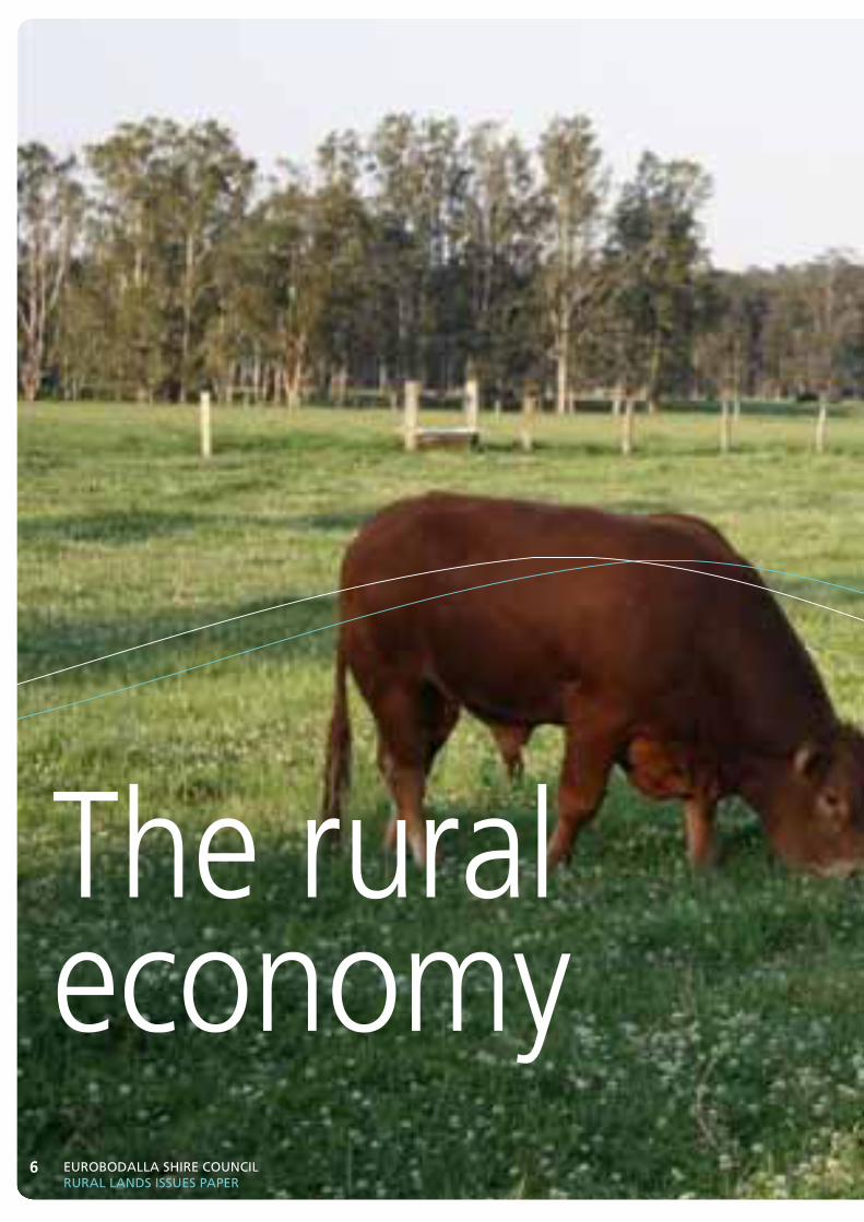
The rural economy
Eurobodalla ShirE CounCil rural landS iSSuES PaPEr
6
7Achieving the PlAn
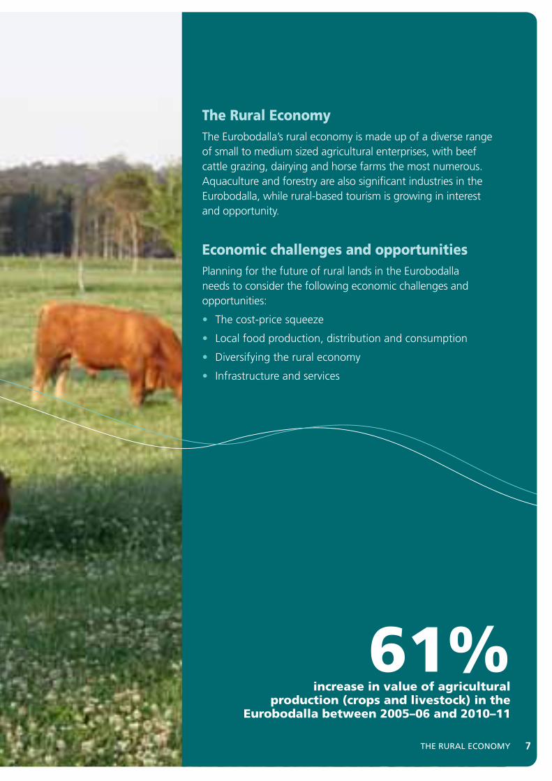
The Rural EconomyThe Eurobodalla’s rural economy is made up of a diverse range of small to medium sized agricultural enterprises, with beef cattle grazing, dairying and horse farms the most numerous. Aquaculture and forestry are also significant industries in the Eurobodalla, while rural-based tourism is growing in interest and opportunity.
Economic challenges and opportunitiesPlanning for the future of rural lands in the Eurobodalla needs to consider the following economic challenges and opportunities:
• The cost-price squeeze
• Local food production, distribution and consumption
• Diversifying the rural economy
• Infrastructure and services
7ThE rural EConoMY
61%increase in value of agricultural
production (crops and livestock) in the Eurobodalla between 2005–06 and 2010–11
Eurobodalla ShirE CounCil rural landS iSSuES PaPEr
8
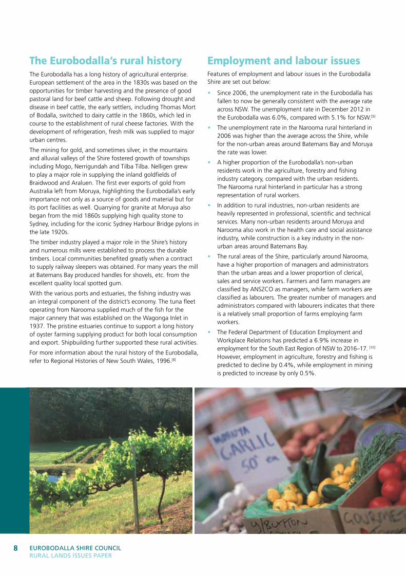
The Eurobodalla’s rural historyThe Eurobodalla has a long history of agricultural enterprise. European settlement of the area in the 1830s was based on the opportunities for timber harvesting and the presence of good pastoral land for beef cattle and sheep. Following drought and disease in beef cattle, the early settlers, including Thomas Mort of Bodalla, switched to dairy cattle in the 1860s, which led in course to the establishment of rural cheese factories. With the development of refrigeration, fresh milk was supplied to major urban centres.
The mining for gold, and sometimes silver, in the mountains and alluvial valleys of the Shire fostered growth of townships including Mogo, Nerrigundah and Tilba Tilba. Nelligen grew to play a major role in supplying the inland goldfields of Braidwood and Araluen. The first ever exports of gold from Australia left from Moruya, highlighting the Eurobodalla’s early importance not only as a source of goods and material but for its port facilities as well. Quarrying for granite at Moruya also began from the mid 1860s supplying high quality stone to Sydney, including for the iconic Sydney Harbour Bridge pylons in the late 1920s.
The timber industry played a major role in the Shire’s history and numerous mills were established to process the durable timbers. Local communities benefited greatly when a contract to supply railway sleepers was obtained. For many years the mill at Batemans Bay produced handles for shovels, etc. from the excellent quality local spotted gum.
With the various ports and estuaries, the fishing industry was an integral component of the district’s economy. The tuna fleet operating from Narooma supplied much of the fish for the major cannery that was established on the Wagonga Inlet in 1937. The pristine estuaries continue to support a long history of oyster farming supplying product for both local consumption and export. Shipbuilding further supported these rural activities.
For more information about the rural history of the Eurobodalla, refer to Regional Histories of New South Wales, 1996.[8]
Employment and labour issuesFeatures of employment and labour issues in the Eurobodalla Shire are set out below:
• Since 2006, the unemployment rate in the Eurobodalla has fallen to now be generally consistent with the average rate across NSW. The unemployment rate in December 2012 in the Eurobodalla was 6.0%, compared with 5.1% for NSW.[9]
• The unemployment rate in the Narooma rural hinterland in 2006 was higher than the average across the Shire, while for the non-urban areas around Batemans Bay and Moruya the rate was lower.
• A higher proportion of the Eurobodalla’s non-urban residents work in the agriculture, forestry and fishing industry category, compared with the urban residents. The Narooma rural hinterland in particular has a strong representation of rural workers.
• In addition to rural industries, non-urban residents are heavily represented in professional, scientific and technical services. Many non-urban residents around Moruya and Narooma also work in the health care and social assistance industry, while construction is a key industry in the non-urban areas around Batemans Bay.
• The rural areas of the Shire, particularly around Narooma, have a higher proportion of managers and administrators than the urban areas and a lower proportion of clerical, sales and service workers. Farmers and farm managers are classified by ANSZCO as managers, while farm workers are classified as labourers. The greater number of managers and administrators compared with labourers indicates that there is a relatively small proportion of farms employing farm workers.
• The Federal Department of Education Employment and Workplace Relations has predicted a 6.9% increase in employment for the South East Region of NSW to 2016–17. [10] However, employment in agriculture, forestry and fishing is predicted to decline by 0.4%, while employment in mining is predicted to increase by only 0.5%.
9ThE rural EConoMY 9
0.4%predicted decrease in employment in
agriculture, forestry and fishing to 2016–17
For more information about the economic profile of the Eurobodalla and its rural areas, visit Council’s Community Profile website.[1]
Employment in agricultural industries declined between 2006 and 2011, as shown in the table below.
Industry 2006 2011Change
2006–2011
Agriculture, nfd 8 6 - 2
Nursery and floriculture production 16 14 - 2
Mushroom and vegetable growing 9 8 - 1
Sheep, beef cattle and grain farming 115 85 - 30
Dairy cattle farming 54 48 - 6
Other livestock farming 18 14 - 4
Forestry and fishing 126 116 - 10
Total employment in agriculture 346 291 - 55
Rural production and marketsAccording to the Australian Bureau of Statistics, the total value of agricultural production in the Eurobodalla in 2006 was $12.6m. [11] This total is made up of the gross value of crops ($2.0m), livestock slaughterings ($3.4m) and livestock products ($7.2m). By way of comparison, the value of building activity in the Eurobodalla in 2006 was approximately $100m, while the total takings for accommodation in hotels and motels in 2009 were approximately $20m.[12] Preliminary releases from the 2010-11 Agricultural Census indicates that the value of crop and livestock production in the Eurobodalla grew to $20.3m, an increase of 61% since 2005-06.
In addition, the Socio-Economic Assessment of the Batemans Marine Park report in 2006 identified that the commercial fishing catch on the Eurobodalla coast was valued at approximately $3.9m in 2005. [13] The report further identified that aquaculture in the Batemans Shelf Bioregion (which extends from Kiama to Tathra) was worth $8.8m in 2004–05. The NSW Department of Primary Industries’ Aquaculture Production Report 2011/2012 shows that the value of Sydney rock oysters in the Clyde River, Tuross Lake and Wagonga Inlet totalled $5.12m. This is a slight increase from the 2010–11 value of $4.48m, but is down from the 2004–05 value of $6.22m. [14]
Markets for the Eurobodalla’s rural produce are local, regional, national and international. Geographically, the nearest major market for the Eurobodalla’s rural produce is Canberra, principally via the Kings Highway. Access to the Sydney market, and through Sydney to national and international markets, is available via the Princes Highway and the Moruya Airport. Certain rural products have regional markets. Cattle and sheep, for example, are bought and sold at regional saleyards, including at Bega and Braidwood in South East NSW and Bairnsdale in North East Victoria.
At the local level, farmer’s markets or produce markets operate in many regional towns, providing direct sales from the farmer to the consumer. This type of direct contact between producer and consumer can also be achieved through roadside stalls and community supported agriculture programs, such as fruit and vegetable box deliveries. The South East Food Plan identified that marketing networks within the Eurobodalla can make a future contribution to the local economy.[15]
Eurobodalla ShirE CounCil rural landS iSSuES PaPEr
10
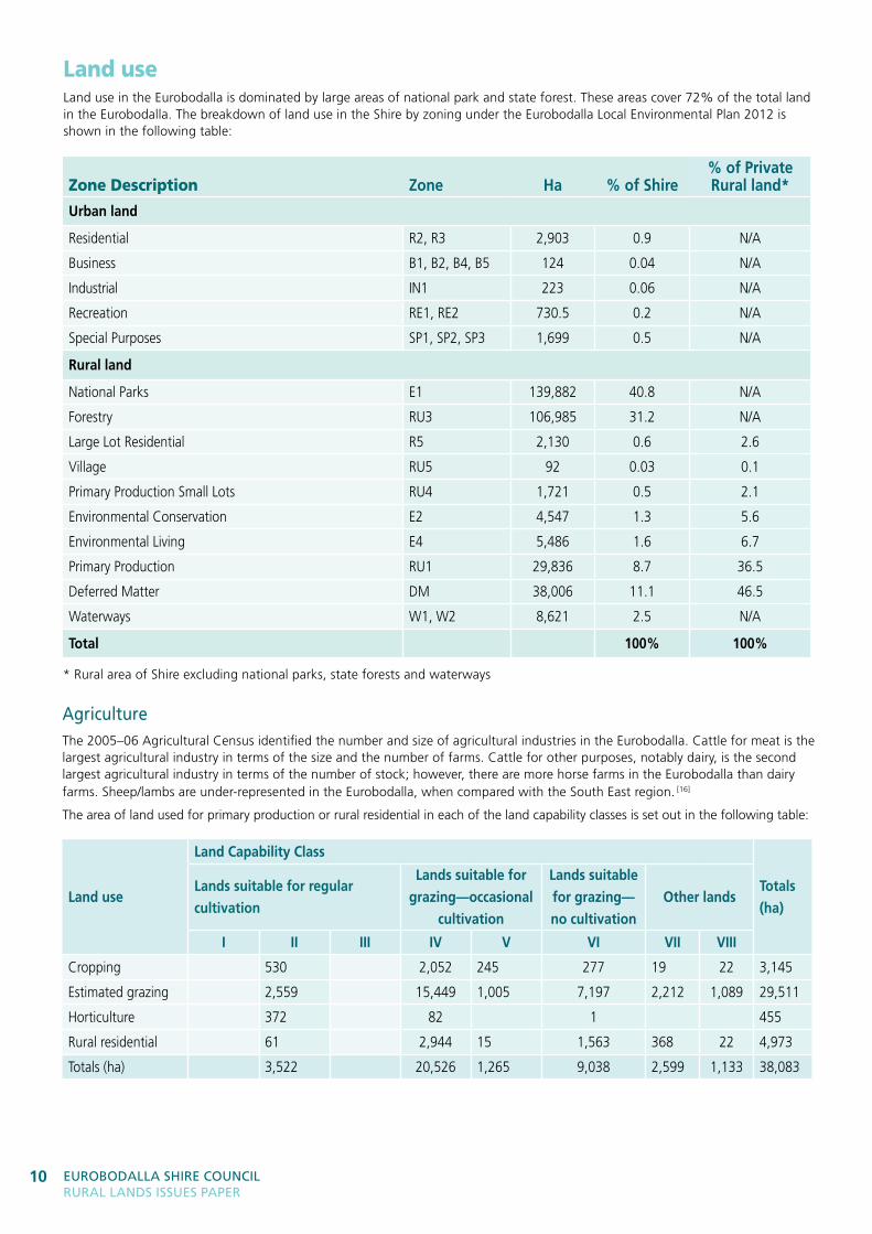
Land useLand use in the Eurobodalla is dominated by large areas of national park and state forest. These areas cover 72% of the total land in the Eurobodalla. The breakdown of land use in the Shire by zoning under the Eurobodalla Local Environmental Plan 2012 is shown in the following table:
Zone Description Zone ha % of shire% of Private rural land*
urban land
Residential R2, R3 2,903 0.9 N/A
Business B1, B2, B4, B5 124 0.04 N/A
Industrial IN1 223 0.06 N/A
Recreation RE1, RE2 730.5 0.2 N/A
Special Purposes SP1, SP2, SP3 1,699 0.5 N/A
rural land
National Parks E1 139,882 40.8 N/A
Forestry RU3 106,985 31.2 N/A
Large Lot Residential R5 2,130 0.6 2.6
Village RU5 92 0.03 0.1
Primary Production Small Lots RU4 1,721 0.5 2.1
Environmental Conservation E2 4,547 1.3 5.6
Environmental Living E4 5,486 1.6 6.7
Primary Production RU1 29,836 8.7 36.5
Deferred Matter DM 38,006 11.1 46.5
Waterways W1, W2 8,621 2.5 N/A
total 100% 100%
* Rural area of Shire excluding national parks, state forests and waterways
agricultureThe 2005–06 Agricultural Census identified the number and size of agricultural industries in the Eurobodalla. Cattle for meat is the largest agricultural industry in terms of the size and the number of farms. Cattle for other purposes, notably dairy, is the second largest agricultural industry in terms of the number of stock; however, there are more horse farms in the Eurobodalla than dairy farms. Sheep/lambs are under-represented in the Eurobodalla, when compared with the South East region. [16]
The area of land used for primary production or rural residential in each of the land capability classes is set out in the following table:
Land use
Land Capability Class
totals (ha)
Lands suitable for regular cultivation
Lands suitable for grazing—occasional
cultivation
Lands suitable for grazing—no cultivation
other lands
i ii iii iV V Vi Vii Viii
Cropping 530 2,052 245 277 19 22 3,145
Estimated grazing 2,559 15,449 1,005 7,197 2,212 1,089 29,511
Horticulture 372 82 1 455
Rural residential 61 2,944 15 1,563 368 22 4,973
Totals (ha) 3,522 20,526 1,265 9,038 2,599 1,133 38,083
11ThE rural EConoMY 11
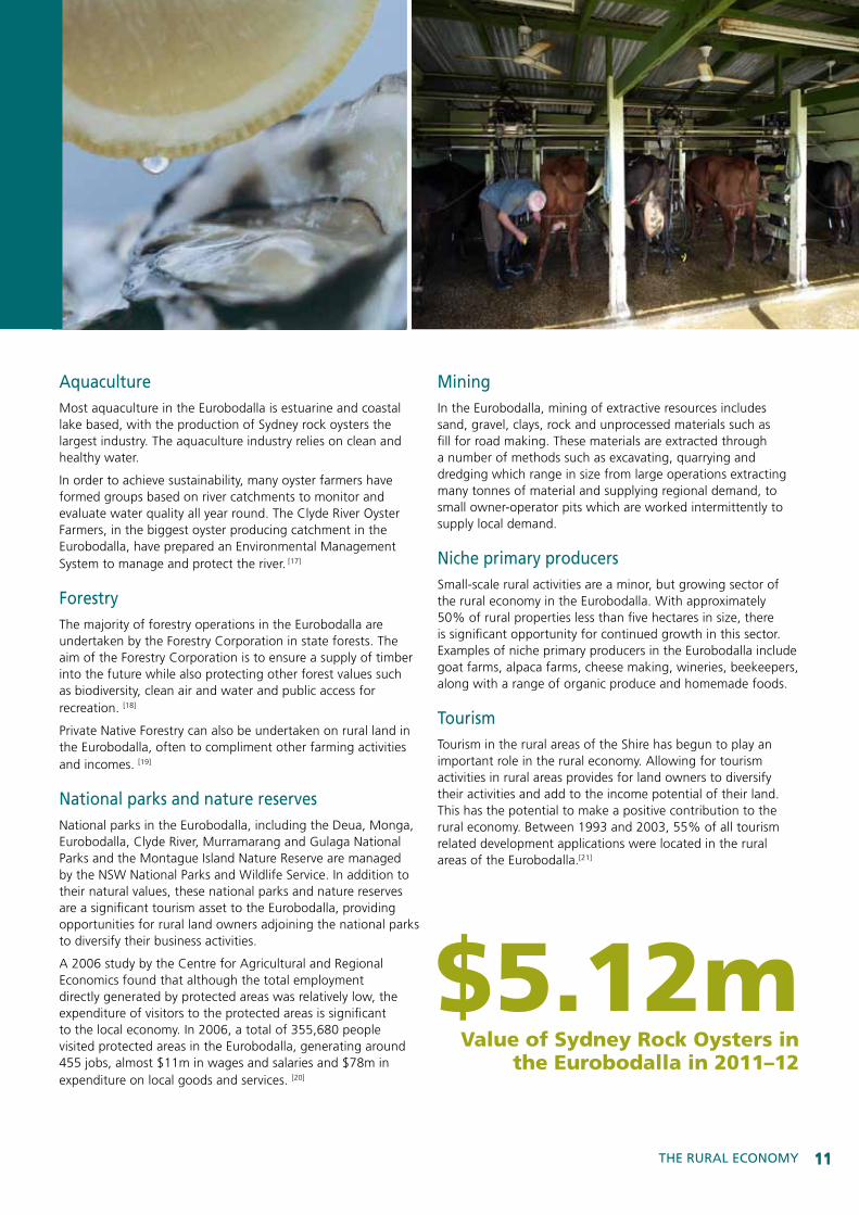
aquacultureMost aquaculture in the Eurobodalla is estuarine and coastal lake based, with the production of Sydney rock oysters the largest industry. The aquaculture industry relies on clean and healthy water.
In order to achieve sustainability, many oyster farmers have formed groups based on river catchments to monitor and evaluate water quality all year round. The Clyde River Oyster Farmers, in the biggest oyster producing catchment in the Eurobodalla, have prepared an Environmental Management System to manage and protect the river. [17]
ForestryThe majority of forestry operations in the Eurobodalla are undertaken by the Forestry Corporation in state forests. The aim of the Forestry Corporation is to ensure a supply of timber into the future while also protecting other forest values such as biodiversity, clean air and water and public access for recreation. [18]
Private Native Forestry can also be undertaken on rural land in the Eurobodalla, often to compliment other farming activities and incomes. [19]
national parks and nature reservesNational parks in the Eurobodalla, including the Deua, Monga, Eurobodalla, Clyde River, Murramarang and Gulaga National Parks and the Montague Island Nature Reserve are managed by the NSW National Parks and Wildlife Service. In addition to their natural values, these national parks and nature reserves are a significant tourism asset to the Eurobodalla, providing opportunities for rural land owners adjoining the national parks to diversify their business activities.
A 2006 study by the Centre for Agricultural and Regional Economics found that although the total employment directly generated by protected areas was relatively low, the expenditure of visitors to the protected areas is significant to the local economy. In 2006, a total of 355,680 people visited protected areas in the Eurobodalla, generating around 455 jobs, almost $11m in wages and salaries and $78m in expenditure on local goods and services. [20]
MiningIn the Eurobodalla, mining of extractive resources includes sand, gravel, clays, rock and unprocessed materials such as fill for road making. These materials are extracted through a number of methods such as excavating, quarrying and dredging which range in size from large operations extracting many tonnes of material and supplying regional demand, to small owner-operator pits which are worked intermittently to supply local demand.
niche primary producersSmall-scale rural activities are a minor, but growing sector of the rural economy in the Eurobodalla. With approximately 50% of rural properties less than five hectares in size, there is significant opportunity for continued growth in this sector. Examples of niche primary producers in the Eurobodalla include goat farms, alpaca farms, cheese making, wineries, beekeepers, along with a range of organic produce and homemade foods.
TourismTourism in the rural areas of the Shire has begun to play an important role in the rural economy. Allowing for tourism activities in rural areas provides for land owners to diversify their activities and add to the income potential of their land. This has the potential to make a positive contribution to the rural economy. Between 1993 and 2003, 55% of all tourism related development applications were located in the rural areas of the Eurobodalla.[21]
$5.12mValue of Sydney Rock Oysters in
the Eurobodalla in 2011–12
Eurobodalla ShirE CounCil rural landS iSSuES PaPEr
12
Value-adding activitiesThe food and fibre system is described as comprising the following sets of activities:
(i) Producing food and fibre; Processing and packaging food and fibre
(ii) Distributing and retailing food and fibre
(iii) Consuming food and purchasing fibre products[22].
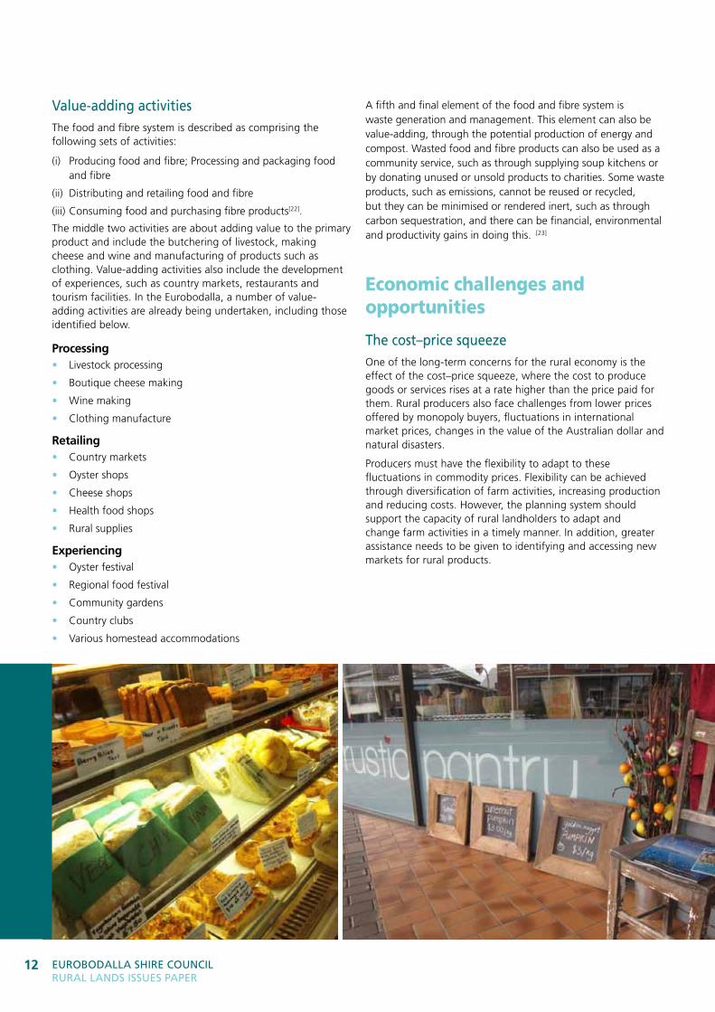
The middle two activities are about adding value to the primary product and include the butchering of livestock, making cheese and wine and manufacturing of products such as clothing. Value-adding activities also include the development of experiences, such as country markets, restaurants and tourism facilities. In the Eurobodalla, a number of value-adding activities are already being undertaken, including those identified below.
Processing• Livestock processing
• Boutique cheese making
• Wine making
• Clothing manufacture
retailing• Country markets
• Oyster shops
• Cheese shops
• Health food shops
• Rural supplies
experiencing• Oyster festival
• Regional food festival
• Community gardens
• Country clubs
• Various homestead accommodations
A fifth and final element of the food and fibre system is waste generation and management. This element can also be value-adding, through the potential production of energy and compost. Wasted food and fibre products can also be used as a community service, such as through supplying soup kitchens or by donating unused or unsold products to charities. Some waste products, such as emissions, cannot be reused or recycled, but they can be minimised or rendered inert, such as through carbon sequestration, and there can be financial, environmental and productivity gains in doing this. .[23]
Economic challenges and opportunities
The cost–price squeezeOne of the long-term concerns for the rural economy is the effect of the cost–price squeeze, where the cost to produce goods or services rises at a rate higher than the price paid for them. Rural producers also face challenges from lower prices offered by monopoly buyers, fluctuations in international market prices, changes in the value of the Australian dollar and natural disasters.
Producers must have the flexibility to adapt to these fluctuations in commodity prices. Flexibility can be achieved through diversification of farm activities, increasing production and reducing costs. However, the planning system should support the capacity of rural landholders to adapt and change farm activities in a timely manner. In addition, greater assistance needs to be given to identifying and accessing new markets for rural products.
13ThE rural EConoMY 13
47%rural properties in the
Eurobodalla less than 5ha in size
local food production, distribution and consumptionFood security at a global level is currently a critical issue. There are more people in the world and the population is growing at a rate faster than the world is able to produce enough food from the limited area of arable land. In Australia, the price of food is a key factor in achieving food security.
The Eurobodalla producers have a vital and increasing role to play in achieving food security locally and beyond. Direct supply of local produce to local consumers can help increase the affordability and availability of fresh food.
In 2011, a report titled South East Food: Growing the Regional Food Economy in South East NSW identified the following 10 barriers to increasing production and consumption of local food in the South East region:
1. Lack of consistent supply and not enough producers
2. Lack of financial motivation
3. Lack of outlets for local food
4. Lack of coordination of supply and demand
5. Difficulties in competing with supermarkets
6. Unnecessary regulations
7. Lack of an integrated and coordinated transport and logistics system
8. Lack of food processing facilities
9. Lack of support for producers
10. Lack of affordable land. [24]
The final report titled South East Food Plan: A Plan for Growing the Regional Food Economy in South East NSW released in May 2012, proposed 10 projects to overcome the barriers identified above. These projects include strengthening local producer support networks, highlighting opportunities for regional provedore services and marketing the region as a supporting and exciting place to produce, experience and live on sustainably produced food. [15] These represent areas for investigation by the Steering Committee.
Raising community awareness of the nutritional benefits of healthy local food is about increasing the ‘food literacy’ of the Eurobodalla residents. This aims to increase food knowledge and to change consumer attitudes about food. Council’s Live Life Eurobodalla program has undertaken a number of programs aimed at increasing food literacy through healthy eating and developing edible urban gardens. [25]
diversifying the rural economyRural land is used for many purposes, from various forms of agriculture to mining, tourism, rural living, recreation and conservation. Often, many of these activities are undertaken on the same property. However, in some parts of NSW, there are conflicts between land uses, such as between farming and coal seam gas extraction activities. A productive rural community should aim to provide for a diverse range of activities, all operating in harmony with each other.
The challenge for the Eurobodalla is to facilitate growth in the key agricultural industries of beef and dairy cattle and aquaculture, while at the same time providing for growth in a range of agricultural enterprises, from increased processing capacity, to other value-adding activities and to niche cottage industries.
However, diversification can also lead to land use conflicts. The South Coast Regional Strategy identifies land use conflict as a key planning issue affecting the viability of agriculture in the region. [6] Land use conflicts can lead to pressures to redevelop rural land for urban purposes. This pressure has significant implications, including:
• the potential permanent loss of agricultural land
• the potential increase in rural/urban conflicts which can impact on farming operations
• the creation of dispersed settlements that will have infrastructure capacity and cost issues
• inflated land values caused by price speculation, making land purchase for farming activities unviable.
infrastructure and servicesGrowth in agriculture in the Eurobodalla is limited by the capacity of infrastructure, particularly in relation to transport and water. Many rural communities are isolated from major transport routes and service centres. Local road conditions in the rural areas are often not suitable for heavy vehicle use and can at times be damaged or isolated by localised flooding events. The cost of transporting both farm inputs and agricultural produce has grown significantly in recent years, partly as a result of increasing fuel and electricity prices.
Increasing access to markets outside the Eurobodalla is limited by the capacity of transport infrastructure. Road transport is limited by the capacity for B-double trucks to move between markets and local distribution centres. Air transport is limited by the available flights from the Moruya and Canberra Airports. The Eurobodalla has no rail transport and no major port for sea transport. Expansion of the Canberra Airport to offer direct international flights, along with upgrades to the Kings Highway to provide B-double truck use, will significantly improve access to international markets for the Eurobodalla producers.
Whilst recent rains have replenished surface and sub-surface water supplies, the quantity of water available for agricultural use remains limited and needs to be carefully managed into the future, including the potential capacity for increased water storage on farms, particularly given the potential impacts of climate change on water availability.
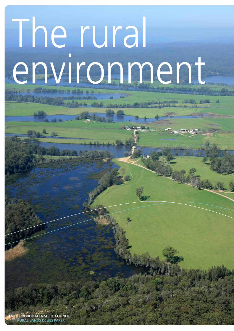
The rural environment
Eurobodalla ShirE CounCil rural landS iSSuES PaPEr
14
15Achieving the PlAn
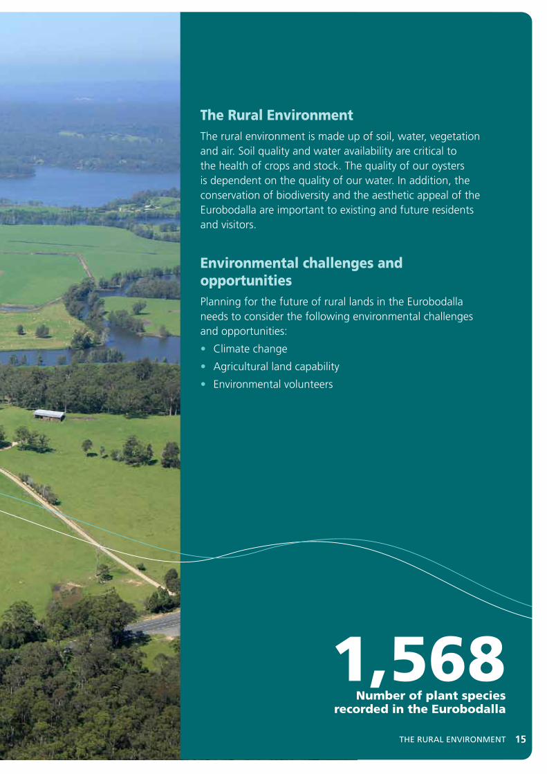
The Rural EnvironmentThe rural environment is made up of soil, water, vegetation and air. Soil quality and water availability are critical to the health of crops and stock. The quality of our oysters is dependent on the quality of our water. In addition, the conservation of biodiversity and the aesthetic appeal of the Eurobodalla are important to existing and future residents and visitors.
Environmental challenges and opportunitiesPlanning for the future of rural lands in the Eurobodalla needs to consider the following environmental challenges and opportunities:
• Climate change
• Agricultural land capability
• Environmental volunteers
15ThE rural EnVironMEnT
1,568Number of plant species
recorded in the Eurobodalla
Eurobodalla ShirE CounCil rural landS iSSuES PaPEr
16
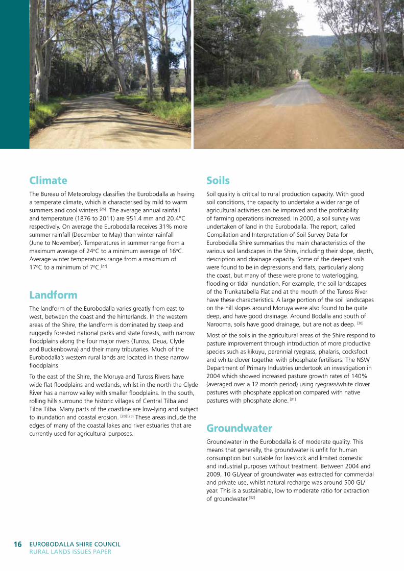
ClimateThe Bureau of Meteorology classifies the Eurobodalla as having a temperate climate, which is characterised by mild to warm summers and cool winters.[26] The average annual rainfall and temperature (1876 to 2011) are 951.4 mm and 20.4°C respectively. On average the Eurobodalla receives 31% more summer rainfall (December to May) than winter rainfall (June to November). Temperatures in summer range from a maximum average of 24oC to a minimum average of 16oC. Average winter temperatures range from a maximum of 17oC to a minimum of 7oC.[27]
LandformThe landform of the Eurobodalla varies greatly from east to west, between the coast and the hinterlands. In the western areas of the Shire, the landform is dominated by steep and ruggedly forested national parks and state forests, with narrow floodplains along the four major rivers (Tuross, Deua, Clyde and Buckenbowra) and their many tributaries. Much of the Eurobodalla’s western rural lands are located in these narrow floodplains.
To the east of the Shire, the Moruya and Tuross Rivers have wide flat floodplains and wetlands, whilst in the north the Clyde River has a narrow valley with smaller floodplains. In the south, rolling hills surround the historic villages of Central Tilba and Tilba Tilba. Many parts of the coastline are low-lying and subject to inundation and coastal erosion. [28] [29] These areas include the edges of many of the coastal lakes and river estuaries that are currently used for agricultural purposes.
SoilsSoil quality is critical to rural production capacity. With good soil conditions, the capacity to undertake a wider range of agricultural activities can be improved and the profitability of farming operations increased. In 2000, a soil survey was undertaken of land in the Eurobodalla. The report, called Compilation and Interpretation of Soil Survey Data for Eurobodalla Shire summarises the main characteristics of the various soil landscapes in the Shire, including their slope, depth, description and drainage capacity. Some of the deepest soils were found to be in depressions and flats, particularly along the coast, but many of these were prone to waterlogging, flooding or tidal inundation. For example, the soil landscapes of the Trunkatabella Flat and at the mouth of the Tuross River have these characteristics. A large portion of the soil landscapes on the hill slopes around Moruya were also found to be quite deep, and have good drainage. Around Bodalla and south of Narooma, soils have good drainage, but are not as deep. [30]
Most of the soils in the agricultural areas of the Shire respond to pasture improvement through introduction of more productive species such as kikuyu, perennial ryegrass, phalaris, cocksfoot and white clover together with phosphate fertilisers. The NSW Department of Primary Industries undertook an investigation in 2004 which showed increased pasture growth rates of 140% (averaged over a 12 month period) using ryegrass/white clover pastures with phosphate application compared with native pastures with phosphate alone. [31]
GroundwaterGroundwater in the Eurobodalla is of moderate quality. This means that generally, the groundwater is unfit for human consumption but suitable for livestock and limited domestic and industrial purposes without treatment. Between 2004 and 2009, 10 GL/year of groundwater was extracted for commercial and private use, whilst natural recharge was around 500 GL/year. This is a sustainable, low to moderate ratio for extraction of groundwater.[32]
17ThE rural EnVironMEnT 17
951mmaverage annual rainfall in
the Eurobodalla
Environmental attributesEnvironmental attributes, described as environmental assets in the South Coast Regional Conservation Plan, in the Eurobodalla include:• Endangered ecological communities, such as Bangalay Sand
Forest and Littoral Rainforests• Rare, poorly conserved and overcleared vegetation types• Old-growth forests• Threatened and significant species, such as the
Yellow-Bellied Glider• Wetlands and significant aquatic habitats, including Durras,
Brou and Corunna Lakes• Wilderness, such as in the Wadbilliga and Deua
National Parks• Wildlife corridors• Sites of geological or landform significance, such as the
limestone caves at Bendethera. [33]
There is a large amount of total vegetation within the Shire due to the extent of national parks and state forests, mostly in the western parts. However, some specific landscape types in the Shire have been heavily cleared, including coastal valleys, wetlands and floodplains, and coastal sandplains. Consequently, many of the vegetation types that occur in these landscapes have been classified as threatened or endangered.[33] The Eurobodalla also has many marine, estuarine and fresh water environments that are integral to the region’s character, lifestyle and economy.
The challenge for the Eurobodalla is to ensure the protection of the under-reserved coastal environments and facilitate appropriate connections to the woodlands along the coastal range, without unduly restricting the capacity for growth in agricultural enterprise.
Flora and faunaThe full extent of native animal and plant species diversity in the Eurobodalla Shire Council area is not known. About 1,568 plant species (native and introduced) and 782 animal species have been recorded, but these records are not comprehensive. [34]
Threatened and endangered species in the Eurobodalla are protected by both state and federal legislation, as identified below. The presence of threatened and endangered species, communities or populations on land does not prohibit development. Rather, it triggers a requirement for a more detailed assessment to be undertaken before development can take place.
Threatened Species Conservation Act, 1995 (nSW) [35]
• Endangered ecological communities
• Endangered populations
• Threatened species.
Fisheries Management Act, 1994 (nSW) [35]
• Listed species
• Marine vegetation.
Environmental Protection and Biodiversity Conservation Act, 1999 (Commonwealth) [36]
• Ecological communities
• Nationally important wetlands
• Marine species
• Migratory species
• Threatened species.
Wetlands and watercoursesThe natural drainage system in the Eurobodalla is dominated by the major river systems and a series of lakes and lagoons along the coastline. These waterways and wetlands are of vital importance for the Shire’s economy as they sustain much of the irrigation, dairy, aquaculture and food processing industries. These waterways are also important to the tourism industry and provide the supply of potable water to the Eurobodalla residents and visitors. Wetlands and waterways are also important nature conservation areas, particularly as habitat for many species of waterbirds and as fisheries nurseries.
Water quality within the Eurobodalla is of a relatively high standard. At the two monitoring sites (Deua River and Tuross River), the levels of salinity, algal blooms and turbidity were well within acceptable standards during 2004 to 2009.[37] Anecdotally, over the nine-year period the Bingi Resident’s Association was testing water quality at Coila Lake, Kelly Lake and Mullimburra Lagoon as part of the Water Watch program, only one case of high alkalinity was detected.
Wetlands and watercourses are of significant value to rural land holders, in terms of access to water for stock, irrigation of crops, habitat for wildlife and for their aesthetic value in the rural landscape.
Eurobodalla ShirE CounCil rural landS iSSuES PaPEr
18
Environmental constraints
land degradationLand degradation issues for rural landholders in the Eurobodalla include the acidification and loss of soils. Acid sulfate soils are a primary concern in the management of soils in some low-lying areas of the Eurobodalla, within the floodplains of rivers and streams. When soils containing iron sulfides are disturbed and exposed to oxygen, sulfuric acid is produced. When this acid enters waterways, it can lower the pH balance and destroy the sensitive ecosystems present.[38]
Although many Shire soils are acidic this is not normally a constraint for pasture improvement and can be rectified with lime application for vegetable and horticultural crops.[61] Soil acidity can accelerate land degradation.[39]
Soil salinity is very limited in the Shire, with only two known sites near Garlandtown and Turlinjah, and no forecast increase in the areas affected to the year 2050.[40]
The removal of native vegetation, rabbits and grazing without pasture improvement in some areas has resulted in gully erosion, sheet erosion and landslip. Erosion can be increased by the presence of stock animals on the cleared land, especially near creeks and other waterways. Gully erosion has become extreme in some areas of the Eurobodalla and, in an attempt to minimise the damage to river banks and beds, some land owners have constructed fences along waterways as well as significant erosion control structures over some of the most seriously affected areas. From surveys conducted between 1985 and 1992, there were approximately 19 km of gully erosion and 145 km of stream bank erosion in the Eurobodalla Shire. Twenty seven percent of the Shire was also recorded as having minor to moderate sheet erosion, while 0.3% (919 ha) has severe to extreme sheet erosion.[40]
bushfireThe Eurobodalla is prone to bushfires due to the significant proportion of the Shire covered in bushland. The bushfire risk to the Eurobodalla communities is increased by the proximity of settlements to bushland. The Eurobodalla Shire has, on average, 60 bushfires a year of which three or four can be considered significant. The most recent major fires, in 2002, burnt large amounts of rural areas around the Deua River.[41]
All land owners have a statutory obligation under the Rural Fires Act 1997 to minimise the hazard of bushfires. Councils also have a responsibility to assess development applications on private land that is bushfire prone having regard to State planning guidelines for bushfire protection. [42]
FloodingThe waterways of the Eurobodalla are fed by steep and rugged land which rises sharply within a short distance from the coast and settlements. The coastal areas are low-lying with significant areas of wetlands. As a result of these factors, the major rivers of the Shire transmit large volumes of water at high velocity during major flooding events presenting a risk to lives, property and livestock.
Farming and flooding are inextricably linked in the Eurobodalla’s rural lands, with some of the most productive farm lands being located within the flood zone of our major rivers. Floods have the potential to remove and redeposit significant amounts of topsoil over large areas of farming land.
In March 2010, major riverine flooding occurred within the Shire, causing road slips and damage to stormwater structures. Costs associated with flooding on the Moruya River are estimated in the Moruya River Floodplain Management Plan to be in excess of $1.6m per year. [28] This highlights the importance of investing in flood mitigation, planning and education.
invasive speciesAn invasive species is a species occurring, as a result of human activities, beyond its normal distribution and which threatens valued environmental, agricultural or other social resources by the damage it causes.
Key invasive species in the Eurobodalla Shire include foxes, wild dogs, rabbits, Bitou Bush, Lantana, Fireweed and African Love Grass. [43] [44] These species have the potential to greatly impact on the rural lands of the Eurobodalla if regular control programs are not in place.
Environmental and cultural heritageHeritage items include places and landscapes of historic, cultural, natural, social, spiritual, archaeological, architectural and/or aesthetic significance. Appropriate management of the Shire’s heritage, particularly in rural areas, can increase opportunities for tourism. Eurobodalla Shire Council has 275 heritage items listed in its Local Environmental Plans [7][45] and four items listed on the NSW State Heritage Register. Aboriginal heritage in the Eurobodalla is also reflected in planning instruments, with 11 Aboriginal Places of Heritage Significance
27%area of the the Eurobodalla recorded as having minor to moderate sheet erosion
19ThE rural EnVironMEnT 19
listed in the Eurobodalla Local Environmental Plan 2012 [7].
Owners of heritage items in the Eurobodalla are entitled to free advice from Council’s heritage advisor and to apply for funding to support the conservation of their heritage item or place or to assist them in managing heritage items.
Environmental challenges and opportunities
Climate changeThere are potentially significant positive and negative consequences for agriculture due to climate change. The direct impacts of climate change, such as sea level rise, increases in average temperatures and changes to average rainfall, may have flow-on effects for rural lands in the Eurobodalla. For example:
• a warmer climate may extend growing seasons or change the crops that can be grown
• warmer sea temperatures may influence aquaculture yields
• a reduction in average rainfall may limit pasture growth
• warmer temperatures may increase heat stress in livestock
• the number of large bushfires per year may increase
• risks due to heat waves and the spread of tropical diseases/pests may increase
• increases in evaporation may mean less water in dams.
The NSW Department of Primary Industries website contains a number of research papers on the potential impacts of climate change on agricultural industries. [46]
The Standing Committee on Primary Industries and Resources of the House of Representatives in the federal government has recently released a report called Farming the Future. The Report looks at the role of government in assisting Australian farmers to adapt to the impacts of climate change. It recommends increased investment by the government in soil carbon sequestration, soil stabilisation and pasture improvement techniques, soil water retention strategies and water use,
landscape plans and natural resource management and risk management. The report also recommends increased investment in alternative fuels on-farm including biofuels, biomass from agricultural waste and biochar (charcoal produced from burning organic materials). [47]
agricultural land capabilityThe capacity and suitability of agricultural land is an important planning and development issue across all rural land. Agricultural land classification mapping produced by the Department of Primary Industries, takes into account natural attributes, soil types and climate, and classifies land into five categories according to its suitability for a wide range of agricultural activities. [48]
These classifications, together with the relatively small size of rural parcels in some of the most productive areas of the Eurobodalla, suggest that grazing of animals, pasture improvement and small-scale cropping will most likely continue to be the main forms of agriculture in the Eurobodalla. Whilst some land may be classified as highly arable (Class 1), the types and methods of agriculture that can be undertaken and the production capacity of the land will be influenced by environmental attributes and constraints and by factors such as infrastructure and distance to markets.
Environmental volunteersVolunteer groups such as Landcare, Creekcare, Bushcare, Rivercare and Coastcare play a significant role in addressing environmental constraints to enhance the Eurobodalla’s environment. During 2011–12 over 600 volunteers contributed 14,937 hours of their time valued at $448,110.[49]
These groups undertake a variety of projects in partnership with Council as well as many unfunded projects throughout the Eurobodalla, such as coastal and gully erosion control, noxious weed control and revegetation projects. To enhance the skills of the volunteers and the wider community, Council supports a range of initiatives including The Healthy Soils Field Day, SAGE Garden Blitz, Southeast Harvest Festival, Bushcare training days and weed control.[49]
Legislation and planning
Eurobodalla ShirE CounCil rural landS iSSuES PaPEr
20
21Achieving the PlAn
Legislation and Planning Councils are obligated to conform to different legislative requirements set by both federal and state governments along with regulations set by different levels of government which create a confusing web of rules when considering local planning instruments. Council needs to be compliant with all legislative, policy and strategic requirements.
In general there are three layers to the policy and strategy context:
• Legislation
• State and regional planning
• Local planning.
21lEGiSlaTion and PlanninG
46.5%area of private rural land deferred from the Eurobodalla Local Environmental Plan 2012
Eurobodalla ShirE CounCil rural landS iSSuES PaPEr
22
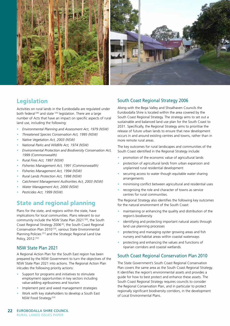
LegislationActivities on rural lands in the Eurobodalla are regulated under both federal [36] and state [35] legislation. There are a large number of Acts that have an impact on specific aspects of rural land use, including the following:
• Environmental Planning and Assessment Act, 1979 (NSW)
• Threatened Species Conservation Act, 1995 (NSW)
• Native Vegetation Act, 2003 (NSW)
• National Parks and Wildlife Act, 1974 (NSW)
• Environmental Protection and Biodiversity Conservation Act, 1999 (Commonwealth)
• Rural Fires Act, 1997 (NSW)
• Fisheries Management Act, 1991 (Commonwealth)
• Fisheries Management Act, 1994 (NSW)
• Rural Lands Protection Act, 1998 (NSW)
• Catchment Management Authorities Act, 2003 (NSW)
• Water Management Act, 2000 (NSW)
• Pesticides Act, 1999 (NSW).
State and regional planningPlans for the state, and regions within the state, have implications for local communities. Plans relevant to our community include the NSW State Plan 2021 [50], the South Coast Regional Strategy 2006 [6], the South Coast Regional Conservation Plan 2010 [33], various State Environmental Planning Policies [51] and the Strategic Regional Land Use Policy, 2012.[52]
nSW State Plan 2021A Regional Action Plan for the South East region has been prepared by the NSW Government to turn the objectives of the NSW State Plan 2021 into actions. The Regional Action Plan inlcudes the following priority actions:
• Support for programs and initiatives to stimulate employment opportunities in key sectors including value-adding agribusiness and tourism
• Implement pest and weed management strategies
• Work with key stakeholders to develop a South East NSW Food Strategy.[53]
South Coast regional Strategy 2006Along with the Bega Valley and Shoalhaven Councils the Eurobodalla Shire is located within the area covered by the South Coast Regional Strategy. The strategy aims to set out a sustainable and balanced land use plan for the South Coast to 2031. Specifically, the Regional Strategy aims to prioritise the release of future urban lands to ensure that new development occurs in and around existing centres and towns, rather than in more remote rural areas.
The key outcomes for rural landscapes and communities of the South Coast identified in the Regional Strategy include:
• promotion of the economic value of agricultural lands
• protection of agricultural lands from urban expansion and unplanned rural residential development
• securing access to water though equitable water sharing arrangements
• minimising conflict between agricultural and residential uses
• recognising the role and character of towns as service centres for rural communities.
The Regional Strategy also identifies the following key outcomes for the natural environment of the South Coast:
• maintaining or enhancing the quality and distribution of the region’s biodiversity
• identifying and protecting important natural assets through land use planning processes
• protecting and managing oyster growing areas and fish nursery and habitat areas within coastal waterways
• protecting and enhancing the values and functions of riparian corridors and coastal wetlands.
South Coast regional Conservation Plan 2010The State Government’s South Coast Regional Conservation Plan covers the same area as the South Coast Regional Strategy. It identifies the region’s environmental assets and provides a guide for how to best protect and enhance these assets. The South Coast Regional Strategy requires councils to consider the Regional Conservation Plan, and in particular to protect regionally significant biodiversity corridors, in the development of Local Environmental Plans.
23lEGiSlaTion and PlanninG 23
State Environmental Planning PoliciesIn addition to regional strategic planning, the State Government makes State Environmental Planning Policies (SEPPs) which provide principles, objectives and development standards for specific places or types of development. Examples of SEPPs include:
• SEPP (Rural Lands) 2008
• SEPP 14 Coastal Wetlands
• SEPP (Exempt and Complying Development Codes) 2008
• SEPP (Infrastructure) 2007.
Strategic regional land use PolicyIn September 2012, the NSW State Government adopted a Strategic Regional Land Use (SRLU) Policy along with SRLU plans for the Upper Hunter and New England North West regions of the state. The principal purpose of the policy and plans is to manage and balance the competing land uses. A key method to achieve this outcome is through the identification of strategic agricultural land.
nSW Primary industries Policy – Maintaining land for agricultural industriesTo assist councils in preparing planning documents, NSW Department of Primary Industries developed a policy in 2011 called Maintaining Land for Agricultural Industries that requires the best agricultural land in the state to be maintained as rural land for future generations. The policy requires planning documents to:
• promote the continued use of agricultural land for commercial agricultural purposes
• avoid land use conflicts
• protect natural resources used by agriculture
• protect other values associated with agricultural land that are of importance to local communities such as heritage and visual amenity
• provide for a diversity of agriculture enterprises
• allow for value adding and integration of agricultural industries into regional economics.[54]
draft Southern rivers Catchment action Plan 2013–2023In November 2012, the Southern Rivers Catchment Management Authority released a Draft Catchment Action Plan (CAP) that is a 10-year plan identifying priority strategies for improving the resilience of the Southern Rivers region. The priority strategies in the Draft CAP include:
• support local industries dependent on natural resources to be more profitable and sustainable
• support land managers to make well informed natural resource use and stewardship decisions
• ensure frameworks are in place to effectively respond and adapt to change
• maintain diverse, healthy and connected natural environments
• maintain and improve soil conditions to support people and the environment
• maintain and improve water security to support people and the environment. [55]
Local planningEurobodalla Shire Council undertakes a range of planning and policy development activities to manage, facilitate and support land use activity in the Shire, including Strategic Plans, Local Environmental Plans and Development Control Plans, Codes and Policies.
Strategic PlansStrategic Plans are long-term planning documents written to inform future changes to local planning controls. These plans are based on an understanding of the key trends and issues affecting the Shire.
The community-based Eurobodalla Settlement Strategy (ESS) has provided strategic direction in the Eurobodalla since 2006. Importantly, the ESS, adopted by Council as a blueprint for a new LEP, informed the development of the Eurobodalla Local Environmental Plan 2012. The ESS contained strategies and actions relating to weed management, agricultural diversification, recognition of property management plans and conservation agreements, use of treated effluent and buffering between adjoining land uses. [21]
In April 2012, Council adopted its Community Strategic Plan, Eurobodalla 2030 (CSP) in line with the State Government’s integrated planning and reporting framework. Key directions of the Community Strategic Plan filter all the way through Council’s plans, policies and activities. The Rural Lands Strategy implements Strategy 5.2 of the CSP, ‘Plan to improve natural and built environments’. [56]
In accordance with State Government requirements, the Community Strategic Plan is currently being reviewed following the local government elections held in September 2012.
10,700new dwellings required in the
Eurobodalla by 2031
Eurobodalla ShirE CounCil rural landS iSSuES PaPEr
24
local Environmental PlansLocal Environmental Plans (LEPs) provide the ‘rules’ for development of land. They control the types of permissible development through the application of zones, land use tables and development standards, such as minimum lot size. The Eurobodalla Local Environmental Plan 2012 (ELEP 2012) covers the majority of the Shire, including most rural land. However, 38,006.3 ha, or 11.1% of the Shire (equating to 46.5% of private rural land), was deferred from the ELEP 2012 and this land is still under the Rural Local Environmental Plan 1987 [15] (RLEP 1987).
development Control Plans, Codes and PoliciesDevelopment Control Plans (DCPs), Codes and Policies further the objectives of the LEPs by providing detailed land use requirements and guidelines. There is currently no specific rural DCP, though some rural land in the Tilba area may be subject to the Tilba Villages and Conservation Area DCP [57]. Subdivision of rural land covered by the RLEP 1987 is subject to the Rural Subdivision DCP
[58]. A new comprehensive DCP for rural areas will be developed following the completion of the Rural Lands Strategy.
Legislative and planning challenges and opportunitiesIn developing its Draft Catchment Action Plan, the Southern Rivers Catchment Management Authority identified the following changes affecting landholders and the environment of the Southern Rivers region:
• emerging enterprise opportunities, including carbon
• greater interest and expectation by the community to live sustainably
• a more variable climate
• increased demand for food, oil, energy and water
• generational change in farm ownership
• competing demands on the use of land.
In adapting to these changes, landholders rely on the right legislative and policy settings of governments at all levels. Rural land in the Eurobodalla is subject to a number of legislative controls which regulate land use and attempt to mitigate any harmful effects on our rural lands. These controls are often triggered by the presence of a certain factor, such as threatened species, bushfire risk or contamination.
For example, clearing vegetation of all types is a highly regulated activity in NSW. In rural areas, the Native Vegetation Act 2003 identifies clearing activities that require approval and those that do not, such as for routine agricultural maintenance activities and for a dwelling. The Southern Rivers Catchment Management Authority’s Fact Sheet outlines what clearing activities do not require approval. [59]
The Native Vegetation Act 2003 requires property vegetation plans to be prepared and approved before undertaking clearing that requires an approval. However, a range of other Acts also regulate the impacts of development on vegetation, such as the NSW National Parks and Wildlife Act 1974, Threatened Species Conservation Act 1995, Rural Fires Act 1997 and Water Management Act 2000 and the Commonwealth’s Environmental Protection and Biodiversity Conservation Act 1999. The multitude of legislation can create confusion for landholders.
Opportunities to influence the policy settings and legislative requirements of the Australian and NSW Governments arise from time to time. Recently, the National Food Plan Green Paper was released for public comment.[22] In NSW, reviews of the NSW Planning System and the Native Vegetation Regulations are currently underway. [60] [61] The Draft Southern Rivers Catchment Action Plan was recently on exhibition for public comment. Policy settings relating to specific industries can also be influenced through the advocacy of peak industry bodies.
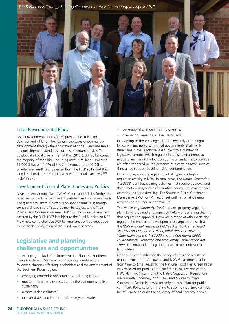
The Rural Lands Strategy Steering Committee at their first meeting in August 2012
25rEFErEnCES 25
References[1] Eurobodalla Community Profile website: http://profile.id.com.au/eurobodalla/home
[2] Eurobodalla Population Profile website: http://forecast2.id.com.au/Default.aspx?id=319&pg=5000
[3] Eurobodalla Community Atlas website: http://atlas.id.com.au/eurobodalla/
[4] Australia to 2050, 2010, Commonwealth of Australia: http://archive.treasury.gov.au/igr/igr2010/report/pdf/IGR_2010.pdf
[5] Australian Bureau of Statistics Census 2011 Community Profiles-Eurobodalla website (go to Time Series Profile, T14): www.censusdata.abs.gov.au/census_services/getproduct/census/2011/communityprofile/145152750?opendocument&navpos=230
[6] South Coast Regional Strategy, 2006, NSW Department of Planning and Infrastructure: www.planning.nsw.gov.au/StrategicPlanning/Regionalplanning/SouthCoast/tabid/197/language/en-AU/Default.aspx
[7] Eurobodalla Local Environmental Plan 2012: www.legislation.nsw.gov.au/maintop/view/inforce/epi+333+2012+cd+0+N
[8] Regional Histories of New South Wales, 1996, Heritage Office and Department of Urban Affairs and Planning
[9] Small Area Labour Markets Australia, December Quarter 2012, Department of Education, Employment and Workplace Relations: http://foi.deewr.gov.au/node/31829
[10] Australian Government Department of Education, Employment and Workplace Relations, Employment Projections website (go to Regional Projections to 2016-17): www.deewr.gov.au/lmip/default.aspx?LMIP/Publications/IndustryEmploymentProjections
[11] Australian Bureau of Statistics National Regional Profile: Eurobodalla website: www.abs.gov.au/AUSSTATS/[email protected]/Previousproducts/LGA12750Industry12004-2008?opendocument&tabname=Summary&prodno=LGA12750&issue=2004-2008
[12] Economic Development and Employment Lands Strategy, Eurobodalla Shire Council, 2011: www.esc.nsw.gov.au/services/planning-and-development/plans-policies-and-strategies/
[13] Socio-Economic Assessment of the Batemans Marine Park, 2006, Marine Parks Authority NSW: www.mpa.nsw.gov.au/bmp.html
[14] Aquaculture Production Report 2011-2012, Department of Primary Industries, 2013: www.dpi.nsw.gov.au/fisheries/aquaculture/faqs/aquaculture-production-reports
[15] South East Food Plan, 2012, South East Food Project: http://southeastfood.com.au/uploads/media/South_East_Food_Plan_2012.pdf
[16] Australian Bureau of Statistics Agricultural Commodities 2005-06 website (go to NSW SLA Livestock): www.abs.gov.au/AUSSTATS/[email protected]/DetailsPage/7125.02005-06%20(Reissue)?OpenDocument
[17] Clyde River Oyster Farmers Environmental Management System website: http://clyderiveroysterfarmers.com.au/how-you-can-help.php
[18] Forestry Corporation website: www.forestrycorporation.com.au
[19] NSW Office of Environment and Heritage Private Native Forestry website: www.environment.nsw.gov.au/pnf/index.htm
[20] Impact of National Parks on the Regional Economies of the NSW Far South Coast, 2006, Centre for Agricultural and Regional Economics Pty Ltd: www.environment.nsw.gov.au/projects/farsoutheconomicstudy.htm
[21] Eurobodalla Settlement Strategy, 2006, Eurobodalla Shire Council: www.esc.nsw.gov.au/media/399434/Eurobodalla_Settlement_Strategy.pdf
[22] National Food Plan Green Paper, 2012, Australian Government: www.daff.gov.au/nationalfoodplan/process-to-develop/green-paper
[23] NSW Minister for Primary Industries Media Release,20 March 2012, ‘Farmers take lead in Australian First Soil Carbon Pilot’: www.dpi.nsw.gov.au/__data/assets/pdf_file/0008/428498/20120320-FARMERS-TAKE-LEAD-IN-AUSTRALIAN-FIRST-SOIL-CARBON-PILOT.pdf
[24] South East Food: Growing the Regional Food Economy in South East NSW Discussion Paper, 2011, South East Food Project: www.sustainingourtowns.org.au/regional-initiatives/south-east-food/
[25] Eurobodalla Shire Council Live Life Eurobodalla website: http://www.esc.nsw.gov.au/community/community-wellbeing/live-life-eurobodalla/
[26] Bureau of Meteorology website: www.bom.gov.au/climate/environ/other/kpn.jpg
[27] Eurobodalla Tourism website: www.eurobodalla.com.au/climate
[28] Moruya River Floodplain Management Plan, 2004, Eurobodalla Shire Council
[29] Coastal Hazards Scoping Study, 2010, SMEC: www.esc.nsw.gov.au/environment/coastal-management/studies-and-management-plans/
26 Eurobodalla ShirE CounCil rural landS iSSuES PaPEr
[30] Compilation and Interpretation of Soil Survey Data for Eurobodalla Shire, 2000
[31] Matching pasture to livestock enterprises, coastal regions, NSW Department of Primary Industries Agnote DPI-500, November 2004: www.dpi.nsw.gov.au/__data/assets/pdf_file/0007/162835/Coastal-regions.pdf
[32] Regional SoE website: www.envcomm.act.gov.au/soe/rsoe2009/eurobodalla//indicators/groundwater.shtml
[33] South Coast Regional Conservation Plan, 2010, NSW Office of Environment and Heritage: www.environment.nsw.gov.au/biodiversity/regconsplans.htm
[34] Regional SoE website: www.envcomm.act.gov.au/soe/rsoe2009/eurobodalla/indicators/nativespecies.shtml
[35] NSW Government legislation website: www.legislation.nsw.gov.au/maintop/scanact/inforce/NONE/0
[36] Commonwealth Government legislation website: www.comlaw.gov.au/Browse/ByTitle/Acts/Asmade
[37] Regional SoE website: www.envcomm.act.gov.au/soe/rsoe2009/eurobodalla/indicators/surfacewaterquality.shtml
[38] Eurobodalla Shire Council Acid Sulphate Soils website: www.esc.nsw.gov.au/environment/acid-sulfate-soils/
[39] Pastures and Acid Soils Leaflet No. 6, NSW Agriculture, July 1999: www.dpi.nsw.gov.au/agriculture/resources/soils/acidity/publications/pastures
[40] Regional SoE website: www.envcomm.act.gov.au/soe/rsoe2009/eurobodalla/indicators/landdegradation.shtml
[41] Eurobodalla Bushfire Risk Management Plan, 2011, Eurobodalla Bush Fire Risk Management Committee:
[42] NSW Rural Fire Service planning guidelines: www.rfs.nsw.gov.au/dsp_content.cfm?CAT_ID=900
[43] Regional SoE website: www.envcomm.act.gov.au/soe/rsoe2009/eurobodalla/indicators/pestanimals.shtml
[44] Regional SoE website: www.envcomm.act.gov.au/soe/rsoe2009/eurobodalla/indicators/pestplants.shtml
[45] Eurobodalla Rural Local Environmental Plan 1987: www.legislation.nsw.gov.au/maintop/view/inforce/epi+592+1987+cd+0+N
[46] NSW Department of Primary Industries research papers: www.dpi.nsw.gov.au/research/topics/climate-change/impacts-on-industry
[47] Farming the Future, 2010, Former Standing Committee on Primary Industries and Resources, Commonwealth House of Representatives: www.aph.gov.au/Parliamentary_Business/Committees/House_of_Representatives_Committees?url=pir/australianfarmers/report.htm
[48] Agricultural Land Classification Factsheet, 2002, NSW Primary Industries http://www.dpi.nsw.gov.au/agriculture/resources/lup/strategic-planning/agricultural
[49] Eurobodalla Shire Council Annual Report, 2011-12: www.esc.nsw.gov.au/publications/corporate-reports/2011-12/annual-report-2011-12/
[50] NSW State Plan, NSW 2021, 2011, NSW Government: www.2021.nsw.gov.au/
[51] NSW Department of Planning and Infrastructure State Environmental Planning Policies website: http://www.planning.nsw.gov.au/PolicyandLegislation/Legislationandplanninginstruments/ListingofStatePolicies/tabid/614/language/en-US/Default.aspx
[52] Strategic Regional Land Use Policy, 2012, NSW Department of Planning and Infrastructure: www.planning.nsw.gov.au/srlup
[53] South East NSW Regional Action Plan, December, 2012, NSW Government: www.2021.nsw.gov.au/regions/south-east
[54] Maintaining Land for Agricultural Industries Fact Sheet, 2011, NSW Primary Industries: http://www.dpi.nsw.gov.au/__data/assets/pdf_file/0008/396458/Policy-O-104-maintaining-land-agricultural-industries.pdf
[55] Draft Catchment Action Plan, 2012, Southern Rivers Catchment Management Authority: http://yoursaysouthernriverscma.com.au/
[56] Eurobodalla 2030, Community Strategic Plan, 2011, Eurobodalla Shire Council: www.esc.nsw.gov.au/services/planning-and-development/ipr/
[57] Tilba Villages and Conservation Area DCP, 2012, Eurobodalla Shire Council: www.esc.nsw.gov.au/services/planning-and-development/plans-policies-and-strategies/development-control-plans/
[58] Rural Subdivisions DCP, 1994, Eurobodalla Shire Council: www.esc.nsw.gov.au/services/planning-and-development/plans-policies-and-strategies/development-control-plans/
[59] Native Vegetation Act 2003 Fact Sheet 3, undated, Southern Rivers Catchment Management Authority: http://www.southern.cma.nsw.gov.au/htmleditor/documents/SRCMA%20NV%20Fact%20Sheet%203.PDF
[60] NSW Planning System Review website: http://www.planning.nsw.gov.au/a-new-planning-system-for-nsw
[61] Review of the Native Vegetation Regulation website: http://www.environment.nsw.gov.au/vegetation/nvmanagement.htm
Your feedbackComments on the Rural Lands Issues Paper are invited until 12 June 2013.
You can use the Rural Lands Issues Paper Fact Sheets to write your comments and place them in the Submission Box at Council’s libraries or Administration Centre, or mail them to us at the address below. You can also make an online submission using the form on Council’s website, or send us an email at [email protected]
If you would like to speak to us to share your views, you can come to one of our information sessions. Please see Council’s website for details. Alternatively, you can call our Rural Lands Strategy Hotline on 4474 7486.
Written submission can be sent to us as:The General ManagerRural Lands Issues PaperPO Box 99MORUYA NSW 2537
All of the information you need is on Council’s website at www.esc.nsw.gov.au by clicking on Eurobodalla Rural Lands Strategy.
Don’t forget to make your submission by no later than 12 June 2013.
To register your interest in the Rural Lands
Strategy to receive information updates
and notifications about future community
engagement activities, please email us at
To contact Council and for more information
PO Box 99 Moruya NSW 2537
T 02 4474 1000 I F 02 4474 1234
[email protected] I www.esc.nsw.gov.au04/13