Embed Size (px)
Citation preview

ROYAL BOROUGH OF WINDSOR & MAIDENHEADPLANNING COMMITTEE
MAIDENHEAD DEVELOPMENT CONTROL PANEL
14 February 2018 Item: 1ApplicationNo.:
17/02812/OUT
Location: Land Including Thames Auto Sales And The Amber Centre And Former Unit 5 OldfieldRoad Maidenhead
Proposal: Outline application (means of access, appearance, layout and scale only to bedetermined) for demolition of existing buildings, erection of a three storey building inthe southern part of the site, erection of a part two/part three/part four storey building inthe northern part of the site to provide 67 residential dwellings and associated parking.
Applicant: Shanly Homes LtdAgent: Mr Kevin ScottParish/Ward: Maidenhead Unparished/Oldfield Ward
If you have a question about this report, please contact: Laura Ashton on 01628 682977 or [email protected]
1. SUMMARY
1.1 Part of the proposed development would result in the loss of designated employment land.Whilst this is only relevant to part of the site in the absence of any evidence to demonstrate thatthere is no reasonable prospect of the site’s continued employment use, the developmentproposals are unacceptable. The proposed development would also have a negative impactupon the character and appearance of the area due to its height and lack of space for anymeaningful landscaping. The development fails to make appropriate provision for refusecollection within the development scheme and fails to demonstrate that the development will notpose a threat to trees that are of importance to the character of the area. The developmentproposals have also failed the sequential test which seeks to direct development towards areasat a lower risk of flooding.
It is recommended the Panel refuses planning permission for the following summarisedreasons (the full reasons are identified in Section 10 of this report):
1. The proposal results in the loss of employment land in the absence of evidence todemonstrate that the site has no reasonable prospect of remaining in anemployment use.
2. The proposed development will be harmful to the character and appearance of thearea due to its height and bulk relative to surrounding buildings and a lack of spacefor any meaning full landscaping
3. The proposed development’s proximity to trees on the railway embankment will leadto the trees overshadowing living and amenity spaces to the detriment of theamenity of future occupiers and the sustainability of the trees due to pressures toprune or fell them.
4. The submitted Sequential Assessment fails to demonstrate that the proposal cannotbe located on an alternative site that is reasonably available with a lower probabilityof flooding.
5. The scheme fails to make appropriate provision for refuse servicing on thedevelopment site and subsequently poses a threat to highway safety andconvenience.

2. REASON FOR PANEL DETERMINATION
At the request of Councillor Wilson – “Panel to consider the application as part of an overallhousing scheme. The use of voids similar to other schemes permitted in Fathingales,Oldacres and the Chiltern Road Estate, as the proposal is contained within the functionalfloodplain.”
3. DESCRIPTION OF THE SITE AND ITS SURROUNDINGS
3.1 The application site consists of three elements: Thames Auto Sales (a single storey car sales unitand associated forecourt), the Amber Centre (a two storey commercial building divided into twounits), and a piece of previously developed land that has been cleared (former commercial site).
3.2 The whole site is located to the east of Maidenhead town centre, and fronts both Oldfield Roadwhich forms part of the circulatory route around the town centre and the suburban residentialstreet of Oldacres to the north. To the north Oldfield road leads to the A4, while to the south itgoes underneath the railway bridge and connects with roads leading to the M4 and Windsor.
3.3 The site is within identified employment land and its surrounding character is mixed; comprisinglow level commercial and residential land uses.
4. DESCRIPTION OF THE PROPOSAL AND ANY RELEVANT PLANNING HISTORY
4.1 The planning application seeks outline consent for the demolition of the existing buildings on siteand the erection of a three storey building on the southern part of the site and the erection of apart two, three and four storey building on the northern part of the site to provide 67 flats. Theapplication requests that matters relating to means of access, appearance, layout and scale beconsidered as part of the current application. Issues surrounding landscaping will be dealt withunder reserved matters in the event that outline permission is granted.
4.2 The table below provides a summary of the site’s planning history:
Application Description Status
03/40374/FULLErection of a two storey storage and distributionwarehouse with ancillary parking
Approved
04/00114/COUUse of building for single occupier B1(office)purposes
Approved
04/41736/FULLErection of a two storey storage and distributionwarehouse
Approved
04/00461/OUTErection of a two storey storage and distributionwarehouse with ancillary parking (revision toapproved 03/40374)
Refused(AppealAllowed)
08/02161/FULLRedevelopment to provide 19 no. B1 commercialunits of two three and four storeys with associatedparking and landscaping
Refused(AppealAllowed)
12/01892/FULL
Redevelopment to provide 19 no. B1 commercialunits of two three and four storeys with associatedparking and landscaping. Renewal of planningpermission 08/02161 (allowed on appeal)
Refused(AppealAllowed)
13/00569/OUT9 Dwellings and associated works Refused
(AppealAllowed)
14/02892/REMReserved Matters associated with 13/00569/OUTfor 9 dwellings
Approved
15/01215/VAR Vary Condition 1 of 13/00569 Approved
15/01388/FULLChange of use of premises to use as a tyre retailingand fitting centre (sui generis use)
15/02846/VAR Vary Condition 17 of 15/01215/VAR Refused15/02851/VAR Vary Condition 1 of 15/01226/VAR Approved

15/02111/OUT 9 Flats and associated works Withdrawn15/03979/CONDIT Discharge of conditions required by 12/01892
16/02209/OUT 9 flats and associated works Refused
16/01519/CONDIT
Details required by condition 2 (material samples) 4(flood evacuation plan) 9 (sustainability measures)10 (hard surface for driveways and road) 12(construction management plan) 13 (tree protection)14 (scheme of remediation) 15 (environmental noiseassessment) of planning permission 15/01215/VARas approved under 13/00569 for outline planningapplication (with appearance, landscaping, layoutand scale reserved) for the erection of 9 residentialdwellings, with associated car parking andlandscaping
Discharged
5. MAIN RELEVANT STRATEGIES AND POLICIES RELEVANT TO THE DECISION
5.1 National Planning Policy Framework Sections
Royal Borough Local Plan
5.2 The main strategic planning considerations applying to the site and the associated policies are:
Withinsettlement area
Highways andParking Trees Employment Flooding
DG1, H10, H11 P4, T5 N6 E2 & E5 F1
These policies can be found athttps://www3.rbwm.gov.uk/downloads/download/154/local_plan_documents_and_appendices
Borough Local Plan: Submission Version
Issue Local Plan PolicyHousing Mix & Type HO1Affordable Housing HO3Design in keeping with character and appearanceof area
SP2, SP3
Employment Sites ED2Manages flood risk and waterways NR1Trees, Woodland & Hedgerows NR2Makes suitable provision for infrastructure IF1
The NPPF sets out that decision-makers may give weight to relevant policies in emerging plansaccording to their stage of preparation. The Borough Local Plan Proposed SubmissionDocument was published in June 2017. Public consultation ran from 30 June to 27 September2017. Following this process the Council will prepare a report which summarises the issuesraised in the representations and sets out its response to them. This report, together with all therepresentations received during the representation period, the plan and its supporting documentswill then be submitted to the Secretary of State for examination by the Planning Inspectorate. Inthis context, the Borough Local Plan: Submission Version is a material consideration, but limitedweight is afforded to this document at this time.
This document can be found at:http://rbwm.moderngov.co.uk/documents/s14392/Appendix%20A%20-%20Borough%20Local%20Plan%20Submission%20Version.pdf
Supplementary planning documents

5.3 Supplementary planning documents adopted by the Council relevant to the proposal are:
The Interpretation of Policy F1 (Area Liable to Flooding) Supplementary Planning Guidance(SPG) 2004
Affordable Housing Planning Guidance December 2016
More information on these documents can be found at:https://www3.rbwm.gov.uk/info/200414/local_development_framework/494/supplementary_planning
Other Local Strategies or Publications
5.4 Other Strategies or publications relevant to the proposal are:
RBWM Townscape Assessment – view at:https://www3.rbwm.gov.uk/info/200414/local_development_framework/494/supplementary_planning/20 RBWM Parking Strategy – view at:https://www3.rbwm.gov.uk/info/200414/local_development_framework/494/supplementary_planning/13
More information on these documents can be found at:https://www3.rbwm.gov.uk/info/200414/local_development_framework/494/supplementary_planning
6. EXPLANATION OF RECOMMENDATION
6.1 The key issues for consideration are:
i Principle of Development
ii Impact on the Character of the Area
iii Amenities of Neighbouring Occupiers
iv Amenities of Future Occupiers
v Highways & Parking
vi Flood Risk
vii Surface Water Drainage
viii Trees & Landscape
ix Ecology
x Affordable Housing
xi Environmental Health
xii Archaeology

Principle of Development
6.2 The site is located within a defined Employment Area as shown on the adopted proposals map.In this location, in accordance with Saved Local Plan Policy E5, the council will not permitdevelopment, redevelopment or change of use for any other purpose other than business,industrial or warehousing use. This however should be weighed against paragraph 22 of theNPPF which states that:
“Planning policies should avoid the long term protection of sites allocated for employmentuse where there is no reasonable prospect of the site being used for thatpurpose…Where there is no reasonable prospect of a site being used for employmentuse, applications should be treated on their merits having regard to market signals andthe relative need for different land uses to support sustainable local communities.”
6.3 It is therefore necessary to assess whether there is any reasonable prospect of the site beingused for an employment use having regard to the relative need to increase the supply of homesas advocated by the NPPF. The applicant has not submitted any evidence of the site beingmarketed recently for employment use and is relying heavily on the lack of five year housing landsupply to justify the loss of employment land. This is contrary to the approach advocated by theNPPF.
6.4 Whilst the applicant highlights that planning permission was granted for the residential use ofpart of the site in 2013 (13/00569), this application was accompanied by information thatdemonstrated an unsuccessful four year marketing campaign relating to the commercial use ofthe site. There does not appear to be any recent attempt to market the site for commercial useand this is regrettable considering the potential difference in the market now compared to 2009which most noticeably coincided with the recession. In any event the 2013 extant consent onlyapplies to the northern section of the site and does not include land associated with the AmberCentre.
6.5 The applicant seeks to argue that the site is not a significant generator of employment. A sitethat has been mostly cleared of buildings is obviously not going to be a significant generator ofemployment. There is no reason in the future why the site could not be developed for a moreemployment intensive use. If the site is redeveloped for housing there is no prospect of itreturning to an employment use. It is important to note that the purpose of policy E5 to protectemployment land and to keep it available for business, industrial and warehousing uses.Employment buildings inevitably become obsolete over time but there is no reason why anobsolete building cannot be redeveloped to provide a modern building that meets therequirements of potential business premises occupiers.
6.6 The applicant wishes to highlight the fact that not all of the site is in “business” use. Here theyare referring to the fact that the southern corner of the site is occupied by a car sales use whichis a Sui Generis use. It is not unusual to find car sales premises in employment areas particularlyat edge of centre locations. Whilst it is not a protected use per se, there is no reason why itwould be undesirable for this land to remain as a car sales premises or to be redeveloped for a BClass Use in the future. It is also important to note that the car sales will be an employer ofpeople and will contain an element, albeit small, of B1 and storage use.
6.7 The applicant also suggests that the site should be re-developed for housing because theemployment allocation is not carried forward in the Borough Local Plan. As previously stated, thepolicies within the Borough Local Plan are currently held in limited weight. In the event that anexamining Inspector were to find that the Borough Local Plan is not providing enoughemployment floorspace/land then this site would be a logical contender to be re-allocated for anemployment use. Notably the Council’s latest evidence highlights a particular need for B1 uses.
6.8 In summary, due to a lack of evidence being provided to demonstrate that there is no reasonableprospect of the continued employment use of the site, the proposed development is consideredto be unacceptable in principle and planning permission should be refused on this basis.
Impact on the Character of the Area

6.9 Whilst there is no objection to the scale and appearance of Block B, there is concern relating tothe scale of Block A and its relationship with the traditional, suburban-style two storey dwellinghouses on Oldacres. The buildings in the site’s surroundings are predominantly two storeys inheight. The site is very much a transitional zone between the commercial area to the west andthe suburban residential area to the east. Being on the east side of Oldfield Road, the site bearsa closer physical relationship with the residential area which is suburban in character and scale.The proposed elevation that fronts Oldacres will be, for the most part, two storeys higher thanthe dwelling houses opposite. This is considered to result in an uncomfortable visual relationshipwhich will be harmful to the character and appearance of the area. Whilst the height of parts ofthis frontage have been reduced since the earlier planning application was withdrawn, it stillexceeds the height of the scheme that was approved by the appeal inspector (12/01892/FULL).With the exception of a small section of this elevation in the north east corner of the site whichwas 1.2 metres less in height than the current proposal, 44.75 metres of the elevation will betaller than the appeal scheme. Subsequently the main bulk of this elevation would be between3.4 and 6 m taller than the appeal scheme. The 6 m difference in height can be explained by thecrenelated form of the Oldacres elevation of the appeal scheme. This served to allow sections ofthe building to be of reduced height which successfully broke up the bulk and massing of theearlier scheme. The building as currently proposed is taller and lacks the measures that broke upthe massing of the appeal scheme’s elevation (see Street Sections).
6.10 The proposed layout also leaves limited opportunity for landscaping on the street frontage whichis particularly regrettable given the sylvan character of Oldacres. Whilst it is acknowledged thatthe set back of Block B is comparable with that of the appeal scheme and a larger area isretained in the north east corner for planting, the scheme currently being considered includes amuch larger building and subsequently it would be clearly preferable to have more opportunitiesfor planting to soften the appearance of the substantial built form. Oldacres is sylvan in natureand as previously identified the application site has a stronger physical relationship with the areaand so it would only be appropriate for the sylvan nature of Oldacres to be reflected in the anyscheme on the application site. Opportunities to enhance the character of the area have clearlybeen missed. On this basis it is recommended that planning permission is refused due to thescheme’s negative impact on the character and appearance of the area. The developmentproposals are considered to be contrary to Saved Local Plan policies DG1, H10 & H11 andparagraph 64 and Core Principle 4 of the NPPF.
Amenity of Neighbouring Occupiers
6.11 The separation between Blocks A and B and the adjacent neighbouring properties is consideredto be reasonable and the fenestration has been laid out so as not to lead to any harmful loss ofprivacy that would warrant the refusal of this planning application. The proposed arrangement isconsidered to be acceptable when assessing its impact on the amenities of neighbouringoccupiers when considering the potential for loss of light, privacy or overbearing impacts. Theearlier objection to this scheme was based on an inaccurate measurement and so the previousobjection to the scheme on amenity grounds has been withdrawn.
Amenity of Future Occupiers
6.12 All of the flats, whilst small, are of a reasonable size and a number of the flats have access toprivate amenity space and the site is in close proximity to areas with opportunities for outdoorrecreation. Other than the issues with the proximity of boundary trees discussed later, the flatsare considered to provide a reasonable standard of amenity to future occupiers. There issubsequently no objection to the proposals on this basis.

Highways & Car Parking
Access Arrangement
6.13 Drawing number 1294.PLN.301 shows that there is to be one point of vehicular access to thesite and this will be in the form of a two-way priority junction with Oldfield Road, broadly in thesame location as one of the two existing (centrally located) access points currently serving theAmber Centre.
6.14 Paragraph 3.7 of the TA, states that pedestrian and cycle access to the site would be facilitatedin the same location as the singular point of vehicle access to Oldfield Road. Two further pointsof access for pedestrians are also proposed.
6.15 According to the TA, an Automated Traffic Counter (collecting survey data for vehicle flows andspeeds) was in place on Oldfield Road adjacent to the site over a 7-day period Friday 02September to Thursday 08 September 2016. The data is sufficiently robust to determine theextent of visibility splays appropriate to serve the proposed development.
6.16 The proposed access arrangements and visibility splays are deemed acceptable in highwayterms. The Highways Officer has recommended that the existing three redundant points ofvehicular access to Oldfield Road are stopped up and reinstated to an adopted footway, as partof the development proposal. An opportunity should also be taken to widen the existing footwayacross the whole of the planning application site frontage (eastern side) of Oldfield Road to atleast 2.0m to enhance pedestrian movement including wheel chair use. These works could besecured by way of a separate agreement made with the council under S278 of the Highways Act1980.
Parking Provision/requirement
6.17 This section of Oldfield Road is predominately subject to double yellow lines on both sides withthe exception of a short area opposite Thames Auto Sales which has a 1 hour no return within 1hour (Mon-Sat; 8am to 6pm) for 4 vehicles. Old Acres has a residents parking scheme. None ofthe future residents of the new flats would qualify for residents parking permits.
6.18 The site is located approximately 1.3km from Maidenhead train station and is therefore outsidethe 800m distance to fall within an area of good accessibility. The Transport assessmentcorrectly states that the proposed total on-site vehicle parking provision of 95 spaces (for the 49x 2-bed and 18 x 1-bed units) does not meet the maximum standard for areas of pooraccessibility as defined in the Council’s Parking Strategy dated May 2004.
6.19 It is worth noting with regards to the use of maximum parking standards, that in a PlanningUpdate to the House of Commons on 25th March 2015, the then secretary of state at theDepartment for Communities The RT. Hon. Sir Eric Pickles MP; said that the government waskeen to ensure that there is adequate parking provision both in new residential developmentsand around our town centres and high streets. He went on to say that the government abolishedmaximum parking standards in 2011 under the National Planning Policy Framework (NPPF) withparking standards being covered in paragraph 39 of the NPPF. The Council are in the process ofrevising the local parking standards for residential and non-residential development in light ofcurrent national advice.
6.20 If the council’s current full parking standard for this level of development (in Areas of PoorAccessibility) is to be used then a total of 116 on-site parking spaces would be required. In lightof some similar developments which have been on the periphery of “Areas of Good Accessibility(such as this site) a ratio of 1.5 spaces for a 2 bedroom apartment has been deemed acceptableby the Council. Therefore the Highways Officer will accept that 1 car parking space is providedfor a 1 bedroom unit and 1.5 spaces are provided for a 2 bedroom unit. This would equate to arequirement of 92 car parking spaces. As mentioned above 95 car parking spaces are providedtherefore the proposals are acceptable in this sense.

6.21 The Highways Officer recommends that all 95 car parking spaces are retained for communal usein association with the proposed development and not be allocated such as sold or let separatelyto any of the 67 individual flats.
Traffic Generation / Road Safety
6.22 The TA has undertaken a qualitative highway safety assessment for the surrounding highwaynetwork in respect of the latest three year period between 1st of June 2013 to 31st May 2016.
6.23 There is no reason to disagree with the conclusion as set in paragraph 2.32 & 2.33 of the TA, inthat the local highway network has a good Personal Injury Collision record and the proposeddevelopment will not give rise to any unacceptable road safety issues within the area studied.
6.24 Section 5 of the TA assesses the number of vehicle movements that is likely to be generated bythe proposed development and comparing this with likely vehicle trips emanating from theexisting/permitted uses on site, all using survey information contained in the TRICS database.
6.25 The TA using this TRICS survey data predicts the total existing trip generation to be 160 vehiclemovements per day and estimates the proposed development would result in 183 daily vehiclemovements (a slight increase in vehicle movements at 23 per day). This equates to a daily tripratio of 2.725 vehicle movements per dwelling. It is considered that the increased traffic likely tobe generated as a result of this level and scale of residential development can beaccommodated on the adjoining highway network.
Cycle Provision
6.26 60 cycle spaces have been provided on the ground floor of Block A within 3 separate stores.From looking at drawing number 1294.PLN.306 (Rev d) the cycle store, spacing andmanoeuvrability appears to be very constrained. More detailed plans and information will berequired showing which type of facility will be used to park bicycles. This information can besecured by way of condition
Refuse Provision
6.27 The Highways Officer originally raised an objection to the proposed refuse arrangement due tothe distance that residents would need to carry their waste and requested a swept path analysisto demonstrate that a refuse lorry could safely manoeuvre within the site. The applicant hasproduced an updated site plan showing 4 refuse stores of which 2 are proposed to be servicedfrom Oldacres and the other 2 are proposed to be serviced from Oldfield Road.
6.28 Although this can be accepted along Oldacres which is a quiet residential cul de sac, servicingtwo refuse stores which will accommodate a high number of refuse bins from Oldfield Road willhave a detrimental effect on the free flow of traffic and to highway safety. There is also theproblem that there are currently no dropped kerbs close to the 4 refuse stores. The ProjectCentre would require that an area is provided within the site (accompanied with a swept pathanalysis) to enable the two refuse stores (near to Oldfield Road) to be serviced on site ratherthan along Oldfield Road.
6.29 The Highways Officer therefore objects to the planning application on the basis that the refusearrangement would pose a threat to highway safety and convenience.
Flood Risk
6.30 The site falls within Flood Zone 3a and as such the applicant has submitted a Sequential Testand an Exception Test. The applicant will also need to demonstrate compliance with therequirements of Saved Local Plan policy F1 as well as paragraph 103 of the NPPF.

Sequential Test
6.31 The aim of the Sequential Test is to steer new development to areas with the lowest probabilityof flooding. The NPPF advises that development should not be permitted if there are reasonablyavailable sites appropriate for the proposed development in areas with a lower probability offlooding. Whilst the NPPG suggests that a pragmatic approach should be taken to the availabilityof alternatives, the applicant has failed to consider an adequate catchment area for alternativesites and has also discounted a number of sites for reasons that Officers consider to beunjustified. The evidence provided is not considered robust enough to conclude that theproposed development could not reasonably come forward on an alternative site in an area oflesser flood risk. Given the failure to pass the Sequential Test, legal advice provided to theCouncil suggests that it is not necessary to proceed to consider the Exceptions Test. Thedevelopment proposals are subsequently contrary to paragraph 100-102 of the NPPF. Planningpermission should be refused on this basis.
Surface Water Drainage
6.32 The LLFA are satisfied that the proposals and the mitigation measures are in line withNPPF/Non-statutory technical standards for SuDS, Ciria SuDS Manual C753. The applicant hasprovided microdrainage calculations that have been updated to reflect previous concernregarding the infiltration rate used. The LLFA have confirmed that they are satisfied with theadditional information and subsequently raise no objection to this planning application.
Trees & Landscape
6.33 Issues surrounding Landscaping would be considered under a future reserved mattersapplication if this application were to be approved. The Tree Officer has, however, considered thedevelopment’s impact on trees in detail. The Tree Officer objected to the development proposalon the basis that it poses a threat to the sustainability of trees T1-T11. Given however that thepositioning of the proposed building is very similar to that of the extant office scheme that wasapproved at appeal and the trees are equally threatened, unfortunately it would be unreasonableto object on this basis.
6.34 Other trees are however impacted by the development proposals. The Ash and Sycamore trees(G1) growing on the railway embankment are a mixture of self-sown saplings through to semimature trees. Considering their elevated position they are, as a collective group, a key amenityfeature within the local landscape. Taking into account the position of the south elevation of theapartments to the northern canopies of these trees (0.75m at the closet point) and future growthpotential of these trees (mature height of ash 25-30m with a crown spread of 20m) there will be afuture conflict with the building, resulting in post development pressure for either their removal orsignificant detrimental pruning. Network Rail has carried out vegetation clearance to provide a6m buffer from the new Crossrail overhead power cables. No evidence has been presented toconfirm the remaining trees growing within the embankment will be removed.
6.35 A detailed shade assessment, taking into current and future crown height/spread, and elevatedposition of trees growing within the embankment has not been submitted to support theapplication. Even in the absence of such an assessment, it is clear from BS5837:21012 section5.2.2 note 1, the south and west elevation of plot ‘B’ (kitchen/dining room – for mid plotskitchen/dining room/bedroom) will be heavily shaded during the day as the sun rises in the eastand sets in the west passing through a southern azimuth. There is also no provision for new treesto form any meaningful landscape planting to soften the impact of plots A and B.
6.36 Due to the concerns raised above the Tree Officer objects to this planning application as failing tocomply with Saved Local Plan policies N6 and DG1 and paragraph 118 and Core Principle 4 ofthe NPPF. It is acknowledged that ACD has provided a rebuttal to the Tree Officer’s commentsyet the Tree Officer continues to disagree with their assertions and maintains the objection

Ecology
6.37 A phase 1 habitat survey has been submitted in support of this planning application from whichthe following observations have arisen.
Designated Sites
6.38 Bray Meadows Site of Special Scientific Interest (SSSI) lies within 1km of the proposeddevelopment site and several other SSSI’s are located within 2km. Sites of Special ScientificInterest (SSSI’s) are statutory designated sites protected under the Wildlife and Countryside Act1981, as amended. The planning authority must consider whether a planning application willaffect an SSSI or its features of interest, with section 28G stating that “Public bodies must takereasonable steps, consistent with the proper exercise of their functions, to further theconservation and enhancement of SSSI’s”. The Council’s Ecologist requested that NaturalEngland be consulted in respect of this planning application. Natural England have respondedand raise no comments in response to the consultation request.
Bats
6.39 The buildings on site were assessed for their potential to support roosting bats. None of thebuildings had potential to support roosting bats due to the unsuitable construction and/orsupporting no suitable features. No further survey on the buildings is deemed necessary.
6.40 There are mature trees along the railway embankment to the south of the site, which are likely toprovide features suitable to support roosting bats and provide suitable habitat for foraging andcommuting bats. It is understood that this area is to be retained and protected duringdevelopment and therefore no further survey is necessary.
6.41 The proposed development is likely to increase the levels of light at the site which, withoutappropriate mitigation, could have a negative impact on the local distribution/ abundance of batsthat use adjacent habitats. The applicant’s ecologist has recommended that a sensitive lightingstrategy for the site is designed in order to limit the light spill onto the adjacent tree belt. Thisshould include minimising the effects of lighting by avoiding lighting sensitive areas, use ofnarrow spectrum lights, using light sources which emit minimal UV, avoiding blue and whitewavelengths, use of luminaires or other directional light accessories and timing of light use. Asensitive lighting strategy should be prepared and provided to the local planning authority forapproval. If the application were to be approved this could be secured by an appropriatelyworded condition.
Reptiles and small mammals
6.42 The northern part of the site was recorded as having very low potential to support reptiles andsmall mammals such as hedgehogs. All native species of reptile are protected from killing andinjury under the Wildlife and Countryside Act (1981) as amended. In addition, all common nativespecies of reptile and hedgehogs are Species of Principal Importance (SPI) under Section 41 ofthe NERC Act 2006 and receive further protection through national planning policy. As aprecaution, the applicant’s ecologist has provided recommendations for sensitive clearance ofthis part of the site including hand searches of the area prior to vegetation clearance andecological supervision during works. If the application were to be approved this could be securedby an appropriately worded condition. If the application were to be approved this could besecured by an appropriately worded condition.

Breeding Birds
6.43 The vegetation on site was recorded as having the potential to support breeding birds. Breedingbirds, their eggs and active nests are protected by the Wildlife and Countryside Act 1981, asamended. The applicant’s ecologist has provided information with regards to sensitive timing ofvegetation removal and protective measures with regards to nesting birds during the breedingbird season. Should the Local Planning Authority be minded to grant planning permission, it isrecommended that this advice be incorporated into a suitably worded condition or informativenote.
Biodiversity Enhancements
6.44 Section 40 of the Natural Environment and Rural Communities Act 2006 states that “Every publicauthority must, in exercising its function, have regard, so far as is consistent with the properexercise of those functions, to the purpose of conserving biodiversity”. In addition, Paragraph 109of the NPPF states that: “The planning system should contribute to and enhance the natural andlocal environment by […] minimising impacts on biodiversity and providing net gains inbiodiversity where possible, contributing to the Government’s commitment to halt the overalldecline in biodiversity, including by establishing coherent ecological networks that are moreresilient to current and future pressures”.
6.45 The applicant’s ecologist has provided a number of recommendations for ecologicalenhancement in order to provide compensation for any habitats lost and in order to provide a netgain in biodiversity at the site. These include incorporating native species or species with aknown value to wildlife into the landscaping, incorporation of green/ brown roofs, installation ofbird nesting features and bat roosting features onto the new buildings. These enhancementsseem appropriate for this size of development. If this application were to be approved, it isrecommended that a landscape management plan is provided as part of the reserved matters.The management plan would be required to detail the creation, maintenance and management ofall biodiversity enhancements to be included within the proposed development. This could beoutlined in an appropriately worded condition if this application were to be approved.
Affordable Housing
6.46 Current policy requirements are for 30% affordable housing on sites of 0.5Ha or over, orschemes proposing 15 or more net additional dwellings. This is confirmed in the affordablehousing supplementary planning guidance document produced in December 2016.
6.47 This application proposes 67 residential dwellings resulting in a policy requirement to provide 20affordable homes. The applicant has however submitted a viability report in support of thisplanning application that seeks to demonstrate that the proposed development is unable to makean affordable housing contribution without the scheme becoming unviable. This report has beenscrutinised by the Borough Valuer who concluded that the all private scheme shows a smalldeficit of £13,249 against a benchmark profit of 20%. On this basis the Borough Valuer is of theview that the proposed scheme is only just viable as an all private scheme and therefore cannotsupport any level of affordable housing contribution or additional s106 contributions. They dohowever suggest that if the Council were to be minded to grant consent, the section 106agreement should include a timescale for delivery which if not met triggers a viability review.
Environmental Health
6.48 Issues surrounding contamination can be satisfactorily dealt with through an appropriatelyworded condition if this planning application is approved. An Air Quality Assessment wassubmitted in support of this planning application. The air quality impacts associated with thescheme to be acceptable. There are therefore no objections to the development proposals onenvironmental health grounds.

Archaeology
6.49 Although partly previously developed, the site is of archaeological potential. In view of thepotential impacts of the development proposal on below ground deposits, a programme ofarchaeological work is merited should the application be permitted, in accordance with Paragraph141 of the NPPF. No objection is raised to the proposed development subject to the use of acondition to secure a programme of archaeological field evaluation in accordance with a writtenscheme of investigation.
Other Material Considerations
Housing Land Supply
6.50 Paragraphs 7 and 14 of the National Planning Policy Framework (NPPF) set out that there will bea presumption in favour of Sustainable Development. Paragraph 49 of the NPPF states thathousing applications should be considered in the context of the presumption in favour ofsustainable development, and that relevant policies for the supply of housing should not beconsidered up-to-date if the local planning authority cannot demonstrate a 5 year supply ofdeliverable housing sites.
6.51 It is acknowledged that this scheme would make a contribution to the Borough’s housing stockThe Council currently cannot demonstrate a five year supply of deliverable housing sites againstthe objectively assessed housing need of 712 dwellings per annum set out in the Berkshire(including South Bucks) Strategic Housing Market Assessment (SHMA) (2016). Work isprogressing to prepare the Borough Local Plan that sets out a stepped housing trajectory overthe plan period (2013-2033). A five year supply of deliverable housing sites can be demonstratedagainst this proposed stepped trajectory.
7. COMMUNITY INFRASTRUCTURE LEVY (CIL)
7.1 In line with the Council’s Charging Schedule the proposed development would now be CIL liable.The applicant has submitted the required forms including the assumption of liability for paymenton the net increase in gross internal floor space. The required CIL payment for the proposeddevelopment would be £386,500 on the basis of a net increase of 3865 sq.m. No further actionis required until prior to commencement of the development if the proposal is subsequentlyapproved.
8. CONSULTATIONS CARRIED OUT
Comments from interested parties
15 occupiers were notified directly of the application.
The planning officer posted a notice advertising the application at the site on 12TH September2017 and the application was advertised in the Maidenhead & Windsor Advertiser on the 21st
September 2017.
No letters were received supporting the application.
4 letters were received objecting to the application, summarised as:
CommentWhere in thereport this isconsidered
1. Objects to loss of business. This site is important to local businessand local jobs mean shorter journeys to work
See paras 6.2-6.8
2. Not enough car parking provided See paras 6.17-6.21
3. Concern regarding congestion See paras 6.22-6.25
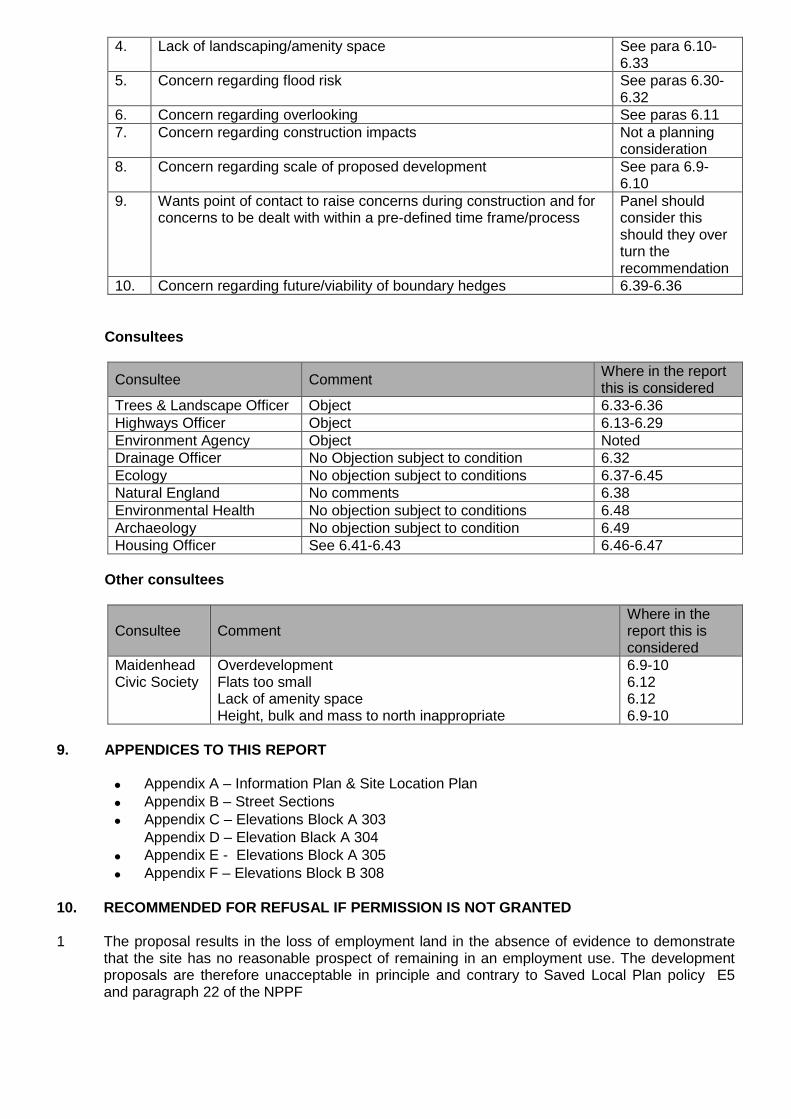
4. Lack of landscaping/amenity space See para 6.10-6.33
5. Concern regarding flood risk See paras 6.30-6.32
6. Concern regarding overlooking See paras 6.117. Concern regarding construction impacts Not a planning
consideration8. Concern regarding scale of proposed development See para 6.9-
6.109. Wants point of contact to raise concerns during construction and for
concerns to be dealt with within a pre-defined time frame/processPanel shouldconsider thisshould they overturn therecommendation
10. Concern regarding future/viability of boundary hedges 6.39-6.36
Consultees
Consultee CommentWhere in the reportthis is considered
Trees & Landscape Officer Object 6.33-6.36Highways Officer Object 6.13-6.29Environment Agency Object NotedDrainage Officer No Objection subject to condition 6.32Ecology No objection subject to conditions 6.37-6.45Natural England No comments 6.38Environmental Health No objection subject to conditions 6.48Archaeology No objection subject to condition 6.49Housing Officer See 6.41-6.43 6.46-6.47
Other consultees
Consultee CommentWhere in thereport this isconsidered
MaidenheadCivic Society
OverdevelopmentFlats too smallLack of amenity spaceHeight, bulk and mass to north inappropriate
6.9-106.126.126.9-10
9. APPENDICES TO THIS REPORT
Appendix A – Information Plan & Site Location Plan
Appendix B – Street Sections
Appendix C – Elevations Block A 303Appendix D – Elevation Black A 304
Appendix E - Elevations Block A 305
Appendix F – Elevations Block B 308
10. RECOMMENDED FOR REFUSAL IF PERMISSION IS NOT GRANTED
1 The proposal results in the loss of employment land in the absence of evidence to demonstratethat the site has no reasonable prospect of remaining in an employment use. The developmentproposals are therefore unacceptable in principle and contrary to Saved Local Plan policy E5and paragraph 22 of the NPPF

2 The proposed development will be harmful to the character and appearance of the area due to itsheight and bulk relative to surrounding buildings and a lack of space for any meaning fulllandscaping contrary to Saved Local Plan policies DG1, H10 & H11 and paragraph 64 and CorePrinciple 4 of the NPPF
3 The proposed development's proximity to trees on the railway embankment will lead to the treesovershadowing living and amenity spaces to the detriment of the amenity of future occupiers andthe sustainability of the trees due to pressures to prune or fell them contrary to Saved Local Planpolicies N6 and DG1 and paragraph 118 of the NPPF
4 The submitted Sequential Assessment fails to demonstrate that the proposed developmentcannot be located on an alternative site that is reasonably available with a lower probability offlooding contrary to saved Local Plan policy F1 and paragraphs 100 & 101 of the NPPF...
5 The development proposals fail to make appropriate provision for refuse servicing on thedevelopment site and subsequently poses a threat to highway safety and convenience contrary tosaved Local Plan policy DG1.

Appendix A – Information Plan & Site Location Plan

Appendix B – Street Sections

Appendix C – Elevations Block A 303D

Appendix D – Elevation Black A 304B

Appendix E - Elevations Block A 305B

Appendix F – Elevations Block B 308B

ROYAL BOROUGH OF WINDSOR & MAIDENHEADPLANNING COMMITTEE
MAIDENHEAD DEVELOPMENT CONTROL PANEL
14 February 2018 Item: 2ApplicationNo.:
17/03288/FULL
Location: South East Water The Keleher Water Treatment Works Monkey Island Lane BrayMaidenhead SL6 2AZ
Proposal: Proposed improvement works to water treatment works including new process andfilter plant, tanks, kiosks and associated works, replacement landscaped areas,alterations to internal access road within the site and creation of areas of hardstandingfor operational purposes. Replacement of existing fence along the western boundarywith a security fence 3.5m high. Temporary contractor's compound with temporaryoffices, welfare facilities, parking area and storage areas on land north of the existingoperational site, with temporary gated access off Monkey Island Lane.
Applicant: South East WaterAgent: Mrs Debra IvoryParish/Ward: Bray Parish/Bray Ward
If you have a question about this report, please contact: Laura Ashton on 01628 682977 or [email protected]
1. SUMMARY
1.1 This planning application proposes improvements to the Water Treatment Works at MonkeyIsland Lane. The improvements are required as part of South East Water’s legal obligations tomaintain a constant and efficient supply of water within its authority area. The works areessential in maintaining a sufficient water supply. The site is located in the Green Belt where theproposed development by definition is inappropriate and harmful to the Green Belt. Developmentof this nature may only be approved where Very Special Circumstances exist that outweigh theharm to the Green Belt as well as any other harm associated with the development. The need tomaintain a water supply to homes and businesses, as well as the lack of alternative options andthe low Green Belt functionality of the site are considered to represent the Very SpecialCircumstances that outweigh the harm caused to the Green Belt. As no other harm has beenidentified it is therefore recommended that the Panel grants planning permission.
It is recommended that the Panel defers and delegates the grants of planning permissionto the Head of Planning subject to the following:
• the conditions listed in Section 11 of this report;• No objection being raised by Natural England• The Environment Agency removing their objection• A scheme of Drainage being secured to the satisfaction of the LLFA• Completion of a satisfactory legal agreement to ensure the construction
traffic routes are used as recommended by the Construction TrafficManagement Plan
2. REASON FOR PANEL DETERMINATION
The Council’s Constitution does not give the Head of Planning delegated powers todetermine the application in the way recommended; such decisions can only be made by thePanel.
3. DESCRIPTION OF THE SITE AND ITS SURROUNDINGS
3.1 The application site comprises a long established water treatment works which are located onMonkey Island Lane in Bray. The CEMEX Quarry bounds the site to the south and west, beyond

which Bray Lake is located to the west. An area of housing is located to the south beyond theQuarry. Bray Marina is located on the opposite side of Monkey Island Lane to the east of the site.
3.2 The site is well screened by landscaping and bunds that were secured as part of the landscapingscheme associated with the original consent for the water treatment works. The site is otherwiserelatively flat.
4. DESCRIPTION OF THE PROPOSAL AND ANY RELEVANT PLANNING HISTORY
4.1 The planning application proposes improvements to the water treatment works. South East Waterpropose to construct on the operational site additional structures housing plant and machinery toprovide filtration, treatment and waste processes very similar to those already existing on the site.Four control cabinets or kiosks are also proposed plus four steel tanks as part of the sludgeprocess on site with associated pipework and transformer compound. The internal access road tothe west of the existing operational tanks and filters is also proposed. Some additional securityfencing will be erected. The new installations will predominantly be located in the western andnorth western sections of the site.
4.2 The site at present is constrained by earth mounds. To facilitate the construction of the newprocess units, several of the earth mounds will be removed and the ground levelled. Theremoved soil will be re-used where possible to re-provide the mounds. Any excess soil fromthese mounds will be disposed of at a licensed site. A temporary construction compound will berequired for the duration of the construction works. This will be located towards the north of thesite.
4.4 The table below provides a summary of the site’s planning history:
Ref. Description Decision and Date
90/00117/OBS The extraction of sand and gravel andrestoration to a nature reserve; andrestoration of old silt lagoons toagriculture
Approve 04.03.1991
93/00128/REM Details of outline permission 425368 to erecta water treatment works with associatedexternal works and landscaping
Approve 23.08.1993
94/00121/OBS Use of land for stockpiling of topsoilSubsoil and spoil
Approve 15.04.1994
94/00122/OBCM
Variation of condition 3 on planningpermission 424141
Approve 08.08.1994
97/31276/OBCM
Variation of condition 3 for extension of time andnon compliance of condition 5 of permission424141 regarding silt disposal and restoration.
Approve 16.06.1997
98/32867/FULL To construct car park (approx.13 spaces) adjoiningBray Lake for use by walkers and cyclists andresurfacing part of access road.
Approve 22.10.2001
11/00350/FULL Construction of a building containing ultravioletdisinfection plant
Approve 22.03.2011
5 MAIN RELEVANT STRATEGIES AND POLICIES RELEVANT TO THE DECISION
5.1 National Planning Policy Framework Sections
Royal Borough Local Plan

5.2 The main strategic planning considerations applying to the site and the associated policies are:
Green Belt DesignFloodRisk
Trees &Ecology
Highways/Parkingissues
Local PlanGB1 & GB2 DG1 F1 N6 & N7
T5, P4
These policies can be found athttps://www3.rbwm.gov.uk/downloads/download/154/local_plan_documents_and_appendices
Borough Local Plan: Submission Version
Policy TopicSP3 Character and Design of New DevelopmentSP5 Development in the Green BeltNR1 Managing Flood Risk & WaterwaysNR2 Tree, Woodland & HedgerowsIF8 UtilitiesHA23 Land West of Monkey Island Lane
The NPPF sets out that decision-makers may give weight to relevant policies in emerging plansaccording to their stage of preparation. The Borough Local Plan Proposed SubmissionDocument was published in June 2017. Public consultation ran from 30 June to 27 September2017. Following this process the Council will prepare a report which summarises the issuesraised in the representations and sets out its response to them. This report, together with all therepresentations received during the representation period, the plan and its supporting documentswill then be submitted to the Secretary of State for examination by the Planning Inspectorate. Inthis context, the Borough Local Plan: Submission Version is a material consideration, but limitedweight is afforded to this document at this time.
This document can be found at:
http://rbwm.moderngov.co.uk/documents/s14392/Appendix%20A%20-%20Borough%20Local%20Plan%20Submission%20Version.pdf
Supplementary planning documents
5.3 Supplementary planning documents adopted by the Council relevant to the proposal are:
The Interpretation of Policy F1 (Area Liable to Flooding) Supplementary Planning Guidance(SPG) 2004
More information on these documents can be found at:https://www3.rbwm.gov.uk/info/200414/local_development_framework/494/supplementary_planning
Other Local Strategies or Publications
5.4 Other Strategies or publications relevant to the proposal are:
RBWM Landscape Character Assessment - view at:https://www3.rbwm.gov.uk/info/200414/local_development_framework/494/supplementary_planning/11
● RBWM Strategic Flood Risk Assessment - view at: https://www3.rbwm.gov.uk/info/200414/local_development_framework/494/supplementary_planning/6

6. EXPLANATION OF RECOMMENDATION
6.1 The key issues for consideration are:
i Principle of Development – Green Belt Issues
ii Flood Risk
iii Surface Water Drainage
iv Highways
v Impact on Character of the Area / Visual Impact
vi Impact on Neighbouring Amenities
vii Ecology
viii Trees
ix Environmental Protection
x Public Rights of Way
Issue 1 – Principle of Development – Green Belt Issues
6.2 Paragraph 87 of the NPPF explains that inappropriate development in the Green Belt is harmfuland that it should only be approved in Very Special Circumstances. Paragraph 88 continues bystating that when considering planning applications, substantial weight should be given to anyharm to the Green Belt. “Very Special Circumstances” will not exist unless the potential harm tothe Green Belt by reason of inappropriateness, and any other harm, is clearly outweighed byother considerations.
6.3 Paragraph 89 of the NPPF gives the example that “a local planning authority should regard theconstruction of new buildings as inappropriate in the Green Belt” and follows with a limited list ofexceptions. It is acknowledged that much of the proposed development does not constitutebuildings, as defined by section 55 of the 1990 Town & Country Planning Act yet neither do theproposals fit neatly within the list of exceptions. In this instance it is important to note that theNPPF is guidance rather than policy or legislation and the fundamental purpose of Green Belt isto “prevent urban sprawl by keeping land permanently open” (paragraph 79) . Being mindful ofthe purpose of this designation and the fact that the proposal will be introducing reasonableadditional built form to the site, it is thus considered reasonable to regard the developmentproposals as inappropriate and assess the development proposals accordingly. This is with theexception of the works to the bunds which is considered to constitute an engineering operationwhich is “not inappropriate” in accordance with paragraph 90 of the NPPF.
6.4 Although the Local Plan pre-dates the NPPF, Policy GB1 adopts a broadly similar approach. Insummary the erection of the additional facilities at the water treatment works is defined asinappropriate development and by virtue of the introduction of additional built form, will have asignificant detrimental impact upon the openness of this Green Belt site. The development istherefore categorised as inappropriate development; is harmful; prejudices the openness of theGreen Belt in the locality of the site; and would conflict with the Green Belt purpose ofsafeguarding the countryside from encroachment. Substantial weight should be attached to thisharm.
6.5 In order to assess this planning application it is thus necessary to establish if Very SpecialCircumstances exist that outweigh the harm to the Green Belt posed by the development andany other harm associated with the scheme. The case for Very Special Circumstances isoutlined in full at the end of this report and balanced against any “other” sources of harm thathave been identified through the other development management considerations.

Issue 2 – Flood Risk
6.6 The site is located within Flood Zone 2 with a small area of the site being within Flood Zone 3.Table 3 of the NPPG defines appropriate land uses for each flood zone and helps guidedevelopment to areas of lower flood risk. As the development is categorised as EssentialInfrastructure the development is “appropriate” and consideration of the Exceptions Test istherefore not required. A Sequential Test is required. It is accepted, however, that the proposalsare an extension to an existing facility and given the nature of the operation it would not bepractical or reasonable to request South East Water to consider alternative sites. Given the needfor access to the River Thames, in any event alternative locations would likely also be in FloodZone 2 or higher. The Sequential Test requirement is thus considered satisfied.
6.7 The development will however need to be accompanied by a site specific FRA that demonstratesthat, in accordance with paragraph 103 of the NPPF, the development is appropriately floodresilient and resistant and that any residual risk can be safely managed. It is also required todemonstrate that there would be no loss of flood plain storage. Along these lines Saved LocalPlan policy F1 will require any application to demonstrate that the development will not impedethe flow of flood water; reduce the capacity of the flood plain to store flood water; or increase thenumber of people at risk from flooding.
6.8 At the time of writing there is an objection from the Environment Agency in that the submittedFRA does demonstrate how a loss of flood plain storage will be mitigated. The applicant isworking with the EA to overcome this objection and this will be dealt with in an update to thePanel.
Issue 3 – Surface Water Drainage
6.9 The LLFA initially raised an objection to this planning application based on the submittedDrainage Strategy being inadequate. The applicant has however provided further details toaddress the concerns of the LLFA and this will be dealt with in an update to the Panel.
Issue 4 - Highways
6.10 The site is located on the south section of Monkey Island Lane where vehicular access is derivedfrom the A308 Windsor Road. The site currently benefits from a single vehicular access offMonkey Island Lane which is a private road. The application proposes introducing a temporarysite access off Monkey Island lane for the duration of the works. Upon completion of the worksthe temporary access, compound, access road and gates will be removed and the highwayreinstated. The Water Treatment Works only employs a small number of staff and these movefrom facility to facility and so there are never a large number of people at the works at any onetime. This will not change as a result of the development proposals. The main highways impactswould therefore be associated with the construction of the proposed development. AConstruction Traffic Management Plan (CTMP) has been prepared and submitted in support ofthis planning application. The applicant proposes using the following two routes for constructiontraffic:
1. Route A used by HGV and 7.5t vehicles are prohibited from turning right (west) onto theA308 Windsor Road towards Maidenhead. All vehicles will turn left and head east towardsthe A332/M4 (Junction 6).
2. Route B only be used by cars and small commercial vans travelling to and from the site.
6.11 The CTMP does not mention the level of traffic the proposal is likely to generate. However, thereport does state that, ‘Because of the increase in heavy road traffic warning signs will be placedin the areas shown in Figure 4 to warn local residents and people visiting the local businesses ofthe heavy construction traffic’. Although the CTMP omits to include the likely increase invehicular activity generated by the proposal, the mitigation measures proposed are sufficient toensure that the works do not pose a significant harm to those residing or commuting in the

immediate and surrounding road network. Condition 19 will ensure that the development iscarried out in accordance with the CMTP and a legal agreement will be entered into to ensurethe construction traffic routes are adhered to. No objection therefore arises to this planningapplication on Highways grounds.
Issue 5 – Impact on Character of the Area / Visual Impact
6.12 The proposed alterations and additions to the Water Treatment Works replicate the form andappearance of development that is already on site and subsequently forms part of the establishedcharacter of the area. The form and appearance of the proposed development is unremarkableand as you would expect on a water treatment works site. The development proposals aretherefore considered to be acceptable when considering their impact upon the character of thearea.
6.13 The water treatment works is visible from only very limited public views due to surrounding treesand bushes and the topography of the land surrounding the site. The works are only visible fromMonkey Island Lane in the vicinity of the entrance to the site and there are some glimpsesthrough some gaps in the vegetation from the lane to the north. The site visit was undertakenduring the winter and so represented a “worst case” scenario. Notably the works are not visiblefrom the opposite banks of Bray Lake. Taking this into account, with an appropriate scheme oflandscaping, the visual impact of the development is considered to be low.
Issue 6 – Impact on Neighbour Amenities
6.14 The site boundary is a minimum of 120 metres from the nearest residential property. This isconsidered to be sufficient separation to avoid any harmful noise and disturbance associated withthe additional processing that will occur as a result of the proposals. It was noted during the sitevisit that, whilst there were some noisy rooms on the premises, the site itself wasn’t particularlynoisy when experienced from outside. There was of course the sound of rushing water yet thistype of noise from a distance does not give cause for concern.
6.15 The separation distances are such where no impacts associated with privacy, light or overbearingimpact are expected arise as a result of the development proposals.
Issue 7 - Ecology
6.17 The following observations and recommendations and have been made in respect of ecology.
Designated Sites
6.18 Bray Pennyroyal Field Site of Special Scientific Interest (SSSI) is located immediately to thesouth-east of the proposed development site. Natural England has been consulted on thisapplication with regards to the impact on the features of the SSSI. At the time of writing aresponse has not been received. This however will be dealt with in an update to the Panel.
Bats
6.19 The buildings and trees on site were assessed for their potential to support bats. The majority ofthe trees were recorded as having negligible potential to support roosting bats, one tree wasidentified as having the potential to support roosting bats. It was recommended that once thedesign plans had been finalised, an up to date bat survey was undertaken, focusing on thestructures and trees which will be impacted by the works. A bat roost assessment wasundertaken in February 2017 and it has been concluded that no further surveys are required forthe works. However, the results of the survey and justification as to why further surveys are notrequired have not been provided, given the previous potential of the buildings and a tree tosupport roosting bats. It is recommended that this information is provide to the LPA prior tothe determination of this application in order for the LPA to ensure bats and their roostswill not be affected by the proposed development.

Badgers
6.20 A badger survey was undertaken in August 2016. No signs of badgers or their setts wererecorded. Mammal tracks were recorded in October 2016 and therefore trail cameras were usedto establish the species using the site. Only rabbits were recorded and it was concluded thatbadgers were not utilising the site. Badgers are protected under the Protection of Badger Act1992 and all mammals are protected under the Wild Mammals (Protection) Act 1996.
6.21 As a year has passed since the original survey and badgers are highly mobile animals, it isrecommended that the entire site and a 30m buffer around the site is subject to a walkover forbadgers by an ecologist within six months of the works commencing and any signs or settsrecorded. If a badger sett is discovered, mitigation and a license from Natural England may berequired. The results of the walkover survey for badgers and appropriate mitigation/ licenses, ifrequired, should be provided to the council for approval prior to any site works. In addition, as thesite provides good foraging habitat for badgers and other mammals, there is the chance of thembeing present within the site during construction works. If permission is granted it isrecommended that measures to protect badgers and other mammals from being trapped inexcavations, pipes or culverts during development be incorporated into a suitably wordedcondition. This conditions 3 and 21 based on the advice above are included in section 11 of thisreport.
Great Crested Newts
6.22 Three waterbodies were recorded as being within 500m of the proposed development site. Thesite and surrounding area was surveyed for great crested newts (GCN) in 2007 and none wererecorded. Given the age of the surveys and the suitable terrestrial habitat for GCN in the north ofthe site, further survey for GCN was recommended. Great crested newts receive full legalprotection under the Conservation of Species and Habitats Regulations 2010 and the Wildlife andCountryside Act 1981 (as amended). This makes it illegal to deliberately injure, kill, capture ordisturb a great crested newt, or to damage, destroy or obstruct any places used for shelter andprotection.
6.23 An ecological walkover was undertaken in 2016 and concluded that the presence of GCN wasunlikely given the fact that two of the waterbodies were unsuitable due to their large size andusage and the smaller waterbody previously recorded no longer existed. Therefore no furthersurvey is required.
Reptiles
6.24 The grassland in the north of the site, in which the temporary compound will be situated, wasrecorded as having suitable habitat for reptiles. The remaining site was not considered to offerhabitat to support reptiles. All native species of reptile are protected from killing and injury underthe Wildlife and Countryside Act (1981) as amended. In addition, all common native species ofreptile are Species of Principal Importance under Section 41 of the NERC Act 2006 and receivefurther protection through national planning policy.
6.25 A presence/ absence survey for reptile was undertaken at the site in 2016 and no reptiles wererecorded. Precautionary habitat management was undertake in October 2016 and February 2017to ensure the grassland areas are maintained in a short condition to deter reptiles moving into theareas. No further survey or mitigation for reptiles is required as long as this management regimeis being adhered to.
Breeding Birds
6.26 The trees, shrubs and hedgerows on and in the vicinity of the site were recorded as having thepotential to support breeding birds. Breeding birds, their eggs and active nests are protected bythe Wildlife and Countryside Act 1981, as amended. The applicant’s ecologist has providedinformation with regards to sensitive timing of vegetation removal and protective measures withregards to nesting birds during the breeding bird season. This advice has been incorporated intorecommended condition 4 as set out in section 11 of this report.

Plants
6.27 A botanical survey of the entire site was undertaken in 2016. A single pennyroyal plant wasrecorded at the northern most end of the vegetated area. This plant species is included inSchedule 8 of the Wildlife and Countryside Act 1981, as amended and listed in the British RedData Book of vascular plants. It was concluded that the area was unsuitable to support apopulation of this plant given the well-established taller vegetation structure already present.However, the applicant’s ecologist has recommended a precautionary approach to developmentwithin the vicinity of this area and includes creating a buffer zone/ barrier around the plant torestrict movement in this area. This advice has been incorporated into condition 6 in section 11 ofthis report.
Biodiversity Enhancements
6.28 Paragraph 109 of the NPPF states that: “The planning system should contribute to and enhancethe natural and local environment by […] minimising impacts on biodiversity and providing netgains in biodiversity where possible, contributing to the Government’s commitment to halt theoverall decline in biodiversity, including by establishing coherent ecological networks that aremore resilient to current and future pressures”. In addition, Section 40 of the Natural Environmentand Rural Communities Act 2006 states that “Every public authority must, in exercising itsfunction, have regard, so far as is consistent with the proper exercise of those functions, to thepurpose of conserving biodiversity”.
6.29 The development has the potential to increase the biodiversity at the site. It is recommended thata Biodiversity Enhancement Plan is produced and provided to the local planning authority forapproval, which details all the enhancements for biodiversity at the site. These could include butnot be limited to planting of native species, installation of bird and bat boxes on to buildings andretained mature trees and construction of log piles. This advice has been incorporated into acondition in section 11 of this report.
6.30 In summary with the condition 5 along with conditions 4 and 6, listed in section 11 of this report,the Council’s Ecologist raises no objection to this planning application.
Issue 8 – Trees
6.31 The submitted Arboricultural report is considered to be sound in that due to the extent of theproposed works including level changes and alterations to the bunds the majority of treesgrowing along the western and northern boundaries will need to be removed as part of theproposed development. The trees to be removed include a line of Lombardy poplar and groups ofsemi mature broadleaf trees. The loss of these trees will be screened from view on MonkeyIsland Lane by the trees retained on the eastern boundary.
6.32 Additional arboricultural information will need to be submitted and approved before any works areundertaken on site. These details will need to include a detailed Arboricultural Method Statementand Tree Protection Plan in accordance with British Standard 5837:2012. Outline details for thereplacement tree planting have been provided. Additional landscaping details including areprovided if this planning application is approved. This would include a landscaping scheme thatreferences compliance with industry standards for plants, plant handling, planting andmaintenance, as well as the species, quantity, density, stock type, size, position and a program ofplanting of all trees, shrubs, and hedges and that includes details of site/soil preparation and afive year maintenance schedule (watering, mulching, weeding, support etc.) to ensureestablishment. Conditions 7-9 to secure the information requested by the Tree Officer are set outin section 11 of this report. Subject to the use of these recommended conditions, the Tree Officerraises no objection to this planning application.
Issue 9 – Environmental Protection

6.33 The Environmental Protection Officer has raised no objection to this application subject toconditions to minimise the potential for noise disturbance and to control dust as well as conditionsto manage issues surrounding the potential for contamination. These conditions, 10-17, are listedin section 11 of this report.
Issue 10 – Public Rights of Way
6.34 The section of Monkey Island Lane from the A308 Windsor Road to the application site is a publicbridleway (Bridleway 73 Bray), and also forms part of the national cycleway network. It is notedthat the Bridleway will remain open and available for public use throughout the constructionperiod. Taking into account the measures for protecting users of the bridleway set out in theConstruction Traffic Management Plan, the Public Rights of Way Officer raises no objection tothis planning application.
PLANNING BALANCE:
7. Very Special Circumstances and Conclusions
7.1 The development proposals will be harmful to the Green Belt and will clearly impact upon itsopenness and this needs to be given substantial weight. An assessment therefore remains to bemade as to whether Very Special Circumstances exist that clearly and demonstrably outweighthe harm caused by the proposed “inappropriate” development within the Green Belt and anyother harm. The applicant has put forward a case to this effect which is as follows:
The Need for the Proposed Works
7.2 The development proposals will allow South East Water to increase the water treatment capacityof Keleher Water Treatment Works from 45 million litres per day of fresh drinking water to 68million litres. This will contribute to South East Water meeting its water supply obligations whichis essential to life, environmental health and the economy. South East Water has a statutory dutyunder section 8 of the Water Industry Act 1991 to develop and maintain an efficient andeconomical system to maintain a clean and reliable supply of water in its area. The WaterTreatment Works supplies Berkshire, Surrey, Hampshire, Sussex and Kent. If the water supplyat Keleher Water Treatment Works is not increased there is a danger that there could be ashortfall in the water supply.
7.3 Considering the case for Very Special Circumstances, the need to provide fresh drinking water inthe region is a compelling case – particularly considering the growing population – in thisinstance this need is held in substantial weight.
Location of the Development
7.4 The siting of the proposed development within the Green Belt is dictated by the location of theoperational Water Treatment Works for which access to the River Thames is essential. Given thenature of the operation it would not be considered practicable or desirable for South East Waterto consider alternative locations for a new works. The lack of available alternative locations forthis development is held in significant weight. The intensification of the existing site is alsorecognised as making efficient and prudent use of land.
The Site’s “Green Belt Function” Performance
7.5 The Council’s Edge of Settlement Study (2016) assessed the function of the Green Belt in thislocation – in a land parcel that included the mineral processing works - assessing it against thefive purposes of the Green Belt as set out in paragraph 80 of the NPPF. The site was found toperform moderately considering its role of preventing the unrestricted sprawl of the built-up areaon the basis that the parcel is not contained by the built-up area nor does any surroundingfeature provide a sense of visual containment. The boundaries of the parcel were identified asdurable comprising a lake edge, water course and public road. The existing boundary of theGreen Belt is durable, consisting of well-defined and regular property boundaries.

7.6 The parcel was found to have no or limited function in performance when considering the GreenBelt function of preventing neighbouring towns from merging. This is on the basis that the parceldoes not form or contribute to a gap between settlements and therefore makes no discerniblecontribution to separation. The parcel was found to be mixed in character and on balance wasconsidered to have an urban edge character and so is considered to offer a lower performancewhen considering the parcel’s role in safeguarding the countryside from encroachment. Overallthe Green Belt function performance of the application site is considered to be low this is on thebasis that of the parcel assessed, the application site portion is the most urban and theapplication site itself has defensible boundaries. In summary the low Green Belt performance ofthe site is held in significant weight when considering the case for Very Special Circumstances.
Conclusion
7.7 Subject to the use of the recommended conditions and the drainage and flood risk issues beingresolved – and these issues are expected to be resolved in advance of the Panel meeting – noharm has been identified in the assessment of development management issues and so no“other harm” can be apportioned to the development. The proposed development is for essentialinfrastructure improvements that are required to maintain a reliable water supply to Berkshire,Surrey, Hampshire, Sussex and Kent. If the improvement works cannot be carried out there couldbe a shortfall in the water supply. The water treatment works cannot reasonably look atalternative sites. This combined with the lower Green Belt function of the site is considered toconstitute Very Special Circumstances that outweigh the harm to the Green Belt associated withthe loss of openness and encroachment of built development into the countryside. It is thereforerecommended that planning permission is granted.
8. COMMUNITY INFRASTRUCTURE LEVY (CIL)
8.1 The development is not a sort from which Community Infrastructure Levy is sought.
9. CONSULTATIONS CARRIED OUT
Comments from interested parties
2 neighbouring occupiers were notified directly of this planning application. The planning officerposted a notice advertising the application at the site on the 7th November 2017 and theapplication was advertised in the Maidenhead & Windsor Advertiser on 9th November 2017. Norepresentations have been received as a result of the publication of the planning application
Consultees
Consultee CommentWhere in thereport this isconsidered
Trees &Landscape
No objection subject to conditions 6.31
Ecology No objection subject to conditions 6.17-6.30Natural England Awaiting response – will be dealt with in Panel Update 6.18Highways No objection subject to conditions 6.10-6.11EnvironmentalProtection
No objection subject to conditions 6.33
LLFA Awaiting updated response – Will be dealt with in PanelUpdate
6.9
EnvironmentAgency
Awaiting updated response – Will be dealt with in PanelUpdate
6.6-6.8
PROW Officer No objection Noted

10. APPENDICES TO THIS REPORT
Appendix A - Site location plan
Appendix B – Existing Elevations
Appendix C – Proposed Elevations
11. CONDITIONS RECOMMENDED FOR INCLUSION IF PERMISSION IS GRANTED REASONS
1 The development hereby permitted shall be commenced within three years from the date of thispermission.Reason: To accord with the provisions of Section 91 of the Town and Country Planning Act 1990(as amended).
2 The materials to be used in any exterior work must be of a similar appearance to those used inthe construction of the exterior of the existing water treatment works facilities unless firstotherwise agreed in writing by the Local Planning Authority.Reason: In the interests of the visual amenities of the area. Relevant Policies - Local Plan DG1
3 Within the six months prior to the commencement of development the entire site and a 30mbuffer around the site shall be subject to a walkover survey to check for evidence of badgers. Anysigns of setts shall be recorded. If a badger sett is discovered, a suitably qualified ecologist shallbe contacted for advice and the appropriate mitigation organised and thereafter undertaken infull. The results of the walkover survey for badgers and appropriate mitigation/ licences, ifrequired, shall be provided to the Council for approval in writing prior to the commencement ofdevelopment on site. Reason: To protect any badgers using the site in accordance with theProtection of Badger Act 1992 and the Wild Mammals (Protection) Act 1996 and Paragraphs 109& 118 of the NPPF.
4 No removal of scrub or trees shall take place between 1st March and 31st August inclusive,unless a competent ecologist has undertaken a careful, detailed check of vegetation for activebirds’ nests immediately before vegetation clearance and provided written confirmation that nobirds will be harmed and/ or that there are appropriate measures in place to protect nesting birdinterest on site. Any such written confirmation should be submitted to the council. Reason: Toprotect breeding birds, their eggs and active nests in accordance with the Wildlife andCountryside Act 1981, as amended and Paragraphs 109 & 118 of the NPPF
5 Prior to the Commencement of Development a Landscape and Ecology Enhancement andManagement Plan shall be submitted to and approved in writing by the Local Planning Authority.This plan shall detail a range of biodiversity enhancements and include details of the creation/installation, maintenance, and management of the biodiversity enhancements for at least the firstfive years. The plan shall cover all areas of existing and proposed landscaping and shall includelong-term design objectives, management responsibilities and maintenance schedules. Reason:To ensure that ecological enhancements are secured and managed as part of the development,to ensure the long term management of the landscaped setting of the development and to ensureit contributes positively to the visual amenities of the area. Relevant policies/Legislation:Paragraphs 109 & 118 of the NPPF; Saved Local Plan policies DG1, N6 & N7 Section 40 of theNatural Environment and Rural Communities Act 2006, Conservation of Habitats and SpeciesRegulations (2010) as amended; the Countryside Rights and Way Act 2000; and the Wildlife andCountryside Act 1981.
6 Prior to the commencement of the development a plan shall first be submitted to and approved inwriting by the Local Planning Authority showing full details of a buffer zone or barrier that will beinstalled to restrict movement towards the location of the penny royal plant that was found onsite. The buffer or barrier shall be implemented in accordance with the aforementioned detailsprior to the commencement of the development and maintained as such throughout constructionunless otherwise agreed in writing by the Local Planning Authority. Reason: To protect a specieslisted in Section 8 of the Wildlife and Countryside Act 1981Relevant legislation: the Wildlife andCountryside Act 1981

7 No tree or hedgerow shown to be retained in the approved plans shall be cut down, uprooted ordestroyed, nor shall any retained tree work be undertaken other than in accordance with theapproved plans and particulars and without the written approval of the Local Planning Authority,until five years from the date of the first use of the buildings for their permitted use. Any approvedtree work shall be carried out in accordance with British Standard 3998 Tree work. If any retainedtree is removed, uprooted or destroyed or dies, another tree shall be planted in the immediatevicinity and that tree shall be of the size and species, and shall be planted at such time, asspecified by the Local Planning Authority in writing. Reason: In the interests of the visualamenities of the area. Relevant Policies - Local Plan DG1, N6.
8 Prior to any equipment, machinery or materials being brought onto the site, details of themeasures to protect, during construction, the trees shown to be retained on the approved plan,shall be submitted to and approved in writing by the Local Planning Authority. The approvedmeasures shall be implemented in full prior to any equipment, machinery or materials beingbrought onto the site, and thereafter maintained until the completion of all construction work andall equipment, machinery and surplus materials have been permanently removed from the site.These measures shall include fencing and ground protection in accordance with British Standard5837. Nothing shall be stored or placed in any area fenced in accordance with this condition andthe ground levels within those areas shall not be altered, nor shall any excavation be made,without the written consent of the Local Planning Authority. Reason: To protect trees whichcontribute to the visual amenities of the site and surrounding area. Relevant Policies - Local PlanDG1, N6.
9 No development shall take place until full details of both hard and soft landscape works, includingreplacement bunds, have been submitted to and approved in writing by the Local PlanningAuthority and these works shall be carried out as approved within the first planting seasonfollowing the substantial completion of the development and retained thereafter in accordancewith the approved details. If within a period of five years from the date of planting of any tree orshrub shown on the approved landscaping plan, that tree or shrub, or any tree or shrub planted inreplacement for it, is removed, uprooted or destroyed or dies, or becomes seriously damaged ordefective, another tree or shrub of the same species and size as that originally planted shall beplanted in the immediate vicinity, unless the Local Planning Authority gives its written consent toany variation. Reason: To ensure a form of development that maintains, and contributespositively to, the character and appearance of the area. Relevant Policies - Local Plan DG1.
10 The rating level (in accordance with BS4142:2014) from all plant, equipment and vents etc.(collectively) associated with this application shall be lower than the existing background level(L90) at the boundary of the premises subject to this application and having regard to noisesensitive premises. Tonal/impulsive noise frequencies should be eliminated or at leastconsidered in any assessment and should carry an additional correction in accordance withBS4142:2014. This is to prevent unreasonable noise disturbance to other premises. Thisrequirement applies both during the day (0700 to 2300 hrs over any one hour period) and nighttime (2300 to 0700 hrs over any one 15minute period).Reason: To protect the residentialamenities of the area. Relevant Policy Local Plan NAP3 and paragraph 17 and 123 of the NPPF.
11 The permitted working hours of the site during construction including site preparation, plant,equipment, machinery, their maintenance or repair, vehicle delivery and despatches are asfollow: Monday to Friday 08:00 - 18:00Saturdays 08:00 - 13:00No work shall beundertaken outside these hours or on Sundays, Public or Bank Holidays. REASON: Toprotect the amenity of the area and prevent nuisance arising from noise and to accord with theLocal Plan Policy NAP3, NPPF paragraphs 17 and 123, and NPPF Technical Guidance.
12 All plant, equipment and machinery shall comply with current noise emission/silencing standardsand shall be maintained in good working order at all times. Any breakdown or malfunctioningleading to increased noise and/or dust emissions shall be dealt with promptly. Site operationsshall be adjusted or suspended until normal working conditions of any malfunctioning plant,equipment and machinery is restored. REASON: To protect the amenity of the area andprevent nuisance arising from noise. Relevant Policies: Saved Local Plan policies NAP3,Paragraph 17 and 123 of the NPPF and the NPPF Technical Guidance.

13 Prior to the commencement of the development a plan showing full details of the access roadand layout of the site shall be submitted to and approved in writing by the Local PlanningAuthority. The layout shall be arranged so as to allow vehicles fitted with reversing alarms to turnwithout the need to reverse. Where reversing alarms are used on earth-moving plants, quieter orsilent types shall be used. The access road and layout of the site shall be constructed inaccordance with the approved plan. REASON: To protect the amenity of the area andprevent nuisance arising from noise and to accord with the Local Plan Policy NAP3 andparagraphs 17 and 123 of the NPPF
14 No activity hereby permitted shall cause dust to be emitted from the site. In the event dustemissions occur, the activity shall be suspended until this can be resumed without causing anyfurther emissions. REASON: To protect the amenities of the area. Relevant policy: Paragraph123 and 124 of the NPPF and the NPPF Technical Guidance
15 Unless otherwise agreed by the Local Planning Authority, development other than that requiredto be carried out as part of an approved scheme of remediation must not commence untilconditions 1 to 4 have been complied with. If unexpected contamination is found afterdevelopment has begun, development must be halted on that part of the site affected by theunexpected contamination to the extent specified by the Local Planning Authority in writing untilcondition 4 has been complied with in relation to that contamination.1. Site CharacterisationAn investigation and risk assessment, in addition to any assessment provided with the planningapplication, must be completed in accordance with a scheme to assess the nature and extent ofany contamination on the site, whether or not it originates on the site. The contents of thescheme are subject to the approval in writing of the Local Planning Authority. The investigationand risk assessment must be undertaken by competent persons and a written report of thefindings must be produced. The written report is subject to the approval in writing of the LocalPlanning Authority. The report of the findings must include:- a survey of the extent, scale andnature of contamination;- as assessment of the potential risks to: - human health- property(existing or proposed) including buildings, crops, livestock, adjoining land,- groundwater andsurface waters,- ecological systems,- archaeological sites and ancient monuments:- an appraisalof remedial options, and proposal of preferred option(s).This must be conducted in accordancewith DEFRA and the Environment Agency's 'Model procedures for the Management of LandContamination, CLR 11'.2. Submission of Remediation Scheme. A detailed remediationscheme to bring the site to a condition suitable for intended use by removing unacceptable risksto human health, buildings and other property and the natural and historical environment must beprepared, and is subject to the approval in writing of the Local Planning Authority. The schememust include all works to be undertaken, proposed remediation objectives and remediationcriteria, timetable of works and site management procedures. The scheme must ensure that thesite will not qualify as contaminated land under Part 2A of the Environmental Protection Act 1990in relation to the intended use of the land after remediation.3. Implementation of ApprovedRemediation Scheme. The approved remediation scheme must be carried out in accordance withits terms prior to the commencement of development other than that required to carry outremediation, unless otherwise agreed in writing by the Local Planning Authority. The LocalPlanning Authority must be given two weeks written notification of commencement of theremediation scheme works. Following completion of measures identified in the approvedremediation scheme, a verification report (referred to in PPS23 as a validation report) thatdemonstrates the effectiveness of the remediation carried out must be produced, and is subjectto the approval in writing of the Local Planning Authority.4. Reporting Unexpected ContaminationIn the event that contamination is found at any time when carrying out the approved developmentthat was not previously identified it must be reported in writing immediately to the Local PlanningAuthority. An investigation and risk assessment must be undertaken in accordance with therequirements of condition 1, and where remediation is necessary a remediation scheme must beprepared in accordance with the requirements of condition 2, which is the subject of the approvalin writing of the Local Planning Authority. Following completion of measures identified in theapproved remediation scheme a verification report must be prepared, which is subject to theapproval in writing of the Local Planning Authority in accordance with condition 3.5. Long TermMonitoring and Maintenance monitoring and maintenance scheme to include monitoring the long-term effectiveness of the proposed remediation over a period years to be determined based onthe findings of the aforementioned investigations, and the provision of reports on the same must

be prepared, both of which are subject to the approval in writing of the Local Planning Authority.Following completion of the measures identified in that scheme and when the remediationobjectives have been achieved, reports that demonstrate the effectiveness of the monitoring andmaintenance carried out must be produced and submitted to the Local Planning Authority. Thismust be conducted in accordance with DEFRA and the Environment Agency's ' ModelProcedures for the Management of Land Contamination, CLR 11'.Reason: To ensure that risksfrom land contamination to the future users of the land and the neighbouring land are minimised,together with those to controlled waters, property and ecological systems, and to ensure that thedevelopment can be carried out safely without unacceptable risks to workers, neighbours andother offsite receptors. Relevant Policy Local Plan NAP4 and paragraph 120, 121 and 123 of theNPPF
16 Prior to the commencement of the development a complaint procedure showing details of howthe operator will record, address and respond to complaints from local residents relating toenvironmental matters including noise, dust, HGVs traffic and lights, shall be submitted to andapproved in writing by the Local Planning Authority. REASON: To prevent and resolvenuisance complaints
17 To minimise the air quality impact the operator shall ensure that its own vehicles used for sitedeliveries and dispatches are compliant with Euro V or higher and for non-road mobile plant arecompliant with Stage IV standards. REASON: To reduce the impact on local air quality RelevantPolicies: Paragraph 123 and 124 of the NPPF
18 Within three months of the water treatment facilities hereby approved being completed, thetemporary site compound and any equipment, structures and machinery within it; the temporaryaccess, access road and gates will be removed and the highway reinstated and the land madegood in accordance with a scheme of hard and soft landscaping that shall first be submitted toand approved in writing by the Local Planning Authority. Reason: To protect the visual amenity ofthe site and the openness of the Green Belt. Relevant policies: Saved Local Plan policies DG1,GB1 and T5.
19 The development hereby approved shall be carried out in accordance with the ConstructionTraffic Management Plan contained within the Transport Statement prepared by South EastWater dated 6th Oct 2017 unless agreed in writing by the Local Planning Authority. Reason: Inthe interests of highway safety and convenience. Relevant Policies - Saved Local Plan policy T5.
20 The development will be carried out in accordance with the methodology and recommendationscontained within the Asbestos Works Methodology prepared by South East Water and dated 19thSeptember 2017 unless agreed in writing by the Local Planning Authority. Reason: In theinterests of public health and safety relevant policies: Paragraph 123 of the NPPF
21 Any trenches within the working area of the site will either be covered over-night, or planks ofwood will be secured within any trench to form a ramp to allow badgers to escape; anytemporarily exposed open pipes shall be capped or covered in such a way to prevent badgersgaining access; and night working will not be permitted. Reason: In order to ensure badgers arenot harmed during construction Relevant Policies/Legislation: Protection of Badgers Act 1992and the Wild Mammals (Protection) Act 1996 (as amended)

Appendix A – Site Location

Appendix B – Existing Elevations

Appendix C – Proposed Elevations

ROYAL BOROUGH OF WINDSOR & MAIDENHEADPLANNING COMMITTEE
MAIDENHEAD DEVELOPMENT CONTROL PANEL
14 February 2018 Item: 3ApplicationNo.:
17/03372/FULL
Location: Braywick Park Driving Range Braywick Road MaidenheadProposal: Erection of new leisure centre; formation of outdoor sports pitches; vehicle parking;
and associated works including retention of adventure golf course and hire shop/officebuilding
Applicant: Royal Borough Of Windsor And MaidenheadAgent: Stephen RichardsParish/Ward: Maidenhead Unparished/Oldfield Ward
If you have a question about this report, please contact: Laura Ashton on 01628 682977 or [email protected]
1. SUMMARY
1.1 The proposed development is defined as inappropriate by Green Belt policy and guidance and isharmful by virtue of its inappropriateness, the loss of openness and encroachment of builtdevelopment into the countryside. This harm should be held in substantial weight. Thedevelopment would only be acceptable if Very Special Circumstances can be demonstrated thatoutweigh the harm to the Green Belt and any other harm associated with the development. Thisreport sets out the Applicant’s case for Very Special Circumstances which are that there is anexisting and growing demand for the Leisure Centre, an appropriate facility can no longer beprovided on the existing Magnet Centre site and there is no available alternative location for theLeisure Centre outside of the Green Belt. There is also a tangible and far reaching public benefitassociated with the proposed development when considering the role it plays in enablinghealthier lifestyles, providing opportunities to participate in sports and the community function thebuilding would offer.
1.2 The case made by the Applicant is considered to constitute Very Special Circumstances thatoutweigh the Green Belt harm associated with the development. As set out in this report no harmis considered to arise as a result of the visual impact associated with the proposals and no otherharm has been identified in this report that would not be outweighed by the Very SpecialCircumstances. Subject to a number of minor issues identified in this report being resolved andthe Panel being updated accordingly, it is recommended that planning permission is granted asset out below.
It is recommended the Panel authorises the Head of Planning to grant planningpermission subject to:1. i) The satisfactory completion of an unilateral undertaking to secure the following:
• A Travel Plan• Bus Stops on St Clouds Way• A shuttle bus to serve the Leisure Centre• Improvements to access junction• Landscape & Ecology Enhancement & Management Plan• To secure public access and retain leisure use.
ii) The conditions listed in section 10 of this reportiii) Referral to the Secretary of State through the National Planning Case Work Unitand there being no call-in as a result of the referral
2. REASON FOR PANEL DETERMINATION
The Council’s Constitution does not give the Head of Planning delegated powers todetermine the application in the way recommended; such decisions can only be made by the

Panel.
3. DESCRIPTION OF THE SITE AND ITS SURROUNDINGS
3.1 The application site comprises a golf driving range and adventure golf course which is located atthe southern end of Braywick Sports & Recreation Ground. The driving range itself is a singlestorey, open fronted structure which is located at the western end of the site. A club house islocated in the north western corner of the site. The site is predominantly laid out as manicuredgrassland although there is a tree belt running north to south bisecting the eastern quarter of thesite. There are a number of individual trees located in the south-west corner of the site and thereis a woodland copse on the boundary with the nursery.
3.2 Braywick Cemetery forms part of the site’s southern boundary. The existing golf club car park,Braywick Nurseries and Maidenhead Target Shooting Club’s rifle range from the site’s northernboundary, beyond which a Toby Carvery and Maidenhead Rugby & Football Club are located.Braywick Road bounds the site to the west. A footpath/track forms the site’s eastern boundarybeyond which there are a number of playing pitches associated with the rugby and football club.Braywick Park is located to the east of the sports pitches and is used for informal recreationpurposes.
3.3 Braywick Sports & Recreation Ground is also home to Maidenhead Athletics Club, Braywick ParkGym and Sports Able which offers sports facilities and training to the disabled. The site is locatedwithin the Green Belt and a small section of the site towards the eastern end, beyond the treebelt, is located in Flood Zone 2. This is likely associated with The Cut watercourse which islocated 300 m to the east of the site.
4. DESCRIPTION OF THE PROPOSAL AND ANY RELEVANT PLANNING HISTORY
4.1 The planning application proposes the provision of a new leisure centre on the site of the drivingrange at Braywick Sports & Recreation Ground. The leisure centre is proposed to provide some9,500 sq m of internal floorspace which would include a swimming pool and children’s trainingpool; squash courts; a fitness suite; a spinning studio; a multipurpose sports hall; fitness andholistic studios; a crèche, a café; and a multi-functional hall for use for community functions.Outdoor games pitches are also proposed and pedestrian and cycle paths are proposed to beprovided and would link the site with the wider network. Car, cycle and coach parking would beaccommodated on the site.
4.2 The leisure centre building is proposed to be located some 140 metres into the site and would befronted by a car parking area which would appear as an extension of the existing car park that islocated in front of the nursery. Outdoor sport pitches would be located to the rear of the proposedbuilding.
4.3 The table below sets out a summary of the site’s planning history:
Ref. Description Decision and Date15/03459/FULL Changes in ground levels and landscaping of
the existing driving range to create a multi-shotdriving range and six hole junior academycourse
Approved 31st May2016
10/00365/FULL Erection of a covered seating area within theminigolf course
Approved 6th April2010
09/02530/FULL Construction of a 9-hole Scandinavian Mini-golf course
Approved 27th
January 201006/01170/FULL Erection of two sections of ball stop mesh
fencing on metal posts, 100 metres long by 12metres high and 20 metres long by 4 metreshigh
Approved 7th August2006
06/00948/FULL Construction of a single storey sports pavilion Approved 12th July2006

5 MAIN RELEVANT STRATEGIES AND POLICIES RELEVANT TO THE DECISION
5.1 National Planning Policy Framework Sections
Royal Borough Local Plan (1999)
5.2 The main strategic planning considerations applying to the site and the associated policies are:
Green Belt Design LeisureProtectedTrees
Flood Risk Highwaysissues
LocalPlan
GB1, GB2 DG1 R7, R8 N6, N7F1
T5, P4
These policies can be found athttps://www3.rbwm.gov.uk/downloads/download/154/local_plan_documents_and_appendices
Borough Local Plan: Submission Version (2017)
Issue Local Plan PolicyAppropriate Development in Green Belt and acceptableimpact on Green Belt
SP1, SP5
Design in keeping with character and appearance ofarea
SP2, SP3
Manages flood risk and waterways NR1Trees, Woodland & Hedgerows NR2Nature Conservation NR3Makes suitable provision for infrastructure IF1Contaminated Land & Water EP5New Sports & Leisure Development at Braywick Park IF6Community Facilities IF7
The NPPF sets out that decision-makers may give weight to relevant policies in emerging plansaccording to their stage of preparation. The Borough Local Plan Submission Document waspublished in June 2017. Public consultation ran from 30 June to 27 September 2017. Followingthis process the Council will prepare a report which summarises the issues raised in therepresentations and sets out its response to them. This report, together with all therepresentations received during the representation period, the plan and its supporting documentshave now been submitted to the Secretary of State for examination. In this context, the BoroughLocal Plan: Submission Version is a material consideration, but limited weight is afforded to thisdocument at this time ahead of its examination.
This document can be found at:http://rbwm.moderngov.co.uk/documents/s14392/Appendix%20A%20-%20Borough%20Local%20Plan%20Submission%20Version.pdf
Other Local Strategies or Publications
5.3 Other strategies or publications relevant to the proposal are:
● RBWM Landscape Character Assessment - view at: https://www3.rbwm.gov.uk/info/200414/local_development_framework/494/supplementary_planning/11
● RBWM Parking Strategy - view at: https://www3.rbwm.gov.uk/info/200414/local_development_framework/494/supplementary_planning/13
● RBWM Strategic Flood Risk Assessment - view at: https://www3.rbwm.gov.uk/info/200414/local_development_framework/494/supplementary_planning/6
● Built Facilities Strategy, Dec 2016 ● Open Space Study Dec 2016
● Infrastructure Delivery Plan May 2017

https://www.google.co.uk/search?q=rbwm+IDP&ie=utf-8&oe=utf-8&client=firefox-b-ab&gfe_rd=cr&dcr=0&ei=9gVyWoGrGMX38AeDg5-ADQ
● Indoor Sports and Leisure facility Strategy March 2016 https://www3.rbwm.gov.uk/downloads/file/3365/indoor_sport_and_leisure_facility_strategy
6. EXPLANATION OF RECOMMENDATION
6.1 The key issues for consideration are:
i Green Belt – Principle of Development
ii Loss of Golf Facility and Open Space
iii Impact on Character of the Area/Visual Impact
iv Design
v Flood Risk & Surface Water Drainage
vi Highways
vii Trees & Landscape
viii Ecology
ix Residential Amenity
x Design & Crime
xi Environmental Protection
xii Air Quality
xiii Archaeology
xiv Conservation
Principle of Development
6.2 Section 8 of the NPPF establishes the importance of promoting healthy communities through theplanning process. It recognises that the planning system plays an integral role in facilitation socialinteraction and delivering robust, healthy and inclusive communities. Relevant to this applicationare those elements of section 8 that talk of the delivery of social, recreational and culturalfacilities and services the community needs. To do this the NPPF explains that planning policiesand decisions should (inter alia):
“Plan positively for the provision and use of shared space, community buildings (includingmeeting places, sports venues and cultural buildings) and other local services to enhancethe sustainability of communities and residential environments”
“Guard against the unnecessary loss of valued facilities and services”
6.3 Section 9 of the NPPF set out the Government’s approach to development in the Green Belt. Itstates that the fundamental aim of Green Belt policy is to prevent urban sprawl by keeping landpermanently open. The essential characteristics of Green Belts are their openness and theirpermanence. The NPPF apportions five purposes to the Green Belt:

• To check the unrestricted sprawl of large built-up areas;• To prevent neighbouring towns merging into one another;• To assist in safeguarding the countryside from encroachment;• To preserve the setting and special character of historic towns; and• To assist in urban regeneration by encouraging the recycling of derelict and other
urban land
6.4 Green Belt Boundaries can only be altered in exceptional circumstances through the preparationor review of a Local Plan. Whilst the site is proposed for removal from the Green Belt in theBorough Local Plan Submission Version, the plan has not yet been examined and so the siteshould be assessed as per its current Green Belt status.
6.5 Paragraph 87 of the NPPF explains that inappropriate development in the Green Belt is harmfuland that it should only be approved in Very Special Circumstances. Paragraph 88 continues bystating that when considering planning applications, substantial weight should be given to anyharm to the Green Belt. “Very Special Circumstances” will not exist unless the potential harm tothe Green Belt by reason of inappropriateness, and any other harm, is clearly outweighed byother considerations.
6.6 The NPPF explains that the construction of new buildings should be regarded as inappropriate inthe Green Belt and sets out a limited list of exceptions. Buildings for indoor sport do not fallwithin the list of exceptions. Although the adopted Local Plan pre-dates the NPPF, Policy GB1adopts a broadly similar approach. Whilst the exceptions do include “the provision of appropriatefacilities for outdoor sport and outdoor recreation”….”as long as it preserves the openness of theGreen Belt and does not conflict with the purposes of including land within it” and part of thedevelopment is for the provision of outdoor pitches, once part of the development constitutesinappropriate development, planning case law indicates that the development as a whole shouldbe considered as inappropriate.
6.7 The erection of a building for indoor sports with a footprint of 6,564 square metres, introductionof car parking and the laying out of sport pitches/courts, therefore constitutes inappropriatedevelopment and by virtue of the introduction of significant built form, would have a significantimpact upon the openness of this Green Belt site. The leisure centre development thereforeprejudices the openness of the Green Belt in the locality of the site; and would conflict with theGreen Belt purposes of safeguarding the countryside from encroachment and to prevent urbansprawl. Substantial weight should be attached to this harm.
6.8 In summary the proposals are contrary to paragraphs 89 and 90 of the NPPF and Local Planpolicies GB1 and GB2(a). It is therefore necessary to demonstrate whether Very SpecialCircumstances (VSC) exist that would clearly outweigh the harm to the Green Belt associatedwith the development and any other harm identified. The applicant has made a case for VSCand this case is considered in the planning balance at the end of this report.
Loss of Golf Facility and Open Space
6.9 Whilst the driving range facility would be lost as a result of the scheme, the adventure golf coursewould be retained and the driving range would be replaced by a golf simulator and so somegolfing facilities would be retained. (see condition 22).
6.10 Sport England has confirmed that England Golf raises no objection to the loss of the drivingrange and that Sport England recognises that the development proposals meet an identified needfor this type of facility. It is acknowledged that the leisure centre would provide facilities for agreater range of sports that could be enjoyed by a larger proportion of the population as well as aflexible community space.

6.11 Sport England, whilst supporting the proposal in principle, has requested some clarification as towhether the sports facilities meet the relevant standards of Sport England and the governingbodies of the various sports offered. The applicant has provided more details in respect of theform of the courts and sports pitches and whether the facilities meet the relevant standards willbe dealt with in a written update to the panel, circulated at the meeting.
6.12 The need for a new Leisure Centre to serve this part of the Borough is outlined in the Council’sIndoor Sport & Leisure Facility Strategy (2016-2021) and draft Infrastructure Delivery Plan (mostrecently updated in 2018) which relies upon the proposed Leisure Centre to provide an improvedfacility as well as 20% uplift in the capacity over and above that currently provided by the MagnetCentre. The need for a new Leisure Centre is also carried forward into the Submission VersionBorough Local Plan where policy IF6 seeks to allocate the application site to provide the requiredfacility. At Regulation 19 stage 78 comments were identified against this particular policy. As theplan is yet to be examined this policy is therefore afforded only limited weight.
6.13 An assessment has to be made as to whether there would be a loss of open space. Whilst therewould be no loss of open space accessible to the general public not participating in the golfingactivity on the site the NPPF defines open space as, “all open space of public value, includingnot just land, but also areas of water which offer important opportunities for sport and recreationand can act as a visual amenity.” Paragraph 74 of the NPPF goes on to say that existing openspace, sports and recreational buildings and land including playing fields should not be builtupon unless:
• An assessment has been undertaken which clearly shown the open space, buildings orland to be surplus to requirements; or
• The loss resulting from the proposed development would be replaced by equivalent orbetter provision in terms of quantity and quality in a suitable location; or
• The development is for alternative sports and recreational provision, the needs for whichclearly outweigh the loss.
6.14 The proposal would result in the partial loss of a sporting facility and an area of open space.However this loss is considered acceptable because the need for the proposed development, asevidenced in this report, clearly outweighs the loss. In this respect the development proposalsare in accordance with Saved Local Plan policy R7.
Impact on Character of the Area/Visual Impact
6.15 The site’s surroundings are of an urban edge character and the site’s immediate surroundingsare in sport/recreational land uses. As Braywick Park already forms a sports campus the additionof a leisure centre is considered to be appropriate and would not be harmful when considering itsimpact upon the character of the area in terms of its use and general appearance.
6.16 The proposed leisure centre building is large – being between 5.12 and 14.62 metres high,between 63.69 and 99.83 metres wide; and 57.87 and 70.63 metres deep. The building wouldalso be set in an expansive area of hard standing, new landscaping and pitches and courts. Theproposals would therefore have a clear visual impact upon the landscape. It should be noted thatvisual impact should not be confused with the concept of openness which is discussed elsewherein this report. It should be noted that the landscape is not of any special quality at present. Thevisual impact of the development on the landscape is also considered to be mitigated in part bythe topography of the land surrounding the site, the positioning of the proposed building within thesite and existing and proposed tree/hedge cover.
6.17 One of the key views of the development would be from Braywick Road. During the summer, theproposed building would be largely obscured by the existing mature trees that are located on thesite boundary. The parking area would be visible but this would be viewed in the context of theexisting parking area and would be softened by the landscaping scheme. In the winter, when thetrees shed their leaves, the building would be more apparent although the impact would bereduced due to the building being set back 140 m from the road and viewed in the context of theexisting built form and hard standing in Braywick Park.

6.18 There would be very limited views of the building from the residential area on the opposite sideof Braywick Road to the park, as these would be largely obscured by the deciduous trees andbushes that are located on the central reservations. The proposed development would not bevisible from Bray Road or Hibbert Road due to the separation distances involved and tree andhedge cover.
6.19 The main views of the building would be from within Braywick Park itself. Here it would beviewed within the context of the existing buildings and sports facilities and would appear as anextension of the existing built form. Views from the north again would be partly obscured by andviewed within the group of existing buildings within the park. The biggest visual impact would beto views from Green Lane. Only a small portion of Green Lane however would be impacted andit should be noted that the proposed building is considered to be of high quality design and wouldappear as an extension of the existing sports/recreational land uses and so would not appear outof place.
6.20 The development proposals include low level bollard lighting to the car parking areas and floodlighting and fencing to serve/contain the outdoor sports pitches/courts. The impact of thiselement of the development needs to be assessed in terms of the impact on the character of thearea and the potential for any nuisance associated with light pollution. The flood lights would be10 metres high. There would be six floodlights serving the football pitch and the netball courtswould be served by eight floodlights. Whilst the physical presence of the lights and fences willhave a visual impact this is not considered to be harmful because floodlights and fencing isalready prevalent in the site’s surroundings, serving the existing sports facilities andsubsequently form part of the established character of the area. The floodlights and fences willalso be viewed in the context of the leisure centre building and would be contained within thesports complex area.
6.21 In summary, and as supported in the applicant’s visual impact assessment submitted with theapplication, the impact on the character of the area and in long and short views is considered tobe acceptable. The loss of open space is justified against the NPPF and in compliance withlocal plan policy.
Design
6.22 As identified above the site and its surroundings are of a character more akin to an edge of towncentre location than a rural one. This in-part offers an explanation of the lower Green Beltfunctionality of the site which is discussed later in this report. None-the-less, the visual impact ofthe scheme and its subsequent impact on the openness of the Green Belt needs to be fullyassessed. The Design & Access statement sets out that the building has been designed to blendinto the landscape as much as possible. To avoid “overwhelming” the parkland with the physicalpresence of a large building, the Design & Access Statement explains how the concept of thefloating curved roof sitting over a predominantly glazed elevation was devised. It is consideredthat this serves to create a more organic form and give the perception of a light-weight structureby reducing the massing and bulk of the building. The curved ‘floating roof’ would sit over glazingwhich would include vertical external louvres in timber or timber effect vertical louvres. This formof the building was designed with the intention of reducing the impact of what would otherwiseform a solid barrier.
6.23 To break down the massing and perceived height of the glazed frontage, the first floor fitnesssuite has been elevated over a colonnade of white circular columns, with the ground flooraccommodation set back and largely glazed. It is considered that this architectural techniquewould further reduce the perceived scale and massing of the south west elevation.
6.24 The orientation of the building and its position has been determined by the existing trees on siteand poor ground conditions to the north east. Having the building pushed back into the site bysome 140 metres increases the separation with the existing dwelling houses on Braywick Roadand also reinforces the existing building line created by the nursery and carvery restaurant. Thisalso serves so that the new building would be viewed in the context of existing built developmentthus seeking to minimise its visual impact.

6.25 The less active frontages of the building which include the pool and sports halls are proposed toface towards, and be shielded by, the tree and vegetation bands adjacent to them. It isconsidered that the car parking and servicing areas would appear as an extension to the existingcar parking area. It is also considered that the car parking would be softened by proposedextensive tree planting. Existing trees, where possible, have been integrated into thelandscaping scheme to maintain the landscape maturity of the site. These details would besecured by condition.
6.26 Whilst there is nothing of the proposed Leisure Centre’s scale in the site’s surroundings it isconsidered that the proposed building would not appear out place due to the surrounding landuses. As explained above, measures have also been taken to reduce the bulk of the building andto assimilate it into the landscape thus mitigating its impact. The design and appearance of thescheme overall is considered to be acceptable in its context and in compliance with Policy DG1of the Local Plan and emerging policy SP3 of the Borough Local Plan Submission Version.
Flood Risk & Surface Water Drainage
Fluvial Flooding6.27 Part of the site is located within Flood Zone 2. An assembly and leisure use is classed as a “less
vulnerable use” and is subsequently regarded as appropriate development that can be located inFlood Zone 2. As set out in the NPPF an Exceptions Test is therefore not required. The planningapplication is however required to be accompanied by a Sequential Test. A SequentialAssessment has been submitted in support of this planning application. Having reviewed thesubmission it is considered that the submitted Sequential Assessment demonstrates that there isno suitable, alternative site available in Flood Zone 1.
6.28 The Environment Agency was not consulted in respect of this planning application because thedevelopment is not within 20 metres of a main river and the development is classed as a “lessvulnerable use” and is not a land or building used for agriculture or forestry; a waste treatmentsite; a mineral processing site, a water treatment plant; or a sewage treatment plant. As suchthere is no requirement to consult. Furthermore there is no ‘standing advice’ from theEnvironment Agency for this sort of development. The proposal has therefore been assessed byofficers on the basis of policy and the submitted Flood Risk Assessment (FRA).
6.29 Given that the building would be located in Flood Zone 1, the development would not beexpected to impede the flow of flood water or reduce flood plain storage. It is noted from thesubmitted FRA that the Finished Floor Level (FFL) associated with the proposed building wouldbe set at 27.500m AOD. This proposed FFL is approximately 200mm above the adjacent nurserybuilding FFL which was existing at the time of preparing the original 0.1% AEP flood mapping andshown to be outside of the associated flood extent. A condition will be applied to secure theappropriate FFL which will ensure that the building would be flood resilient (See condition 29).
6.30 Considering the need for safe access, given that most of the site, the building and Braywick Roadare located in Flood Zone 1; safe and dry access/egress will be possible during a flood event.There is nothing to suggest that any user of the building would be in danger of becomingstranded. The proposed development would therefore not increase the number of people at riskof flooding and is thus considered to be safe.
6.31 For the reasons above the proposed development is considered to be in compliance withparagraph 103 of the NPPF.
Surface Water Drainage6.32 The LLFA is satisfied that the surface water drainage system serving the proposed development,
as set out in the submitted Flood Risk Assessment, is acceptable in principle. Normally infiltrationtesting to Building Research Establishment note 365 would be expected to demonstrate theworkability of a surface water drainage system relying on infiltration. It is however noted thatfalling head tests have been undertaken and that the results of these tests demonstrate thatinfiltration will be practical. The LLFA raises no objection to planning permission being grantedsubject to the imposition of a suitably worded pre-commencement planning condition requiringsubmission of full details of the proposed surface water drainage system and supporting

calculations based on on-site infiltration testing undertaken in accordance with BRE365. Thiscondition is included in section 10 below (see condition 9).
Highways
The Site and the surrounding area6.33 The main access to Braywick Park is directly off the A308 Braywick Road dual carriageway
where the site has extensive frontage to the main road. Hibbert Road runs along the southernboundary to the site. Tip Lane is located on part of the northern boundary before joiningStafferton Way which accesses the A308 Braywick Road by way of a roundabout junction justsouth of Maidenhead Railway Station. Further to the north, on the other side of the railwaystation, the A308 joins the A4 Reading to Slough Road at Castle Hill/Frascati Way/MarlowRoad/Bad Godesberg Way before heading in a north-westerly direction to link with the A404Maidenhead to High Wycombe Road at Bisham. The A308 Braywick Road continues as a dualcarriageway to the south past the site and connects to the A308 Windsor Road, A330 AscotRoad and the A308 (M) at Bray Wick. The A308 (M) then links to Junction 8/9 of the M4. There ispeak hour congestion on roads approaching and at the junctions through Maidenhead TownCentre and also those at and approaching Junction 8/9 of the M4.
6.34 Maidenhead Railway Station where the Elizabeth Line is scheduled to operate (with effect from2019) is located about 1km north of the main site entrance. Local services and amenities inMaidenhead Town Centre can be accessed within a short walking distance from the railwaystation.
6.35 The main access to the existing leisure facilities at Braywick Park is located off the main A308dual carriageway which is subject to a local 40mph speed restriction. There is an existing rightturn lane facility which enables northbound traffic (from the strategic highway network) to accessthe site by crossing the southbound traffic lanes of the dual carriageway. Ingress and egress forsouthbound traffic entering and leaving the site access is segregated.
Baseline Surveys6.36 The following junctions were tested through RBWM’s 2017 strategic transport model;
• A308 Braywick Road/Stafferton Way/Rushington Avenue• A308 Windsor Road/A308 (M)/ A330 Ascot Road• A Manual Classified Turning Count (MCTC) was completed at the site access
along Braywick Road.
Magnet Leisure Centre Surveys6.37 The submitted Transport Assessment (TA) reports that a series of counts and surveys were
carried out to determine the vehicular and pedestrian activity arising from the existing leisurecentre and from the nearby health centre. The results suggest that a significant number ofvehicular and pedestrian movements occur during the am and pm peak periods. The parkingoccupancy rate during the weekdays is evenly spread throughout the day, except during the amand pm peak periods. However, during the weekend the peaks are concentrated during themorning periods, peaking between 10:00 and 11:00am.
Accident Records6.38 Whilst there have been 4 recorded personal injury accidents in the past 5 years, the data
obtained from Royal Borough of Windsor and Maidenhead shows no re-occurring patterns tosuggest there are inherent problems on the local highway network.
Access6.39 The development proposes retaining, but also modifying, the existing access junction to allow for
coach movements. The improvements to the proposed access would be secured through aunilateral undertaking and condition 22. The development also provides a pedestrian and cyclelink from the site’s south east boundary to footpath 8 at Green Lane
6.40 It is noted that a number of residents have commented or raised concern in connection withpedestrian access to the site with particular reference to the lack of a pedestrian crossing onBraywick Road. Whilst there is no zebra, pelican or puffin crossing on Braywick Road, there area number of drop kerb pedestrian crossings along the road. The Highways Officer suggests thatthis application in isolation would not warrant the formation of a more formal crossing and so onehas not been requested as part of this application.
6.41 A meandering path has been proposed connecting the site to Green Lane. A straight path hasbeen not been proposed due to level difference – the curves create a reasonable gradient alongthe path’s length which would make it safe for all users. This is considered to be acceptable buta condition (condition 31) would be applied to any consent to ensure the path is designed to beInclusive Mobility compliant.
Car Parking Provision6.42 The TA includes an extract from the Borough’s Parking Strategy (2004) for the various use
classes within the developments. The Borough Parking Strategy defines good accessibility asbeing within 800m distance of a railway station with a regular half hourly or better train service.The site is however located just over 1 km from the railway station. It is acknowledged that thearea has been described in a recent planning appeal as being within an accessible location, witheasy access to the town centre, public transport and retail and commercial facilities.Subsequently an average range between good and poor accessibility has been applied whendetermining the parking requirement for the development. Based on an average parkingstandard the Sports Hall and Cafe attracts a demand for 202 and 26 parking spacesrespectively. The remaining assembly and leisure (Class D2) elements, the swimming pool, thesports court and the hockey pitch were individually assessed since these could be used moreextensively than a sports field. The approach and assumptions made to determine the parkingprovision for these use classes is considered acceptable and would lead to a demand for 446spaces. However, the TA remarks that the swimming pool is not expected to regularly reach amaximum capacity and as such a parking provision of 430 spaces is sufficient for the proposeddevelopment.
6.43 The parking plan shows a parking provision of 430 spaces which are allocated as follows:
• Parking bays – 388 spaces• Accessible bays – 28 spaces• Staff bays – 14 spaces
The provision for electric vehicle charging is as follows:• Active Electric Charging area – 6 spaces• Passive Electric Charging area - 80 spaces
6.44 The development also proposes 48 visitor cycle parking spaces, 10 staff cycle spaces and 22motorcycle parking spaces. The applicant also proposes replacing 16 visitor cycle parkingspaces. Overall it is considered that the proposed vehicle and cycle parking provision isacceptable.
6.45 The TA states, “Where possible, cycle and motorcycle parking will be covered, well-lit andinclude extra security such as CCTV or sited at locations where security is high.” The design andarrangement of the cycle and motorcycle parking would be covered by planning condition(condition 20).
6.46 The TA also mentions the provision of a free shuttle bus service between the site and the towncentre. This would run every 15 minutes, seven days a week from bus stops at Saint-CloudWay. The shuttle bus and the Saint-Clouds Way bus stops would be secured through a legalagreement.
Trip Generation6.47 The methodology used to predict the traffic generated by the new leisure centre is considered to
be acceptable.

Modelling6.48 The RBWM strategic transport model has been developed by the Planning Authority with its
consultant (WSP) to assess the impact of developments on the local highway network. Thefollowing junctions were assessed, both with and without the proposed development:
• The A308 Braywick Road/Stafferton Way/Rushington Avenue roundabout;• The A308 Braywick Road/Site Access priority junction;• The A308 Windsor Road/A308 (M)/A330 roundabout
6.49 The submitted TA concludes that the proposed development would not have a severe impact inthe context of Paragraph 32 of the NPPF. The development alone does not give the rise to arequirement to undertake any junction improvements.
Construction Management6.50 No Construction Management Plan has been submitted in support of this application. This
however can be secured through a condition, as set out in condition 18 in section 10 below.
Travel Plan6.51 A draft Travel Plan has been submitted in support of the planning application which aims to
promote the use of sustainable transport modes. There are however a number of areas thatrequire addressing before this can be approved and finalised. The final Travel Plan could alsoinclude penalties that are currently not considered in the draft version. A condition (condition 21)would be applied to ensure a robust Travel Plan is devised and adopted. The Travel Plan wouldalso be secured through a legal agreement to enable monitoring of its outcomes.
Summary6.52 In summary there is no objection to the development proposals on highways grounds subject to
the following being provided: improvements to the access junction being secured; cycle parkingand motorcycle parking details; a swept path analysis for buses, coaches and service vehicles;and a Construction Management Plan. These details would be secured by condition. A TravelPlan which would be secured by condition and through a legal agreement to enable monitoring.The bus stop and shuttle bus recommendations would also be secured through a legalagreement. With the aforementioned requirements being secured the development proposalsare considered to be in compliance with Saved Local Plan policies DG, P4, T5 & T7 andparagraphs 32 & 34 – 36 of the NPPF
Trees & Landscape
6.53 One mature ‘B’ category tree is proposed to be removed, but the other main landscape trees areshown for retention. A number of poorer quality trees are also shown for removal, but it isconsidered that the proposed planting would mitigate this. Whilst there is no “in-principle”objection to the application proposals, some small amendments have been requested and thesewill be detailed in an update to the panel. As there is no fundamental objection to the scheme ontrees and landscaping grounds and it is anticipated that the outstanding issues can easily beresolved, no objection is raised and condition 5 is recommended to secure a detailed scheme ofLandscaping. With the outstanding issues being resolved the proposed development isconsidered to comply with Saved Local Plan policies N6 and N7.
Ecology
Designated Sites6.54 Bray Meadows Site of Special Scientific Interest (SSSI) is located approximately 285m from the
site. The site is designated for its improved grassland habitats and the species it supports. TheCouncil’s ecologist recommended that Natural England be consulted in respect of this planningapplication, given the site’s proximity to a SSSI. Natural England indicated that it raises noobjection to this application.

6.55 The site is also located within 100m of Braywick Park Local Nature Reserve (LNR) and 200mfrom Braywick Park Local Wildlife Site (LWS). LNR and LWS are protected by local plan policyN9 which states “In considering development proposals affecting Local Nature Reserves andWildlife Heritage Sites (known also as Local Wildlife Sites), the council will have particular regardto the need to protect natural features and the availability of mitigation measures, Measures willbe required to safeguard and enhance Wildlife Heritage Sites included within any developmentproposals”.
6.56 The applicant’s ecologist has recommended that appropriate mitigation measures areincorporated into the development in order to avoid potential impacts (including potential dust andgroundwater pollution) of the development on these sites. The applicant should provide aConstruction Environmental Management Plan which shall include details of the protection of thedesignated sites which lie in close proximity to the development site, the prevention of pollutionevents (including dust pollution) and decreasing the noise and light pollution. Should the Panel beminded to grant planning permission this can be secured by condition 12.
Bats
6.57 Two buildings and two trees which are going to be directly affected by the development weredeemed to have the potential to support roosting bats and therefore further survey work wasundertaken. All bats and their roosts are protected under the Conservation of Habitats andSpecies Regulations 2010, as amended, the Countryside & Rights and Way Act 2000 and theWildlife and Countryside Act 1981, as amended. Seven bat species are considered Species ofPrincipal Importance (SPI’s) under Section 41 of the NERC Act 2006. As legally protectedspecies, the potential for impacts to bats is a material consideration when making planningdecisions (paragraph 98 of the ODPM Circular 06/2005). No bats were recorded emerging orreturning to roost within these buildings and trees and therefore no further survey is deemednecessary.
6.58 A precautionary approach to the felling of the two trees with bat potential has been recommendedwithin the ecology report and includes a further dawn survey immediately prior to felling, in orderto confirm the absence of bats, and that the trees are soft felled. The survey should beundertaken at an appropriate time of year following best practice guidelines. It is recommendedthat this advice be incorporated into a suitably worded condition (see condition 14). Should batsbe found to be present during these further surveys, a European Protected Species Licence islikely to be required in order for the development to proceed lawfully.
6.59 All other trees with the potential to support bats are currently to be retained and protected andtherefore no further survey on trees is necessary. However, if the plans change and further treeswith bat potential are to be removed, further survey and mitigation, if appropriate, would berequired prior to the determination of this application.
6.60 The site was recorded as having good foraging and commuting potential for bats and eightspecies of bats were recorded on site during the bat activity surveys. The proposed developmentwould increase the levels of light at the site which, without appropriate mitigation, could have anegative impact on the local distribution/ abundance of bats that use the site. Recommendationswith regards to sensitive lighting at the site in order to minimise these effects has been providedand includes avoiding lighting sensitive areas such as trees, hedgerows and woodland,maintenance of dark corridors across the site, use of narrow spectrum lights, using light sourceswhich emit minimal UV, avoiding blue and white wavelengths, use of luminaires or otherdirectional light accessories and timing of light use. A sensitive lighting strategy should beprepared and provided to the local planning authority for approval following the recommendationswithin the ecology reports as stated above. This advice is incorporated into a condition (seecondition 15).
Herpetofauna6.61 One pond was recorded approximately 200m from the proposed development. Although some
habitats on site had the potential to support great crested newts in their terrestrial phase, theapplicant’s ecologist concluded that it is very unlikely that great crested newts were using the

proposed development site due to the distance, lack of local records and the fact that there ismore suitable habitat closer to the pond. No further survey is required.
6.62 Small areas of the site were recorded as having the potential to support reptiles and toads. Allnative species of reptile are protected from killing and injury under the Wildlife and CountrysideAct (1981) as amended. In addition, all common native species of reptile and toads are Speciesof Principal Importance under Section 41 of the NERC Act 2006 and receive further protectionthrough national planning policy. As there is suitable surrounding habitat for reptiles and toads,the applicant’s ecologist has recommended a precautionary working method with regards tothese species including sensitive timing of works, habitat manipulation and removal of shelteringfeatures by hand. This should all be undertaken under the supervision of a suitably qualifiedecologist and further detailed within a reptile and amphibian method statement. A suitablyworded condition can be applied to any consent requiring a reptile and amphibian methodstatement to be produced and provided to the local planning authority for approval.
Breeding Birds6.63 A number of birds were recorded on site and the woodland, trees, scrub and hedgerows have the
potential to support breeding birds. Details of how breeding birds are going to be safeguardedduring the proposed development has been provided within the ecology report. In addition asthere would be loss of foraging and nesting habitat for birds, it has been recommended thatreplacement habitat should be provided (appropriate planting and nest boxes) within thelandscape designs as part of the application. This would be secured by condition. (See condition13).
Badgers and other mammals6.64 No badger setts were recorded during the ecology survey, however, their presence could not be
completely ruled out as the areas of dense scrub were inaccessible at the time of survey. Therewas evidence of fox and rabbits on the site and potential for hedgehogs. The ecology reportmakes recommendations for the protection of badgers and other mammals during constructionincluding sensitive clearing of scrub habitat under ecological supervision, and covering trenchesand open pipes overnight. This can be secured by condition 27. Whilst not a planningconsideration, in accordance with protected species legislation the applicant will be advised thatshould a badger sett be recorded prior to the commencement of development, ecologicalsupervision should be sought and a licence from Natural England may be required.
Biodiversity Enhancements6.65 Section 40 of the Natural Environment and Rural Communities Act 2006 states that “Every public
authority must, in exercising its function, have regard, so far as is consistent with the properexercise of those functions, to the purpose of conserving biodiversity”. In addition, Paragraph109 of the NPPF states that: “The planning system should contribute to and enhance the naturaland local environment by […] minimising impacts on biodiversity and providing net gains inbiodiversity where possible, contributing to the Government’s commitment to halt the overalldecline in biodiversity, including by establishing coherent ecological networks that are moreresilient to current and future pressures”.
6.66 The applicant’s ecologist has provided a number of recommendations for ecologicalenhancement in order to provide compensation for any habitats lost and in order to provide a netgain in biodiversity at the site. These include incorporating native species or species with aknown value to wildlife into the landscaping, expansion of scrub habitats, creation of dead woodhabitats, installation of bird (swift, house sparrow and starling), bat and invertebrate boxes ontothe new buildings and retained mature trees. A landscaping plan has been provided with theapplication and includes new native planting including grassland, swale, wetland and treehabitats, native scrub and a species-rich native hedgerow is planted along the pathway in thenorth of the site in order to maintain connectivity across the site for bats. In addition, all thebiodiversity enhancements which are to be incorporated into the site, in line with the ecologist’srecommendations, should be provided in a Landscape & Ecology Enhancement & ManagementPlan. Details within this document should include the creation/ installation, maintenance, andmanagement of the biodiversity enhancements for at least the first five years (see condition 13).This would also be included in a legal agreement to enable monitoring.

6.67 In summary, subject to the mitigation secured by the recommended conditions, the proposeddevelopment is considered to be acceptable when considering its impact upon protected speciesin accordance with paragraphs 109 and 118 of the NPPF.
Residential Amenity
6.68 The nearest residential property to the south is located approximately 278 metres from thesouthern boundary of the application site and the nearest residential property to the west islocated approximately 40 metres from the sites western boundary and is separated from the siteby Braywick Road. Given the separation distances there are not expected to be any negativeimpact on neighbouring amenities when considering the potential for loss of privacy, overbearingimpacts or loss of light in accordance with Core Principle 4 of paragraph 17 and paragraph 56 ofthe NPPF. Due to the distance from the nearest residential property and the fact that thefloodlights would be angled towards the court/pitches they serve, no nuisance is expected toarise when considering the potential for light pollution. In any event, as discussed below, thehours of use of the outdoor pitches would be controlled by condition 28.
6.69 The layout of the scheme has been designed to be mindful of potential amenity impacts on theneighbouring cemetery. No openings are proposed on the elevation adjacent to the sharedboundary and any mechanical plant on this elevation would be fitted with sound attenuationbaffles to minimise any potential disturbance from plant noise (see conditions 25 and 31).
6.70 In summary considering the points above and those explored in the Environmental Protectionsection, there is no objection to the proposals on the grounds of neighbour amenity and thedevelopment proposals are considered to accord with Core Principle 4 of paragraph 17 andparagraph 56 of the NPPF.
Design & Crime
6.71 At the time of writing no response has been received from Thames Valley Police (TVP) inconnection with design and crime. Officers are however satisfied that TVP provided asubstantive response to the earlier pre-application enquiry and the advice, with conditions (seeconditions 20), can be followed through into the current planning application.
Environmental Protection
6.72 The application submission was supported by documents assessing the various impactsconsidered below:
Acoustics6.73 The planning application is supported by the Braywick Leisure Centre, Maidenhead Planning
Submission Acoustics Report 19/10/2017 Revision 1 Acoustics prepared by SG and verified byJNB of Hoare Lea. This report has measured the current sound levels along the south easternboundary of the site to assess the impact of the development upon the nearest noise sensitivereceptors.
Equipment and Plant Noise6.74 The leisure centre would have equipment and plant including heating, hot water, water treatment
for the swimming pool, air conditioning and extraction systems, such as from the kitchen for thecafe. The noise from this equipment needs to be assessed and controlled so that it does notharm the amenity of those living nearby.
6.75 The impact of noise of equipment can be assessed using British Standard 4142:2014 and soundslimits can be set using this standard. Lar Tr is a noise rating that refers to specific noise level plusany adjustment for characteristic features of the noise. Section 5 of the of the Hoare LeaAcoustics report recommends levels of LAr Tr 33 decibels (dB) beside the residential propertiesand LAr Tr 48 dB besides the cemetery. It is considered that these levels are achievable andreasonable.

6.76 The selection of the equipment would not be finalised until towards the end of the fitting out of theleisure centre so compliance with these sound levels cannot be confirmed until then – it ishowever known that it is possible to comply with the levels. To ensure these sound levels areachieved a condition will be applied requiring a sound report listing the equipment, its noise levelsand confirmation that the levels quoted above will be achieved (see condition 25).
Loud Voices and Whistles6.77 The leisure centre plans show 4 additional external sports pitches. The sound of loud voices and
whistles is known to be a frequent complaint about sports pitches, especially late in the eveningwhen the volume of background sound has reduced making the sound of voices and whistlesnoticeable.
6.78 The applicant commissioned an outdoor noise assessment to assess the potential for a harmfulincrease in outdoor noise. This modelled the noise from the proposed pitches using noise levelssupplied by Sport England and verified by measurements. Current noise levels in the area havebeen measured. The distance attenuation to the nearest residential properties, Halcyon Cottageand Bray Broc Hall has been calculated. The calculations show that the noise from the sportspitches would be LAeq (1 hour) 42 dB (decibels)11 dB below the measured existing noise ambientlevel between 22:00 -23:00 of LAeq (1 hour) 53 dB. The ambient noise level is considerably louderduring the rest of the day.
6.79 The noise from the sports pitches, being at least 11dB below the existing ambient noise levels,has been considered on the basis that there would be no cause for a justifiable complaint. Noharmful noise is therefore expected to arise from the development to an extent where it wouldjustify the refusal of this planning application. The Environmental Protection Officer has howeversuggested restricting the hours of use of the outdoor sports pitches to protect neighbouringresidents from general noise and light disturbance, it is considered that this approach isreasonable. A condition 28 to this effect is included in section 10 below.
Internal Sound levels6.80 Swimming pools and sports halls have a high amount of hard surfaces that reflect sounds making
them reverberant sound environments. The reverberation would make the internal soundenvironment echo and uncomfortable, the volume of sound will be louder and it will make speechunintelligible. This is a particular problem in sports halls that may be used for other activitiesMeasures can be implemented to reduce the amount the reverberation in these areas.
6.81 The reverberation time of sound in spaces used for the performance of music and drama has tobe carefully managed. There is a careful balance between too much and not enough. Thereverberation would need to be assessed and mitigation designed to achieve an acceptableinternal acoustic environment. Particular care will need to be taken for the acoustic environmentin the sports and cultural space. Whilst the internal sound environment is of limited consequencefrom a planning point of view, it is an important design consideration.
6.82 Whilst a condition has been recommended restricting the hours of use of the outdoor sportspitches, it is not considered necessary to restrict the hours of operation of the leisure centre itself.This is on the basis that other leisure centres in the borough operate on an unrestricted basis andno complaints have arisen from this. A restrictive condition is therefore not considered to bejustified in this instance.
Odour6.83 A café is shown on the plans which would be ancillary to the main leisure centre use offering a
selection of cold and hot food. From the application submission it is noted that adequateventilation and extraction has been designed into the building and no additional extractionequipment is necessary. (Ventilation chimneys have been designed into the building and areshown on the elevations).

Contaminated land6.84 RPS Consulting was commissioned by the applicant to investigate any potential pollutant linkage,
which can affect the proposed redevelopment for commercial end use. The results of intrusivesite investigations showed presence of lead and asbestos within the footprint of the former landfillarea. Therefore, it is considered that the proposed excavation of made ground of min. 300mmand replacement with clean topsoil/subsoil will be satisfactory.
6.85 Ground gas protection standards for commercial buildings require consideration. The design ofwater supply pipes should also be taken into consideration when installed in remaining madeground. A validation report would be required to confirm the above and the applicant will berequired to consult the Environmental Agency with regards to risk to controlled waters. This canall be appropriately controlled by the use of condition 7. With these conditions the developmentproposals are considered to comply with saved Local Plan policy NAP4.
Working hours6.86 To minimise the disturbance to nearby residents an informative shall be applied to any consent
reminding them of the hours during which construction work should take place.
6.87 In summary the development proposals are considered to comply with Saved Local Plan policiesNAP3, NAP4 and paragraphs 121-124 of the NPPF subject to the use of the recommendedplanning conditions 7, 25 & 28 and the Environmental Protection elements of informative 1 thatare listed in section 10 below.
Air Quality
6.88 The Maidenhead Air Quality Management Area is located approximately 335 metres from thesite. An Air Quality Assessment was commissioned by the applicant to assess potential airquality impacts during construction and operation of the proposed leisure centre. Theassessment has been reviewed and the following conclusions drawn.
6.89 The impacts of the construction works on dust and ambient PM10 (particulate matter)concentrations have been assessed and predicted to be “not significant”. This is based on therecommendation that good practice control measures, as highlighted in Table 10 of theDocument, would need to be implemented. Condition 10 is included in section 10 below toensure that dust mitigation measures are implemented.
6.90 The air quality impacts from vehicle exhaust emissions and the energy combustion plantemissions generated by the proposed development have been assessed. The energycombustion plant is predicted to give rise to a potentially significant impact, however there is norelevant exposure within the area where the NO2 (Nitrous Oxide) concentration is predicted toincrease, and therefore the impact is considered to be not significant.
6.91 There are no exceedances of the annual mean NO2 objective predicted at any of the existingreceptors. However, receptors located close to the junction of Braywick Road and Hibbert Roadare predicted to experience a moderate impact. The predicted annual mean concentrations at allreceptors meet the NO2 annual mean objective and no mitigation measures have beenrecommended as a result of the operational phase.
6.92 It is recommended that a Travel Plan is devised to encourage the use of alternatives to single-occupancy car use has been submitted with the application, this ties in with the comments fromthe Highway Authority in relation to the submitted Transport Assessment. Overall the findingsand conclusion of the Air Quality Assessment and the air quality impact associated with thedevelopment is considered to be not significant. The proposals are subsequently considered tobe in compliance with 124 of the NPPF.
Archaeology
6.93 The application site is accepted to be of high archaeological potential. Berkshire Archaeology hasreviewed the results of the geophysical survey prepared by the applicant. Berkshire Archaeologyis content that further field evaluation of the application area prior to the determination of thisapplication is not merited. The survey has established that the eastern third of the site has beensubject to historic gravel extraction. The survey has not identified any anomalies certainly ofarchaeological origin in the west of the site but the results may mask more subtle anomalies. Inview of the area involved (c. 2.8ha outside the area of the former quarry), the potential impacts ofthe proposed development and the high archaeological potential of the Middle Thames Valley,further archaeological investigation is merited but this can be secured by an appropriately wordedcondition, should permission be granted. This is in accordance with Paragraph 141 of the NPPFwhich states that local planning authorities should ‘require developers to record and advanceunderstanding of the significance of any heritage assets to be lost (wholly or in part) in a mannerproportionate to their importance and the impact, and to make this evidence (and any archivegenerated) publicly accessible’. Condition 8, as recommended by Berkshire Archaeology is listedin section 10 below.
Conservation
6.94 A row of five Grade II Listed cottages are located approximately 320m south of the site and areseparated from the site by Braywick Cemetery and the nature reserve. Grade II listed ‘TheClocktower’ lies approximately 450m north of the site. Grade II* listed ‘Braywick House’ liesapproximately 380m south west of the site. The setting, features and views of these ListedBuildings would not be impacted by the proposed development due to the separation distancesinvolved.
Other Matters
Safeguarding6.95 Whilst not a planning matter there have been a number of complaints about voyeurism at
Windsor Leisure Centre. The walls of the cubicles in the shared changing area do not extend allthe way down to the floor. This has allowed the taking of photographs, under the wall, of those inthe neighbouring cubicle the applicant has been advised of this as it can’t be the subject of aplanning condition.
Food safety6.96 Whilst not a planning matter the kitchens must comply with current food safety requirements and
be registered with the Royal Borough informative 1 is recommended to highlight theserequirements.
Licensing6.97 Whilst not a planning matter the leisure centre would require a premises licence if it intends to
supply alcohol and regulated entertainment. A licence for the performance of live and / or recordmusic and dancing including dancing performances may also be required. Informative 1 part cwill be applied to any decision notice to notify the applicant of this requirement.
CONCLUSIONS
6.98 The development proposals would be harmful to the Green Belt and would clearly impact upon itsopenness and two of the five Green Belt purposes. This is required to be given substantialweight in the planning balance. An assessment therefore remains to be made as to whetherVery Special Circumstances exist that clearly and demonstrably outweigh the harm caused bythe proposed “inappropriate” development within the Green Belt. The applicant has put forward acase to this effect which is as follows:
Need for the Facility6.99 The applicant sets out that the need for a new, larger and more expansive Leisure Centre is
explained by population growth, people’s increasing activity levels and demand on leisurefacilities, and the recognition that taking part in sports and recreational activities can help in
checking the growth of obesity and other health issues. The Council’s own Indoor Sport &Recreation Study (March 2016), prepared to support the infrastructure position in the BLPSubmission Version, states that swimming provision is good within the Borough, but highlightsthat the Magnet Leisure Centre is past its best and needs to be replaced. Market segmentationanalysis suggests that there is further potential demand for swimming, both within the existingpopulation and as a consequence of population growth.
6.100 It is accepted that the need for a new facility is also explained by the fact that the original MagnetLeisure Centre is approximately 40 years old and is nearing the end of its operable life. The size,age and condition of the Magnet Centre are making it increasingly challenging to provide a highquality sports offering. Maintenance and running costs are high compared to newer facilities. It isunderstood that the quality of the user experience is declining and without significant investmentand/or new provision, the situation will worsen. The facilities in the Magnet Centre have also befound to fail to comply with minimum standards required to adhere to best practise set by SportEngland.
6.101 The applicant sets out that the Magnet Centre is struggling to cope with the increased demandfor its facilities. Its use over the last four years has risen from 696,659 to 783,287, an increase of11.1%. The population increase for the same period was only 1.7%. The applicants’ case is thatthis highlights that, in general, people are using this type of facility more often. The applicantfurther sets out that with the DCLG Household projections from 2014 to 2039 showing a 16%increase in the population nationally, the demand for such facilities will continue to growexponentially, reaching twice the figure that use the Magnet Leisure Centre on an annual basis.
6.102 Sport England has carried out research about people’s activity (aged 16+). The research is splitup into three age groups with the number of people undertaking sport and recreational activitiesbeing the highest for the 35 to 54 year old age range. This age range and the older one (55+)account for 61.3% of the adult population. Growth in the 45+ age range is also high. Facilities inwhich to take part in sport and other forms of physical activity will be increasingly significant inhelping the ‘get active’ message and the opportunity to engage and ‘be active’. According toSport England most recent published Active People Survey, an estimated 42.3% of adults inRBWM participate in at least 30 minutes of moderate intensity sporting activity per week (thenational average is 35.8%). These figures support the applicant’s position that there is asignificant demand for the facilities being provided for at the new Leisure Centre, and that withthe increase in the older population taking part in sports and recreational activities, this demandis going to continue into the future.
6.103 Further, Sport England has broken down the type of sports and recreational activity that takesplace nationally and the largest increase in sport and recreation was volleyball followed byswimming. These, having a year on year difference of 56% and 47% respectively. This supportsthe inclusion of the improved court space and the better equipped swimming pool being providedby the new Leisure facility. In addition, the need for general keep fit and gym facilities remains,with this being the most popular activity over the survey period.
6.104 Sport England’s market segmentation profile for Windsor and Maidenhead indicates that theBorough’s demographic profile is one of high sports and fitness participation and indicates highexisting and growing demand in particular for health and fitness, swimming and cycling provision.The profile and importance of health has also grown immeasurably over recent years.
6.105 The next five to ten years will see significant growth in Maidenhead both in population andhousing as Crossrail is developed and implementation of plans for the regeneration of its towncentre continue. Population growth will increase demand for sport and recreation facilities. Overthe Strategy period (2015-2020) the socio-economic profile of the Authority will remain broadlythe same. Sports and activities which are popular now in RBWM, going to the gym, exerciseclasses, cycling, swimming and running will continue to be the most popular.
6.106 The proposed leisure centre is relied upon to make provision for the Borough’s sport, recreationaland leisure needs in the Draft Infrastructure Deliver Plan (2018) that underpins the SubmissionVersion Borough Local Plan. It is accepted that there is an existing and growing need for amodern leisure centre in Maidenhead. Due to its age, general condition and inability to meet

accessibility requirements it is accepted that the Magnet Centre does not meet current standardsand is not capable of being made fit for purpose in its current format. The applicant has alsopresented evidence of the growing demand for the types of sports facilities that have beenproposed. In summary the need for the facility is held in significant weight.
Sequential Test6.107 A sequential site assessment has been undertaken by GL Hearn. It considers alternative possible
sites for the leisure centre and forms part of the Council’s evidence in support of the BoroughLocal Plan Policy IF 6. This test assesses the proposal against paragraph 24 of the NPPF whichrequires Local Planning Authorities to apply a sequential test to planning applications for maintown centre uses that are not in an existing centre and are not in accordance with an up-to-dateLocal Plan. This advice requires Local Planning Authorities to require applications for main towncentre uses to be located in town centres, then in edge of centre locations and only if suitablesites are still not available should out of centre sites be considered. When considering edge ofcentre and out of centre proposals, preference should be given to accessible sites that are wellconnected to the town centre. Applicants and local planning authorities should demonstrateflexibility on issues such as format and scale. The sites that have been considered within theSequential Site assessment have been drawn from a variety of sources as set out below:
• RBWM Development Plan Search; Identification of sites allocated fordevelopment in the following adopted or emerging local planning documents:
• RBWM Local Plan (adopted July 1999) with alterations (June 2003) – SavedPolicies (September 2011)
• Maidenhead Town Centre Area Action Plan (adopted September 2011)
• Submission Version Borough Local Plan (published July 2016)• Local Plan evidence base documents;
• Strategic Housing Land Availability Assessment (SHLAA) (January 2014)
• Housing Site Assessment (January 2014)
• Edge of Settlement Analysis: Preferred Options (January 2014)
• Edge of Settlement Analysis: Green Belt Purpose Assessment (July 2016)
• Employment Land Review (2013)
• Green Belt Boundary Study (December 2013)
• Green Belt Purpose Assessment (July 2016)
• On the ground site survey and discussions with RBWM Officers
6.108 The sites identified through the aforementioned sources have subsequently been sifted based ontheir proximity to Maidenhead, and therefore suitability for the re-provision of the existing leisurecentre, with only those sites either within or adjoining the Maidenhead Settlement Boundarytaken forward for further consideration. Through this preliminary sifting exercise 28 sites havebeen identified for further assessment. These sites are listed below.
Allocated Sites – MTC AAP Opportunity Areas (OA):Broadway OA
West Street OA
York Road OA
Railway Station OA
Stafferton Way OA
Non Allocated Sites:
DTC Research Centre
Boyn Valley Road
Whitebrook Park
Land south of Ray Mill Road East
Shoppenhangers Manor

Reform Road
Land at Woodlands Park Avenue
Cannon Court Farm
Spencers Farm
Blackamoor Lane and North Town Moor
Land opposite Green Lane Allotments
Maidenhead Golf Course
Land North of Ockwells Road
Summerleaze Road
Land North of Breadcroft Lane
Area South of Harvest Hill Road
Howarth Road
Land south of Stafferton Way
St Cloud Gate (existing MLC)
Braywick Park, Golf Driving Range
Land at Ockwells Road
6.109 The criteria used in the assessment of each of the 28 sites, identified through the Initial SiteIdentification, was informed by the Council’s requirements for the relocation of the Leisure Centreas well as the requirements for sequential assessments as set out in National policy / guidance.The criteria therefore considered site requirements, proximity to the Town Centre, policyallocations, site constraints and accessibility. A traffic light scoring system has been applied todetermine the appropriateness of each site, with each criteria assessed as being either positive(green), neutral (amber) or negative (red). The full assessment of all 28 sites is included inAppendix A.
6.110 Following assessment of the 28 sites against the above criteria, 18 sites were rejected. Theremaining 10 sites have been taken forward for further assessment and considered against afurther three criteria to assess the deliverability of leisure uses on each site. This stage 3assessment is based upon the availability of the site, the suitability of the site and theachievability of development in this location as set out within National and Local Planning Policy.This is set out in the table below:

6.111 Following completion of the sequential test the application site was the only option found to beachievable, suitable and available. It is recognised that the Golf Driving range site currently liesin the Green Belt but there were no other sites coming forward that were of the right size,achievable and deliverable.
6.112 The existing Magnet Centre site was discounted because of the costs involved in refurbishing theexisting centre and the need to provide a continuous service. In order to meet the requiredstandards significant re-modelling and extension of the existing building would be required andthis would not be cost effective. The redevelopment of the existing site has been discountedbecause the existing leisure centre would need to remain operational along with the 166 spacecar park during the construction of a new leisure centre. The remaining available space wouldallow for a building with a footprint incapable of providing the identified essential facility mix.
6.113 In summary it is accepted that there is no alternative, suitable site for the proposed leisure centreFurthermore, Braywick Park is a short walking distance from Maidenhead town centre, isaccessible by public transport, and in a highly prominent and accessible location. This is held insignificant weight when considering the case for very special circumstances.
Health & Well Being6.114 The NPPF recognises the role that high quality sports and recreational opportunities play in the
health and well-being of a community. It is accepted that the proposed development wouldenhance opportunities for residents to participate in activities that promote good health and well-being.
6.115 NHS Statistics on Obesity, Physical Activity and Diet produced for England in 2017 have beenpresented by the applicant and these confirm that obesity prevalence has grown from 15% in1993 to 27% in 2015. The NHS acknowledges that “physical activity contributes to a wide rangeof health benefits and regular physical activity can improve health outcomes irrespective ofwhether individuals achieve weight loss”. The Government support this and the Physical activityguidelines for 19 to 64 year olds advises 150 minutes of activity each week, with swimminghighlighted as one of the activities that will provide much needed vigorous intensity. Asdescribed below the centre will participate in a GP referral programme.
6.116 The health benefits that the scheme will offer to the community are held in significant weightwhen considering the case for VSC.
Community Benefits6.117 The NPPF recognises the role that planning plays in facilitating social interaction and creating
healthy, inclusive communities (paragraph 69). The NPPF also, at paragraph 70, advocatespositive decision making in planning for shared space and community facilities, including sportsvenues, in order to enhance the sustainability of communities and residential environments.
6.118 The leisure centre would act as a community recreational hub and as well as providing for arange of major sports it would also cater for those requiring specialist equipment/courts. Studioswould be available for aerobic, dance and holistic classes. The facility would supportparticipation in sport at entry level and would be inclusive.
6.119 The Leisure Centre would be managed to ensure that it is accessible to all including the disabledand those on low incomes. The RBWM Learning Disability Partnership would help promote thisand the applicant has set out that the centre would work closely with Sportsable – anorganisation that encourages people with disabilities to participate in sport. The applicant hasbeen working with the Braywick Park User Group ensuring the new centre would providecomplimentary facilities which would further consolidate the Park as the town's foremost sportsand recreational centre. Relationships would also be established with local schools. The detailsto achieve this would develop ahead of the opening of the Sports Centre. However, oneapproach would be through the Council’s Advantage card scheme, which is free to all residents.It has many advantages including discounts when accessing the leisure centres. There is alsothe advantage plus scheme targeted at recipients of benefits, and the GP referral scheme. Thelatter operates with all local GP surgeries where they can refer patients with specific healthissues to the Leisure centre to access healthy workouts in a discounted membership scheme. Inaddition, there would be the SMILE club at the centre targeting the over 50s. This presentlyattracts well over 100 users a week, and the oldest is aged 94. It is also intended to carry onrunning classes for Cardiac rehabilitation, cancer rehabilitation and stroke rehabilitation. Theseare all based in the gym environment where physical activity is used to assist in rehabilitation.Other opportunities would arise through work with SportsAble.
6.120 The RBWM Access Advisory Committee have written in support of this planning application andstate that they “believe the inclusivity being built in to the design and fit-out of the leisure centrewill help raise sport and leisure participation by residents and visitors with disabilities”. Theyhave also noted a number of improvements when compared to the existing Magnet Centre.These include the following:

• Significant enhancements in inclusive activity programmes• The number of blue badge spaces, their dimensions and proximity to the leisure
centre entrance• The inclusion of a blue badge parking space in the electric charging area• Level access from the car park to the leisure centre entrance• The design of the foyer and reception desk• An induction loop• Improved signage and way-finding through the leisure centre• Minimising the number of doors to be navigated• Level access throughout both ground and first floors• The inclusion of a Changing Places facility and its location near the entrance• Disabled changing rooms in both the Wet and Dry areas• A pool lift and hoist• Doors to the sports hall being wide enough for sports wheelchairs• One of the two lifts being wide enough for sports wheelchairs• Disabled WCs on both the ground and first floors• Wheelchair user spectator points over the main swimming pool• Safety refuge points on the first floor• More inclusive gym equipment
6.121 It is however noted that SportsAble has objected to the planning application. SportsAble hasbeen given an additional opportunity to respond to provide details of the specific nature of theirobjection. A response has not been provided at the time of writing this report and so anyforthcoming details will be dealt with in an update to the panel.
6.122 Due to the range of activities on offer and opportunities being taken to engage with schools andlocal sporting clubs, the community benefits of the development are considered to be farreaching and of wider community benefit compared to the existing Golf Driving Range whichwould be used by a narrower demographic than that associated with the leisure centre. Thecommunity benefits associated with the scheme are held in significant weight whenconsidering the case for VSC.
Borough Local Plan Submission Version6.123 Due to lack of testing the draft allocation within the Borough Local Plan and other policies within
it can only be held in limited weight at this time. Weight will however be afforded to the lowerGreen Belt function of the site, as discussed below, and the rationale behind its proposed GreenBelt release.
6.124 Paragraph 73 of the NPPF explains that “access to high quality open spaces and opportunitiesfor sport and recreation can make an important contribution to the health and well-being ofcommunities. Planning policies should be based on robust and up-to-date assessments of theneeds for open space, sports and recreation facilities and opportunities for new provision.” Therationale behind the need for the leisure centre and the proposed Green Belt release are set outin the evidence base that supports the Borough Local Plan Submission Version.
Green Belt Function6.125 The level of harm associated with the scheme should also be assessed by considering the site’s
performance when considering the Green Belt functions set out in paragraph 80 of the NPPF.The Edge of Settlement Study, which was undertaken in support of the Borough Local Plan, hasalready assessed the site’s performance in this respect - in the context of the wider BraywickPark land parcel. It is accepted that the site, in its parcel, makes a lower contribution to theGreen Belt purpose of preventing the unrestricted sprawl of a built-up area. The parcel is wellrelated to the built-up area of Maidenhead and is partly enclosed by it. Whilst the parcel is notfully contained, mature trees and buildings act to provide some sense of visual containmentalthough this is not uniform across the parcel. The existing boundary of the Green Belt isdurable, consisting of roads and well defined and regular property boundaries. The proposeddevelopment itself is not considered to amount to or contribute to “unrestricted sprawl”.

6.126 The parcel makes a moderate contribution to preventing settlements from merging. The parcelforms part of a gap between the excluded settlement of Maidenhead and the Green Beltsettlement of Bray. Development across the parcel would reduce the actual distance betweenthe settlements. The presence of wider built form within the gap increases the importance ofopen areas and the gaps sensitivity to further development. The scale of the gap is thereforeimportant to restricting the merging of the settlements. Notwithstanding this, given the size of theparcel and the stronger relationship of the northern section to Maidenhead, some development inthis area may be possible without the risk of the settlements merging provided the overall scaleand strength of the gap is maintained. Development in the southern area would significantlyreduce the actual and perceived distance between the settlements. On balance, considering therole of the site within its parcel, due to the surrounding built form the proposed building it is notconsidered that the proposal would reduce the separation between the settlements ofMaidenhead and Bray.
6.127 The parcel makes a lower contribution to safeguarding the countryside from encroachment. Theparcel displays a mixed character. The western section of the parcel is characterised by its usefor formal sports and recreation, containing associated built form. The eastern section comprisesa natural area and as a result has a largely rural character. Views to the eastern section frombeyond the parcel are largely restricted by mature trees. It is considered that the parcel displaysan urban fringe character. The boundaries of the parcel are durable comprising public road, astream and well defined property boundaries. The existing boundary of the Green Belt is durable,consisting of roads and well defined and regular property boundaries.
6.128 The parcel does not contribute to preserving the setting or special qualities of a historic place.The parcel does not adjoin or provide direct views of an identified historic settlement. The parceldoes not retain characteristics of a wider historic environment which is considered relevant to theassessment of this Green Belt purpose.
6.129 The parcel is not in proximity to a regeneration project. However the development would assist infacilitating urban regeneration in that the relocation of the leisure centre would enable theregeneration of the Magnet Centre and would “free up” the site for a residential led mixed usescheme. This would be capable of delivering new homes in a sustainable form of developmenton a brownfield site adjacent to the town centre to help meet RBWM housing needs. As a wholethe Braywick Park land parcel has been found to make a lower contribution to the purposes ofincluding land within the Green Belt and as such this reduces the harm that the developmentwould cause. The lower Green Belt function of the site will be held in significant weight.
Location of the Development6.130 It is recognised that Maidenhead is the major service centre of the Borough. The proposal
reflects this vision by providing a much needed facility which enhances the leisure facilities in thearea and complements the existing environment.
6.131 The relocation of the leisure centre at Braywick Park would create a sports and leisure hub forboth able and disabled users. This aligns with Sport England’s strategy for inter-generationalrecreation and sport, whereby a family can enjoy a diverse range of activities at one destination,thereby increasing participation. The leisure centre would also be well located to promote theuse of the adjacent footpaths and cycle ways and build on links to the countryside, the NationalCycle Route, the Green Way, and other parts of the town. The “street” included in the schemewill be key to linking the leisure centre with the surrounding parkland and the layout maximisesthis but also helps strengthen the links to the town centre.
6.132 The appropriateness of the proposed location of the Leisure Centre, when considering thesurrounding land uses, will be held in significant weight. Some elements of the scheme can beseen as assisting in the government’s objective to provide opportunities for outdoor sport andrecreation which will be held in moderate weight. Moderate rather than significant weight isapportioned to this benefit, due to the fact that most of the facilities are indoors.

Biodiversity6.133 The biodiversity enhancements are a welcome benefit but as these are required to make the
scheme acceptable in planning terms they are afforded no weight when assessing the case forVSC.
Previously Developed Land6.134 Realistically only a small part of the site can reasonably be described as PDL and so this will be
held in limited weight when considering the case for VSC.
Public Consultation Response6.135 Whilst public support is welcome and the support for the scheme is clear, when considering VSC
and Green Belt impacts this will be held in no weight. It is however acknowledged that thesupport for the scheme will arise from enthusiasm for the health and community benefits of thescheme that, as noted above, will form part of the case for VSC.
Conclusion – Weighting of Green Belt harm Against Very Special Circumstances
6.136 The main harm associated with the development would be 1) the harm by definition due toinappropriate development and 2) the loss of openness associated with the building.
6.137 Whilst the building’s impact is minimised through its design, location and landscaping; underGreen Belt policy the scheme by definition is inappropriate development and therefore harmfuland substantial weight should be apportioned to this harm. A case for Very SpecialCircumstances therefore needs to be assessed in order for the development to be considered tobe acceptable. As discussed in the development management issues section of this reportbeyond Green Belt harm, with the conditions recommended in Section 10 of this report and thelegal agreement, no other harm can be apportioned to the development.
6.138 There is an existing and growing demand for the leisure centre and an appropriate facility can nolonger be provided on the Magnet site. Other alternative locations have also been demonstratedto be unavailable or inappropriate. There is a clear public benefit associated with the proposal interms of enabling people to live healthier lifestyles and promoting participation in sports and thebuilding and facilities it offers will contribute to the pursuance of sustainable development in theborough. The benefits to the community associated with the development are considered to bewide reaching. The health and community benefits associated with the scheme are those whichare promoted in chapter 8 of the NPPF. These factors should be held in substantial weight and, incombination, are considered to constitute Very Special Circumstances. This clearly outweighs thesubstantial weight given to the harm by definition, the actual physical openness of the site andthe harm to two of the five purposes of the Green Belt – namely to protect settlements frommerging and protecting the countryside from encroachment. It is therefore considered that thedevelopment proposals are acceptable when assessed against restrictive Green Belt policy.
6.139 It is recommended that planning permission is granted with the recommended legal agreementand the conditions listed in Section 10 of this report.
7. COMMUNITY INFRASTRUCTURE LEVY (CIL)
7.1 The proposed development is not CIL liable this is on the basis that it is not a type ofdevelopment that would attract a CIL payment.
8. CONSULTATIONS CARRIED OUT
Comments from interested parties
42 neighbouring occupiers were notified directly of this planning application and four site noticeswere displayed around the periphery of the site on the 9th November 2018. The planningapplication was also publicised in the Maidenhead & Windsor Advertiser on 16th November 2017.

As a result of the public consultation detailed above 3 letters were received supporting theapplication, summarised as:
CommentOfficer Comment/Wherein the report this isconsidered
1. Centralisation of sporting activity welcomed Noted2. Investment in sport campus positive – LC will be asset to the
townNoted
3. The development will be more accessible by bike Noted4. Effective use of parking area Noted5. Are encouraged by the plans – acoustic and aesthetic
implications should be considered in treatment of hall and itspotential to be used for orchestral concerts
6.80 - 6.81
7 letters were received objecting to the application, summarised as:
CommentOfficer Comment/Wherein the report this isconsidered
1. Green Belt concerns/application premature (raised in 5letters)
6.98-9.139
2. Parking inadequate (raised in 1 letter) 6.42-6.443. Air quality/pollution from traffic (raised in 4 letters) 6.88-6.924. LC should stay in town/could be accommodated elsewhere
(raised in 3 letters)6.107-6.113
5. Loss of open space used for a variety of purposes (raised in 1letter)
6.13
6. Concern regarding noise from events/vehicles/generaldisturbance (raised in 4 letters)
6.77-6.82
7. Objection to café and events space - will compete with othercommercial venues (raised in 1 letter)
Competition is not aplanning consideration
8. Difficult for pedestrians to access site/ no pedestrian crossing(raised in 4 letters)
6.40
9. Travel Plan inadequate (raised in 1 letter) 6.5110. Loss of wildlife habitat (raised in 1 letter) 6.54 – 6.6711. Concern regarding highway safety (raised in 3 letters) 6.3812. Bus service inadequate/needs improving (raised in 4 letters) 6.4613. No consideration of other planned development (e.g. school) TA and Highways Officer
have considered futureplanned developments.Any future developmentand its planning meritswill be considered fullywhen a planningapplication is submitted.

Consultees
Consultee CommentWhere in thereport this isconsidered
BerkshireArchaeology
No objection subject to conditions 6.93
Ecology No objection subject to conditions 6.54-6.67EnvironmentalProtection
No objection subject to conditions 6.72-6.92
Recreation & Lands No response received NASport England Pending confirmation on court/pitch standards – will
be explored in panel update6.10-6.11
Rights Of WayOfficer
No comment NA
Thames ValleyPolice
No response received 6.71
Natural England No objection NotedTrees & Landscape No objection subject to conditions and clarification to
be explored in panel update6.53
Highways No objection subject to conditions and legalagreement
6.33-6.51
SportsAble Object – specifics to be dealt with in panel update 6.121Lead Local FloodAuthority
No objection subject to condition 6.32
Maidenhead CivicSociety
Measured comments – would ask relocation to bereconsidered but notes:PositiveWelcomes performance areaParking probably adequateDesign, layout and elevations positiveNegativeMagnet site could be upgradedBraywick Road access/egress inadequateDifficulty for pedestrians crossing roadBus transport to site non-existentNeutralEmergency access should be evaluatedDécor, staging, acoustics, lighting and sound shouldbe considered
NotedNotedNoted
6.1006.396.406.46
Building RegsThese internalelements aren’tplanningconsiderations
RBWM AccessAdvisory Forum
Supports application 6.120
9. APPENDICES TO THIS REPORT• Appendix A – Sequential Test Table 1• Appendix B – Site location• Appendix C - Landscape Masterplan• Appendix D – Proposed Elevations 1• Appendix E – Proposed Elevations 2
10. CONDITIONS RECOMMENDED FOR INCLUSION IF PERMISSION IS GRANTED REASONS
1 The development hereby permitted shall be commenced within three years from the date of thispermission.Reason: To accord with the provisions of Section 91 of the Town and Country Planning Act 1990(as amended).

2 No development shall take place until samples of the materials to be used on the externalsurfaces of the development have been submitted to and approved in writing by the LocalPlanning Authority. The development shall be carried out and maintained in accordance with theapproved details.Reason: In the interests of the visual amenities of the area. Relevant Policy DG1
3 Notwithstanding the information already submitted, prior to the commencement of developmentor other operations on site, an arboricultural method statement shall be submitted to andapproved in writing by the Local Planning Authority and shall include details of theimplementation, supervision and monitoring of all temporary tree protection and any specialconstruction works within any defined tree protection area. Thereafter the development shallincorporate and be undertaken in accordance with the approved statement. Reason: To protecttrees which contribute to the visual amenities of the site and surrounding area. Relevant Policies- Local Plan DG1, N6.
4 Notwithstanding the information already submitted, prior to any equipment, machinery ormaterials being brought onto the site, details of the measures to protect, during construction, thetrees shown to be retained on the approved plan, shall be submitted to and approved in writingby the Local Planning Authority. The approved measures shall be implemented in full prior to anyequipment, machinery or materials being brought onto the site, and thereafter maintained untilthe completion of all construction work and all equipment, machinery and surplus materials havebeen permanently removed from the site. These measures shall include fencing in accordancewith British Standard 5837. Nothing shall be stored or placed in any area fenced in accordancewith this condition and the ground levels within those areas shall not be altered, nor shall anyexcavation be made, without the written consent of the Local Planning AuthorityReason: Toprotect trees which contribute to the visual amenities of the site and surrounding area. RelevantPolicies - Local Plan DG1, N6.
5 No development shall take place until full details of both hard and soft landscape works, havebeen submitted to and approved in writing by the Local Planning Authority and these works shallbe carried out as approved within the first planting season following the substantial completion ofthe development and retained thereafter in accordance with the approved details. If within aperiod of five years from the date of planting of any tree or shrub shown on the approvedlandscaping plan, that tree or shrub, or any tree or shrub planted in replacement for it, isremoved, uprooted or destroyed or dies, or becomes seriously damaged or defective, anothertree or shrub of the same species and size as that originally planted shall be planted in theimmediate vicinity, unless the Local Planning Authority gives its written consent to any variation.Reason: To ensure a form of development that maintains, and contributes positively to, thecharacter and appearance of the area. Relevant Policies - Local Plan DG1.
6 Prior to the commencement of development a landscape management plan including long-termdesign objectives, management responsibilities and maintenance schedules for a minimumperiod of 5 years shall be submitted to and approved in writing by the Local Planning Authority.The plan shall cover any areas of existing landscaping, including woodlands, and all areas ofproposed landscaping other than private domestic gardens. Reason: To ensure the long termmanagement of the landscaped setting of the development and to ensure it contributes positivelyto the visual amenities of the area. Relevant Polices - Local Plan DG1.
7 Unless otherwise agreed by the Local Planning Authority, development other than that requiredto be carried out as part of an approved scheme of remediation must not commence untilconditions a to d have been complied with. If unexpected contamination is found afterdevelopment has begun, development must be halted on that part of the site affected by theunexpected contamination to the extent specified by the Local Planning Authority in writing untilcondition D has been complied with in relation to that contamination. A Site Characterisation aninvestigation and risk assessment, in addition to any assessment provided with the planningapplication, must be completed in accordance with a scheme to assess the nature and extent ofany contamination on the site, whether or not it originates on the site. The contents of thescheme are subject to the approval in writing of the Local Planning Authority. The investigationand risk assessment must be undertaken by competent persons and a written report of thefindings must be produced. The written report is subject to the approval in writing of the Local

Planning Authority. The report of the findings must include:o a survey of the extent, scaleand nature of contamination;o as assessment of the potential risks to: o humanhealthoproperty (existing or proposed) including buildings, crops, livestock, adjoiningland,ogroundwater and surface waters,o ecological systems,o archaeological sites andancient monuments:o an appraisal of remedial options, and proposal of preferred option(s).Thismust be conducted in accordance with DEFRA and the Environment Agency's 'Model proceduresfor the Management of Land Contamination, CLR 11'. B. Submission of RemediationScheme.A detailed remediation scheme to bring the site to a condition suitable for intended useby removing unacceptable risks to human health, buildings and other property and the naturaland historical environment must be prepared, and is subject to the approval in writing of the LocalPlanning Authority. The scheme must include all works to be undertaken, proposed remediationobjectives and remediation criteria, timetable of works and site management procedures. Thescheme must ensure that the site will not qualify as contaminated land under Part 2A of theEnvironmental Protection Act 1990 in relation to the intended use of the land after remediation.C.Implementation of Approved Remediation Scheme.The approved remediation scheme must becarried out in accordance with its terms prior to the commencement of development other thanthat required to carry out remediation, unless otherwise agreed in writing by the Local PlanningAuthority. The Local Planning Authority must be given two weeks written notification ofcommencement of the remediation scheme works.Following completion of measures identified inthe approved remediation scheme, a verification report that demonstrates the effectiveness of theremediation carried out must be produced, and is subject to the approval in writing of the LocalPlanning Authority.D. Reporting Unexpected ContaminationIn the event that contamination isfound at anytime when carrying out the approved development that was not previously identifiedit must be reported in writing immediately to the Local Planning Authority. An investigation andrisk assessment must be undertaken in accordance with the requirements of part A of thisconsition, and where remediation is necessary a remediation scheme must be prepared inaccordance with the requirements of part B of this condition, which is the subject of the approvalin writing of the Local Planning Authority.Following completion of measures identified in theapproved remediation scheme a verification report must be prepared, which is subject to theapproval in writing of the Local Planning Authority in accordance with part C of this condition.E.Long Term Monitoring and Maintenance. A monitoring and maintenance scheme to includemonitoring the long-term effectiveness of the proposed remediation over a period of years to bedetermined following the results of the investigations detailed above, and the provision of reportson the same must be prepared, both of which are subject to the approval in writing of the LocalPlanning Authority.Following completion of the measures identified in that scheme and when theremediation objectives have been achieved, reports that demonstrate the effectiveness of themonitoring and maintenance carried out must be produced and submitted to the Local PlanningAuthority. This must be conducted in accordance with DEFRA and the Environment Agency's'Model Procedures for the Management of Land Contamination, CLR 11'.Reason: To ensure thatrisks from land contamination to the future users of the land and the neighbouring land areminimised, together with those to controlled waters, property and ecological systems, and toensure that the development can be carried out safely without unacceptable risks to workers,neighbours and other offsite receptors. Relevant Policy Local Plan NAP4.
8 Prior to the commencement of development the applicant, their agents or successors in title havesecured and implemented a programme of archaeological field evaluation in accordance with awritten scheme of investigation, which has been submitted by the applicant and approved inwriting by the Local Planning Authority. The results of the evaluation will inform the preparation ofa subsequent mitigation strategy which will be submitted by the applicant and approved in writingby the Local Planning Authority prior to the commencement of the development. Reason: Toallow the archaeological potential of the site to be fully assessed and to enable the protection ofany archaeological deposits. Relevant policies: Saved Local Plan policies Arch1 and Arch 3 andparagraph 128 of the NPPF.
9 Prior to the commencement of development a surface water drainage scheme for thedevelopment, based on sustainable drainage principles will be submitted to and approved inwriting by the Local Planning Authority. Details shall include:o Full details of all components ofthe proposed surface water drainage system including dimensions, locations, gradients, invertlevels, cover levels and relevant construction details.o Supporting calculations based oninfiltration rates determined by infiltration testing carried out in accordance with BRE365

confirming compliance with the Non-Statutory Standards for Sustainable Drainage SystemsoDetails of the maintenance arrangements relating to the proposed surface water drainagesystem, confirming who will be responsible for its maintenance and the maintenance regime to beimplemented. The surface water drainage system shall be implemented and maintained inaccordance with the approved details thereafter. Reason: To ensure compliance with NationalPlanning Practice Guidance and the Non-Statutory Standards for Sustainable Drainage Systems,and to ensure the proposed development is safe from flooding and does not increase flood riskelsewhere. Relevant Policies: Paragraph 103 of the NPPF
10 Prior to the commencement of the development a dust management plan detailing mitigationmeasures to control dust emission arising from site remediation, construction, and demolitionwork shall be submitted to and approved in writing by the Local Planning Authority. The plan shallbe implemented in full and in accordance with the approved dust management plan. Reason: Toprotect the amenities of the area and prevent dust nuisance Relevant Policies: Saved Local Planpolicy NAP3
11 Prior to the commencement of development full details of the means of enclosure and netsassociated with the outdoor pitches and courts hereby approved will be submitted to andapproved in writing by the local planning authority. Reason: To protect the character of the areaand the openness of the Greenbelt Relevant Policies: Saved Local Plan Policies GB1 and DG1
12 Prior to the commencement of development a Construction Environmental Management Planshall be submitted to and approved in writing by the Local Planning Authority. This document willinclude details of measures taken to protect designated sites that lie in close proximity to thedevelopment, the prevention of pollution including dust, noise and light. Reason: To ensure thatthe development's impact on biodiversity is minimised and to enhance the natural environmentwhere possible relevant policies/Legislation: Paragraphs 109 & 118 of the NPPF and Section 40of the Natural Environment and Rural Communities Act 2006
13 Prior to the Commencement of Development a Landscape & Ecology EnhancementManagement Plan shall be submitted to and approved in writing by the Local Planning Authority.This plan should detail all the biodiversity enhancements recommended in the EcologicalAppraisal prepared by Austin Foot Ecology dated July 2017 and include details of the creation/installation, maintenance, and management of the biodiversity enhancements for at least the firstfive years. Reason: To ensure that ecological enhancements are secured and managed as partof the development Relevant policies/Legislation: Paragraphs 109 & 118 of the NPPF; SavedLocal Plan policies N6 & N7 Section 40 of the Natural Environment and Rural Communities Act2006, Conservation of Habitats and Species Regulations (2010) as amended; the CountrysideRights and Way Act 2000; and the Wildlife and Countryside Act 1981
14 In order to confirm the absence of bats in tree TN5 and tree TN3, prior to the felling of these treesa further dawn survey should be undertaken (between May and August inclusive), and the resultssubmitted to and approved in writing by the Local Planning Authority. Should any evidence ofbats be found, a European Protected Species Licence must be obtained from Natural England.Trees TN5 and TN3 will be soft felled unless agreed in writing by the Local Planning Authority.Reason: To protect bats that might be using trees on the site. Relevant policies/legislation:Conservation of Habitats and Species Regulations (2010) as amended; the Countryside Rightsand Way Act 2000; and the Wildlife and Countryside Act 1981 and paragraphs 109 and 118 ofthe NPPF
15 Prior to the commencement of development a sensitive lighting design strategy for the site, inaccordance with the recommendations found within the Austin Foot Ecology Report dated July2017, should be submitted to and approved in writing by the local planning authority. This shouldinclude full details of all artificial lighting of the building(s) and sports pitches(s) and measurestaken to minimise the level of unwanted light emanating from the said building(s) and pitches(s)The scheme shall including the number make and model of the luminaires, lamps, location andheight of lighting columns angle of the luminaires and an isolux plan of the lit area includingdetails of spill and back light. All external lighting shall be installed in accordance with thespecifications and locations set out within the strategy and these shall be maintained thereafter inaccordance with the strategy. Under no circumstances should any other external lighting be

installed without prior consent from the local planning authority Reason: To protect bats thatmight be using the site and the amenities of neighbouring occupiers. Relevant policies/legislation:Saved Local Plan policy DG1, Conservation of Habitats and Species Regulations (2010) asamended; the Countryside Rights and Way Act 2000; and the Wildlife and Countryside Act 1981and paragraphs 109 and 118 of the NPPF
16 Prior to commencement, a reptile and amphibian method statement should be submitted to andapproved by the Local Planning Authority. The method statement shall include details of theprotection of amphibians and reptiles at the site and include timing of works, habitat manipulationand removal of sheltering features by hand. All works must be carried out under ecologicalsupervision. Reason: To protect toads and reptiles that might be using the site relevantpolicies/legislation: Wildlife and Countryside Act (1981) as amended and Section 41 of the NERCAct (2006) and paragraphs 109 and 118 of the NPPF.
17 No removal of or trees, scrub or hedgerows shall take place unless an appropriately qualifiedecologist has undertaken a careful, detailed check of the vegetation for active birds’ nests andbadger setts immediately before site clearance and provided written confirmation that no nestingbirds or badgers setts will be harmed/disturbed and/ or that there are appropriate measures inplace to protect nesting birds and badgers on site. Details of these measures shall be submittedto and approved by the local planning authority prior to works commencing. Reason: In order toensure no badgers and/or breeding birds are harmed as a result of the development RelevantPolicies/legislation: Protection of Badgers Act 1992, the Wild Mammals (Protection) Act 1996 (asamended) and the Wildlife & Countryside Act 1981 (as amended) and Saved Local Plan policyNR2
18 Prior to the commencement of any works a Construction Management Plan showing howdemolition and construction traffic, (including cranes), materials storage, facilities for operativesand vehicle parking and manoeuvring will be accommodated during the works period shall besubmitted to and approved in writing by the Local Planning Authority. The plan shall beimplemented as approved and shall be maintained for the duration of the works or as may beagreed in writing by the Local Planning Authority. Reason: In the interests of highway safety andconvenience Relevant Policies - Saved Local Plan policy T5.
19 Prior to the commencement of development a swept path analysis showing the movement buses,coaches and refuse vehicles shall first been submitted to and approved in writing by the LocalPlanning Authority. Reason: In the interests of highway safety relevant policies: Saved Local Planpolicy DG1
20 No part of the development shall be occupied until covered, lit and secure cycle parking andmotorcycle facilities have been provided in accordance with details that have first been submittedto and approved in writing by the Local Planning Authority. These facilities shall thereafter bekept available for the parking of cycles in association with the development at all times. Reason:To ensure that the development is provided with adequate parking facilities in order to encouragethe use of alternative modes of transport. Relevant policies: Saved Local Plan policies T7 andDG1
21 No development shall commence until details of a Travel Plan Framework has been submitted toand approved by the Local Planning Authority. Full details of the Final Travel Plan shall besubmitted for approval within 6 months of the development first being brought into use. Reason:To comply with the principles as set out in the National Planning Policy Framework relating toopportunities to encourage the use of sustainable travel modes.
22 Prior to the commencement of development full details of the replacement golf facilities will beprovided to and agreed in writing by the Local Planning Authority. Reason: to ensure theprovision of some of the golf facilities that currently exist on the site. Relevant policies: SavedLocal Plan policy R7 and paragraph 74 of the NPPF

23 No other part of the development shall commence until the access has been constructed inaccordance with details that have first been submitted to and approved in writing by the LocalPlanning Authority. The access shall thereafter be retained.Reason: In the interests of highway safety and the free flow of traffic. Relevant Policies - LocalPlan T5, DG1.
24 No part of the development shall be occupied until vehicle parking space has been provided inaccordance with the approved drawing. The space approved shall be retained for parking inassociation with the development. Reason: To ensure that the development is provided withadequate parking facilities in order to reduce the likelihood of roadside parking which could bedetrimental to the free flow of traffic and to highway safety. Relevant policies: Saved Local Planpolicy P4 and Saved Local Plan policy DG1
25 Prior to the occupation of the development, a scheme for the insulation of the building(s) and/orplant in order to minimise the level of noise emanating from the said building(s) and/or plant shallbe submitted to and approved in writing by the local planning authority, the scheme as approvedshall be fully implemented before the use hereby permitted is commenced and maintained inaccordance with the agreed details thereafter. The scheme shall include details of the number,make, model and location of the equipment assessed. The scheme shall include a report inaccordance with British Standard 4142:2014, "Methods for Rating and Assessing Industrial andCommercial Sound. “Reason: To protect the amenity of the users of neighbouring land fromnoise pollution relevant policy: Paragraph 17 of the NPPF
26 Unless agreed in writing by the local planning authority the permitted hours of construction anddeliveries of construction materials shall be 08:00 and 18:00 Monday to Friday 09:00 and13:00 Saturday No time Sunday or Public Holidays
27 Any trenches within the working area of the site will either be covered over-night, or planks ofwood will be secured within any trench to form a ramp to allow badgers to escape; anytemporarily exposed open pipes will be capped or covered in such a way to prevent badgersgaining access; and night working will not be permitted. Reason: In order to ensure badgers arenot harmed during construction Relevant Policies/Legislation: Protection of Badgers Act 1992and the Wild Mammals (Protection) Act 1996 (as amended)
28 The outdoor sports pitches/courts hereby approved may be used between the hours of 0700 and2200 only. Reason: To protect the amenities of occupiers of nearby residential properties.Relevant Policies: Saved Local Plan policy R8 and NAP3
29 The finished floor level of the building hereby approved will be set at no less than 27.500mAOD.Reason: In the interests of flood resilience and community safety Relevant Policies:Paragraph 103 of the NPPF
30 The proposed footpath linking the leisure centre to Green Lane will be constructed to InclusiveMobility Standards unless agreed in writing by the Local Planning Authority. Reason: To ensurethe footpath is accessible to those with impaired mobility including wheelchair users. RelevantPolicies: Paragraphs 17 and 57 of the NPPF
31 No openings are permitted or may be installed on the southern elevation of the building herebyapproved unless first agreed in writing by the Local Planning Authority. Reason: To protect theamenities of the cemetery users to the south. Relevant policies: Saved Local Plan policy NAP3and Paragraph 17 of the NPPF

Informatives
1 Environmental Protection Informatives:
A. Odour informative to satisfy standard condition Odour/Fume Filtration/Extraction, detailsshould be provided in accordance with Annex B of the, "Guidance on the Control of Odourand Noise from Commercial Kitchen Exhaust Systems," prepared by Netcen on behalf ofDepartment for Environment, Food and Rural Affairs (DEFRA) dated January 2005 availableat:http://webarchive.nationalarchives.gov.uk/20130123162956/http:/www.defra.gov.uk/environment/quality/noise/research/kitchenexhaust/documents/kitchenreport.pdfB.
B. Food Safety. As the premises is intended to be run as a food business the applicant isreminded that under the Food Safety Act 1990 (as amended) the premises will need toregistered with the Royal Borough of Windsor and Maidenhead. In order to avoid additionalcosts it is recommended that the applicant ensure that the kitchen, food preparation andfoods storage areas comply with food hygiene legislation, before construction starts. Theapplicant is advised to contact the Commercial Services Team by [email protected]
C. Licensing If the premises is intended to provide alcohol, regulated entertainment or food after11pm or before 5 am it may require a Premise Licence under the Licensing Act 2003. Theapplicant is advised to contact The Licensing Team by [email protected] Control Informative
D. The Royal Borough receives a large number of complaints relating to construction burningactivities. The applicant should be aware that any burning that gives rise to a smokenuisance is actionable under the Environmental Protection Act 1990. Further that any burningthat gives rise to dark smoke is considered an offence under the Clean Air Act 1993. It is theEnvironmental Protection Team policy that there should be no fires on construction ordemolition sites. All construction and demolition waste should be taken off site for disposal.The only exceptions relate to knotweed and in some cases infected timber where burningmay be considered the best practicable environmental option. In these rare cases we wouldexpect the contractor to inform the Environmental Protection Team before burning.
E. Dust Control Informative The applicant and their contractor should take all practicable stepsto minimise dust deposition outside the site boundaries which is a major cause of nuisance toresidents living near to construction and demolition sites. All loose materials should becovered up or damped down by a suitable water device, all cutting/breaking is appropriatelydamped down, the haul route is paved or tarmac before works commence and is regularlyswept and damped down, and to ensure the site is appropriately screened to prevent dustnuisance to neighbouring properties. The applicant is advised to follow guidance: the LondonCode of Practice, Part 1: The Control of Dust from Construction; and the Building ResearchEstablishment: Control of dust from construction and demolition activities.
F. Hours of Construction MONDAY TO FRIDAY 8:00am to 6:00pmSATURDAY 8:00am to 1:00pmSUNDAY AND BANK HOLIDAYS No work allowed
2 To protect the users of the building hereby approved from crimes and reduce the fear of crime,the applicant is advised that the partition walls and doors forming any changing room cubicle willextend from floor to ceiling.


• Appendix B – Site location
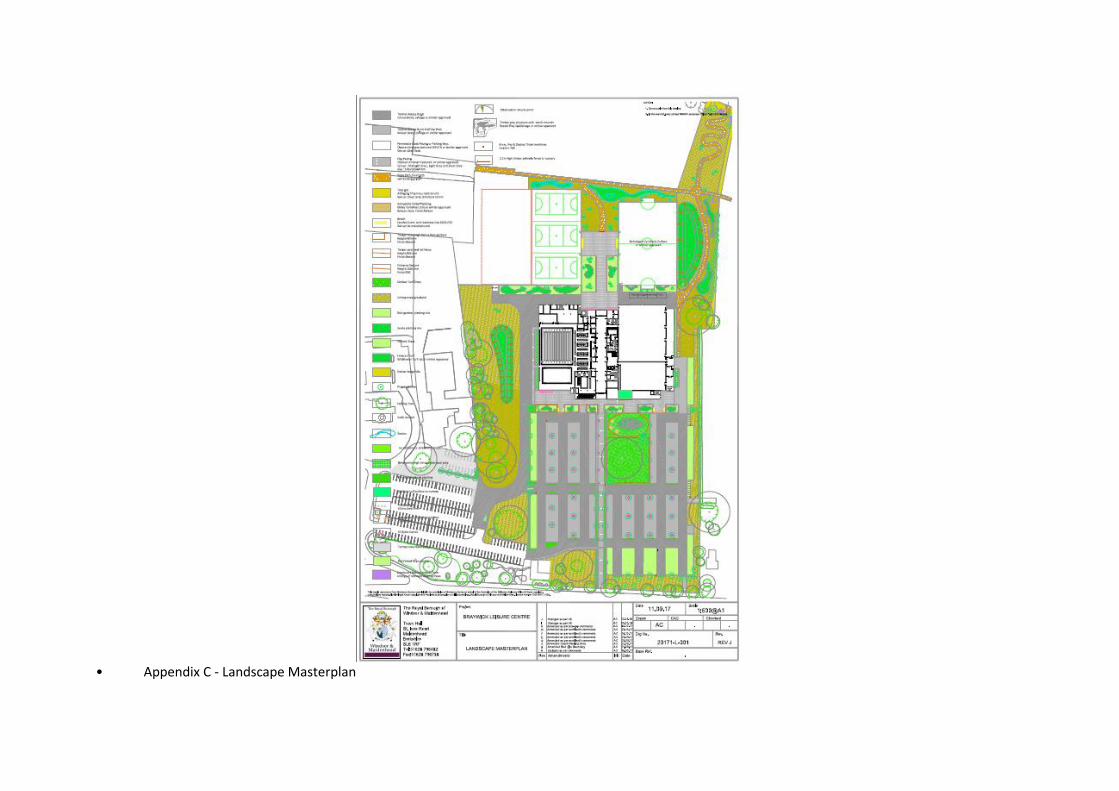
• Appendix C - Landscape Masterplan

• Appendix D – Proposed Elevations 1

• Appendix E – Proposed Elevations 2

ROYAL BOROUGH OF WINDSOR & MAIDENHEADPLANNING COMMITTEE
MAIDENHEAD DEVELOPMENT CONTROL PANEL
14 February 2018 Item: 4ApplicationNo.:
17/03949/FULL
Location: Great Oaks Forest Green Road Holyport Maidenhead SL6 3LQProposal: Change of use of land for sports use in association with Holyport College and
continuing use of the existing land as Polo/EquestrianApplicant: Great Oaks Services LtdAgent: Belvedere Property ManagementParish/Ward: Bray Parish/Bray Ward
If you have a question about this report, please contact: James Langsmead on 01628 685804 or [email protected]
1. SUMMARY
1.1 This application seeks planning permission for the change of use of a field within the curtilage ofGreat Oaks, Forest Green Road, from Polo and Equestrian use to a mixed use ofPolo/Equestrian for the occupiers of Great Oaks; and, sport / recreation playing field associatedwith the education curriculum of the College (D2 Use Class). The playing fields are to be used bythe Holyport College for sports and recreation activities in line with their educational curriculum;and, the existing Equestrian/Polo use for the occupiers of Great Oaks is to be retained, ascurrently established. Whilst a change of use is unacceptable in terms of National policy (NPPF)on Green Belt, the applicant has presented Very Special Circumstances which outweigh theharm to the Green Belt.
1.2 Holyport College currently have a shortfall of on-site recreational / sports grounds to meet theneeds of their educational sports curriculum. The College has a legal agreement with EtonCollege, which establishes the heads of terms for educational sponsorship (non-financial),facilitating the use of Eton’s sport facilities to enable the College to deliver its sports education. Itwould be of significant benefit to the College to provide this education within close proximity tothe College site. The Very Special Circumstances that support this, in this instance, are that thechange of use is considered to be sustainable development, reducing the College’s need totransport its students off-site for sports and recreation activities covered in their curriculum. Thiswill reduce the financial and environmental (carbon emissions) implications of the College’scurrent practices. There will still be a need to use facilities offsite, however, the outdoor fieldsports needs would be met by the proposed provisions and the environmental and financialimplications of current practices would be significantly reduced. Furthermore, the proposal wouldretain open land, with no proposed permanent structures. Therefore, the change of use wouldpreserve the openness of the Green Belt, and would not conflict with the purposes of includingland in the Green Belt. Accordingly, the Local Planning Authority consider the proposals to be anappropriate sustainable use of the site, as per the definition of ‘sustainable development’contained in Paragraph 14 of the National Planning Policy Framework.
It is recommended the Panel defers and delegates approval to the Head of Planningsubject to no new material considerations being raised in response to the publicconsultation, which have not been addressed in the Officer’s report.
2. REASON FOR PANEL DETERMINATION
At the request of Councillor Leo Walters, on the grounds that the review of change of use ofthe field would be within the Public’s interest.

3. DESCRIPTION OF THE SITE AND ITS SURROUNDINGS
3.1 The application site relates to an enclosed field off of Ascot Road (south-east side), oppositeLeslions Farm. Holyport College is situated to the south-west of the site within the Green Belt.The north east of the site is bound by more enclosed fields. The field falls within the curtilage ofGreat Oaks a residential property accessed on Forest Green Road. The field’s current planninguse is recognised equine use in association with sport use i.e. for the purposes of playing Polo.Part of the site is situated within a Flood Zone identified as having a flood risk of category 2.
4. DESCRIPTION OF THE PROPOSAL AND ANY RELEVANT PLANNING HISTORY
4.1 This application proposes a change of use of the application site from Polo and Equestrian to useto a mixed use of Polo/Equestrian for the residents of Great Oaks; and, sport / recreation playingfield (D2 Use Class) associated with the education curriculum of Holyport College. There are nopermanent structures (e.g. changing rooms, sports pavilions or other buildings) proposed inconnection with either use. The field would continue to be used by the residents of Great Oaks asan Equestrian / Polo field, as and when; and be utilised for sports in connection with the College’scurriculum and co-curriculum programme for no more than 180 days of the calendar year.
4.2 The site is approximately 116m (width) x 180m (length), equating to 20,880sqm (2.08 hectares).This is the equivalent to approximately 2 rugby pitches (at 1 hectare each) or 2.5 – 3.3 footballpitches (at 0.62 or 0.82 hectares each).
4.3 Access is obtained through an existing secure gate on the north east boundary of HolyportCollege’s grounds. A narrow un-kept / beaten path runs adjacent to Ascot Road, inside thecurtilage of the land identified as being in Great Oak’s ownership.
Ref. Description Decision andDate
17/01499/FULL Change of use of existing land fromPolo/Equestrian use to a mixed use ofPolo/Equestrian and sports use in associationwith Holyport College.
Withdrawn:
02.11.2017
03/40197/FULL Horse exercise track and bund alongside AscotRoad. (Retrospective)
Permitted:12.09.2003
03/40082/FULL Formation of polo field and enlargement ofexisting pond
Permitted:12.09.2003
99/34415/FULL Erection of new entrance gates, walls andfences at Great Oaks and Impala Polo.Retrospective.
Permitted:
23.03.2001
89/00478/FULL OUTDOOR SAND RIDING AREA Permitted:23.11.1989
89/00477/SEC53 PROPOSED SAND RIDING AREA Permitted:03.11.1989
5. MAIN RELEVANT STRATEGIES AND POLICIES RELEVANT TO THE DECISION
5.1 National Planning Policy Framework Paragraphs 14, 89
Royal Borough Local Plan

5.2 The main strategic planning considerations applying to the site and the associated policies are:
IssueLocal PlanPolicy
Compliance
Acceptable impact on character and appearance ofarea
DG1 Yes
Acceptable impact on Green Belt GB1, GB2 Yes
Acceptable impact on the residential amenity NAP3 Yes
Sufficient parking space available P4 Yes
Does not increase flood risk F1 Yes
Trees and development N6 Yes
These policies can be found athttps://www3.rbwm.gov.uk/downloads/download/154/local_plan_documents_and_appendices
Borough Local Plan: Submission Version
Issue Local Plan PolicyDesign in keeping with character and appearance ofarea
SP2, SP3
Manages flood risk and waterways NR1
The NPPF sets out that decision-makers may give weight to relevant policies in emerging plansaccording to their stage of preparation. The Borough Local Plan Proposed SubmissionDocument was published in June 2017. Public consultation ran from June to September with theintention to submit the Plan to the Planning Inspectorate in October 2017. In this context, theBorough Local Plan: Submission Version is a material consideration, but limited weight isafforded to this document at this time.
This document can be found at:http://rbwm.moderngov.co.uk/documents/s14392/Appendix%20A%20-%20Borough%20Local%20Plan%20Submission%20Version.pdf
Supplementary planning documents
5.3 Supplementary planning documents adopted by the Council relevant to the proposal are:
The Interpretation of Policy F1 (Area Liable to Flooding) Supplementary Planning Guidance(SPG) 2004
More information on these documents can be found at:https://www3.rbwm.gov.uk/info/200414/local_development_framework/494/supplementary_planning
6. EXPLANATION OF RECOMMENDATION
6.1 The key issues for consideration are:
i Impact on the Green Belt
ii Impact on Character and Appearance of the of the site and surrounding area
iii Impact on neighbouring Residential Amenities
iv Flooding
v Sustainability
vi The Planning Balance
Impact on the Green Belt
6.2 The site is located within the Green Belt where most development is considered to beinappropriate. The NPPF sets out the basis for development within the Green Belt and makes itclear that changes of use of land are inappropriate development. Although the Local Plan pre-dates the publication of the NPPF, Policy GB1 adopts a broadly similar approach to nationalpolicy.
6.3 On this basis, the proposed change of use from equestrian and polo to a mixed use ofPolo/Equestrian for the residents of Great Oaks; and, sport / recreation playing field associatedwith the Colleges curriculum is regarded as inappropriate development, and thus, the onus is onthe applicant to set out a case for very special circumstances (VSC). The judgement then iswhether the case for VSC outweighs the harm to the Green Belt in principle, any other Green Beltharm, and then, any additional harm by conflict with other policies in the Local Plan. In this case,the applicant cites the benefits of mitigating the financial and environmental implications thatarise from the College’s current sports and recreations operations, as the basis for the VSCjustification of this proposal. This is assessed later in this report in the assessment of thePlanning Balance.
Impact on the character and appearance of the of the site and surrounding area
6.4 Officers consider that the proposed change of use from Polo and Equestrian to mixed use ofPolo/Equestrian for the residents of Great Oaks; and, sport / recreation playing field associatedwith the education curriculum of the College will not have a significant impact on the characterand appearance of the site. As the applicant has stated in the planning statement submitted,there would be no permanent structures (e.g. changing rooms, sports pavilions or other buildings)to be constructed in connection with these uses. Existing changing rooms and storage facilitiesfor equipment are available at the College site, and this will negate the need to provide any suchstructures on the application site in future. Furthermore, a condition will be recommended toensure that no structures shall be placed on the application site (Condition 8). Given that theEquestrian and Polo use is the site’s established use, which does not have any existing orproposed associated built development, it is considered that the impact on the Green Belt’spurpose, openness and visual amenity would not be demonstrably affected by the retention ofthis use, to an extent that would warrant the application’s refusal on character and appearancegrounds.
6.5 With respect to the sports and recreation use in connection with the College’s curriculum and co-curriculum programme, the field would be utilised for activities such as football, rugby, cricket,hockey and athletics. From time to time, temporary field markings and sports equipment (e.g.football goals, rugby posts and corner flats) would be erected on the field to facilitate proper use.The applicant states that use of the field would only commence after 9am during school hoursand conclude no later than daylight hours. No floodlighting is intended and no use of soundequipment such as PA systems during regular use associated with the College’s curricular use isproposed. As such, it is considered that the physical impact on the application site would not bedemonstrable to an extent that would warrant the applications refusal on character andappearance grounds.
Impact on neighbouring Residential Amenities
6.6 Given the rural nature of the surrounding area; the small number of residential uses within theimmediate vicinity of the site; and, that the College already exists and operates ‘play’ andsporting activities on a number of grounds within their own site, it is considered that the change ofuse of the neighbouring field for ‘play’ and sporting use during college hours would not introduceany greater impact on the neighbouring residential occupiers to an extent that would warrant theapplications’ refusal on these grounds. Whilst the applicant has indicated that there will bespectators from time to time, existing parking onsite at the school would be used and the number

of spectators would be limited. As noted, in the character and appearance section, the applicantdoes not propose the installation of floodlighting, or the regular use of a Public Address (PA)system. As such, the Local Planning Authority would recommend application of a restrictivecondition, limiting the use of PA equipment (Condition 6).
6.7 In respect of the of the Equestrian / Polo use, this is the current established use of the site whichwas granted permission under application referenced 03/40082/FULL. The use was grantedplanning permission subject to the condition that the field is only to be used for Equestrian / Poloby the occupiers of Great Oaks and their guests and not for competitive matches and events. Assuch, the use constraints with respect Polo / Equestrian use would remain the same - and shallbe formally conditioned as such (Condition 4) – and therefore, it is not considered that theretention of this use would give rise to any greater impacts on the residential amenities ofneighbouring occupiers.
Flooding
6.8 The application site is located with Flood Zone risk categories 2 and 3. A Flood Risk Assessmenthas been provided which identifies that the grounds keeper and teachers will make anassessment of the field prior to any ‘play’ or sports use to ensure that it is safe for the students. Inthe event that pitch is rendered unusable due to flooding, the field will not be used. Accordingly,the Local Planning Authority consider this approach to be acceptable and are of the view that asthere are no associated permanent built structures proposed, the change of use will not result inany increased risk of flooding to the site or beyond the site.
Sustainability
6.9 As noted above in the section on Green Belt, the use of the neighbouring field by the College willenable the mitigation of financial and environmental implications arising from current practicesand is therefore considered to be an appropriate sustainable use of the site, as per the definitionof ‘sustainable development contained in Paragraph 14 of the National Planning PolicyFramework.
Planning Balance
6.10 In accordance with Paragraph 88 of the NPPF, the Local Planning Authority attaches substantialweight to harm to the Green Belt, which in this instance solely arises from the proposedinappropriate change of use of the land. Such a change is identified as a policy harm, rather thanphysical harm. Notwithstanding this, the applicant has presented a case for Very SpecialCircumstances (VSC) which outweighs the identified harm to the Green Belt as is detailed in thefollowing paragraphs.
6.11 The applicant has made the case that the proposed change of use would make a valuablecontribution towards to the education of the students attending the college and would also reducefinancial and environmental (e.g. carbon emissions) implications and costs that currently arisefrom the College making arrangements to transport students to sports facilities that are off site.Currently, Holyport College has a legal agreement with Eton College, which establishes theheads of terms for educational sponsorship. The sponsorship is not a financial sponsorship, butinstead agrees the provision of support through Eton’s resources as set out in the agreement(available at:http://www.holyportcollege.org.uk/media/cms_page_media/41/Holyport%20HoTv4%20(002).pdf).
6.12 One such term of the agreement is that Eton College, from time to time, will provide access forHolyport pupils to use its sports facilities, some 6+ miles from Holyport College. The Officer’sdelegated report for the original application (Ref: 13/00287/FULL) for site’s redevelopment intoHolyport College as it currently stands, was approved on acknowledgement that the College hasa need to run a fleet of mini-buses to transport children to sports pitches and facilities at EtonCollege during the school day. As the college grows in its pupil numbers, the applicant has madethe case that the access to these facilities may become less viable due to timetabling andcapacity constraints. Additionally, such arrangements have environmental, financial and logisticalcosts and implications as stated above, and thus, the benefits of being able to facilitate the

college’s physical education and sports curriculum closer to the college site will minimise theseunnecessary costs and implications, providing benefits that effectively outweigh the harm to theGreen Belt and improve the sustainable practices of the College. In order to protect theapplication site, and the vested interests of both parties (Holyport College and Great Oaks),Holyport College have agreed to the terms of a lease agreement provided by Great Oaks, inwhich it is stated that the field shall only be utilised by the College for 180 calendar days of theyear, primarily during term time. Occasional use outside of this are to be agreed between partiesand no vehicles are to be allowed on site, except for a single vehicle to assist with thetransportation of sporting equipment. As such, the terms of this agreement help to minimise harmto the openness and visual amenity of the Green Belt. Furthermore, planning conditions 1-8 arealso recommended in order to protect the Green Belt. Use of the field by the Great Oaksoccupiers for Polo / Equestrian use would continue as established, and thus there would be nogreater impact on the Green Belt from the retention of this existing use.
6.13 It is considered that the proposals would retain the application site as open land and thereforewould preserve the openness of the Green Belt and would not conflict with the purposes ofincluding land in the Green Belt. As such, the applicant has demonstrated a case for Very SpecialCircumstances which would outweigh the substantial harm to the Green belt.
6.14 In summary, it is considered on balance that there would no demonstrable harm to openness ofthe Green Belt or to the purposes of including land in the Green belt. No other harm has beenidentified. As such the proposal is considered to be acceptable.
OTHER MATTERS
6.15 Public consultation for this application is still ongoing until 14 February 2018, therefore, in theevent that further material considerations are brought forward the Local Planning Authority willassess their impact on the appropriateness of the proposed development and undertake its dutyin accordance with the Panel resolution, as necessary.
7. CONSULTATIONS CARRIED OUT
Comments from interested parties
At the time of publication of this report no comments have been received from the 2 neighbouringproperties notified, or in response to the Site Notice displayed 8th January 2018. Notwithstandingthis, the application was requested for review at Panel by Cllr Walters, on the grounds on of theproposals being within the public interest.
The following Consultation comments were received from Statutory / Other Consultees:
Consultee Comment Officer response
Bray Parish Council:No Objections - recommend for approval.
Noted.
Environmental Protection: No Objection. Noted.
Highways: No Objection. Noted.
8. APPENDICES TO THIS REPORT
Appendix A - Site location plan (Ref: LAND AT SL6 3LQ – Dated: 31.07.2017)
9. CONDITIONS RECOMMENDED FOR INCLUSION IF PERMISSION IS GRANTED
1 The development hereby permitted shall be commenced within three years from the date of thispermission.Reason: To accord with the provisions of Section 91 of the Town and Country Planning Act 1990(as amended).

2 The leisure (D2 Use Class) sporting facilities hereby approved shall only be used in connectionwith sporting lessons, matches and other related activities that Holyport College is actively takingpart in. Reason: To protect the amenities of local residents; and, the purpose and openness ofthe Green Belt. Relevant Policy - Local Plan NAP3, GB1, GB2
3 Unless otherwise first approved in writing by the Local Planning Authority the pitch shall not beused for College activities outside of term time and shall not be used for formal or informal sportsand / or by spectators outside the following hours: i) In the months of April to September thepitches and facilities shall only be used between the hours of 0900 and 2100 hours on Mondaysto Thursday and from 0900 to 1930 hours Fridays to Sundays and Bank Holidays falling withinterm time.ii) In the months of October to March the pitches and facilities shall only be usedbetween the hours of 0900 and 1930 hours Monday to Sunday and Bank Holidays falling withinterm time. Reason: To protect the amenities of local residents. Relevant Policy - Local PlanNAP3
4 The use of the site for polo hereby approved shall be used for practice and recreation by theoccupiers of Great Oaks and their house guests only and no competitive matches or events shallbe held. Reason: To accord with the terms of the application and to ensure that the developmentdoes not impact on the neighbouring residential amenities or generate a disproportionate level oftraffic likely to prejudice road safety and the free flow of traffic on the surrounding road network. -Local Plan NAP3, T3
5 Unless otherwise first agreed in writing by the Local Planning Authority, no starter gun and nowhistle(s) shall be used in association with the use of the approved facilities other than betweenthe hours of 0900 and 1800.Reason: To protect the amenities of local residents. Relevant Policies - Local Plan NAP3.
6 No public address system including loud hailers (PA) may be used in association with the use ofthe approved facilities, other than for a maximum of five days for each of the five calendar yearsof 2017, 2018, 2019, 2020 and 2021, and these days shall be selected from Mondays toSaturdays only. PA equipment may not be used in connection with the approved facilities onSundays, Bank Holidays or outside of school term time, and on those days selected by theschool for its use. PA equipment shall be used only between the hours of 0900 and 1930. Inaddition, the school shall keep a log of the dates on which the PA equipment is used, to be keptavailable for reference by the Local Planning Authority if and when required. Reason: Toprotect the amenities of local residents. Relevant Policy - Local Plan NAP3
7 All sports equipment erected on the site (including, football goals, rugby posts, corner flags) shallbe dismantled and removed from the land outside of the College's academic teaching term.Reason: To protect the openness of the Green Belt. Relevant Policies - Local Plan GB1, GB2
8 No built structures or free-standing containers shall be placed on the site. Reason: To protect theopenness of the Green Belt. Relevant Policies - Local Plan GB1, GB2
9 The development hereby permitted shall be carried out in accordance with the approved planslisted below.Reason: To ensure that the development is carried out in accordance with the approvedparticulars and plans.


ROYAL BOROUGH OF WINDSOR & MAIDENHEADPLANNING COMMITTEE
MAIDENHEAD DEVELOPMENT CONTROL PANEL
14 February 2018 Item: 5ApplicationNo.:
17/04000/FULL
Location: Walnut Tree Cottage Cookham Dean Common Cookham Maidenhead SL6 9NZProposal: Two storey side extensionApplicant: Mr & Mrs SaundersAgent: Miss Stefania PetrosinoParish/Ward: Cookham Parish/Bisham And Cookham Ward
If you have a question about this report, please contact: Hannah Gillett on 01628 683939 or [email protected]
1. SUMMARY
1.1 The site lies in the Green Belt and within the Cookham Dean Conservation Area. The proposal isfor a two storey side extension to the dwelling. The cumulative increase in floor space over theoriginal dwelling would total 55%. In this case, the increase is subordinate in scale and thereforeon this basis is not considered to constitute a disproportionate addition and is thereforeconsidered appropriate development in the Green Belt. The bulk and scale of the proposal isconsidered appropriate in relation to the original dwelling and the extensions are not consideredto result in harm to the openness of the Green Belt. The scale and design of the extensions areconsidered in keeping with the character of the existing dwelling and the surrounding area. It isconsidered the proposal would not result in significant harm to any neighbouring property inrelation to loss of privacy, outlook, daylight, sunlight or otherwise and the proposal complies withrelevant Local Plan policies in relation to parking and trees. The proposal is considered to complywith all relevant Local Plan policies.
It is recommended the Panel grants planning permission with the conditions listed inSection 10 of this report.
2. REASON FOR PANEL DETERMINATION
As the applicant is an elected member of the Council, the Council’s Constitution does notgive the Head of Planning delegated powers to determine the application in the wayrecommended; such decisions can only be made by the Panel.
3. DESCRIPTION OF THE SITE AND ITS SURROUNDINGS
3.1 The application site is located to the west of Cookham Common, in Cookham and compromisesa two storey detached dwelling. The site is located within the Green Belt and is located within theCookham Dean Conservation Area.
4. DESCRIPTION OF THE PROPOSAL AND ANY RELEVANT PLANNING HISTORY
4.1 Planning permission is sought for the erection of a two storey side extension.
Ref. Description Decision andDate
12/03043/FULL Replacement porch and minor alterations. Permitted.10.12.2012
10/01338/FULL Two storey side extension with open entranceporch following demolition of existing garage
Permitted.13.09.2010

(amended description).
98/32302/FULL Replacement of flat roof with tiled pitched roofand two dormer windows and fully glazed porch.
Permitted.31.03.1998
The current proposal is identical to a previously submitted scheme which was approved but notimplemented (application reference: 10/01338).
5 MAIN RELEVANT STRATEGIES AND POLICIES RELEVANT TO THE DECISION
Royal Borough Local Plan (1999)
5.1 The main strategic planning considerations applying to the site and the associated policies are:
IssueLocal PlanPolicy
Compliance
Design in keeping with character of area DG1 Yes
Acceptable impact on appearance of area H14 Yes
Acceptable impact when viewed from nearbyoccupiers
H14 Yes
Maintains acceptable level of privacy for nearbyresidents
H14 Yes
Maintains acceptable level of daylight andsunlight for nearby occupiers
H14 Yes
Sufficient parking space available P4 Yes
Appropriate development in the Green Belt GB1 Yes
Extensions proportionate to original dwelling GB4 Yes
Acceptable impact on Green Belt GB2 Yes
Preserves or enhances Conservation Area CA2 Yes
Acceptable impact on trees important to thearea
N6 Yes
Complies with the Cookham Village DesignStatement
G6.1, G6.2,G6.3, G6.5,G6.8, G6.9
Yes
These policies can be found at:https://www3.rbwm.gov.uk/downloads/download/154/local_plan_documents_and_appendices
Borough Local Plan: Submission Version
Issue Local Plan PolicyAppropriate Development in Green Belt and acceptableimpact on Green Belt
SP1, SP5
Design in keeping with character and appearance ofarea
SP2, SP3
Historic Environment HE1, HE3
5.2 The NPPF sets out that decision-makers may give weight to relevant policies in emerging plansaccording to their stage of preparation. The Borough Local Plan Proposed Submission Documentwas published in June 2017. Public consultation ran from 30 June to 27 September 2017.Following this process the Council will prepare a report which summarises the issues raised inthe representations and set out its response to them. This report, together with all therepresentations received during the representation period, the plan and its supporting documentswill then be submitted to the Secretary of State for examination by the Planning Inspectorate. Inthis context, the Borough Local Plan: Submission Version is a material consideration, but limitedweight is afforded to this document at this time.

5.3 This document can be found at:http://rbwm.moderngov.co.uk/documents/s14392/Appendix%20A%20-%20Borough%20Local%20Plan%20Submission%20Version.pdf
5.4 The Council’s planning policies in the Local Plan can be viewed at:https://www3.rbwm.gov.uk/downloads/download/154/local_plan_documents_and_appendices
Other Local Strategies or Publications
5.5 Other Strategies or publications relevant to the proposal are:
RBWM Parking Strategy
Conservation Area appraisal – view at
https://www3.rbwm.gov.uk/info/200207/conservation_and_regeneration/666/conservation_areas_and_listed_buildings
6. OTHER MATERIAL CONSIDERATIONS
6.1 The Council has paid special attention to the desirability of preserving or enhancing thecharacter or appearance of the conservation area, as required under Section 72(1) of thePlanning (Listed Buildings and Conservation Areas) Act 1990.
7. EXPLANATION OF RECOMMENDATION
7.1 The key issues for consideration are:
i. Whether the development is appropriate in the Green Belt and if not, whether there areany very special circumstances;
ii. The impact on the character and appearance of the existing dwelling and the characterand appearance of the surrounding area;
iii. The impact on the amenities of neighbouring properties;
iv. Parking implications; and
v. Impact on trees important to the area
7.2 Green Belt
Section 9 of the NPPF sets out the Government’s approach to protecting Green Belt land.Paragraph 87 of the NPPF states: ‘As with previous Green Belt policy, inappropriate developmentis, by definition, harmful to the Green Belt and should not be approved except in very specialcircumstances.’ Paragraph 89 of the NPPF advises that local planning authorities should regardthe construction of new buildings as inappropriate however; there are a limited number ofexceptions to this general rule. One of the exceptions includes; ‘the extension or alteration of abuilding provided that it does not result in disproportionate additions over and above the size ofthe original building’.
Policy GB4 of the Local Plan relates to residential extensions in the Green Belt and this policystates floor space calculations will be a guiding factor in assessing whether a proposal isdisproportionate. Extensions which increase the floor space by more than 50% over the originaldwelling are generally deemed disproportionate. However, the bulk and scale of the proposedextensions and their effect on the openness of the Green Belt must also be assessed.

In determining whether additions are disproportionate, Policy GB4 states the percentage increasein floor space is not the sole determining factor; it is important also to assess the bulk and scaleand the effect on the openness of the Green Belt. The application is identical to a previousapplication (application ref: 10/01338/FULL) and during the course of the previous application,amended drawings were received in order to overcome concerns raised regarding the scale ofthe extensions. The proposed extensions are considered to be subordinate to the originaldwelling and together with previous additions, would not form a disproportionate addition to theoriginal dwelling.
Policy GB2 indicates that permission will not be granted for a new development within the GreenBelt if it would have a greater impact on the openness of the Green Belt than the existingdevelopment on the site or if the development would harm the character of the countryside byvirtue of its scale and siting or by making a material increase in the scale of development of thesite. The site is within the built-up area of the village. Although the separation distance betweenthe application dwelling and neighbouring property Cherry Tree Cottage would be reduced, aminimum distance of 1.4 metres would be maintained. The side extension would be set downfrom the maximum ridge height of the dwelling, and the roof would pitch away from this neighbourwhich would contribute to the maintenance of the spacious character of the surrounding area.Overall, the impact on openness is considered to be minimal.
The site is located within the Green Belt where strict control over development is necessary inorder to maintain the openness of the Green Belt, for this reason, permitted development rightsfor further additions to the dwelling have been removed by condition.
7.3 Impact on the character and appearance of the existing dwelling and the character andappearance of the surrounding area
The appearance of a development is a material planning consideration and the National PlanningPolicy Framework, Section 7 (Requiring Good Design) and Local Plan Policy DG1, advises thatall development should seek to achieve a high quality of design that improves the character andquality of an area. Policy CA2 states development in conservation areas must enhance orpreserve the character and appearance of the area. The Cookham Village Design statementstates extensions should be subordinate in scale and should sympathetically reflect the design ofthe original building.
The Conservation Officer has raised no objection to the proposal. The scale and design of theproposed extension are considered appropriate to the existing dwelling and the additions wouldappear in keeping with the host dwelling. The proposal is therefore considered to be acceptablein terms of its design in relation to the character and appearance of the existing dwelling and thestreet scene.
7.4 Impact on the amenities of neighbouring properties
The proposal is not considered to result in significant harm to any immediate neighbouringproperty in terms of loss of privacy, outlook, daylight, sunlight or otherwise.
Policy GB4 House Extensions in the Green Belt
% increase
Floor space oforiginal dwelling or at01/07/1947
130 sqm
Extensions addedprior to the currentapplication
11.4 sqm 8.8%
Current proposal 60 sqm 46.2%
Total floor spaceadded
71.4 sqm 55%

7.5 Parking implications
Sufficient space would remain on the site to accommodate the car parking for the resultingdwelling in compliance with the adopted parking standards in Appendix 7 of the Local Plan asamended by the Royal Borough of Windsor and Maidenhead Parking Strategy, May 2004.
7.6 Impact on trees important to the area
There are no Tree Preservation Orders covering the site, however, as the site is located within aconservation area, permission would be required to remove any trees. It is considered theproposed two storey side extension would be sited a sufficient distance from the trees on the siteand provided suitable tree protection measures are taken it should be possible to construct theextension without having a significant impact on the trees or hedging. Further tree protectionmeasures have been secured by condition.
8. CONSULTATIONS CARRIED OUT
Comments from interested parties
8.1 3 occupiers were notified directly of the application.The application was advertised in the Windsor and Maidenhead Advertisers on 18/01/2018.The planning officer posted a statutory notice advertising the application at the site on11/01/2018.
8.2 No letters of representation have so far been received from any neighbouring property.
Statutory consultees
Consultee CommentWhere in thereport this isconsidered
Conservationofficer
Thank you for consulting conservation on the application17/04000/FULL. After reviewing the proposals I note thatthey are identical to those submitted and approved in2010. In this instance the assessment of the impact on theconservation area remains the same, namely that it willpreserve and therefore I do not raise an objection to theproposal.
Condition recommended.
Section 7.3
Tree officer I have visited the above site and would like to offer thefollowing comments on the information that has beenprovided to date.
This site includes several mature trees and boundaryhedging that is all shown to be retained on the SchemeProposals Plans and Elevations (Dwg. No PL-200 A).Unfortunately no arboricultural information has beensubmitted with this application to show how the trees andhedging would be protected as part of the development.
The proposed two storey extension has been sited awayfrom the trees and if suitable tree protection measures aretaken it should be possible to construct the extensionwithout having a significant impact on the trees orhedging.Conditions recommended.
Section 7.6

9. APPENDICES TO THIS REPORT
Appendix A – Existing Layouts Plans and Elevations
Appendix B – Scheme Proposals Plans and Elevations
Documents associated with the application can be viewed athttp://www.rbwm.gov.uk/pam/search.jsp by entering the application number shown at the top ofthis report without the suffix letters.
This recommendation is made following careful consideration of all the issues raised through theapplication. The Case Officer has sought solutions to these issues where possible to secure adevelopment that improves the economic, social and environmental conditions of the area, inaccordance with NPFF.
In this case the issues have been successfully resolved.
10. CONDITIONS RECOMMENDED FOR INCLUSION IF PERMISSION IS GRANTED
1 The development hereby permitted shall be commenced within three years from the date of thispermission.Reason: To accord with the provisions of Section 91 of the Town and Country Planning Act 1990(as amended).
2 The materials to be used in any exterior work shall match those used in the construction of theexterior of the existing dwelling house unless first otherwise agreed in writing by the LocalPlanning Authority. The development shall be carried out in accordance with the approveddetails.Reason: In the interests of the visual amenities of the area. Relevant Policies - Local Plan DG1,CA2
3 No tree or hedgerow shown to be retained in the approved plans shall be cut down, uprooted ordestroyed, nor shall any tree work be undertaken other than in accordance with the approvedplans and particulars and without the written approval of the Local Planning Authority, until fiveyears from the date of occupation of the building for its permitted use. Any tree work approvedshall be carried out in accordance with British Standard 3998 Tree work. If any retained tree isremoved, uprooted or destroyed or dies, another tree shall be planted in the immediate vicinityand that tree shall be of the size and species, and shall be planted at such time, as specified bythe Local Planning Authority. Reason: In the interests of the visual amenities of the area.Relevant Policies - Local Plan DG1, N6.
4 No works or development shall take place until an Arboricultural Method Statement and TreeProtection Plan specific to this scheme, has been submitted and approved in writing by the LocalPlanning Authority. The Tree Protection Plan and Arboricultural Method Statement shall bewritten in accordance with sections 5.5, 6.1, 6.2, 6.3 and 7 of British Standard 5837:2012 Treesin relation to design, demolition and construction - recommendations. Nothing shall be storedor placed in any area protected in accordance with this condition and the ground levels withinthose areas shall not be altered, nor shall any excavation be made, without the priorwritten approval of the Local Planning Authority. Thereafter the works shall be carried out inaccordance with the approved details until completion of the development. Reason: To protecttrees which contribute to the visual amenities of the site and surrounding area. Relevant Policies- Local Plan DG1, N6.

5 Notwithstanding the provisions of Article 3 and Classes A, B & E of Part 1 of Schedule 2 of theTown and Country Planning (General Permitted Development) (England) Order, 2015 (or anyOrder revoking and re-enacting that Order with or without modification) , no enlargement,improvement or other alteration (including the erection of a garage, stable, loosebox or coach-house within the curtilage) of or to Walnut Tree Cottage; dwelling house the subject of thispermission, shall be carried out nor shall any building or enclosure required for a purposeincidental to the enjoyment of any said dwelling house as such be constructed or placed on anypart of the land covered by this permission. (ND14A)Reason: The site is located within the Metropolitan Green Belt where strict control overdevelopment is necessary in order to maintain the openness of the Green Belt.
6 No development shall take place until any extensions, buildings and/or enclosures constructedunder Article 3 and Classes A, B & E of Part 1 of Schedule 2 of the Town and Country Planning(General Permitted Development) (England) Order, 2015 (as amended or any Order revokingand re-enacting that Order with or without modification) following the granting of this permissionand prior to the commencement of works the subject of this permission, have been removed ordemolished in their entirety. All materials resulting from such removal/demolition shall beremoved from the site by the substantial completion or occupation of the development herebypermitted, whichever is the sooner.Reason: The site is located within the Metropolitan Green Belt wherein strict control overdevelopment is necessary to maintain the openness of the Green Belt and to ensure asatisfactory development in accordance with the terms of the application.
7 The development hereby permitted shall be carried out in accordance with the approved planslisted below.Reason: To ensure that the development is carried out in accordance with the approvedparticulars and plans.
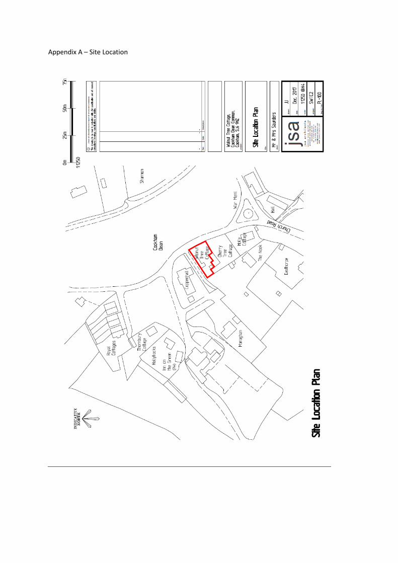
Appendix A – Site Location

Appendix B – Existing Plans

Appendix C Proposed Plans

ROYAL BOROUGH OF WINDSOR & MAIDENHEADPLANNING COMMITTEE
MAIDENHEAD DEVELOPMENT CONTROL PANEL
14 February 2018 Item: 6ApplicationNo.:
17/04031/FULL
Location: Delmere Moneyrow Green Holyport Maidenhead SL6 2NAProposal: Replacement dwellingApplicant: Mr And Mrs DmochAgent: Miss Stefania PetrosinoParish/Ward: Bray Parish/Bray Ward
If you have a question about this report, please contact: Jo Richards on 01628 682955 or [email protected]
1. SUMMARY
1.1 The proposal is for a replacement dwelling in the Green Belt which due to its proposed form, bulkand scale would be materially larger than the one it would replace. The proposal would thereforeconstitute inappropriate development within the Green Belt as outlined under paragraph 89 of theNPPF. Inappropriate development is by definition harmful to the Green Belt and should not beapproved except in very special circumstances. A case of Very Special Circumstances that wouldoutweigh the harm by inappropriateness has not been demonstrated.
1.1. The proposal is considered to be acceptable in terms of impact on the general character of thearea, neighbouring amenity, highway safety and parking.
It is recommended the Panel refuses planning permission for the following summarisedreasons (the full reasons are identified in Section 10 of this report):
1. The proposed replacement dwelling, by reason of its form, bulk and scale,particularly at first floor level, would be materially larger than the one it is replacing.The proposal therefore constitutes inappropriate development in the Green Belt asoutlined under paragraph 89 of the NPPF and local plan policy GB3. No Very SpecialCircumstances exist that clearly outweigh the harm caused by the reason ofinappropriateness.
2. REASON FOR PANEL DETERMINATION
At the request of Councillor D. M. Coppinger if the application is recommended for refusal inthe public interest
3. DESCRIPTION OF THE SITE AND ITS SURROUNDINGS
3.1 The proposal site comprises a detached bungalow sitting within a sizable plot on the north-westside of Moneyrow Green. The site is located within the Green Belt and just inside the boundary ofHolyport Conservation Area. The area is characterised predominantly by detached dwellings ofdiffering scales and the development is spaciously set out within the street scene. To the south ofthe application site lies land comprising a scout hut, village hall and community playing fields.
4. DESCRIPTION OF THE PROPOSAL AND ANY RELEVANT PLANNING HISTORY
4.1 Permission exists by virtue of the General Permitted Development Order 2015 for a single storeyrear extension to the dwelling house, ref: 15/01739/CPD. There is also an extant planningpermission for extensions to the dwelling house, including raising the ridge of the dwelling houseand the insertion of front and rear dormer windows, under planning application ref:15/03010/FULL.

4.2 An application for a replacement dwelling house was submitted under planning application ref:17/03091/FULL, but was withdrawn because the Council had concerns over the bulk and scale ofthe roof of the proposed dwelling house.
4.3 The current proposal is for a replacement dwelling house in a similar position on the plot to theexisting dwelling house, with accommodation over two floors, incorporating front and rearprojecting gable sections with semi-hipped roofs and front and rear dormer windows.
Ref. Description Decision and Date15/01739/CPD Certificate of lawfulness to
determine whether a proposedsingle storey side extension islawful
Approved - 15.06.2015
15/03010/FULL Single storey side and frontporch extensions, raising ofridge, and installation of 3 frontand 3 rear dormers
Approved – 04.11.2015
17/03091/FULL Replacement dwelling Withdrawn – 04.12.2017
5 MAIN RELEVANT STRATEGIES AND POLICIES RELEVANT TO THE DECISION
5.1 National Planning Policy Framework (NPPF) Sections 6 (Delivering a wide choice of high qualityhomes), 7 (Requiring good design), 9 (Protecting Green Belt Land) and 12 (Conserving andEnhancing the Historic Environment).
5.2 The main strategic planning considerations applying to the site and the associated policies are:
Royal Borough Local Plan
IssuesLocal Plan
Policy ComplianceAcceptable impact on appearance of area DG1, H10, H11 Yes
Acceptable impact on Conservation Area CA2 Yes
Acceptable impact when viewed from nearbyOccupiers
H11 Yes
Maintains acceptable level of daylight andsunlight for nearby occupiers
H11 Yes
Maintains acceptable level of privacy for nearbyResidents
H11 Yes
Sufficient parking space available P4 Yes
Appropriate development in the Green GB1 No
Acceptable impact on Green Belt GB2, GB3 No
Acceptable impact on trees important to theArea
N6 Yes
Impact on highways safety T5 Yes
These policies can be found athttps://www3.rbwm.gov.uk/downloads/download/154/local_plan_documents_and_appendices
Borough Local Plan: Submission Version
Issue Local Plan PolicyAppropriate Development in Green Belt andacceptable impact on Green Belt
SP1, SP5
Design in keeping with character and appearanceof area
SP2, SP3, HE1
The NPPF sets out that decision-makers may give weight to relevant policies in emerging plansaccording to their stage of preparation. The Borough Local Plan Proposed SubmissionDocument was published in June 2017. Public consultation ran from 30 June to 27 September2017. Following this process the Council will prepare a report which summarises the issuesraised in the representations and sets out its response to them. This report, together with all therepresentations received during the representation period, the plan and its supporting documentswill then be submitted to the Secretary of State for examination by the Planning Inspectorate. Inthis context, the Borough Local Plan: Submission Version is a material consideration, but limitedweight is afforded to this document at this time.
This document can be found at:http://rbwm.moderngov.co.uk/documents/s14392/Appendix%20A%20-%20Borough%20Local%20Plan%20Submission%20Version.pdf
Other Local Strategies or Publications
5.3 Other Strategies or publications relevant to the proposal are:
• RBWM Townscape Assessment• RBWM Parking Strategy• Holyport Conservation Area Character Appraisal
More information on these documents can be found at:https://www3.rbwm.gov.uk/info/200414/local_development_framework/494/supplementary_planning
6. EXPLANATION OF RECOMMENDATION
6.1 The key issues for consideration are:
i whether the proposed development is appropriate development within the Green Belt
ii impact on the character of the area;
iii impact on neighbouring amenities;
iv parking and highways safety;
v landscaping; and
vi other considerations.
Green Belt
6.2 The site lies within the Green Belt with the fundamental aim to keep land permanently open asset out in paragraph 79 of the NPPF. Paragraph 89 of the NPPF outlines that the construction ofnew buildings is inappropriate development in the Green Belt apart from a few limitedexceptions. One of the exceptions is the replacement of a building provided that the new buildingis in the same use and not materially larger than the one it replaces. Local Plan policy GB1

adopts a broadly similar approach to national policy and sets out the general types of appropriatedevelopment in the Green Belt. GB1 only allows for residential development in accordance withpolicies GB3 to GB5. GB3 is the most relevant and it sets out the limited circumstances whennew residential dwellings will be acceptable. This includes proposals that relate to the rebuildingor one-for-one replacement of an existing habitable dwelling.
6.3 There is no real definition of materially larger provided within the NPPF, however it has emergedfrom various appeal decisions that it is a matter of fact and degree and that an assessmentshould consider all of the relevant circumstances which could include, among other things, thefloor area, volume, height and form of the proposed building.
6.4 Firstly, regarding floor area, it is accepted from previous planning records that the dwelling househas a total existing floor area of 194 sq.m. It should be noted that the existing garages, lean-toand rear conservatory are of limited height and bulk. Indeed the southernmost garage is more ofa carport structure and is of a very dilapidated state and thus the impact on the openness of theGreen Belt as a result of these structures is very limited.
6.5 In comparison the proposed dwelling house would have a floor area of approximately 249.5 sq.mwhich would result in an increase in built form of approximately 29%. In some instancesincreases in floor area of up to 30% may be considered acceptable, however the assessment ofwhether a replacement building is materially larger is not simply a question of floor area. In thiscase, there is also an increase in the height of the dwelling house from 5.3m to 5.8m, theintroduction of a flat-top or crown roof, front and rear projecting gable sections and dormerwindows. The scale and bulk of the proposed dwelling is therefore significantly greater at rooflevel than the existing bungalow, resulting in an obvious two-storey development, which has amarkedly different character to the existing bungalow which takes on a more subservientappearance within the landscape. Whilst the agent’s floor area figures differ marginally from theCouncil’s (set out in paragraphs 8.3-8.5 of the Design and Access statement), fundamentallywhat has been shown here is that the current proposal would result in significantly more floorspace at first floor level than the existing dwelling. It is concluded therefore that as a result of theincrease in floor area, height, scale and bulk of the dwelling house, particularly at first floor level,that the proposed replacement dwelling house would be materially larger than the one it is toreplace and thus does not constitute appropriate development in the Green Belt. Paragraph 87of the NPPF states that inappropriate development is by definition harmful to the Green Belt andshould not be approved except in Very Special Circumstances.
6.6 It is a material consideration that the existing dwelling house could be extended under the twoprevious planning permissions as referenced above. Indeed the Design and Access statementstates that the proposed replacement dwelling house would result in a 10% reduction in floorarea when compared to these permitted developments. It therefore needs to be establishedwhether either of these permissions would justify the approval of the inappropriate developmentas described above. Turning first to the single storey rear extension deemed to be permitteddevelopment under application ref: 15/01739/CPD, this would result in a 4m deep ground floorprojection along the width of the original dwelling house. Whilst the overall floor area of thecurrent proposal may be marginally less than the existing dwelling house and permittedextension, given the limited height and bulk of this extension and the fact that it would besituated to the rear of the dwelling house, it would have a very limited impact on the openness ofthe Green Belt. As stated above, an assessment based on floor area alone is not a strongenough indicator of overall impact on the Green Belt. Turning now to the extensions approvedunder full planning application ref: 15/03010/FULL, whilst there would be a minor increase inridge height to the dwelling house and the insertion of front and rear dormer windows, a ridgeline would be maintained and thus the resultant development would not stray too far from that ofthe existing bungalow in terms of form, bulk and scale. Furthermore, whilst the agent states thatthe overall floor area would be slightly less than that of the proposed replacement dwellinghouse, again, the majority of the floor area would be single storey and thus the impact on theGreen Belt would be limited. This is demonstrated on drawing No. PL-402A which shows that theproposed first floor would be significantly deeper than either permitted schemes. It is thereforeconcluded that neither fallback position would be as harmful to the Green Belt as the currentproposal and therefore they can only be given very limited weight in the decision makingprocess.

6.7 Concerns have been raised that the existing dwelling house has a negative impact on thecharacter of the Conservation Area and the proposed replacement dwelling house would be animprovement to the character of the area and thus should be justified. Whilst no objections havebeen raised by the Council’s conservation officer to the current scheme, it is noted that noobjections were raised to the previous application ref: 15/03010/FULL and thus it cannot bestated that this fallback position would be more harmful to the character of the ConservationArea. Furthermore, such an argument is not commonly accepted as constituting a Very SpecialCircumstance.
6.8 Finally, whilst it is noted that the proposal has been amended from the scheme submitted underplanning application ref: 17/03091/FUL, to which the Council previously raised concerns, itshould be noted that the only changes to the scheme are that the projecting front and reargables have be designed with semi-hipped roofs. This has reduced the bulk at first floor levelonly very marginally and thus the concerns held by the previous case officer still remain.
6.9 Thus to conclude this section of the report, a case for Very Special Circumstances has not beendemonstrated.
Impact on the character of the area
6.10 The site lies within Holyport Conservation Area. The application building is neither designated asnegative or a significant non-listed building within the Conservation Area Appraisal and thus it isconsidered that it has a negligible effect on the character of the Conservation Area. As statedabove, no objection has been raised by the Council’s Conservation and Design Officer to theproposed dwelling house subject to the used of appropriate materials within the development.
6.11 The street scene is generally characterised by detached traditional styled dwellings. Thedwellings immediately opposite the application site are chalet style with semi-hipped roofs, suchas that currently proposed. Therefore, despite the specific concerns raised above relating to theimpact on the Green Belt, there are no objections to the character of the street scene or thecharacter of the area in general.
Impact on neighbouring amenities
6.12 The application site is bordered by playing fields to the south and an access road to the north.The nearest neighbouring properties are a considerable distance away from the proposeddevelopment such that the proposal would not materially affect the living conditions of theseneighbouring occupiers in terms of loss of light, loss of privacy or overdominance.
6.13 Noise and disturbance experienced by neighbouring occupiers or users of the communityfacilities adjacent to the site as a result of demolition and construction works is not a materialplanning consideration. Any works that become a statutory nuisance can be reported to theEnvironmental Protection department of the Local Authority.
Parking provision and highway safety
6.14 The proposal is for a one-for-one replacement dwelling and therefore there would be nointensification of the site. Therefore, there was no requirement to consult the Highways Authorityon the application.
6.15 Sufficient space would exist on the site to accommodate the car parking for the resulting dwellingin compliance with the adopted parking standards in Appendix 7 of the Local Plan as amendedby the Royal Borough of Windsor and Maidenhead Parking Strategy, May 2004.
Trees and Landscaping
6.16 The trees and vegetation within the site and on the site boundaries are of limited importance.Mature trees which lie on the access road to the north are sufficiently far enough away from theproposed redevelopment not to be affected.

Other Material Considerations
6.17 Concerns have been raised regarding the use of part of the existing and proposed dwelling as apodiatry surgery. This issue was investigated by the Council’s Enforcement team in 2012 and nobreach of planning control was found. The use of part of a dwelling house for business purposesdoes not necessarily result in a material change of use. In this case, only a small part of thedwelling house is used for the podiatry surgery and not on a permanent basis, the applicantreceiving only one client at a time, and as such, it does not materially alter the use of the propertyfrom a dwelling use (class C3). The proposed plans indicate that there would be a small homeoffice on the ground floor and therefore, it is assumed that the applicant’s business wouldcontinue in the same manner and the proposed dwelling house would be predominantly used forresidential purposes. As there is no material change of use, the Planning Authority cannot getinvolved in issues such as parking (other than to ensure there is a sufficient number of spaces fora dwelling house of this size) – if visitors to the premises are parking on neighbouring driveways,this would be a civil between the applicant and the neighbour. Likewise, issues such as disposalof medical waste and whether the applicant is paying business rates would not be covered underthe planning remit.
6.18 Safe demolition of the dwelling house does not fall to be considered as part of the currentplanning application and would be a matter for any subsequent building regulations application.
7. COMMUNITY INFRASTRUCTURE LEVY (CIL)
7.1 In accordance with the Council’s charging schedule the proposal is CIL liable, but it has not beendemonstrated by the applicant what the chargeable floor area would be, if any. However as theproposal is recommended for refusal no further action is required at this stage. Should theapplication be approved, it would be necessary for the relevant CIL forms to be completed andsubmitted to the Council.
8. CONSULTATIONS CARRIED OUT
Comments from interested parties
12 occupiers were notified directly of the application.
The planning officer posted a notice advertising the application at the site on 18.01.2018 and theapplication was advertised in the Maidenhead & Windsor Advertiser on 18.01.2018
3 letters have been received supporting the application, summarised as:
CommentWhere in thereport this isconsidered
1. The existing dwelling detracts from the character of the ConservationArea
6.7
2. The replacement dwelling would enhance the character of theConservation Area and area in general
6.7
3. The applicant has a legitimate and realistic fallback option 6.64. It is necessary to grant permission to prevent the fallback option being
implemented which is less attractive6.6
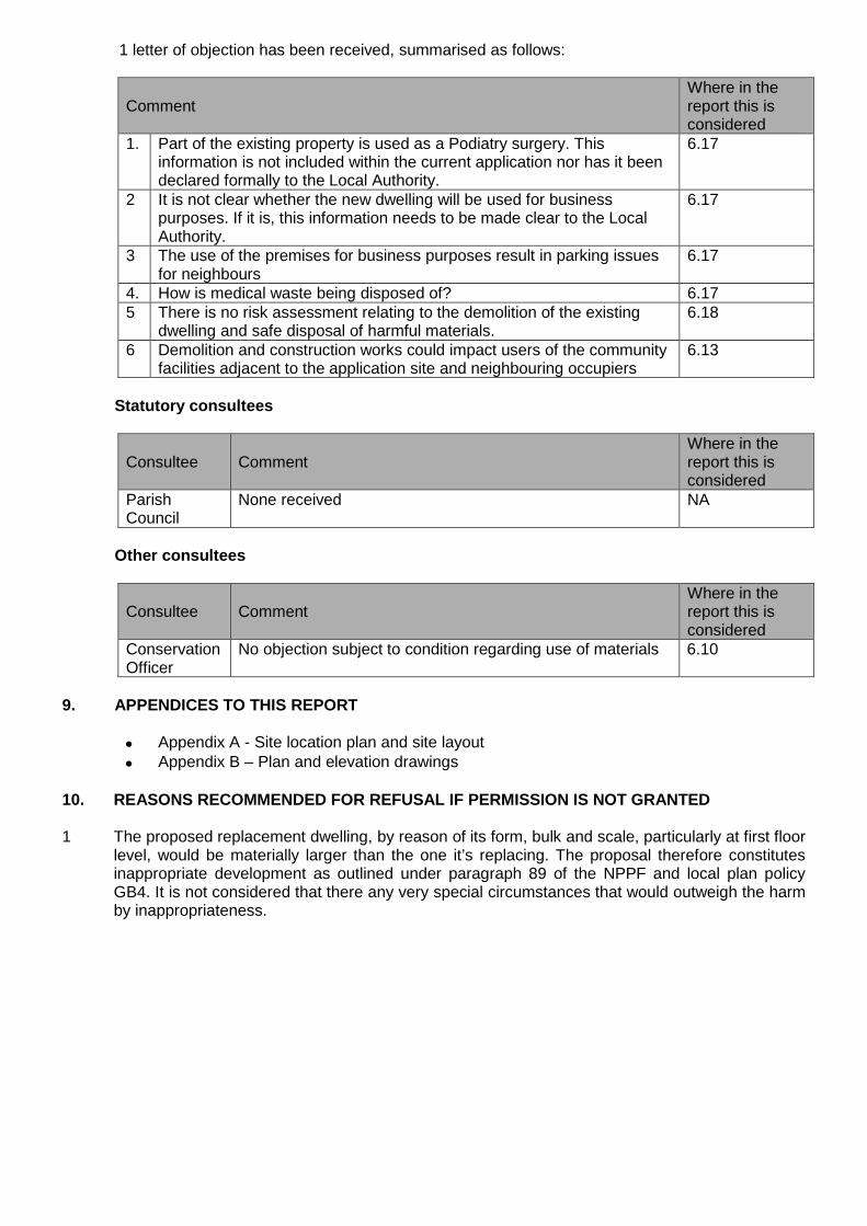
1 letter of objection has been received, summarised as follows:
CommentWhere in thereport this isconsidered
1. Part of the existing property is used as a Podiatry surgery. Thisinformation is not included within the current application nor has it beendeclared formally to the Local Authority.
6.17
2 It is not clear whether the new dwelling will be used for businesspurposes. If it is, this information needs to be made clear to the LocalAuthority.
6.17
3 The use of the premises for business purposes result in parking issuesfor neighbours
6.17
4. How is medical waste being disposed of? 6.175 There is no risk assessment relating to the demolition of the existing
dwelling and safe disposal of harmful materials.6.18
6 Demolition and construction works could impact users of the communityfacilities adjacent to the application site and neighbouring occupiers
6.13
Statutory consultees
Consultee CommentWhere in thereport this isconsidered
ParishCouncil
None received NA
Other consultees
Consultee CommentWhere in thereport this isconsidered
ConservationOfficer
No objection subject to condition regarding use of materials 6.10
9. APPENDICES TO THIS REPORT
Appendix A - Site location plan and site layout
Appendix B – Plan and elevation drawings
10. REASONS RECOMMENDED FOR REFUSAL IF PERMISSION IS NOT GRANTED
1 The proposed replacement dwelling, by reason of its form, bulk and scale, particularly at first floorlevel, would be materially larger than the one it’s replacing. The proposal therefore constitutesinappropriate development as outlined under paragraph 89 of the NPPF and local plan policyGB4. It is not considered that there any very special circumstances that would outweigh the harmby inappropriateness.

Appendix A—Site location plan and site layout


Appendix B—plan and elevation drawings
Existing and proposed ground floor plan

Existing and proposed first floor plan

Existing elevations

Proposed elevations