Embed Size (px)
Citation preview
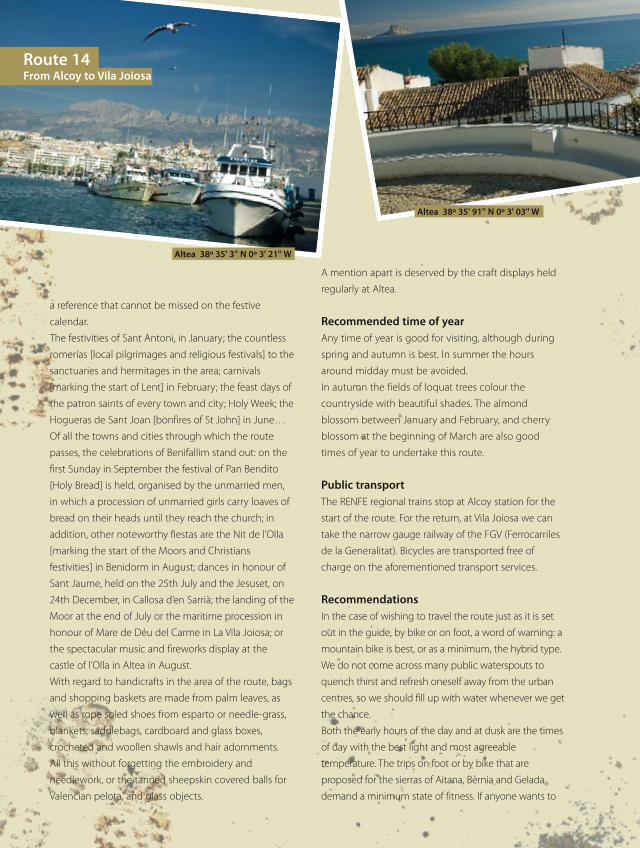
Route 14From Alcoy to La Vila Joiosa
From the Sierra de Aitana to the Serra Geladathrough ancient Arabic lands
1 • La Serreta
2 • Castle: Castillo de Penella
3 • Paraje del Salt
4 • Ravine: Barranc dels Horts
de Marra
5 • Mount: Sierra del Rontonar
6 • Summit: Cumbre del
Rontanar
7 • Castle: Castillo de
Benifallim
8 • Hermitage: Ermita de
Torresena
9 • Castle: Castillo de Penáguila
10 • Ares del Bosc
11 • Aitana
12 • Farm: Partida de Xarquera
13 • Waterspout: Font del Arbre
14 • Waterspout: Font del Espinal
15 • Waterspout: Font de Forata
16 • Castle: El Castell de Guadalest
17 • Caserío de Abdet
18 • Waterspout: Fuente de
Partagat
19 • Castle: Castillo de Sella
20 • Reservoir: Embalse de
Guadalest
21 • Waterspout: Font de Les
Salines
22 • Pas del Comptador
23 • Waterspout: Fuentes del Algar
24 • Fortress: Fort de Bèrnia
25 • Mount: Puig Campana
26 • La Lloma
27 • Beach: Playa de la Olla
28 • Beaches: Playas del Cap
Blanch
29 • Altea la Vella
30 • Beach: Playa de l’Albir
31 • Mount: Serra Gelada
32 • Islet: Illeta de l’Olla
33 • Islet: Islote de Benidorm
34 • Racó de l’Oix
35 • Beach: Playa de Poniente
36 • Theme Park: Parque
temático Terra Mítica
37 • Beach: Playa de Levante
38 • Beach: Playa de la Vila Joiosa
RUTA14y15_142a172_da OK ingles.qxp:rutas 15/07/10 8:19 Página 142
This route will allow us to explore the Aitana sierra and the
spectacular valleys with beautiful towns nestling on their
north-facing slopes. Former land of Moors [post-
reconquest Arabs converted to Christianity], in this
territory it is noticeable how the former inhabitants of this
territory exploited nature in the most beneficial and
respectful way: terraces of dry-stone walling and irrigation
channels to irrigate just a few metres of places where
nature is the undisputed powerful queen. From the Aitana
sierra we have spectacular views that enable us to see,
among other places, our next destination: the Bèrnia
sierra. We will be left in wonder and delight getting to
know these spots and, if the heat gets too much, we will
visit the waterspouts of the Fuentes de Algar, a real natural
water park in the Region of Valencia. Travelling through La
Marina Baixa we will reach the coast, where the city of
Altea awaits, muse of artists and craftworkers. From this
point, and until we reach Benidorm, the end of our route,
we will pass though the Serra Gelada, a coastal sierra with
beautiful cliffs and magical small islands just off the coast:
a spectacular route through mountains and along the
coast that will allow us, in a few short kilometres, to pass
through places as different as the Aitana sierra and
Benidorm, a capital of tourism.
From Alcoy to Benifallim over thehillsides of the Hontonar sierra
From Alcoy to Benilloba we will have to take the CV-70.
Along this road, close to Alcoy, we are accompanied by
the pleasant pinewood of the Serreta and, when the
landscape changes and on the slopes of the ravines we
glimpse crops of almonds and olives, vines and cereals,
on our left we will discover Penella castle, belonging to
the municipal district of Cocentaina. Penella castle,
situated in a delightful setting, is a 13th century Spanish
construction located on the Cerro de Sant Cristòfol. A few
kilometres further on we come to the town of Benilloba.
This former Arab hamlet responds to that with its steep,
narrow streets surrounded by whitewashed houses.
Benilloba is a rich and prosperous town, forged in the
heat of the powerful textile industry of the region to
which it belongs: El Comtat. We notice in this
municipality the delightful places there are around it.
These spots are the result of the river Frainós running by
the town. So, we will visit the spot named Salt [from the
Spanish for “leap”, not the English word!], where there are
remains of an Arab aqueduct, the course of which is now
covered under a green mantle. Following the river we will
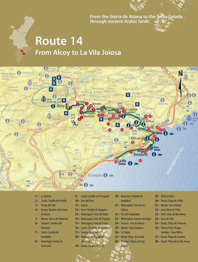
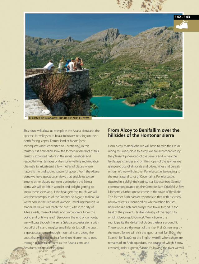
El Castell de Guadalest 38º 40' 61'' N 0º 11' 9'' W
- 143142
RUTA14y15_142a172_da OK ingles.qxp:rutas 15/07/10 8:19 Página 143
reach the Cuixot ravine, where we find the remains of an
arch-shaped bridge of Arabic origin. From Benilloba we
head along the CV-787 as far as Benifallim, on a
continuous uphill climb along the length of the Horts de
Marra ravine. Having reached the tiny town of Benifallim,
its single-storey buildings with wrought iron grilles
immediately attract our attention. At the foot of the
Rontanar sierra, in this space next to the village, we find
spots with abundant masses of Holm oaks and pines, so
much so that the place has been declared a micro-
reserve for its flora. At Benifallim, another of the
outstanding features is the castle, set on a rocky ridge
commanding a very wide visual domain that takes in the
castles of Cocentaina, Penelles, Penáguila and La
Costurera. From the town we can also make an excursion
taking us to the summit of the Rontanar, at 1,330 metres,
following a road that will take us past the great snow-
storage pit of this sierra.
Over the hillsides of theAitana sierra on the way to ElCastell de Guadalest
Our next destination is Penàguila. From
Benifallim we will have to take the CV-785 to
reach this municipality. On the way we will find
ourselves in the harmonious and relaxing spot
formed by the farmstead, the hermitage and the
Sena tower. Having arrived at Penàguilar, its rich
architectural heritage gives the impression that the
town has been a privileged witness to the history of
this area. After the conquest by Jaume I, at
Penàguila, due to the abuses from the Spaniards, the
Moors of the area rebelled. The Arab leader Al Azraq,
who dominated the Gallinera valley came to the aid
of the infuriated rebels although the Spaniards
eventually put down the rebellion and Al Azraq died
in Alcoy in 1276. Due to Penàgulla’s strategic
importance, Pere III of Aragon did not restrict himself to
facilitating the arrival of Spanish colonists, but rather, in
1278, when he signed Penàgulla’s town charter, he
obliged the hundred Spanish colonists by contract to look
after the castle and build houses and defensive walls
around it. Later, Penàgulla was besieged in 1356 by the
troops of Pedro I, the Cruel, who ended up being
defeated, which made the king of Aragon concede
Penàguilar the right to be called Villa Real [Royal Town]
and to have a vote in the courts. As a royal town,
Penàguilar sheltered the houses of the nobles of different
dominions of towns in the region and so, we can find
different houses of the nobility, of great architectural and
heritage value. Of the former defensive wall, only a few
towers and portals remain, outstanding amongst which is,
undoubtedly, El Portalet, a curious gate that impeded
entry into the town in a straight line, obliging those
entering to make two right-angled turns, thus increasing
control over the people who entered. The castle, for its
part, declared of Cultural Interest, is in a half-ruined state.
In the vicinity of its urban centre we will visit the palace
and Garden of Saints with its museum-house. This is a
Route 14From Alcoy to Vila Joiosa
El Castell de Guadalest 38º 40' 64'' N 0º 11' 9'' W
RUTA14y15_142a172_da OK ingles.qxp:rutas 15/07/10 8:20 Página 144
- 145
romantic garden which displays within its interior
botanical species unique in the area and a charming tree-
lined maze. We leave Penàguilar on the CV-781 in the
direction of Alcoleja and, before reaching this town, at the
point where the road divides and becomes the CV-770, on
a there and back stretch we will make a visit to the
peaceful and beautiful town of Benasau. Walking around
the streets with their harmonious vernacular architecture,
we come to the palace-tower of the Barons of Finestrat,
declared a Place of Cultural Interest. Within its municipal
boundary, we come to the town of Ares del Bosc, where
the 16th century palace of the Marquises of Bosc is
situated. In the environs we will find the remains of what
was the Arab town of Frainos, abandoned in 1609. Having
returned to our route, we come to Alcoleja where we are
pleasantly surprised by the ruggedness of its mountainous
setting, at the foot of the Aitana sierra, with a landscape
dominated by crops of olives and almonds, that drive the
economy of this mountainous population. Its closeness to
the Aitana sierra turns it into one of the favourite access
points for hikers to set out on the different routes there
are in the sierra. Within the town we will visit the
mediaeval part of the village, presided over by the remains
of the Marquis of Malferit’s palace. The most outstanding
features of this palatial house are the unusual tower
adjoining the building, in a good state of conservation,
and the great gateway with a semi-circular arch. From
Alcoleja we will take a pleasant quiet rural road. On this
stretch we will visit the town of Beniafé. We will pass
through the district of Xarquera, negotiating next a
narrow pass at over a thousand metres above sea level.
Once we have reached the top of this hard climb, the
views that open out before us are impressive. Confrides
Castle presents itself on a seemingly inaccessible hill, and
the Guadalest valley and some of the hamlets that shape
it today are glimpsed in the incomparable natural setting
of the Aitana sierra. And we say they shape it today, given
that before the expulsion of the Moors there were twenty
centres of habitation in the valley, and in present times
there are only six: Confrides, Abdet, Benifató, Beniardà,
Benimantell and Guadalest castle. The repopulation of the
area after the expulsion of the Moors in 1609 was slow
and scant and the Arab traces are perceived in modern
times in the water channels and ways in which the springs
are made use of. These are intelligent water management
systems that are today part of a living cultural landscape;
small dams, irrigation ditches, public washing places,
watering pools, cisterns, waterwheels… We can find these
demonstrations of Arab engineering both in the
mountain areas (with public waterspouts such as those of
Forata, Arbre, Espinal, Partagat, Xorrets, Salines or Molí) and
in the urban areas. They are a singular human work and
heritage to make beneficial use of water, in a readily
accessible and convenient way. We can also see signs of
the Moors passage, in the terraces, crops in impossible
places that form spots of unique beauty, such as when the
green of the olives blends with the whitey-grey of the
limestone rocks. In the area of the shaded side of the
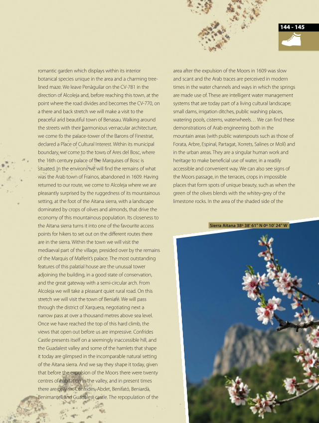
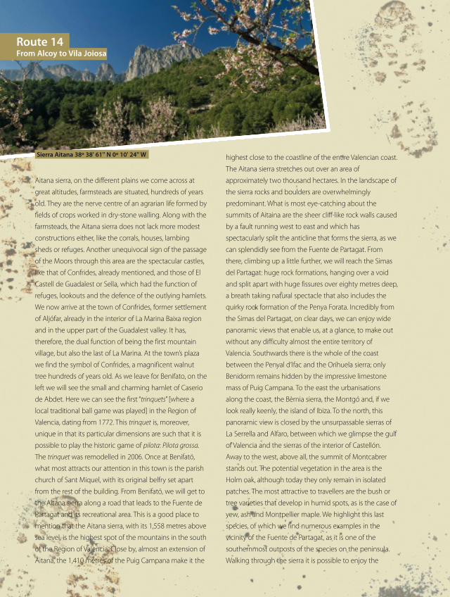
Sierra Aitana 38º 38' 61'' N 0º 10' 24'' W
144
RUTA14y15_142a172_da OK ingles.qxp:rutas 15/07/10 8:20 Página 145
highest close to the coastline of the entire Valencian coast.
The Aitana sierra stretches out over an area of
approximately two thousand hectares. In the landscape of
the sierra rocks and boulders are overwhelmingly
predominant. What is most eye-catching about the
summits of Aitaina are the sheer cliff-like rock walls caused
by a fault running west to east and which has
spectacularly split the anticline that forms the sierra, as we
can splendidly see from the Fuente de Partagat. From
there, climbing up a little further, we will reach the Simas
del Partagat: huge rock formations, hanging over a void
and split apart with huge fissures over eighty metres deep,
a breath taking natural spectacle that also includes the
quirky rock formation of the Penya Forata. Incredibly from
the Simas del Partagat, on clear days, we can enjoy wide
panoramic views that enable us, at a glance, to make out
without any difficulty almost the entire territory of
Valencia. Southwards there is the whole of the coast
between the Penyal d’Ifac and the Orihuela sierra; only
Benidorm remains hidden by the impressive limestone
mass of Puig Campana. To the east the urbanisations
along the coast, the Bèrnia sierra, the Montgó and, if we
look really keenly, the island of Ibiza. To the north, this
panoramic view is closed by the unsurpassable sierras of
La Serrella and Alfaro, between which we glimpse the gulf
of Valencia and the sierras of the interior of Castellón.
Away to the west, above all, the summit of Montcabrer
stands out. The potential vegetation in the area is the
Holm oak, although today they only remain in isolated
patches. The most attractive to travellers are the bush or
tree varieties that develop in humid spots, as is the case of
yew, ash and Montpellier maple. We highlight this last
species, of which we find numerous examples in the
vicinity of the Fuente de Partagat, as it is one of the
southernmost outposts of the species on the peninsula.
Walking through the sierra it is possible to enjoy the
Aitana sierra, on the different plains we come across at
great altitudes, farmsteads are situated, hundreds of years
old. They are the nerve centre of an agrarian life formed by
fields of crops worked in dry-stone walling. Along with the
farmsteads, the Aitana sierra does not lack more modest
constructions either, like the corrals, houses, lambing
sheds or refuges. Another unequivocal sign of the passage
of the Moors through this area are the spectacular castles,
like that of Confrides, already mentioned, and those of El
Castell de Guadalest or Sella, which had the function of
refuges, lookouts and the defence of the outlying hamlets.
We now arrive at the town of Confrides, former settlement
of Aljófar, already in the interior of La Marina Baixa region
and in the upper part of the Guadalest valley. It has,
therefore, the dual function of being the first mountain
village, but also the last of La Marina. At the town’s plaza
we find the symbol of Confrides, a magnificent walnut
tree hundreds of years old. As we leave for Benifato, on the
left we will see the small and charming hamlet of Caserio
de Abdet. Here we can see the first “trinquets” [where a
local traditional ball game was played] in the Region of
Valencia, dating from 1772. This trinquet is, moreover,
unique in that its particular dimensions are such that it is
possible to play the historic game of pilota: Pilota grossa.
The trinquet was remodelled in 2006. Once at Benifató,
what most attracts our attention in this town is the parish
church of Sant Miquel, with its original belfry set apart
from the rest of the building. From Benifató, we will get to
the Aitana sierra along a road that leads to the Fuente de
Partagat and its recreational area. This is a good place to
mention that the Aitana sierra, with its 1,558 metres above
sea level, is the highest spot of the mountains in the south
of the Region of Valencia. Close by, almost an extension of
Aitana, the 1,410 metres of the Puig Campana make it the
Route 14From Alcoy to Vila Joiosa
Sierra Aitana 38º 38' 61'' N 0º 10' 24'' W
RUTA14y15_142a172_da OK ingles.qxp:rutas 15/07/10 8:20 Página 146
- 147146
presence of birds of prey like the peregrine falcon, golden
eagle and Bonelli’s eagle. Spotting mammals is more
complicated, since the possibilities of coming across
species like the mountain cat, marten, fox, wild boar or
badger are unlikely, as they are nocturnal. Easier to see
might be the hedgehog, wild rabbit, hares and rats, as
well as a whole series of reptiles like the ladder snake, the
Montpellier snake, and the snub-nosed viper [none of
which are dangerous]. In the Aitana sierra we can also
come across the snow pits (in this area called “pous de
neu”), so characteristic of the Alicante mountains. After
having got to know the Aitana sierra and returning to
Benifato, we now head for the village of Beniardá. We
discover there a small town, situated almost on the shores
of the Guadalest reservoir. Like the rest of the towns in the
valley, it presents streets set out at the service, in its time,
of a mediaeval society in which the location, structure and
materials, not only served for living comfortably - narrow
streets cool in summer, walls of limestone and clay - but
they also served as defensive lookouts and to watch over
the crops and livestock. The most attractive activity we
can undertake in Benardña is, perhaps, to take a stroll
around the environs of the Guadalest reservoir between
peaceful fields of olive and almond trees. We must also
visit the Font Vella, with four waterspouts, surrounded by
strong, fat, ancient eucalyptus trees giving shade to the
whole of the little plaza where there is also a former public
washing place. Another place of interest is the Font de la
Mesquita, which is set in the environs of where it is
believed the second largest Mosque in Al-Andalus was
sited. From Beniardá we now head for the next town of
Benimantell. The steep streets of this town have their most
representative example in the Trencacames (leg breaker), a
street so named for its steepness. We reach the parish
church dedicated to San Vicente Mártir, which is a
building of architectural interest for having a curiously
hexagonal tower. From this town we can undertake
outings to various spots within its municipal boundary. We
can visit different public waterspouts like the Font Major,
Pi, Salines or that of Molí, with a very well-appointed
recreational area. Also interesting are the ruins of the
castle on the Peña del Castellet, declared a Place of
Cultural Interest. Before heading for the municipality of El
Castell de Guadalest we should visit the Pas de
Comptador, on the Aitana sierra, thus named because it
was so narrow the shepherds could count their sheep
through it one by one.
From El Castell de Guadalest’s castleto the Fortress of the Serra de Bèrnia
Shortly after leaving Benimantell we enter El Castell de
Guadalest. Historical capital of the valley, the whole
village has been declared a Place of Cultural Interest.
This town is reached through a natural opening in the
mountain, on which the municipality is situated. It is a
hill over five hundred metres high on which the town
sits. The most outstanding feature of the village, and
not just for being on the highest rock of the town, is
undoubtedly the castle of Sant Josep, from where there
are some extremely beautiful panoramic views of the
area. The castle played a very important role
throughout the Middle Ages and in modern times,
thanks to its strategic position. The earthquakes in 1644
and 1748, and being blown up in 1708 during the War
of Succession were responsible for its destruction. There
is another castle in the town of El Castell de Guadalest,
that of Alcozaiba, raised by the Arabs in the 11th
century, and of which in present times only a half
ruined tower remains. In the old quarter we find
different houses of the nobility of great architectural
Almond trees in Valle de Guadalest 38º 39' 61'' N 0º 12' 1'' W
RUTA14y15_142a172_da OK ingles.qxp:rutas 15/07/10 8:20 Página 147
interest, amongst which stands out that of the Orduña
family, former lords of the valley, which have various
floors arranged according to the level of the mountain
on which they are situated. In El Castell de Guadalest, it
is striking how many museums there are in a small
village. Thus we can visit the museum of instruments of
torture, the municipal museum Casa Orduña, the
museum of micro-miniatures, the Guadalest
ethnological museum, the micro-gigantic museum (of
miniatures and gigantic sculptures), the museum of
nativity scenes and dolls’ houses, the historical vehicle
museum, and the Ribera Girona museum. Nowadays El
Castell de Guadalest has become an icon of La Marina
Baixa tourism as a supplementary offer to the coastal
sun and beach tourism. Its fame is more than deserved
given its history, architectural heritage, its daring and
defensive location on some inaccessible crags over five
hundred metres high and the total conversion to
tourism of its traditional agrarian economy. As we
come down from El Castell de Guadalest towards
Callosa d’en Sarrià, we can observe how all types of
crops are grown up the lower slopes of the Aitana, from
oranges in the southern and lower areas of the Puig
Campana and Palop, passing to loquats or Japanese
medlar, and then on the steepest mountain slopes,
olives and almonds. The magnificent natural and
cultural landscapes of these sierras have in recent years
been at the centre of attention of the more sensitive
foreigners and lovers of our cultural heritage. The result
is a tendency towards cultural and environmental
tourism, which has given rise to the appearance of new
economic activities that we could include in what is
generically referred to as rural tourism. This dedication
to cultural tourism has encouraged the recuperation of
a large part of the dwellings of the rural world not only
in the built-up areas, but also in the rest of the territory
of each municipal district. The restoration of buildings
has a variety of ends that enrich the resulting new
cultural landscape: rural hostels, mountain hotels,
refuges or dwellings of new residents in the area, from
the townspeople retiring and returning to their roots,
passing through the children of émigrés of the 1960s
and ’70s who return or remain in the town, and ending
up with the British, German or French people who have
discovered their own personal paradises in the
mountains of the two marine provinces. Even a
farmstead located in the vicinity of Tudons harbour has
been converted into an art gallery. So, the hotel and
catering trade, accommodation, handcrafts, the
gathering of aromatic herbs… all are the modern work
and activities in the Aitana-Puig Campana area that
have given a new character and reality to some
mountains that seemed abandoned to their fate at the
beginning of the 70s, when tourism was concentrated
along the coastal strip. Our route now reaches Callosa
d’en Sarrià. This town was famous for its historical
disputes over property rights and municipal
boundaries, due to the richness of its waters, since
Callosa is surrounded by the rivers Guadalest, Bolulla
and Algar. Such abundance of water and a benign
climate has favoured the production, on the classic
terraces, of Mediterranean crops such as almonds and
grapes, and of tropical fruit such as kiwi, mango and,
Route 14From Alcoy to Vila Joiosa
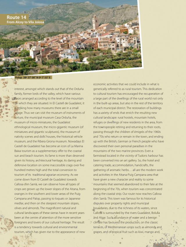
Polop 38º 37' 08'' N 0º 7' 53'' E
RUTA14y15_142a172_da OK ingles.qxp:rutas 15/07/10 8:20 Página 148
- 149148
above all, the loquat. Callosa produces over half of the
total national production of loquat, which has been
granted a Denomination of Origin for the entire area.
Today Callosa is a beautiful, white and ochre-coloured
city with an old quarter in which its church of San Juan
Bautista can be visited, with an original neoclassical
portal, as well as the Portal or mediaeval arched
gateway that gave access to the mediaeval town, or
again, the remains of the mediaeval wall situated above
all at the Plaza del Castell, originally the site of the
feudal lord’s residence. Within the municipal boundary
of Callosa d’en Sarriá we find two hits with Valencian
tourism: the Fuentes del Algar and the Fort de Bèrnia.
To reach the Fuentes del Algar there is a three-kilometre
stretch there and back from our main route. So we head
for the famous gushing waters of the river Algar, a leafy
and exuberant spot, formed by the river Algar at the
foot of the Bèrnia sierra: waterfalls and spectacular
natural pools of crystal clear water surrounded by
exuberant vegetation. Visitors must be aware that in
order to enjoy this impressive spot of nature they must
pay a small admission fee. In exchange, at the Fuentes
del Alagar you will find all types of services. In the
vicinity of the Fuentes del Algar a path leads up to the
defiant summits of the Bèrnia sierra. A circular route
through this sierra and returning to the Fuentes del
Algar, could take some six hours
of stiff walking. The outing is
more than worth the trouble. The
path goes up dizzyingly until it
reaches the Xaló pass. Here the
circular route begins which will
take us, in the first place, to the
Casas de Bèrnia. On the way
there the Bèrnia sierra surprises
us, with the image of a shaded
ravine with nearly vertical
walls that plummet
dizzyingly: a lonely, spot
worthy of the high mountain,
extremely spectacular.
Leaving behind the Casas de Bèrnia, we see that the
impregnable appearance would have been more real in
mediaeval times, when the social marginalisation of the
Moors turned the crags and gravel pits into a subversive
refuge hard to control. Today, however, Bèrnia offers us
no more than motives, sites of both natural and cultural
heritagefor the intense enjoyment of a surprising
mountainous area. There is only one waterspout on the
circular route, at Cabanes, so it will be necessary to take
water and remember to refill flasks. The steep incline
opens up an amazing landscape at our feet. We now
head for the Forat de Bènia along a delightful path,
embedded in the steep slope, from where we can
appreciate spectacular crests of stone that crown the
sierra. Having reached the Forat de Bèrnia we will realise
that we are looking at one of the most impressive
caprices of nature existing in the Region of Valencia. El
Forat de Bèrnia is a tunnel formed without human
assistance which provides a perfect connection
between the shady side of the sierra and the sunny
face. It is also the most original and unusual means of
communication between the regions of La Marina Alta
and La Marina Baixa. Given that it is not very high, you
have to go through the Forat crouching down. The
narrow opening we enter on the shady side opens out
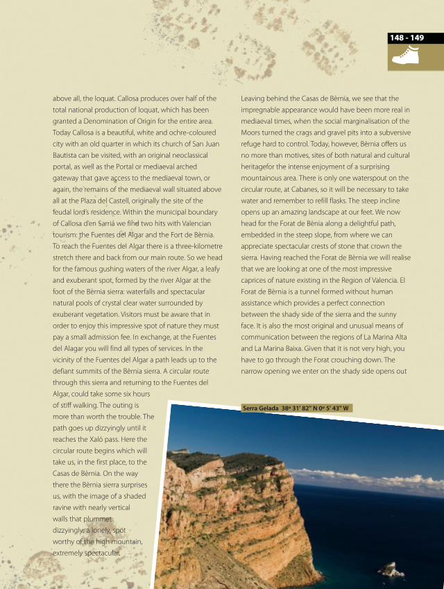
Serra Gelada 38º 31' 82'' N 0º 5' 43'' W
RUTA14y15_142a172_da OK ingles.qxp:rutas 15/07/10 8:20 Página 149
into a great cave which, like a balcony, leaves all of La
Marina Baixa at our feet. On a clear day we will be able
to see the Serra Gelada, Alacant castle, Tabarca island
and Santa Pola cape all stand out clearly. Looking inland
we glimpse other mountainous ‘balconies’ that, like
Bèrnia, look toward the sea: Cabeçó d’Or, Peña de
Migdia, Sierra del Maigmó, Sierra de Crevillent… Further
inland, the most emblematic mountains of these
regions dominate the landscape: Puig Campana, Aitana,
Serrella and Montecabrer. After the Forat, the path
heads for the Fort de Bèrnia, witness to one of the
darkest chapters in the history of the Region of Valencia.
In the year 1562 Felipe II ordered the construction on
the southern slope of the sierra what was named Fort
de Bèrnia. The aim of the building was, on the one
hand, to prevent Moorish rebellions, and on the other,
to defend the coast against the frequent Berber pirate
attacks. During the Moorish rebellion of 1609 the rebels
took charge of the fort, entrenching themselves in it for
a year until, exhausted and demoralised, they preferred
to die throwing themselves over the precipices of the
sierra rather than surrender and be expelled. As from
1612 it started to be dismantled, since provisioning it
was very complicated due to its remote location and
the Spanish Moors had already been expelled.
Nowadays numerous remains of the fort may be
observed: stretches of defensive wall, vaulted
constructions, moats and towers of the Fort. After our
look around the Fort de Bèrnia, the road brings us back
to the Xaló pass and, from there, to the Fuentes del
Algar. Returning this way to Callosa d’en Sarrià, we
resume our route in the direction of Polop.
From Callosa d’en Sarrià to l’Alfàsdel Pi amongst loquats
We arrive in Polop through a traditional rural landscape
with agriculture which, among the almond, olive and
loquat trees, allows citrus crops to be glimpsed. Polop
was the historic capital of La Marina Baixa. The town is
found situated at the foot of Mount Ponoig, 1,181
metres high, on a hill, surrounding its castle. Polop
castle is of Arab origin and was built at the beginning of
the 12th century. It was an important stronghold with
great strategic value in the region but, because of the
conflicts in which it played a leading role, the
constructions in its interior were pulled down, the
materials also being made use of for the building of the
neighbouring hermitage. Among the aforementioned
conflicts, it is worth summarising the occurrence during
the Germanías, when a new Moorish rebellion had its
centre at Polop castle, where the rebels fortified
themselves until they were defeated by lies and trickery
and practically massacred. After wandering around the
village of Polop and discovering its pretty vernacular
architecture, we head for the village of La Nucia, just a
kilometre away. La Nucia, like nearly all the hamlets in
the area, was originally an Arab ‘alquería’ or country
estate. The surrounding landscape shows an original
topography for the presence of various hills that have
been made use of for the location of different urban
developments. In La Nucia, the influence of coastal
tourism has cornered its former agricultural activity. Its
urban layout stretches quite harmoniously over an
agreeable plain at the foot of the Cerros de les Forques.
Walking through the streets of La Nucia, we come
across the Seu Unversitària, a building which was
formerly the San Rafael state school, situated right in
the urban centre and opened in 1936. The building was
altered and extended in 2007, to become the
permanent seat of La Universitat d’Alicant in La Nucia.
The project, designed by the local architect José
Campos Rosique, represents a bold bid to reconcile the
old with the new and is destined to become a
reference point for the whole region. From La Nucia we
reach Altea by means of the CV-760; nevertheless, those
who prefer the peace and quiet of a cycle ride or a walk
may reach Altea through rural landscapes by means of
agricultural roads such as that of La Lloma. If El Castell
de Guadalest is an icon of tourism in the mountain
region of La Marina Baixa, the cupola of the church of
Route 14From Alcoy to Vila Joiosa
RUTA14y15_142a172_da OK ingles.qxp:rutas 15/07/10 8:20 Página 150
- 151150
Altea, all in blue with white geometrical decoration,
crowing the hill of the old quarter, is that of the coast;
not in vain is it known as “the cupola of the
Mediterranean”. The quietness of the old quarter has for
decades, made Altea a place for artists and craftspeople
to visit and live: Eberhard Schlotter, Rafael Alberti,
Vicente Blasco Ibáñez, and Josh Rouse. In its urban
layout of sheltered steep, narrow alleyways opening out
every so often onto vantage points and tiny tree-lined
squares, we come across the Galera tower, declared a
Place of Cultural Interest. In spite of, or perhaps because
of, its tourist renown, Altea has never stopped being a
small fishing town with its white houses, flowers and
cobbled streets. As if this were not enough, to the north
the Bèrnia sierra creates a shield of solid rock, which
prevents the cold winds and external influences from
penetrating into the bay, creating a magical
microclimate. If we move away from the urban centre
towards the line of the coast, we must not miss the
beautiful spots like those of the beaches of: La Roda,
Cap Blanch, Cap Negret, Cala de Soio or Cala de la Olla.
Or the gravel beach like La Barreta. On the other hand,
at the foot of the Bèrnia sierra the original site of Altea.
We refer to Altea la Vella. If we go there today, we can
enjoy a close-knit centre of population with a beautiful
Calvary [route with the Stations of the Cross] lined with
eye-catching cypresses. After Altea our route makes its
way in the direction of L’Alfàs del Pi
along peaceful rural roads of
Arcs and Altea. L’Alfàs del Pi
has acquired international
renown for its Film Festival
held in July. At L’Alfas del Pi we
come across a curious detail
and it is that more than half the
population is foreign. In fact,
L’Alfàs del Pi has the second
largest concentration of
Norwegian citizens resident
outside their country (London has
the most). Two kilometres from
L’Alfàs del Pi, within its municipal boundary, we find
l’Albir beach, situated at the foot of the Serra Gelada.
Continuing from l’Albir beach in the direction of the
lighthouse along the same coast, we come to a naturist
beach with unrestricted access. From this beach an
excursion sets out to l’Albir along the old road, set out
as an ecological route, offering recreational areas and
magnificent panoramic views of the coast. Beside the
lighthouse there is the Bombarda tower, declared a
Place of Cultural Interest. We can also reach the summit
of Serra Gelada by a well-signposted path.
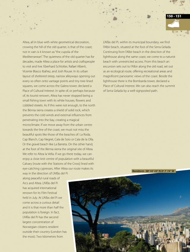
Benidorm 38º 32' 23'' N 0º 7' 74'' W
RUTA14y15_142a172_da OK ingles.qxp:rutas 15/07/10 8:20 Página 151
Along the cliffs of the Serra Gelada,on the way to Benidorm and La VilaJoiosa
The Serra Gelada is one of the most unusual nature
parks in the Region of Valencia, being the first land and
sea park in the territory. The Serra Gelada is a small
mountainous range orientated northeast-southwest,
separating the bays of Benidorm and Altea.
It is characterized by its asymmetric shape which is
obvious along the whole of its six-kilometre length. In
addition, the group of various islets must be added, two
within the municipal boundary of Benidorm (l’Illa de
Benidorm and l’Illa Mijana), and two within the
municipal boundary of Altea (l’Olla and the tiny islet of
La Galera).
Within its waters we can find some of the most
interesting and surprising areas of the entire peninsular
coast of the Mediterranean, the most outstanding
being extensive meadows of the protected sea grass
known locally as Alguers (Posidonia oceanica) and rocky
seabeds, such as La Llosa, with an exceptional biological
diversity.
The easiest and most direct way to get up the 435
metres to its summit is by taking the road that starts
out from the water treatment plant, in the Pla del
Cuartel district.
Almost at the edge of the cliff there is a trig point, from
where we can contemplate the majesty of these
precipices, where examples of yellow-legged gulls
flying hundreds of metres below us seem miniscule.
The route over the sierra continues up
and downhill, passing the ruins of a
former coastguard house and a small
water well on the watercourse.
Halfway along we come to an area
where there is a small stand of pines
that will serve to rest in the shade,
offering us a delightful view of l’Illa Mitjana. The final
stretch of scrubland that we will travel through passes
over a high point where we can look, once again, at the
cliffs. From this landmark on we have to watch out so as
not to miss the path running through low vegetation or
over bare rock.
A few minutes later we reach a cross placed on top of
the Racó de l’Oix, where an asphalted track starts that
leads to Benidorm. Travellers will have mixed feelings at
the sight of Benidorm, but what is certain is that the
Valencian tourist resort will not leave you indifferent. Its
image is unmistakable as few others on the Valencian
coast, not only for its model in height offered for
tourism but also for the sheer amount on offer for
leisure and the quality of its hotels.
But above all for its weather, beaches and location, on
the southern slope of the utterly beautiful Aitana sierra
and the Puig Campana, which protect the city from the
cold north winds. Benidorm is the town with most
skyscrapers per inhabitant in the world and the second
in the number of skyscrapers per square metre after
Manhattan.
What would be the tallest building in Spain, the Hotel
Bali III, is in Benidorm, and is the tallest hotel in Europe.
Also, building has begun on the tallest residential
building in Europe, which will be called Intempo
(200m). As well as skyscrapers, in Benidorm we ought to
visit the vantage point on the Poniente beach with its
balustrade of white stone.
Away from the old quarter, the Aigüera green park is
relevant, designed by the architect Ricardo Bofill,
situated in the centre of the modern city. And all of
that, without forgetting the numerous leisure parks like
the Terra Mitica [land of myths] theme park or that of
Route 14From Alcoy to Vila Joiosa
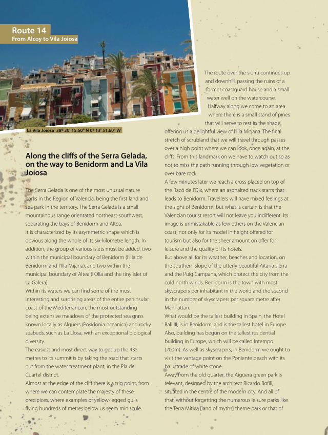
La Vila Joiosa 38º 30' 15.60" N 0º 13' 51.60" W
RUTA14y15_142a172_da OK ingles.qxp:rutas 15/07/10 8:20 Página 152
Terra Natura [land of nature]. A pleasant stroll of two
kilometres will enable us to look around the Levante
beach and the peaceful Poniente beach. Both have
assiduous visitors throughout the year.
From Benidorm a nice boat trip can be taken to L’Illa
[the Isle of Benidorm], with exceptional flora and fauna
on its sea beds. We leave Benidorm to head for Vila
Joiosa.
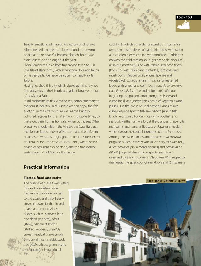
Having reached this city which closes our itinerary, we
find ourselves in the historic and administrative capital
of La Marina Baixa.
It still maintains its ties with the sea, complementary to
the tourist industry. In this sense we can enjoy the fish
auctions in the afternoon, as well as the brightly
coloured façades for the fishermen, in bygone times, to
make out their homes from afar when out at sea. Other
places we should visit in the Vila are the Casa Barbara,
the Roman funeral tower of Hercules and the different
beaches, of which we highlight the beaches del Centro,
del Paradis, the little cove of Racó Conill, where scuba
diving or naturism can be done, and the transparent
water coves of Bol Nou and La Caleta.
Practical information
Fiestas, food and craftsThe cuisine of these towns offers
fish and rice dishes, more
frequently the closer we get
to the coast, and thick hearty
stews in towns further inland.
Inland and around Alcoy,
dishes such as: pericana [cod
and dried peppers], olleta
[stew], bajoques farcidas
[stuffed peppers], pastel de
carne [meatloaf ], arròs caldós
amb conill [rice in rabbit stock]
and giraboix [cod, green beans
and potato]. It is traditional
cooking in which other dishes stand out: gazpachos
manchegos with pieces of game [rich stew with rabbit
and chicken pieces cooked with tomatoes, nothing to
do with the cold tomato soup “gazpacho de Andaluz”],
fraseures [meatballs], rice with rabbit, gazpacho tibero
[from Tibi, with rabbit and partridge, tomatoes and
mushrooms], llegum amb penques [pulses and
vegetables], caragols [snails], minchos [unleavened
bread with wheat and corn flour], coca de sardina and
coca de cebolla [sardine and onion tarts]. Without
forgetting the putxero amb tarongetes [stew and
dumplings], and potaje [thick broth of vegetables and
pulses]. On the coast we shall taste all kinds of rice
dishes, especially with fish, like caldero [rice in fish
broth] and arròs a banda - rice with good fish and
seafood. Neither can we forget the oranges, grapefruits,
mandarins and nisperos [loquats or Japanese medlar],
which colour the costal landscapes on the fruit trees.
Among the sweets that stand out are: torrat ensucrat
[sugared pulses], brazo gitano [like a very fat Swiss roll],
dulces sequillos [dry almond biscuits] and peladillas de
l’Alcoià [sugared almonds]. A special mention is
deserved by the chocolate in Vila Joiosa. With regard to
the fiestas, the splendour of the Moors and Christians is
Altea 38º 35' 92'' N 0º 3' 16'' W
- 153152
RUTA14y15_142a172_da OK ingles.qxp:rutas 15/07/10 8:20 Página 153
a reference that cannot be missed on the festive
calendar.
The festivities of Sant Antoni, in January; the countless
romerías [local pilgrimages and religious festivals] to the
sanctuaries and hermitages in the area; carnivals
[marking the start of Lent] in February; the feast days of
the patron saints of every town and city; Holy Week; the
Hogueras de Sant Joan [bonfires of St John] in June…
Of all the towns and cities through which the route
passes, the celebrations of Benifallim stand out: on the
first Sunday in September the festival of Pan Bendito
[Holy Bread] is held, organised by the unmarried men,
in which a procession of unmarried girls carry loaves of
bread on their heads until they reach the church; in
addition, other noteworthy fiestas are the Nit de l’Olla
[marking the start of the Moors and Christians
festivities] in Benidorm in August; dances in honour of
Sant Jaume, held on the 25th July and the Jesuset, on
24th December, in Callosa d’en Sarrià; the landing of the
Moor at the end of July or the maritime procession in
honour of Mare de Déu del Carme in La Vila Joiosa; or
the spectacular music and fireworks display at the
castle of l’Olla in Altea in August.
With regard to handicrafts in the area of the route, bags
and shopping baskets are made from palm leaves, as
well as rope soled shoes from esparto or needle-grass,
blankets, saddlebags, cardboard and glass boxes,
crocheted and woollen shawls and hair adornments.
All this without forgetting the embroidery and
needlework, or the tanned sheepskin covered balls for
Valencian pelota, and glass objects.
A mention apart is deserved by the craft displays held
regularly at Altea.
Recommended time of yearAny time of year is good for visiting, although during
spring and autumn is best. In summer the hours
around midday must be avoided.
In autumn the fields of loquat trees colour the
countryside with beautiful shades. The almond
blossom between January and February, and cherry
blossom at the beginning of March are also good
times of year to undertake this route.
Public transportThe RENFE regional trains stop at Alcoy station for the
start of the route. For the return, at Vila Joiosa we can
take the narrow gauge railway of the FGV (Ferrocarriles
de la Generalitat). Bicycles are transported free of
charge on the aforementioned transport services.
RecommendationsIn the case of wishing to travel the route just as it is set
out in the guide, by bike or on foot, a word of warning: a
mountain bike is best, or as a minimum, the hybrid type.
We do not come across many public waterspouts to
quench thirst and refresh oneself away from the urban
centres, so we should fill up with water whenever we get
the chance.
Both the early hours of the day and at dusk are the times
of day with the best light and most agreeable
temperature. The trips on foot or by bike that are
proposed for the sierras of Aitana, Bèrnia and Gelada
demand a minimum state of fitness. If anyone wants to
Route 14From Alcoy to Vila Joiosa
Altea 38º 35' 3'' N 0º 3' 21'' W
Altea 38º 35' 91'' N 0º 3' 03'' W
RUTA14y15_142a172_da OK ingles.qxp:rutas 15/07/10 8:20 Página 154
- 155154
make use of the car, on the tracks where it is possible to
drive motor vehicles, the main track should never be left,
as it is much better and more respectful to the
environment.
In order to get to know each area of nature we propose
in greater detail, it is recommended that you leave the
car parked somewhere safe and secure and undertake
trips on foot.
RECOMMENDED MAPS TO FOLLOW THE ROUTE CORRECTLY:
National Geographic Institute: Scale 1:25,000, sheet numbers: 821-III and IV; 847-I, II and IV; 822- III; and 848-I and III.Further information: www.comunitatvalenciana.comInformation on regional and local trains: Renfe 902 24 02 02. www.renfe.es
TOURIST INFO OFFICES FOR THE ROUTE:
Tourist Info AlcoyC/ Sant Llorenç, 2 03801 AlcoyTel. 965 53 71 55 Fax 965 53 71 [email protected]
Tourist Info AlteaC/ Sant Pere, 9 03590 AlteaTel. 965 84 41 14 Fax 965 84 42 [email protected]
Tourist Info Benidorm-AutobusesAv. Comunidad Europea, s/n 03502 BenidormTel. 965 85 96 [email protected]
Tourist Info Benidorm-CentroAv. Martínez Alejos 16 03501BenidormTel. 965 85 13 11 Fax 965 86 36 [email protected]
Tourist Info Benidorm-EuropaAv. Europa, s/n (crossing C/ Ibiza)03503 BenidormTel. 965 86 00 95 [email protected]
Tourist Info Benidorm-Rincón L’OixAv. Derramador, s/n(intersection C/ Gerona)03503 BenidormTel. 966 80 59 14Fax 965 86 36 25 [email protected]
Tourist Info Callosa d’En SarriàC/ Sant Antoni, 2 03510 Callosa d`En SarriàTel. 965 88 01 53 Fax 965 88 01 [email protected]
Tourist Info Castell de GuadalestAv. Alicante, s/n.03517 El Castell de GuadalestTel. 965 88 52 98 Fax 965 88 53 [email protected]
Tourist Info L’Alfàs del PiC/ Federico García Lorca, 11(Town Hall ground floor) 03580 L'Alfàs del PiTel. 965 88 89 05 Fax 965 88 71 [email protected]
Tourist Info L’Alfàs del Pi-PlayaPaseo de las Estrellas., Platjade l’Albir, 23 03581 L'Alfàs del PiTel. 966 86 70 22 Fax 965 86 70 [email protected]
Tourist Info La NuciaAv. Marina Baixa, 1 - Parquede la Font de la Favara 03094 La NuciaTel. 966 89 56 [email protected]
Tourist Info La Vila JoiosaAv. País Valenciá, 10 bjo. 03570 La Vila JoiosaTel. 966 85 13 71 Fax 966 85 29 [email protected]
Tourist Info La Vila Joiosa-La CalaAv. de los marineros, s/n 03570 La Vila JoiosaTel. 965 85 10 45 Fax 965 85 10 [email protected]
Tourist Info Polop de LaMarinaAv. Sagibarba, 15. 03520 PolopTel. 966 89 60 72 Fax 966 89 54 [email protected]
RUTA14y15_142a172_da OK ingles.qxp:rutas 15/07/10 8:20 Página 155