Embed Size (px)
Citation preview

Roissy Charles-de-Gaulle
The difficult management of a main gateway ?
Main gateway of Paris Ile-de-France Region
CDG, one of the global hubs : 50 M pax, 2 Mt de fret
High connectivity with North-West of Europe : HST, Highways (A1 & A16), future Seine-North Europe canal…

Land transportation : no comprehensive approach
• Roadsradial axis overloaded, ring roads to be completed
• Public transportationCDG, exceptional accessibility at national andinternational level, but low accessibility at the local level for passengers and employees
several projects without a comprehensive approach
• Goodsdomination of the road transportation
future Seine-North Europe canal
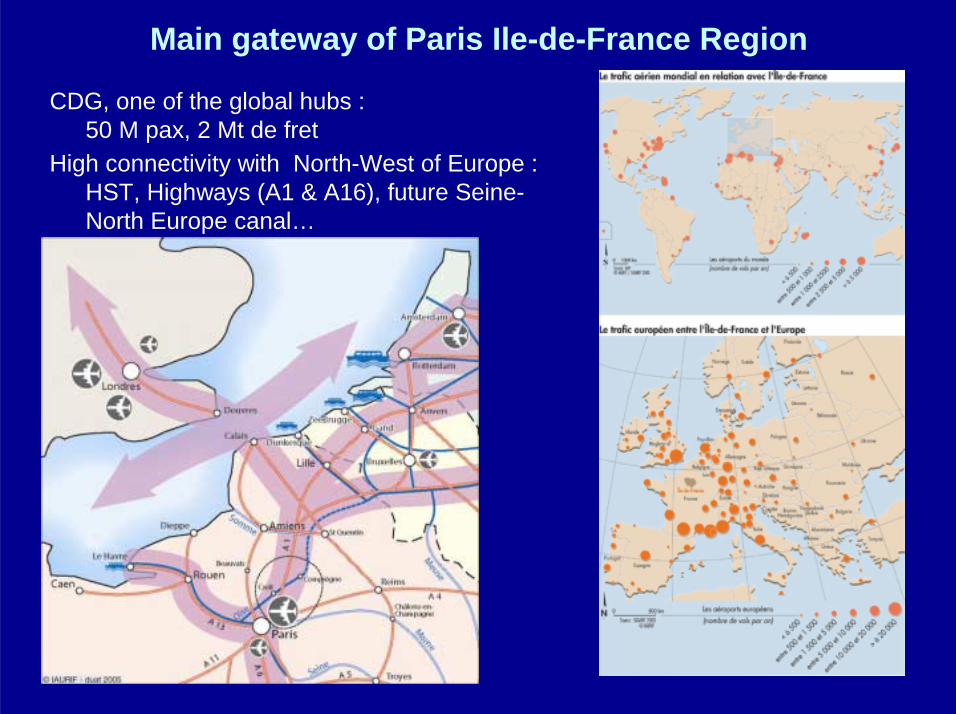
CDG, a job pole
• CDG, an engine of job creation (80 000 jobs, 4000 new jobs/year since 10 years)
• High unemployement rate in the close urban areas
Economic activity zones : a large offer, but not concentrated- 80 ZAE (2650 ha), - 4 ZAE > 100 ha (Paris-Nord II = 370 ha, Mitry-Mory = 250 ha, Roissy fret = 200 ha, Marly = 118 ha) 20% of the regional market
Saling rythm- 60 ha/an, about 3 years of available capacitybut 50 years in the prospects of local authorities

Economic activities
• Garonor (logistic)
• Logistic parks along A1 highway
• 3% of the office park of the region
• 30% of the storage park
• Large exhibition parc (Villepinte 450.000 m2 to be extended to 600.000 m2)
• Congress center, hôtels
• Industries (aeronautic and car production)
• A highly perfomance agriculture

Spatial organisation
The airport limits the urbanization (noise protection) to the North and the emergence of strong urban centers
A large agricultural plain : Plaine de France
Large forests l’Isle-Adam, Compiègne, included in Naturalregional park
The southern part has a decayed urban areas

• social and territorial disparities
• Lack of jobs
• Lack of access to the airport platformfor inhabitants of the surroundings
• Lack of balance of the economicincome for thecommunes (taxes)
Cohesion

A low demography, high social disparities
• A young population, big families, numerous decayed neighborhoodson the South of the Airport.
• Low population growth, due only to natural balance
• New middle class neighborhoods on theNorthern part
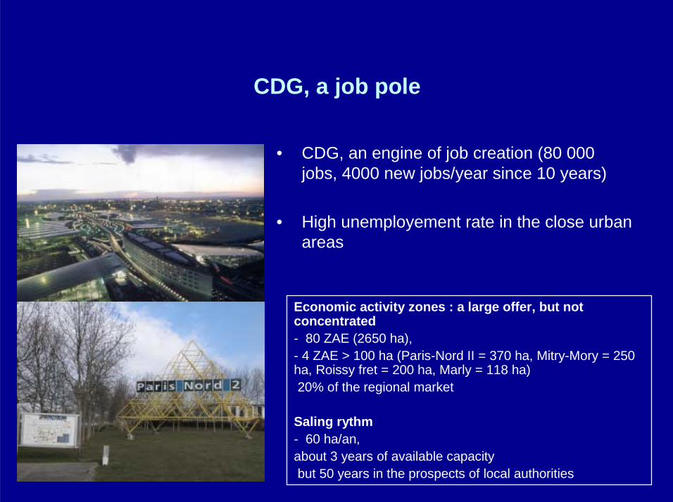
IDF Regional vision
The Regional Vision for 2030

Vision Diagram

Housing and urban projects

Economic supports

Economic development projects
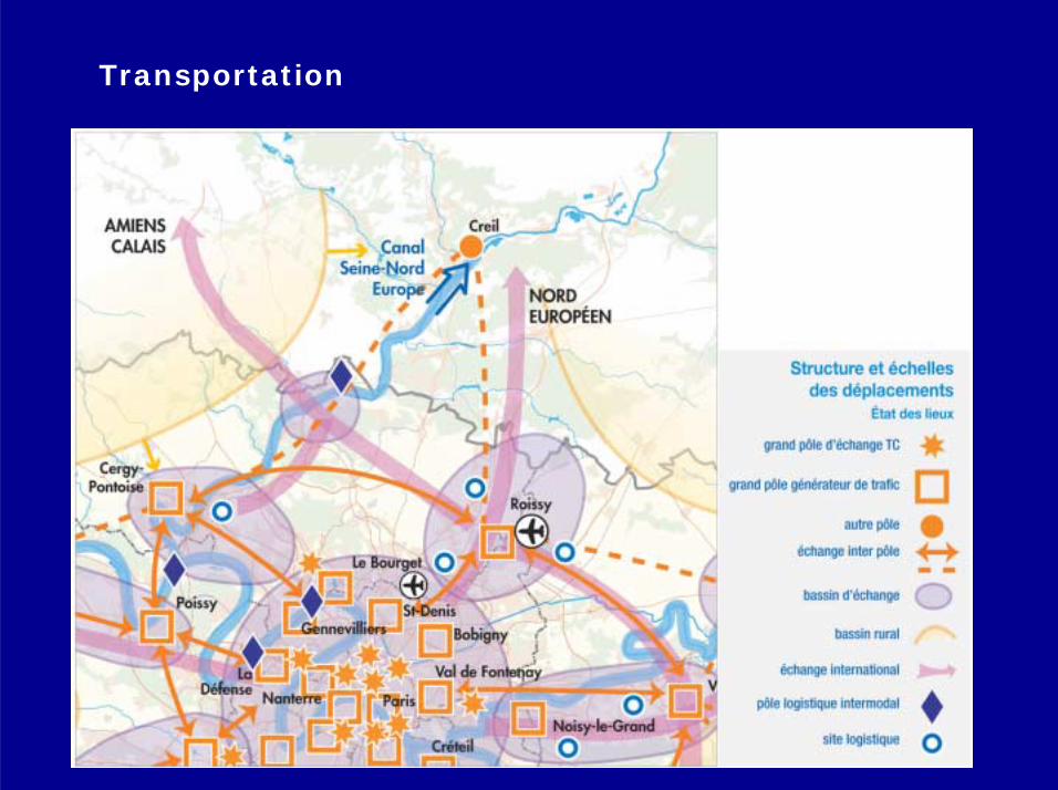
Transportation

Transportation projects

Environment

Environmental projects

How to manage the territory ?
1. Between noise and pollution to local developments
2. Between high accessibility performance and urban polarization that creates saturation
3. Between top-down to bottom-up processes : sharing the decision and the wealth to balance the development

• How to develop housing projects (today 2400 housing unit/year) with the constraints of the Noise protection (new PEB, 180.000 inhabitants), the infrastructures, the pollutions
• Need to upgrade decayed areas (ANRU)
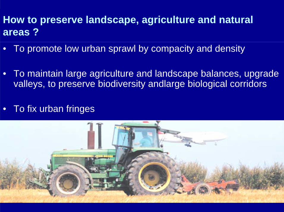
How to preserve landscape, agriculture and natural areas ?• To promote low urban sprawl by compacity and density
• To maintain large agriculture and landscape balances, upgrade valleys, to preserve biodiversity andlarge biological corridors
• To fix urban fringes

How to make governance ?
Complexity of institutionnalsystem :
• 50 Communes, • 2 Communities
of communes• 3 Departements, • 2 Régions
In the middle : CDG with a specialstatut
A privitazation process

Strategic sites in the Region
• New towns
• Airports
• Large rebuilding sites
• The River
• Large integrated urban projects
• Ecological priorities(PNR)
• EPA Plaine de France (30 Communes) is covering CDG, Le Bourget and Plaine Commune (St Denis) but not the Eastern part of CDG
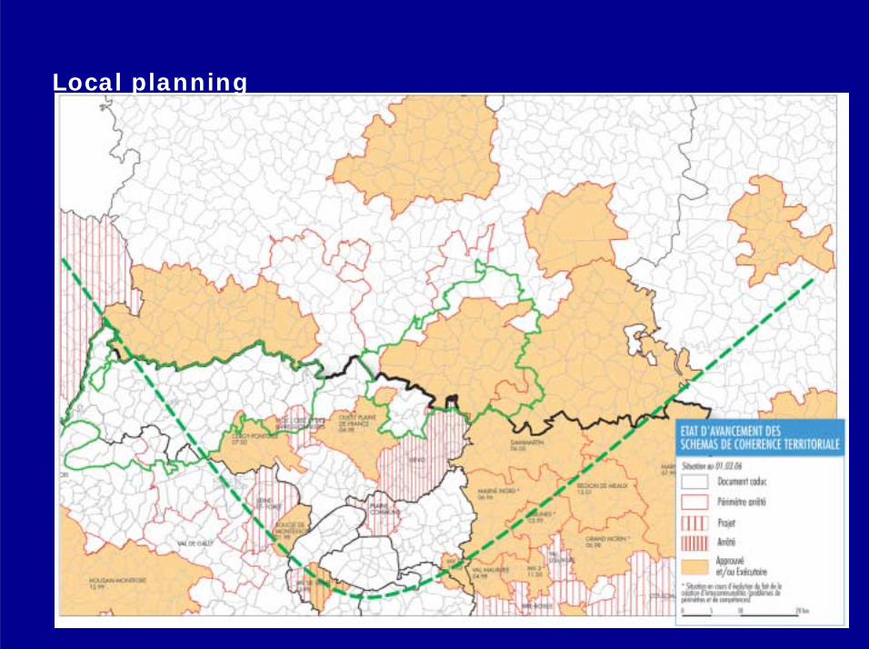
Local planning

From performance of the gateway to the urban pole : a contradiction ?
• High connectivity at international, national and metropolitan levels
• High investment in equipment and infrastructures
• High capacity to attractprivate investments
• Mix uses
• Trafic jams
• Competition with surrounding activities (mall/vs/retails centers in the commnes)
• Unbalanced benefit at the local level