Embed Size (px)
Citation preview
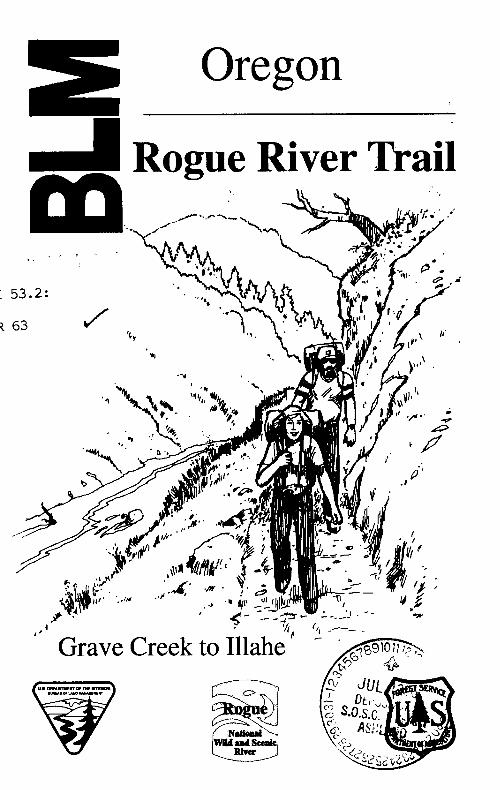
Oregon
Rogue River Trail,, t
I 53.2:
R 63 /
41II A*
p.a
to
_,-
oAr .
to IMlaheGrave Creek

IntroductionThe Rogue River Trail from Grave Cthe National Wild and Scenic Roguewas one of eight rivers originally desScenic Rivers Act of 1968. The interriver's outstanding values of scenery,present and future generations.
'4.~~~~~~~~~~4
One of the most interesting ways toCanyon is by taking a backpacking tNational Recreation Trail.
LocationThe Rogue River National Recreatikof the river as it winds its way towaitrail head is at Foster Bar about 30 rcoastal town of Gold Beach. Graveabout 30 river miles downriver frorrbrochure titled "Shuttle Map" provi(roads to the trail heads. For a free cone of the offices on the back of this
-2- - 3 -

IntroductionThe Rogue River Trail from Grave Creek to Illahe is in the heart ofthe National Wild and Scenic Rogue River Canyon. The Roguewas one of eight rivers originally designated under the Wild andScenic Rivers Act of 1968. The intent of the act is to protect theriver's outstanding values of scenery, fisheries and recreation forpresent and future generations.
One of the most interesting ways to experience the Rogue RiverCanyon is by taking a backpacking trip on the Rogue RiverNational Recreation Trail.
LocationThe Rogue River National Recreation Trail follows the north bankof the river as it winds its way toward the Pacific Ocean. The westtrail head is at Foster Bar about 30 river miles inland from thecoastal town of Gold Beach. Grave Creek, the east trail head, isabout 30 river miles downriver from the town of Grants Pass. Abrochure titled "Shuttle Map" provides detailed information on theroads to the trail heads. For a free copy of the Shuttle Map contactone of the offices on the back of this brochure.
-3-
Trip PlanningMost of the Rogue River Trail is well constructed and hasmoderate grades. The average hike over this 40 mile trail takes 4to 5 days. Trees, land slides and high water can create difficultpassage across the trail after storms. Trail maintenance is done inMay or June after winter storms are no longer a threat. This is ahiking trail only and is closed to motorized vehicles, bicycles andpack animals.
The trail can be hiked starting from either end or from the middle.(See "vehicle access points" below.) If you hike east the sun willbe at your back in the afternoon, which might be desirable in thesummer time. Spring and fall are the popular hiking seasons asthe summer can be hot and dry in the Rogue River canyon.
Most of this brochure is a trail log, therefore, mileage figures inthe text refer to mileage figures in the trail log.
Facilities and ServicesThere are private lodges on the trail (see map and trail log) thatcan accommodate hikers with reservations. Shuttle services arealso available. For more information contact a local Chamber ofCommerce or one of the offices on the back of this brochure.
Vehicle Access PointsThe west trail head (Foster Bar) has camping, toilets andovernight parking. Drinking water is available (May throughSeptember) one mile downriver at Illahe Campground. Camphosts staff both these campgrounds May through September.
Grave Creek (east trail head) has toilets and a small parking areaalong the road above the trail head. Overnight parking andcamping are not allowed at Grave Creek boat ramp area.
Drinking water and camping are avfrom Grave Creek, at Almeda Camlcampground April 15 to October IfNovember.
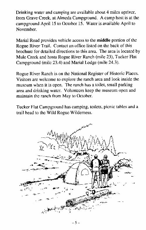
Marial Road provides vehicle accesRogue River Trail. Contact an offi4brochure for detailed directions to tMule Creek and hosts Rogue RiverCampground (mile 23.4) and Maria
Rogue River Ranch is on the NatioiVisitors are welcome to explore themuseum when it is open. The rancarea and drinking water. Volunteeimaintain the ranch from May to Oc
Tucker Flat Campground has camptrail head to the Wild Rogue Wilde
-.
i K, M t
~.- _ _n - X,
I t\E or~~~~ .- .9
4~~~~. o
, \;@ )'-
-4 - - 5 -
il is well constructed and hasye hike over this 40 mile trail takes 4and high water can create difficultstorms. Trail maintenance is done inms are no longer a threat. This is aI to motorized vehicles, bicycles and
F from either end or from the middle.)elow.) If you hike east the sun will3n, which might be desirable in theare the popular hiking seasons as
y in the Rogue River canyon.
I log, therefore, mileage figures in-s in the trail log.
cese trail (see map and trail log) thatreservations. Shuttle services are
rmation contact a local Chamber ofes on the back of this brochure.
Iar) has camping, toilets andwater is available (May througher at illahe Campground. Camp)unds May through September.
has toilets and a small parking areahead. Overnight parking andrave Creek boat ramp area.
Drinking water and camping are available about 4 miles upriver,from Grave Creek, at Almeda Campground. A camp host is at thecampground April 15 to October 15. Water is available April toNovember.
Marial Road provides vehicle access to the middle portion of theRogue River Trail. Contact an office listed on the back of thisbrochure for detailed directions to this area. The area is located byMule Creek and hosts Rogue River Ranch (mile 23), Tucker FlatCampground (mile 23.4) and Marial Lodge (mile 24.3).
Rogue River Ranch is on the National Register of Historic Places.Visitors are welcome to explore the ranch area and look inside themuseum when it is open. The ranch has a toilet, small parkingarea and drinking water. Volunteers keep the museum open andmaintain the ranch from May to October.
Tucker Flat Campground has camping, toilets, picnic tables and atrail head to the Wild Rogue Wilderness.
-5 -
I --- '--.----- --- -.---- ~---.- ~ -~---- -- -- - - -- -, --.- ,. I -
Foot AccessThere are many small primitive campsites along the trail, locatednear creeks. Some campsites have a toilet, either at the site or at anearby river site. Water is available from the creeks, filtering orboiling is recommended.
SafetyIf you find yourself in need, Agness (8 miles downriver fromFoster Bar) and Galice (7 miles upriver from Grave Creek) are thenearest towns. Emergency services can be contacted by radio fromRand Visitor Center, Rogue River Ranch, Mule Creek GuardStation, Brushy Bar Guard Station, Foster Bar and IllaheCampground. Rand Visitor Center is about 5 miles upriver fromGrave Creek (see back of brochure). The guard stations are staffedJune through September. You can also find help through theprivate lodges along the trail.
Watch out for poison oak, ticks, rattlesnakes and black bears.
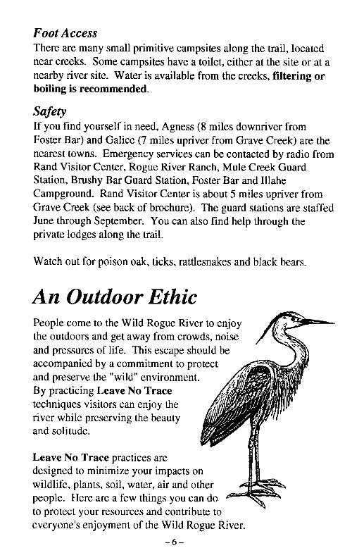
An Outdoor EthicPeople come to the Wild Rogue River to enjoythe outdoors and get away from crowds, noiseand pressures of life. This escape should beaccompanied by a commitment to protectand preserve the "wild" environment. !By practicing Leave No Trace /
techniques visitors can enjoy the , !river while preserving the beautyand solitude.
Leave No Trace practices aredesigned to minimize your impacts onwildlife, plants, soil, water, air and other -
people. Here are a few things you can doto protect your resources and contribute toeveryone's enjoyment of the Wild Rogue River.
Campfires
Practice Leave No Trace ethics by cstove and avoid building campfires.wood supplies.
If you havea fire pan400 feet
~~~~~ ~~~ fire blarwhatev
~~~~ ~~~Fire re
the canyon with other garbage. EgEoil should not be burned as they do X
to the site.
Check fire regulations with local aultrip. If you are going to build a camsandy spot or bare ground away froibuild a fire next to rocks because snonly down and dead wood. Small vproviding good coals for cooking atthan partially burned large wood.
tive campsites along the trail, located,s have a toilet, either at the site or at aLvailable from the creeks, filtering or
Campfires
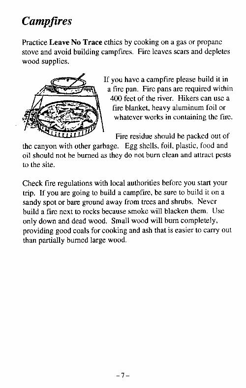
Practice Leave No Trace ethics by cooking on a gas or propanestove and avoid building campfires. Fire leaves scars and depleteswood supplies.
Agness (8 miles downriver from[les upriver from Grave Creek) are theervices can be contacted by radio fromRiver Ranch, Mule Creek Guardtation, Foster Bar and IllaheCenter is about 5 miles upriver from)chure). The guard stations are staffedu can also find help through the
If you have a campfire please build it ina fire pan. Fire pans are required within400 feet of the river. Hikers can use afire blanket, heavy aluminum foil oriwhatever works in contaning the fire.
Fire residue should be packed out ofthe canyon with other garbage. Egg shells, foil, plastic, food andoil should not be burned as they do not burn clean and attract peststo the site.
ks, rattlesnakes and black bears.
thicue River to enjoy)m crowds, noisecape should bent to protect
luty
pacts onr and otheryou can do
contribute toVild Rogue River.
Check fire regulations with local authorities before you start yourtrip. If you are going to build a campfire, be sure to build it on asandy spot or bare ground away from trees and shrubs. Neverbuild a fire next to rocks because smoke will blacken them. Useonly down and dead wood. Small wood will burn completely,providing good coals for cooking and ash that is easier to carry outthan partially burned large wood.
==M.-
-7 -
Washing Human Waste
Waste water from bathing and dish washing should be discarded atleast 100 feet from camp, the river and creeks. Washing should bedone carefully so the environment is notpolluted and fish and aquatic life are notinjured. Water can become polluted pfrom the runoff of soaps and foodwaste. Bathing and dishwashingshould be done without soap, evenbiodegradable soap is a pollutant.
To clean dishes properly use boiling '\ .
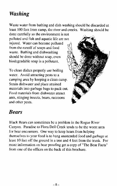
water. Avoid attracting pests to acamping area by keeping a clean camp.Strain dishwater and place strainedmaterials into garbage bags to pack out.Food materials from dishwater attractants, stinging insects, bears, raccoonsand other pests.
Bears
Black Bears can sometimes be a problem in the Rogue RiverCanyon. Paradise to Flora Dell Creek tends to be the worst areafor bear encounters. One way to keep bears from helpingthemselves to your food is to hang unattended food and garbage atleast 10 feet off the ground in a tree and 4 feet from the trunk. Formore information on bear proofing get a copy of "The Bear Facts"from one of the offices on the back of this brochure.
Please use toilets when available. Ifuse the "cat method" of making a sh;when done. A cat hole should be du100 feet from camp, the river and crnand other man-made toiletries.
Leaves and sticks are good toiletpaper substitutes and you don'thave to pack them out. Natural otoilet paper substitutes should beleft in the cat hole then covered withdirt and organic matter. When usinEleaves or sticks as toilet paper try toavoid poison oak and other obviousperfect." Minimizing contaminationdecomposition are the primary goalswaste.
Other helpful hints
Use established campsites wheneveiUse established trails.Pack out all garbage.If you smoke, carry out all cigarette
Many canyon visitors are seeking qiscenery, use common courtesy aroui
-9 --8-
Human Waste
I dish washing should be discarded atriver and creeks. Washing should benent is notlife are notDiluted'oodingeven haant.
)oilingto a-an camp.ainedi pack out.r attracticcoons
e a problem in the Rogue River11 Creek tends to be the worst area
(to keep bears from helpinghang unattended food and garbage ata tree and 4 feet from the trunk. For
ofing get a copy of "The Bear Facts"back of this brochure.
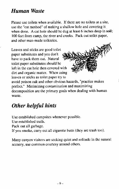
Please use toilets when available. If there are no toilets at a site,use the "cat method" of making a shallow hole and covering itwhen done. A cat hole should be dug at least 6 inches deep in soil;100 feet from camp, the river and creeks. Pack out toilet paper,and other man-made toiletries.
Leaves and sticks are good toiletpaper substitutes and you don't r-have to pack them out. Naturaltoilet paper substitutes should beleft in the cat hole then covered withdirt and organic matter. When usingleaves or sticks as toilet paper try toavoid poison oak and other obvious hazards, "practice makesperfect." Minimizing contamination and maximizingdecomposition are the primary goals when dealing with humanwaste.
Other helpful hints
Use established campsites whenever possible.Use established trails.Pack out all garbage.If you smoke, carry out all cigarette butts (they are trash too).
Many canyon visitors are seeking quiet and solitude in the naturalscenery, use common courtesy around others.
- 9-
�- - , - -- - - - - ----
How to use this trail guideThe trail log starts at Grave Creek as mile zero. Continuing milesare from Grave Creek, which is the east trail head of the RogueRiver Trail. The term "north bank" refers to the same side of theriver as the trail, "south bank" refers to the opposite side of theriver. Facilities are described in italics. Campsites that areaccessible from the trail are described in this log. In the summertime you can expect to compete for the riverside sites with boaters.
Trail Log
iM _
0.6 Sanderson Homesite - northa concrete foundation from ,Sanderson brothers (miners)operations exist at this site.1971.Camping - Small site betweeor toilet
0.0 Grave Creek - north bank. The Rogue River Trail head islocated west of the boat landing. This is the beginning ofthe wild section of the Rogue River.
Named after the grave of Martha Leland Crowley, daughterof a pioneer couple, Martha was buried under an oak treenear the stream in 1846.
The first 5 miles of the trail are quite rocky. These rocksare part of the Rogue Formation. They are a result of lavaflows and rocks formed by ancient volcanoes which wereactive about 140 million years ago. High temperatures andpressure have altered and folded these rocks into a nearlyvertical position. Signs of this folding can be seen on thesteep canyon walls which have been carved by the powerfulforces of the Rogue River over a period of nearly a millionyears.Camping - 4 miles upriver at Almeda Campground or 0.6miles downriver. Almeda Campground has drinking wateravailable April through November. Grave Creek has toiletsand a small parking area. Overnight parking is allowedalong the road above the trail head.
0.1 Grave Creek Rapids-10-
Sanderson's I
1.1 Sanderson's Bridge - The cosides of the river are all thatmule pack trains and foot trz1907 and was destroyed by;
1.3 Cabin - south bank. Abovethe remains of an old mininj
-11-
lil guideCreek as mile zero. Continuing milesh is the east trail head of the Roguel bank" refers to the same side of the
r" iefers to the opposite side of thed in italics. Campsites that areJescribed in this log. In the summerete for the riverside sites with boaters.
ail Log
�M -
0.6 Sanderson Homesite - north bank. There are the remains ofa concrete foundation from a home built in 1940 by theSanderson brothers (miners). Evidence of old miningoperations exist at this site. The cabin was dismantled in1971.Camping - Small site between river and trail with no wateror toilet
)ank. The Rogue River Trail head is)at landing. This is the beginning of- Rogue River.
e of Martha Leland Crowley, daughterdartha was buried under an oak tree46.
ie trail are quite rocky. These rocksFormation. They are a result of lavaed by ancient volcanoes which wereion years ago. High temperatures andand folded these rocks into a nearlyns of this folding can be seen on the'hich have been carved by the powerfulUiver over a period of nearly a million
wriver at Almeda Campground or 0.6neda Campground has drinking watergh November. Grave Creek has toiletsarea. Overnight parking is allowedthe trail head.
Sanderson's Bridge
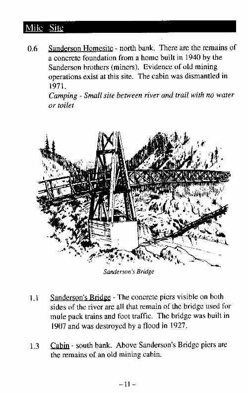
1.1 Sanderson's Bridge - The concrete piers visible on bothsides of the river are all that remain of the bridge used formule pack trains and foot traffic. The bridge was built in1907 and was destroyed by a flood in 1927.
1.3 Cabin - south bank. Above Sanderson's Bridge piers arethe remains of an old mining cabin.
- 10 - -11-
-10- -11-
__ ____ I- __---�--- - - � - -_ , - -- , -_ � -" , , -
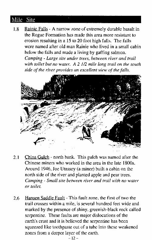
1.8 Rainie Falls - A narrow zone of extremely durable basalt inthe Rogue Formation has made this area more resistant toerosion resulting in a 15 to 20 foot high falls. The fallswere named after old man Rainie who lived in a small cabinbelow the falls and made a living by gaffing salmon.Camping - Large site under trees, between river and trailwith toilet but no water. A 2 1/2 mile long trail on the southside of the river provides an excellent view of the falls.
3.1 Rum Creek - south bank. "Eon Rum Creek in the late 19approximately 10 degrees c(creeks and salmon can oftenmouth of the creek.
Whisky Creek - north bank.is Whisky Creek Cabin. Thminer about 1880. The last(1957-1973) was Lou Reub(Cabin is on the National Reloffers a glimpse into the pioRiver. This and other cabiour national heritage and,do not remove or disturb fare what make the Rogueto visit. Camping - Large sthe creek with toilet (east sih
C
2.1 China Gulch - north bank. This gulch was named after theChinese miners who worked in the area in the late 1 800s.Around 1946, Joe Utassey (a miner) built a cabin on thenorth side of the river and planted apple and pear trees.Camping - Small site between river and trail with no wateror toilet.
2.6 Hansen Saddle Fault - This fault zone, the first of two thetrail crosses within a mile, is several hundred feet wide andmarked by the presence of shiny, greenish-black rock calledserpentine. These faults are major dislocations of theearth's crust and it is believed the serpentine has beensqueezed like toothpaste out of a tube into these weakenedzones from a deeper layer of the earth.
- 12 -
To Rogue River Trail
-13-
i zone of extremely durable basalt inas made this area more resistant to5 to 20 foot high falls. The fallsian Rainie who lived in a small cabinJe a living by gaffing salmon.nder trees, between river and trail: A 2 1/2 mile long trail on the southes an excellent view of the falls.
3.1 Rum Creek - south bank. "Bedrock" Nell (a miner) livedon Rum Creek in the late 1920s and 1930s. Rum Creek isapproximately 10 degrees cooler and fresher than othercreeks and salmon can often be found schooling at themouth of the creek.
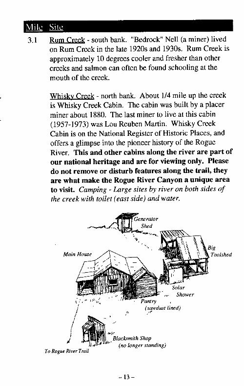
Whisky Creek - north bank. About 1/4 mile up the creekis Whisky Creek Cabin. The cabin was built by a placerminer about 1880. The last miner to live at this cabin(1957-1973) was Lou Reuben Martin. Whisky CreekCabin is on the National Register of Historic Places, andoffers a glimpse into the pioneer history of the RogueRiver. This and other cabins along the river are part ofour national heritage and are for viewing only. Pleasedo not remove or disturb features along the trail, theyare what make the Rogue River Canyon a unique areato visit. Camping - Large sites by river on both sides ofthe creek with toilet (east side) and water.
Generalor
_ q b i~Shed
-
ink. This gulch was named after the'orked in the area in the late 1 800s.;sey (a miner) built a cabin on theand planted apple and pear trees.Petween river and trail with no water
This fault zone, the first of two theile, is several hundred feet wide and
:e of shiny, greenish-black rock calledIts are major dislocations of theelieved the serpentine has been;te out of a tube into these weakenediyer of the earth.-12-
(no longer standing)To Rogue River Trail
- 13 -
- __1 , � .1 - 1. I I I I
3.2 Old Rogue River Trail - This was the trail used by minersand settlers in the late 1800s and early 1900s. The trailcame in on the north from Mt. Reuben.
3.5 Cedar Mountain Fault - This fault zone, like Hansen Faultupstream, also contains serpentine with surfaces smoothedand polished by tremendous pressures generated bymovements of the earth. At the trail level, most traces ofthis fault are covered by the gravel bar of Whisky Creekand landslide debris of Big Slide.
3.7 Big Slide - north bank. In the late 1800s a landslideblocked the entire river, causing it to back up as far asHellgate Canyon (15 miles upriver). Another small moreactive slide can be seen in the sheared rocks of the CedarMountain Fault zone just across the river from Big Slidecamp.Camping - Large park-like site next to trail with toilet, nowater.
3.9 Doe Creek -south bank.
4.4 Alder Creek - north bank. Lou Martin (see mile 3.1) minedfor gold here, but was unsuccessful.
4.7 Booze Creek - north bank. Hardrock mining wasattempted here but no gold was found.Camping - Small site by creek after bridge with water, notoilet.
4.8 Tvee Rapids - Tyee is the Chinook word for chief. TyeeBar (south bank) is the site of a once-famous gold minewhere 300 Chinese workers took one million dollars ingold dust.Camping - Large site by river with toilet, no water.
5.7 Wildcat Rapids
5.8 Russian Creek - north bank.prospector who lived in the,Camping - Two small sites atoilet.
6.1 Montgomery Creek - south tthere was extensive gold miMore than 25 buildings werethe river until they were desi
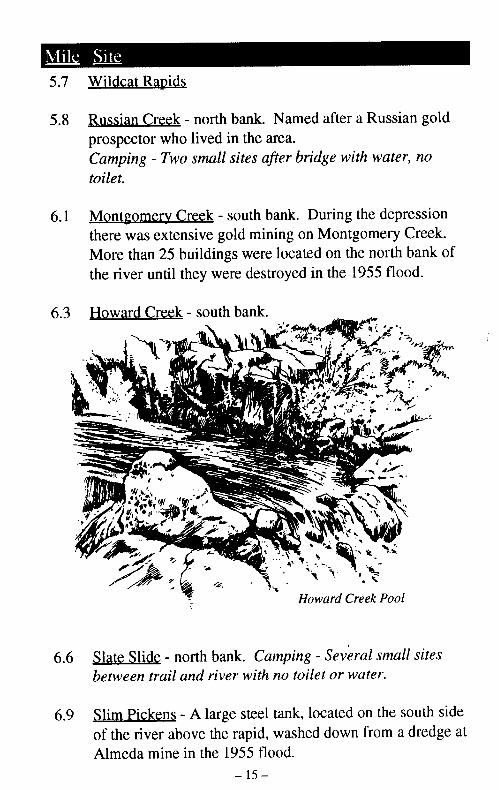
6.3 Howard Creek - south bank.
a ,.
6.6 Slate Slide - north bank. Ccbetween trail and river with
6.9 Slim Pickens - A large steelof the river above the rapid,Almeda mine in the 1955 ft
- 14 - - 1s -
- This was the trail used by miners1800s and early 1900s. The trailom Mt. Reuben.
- This fault zone, like Hansen Faults serpentine with surfaces smoothedidous pressures generated byh. At the trail level, most traces of,y the gravel bar of Whisky Creek'Big Slide.
In the late 1800s a landslider, causing it to back up as far asiiles upriver). Another small morei in the sheared rocks of the Cedarist across the river from Big Slide
-like site next to trail with toilet, no
nk. Lou Martin (see mile 3.1) minedunsuccessful.
ink. Hardrock mining wasgold was found.?y creek after bridge with water, no
the Chinook word for chief. Tyeesite of a once-famous gold mine
)rkers took one million dollars in
by river with toilet, no water.
5.7 Wildcat Rapids
5.8 Russian Creek - north bank. Named after a Russian goldprospector who lived in the area.Camping - Two small sites after bridge with water, notoilet.
6.1 Montgomery Creek - south bank. During the depressionthere was extensive gold mining on Montgomery Creek.More than 25 buildings were located on the north bank ofthe river until they were destroyed in the 1955 flood.
6.3 Howard Creek - south bank.
.~ . ok -d.. .i
6.6 Slate Slide - north bank. Camping - Several small sitesbetween trail and river with no toilet or water.
6.9 Slim Pickens - A large steel tank, located on the south sideof the river above the rapid, washed down from a dredge atAlmeda mine in the 1955 flood.
- 15-
7.6 Bronco Creek - north bank. This was originally JackassCreek (1855), named so because of the loss of a pack burroduring an Indian skirmish.
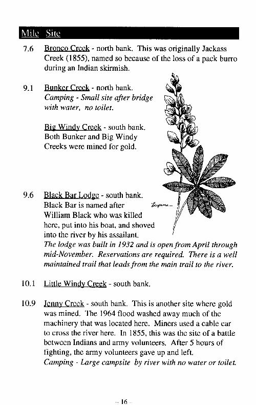
9.1 Bunker Creek - north bank.Camping - Small site after bridgewith water, no toilet.
Big Windy Creek - south bank.Both Bunker and Big WindyCreeks were mined for gold.
11.1 Horseshoe Bend - Becauseharder, it forced the river toadjacent softer rock, creatincurve.
11.8 Shady Creek - north bank.
12.1 Francis Creek - north bank.
12.3 Copsey Creek - north bank.around Horseshoe Bend. Hsouth side of the river, 1 1/2Camping - Small site with M
9.6 Black Bar Lodge - south bank.Black Bar is named after A p
William Black who was killedhere, put into his boat, and shoved 7into the river by his assailant.The lodge was built in 1932 and is open from April throughmid-November. Reservations are required. There is a wellmaintained trail that leads from the main trail to the river.
10.1 Little Windy Creek - south bank.
10.9 Jenny Creek - south bank. This is another site where goldwas mined. The 1964 flood washed away much of themachinery that was located here. Miners used a cable carto cross the river here. In 1855, this was the site of a battlebetween Indians and army volunteers. After 5 hours offighting, the army volunteers gave up and left.Camping - Large campsite by river with no water or toilet.
Gold Bar Mine, 11I
-17--16-
bank. This was originally Jackass;o because of the loss of a pack burroiish.
11.1 Horseshoe Bend - Because the rock across the river isharder, it forced the river to carve its channel into theadjacent softer rock, creating the tight, horseshoe-shapedcurve.
rank.ifter bridge
ath bank.Windy i;)r gold.
th bank.
is killed and shoved /
sailant.1932 and is open from April throughvations are required. There is a welleads from the main trail to the river.
south bank.
ink. This is another site where goldflood washed away much of the
cated here. Miners used a cable carIn 1855, this was the site of a battle
rmy volunteers. After 5 hours ofanteers gave up and left.psite by river with no water or toilet.
11.8 Shady Creek - north bank.
12.1 Francis Creek - north bank.
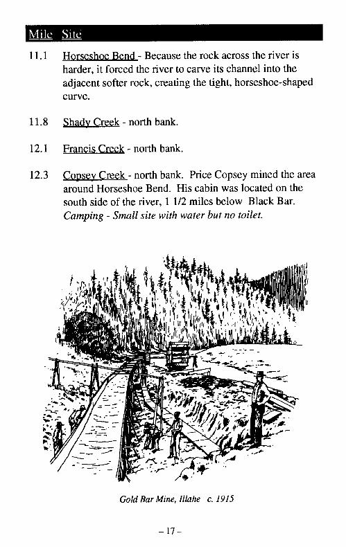
12.3 Copsey Creek - north bank. Price Copsey mined the areaaround Horseshoe Bend. His cabin was located on thesouth side of the river, 1 1/2 miles below Black Bar.Camping - Small site with water but no toilet.
, .
Gold Bar Mine, llahe c. 1915
-17-- 16 -
-J
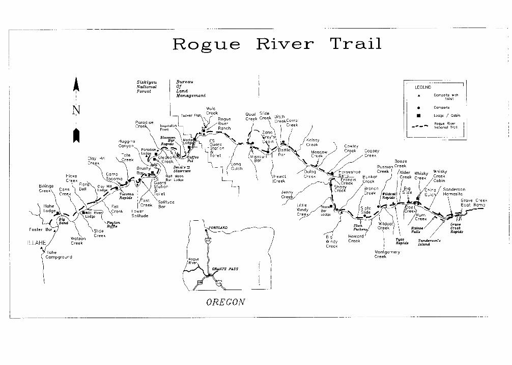
Rogue River Trail
N
SiskiyouNationalForest
BureauOfLandManagement
LEGEND
Caropoite .,thtoilet
MuleCreek
* Carmpsite
* Lodge / Cobinl
Rogue River I--- Notonal1 Tral I
L - - ICowleyCreek Copsey/ - Creek
BoozeCreek
MoonLodge
LowerSolitude
CraveCreekRopid&
, Creek
Illahe>Campground
Suand-ersar'IsIatn
Cr
OREGON
12.4 Cowlev Creek - north bank.
13.6 Meadow Creek - north bank. Miners used a winch to movelarge boulders on the bar, then mined the sand that hadaccumulated around the base of the boulders. Dutch Henrycame to live at Meadow Creek. He raised cattle and grewfruit on his homestead.Camping - Two small sites by creek with water, no toilet.Large site just downriver with toilet, no water.
14.1 Dulog Creek - south bank. Dulog Rapid was blasted byGlen Wooldridge. Glen was one of the first Rogue Riverguides, he guided from 1917 to the 1970s. Wooldridge ranthe first successful upriver trip in 1947, from Gold Beach toGrants Pass.
15.4 Kelsey Creek - north bank. The creek and Kelsey Canyon arenamed for Colonel John Kelsey who led a group of territorialvolunteers against Chief John's Indian forces in the spring of1856.Camping - Two medium sites with water. Trail site east ofbridge, river site west of bridge with toilet.
15.5 Corral Creek - north bank.
16.6 Battle Bar - south bank. Named because of a fightbetween Colonel Kelsey's calvary on the north bank and aband of Takelma Indians on the south bank.
After the massacre of Indian families on Little Butte Creekhostile elements broke out of the Table Rock Reservation,on October 9, 1855. Little Butte Creek and Table RockReservation are located near what is now Medford. TheIndians traveled down the north side of the Rogue killingsettlers and burning dwellings.
Fighting between the whitesfar downriver as Grave Creethe campaign.
The Indian families spent th(April of 1856, a detachmentarea to eliminate the Nativeinto the large clearing on thewere promptly engaged in b~abandoned their camp for th,south side. Though not a mnskirmishes which led to the (from the Rogue River counti
Bob Fox built a cabin on thehad planned a fishing resortbecause Jack Mahoney, a neMay 6, 1947. The 1964 flocabin but the roof and suppcBLM and the White City Vcrefurbished the shelter.
Ditch Creek - north bank. TImining activity as evidencedabout the creek.Camping - Small site with vv
16.7 Slide Creek - north bank
17.5 Hewitt Creek - south bank.Mahoney's cabin (see mile I
-20 - -21 -
bank.
i bank. Miners used a winch to movebar, then mined the sand that hadie base of the boulders. Dutch Henry1w Creek. He raised cattle and grew1.sites by creek with water, no toilet.ver with toilet, no water.
bank. Dulog Rapid was blasted byen was one of the first Rogue Rivern 1917 to the 1970s. Wooldridge ranriver trip in 1947, from Gold Beach to
iank. The creek and Kelsey Canyon areIn Kelsey who led a group of territorialief John's Indian forces in the spring of
um sites with water. Trail site east ofof bridge with toilet.
)ank.
ik. Named because of a fight;ey's calvary on the north bank and aans on the south bank.
Fighting between the whites and the Indians extended asfar downriver as Grave Creek until winter weather stoppedthe campaign.
The Indian families spent the winter near Battle Bar. InApril of 1856, a detachment of soldiers was sent to thearea to eliminate the Native Americans. The soldiers rodeinto the large clearing on the north side of the river andwere promptly engaged in battle with the Indians who hadabandoned their camp for the protection of the bar on thesouth side. Though not a major battle, it was one of theskirmishes which led to the extraction of American Indiansfrom the Rogue River country.
Bob Fox built a cabin on the south side of the river. Bobhad planned a fishing resort but was unable to complete itbecause Jack Mahoney, a neighbor, shot and killed Fox onMay 6, 1947. The 1964 flood destroyed the walls of thecabin but the roof and supports remained. In 1991 theBLM and the White City Veterans Administrationrefurbished the shelter.
Ditch Creek - north bank. This was the site of former placermining activity as evidenced by the piles of gravel scatteredabout the creek.Camping - Small site with water, no toilet
Indian families on Little Butte Creek-. out of the Table Rock Reservation,Little Butte Creek and Table Rock-d near what is now Medford. Thei the north side of the Rogue killingwellings.
16.7 Slide Creek - north bank
17.5 Hewitt Creek - south bank. This is the site of JackMahoney's cabin (see mile 16.6).
-21 -
17.5 Winkle Bar - north bank. Wesbought the mining claim for th1926. Grey then had his cabinto stay while he was fishing arpurchased from Zane Grey's hiproperty. The owner welcome
Historic Kelsev Pack Trail - Tused by Native Americans andloop that leaves the main trail aat Quail Creek.
18.5 Missouri Creek/Bar - south baheavy gold mining. Gerald Fruntil 1987, when he died. GetBillings' grandson (see Billing
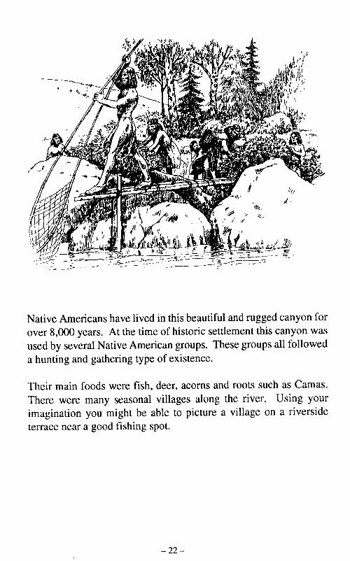
Native Americans have lived in this beautiful and rugged canyon forover 8,000 years. At the time of historic settlement this canyon wasused by several Native American groups. These groups all followeda hunting and gathering type of existence.
Born in 1916 at Big Meadow,canyon and lived here most ofcaretaker of Zane Grey's cabirconstruction of the Rogue RivRiver Ranch when it belonged23.0).
Their main foods were fish, deer, acorns and roots such as Camas.There were many seasonal villages along the river. Using yourimagination you might be able to picture a village on a riversideterrace near a good fishing spot.
- 23 -- 22 -
17.5 Winkle Bar - north bank. Western writer Zane Greybought the mining claim for this site from a prospector in1926. Grey then had his cabin built and used it for a placeto stay while he was fishing and writing. Winkle Bar waspurchased from Zane Grey's heirs and remains privateproperty. The owner welcomes respectful visitors.
Historic Kelsev Pack Trail - This is part of the original trailused by Native Americans and miners. The trail is a 4.5 mileloop that leaves the main trail at Winkle Bar and joins it againat Quail Creek.
18.5 Missouri Creek/Bar - south bank. This area experiencedheavy gold mining. Gerald Frye lived here from the 1950suntil 1987, when he died. Gerald was John and AdelineBillings' grandson (see Billings Creek, mile 39).
in this beautiful and rugged canyon forof historic settlement this canyon was
can groups. These groups all followedof existence.
Born in 1916 at Big Meadow, Gerald was raised in thecanyon and lived here most of his life. He worked as thecaretaker of Zane Grey's cabin, assisted the BLM inconstruction of the Rogue River Trail and worked at RogueRiver Ranch when it belonged to the Andersons (see mile23.0).
Jeer, acorns and roots such as Camas.villages along the river. Using your)le to picture a village on a riversidelot.
-23 -- 22 -
-- - ------ ,--_-,---,-.---.-r-twI-
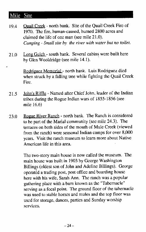
19.4 Ouail Creek - north bank. Site of the Quail Creek Fire of1970. The fire, human-caused, burned 2800 acres andclaimed the life of one man (see mile 21.0).Camping - Small site by the river with water but no toilet.
21.0 Long Gulch - south bank. Several cabins were built hereby Glen Wooldridge (see mile 14.1).
Rodriguez Memorial - north bank. Luis Rodriguez diedwhen struck by a falling tree while fighting the Quail CreekFire.
21.5 John's Riffle - Named after Chief John, leader of the Indiantribes during the Rogue Indian wars of 1855-1856 (seemile 16.6)
23.0 Rogue River Ranch - north bank. The Ranch is consideredto be part of the Marial community (see mile 24.3). Theterraces on both sides of the mouth of Mule Creek (viewedfrom the ranch) were seasonal Indian camps for over 8,000years. Visit the ranch museum to learn more about NativeAmerican life in this area.
The two-story main house is now called the museum. Themain house was built in 1903 by George WashingtonBillings (oldest son of John and Adeline Billings). Georgeoperated a trading post, post office and boarding househere with his wife, Sarah Ann. The ranch was a populargathering place with a barn known as the "Tabernacle"serving as a focal point. The ground floor of the tabernaclewas used to stable horses and mules and the top floor wasused for storage, dances, parties and Sunday worshipservices.
23.0 In 1931, George Billings sold IStanley Anderson who expandcaretaker house, bunkhouse, tastorage shed. The Andersons l
recreational homesite until 197Bureau of Land Management i
Scenic Rivers Act. The ranchHistoric Places.Visitors are welcome to visit tAthe museum. BLM caretakersand emergency radio commun,Drinking water may be obtaimcaretakers house. All of theseMay to October when the ranctrail continues on the road to I
C
n l
NATIONAL Ills
-24 - - 25 -
ik. Site of the Quail Creek Fire of-caused, burned 2800 acres andman (see mile 21.0).y the river with water but no toilet.
ik. Several cabins were built hereee mile 14.1).
north bank. Luis Rodriguez diedg tree while fighting the Quail Creek
after Chief John, leader of the Indian] Indian wars of 1855-1856 (see
torth bank. The Ranch is consideredI community (see mile 24.3). Thef the mouth of Mule Creek (viewed
easonal Indian camps for over 8,000museum to learn more about Nativerea.
)use is now called the museum. Then 1903 by George WashingtonJohn and Adeline Billings). Georget, post office and boarding houserah Ann. The ranch was a popularbarn known as the "Tabernacle"it. The ground floor of the tabernacleses and mules and the top floor wases, parties and Sunday worship
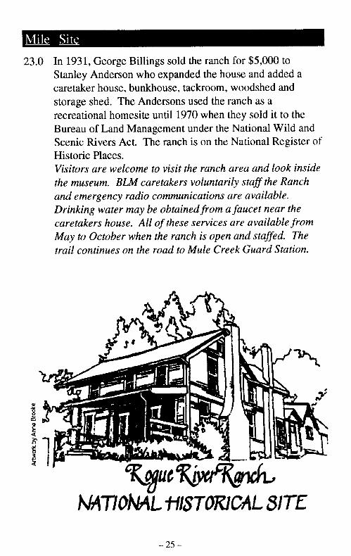
23.0 In 1931, George Billings sold the ranch for $5,000 toStanley Anderson who expanded the house and added acaretaker house, bunkhouse, tackroom, woodshed andstorage shed. The Andersons used the ranch as arecreational homesite until 1970 when they sold it to theBureau of Land Management under the National Wild andScenic Rivers Act. The ranch is on the National Register ofHistoric Places.Visitors are welcome to visit the ranch area and look insidethe museum. BLM caretakers voluntarily staff the Ranchand emergency radio communications are available.Drinking water may be obtained from a faucet near thecaretakers house. All of these services are available fromMay to October when the ranch is open and staffed. Thetrail continues on the road to Mule Creek Guard Station.
I~A
NMTIaNAL -I-ISTOMICAL SITE
- 24 - - 25 -

23.2 Marial Road - follow to west. Trail runs on this road about2.8 miles to Mule Creek Guard Station.
23.4 Tucker Flat Campground - north bank. Take side road tonorth off Marial Road. Mule Creek Trail begins at thenorth end of the campground and provides access to theWild Rogue Wilderness.Camping - Developed BLM campground at Mule Creek,accessible by car, with 6 sites, pit toilets, trash cans,picnic tables and untreated water.
23.5 Mule Creek - north bank. This creek was named in thesummer of 1852 when a company of soldiers from FortOrford tried to open a trail along the Rogue. A member ofthe party later related that a Lt. R.S. Williamson rode amule named John. When the mule was turned loose tograze near the stream, it wandered off and was not founddespite a thorough search. Because of this incident, thestream was named John Mule Creek, but later shortened toMule Creek. The tale ended happily several years laterwhen Williamson found his mule.Camping - Large sites by the river with toilet and water oneast and west side of Mule Creek.
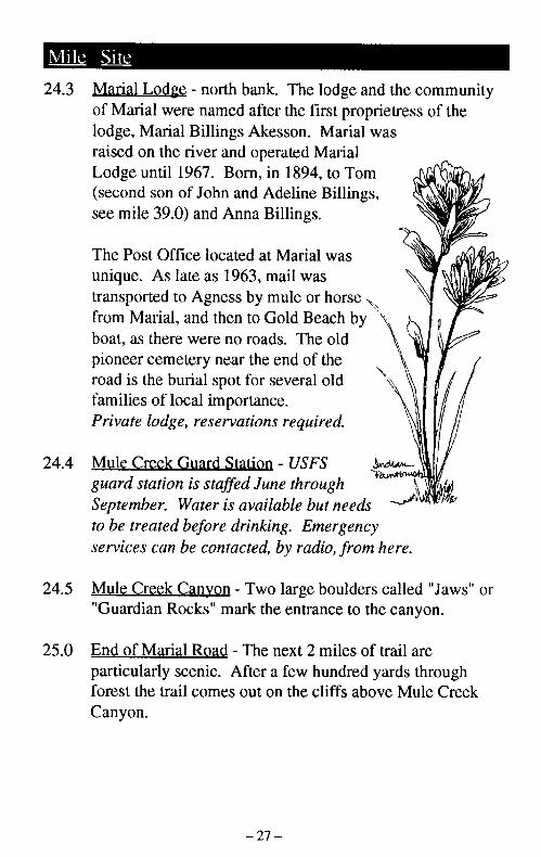
24.3 Marial Lodge - north bank. 1of Marial were named after tIlodge, Marial Billings Akess(raised on the river and operatLodge until 1967. Born, in 1(second son of John and Ade]see mile 39.0) and Anna Billi
The Post Office located at M,unique. As late as 1963, maitransported to Agness by mu]from Marial, and then to Golbboat, as there were no roads.pioneer cemetery near the ensroad is the burial spot for sevfamilies of local importance.Private lodge, reservations ru
24.4 Mule Creek Guard Station - Iguard station is staffed June,September. Water is availabto be treated before drinking.services can be contacted, by
24.5 Mule Creek Canyon - Two la"Guardian Rocks" mark the e
25.0 End of Marial Road - The ne:particularly scenic. After a fiforest the trail comes out on tCanyon.
- -- ~~~~ v,
- 26- -27 -
) west. Trail runs on this road aboutk Guard Station.
_ - north bank. Take side road toMule Creek Trail begins at the
,round and provides access to the,s.BLM campground at Mule Creek,6 sites, pit toilets, trash cans,ated water.
ik. This creek was named in thea company of soldiers from Fort[rail along the Rogue. A member ofhat a Lt. R.S. Williamson rode aien the mule was turned loose toit wandered off and was not foundrch. Because of this incident, then Mule Creek, but later shortened toended happily several years laterId his mule.by the river with toilet and water onfule Creek.
24.3 Marial Lodge - north bank. The lodge and the communityof Marial were named after the first proprietress of thelodge, Marial Billings Akesson. Marial wasraised on the river and operated MarialLodge until 1967. Born, in 1894, to Tom(second son of John and Adeline Billings,see mile 39.0) and Anna Billings.
The Post Office located at Marial wasunique. As late as 1963, mail wastransported to Agness by mule or horsefrom Marial, and then to Gold Beach byboat, as there were no roads. The oldpioneer cemetery near the end of theroad is the burial spot for several old BE \ /families of loc al importance.quiredPrivate lodge, reservations required.
24.4 Mule Creek Guard Station - USFSguard station is staffed June through ' '
September. Water is available but needs Dto be treated before drinking. Emergencyservices can be contacted, by radio, from here.
24.5 Mule Creek Canyon - Two large boulders called "Jaws" or"Guardian Rocks" mark the entrance to the canyon.
25.0 End of Marial Road - The next 2 miles of trail areparticularly scenic. After a few hundred yards throughforest the trail comes out on the cliffs above Mule CreekCanyon.
-I-U.-
- 26 - - 27 -
�- - 1-- - -1 _� - - 1, ,, I II
25.5 Coffeepot - The trail overlooks the Coffeepot, a churningsemi-whirlpool, one mile from the beginning of MuleCreek Canyon. The river bounces off the canyon wallscreating diagonal waves and tricky currents. This is thenarrowest passage on the river.
25.6 Stair Creek - south bank. Stair Creek Falls.
25.7 Inspiration Point - Inspiration Point overlooks Stair CreekFalls from the north bank. The trail is on a narrow ledgehigh on the cliff. Below can be seen deep, cool poolswhere salmon gather in the summer.Camping - Small site with water but no toilet.
27.1 Blossom Bar - Named after the wild azaleas that bloomhere. Blossom Bar was the site of a stamp mill used inmining operations. The rapids used to be impassable untilGlen Wooldridge (see mile 14.1) blasted out the rocks tomake a passage. It is the most difficult water to navigateon the river.Camping - Large site with water and toilet.
27.3 Devils Staircase - A series of pour-offs.
27.4 Gleason Creek - south bank.
27.9 Paradise Creek - north bank. Cascades over a rock wallinto the Rogue from the north. Some years there are sanddeposits at this site permitting camping and other years thesand is washed away.Camping - Small site with water.
28.3 Paradise Bar Lodge - north bbring passengers upstream tePrivate lodge, reservations r
28.4 Half Moon Bar Lodge - sout]Private lodge, reservations r
Lower Paradise Bar CampsitCamping - Small site with to
29.0 Huggins Canyon - This sectiiGlen Wooldridge (see mile 1Huggins. Huggins lived for iwhere his grave is located.
29.4 Sturgeon Hole - The hole is,waterfall coming into the riv(
31.0 East Creek -south bank. Thi"General's Cabin" owned byLeMay, Anderson, and Twingroup by Wooldridge (see mclaim.
-28 - - 29 -
verlooks the Coffeepot, a churningiile from the beginning of Muleiver bounces off the canyon walls'es and tricky currents. This is thethe river.
nk. Stair Creek Falls.
piration Point overlooks Stair Creekank. The trail is on a narrow ledgezw can be seen deep, cool poolsin the summer.with water but no toilet.
I after the wild azaleas that bloomas the site of a stamp mill used inhe rapids used to be impassable untilmile 14.1) blasted out the rocks to
the most difficult water to navigate
with water and toilet.
eries of pour-offs.
h bank.
h bank. Cascades over a rock wall-he north. Some years there are sand,rmitting camping and other years the
with water.
28.3 Paradise Bar Lodge - north bank. Jet powered mail boatsbring passengers upstream to this lodge.Private lodge, reservations required.
28.4 Half Moon Bar Lodge - south bank.Private lodge, reservations required.
Lower Paradise Bar Campsites - north bank.Camping - Small site with toilet.
29.0 Huggins Canyon - This section of the Rogue was named byGlen Wooldridge (see mile 14.1) after a local hunter, AndyHuggins. Huggins lived for many years at Half Moon Bar,where his grave is located.
29.4 Sturgeon Hole - The hole is 70 feet deep with a smallwaterfall coming into the river on the opposite bank.
31.0 East Creek - south bank. This is the site of the former"General's Cabin" owned by Generals Eakers, Spaatz,LeMay, Anderson, and Twining. The land was sold to thegroup by Wooldridge (see mile 14.1) as a former miningclaim.
- 28 - - 29 -
R�O E-31.2 Brushy Bar - north bank. Forest fires burned this area in
1905, resulting in low, dense brush growing over the areaand giving it its name. Mining was extensive here, andditches are still evident.Camping - Large site with water and toilets. There is aUSFS guard station here that is staffed June throughSeptember. Water is available from a faucet by the guardstation. The water is from the creek and needs to be treatedfor drinking. Emergency services can be contacted, byradio, from here.
31.7 Solitude Ba - north bank. This location bustled withmining activity around 1900. A large arrastra wheel islying in the brush on the south bank at this site. An arrastrawas sometimes used in early mining operations to break upthe ore to make extracting the minerals easier.Camping - Large site by the river with toilet but nowater.
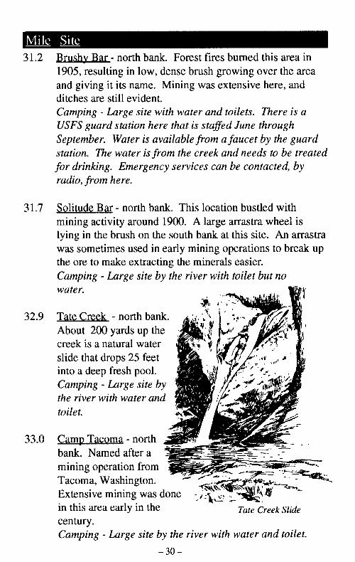
32.9 Tate Creek - north bank.About 200 yards up thecreek is a natural waterslide that drops 25 feet E A -
into a deep fresh pool.Camping - Large site bythe river with water andtoilet.
33.2 Clay Hill Creek and Lodge -homesite is still intact up thealso on the creek. This area iprivate property, pleaserespect the ownersprivacy. HathawayJones' wife, Flora DellThomas, was bornhere. Hathaway Jones 1,(1870-1937) was alocal packer, mail (lcarrier and story teller. iPrivate lodge,reservations required.
34.5 Fall Creek - south bank.Fall Creek Falls tumblesabout 50 feet into a pool.
34.8 Flora Dell Creek - The creekafter Flora Dell Thomas, Hat]33.2). Flora Dell Creek plunjinto a deep trailside pool.Camping - Small site by the rtoilet is downriver, at trail lei
35.8 Pavton Riffle - Named after t]homestead, sometimes referrc
Hicks Creek - Camping - Lar,
36.0 Slide Creek - south bank.
36.1 Wild River Lodge - south banPlace Lodge.Private lodge, reservations re
-31 -
33.0 Camp Tacoma -northbank. Named after amining operation fromTacoma, Washington. -
Extensive mining was donein this area early in the Tate Creek Slidecentury.Camping - Large site by the river with water and toilet.
-30-
ZZ7
;4611
i. Forest fires burned this area inlense brush growing over the areaMining was extensive here, and
ith water and toilets. There is ae that is staffed June throughwailable from a faucet by the guardom the creek and needs to be treated-y services can be contacted, by
ik. This location bustled with1900. A large arrastra wheel ise south bank at this site. An arrastraearly mining operations to break uping the minerals easier.y the river with toilet but no
33.2 Clay Hill Creek and Lodge - north bank. An originalhomesite is still intact up the creek. An old sawmill wasalso on the creek. This area isprivate property, pleaserespect the ownersprivacy. HathawayJones' wife, Flora DellThomas, was bornhere. Hathaway Jones(1870-1937) was alocal packer, mailcarrier and story teller.Private lodge,reservations required.
34.5 Fall Creek - south bank.Fall Creek Falls tumblesabout 50 feet into a pool.
i; P. I-
I ..
34.8 Flora Dell Creek - The creek is namedafter Flora Dell Thomas, Hathaway Jones' wife (see mile33.2). Flora Dell Creek plunges over a 30 foot sheer wallinto a deep trailside pool.Camping - Small site by the river with water and toilet. Thetoilet is downriver, at trail level.
35.8 Pavton Riffle - Named after the original Payton Ranchhomestead, sometimes referred to as Slide Riffle.
Hicks Creek - Camping - Large site with water but no toilet.
36.0 Slide Creek - south bank.
36.1 Wild River Lodge - south bank. Used to be called PaytonPlace Lodge.Private lodge, reservations required.
-31-
'I - . - -
T CTate Creek Slidle
done
By the river with water and toilet.
-30-
Pr------ - N -rM-~--
36.2 Dans Creek - north bank.
37.7 Watson Creek - south bank. On this bank are the remainsof Buster Billings' cabin.
39.0 Big Bend - Site of the last Indian battle of the 1855-1856wars. On May 27, 1856 the 30 hour Battle of Big Bendbegan. Two days later the Upper Rogue Band of Indianssurrendered to Colonel Buchanan at Big Bend. Nearly1200 Indians from southern Oregon were transported bysteamer and land to the Siletz Reservation 125 miles to thenorth. This ended the days of the Indians in the RogueRiver Canyon.
Billings Creek - north bank. The creek was named afterJohn Billings. John (a miner) and his wife Adeline (aKarok Indian) moved from the Klamath River to themouth of the Illinois River, in 1868 with their 3 children.
Kov-rhom-nic-ef-sho-pete was Adeline's Indian name.Adeline also had a less formal Indian name of Krum-ket-tika, which means "a flower growing in any place."
The Billings moved to what is now called Billings Creekin 1878, now with their 7 children. John built andoperated a grist mill that served settlers for miles around.By 1882, the Billings family was complete with 10children.
They moved again in 1891 to the mouth of Mule Creek(see mile 23.0). Their last move was in 1894 when Johnand Adeline moved with their 2 youngest daughters to BigMeadow (about 4 miles above Rogue River Ranch).
Illahe Lodge - north bank.Private lodge, reservations re
Illahg - Chinook word meanir
40.0 Foster Bar/Foster Creek - norCharles Foster, miner, packermilitary during the Indian waiIndian attack at this site and mdownriver to Port Orford (theithe Indian wars Foster returneand married Catherine (a Kar(Camping - Developed USFS cby car, with 12 sites, overnightrash cans, no water. West trboat take-out from the "wild",River. Campground has a ho:September.
41.0 Illahe Campground - CampinAcampground, accessible by caovernight parking, vault toilet.tables, drinking water and a h,
~ September.
d~iY' q
-32- - 33 -

Illahe Lodge - north bank.Private lodge, reservations required.
)ank.
.h bank. On this bank are the remainsabin.
ie last Indian battle of the 1855-1856856 the 30 hour Battle of Big Bendter the Upper Rogue Band of Indiansrel Buchanan at Big Bend. Nearlyouthern Oregon were transported bythe Siletz Reservation 125 miles to theie days of the Indians in the Rogue
rth bank. The creek was named after(a miner) and his wife Adeline (ad from the Klamath River to the, River, in 1868 with their 3 children.
to-pete was Adeline's Indian name.ess formal Indian name of Krum-ket-a flower growing in any place."
to what is now called Billings Creekheir 7 children. John built andI that served settlers for miles around.,s family was complete with 10
n 1891 to the mouth of Mule Creekeir last move was in 1894 when Johnwith their 2 youngest daughters to Bigiiles above Rogue River Ranch).
Illahe - Chinook word meaning "land on earth".
40.0 Foster Bar/Foster Creek - north bank. Named afterCharles Foster, miner, packer and lieutenant in themilitary during the Indian wars. Foster escaped anIndian attack at this site and worked his waydownriver to Port Orford (then Fort Orford). Afterthe Indian wars Foster returned to settle in this areaand married Catherine (a Karok Indian).Camping - Developed USFS campground, accessibleby car, with 12 sites, overnight parking, vault toilets,trash cans, no water. West trail head and popularboat take-out from the "wild" section of the RogueRiver. Campground has a host May throughSeptember.
41.0 Illahe Campground - Camping - Developed USFS feecampground, accessible by car, with 18 sites,overnight parking, vault toilets, trash cans, picnictables, drinking water and a host May through
September.
I
iI III ' I e' //
A\e I�� j� "`/ "I
- 32 - -33 -

I I
Bibliography
A River To Run, by Florence Arman, 1982.
Illahe, by Kay Atwood, 1978.
Requiem of a People, by Stephen Dow Beckham, 1971.
Rogue River Float Guide, USDA, Forest Service, SiskiyouNational Forest, 1993.
Note
Please send comments on the trailoffices on th
- 35 -- 34-

Notes
krman, 1982.
Tien Dow Beckham, 1971.
)A, Forest Service, Siskiyou
Please send comments on the trail or this brochure to one of theoffices on the back.
-35--34-
For More Information: OrBureau of Land ManagementMedford District3040 Biddle RoadMedford, Oregon 97504 (503) 770-2200 R ogueAll year (7:30 - 4:30 M-F)
Rand Visitor Center14335 Galice Road IMerlin, Oregon 97532 (503) 479-3735May 15 - October 15 (7:00 - 4:00 7 days a week)
I 53.2:Siskiyou National Forest R 6Gold Beach Ranger District R 631225 S. Ellensburg Ave.Gold Beach, Oregon 97444 (503) 247-6651All year (7:30 - 5:00 M-F) as '*, Memorial - Labor Day (8:00 - 4:00 Weekends)
The following brochures would be helpful to trail hikers.Contact one of the offices listed above for a free copy.
Books about the Rogue River {*Shuttle Map
Wild Rogue Campsites M
The Bear FactsRogue River Ranch
Whisky Creek Cabin Grave Creek to Ilh
( Please Recycle. The Bureau of Land Management is committed tobeing environmentally responsible. (
BLMIOR/WA/GI-93/37+4800 7 C NSeptember 1993 v m
- 36-