Embed Size (px)
Citation preview
River and Lake Level data from Radar Altimetry in Support of the Tiger Initiative
�Benveniste, J1; Berry,, P2; Milagro-Perez, M.P3;; Serpe, D3; �1ESA; 2De Montfort Univ.;
(1) ESRIN, European Space Agency ([email protected]) (2) EAPRS Lab, De Montfort University ([email protected])
(3) Serco support to ESA-ESRIN
Hydrospace07, WMO, Geneva, 12-14 Nov 2007
2
• A web-based pilot demonstration makes Envisat-derived radar altimetry measurements of the inland surface water level freely available in near-real time, globally, therefore supporting the TIGER Initiative to supply EO data to Africa for water resource management. Envisat's Radar Altimeter-2 data are processed in Near real time by a sophisticated algorithm developed by De Montfort University (DMU) in Leicester, UK, under ESA contract. Until now reliable information has been difficult to access because of the high cost in equipment, manpower and communications, and because it still is problematical to obtain hydrological data from many countries, despite efforts from international organizations, agencies and forums. The near-real-time processing system identifies that part of each surface echo originating from inland water, enabling measurement of much smaller targets, with an increased accuracy, than has previously been possible. With the recent improvement of the data processing in real-time of the precise orbit determination system aboard the satellite, DORIS, the system can be pushed further to deliver water levels in less than six hours, in order to better satisfy the actual needs of users. Supported by the European Space Agency's Earth Observation Data User Element, the River and Lake project is aimed at developing, demonstrating and assessing an information service based on inland water altimetry, globally and both in near real time and for analysing long time series. The data retrieved over Africa is supporting ESA's TIGER initiative. Following the 2002 Johannesburg World Summit on Sustainable Development, the European Space Agency has launched the TIGER Initiative - focusing on the use of space technology for water resource management in Africa and providing concrete actions to match the Resolutions. A brief description of the initiative and its present status will be presented.
3
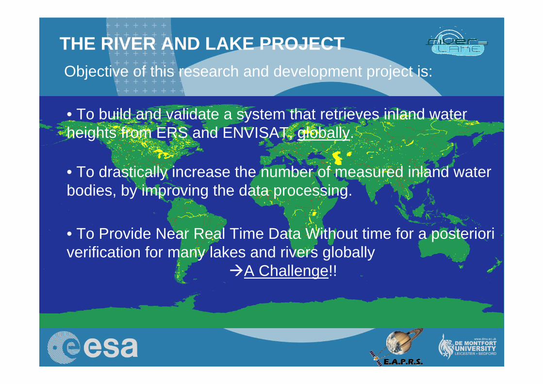
THE RIVER AND LAKE PROJECTObjective of this research and development project is:
• To build and validate a system that retrieves inland water heights from ERS and ENVISAT, globally.
• To drastically increase the number of measured inland water bodies, by improving the data processing.
• To Provide Near Real Time Data Without time for a posteriori verification for many lakes and rivers globally
A Challenge!!
4
THE RIVER AND LAKE PROJECT
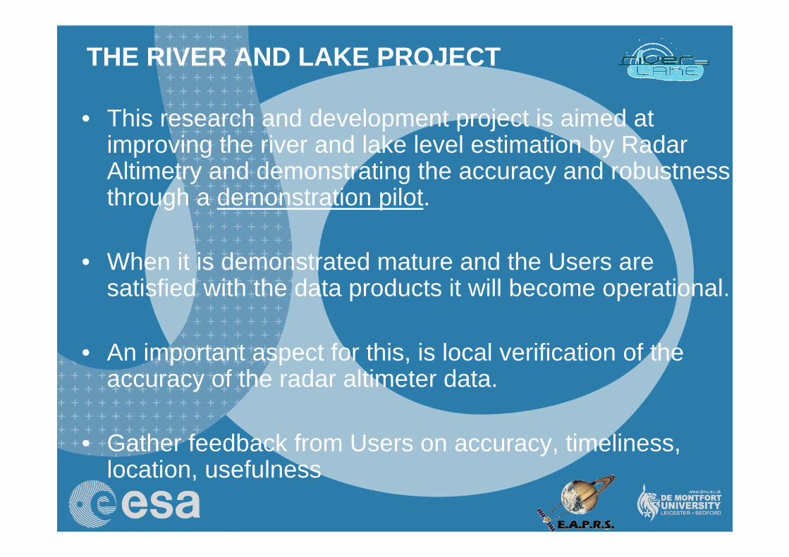
• This research and development project is aimed at improving the river and lake level estimation by Radar Altimetry and demonstrating the accuracy and robustness through a demonstration pilot.
• When it is demonstrated mature and the Users are satisfied with the data products it will become operational.
• An important aspect for this, is local verification of the accuracy of the radar altimeter data.
• Gather feedback from Users on accuracy, timeliness, location, usefulness
5
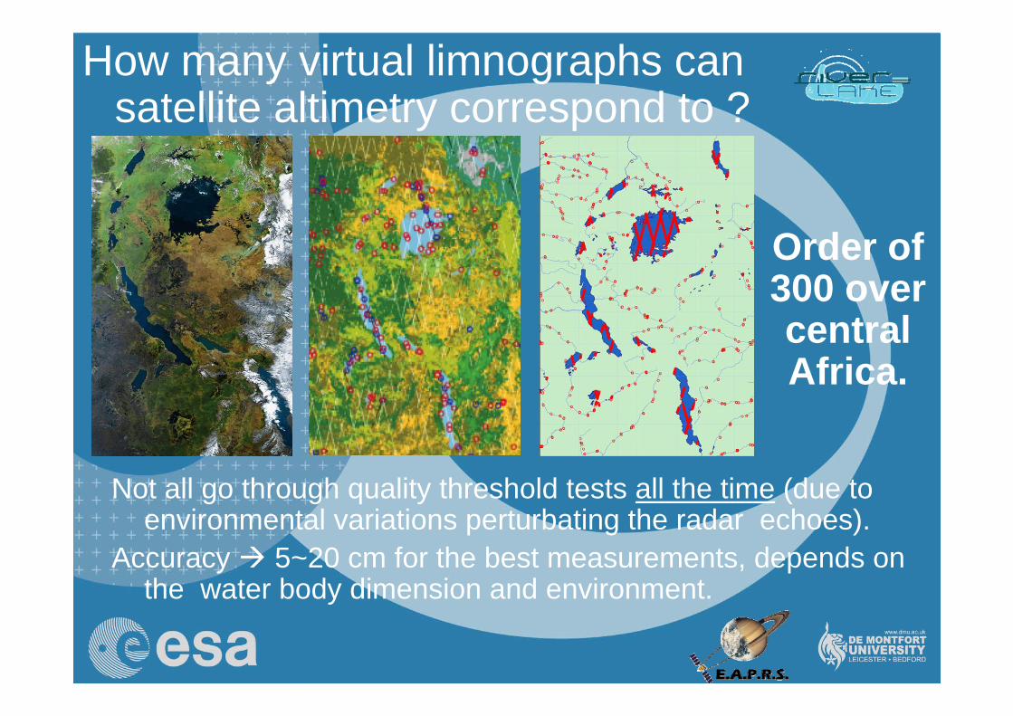
How many virtual limnographs can satellite altimetry correspond to ?
Not all go through quality threshold tests all the time (due to environmental variations perturbating the radar echoes).
Accuracy 5~20 cm for the best measurements, depends on the water body dimension and environment.
Order of 300 over central Africa.
6
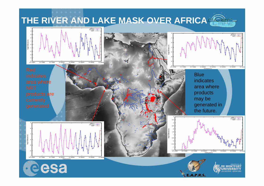
THE RIVER AND LAKE MASK OVER AFRICA
Red indicates area where NRT products are currently generated
Blue indicates area where products may be generated in the future.
7
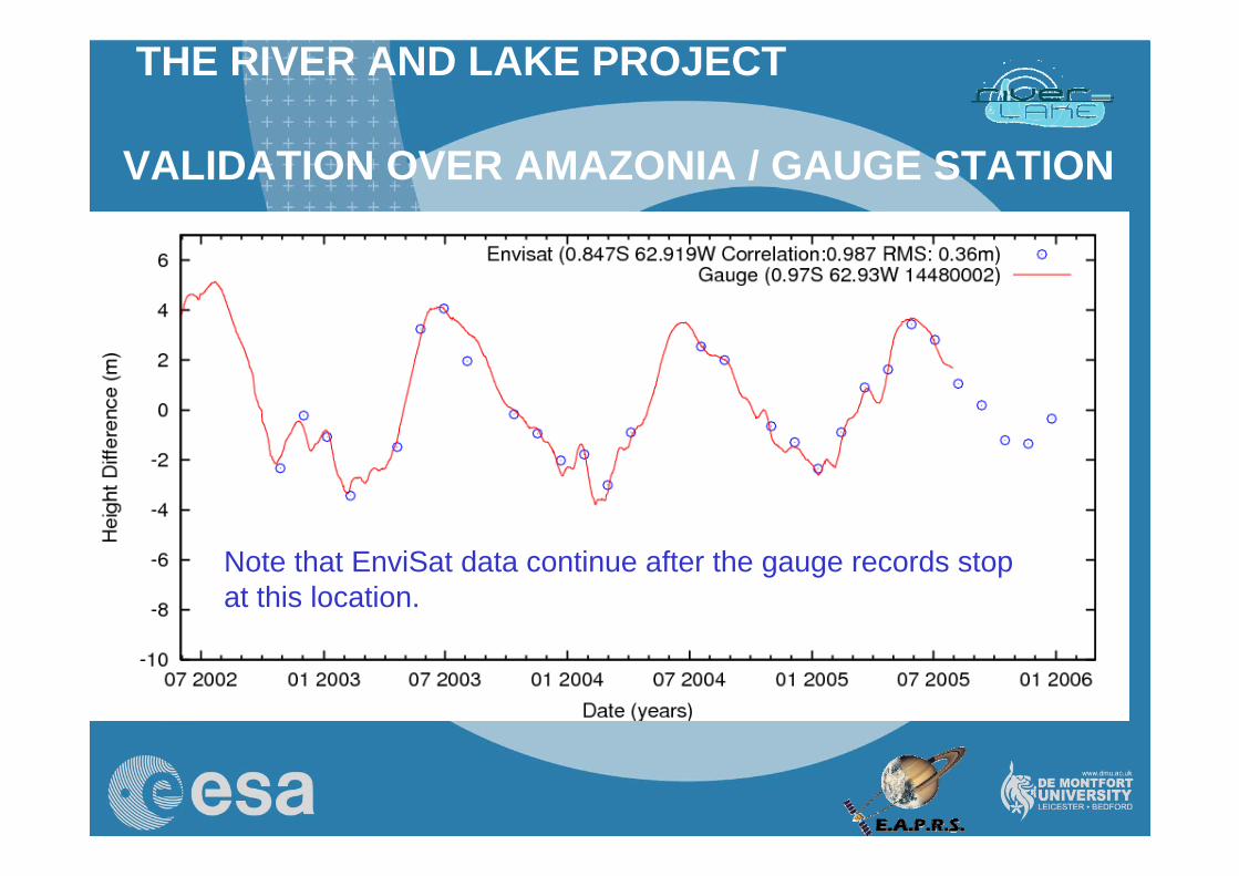
THE RIVER AND LAKE PROJECT
Rio Negro
VALIDATION OVER AMAZONIA / GAUGE STATION
Note that EnviSat data continue after the gauge records stop at this location.
8
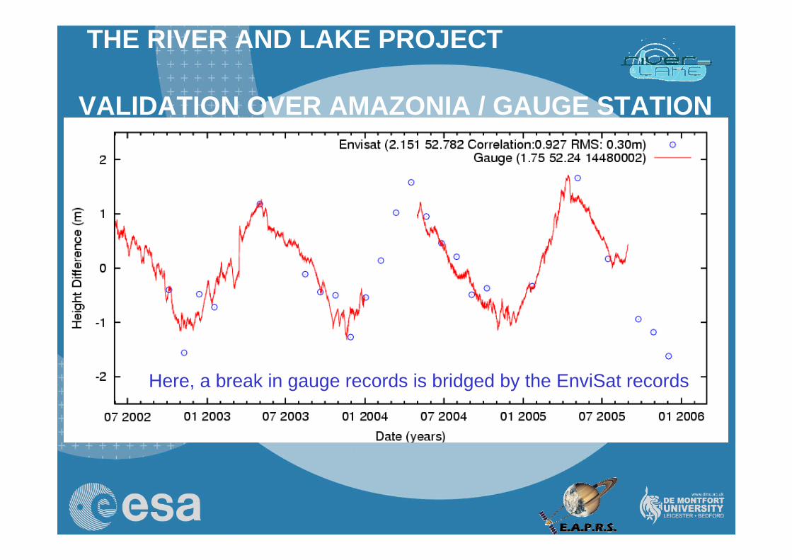
THE RIVER AND LAKE PROJECT
Rio Amazonas
VALIDATION OVER AMAZONIA / GAUGE STATION
Here, a break in gauge records is bridged by the EnviSat records
9
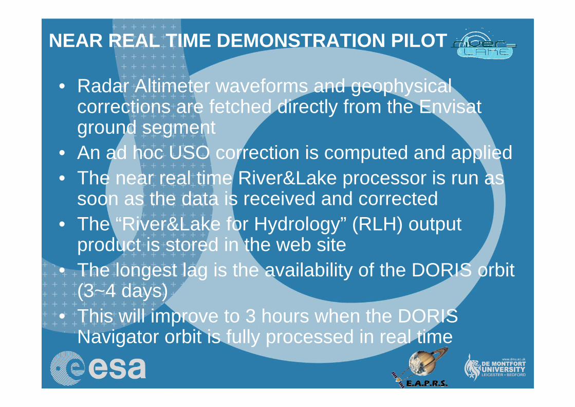
• Radar Altimeter waveforms and geophysical corrections are fetched directly from the Envisat ground segment
• An ad hoc USO correction is computed and applied• The near real time River&Lake processor is run as
soon as the data is received and corrected• The “River&Lake for Hydrology” (RLH) output
product is stored in the web site• The longest lag is the availability of the DORIS orbit
(3~4 days)• This will improve to 3 hours when the DORIS
Navigator orbit is fully processed in real time
NEAR REAL TIME DEMONSTRATION PILOT
10
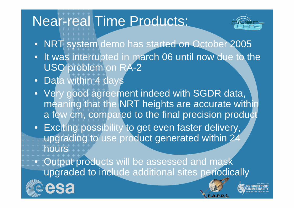
Near-real Time Products:• NRT system demo has started on October 2005• It was interrupted in march 06 until now due to the
USO problem on RA-2• Data within 4 days• Very good agreement indeed with SGDR data,
meaning that the NRT heights are accurate within a few cm, compared to the final precision product
• Exciting possibility to get even faster delivery, upgrading to use product generated within 24 hours
• Output products will be assessed and mask upgraded to include additional sites periodically
11
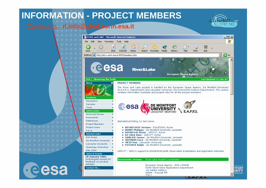
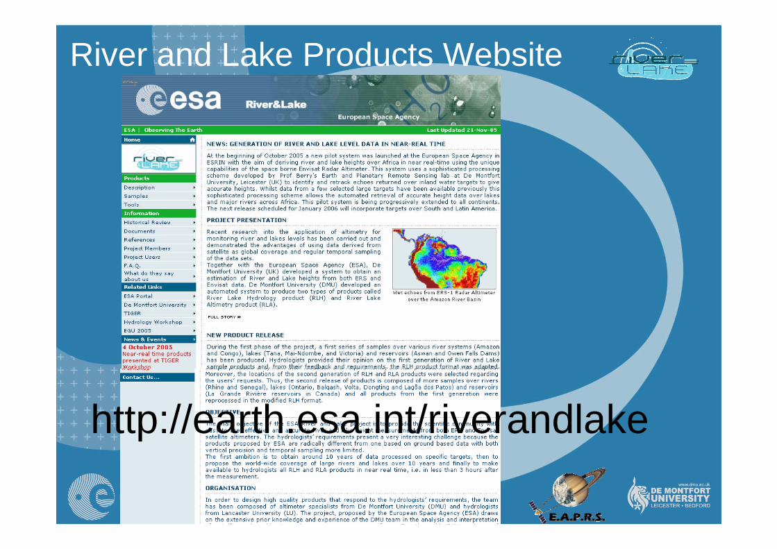
River and Lake Products Website
http://earth.esa.int/riverandlake
12
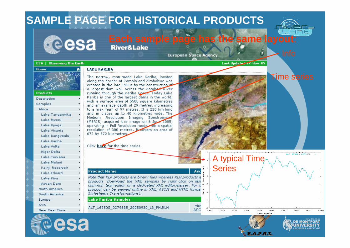
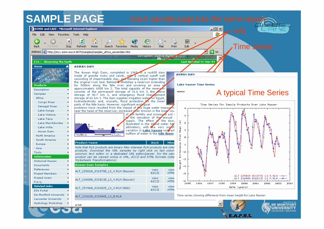
Each sample page has the same layout:
SAMPLE PAGE FOR HISTORICAL PRODUCTS
Info
Time series
Products download
A typical Time Series
13
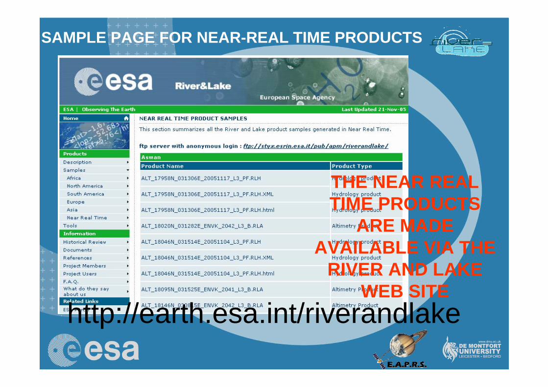
SAMPLE PAGE FOR NEAR-REAL TIME PRODUCTS
THE NEAR REAL TIME PRODUCTS
ARE MADE AVAILABLE VIA THE
RIVER AND LAKE WEB SITE
http://earth.esa.int/riverandlake
14
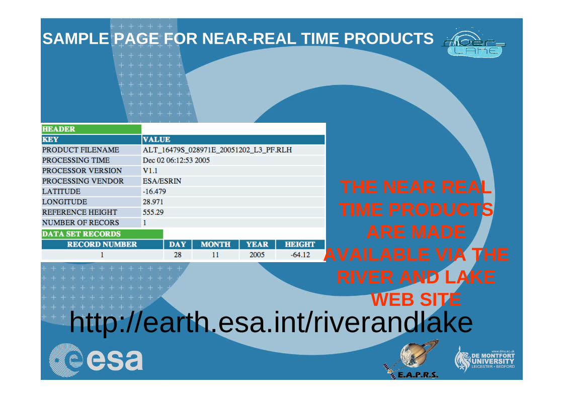
SAMPLE PAGE FOR NEAR-REAL TIME PRODUCTS
http://earth.esa.int/riverandlake
THE NEAR REAL TIME PRODUCTS
ARE MADE AVAILABLE VIA THE
RIVER AND LAKE WEB SITE
15
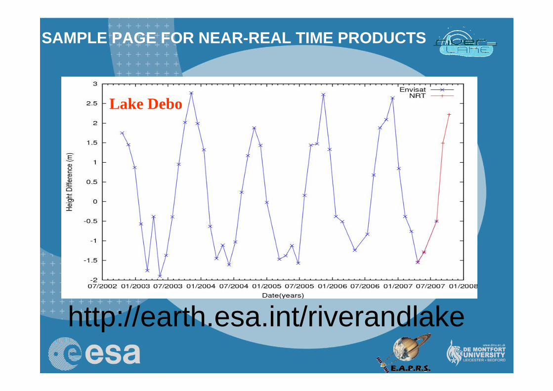
SAMPLE PAGE FOR NEAR-REAL TIME PRODUCTS
http://earth.esa.int/riverandlake
Lake Debo
16
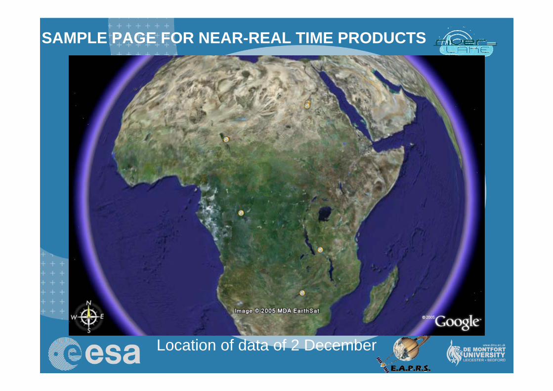
SAMPLE PAGE FOR NEAR-REAL TIME PRODUCTS
Location of data of 2 December
17
SAMPLE PAGE FOR NEAR-REAL TIME PRODUCTS
Location of data since 25 October
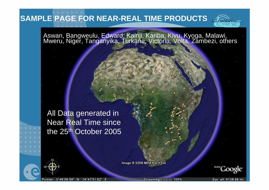
All Data generated in Near Real Time since the 25th October 2005
Aswan, Bangweulu, Edward, Kainji, Kariba, Kivu, Kyoga, Malawi, Mweru, Niger, Tanganyika, Turkana, Victoria, Volta, Zambezi, others
SAMPLE PAGE FOR NEAR-REAL TIME PRODUCTS
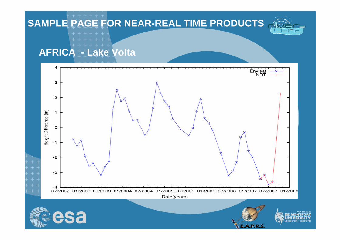
AFRICA - Lake Volta
SAMPLE PAGE FOR NEAR-REAL TIME PRODUCTS
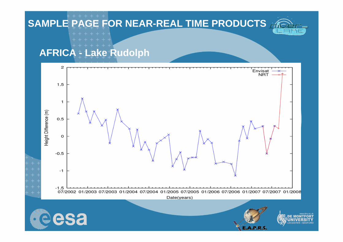
AFRICA - Lake Rudolph
SAMPLE PAGE FOR NEAR-REAL TIME PRODUCTS
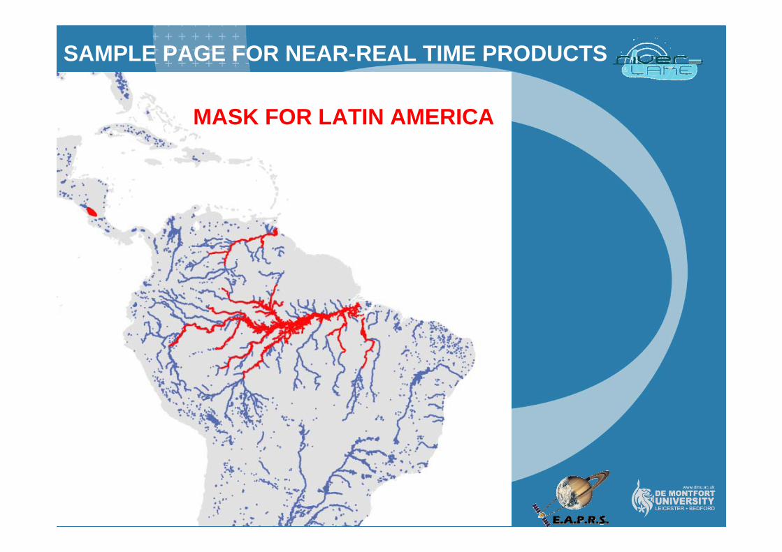
AFRICA MASK FOR LATIN AMERICA
SAMPLE PAGE FOR NEAR-REAL TIME PRODUCTS
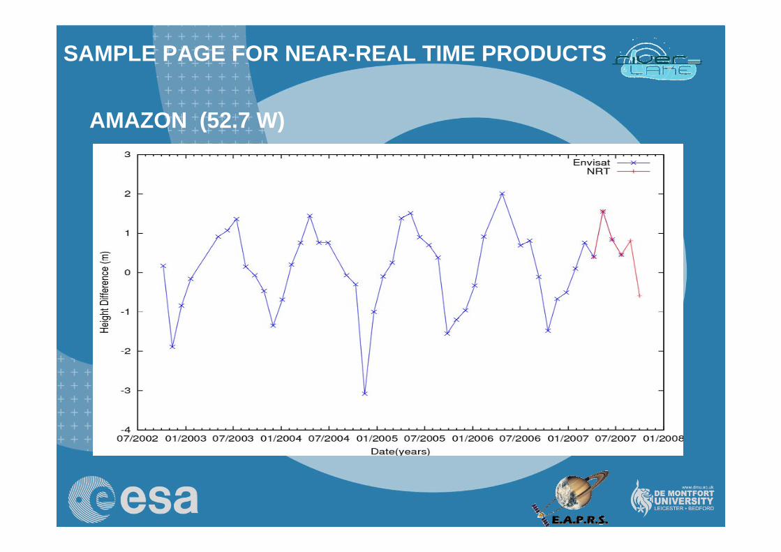
AMAZON (52.7 W)
SAMPLE PAGE FOR NEAR-REAL TIME PRODUCTS
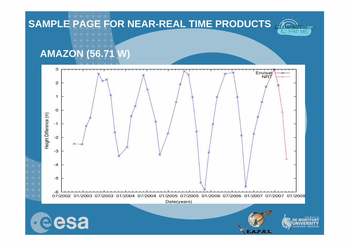
AMAZON (56.71 W)
SAMPLE PAGE FOR NEAR-REAL TIME PRODUCTS
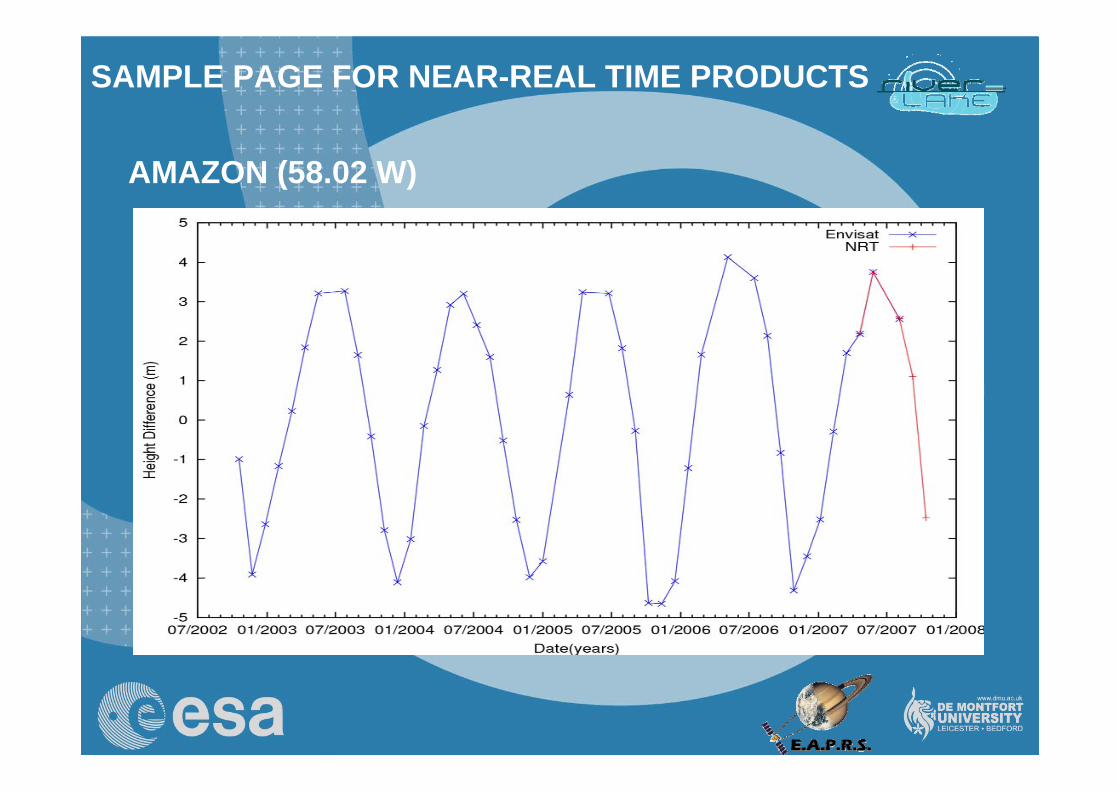
AMAZON (58.02 W)
SAMPLE PAGE FOR NEAR-REAL TIME PRODUCTS
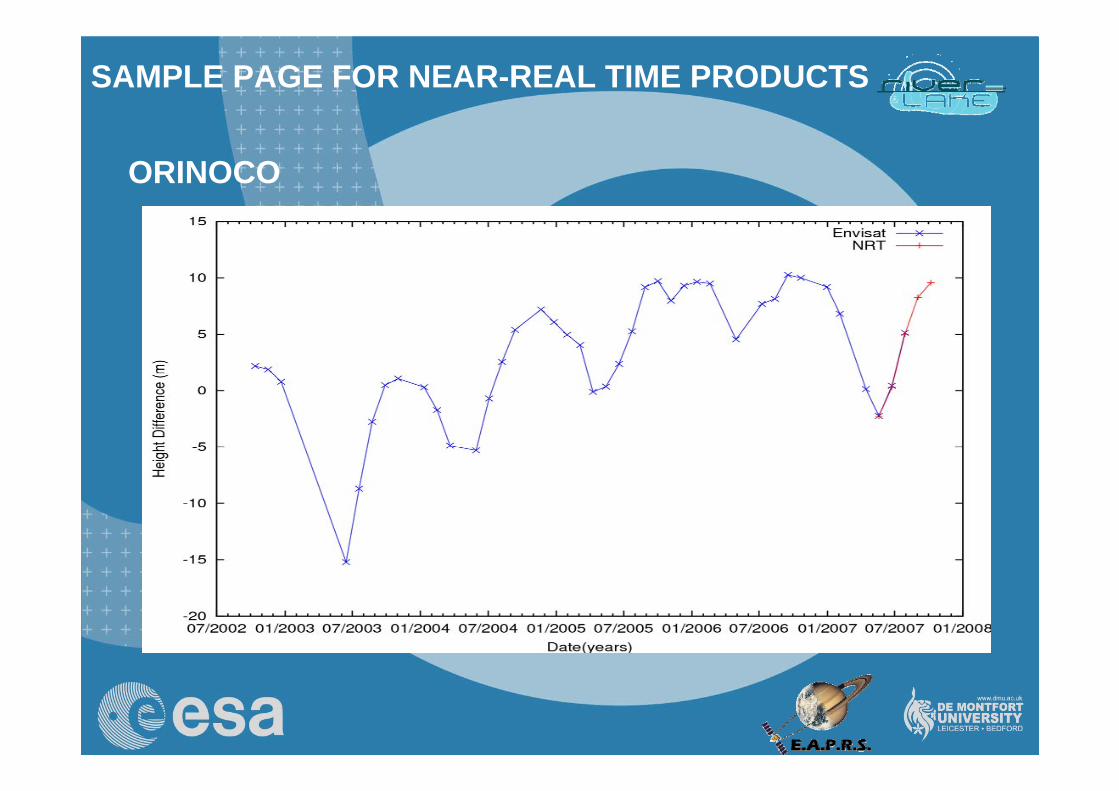
ORINOCO
SAMPLE PAGE FOR NEAR-REAL TIME PRODUCTS
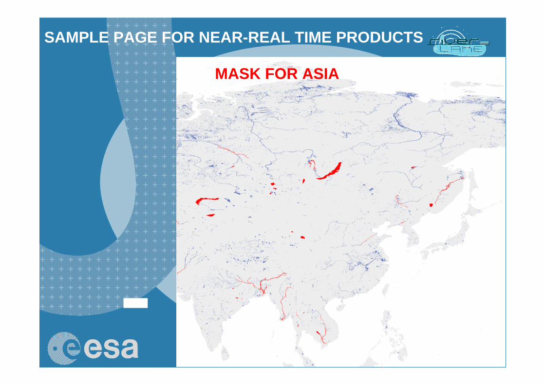
MASK FOR ASIA
SAMPLE PAGE FOR NEAR-REAL TIME PRODUCTS
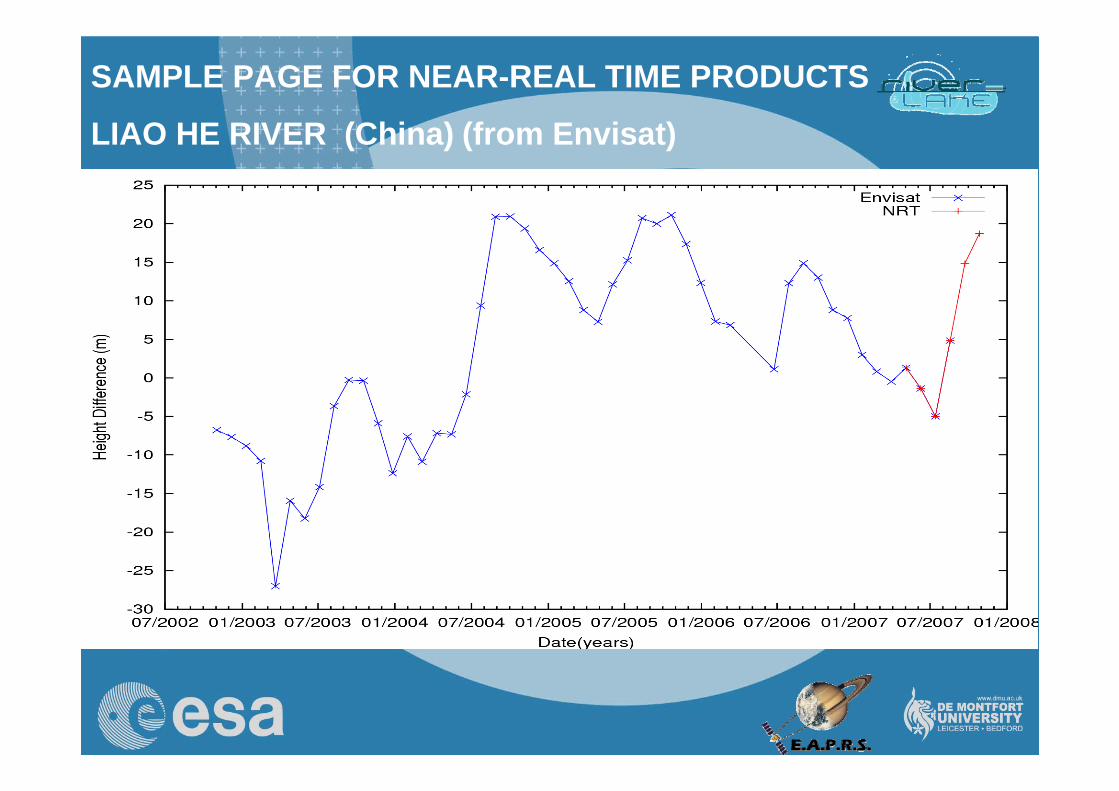
LIAO HE RIVER (China) (from Envisat)
SAMPLE PAGE FOR NEAR-REAL TIME PRODUCTS
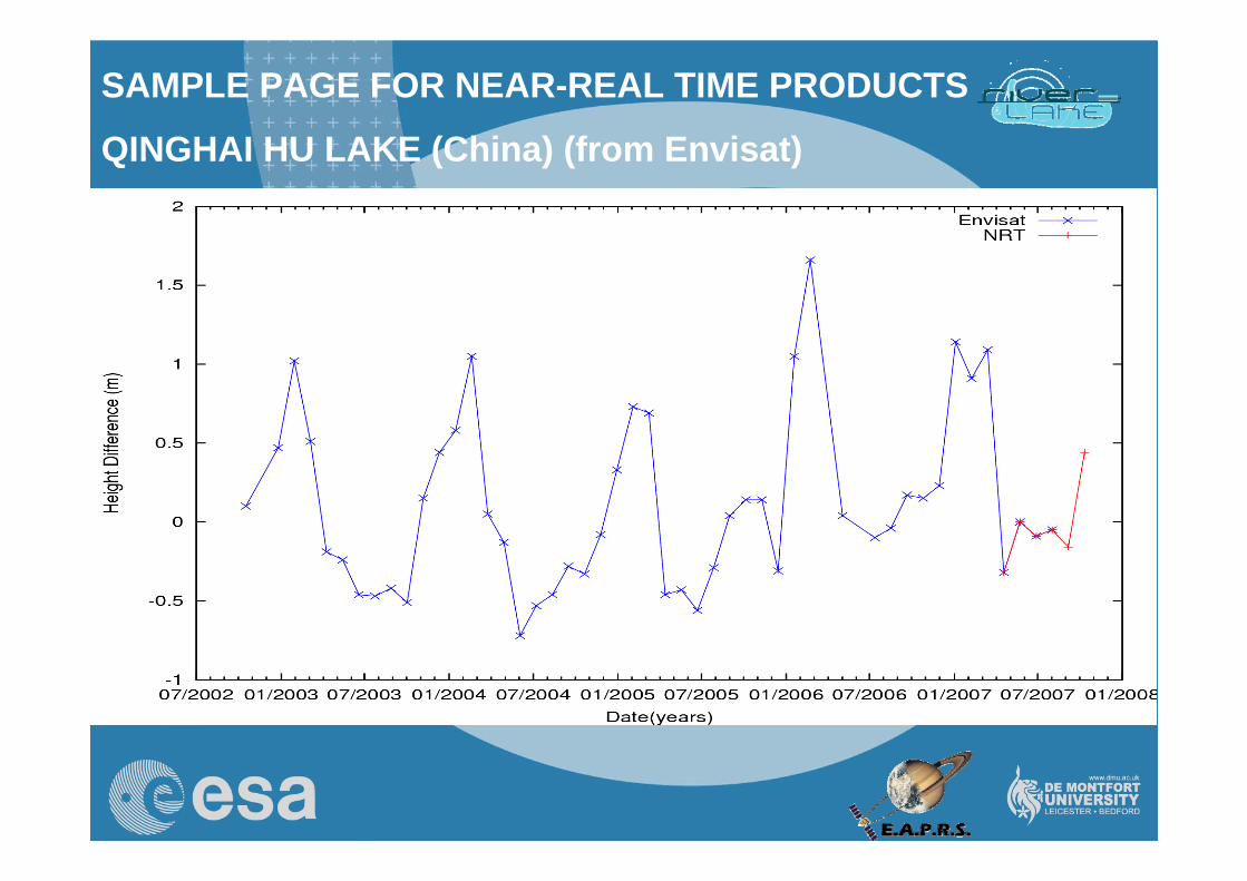
QINGHAI HU LAKE (China) (from Envisat)
28
SAMPLE PAGE FOR NEAR-REAL TIME PRODUCTS
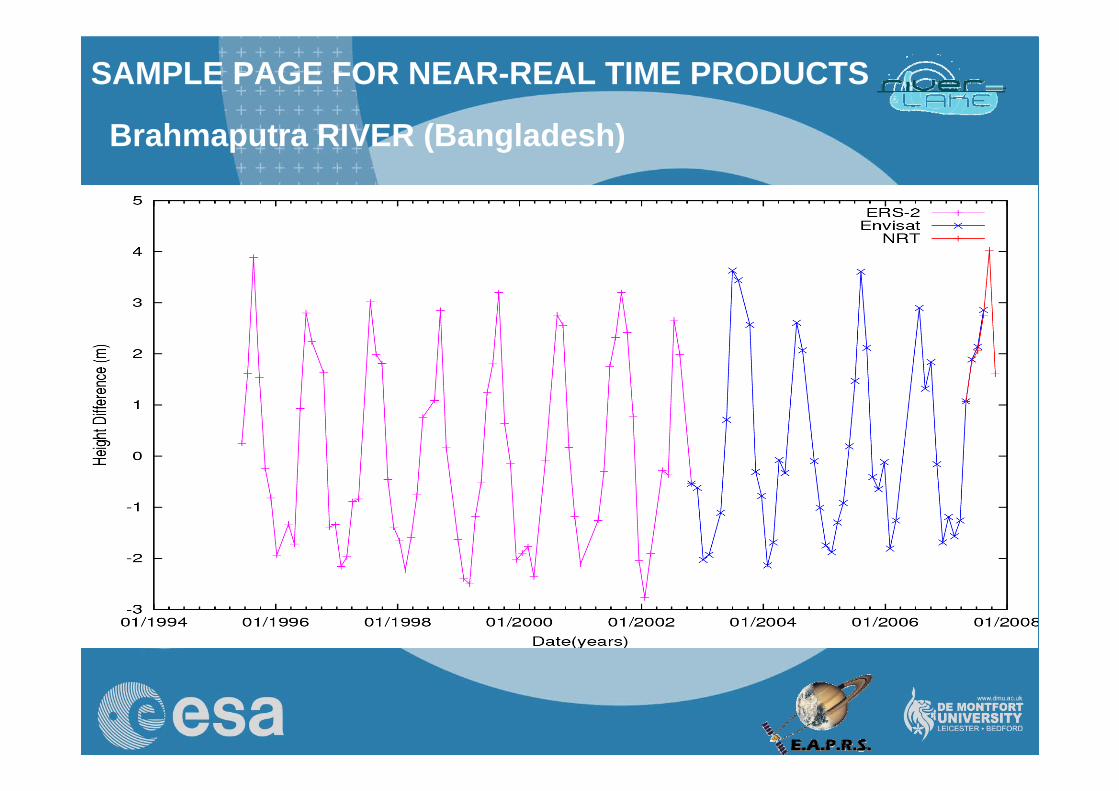
Brahmaputra RIVER (Bangladesh)
29
SAMPLE PAGE FOR NEAR-REAL TIME PRODUCTS
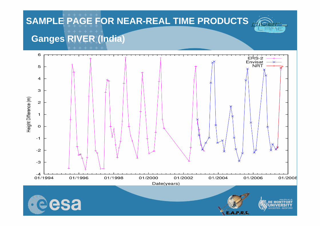
Ganges RIVER (India)
30
SAMPLE PAGE FOR NEAR-REAL TIME PRODUCTS
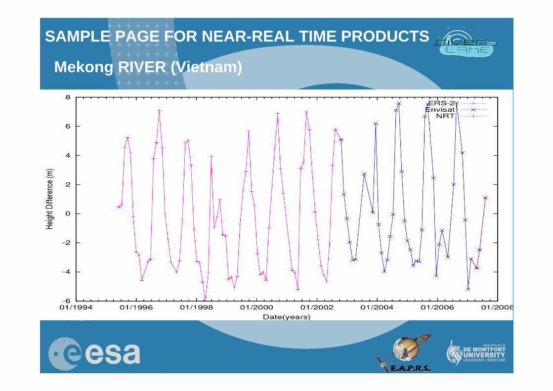
Mekong RIVER (Vietnam)
31
SAMPLE PAGE FOR NEAR-REAL TIME PRODUCTS
THE MASK CAN BE ENHANCED TO ATTEMPT RETRIEVAL OVER
YOUR PROJECT’S AREA
http://earth.esa.int/riverandlake
32
DEMONSTRATION PILOT DATA DISSEMINATION
THE NEAR REAL TIME ARE MADE AVAILABLE VIA THE RIVER AND LAKE
WEB SITEASK FOR HISTORICAL DATA
IN YOUR AREA
http://earth.esa.int/riverandlake

33
River and Lake Products Website
http://earth.esa.int/riverandlake
34
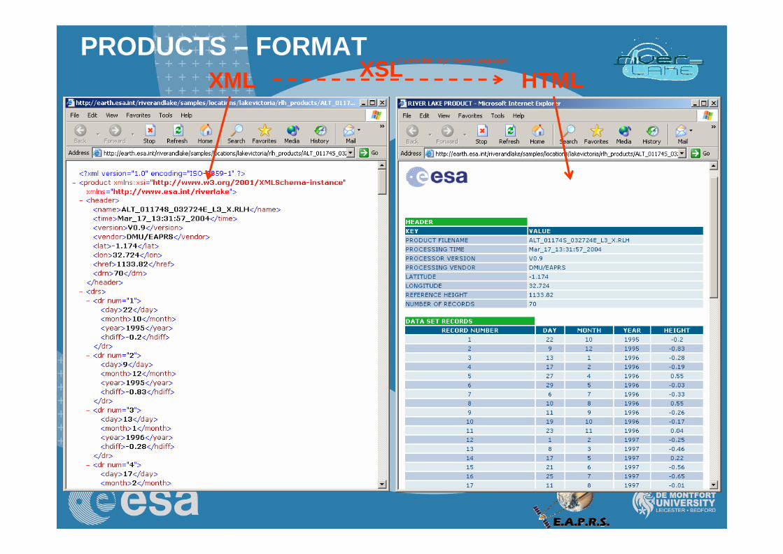
PRODUCTS – FORMATXML HTMLXSL(Extensible Stylesheet Language)
35
Each sample page has the same layout:SAMPLE PAGEInfo
Time series
Products download
A typical Time Series
36
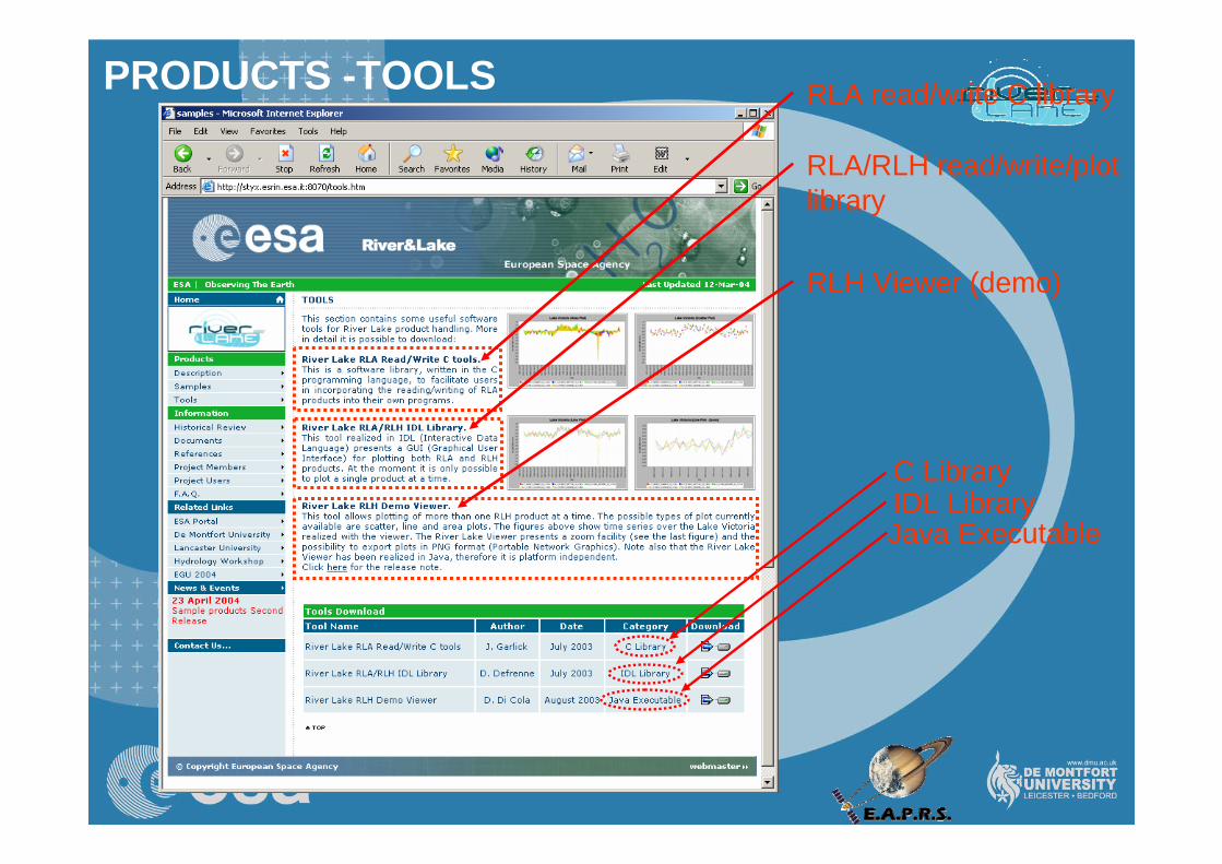
PRODUCTS -TOOLS RLA read/write C library
C Library
RLA/RLH read/write/plot library
IDL Library
RLH Viewer (demo)
Java Executable
37
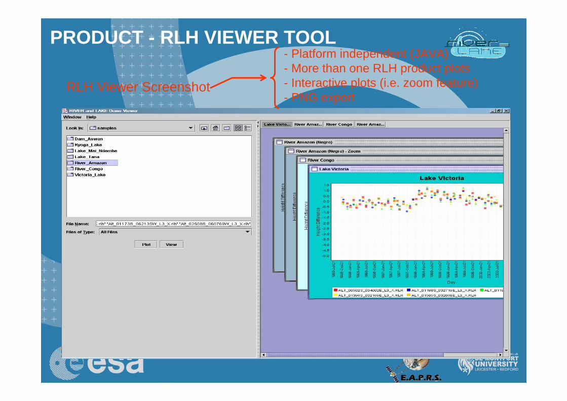
PRODUCT - RLH VIEWER TOOL
RLH Viewer Screenshot
- Platform independent (JAVA)- More than one RLH product plots- Interactive plots (i.e. zoom feature)- PNG export
38
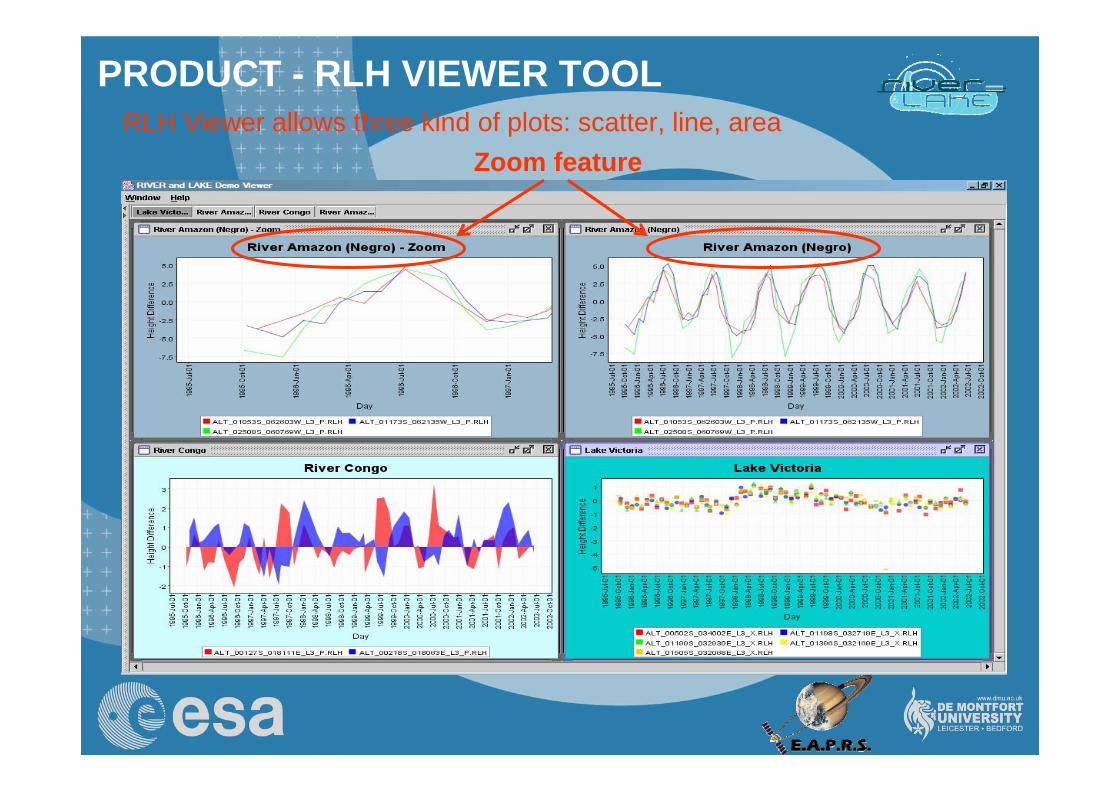
RLH Viewer allows three kind of plots: scatter, line, areaZoom feature
PRODUCT - RLH VIEWER TOOL
39
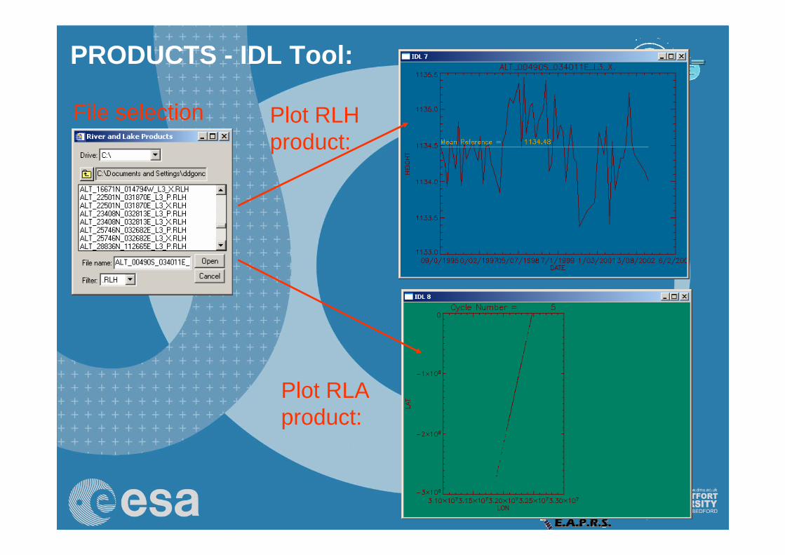
PRODUCTS - IDL Tool:
File selection Plot RLH product:
Plot RLA product:
40
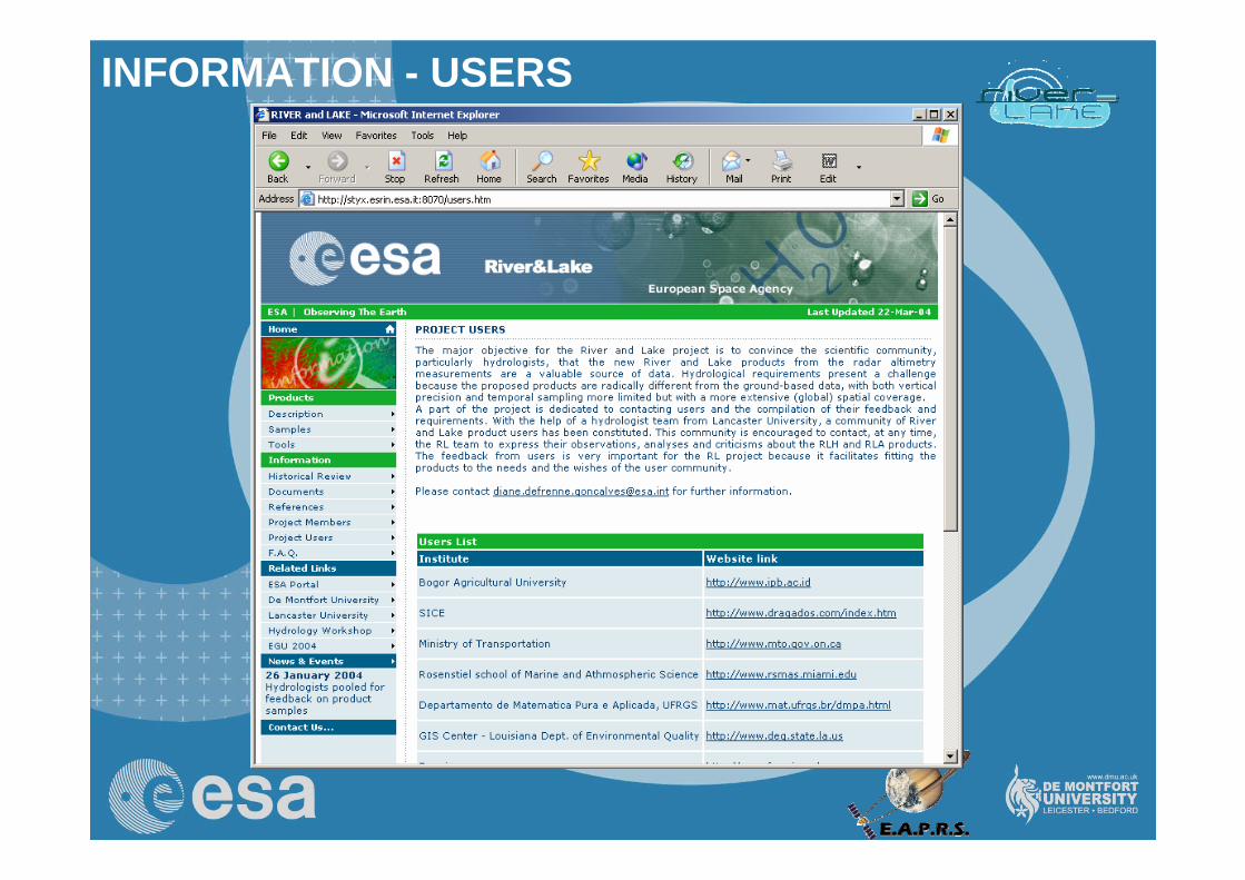
INFORMATION - USERS
41
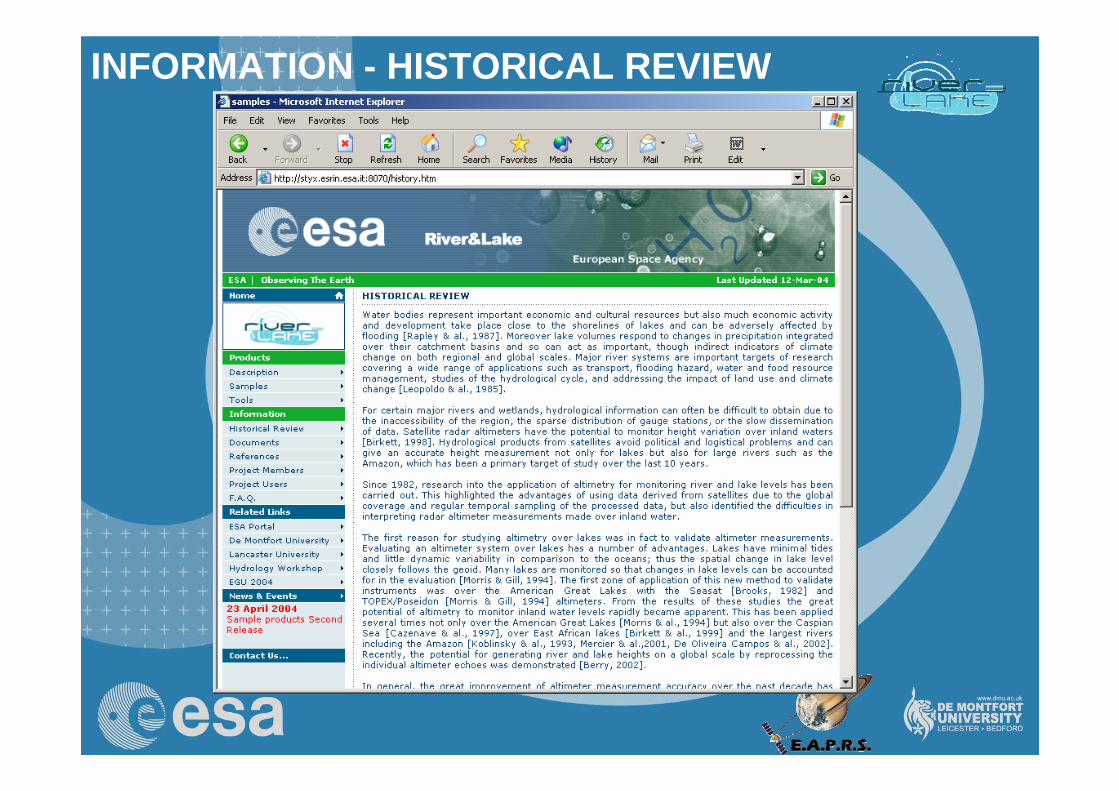
INFORMATION - HISTORICAL REVIEW
42
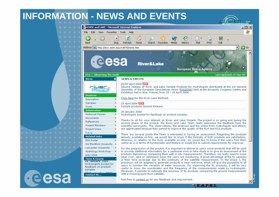
INFORMATION - NEWS AND EVENTS
43
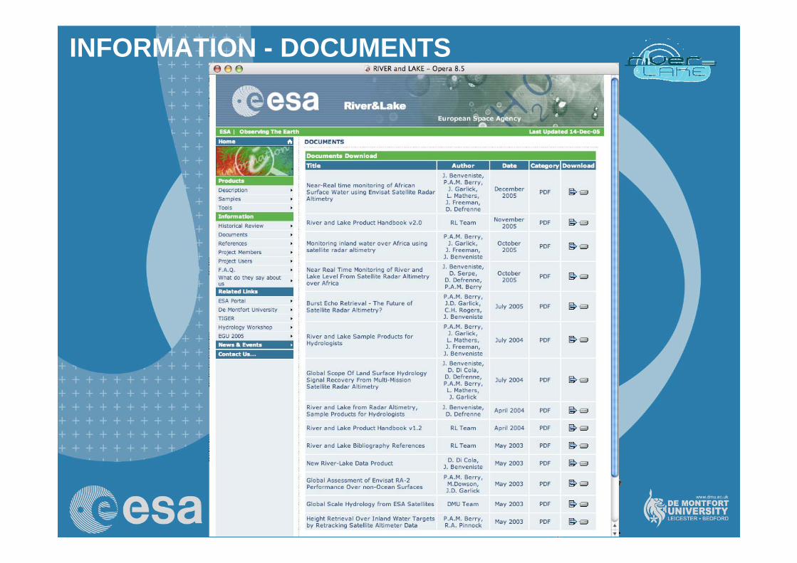
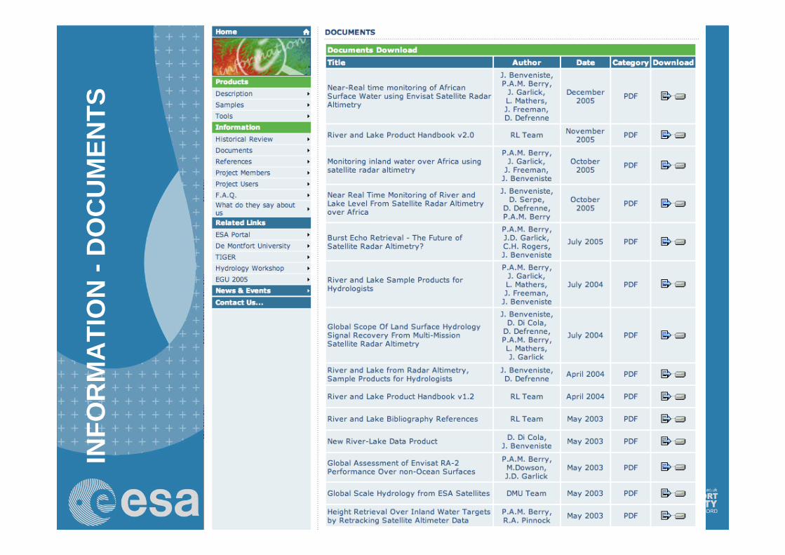
INFORMATION - DOCUMENTS
44
INFO
RM
ATI
ON
-D
OC
UM
ENTS
45
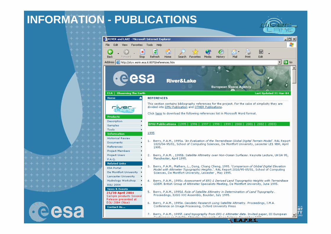
INFORMATION - PUBLICATIONS
47
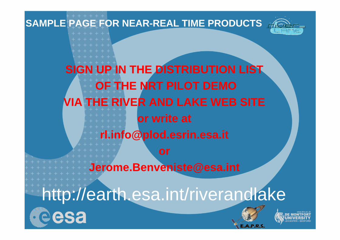
SAMPLE PAGE FOR NEAR-REAL TIME PRODUCTS
SIGN UP IN THE DISTRIBUTION LISTOF THE NRT PILOT DEMO
VIA THE RIVER AND LAKE WEB SITEor write at
http://earth.esa.int/riverandlake

48
TIGER Objectives
Support improved water governance and decision-making: (at regional, national and local scales) by using space-based information to provide accurate and timely geo-information for the integrated water resource management process.
Contributing to enhance institutional, human and technical capacity: support the consolidation of a critical mass of technical centres in Africa with the skills and capabilities to exploit the advantages of EO technology in order to improve water research and knowledge in Africa as well as to derive water-relevant geo-information.
Fostering sustainability: Development of strategy for strengthening and sustaining EO-supported IWRM information and decision-support systems in the long term.
49
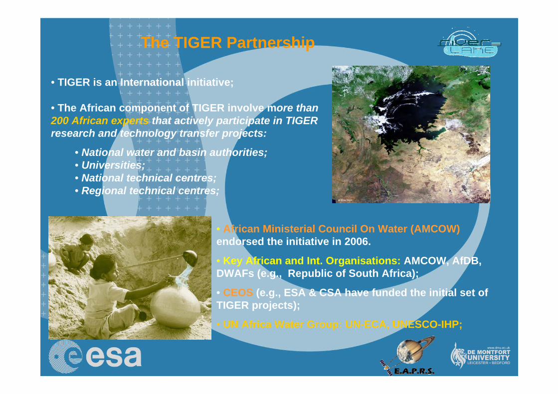
The TIGER Partnership
• African Ministerial Council On Water (AMCOW) endorsed the initiative in 2006.
• Key African and Int. Organisations: AMCOW, AfDB, DWAFs (e.g., Republic of South Africa);
• CEOS (e.g., ESA & CSA have funded the initial set of TIGER projects);
• UN Africa Water Group: UN-ECA, UNESCO-IHP;
• TIGER is an International initiative;
• The African component of TIGER involve more than 200 African experts that actively participate in TIGER research and technology transfer projects:
• National water and basin authorities;• Universities;• National technical centres;• Regional technical centres;
50
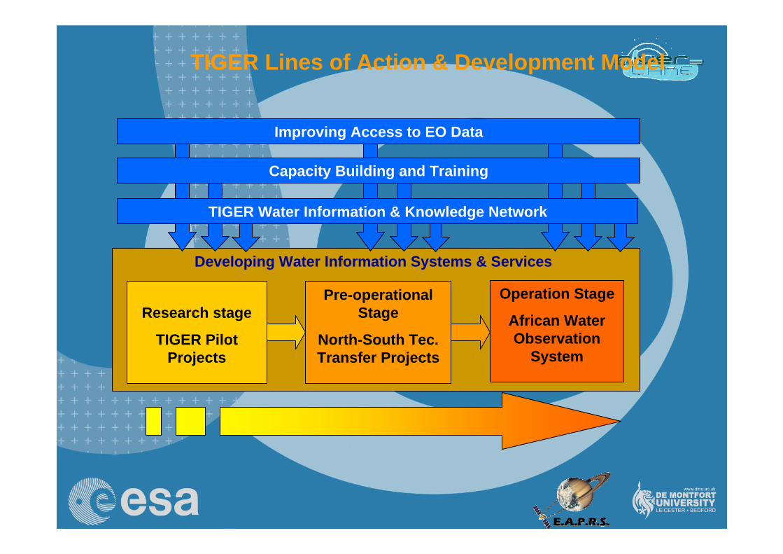
TIGER Lines of Action & Development Model
Research stage
TIGER Pilot Projects
Pre-operational Stage
North-South Tec. Transfer Projects
Operation Stage
African Water Observation
System
Improving Access to EO Data
Capacity Building and Training
TIGER Water Information & Knowledge Network
Developing Water Information Systems & Services
51
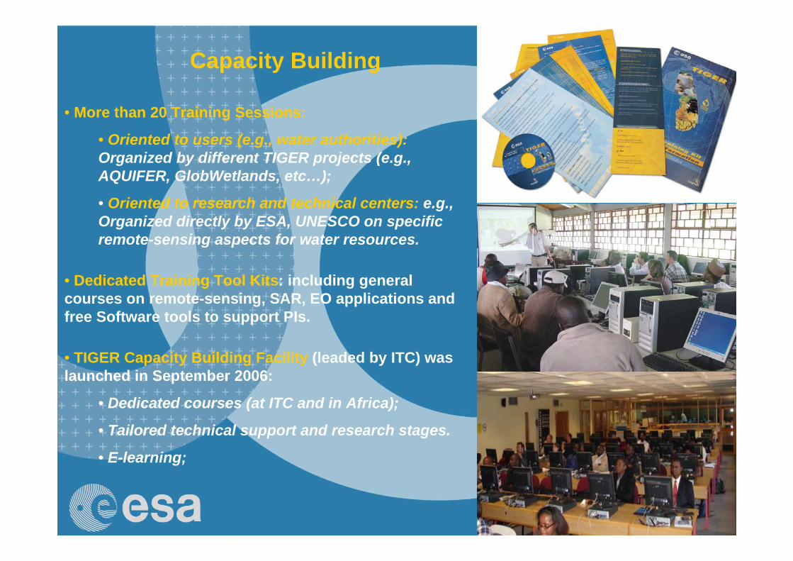
Capacity Building
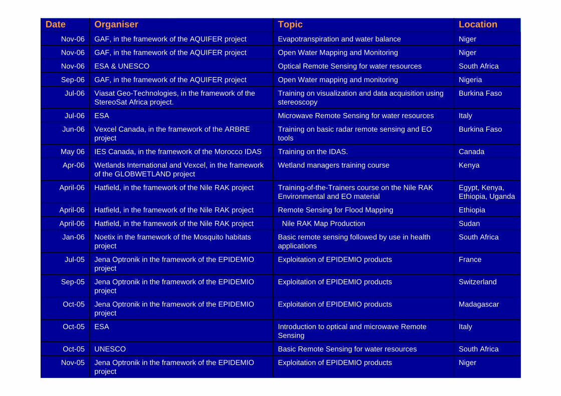
• More than 20 Training Sessions:
• Oriented to users (e.g., water authorities):Organized by different TIGER projects (e.g., AQUIFER, GlobWetlands, etc…);
• Oriented to research and technical centers: e.g., Organized directly by ESA, UNESCO on specific remote-sensing aspects for water resources.
• Dedicated Training Tool Kits: including general courses on remote-sensing, SAR, EO applications and free Software tools to support PIs.
• TIGER Capacity Building Facility (leaded by ITC) was launched in September 2006:
• Dedicated courses (at ITC and in Africa);
• Tailored technical support and research stages.
• E-learning;
52
NigerExploitation of EPIDEMIO productsJena Optronik in the framework of the EPIDEMIO project
Nov-05
South AfricaBasic Remote Sensing for water resourcesUNESCOOct-05
ItalyIntroduction to optical and microwave Remote Sensing
ESAOct-05
MadagascarExploitation of EPIDEMIO productsJena Optronik in the framework of the EPIDEMIO project
Oct-05
SwitzerlandExploitation of EPIDEMIO productsJena Optronik in the framework of the EPIDEMIO project
Sep-05
FranceExploitation of EPIDEMIO productsJena Optronik in the framework of the EPIDEMIO project
Jul-05
South AfricaBasic remote sensing followed by use in health applications
Noetix in the framework of the Mosquito habitats project
Jan-06
SudanNile RAK Map ProductionHatfield, in the framework of the Nile RAK projectApril-06
EthiopiaRemote Sensing for Flood MappingHatfield, in the framework of the Nile RAK projectApril-06
Egypt, Kenya, Ethiopia, Uganda
Training-of-the-Trainers course on the Nile RAK Environmental and EO material
Hatfield, in the framework of the Nile RAK projectApril-06
KenyaWetland managers training courseWetlands International and Vexcel, in the framework of the GLOBWETLAND project
Apr-06
CanadaTraining on the IDAS.IES Canada, in the framework of the Morocco IDASMay 06
Burkina FasoTraining on basic radar remote sensing and EO tools
Vexcel Canada, in the framework of the ARBRE project
Jun-06
ItalyMicrowave Remote Sensing for water resourcesESAJul-06
Burkina FasoTraining on visualization and data acquisition using stereoscopy
Viasat Geo-Technologies, in the framework of the StereoSat Africa project.
Jul-06
NigeriaOpen Water mapping and monitoringGAF, in the framework of the AQUIFER projectSep-06
South AfricaOptical Remote Sensing for water resourcesESA & UNESCONov-06
NigerOpen Water Mapping and Monitoring GAF, in the framework of the AQUIFER projectNov-06
NigerEvapotranspiration and water balanceGAF, in the framework of the AQUIFER projectNov-06
LocationTopicOrganiserDate
53
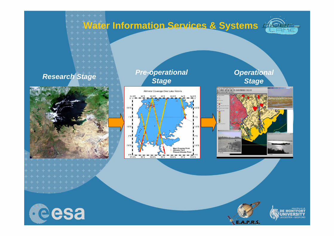
Water Information Services & Systems
Research Stage Pre-operational Stage
Operational Stage
54
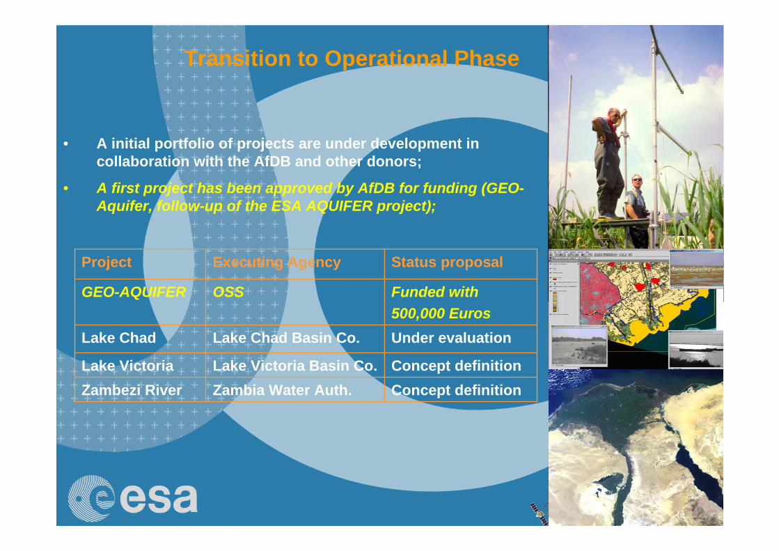
• A initial portfolio of projects are under development in collaboration with the AfDB and other donors;
• A first project has been approved by AfDB for funding (GEO-Aquifer, follow-up of the ESA AQUIFER project);
Transition to Operational Phase
Funded with500,000 Euros
OSSGEO-AQUIFER
Concept definitionZambia Water Auth.Zambezi RiverConcept definitionLake Victoria Basin Co.Lake Victoria
Under evaluationLake Chad Basin Co.Lake Chad
Status proposalExecuting AgencyProject
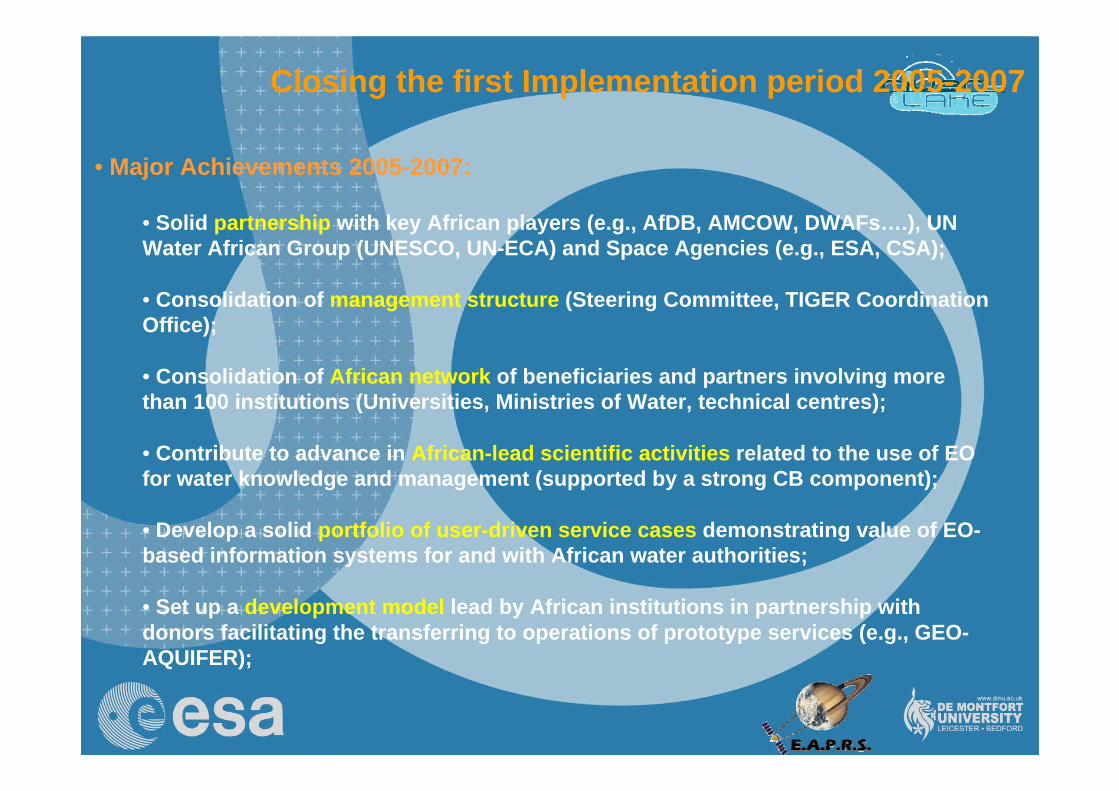
55
• Major Achievements 2005-2007:
• Solid partnership with key African players (e.g., AfDB, AMCOW, DWAFs….), UN Water African Group (UNESCO, UN-ECA) and Space Agencies (e.g., ESA, CSA);
• Consolidation of management structure (Steering Committee, TIGER Coordination Office);
• Consolidation of African network of beneficiaries and partners involving more than 100 institutions (Universities, Ministries of Water, technical centres);
• Contribute to advance in African-lead scientific activities related to the use of EO for water knowledge and management (supported by a strong CB component);
• Develop a solid portfolio of user-driven service cases demonstrating value of EO-based information systems for and with African water authorities;
• Set up a development model lead by African institutions in partnership with donors facilitating the transferring to operations of prototype services (e.g., GEO-AQUIFER);
Closing the first Implementation period 2005-2007
56
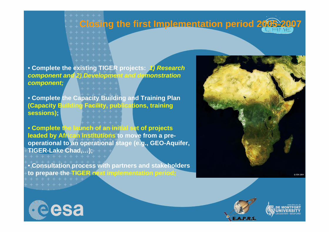
Closing the first Implementation period 2005-2007
• Complete the existing TIGER projects: 1) Research component and 2) Development and demonstration component;
• Complete the Capacity Building and Training Plan (Capacity Building Facility, publications, training sessions);
• Complete the launch of an initial set of projects leaded by African institutions to move from a pre-operational to an operational stage (e.g., GEO-Aquifer, TIGER-Lake Chad,…);
• Consultation process with partners and stakeholders to prepare the TIGER next implementation period;