Embed Size (px)
Citation preview
RICE UNIVERSITY
iSUPER NAFTA LAND
by
Richie Gelles
A THESIS SUBMITTED IN PARTIAL FULFILLMENT OF THE REQUIREMENTS FOR THE DEGREE
Master of Architecture
APPROVED THESIS COMMITTEE
Carlos Jimerjlaquoz Professor Architecture
bull~JH r laquo raquo r l i
Fares el-Dahdah Associate Professor Architecture
Eva Franch Wortham Fellow Architecture
HOUSTON TEXAS
MAY 2009
UMI Number 1466778
INFORMATION TO USERS
The quality of this reproduction is dependent upon the quality of the copy
submitted Broken or indistinct print colored or poor quality illustrations
and photographs print bleed-through substandard margins and improper
alignment can adversely affect reproduction
In the unlikely event that the author did not send a complete manuscript
and there are missing pages these will be noted Also if unauthorized
copyright material had to be removed a note will indicate the deletion
UMT UMI Microform 1466778
Copyright 2009 by ProQuest LLC All rights reserved This microform edition is protected against
unauthorized copying under Title 17 United States Code
ProQuest LLC 789 East Eisenhower Parkway
PO Box 1346 Ann Arbor Ml 48106-1346
ABSTRACT The Mexico US border is a line of division between two nashytions but paradoxically a moment of connection between loshycal border communities These competing interests of the border region at the federal and local scales have created a dyshynamic hybridized and rapidly growing regional zone known as the third space The emerging potential of this third space as an economic engine has been jeopardized by US immigrashytion policies which insist on understanding the border as a line rather than its spatial reality as a blurred zone of transishytion
Free trade agreements such as NAFTA open up borders for goods and capital but restrict the flow of the people SUPER NAFTA LAND is a critique of the militarized linear border It presents an alternative model of using mega infrastructures to establish border regions as independent bi-national zones of freedom productivity trade and culture open to the peoshyple of both countries
ACKNOWLEDGEMENTS Mom + Dad the coolest parents of all time and remote render farmers Bro composer of the official SUPER NAFTA LAND sound track and infamous purveyor of genius
NkiruMokwe design brainstormer starvation preventer and girl friend extraordinaire Asma Husain mega photoshopper and spectacular roommate Melissa McDonnell photoshopper deluxe and gigantic satellite plan aggregator Tzu-yu Chen photoshopper of endless fields of goats and comic book speech bubble section scaley inserter Timmie Chan photoshopper of mega miniatures and triple section scaley placer Jen Daniels Underwater photoshopper annual life saver and fellow Gator Adam Casey post-punk photoshopper and fellow Gator Jonathan Hutchison border thesis topic initiator and fellow Gator Fede Cavallos + Parents gracious hosts of Lobo Creek Ranch in Laredo Texas
Carlos Jiminez architectural poet ultra low stress operator and ultimate movie recommender Eva Franch design pusher work encourager and emissary of Utopia Fares el-Dahdah the ultimate chillaxer Albert Pope thesis focuser Fianuna Montezemolo media recommender and border anthropologist
Houston chopped and screwed epicenter
TABLE OF CONTENTS
02 THE DAILY INTERNATIONAL COMMUTE
OPERATION NAFTA GATE
THE SECURE FENCE ACT OF 2006
THE FLUVIAL BORDER
LEARNING FROM THE SISTER CITIES
MAPPING THE THIRD SPACE
iSUPER NAFTA LAND
NOTESBIBLIOGRAPHY
ILLUSTRATION INFOPHOTO CREDITS
08
18
22
30
40
50
85
93
jSUPER NAFTA
Top Jumping the Fence Bottom Commuting to San Diego 03
04 The International Daily Commute
Left Satellite Image of the Border Right Video Stills of Tijuana OS
06 The International Daily Commute
Photos of Laredo and Nuevo Laredo 07
^X-
^ P amp S M
08
OPERATION NAFTA GATE In the early 90s two pivotal political acts clearly defined the United States federal policy on how movement across the border would be controlled NAFTA and Operation Gatekeeper
The North American Free Trade Agreement or NAFTA is a trilateral free trade bloc in North America created by the governments of the United States Canada and Mexico The agreements were signed in December 1992 by the leaders of the three countries mdash Brian Mulroney of Canada Carlos Salinas de Gortari of Mexico and Bill Clinton of the United States but did not come into effect until January 1 1994 It is the trade bloc is the largest in the world and second largest by nominal GDP comparison1 After the ratification of NAFTA trade between the US and Mexico expanded rapidly tripling in only 10 years Mexico in particular has become increasingly reliant on the US to drive its economy with 88 of exports and 56 of imports shipped to or from its northern neighboor2 The United States economy is much larger and more diversified but Mexico still ranks as its third largest trading partner Economically the two countries are increasingly intertwined
Operation Gatekeeper was a Clinton-era security operation on the United States-Mexico border near San Diego California According to the Immigration and Naturalization Service the goal of Gatekeeper was to restore integrity and safety to the nations busiest border Operation Gatekeeper was announced in Los Angeles on September 17 1994 by US Attorney General Janet Reno and was launched two weeks later on October l3 Congressman Duncan Hunter obtained surplus military landing mats to use as a border fence between San Diego and Tijuana Stadium lighting ground sensors and infra-red cameras were also placed in the area That militarization of the border had begun Apprehensions decreased dramatically in that area as the aliens crossed in different regions Despite the wishes of
Top Illustration of NAFTA Bottom Wal-Mart Wall 09
bullraquo V
10 Operation NAFTA Gate
the federal government to control immigration via increased security on the border illegal immigration numbers most closely follow the comparative economic conditions between the two nations In 1995 the peso was devalued and the US was in the midst of an economic boom causing immigration to increase dramatically4 In 2000 and 2001 after the dot com bubble crashed and 9-11 the US economy slowed down and immigration follow suit The militarization of the border has had little effect on the nation wide immigration numbers but instead has cause a steady increase in migrant deaths since programs such as Operation Gatekeeper were put into place5
Capital and goods have subsequently been able to freely traverse the Mexico US border while people and their labour have been strongly restricted This dichotomy in approaches has been the primary cause of the tremendous tension that shapes the border today
bull
r
U
1 bdquo raquoltamp
J
n
raquo bull bull amp
gt_
r
62-
i
laquo amp i ^ f n -
^
Stills from the SUPER NAFTA LAND Introductary Video 11
af mm mampm
^Ky
^JmJ^aH- I 0 bullbull
bull- m-raquo
bull4T
P f raquo V lt B bullbull bull
m mmm
ft- ^iMtt
-1003copy
w SUM JraquoSW atw bull
gSOtgcopy PDLiregSisect QMS bullamp-bull ^ a
aapwwgsi
-^a i i i^s(raquo l y lt2-jt ^ bull
k
- --gt
if s
HI
-
bullf
-v
Jg^
w
Jgt
H t
bull
17
fig
-trade gt ^ t S ^
^ raquo bull raquo
XR^ i -^^i 3 regIF-BDaSQflcopy
wBsracopy OiiP
4 laquofS3gi
5 ] a t o i i M ^ f laquo i f
12 Operation NAFTA Gate
bull
Y J j
bull
V
V Itl1- bdquo gtltrm-
flsectsect Him HDDS ft
bull bull bull laquo raquo
laquoi gt
Stills from the j SUPER NAFTA LAND Introductary Video 13
1
Szgtr-
mm-3 j bull-
W^ZJTTire =r S gt -i -iimdash -- a ^77 1535TW
8
7pound
f t
bullbull f
bull
^v5lff
mamp
c nreg9^Mtsectm HDH jsectreg agii
SaSS
14 Operation NAFTA Gate
mmmm msmm mm $mamp~ mm
lit ftliife
bull5lt
-1
ampgt - - i
Stills from the SUPER NAFTA LAND Introductary Video 15
T^
bullbullampampi
16 Operation NAFTA Gate
y^wtKicr^fliiiliMiMifl^iMc
PMIfPSlgCi K P - 4iimWmm
rtEmm bulliiimdHiEKS
x
i a
Stills from the j SUPER NAFTA LAND Introductary Video 17
-f gt^ ^ k
^tyj^raquo^^f gtlaquof--v fcH
B 4
raquoV if IMC^t^lt
| - raquo i v^x-^laquoitW^ -
mrmv mmswm^
vbdquo ( V
i S g i gtbull i bull bull bull
-5 1 v gt
pi^^ SJgtraquoprlaquofM
m~ laquo= fft
f ^VTVl^ r ^ ^hs^ i iK ^-MflfMiAixl
V X
V
i V
- lt
18
THE SECURE FENCE ACT OF 2006 The US-Mexican border es una herida abierta where the Third World grates against the first and bleeds And before a scab forms it hemorrhages again the lifeblood of two worlds merging to form a third country - a border culture
-Gloria Anzaldua Borderlands1
One of the original intentions of NAFTA was to decrease illegal immigration to the US by advancing Mexicos economic development This has been largely unsuccessful but NAFTA has had the pronounced effect of shifting and concentrating Mexicos economic growth to the border region It is estimated that in less then 25 years as much as 40 of the entire Mexican population may be living on the border2 This close proximity has made it even more likely for Mexicans to jump the fence in search of work Today undocumented workers primarily from Mexico make up an increasingly large percentage of the US labor force especially in the fields of construction and agriculture3
A response to the constant flow of illegal immigration the Secure Fence Act of 2006 requires the Department of Homeland Security to construct over 700 miles of double-reinforced fence along the US Mexico border It authorizes the installation of more lighting vehicle barriers and border checkpoints while putting in place more advanced equipment like sensors cameras satellites and unmanned aerial vehicles in an attempt to watch and control illegal immigration into the United States4 This is policy based on the understanding of the border as a secure line of division between people and cities an urbanism born of surveillance and exclusion5
Top Photo of Nogales Bottom A Fence Fantasy 19
UMMJtGIMjtO lUNNOilW OSHCT68S ltSyenwtwraquoMlaquod eurotetlreraquo8laquoMk
20 The Secure Fence Act of 2006
Photos of the Existing Border Wall 21
22
THE FLUVIAL BORDER The border itself is a migrant We didnt cross the
border the border crossed us goes the Latino immigrant saying1 The idea of the border as a permenatly fixed line in space is a mythology perpetuated by politicians and anti-immigration activists In reality the shape of the border and the spatial boundaries it defines change everyday
The longest section of the border between the US and Mexico is defined by the Rio Grande or as it is more ominously known in Mexico the Rio Bravo del Norte Meandering rivers however do not make the most reliable of boundaries and this one has a habit of throwing out oxbows that have put some bewildered farmers and their land in a new country2 In the case of the formerly Texan town of Rio Rico the river changed course and for the last 15 years the town and the land have belonged to Mexico even though most of the nearly 1000 residents who were born there claim US citizenship3 The United States - Mexico International Boundary and Water Commission was established in 1889 with the purpose of solving such disputes and has to date ruled on over 230 boundary shifts involving about 30000 acres of land4 Most rulings have been quickly resolved but the Chamizal Dispute created when a 1895 flood effectively ceded about 600 acres to El Paso at the expense of its Mexican neighbor Ciudad Juarez was not resolved until 19675 To make sure similiar problems did not rise again the commision decided to straighten 44 miles of the recalcitrant river and the line the bed with concrete so the Rio Grande and the border would no longer move6 To date the Mexican and American Governments have spent millions on course corrections and flood-control programs including the construction of canals dams and levees7 To prevent further disputes the commission has designated the official border as the deepest part of the river during the years of a survey taken in the 1960s all subsequent shifts in the rivers course are no longer recognized This means that the phantom river of 40 years ago is now the international border8 Even though heated words
mdash - raquo mdash Proposed US-Mexico Border Fence
Urban Areas
^ ^ H StateNational Parks
H | H Wildlife Management Areas
National Wildlife Refuges
I Laguna Atascosa
JHjH|| Lower Rio Grande Valley
^ ^ H Santa Ana
Map Showing Proposed DHS Wall Placement in the Rio Grande Valley 23
24 The Fluvial Border
from Washington and Mexico City often make it appear that the two neighbors want to build a good sturdy 2000 mile fence between them most of the line exists only on paper9
Rivers are naturally territorial and not strictly linear making it difficult and expensive to force a river into a neatly secured linear border The Department of Homeland Security has subsequently found it difficult to meet its mandate of building 700 miles of fencing along the border particularly in the Rio Grande Valley Due to a 1971 border treaty between the United States and Mexico no construction is permitted within the 100 year flood plain of the river meaning any future fencing would have to be built up to a mile inland leaving tens of thousands of Texans on the Mexican side of the fence This would create a swath of land in a kind of soverignty limbo with US citizens required to pass through border checkpoints to get to the grocery store and the doctor and ambulances to pass through Border Patrol checkpoints to get to them10 In order to get around some of these issues the Department of Homeland Security has designed a kind of movable fence that will sit on top of levees but be moved away from the river before it floods to avoid violating any international treaties11
Even in the desert the DHS has needed to develop a new kind offence that floats on top of and self-adjusts along with the ever shifting sand dunes always maintaining its 15 foot height and constantly altering the international boundary12
Over time borders are always fluctuating and now security technology has advanced enough to accomodate this need
Taken over its entire history the Mexico US border has shifted across the entire continent where huge swaths of nebulous territorial claims were gradually foccused down to well defined linear boundaries that wars could be fought over The boundaries between the US and Spain and subsequently Mexico have been defined and redefined by a mixture of treaties wars and revolutions Our current boundaries have more to do with 19th century legal agreements than the actual real life situation existing in and around the border region of the two nations today The reality of the border is not as a sharply defined static line in the sand but instead a dynamic and ever-fluctating extra-territorial zone
Top Bottom Right Satellite Photo and Diagram of Chamizal Area Bottom Left Floating Wall 25
Settlement 1963
aiHifi
U4LA
CiuJaJ JUMV
MI WCtt
26 The Fluvial Border
i raquo -bull - )
s V
Historical Boundaries of the United States and Mexico 27
i i 1
i sect
lb
bull
28 The Fluvial Border
Nv
bullbull n
amp
bull
Historical Boundaries of the United States and Mexico 29
gtpound2gt
m i bull
mmmm
f0^C
poundgt
30
LEARNING FROM THE SISTER CITIES
The only way the cities in this region can make it is to forget that a line and a river exist here
- former Ciudad Juarez mayor Gustavo Elizondo1
Over 90 of the 12 million residents of the border region live in the 14 sister cities that line the MexicoUS border2 These sister cities are the highly successful job creating dynamos that make the NAFTA economic machine run but they are faced with urban and societal problems entirely distinct from the typical border concerns held by the physically distant national capitals of Washington DC and Mexico City In order to solve these problems the sister cities have developed a strong degree of local interdependence effectively bypassing the international boundary that divides them As described by former Ciudad Juarez mayor Gustavo Elizondo Our [federal] governments treat us like a third country so we might as well act like one3 The degree to which the sister cities do act as single independent municipalities is astonishing The cities of Calexico California and Mexicali Baja California share police and fire protection across the border4 In Laredo Texas shoppers from Nuevo Laredo located just across the Rio Grande have made its Wal-Mart the highest grossing per square foot in the US5 In McAllen Texas 40 of all retail goods are sold to residents of its sister city Reynosa or other Mexicans6 El Paso Texas and its sister city Ciudad Juarez Chihuahua make up the largest border community in the world with over 2 million inhabitants and expanding at more than 5 annually7 El Paso and Juarez which are projected to run out of water by 2025 recently teamed up behind the backs of their federal governments to increase the amount of wastewater that Jaurez can channel to agriculture8 In order to combat shared municipal concerns such as crime disease water shortage and pollution El Paso and Juarez have signed more treaties than their national governments can keep track of let alone
Satellite Photo of Laredo Texas and Nuevo Laredo Tamaulipalus 31
r s OTT
v V
bull bull -
vraquo
1 I
fa-toi ^
t r bull
R 1 bull bullbull vt - bull bull gt f
bull-fin -bull f r - r s amp -- v gt J - 4^ lt raquo raquo ^ ^
f T raquoFj5tpound bullbull bull-bullbull ^ - bull- 9 ft laquo - - -c- vgt Vs J-
Mjk |W v yaL- bdquo ^ - - JV ^ - 2laquo- bdquo v ^ f l P 5 ^ 5- -b
-raquolaquoi J-
1 1
4a-iS
IS m$sreg mm
laquo rw
u 1
--
32 Learning From the Sister Cities
ratify9 It is a partnership forged out of necessity and survival and the sister cities are proud of their ability to take care of their problems at a local level faster and cheaper than any far away federal bureaucrat10
The positive economic growth and political cooperation of the sister cities is now jeopardized by the increasing militarization of the border When in the past people could freely walk from the Mexican side of Nogales to Nogales Arizona they now have to go through tedious Border Patrol security checks even to buy groceries or visit family right down the street It takes several hours for commuters to drive across the World Trade Bridge in Laredo Texas just to get to work Opposition to the Secure Fence Act of 2006 is unanimous amongst political leaders of the border cities As put by Mike Allen an executive president with the Economic Development Corporation of McAllen Texas Every single mayor from Brownsville to El Paso is against the border wall This will be a tremendous waste of money and it will not stop illegal immigration People will just go around it11 and the mayor of Brownsville Texas Pat Ahumada To appease people in middle America they are going to kill our communities along the border The rest of America has no idea how we live our lives here We are linked by the Rio Grande not divided by it12
By the year 2020 the border population is expected to double to 24 million people13 The problems in the border cities such as water scarcity drugs crime and pollution already operate on a national scale and will only continue to get worse Cooperation at the municipal level has allowed the sister cities to develop up to this point but local officials know they are tinkering at the edge of the crisis14 They are urging Washington and Mexico City to form autonomous regional authorities funded and staffed by both nations as a new supra-national method to handle the binational border regions existing problems and future growth15
Border Photos of Nogales Arizona and Nogales Sonora from 1898 and 2008 33
j raquo 1
E^gjugtm
34 Learning From the Sister Cities
Douglas AZ
Agua Prieta SON Pass TX
Piedras Negras COA
Calexico CA
Mexicali BCA t Naco AZ
Naco SON
Sister City Diagrams 35
Nogales AZ
Nogales SON
Ojinaga CHH
Brownsville TX
Matamoros TMP
36 Learning From the Sister Cities
ReynosaTMP
Columbus NM
gt
Cuidad Acuna
RioTX
Las Palomas CHH
Sister City Diagrams 37
Yuma AZ
San Luis Rio Colorado SON
38 Learning From the Sister Cities
San Diego CA
Tijuana BCA
Sister City Diagrams 39
Neuvo Laredo TMP
40 Mapping the Third Space
MAPPING THE THIRD SPACE The border is not where the US stops and Mexico begins It is where the US blends into Mexico
- former Laredo mayor Betty Flores1
It is often said that border is its own country Amexica neither Mexican nor American but a third space in between the line of the border expanded out into a new nation2 But if the border is no longer a line what shape does it take Whether mapping political boundaries transportation networks cultural influence or hydrology the shape of the border changes No matter which meta data is mapping the third space it appears as a kind of shifting animal like territory in the larger context Suddenly the act of building a border wall on the border line seems more like the violent act of a guillotine slicing a nation in half rather than a division between two very distinct places
After first revealing the border as a country unto itself further mappings reveal that there is a greater difference along the length the border than on either side In the far West solar radiation values are among the highest in the world but wind power potential is poor while in the East the opposite is true3 The Western half of the border is primarily federal land while the East is almost entirely privately owned In practice this has allowed the Department of Homeland Security to build fences with impunity in Arizona and California but unable to build at all having to deal with the multitude of angry property owners along the border in Texas The maps can be misleading in their apparent continuity however the urban density map reveals the third space as a series of disconnected islands For Amexica to continue to develop a new infrastructural system must be built that not only connects all the sister cities but is flexible enough to adapt to the various border conditions and productive enough to provide the all important border resources of food energy and water for the entire region
Political Map of the Border Region 41
42 Mapping the Third Space
i )QOf -lt^QOQj ^ 300 bull K=LOMETERS1
Left Transportation Map Right Hydrology Map 43
( iUi Ui l i i a i SUBAREAS OF THE HYDROREGtONAL BORDER ZONE
Brownsville
McAllen-
Matamoros
Reynosa
bull-bullNI fjjiiL-Bra-
Laredo-
yJf-OiiiiKi-jK
T- Nuevo Laredo
Eagle Pass | -- bull-_ Piedras Negras
Del Rio gtpound bull -J fCiudad Acuria
(bull Agua Prieta
r Jgt Q5 Nacraquo-- -I ~Ze t A
ct_iWtjoRWL^
Nogales
uis Rio Colorado
flilillliWyif
= ^ 3 R=bE-s AJ
44 Mapping the Third Space
as bull 493 HISPAN c [ J
Ma bull mn HISPAN c trade
70c -EMi) HISPANIC I J
raquo - 00 HISPANIC
Left Cultural Map Right Urban Map 45
v r
Brownsville Matamoros
McAllen leynosa
V$gt
M i - V bull bull f i l - f
bull bull bull bullKV- slt bull bull jlaquo j -r bull
bull - iL - ^ -V
KefilsRilB - mmm SltP
(iaslaquocopyilaquoKSi3i rap
ijiiissssM-iasssaHa
bull- copyaBSSBampreg4ii NN-airlaquo8aiiB
i s m reg
bullfesraquosbJiboasis
iGSSXS
bull s s s s
gt f5T
bull s3es
bull bull bull
gtbullbullbull-iass
VBte3
$ampsagas-
iampireg
siacopyst-
PERI-URBAN AREAS
URBAN ARLAS
50 100 bull bull I
3 K i mbull -
46 Mapping the Third Space
Brownsville-_Matamoros
mampmregwamp-
McAllen Reynosa
Laredo-mdash
bull-bullbull Nuevo Laredo
Eagle Pass ()
Del Rio (
bdquo v
r-
h
$
S C ElPasojpf l~f ^ f k Ciudail Juarez bull O-
if- -bull bull bullamp ColumbusoS-^Lnfiw 1
=2) ^^LasTafbmasy ^ gt W
43 - 52 kWh SQ METER DAY
52 - 63 kWh SQ METER DAY
63 - 75 kWh SQ METER DAY [_J
75 - 9 kWh SQ METER DAY [ |
3pci ki IMI in^-l
Left Sunlight Radiation Map Right Rainfall Map 47
48 Mapping the Third Space
P
Brownsville-xMatamoros
McAllen Reynosa
Laredo---
-bullbull Nuevo Laredo
Eagle Pass (~ I Piedras Negras
Del Rio ~ ) Ciudad Acuna
C ^ Ojinaga
ISO- -
J Ciudad Juarez
c deg u m b u s C ) L a s P a l o m a s deg
M ]bull Agua Prieta
Naco | 1
Nogales
amp
L v - gtgt i Sari
Ca l^ to i r ^ex iSa lb -
MegoQjTiJoana
Luis Rio Colorado
lt200WSQUARE METER (lt56 MS) (lt125 MPH)
200-300 WSQUARE METER (56-6 4 MS) (125-147 MPH)
300-400 WSQUARE METER (64-70 MS) (147-157 MPH)
400-2000 WSQUARE METER (70-119 MS) (157-178 MPH) bull
0 - 50- bull 10b
300 KILOMETERS1
Left Wind Speed Map Right Middle Hag of jSUPER NAFTA LAND 49
bull bull bull bull bull bull bull bull bull
bull bull bull bull - bull bull bull bull bull bull bull bull bull bull
bull bull bull bull bull
bull
50
jSUPER NAFTA LAND jSUPER NAFTA LAND begins with the idea of
border region sovereignty The third space become manifest as a political entity a neutral territory of mediation between the US and Mexico a place permeable for both Americans and Mexicans Secondly the connective corridor no longer the security fence tracing Border Patrol road but a high speed train and resource and communication pipeline connecting the islands of border urbanism into a new cohesive whole1
Out of this new nation and web of connective fabric a mega infrastructure of resource production begins to in fill This production infrastructure provides all the food water and energy requirements for the entire border population and is expanded accordingly The border now develops as an increasingly thickening zone of productivity and trade
By the end of the 21rst century SUPER NAFTA LAND has developed into a 2000 mile long artificial landscape of production that adapts to differences in the various border regions and interfaces with the existing sister cities SUPER NAFTA LAND is divided into 4 states each with a unique structural system and method of resource production related to the specific characteristics of its host region Estado de la Tierra extends from Mexicali to El Paso and is the bread basket of the nation featuring aeroponic farming pods using 1 10th the water of traditional farming methods and solar panels to best take advantage of the high levels of solar radiation2
3 Estado del Aire extends from El Paso to Matamoros and generates power for the entire border population with a huge floating wind farm array The hydrogen filled structural balloons are tethered to the ground at the sister cities which have expanded up into the structure Estado del Agua is the shipping fish farming and desalination center for [SUPER NAFTA LAND Finally Estado de Ciudad is a permeable wall condition of the project occurring only in LaredoNuevo Laredo El Paso Juarez and San Diego Tijuana strategically concentrating greater trade and connections at the 3 busiest ports of the border encouraging trans-border as well as cross-border trade
Left Production Modules Right Master Plan of jSUPER NAFTA LAND 51
PRODUCTION MODULES
BraquoUMMUMMU1B)
52 jSUPER NAFTA LAND
Y^i NUCLEAR(HELIUM COOLED) 20000000 MW
gtbull
^y^y i SOLAR 600000 MW
WIND 28000000 MW
WAVE 100000 MW
2500000 ACRE FEET TO POWER GENERATION ANNUALLY
48700000 MW ELECTRICITY
WATER COLLECTION DESALINAT 15500000 ACRE FEET ANNUALI
Resource Flows 53
RESOURCE FLOWS
20000000 ACRES OF AEROPONIC OCEAN
BASED FARMING
54 iSUPER NAFTA LAND
ACREAGE DISTRIBUTION
ESTADO DE LA TIERRA (25000000 ACRES)
AEROPONIC FARMING
ESTADO DEL AIRE (30000000 ACRES)
ESTADO DEL AGUA (2000000 ACRES)
WAVE POWER
SHIPPING MANUFACTURING HOUSING
FISH FARMING
Acreage Distribution 55
HOUSING PRODUCTION
NUCLEAR
bullC~
URBAN
WATER COLLECTION
56 jSUPER NAFTA LAND
Top Section Cut through Estado de la Tierra Bottom Section Zoom 57
58 SUPER NAFTA LAND
I SF
Aeroponic Farming on the Surface of Estado de la Tierra 59
^flampHL
bullbull4 tradeC iU bull - ^
60 SUPER NAFTA LAND
if
ijpoundi poundamppoundbull
A
^
^fe^ampll ^ WTt r
Top Rendered Section through Estado de la Tierra Bottom Section Zoom 61
bullmgt
62 jSUPER NAFTA LAND
Satellite Plan of Estado de la Tierra 63
bullgtbulllt
claquopound
Hr^
64 i SUPER NAFTA LAND
The Underside of Estado de la Tierra 65
iamp^^SF 3 -AH 1
amp gt
66 -SUPER NAFTA LAND
mampmampmMxik-
Top Left Aeroponic Pod Interior Bottom Left Super Maquiladora Right SCAPE Suit 67
SCAPE SUIT PROTECTION AND MOBILITY COMPONENTS
OXYGEN PRODUCTION FILTRATION SYSTEM
JETPACK (OPTIONAL)
ANTI ULTRA VIOLET CARCINOGEN
PROTECTIVE SHIELD
GAS MASK
PROTECTIVE VAUTEXreg SKIN
PROTECTIVE VAUTEXreg GLOVES
MAGBOOTS
68 SUPER NAFTA LAND
Section Cut Through Eagle Pass and Piedras Negras in Estado del Aire 69
- P bullbullbullraquo-gtbull ^ y^Sltr^^-
70 SUPER NAFTA LAND
Free Zone Above Eagle Pass and Piedras Negras in Estado del Aire 71
72 jSUPER NAFTA LAND
SSL
Left Flying Wind Power Right Rain Collection and Distribution in Estado del Aire 73
74 SUPER NAFTA LAND
Ymcopy copyin mm
jt o el
_e m
Top Section Cut through Port of Estado del Agua Bottom Section Zoom 75
f bullbull3
-y-i
bullK ^m ^w^v n fpound f bull4 V bull
gt-y
76 iSUPER NAFTA LAND
The Port of Estado del Agua 77
78 [SUPER NAFTA LAND
Underwater Living in Estado del Agua 79
JV3amp Vv AVgt
80 SUPER NAFTA LAND
-raquo
Jamplir
raquo gt 5 ampjr
L S ^
bull
^
gt -
s s f e s S a ^ ^ ^ i f e i ^ J ^ amppound
bull
MPjr ^f ampbull
Fish Farms in Estado del Agua 81
82 [SUPERNAFTA LAND
Left Section Cut through Estado de Ciudad Right Estado de Ciudad in San Diego Sprawl 83
sSIPPl mi
SA
fcW
J N
bull0
85
NOTES BIBLIOGRAPHY THE DAILY INTERNATIONAL COMMUTE 1 Fernando Romero Hyper Border The Contemporary USshyMexico Border and its Future Princeton Architectural Press New York 2008
2 Mexico - United States Border Wikipedia The Wikimedia Foundation Inc httpenwikipediaorgwiki Us_mexico_border
3 US Census Top Trading Partners - Total Trade Exports Imports October 2006
4 Nancy Gibbs A Whole New World Along the USshyMexican Border Where Hearts and Minds and Money and Culture Merge the Century of the Americs is Born Time June 112001
5 Ibid
6 Timothy Roche and Hilary Hylton Just Another Day in a Bridge Town Time June 11 2001
7 Jorge Mestre and Ivan Bercedo Borders Quaderns Borders eds Jorge Mestre and Ivan Bercedo Collegi dArquitectes de Catalunya Barcelona Spain 2001
OPERATION NAFTA GATE 1 North American Free Trade Agreement Wikipedia The Wikimedia Foundation Inc httpenwikipediaorgwiki Nafta
2 Jesus Canas and Roberto Coronado Cyclical Differences Emerge in Border City Economies Crossroads Economic Trends in the Desert Southwest Federal Reserve Bank of Dallas 2005 httpdallasfedorgresearchcrossroads2005 cross0501ahtml
87
3 Operation Gatekeeper Wikipedia The Wikimedia Foundation Inc httpenwikipediaorgwikiOperation_ Gatekeeper
4 Fernando Romero Hyper Border
5 Joseph Nevins Operation Gatekeeper The Rise of the Illegal Alien and the Making of the US - Mexico Boundary Routledge 2002
THE SECURE FENCE ACT OF 2006 1 Gloria Anzaldiia Borderlands Quaderns Borders eds Jorge Mestre and Ivan Bercedo Collegi dArquitectes de Catalunya Barcelona Spain 2001
2 Nancy Gibbs A Whole New World
3 Fernando Romero Hyper Border
4 The House approved The Secure Fence Act of 2006 (HR 6061) by a vote of 283-138 The Senate approved The Secure Fence Act of 2006 (HR 6061) by a vote of 80-19 including 2008 presidential candidates Biden (D-DE) Clinton (D-NY) McCain (R-AZ) Obama (D-IL) voting YEA Secure Fence Act of 2006 Govtrackus httpwwwgovtrackus congressbilltextxpdbill=hl09-6061
5 Teddy Cruz Border Tours Strategies of Surveillance Tactics of Encroachment Indefensible Space The Architecture of the National Insecurity State ed Michael Sorkin Routledge New York 2008
THE FLUVIAL BORDER 1 Rebecca Solnit Twenty-three Steps Across the Border and Back Against the Wall ed Michael Sorkin The New Press New York 2005
2 Ibid
3 Larry Rohter A Liquid Border Pays No Heed to
89
Diplomacy The New York Times September 261987
4 Ibid
5 Anthony DePalma US-Mexican Border A Shifting Line in the Mud The New York Times May 71996
6 Ibid
7 Larry Rohter A Liquid Border
8 Rebecca Solnit Twenty-three Steps
9 Anthony DePalma A Shifting Line in the Mud
10 Brian Finoki Flooding the Border with Security Preserves httpsubtopiablogspotcom August 7 2008
11Ibid
12 Floating Border Fence Gulf Times httpwwwgulf-timescom March 15 2006
LEARNING FROM THE SISTER CITIES 1 Nancy Gibbs A Whole New World
2 Alfredo Corchado and Tracy Eaton Is Mexico Turning into Columbia Dallas Morning News October 16 2005
3 Tim Padgett and Cathy Booth Thomas Two Countries One City Time June 11 2001
4 Robert Weitzel Can Obama Bridge Americas Wall of Ignominy httpwwwCountercurrentsorg August 14 2008
5 Timothy Roche and Hilary Hylton Just Another Day in a Bridge Town Time June 11 2001
6 Jesus Canas and Roberto Coronado Cyclical Differences
91
Emerge in Border City Economies
7 Padgett and Booth Thomas Two Countries One City
8 Ibid
9 Nancy Gibbs A Whole New World
10 Ibid
11 Weitzel Can Obama Bridge Americas Wall of Ignominy
12 Luis Alberto Urrea 12$ Billion Fence Adds Little or No Security httpwwwsfgatecom February 10 2008
13 Corchado and Eaton IsMexico Turninginto Columbia
14 Padgett and Booth Thomas Two Countries One City
15Ibid
MAPPING THE THIRD SPACE 1 Nancy Gibbs A Whole New World
2 Ibid
3 Solar Resource Maps National Renewable Energy Laboratory httpwwwnrelgovcspmodeling_analysis html
jSUPER NAFTA LAND 1 Stephan Truby 5 Codes On Architecture Paranoia and Risk 5 Codes Architecture Paranoia and Risk in Times of Terror Ed Igmade Birkhauser Basel 2006
2 Hydroponics Wikipedia The Wikimedia Foundation Inc httpenwikipediaorgwikiHydroponic
3 NREL httpwwwnrelgovcspmodeling_analysis html
93
ILLUSTRATION INFO PHOTO CREDITS
03 Top httpwwweziloncominformationuploadsus-mexico-bordergif
03 Bottom Google maps httpmapsgooglecom
04 Left Google maps httpmapsgooglecom
05 All Images jSUPER NAFTA LAND Introductory Movie
06 - 07 All Taken by Author
09 Top httpwwweumednetcursecon17NAFTAjpg
09 Bottom Wal-Mart Wall collage by the author Young Shopper sculpture by Duane Hanson
11 Top httpwwwwcensusgovforeign-tradebalance c2010html
11 Bottom Left and Right Jesus Canas and Roberto Coronado Cyclical Differences Emerge in Border City Economies Crossroads Economic Trends in the Desert Southwest Federal Reserve Bank of Dallas 2005 h t tp dallasfedorgresearchcrossroads2005cross0501ahtml
13 All Images SUPER NAFTA LAND Introductory Movie
13 Top Right Department of Homeland SecurityCBP
15 Evidence from Mexico Federal Reserve Bank of Dallas Conference 2005
17 Fernando Romero Hyper Border The Contemporary US- Mexico Border and its Future Princeton Architectural
95
Press New York 2008
19 Top Sgt 1st Class Gordon Hyde January 30 2007 http wwwarmymil- images200701302184army mil-2007-01-30-084335jpg
19 Bottom httpwwwweneedafencecom
21 All Images Diane Cook and Len Jenshel for National Geographic (May 2007) httpngmnationalgeographic c o m 2 0 0 7 0 5 u s - m e x i c a n - b o r d e r c o o k - j e n s h e l -photography
23 Department of Homeland Security
25Top Google maps httpmapsgooglecom
25 Bottom Left Floating Border Fence Gulf Times h t tp wwwgulf-timescom March 15 2006
25 Bottom Righthttpstrangemapswordpress com20080306
26-29 http wwwuintahbasintahorgmapsusterritories
JPg
ht tp en wik iped ia Org wik i ImageMexico_s ta tes_ evolutiongif
31 Google maps httpmapsgooglecom
33
h t t p w a l k i n g a l o ng t h e ra i l way s f i les wo r dp r ess com200902nogales
1437compjpg
34 - 39 Google maps httpmapsgooglecom
97
41 Fernando Romero Hyper Border The Contemporary US- Mexico Border and its Future Princeton Architectural Press New York 2008
42 Barton-Aschman amp La Empresa 1997 httpwww borderplanningfhwadotgovmapsairportsjpg httpwwwborderplanningfhwadotgovmapsrailroads jpgand httpaifmcsadotgovInternationalimagesmexusmap
JPg
43 Department of the Interior httpwwwcercusgsgov fccpubsFact_sheetsDOI_US-MX_Border_FCC_Fact_sheet_lpdf
44 US Census 2000
45 Columbia university center for international earth science information network NASA US Census2000
46 National Renewable Energy Laboratory
47 TTE Digital Mapping NCDC Cooperative Stations
48 National Renewable Energy Laboratory
49 Flag of the Republic of the Rio Grande
51 Google maps httpmapsgooglecom
52-53 FOOD LAND POPULATION and the US
ECONOMY by David Pimentel of Cornell University and Mario Giampietro Istituto of Nazionale della Nutrizione Rome httpwwwscribdcomdoc4949004Starpoint-Solar-ExSum-Executive-File httpenwikipediaorgwikiTemelC3ADn_Nuclear_ Power_Station h t t p m e d i a b a r o m e t e r o r s t e d u m e d i a s t o r a g e paper854news20090203NewsOsu-Gets66Million ForsuperHotSuperEfficientNuclearReactor-3609514
99
shtml httpwwwnrelgovcsptroughnetfaqshtml http wwwutilipointcomissuealertprintasp id=1728 h t t p t a s t y h a r v e s t c o m m e r c h a n t 2 m e r c h a n t mvcScreen=ZCOMampStore_Code=TH httpwwwmpsutilitycomTurbineStatshtm httpwwwindianacleanpowerorgrenewableresources html
99 Nkiru Mokwe Photo taken in January 2009 of Richie Gelles and Adam Casey at Big Bend National Park after a successful swim across the Rio Grande to Mexico and back
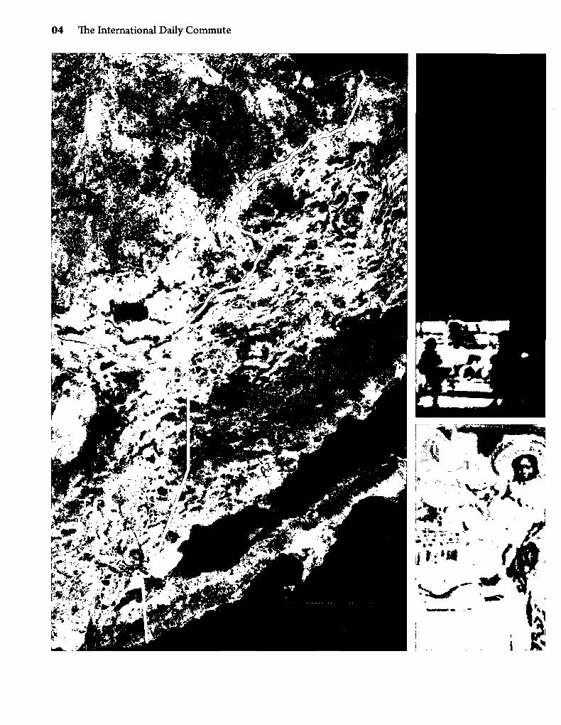
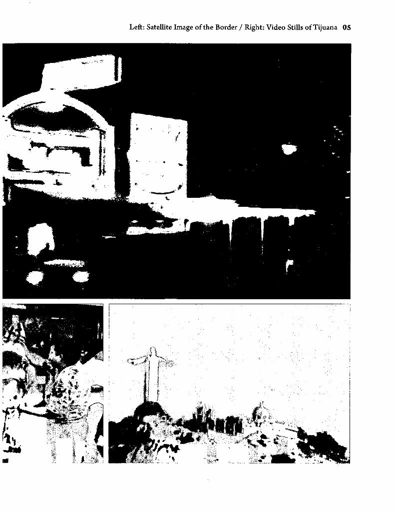
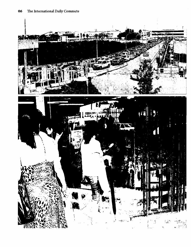
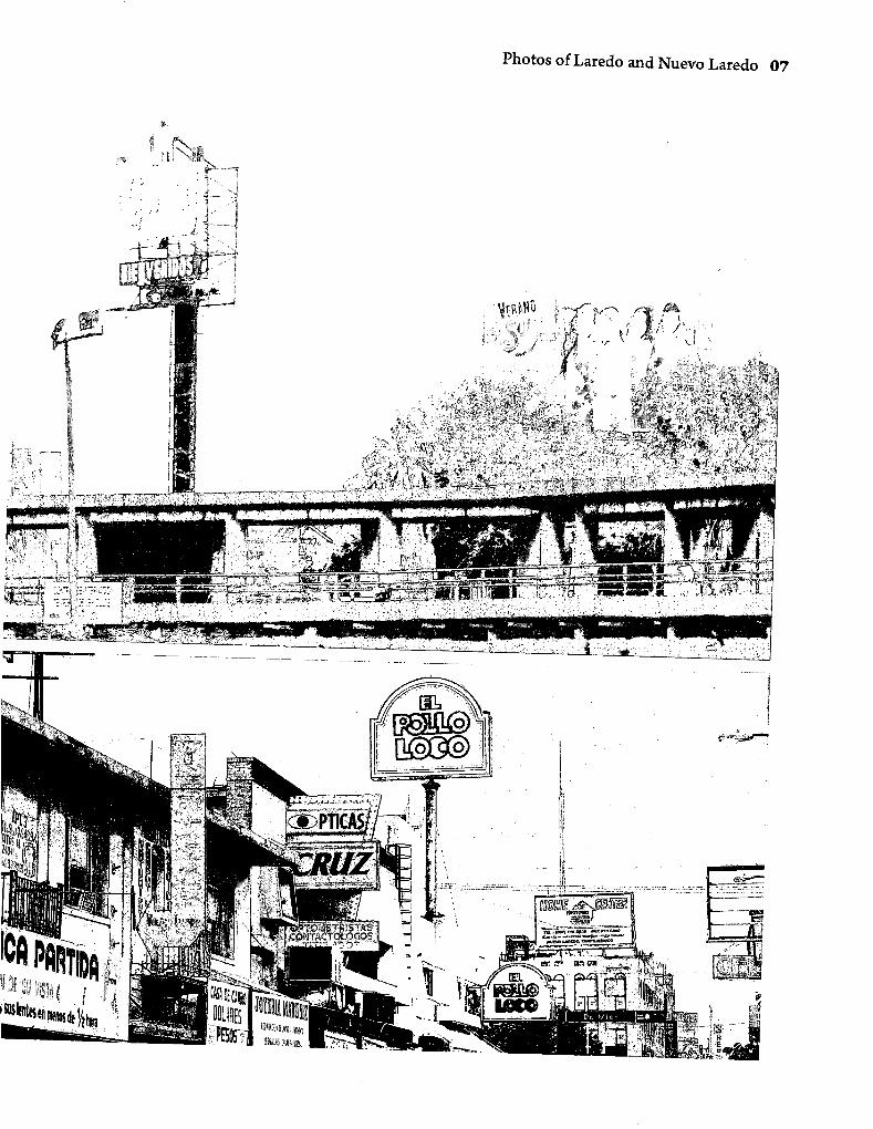
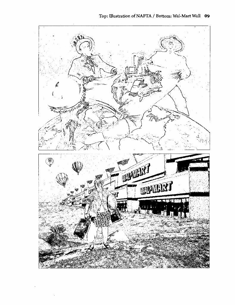
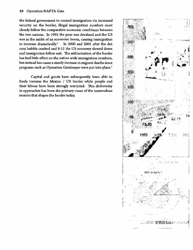
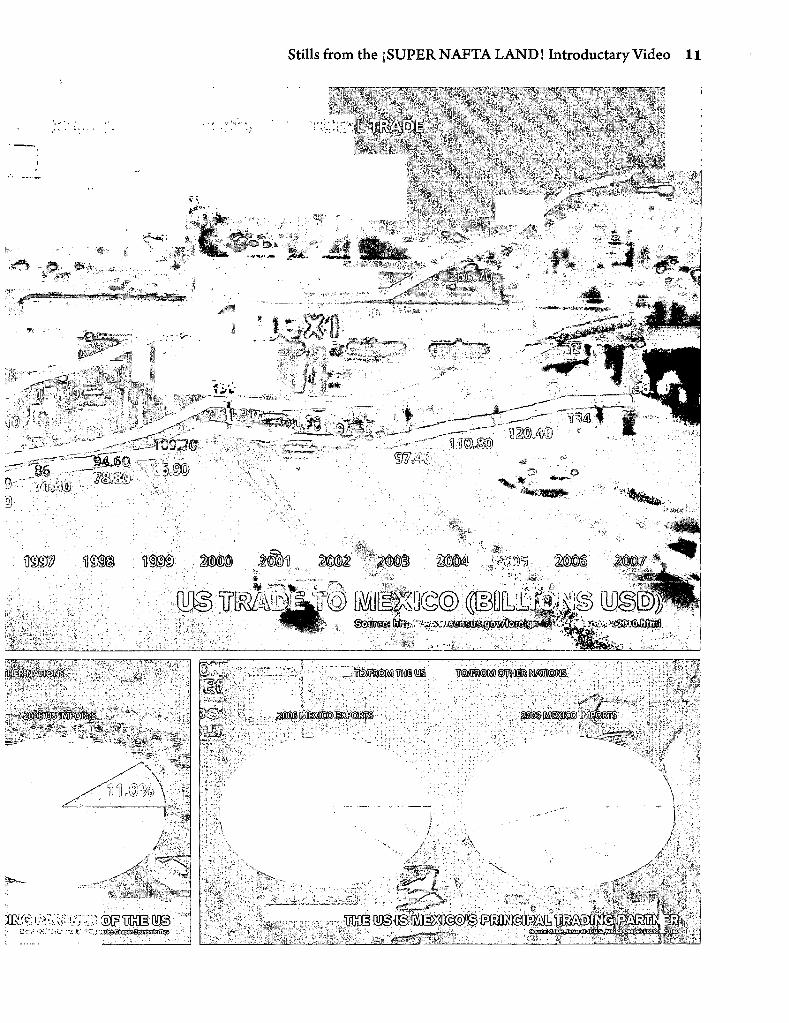
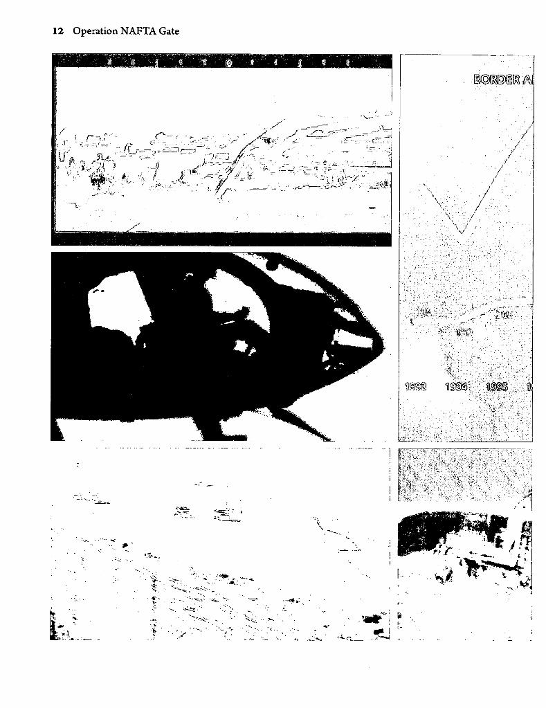
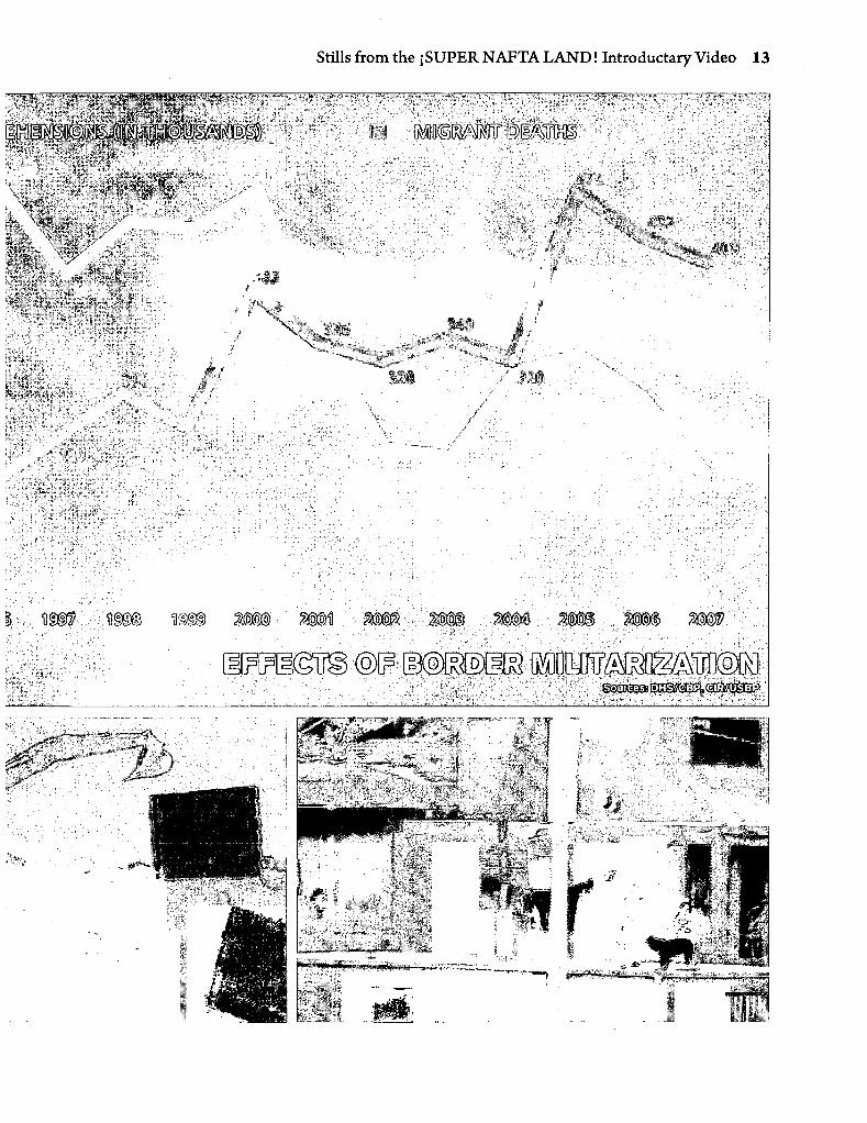
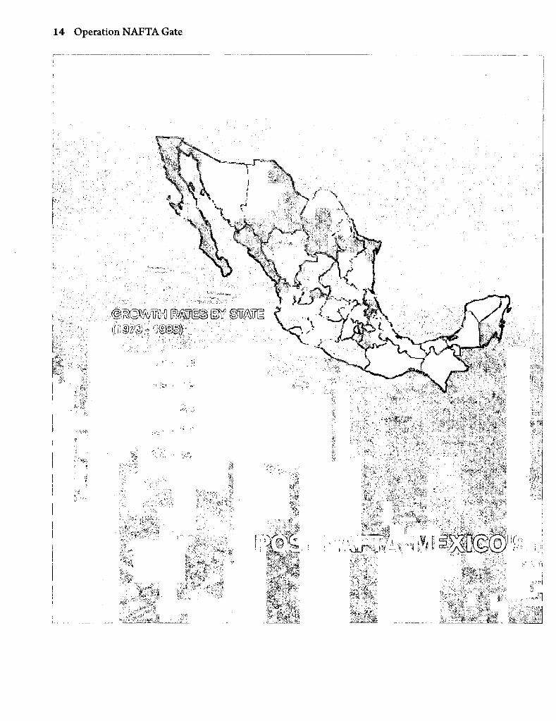
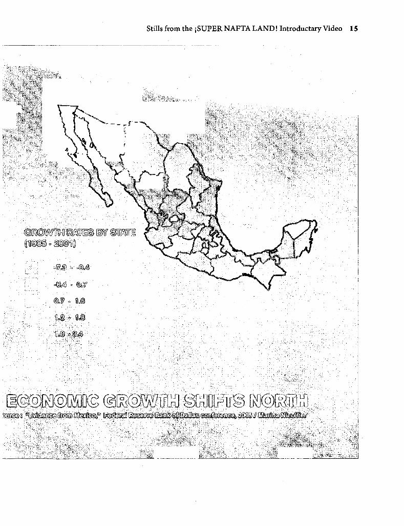
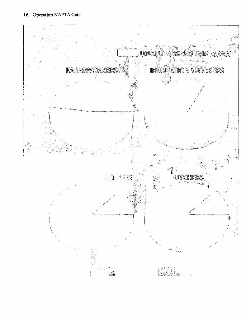
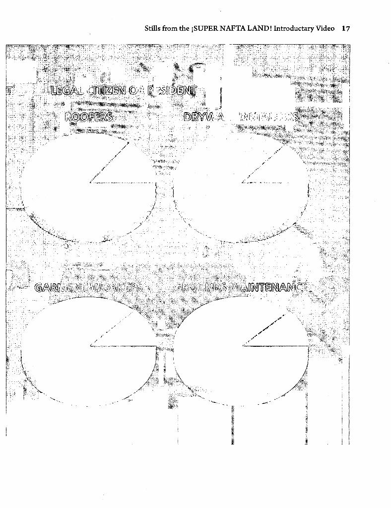
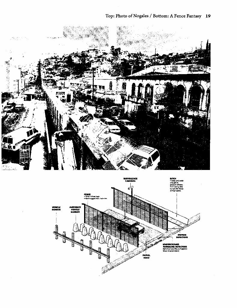
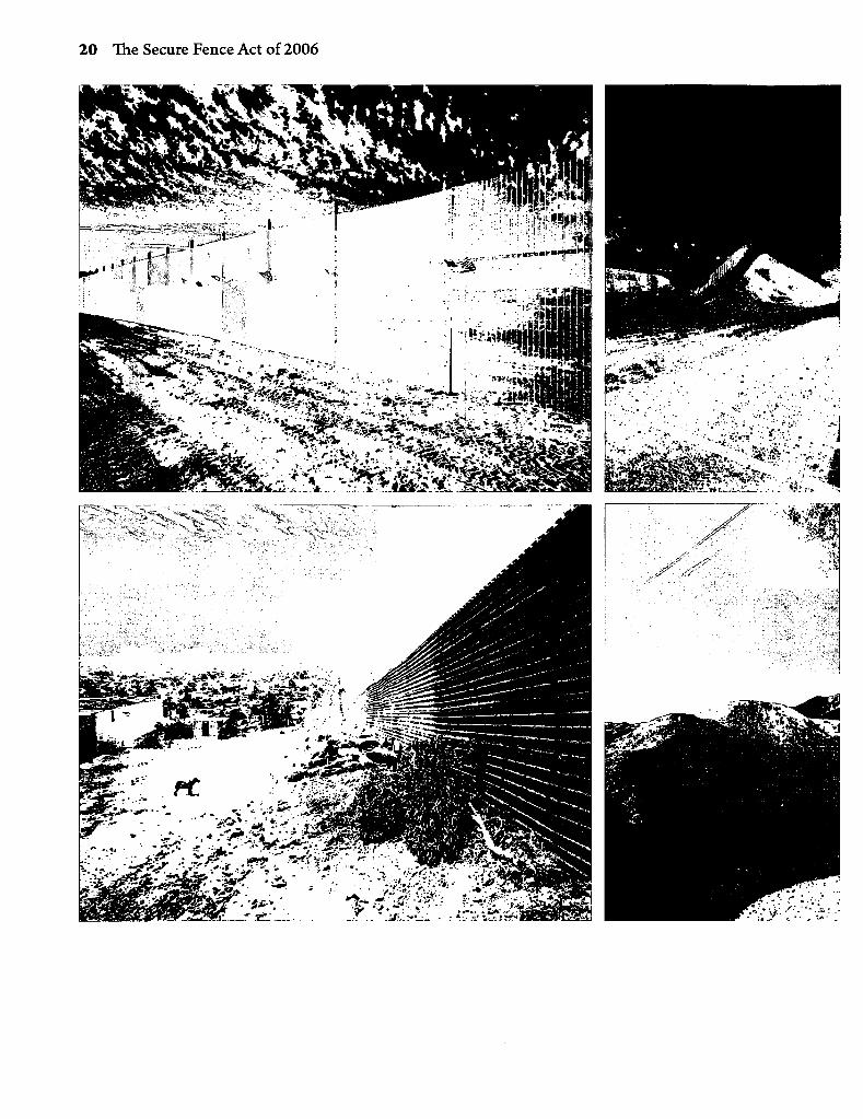
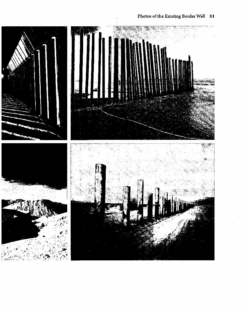
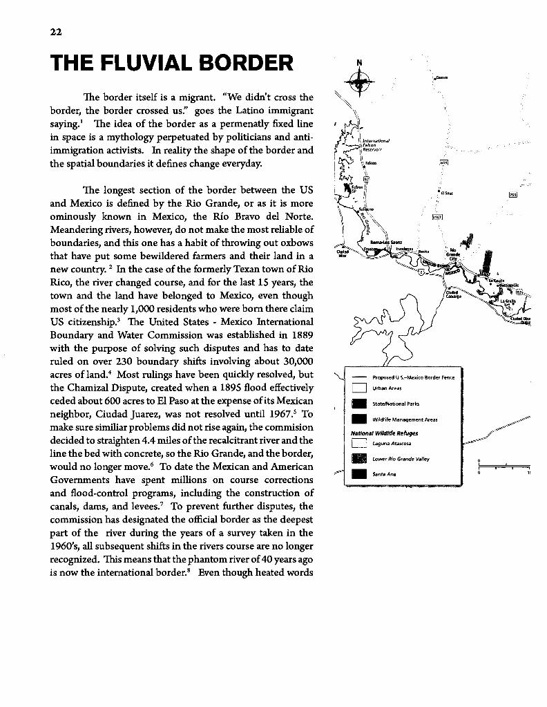
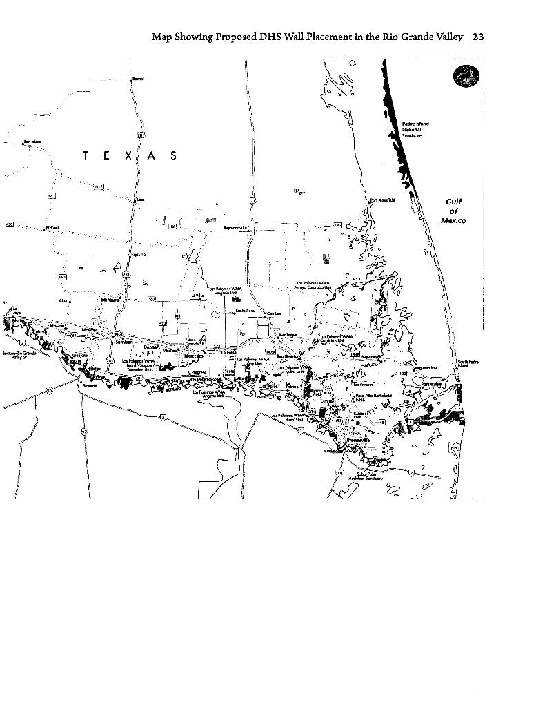
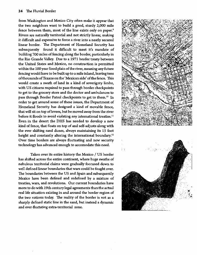
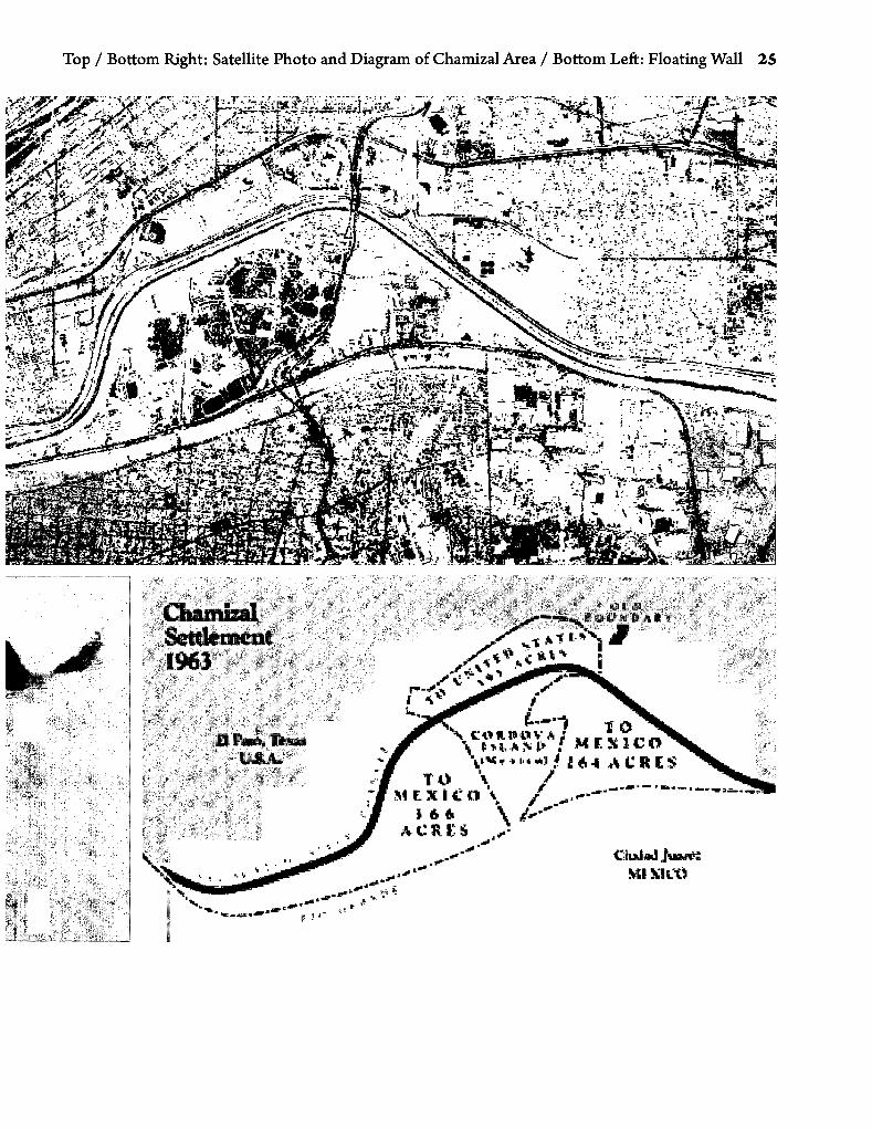
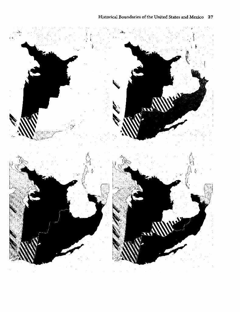
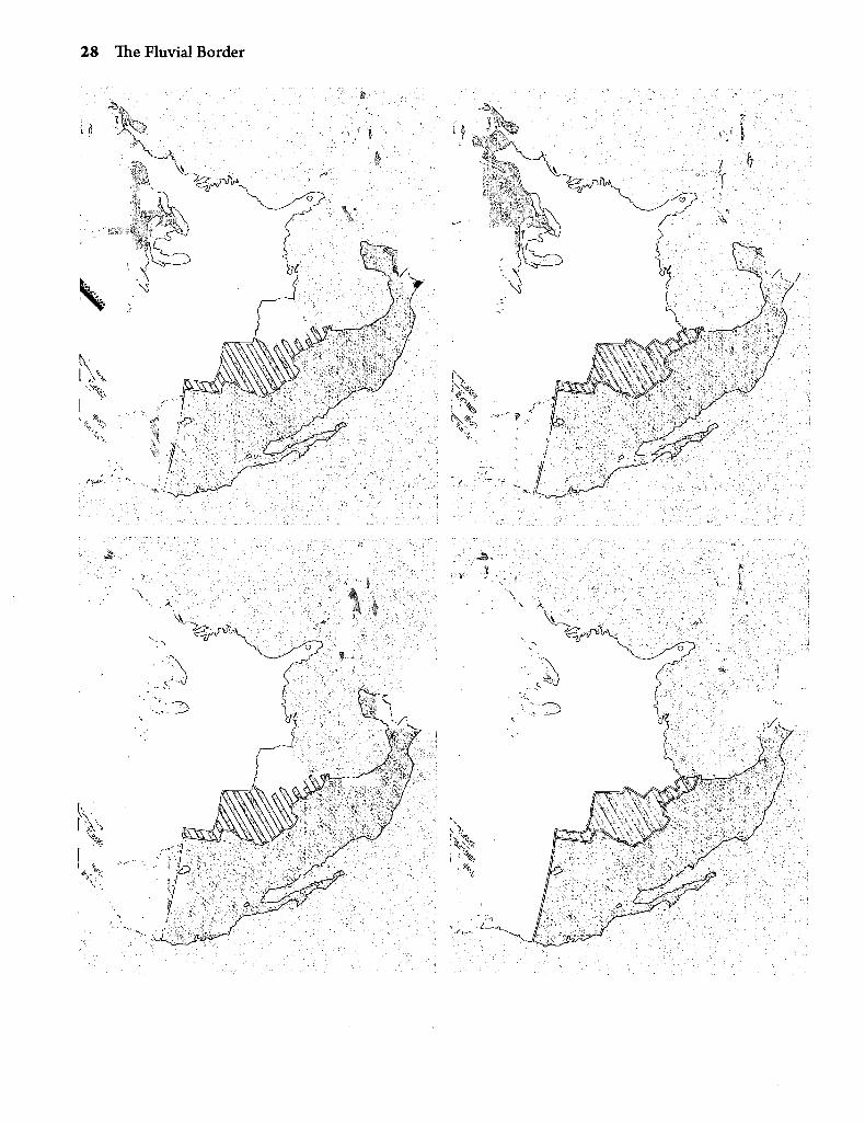
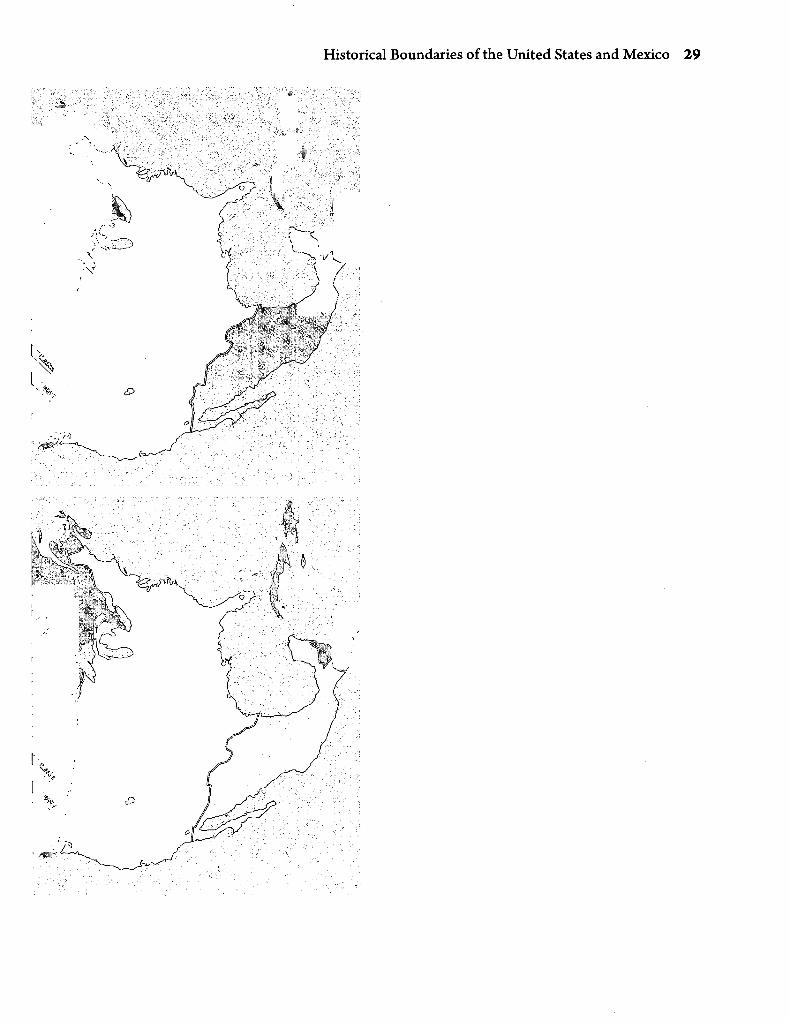
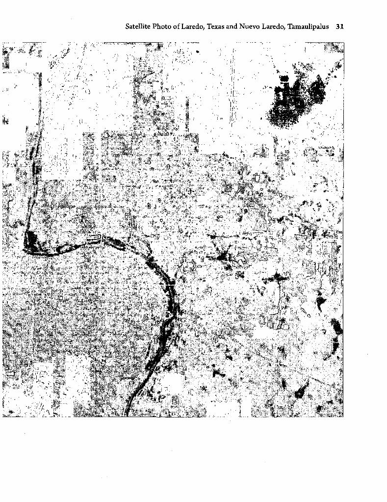
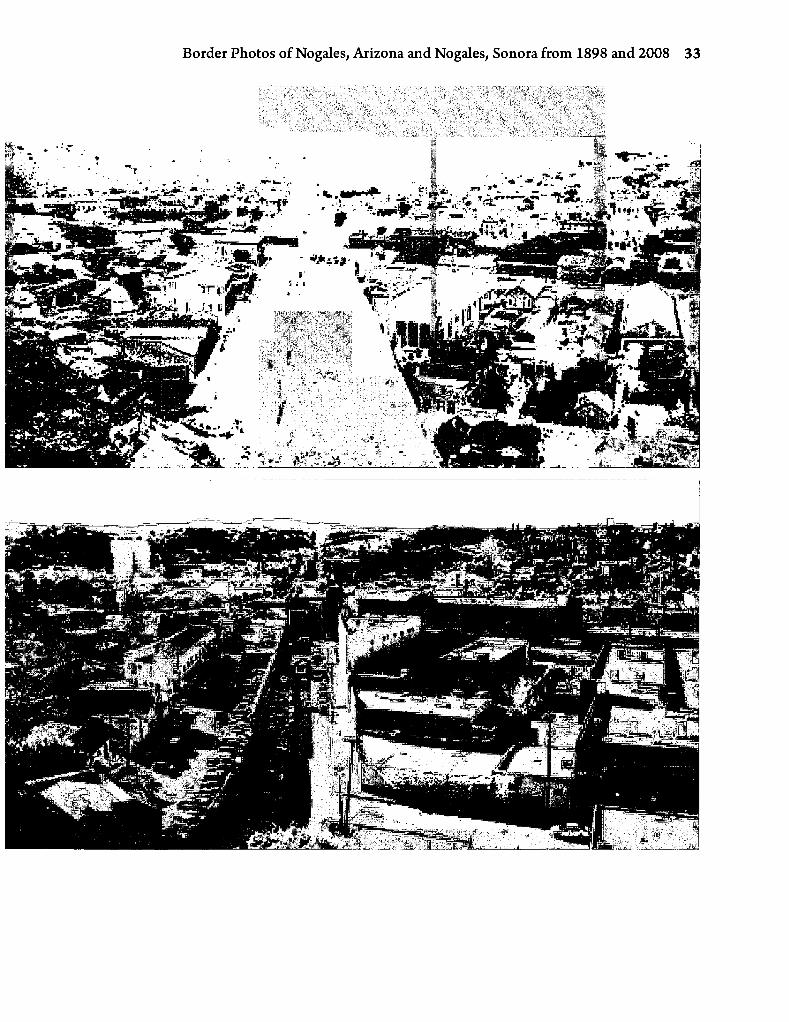
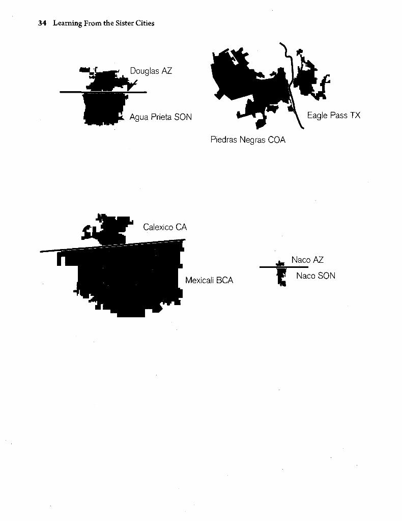
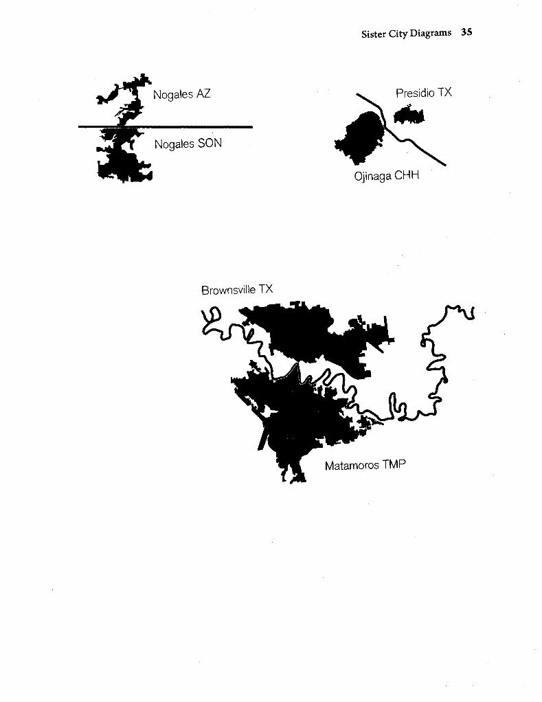
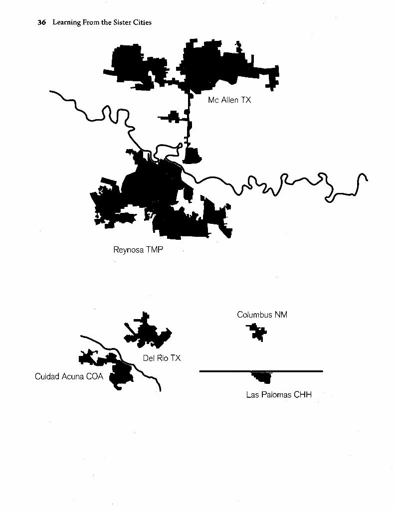
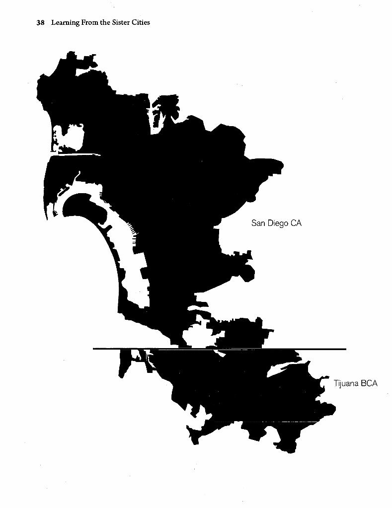
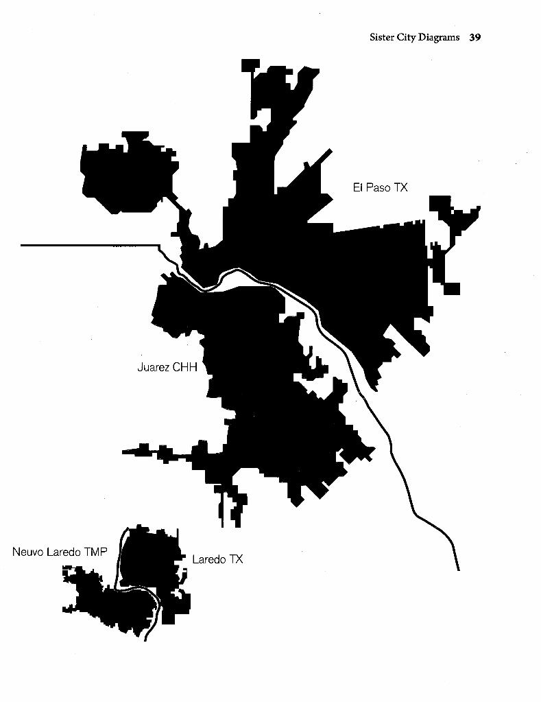
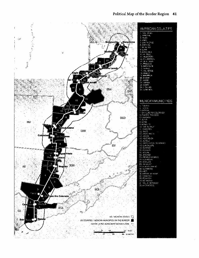
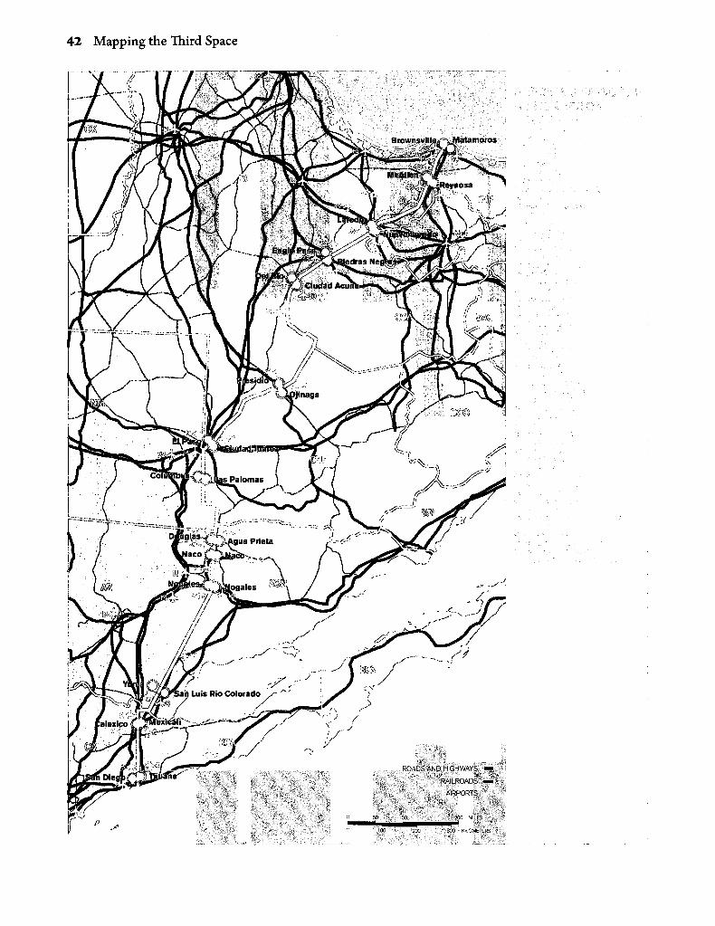
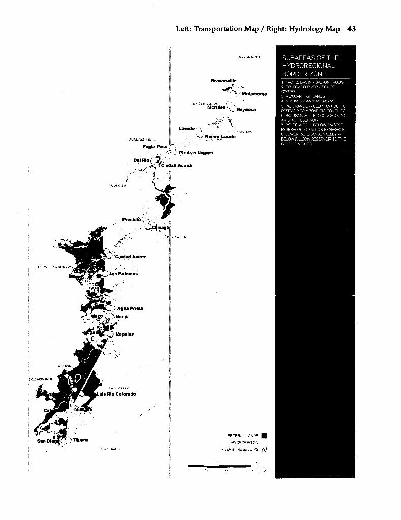
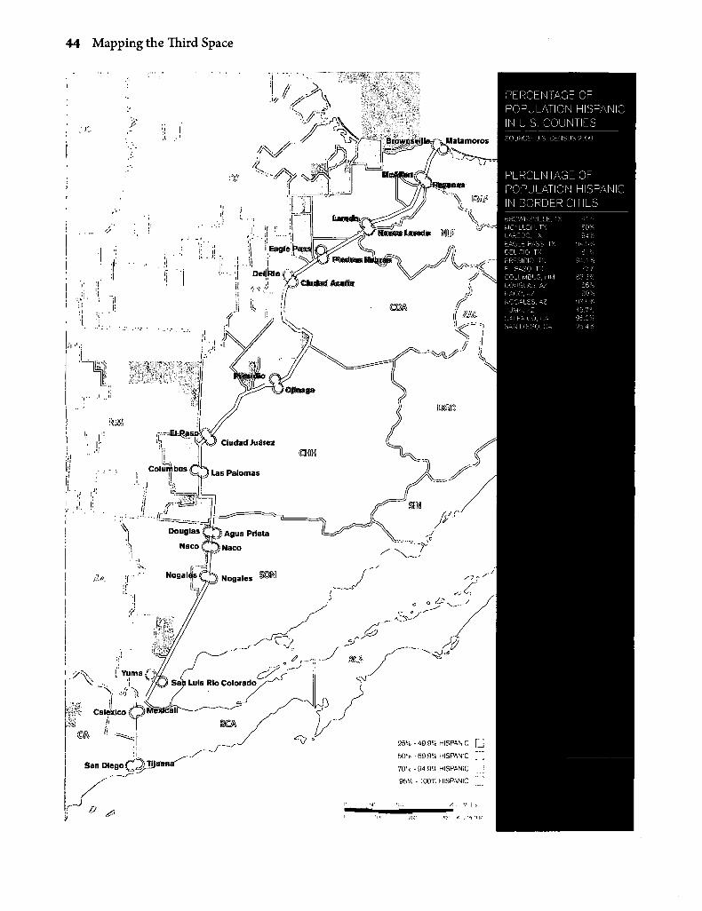
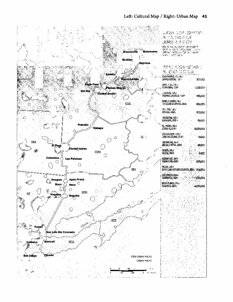
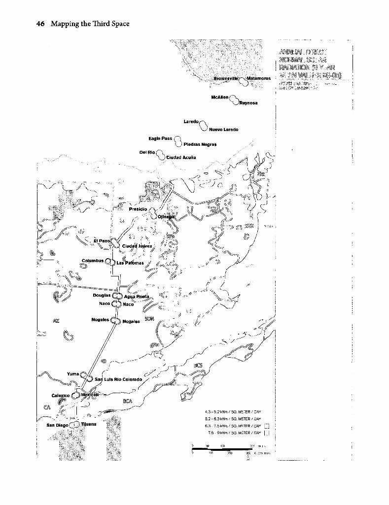
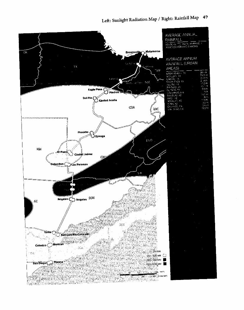
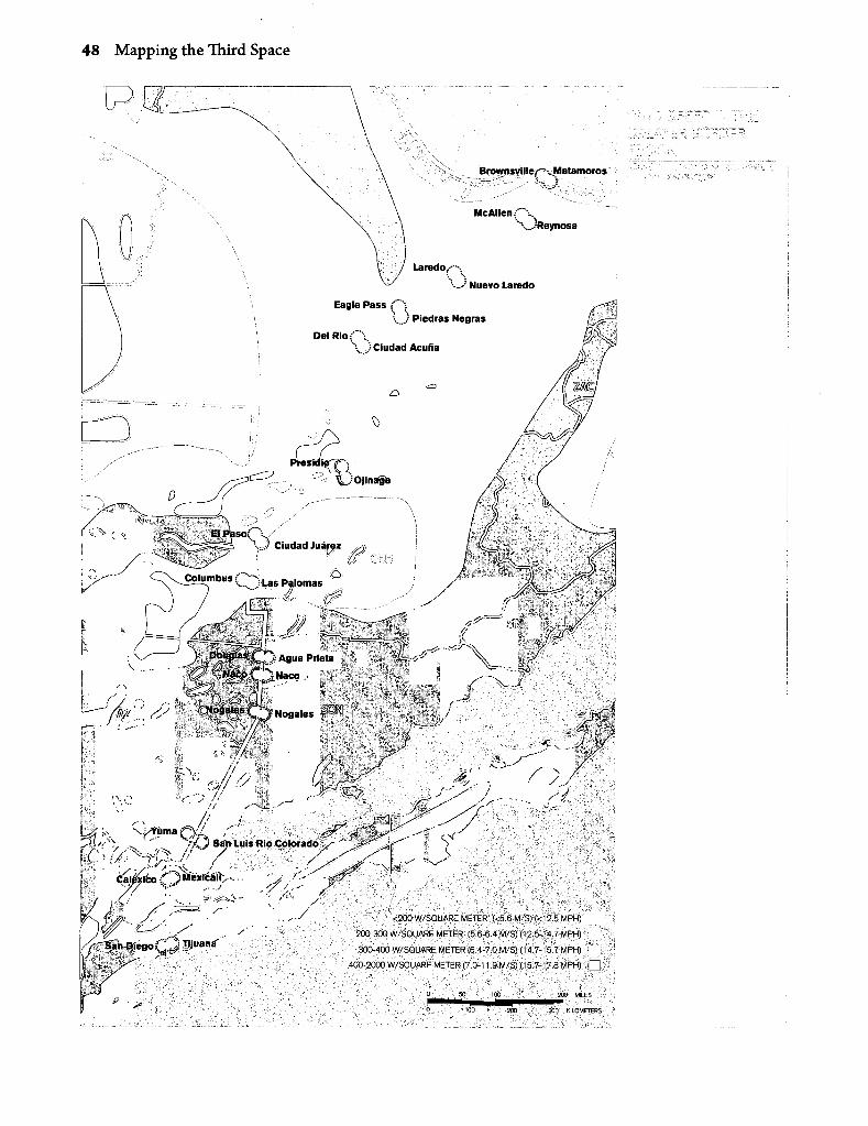
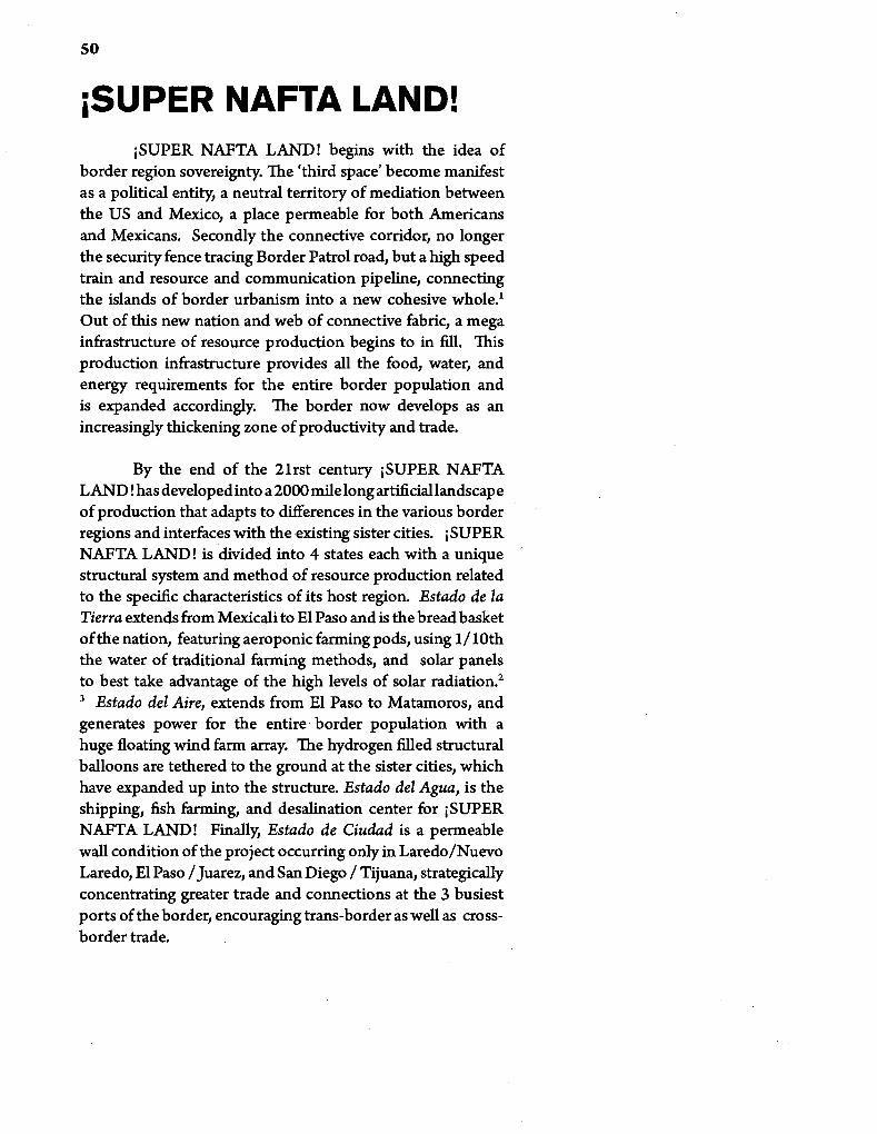
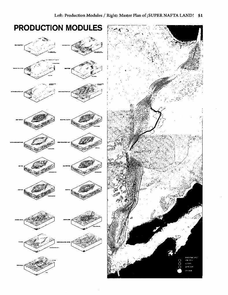
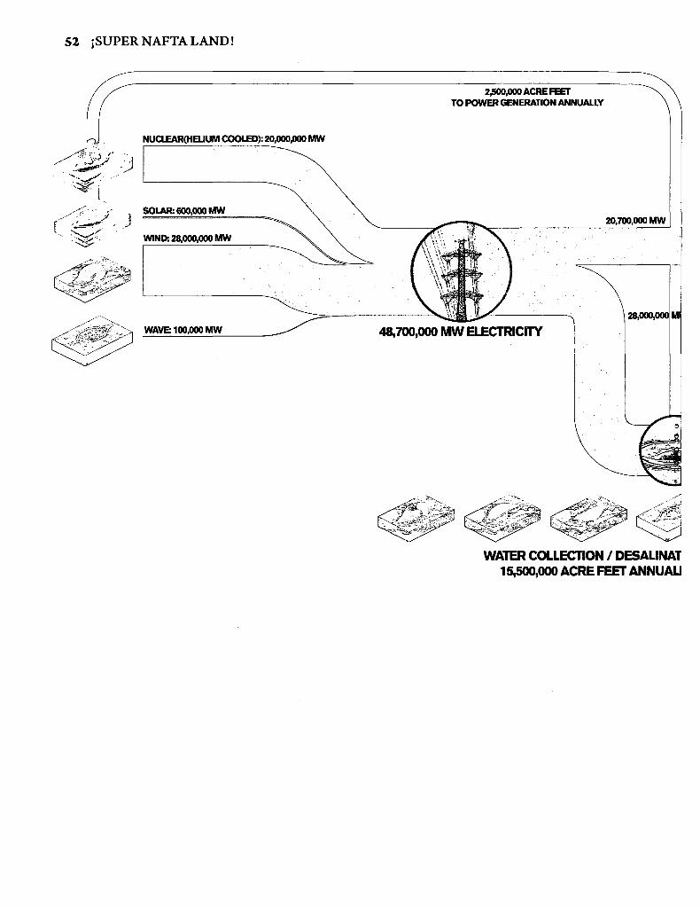
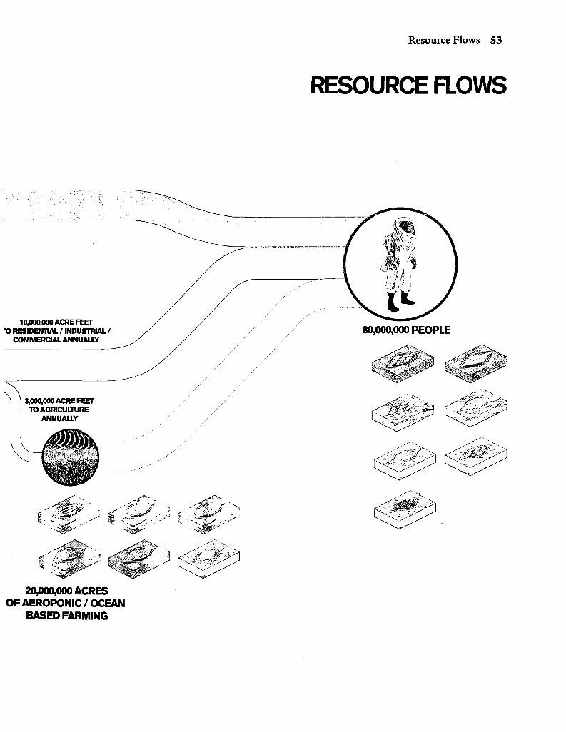
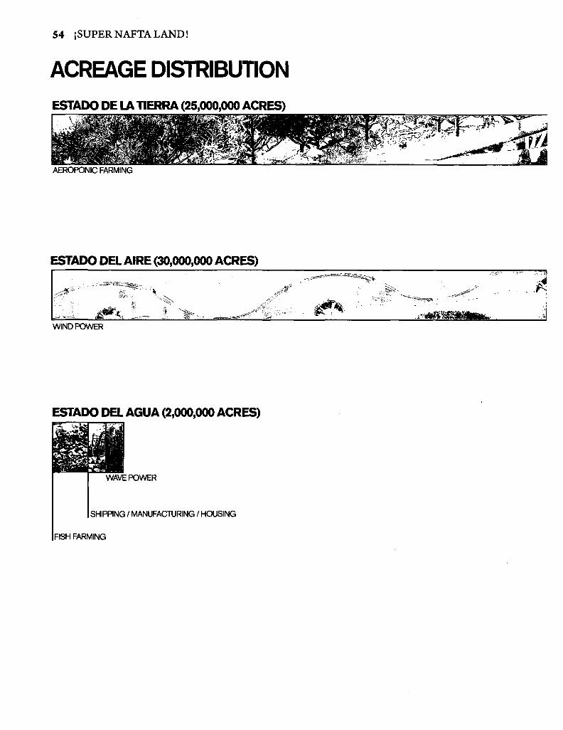
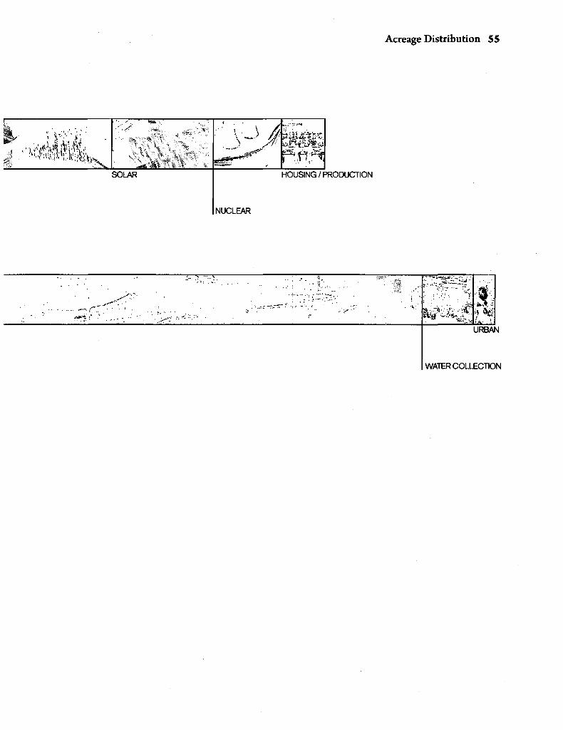
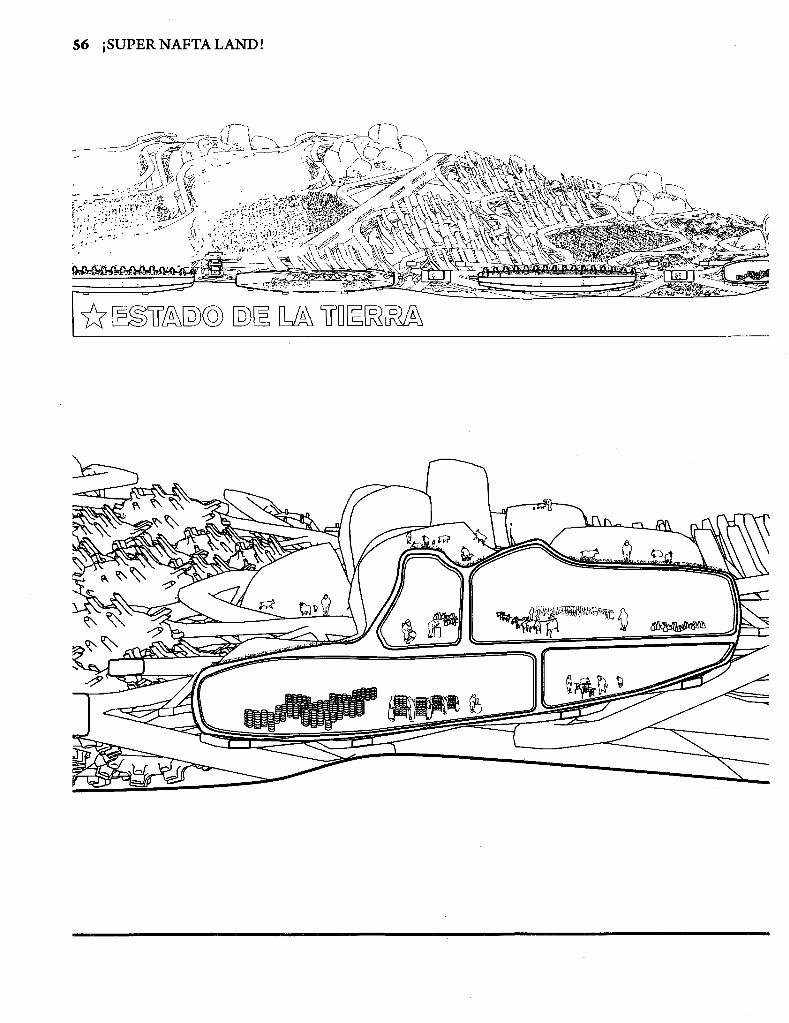
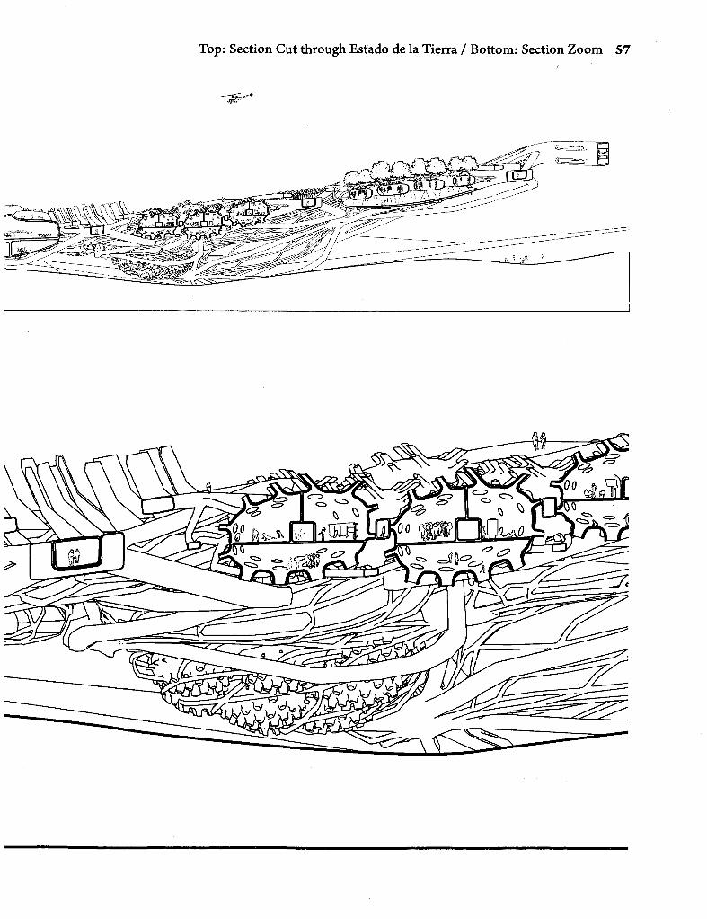
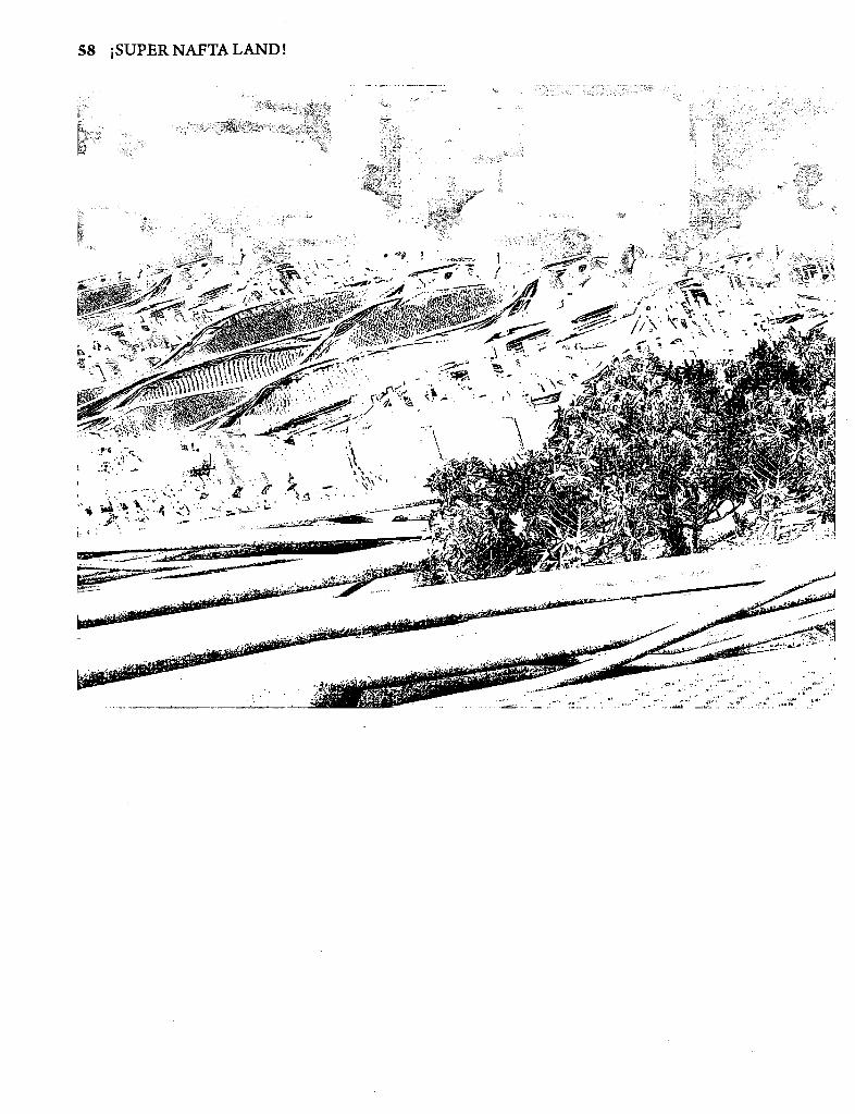
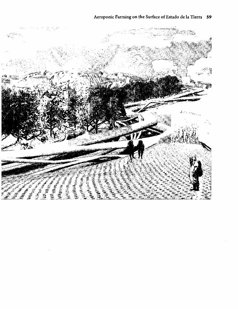
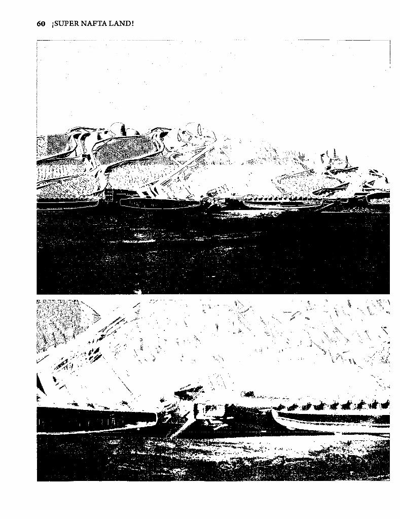
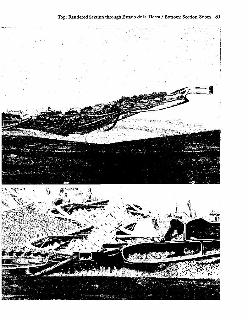
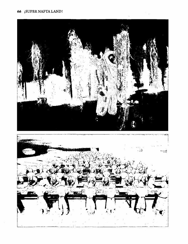
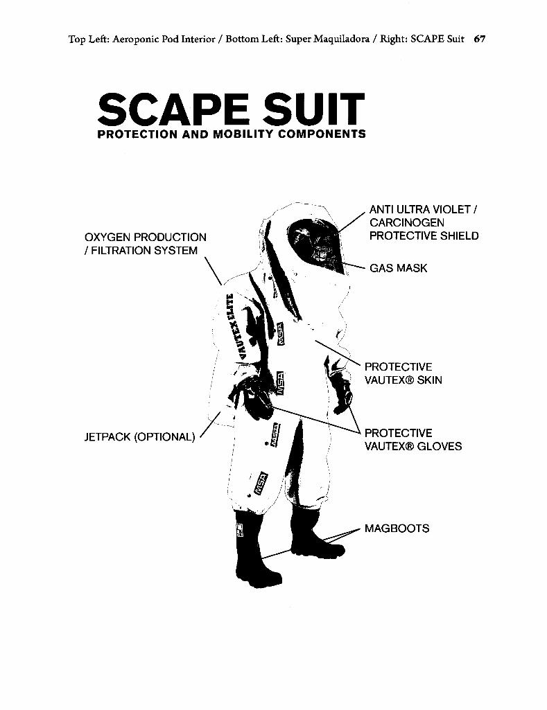
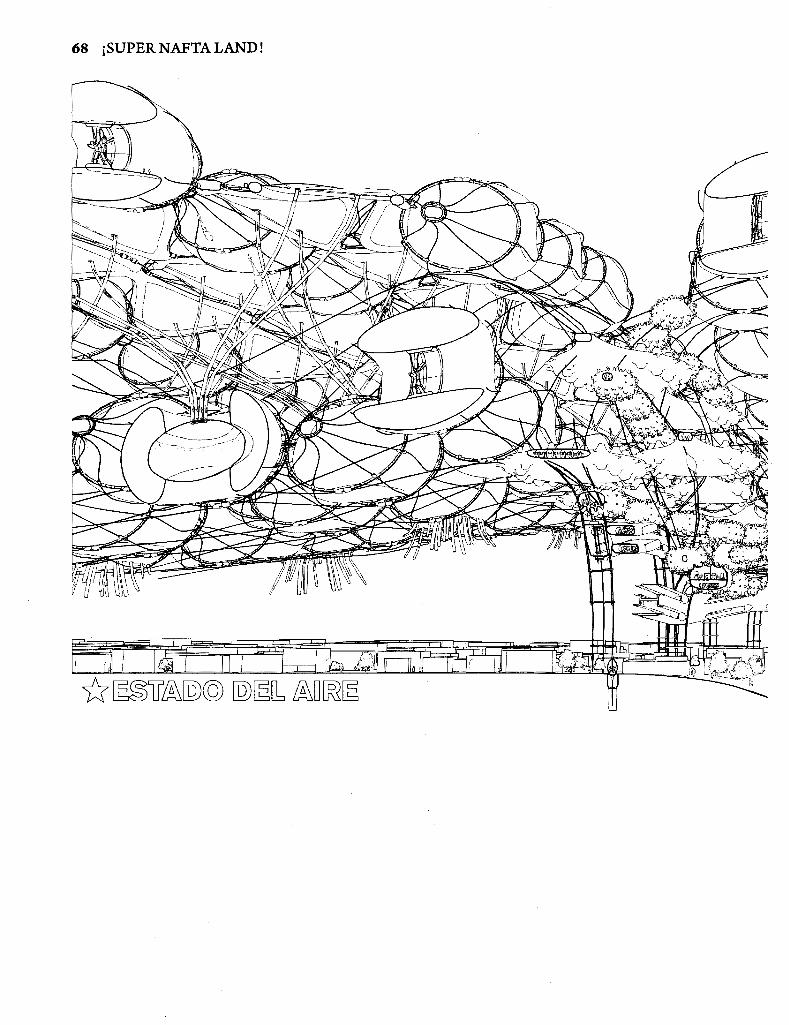
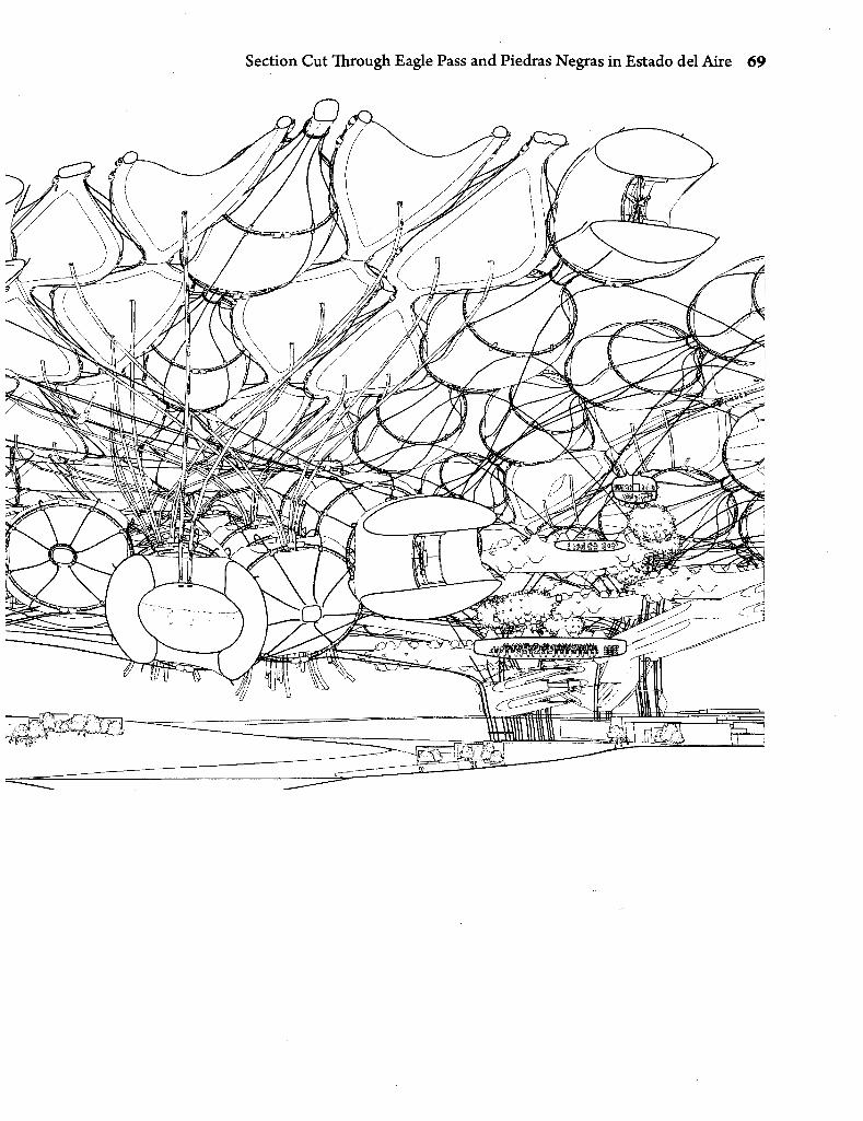
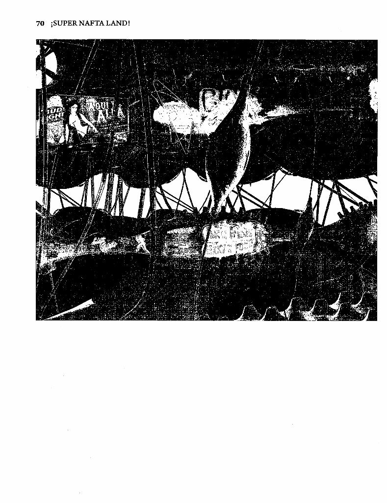
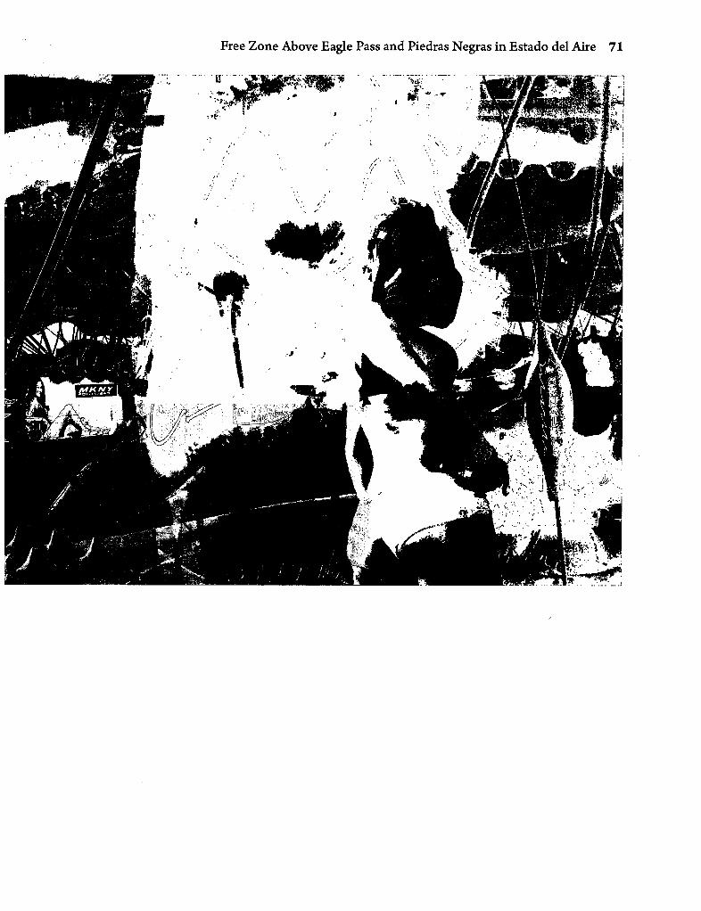
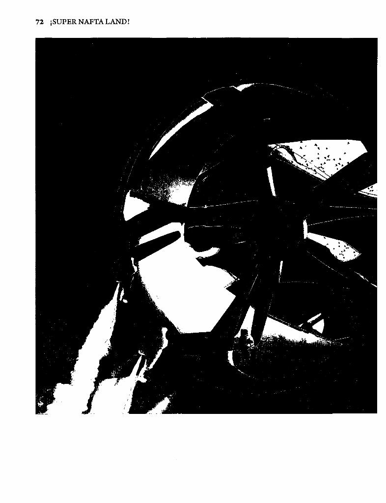
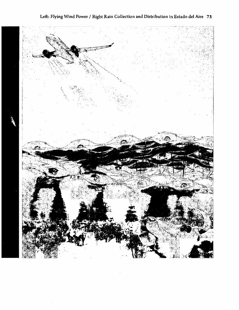
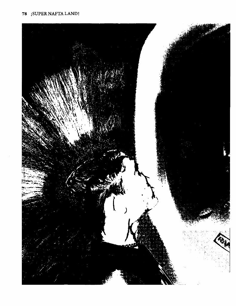
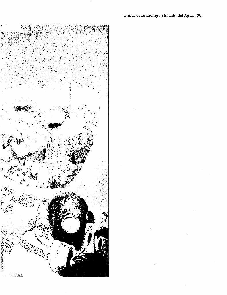
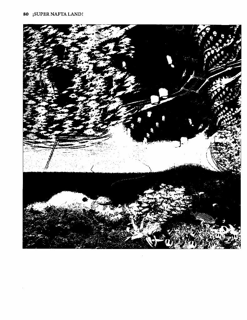
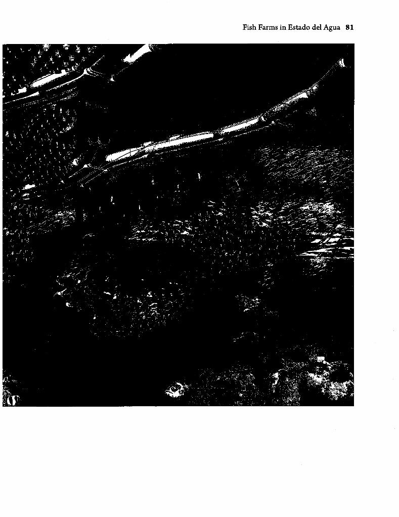
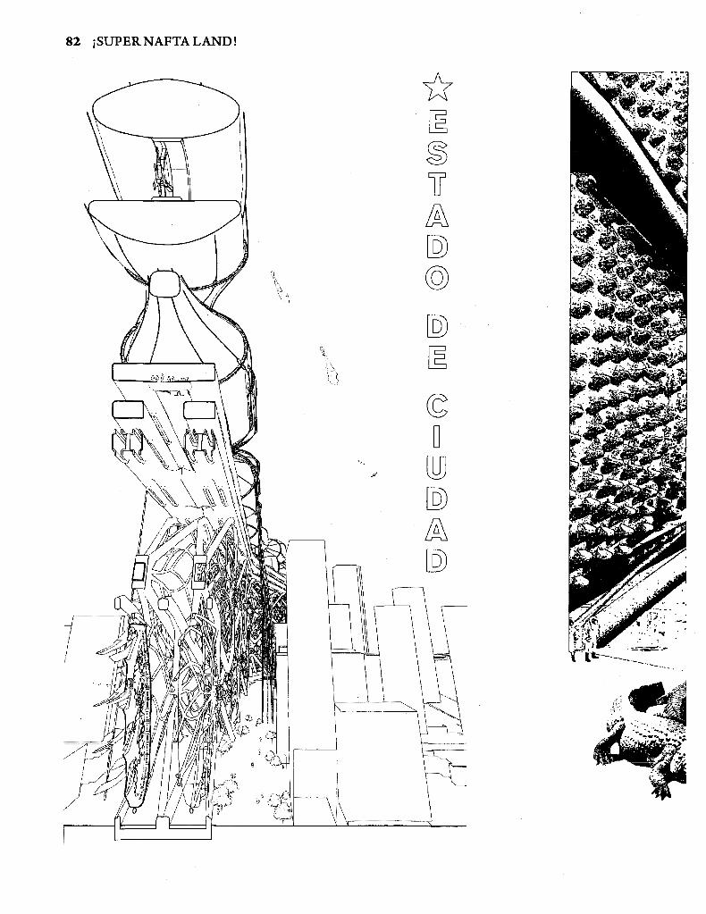
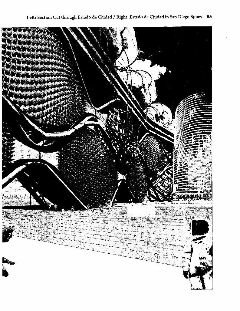
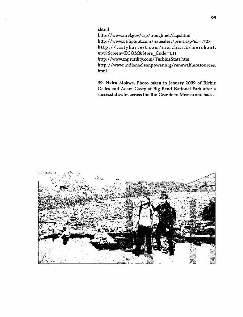

![INDIRECT EXPROPRIATION UNDER NAFTA AND DR-CAFTA: … · 2006] INDIRECT EXPROPRIATION UNDER NAFTA AND DR-CAFTA 933 NAFTA and DR-CAFTA. Part II explains how three earlier NAFTA tribunals](https://img.pdfslide.us/doc/110x75/5ec6d30ffb2475648e7b2fba/indirect-expropriation-under-nafta-and-dr-cafta-2006-indirect-expropriation-under.jpg)