Embed Size (px)
Citation preview
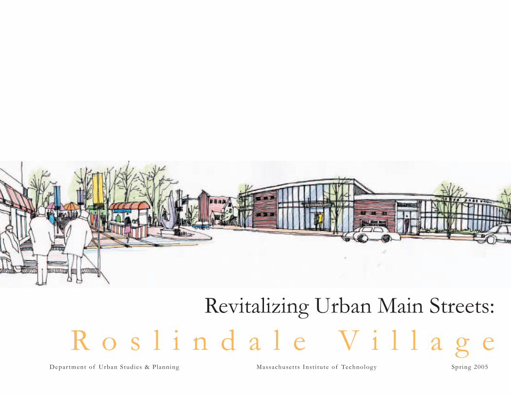
Revitalizing Urban Main Streets:
R o s l i n d a l e V i l l a g e D e p a r t m e n t o f U r b a n S t u d ie s & Pla n n in g M a s s a c h u s e t t s I n s t i t u t e o f Te ch n o lo g y S p r in g 2 0 0 5
1
May 2005
Dear Roslindale Village Main Streets:
Thank you for welcoming us into the Roslindale community. Working with RVMS has given our team an opportunity to better understand the integrated nature of urban design and economic development within the context of a successful and storied district. In a three-stage work process that began with an inventory of existing conditions, continued with the development of a strategic vision, and ended with the formulation of a concrete set of recommendations, it is with great pleasure that we present you with this comprehensive main street revitalization plan.
As the product of a partnership between Roslindale Village Main Streets and Massachusetts Institute of Technology Department of Urban Studies and Planning, this revitalization plan highlights how integrated design and economic development efforts in current and future endeavors will help Roslindale enhance its sense of place, promote its district core as a civic center, and preserve its unique “village” identity. The existing natural, cultural, and historic elements of the district provide a strong and viable framework from which redevelopment strategies and district growth must be tied, and are essential elements in defi ning what the Roslindale “village” is to be.
We wish to extend our thanks to the community, residents, business owners, and many others who participated in our information gathering and assessment process, contributing to our understanding of the district and the fi nal development of this proposal. Your dedicated and continued commitment to building a better Roslindale Village will assure the successful implementation of the plan, and in turn the continued growth and success of the main street district.
Sincerely,
The MIT Department of Urban Studies and PlanningRevitalizing Urban Main Streets Roslindale Village Team

3 2 Enhancing the Village: Roslindale Village Main Streets
2
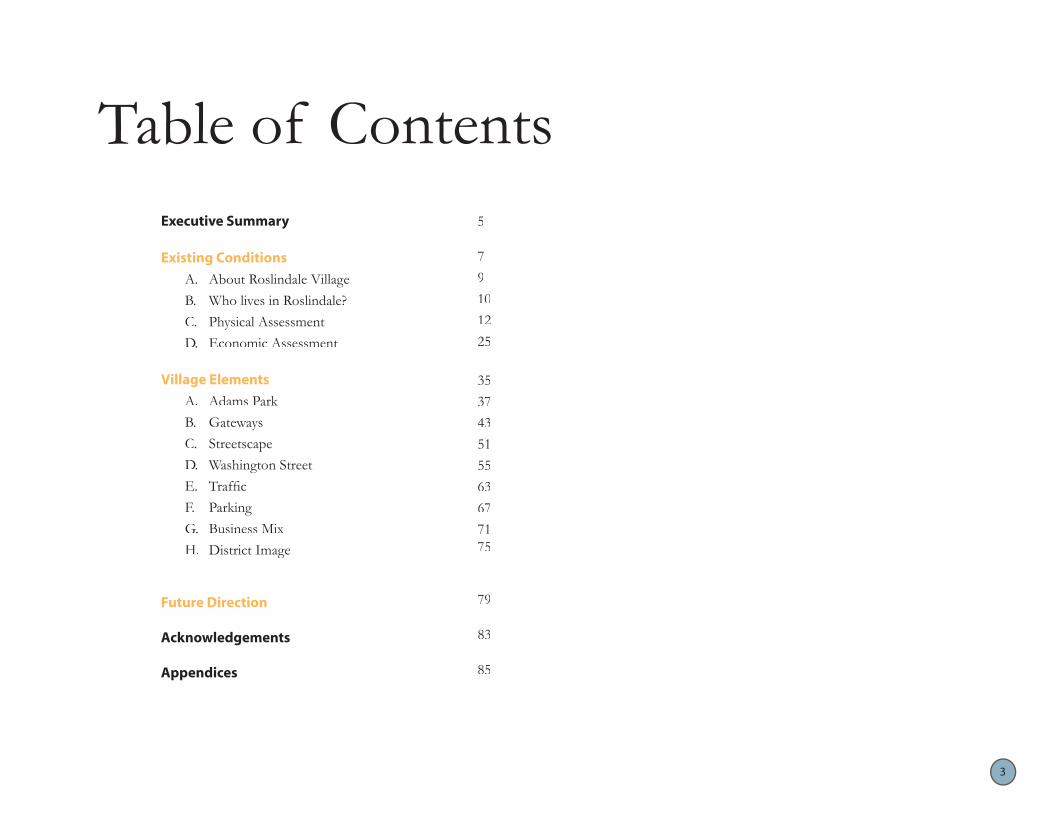
Table of ContentsExecutive Summary 5
Existing Conditions 7
A. About Roslindale Village 9
B. Who lives in Roslindale? 10
C. Physical Assessment 12
D. Economic Assessment 25
Village Elements 35
A. Adams Park 37
B. Gateways 43
C. Streetscape 51
D. Washington Street 55
E. Traffic 63
F. Parking 67
G. Business Mix 71
H. District Image 75
Future Direction 79
Acknowledgements 83
Appendices 85
3

4 Enhancing the Village: Roslindale Village Main Streets
4
oppor – in re-
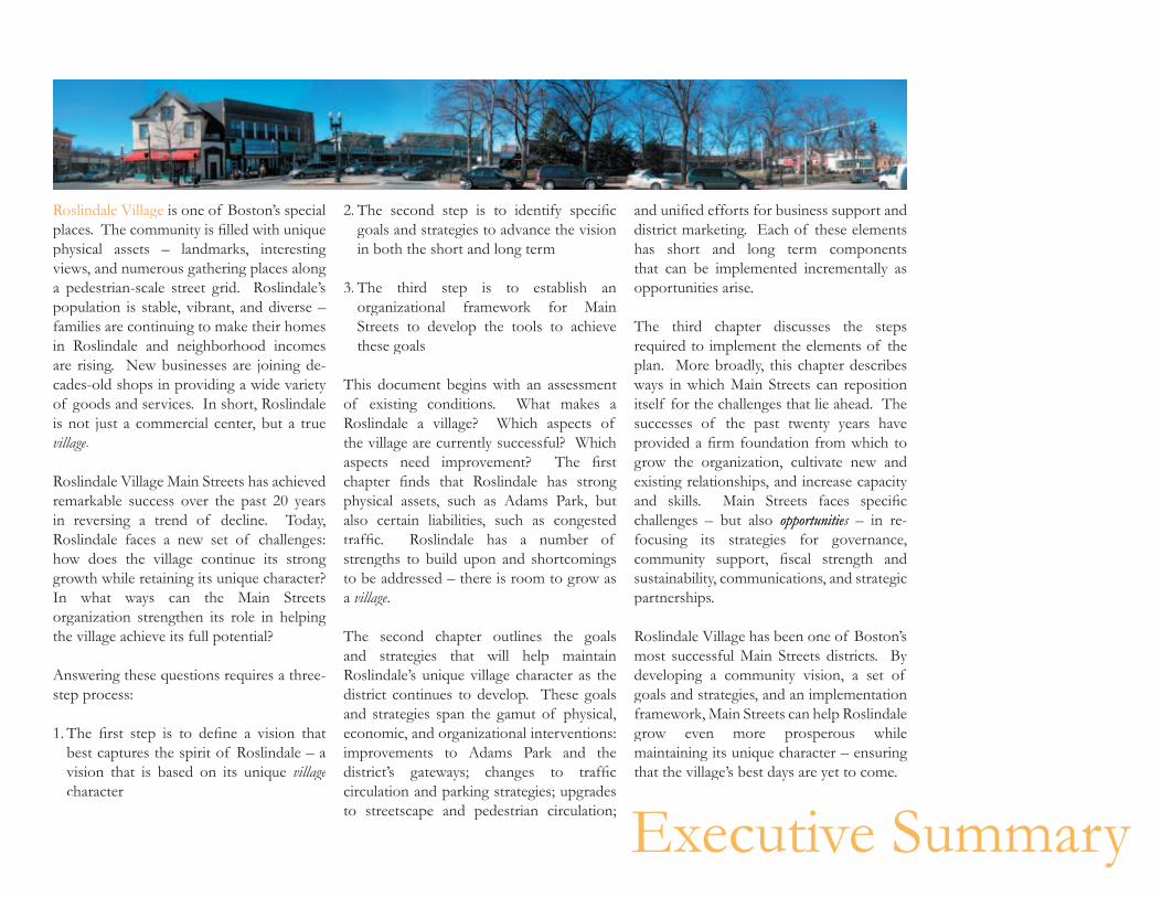
Roslindale Village is one of Boston’s special 2. The second step is to identify specific and unified efforts for business support and places. The community is filled with unique physical assets – landmarks, interesting views, and numerous gathering places along a pedestrian-scale street grid. Roslindale’s population is stable, vibrant, and diverse – families are continuing to make their homes in Roslindale and neighborhood incomes are rising. New businesses are joining de-cades-old shops in providing a wide variety of goods and services. In short, Roslindale is not just a commercial center, but a true village.
Roslindale Village Main Streets has achieved remarkable success over the past 20 years in reversing a trend of decline. Today, Roslindale faces a new set of challenges: how does the village continue its strong growth while retaining its unique character? In what ways can the Main Streets organization strengthen its role in helping the village achieve its full potential?
Answering these questions requires a three-step process:
1. The first step is to define a vision that best captures the spirit of Roslindale – a vision that is based on its unique village character
goals and strategies to advance the vision in both the short and long term
3. The third step is to establish an organizational framework for Main Streets to develop the tools to achieve these goals
This document begins with an assessment of existing conditions. What makes a Roslindale a village? Which aspects of the village are currently successful? Which aspects need improvement? The first chapter finds that Roslindale has strong physical assets, such as Adams Park, but also certain liabilities, such as congested traffic. Roslindale has a number of strengths to build upon and shortcomings to be addressed – there is room to grow as a village.
The second chapter outlines the goals and strategies that will help maintain Roslindale’s unique village character as the district continues to develop. These goals and strategies span the gamut of physical, economic, and organizational interventions: improvements to Adams Park and the district’s gateways; changes to traffic circulation and parking strategies; upgrades to streetscape and pedestrian circulation;
district marketing. Each of these elements has short and long term components that can be implemented incrementally as opportunities arise.
The third chapter discusses the steps required to implement the elements of the plan. More broadly, this chapter describes ways in which Main Streets can reposition itself for the challenges that lie ahead. The successes of the past twenty years have provided a firm foundation from which to grow the organization, cultivate new and existing relationships, and increase capacity and skills. Main Streets faces specific challenges – but also opportunitieopportunitiestunities – in re-focusing its strategies for governance, community support, fiscal strength and sustainability, communications, and strategic partnerships.
Roslindale Village has been one of Boston’s most successful Main Streets districts. By developing a community vision, a set of goals and strategies, and an implementation framework, Main Streets can help Roslindale grow even more prosperous while maintaining its unique character – ensuring that the village’s best days are yet to come.
Executive Summary

6 Enhancing the Village: Roslindale Village Main Streets
6Chapter 1 • Existing Conditions

8 Enhancing the Village: Roslindale Village Main Streets
8
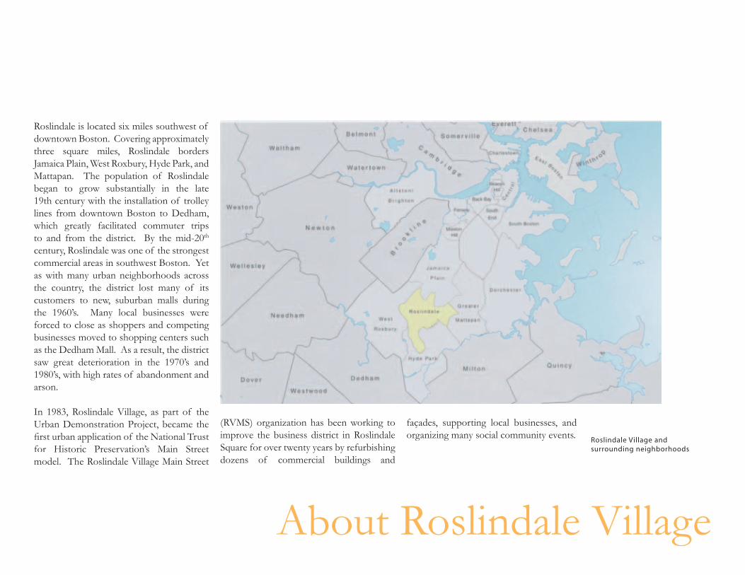
Roslindale is located six miles southwest of downtown Boston. Covering approximately three square miles, Roslindale borders Jamaica Plain, West Roxbury, Hyde Park, and Mattapan. The population of Roslindale began to grow substantially in the late 19th century with the installation of trolley lines from downtown Boston to Dedham, which greatly facilitated commuter trips to and from the district. By the mid-20th
century, Roslindale was one of the strongest commercial areas in southwest Boston. Yet as with many urban neighborhoods across the country, the district lost many of its customers to new, suburban malls during the 1960’s. Many local businesses were forced to close as shoppers and competing businesses moved to shopping centers such as the Dedham Mall. As a result, the district saw great deterioration in the 1970’s and 1980’s, with high rates of abandonment and arson.
In 1983, Roslindale Village, as part of the Urban Demonstration Project, became the first urban application of the National Trust for Historic Preservation’s Main Street model. The Roslindale Village Main Street
(RVMS) organization has been working to façades, supporting local businesses, and improve the business district in Roslindale organizing many social community events.
Roslindale Village and Square for over twenty years by refurbishing surrounding neighborhoods
dozens of commercial buildings and
About Roslindale Village
11
��
��
��
��
��
���
��
��
��
��
�
����
���
���������� �� ���� ��� ��������
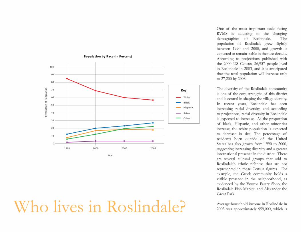
One of the most important tasks facing RVMS is adjusting to the changing demographics of Roslindale. The population of Roslindale grew slightly between 1990 and 2000, and growth is expected to remain stable in the next decade. According to projections published with
����
����
��
�� ������
����
the 2000 US Census, 26,937 people lived in Roslindale in 2003, and it is anticipated that the total population will increase only to 27,200 by 2008.
The diversity of the Roslindale community is one of the core strengths of this district
����� and is central in shaping the village identity. ����� In recent years, Roslindale has seen �������� increasing racial diversity, and according ����� to projections, racial diversity in Roslindale ����� is expected to increase. As the proportion
of black, Hispanic, and other minorities increase, the white population is expected to decrease in size. The percentage of residents born outside of the United States has also grown from 1990 to 2000,
���� ���� ���� ���� suggesting increasing diversity and a greater international presence in the district. There are several cultural groups that add to Roslindale’s ethnic richness that are not represented in these Census figures. For example, the Greek community holds a visible presence in the neighborhood, as evidenced by the Vouros Pastry Shop, the Roslindale Fish Market, and Alexander the Great Park.
Average household income in Roslindale in 2003 was approximately $59,000, which is Who lives in Roslindale?
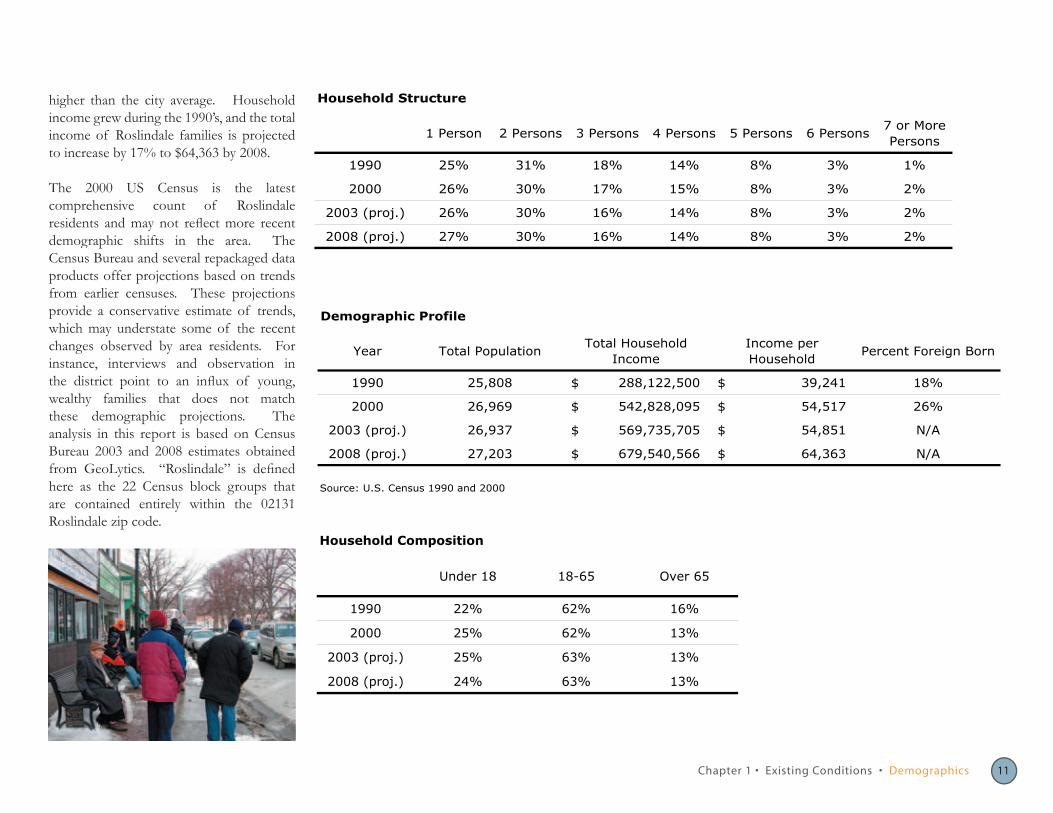
higher than the city average. Household Household Structure
income grew during the 1990’s, and the total 7 or More
income of Roslindale families is projected 1 Person 2 Persons 3 Persons 4 Persons 5 Persons 6 Persons Persons
to increase by 17% to $64,363 by 2008. 1990 25% 31% 18% 14% 8% 3% 1%
The 2000 US Census is the latest comprehensive count of Roslindale residents and may not reflect more recent demographic shifts in the area. The Census Bureau and several repackaged data products offer projections based on trends from earlier censuses. These projections provide a conservative estimate of trends, which may understate some of the recent changes observed by area residents. For instance, interviews and observation in the district point to an influx of young, wealthy families that does not match these demographic projections. The analysis in this report is based on Census Bureau 2003 and 2008 estimates obtained from GeoLytics. “Roslindale” is defined here as the 22 Census block groups that are contained entirely within the 02131 Roslindale zip code.
2000 26% 30% 17% 15% 8% 3% 2%
2003 (proj.) 26% 30% 16% 14% 8% 3% 2%
2008 (proj.) 27% 30% 16% 14% 8% 3% 2%
Demographic Profile
Year Total Population Total Household
Income Income per Household
Percent Foreign Born
1990 25,808 288,122,500$ $ 39,241 18%
2000 26,969 542,828,095$ $ 54,517 26%
2003 (proj.) 26,937 569,735,705$ $ 54,851 N/A
2008 (proj.) 27,203 679,540,566$ $ 64,363 N/A
Source: U.S. Census 1990 and 2000
Household Composition
Under 18 18-65 Over 65
1990 22% 62% 16%
2000 25% 62% 13%
2003 (proj.) 25% 63% 13%
2008 (proj.) 24% 63% 13%
Chapter 1 • Existing Conditions • Demographics 11
13
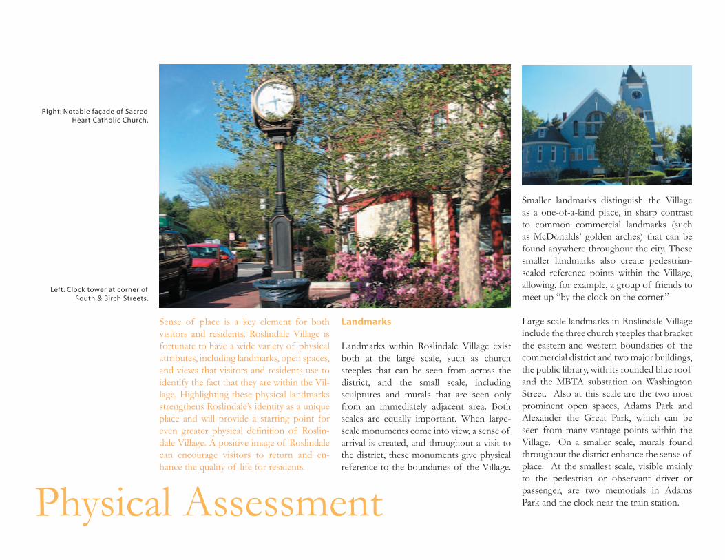
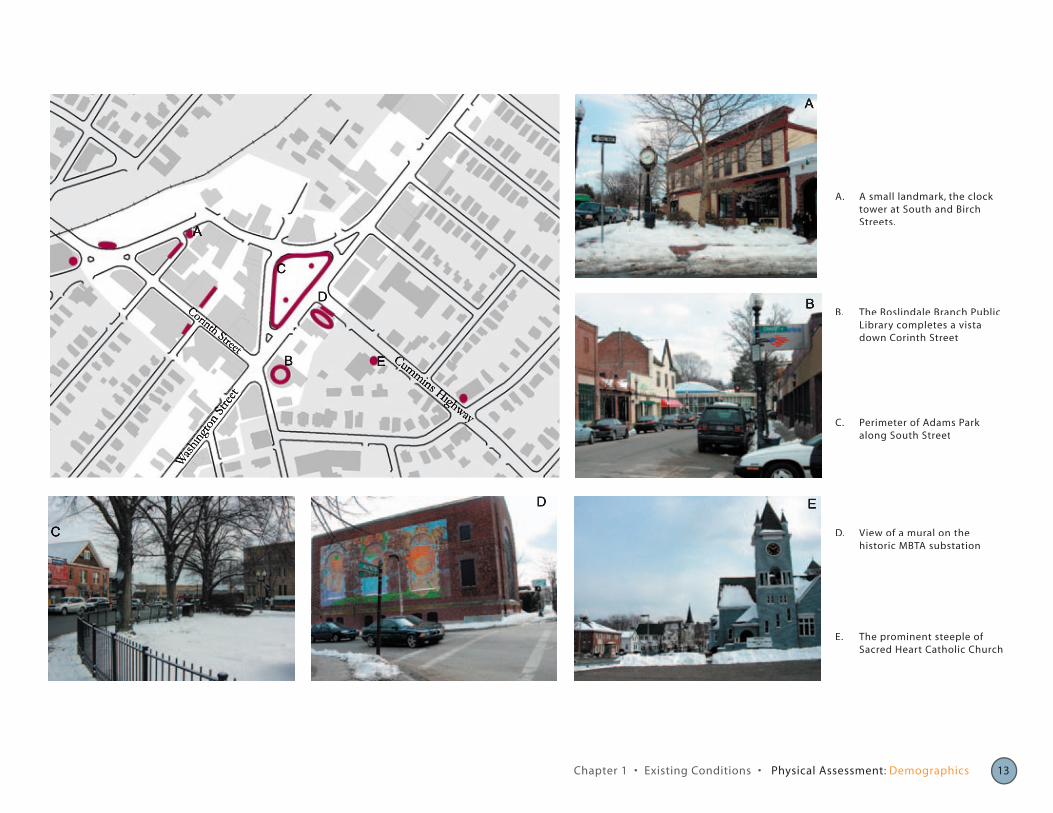
Right: Notable façade of Sacred Heart Catholic Church.
Left: Clock tower at corner of South & Birch Streets.
Sense of place is a key element for both visitors and residents. Roslindale Village is fortunate to have a wide variety of physical attributes, including landmarks, open spaces, and views that visitors and residents use to identify the fact that they are within the Vil-lage. Highlighting these physical landmarks strengthens Roslindale’s identity as a unique place and will provide a starting point for even greater physical definition of Roslin-dale Village. A positive image of Roslindale can encourage visitors to return and en-hance the quality of life for residents.
Landmarks
Landmarks within Roslindale Village exist both at the large scale, such as church steeples that can be seen from across the district, and the small scale, including sculptures and murals that are seen only from an immediately adjacent area. Both scales are equally important. When large-scale monuments come into view, a sense of arrival is created, and throughout a visit to the district, these monuments give physical reference to the boundaries of the Village.
Physical Assessment
Smaller landmarks distinguish the Village as a one-of-a-kind place, in sharp contrast to common commercial landmarks (such as McDonalds’ golden arches) that can be found anywhere throughout the city. These smaller landmarks also create pedestrian-scaled reference points within the Village, allowing, for example, a group of friends to meet up “by the clock on the corner.”
Large-scale landmarks in Roslindale Village include the three church steeples that bracket the eastern and western boundaries of the commercial district and two major buildings, the public library, with its rounded blue roof and the MBTA substation on Washington Street. Also at this scale are the two most prominent open spaces, Adams Park and Alexander the Great Park, which can be seen from many vantage points within the Village. On a smaller scale, murals found throughout the district enhance the sense of place. At the smallest scale, visible mainly to the pedestrian or observant driver or passenger, are two memorials in Adams Park and the clock near the train station.
Wash
ingto
n Stre
et
Cummins Highway
Corinth Street
A
C
B
D E
C
D
EB
A
A. A small landmark, the clock tower at South and Birch Streets.
C. Perimeter of Adams Park along South Street
B. The Roslindale Branch Public Library completes a vista down Corinth Street
D. View of a mural on the historic MBTA substation
E. The prominent steeple of Sacred Heart Catholic Church
Chapter 1 • Existing Conditions • Physical Assessment: Demographics 13
15
Right: A pedestrian crosswalk leading into Adams Park
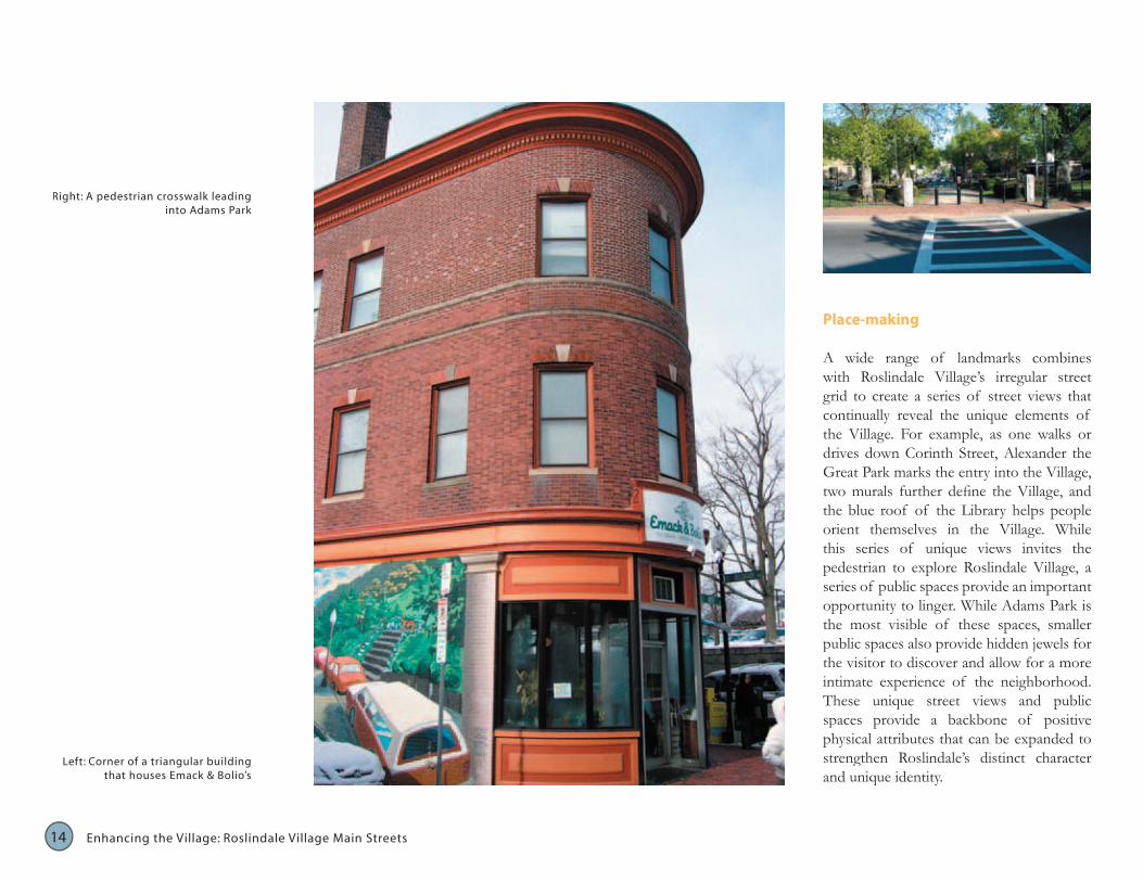
Place-making
A wide range of landmarks combines with Roslindale Village’s irregular street grid to create a series of street views that continually reveal the unique elements of the Village. For example, as one walks or drives down Corinth Street, Alexander the Great Park marks the entry into the Village, two murals further define the Village, and the blue roof of the Library helps people orient themselves in the Village. While this series of unique views invites the pedestrian to explore Roslindale Village, a series of public spaces provide an important opportunity to linger. While Adams Park is the most visible of these spaces, smaller public spaces also provide hidden jewels for the visitor to discover and allow for a more intimate experience of the neighborhood. These unique street views and public spaces provide a backbone of positive physical attributes that can be expanded to strengthen Roslindale’s distinct character Left: Corner of a triangular building
that houses Emack & Bolio’s and unique identity.
14 Enhancing the Village: Roslindale Village Main Streets
14
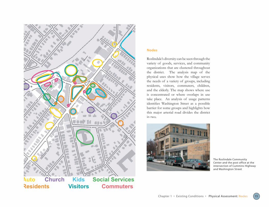
Nodes
Roslindale’s diversity can be seen through the variety of goods, services, and community organizations that are clustered throughout the district. The analysis map of the physical uses show how the village serves the needs of a variety of groups, including residents, visitors, commuters, children, and the elderly. The map shows where use is concentrated or where overlaps in use take place. An analysis of usage patterns identifies Washington Street as a possible barrier for some groups and highlights how this major arterial road divides the district in two.
The Roslindale Community Center and the post office at the intersection of Cummins Highway and Washington Street
Chapter 1 • Existing Conditions • Physical Assessment: Nodes 15
17
Above: Perimeter of Adams Park along Poplar Street in winter.
Middle: Pedestrian pathway in Adams Park.
Below: Entry into Adams Park from Washington Street.
Adams Park
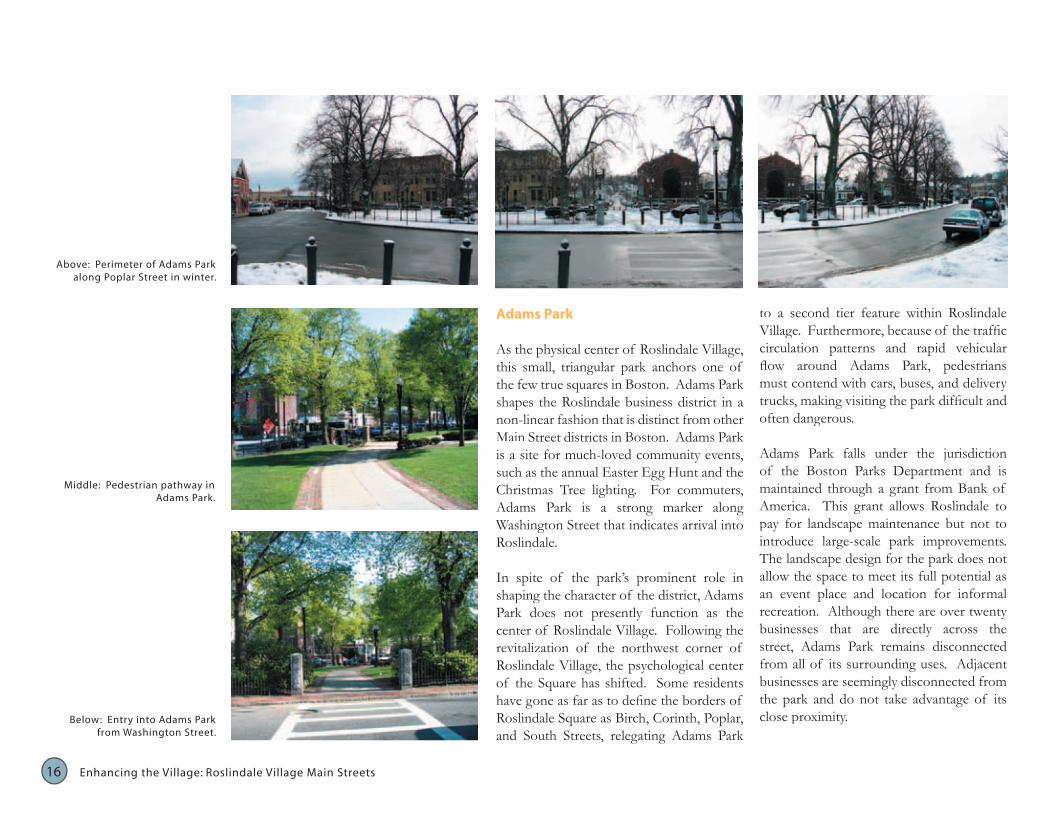
As the physical center of Roslindale Village, this small, triangular park anchors one of the few true squares in Boston. Adams Park shapes the Roslindale business district in a non-linear fashion that is distinct from other Main Street districts in Boston. Adams Park is a site for much-loved community events, such as the annual Easter Egg Hunt and the Christmas Tree lighting. For commuters, Adams Park is a strong marker along Washington Street that indicates arrival into Roslindale.
In spite of the park’s prominent role in shaping the character of the district, Adams Park does not presently function as the center of Roslindale Village. Following the revitalization of the northwest corner of Roslindale Village, the psychological center of the Square has shifted. Some residents have gone as far as to define the borders of Roslindale Square as Birch, Corinth, Poplar, and South Streets, relegating Adams Park
16
to a second tier feature within Roslindale Village. Furthermore, because of the traffic circulation patterns and rapid vehicular flow around Adams Park, pedestrians must contend with cars, buses, and delivery trucks, making visiting the park difficult and often dangerous.
Adams Park falls under the jurisdiction of the Boston Parks Department and is maintained through a grant from Bank of America. This grant allows Roslindale to pay for landscape maintenance but not to introduce large-scale park improvements. The landscape design for the park does not allow the space to meet its full potential as an event place and location for informal recreation. Although there are over twenty businesses that are directly across the street, Adams Park remains disconnected from all of its surrounding uses. Adjacent businesses are seemingly disconnected from the park and do not take advantage of its close proximity.
Enhancing the Village: Roslindale Village Main Streets
16 17
in the
the concentrated
one of
Street in
• • :
of
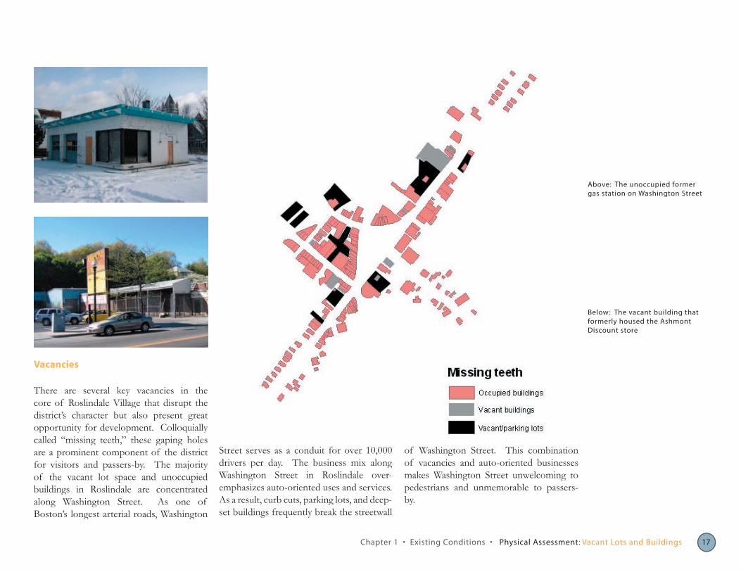
Vacancies
core of Roslindale Village that disrupt the district’s character but also present great opportunity for development. Colloquially called “missing teeth,” these gaping holes are a prominent component of the district
The majority vacant lot space and unoccupied
Boston’s longest arterial roads, Washington
Street serves as a conduit for over 10,000 drivers per day. The business mix along Washington Roslindale over-emphasizes auto-oriented uses and services. As a result, curb cuts, parking lots, and deep-set buildings frequently break the streetwall
Above: The unoccupied former gas station on Washington Street
Below: The vacant building that formerly housed the Ashmont Discount store
Chapter 1 Existing Conditions Physical Assessment Vacant Lots and Buildings
of Washington Street. This combination vacancies and auto-oriented businesses
makes Washington Street unwelcoming to pedestrians and unmemorable to passers-by.
There are several key vacancies
for visitors and passers-by. of buildings in Roslindale are along Washington Street. As
19ts18 Enhancing the Village: Roslindale Village Main Stree
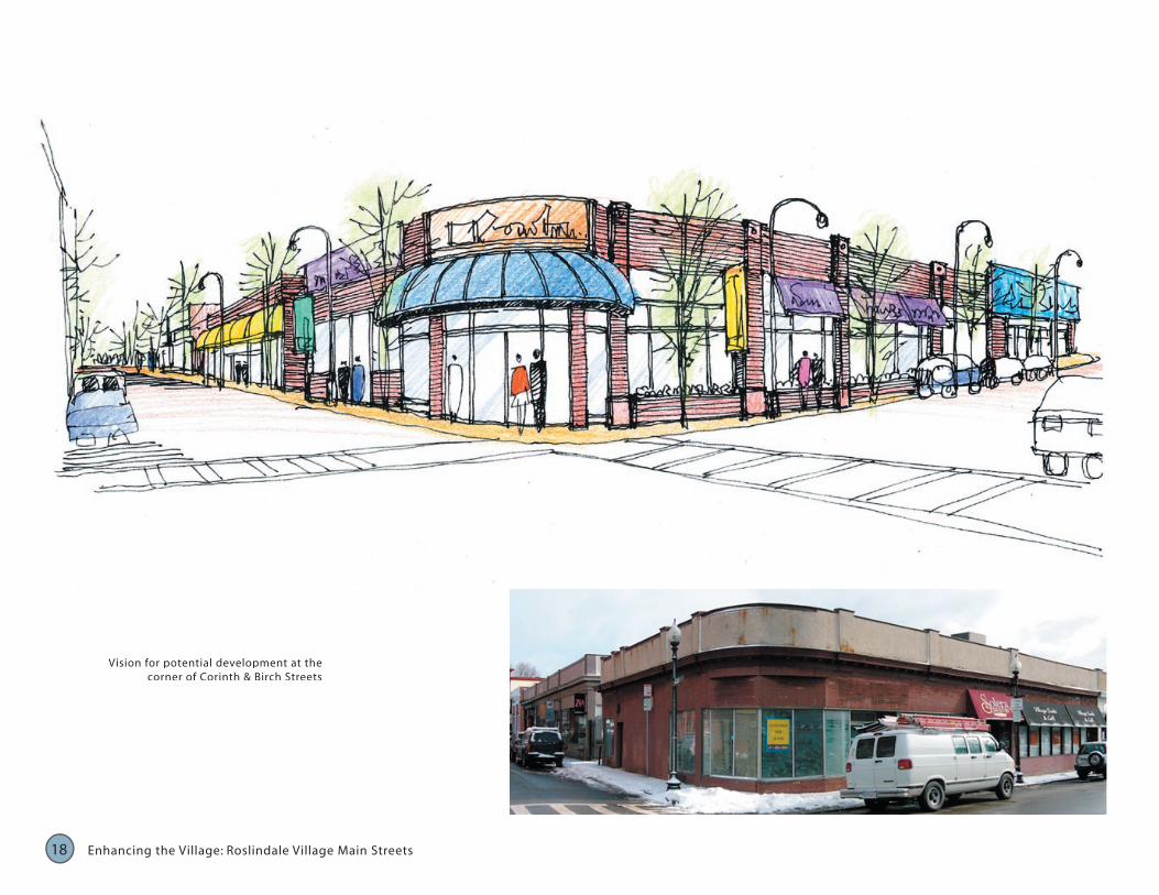
Vision for potential development at the corner of Corinth & Birch Streets
18
Washington Str , which
Traffic
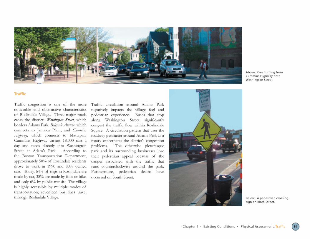
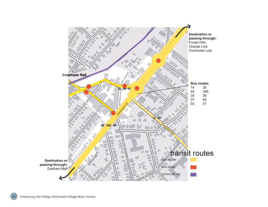
Traffic congestion is one of the more noticeable and obstructive characteristics of Roslindale Village. Three major roads cross the district: Washington StreetWashington Streeteet, which borders Adams Park, Belgrade Avenue, which connects to Jamaica Plain, and Cummins Highway, which connects to Mattapan. Cummins Highway carries 18,000 cars a day and feeds directly into Washington Street at Adam’s Park. According to the Boston Transportation Department, approximately 50% of Roslindale residents drove to work in 1990 and 80% owned cars. Today, 64% of trips in Roslindale are made by car, 38% are made by foot or bike, and only 6% by public transit. The village is highly accessible by multiple modes of transportation; seventeen bus lines travel through Roslindale Village.
Above: Cars turning from Cummins Highway onto Washington Street.
Traffic circulation around Adams Park negatively impacts the village feel and pedestrian experience. Buses that stop along Washington Street significantly congest the traffic flow within Roslindale Square. A circulation pattern that uses the roadway perimeter around Adams Park as a rotary exacerbates the district’s congestion problems. The otherwise picturesque park and its surrounding businesses lose their pedestrian appeal because of the danger associated with the traffic that runs counterclockwise around the park. Furthermore, pedestrian deaths have occurred on South Street.
Below: A pedestrian crossing sign on Birch Street.
Chapter 1 • Existing Conditions • Physical Assessment: Traffic 19
21
Commuter Rail Commuter Rail
Destination or Destination or passing through: passing through:
Dedham Mall Dedham Mall
Destination or passing through: Forest Hills Orange Line Commuter Line
Bus routes: 14 30 34 34E 35 36 37 40 50 51
20 Enhancing the Village: Roslindale Village Main Streets
20
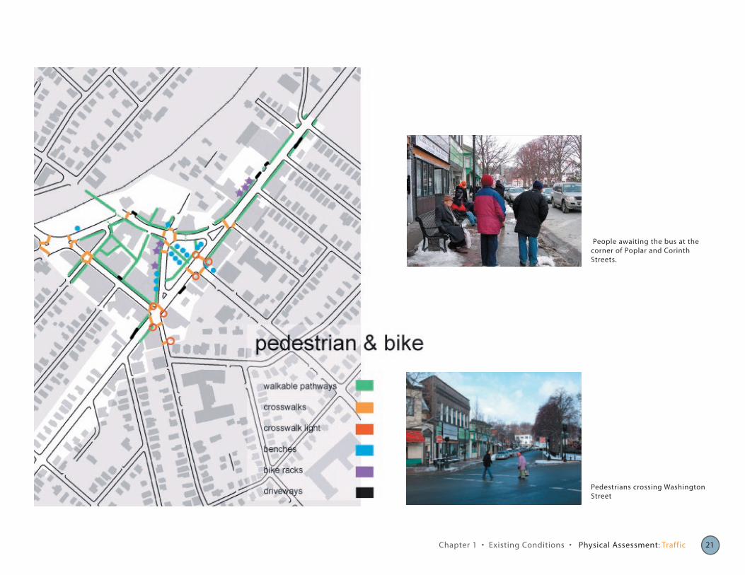
Pedestrians crossing Washington Street
People awaiting the bus at the corner of Poplar and Corinth Streets.
Chapter 1 • Existing Conditions • Physical Assessment: Traffic 21
23
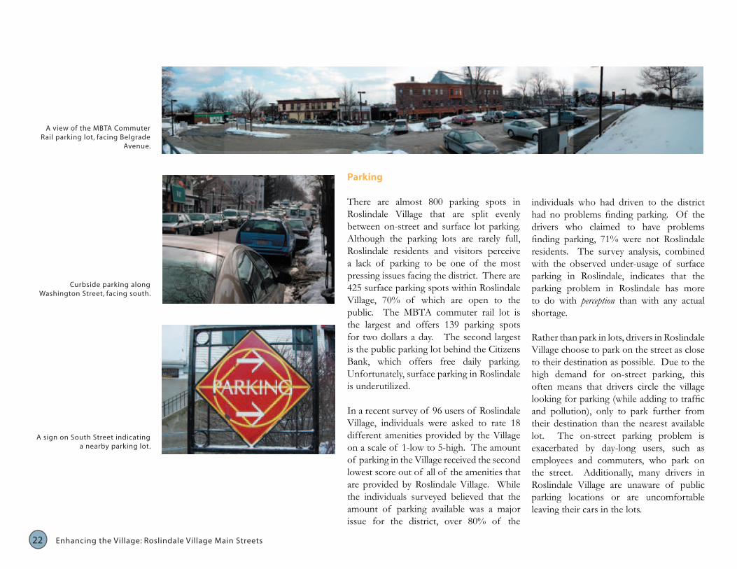
A view of the MBTA Commuter Rail parking lot, facing Belgrade
Avenue.
Curbside parking along Washington Street, facing south.
public. The MBTA commuter rail lot is the largest and offers 139 parking spots for two dollars a day. The second largest is the public parking lot behind the Citizens Bank, which offers free daily parking. Unfortunately, surface parking in Roslindale is underutilized.
In a recent survey of 96 users of Roslindale Village, individuals were asked to rate 18 different amenities provided by the Village A sign on South Street indicating
a nearby parking lot. on a scale of 1-low to 5-high. The amount of parking in the Village received the second lowest score out of all of the amenities that are provided by Roslindale Village. While the individuals surveyed believed that the amount of parking available was a major issue for the district, over 80% of the
22 Enhancing the Village: Roslindale Village Main Streets
are that are split
are
who claimed to problems
more
Parking
There almost 800 parking spots in Roslindale Village evenly between on-street and surface lot parking. Although the parking lots are rarely full, Roslindale residents and visitors perceive a lack of parking to be one of the most pressing issues facing the district. There are 425 surface parking spots within Roslindale Village, 70% of which open to the
individuals who had driven to the district had no problems finding parking. Of the drivers have finding parking, 71% were not Roslindale residents. The survey analysis, combined with the observed under-usage of surface parking in Roslindale, indicates that the parking problem in Roslindale has to do with perception than with any actual shortage.
Rather than park in lots, drivers in Roslindale Village choose to park on the street as close to their destination as possible. Due to the high demand for on-street parking, this often means that drivers circle the village looking for parking (while adding to traffic and pollution), only to park further from their destination than the nearest available lot. The on-street parking problem is exacerbated by day-long users, such as employees and commuters, who park on the street. Additionally, many drivers in Roslindale Village are unaware of public parking locations or are uncomfortable leaving their cars in the lots.
22
).
Zoning
Understanding the zoning and regulatory context for Roslindale Village is crucial to assessing development opportunities and challenges, such as the opportunities and constraints of redeveloping vacant or abandoned parcels. Currently, the bulk of Roslindale Village’s vacant parcels fall into B-1 and B-2 “general business zoning” districts, where an array of allowable uses runs the gamut from residential to retail. This kind of mixed-use zoning is an essential ingredient for building a successful urban retail district as the mix of uses increases foot traffic and a “captive audience” for signage and other marketing techniques.
Currently, the Boston Redevelopment Authority is pursuing the implementation of an interim planning overlay district (IPOD) for the Roslindale neighborhood. The Boston Redevelopment Authority defines an Interim Planning Overlay District as
“a district or group of districts or a subdistrict or group of subdistricts or parts thereof (hereafter referred to as an area) may be established as an interim planning overlay district when it is determined by the Zoning Commission that: (1) the existing zoning is thought to be inappropriate; (2) a rezoning of the area is anticipated; (3) a comprehensive planning study preceding the anticipated rezoning is needed; and (4) interim land use regulations are essential
to maintain the status quo in the area and prevent introduction of changes to the area which may be incompatible with the goals of the comprehensive planning study or anticipated rezoning” (Roslindale Interim Planning Overlay District, BRAPlanning Overlay District, BRAPlanning Overlay District, BRA).
The IPOD is meant to serve as a first step to developing a neighborhood-specific zoning code for Roslindale. Roslindale’s current situation is anomalous; almost all other established neighborhoods in the City of Boston have neighborhood specific zoning regulations.
The latest draft of the proposed IPOD regulations for Roslindale support retail uses through design. Specifically, the
policies put forth by the IPOD mandate the continuity of the street wall, the removal of storefront grates, and preservation of existing neighborhood character. Each of these mandates is consistent with traditional urban design policies for sustaining urban retail. Additionally, no drastic changes to the zoning or physical character of Roslindale are prescribed by the most recent draft overlay district.
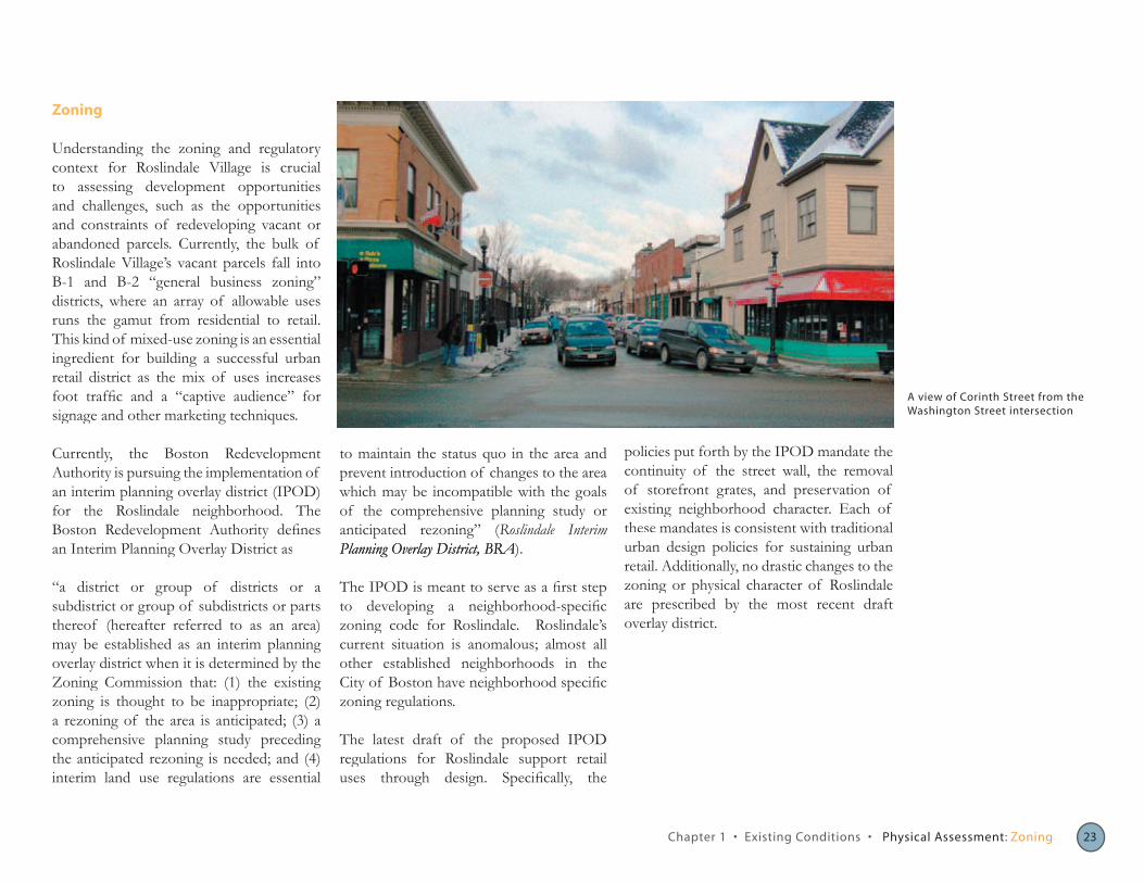
A view of Corinth Street from the Washington Street intersection
Chapter 1 • Existing Conditions • Physical Assessment: Zoning 23