Embed Size (px)
Citation preview
Spatial Data infraStructure in Denmark 2010
review

Spatial Data infraStructure in Denmark 2010 // review
title: Spatial Data infrastructure in Denmark 2010. reviewpublished by: the Danish ministry of the environment, national Survey and cadastre
text: the national Survey and cadastre (kmS)Design: Bystedillustrations: Bysted. photographs: Steen evaldYear of publication: 2011
1cOntentS
cOntentS
2 fOrewOrD
4 2010 – anOtHer impOrtant Step alOnG tHe waY
7 tHe infraStructure takeS SHape
14 fOcuS: puBlic SectOr cOOperatiOn iS pivOtal fOr DiGitiSatiOn
19 GeOData create Great practical value
23 a SHareD infraStructure – witHOut cOnStraintS
25 practical perSpectiveS
28 terminOlOGY
Spatial Data infraStructure in Denmark 2010 // review2
fOrewOrDDenmark is an international leader when it comes to
applying it and other new technologies in the public
sector. the government is keen on taking full advan-
tage of this position. Digitisation should be used to
help modernise the public sector, creating a scope for
the development of services for citizens and busi-
nesses. it should be part of the effort to ensure that
society prospers, by increasing productivity and creat-
ing new areas of growth.
Spatial data has a central role in the continued digiti-
sation of the public sector. establishing a shared infra-
structure for spatial information requires smooth-
running cooperation at technical, organisational and
economic levels. there should be a clear allocation of
responsibilities between authorities and easy access to
information via web services. and duplication of work
must be avoided.
this is also true at the european level, where Denmark
and other eu member states have worked intensively
to ensure that we benefit as much as possible from the
national investments in spatial data through sharing
and re-using data. i have as minister for the environ-
ment emphasised the value of these investments to
the eu commission as well as the importance of coor-
dination in europe between the major infrastructure
programmes inSpire and GmeS (Global monitoring
for environment and Safety).
public sector cooperation and its significance for digiti-
sation has been selected for special focus in this review
of the spatial data infrastructure in Denmark 2010. the
coordination committee on infrastructure for Spatial
information, which i have formed based on the Danish
infrastructure for Spatial information act, represents
an important step in the direction of ensuring a better
organisational and supervisory framework.
realising the benefits of spatial information for the
Danish society requires the application of data. a well-
developed infrastructure for spatial information,
applied widely in both public and private areas, will
also give private businesses access to a standardised,
well-documented basis for the development of solu-
tions and applications. this will create new and better
opportunities for businesses and contribute to eco-
nomic growth.

3fOrewOrD
the spatial data infrastructure is starting to take shape.
putting into action the inSpire Directive and the imple-
mentation of the infrastructure for Spatial information
act are undertakings that require considerable dedica-
tion over a long period. in 2010 the first digital services
became operational and constitute the first visible
results of the undertaking. internet users can already
appreciate the extent of Denmark’s spatial data and
services.
we have thus taken a large step towards more effec-
tive utilisation of the shared geographic basis and
towards establishing geodata as a supporting pillar of
eGovernment.
karen ellemann
minister for the environment
Spatial Data infraStructure in Denmark 2010 // review4
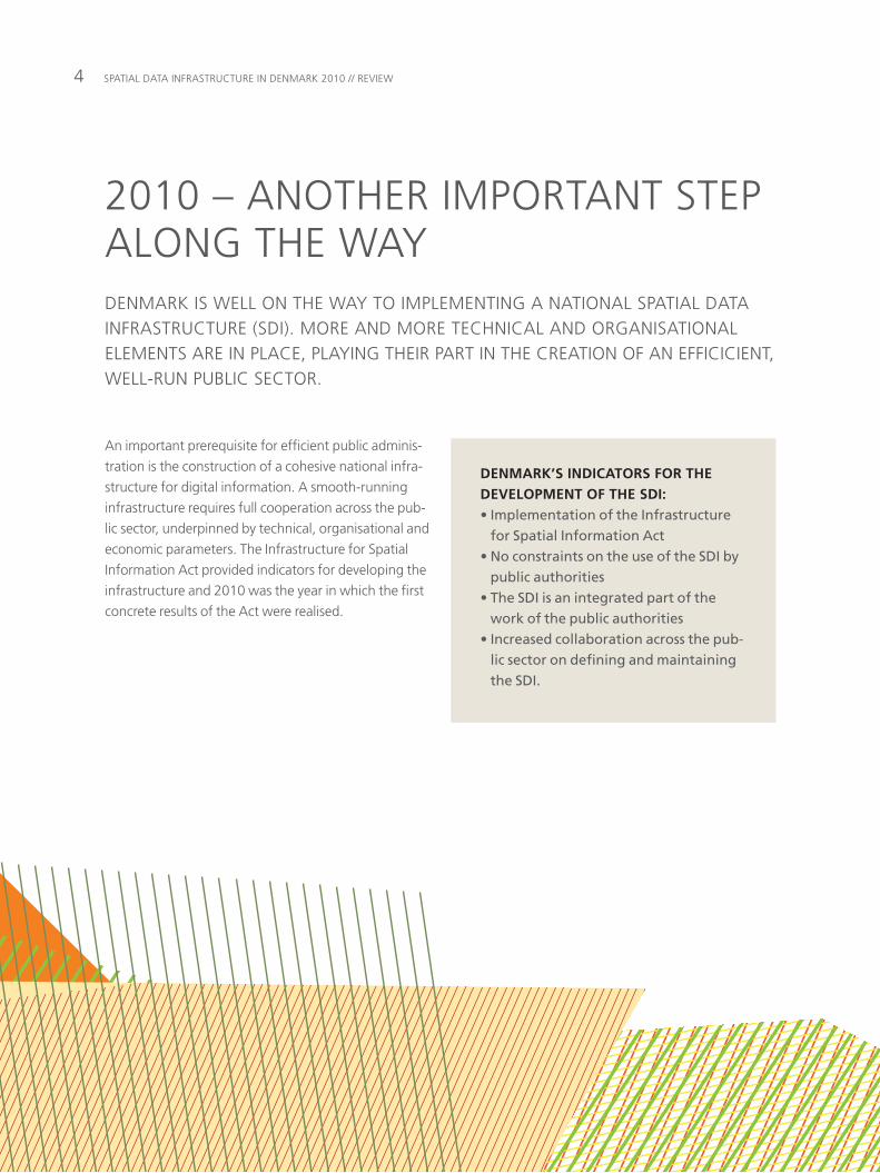
Denmark iS well On tHe waY tO implementinG a natiOnal Spatial Data infraStructure (SDi). mOre anD mOre tecHnical anD OrGaniSatiOnal elementS are in place, plaYinG tHeir part in tHe creatiOn Of an efficicient, well-run puBlic SectOr.
an important prerequisite for efficient public adminis-
tration is the construction of a cohesive national infra-
structure for digital information. a smooth-running
infrastructure requires full cooperation across the pub-
lic sector, underpinned by technical, organisational and
economic parameters. the infrastructure for Spatial
information act provided indicators for developing the
infrastructure and 2010 was the year in which the first
concrete results of the act were realised.
2010 – anOtHer impOrtant Step alOnG tHe waY
DENMARK’S INDICATORS FOR THE DEVELOPMENT OF THE SDI:• Implementation of the Infrastructure
for Spatial Information Act • No constraints on the use of the SDI by
public authorities• The SDI is an integrated part of the
work of the public authorities• Increased collaboration across the pub-
lic sector on defining and maintaining the SDI.
52010 – anOtHer impOrtant Step alOnG tHe waY
ENHANCED VALUE AND USE OF SPATIAL DATAeasy access to spatial data and simple analytical tools
are amongst the most important preconditions for
geographic information being widely used in public
sector activities. utilising geographic information in the
way of a shared infrastructure for spatial information is
the means to achieving this easy access. a shared pub-
lic sector infrastructure is still in its early stages of crea-
tion and even simple geographical analyses are often
not performed because, despite efforts, access to spa-
tial information is perceived as difficult. moreover,
tools for performing the analyses are too complicated
or in many cases not available where decisions have to
be made. this means that in a number of instances
geographical considerations are not taken into
account, despite considerable potential for their use.
the vast majority of activities in the public sector have
a geographic dimension. tasks may relate to people
with an address, to an element of infrastructure or to
a resource with a specific location. Spatial approaches
to solving tasks allow the compilation of information
from one or more sectors by using the geography com-
mon to the information as both starting point and reli-
able foundation for the analysis.
what is the best location for a new health clinic to
meet the needs of a particular target group? How
should one optimise the route for a personal care
worker to minimise waste of time? How should school
districts be established to take into account forecasts
for school applications in a specific area?
in order to realise the potential value for society of the
infrastructure for spatial information, it must be possi-
ble, in a specific public administration office, to utilise
data in a simple manner.
in 2010 work continued on building a shared SDi and
several important milestones were reached. the meas-
ures taken during the year constitute another step
toward establishing geodata as an important element
within the digital information infrastructure that is
used in public administration.
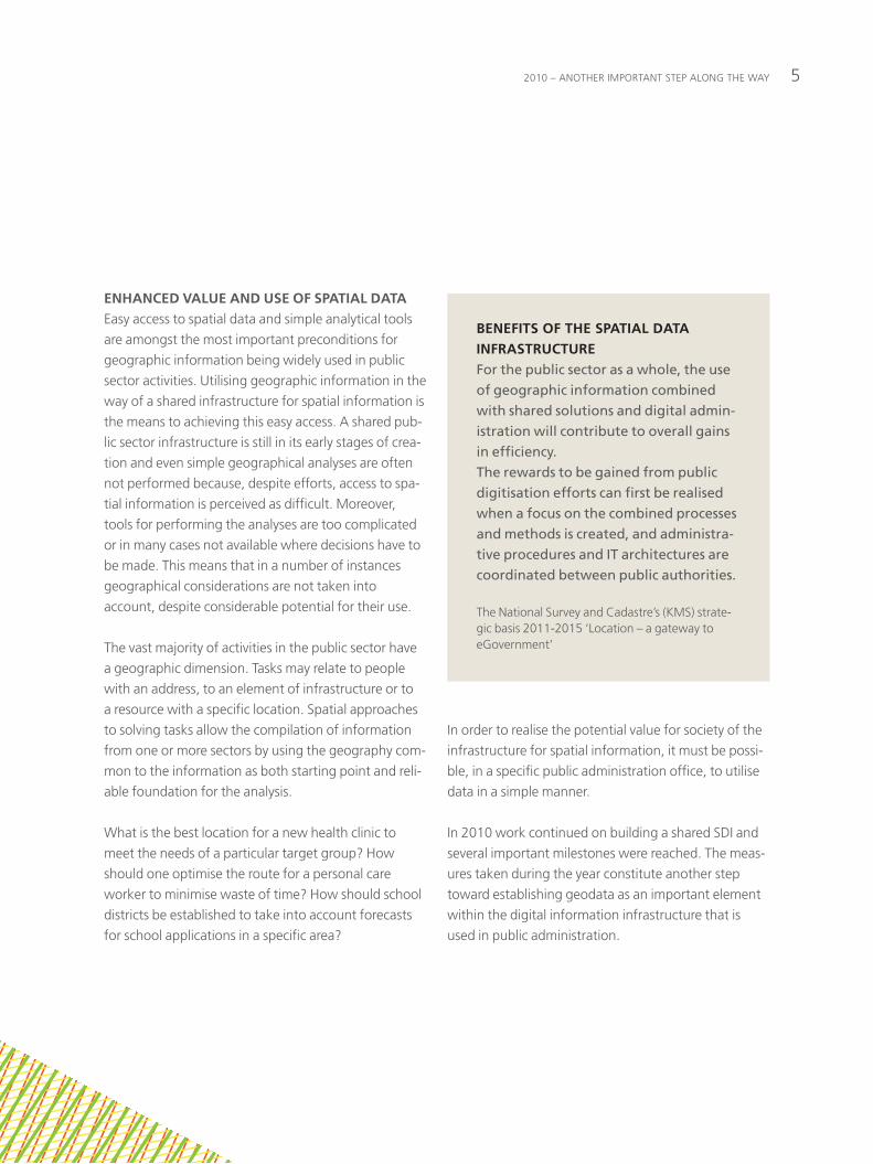
BENEFITS OF THE SPATIAL DATA INFRASTRUCTUREFor the public sector as a whole, the use of geographic information combined with shared solutions and digital admin-istration will contribute to overall gains in efficiency. The rewards to be gained from public digitisation efforts can first be realised when a focus on the combined processes and methods is created, and administra-tive procedures and IT architectures are coordinated between public authorities.
the national Survey and cadastre’s (kmS) strate-gic basis 2011-2015 ‘location – a gateway to eGovernment’
Spatial Data infraStructure in Denmark 2010 // review6
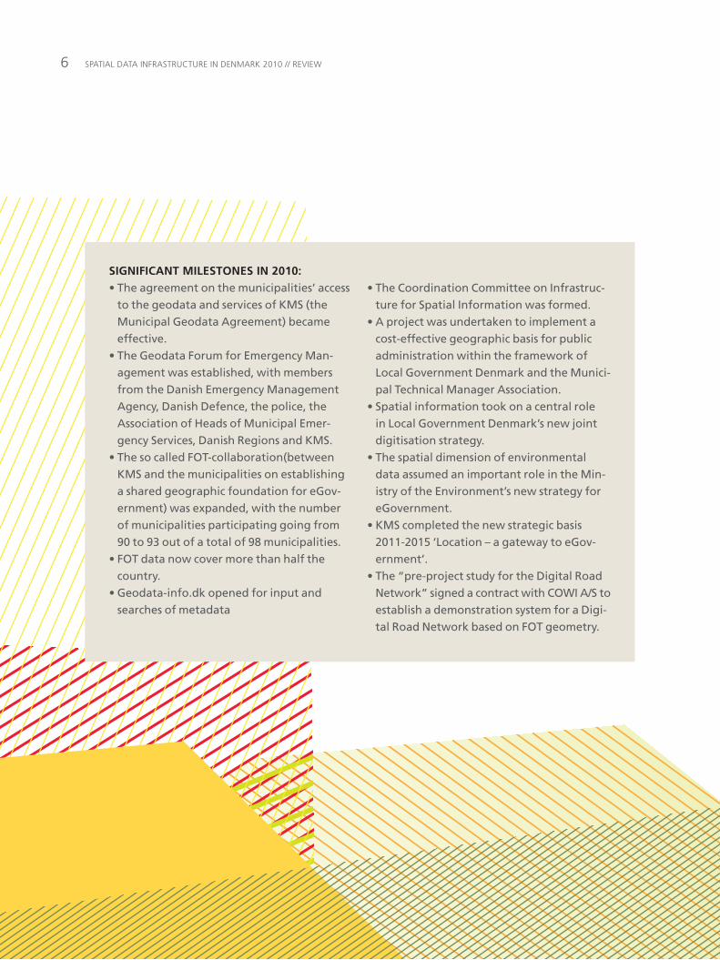
SIGNIFICANT MILESTONES IN 2010:• The agreement on the municipalities’ access
to the geodata and services of KMS (the Municipal Geodata Agreement) became effective.
• The Geodata Forum for Emergency Man-agement was established, with members from the Danish Emergency Management Agency, Danish Defence, the police, the Association of Heads of Municipal Emer-gency Services, Danish Regions and KMS.
• The so called FOT-collaboration(between KMS and the municipalities on establishing a shared geographic foundation for eGov-ernment) was expanded, with the number of municipalities participating going from 90 to 93 out of a total of 98 municipalities.
• FOT data now cover more than half the country.
• Geodata-info.dk opened for input and searches of metadata
• The Coordination Committee on Infrastruc-ture for Spatial Information was formed.
• A project was undertaken to implement a cost-effective geographic basis for public administration within the framework of Local Government Denmark and the Munici-pal Technical Manager Association.
• Spatial information took on a central role in Local Government Denmark’s new joint digitisation strategy.
• The spatial dimension of environmental data assumed an important role in the Min-istry of the Environment’s new strategy for eGovernment.
• KMS completed the new strategic basis 2011-2015 ‘Location – a gateway to eGov-ernment’.
• The “pre-project study for the Digital Road Network” signed a contract with COWI A/S to establish a demonstration system for a Digi-tal Road Network based on FOT geometry.
7tHe infraStructure takeS SHape
cooperation between municipalities, regions and the
state to develop a cohesive national infrastructure for
spatial information has been ongoing for several years.
Development has progressed well due to agreements
between public authorities, with further consolidation
through the infrastructure for Spatial information act,
which came into effect on 15 may 2009.
the act transposes the eu inSpire Directive into Dan-
ish law and sets the framework for the development of
the infrastructure in the form of a series of principles.
the principles support the use of geographical infor-
mation in eGovernment in an efficient and value add-
ing manner.
the infrastructure principles are not limited to spatial
information. they can also be used as a general basis
for enhanced cooperation across public authorities in
developing and sharing collections of public sector
data.
A FOCUS ON COHESIONa pivotal point in the development of the infrastruc-
ture for spatial information is cohesion and this has
been a common theme for many of the milestones
reached in 2010.
tHe infraStructure takeS SHapeSeveral aDvanceS were maDe in 2010 in tHe DevelOpment Of tHe natiOnal Spatial Data infraStructure.
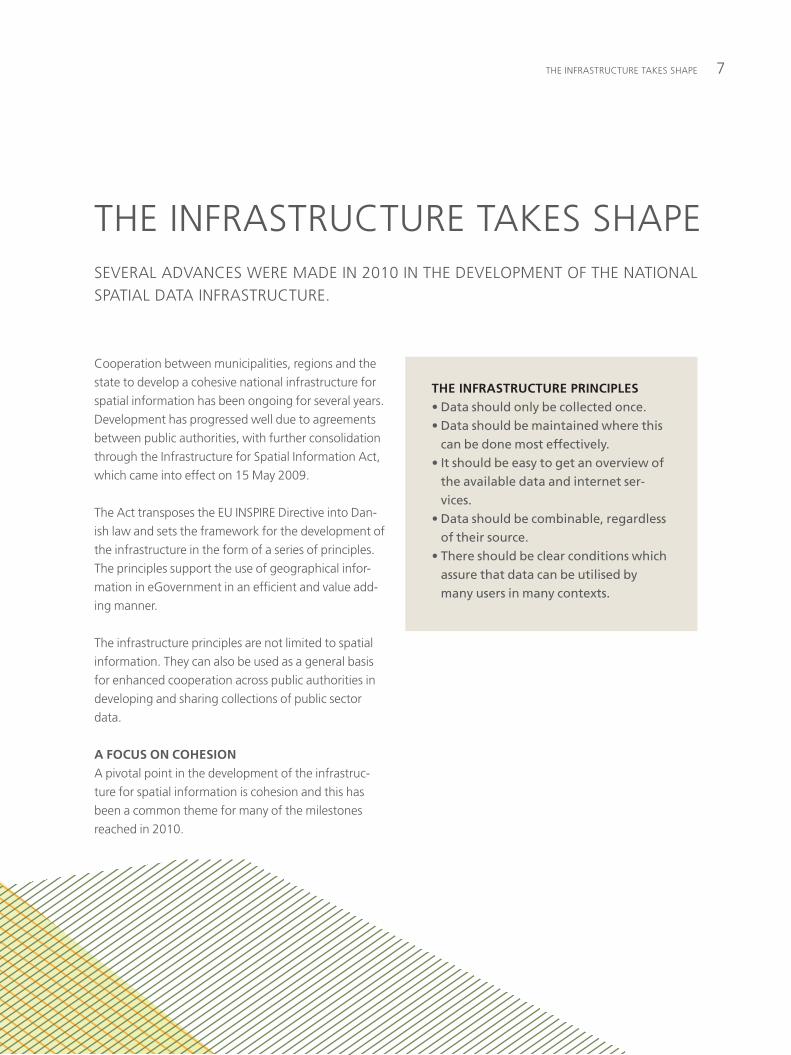
THE INFRASTRUCTURE PRINCIPLES• Data should only be collected once.• Data should be maintained where this
can be done most effectively.• It should be easy to get an overview of
the available data and internet ser-vices.
• Data should be combinable, regardless of their source.
• There should be clear conditions which assure that data can be utilised by many users in many contexts.
Spatial Data infraStructure in Denmark 2010 // review8
THE “FOT” MAPPING COOPERATION IS CLOSE TO ACHIEVING NATIONAL COVERAGEin October 2010 fOtdanmark announced that fOt is
more than half way through its mapping of the entire
country. furthermore, another three municipalities
made a commitment in 2010 to participate in the
shared mapping. this means that only five municipali-
ties had not yet subscribed to the fOt project as of the
end of 2010. fOtdanmark is close to achieving its goal
of national coverage by 2012, which at the same time
ensures the creation of a shared geographic founda-
tion for eGovernment.
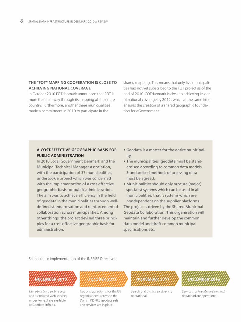
Schedule for implementation of the inSpire Directive:
Search and display services are operational.
Services for transformation and download are operational.
metadata for geodata sets and associated web services under annex i are available at Geodata-info.dk.
national paradigms for the eu organisations’ access to the Danish inSpire geodata sets and services are in place.
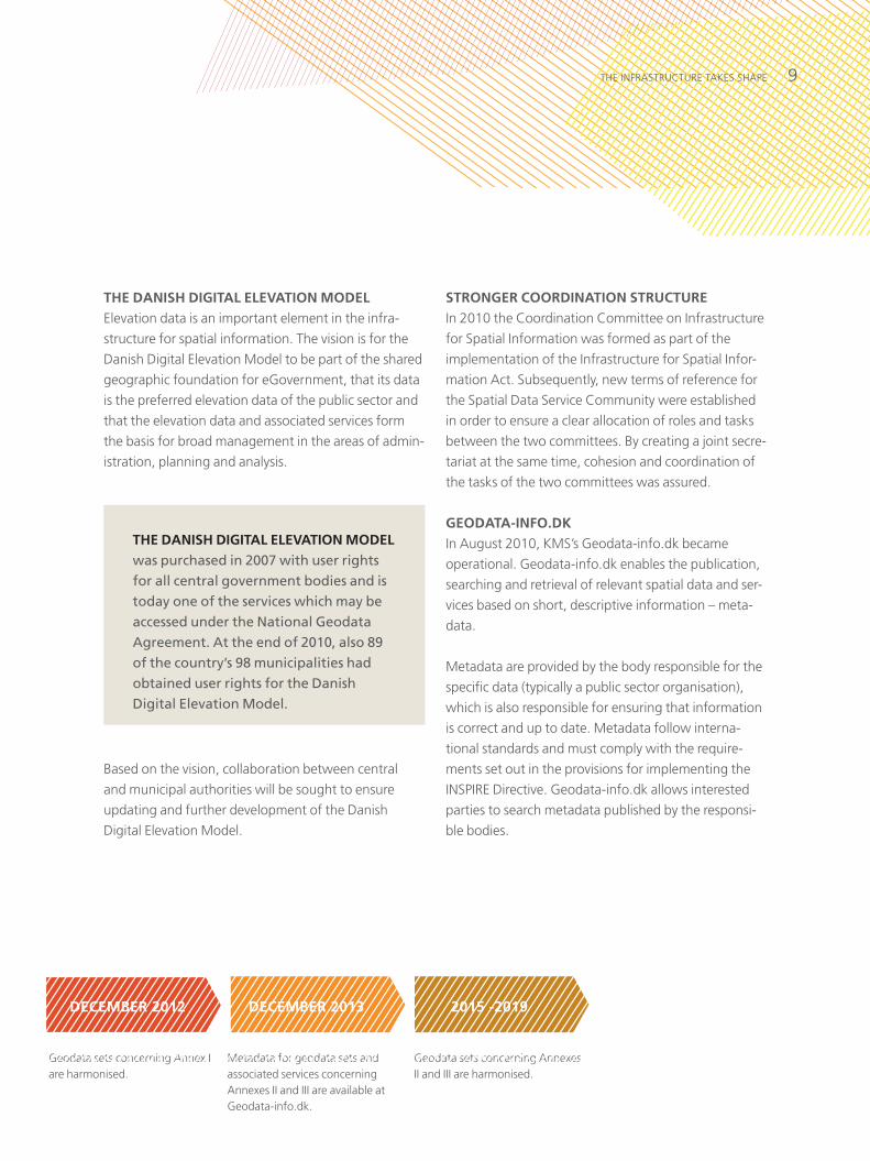
DECEMBER 2010 OCTOBER 2011 NOVEMBER 2011 DECEMBER 2012
A COST-EFFECTIVE GEOGRAPHIC BASIS FOR PUBLIC ADMINISTRATION In 2010 Local Government Denmark and the Municipal Technical Manager Association, with the participation of 37 municipalities, undertook a project which was concerned with the implementation of a cost-effective geographic basis for public administration. The aim was to achieve efficiency in the field of geodata in the municipalities through well-defined standardisation and reinforcement of collaboration across municipalities. Among other things, the project devised three princi-ples for a cost-effective geographic basis for administration:
• Geodata is a matter for the entire municipal-ity.
• The municipalities’ geodata must be stand-ardised according to common data models. Standardised methods of accessing data must be agreed.
• Municipalities should only procure (major) specialist systems which can be used in all municipalities, that is systems which are nondependent on the supplier platforms.
The project is driven by the Shared Municipal Geodata Collaboration. This organisation will maintain and further develop the common data model and draft common municipal specifications etc.
9tHe infraStructure takeS SHape
STRONGER COORDINATION STRUCTUREin 2010 the coordination committee on infrastructure
for Spatial information was formed as part of the
implementation of the infrastructure for Spatial infor-
mation act. Subsequently, new terms of reference for
the Spatial Data Service community were established
in order to ensure a clear allocation of roles and tasks
between the two committees. By creating a joint secre-
tariat at the same time, cohesion and coordination of
the tasks of the two committees was assured.
GEODATA-INFO.DKin august 2010, kmS’s Geodata-info.dk became
operational. Geodata-info.dk enables the publication,
searching and retrieval of relevant spatial data and ser-
vices based on short, descriptive information – meta-
data.
metadata are provided by the body responsible for the
specific data (typically a public sector organisation),
which is also responsible for ensuring that information
is correct and up to date. metadata follow interna-
tional standards and must comply with the require-
ments set out in the provisions for implementing the
inSpire Directive. Geodata-info.dk allows interested
parties to search metadata published by the responsi-
ble bodies.
THE DANISH DIGITAL ELEVATION MODEL elevation data is an important element in the infra-
structure for spatial information. the vision is for the
Danish Digital elevation model to be part of the shared
geographic foundation for eGovernment, that its data
is the preferred elevation data of the public sector and
that the elevation data and associated services form
the basis for broad management in the areas of admin-
istration, planning and analysis.
THE DANISH DIGITAL ELEVATION MODEL was purchased in 2007 with user rights for all central government bodies and is today one of the services which may be accessed under the National Geodata Agreement. At the end of 2010, also 89 of the country’s 98 municipalities had obtained user rights for the Danish Digital Elevation Model.
Based on the vision, collaboration between central
and municipal authorities will be sought to ensure
updating and further development of the Danish
Digital elevation model.
Geodata sets concerning annex i are harmonised.
metadata for geodata sets and associated services concerning annexes ii and iii are available at Geodata-info.dk.
Geodata sets concerning annexes ii and iii are harmonised.
DECEMBER 2012 DECEMBER 2013 2015 -2019
Spatial Data infraStructure in Denmark 2010 // review10
THE DEVELOPMENT OF “VIS STEDET” (‘SHOW LOCATION’) AND “VIS KORT” (‘SHOW MAP’)as a common component, “vis Stedet” aims to facili-
tate the development of solutions that use spatial data.
in order to further the development of “vis Stedet”,
the Spatial Data Service community decided in 2010
to form a group headed by kmS and with the addi-
tional participation of private businesses. with feed-
back from users, this group will ensure ongoing techni-
cal development of “vis Stedet” so that it will continue
to form a part of various value creating solutions. the
development of “vis Stedet” is carried out in close col-
laboration with the open source project “vis kort”,
which is the main user of “vis Stedet”
COMMON COMPONENTSA common component performs the work that is common to several applications, can be used in various different contexts and can be incorporated in end-user solu-tions across portals and authorities.Common components have dual purposes• reducing development costs for
authorities• allowing greater familiarity and coher-
ency between authorities’ solutions.
Geodata-info.dk provides access to and an overview of
national geodata collections and web services; it also
ensures compatibility with other eu member states,
whose metadata and search engines follow the same
basic principles.
GEODATA-INFO.DK FACTS:• Geodata-info.dk contains the meta-
data on geodata sets and associated services in relation to both the INSPIRE Directive and other information.
• Geodata-info.dk comprises a national search engine according to current standards that are also recommended by the INSPIRE Directive.
• Publication and searches are per-formed via standardised interfaces which can be accessed from users’ own IT environments, including current GIS systems.
• Geodata-info.dk is a geo-portal adapted to Danish conditions. It is a web application with a user interface for publication and search functions.
• Geodata-info.dk provides geographic detail based on the common compo-nent ‘Vis stedet’ (Show location).
• Geodata-info.dk is based on the open source software ‘Geonetwork’ and has been developed in cooperation with the other Nordic countries.
• Geodata-info.dk is operated by KMS.
11tHe infraStructure takeS SHape
DETERMINING THE STRATEGIC DIRECTION IN 2010Besides the specific results already mentioned, the
public sector worked on a series of strategies in 2010
that will help to create cohesion and value in eGovern-
ment. the municipalities have agreed on a strategy for
shared work on digitisation, the ministry of the envi-
ronment approved a strategy for eGovernment and
kmS completed its strategic basis ‘location – a gate-
way to eGovernment’. furthermore, the Steering
committee for Joint Government cooperation worked
on a new Danish eGovernment strategy for 2011-
2015. common to all these strategies is that spatial
information have a central role and is seen as an
important element of eGovernment.
A COHERENT STRATEGIC FRAMEWORK IN THE MINISTRY OF THE ENVIRONMENTIn 2010 the organisational management of the Ministry of the Environment approved the ‘Ministry of the Environ-ment’s eGovernment Strategy for 2010-14’ and the first Action Plan for 2010-2011 of this strategy. The strategy is designed to provide a cohesive framework for the Ministry’s use of eGovernment. The strategy emphasises:• that digitisation helps to make admin-
istrative activities more efficient.• that digitisation improves the digital
services available to citizens and busi-nesses.
• that digitisation is achieved by cooper-ation throughout the Ministry thereby creating solutions that can be applied broadly and in multiple contexts and across the public sector, for example through collaboration on the new Danish eGovernment strategy.
• that digital skills are strengthened while governance is made more focused and efficient.
Spatial Data infraStructure in Denmark 2010 // review12
THE BOARD OF LOCAL GOVERNMENT DENMARK ADOPTED A COMMON DIGITISATION STRATEGY FOR LOCAL ADMINISTRATIONS IN 2010
municipalities too have concentrated on collabo-
ration and cross-department solutions. this is
reflected in the municipal Digitisation Strategy,
which the board of local Government Denmark
adopted in 2010. local government goals for
increasing digitisation by 2015 have thus become
a reality.
the strategy outlines targets whereby local gov-
ernment – and thereby all citizens of Denmark –
can and should experience more benefits from the
considerable investment in digitisation. a precon-
dition for this is that municipalities focus far more
intensively than they have done so far on coopera-
tion to achieve common aims and solutions, and
that administrative processes and procedures are
stadardised and seen as interrelated elements.
the municipalities are working with central gov-
ernment and the regions with the particular aim
of avoiding ‘silo thinking’ and of simplifying rules,
standardising reports and terminology and further
enhancing common solutions.
there is still considerable potential for the use of
location as a basis for analyses, route planning,
etc. all administrative areas of local government
can use location as a gateway to operate more
efficiently. in the field of geodata, a project based
on standardisation, benchmarking and testing
new organisational methods is making progress.
this project features specific measures and objec-
tives for:
• contributing to the development of the geodata
area as a uniform basis for administrative sys-
tems that use geodata
• disseminating experience, efficiency measures
and improvements through a geodata imple-
mentation project in 37 municipalities.
‘LOCATION – A GATEWAY TO EGOVERNMENT’, KMS’S STRATEGIC BASIS 2011-2015Data should be collected only once, they should be maintained where this can be done most effectively and they should be widely applicable across administrative levels and sec-tors of public administration. These principles are central to KMS’s new strategic basis, ‘Loca-tion – a gateway to eGovernment’. The start-ing point is the continued development of the SDI, both in Denmark and internationally.The strategic basis is in line with the work on the new Danish eGovernment Strategy, which focuses on identifying authoritative base data and in which the environment and the use of
spatial data play an important role. The strat-egy should be seen in relation to the Ministry of the Environment’s eGovernment Strategy for 2010-2014.The public sector has in recent years purpose-fully applied spatial data. There is however untapped potential for the use of geodata in administration. In order to fully realise that potential, synergies must be achieved between the public sector’s services and the solutions offered by the private sector. A com-mon geographic basis, applied in both the public and private sectors, will also give pri-vate businesses access to a standardised base on which to develop new solutions and busi-ness models.
13tHe infraStructure takeS SHape
THE INTERNATIONAL ASPECTin 2008 euroGeographics set in motion the eSDin
project to provide support for the implementation of
the inSpire Directive in eu member States. kmS took
part in the project, which in 2010 collected a series of
best practice examples of the compilation of geo-
graphic information. the examples will contribute to
the further development of the SDi.
a number of other eu initiatives are designed to ensure
that, depending on specific needs, spatial data should
be able to move freely across national boundaries. this
applies for instance to the environmental and climate
monitoring programme GmeS (Global monitoring for
environment and Security).
GMES (Global Monitoring for Environ-ment and Security) is a programme coor-dinated by the EU based on both terres-trial and space observations. Once gath-ered, data form part of information services that will, among other things, enable the management of natural resources and biodiversity, reactions to natural and man-made disasters and the monitoring of the environment on land, sea and in the atmosphere. All factors of relevance to climate change. In 2010 GMES added the provision that the pro-gramme should as far as possible utilise national datasets that are also applied in connection with INSPIRE. The aim is to prevent that the same data are collected twice and the duplication of existing national datasets. A fully developed GMES programme is expected to be in place between 2014 and 2020.
ESDIN (European Spatial Data Infrastruc-ture Network) has been set up and is managed by EuroGeographics. The pro-ject has 19 partners from universities and from the public and private sectors. The project is mainly funded by the EU. The work consists of the targeted stand-ardisation of descriptions across national boundaries and of making shared geo-graphical information available in accordance with INSPIRE. In short, the aim is that all EU member states should use the same infrastructure when work-ing with spatial data.
Spatial Data infraStructure in Denmark 2010 // review14
central GOvernment, tHe municipalitieS anD tHe reGiOnS aGree tHat puBlic SectOr cOOperatiOn in tHe area Of DiGitaSatiOn iS an impOrtant prereQuiSite in tHe effOrtS tO Streamline, mODerniSe anD imprOve tHe puBlic SectOr. pucBlic SectOr cOOperatiOn On tHe DiGitaSatiOn Of Spatial Data HaS Been a piOneerinG fOrce in tHeSe effOrtS.
the Service community has primarily worked to put in
place basic preconditions to ensure that a shared infra-
structure for spatial information is solidly constructed,
including:
• development of common geographic base data
• a coupling between geodata within specific sectors
and the SDi
• a description of general principles of the architecture.
the Service community has been influential in the
establishment of fOtdanmark and of plansystemDk
for the registration and distribution of planning infor-
mation. together with Geoforum, it has also formu-
lated a series of guidelines for the use of various spatial
information standards. most recently, the Spatial Data
Service community has published a reference architec-
ture to assist in the use of geodata.
in 2010, a new stage in the public sector cooperation
on the SDi was commenced. the ‘coordination com-
mittee on infrastructure for Spatial information’ was
established by the minister for the environment with
regard to the infrastructure for Spatial information act
and represents an important re-structuring and
strengthening of collaborative efforts.
puBlic SectOr cOOperatiOn iS pivOtal fOr DiGitiSatiOn
COORDINATION AND COHESION in order to harness the considerable potential in the
use of geodata in all sectors, there must be a fully func-
tional infrastructure for spatial information. this
requires, among other things, that coherent common
components are built and that it is easy to apply data.
Back in 2002, the Spatial Data Service community was
created by the Digital taskforce to strengthen coopera-
tion over spatial data. although several other service
communities were created at the same time, only the
Spatial Data Service community has survived. it has
been highly instrumental in the digitisation process.
Since its inception, the Spatial Data Service community
has played a vital role in removing technical and organ-
isational barriers to the creation of a shared SDi. it is a
precondition for a fully functional infrastructure, that
there is consensus on the re-use of data, a clear alloca-
tion of responsibilities between authorities and easy
access to information and services.
FOCUS

15puBlic SectOr cOOperatiOn iS pivOtal fOr DiGitiSatiOn
that all public sector operatives responsible for geo-
data and the producers and users of geodata can now
participate in the Service community. the Service
community will in future support the coordination
committee as a forum for the discussion of ideas and
suggestions for cooperation and innovation concern-
ing the SDi. Stakeholders – including national and local
government – may contribute ideas and proposals for
new areas of actions or frameworks for shared devel-
opment of the SDi.
the coordination committee is responsible for two
types of tasks: statutory and agreement-based.
the statutory tasks include preparing recommenda-
tions for the minister for the environment on initiatives
to promote the SDi. furthermore, the committee
assists the minister for the environment in implement-
ing the infrastructure for Spatial information act and
thus the inSpire Directive in Denmark. the committee
also assists the minister in communication with the eu
commission about inSpire.
in addition to the statutory tasks, the coordination
committee now performs some of the tasks previously
under the remit of the Service community – for exam-
ple the coordination of shared initiatives and the inter-
action of the geodata area with other domains.
the coordination committee coordinates and initiates
the necessary agreements on the re-use of data, access
and rights to data and on the maintenance of the
infrastructure. it is thus part of the effort to ensure
cohesion in the development and use of the SDi.
Since the establishment of the coordination commit-
tee in 2010, the Service community’s role has changed
to incorporate new terms of reference which mean
MEMBERS OF THE COORDINATION COMMITTEE:• Ministry of Economic and Business
Affairs• Ministry of Climate and Energy• Ministry of Food, Agriculture and
Fisheries• Ministry of Transport• Ministry of the Environment• Danish Regions• Local Government Denmark• Universities • Geoforum
FOCUS
Spatial Data infraStructure in Denmark 2010 // review16
A NEW COLLABORATIVE STRUCTURE FOR THE COORDINATION COMMITTEE AND THE SPATIAL DATA SERVICE COMMUNITYThe Coordination Committee on Infra-structure for Spatial Information has been formed and the Spatial Data Ser-vice Community has a new mandate. A joint secretariat has been created, which is headed by KMS.
The new mandate results in a clear framework for the work of the Coordi-nation Committee and the Service Com-munity. The joint secretariat will also ensure coherency and coordination of the two committees’ tasks.
achieving the potential of the application of spatial
information requires ongoing expansion and consoli-
dation of the already functional and interrelated col-
laboration in the area of geodata across the public
sector.
in 2010 the OecD produced a review of the results to
date of shared public sector digitisation measures and
strategies. the review highlights the geodata area as a
role model for the cross-sectoral governance, which
OecD recommends as a means of strengthening Den-
mark’s digitisation efforts.
THE OECD’S RECOMMENDATIONS FOR ENHANCED CROSS-GOVERNMENTAL COLLABORATION:
IMPROVING THE CROSS-GOVERNMENTAL COLLABORATION THROUGH CONCRETE ACTIVITIES AND PROJECTS(e.g. the law on geospatial data is a good example). The speed of development of joint solutions in all areas could be increased (e.g. the principle of sharing of data and use of information should be promoted and increasingly used as it will help to break down the silo approach and foster collaboration). The adoption of a new vision (e.g. a new e-govern-ment strategy) sufficiently robust for the next five years to enable the sharing of data and integration of services could be promoted and the collaboration idea/partnership approach could be more strongly sustained. The new vision would thus support a stronger affirmative approach towards the principle of col-laboration across levels of government.
Source: OecD e-Government Studies: ‘efficient e-GOvernment fOr Smarter puBlic Service DeliverY’, 3 June 2010.
FOCUS
17puBlic SectOr cOOperatiOn iS pivOtal fOr DiGitiSatiOn
CONCRETE COLLABORATIONa series of public sector collaborative projects exist,
with a focus on specific solutions. One example is fOt-
danmark, a public association with the municipalities
and central government (kmS) as members. fOt aims
to establish standardised, uniform mapping for use
across administrative levels in the municipalities, the
regions and central government. the productive coop-
eration with several sectors ensures that their needs for
spatial information are met.
Shared public mapping delivers many savings to the
benefit of society, in that among other things it pre-
cludes duplication in the form of parallel mapping.
there are still further efficiencies to be achieved as cen-
tral and local government and the regions make
increased use of opportunities offered by utilising spa-
tial information. at the end of 2010, 93 municipalities
were members of fOtdanmark and more than 50 per
cent of the country was mapped, with the remainder
expected to be mapped by the end of 2012.
THE FOT COLLABORATIONThe FOT collaboration involves:• Creation of a shared, standardised and
continually updated collection of spa-tial objects that can be integrated into the basis for public administration across authorities and sectors.
• A common specification which ensures that geodata are defined in accordance with current practice.
• A general performance requirement to improve and make more economic the creation, quality control and updating of geodata.
• Effective access to the administrative basis through the creation of a shared, modern system for administration, storage and easy communication of spatial information.
FOCUS
Spatial Data infraStructure in Denmark 2010 // review18
the pre-project study for the Digital road network
opens new opportunities for the use of fOt data on a
large scale. One of the aims of the study is to test
whether the road centre lines in fOt can be linked with
the same lines in the road administration system and
thus to other data, including the central register of
roads and paths. these data combined with data from
traffic counts and other dynamic transport information
will form the basis of the Digital road network. Data
will be updated and quality assured to an agreed level.
the pre-project study will also present a business case
for national implementation of the Digital road net-
work.
the infrastructure for spatial information will not real-
ise its true value until it becomes an integrated part of
eGovernment. with a view to this happening, an
agreement has been signed as part of the 2010 finan-
cial agreement between central government and local
Government Denmark on municipalities’ access to the
geodata and services of kmS. the agreement took
effect on 1 april 2010 and means that spatial data
from kmS can be freely applied in and across the coun-
try’s municipalities.
the Danish nature and environment portal, established
in connection with the local government reform of
2007, is another outcome of a public sector collabora-
tive project. the Danish nature and environment portal
is a partnership between the ministry of the environ-
ment, local Government Denmark and Danish
regions. its purpose is to support authorities with envi-
ronmental responsibilities, to provide a uniform, up-to-
date data base, to promote digital administrative pro-
cedures relating to the environment and to strengthen
communication with the public. within the framework
of the ministry of the environment, the responsibility
for the Danish nature and environment portal has been
transferred to kmS, which has been given the respon-
sibility for coordinating data and infrastructure in the
ministry. the nature and environment portal secretariat
has also moved offices to kmS, thus optimising oppor-
tunities for creating synergies in a professional context.
the nature and environment portal gives the public
and environmental professionals access to relevant and
up-to-date data on Denmark’s nature and environ-
ment. Besides acting as a data access point, the portal
also holds several digital solutions for authorities –
including environmental resources, administration of
user rights and access to digital archives containing
cases from the former local environmental authorities.
2 central register of roads and paths (cvf). cvf is the official numbering system for public roads in Denmark.
FOCUS
19GeOData create Great practical value
emerGencY manaGement, caSe prOceSSinG timeS anD arcHaeOlOGical reSearcH are JuSt SOme Of tHe manY cOnteXtS in wHicH Spatial infOr-matiOn can aDD value. Spatial infOrmatiOn iS nOw BeinG uSeD fOr an increaSinG numBer Of purpOSeS.
GeOData create Great practical value
Spatial information is being applied in a growing num-
ber of contexts as more and more people are realising
its ability to generate a better overview, to provide
improved bases for analysis and to make case process-
ing more efficient.
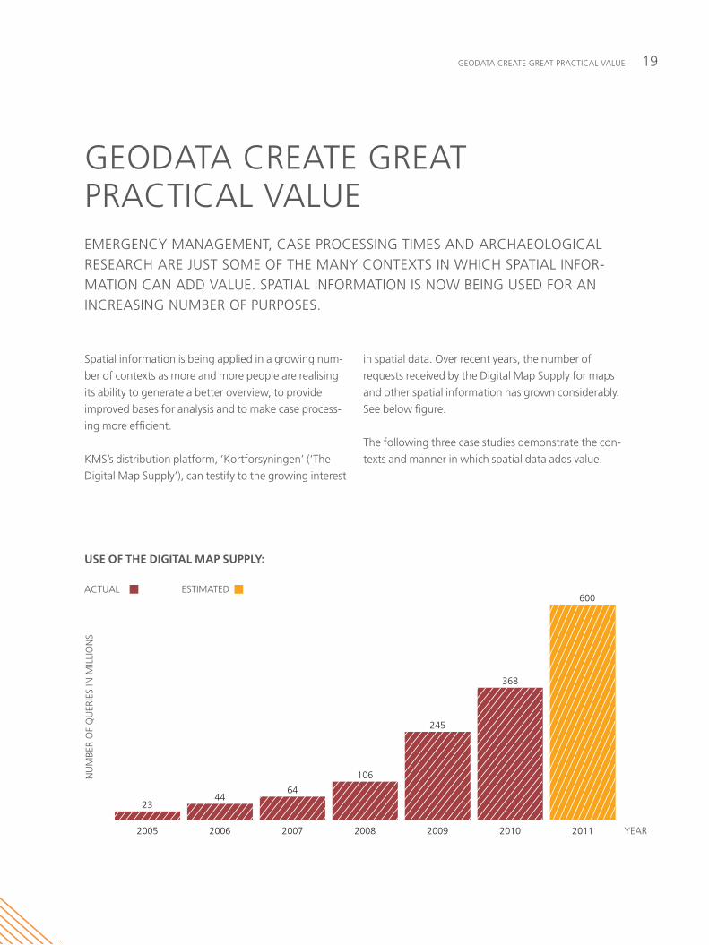
kmS’s distribution platform, ‘kortforsyningen’ (‘the
Digital map Supply’), can testify to the growing interest
USE OF THE DIGITAL MAP SUPPLY:
2011201020092008200720062005
ESTIMATED ACTUAL
YEAR
600
368
245
106
6444
23
NU
MBE
R O
F Q
UER
IES
IN M
ILLI
ON
S
in spatial data. Over recent years, the number of
requests received by the Digital map Supply for maps
and other spatial information has grown considerably.
See below figure.
the following three case studies demonstrate the con-
texts and manner in which spatial data adds value.
Spatial Data infraStructure in Denmark 2010 // review20
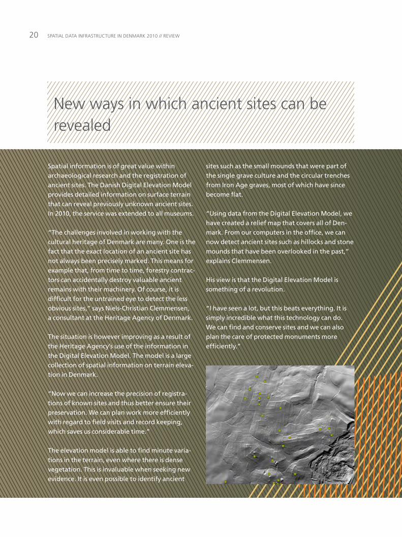
sites such as the small mounds that were part of the single grave culture and the circular trenches from Iron Age graves, most of which have since become flat.
“Using data from the Digital Elevation Model, we have created a relief map that covers all of Den-mark. From our computers in the office, we can now detect ancient sites such as hillocks and stone mounds that have been overlooked in the past,” explains Clemmensen.
His view is that the Digital Elevation Model is something of a revolution.
“I have seen a lot, but this beats everything. It is simply incredible what this technology can do. We can find and conserve sites and we can also plan the care of protected monuments more efficiently.”
Spatial information is of great value within archaeological research and the registration of ancient sites. The Danish Digital Elevation Model provides detailed information on surface terrain that can reveal previously unknown ancient sites. In 2010, the service was extended to all museums.
“The challenges involved in working with the cultural heritage of Denmark are many. One is the fact that the exact location of an ancient site has not always been precisely marked. This means for example that, from time to time, forestry contrac-tors can accidentally destroy valuable ancient remains with their machinery. Of course, it is difficult for the untrained eye to detect the less obvious sites,” says Niels-Christian Clemmensen, a consultant at the Heritage Agency of Denmark.
The situation is however improving as a result of the Heritage Agency’s use of the information in the Digital Elevation Model. The model is a large collection of spatial information on terrain eleva-tion in Denmark.
“Now we can increase the precision of registra-tions of known sites and thus better ensure their preservation. We can plan work more efficiently with regard to field visits and record keeping, which saves us considerable time.”
The elevation model is able to find minute varia-tions in the terrain, even where there is dense vegetation. This is invaluable when seeking new evidence. It is even possible to identify ancient
new ways in which ancient sites can be revealed

21GeOData create Great practical value
“Many regulations and registrations are linked to a specific location – for example a property. Spa-tial data can thus support digital case processing and can allow automatic guidance and validation to ensure that all relevant documents and reports are included in the application.
“This reduces work for staff processing the cases, because applications are quite simply better. Case processing times are shorter, which benefits all sides,” concludes Else-Marie Ulvsgaard.
Although there is no overall conclusion on the project as yet, she says that the findings are extremely positive. “Digital case processing has met with approval – not least from the people handling applications.”
The project will end in 2011, when it will be decided whether to establish a national system of digital case processing for building applications.
Spatial data is present in many digitisation projects within the public sector. For instance, an investigation into the quality and resource-related gains to be made from digitising public administration of construction cases involves spa-tial information as a central element. Preliminary reports suggest that there are significant advan-tages in digitising the handling of construction projects.
“One of the reasons for this is that many applica-tions do not contain the information needed for processing the case. Certain applicants have had difficulty in advancing their case because the required information was not available in one place,” says Else-Marie Ulvsgaard of the Danish Enterprise and Construction Authority, who is in charge of the project.
Testing of digital case handling began in 2010 in six municipalities. Applicants could apply for building permission via the website of the munici-pality. According to Else-Marie Ulvsgaard there are several advantages over the traditional method of paper applications.
Digital information makes case handling of construction projects more efficient
Spatial Data infraStructure in Denmark 2010 // review22
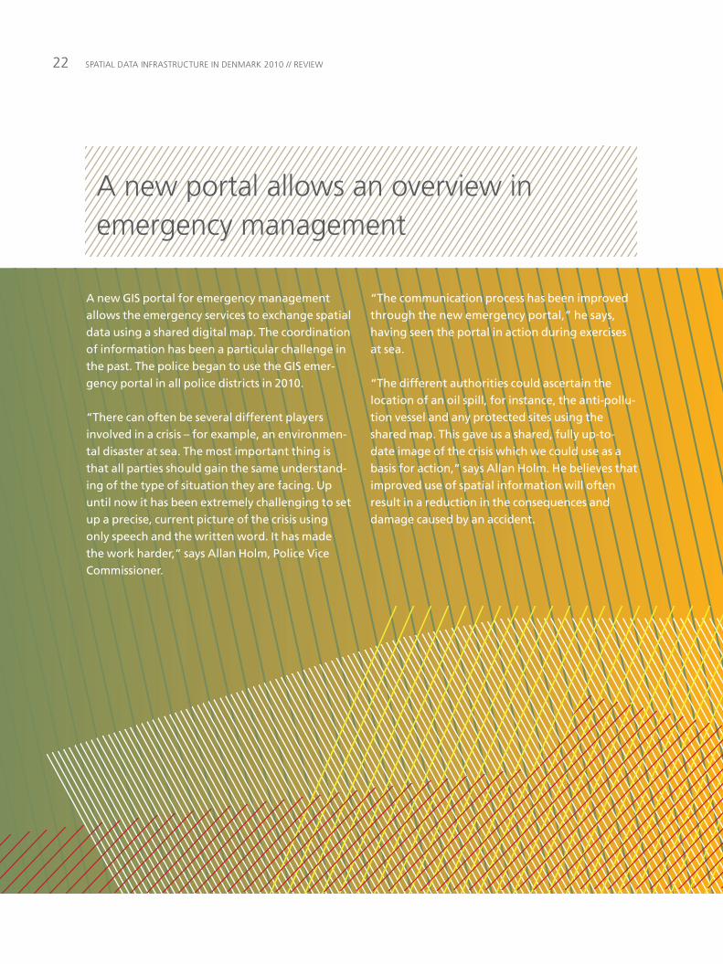
“The communication process has been improved through the new emergency portal,” he says, having seen the portal in action during exercises at sea.
“The different authorities could ascertain the location of an oil spill, for instance, the anti-pollu-tion vessel and any protected sites using the shared map. This gave us a shared, fully up-to-date image of the crisis which we could use as a basis for action,” says Allan Holm. He believes that improved use of spatial information will often result in a reduction in the consequences and damage caused by an accident.
A new GIS portal for emergency management allows the emergency services to exchange spatial data using a shared digital map. The coordination of information has been a particular challenge in the past. The police began to use the GIS emer-gency portal in all police districts in 2010.
“There can often be several different players involved in a crisis – for example, an environmen-tal disaster at sea. The most important thing is that all parties should gain the same understand-ing of the type of situation they are facing. Up until now it has been extremely challenging to set up a precise, current picture of the crisis using only speech and the written word. It has made the work harder,” says Allan Holm, Police Vice Commissioner.
a new portal allows an overview in emergency management
23a SHareD infraStructure – witHOut cOnStraintS
a SHareD infraStructure – witHOut cOnStraintS
collaboration across the public sector to achieve a
shared SDi is a challenge. the main challenges are
concerned with devising decision structures, economic
frameworks and financing models to ensure the most
widespread use possible.
work is still needed to remove constraints whether
they are technical, legal, financial or organisational
in nature.
IMPROVED OVERVIEW OF GEODATA AND GEOSERVICESin order for spatial information to create most value,
users should experience easy access and a simple
method of getting an overview of the data and services
on offer.
One very obvious improvement in this regard was the
launch of Geodata-info.dk in 2010. this allows data
owners to publish metadata and gives users the ability
to locate the geodata and services they require. infor-
mation on the conditions of use associated with the
data is also available.
Geodata-info.dk was established as part of the imple-
mentation of inSpire, but is also concerned with spa-
tial information beyond the scope of the Directive.
STRENGTHENING OF THE COORDINATIONto ensure that the potential of spatial data is achieved
and that optimal support is given to the continued
expansion of shared solutions, emphasis must be
placed on organisational and governance frameworks.
as mentioned above in connection with the new coor-
dination committee, 2010 saw important advances in
improving organisational and governance frameworks.
the simplification of existing governance measures is
now under consideration.
WIDER ACCESS TO GEODATA AND GEOSERVICESthe agreements on central and local government
access to the geodata and services of kmS have
removed a large part of the legal access constraints in
the public sector. there is a continual need to ensure
the agreement base is dynamic so that new data can
be used by everyone.
Some legal constraints on the use of data in the private
sector persist. for many applications there is a growing
concern that spatial data is not freely available for busi-
nesses and private individuals. we need to find ways in
which to remove these constraints – so as to allow
innovation and business development in the private
sector.
wOrk iS Still neeDeD tO remOve cOnStraintS frOm tHe wiDeSpreaD uSe Of Spatial Data.
Spatial Data infraStructure in Denmark 2010 // review24
A COHESIVE INFRASTRUCTURE when the implementation of a solution or standard in
the infrastructure for spatial information fails for one
authority, this can often have consequences for other
authorities and can also weaken their motivation for
implementation, even though there are collectively
many benefits to be gained.
as part of the implementation of the infrastructure,
the Spatial Data Service community undertook a pro-
ject in 2009 on the reference architecture for the use
of geodata. the reference architecture will be influen-
tial in expanding the infrastructure with a view to
achieving savings by increased re-use of data and com-
ponents. Hence the reference architecture for the use
of spatial data in 2010 helped delineate the new
organisation of systems for the Danish nature and
environment portal and fOtdanmark.
GEODATA-INFO.DK AS PART OF THE DIGITAL ROAD NETWORKThe Danish Roads Directorate is currently working on a pre-project study on the Digital Road Network. The study will investigate the extent to which a national quality-assured digital road net-work can be established using existing data in order to improve services for road users. It will also examine the involvement of private parties. A team led by COWI A/S is in charge of establish-ing the database.Metadata from this database will be exhibited on Geodata-info.dk. This will highlight the available geodata and ser-vices and their statuses. This is of interest not only to the six municipalities con-cerned and the Roads Directorate, but also, for example, to computer applica-tion designers who will be able to get an overview over which spatial data their applications can link to. By using an existing component such as Geodata-info.dk the development of a display window for the project can be avoided.
25practical perSpectiveS
practical perSpectiveS
NEW POSSIBILITIES THROUGH TECHNOLOGICAL ADVANCES. it and communication developments grow apace.
mobile devices in the form of smart phones and tablets
have advanced, departing the confines of traditional
telephones and personal computers. mobile devices
have high-speed wireless connections and are
equipped with GpS functionality. the real world and its
digital representation will blend in hitherto unknown
ways. this will afford opportunities for adding informa-
tion “freely” from other media as needed, for example
using surveillance cameras or other sensory resources.
this development results in the need for mobile solu-
tions to be able to utilise the existing base of relevant
spatial information. at the same time it opens the door
for contributions in the form of reports on changed
geographical information that has both spatial and
commercial attributes. in other words, this technologi-
cal advance allows individuals with GpS-equipped
mobile devices to collect geodata and deliver it to
shared databases.
SPATIAL DATA AND DEMOCRACYin a world in which we must all relate to increasingly
complex situations, the use of spatial data has obvious
benefits for a democratic system. the use of spatial
data to describe, analyse, understand and present
complex situations means that public authorities can
communicate complex problems to citizens in an intui-
tive and easily comprehensible manner. Seeing the
world in terms of geodata is intuitive and conditions
relating to the physical world can be effectively com-
municated in this way. it is particularly significant in the
relationship between citizens and public authorities
and between the authorities themselves where spatial
data can help to ensure transparent, clear and effective
administration. interest groups and citizens alike can
put together data, which improves their possibilities to
act as informed members of society.
MAKING BETTER USE OF SPATIAL DATAin order to extend the use of spatial data it is vital that
common components are developed that work well
and interact effectively. these components should
facilitate access to spatial information and deliver the
associated functionality for analysing various subjects.
they should be adaptable to end user solutions across
portals and public sector areas.
where common components focus on geographic
analysis and presentation tools, access to data repre-
sents a challenge. the infrastructure for spatial infor-
mation has made progress in this area, but has not yet
achieved its goal. a precondition for the dissemination
of common components is easy access to sector-inde-
pendent base data as the foundation for sector-specific
spatial data.
in recent YearS Spatial infOrmatiOn HaS attaineD wiDeSpreaD uSe. internet acceSS HaS reDuceD tecHnOlOGical cOnStraintS SO tHat tHe cHOice Of Data SOurceS anD applicatiOnS iS mOre varieD tHan ever BefOre.
Spatial Data infraStructure in Denmark 2010 // review26
the report refers to several international investigations
which confirm that significant benefits can be attained
in both private and public sectors by using geodata
and the SDi. it also argues that an efficient shared pub-
lic SDi can create added value for both public and the
private sectors.
a well-developed infrastructure for spatial informa-
tion, applied widely in both public and private sectors,
will give private businesses access to a standardised,
well-documented starting point for the development
of solutions and applications. this will afford new,
improved opportunities for businesses and contribute
to economic growth.
CONSIDERABLE BENEFITS OF A SHARED PUBLIC SDIthe public sector has broadly embraced the fact that
establishing shared solutions is a precondition for effi-
cient public administration. this also applies to spatial
data and in many areas, work is underway to establish
a shared foundation for public administration. there is
also general recognition of the fact that the value of
shared public solutions is difficult to document
through general business cases, for instance. this is
why in 2009 kmS asked copenhagen economics to
undertake an analysis of the benefits of a shared public
SDi using macroeconomic methods and concepts. the
result was a report that was published in march 2010.
LARGE BENEFITS THROUGH FREE USE OF ADDRESSESAn agreement for the free use of local gov-ernment address data has delivered savings to both businesses and public authorities in the region of DKK 500 million. This is the find-ing of an investigation by the Danish Enter-prise and Construction Authority.
“It is great that the agreement has had such good results. Our task now is to extend the use of addresses to sectors that so far have not used this service. There are still benefits to be gained,” says Henning Steensig, one of the directors of the Danish Enterprise and Construction Authority.
According to Steensig, the addresses can be used in diverse scenarios: “Important services such as GPS, ambulance, police and emer-gency services and post office and transport depend on addresses in their day-to-day work. It is absolutely crucial for security and efficiency that addresses are updated, com-plete and accurate. We are very pleased that everyone can use local authorities’ address data without the need for licenses or pay-ments,” he says. The agreement between the Ministry of Finance and the municipalities was signed in 2002.
Source: the Danish enterprise and construction authority.
27practical perSpectiveS
BENEFITS THROUGH USE OF SPATIAL DATAIn the past 10 to 15 years, several countries including the UK, New Zealand, Spain and Italy have carried out quantitative surveys of the benefits of using geodata and of con-structing a SDI.
Approaches have varied, but the overall conclusion is the same. The surveys have unanimously found that investment in geodata makes sound business sense for society, in that the economic benefits out-weigh the costs.
The British survey is based on observations from 1996. Even at that time it was found that spatial information to a greater or lesser extent contributed between 10 and 20 per cent of total added value in the UK. Since then the use of geodata has increased. If the same applies to Denmark as for the UK in 1996, geodata in Denmark would have accounted for production to a value of DKK 150-300 billion in 2008.
The New Zealand survey in 2008 concluded that the gross national product of that coun-try would have been 0.6 per cent lower if geodata had not been deployed. Applying this principle to Denmark, geodata would create additional production to the value of almost DKK 9 billion compared to a situation in which it was not used.
It is difficult to quantify the value of some-thing as intangible as geodata in terms of economic growth but studies have found, as we have seen, that there are very clear bene-fits to be had and that these can be expected to exceed any estimated costs connected with the maintenance and development of spatial information.
Source: the value of a shared public infrastructure for spatial information, copenhagen economics, march 2010.
Spatial Data infraStructure in Denmark 2010 // review28
terminOlOGY
what is the spatial data infrastructure (SDi) and of what does it comprise? Below is a brief explanation of the basic terms and concepts used in this review.
physical and abstract conditions on the surface of the earth are described using geodata, or spatial data, which consist of the coordinates (location) and descriptive characteristics of rele-vant objects, conditions and events.
a location provides means for finding, analysing and presenting information about objects, conditions or events based on their positions on the ground and in relation to each other. in other words, location makes it possible to retrieve geographical information from geodata.
Geodata are collected in various con-texts and by many organisations, often based on a specific need associated with the organisation’s field of opera-tions.
there is a great deal of interest in the application of geodata and geographi-cal information in areas and organisa-tions other than those where they are initially collected.
the SDI comprises the agreements, data and technology that enable geo-data and geographical information from various sources to be found and utilised. this provides a shared starting point for solutions that increase our understanding of the natural and man-made world.
What are the components of the SDI? the SDI seeks to ensure interop-erability, making it possible for geo-data and geographical information to be merged and used together without being further manipulated.
The SDI comprises:
Geodata themes, which is a collec-tion of spatial data grouped according to application, e.g. the transport net-work, hydrography and buildings. the themes are available as geodata sets and geodata services.
Metadata, which is information describing geodata sets and geodata services, and which make it possible to find, register and use them.
Shared infrastructure services con-sist of a set of web services that allow access to documented geodata themes and to metadata from diverse data sources. Geodata-info.dk is an example of this type of service.
Standards are common rules, condi-tions, guidelines or characteristics of data and associated processes, tech-nologies and organisation.
Cooperation between central and local government and regional author-ities, universities and private enter-prises which must work together to ensure that the SDi meets users’ needs.
Binding agreements between public actors in respect of the SDi.
What are the advantages of the SDI?Geodata are a shared asset. the SDi enables geodata to be effectively col-lected, shared and distributed among public authorities, the general public and the private sector. a coordinated approach to the development of spa-tial data standards for the collection, maintenance, distribution, application and safeguarding of spatial data will improve the quality of spatial data and reduce the cost of using them.
What is the reference architecture for SDI?reference architecture is a comprehen-sive yet precise way of designing a har-monious logical structure, identifying its components and defining its associ-ated terminology. the reference archi-tecture describes how existing and new users can plan for and integrate geodata into their operations.
an essential element of the reference architecture is a formulation of the principles and steps that are necessary for realising a particular vision. this formulation is not a blue print, but serves as a recommended starting point. it can also be used as a basis for developing invitations to tender. work on the reference architecture is a type of standardisation that involves termi-nology, components and interfaces.
29ANNEX: terminOlOGY
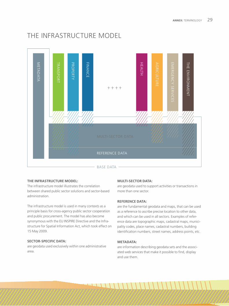
THE INFRASTRUCTURE MODEL:the infrastructure model illustrates the correlation between shared public sector solutions and sector-based administration.
the infrastructure model is used in many contexts as a principle basis for cross-agency public sector cooperation and public procurement. the model has also become synonymous with the eu inSpire Directive and the infra-structure for Spatial information act, which took effect on 15 may 2009.
SECTOR-SPECIFIC DATA:are geodata used exclusively within one administrative area.
MULTI-SECTOR DATA:are geodata used to support activities or transactions in more than one sector.
REFERENCE DATA:are the fundamental geodata and maps, that can be used as a reference to ascribe precise location to other data, and which can be used in all sectors. examples of refer-ence data are topographic maps, cadastral maps, munici-pality codes, place names, cadastral numbers, building identification numbers, street names, address points, etc.
METADATA: are information describing geodata sets and the associ-ated web services that make it possible to find, display and use them.
// THE INFRASTRUCTURE MODEL(INSPIRE-model)
META
DA
TA
BASE DATA
REFERENCE DATA
MULTI-SECTOR DATA
HEA
LTH
AG
RIC
ULTU
RE
EMER
GEN
CY
SERV
ICES
THE EN
VIR
ON
MEN
T
FINA
NC
E
TRA
NSPO
RT
PRO
PERTY
tHe infraStructure mODel

NatioNal Survey aNd CadaStrereNtemeStervej 8dK-2400 CoPeNHaGeN Nv
t. +45 7254 5000f. +45 3587 5051 (+45) 3888 [email protected]